
A post about earthquake tremor swarms and slow slip events.
It is often useful to know where you are, in a spatial sense. In the old days (LOL), field geologists, the kind that make maps of rocks and earth structures would, armed with topography maps and compass, determine their location from some vantage point using line-of-sight and triangulation. I don’t hanker for a return to these days. I’m grateful for the kind of location data instantly available on my smart phone – the little blue dot that seems to follow my course across some digital representation of the universe. But I acknowledge a kind of smugness, in the event the digital world nosedives, knowing that I can still find my way; no General Panic Stations (GPS) if the satellite-based Global Positioning System (the other GPS) fails.
GPS devices can also be attached to bits of the earth’s crust. This is useful because the crust, whether continent, sea floor, or volcanic island, is always on the move. During the Kaikoura earthquake (November 14, 2016), GPS determined (almost immediately) that the northeast corner of South Island, New Zealand, had moved north about 2m. Over the last couple of decades, GPS data has resulted in some exciting new directions of research about our mobile earth, particularly earthquakes and a new category of earth displacements, called by some slow or silent earthquakes (which sounds like a contradiction), but more sensibly called slow-slip events (SSEs) by most. Slow-slip events also result in land or sea floor displacements, but unlike earthquakes that do this in a few seconds, SSEs take days or weeks. These events are commonly accompanied by low frequency seismic rumbling, or tremor, and together are referred to as Episodic Tremor and Slow Slip, or ETS.
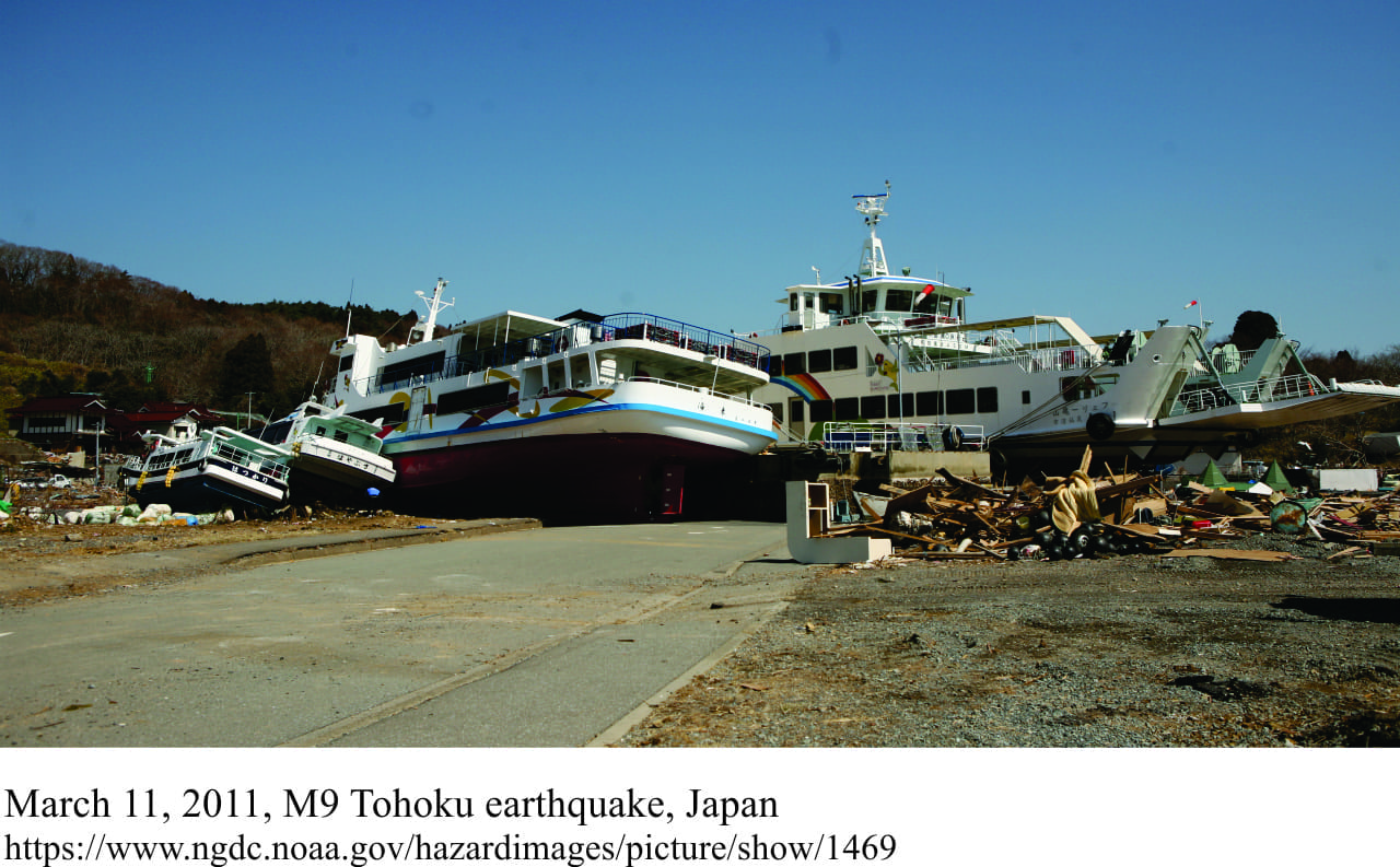
Slow-slip events were first identified in Japan and the Cascadia region of North America around the turn of the millenium. Both regions sit atop subductions zones (where one tectonic plate dives beneath another). Subduction zones are notorious for producing some of the largest earthquakes known (like the 2011 Magnitude 9 Tohoku-oki, and 1960 Chilean M9.5 events).
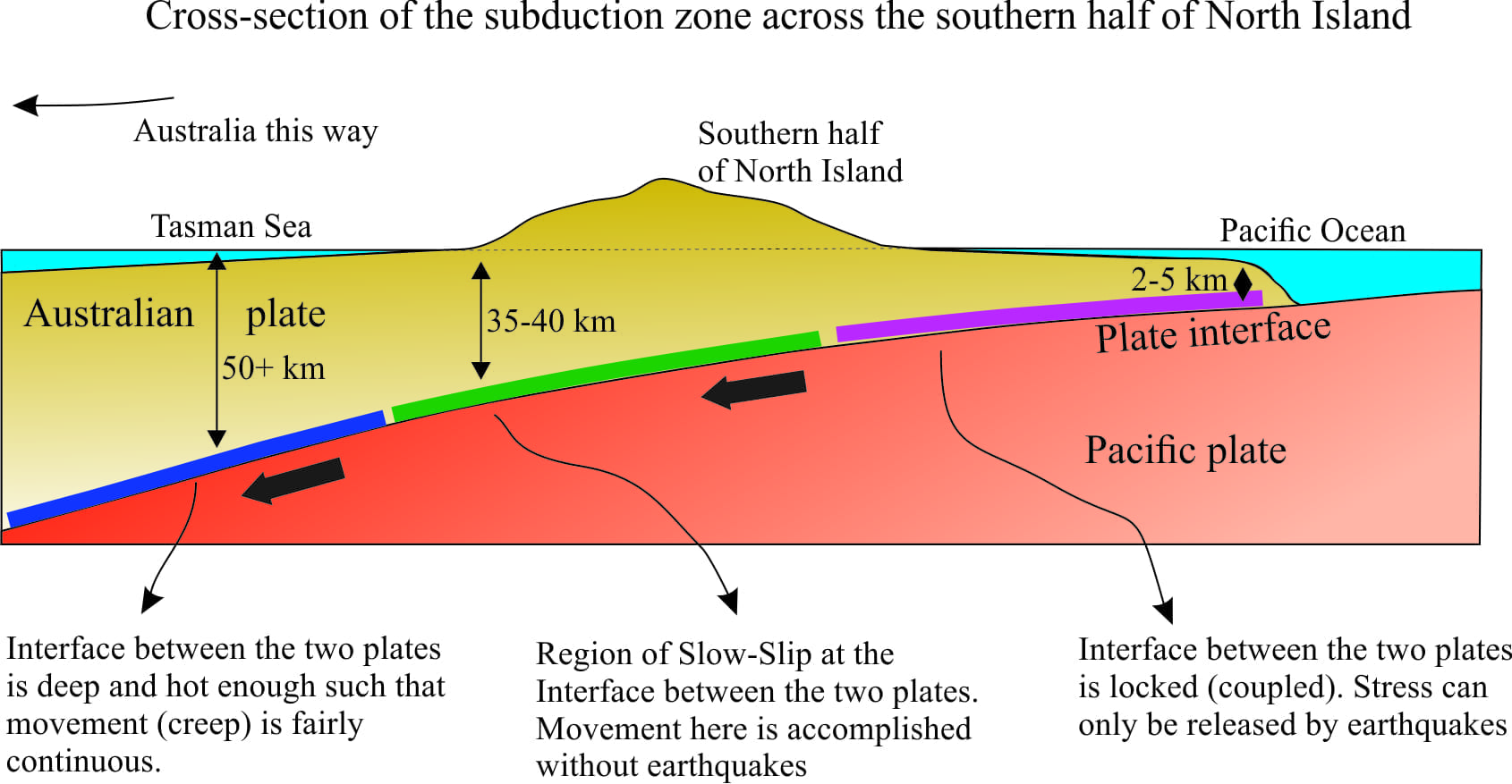
It is generally understood that in some regions the subducting (diving) plate and overlying plate become stuck (coupled, see the cartoon below); devastating earthquakes occur when the plates become momentarily unstuck.
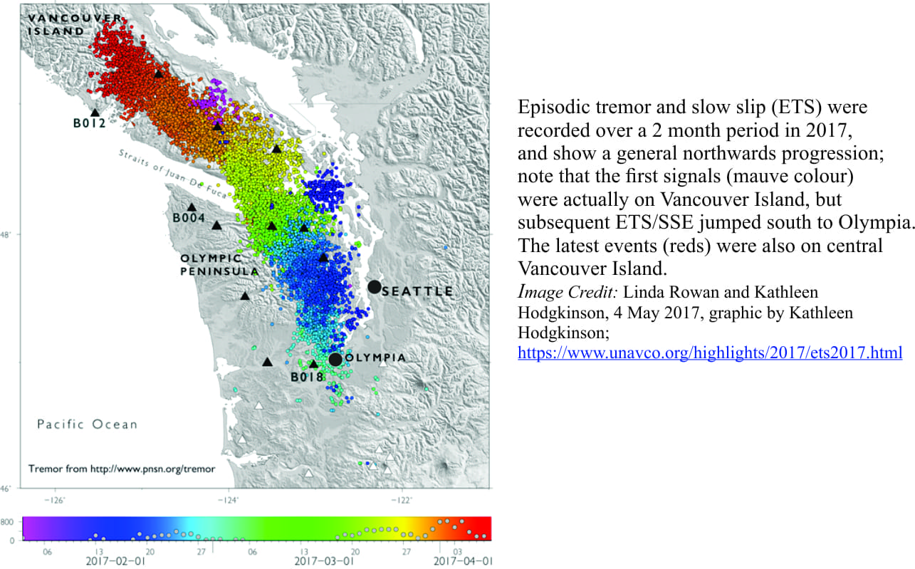
However, the Cascadia data showed that progressive land movement towards the continent (1999), suddenly reversed direction for several days with total surface movement of 2-4 cm (measured by GPS). The total displacement of the land surface (measured by GPS) was equivalent to a M6.5-M6.7 earthquake, and yet no sudden (seismic) movements were recorded, as is typical of earthquakes. It has since been discovered that these slow-slip events are also periodic, recurring about every 1-6 years, and that the region of slow-slip within the subduction zone migrates. Recent SSE events in the Cascadia region demonstrate very clearly this propensity to recur and migrate, where the locus of slow-slip moved, over 2 months (February-April, 2017), about 300 km from central Washington State to central Vancouver Island (British Columbia). None of this movement was associated with major earthquakes.
A patchwork of slow-slip also developed along the east coast of North Island, New Zealand, immediately following the M7.8 Kaikoura earthquake. Eastward land movement of 1-2cm took place over about 2-4 weeks, and like the Cascadia SSEs, were not associated with any significant earthquakes. Slow-slip events are now known from at least 12 locations in New Zealand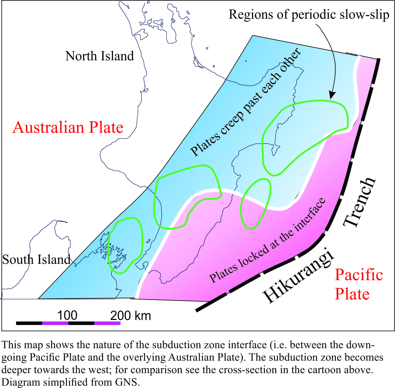 There has been a surge of interest in subduction zone SSEs over the last 10-15 years, much of this driven by the realisation that they provide a new window into the nature of earth movement, particularly as it relates to earthquake prediction. One way to look at the problem is to think of subduction zones (that extend well below earth’s crust) as having different degrees of stress (pressure) in different parts of the zone. Where the subduction zone is locked (coupled), pressure relief can only occur via violent earthquakes; where the zone is not locked, periodic movement between the tectonic plates will result in sedate SSEs. Analysis of events in Japan has shown that there is a close relationship between slow-slip events and clusters of earthquakes greater than M5. In particular, Japanese scientists have warned that the 2013-14 SSEs near Nankai Trough (the surface manifestation of the subduction zone that dives southwestward beneath the islands of Japan), may indicate a build-up of stress along known fault zones.
New data offshore eastern New Zealand has also detected movement of the sea floor caused by SSEs only a few kilometres below the sea floor (September-October, 2014), near the margin of the Hikurangi subduction zone.
The observations were made in an area also known to have harboured major earthquakes (one in 1947 cause a tsunami that inundated parts of the east coast), so it seems that both SSEs and earthquakes can, in some parts of subduction zones, occur in the same place, but at different times.
And this, it seems, is the SSE conundrum; the events themselves will release stress, but they can also re-distribute stress to parts of the subduction zone that are locked, and in doing so, increase the likelihood of major earthquakes. Hence the international interest in these events. Unravel these mysteries and perhaps, just perhaps, scientists will be able to better predict large earthquakes. I wonder if the inventors of GPS ever thought that such technology would be at the forefront of modern geodynamics?