
How Geologists Interpret Ancient Environments. 2 Ruffles and desiccation
Nearly all sedimentary rocks contain structures – fabrics, planes, contortions. If properly identified these sedimentary structures provide important clues to how the original sediments were deposited.
There are many different kinds of sedimentary structures formed by layers of sediment oriented at different angles, or layers that have been contorted and squished, structures formed by wetting and drying of sediment, structures formed by slip and slide, and by animals leaving tracks and traces as evidence of their activity.
All of these structures can be thought of as contributing to the architecture of sediments and sedimentary rocks.
We are going to examine two of the more common kinds of sedimentary structure – Ripples, and Mud Cracks (sometimes called Desiccation Cracks).
A ruffled surface – Ripples
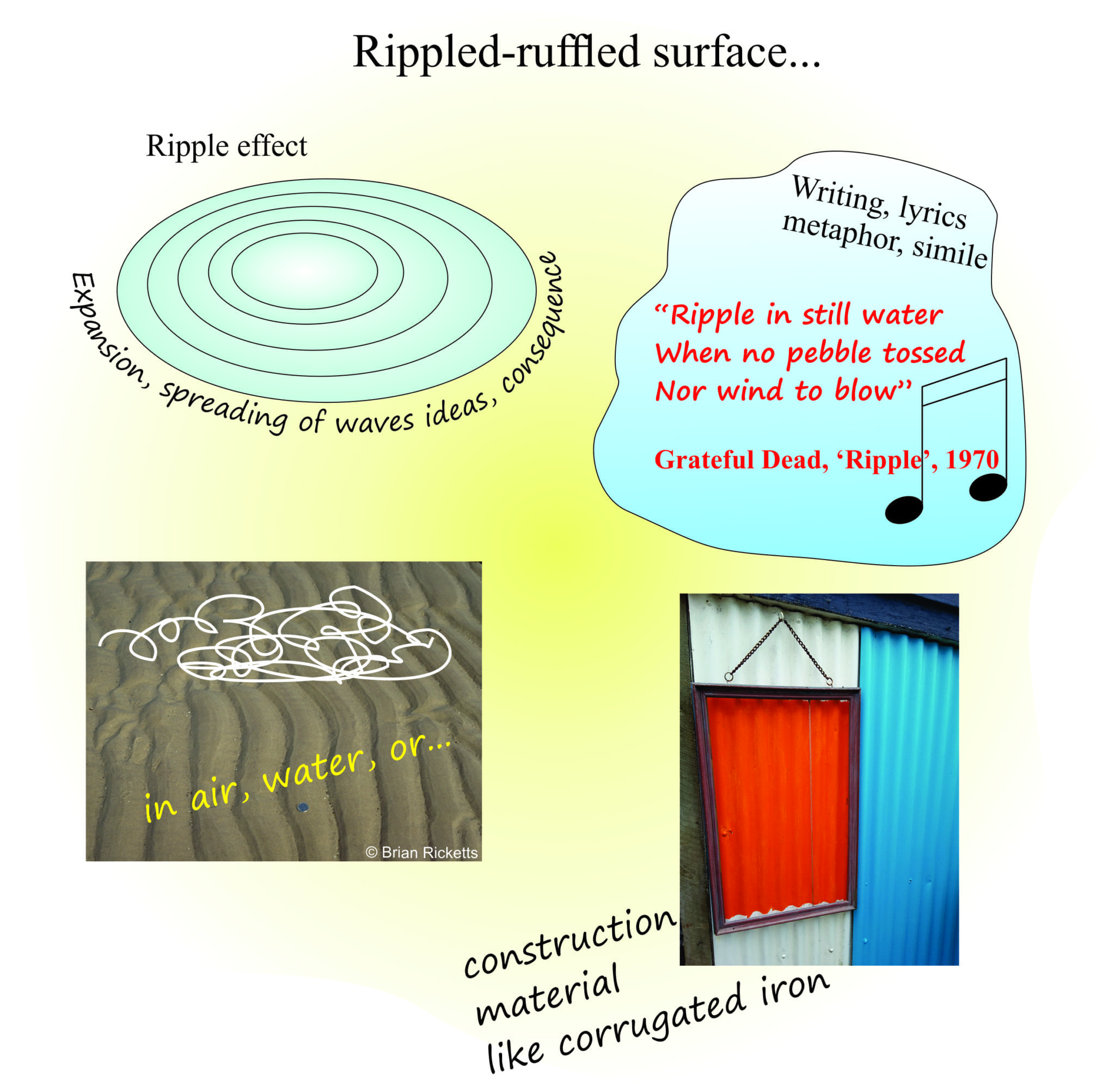 The word Ripple apparently originated in the 15th C, and was used to describe a ruffled surface. Ripple, the word, has several meanings, and most of them originate from the observation of repeated forms, or ruffles, especially in water.
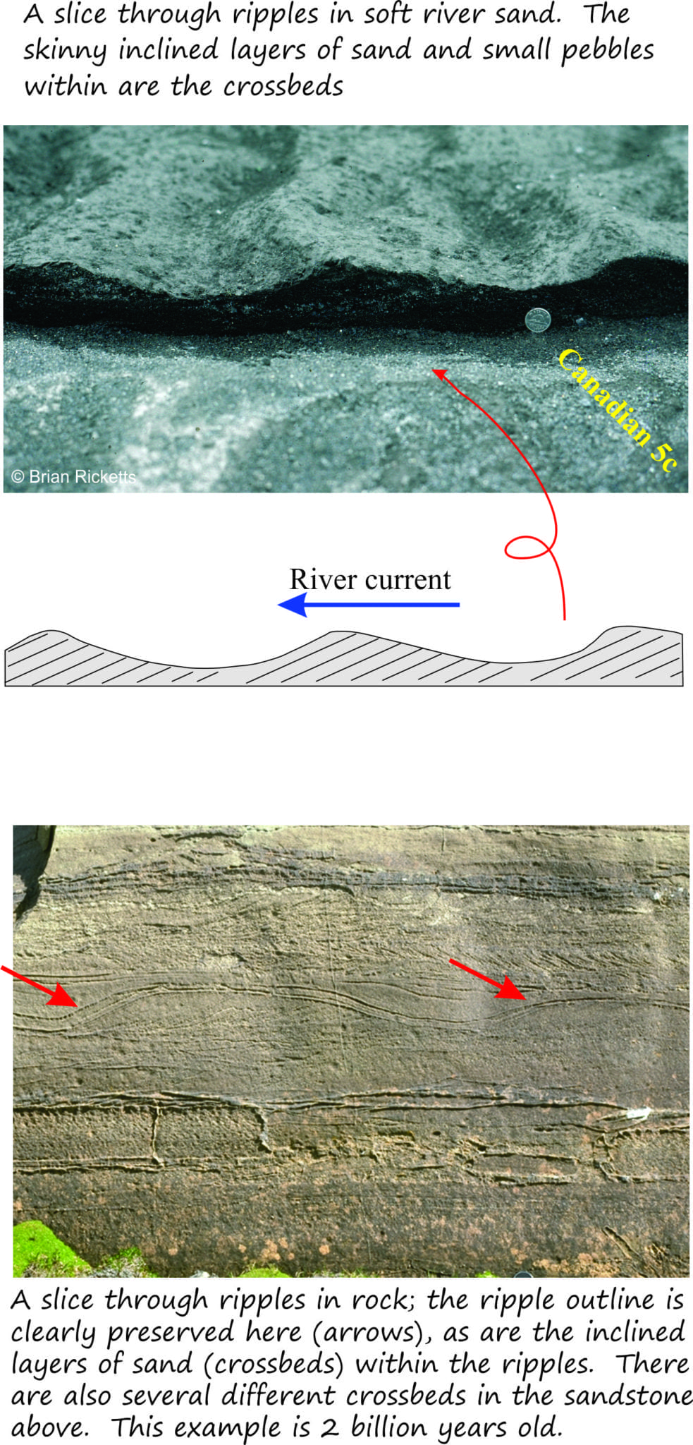
In geology, Ripples belong to a class of structure called crossbeds, so called because of their internal structure. People who study sedimentary rocks spend quite a bit of time trying to decipher the different kinds of crossbeds.
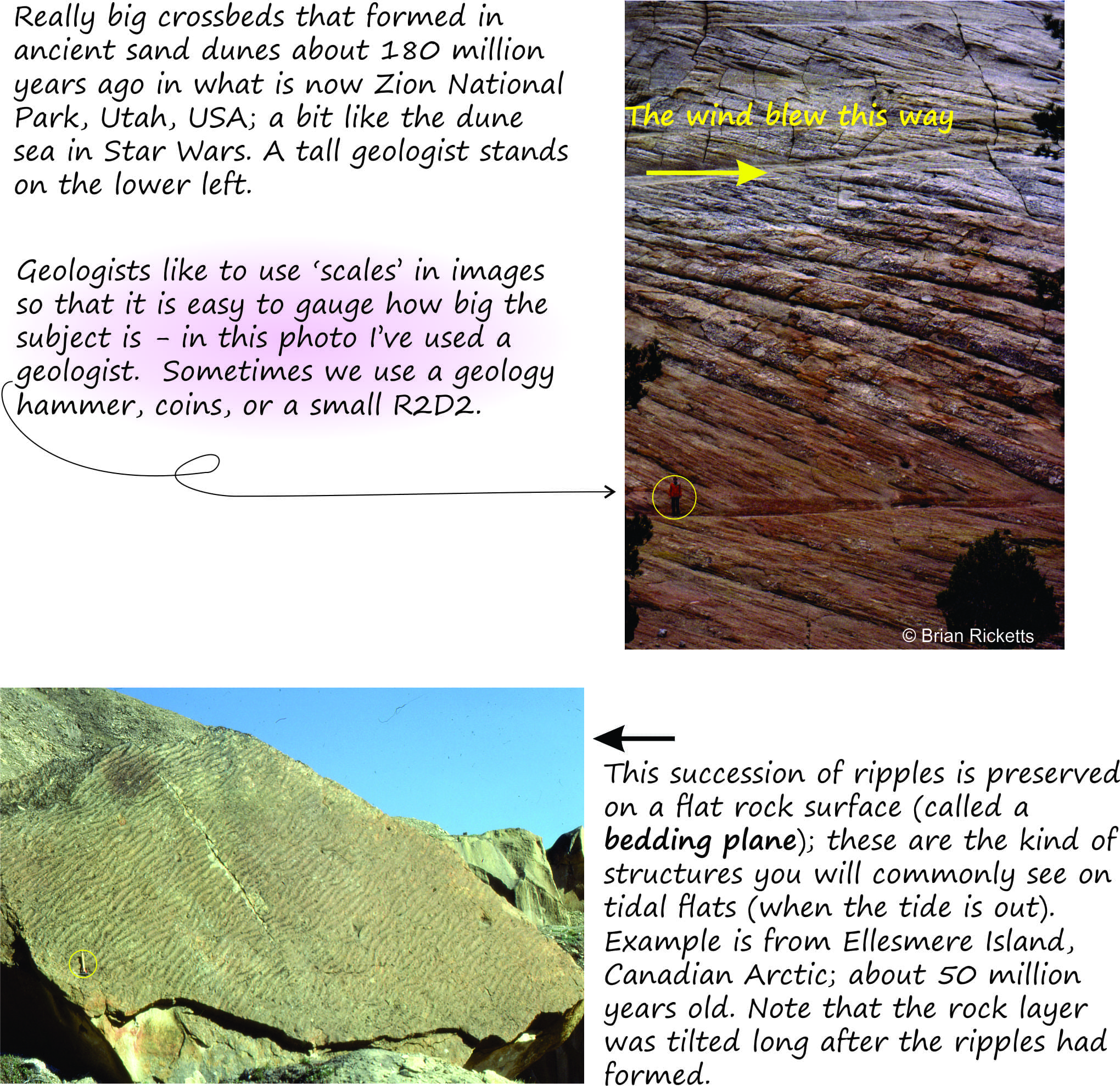 Crossbeds come in all sizes and shapes. We tend to give them different names depending on their size and 3D geometry, but for now we’ll just call them ‘Ripples’.
How ripples form
Geologists have a very sophisticated understanding of how ripples form. We can observe them forming today in moving water or on wind-swept beaches. A great deal of research has also been conducted using artificial channels, or flumes, where all manner of variables can be closely monitored (such as the velocity of water flow, water depth, the size of sand grains, the amount of turbulence).
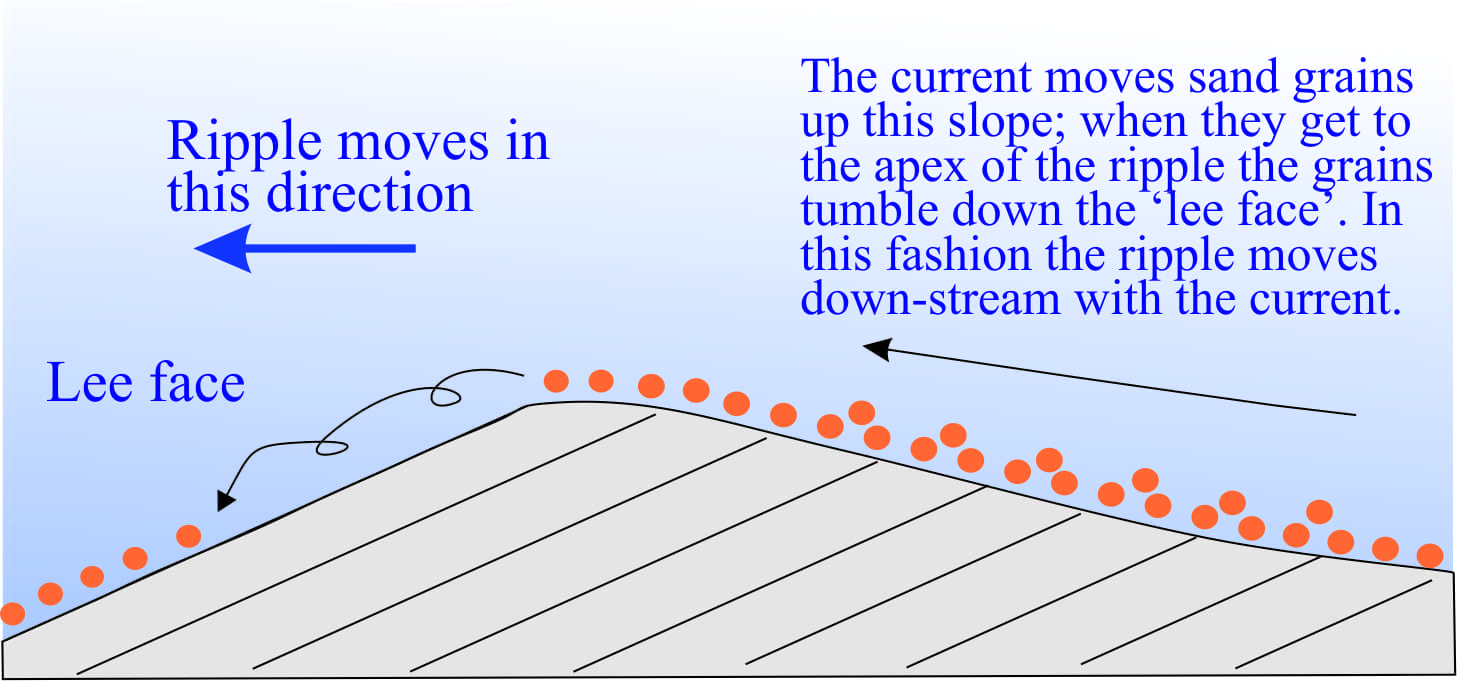 In flowing water or wind, our ripples develop characteristic shapes; the steep side, or face is called the ‘lee face’; it ‘faces’ down-flow. In most ripple-like structures the lee face is preserved by the repetition of inclined surfaces, or crossbeds that are deposited in sequence.
This geometric property is hugely beneficial for those studying ancient sediments because it tells us the direction that the ancient current flowed. Our observations and experiments also tell us that larger ripples usually form in faster flowing currents. This too is very useful information.
Stuff that dries out – Mudcracks
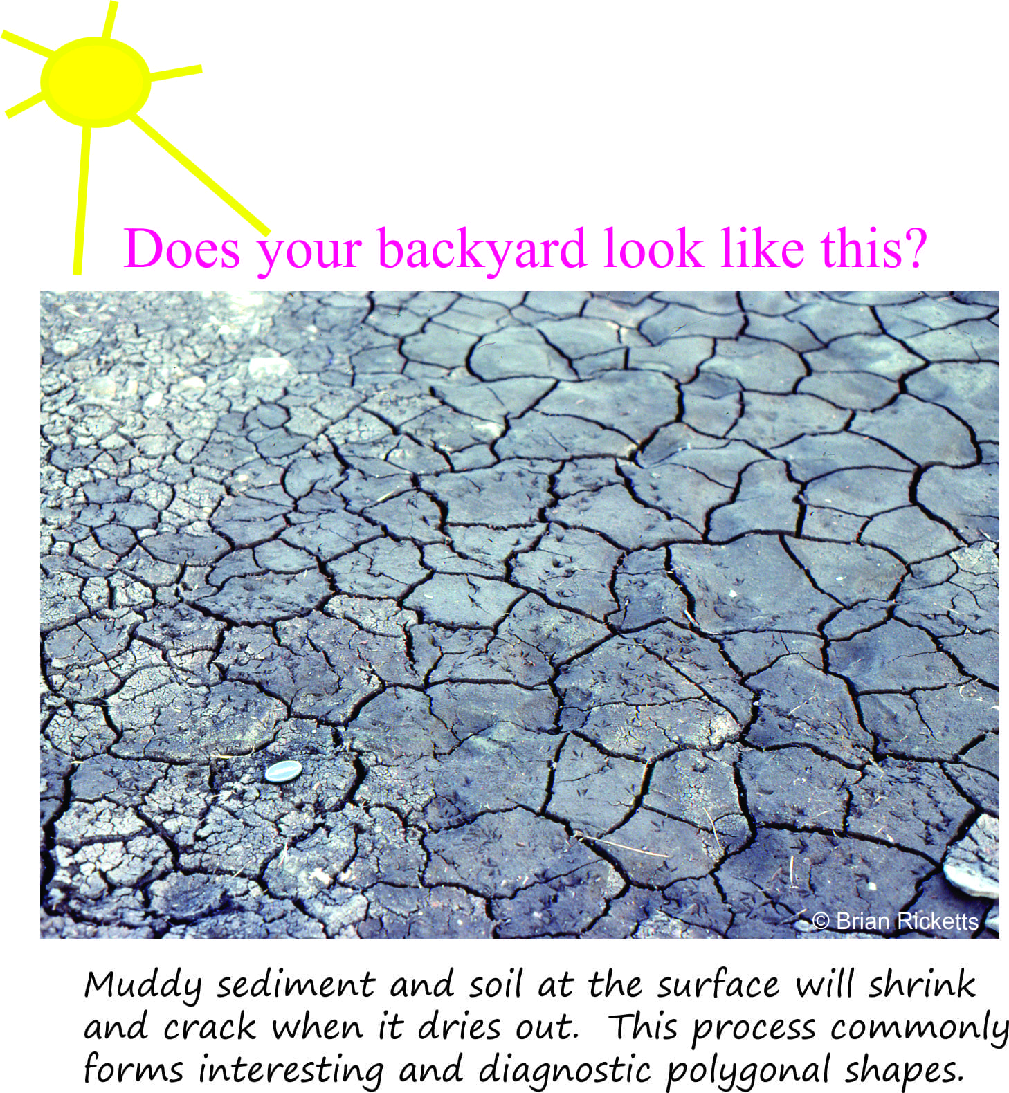 These structures are a common sight in hot dry parts of the world or places that have dry summers. Surface soils or deposits will crack, or desiccate. Take a look in your backyard or the local river bank next summer.
Mudcracks, when we find them preserved in sedimentary rocks tell us (I guess it seems obvious) that the environment at that time was dry, maybe hot, maybe cold. The significance of this will become apparent when we examine mudcracks and other sedimentary structures in a broader context.
The broader picture – ripples and mudcracks in context
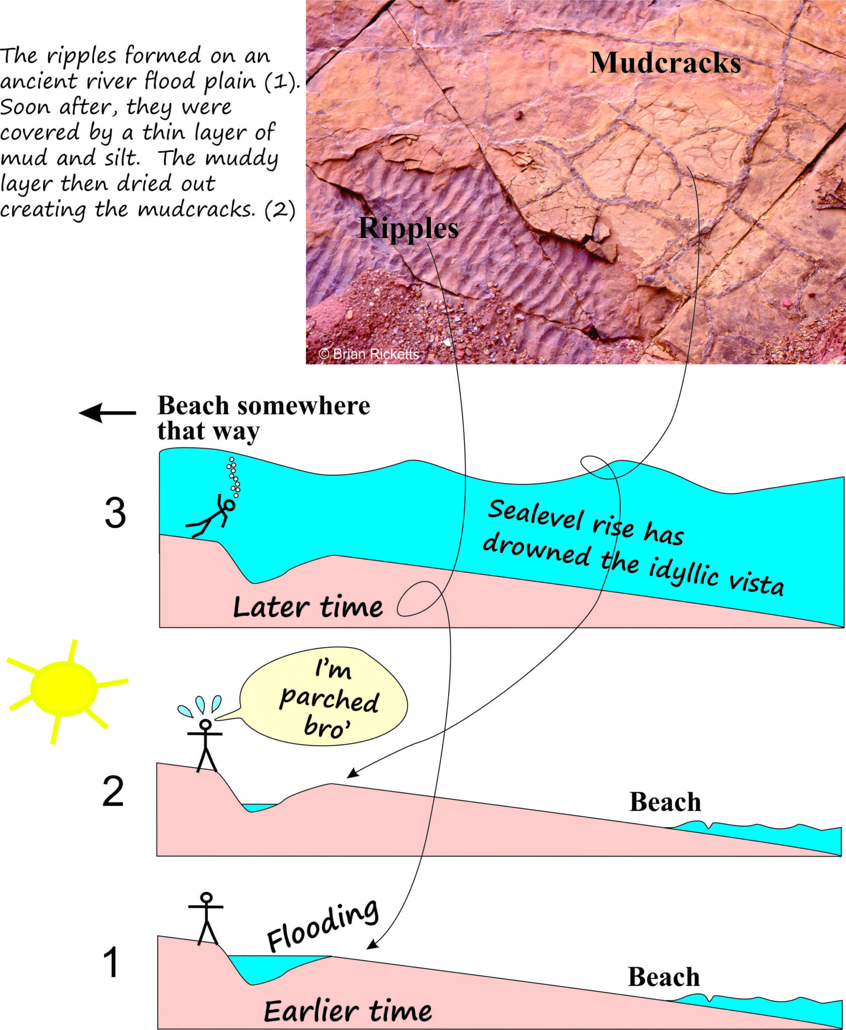
Take a look at the image below (it is the same as the image on the Home Page). Here we have a layer of rippled sandstone that is covered by a layer of mudstone with mudcracks. If we study each layer and sedimentary structure separately, we will obtain some useful information about how the sediment in each was deposited. But if we consider the two layers together we can paint a much more dynamic picture of events. In this example we know that the ripple layer formed before the mudcracked layer (see the first post in this series). So we can picture a sequence of events at this particular location;
1 Flooding from an adjacent river that produced the ripples, and
2 Eventual exposure of the sediment to the elements resulting in drying out and mudcracks.
 In other words, by considering information in multiple sedimentary layers above and below our example, we can create a much more detailed and interesting picture of events, than if we just considered each layer on its own.
Now, just for arguments sake, let’s say that a layer or series of layers above the mudcracks contain fossil clams and structures that tell us they were deposited in seawater a few 10s of metres deep. Our geological story has just become a lot more interesting. First (#1 in the cartoon) we see evidence for river flooding (probably rainy weather) followed by a period of drying out (#2 – nice and sunny) – all this took place on land. We then find (based in evidence from layers above) that we are now standing (swimming) in seawater that is several metres over our head (#3). In other words, over the period of time represented by our many layers, sea-level has risen and drowned the river flood plain. This also means that the local beach has also moved inland from its former position (shown on the cartoon).
There are many different kinds of sedimentary structure (and fossils) that provide the data geologists need to decide whether the deposits formed on land or in the sea, whether the seas were shallow or deep, whether coastlines were rocky or sandy, and so on. The crux of this post is that while each structure in any one layer is interesting in itself, they become far more powerful tools if considered in the context of structures (and fossils) in successive layers; this is the essence of stratigraphy; a fascinating branch of geology.
Pingback: homepage