Tag Archives: Axel Heiberg Island

Atlas of syntectonic sediments

Facebooktwitterlinkedininstagram

Syntectonic sediments – sediments associated with active tectonism

The Atlas, as are all blogs, is a publication. If you use the images, please acknowledge their source (it is the polite, and professional thing to do).

This category is a bit different to the other Atlas collections. It does not refer to a specific environmental state, like fluvial or submarine fan, but to erosion, deposition, and deformation associated with active tectonics. This includes uplift, folding, faulting, the erosion of landscapes created by each of these, and subsequent deposition. Syn-tectonic deposits may be constrained in time to specific events (e.g. faulting), or to periods of mountain building, or other modes of deformation along plate boundaries. Classic examples include the Molasse of central Europe, and basins outboard of the Cordilleran fold and thrust belt in western Canada.

Most of the images here are inferred to have been associated with specific tectonic events. Conglomerate facies are common in fluvial and alluvial settings in close proximity to active faults and uplifts (Eurekan Orogeny in the Canadian Arctic, Alberta Foreland Basin, evolving transform faults in Ridge Basin, and active extension – strike slip faulting in Death Valley), to deep marine turbidites that were also influenced by active (Waitemata) basin tectonics. There’s also a few shots of coastal exposure of an active accretionary prism on New Zealand’s east coast.

This link will take you to an explanation of the Atlas series, the ownership, use and acknowledgment of images.  There, you will also find links to the other categories.

Click on the image for an expanded view, then ‘back page’ arrow to return to the Atlas.


The images:


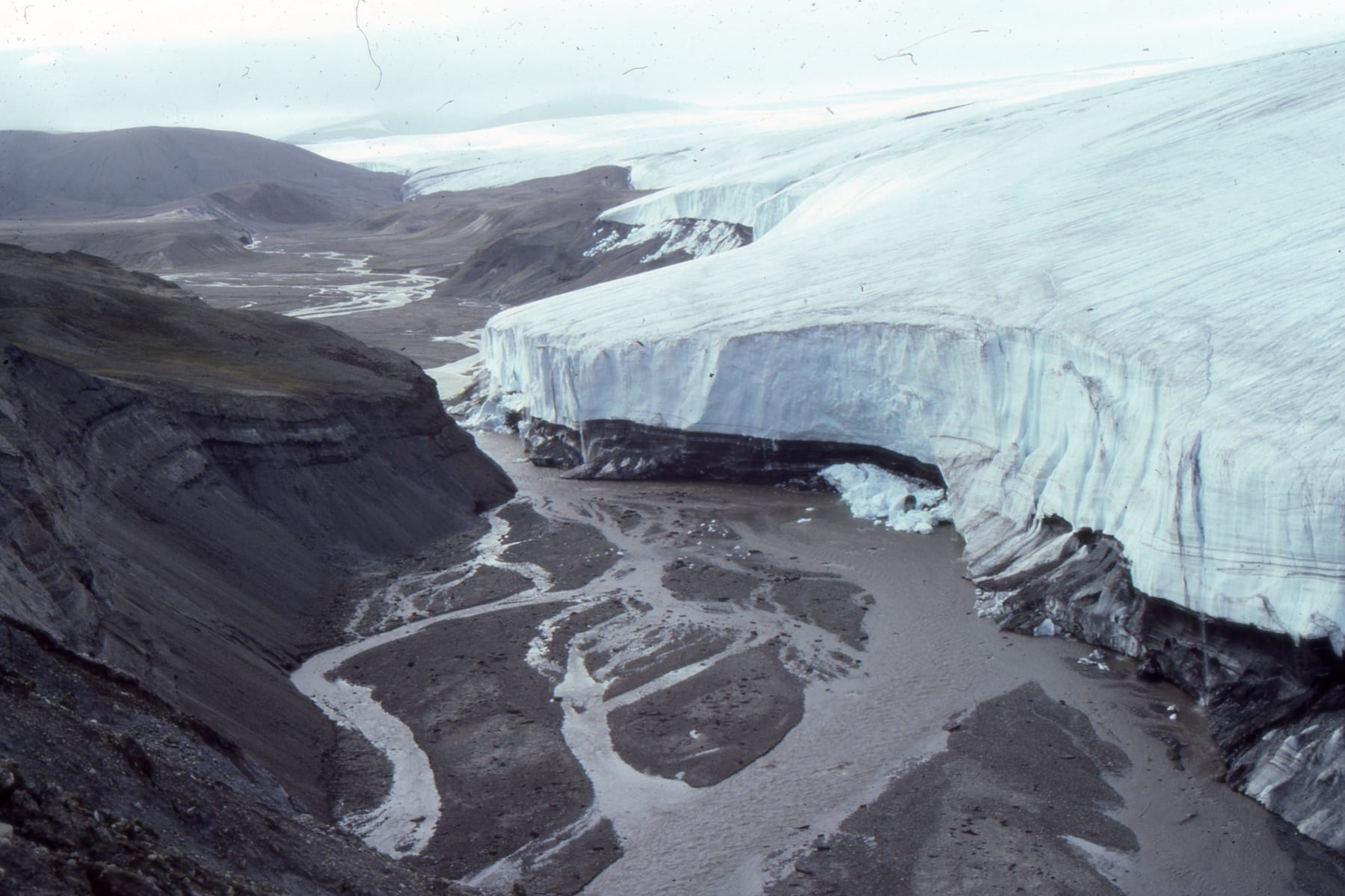
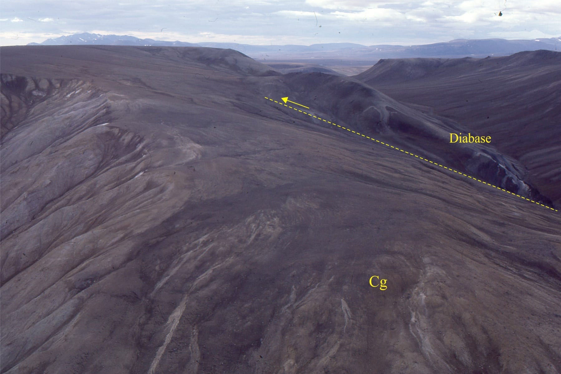
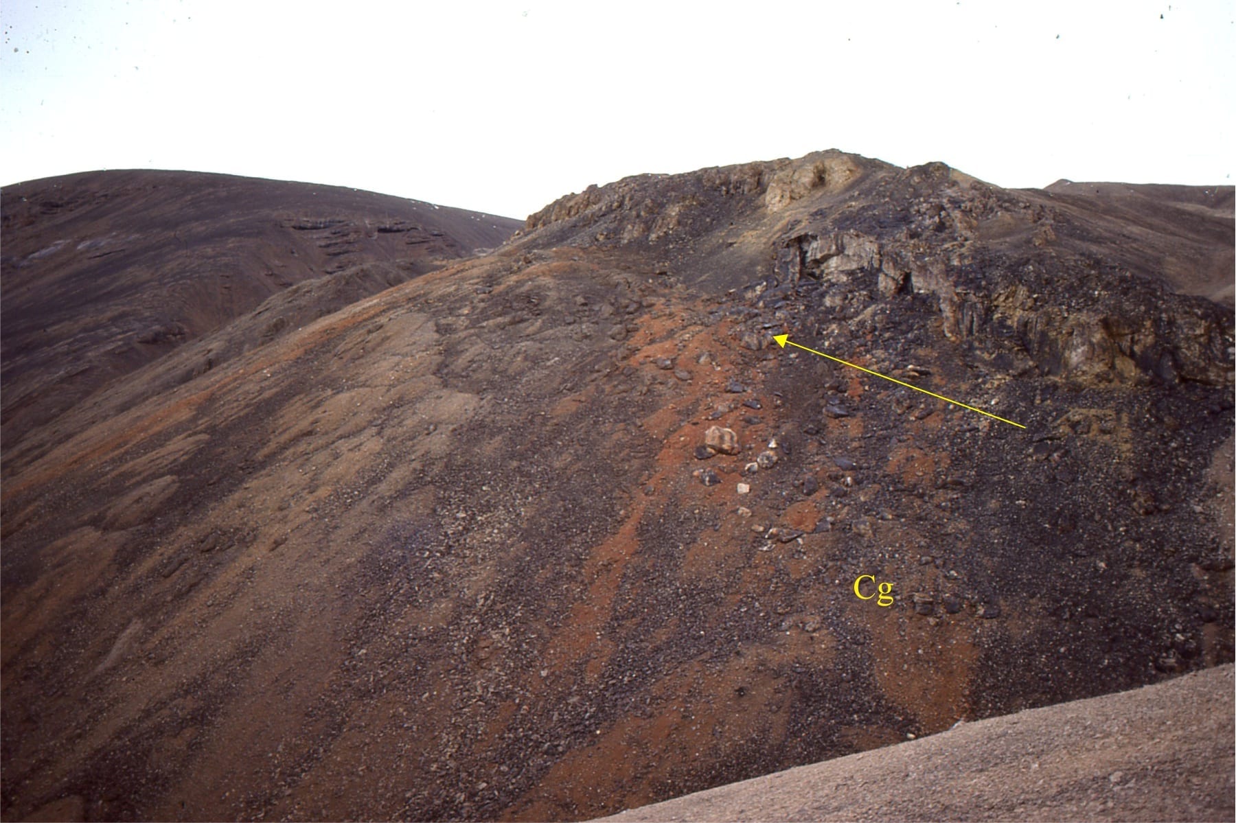
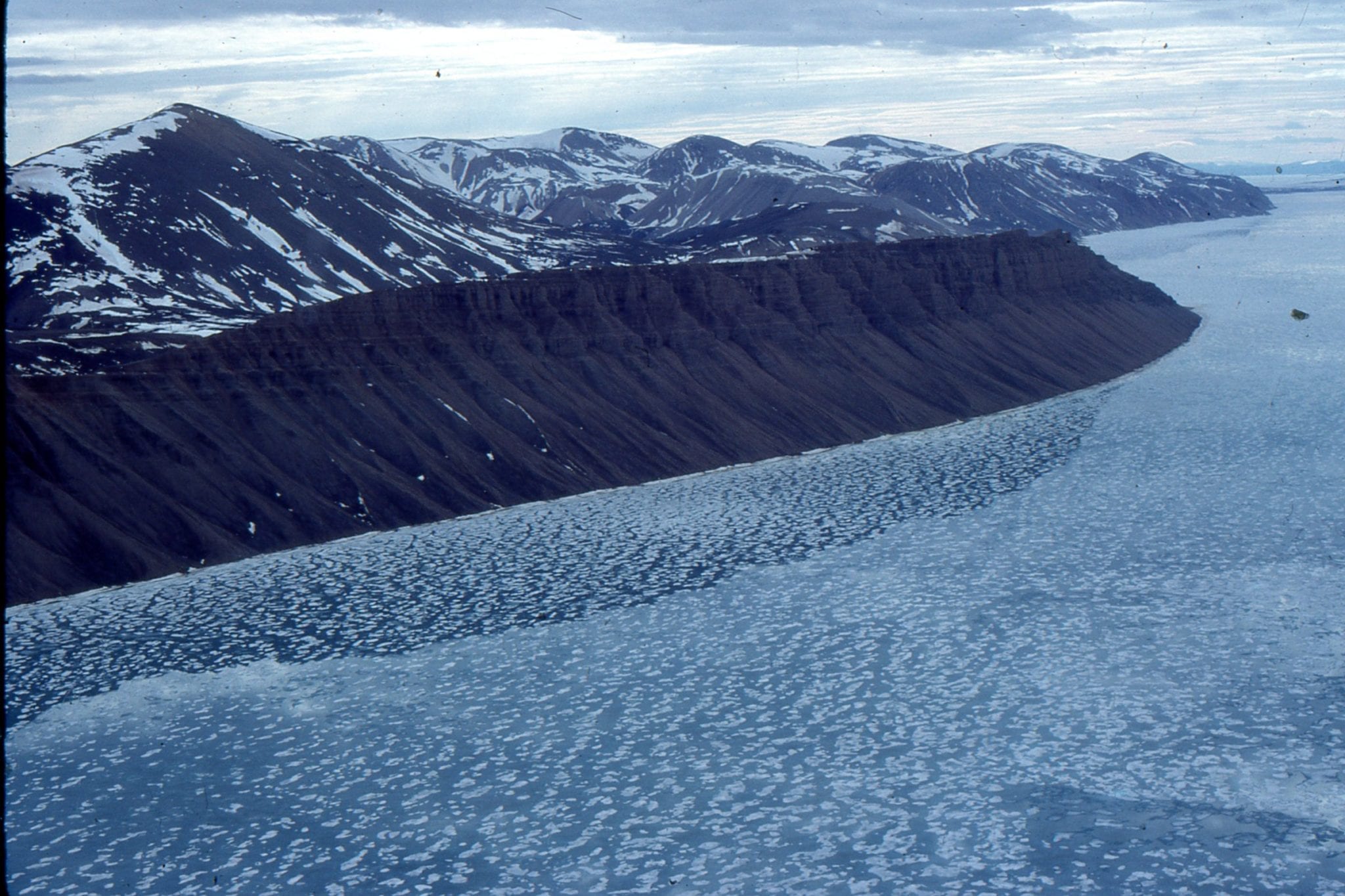
Diabase sills intrude Jurassic through Permian successions in the Arctic Sverdrup Basin. Unroofing of these older rocks during the Eurekan Orogeny (climaxing about mid Eocene) provided large volumes of coarse sediment to alluvial fans, braided and high sinuosity rivers. In these two examples the Stolz Thrust is at the base of slope, with tectonic transport to the right (east). Here, the older rocks have been thrust over the syntectonic deposits (Buchanan Lake Fm.). Axel Heiberg Island.


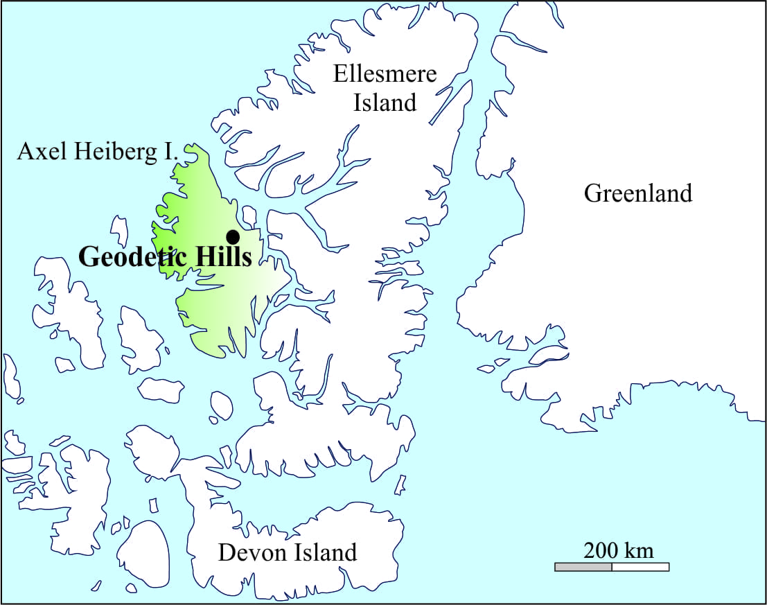
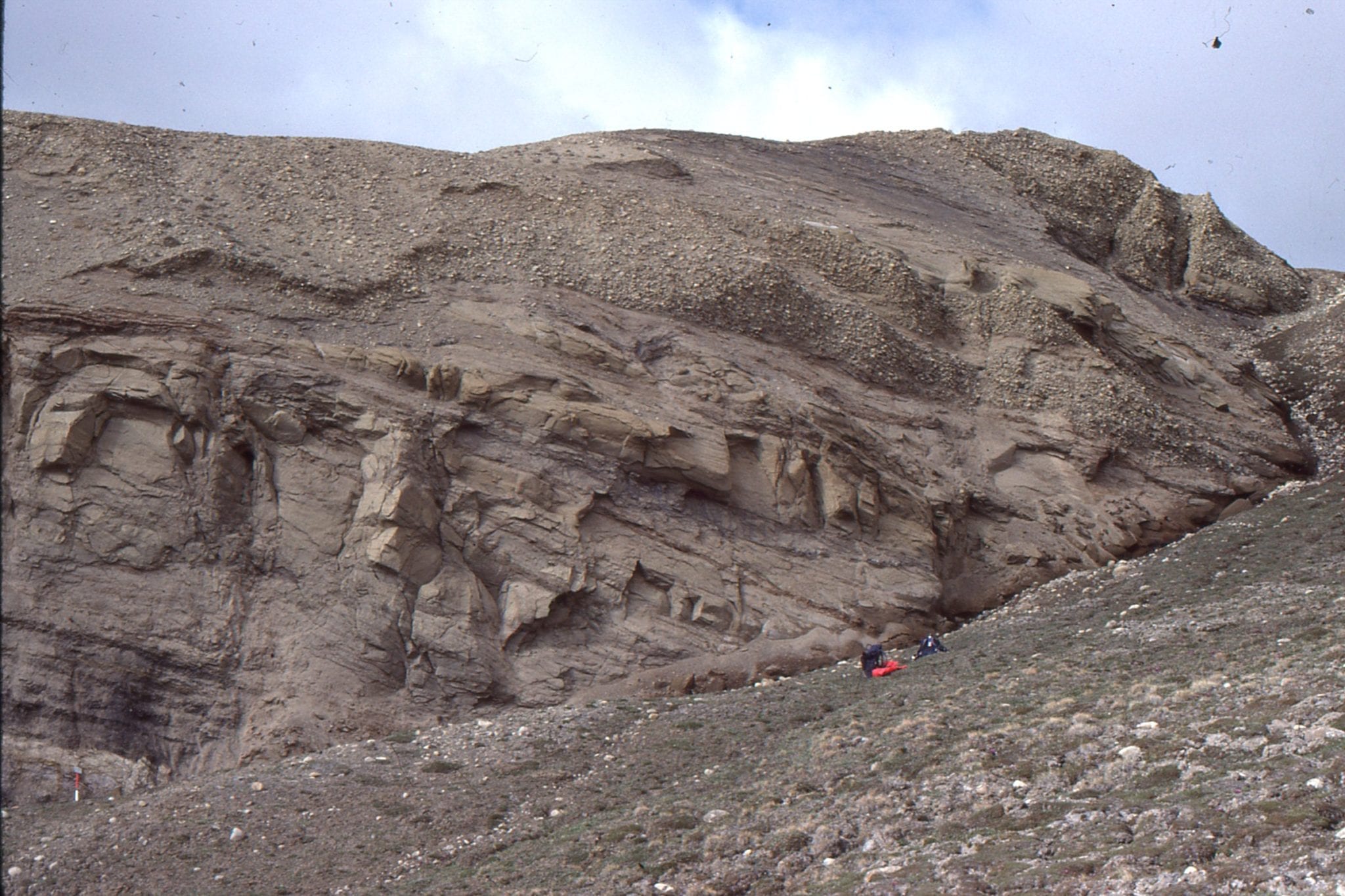
Stolz Thrust at Geodetic Hills (the site of the Middle Eocene Fossil Forest). Left: Diabase sills are thrust over syntectonic conglomerate. Right: Upturned and sheared Triassic rocks in the hanging wall; the fault trace is located in the depression (upper left).


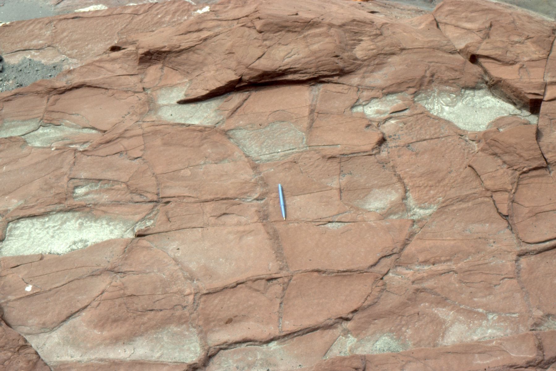
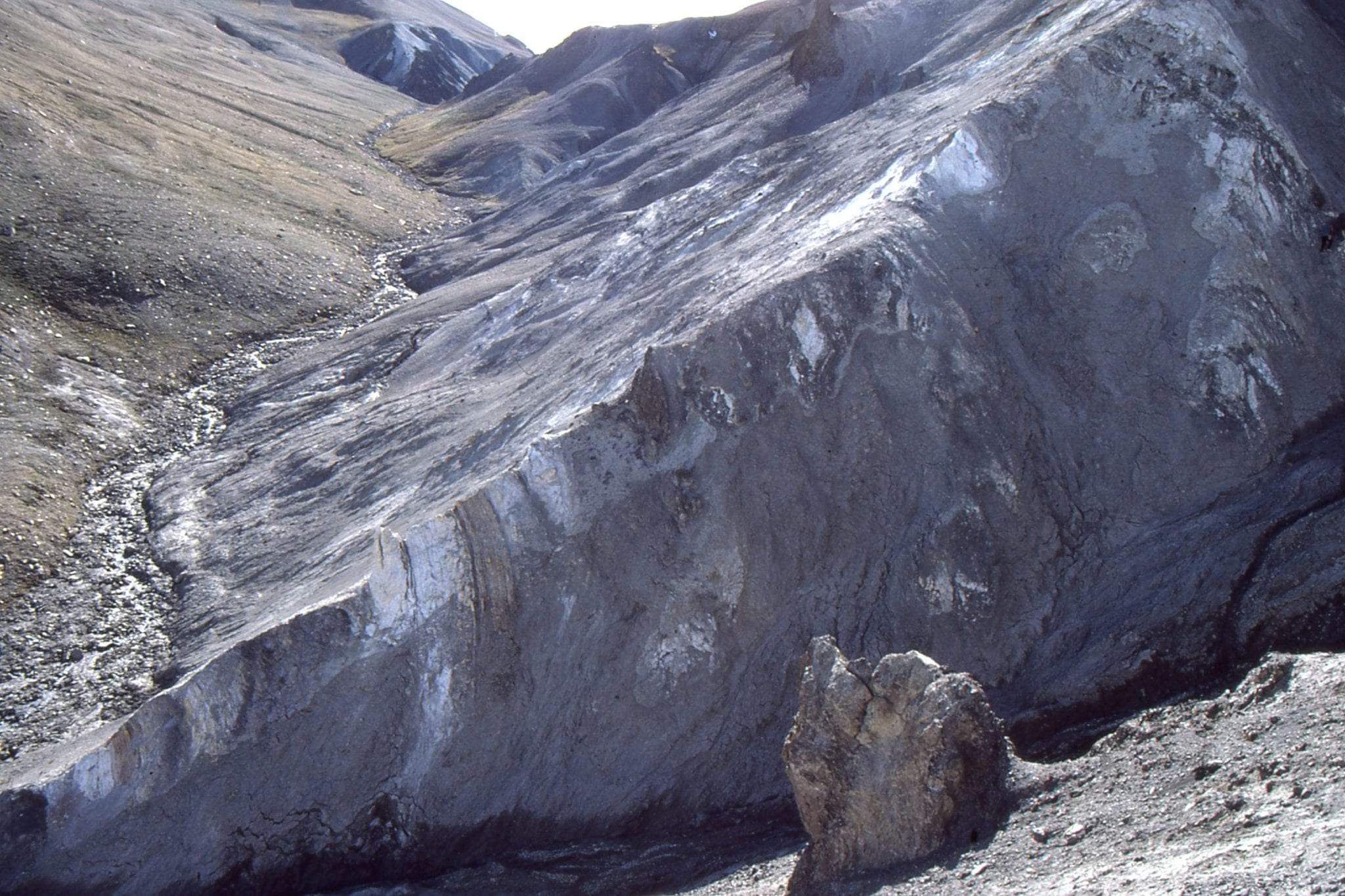
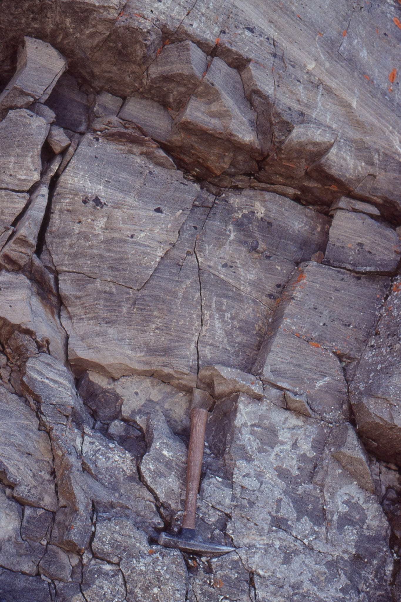
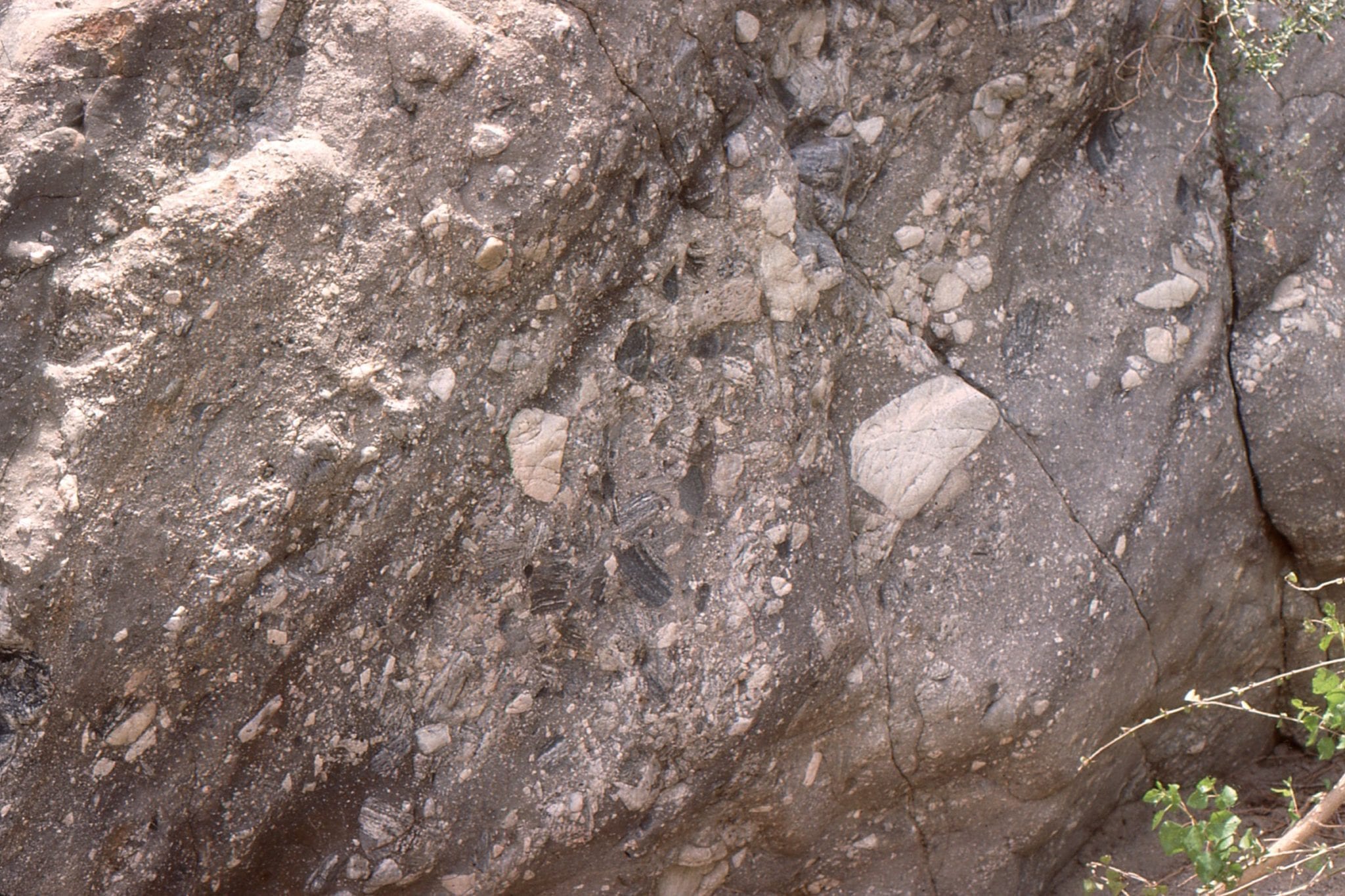
Detail of shear and boudinage of Triassic sandstone-mudstone in Stolz Thrust zone, Geodetic Hills.  Location is the right image above.


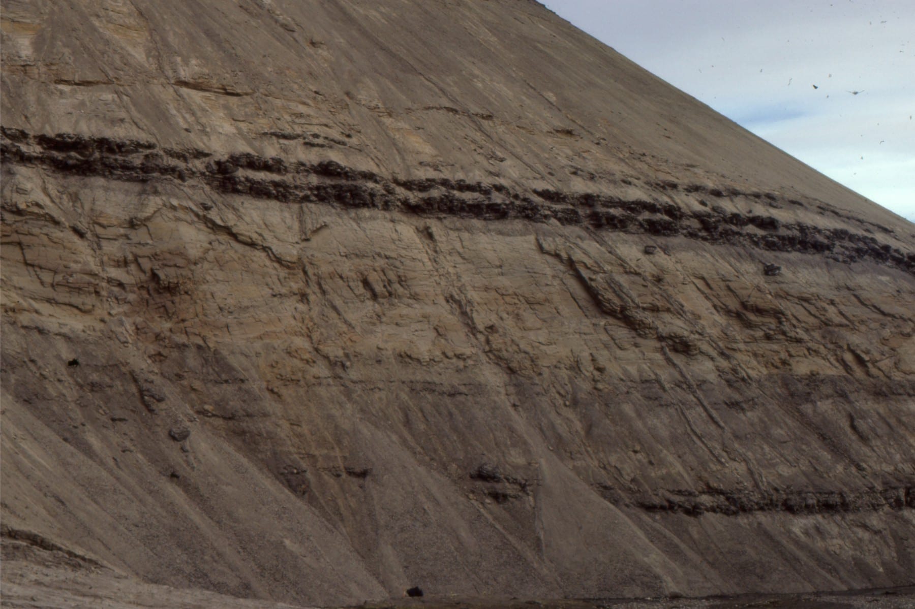
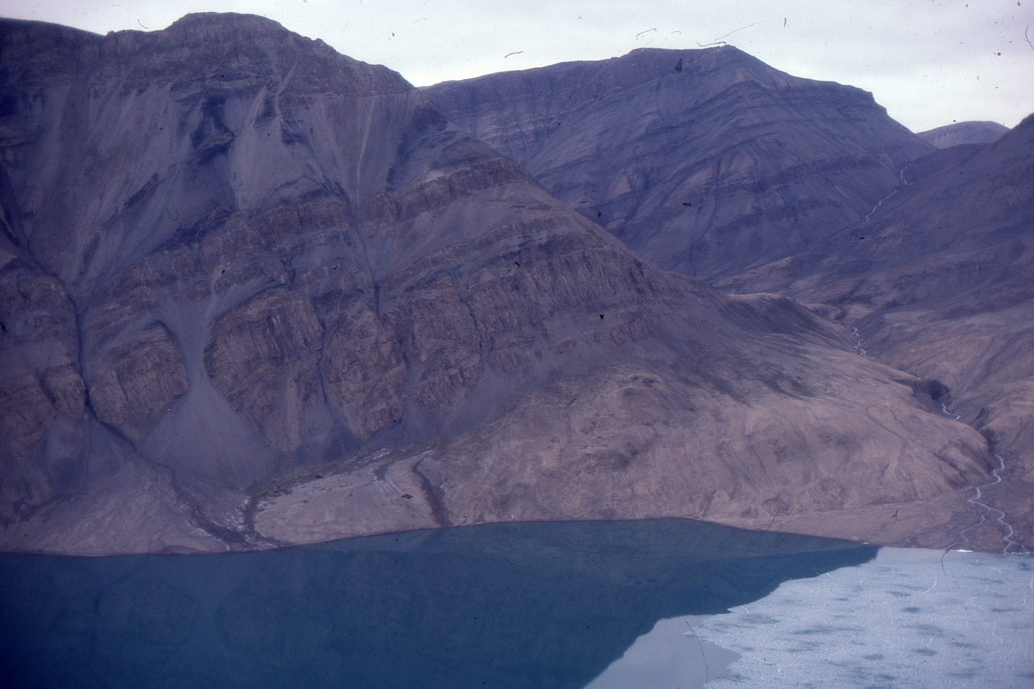
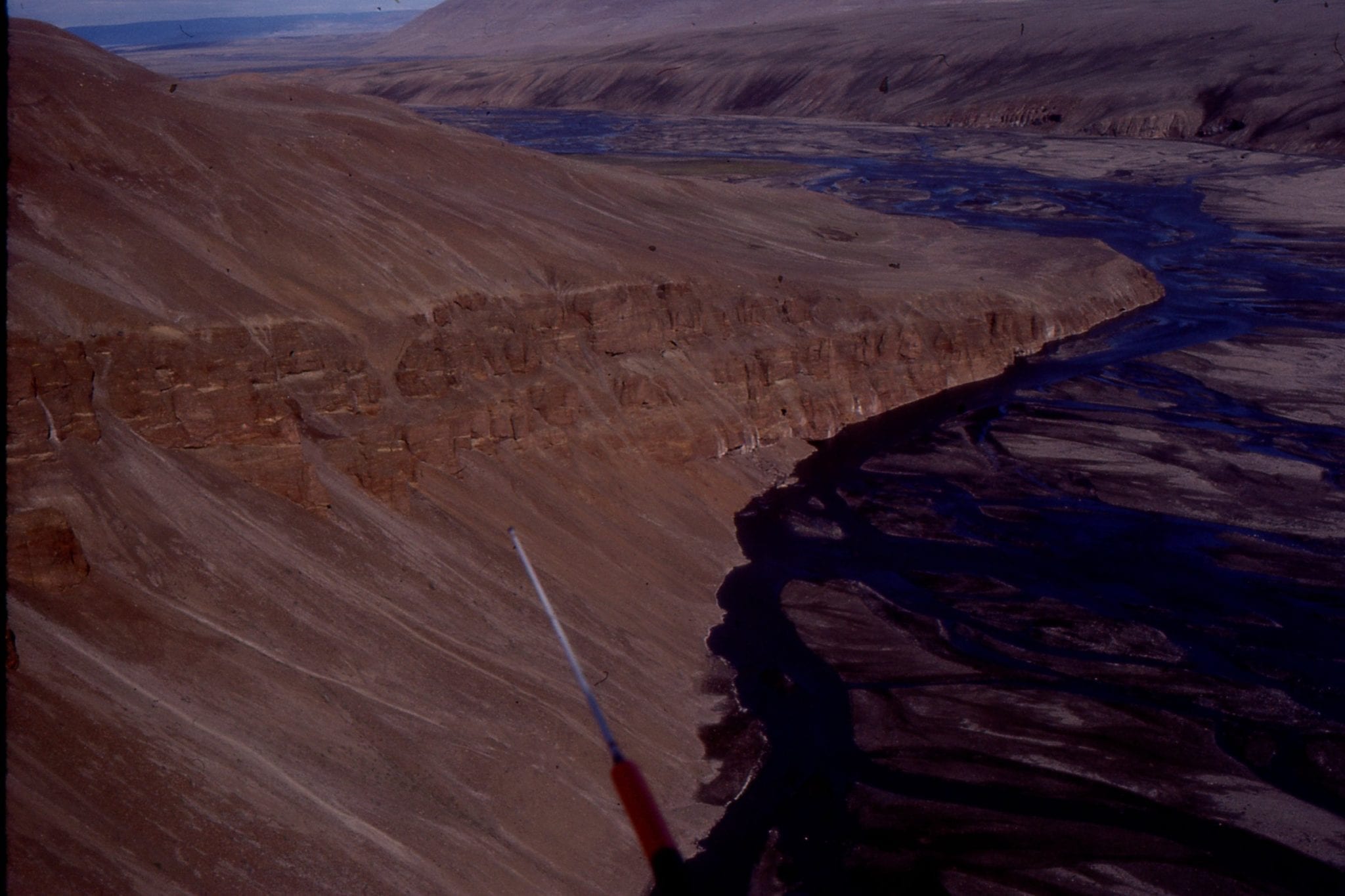
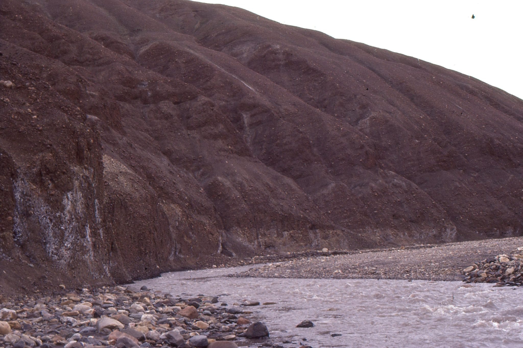
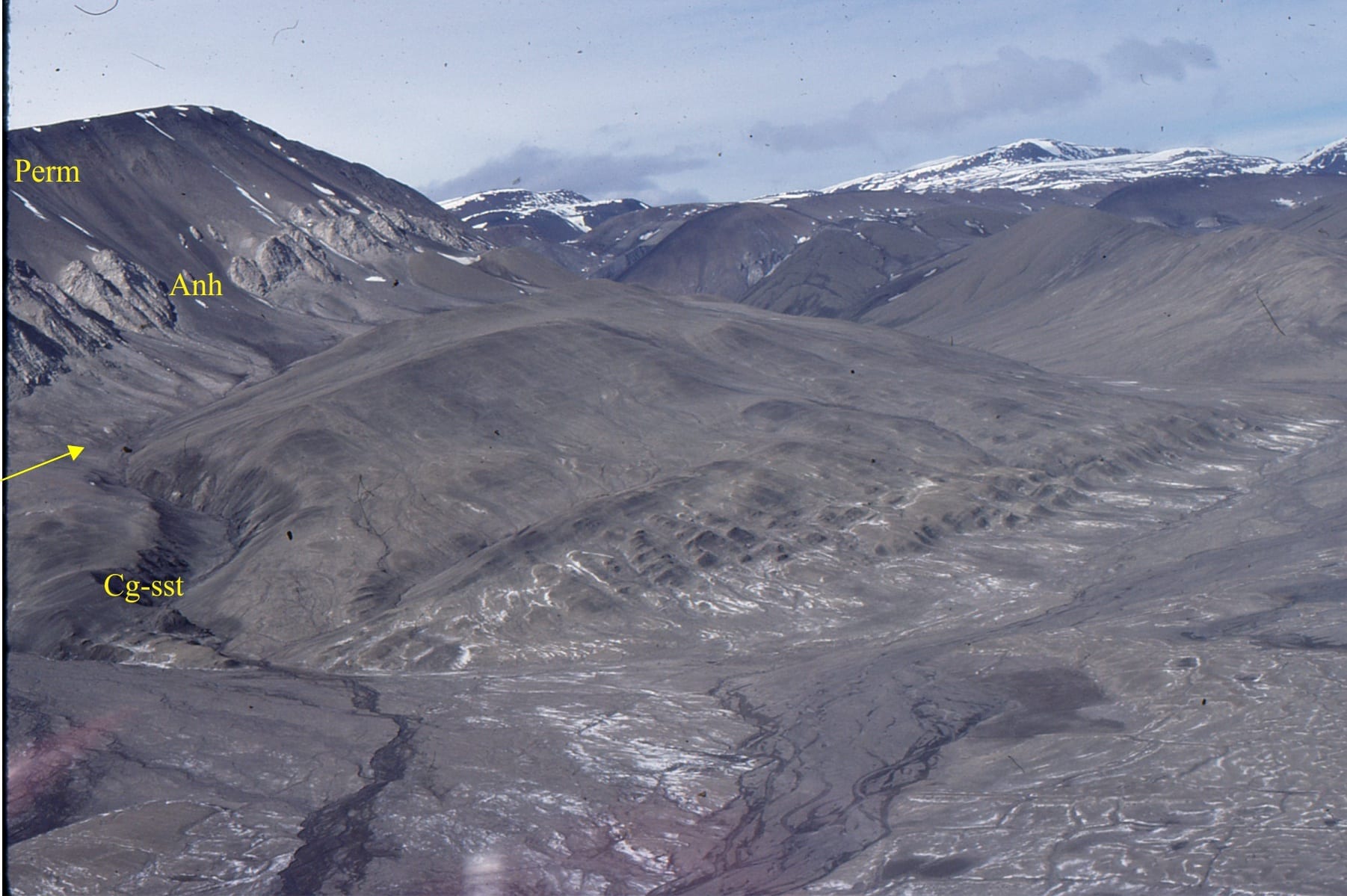
Stolz Thrust, with Permo-Triassic rocks in the hanging wall (including slivers of anhydrite), over middle Eocene syntectonic conglomerate and sandstone (Buchanan Lake Fm.) North of Whitsunday Bay, Axel Heiberg Island.  Coarse-grained sediment was shed from the uplifted older rocks, and subsequently over-ridden by continued thrusting.


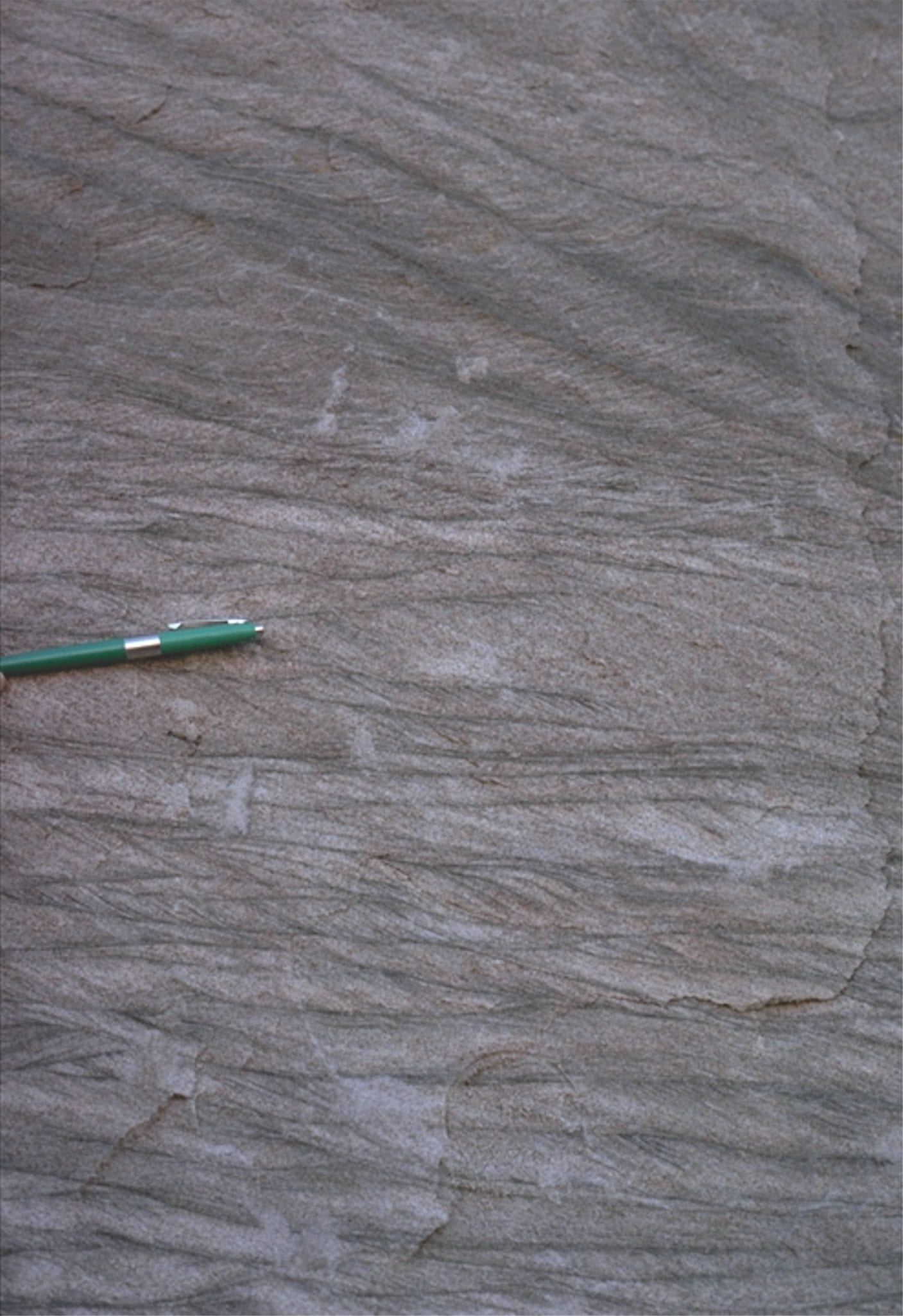
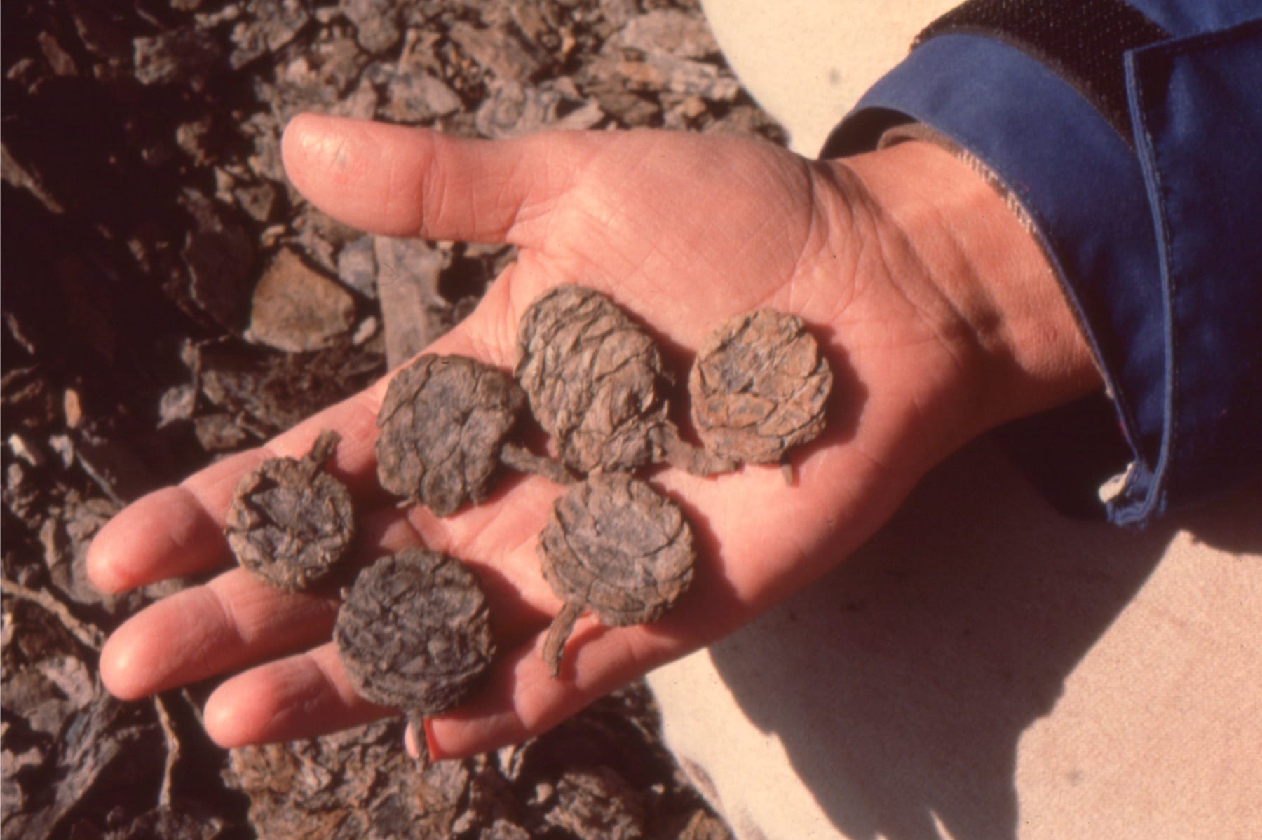
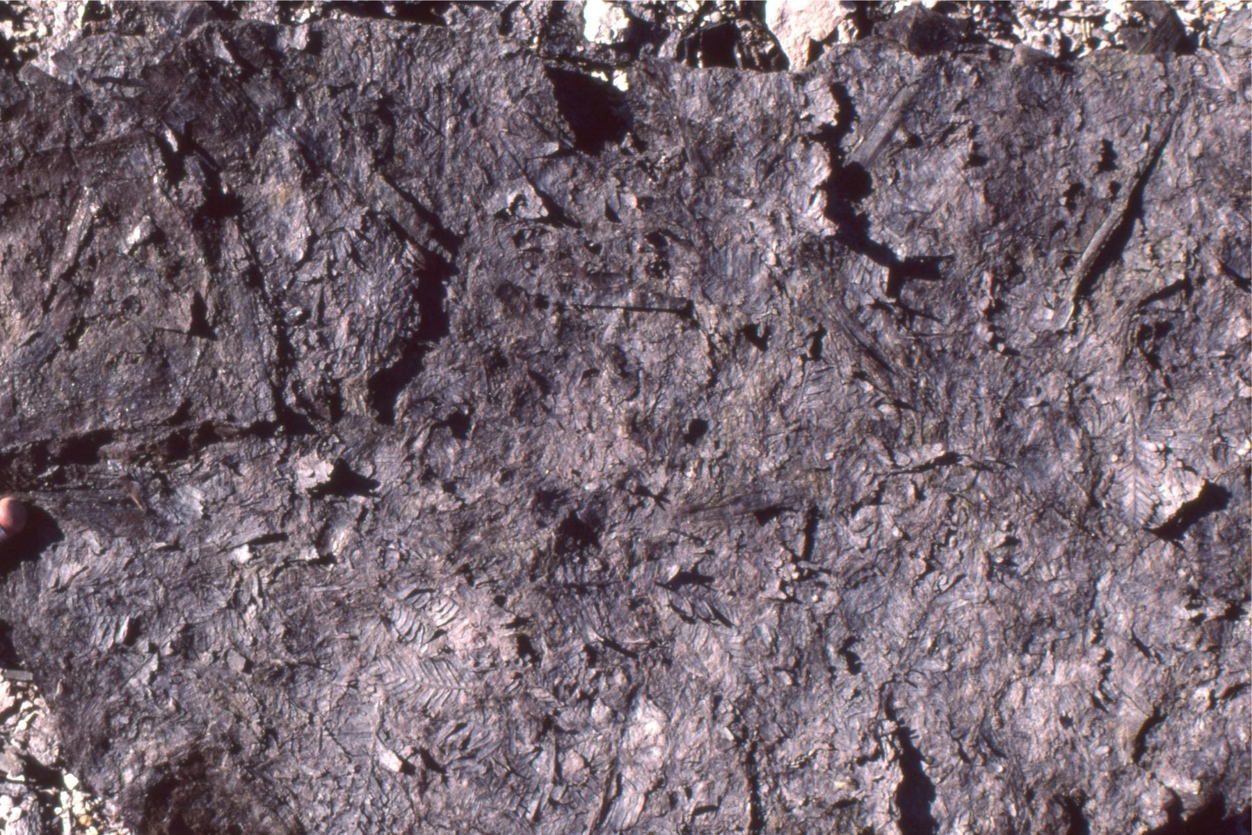
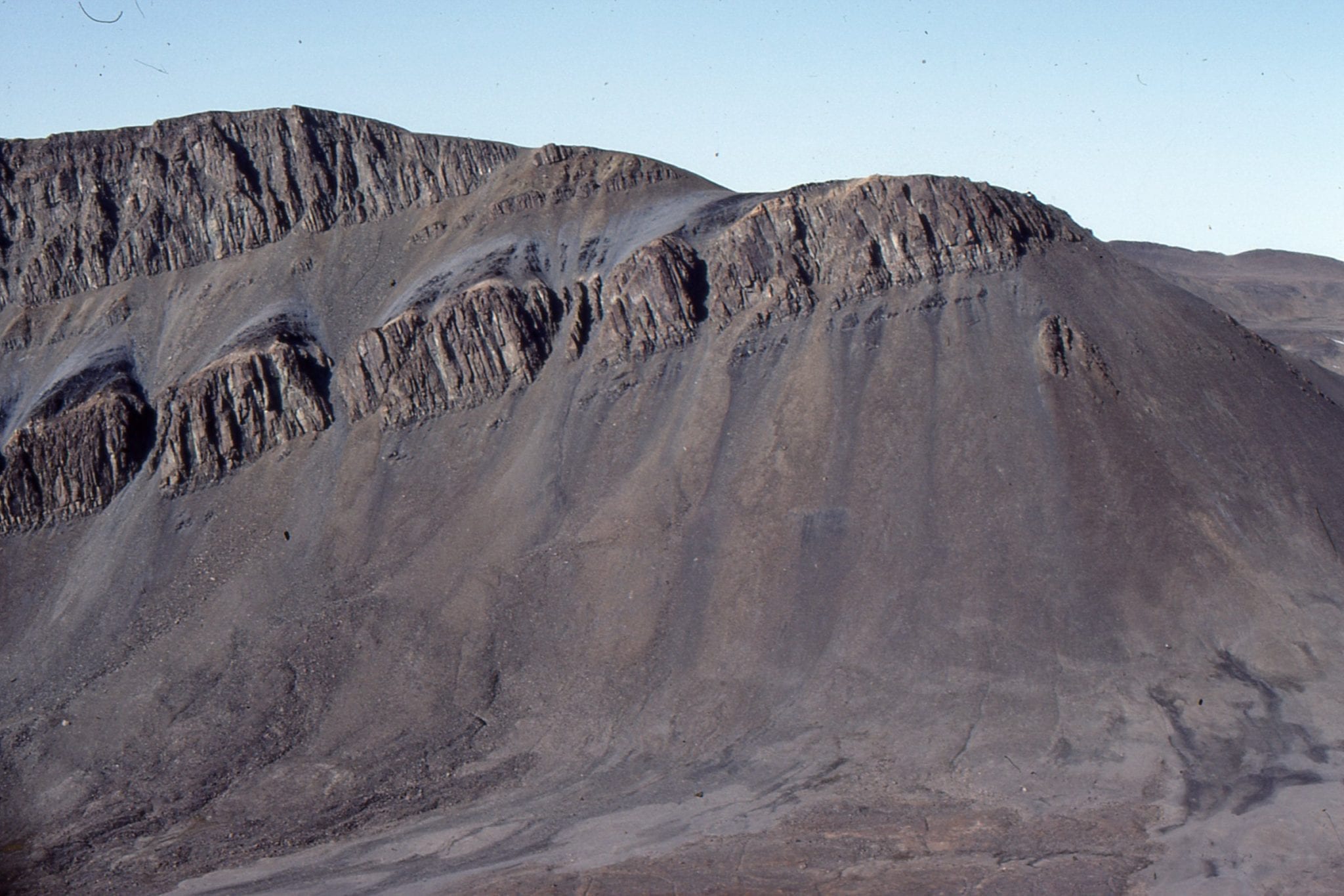
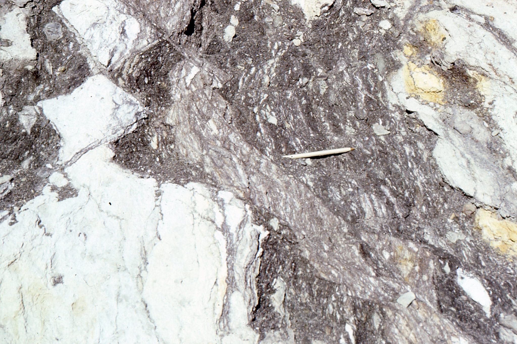
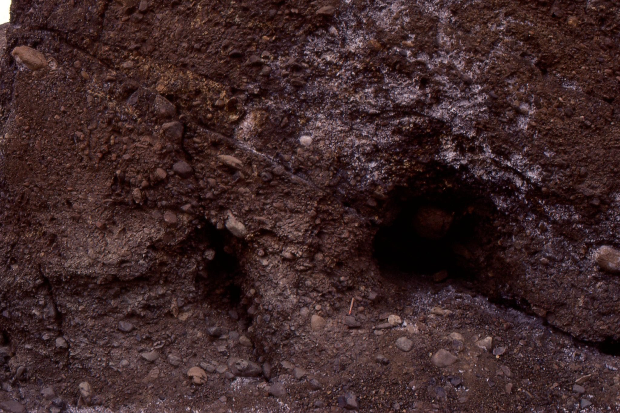
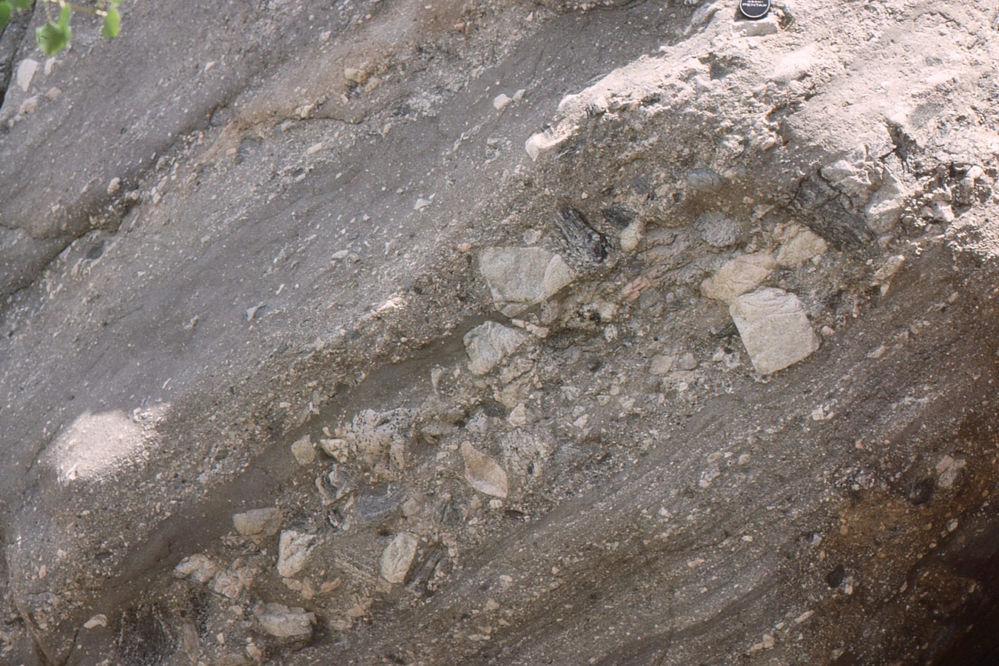
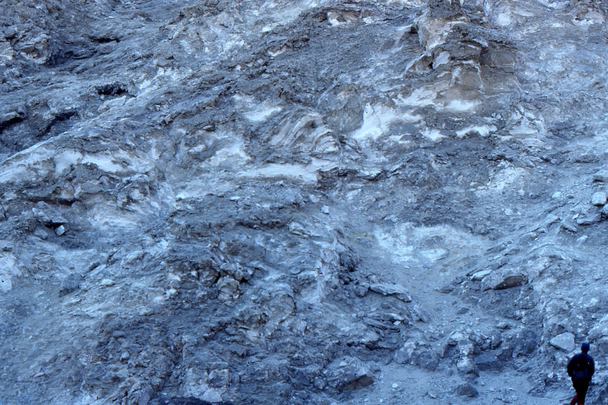
Intensely deformed anhydrite in the hanging wall of Stolz Thrust, Axel Heiberg Island. It is likely anhydrite debris was shed with the coarse sediment, but did not survive the first cycle of transport and deposition.


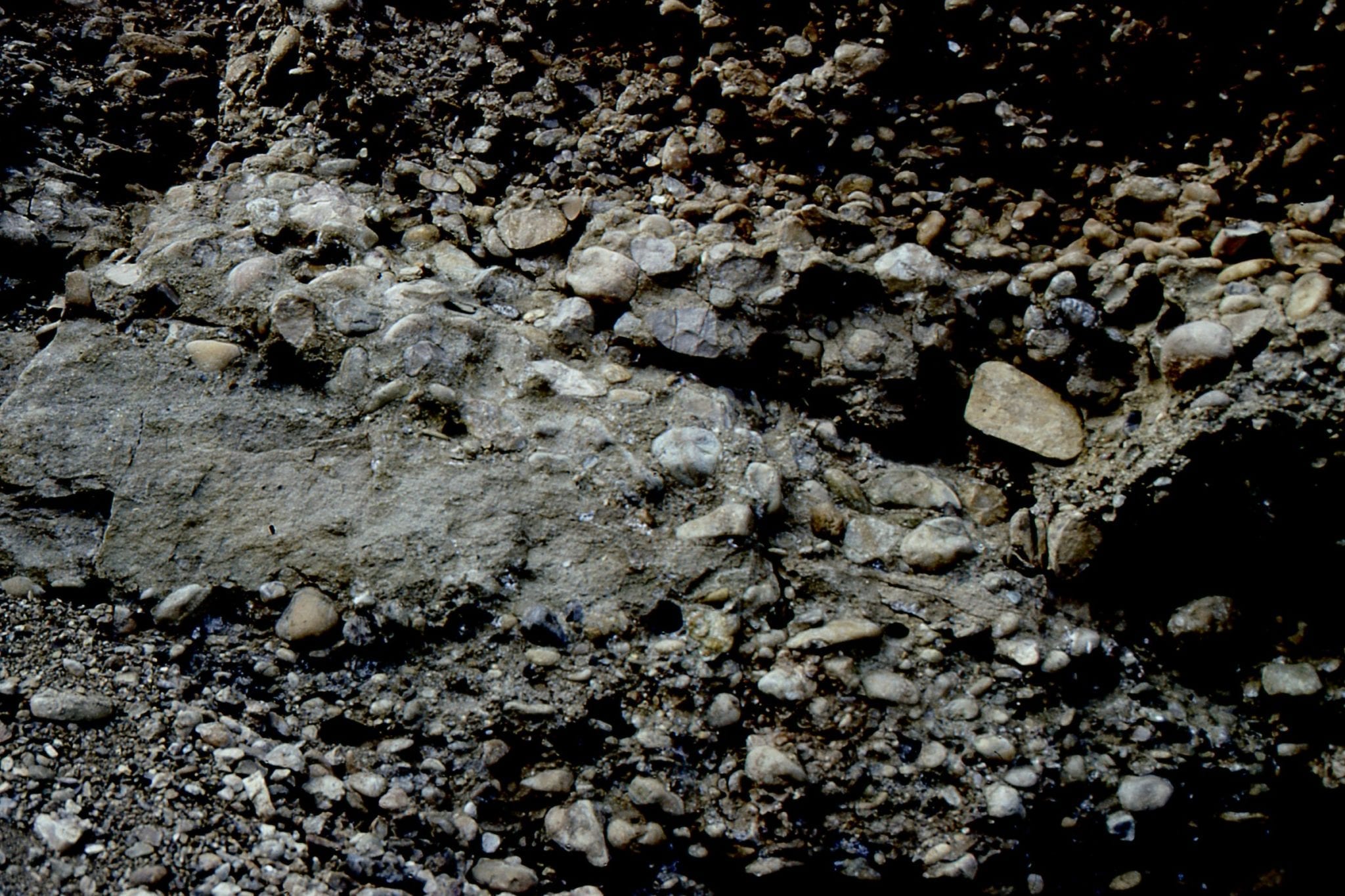
Left: Syntectonic conglomerate (Buchanan Lake Fm.) over-thrust by Ordovician limestone (that also contributed debris to the conglomerate), Franklin Pierce Bay, Ellesmere Island. Right: Syntectonic conglomerate-sandstone braided river deposits that accumulated outboard of faulted uplifts. Boulder Hills, Ellesmere Island.


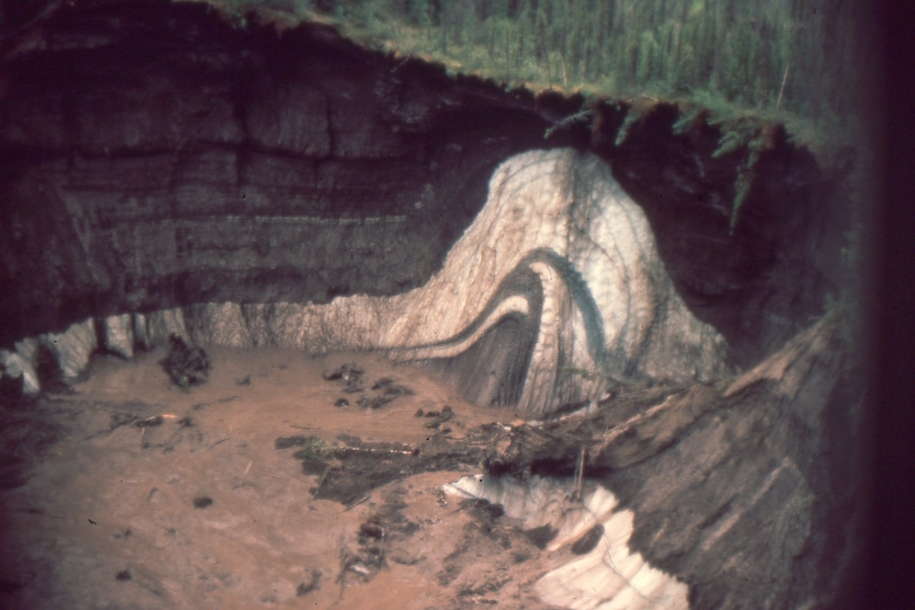
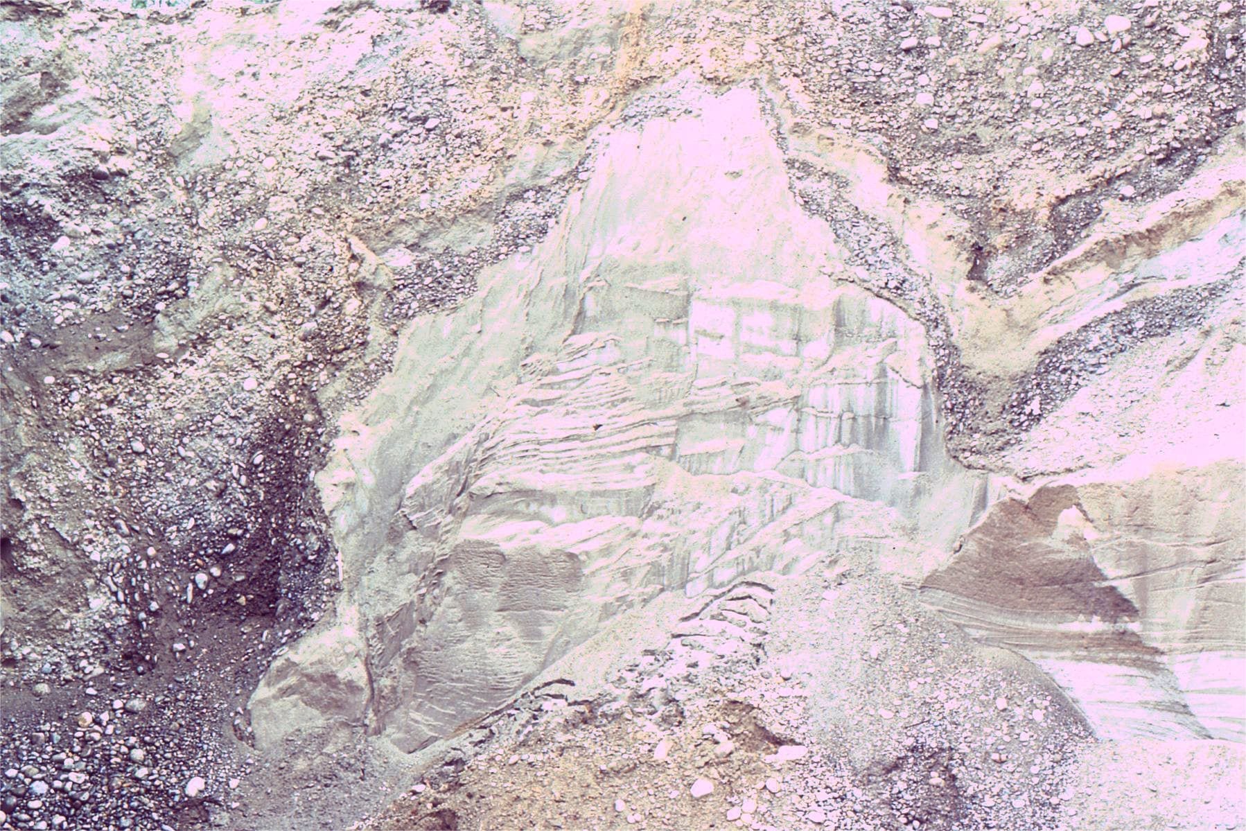
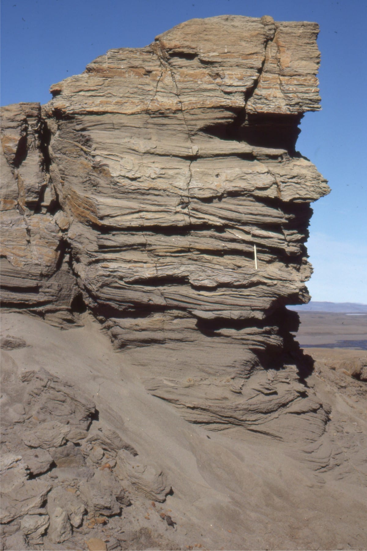
Panorama of Jurassic-Triassic rocks above Stolz Thrust over syntectonic conglomerate at Geodetic Hills (Buchanan Lake Fm.), Axel Heiberg Island (left), and a compositional unroofing sequence in conglomerate (right). The lighter coloured deposits near the base of conglomerate were derived from Jurassic sandstones. the progressive change upward to darker brown conglomerate reflects access to deeper, older Triassic sandstone and diabase sills in the eroding hanging wall.


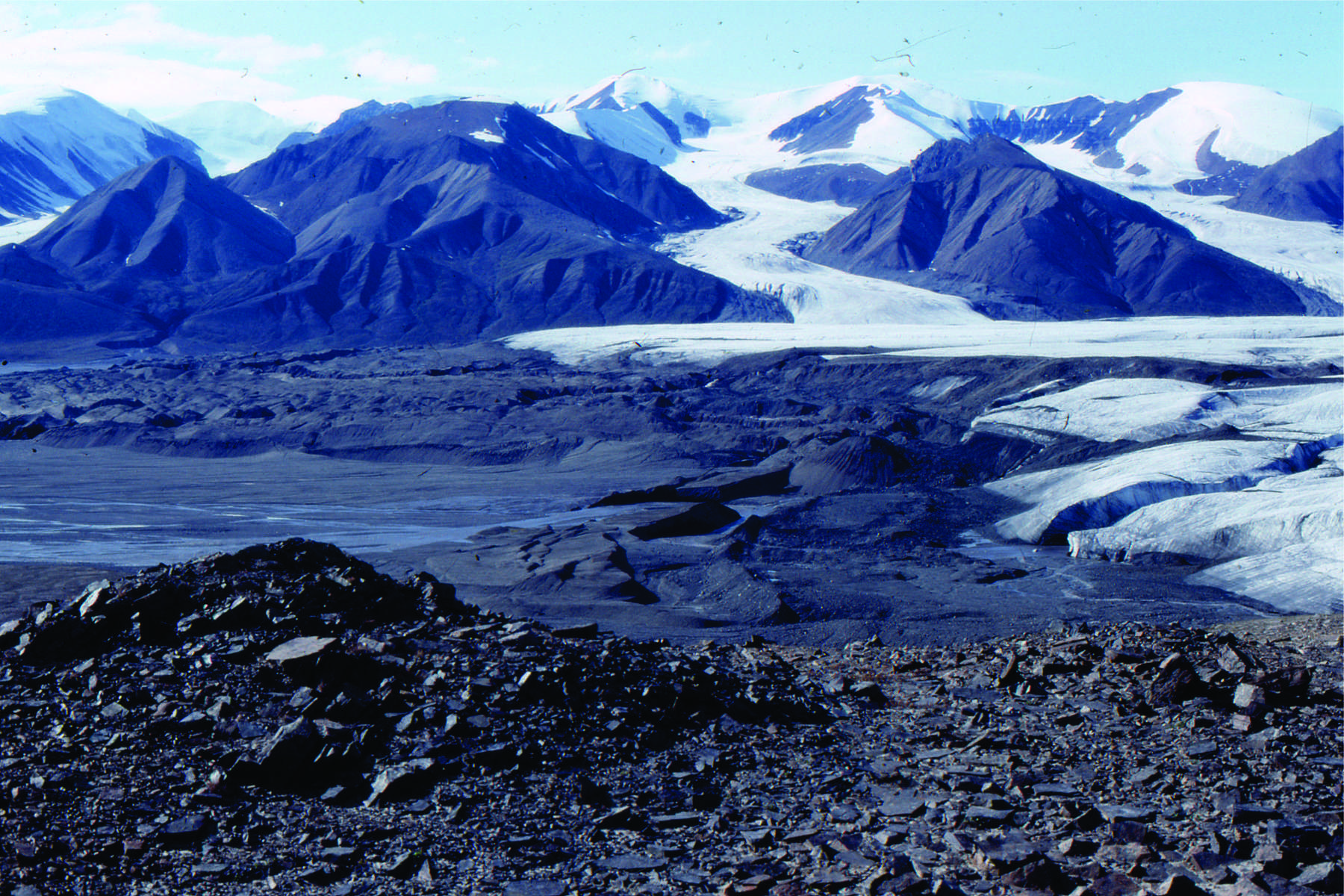
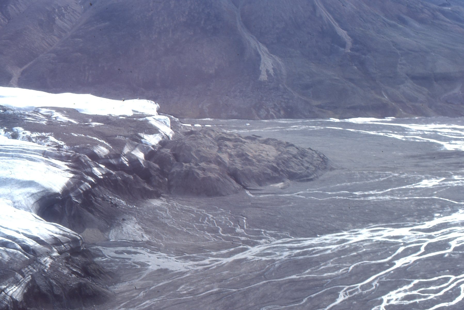
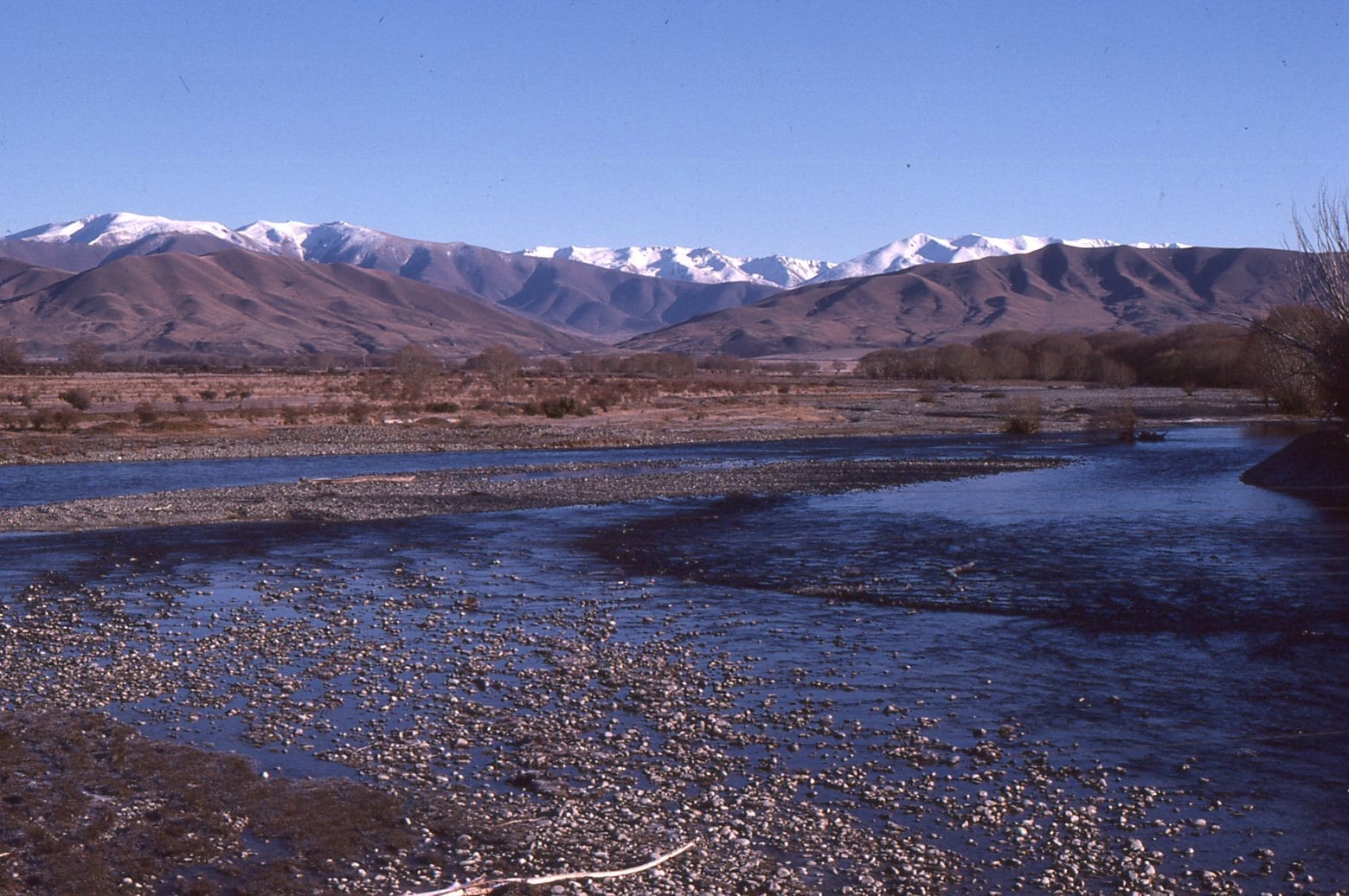
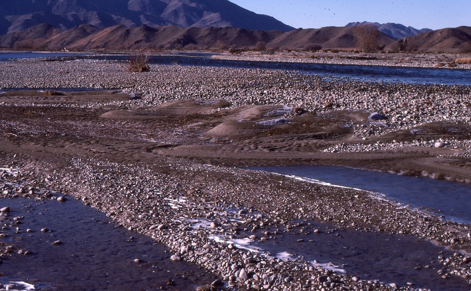
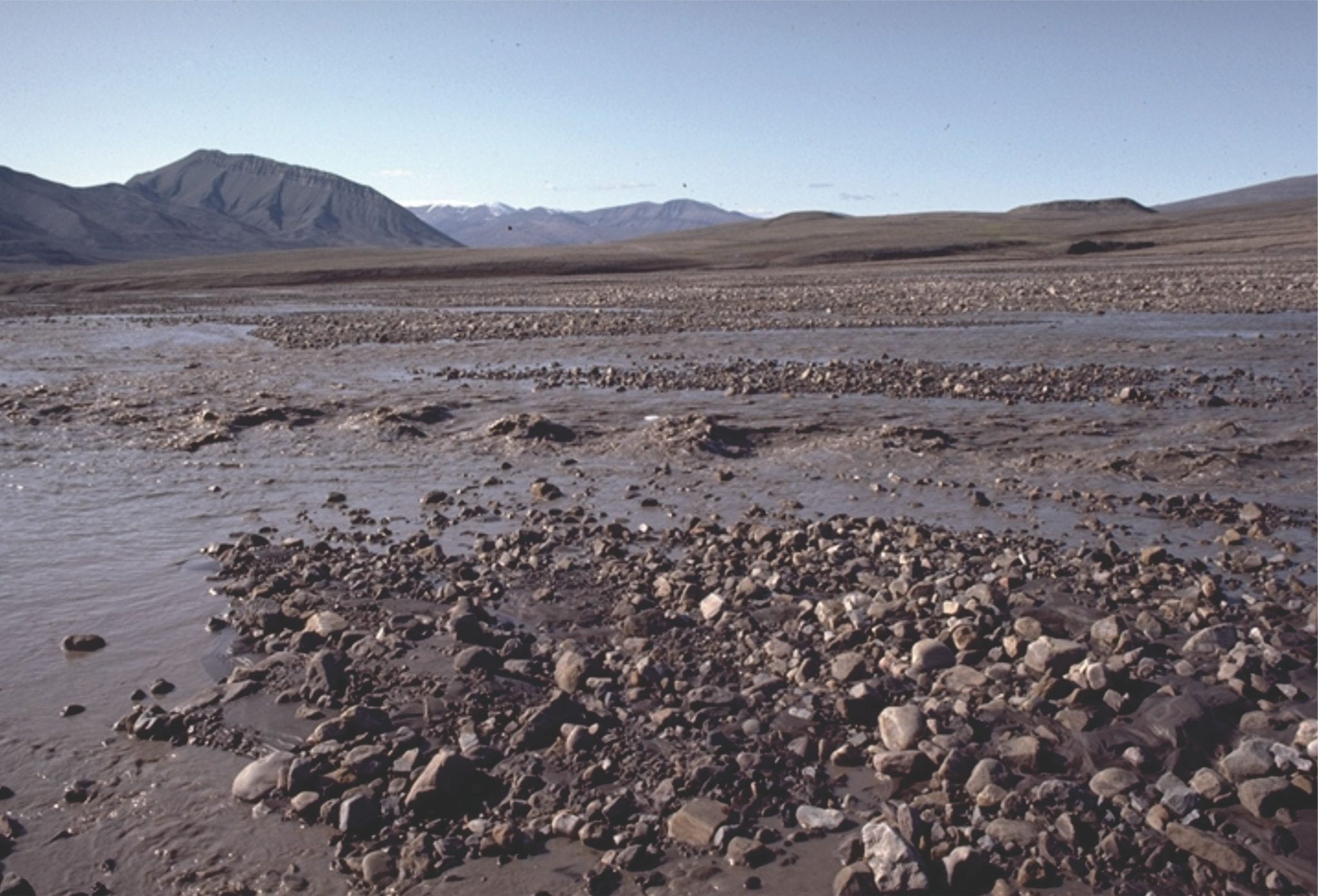
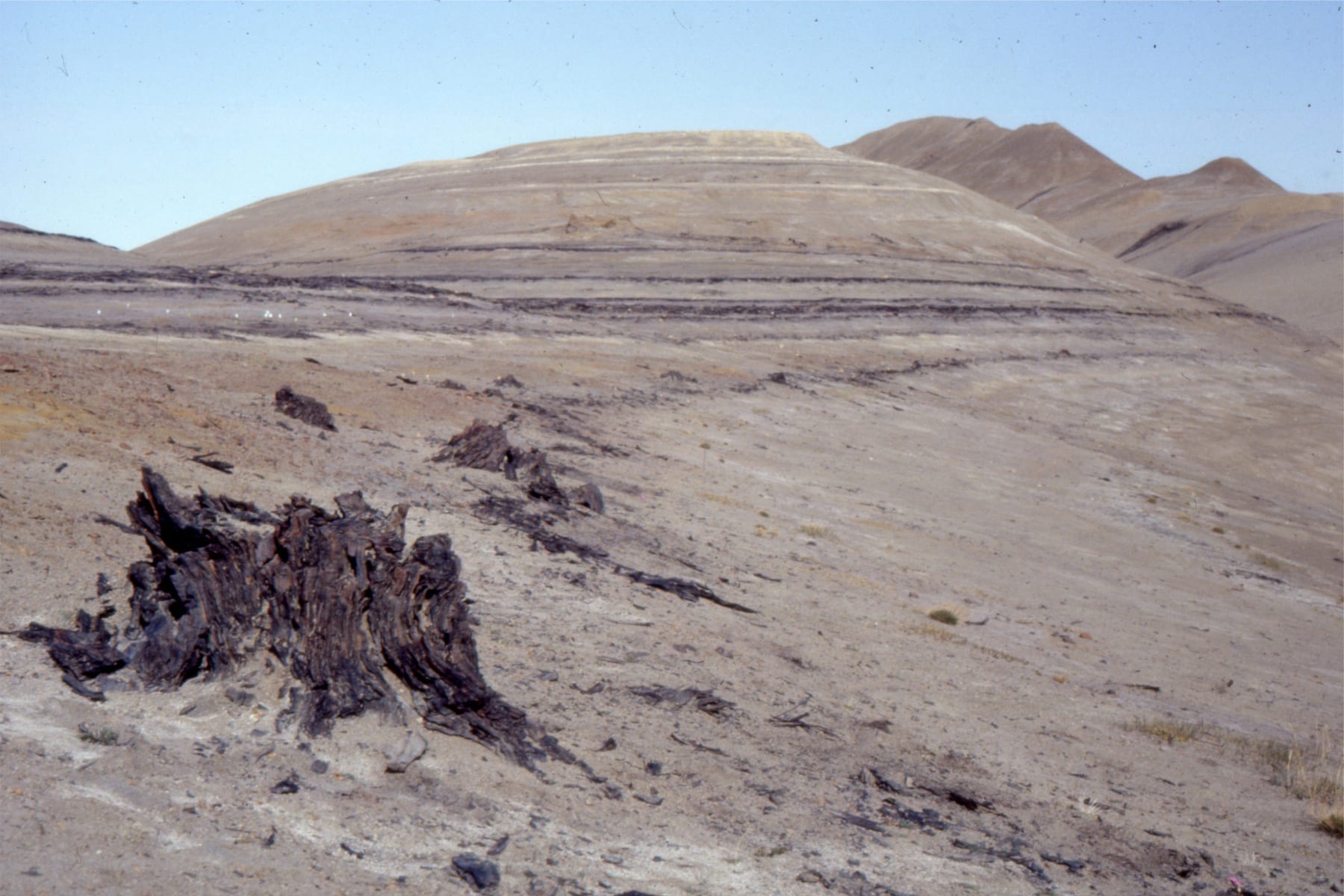
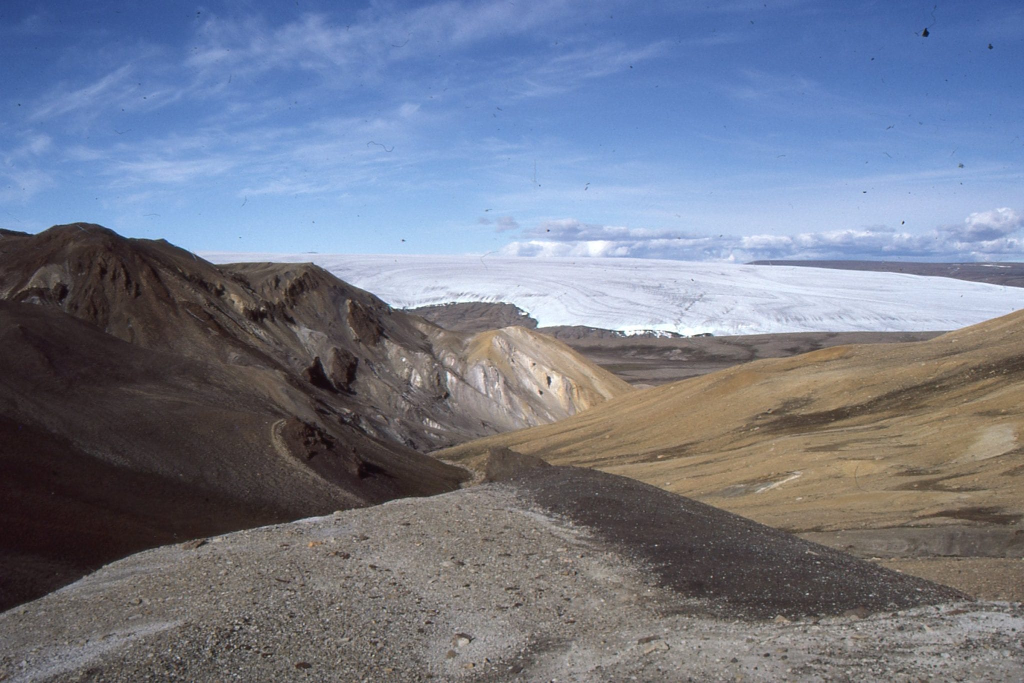
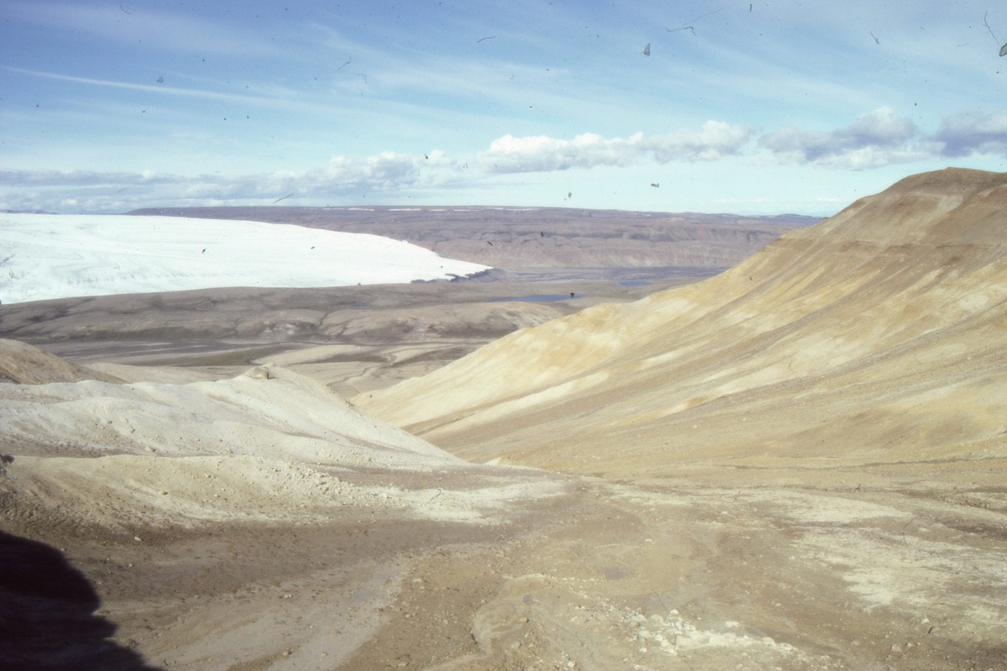
Aerial views of Middle Eocene, syntectonic alluvial fan – braidplain conglomerate outboard of thrusted uplands. Left: Emma Fiord, Ellesmere Island. Right: Geodetic Hills, Axel Heiberg Island.


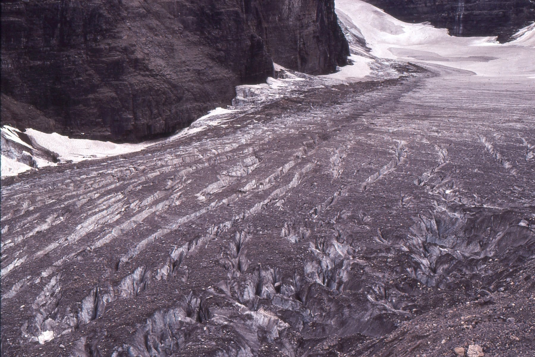
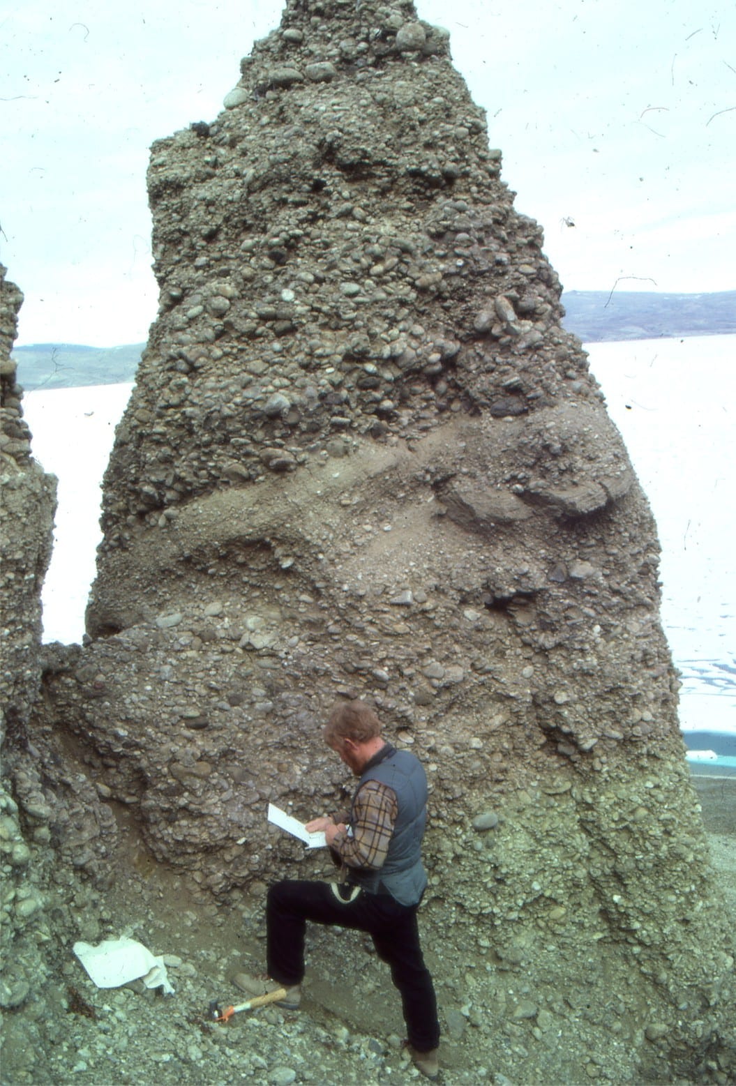
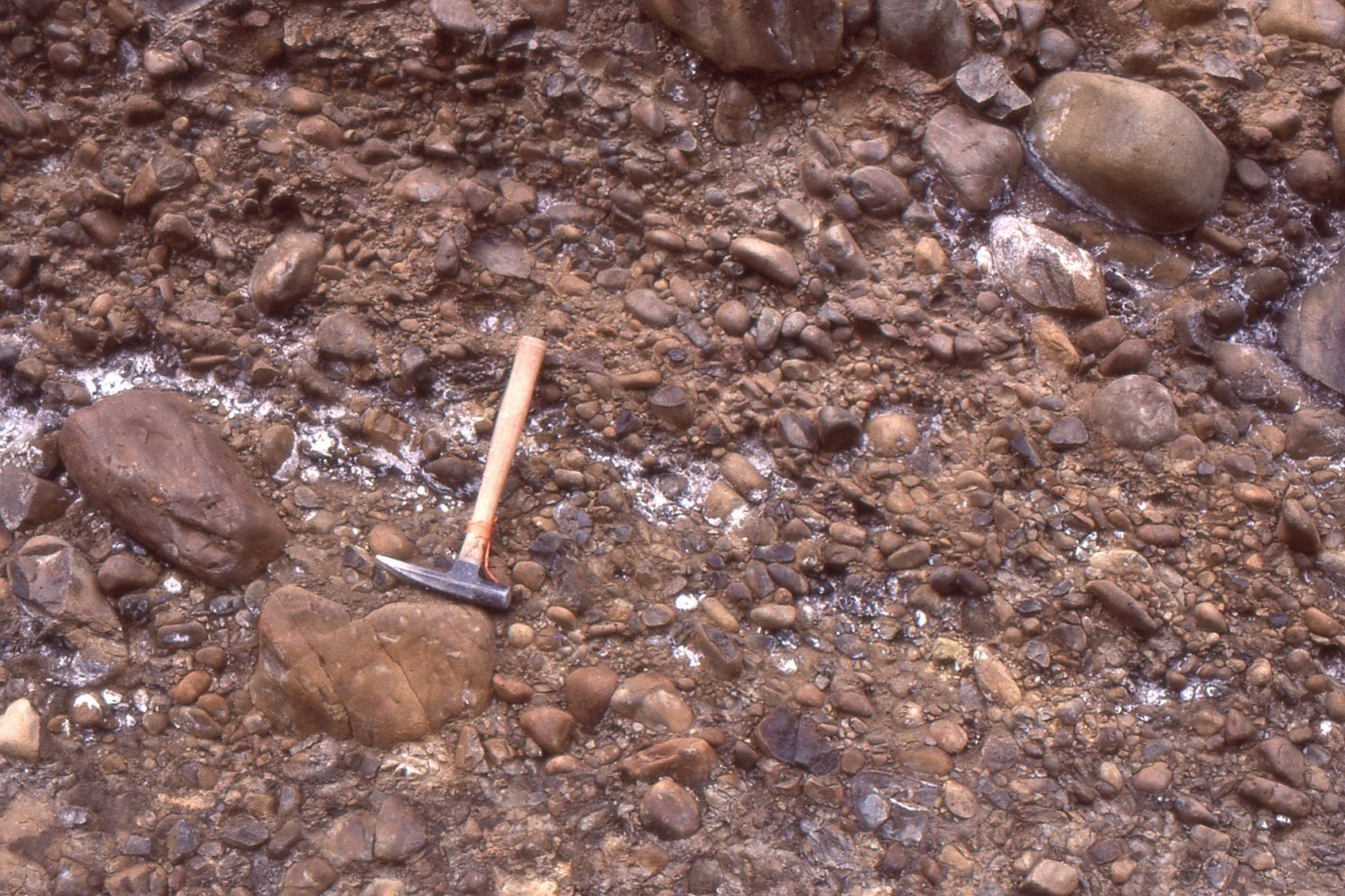
Small thrust fault through proximal, bouldery, syntectonic conglomerate, Geodetic Hills, Axel Heiberg Island.  Hammer lower center. Boulders to 50cm wide.


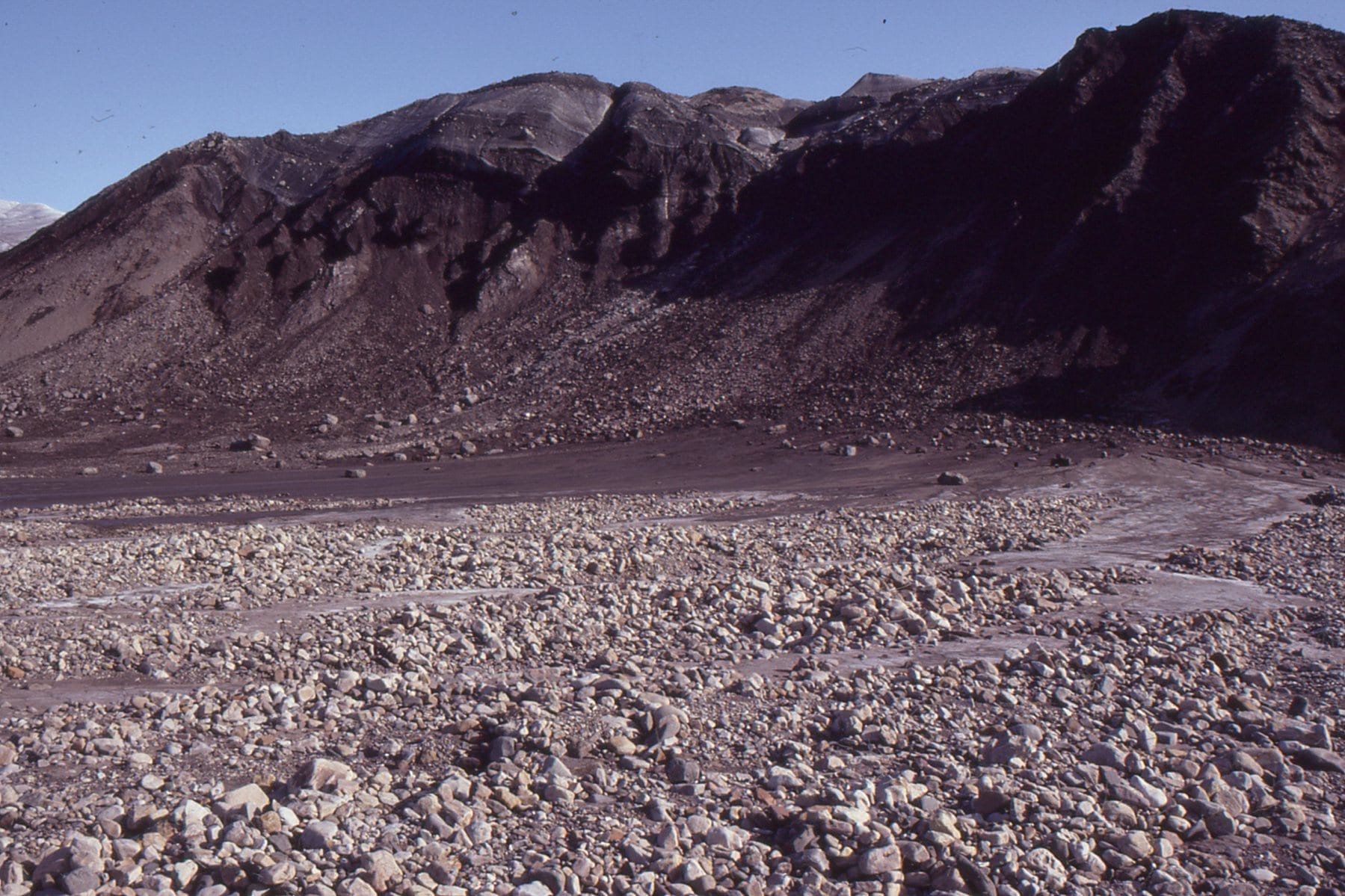
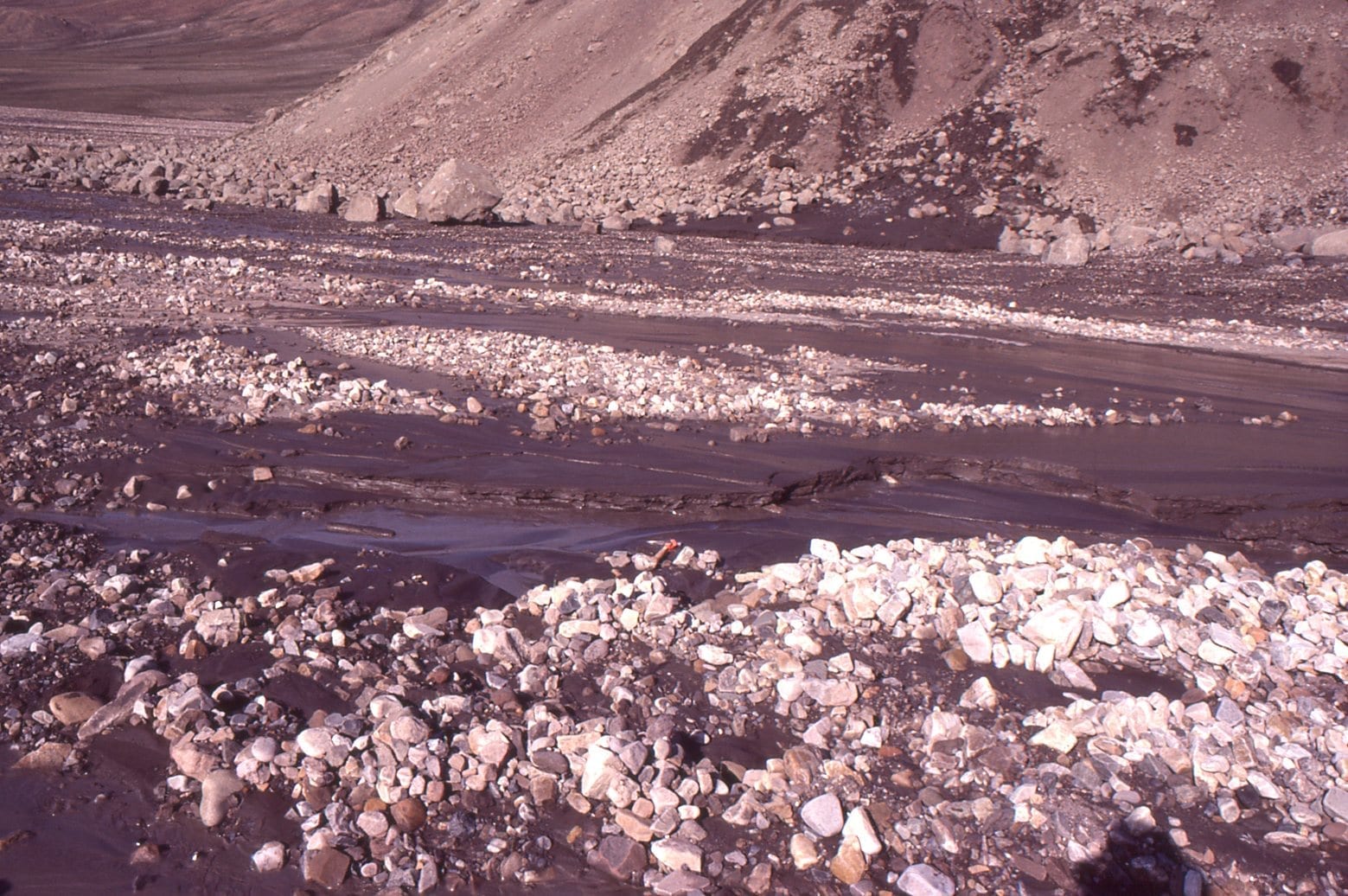
Syntectonic boulder-cobble (mostly diabase) proximal alluvial fan deposits, with scattered sand wedges, Geodetic Hills, Axel Heiberg Island. At the time of deposition, they would have been close to the uplifted source rocks.


Thick, crudely bedded debris flows and sheet flood alluvial fan conglomerates, probably close to sediment source. Diabase clasts up to a metre wide. Middle Eocene, Geodetic Hills, Axel Heiberg Island.


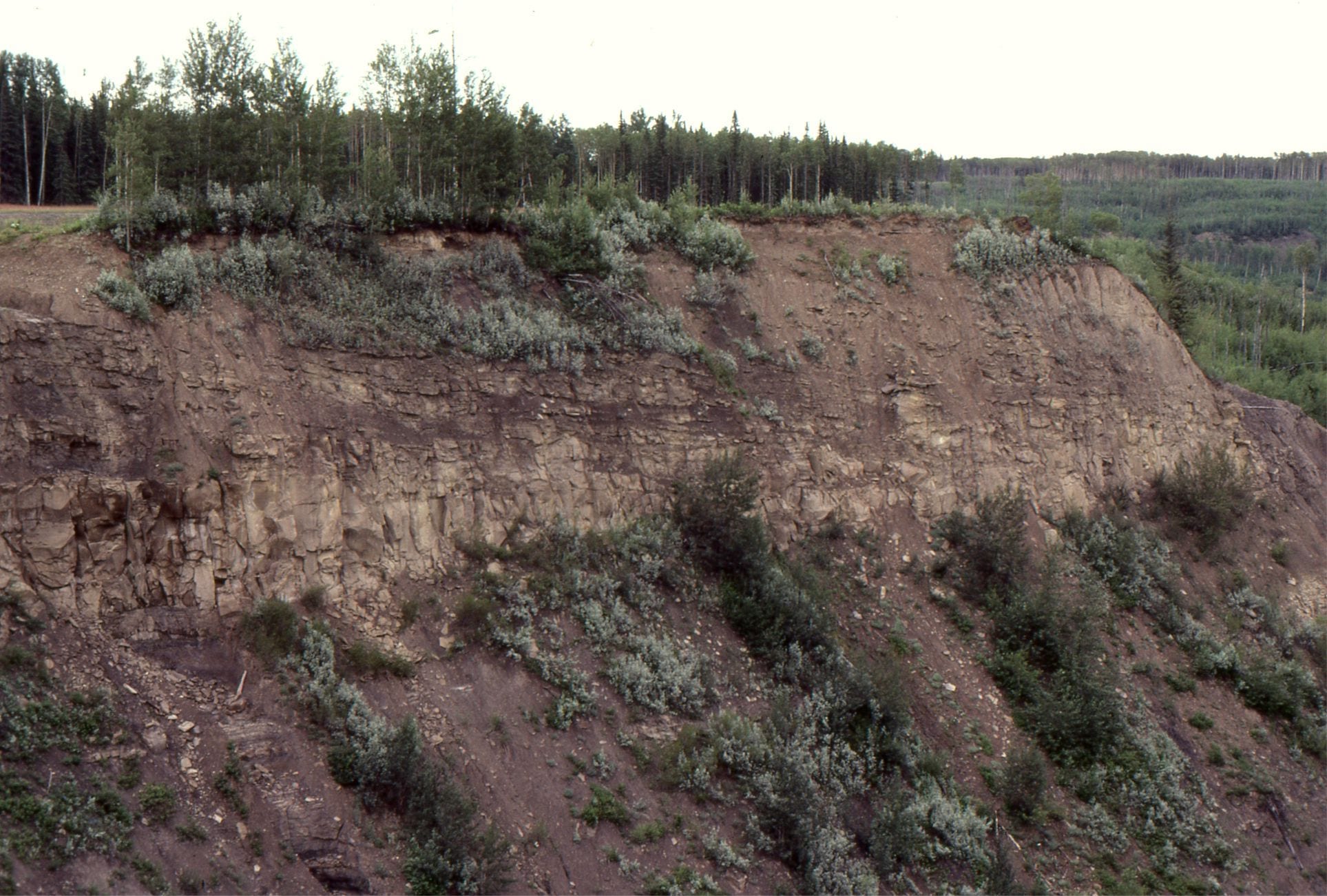
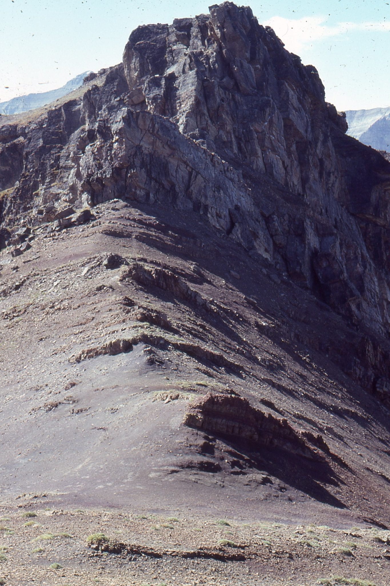
Lower Paleozoic carbonates have been thrust over Upper Cretaceous foreland basin strata (approximately east-dipping bedding visible at top right), Kananaskis, Alberta Basin. The U. Cretacous units accumulated during an earlier phase of thrusting, farther west, and then subsquently over-ridden.


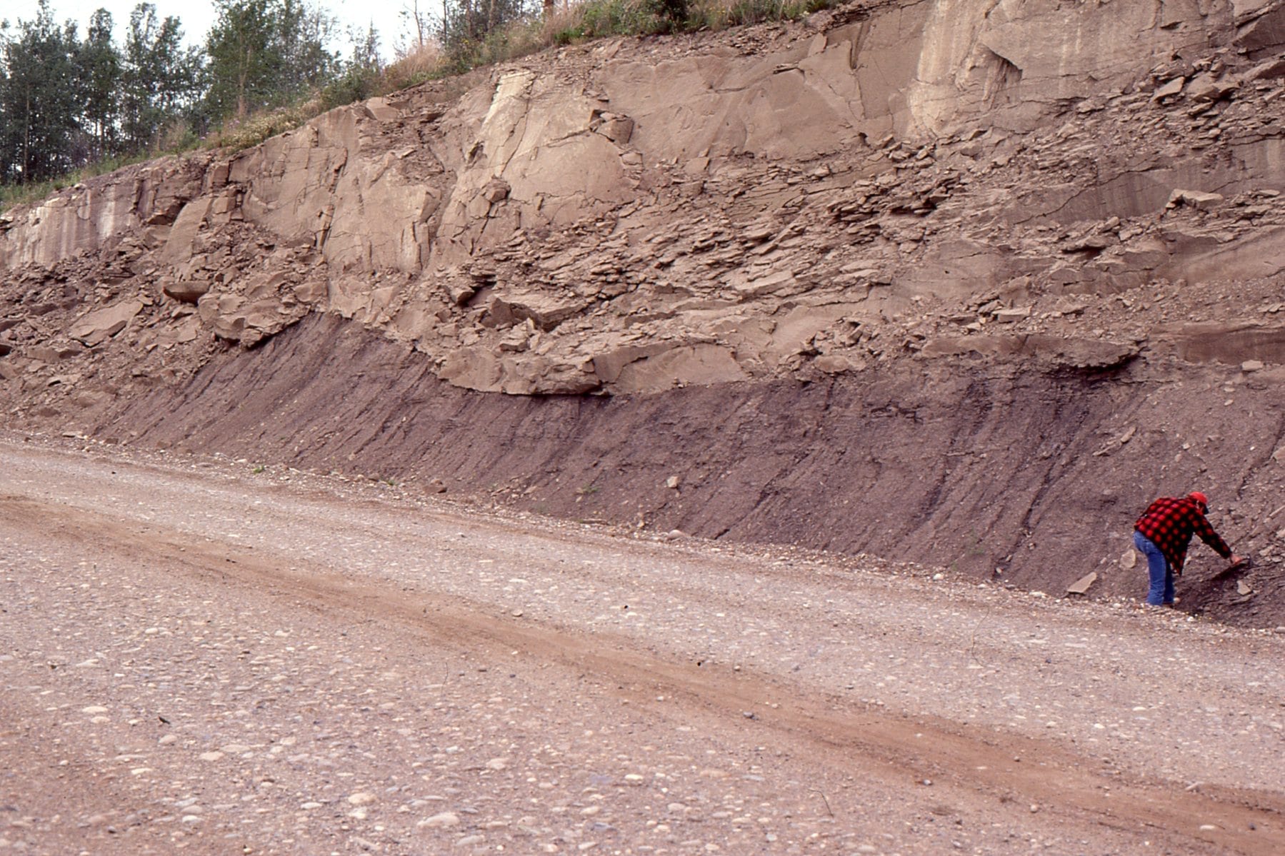
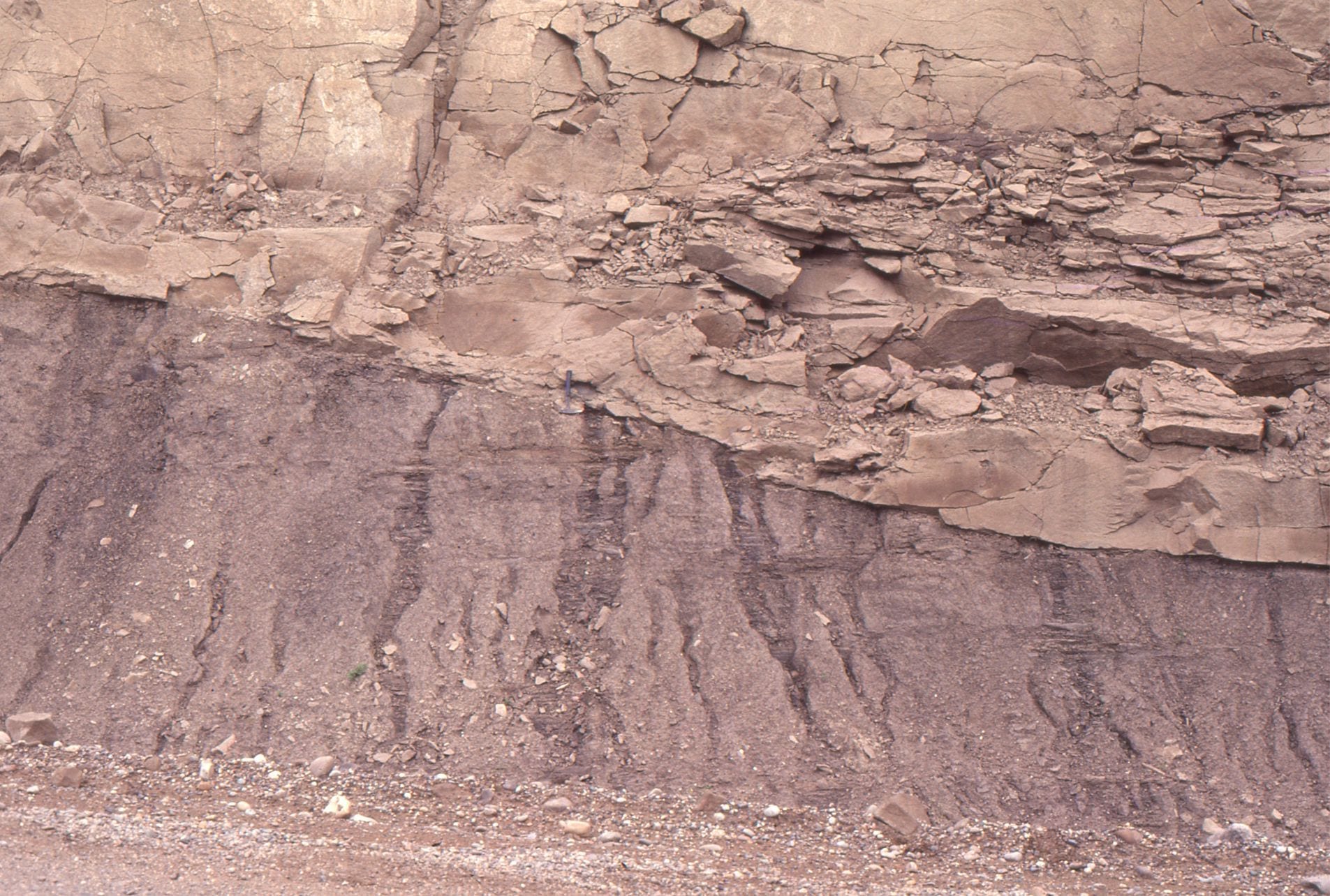
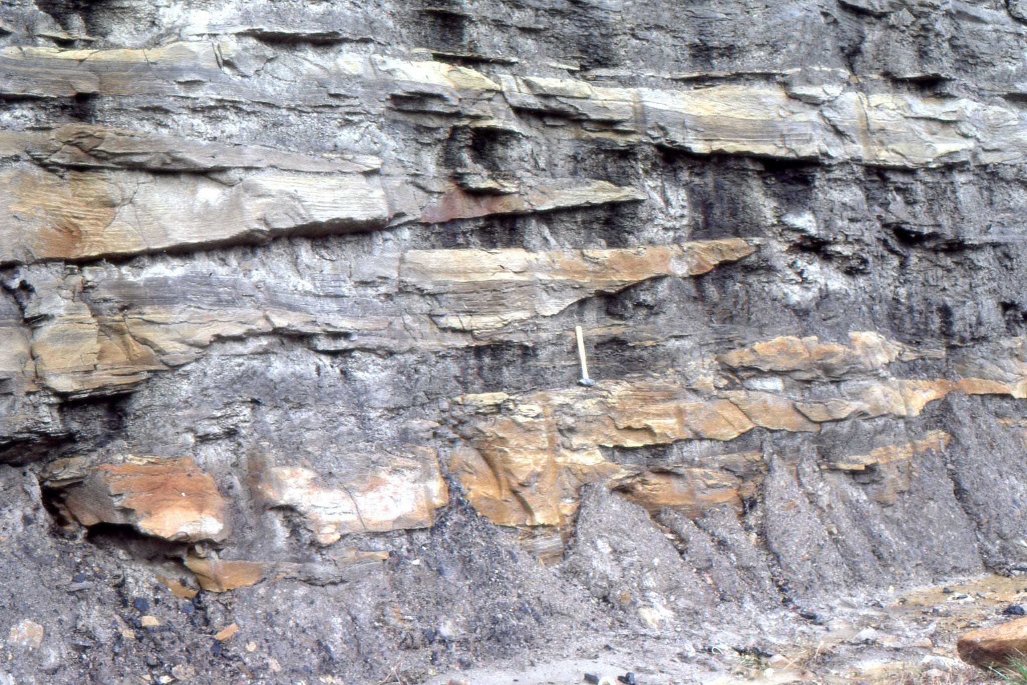
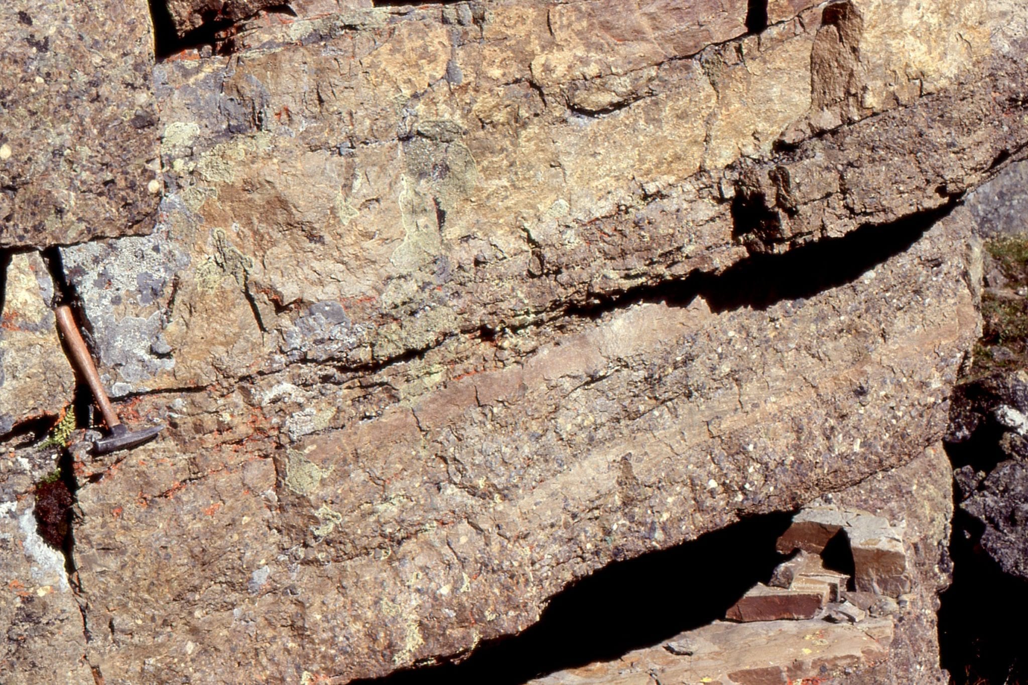
Left: older foreland basin deposits (Kootenay Gp), overlain by conglomerate, shed from a renewed phase of thrusting and folding (resistant units at top) – The Lower Cretaceous Cadomin Fm. interpreted variously as braidplain, alluvial fan, and pediment. Right: Trough crossbedded, pebbly sandstone, Cadomin Fm.


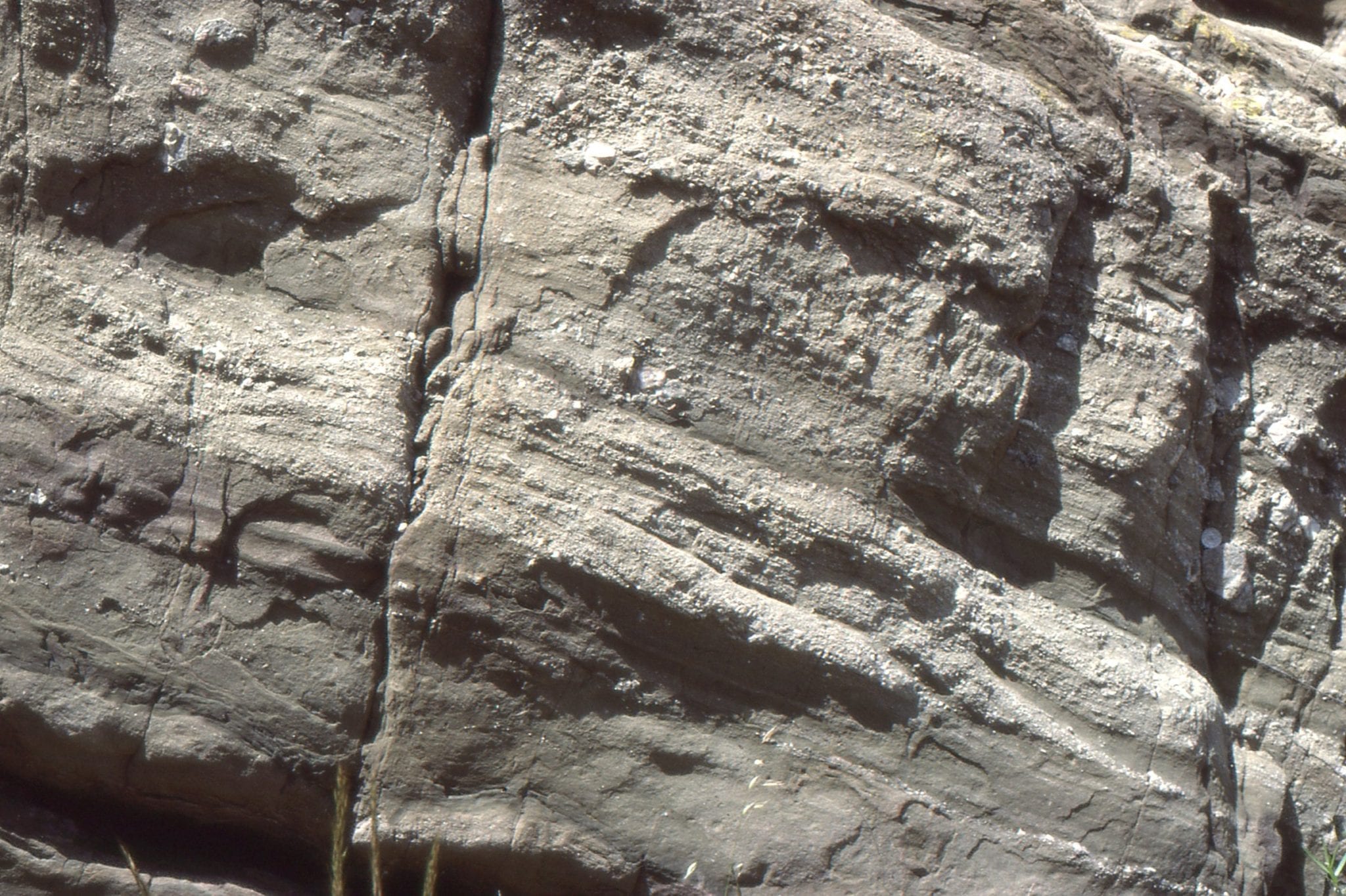
Interbedded conglomerate-sandstone, mostly as planar tabular crossbeds. Cadomin Fm. Mt Allan, Kananaskis.


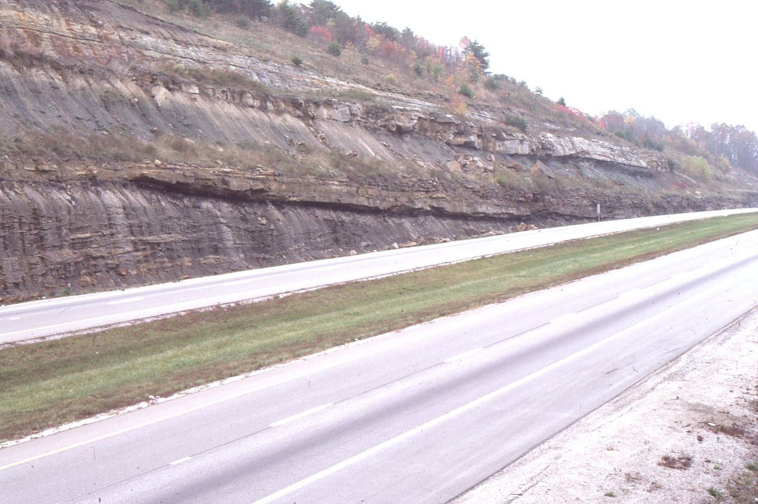
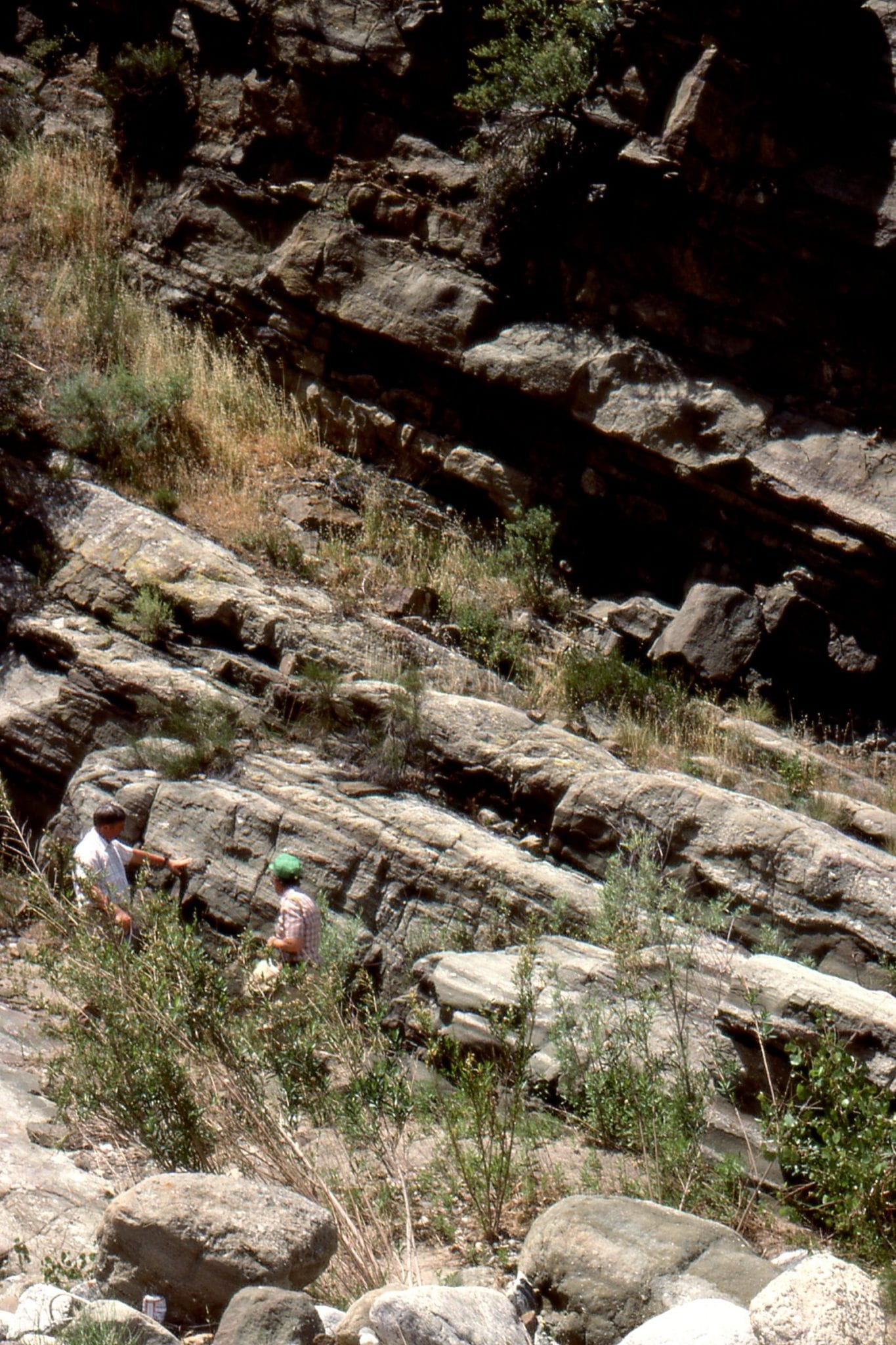
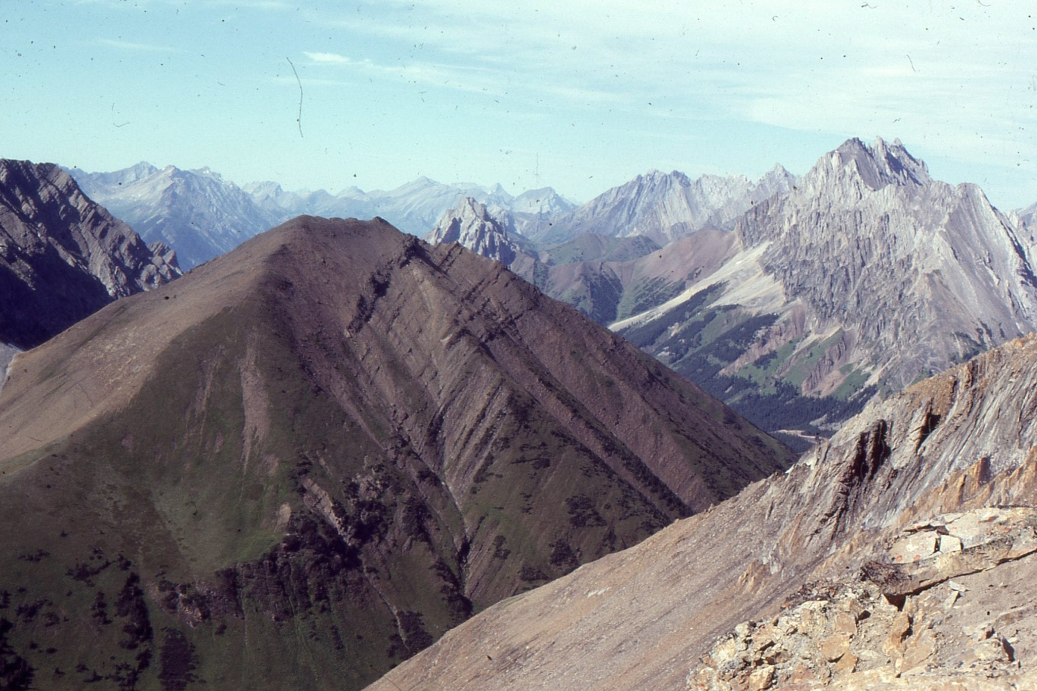
Lower Cretaceous foreland basin strata involved in a later phase of thrusting. View is to the north of Highwood Pass. Lewis Thrust charges down the valley beyond. Front Ranges, Alberta Foreland basin.


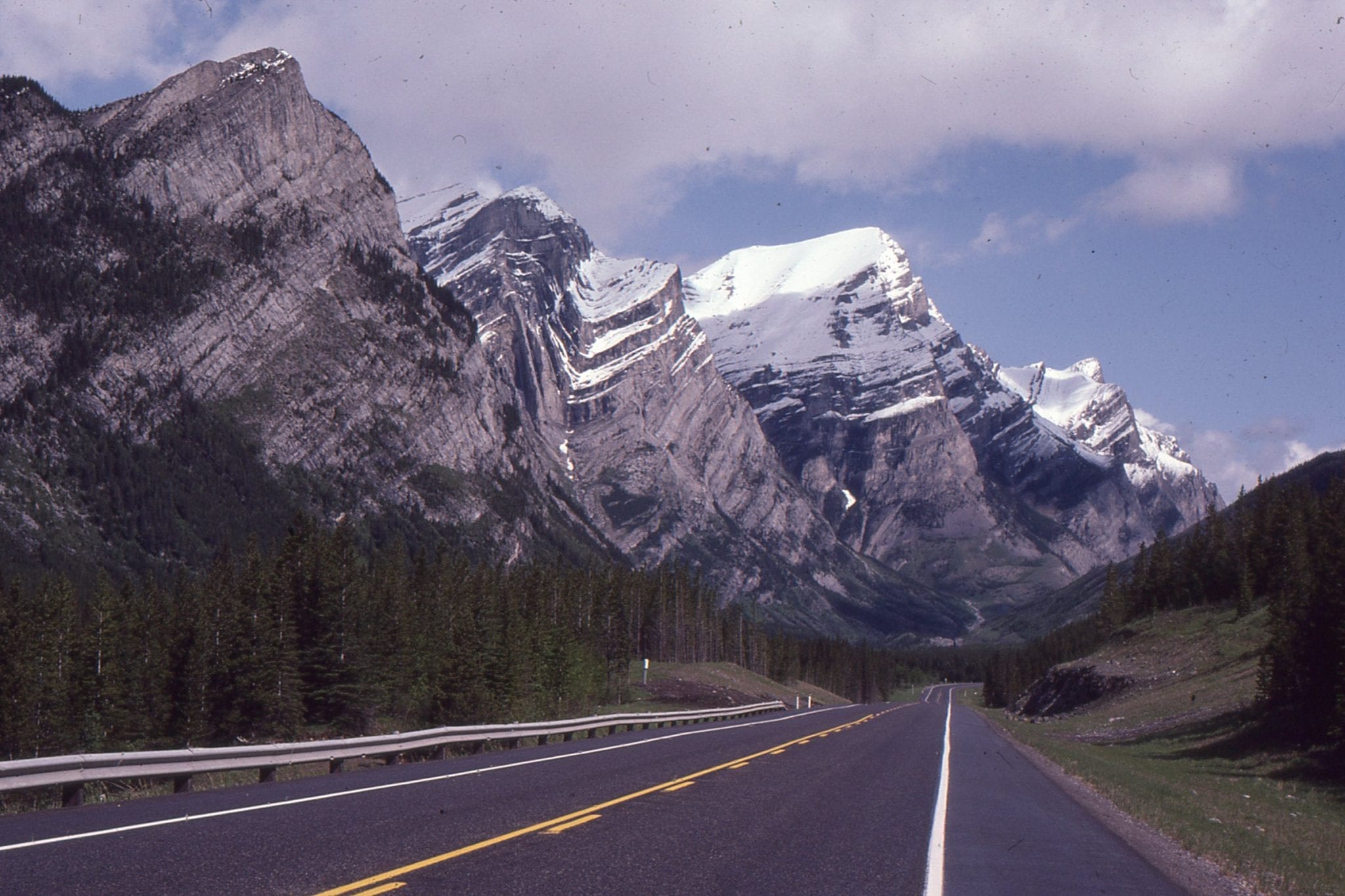
Iconic views of the Front Ranges, Kananaskis. Left: Upturned Lower Paleozoic carbonates and sandstones, and in the valley, recessive Jurassic-Lower Cretaceous foreland basin strata. Right: Probably one of the most photographed fold pairs in Canada – Lewis Thrust terminates at the base of this fold pair. Kananaskis Highway.


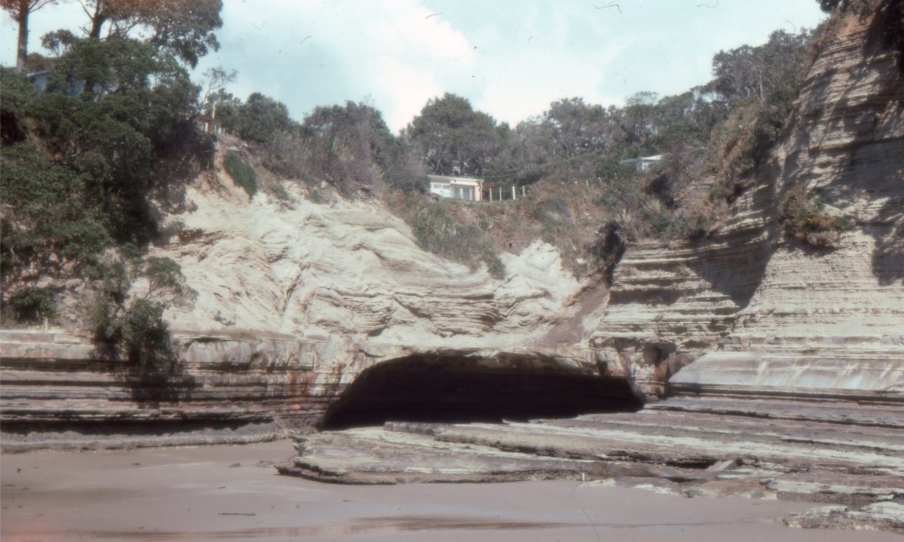
The northern segment of Lower Miocene Waitemata Basin (Auckland) developed atop a moving slab of obducted lithosphere – the Northland Allochthon. The Allochthon, now fragmented, consists of ophiolite (including possible seamounts), marls, terrigenous clastics and limestones. Allochthon rocks, like those shown here (Algies Bay) commonly are intensely deformed. Movement of the Allochthon is implicated in some of the syn-sedimentary – weak rock deformation in Waitemata Basin itself. This view shows thrusted marls, north of Algies Bay.


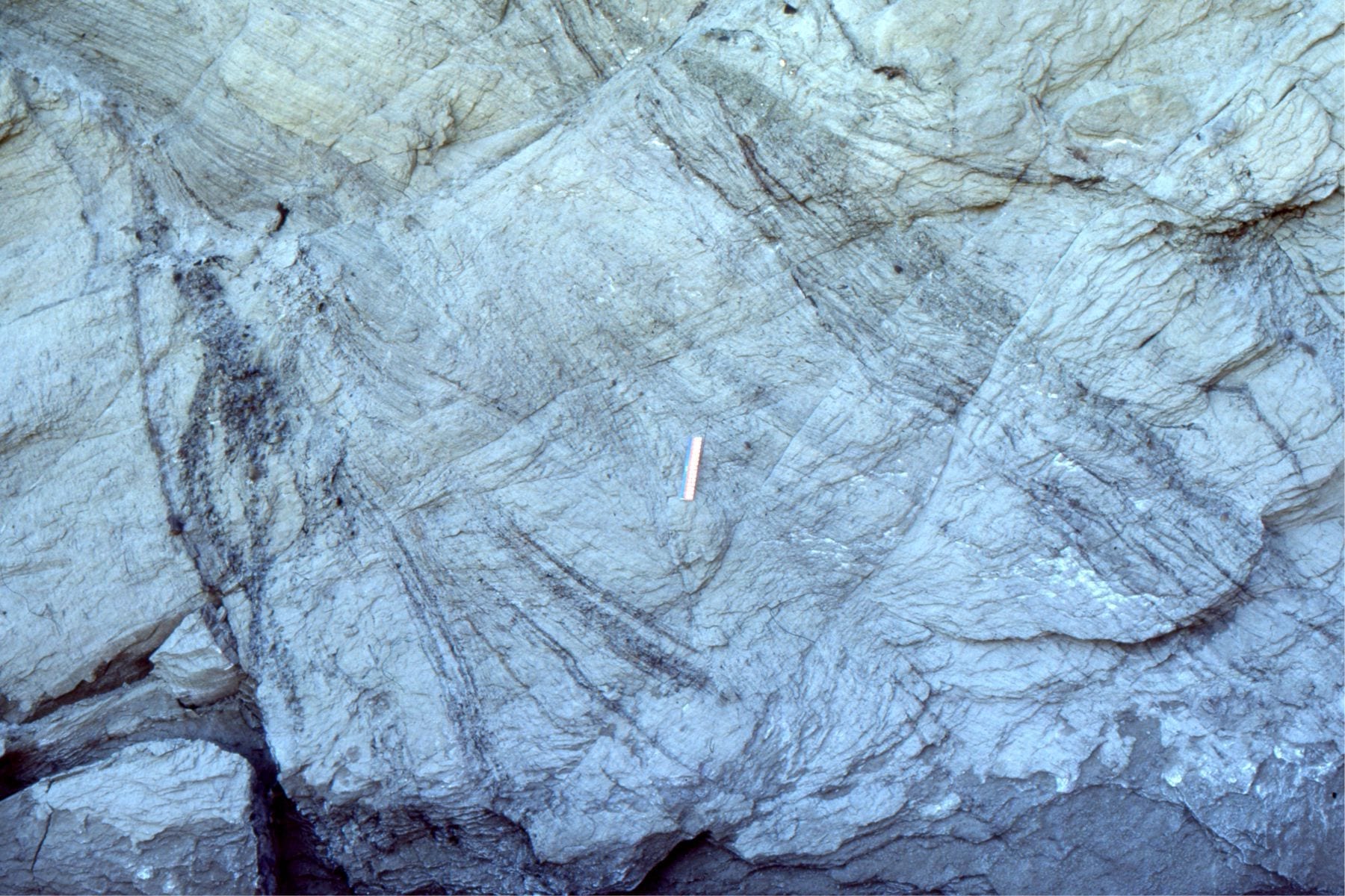
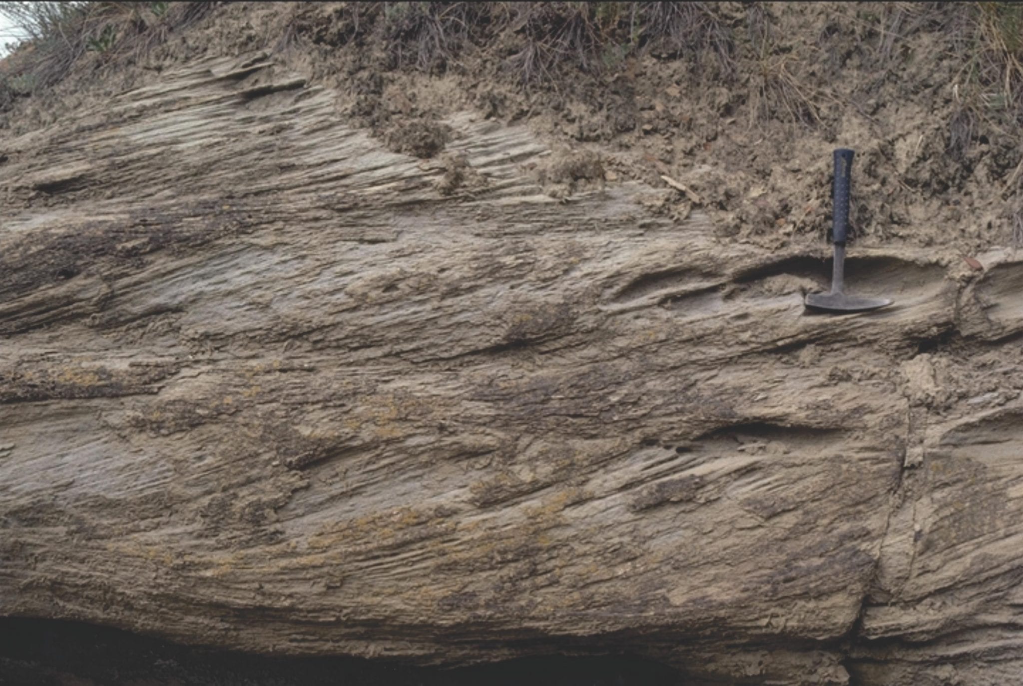
Examples of intense shearing in Northland Allochthon marls and mudstones. Left: multiple generations of fracturing. Right: Boudinage and shear of siderite nodules in the mudrocks (above). Algies Bay, Auckland.


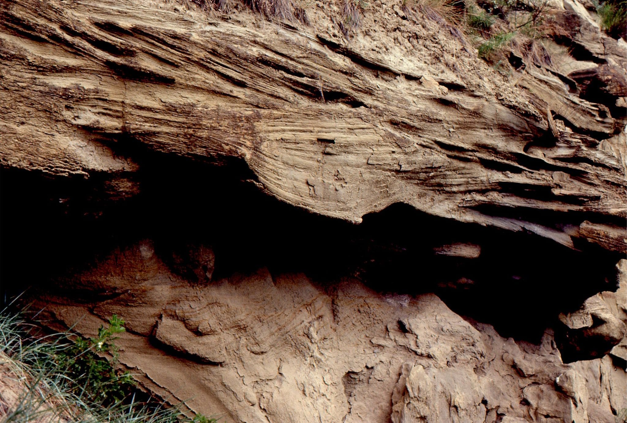
Sedimentary dyke through Northland Allochthon mudrocks. The dyke contains fragments of Lower Miocene Waitemata Basin sandstone and mudstone, attesting to the dynamic relationship between the two.  The dyke in turn is fractured by later deformation. Algies Bay, Auckland.


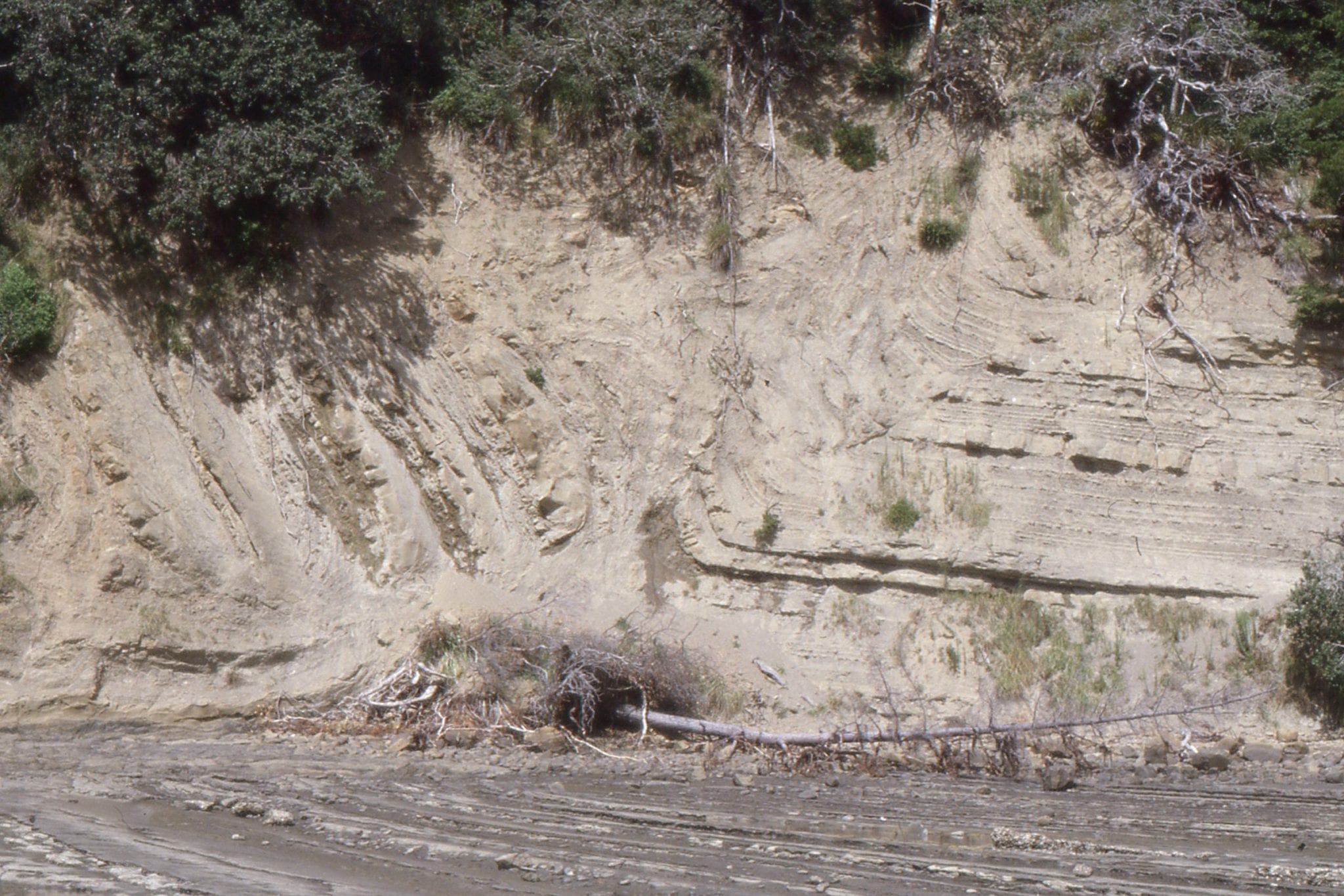
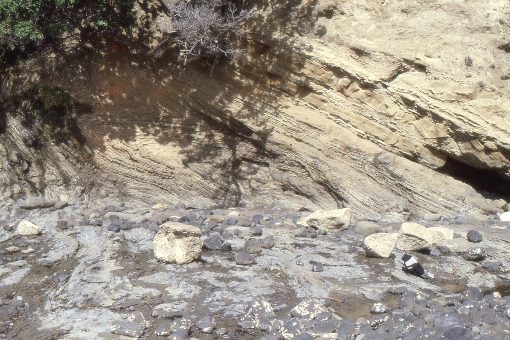
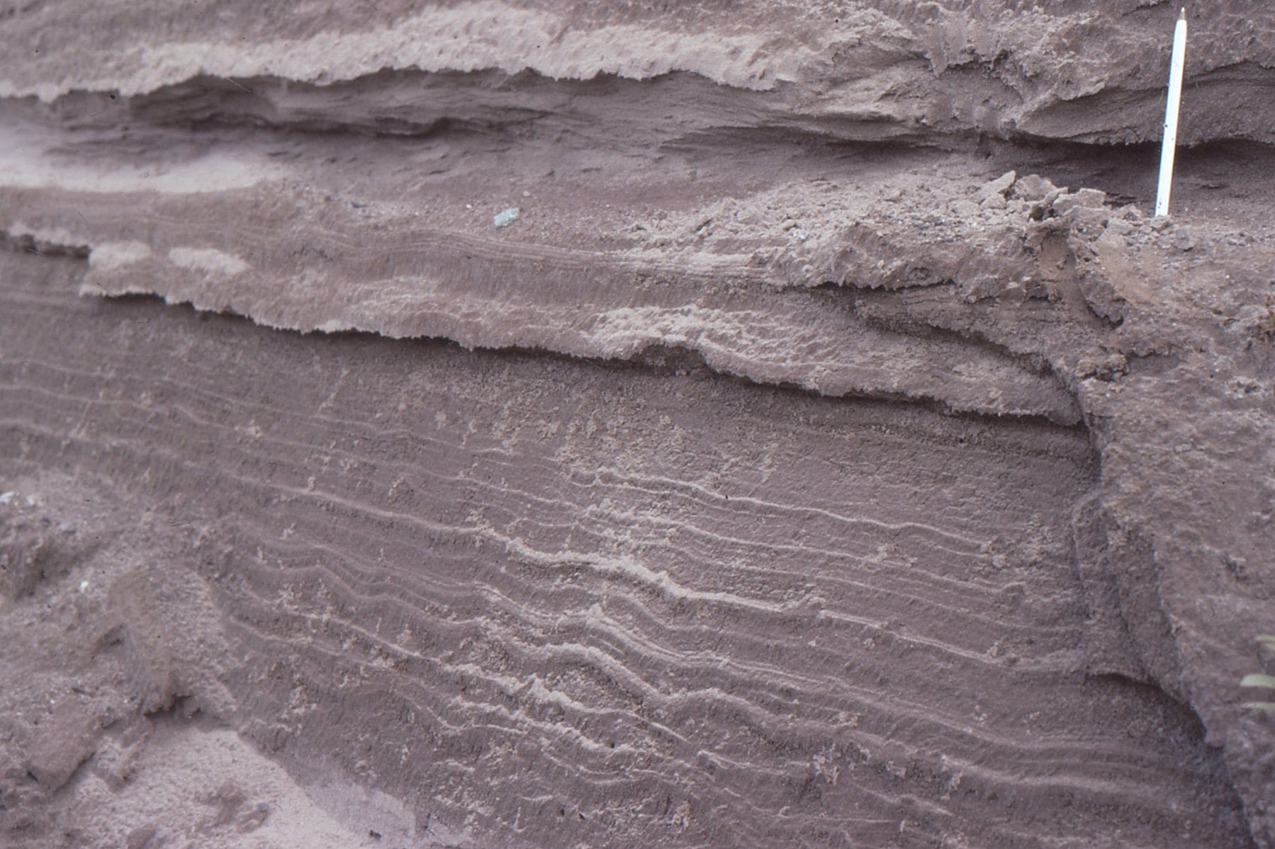
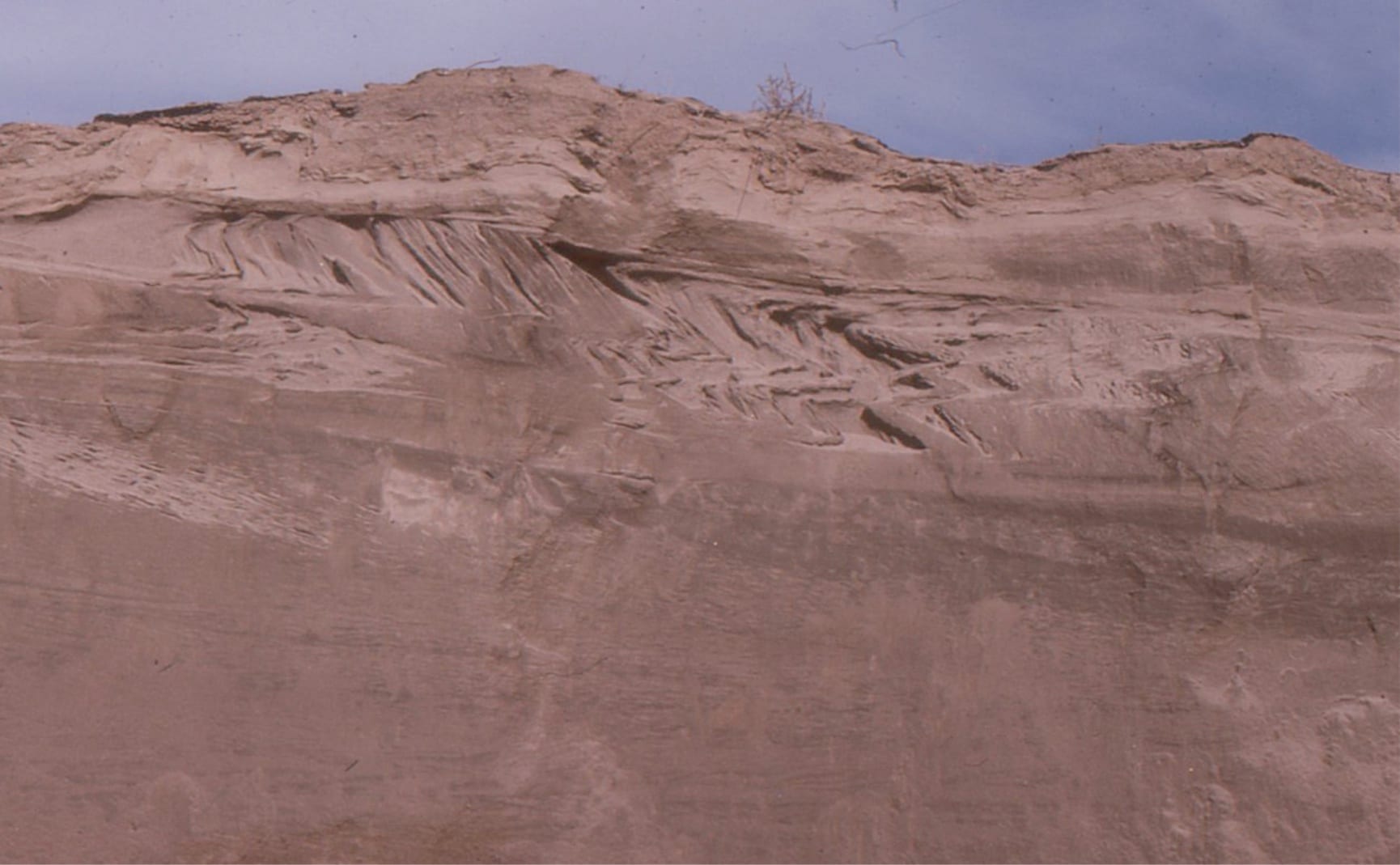
Examples of soft and weak-rock deformation – slumping in Waitemata Basin turbidites, possibly dynamically linked to Northland Allochthon deformation. Left: Thrust-folds near Waiwera. Right: Recumbent isoclinal folds, and rotated boudins in sandstone, Army Bay.


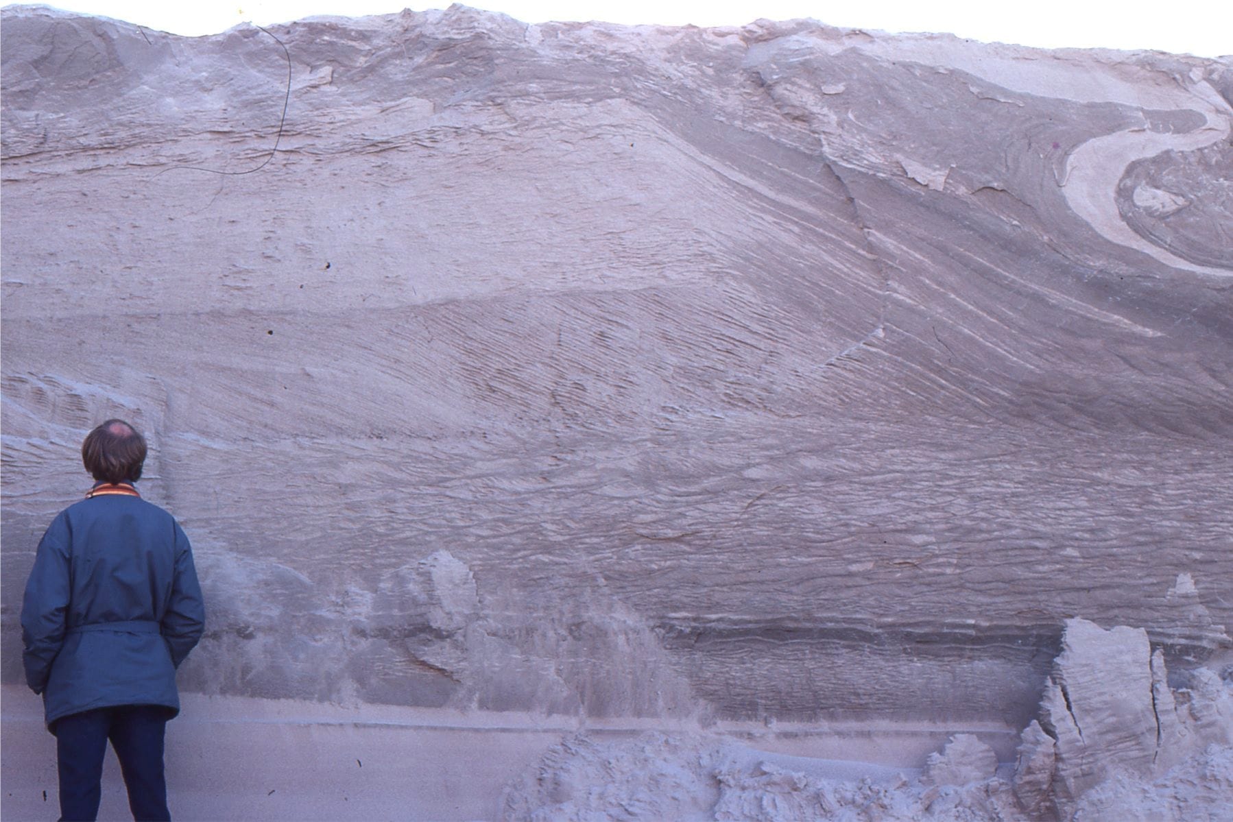
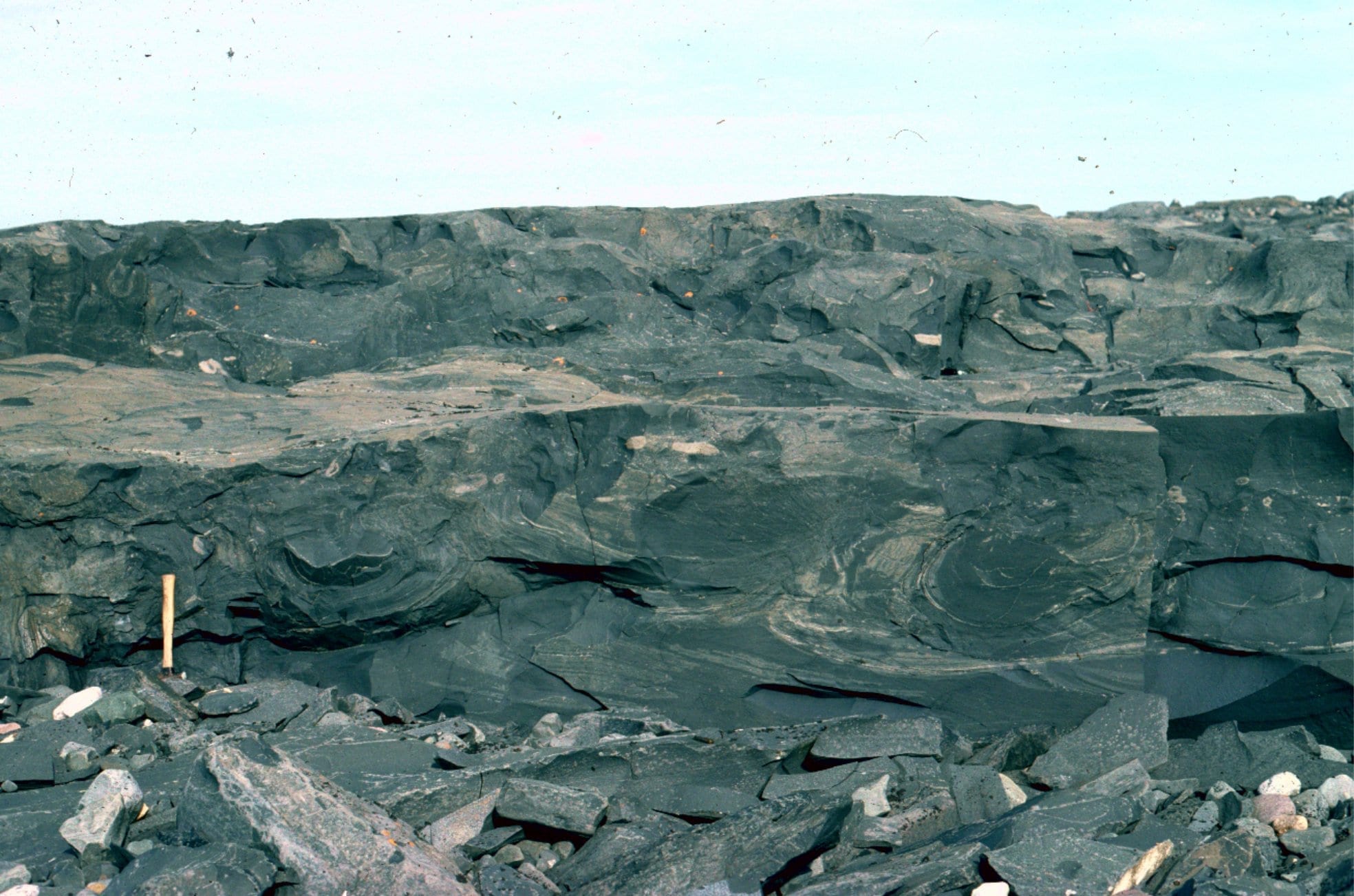
Intensely folded and faulted turbidites above an undeformed glide plane, south of Orewa Beach, possibly dynamically linked to Northland Allochthon deformation.


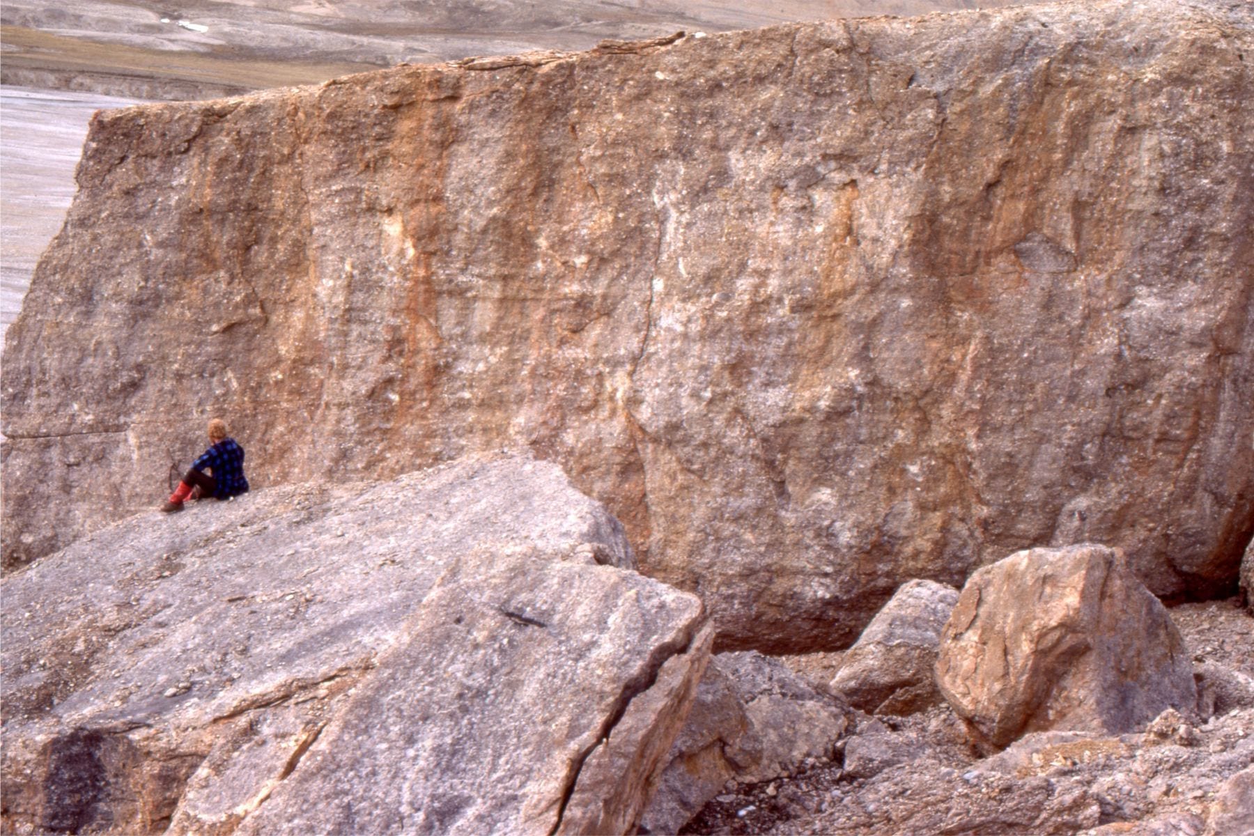
Violin Breccia, Ridge Basin, California. fault plane talus, and or debris flows, adjacent San Gabriel Fault, a Late Miocene splay of the evolving San Andreas transform. Breccia clasts are mainly gneiss. The breccia extends many km along the fault strand, but only about 2km down-dip into the basin.


Left: Lacustrine shoreface – delta sandstone, and stringers of Violin Breccia. Right: detail of the left image, showing crossbedded sandstone and grit-pebble sized material from the Violin Breccia. Ridge Basin, California.


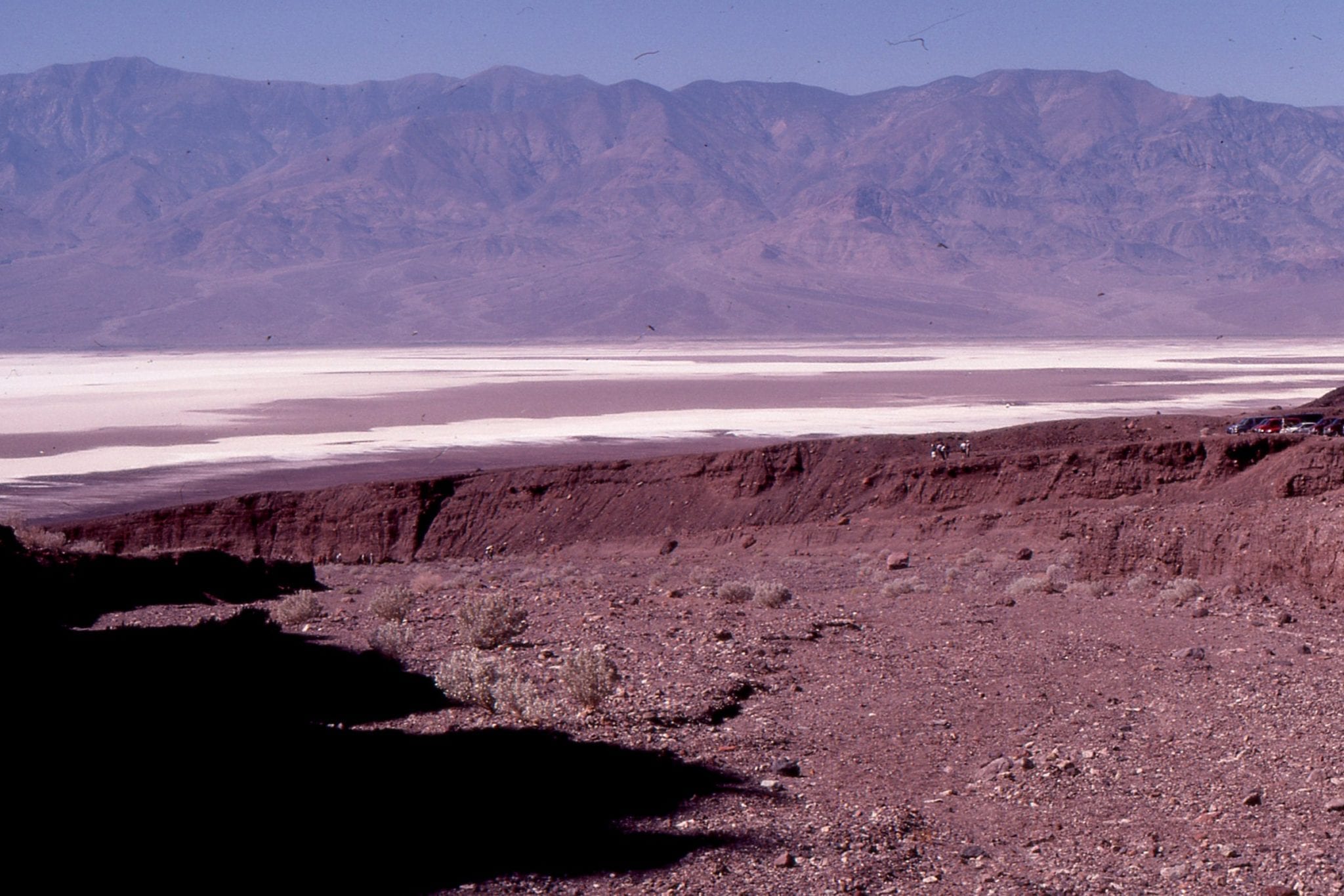
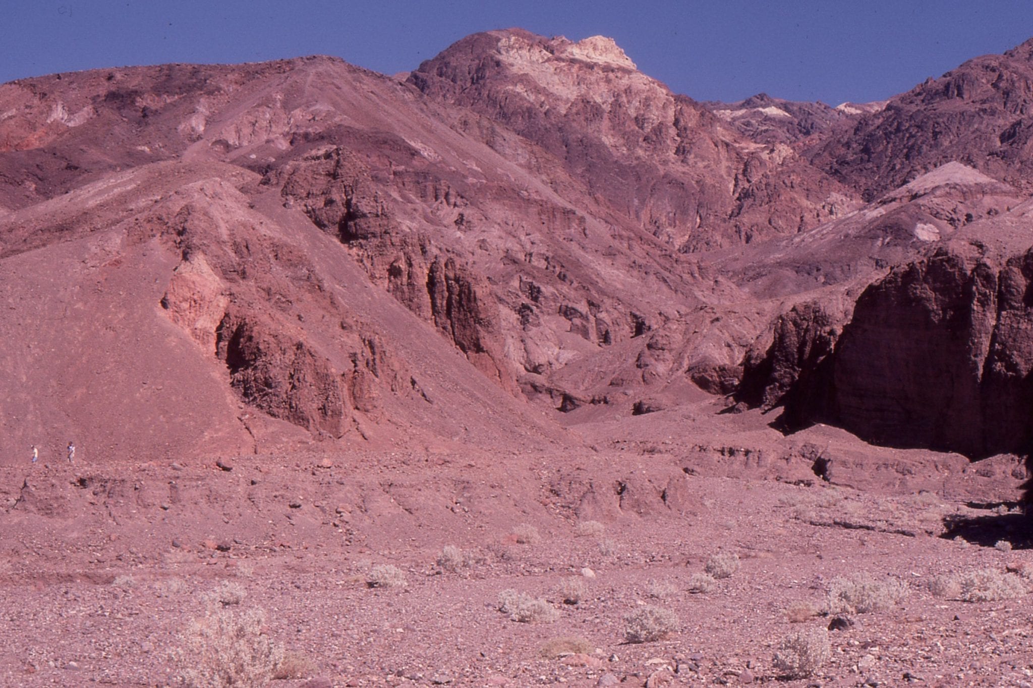
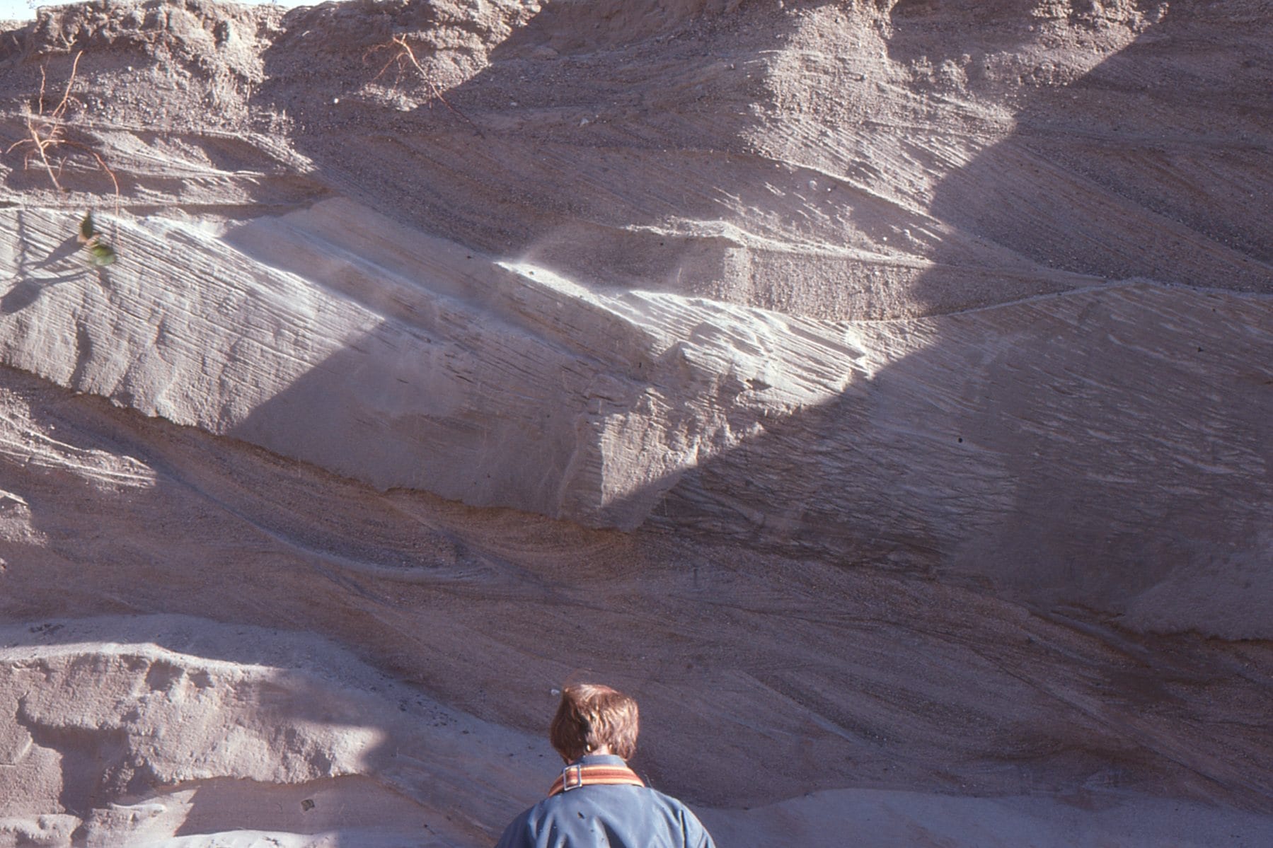
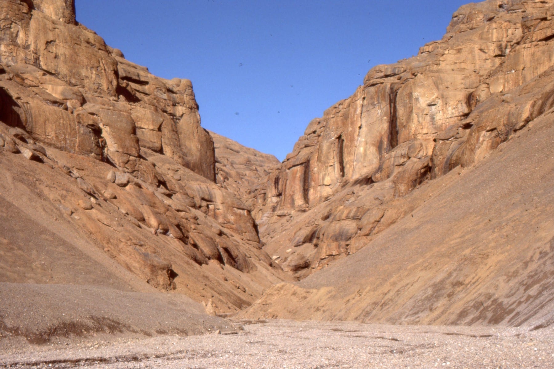
Left: down dip view of dissected Panamint Range alluvial fan, Death Valley. The coarse fan deposits reflect erosion of the uplifted Panamint metamorphic core complex.  The fan canyon-head is shown in the right image.


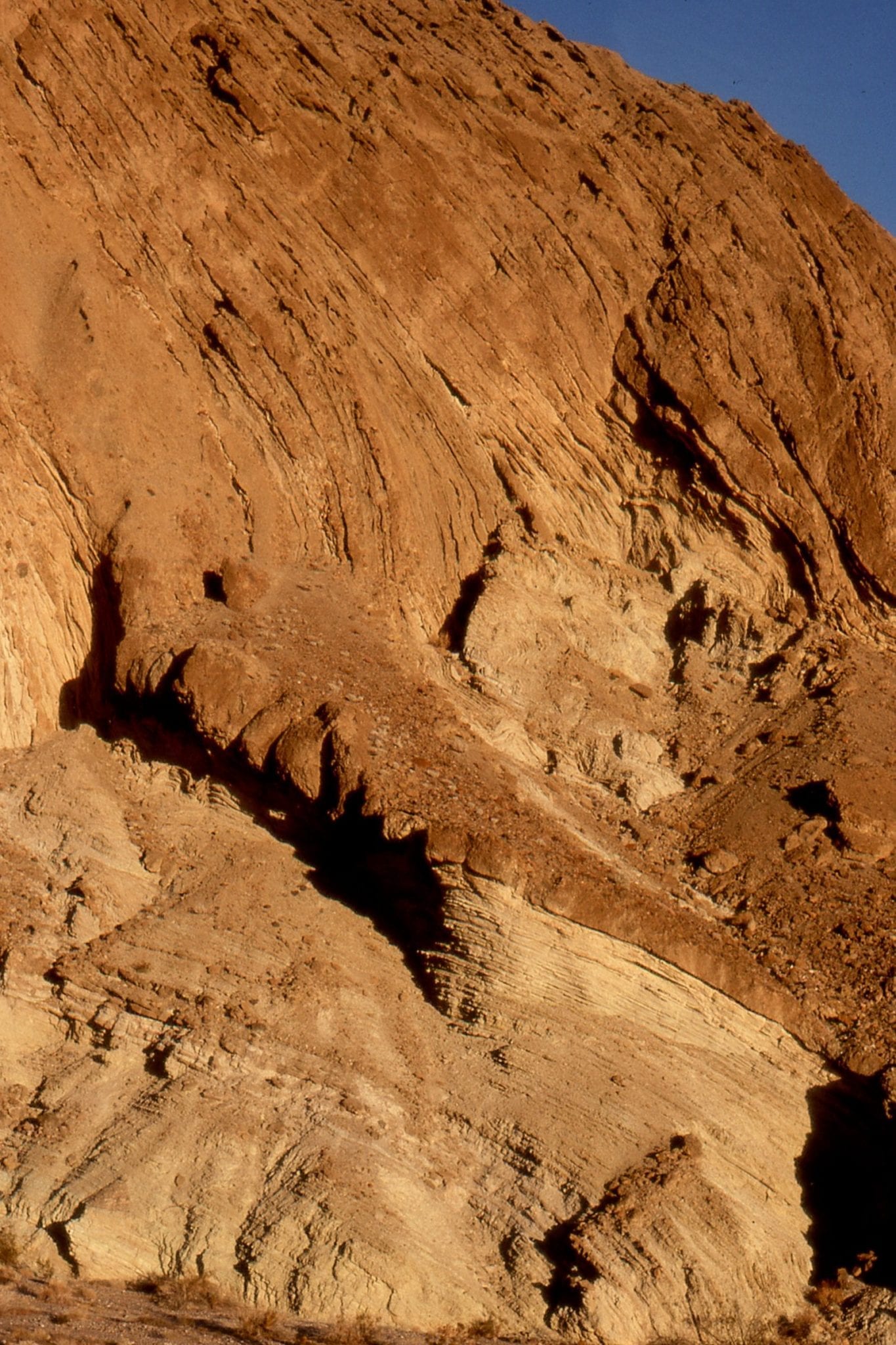
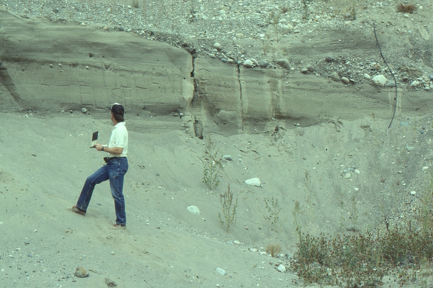
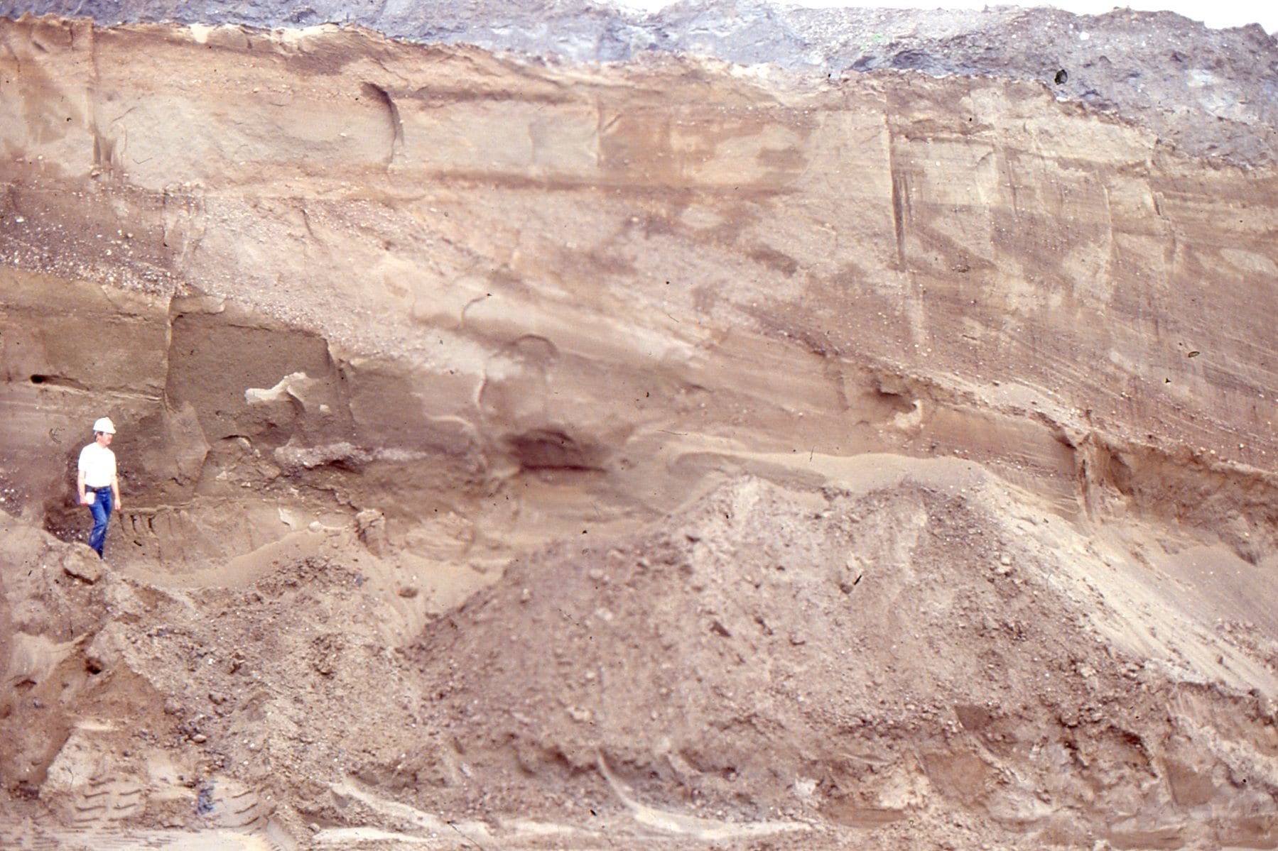
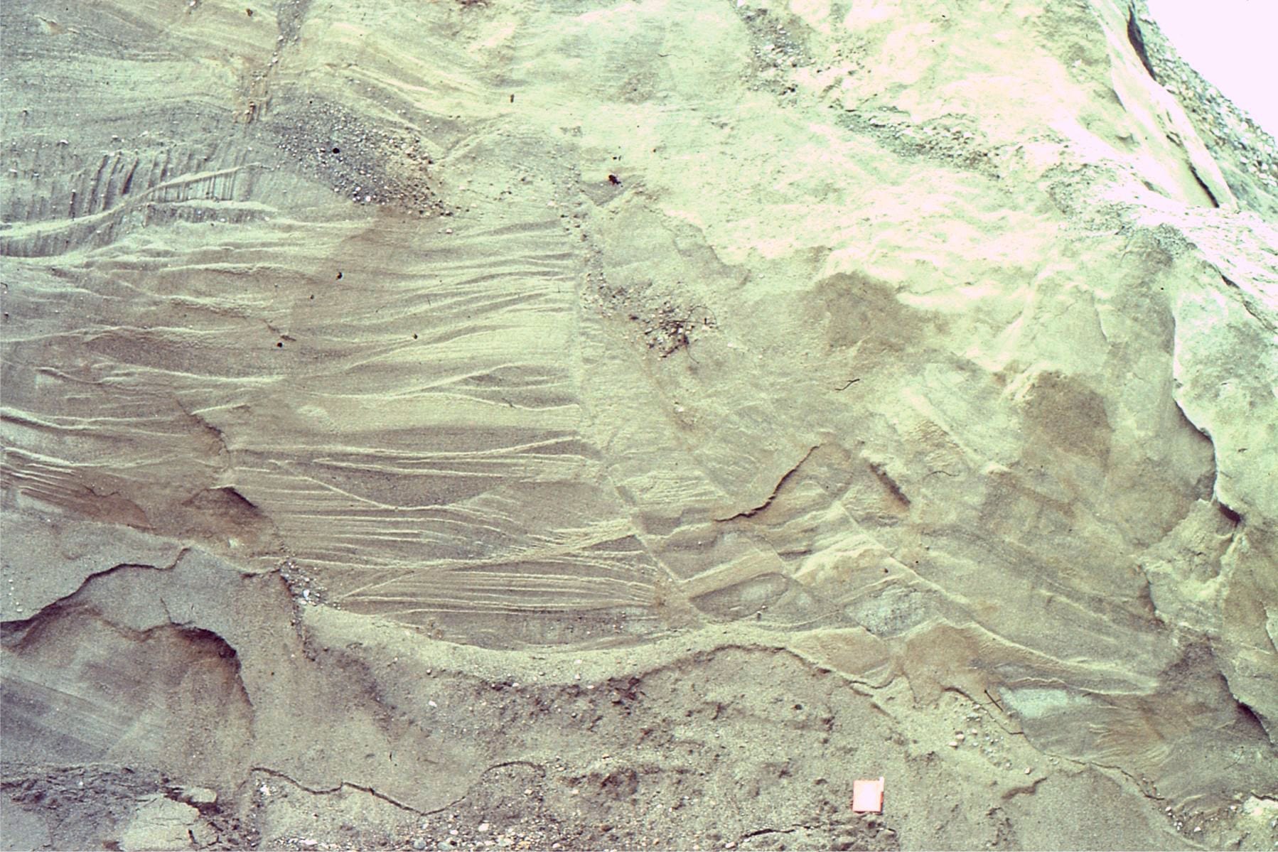
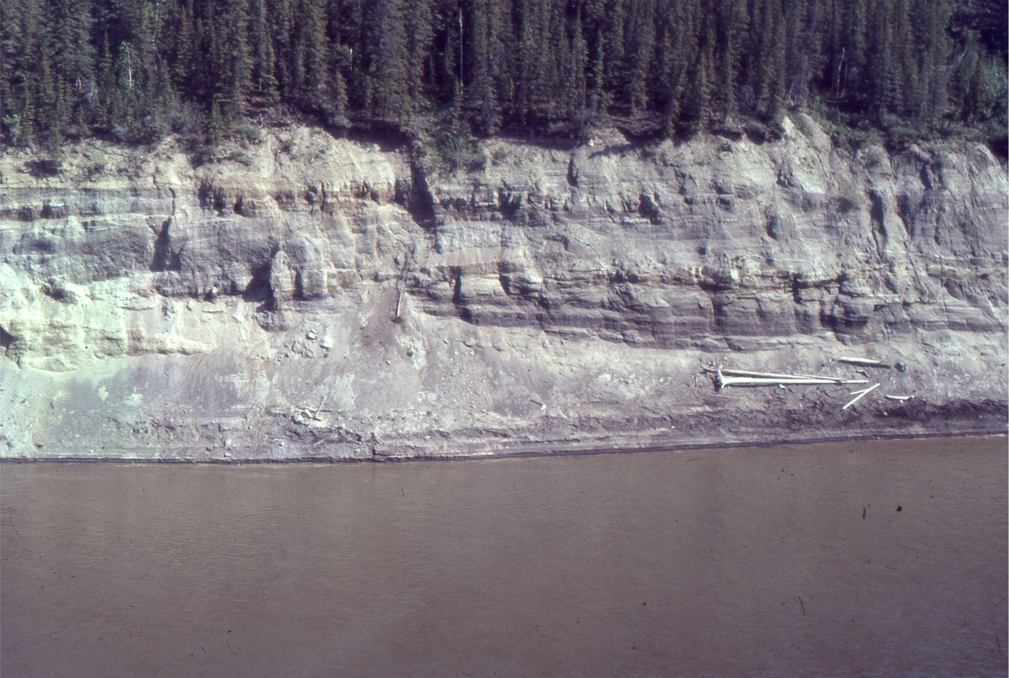
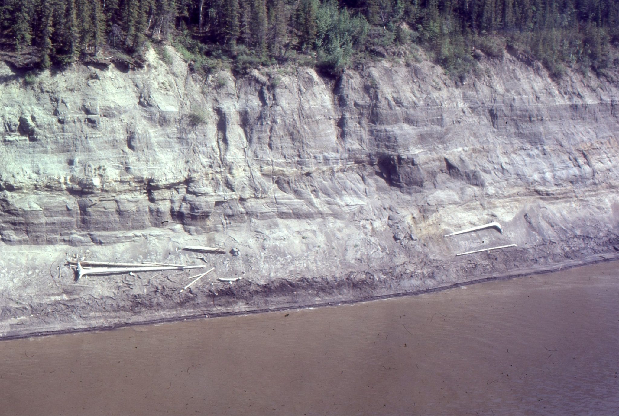
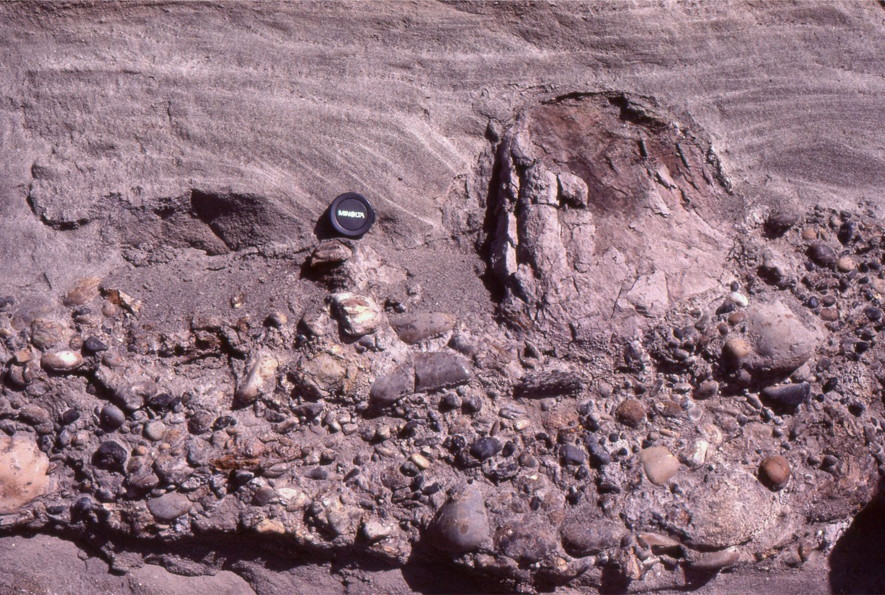
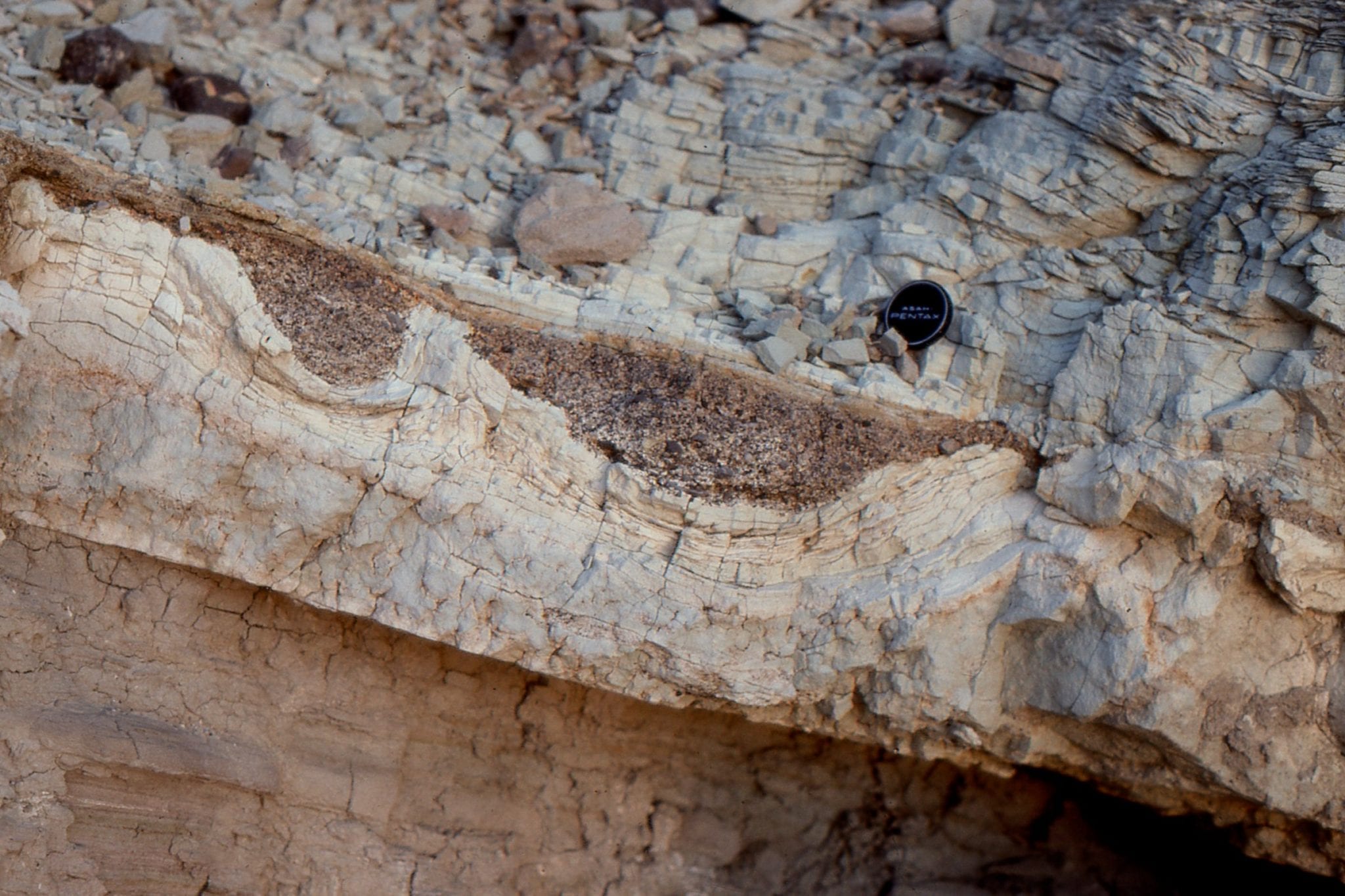
Hole in the Wall, Death Valley. Here, lacustrine sands and muds contain sporadic debris flows (resistant unit). Right image shows debris flow scours. They accumulated during Miocene-Pliocene extension  that resulted in Death Valley basin subsidence. Subsequent deformation took place as the Furnace Creek strike-slip fault created an en echelon stack of fan deltas and associated lacustrine deposits.


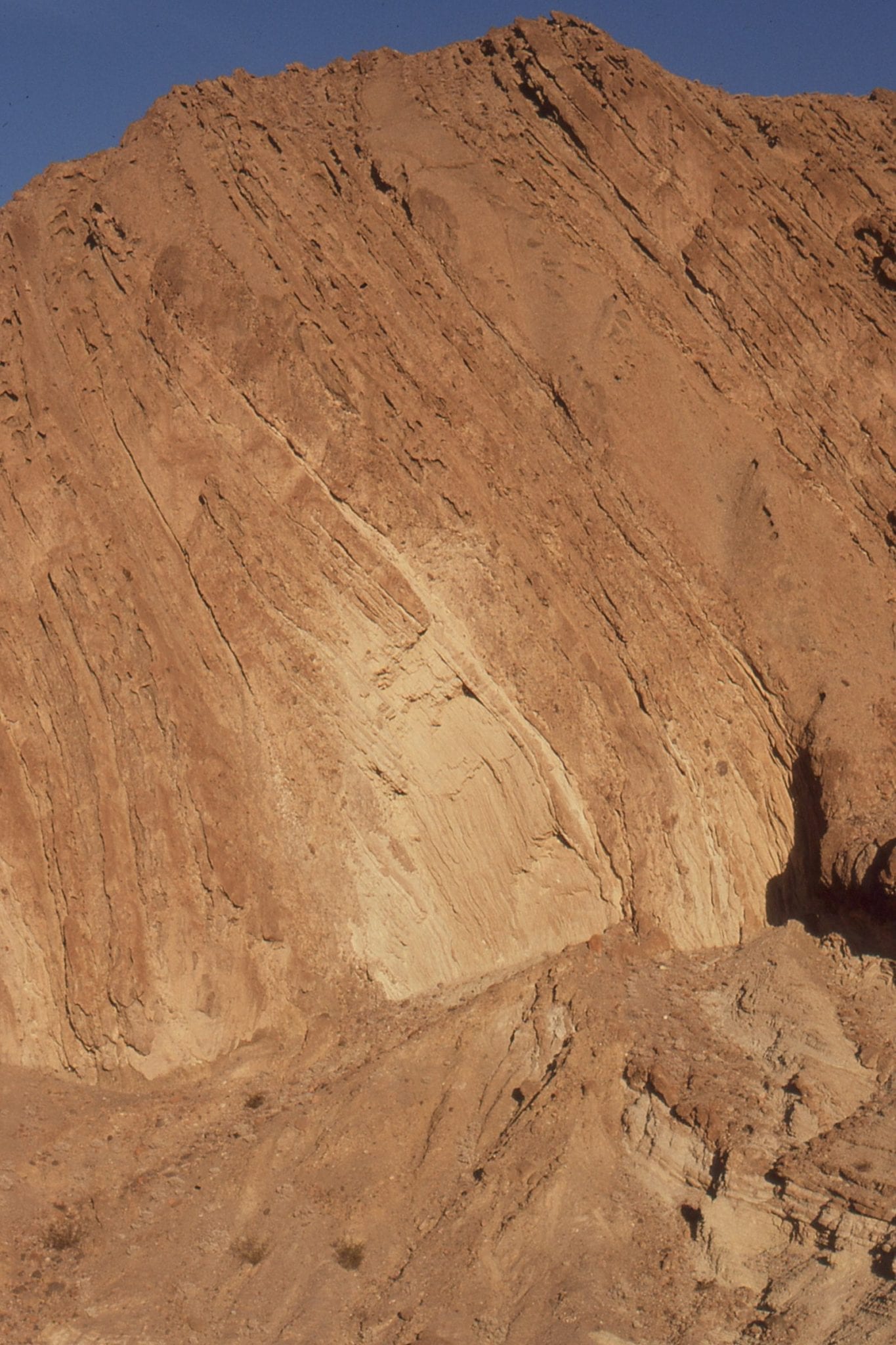
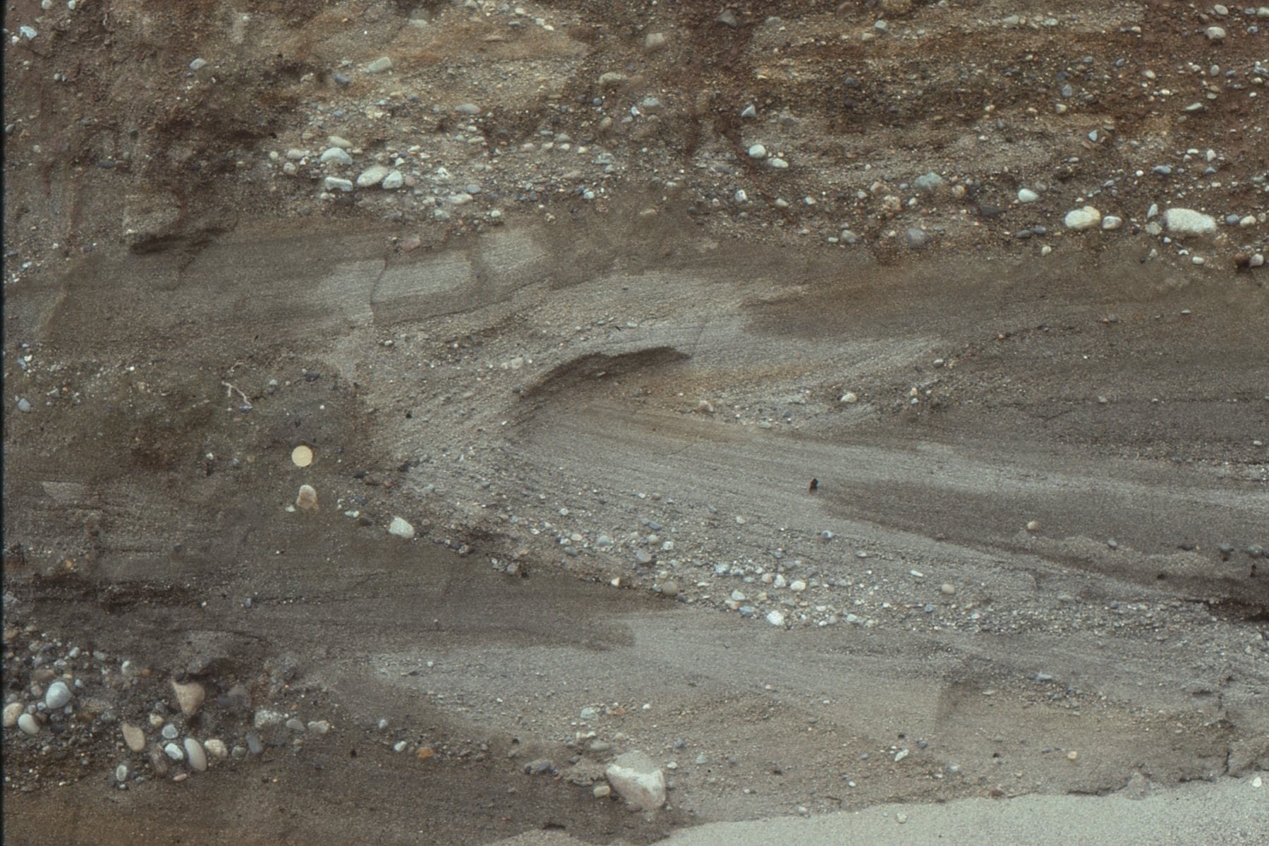
Hole in the Wall, Death Valley. Discordant packages of lacustrine shoreface and prodelta mudstone-sandstone, and pebble conglomerate. The debris flow in the images above can be traced from the lower right to the central part of the cliff.


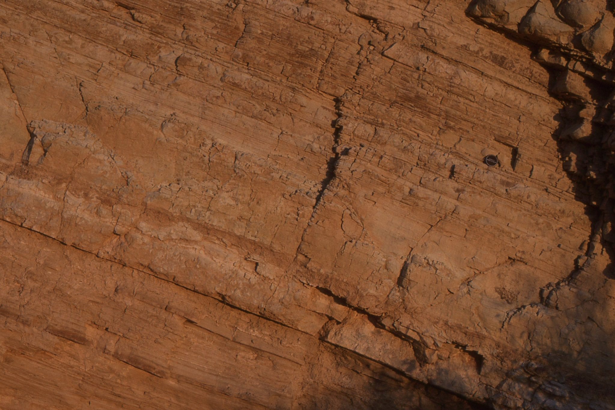
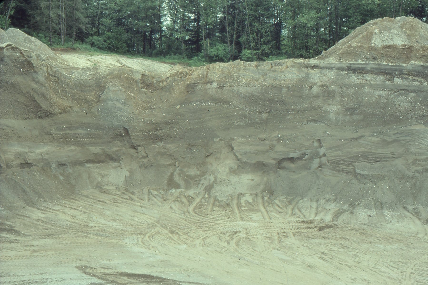
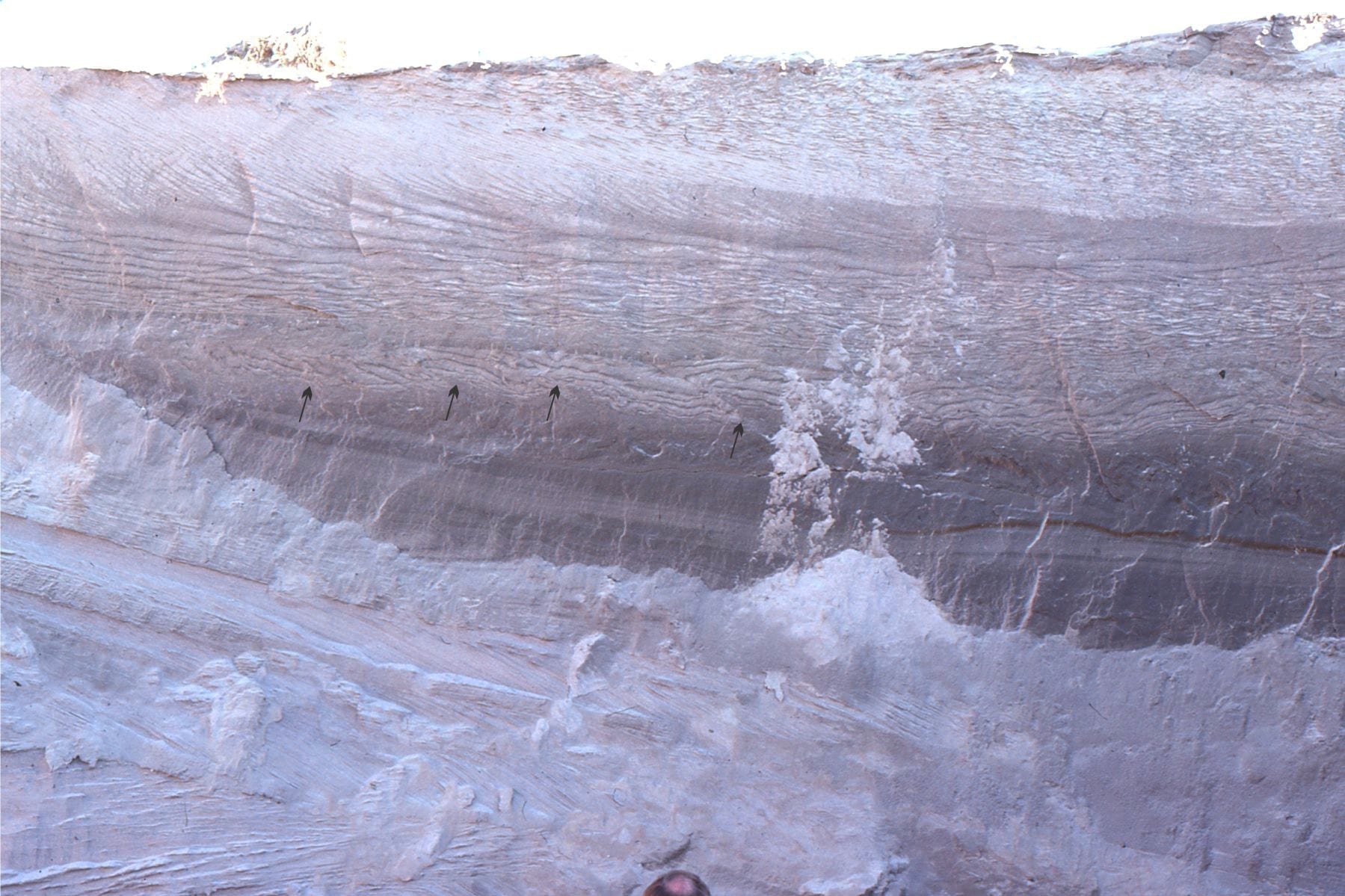
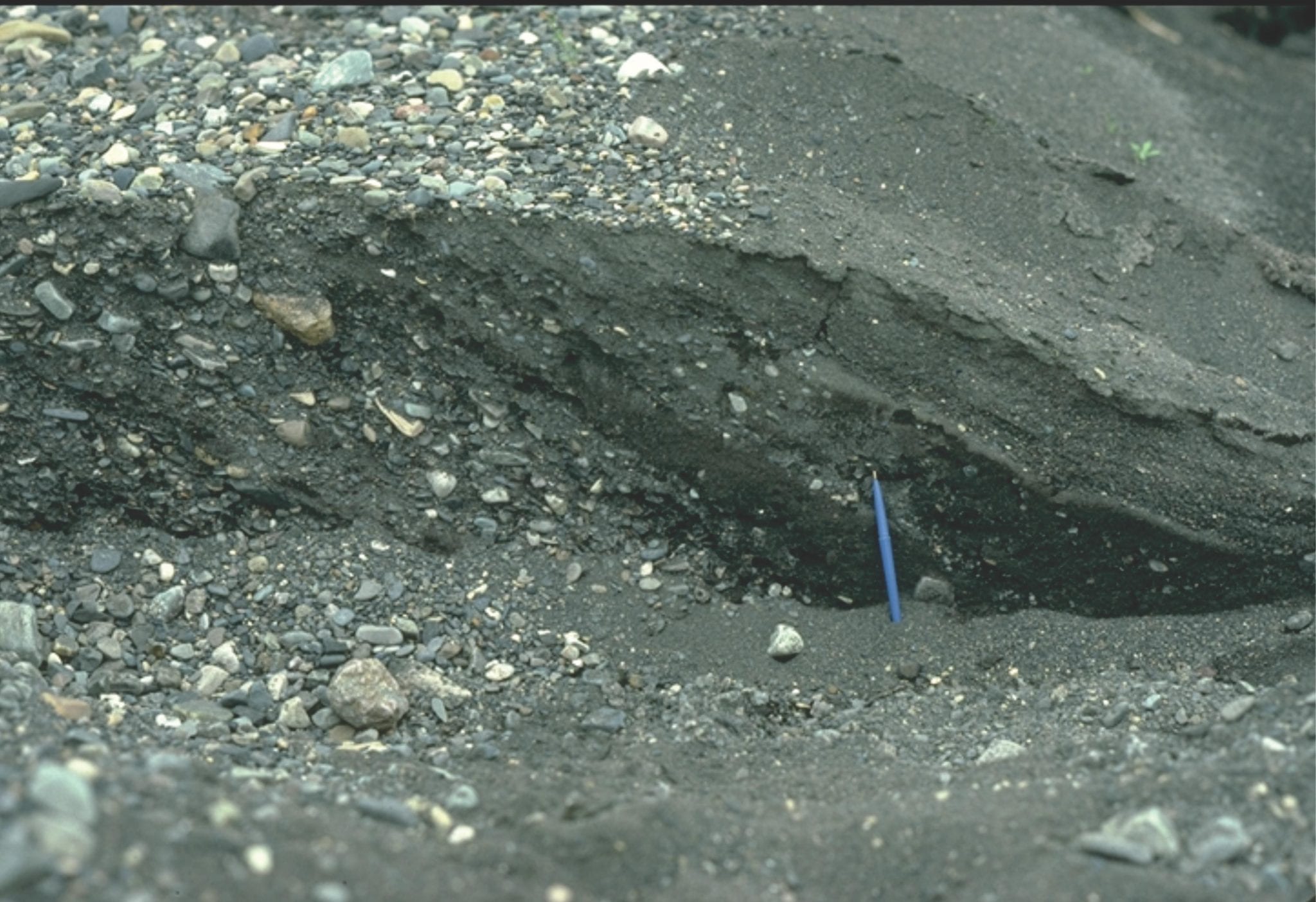
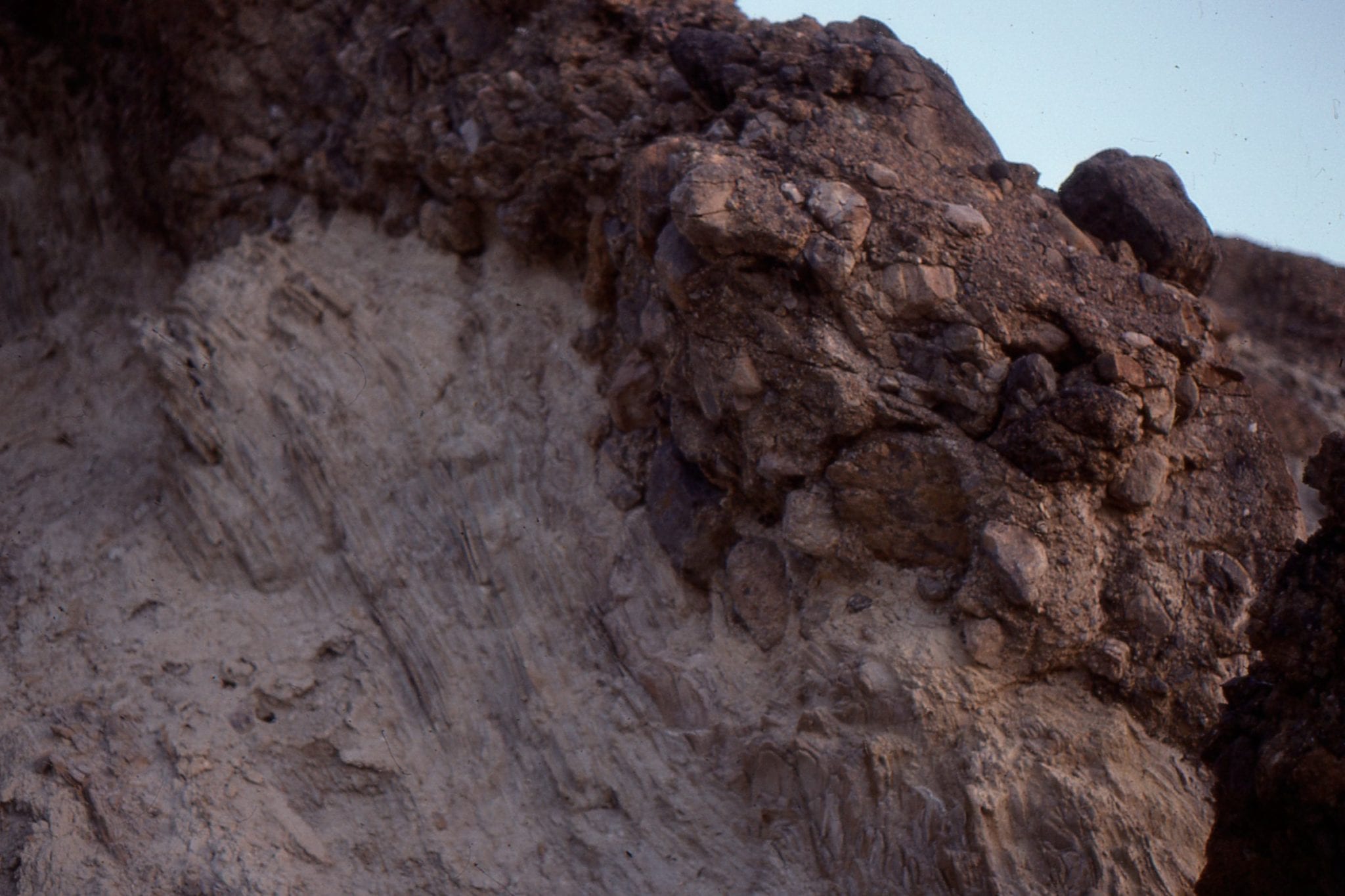
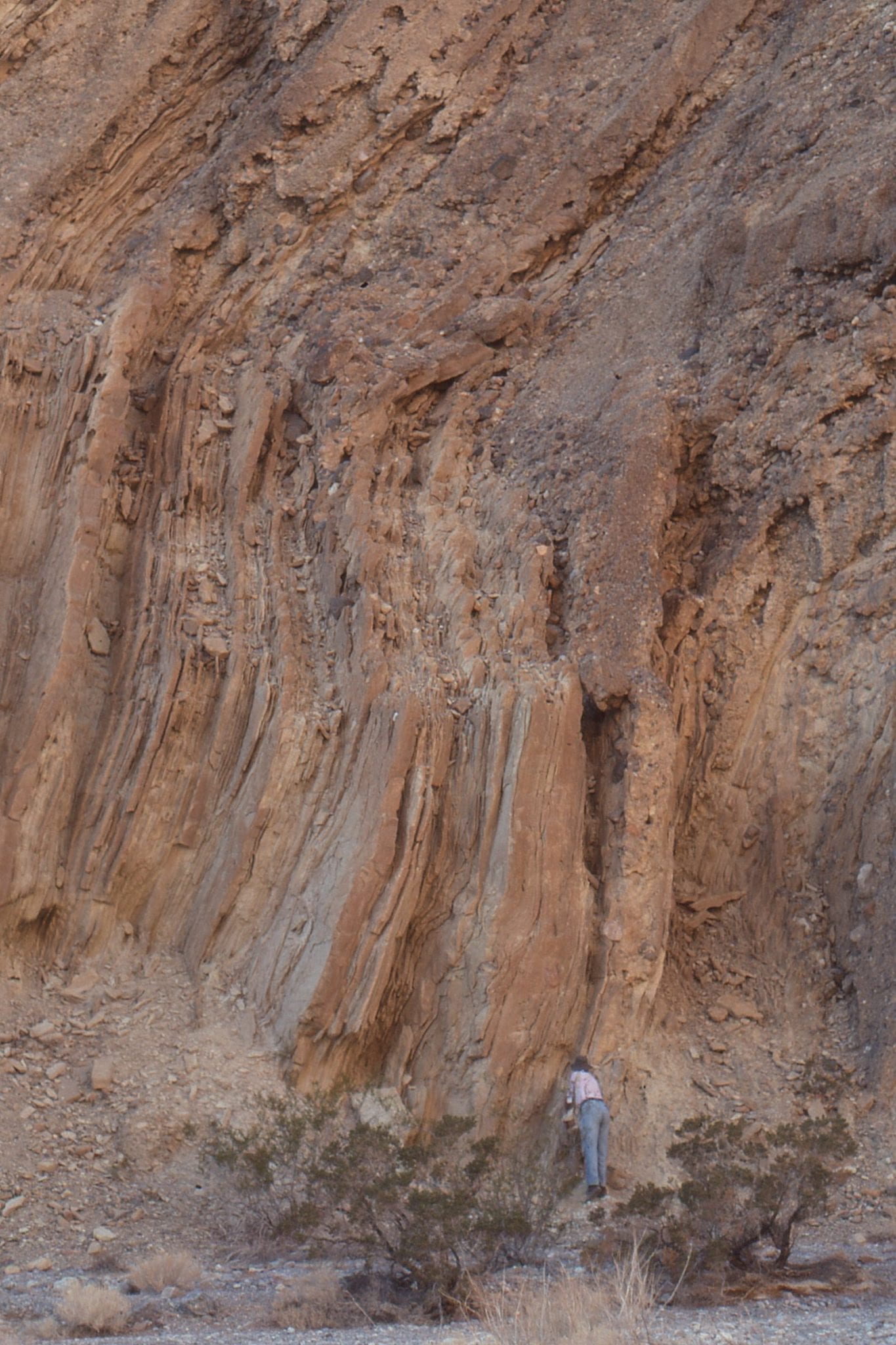
Hole in the Wall, Death Valley. Lacustrine silt and clay, in prodelta or basin floor. The right image shows small grit-filled scours from periodic influxes down the prodelta slope.


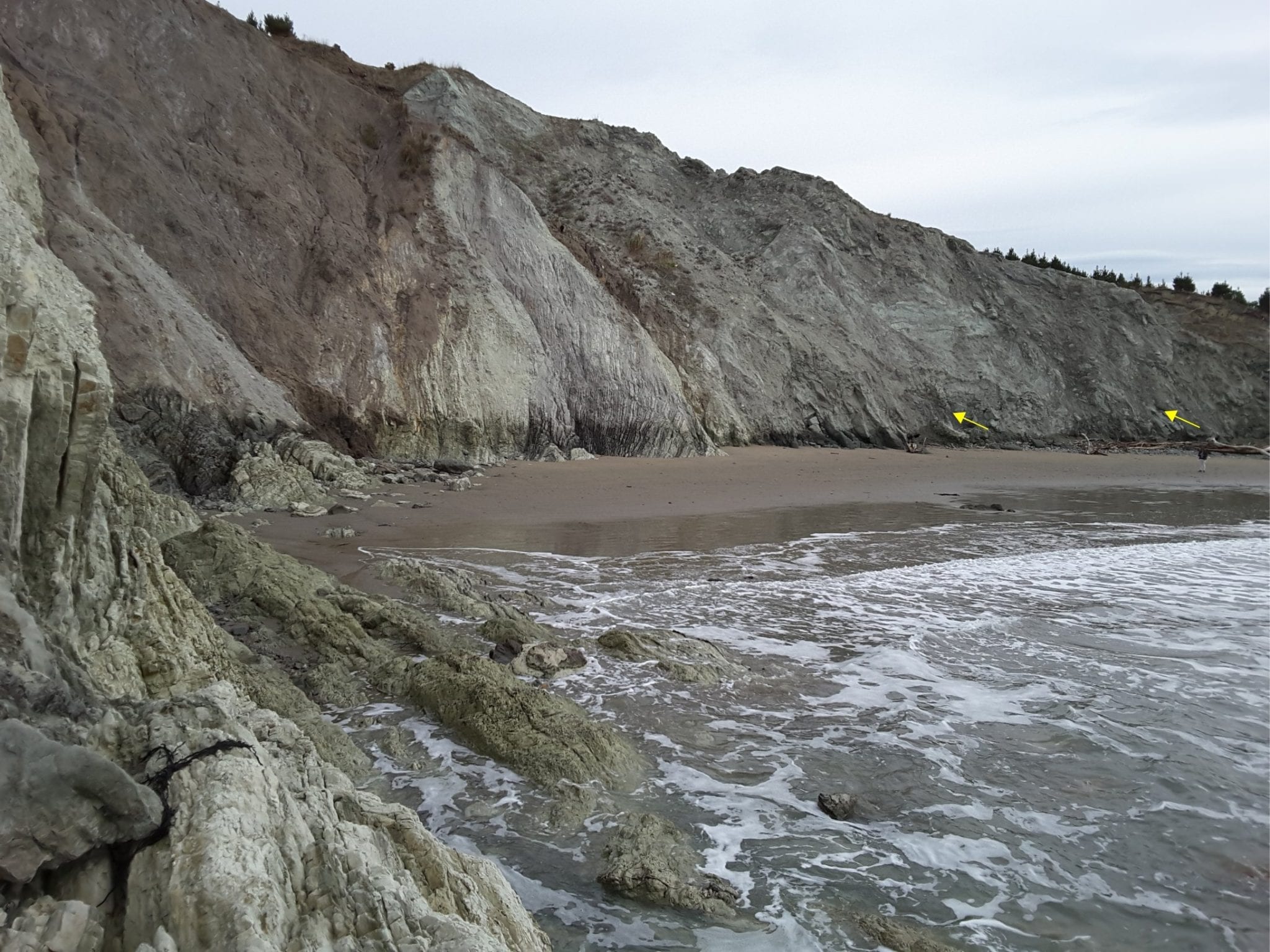
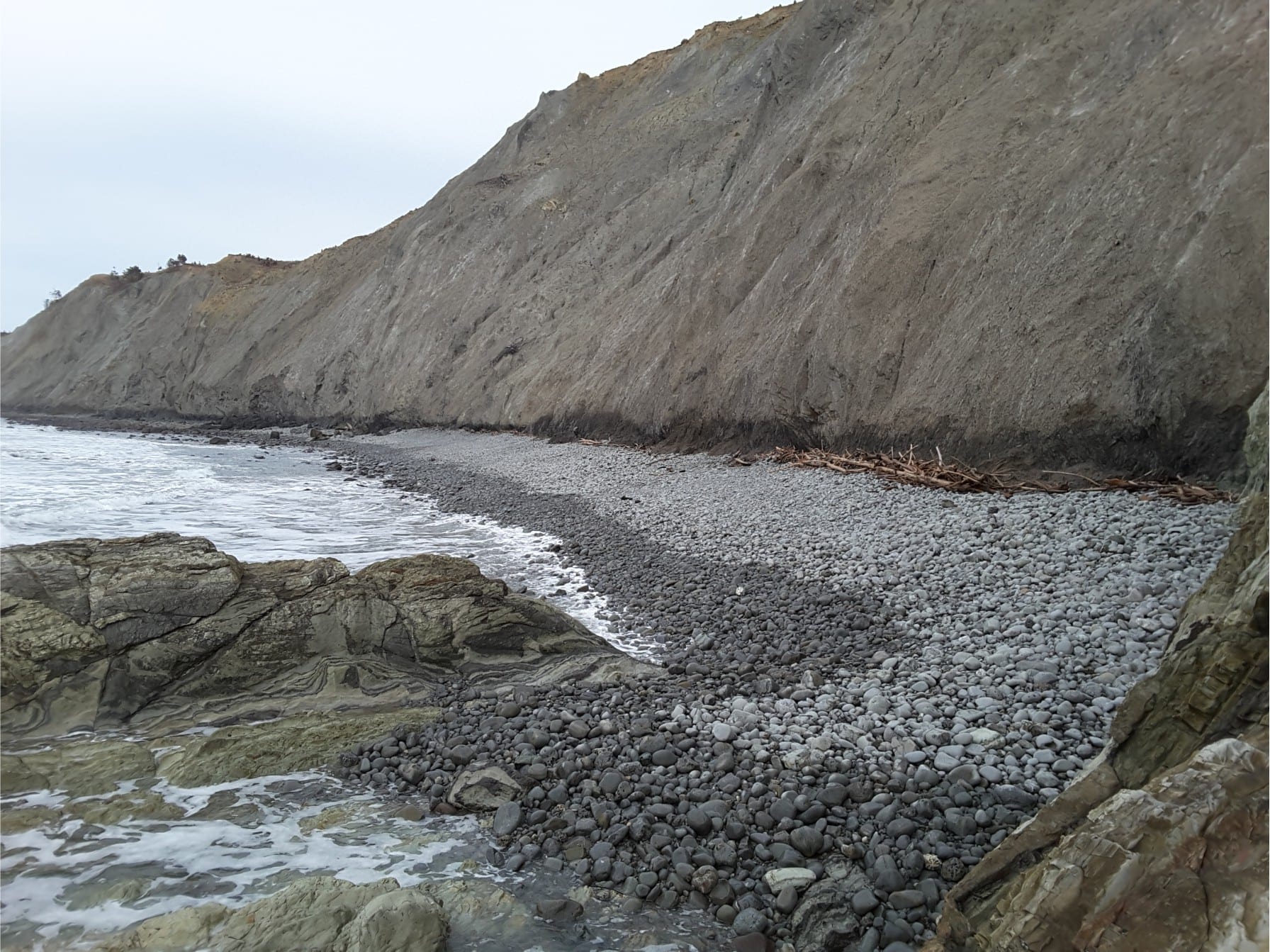
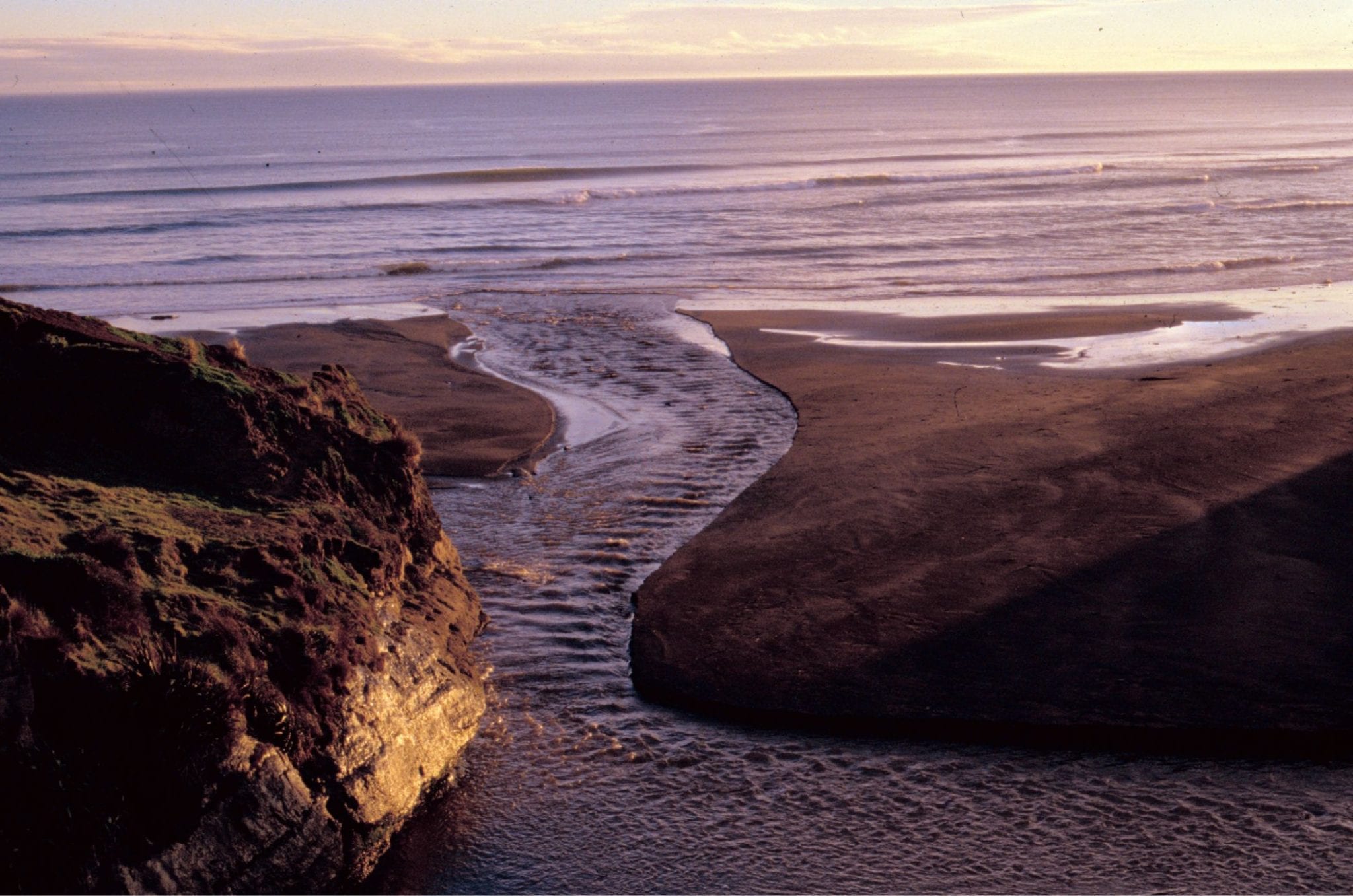
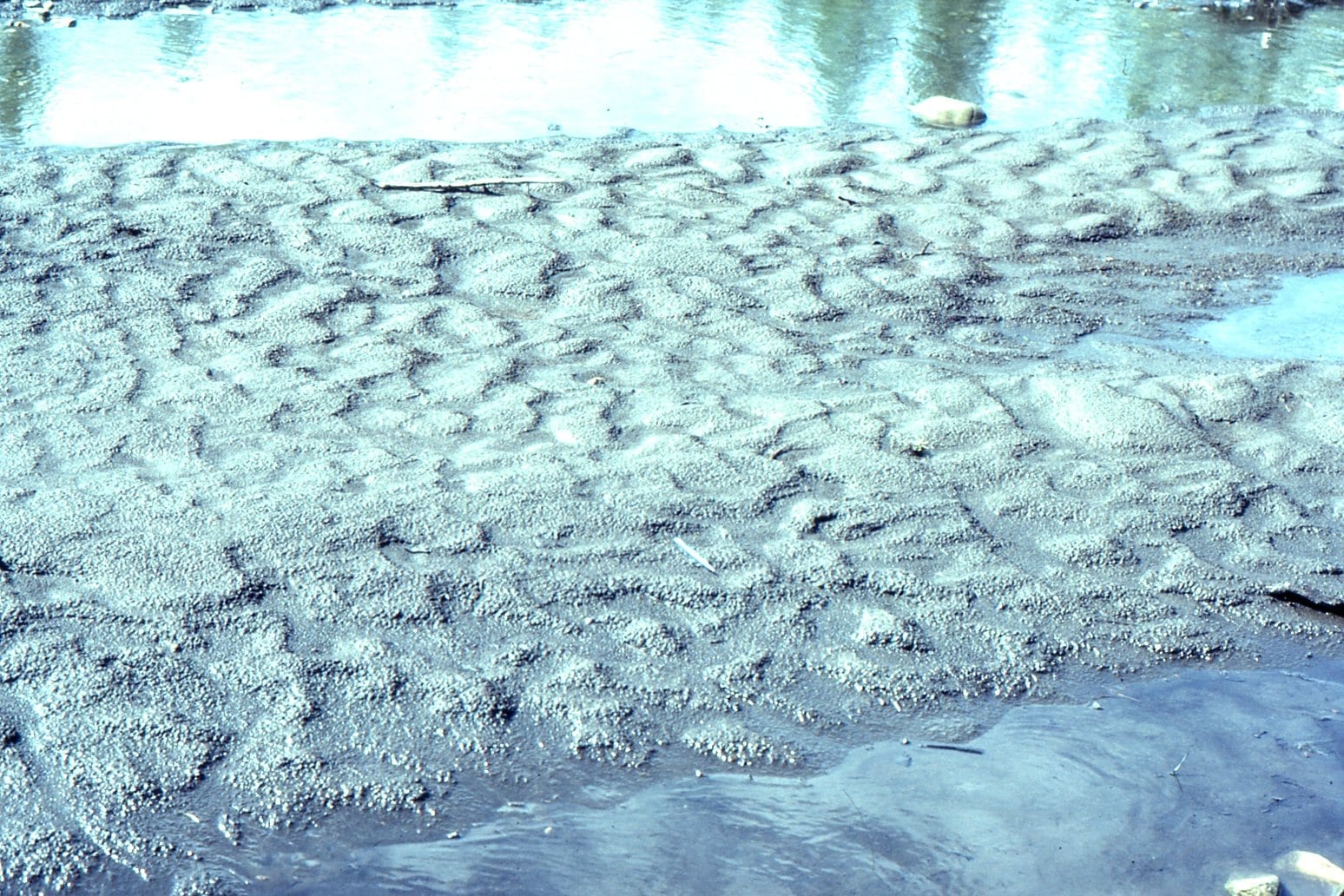
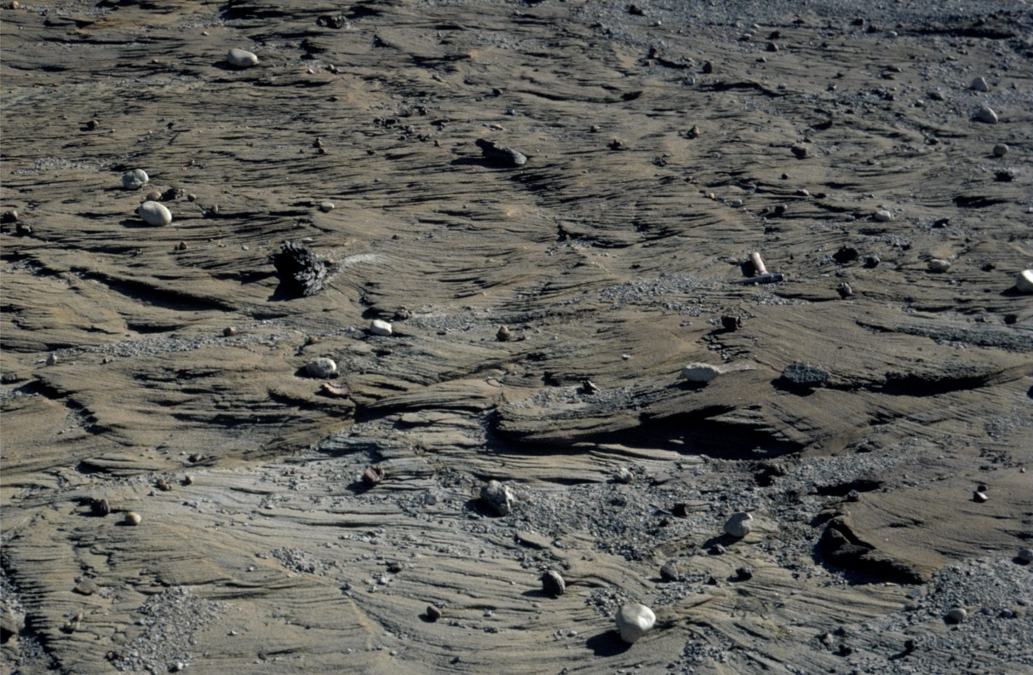
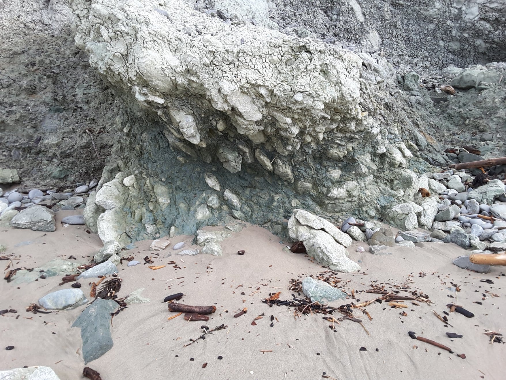
Coastal exposure of an active accretionary prism, Waimarama, eastern North Island. The accretionary prism here consists of telescoped slivers of sea-floor sediment, above Hikurangi subduction zone.  Left: Thrusts and associated shearing in bentonitic mudrocks, sandstones, and marls (arrows), looking north. Right: Looking south at similar lithologies, and the modern expression of sedimentation associated with the deformation – a cobble beach.


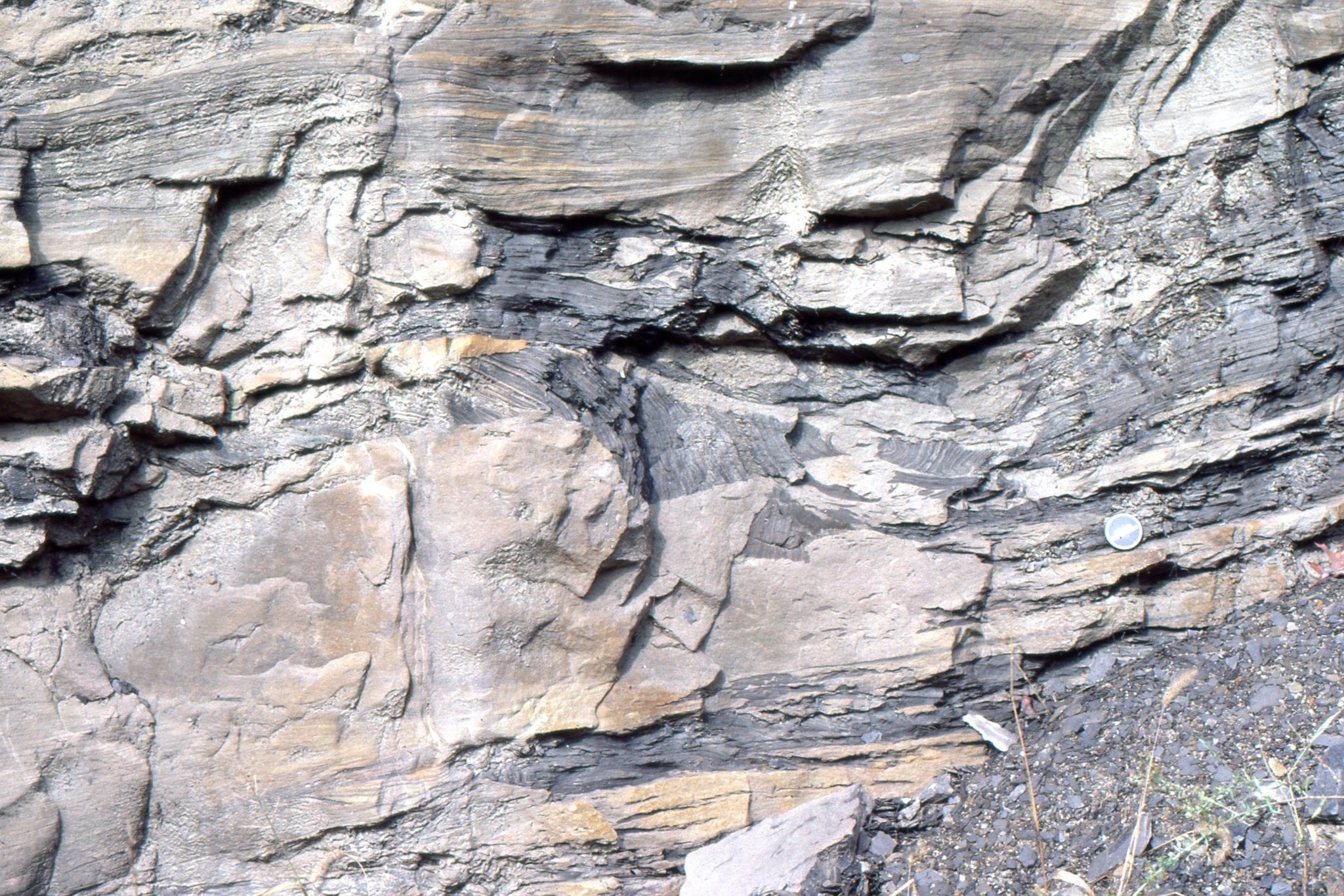
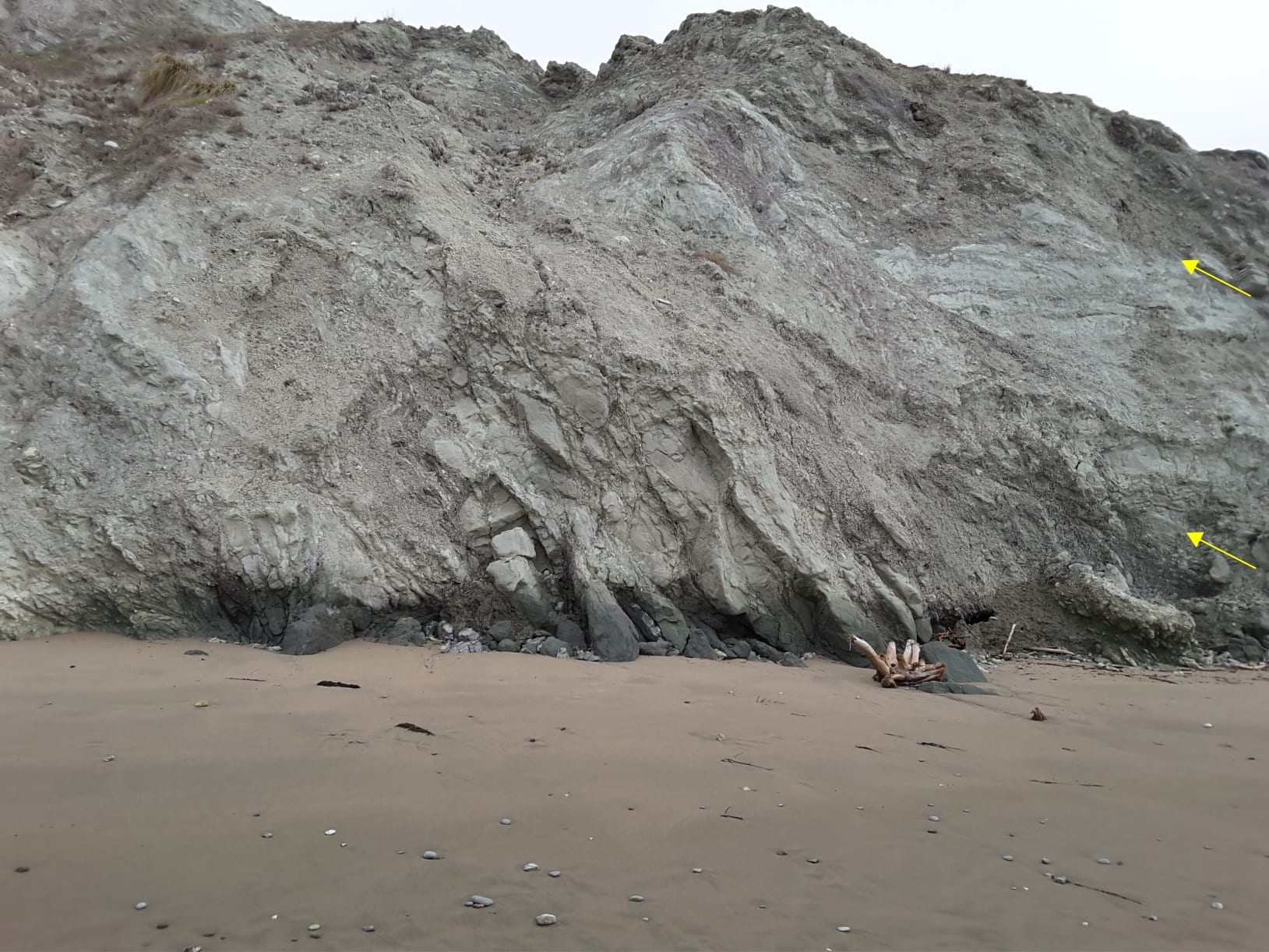
Closer view of thrusts and intensely sheared mudstone-sandstone melange, Waimarama, eastern North Island.


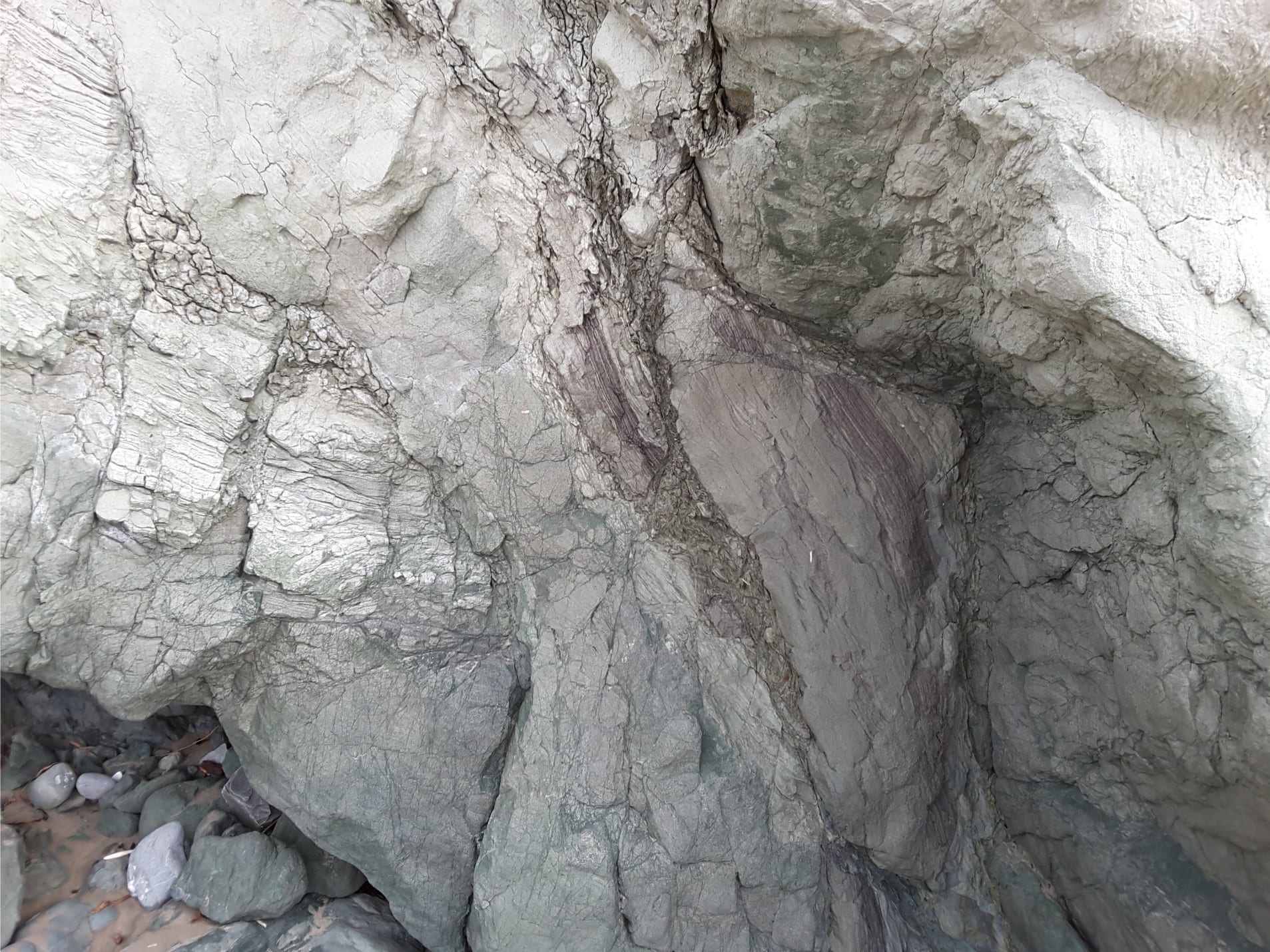
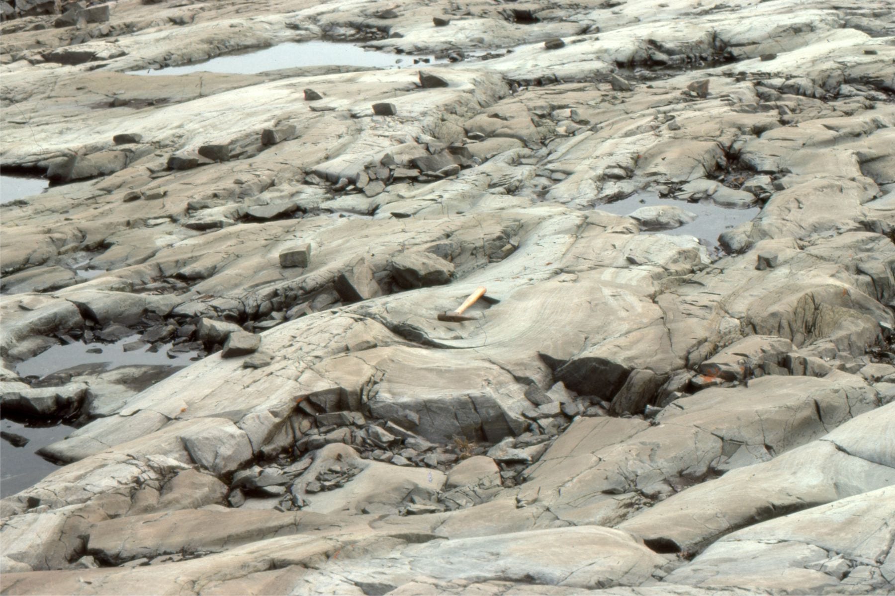
Sheared and stretched sandstone (left), and sheared bentonitic melange (right), within thin, accretionary prism thrust sheets, Waimarama, eastern North Island.


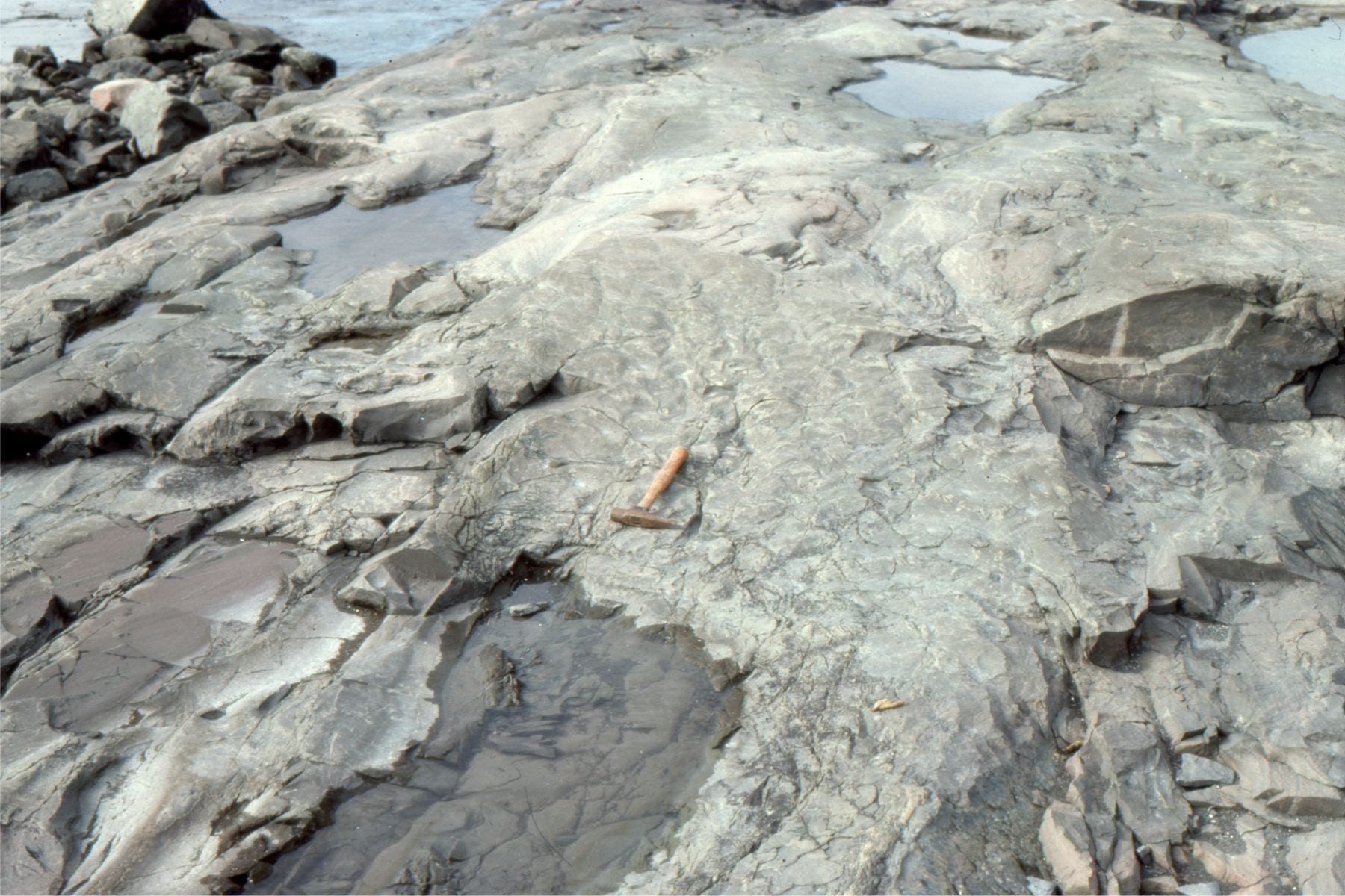
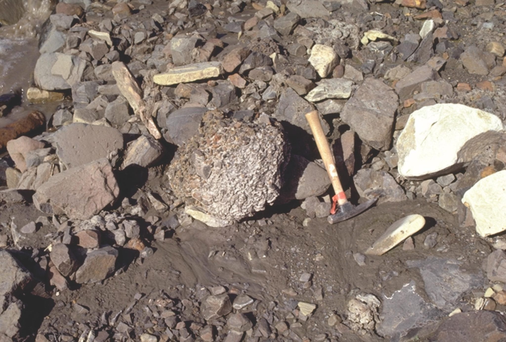
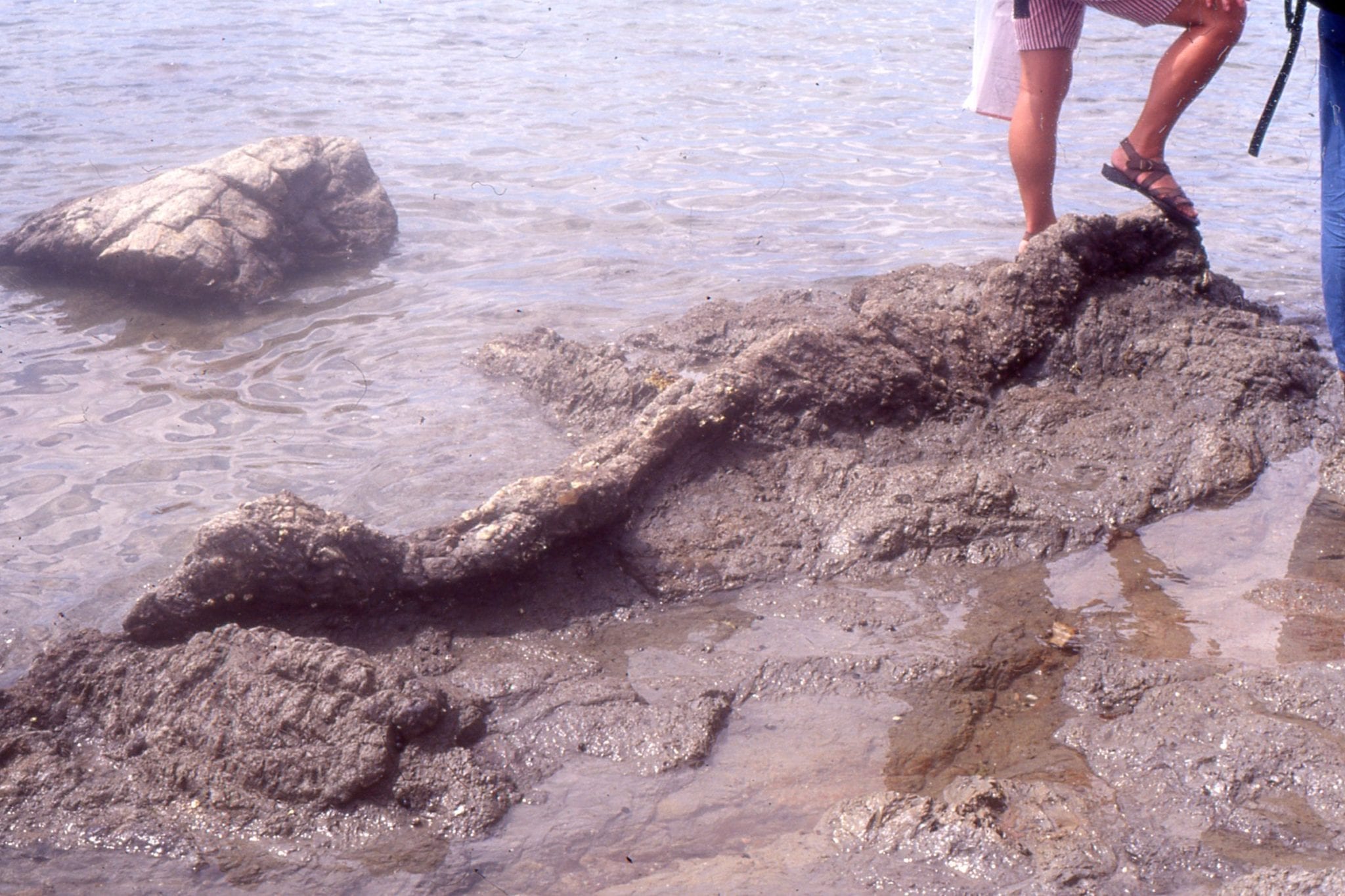
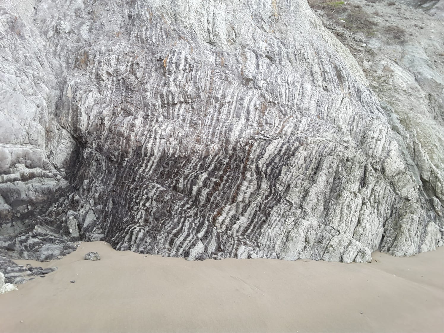
A lozenge of resistant cherty mudstone within the softer bentonitic melange, detached during thrusting, Waimarama, eastern North Island.

Facebooktwitterlinkedininstagram
Facebooktwitterlinkedin

Atlas of glaciofluvial – periglacial deposits

Facebooktwitterlinkedininstagram

The Atlas, as are all blogs, is a publication. If you use the images, please acknowledge their source (it is the polite, and professional thing to do). 

The glaciofluvial-periglacial category refers to pretty well anything sedimentological, that is associated with glaciations, glaciers, ice caps, and ice sheets. It includes the ice itself, outwash sediment in fluvial and lacustrine environments, and ice-related phenomena like permafrost and patterned ground.  Most of my examples are from Canada, the Arctic, and Laurentide Icesheet locations like Ottawa, Ontario, and Fraser Lowlands, British Columbia.

This link will take you to an explanation of the Atlas series, the ownership, use and acknowledgment of images.

Click on the image for an expanded view, then ‘back one page’ arrow to return to the Atlas


The images:

Terminal moraines ahead of a retreating Strand Glacier, Axel Heiberg Island, as it was in 1983.


Part of the Strand Glacier terminal moraine, the meltwater, and outwash channels. The sediment eventually finds its way to Strand Fiord.


Mixed sediment and ice at the snout of Strand Glacier, Axel Heiberg Island


Tanquary Fiord, Ellesmere Island – a typical Arctic fiord, rimmed by steep terrain and small, coastal fan deltas.  The arrow locates a Geological Survey of Canada base camp in 1988.


The edge of an ice cap on central Axel Heiberg Island, eroded by the outwash stream. Deformation of ice is accentuated by dark mud and sand in the ice (clear ice lies above the darker foundation. Ice rheology here includes ductile and brittle deformation.


Aerial view of the ice cap edge shown in the image above.


Lateral moraine and crevasses at the Valley of the Six Glaciers, Lake Louise, Alberta


Polygonal surface in trundra formed by freeze and thaw of surface permafrost. This stuff is really difficult to walk on.


Thermokarst slumping, caused by melting permafrost


Deformed ground ice within the permafrost, probably caused by ice expansion.  The trees above are 3-4m high. The ice fold was exposed in the slip face of a thermokarst slump. North Yukon.


Frost heaved blocks of greywacke; the shape of the blocks is governed by intersecting fractures in the bedrock. Belcher Islands.


Glacial striae on greywacke; scratches formed as rock fragments are dragged across the bedrock surface by flowing ice during the Last Glaciation (Laurentide Icesheet).


A beautiful U-shaped valley at Glen Rosa, Arran (Scotland), gouged by a glacier during the Last Ice Age.


Winter freezing of an estuary at Cape Cod, Massachusetts.


Late Pleistocene, crossbedded glacial outwash channel deposits; the channel base is lined with boulders.  Bradner Road pit, Fraser Valley


Detail of trough crossbeds in a glacial outwash channel, Stokes pit, Fraser Valley, British Columbia.


Large foresets (4-5m thick) in glacial outwash, may have formed as a small Gilbert-type delta in an outwash lake of meltwater pond.  The overlying topset sand is about 1.5m thick, that, in turn was overridden by a diamictite during ice advance.Bradner Road pit, Fraser Valley.


A complex array of trough and planar crossbeds in Late Pleistocene glacial outwash channels. Bradner Road pit, Fraser Valley.


Ice-contact deformation of outwash sands along small listric faults, that appear to detach at the contact with pebbly sand below. Field note book for scale. Bradner Road pit.


Detached slump block, draped by outwash gravels. The block is also cut be several small faults. Deformation was probably caused by ice loading. Bradner Road pit, Fraser Valley.


Crossbedded and rippled glacial outwash in a gravel pit at Kanata, Ottawa. Arrows point to small thrust faults (movement to the left) probably caused by ice loading prior to deposition of the thicker crossbedded unit above (the faults do not extend into the overlying unit).


Thick trough crossbeds in an outwash channel, Kanata, Ottawa. The channel seems to have been filled by at least three stages of sediment influx, and scouring of the channel floor.


Outwash sand, deposited in large migrating dunes (upper half of outcrop), and multiple sets of climbing ripples (about level with the geologist). The topmost layer contains sandy muds folded and contorted by ice loading. Kanata, Ottawa


A nice example of in-phase ripples in fine-grained, outwash sand, Kanata, Ottawa


Kink folds in semi-consolidated outwash sand, formed during ice-contact, Kanata, Ottawa


Facebooktwitterlinkedininstagram
Facebooktwitterlinkedin

Atlas of fluvial deposits

Facebooktwitterlinkedininstagram

This collection of images from various modern and ancient fluvial settings, includes meandering (high sinuosity) and braided (low sinuosity) rivers.  Where possible I have paired modern analogues with ancient examples.

The Atlas, as are all blogs, is a publication. If you use the images, please acknowledge their source (it is the polite, and professional thing to do). 

This link will take you to an explanation of the Atlas series, the ownership, use and acknowledgment of images.

Click on the image for an expanded view, then ‘back one page‘ arrow to return to the list

The images:

river and sea waves

Where transverse sea-waves (generated by wind shear) meet riverine standing waves. Manawapou River, west coast NZ.


Arctic braided river                         Arctic braid bars 

An Arctic braided river, Strand Fiord, Axel Heiberg I. Flow is seasonal, and at a maximum during spring-early summer thaw. The closer view (right) shows a bit more detail of within-channel bar surface features. The sediment load is mixed sand-gravel.


Bonnet Plume braided river                         modern braid bars

Bonnet-Plume River (Yukon) braided reaches, that, unlike high Arctic examples, are framed within vegetated overbank and some inactive gravel bars. The sediment load is mixed sand-gravel. The left image also shows an ephemeral meandering reach that cuts through inactive braid-bars.

boulder braid barsVegetated braid bar gravels exposed in a cut bank. Bonnet-Plume River, Yukon.


Ahuriri RiverGravelly, braided reaches of Ahuriri River, Otago, NZ. The headwaters are in the distant Southern Alps.


gravel bars, OtagoGravel bar, Ahuriri River, Otago, New Zealand, with falling-stage sand deposits along the bar trailing edge (downstream edge).


braided glacial outwashGravelly, braided glacial outwash near the terminus of Strand glacier, Axel Heiberg Island. Erosional chutes, that form during falling stage, are filled with crossbedded sand.


modern planar crossbed                       crossection of crossbed

2-dimensional pebbly dunes, each with simple planar tabular crossbeds, formed along the margins of larger gravel braid bars during river falling stage. Monster River, Yukon.


bar top ripplesBraid bar-top ripples (flow to the right), imprinted by rain drops. Monster River, Yukon.


outwash standing wavesGlacial outwash flow during spring thaw, between gravel bars, Strand Glacier (Axel Heiberg Island). The water is mud-laden. The standing waves are in-phase with antidune bedforms.


fluvial imbricationStrong imbrication  of flat clasts along an exposed river bed.  Flow was to the right.


Arctic flash floodBank-full conditions in an ephemeral, gravelly, Franklin Pierce Bay (Ellesmere Island) stream, during a rare mid summer Arctic rainstorm.  About 25mm fell in a matter of hours.  The stream rose very quickly and forced us to move our camp.  There were many rockfalls from nearby cliffs during the storm.


Eocene fluvialEocene gravel bar deposits, Otto Fiord, Ellesmere Island. The sandy interval mid-picture was interpreted as small, crossbedded, falling stage sand bars, like those shown in the modern analogues.


syntectonic conglomerate                          Eocene gravel braid bars

Left: Thick, Eocene, syntectonic gravelly braided river deposits (Buchanan Lake Formation; Franklin Pierce Bay, Ellesmere Island). Sediment was shed from evolving thrusts during the Eurekan Orogeny.  Right: Large gravel crossbeds (up to 3m thick) in the same formation.


Eocene trough crossbeds                      Festooned troughs

Two examples of trough crossbedded sandstone in low sinuosity channels (braided) in the Middle Eocene Buchanan Lake Fm, Axel Heiberg Island (Arctic Canada).  These channels are the more distal equivalents to syntectonic gravelly deposits (Eurekan Orogeny).


Precambrian troughs                        exhumed trough crossbeds

Festooned trough crossbeds in Proterozoic low sinuosity sandy channels, Loaf Fm. Belcher Islands (about 2 billion years old). The right image shows small ripples that probably developed during waning stream flow.


Precambrian ball and pillowAs river deposits settle and consolidate, the water between grains is forced out by the weight of the sediment (this is called dewatering). The process commonly disrupts and contorts the sedimentary laminae, forming structures that superficially resemble pillows; these structures are given the general name ball and pillow.  Loaf Fm. Belcher Islands (about 2 billion years old).


Precambrian mudcracksReddened (iron oxides), desiccated mudrocks interbedded with channelized sandstone in the Proterozoic Loaf Fm, Belcher Islands; proof that the level of oxygen in the ancient atmosphere had increased significantly.


Braided channel Summit Creek                        channel in braided river

Paleocene Sandy braid channel and associated bar crossbeds (Summit Creek Fm.) exposed in right bank of MacKenzie River near Fort Norman, Northern Canada.


Anastomosing river                        anastomosing river bar

Active sand bars attached to a semi-permanent, vegetated bar, mid-stream, Clearwater River, Alberta.  This is a possible candidate for an anastomosing river.


roots and rocksLarge chunks of rock can be carried significant distances across open water while embedded in the tangle of tree roots. A possible answer to the mystery of some drop-stones.


modern meander beltSmall meandering stream, point bars, and oxbow lake, north of Calgary, Alberta.


Dunvegan point barPoint bar and overbank deposits in a high sinuosity (meandering channel) in the Upper Cretaceous Dunvegan Formation, Peace River, northeast British Columbia. Flow was to the right.


fluvial planar tabular crossbeds                         Fluvial trough crossbeds

Crossbeds in Upper Cretaceous Dunvegan Formation, Peace River, northeast British Columbia. Left: stacked planar tabular crossbeds (2D subaqueous dunes); Right: Trough crossbeds (3D subaqueous dunes).  Both types are associated with the Dunvegan point bar (image above), and the sand-filled channel below.


Dunvegan fluvial channelSandstone-filled channel in the Dunvegan Formation, Peace River, northern British Columbia. This view shows overall asymmetry of the channel.


Dunvegan channelDetail of sandstone channel cutting into slightly older, muddy overbank deposits. Upper Cretaceous Dunvegan Formation, Peace River, northeast British Columbia.


Eocene point barsSandy point bar deposits in high sinuosity channel (meandering), overlain by thin floodplain lignites in the Middle Eocene Buchanan Lake Fm, Geodetic Hills, Axel Heiberg Island.  The lignites contain abundant, well preserved conifers (Spruce), Hickory, and Metasequoia fronds, cones and seeds. The point bar is about 4m thick.


fluvial crossbedsSmall crossbeds and laminated sandstone in point bar deposits, Middle Eocene Buchanan Lake Fm, Geodetic Hills, Axel Heiberg Island. There is abundant plant material throughout. Pen (mid image) is 15cm long.


climbing ripplesMultiple sets of climbing ripples, Middle Eocene Buchanan Lake Fm, Geodetic Hills, Axel Heiberg Island. These form when a significant suspended load of fine sand settles and becomes part of the bedload  on the channel floor.


Axel Heiberg fossil forestsMultiple thin lignite – subbituminous coal beds with exquisitely preserved tree trunks in growth position, Middle Eocene Buchanan Lake Fm, Geodetic Hills, Axel Heiberg Island.  The succession here represents a stacking of flood plain and forested areas adjacent to meandering rivers.  These deposits accumulated in a more distal position to the emerging mountain front during the Eurekan Orogeny.  See my post on the Fossil Forests


Eocene Metasequoia cones                         Eocene Metasequoia fronds

Some of the exquisitely preserved plant material from the Geodetic Hills Fossil forest. Left: Metasequoia cones looking like they were buried yesterday; Right: Metasequoia fronds and hardwood leaves. Middle Eocene Buchanan Lake Fm, Geodetic Hills, Axel Heiberg Island.


point bar overbank                         point bar

Large meandering river point bars and overlying floodplain-swamp muds, associated with the Princess Coals, Carboniferous of Kentucky, near Rush (Highway I-64).  Point bar ‘foresets’ consist of very laminated, rippled, and slumped, fine grained sandstone-mudstone.  I visited these outcrops during an excellent AAPG field trip run by John Horne, 1984.


Carboniferous point barDetail of the inclined point bar layers show numerous discontinuities in sandstone lenses and wedges, and truncation surfaces that indicate shifting sediment distribution across the bar, and possibly some erosion.  Carboniferous of Kentucky, near Rush (Highway I-64).


point bar slumpingSlumping and rotation of laminated sandstone-mudstone in point bar foresets (Carboniferous of Kentucky, near Rush, Highway I-64). Small synsedimentary faults cut the middle layers.


modern armoured mud ball                       armoured mud ball

Odd-ball (sic) structure sometimes found in fluvial deposits, are armoured mudballs. These form when a chunk of sticky mud slumps from a channel margin, is rolled by currents along the channel floor, and in the process picks up small pebbles and bits of wood. The recent example on the left is from Mackenzie River, near Fort Norman. The Paleocene example, to the right of the lens cap,  (right image) is from the Summit Creek Fm, in an outcrop fortuitously nearby the modern analogue – small pebbles impregnate the mud ball surface.


Facebooktwitterlinkedininstagram
Facebooktwitterlinkedin

The Bubbles That Changed our Perspective on the World’s Climate

Facebooktwitterlinkedininstagram

Camp water supply from a small pond on this iceberg

One of my geology field seasons in the Canadian Arctic worked out of a base-camp on Axel Heiberg Island (west of and snuggled against Ellesmere Island).  It was the spring thaw and all rivers and streams were muddy.  Our only source of clean water turned out to be a small melt-water pond atop an iceberg in Strand Fiord, a few hundred metres offshore.  The helicopter would make daily trips with a 45-gallon drum to collect the water.  The ice and its water were crystal clear and probably a few thousand years old. It was a treat. Perhaps the only thing missing was the occasional Scotch or G&T. Continue reading

Facebooktwitterlinkedininstagram
Facebooktwitterlinkedin

A 40 Million Year Old Forest, Looking Like it Formed Yesterday

Facebooktwitterlinkedininstagram

The Stunning Preservation of an Arctic Fossil Forest

Location map for Geodetic Hills, Canadian Arctic In 1985, my field assistant and I were examining sedimentary rocks on central Axel Heiberg I. in the Canadian Arctic.  The project was part of a broader science program being run by the Geological Survey of Canada. I had surmised, from some of my earlier work that the deposits here had formed in response to tectonic upheaval in the region about 40 to 45 million years ago (a geological time called the middle Eocene); we were on the look-out for additional information to assess this hypothesis.  Our helicopter had dropped us off at the base of a gentle ridge, known as Geodetic Hills. Continue reading

Facebooktwitterlinkedininstagram
Facebooktwitterlinkedin