The title page to Johann Lehmann’s 1756 publication on stratigraphy
Preamble: This post outlines the development of formal stratigraphy, focusing on Chronostratigraphy. Entire books have been devoted to this topic; one of the most entertaining and enlightening is Martin Rudwick’s excellent account of the conduct of 19th century gentlemen who argued the case for the Devonian. My account is woefully brief, but there you have it…
This is part of the How To…series on Stratigraphy and Sequence Stratigraphy
The role of a stratigrapher is to decipher the organisation and origin of strata, and the order of events recorded therein. Stratigraphy is all about space and time.
The idea that strata might be ordered in a predictable manner dates back centuries. Imagine an 18th century surveyor or land-man wandering the hills in search of coal, and observing seams that were associated with sandstone, mudstone and limestone, and that the arrangement of these strata was the same from one locality to another. Finding a particular limestone might lead the surveyor to predict the presence of coal seams, if not at the surface, then beneath it.
One of the earliest attempts at formal stratigraphic classification was Johann Lehmann’s three-fold subdivision of rocks, published in 1756. His scheme combined a description of strata, placing them in order, oldest at the bottom:
- Primitive, or Primary crystalline rocks, lacking fossils.
- Secondary stratified, fossiliferous rocks (some derived from the Primitives), and
- Surficial, unconsolidated alluvium and colluvium.
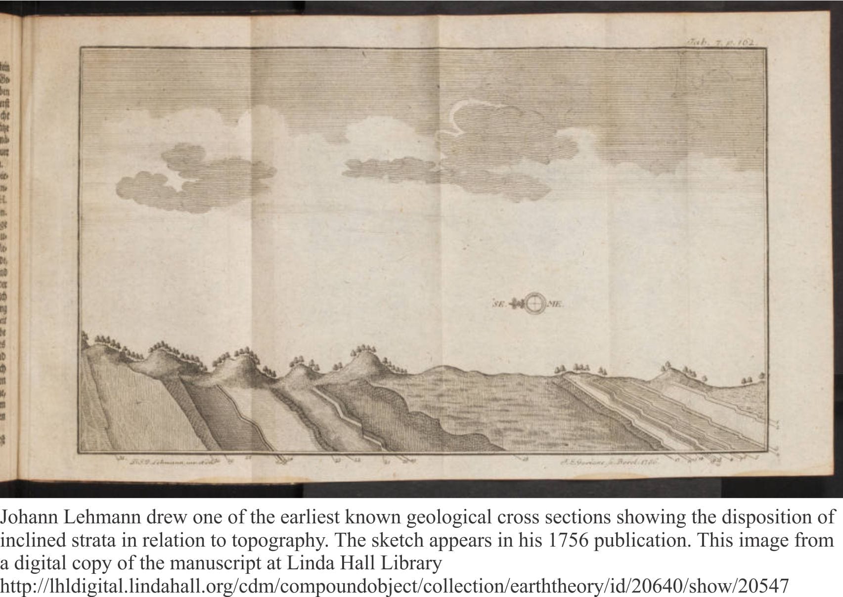
The concept of relative time encapsulated by this succession was based on Steno’s axioms. Towards the end of the 18th century, the influential German geologist Abraham Werner expanded Lehmann’s classification, claiming it to be global in extent, to include a Primitive (crystalline) Series, a Transitional Series (greywackes, limestones), a Stratified, or Secondary Series (much like Lehmann’s), an Alluvial Series to which the term Tertiary was applied by some, and a Volcanic Series. Like Lehmann, Werner’s scheme also combined the physical attributes of rocks and their relative age. Werner is also remembered for advocating that all rocks had precipitated at different times from a universal ocean – a concept that came to be known as Neptunism.
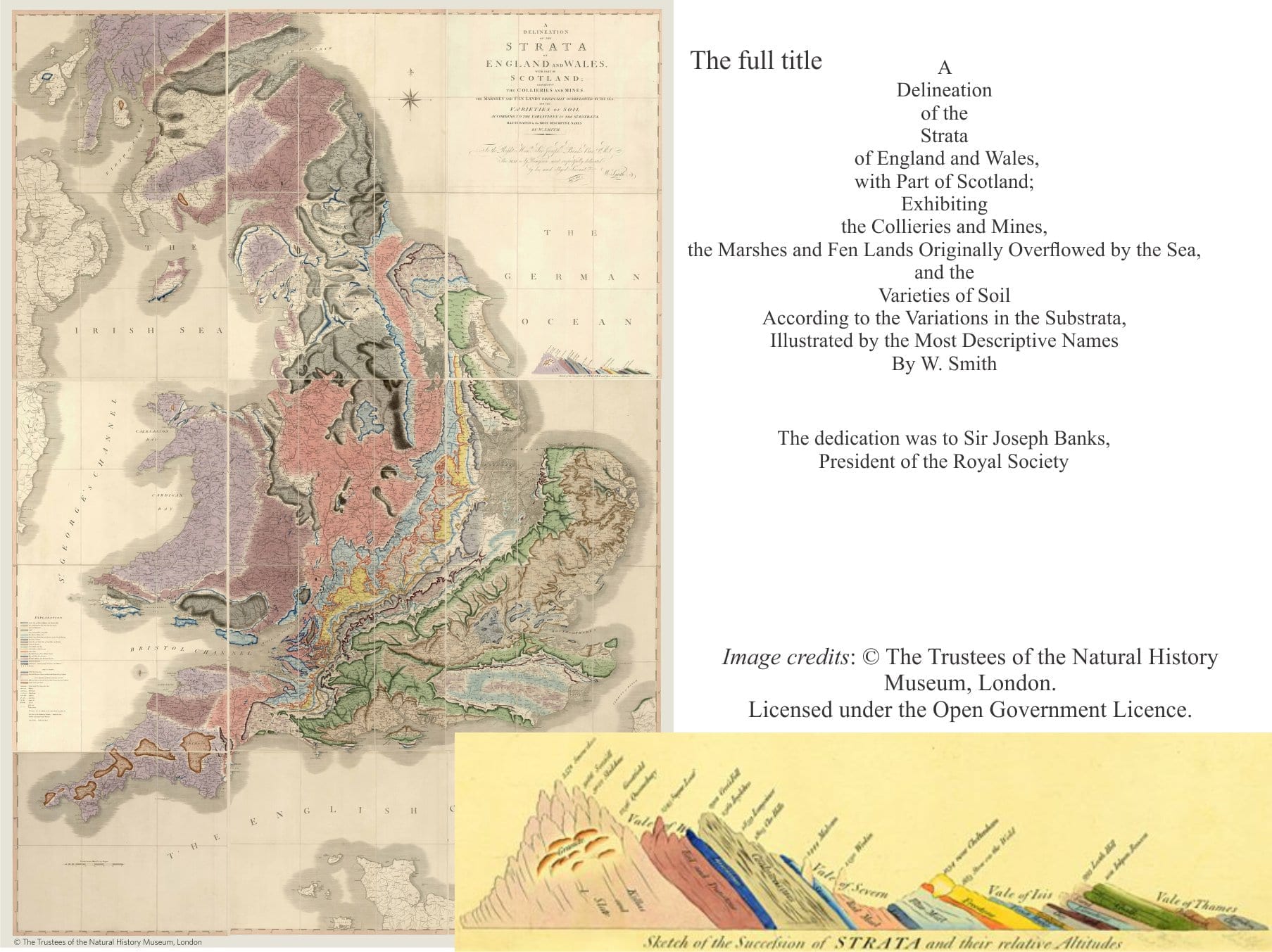
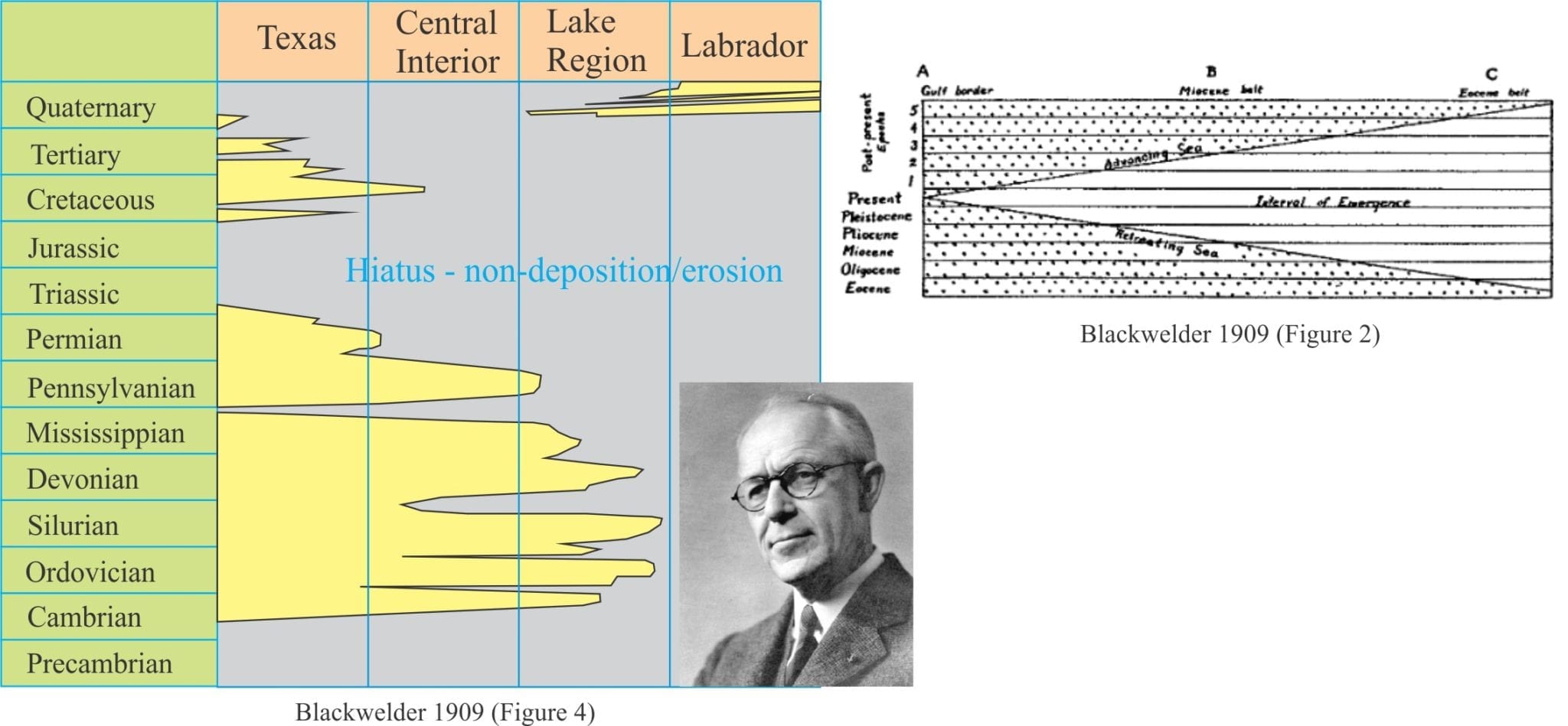
Throughout late 18th and 19th centuries, the naming of rock units became widespread in Europe, Britain, and North America, usually beginning with local knowledge of commonly occurring successions that were traced and mapped farther afield. Fossils became an important part of this development, where it was recognized that certain taxa and assemblages of fossils were characteristic of particular stratigraphic intervals. In England, this was exemplified by William Smith’s iconic map. Assemblages of rocks having identifiable lithological and fossil characteristics were given names that are still in use today; the progress of mapping demonstrated the repetition of characteristic successions, or Groups of strata. Thus, Old Red Sandstone was overlain by Mountain Limestone followed by Coal Measures; the group was subsequently called the Carboniferous Order by Conybeare and Phillips in 1822 (Phillips, 1837), and later the Carboniferous System.
The first half of the 19th century saw a proliferation of Systems, each containing characteristic rocks and fossils, where the relative time relationships of fossils are strategic. In England, and no doubt elsewhere, there were competing views on the placement of system boundaries, and whether systems once established, could be split – some of these rivalries became bitter, even publicly so (Rudwick, 1985). For example, the Carboniferous was eventually divided into Devonian (based on the succession in Devon) followed by Carboniferous, the Cambrian was inserted between Primary rocks and the Silurian (by Roderick Murchison), and later the Ordovician (Charles Lapworth) between these two Systems.
It is important to remember that prior to Charles Darwin (1859) and Alfred Wallace, there was no accepted scientific theory that explained the transition from one species to another – the observation that species change through successive strata does not require a biological mechanism – just a good pair of eyes. Of course, post-Darwin and Wallace, the underlying theoretical mindset changed.
By the late 19th century all major system names, as we know them, had been proposed:
- Sedgwick – Cambrian, 1835
- Lapworth – Ordovician, 1879
- Murchison – Silurian, 1835
- Murchison & Sedgwick – Devonian, 1839
- Conybeare & Phillips – Carboniferous, 1822
- Murchison – Permian, 1841
- Von Alberti – Triassic, 1834
- Von Humboldt – Jurassic, 1799
- D’Halloy – Cretaceous, 1841
- Aduino – Tertiary, 1760
- Denoyers – Quaternary, 1829
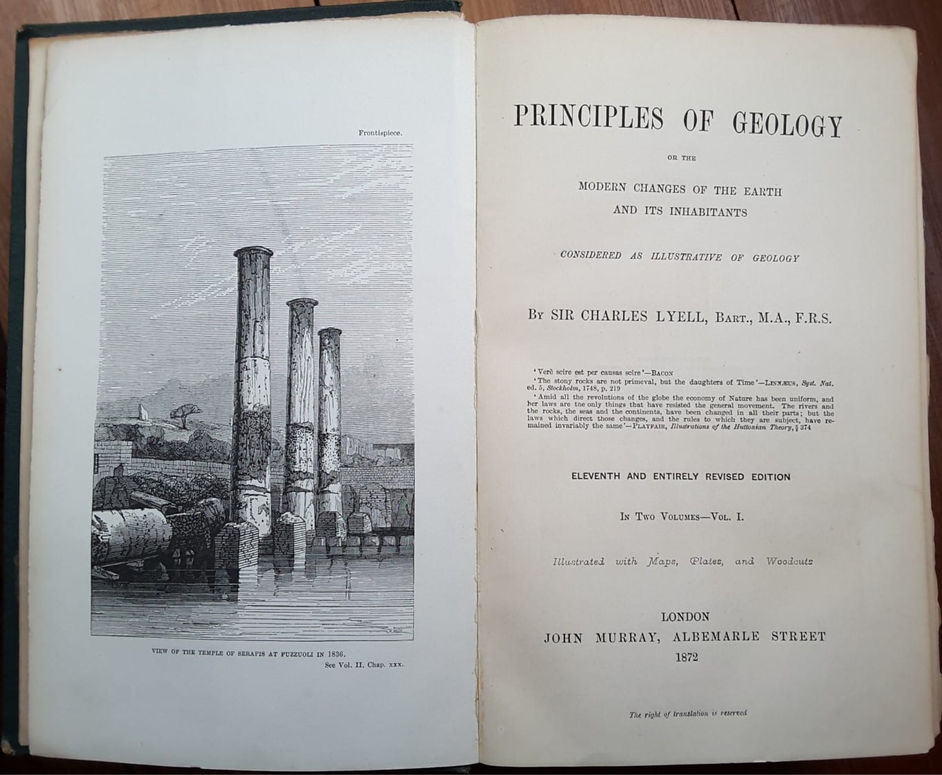
Charles Lyell (1833) created a similar scheme for Tertiary strata, giving us Pliocene, Miocene and Eocene, based on the more modern appearance of fossils; characteristics that clearly set them apart from all Secondary strata. Based on the distinctiveness of fossils in each of Werner’s Transitional, Secondary, and Tertiary Series, Lyell coined the now familiar terms:
Cainozoic (Tertiary) fossils have modern affinities, mammals, and the appearance of Homo sapiens,
Mesozoic (Secondary) the proliferation of ammonites and dinosaurs,
Paleozoic (Transitional) ancient life forms: first invertebrates, first fish, first plants,
Azoic (Primitive)
Publications by John Phillip and Charles Lyell in 1841 extended the system of classification to the entire geological column. Phillips used Lyell’s earlier divisions and subdivided them into Lower, Middle and Upper. Lyell went one further, and referred to the Primary, Palaeozoic, and Tertiary as Periods, acknowledging their chronostratigraphic significance.
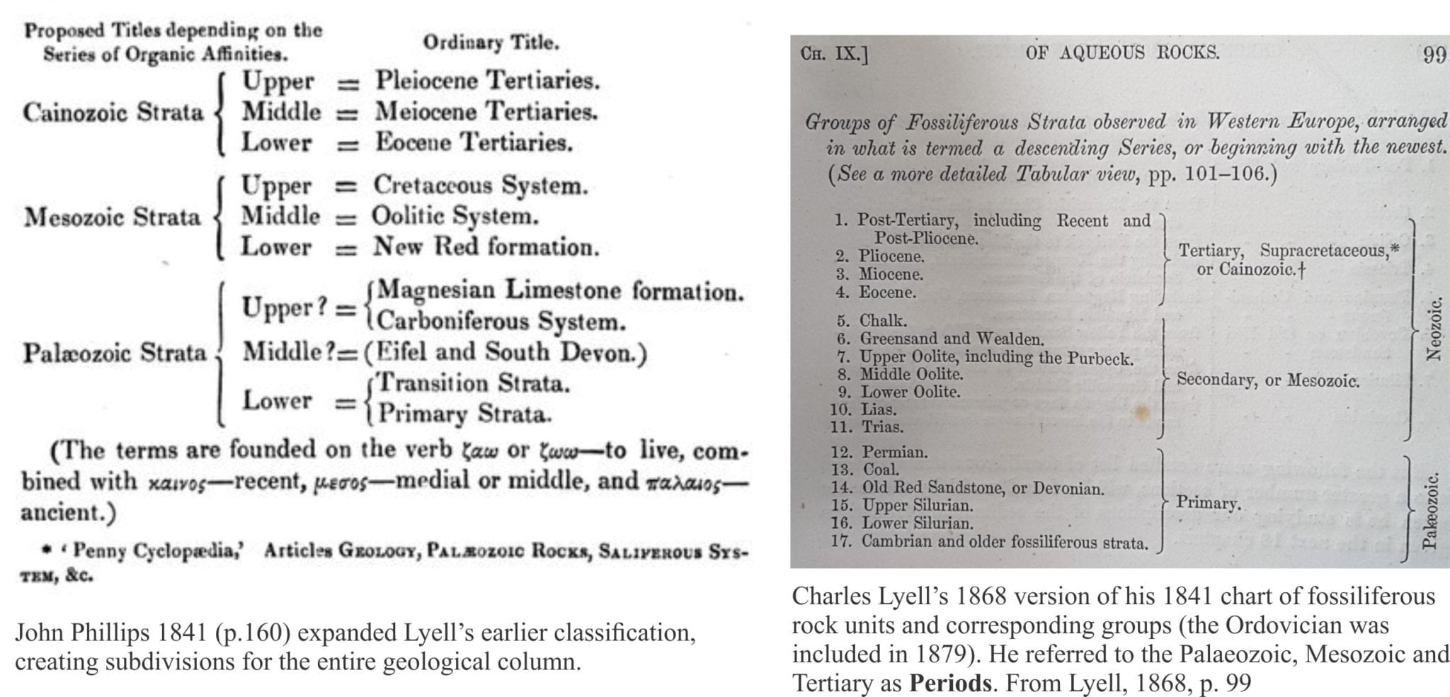
Development of a more formal system of Eras and Systems as fundamental units of geological (relative) time was based entirely on fossils. An early proponent of this strategy was James Dana who in 1880 referred to the Cenozoic (Cainozoic), Mesozoic, Paleozoic and Archean as Times, each Time consisting of Eras (Devonian etc.), divisions within each Era such as Early, Middle and Late were called Periods, and subdivision of Periods into Epochs. To complete the duality of the Geological Time Scale, Dana applied the corresponding terms Series, Systems, Groups and Stages respectively to the equivalent rock units (Dana, 1894). Dana’s time scale has a particularly modern look to it.
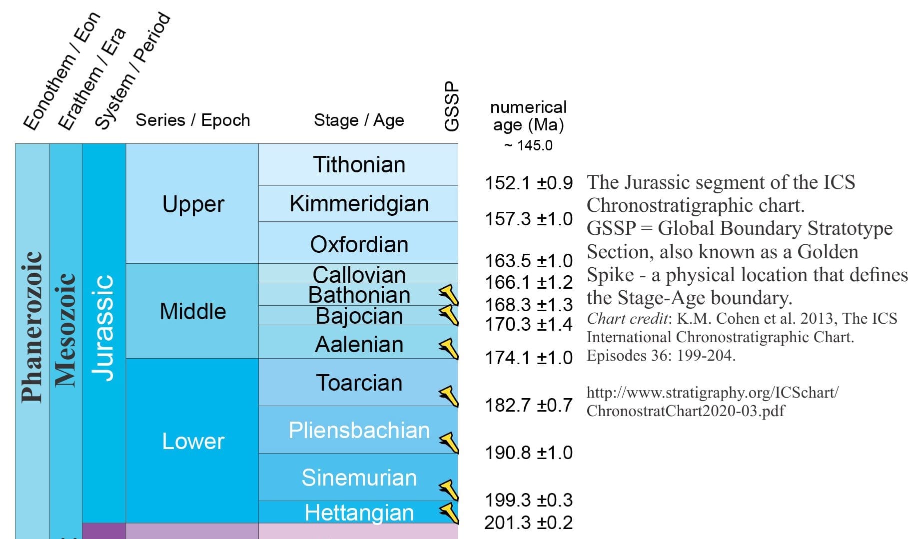
Dana’s Geological Time Scale, and those of other geologists, have in the intervening 140 years, gone through many iterations, modifications, additions and subtractions. One of the most important contributions was the addition of radiometrically determined ages, that changed the relative time scale based on fossils and superposition, to a numerical scale. Geologists could now talk of events 200 million years ago (200 Ma) in addition to referring to Early or Lower Jurassic.
In 1974 the International Commission on Stratigraphy was established, with the aim of standardizing system boundaries. The modern Time Scale moved Dana’s time units to the left – the Devonian is now a Period/System, and the corresponding Era (time) is the Paleozoic. There is now reasonable international consensus on the format and content of the Geological Time Scale. However, the entire enterprise is continually under review; witness the debate on the Anthropocene, the geologically youngest, human-influenced epoch.
We now employ three primary components in formal stratigraphy:
- Time units (Era, Period) that refer only to geological time and not process.
- Time-rock units; strata deposited during a specific interval of time (System, Epoch).
- Rock Units that refer only to the composition and mappability of strata (Formations, Groups).
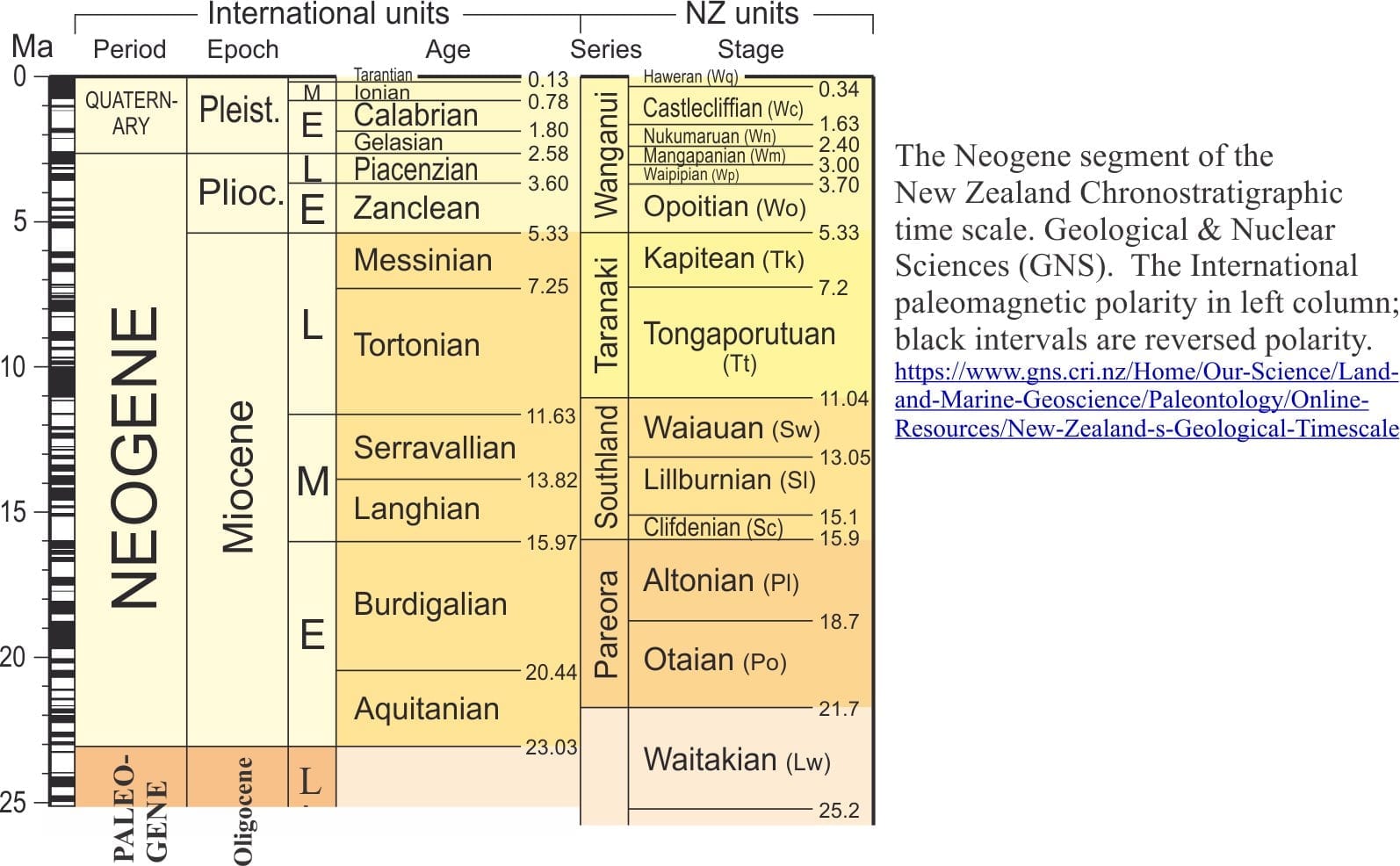
The International Chronostratigraphic time scale provides the framework for more local stratigraphic schemes. For example, much of the New Zealand Cenozoic time scale is based on marine faunas that have little correspondence with northern Hemisphere taxa. Therefore, the New Zealand scheme has Series and Stages, superimposed on International Ages and Epochs.
Formal stratigraphic schemes
Lithostratigraphy
Formal lithostratigraphy is concerned with the description and mappability of rocks, using physical, fossil, and mineralogical attributes. The basic lithostratigraphic unit is the Formation. A Formation must be mappable; it must have well defined and easily identifiable surface or subsurface contacts. Contacts can be abrupt or gradational; they may be unconformable, but an unconformity should not pass through a formation. There is no reference to time. Formations can be subdivided into Members or smaller entities like Beds. Two or more Formations can be named as a Group.
The boundaries of Formations are invariably diachronous. The definition does not include any interpretive quality. Formations require Type Sections, that are locations or outcrops that contain most of the unit’s defining characteristics. Type Sections should be accessible.
Formations need not consist of a single lithology; interbedding of two or more lithologies is common. What is important is the internal consistency of the interbedded nature of strata compared with underlying or overlying formations. The geometry of lithostratigraphic units is also highly variable: sheets, lenses, shoestring, splits, and pinch-outs.
Chronostratigraphy
Prior to the advent of radiometric dating (early 20th century), the concept of geological time was based on superposition and the observed transitions from one taxon to another (fossils); this was relative time, where stratum A is older than overlying stratum B. While the immensity of time was in little doubt (at least among the 19th century scientific community), there was no way to quantify it in terms of years. Intelligent estimates were made based on biblical genealogy (Ussher, Kepler), the rate of Earth surface processes (Lyell, Darwin), and the rate of Earth cooling (Comte de Buffon, Lord Kelvin).
One of the first attempts to radiometrically date rocks (using isotopes of uranium) was made by B. Boltwood in 1907, a Yale University professor. Since then the science and technology of radiometric dating has advanced to the point where minute zones in a single zircon crystal can be dated.
The evolution of chronostratigraphic time scales is noted above. Radiometric dating has provided dates for all the important time and time-rock subdivisions.
Biostratigraphy
The chronological ordering of strata is based on two principles: superposition and the observed stratigraphic variations in fossils and fossil assemblages. These principles provide the foundations for the stratigraphic time scales we use today. The principle of faunal succession is based primarily on the appearance of specific organisms in certain strata that, in progressively younger rocks (deemed younger because they occur higher in the stratal succession), morph into different, but related organisms.
An early attempt to systematically apply variations in species was published by Albert Oppel (1856-1858), who described successive changes in ammonites, beginning with the lowest and oldest Psiloceras Planorbis. He proposed 14 Zones within the Lower Jurassic Lias of England and Germany. Oppel observed that the range of various species was variable; some had narrow stratigraphic ranges, others ranged over greater thicknesses of strata. However, all could be regarded as temporary. He defined a zone by the first appearance of a species, the overlying zone by the appearance of a new species and so on. Any species may range through more than one zone, but its first appearance was considered unique. The concept of zone, or biozone forms the basis of modern biostratigraphy.
Biozones (zones) are the fundamental biostratigraphic units. The five formal biozones are: range zones, interval zones, assemblage zones, abundance zones, and lineage zones. Each biozone is distinct. The International Stratigraphic Commission, and the North American Stratigraphic Code provide complete definitions and rules for their usage.
Magnetostratigraphy
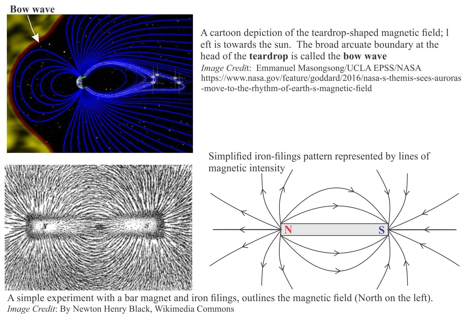
Earth’s magnetic field is generated by a hot (4000-5000oC), fluid-like, iron-nickel rich outer core that moves slowly around a solid iron inner core. The shape of the magnetic field is approximated in a simple experiment using a bar magnet and iron filings. The magnetic field is vertical at the poles and horizontal at the equator. Between the magnet poles, the iron filings approximate lines of equal magnetic intensity. In a three-dimensional Earth, we know that magnetic North moves in a circuitous path around the Geographic North Pole (in fact it has moved more than 1000 km since 1831 when first measured by James Ross). We need two measurable parameters to define the orientation of the magnetic field at any point on Earth’s surface:
- The angle between magnetic north and Geographic north – the declination, and
- Inclination (or magnetic dip), the up or down angle of the field measured from a horizontal plane at any point on the surface. This is approximated by a compass needle pointing down in the northern hemisphere (positive dip), and upwards in the southern hemisphere (most commercial compasses don’t show this because they have been balanced).
Has magnetic polarity reversed in times past?
A couple of early 20th Century geophysicists, Bernard Brunhes and Motonori Matuyama, devised experiments where remnant magnetism was measured in volcanic rocks. The rationale is that when lavas solidify, iron-bearing minerals in the rock, especially basalt, will act like tiny fossil magnets that record the direction (polarity) of the magnetic field at that time. Their experiments demonstrated that the magnetic field had indeed reversed in the distant past. If the age of the rock being measured is known, then so too is the age of the reversed magnetism, a method now extended to sedimentary and other kinds of volcanic rock. It has since been established that reversal of Earth’s magnetic field has occurred every 200,000 to 300,000 years over the last few million years. The last reversal took place 780,000 years ago; this is called the Brunhes-Matuyama Reversal.
The formal stratigraphic measure is the magnetostratigraphic polarity unit. The unit is recorded as Normal Polarity (north pointing) or Reversed Polarity for a body of rock. According to the International Commission on Stratigraphy, a polarity unit is:
- a single polarity of magnetization;
- an intricate alternation of normal and reversed polarity of magnetization;
- having dominantly either normal or reversed polarity, but with minor intervals of the opposite polarity.
An example is shown on the New Zealand stratigraphic chart above.
Other posts in this series:
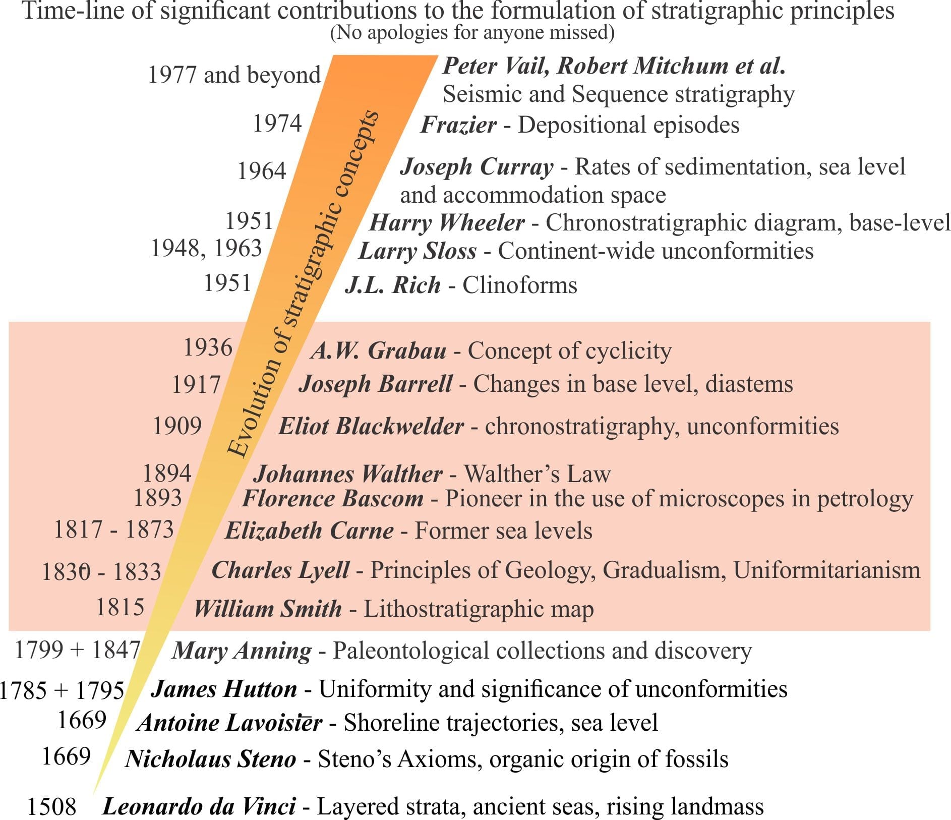
A timeline of stratigraphic principles; 15th to 18th C
A timeline of stratigraphic principles; 19th C to 1950
A timeline of stratigraphic principles; 1950-1977
Baselevel, Base-level, and Base level
Sediment accommodation and supply
Autogenic or allogenic dynamics in stratigraphy?
Stratigraphic cycles: What are they?
Sequence stratigraphic surfaces
Shorelines and shoreline trajectories
Stratigraphic trends and stacking patterns
Stratigraphic condensation – condensed sections
Depositional systems and systems tracts
Which sequence stratigraphic model is that?
References
J.D. Dana, 1894. Manual of Geology: Treating of the Principles of the Science with Special Reference to American Geological History. 4th Edition. American Book Company, 1088 p.
J. Lehmann, 1756. Versuch einer Geschichte von Flötz-Gebürgen (Attempt at a History of Stratified Mountains). Berlin. Available to read at Linda Hall Library
Lyell, 1833. Principles of Geology. John Murray, London.
Lyell, 1868. Elements of Geology, or the ancient changes of the Earth and its inhabitants as illustrated by geological monuments. Appleton and Company. 803p.
A. Oppel, 1856-1858. Die Juraformation, Englands Frankreichs und des Sudwestlichen Deutschlands. The manuscript is available, in German
J. Phillips, 1837, Treatise on Geology. Longman, Orme, Brown, Longman, London. The text can be read in digital form on Internet Archive
J. Phillips, 1841. Figures and descriptions of the Palaeozoic fossils of Cornwall, Devon and west Sommerset. Longman, Brown, Green, and Longmans, London. Digital version available
M.J.S. Rudwick, 1985. The Great Devonian Controversy: The shaping of scientific knowledge among gentlemanly specialists. The University of Chicago Press, 494 p.
H.S. Williams, 1893. The making of the Geological time scale. Journal of Geology, v. 1, p. 180-197.