Tag Archives: crossbedding

Crossbedding – some common terminology

Facebooktwitterlinkedininstagram

This post is part of the How To… series


Stacked tabular crossbeds
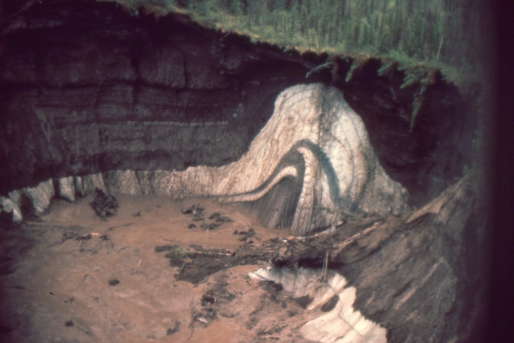
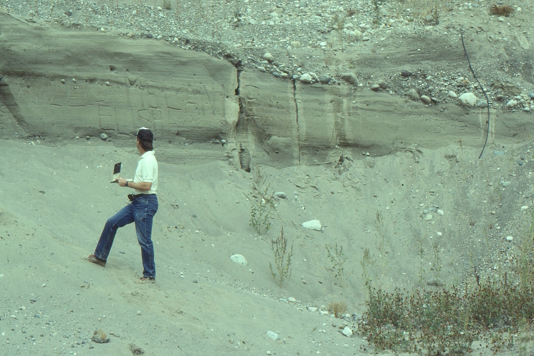
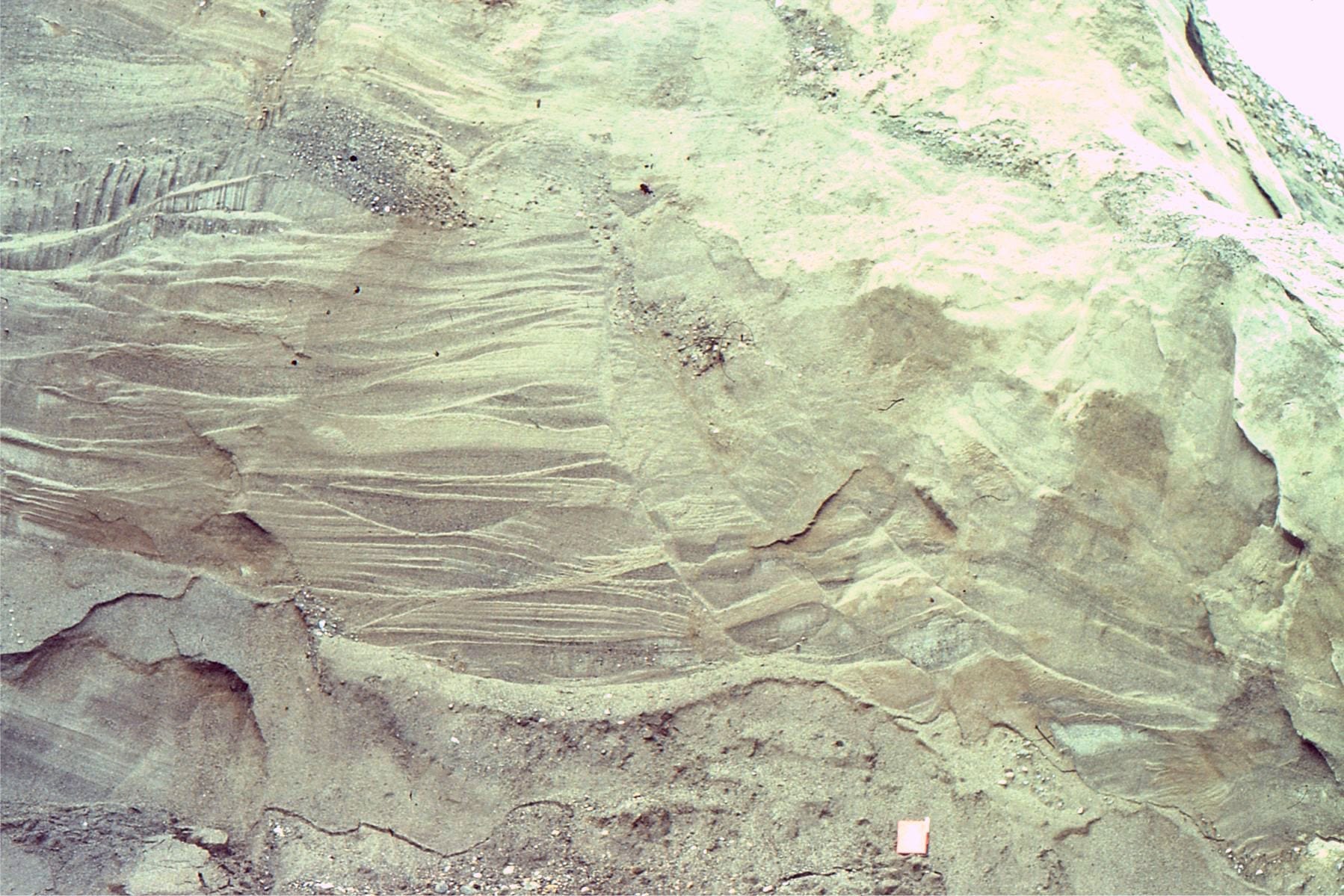
Eocene fluvial tabular crossbeds exposed along MacKenzie River, northern Canada

Crossbeds are ubiquitous in sedimentary rocks. They can be found on the deep ocean floor, the driest desert, and pretty well any depositional environment in between. They are most common in sandy deposits. They are less common, but no less important in gravels (e.g. low sinuosity – braided rivers). Crossbeds form where air and water flow across a bed of loose sediment, so long as the individual sediment grains are cohesionless (non-sticky). Mud crossbeds are rare because individual clay particles tend to bind to one another (a result of residual electric charges).

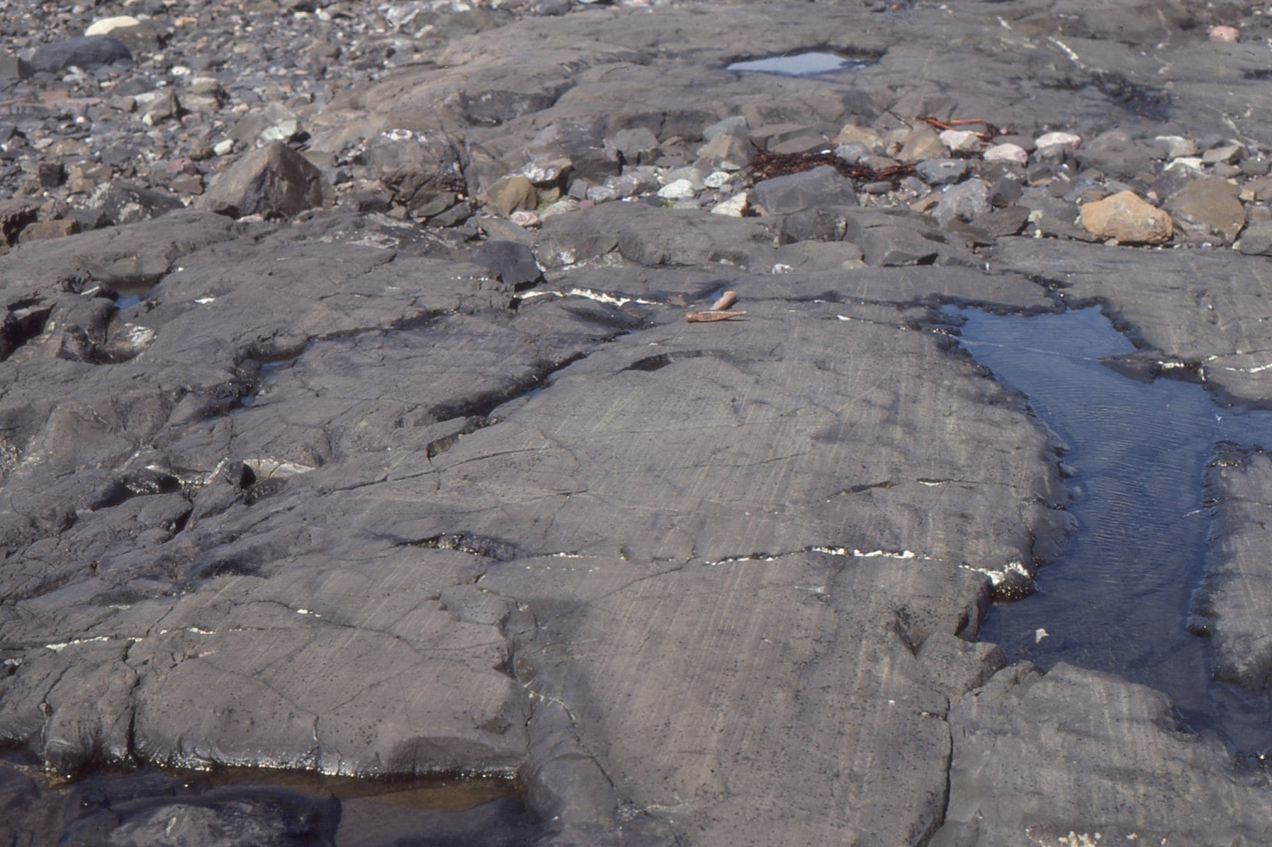
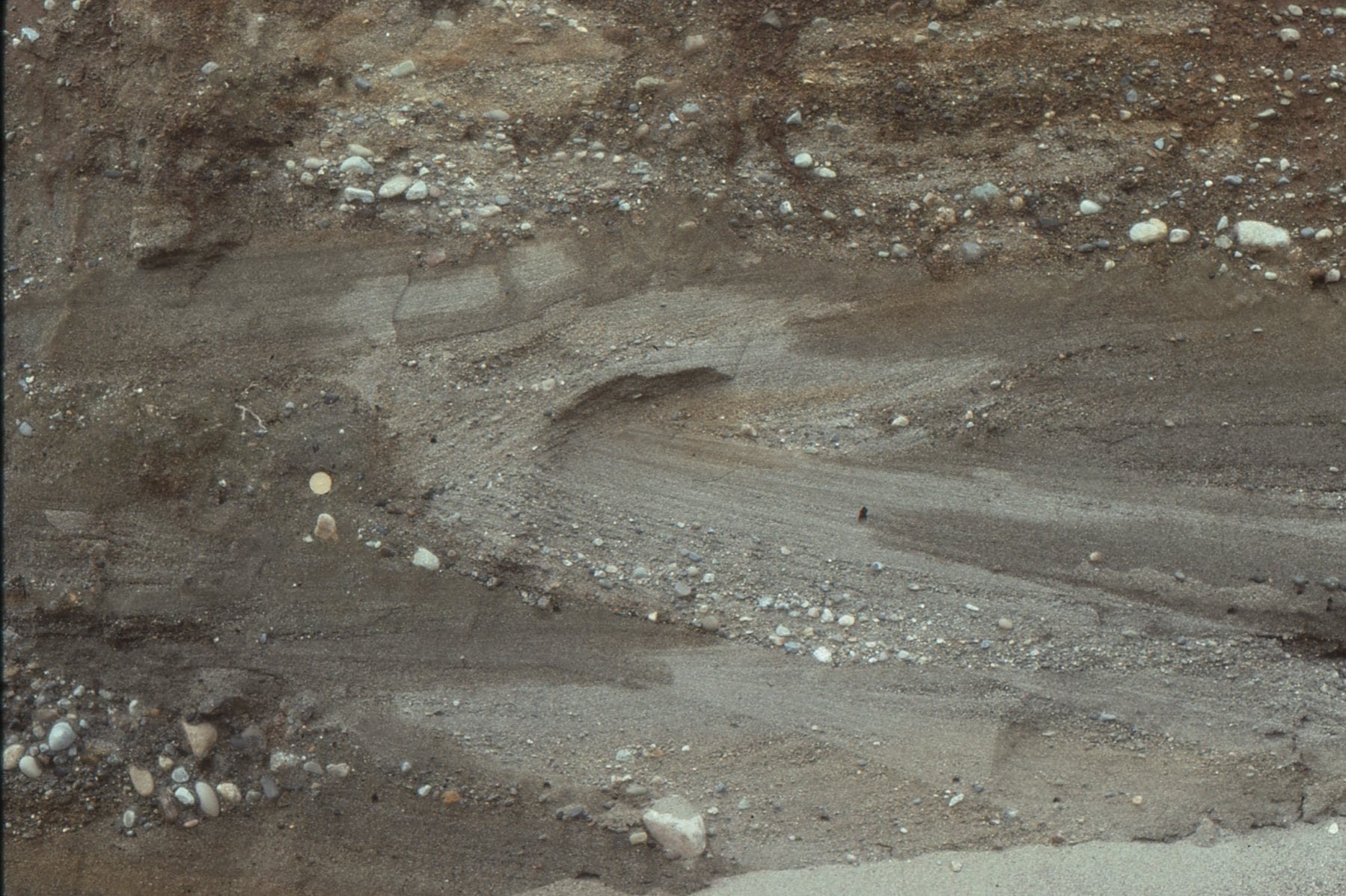
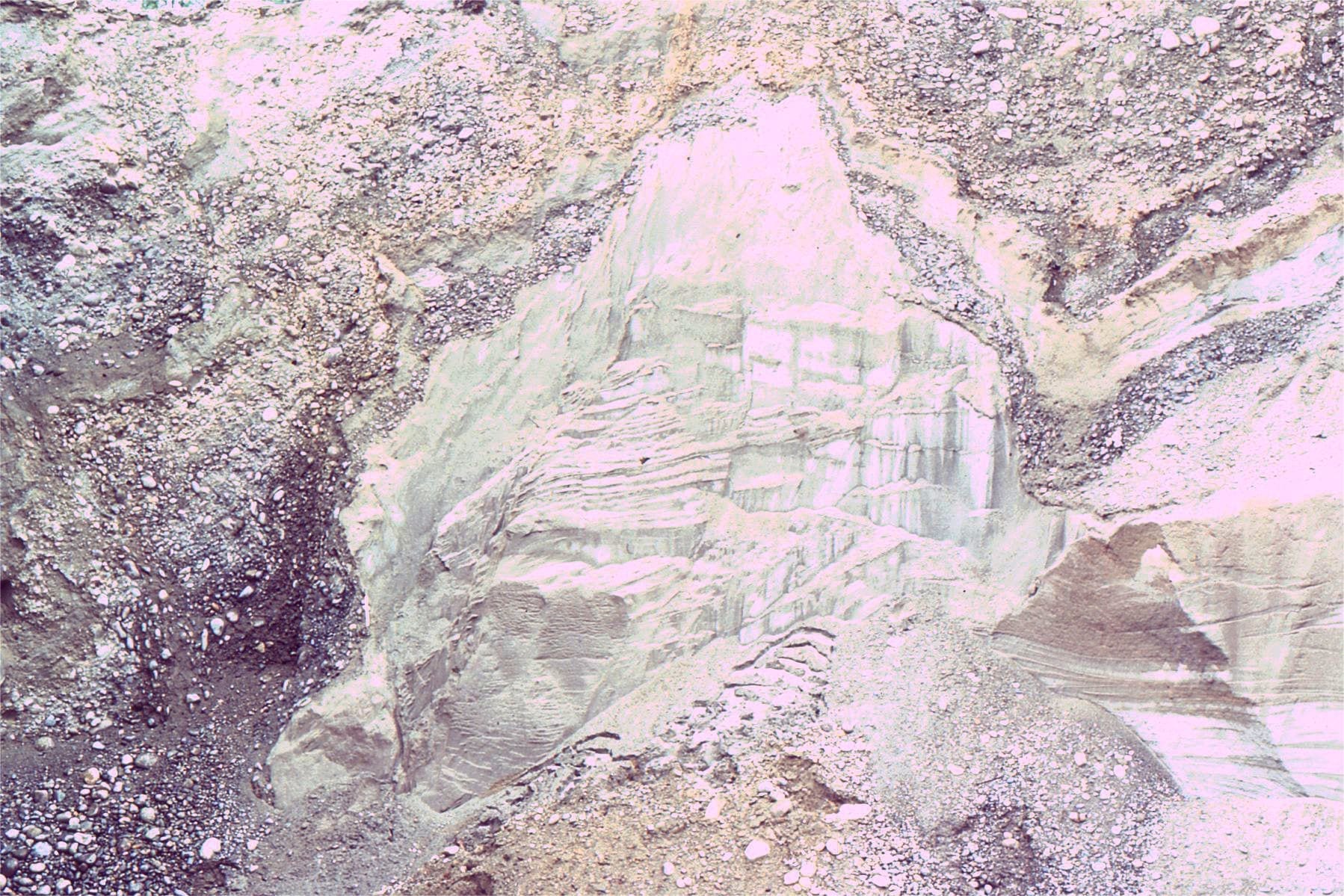
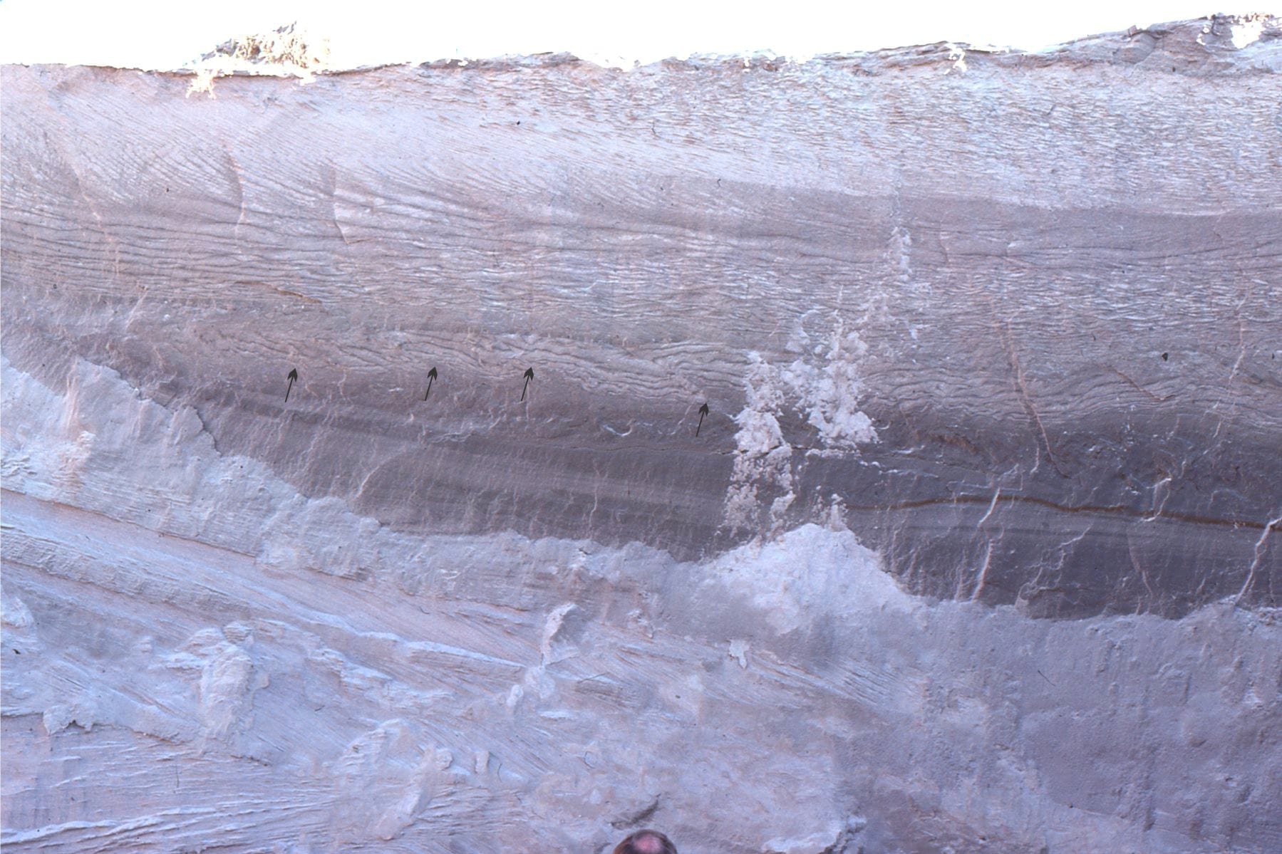
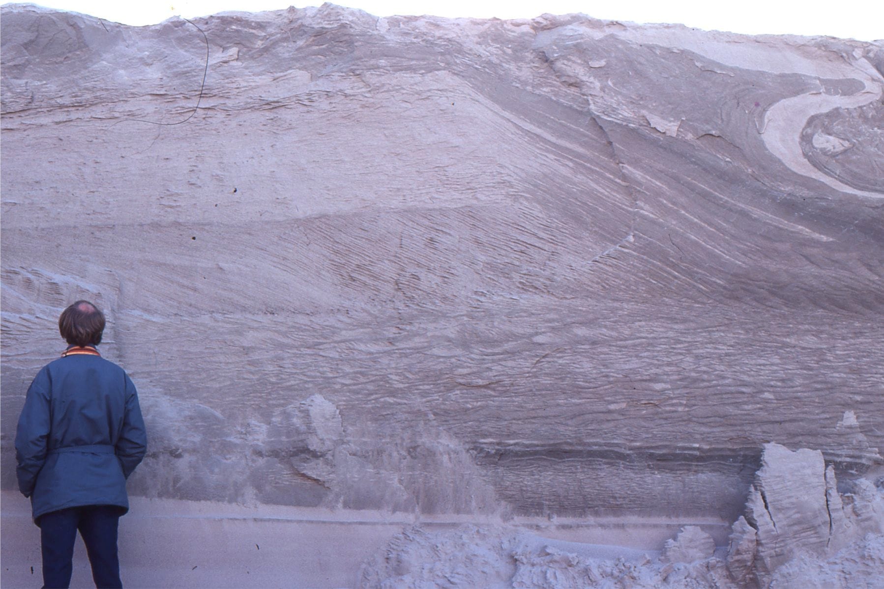
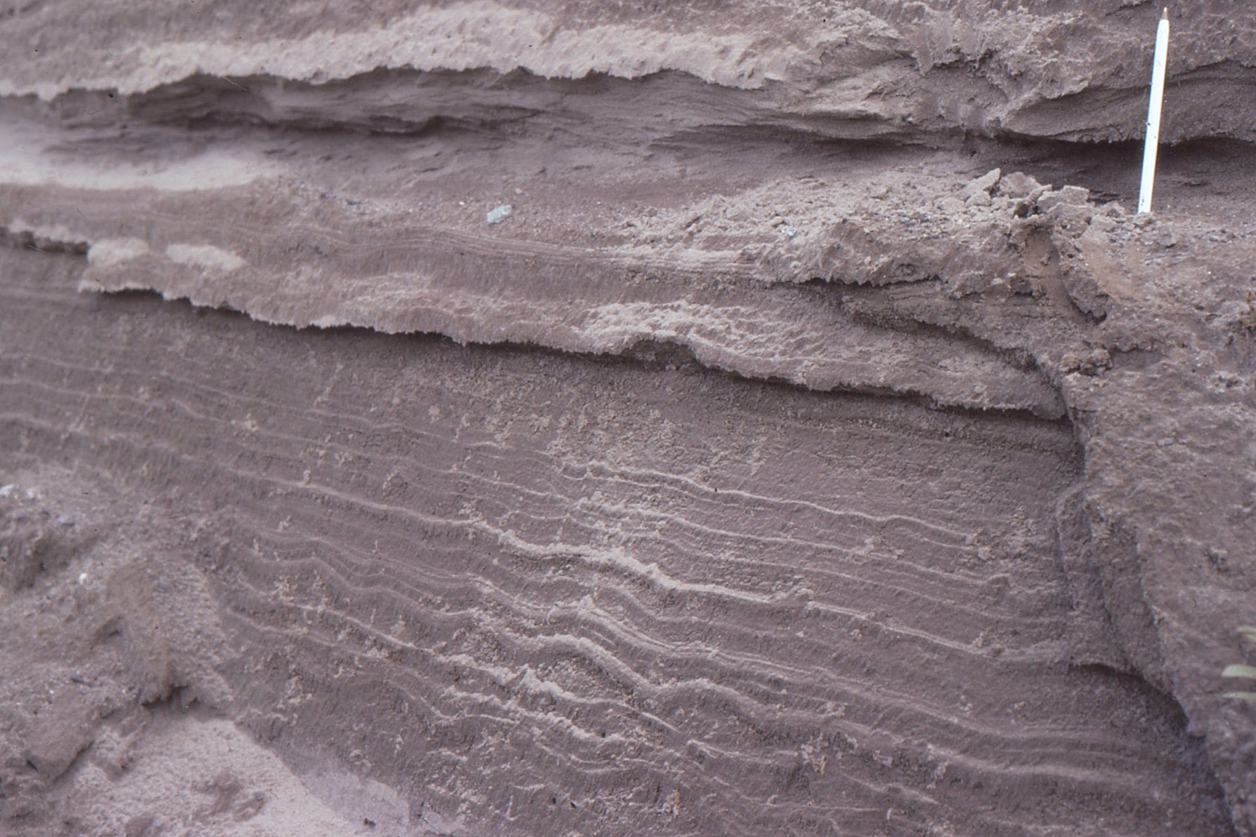
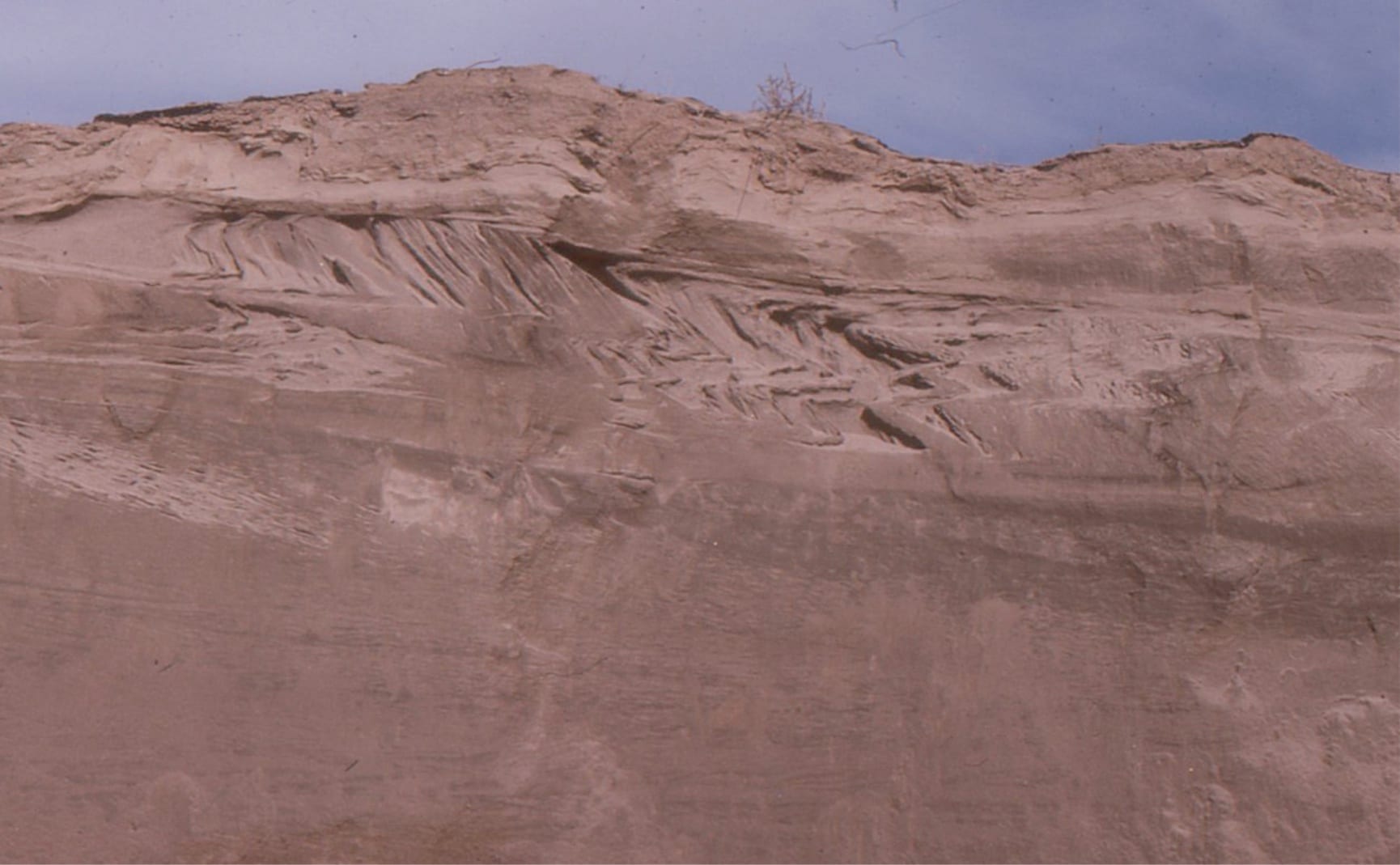
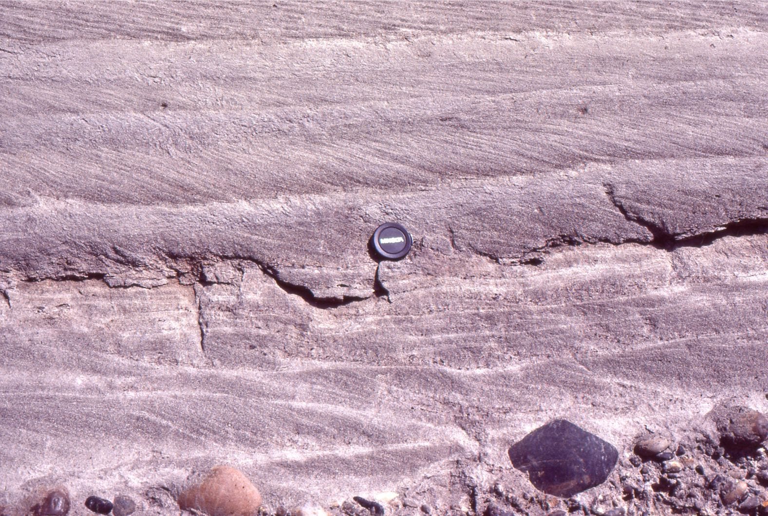
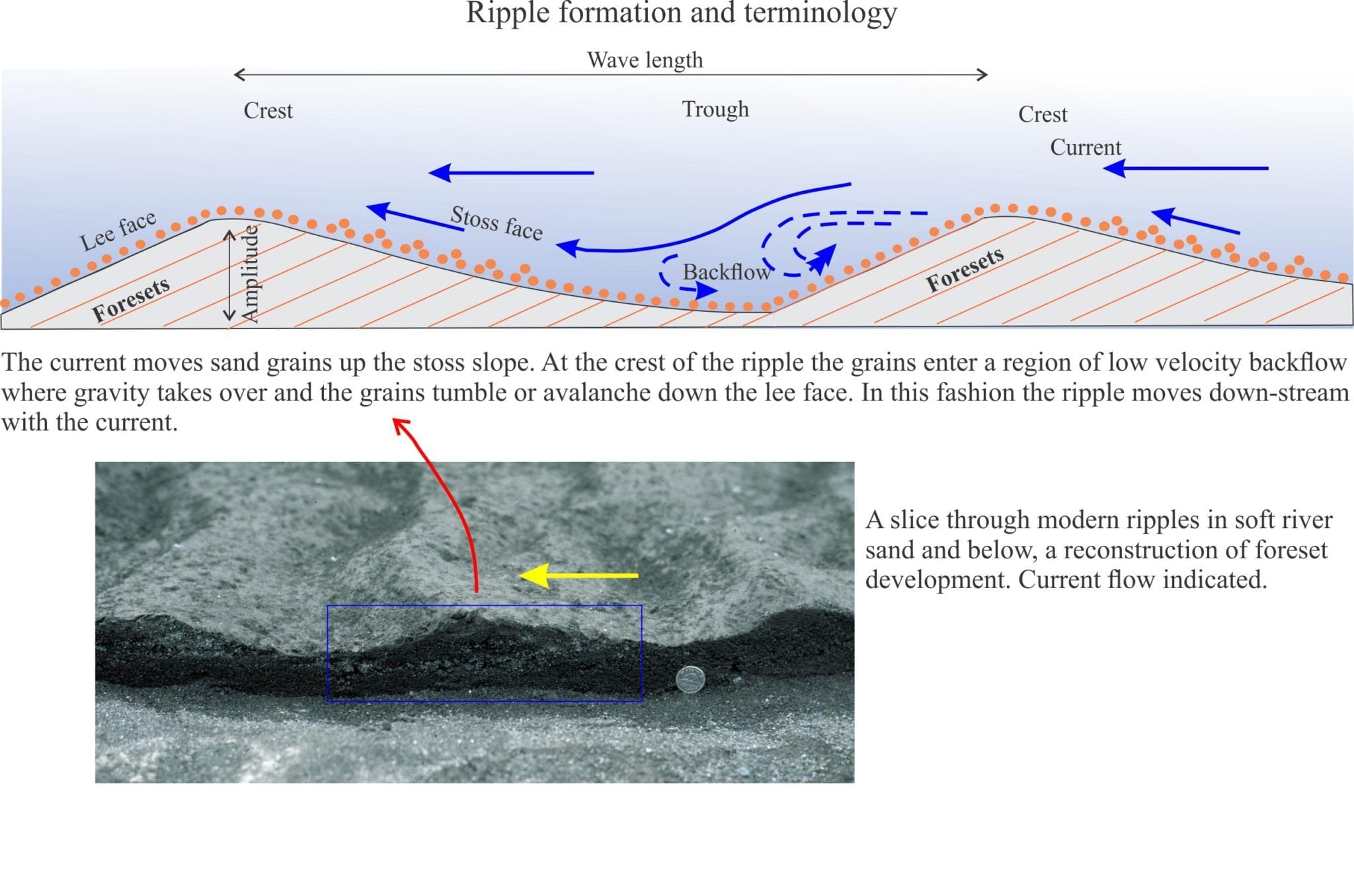
Crossbeds in the rock record are visible in bed cross-sections, or as exhumed 3D ripples and dunes on exposed bedding planes. The term crossbed refers to their internal structure; i.e. laminations that are usually inclined in the down-flow, or down-stream direction.


Graphical display of crossbed terminology, based on McKee and Weir, 1953.

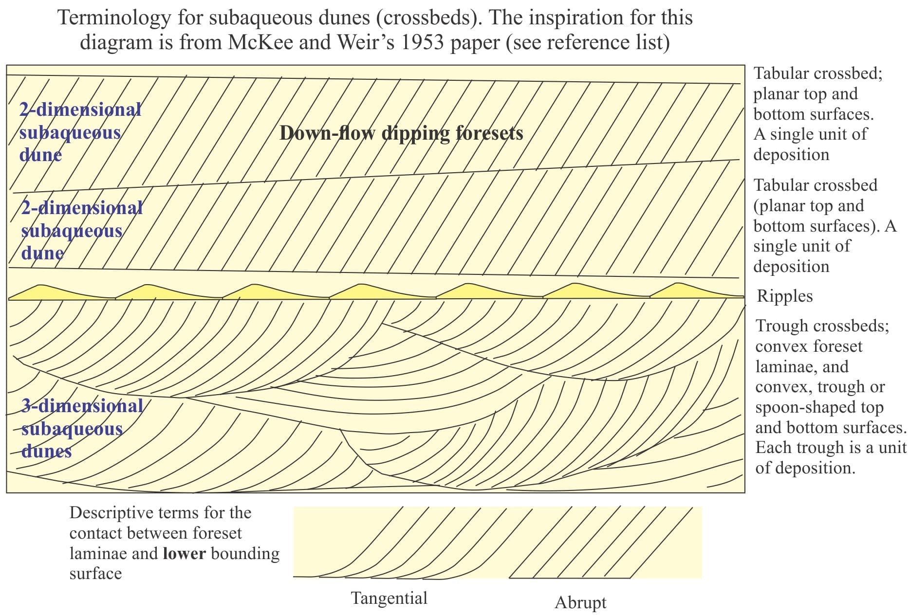
The laminae are called foresets. In a 2D cross-section view, a single crossbed consists of any number of foresets bound above and below by flat or curved boundaries. The geometrical arrangement of foresets, their bounding surfaces and their size or amplitude gives us the information needed to decipher:

  • the kind of crossbed,
  • the hydraulic conditions under which the crossbed formed, and to some extent
  • the paleoenvironment in which they formed; keep in mind that most crossbeds can be found in a range of paleoenvironments but used in conjunction with other criteria such as body and trace fossils, sediment composition and stratigraphic trends (e.g. fining upward) will help pin-point specific depositional settings.

Our interpretations can be advanced further if we are lucky enough to see exhumed structures on bedding, such that we can define:

  • the shape of the ripple or dune crest line (is it straight or sinuous?)
  • the wavelength between successive ripple or dunes, and

a relatively unambiguous measure of ripple-dune migration across the bed (i.e. paleocurrents).

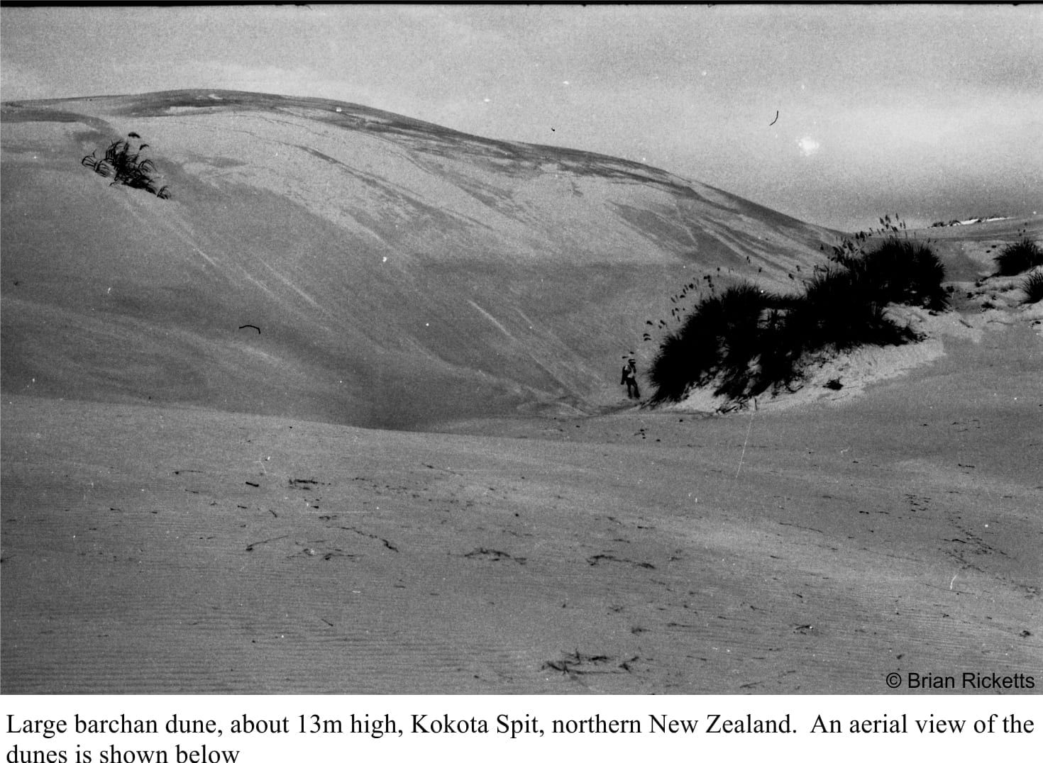
Most of our knowledge about ripples and dunes (collectively referred to as bedforms) and how they form has been garnered from studies of modern environments.  Afterall, if on your walks across a tidal flat or subaerial dune field you see ripples that look identical to those preserved in rocks, it is quite reasonable to predict that the ancient bedforms developed in ways similar to the modern analogues (this is the Uniformitarian Principle at work).


In fact, they have also been videoed forming in real time on Mars.


Ripple and crossbed terminology with a modern example below

This terminology has evolved from an original 1953 description by McKee and Weir (see references at the end of the post). An SEPM workshop in 1987 (Ashley,1990) sought to incorporate in a revised terminology, the 3-dimensional aspects of bedforms larger than common ripples and their inherent hydraulic properties. They recommended that the term dune be used, with the basic distinction between subaerial and subaqueous dunes, of all sizes. Subaqueous dunes can be further separated into:

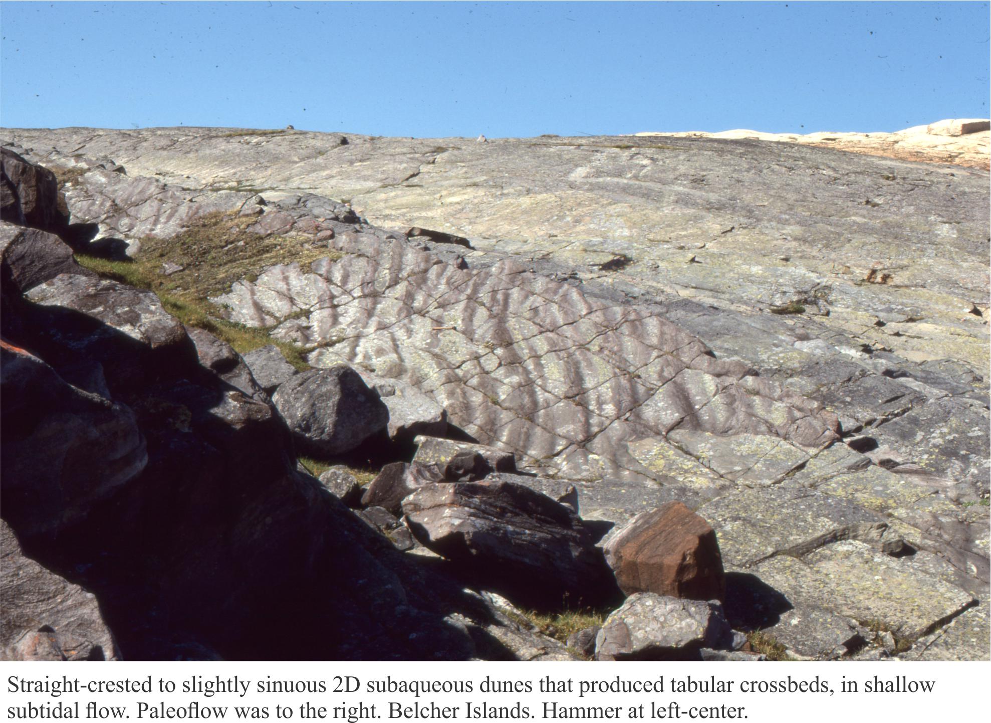
  • 2 dimensional subaqueous dunes having relatively straight crest lines and planar foreset contacts; they correspond to tabular crossbeds (in the above diagram), and
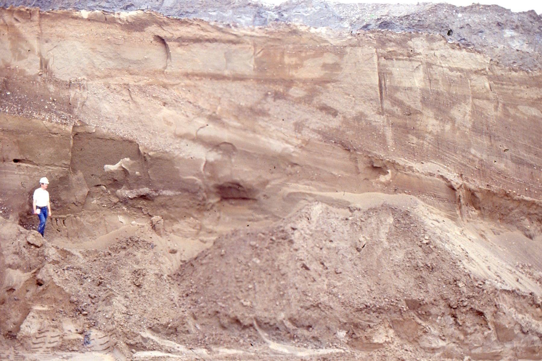
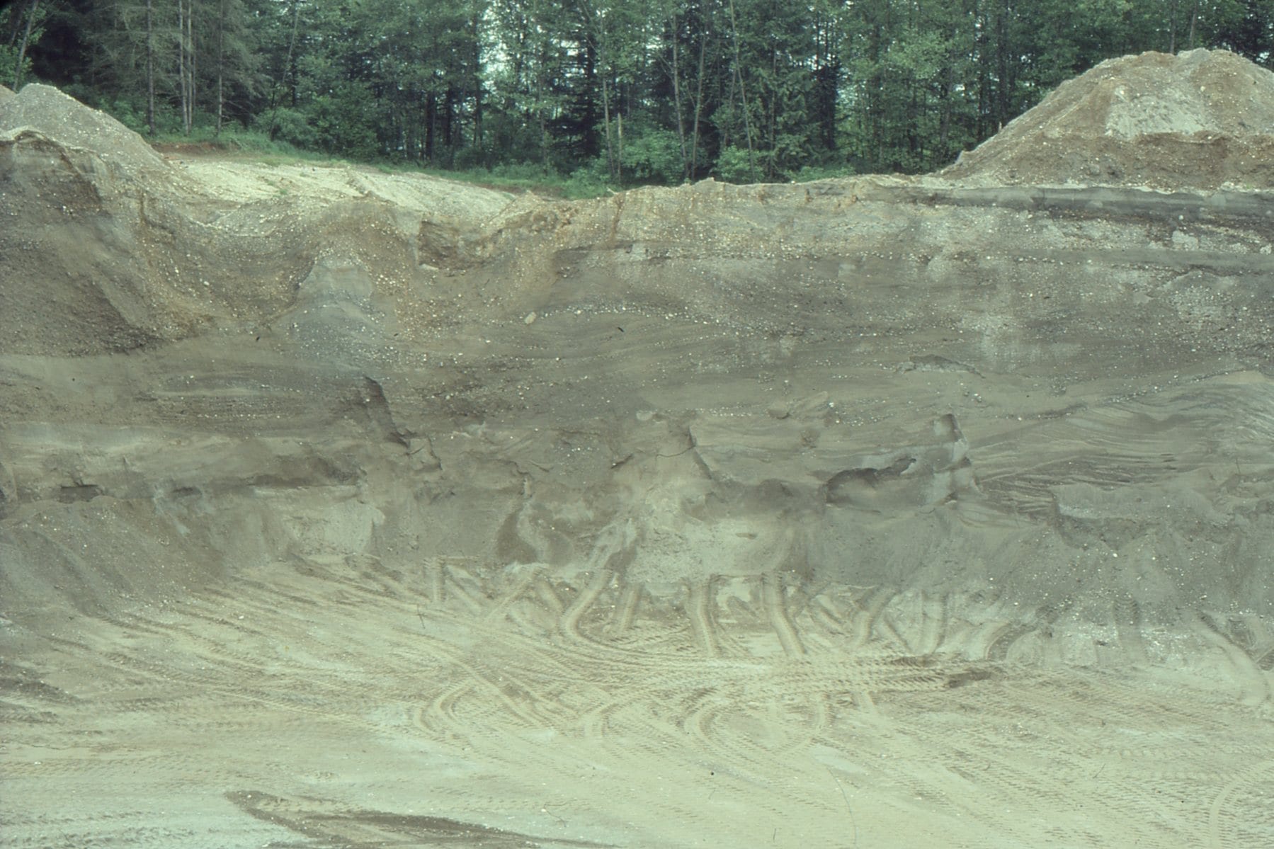
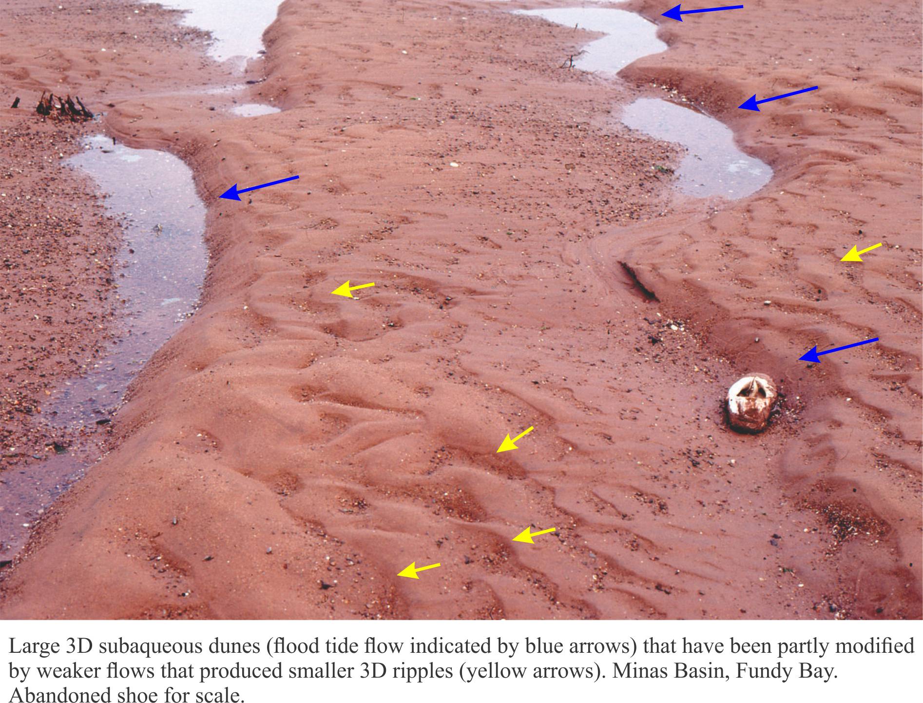
  • 3 dimensional subaqueous dunes having sinuous crest lines and spoon- or scour-shaped foreset contacts. These correspond to the classic trough crossbeds.

Trough crossbeds are most common in channelized, or confined flow (rivers, tidal inlets and channels, rip currents). Three dimensional subaqueous dunes tend to form at higher current velocities than their 2D counterparts.

The SEPM nomenclature is widely used, but deeply entrenched terms like trough and tabular crossbed are still popular.


Tabular. or two dimensional dunes, from Precambrian intertidal deposits


Trough, or three dimensional subaqueous dunes  from a modern sandy tidal flat, Fundy Bay.


Here are some classic older texts on the topic (and just because they are older than 10 years doesn’t mean they are irrelevant!)

Allen, JRL. 1963. The classification of cross-stratified units. With notes on their origin. Sedimentology, v. 2, p.93-114

Ashley, G.M. 1990. Classification of large-scale subaqueous bedforms: A new look at an old problem. Journal of Sedimentary Petrology, v.60, p. 160-172.

McKee, E.D. and Weir, G.W. 1953. Terminology for stratification and cross-stratification. Geological Society of America Bulletin v. 64, p. 381-390.


Some more useful posts in this series:

Sedimentary structures: Fine-grained fluvial

Determining stratigraphic tops

Identifying paleocurrent indicators

Measuring and representing paleocurrents

The hydraulics of sedimentation: Flow Regime

Sediment transport: Bedload and suspension load

Facebooktwitterlinkedininstagram
Facebooktwitterlinkedin

Atlas of glaciofluvial – periglacial deposits

Facebooktwitterlinkedininstagram

The Atlas, as are all blogs, is a publication. If you use the images, please acknowledge their source (it is the polite, and professional thing to do). 

The glaciofluvial-periglacial category refers to pretty well anything sedimentological, that is associated with glaciations, glaciers, ice caps, and ice sheets. It includes the ice itself, outwash sediment in fluvial and lacustrine environments, and ice-related phenomena like permafrost and patterned ground.  Most of my examples are from Canada, the Arctic, and Laurentide Icesheet locations like Ottawa, Ontario, and Fraser Lowlands, British Columbia.

This link will take you to an explanation of the Atlas series, the ownership, use and acknowledgment of images.

Click on the image for an expanded view, then ‘back one page’ arrow to return to the Atlas


The images:

Terminal moraines ahead of a retreating Strand Glacier, Axel Heiberg Island, as it was in 1983.


Part of the Strand Glacier terminal moraine, the meltwater, and outwash channels. The sediment eventually finds its way to Strand Fiord.


Mixed sediment and ice at the snout of Strand Glacier, Axel Heiberg Island


Tanquary Fiord, Ellesmere Island – a typical Arctic fiord, rimmed by steep terrain and small, coastal fan deltas.  The arrow locates a Geological Survey of Canada base camp in 1988.


The edge of an ice cap on central Axel Heiberg Island, eroded by the outwash stream. Deformation of ice is accentuated by dark mud and sand in the ice (clear ice lies above the darker foundation. Ice rheology here includes ductile and brittle deformation.


Aerial view of the ice cap edge shown in the image above.


Lateral moraine and crevasses at the Valley of the Six Glaciers, Lake Louise, Alberta


Polygonal surface in trundra formed by freeze and thaw of surface permafrost. This stuff is really difficult to walk on.


Thermokarst slumping, caused by melting permafrost


Deformed ground ice within the permafrost, probably caused by ice expansion.  The trees above are 3-4m high. The ice fold was exposed in the slip face of a thermokarst slump. North Yukon.


Frost heaved blocks of greywacke; the shape of the blocks is governed by intersecting fractures in the bedrock. Belcher Islands.


Glacial striae on greywacke; scratches formed as rock fragments are dragged across the bedrock surface by flowing ice during the Last Glaciation (Laurentide Icesheet).


A beautiful U-shaped valley at Glen Rosa, Arran (Scotland), gouged by a glacier during the Last Ice Age.


Winter freezing of an estuary at Cape Cod, Massachusetts.


Late Pleistocene, crossbedded glacial outwash channel deposits; the channel base is lined with boulders.  Bradner Road pit, Fraser Valley


Detail of trough crossbeds in a glacial outwash channel, Stokes pit, Fraser Valley, British Columbia.


Large foresets (4-5m thick) in glacial outwash, may have formed as a small Gilbert-type delta in an outwash lake of meltwater pond.  The overlying topset sand is about 1.5m thick, that, in turn was overridden by a diamictite during ice advance.Bradner Road pit, Fraser Valley.


A complex array of trough and planar crossbeds in Late Pleistocene glacial outwash channels. Bradner Road pit, Fraser Valley.


Ice-contact deformation of outwash sands along small listric faults, that appear to detach at the contact with pebbly sand below. Field note book for scale. Bradner Road pit.


Detached slump block, draped by outwash gravels. The block is also cut be several small faults. Deformation was probably caused by ice loading. Bradner Road pit, Fraser Valley.


Crossbedded and rippled glacial outwash in a gravel pit at Kanata, Ottawa. Arrows point to small thrust faults (movement to the left) probably caused by ice loading prior to deposition of the thicker crossbedded unit above (the faults do not extend into the overlying unit).


Thick trough crossbeds in an outwash channel, Kanata, Ottawa. The channel seems to have been filled by at least three stages of sediment influx, and scouring of the channel floor.


Outwash sand, deposited in large migrating dunes (upper half of outcrop), and multiple sets of climbing ripples (about level with the geologist). The topmost layer contains sandy muds folded and contorted by ice loading. Kanata, Ottawa


A nice example of in-phase ripples in fine-grained, outwash sand, Kanata, Ottawa


Kink folds in semi-consolidated outwash sand, formed during ice-contact, Kanata, Ottawa


Facebooktwitterlinkedininstagram
Facebooktwitterlinkedin

Sand dunes but no beach; a Martian breeze

Facebooktwitterlinkedininstagram

A Recent barchan dune from northern NZ

When James Hutton in 1785 presented to the Royal Society of Edinburgh his ideas on the uniformity of earth processes (over vast tracts of time), he did so with both feet planted firmly on good Scottish ground.  Hutton’s Principle, for which Archibald Geikie later (1905) coined the phrase “The present is the key to the past” gave to geologists a kind of warrant to interpret the geological past using observations and experiments of processes we see in action today (see an earlier post for a bit more discussion on this philosophy).  One wonders whether either of these gentlemen gave thought to the Principle being used to interpret processes elsewhere in our solar system.

There is of course, no logical reason why we cannot use terrestrial environments and physical-chemical-biological processes to unravel the geology on our solar neighbours.  We may need to extend our thinking beyond purely earth-bound processes, but the Principle remains a starting point for scientific thinking, interpretation, and discovery.  Mars provides the perfect opportunity for this scientific adventure. Continue reading

Facebooktwitterlinkedininstagram
Facebooktwitterlinkedin