Volcanoes and the products of volcanism
Volcanoes shape our earth: landscapes, the air we breathe, the oceans. From day one they have had a direct influence and impact on life itself. They still occupy a central place in our daily lives. Recent events in Hawaii (fissure eruptions, May-June 2018) and the explosive eruption of Fuego with its destructive pyroclastic flows (Guatemala, June 2018), have killed local inhabitants and destroyed property. Social media makes sure that we are kept up to date with these events; the fourth estate makes sure we are regaled with the death and mayhem.
I have never seen an actual eruption; the inquisitive, scientific part of me would love to witness one (at a safe distance). On my doorstep are three extinct stratovolcanoes 2-3 million years old. An hour and a half drive south puts me smack in the middle of the Taupo Volcanic Zone that, historically and prehistorically is prone to cataclysmic, explosive fits. The same travel time north and I’m in the Auckland volcanic field, the most recent eruption there being about 600 years ago. I have seen the products of volcanism – the quiet effusive types, explosive and cataclysmic events; some as old as 2 billion years, others much more recent.
The collection of images here is a sample of these events. Some I have published, others just visited. I include this category in the Atlas because volcanic edifices and eruption products have a significant impact on sedimentary basins, and provide large volumes of sediment that ultimately are distributed throughout terrestrial drainage systems and marine environments; volcanoes contribute to sediments and sedimentary environments.
There are lots of good sites detailing volcanoes and eruptions. One of my favourite sites for volcano updates is Voices of Volcanology – Facebook @VoicesofVolcanology
Its contributors also provide a rational response to some of the silly, sometimes dangerous media hyperbole, particularly those concerning Yellowstone National Park, the site of an ancient supervolcano.
The USGS also provides media, scientific, and activity alert updates for many volcanoes around the world. One that I keep tabs on (for obvious reasons) is the NZ volcano scene
Click on the image for an expanded view, then ‘back page’ arrow to return to the Atlas.
This link will take you to an explanation of the Atlas series, the ownership, use and acknowledgment of images. There, you will also find links to the other Atlas categories.
The Atlas, as are all blogs, is a publication. If you use the images, please acknowledge their source using the full URL (it is the polite, and professional thing to do).
Here are some other posts on volcanics and volcaniclastics.
Volcanics in outcrop: Lava flows
Volcanics in outcrop: Secondary volcaniclastics
Volcanics in outcrop: Pyroclastic fall deposits
Volcanics in outcrop: Pyroclastic density currents
Ignimbrites in outcrop and thin section
Accretionary aggregates and accretionary lapilli
The images:
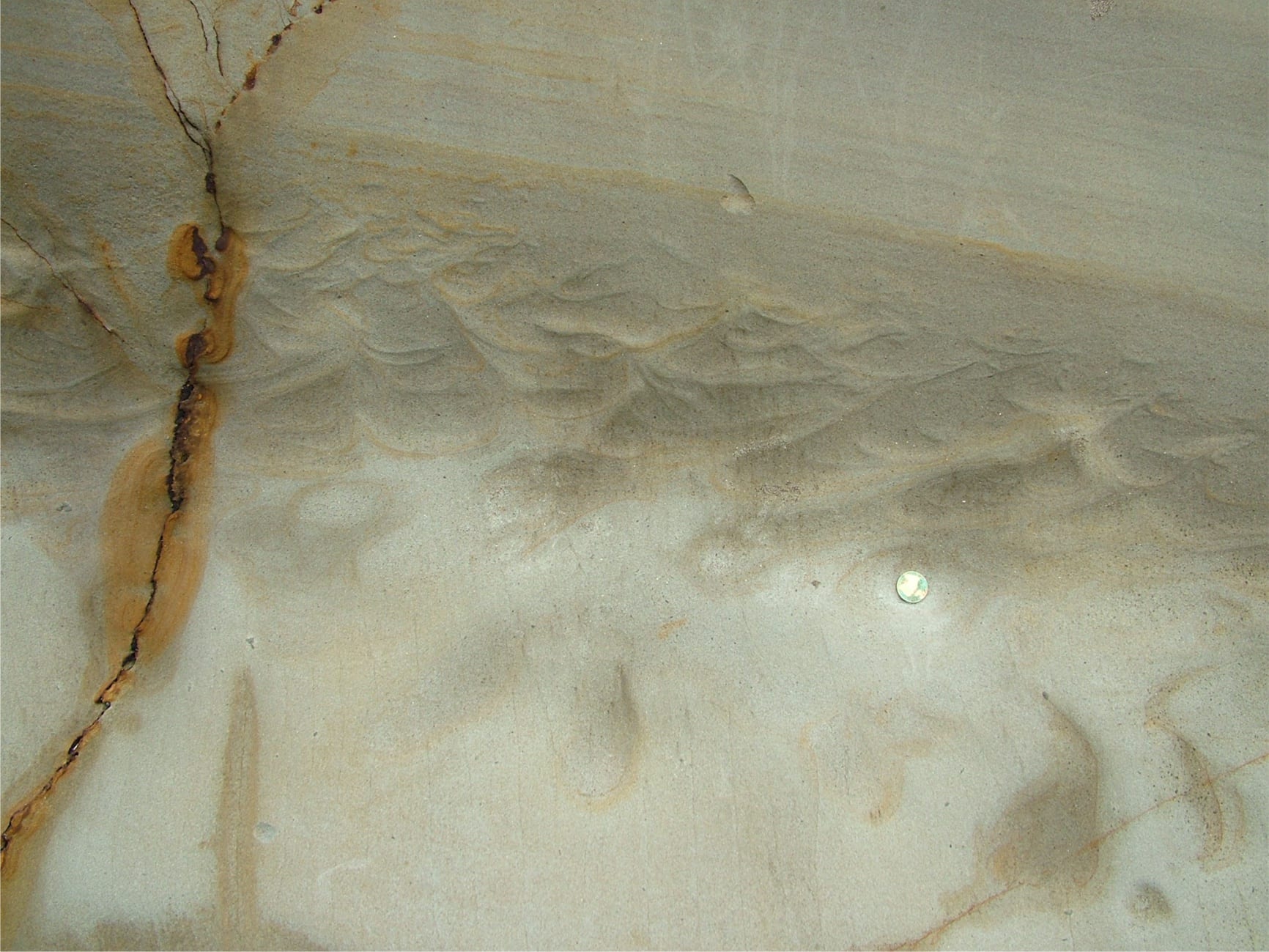
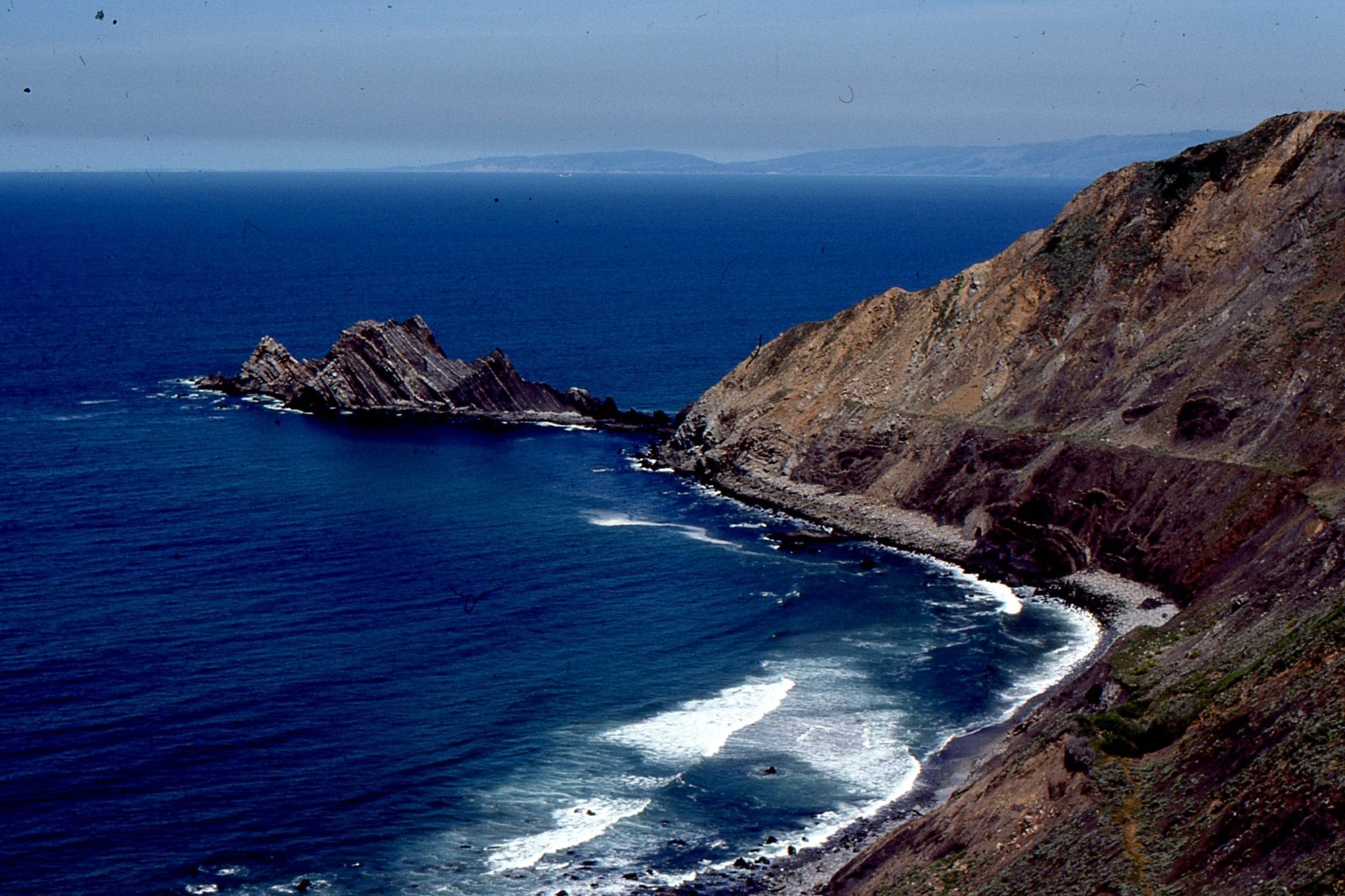
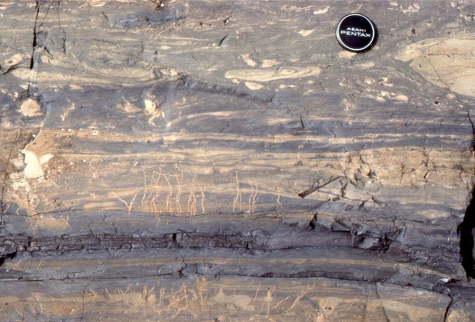
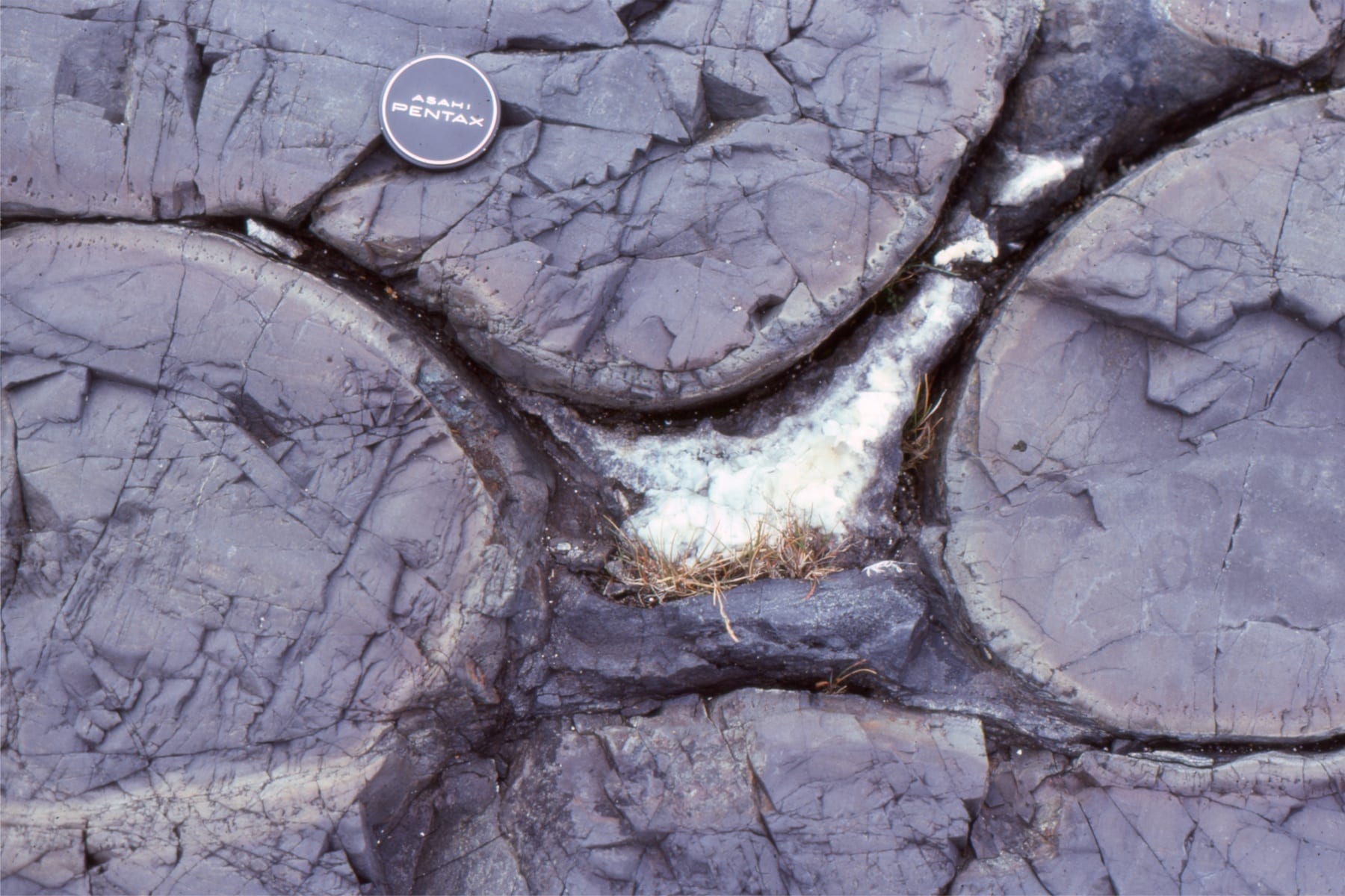
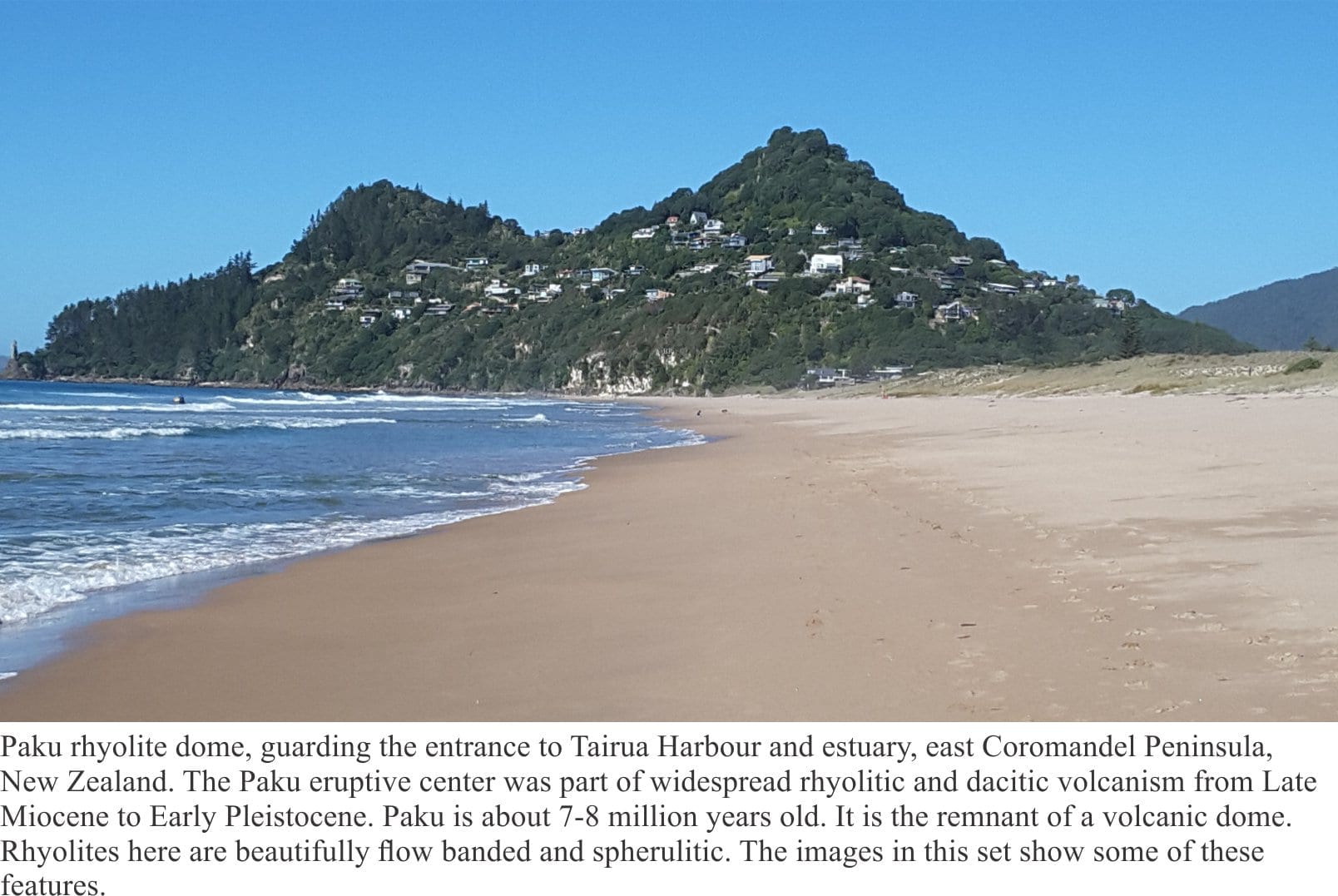
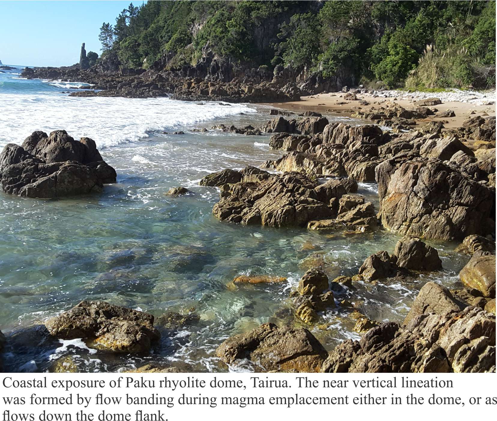
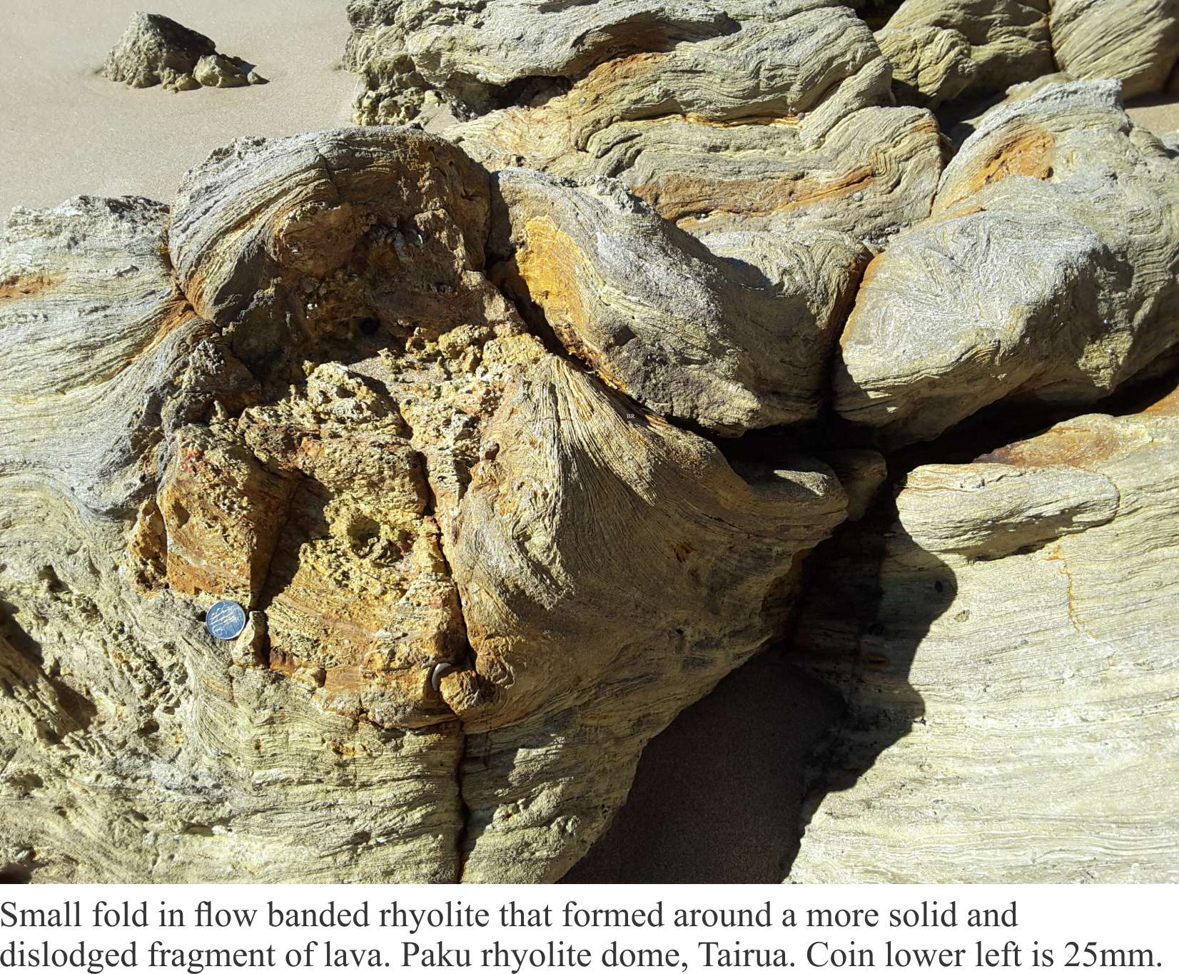
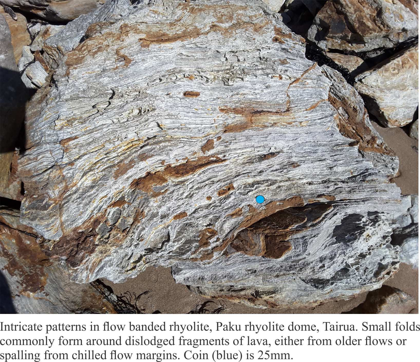
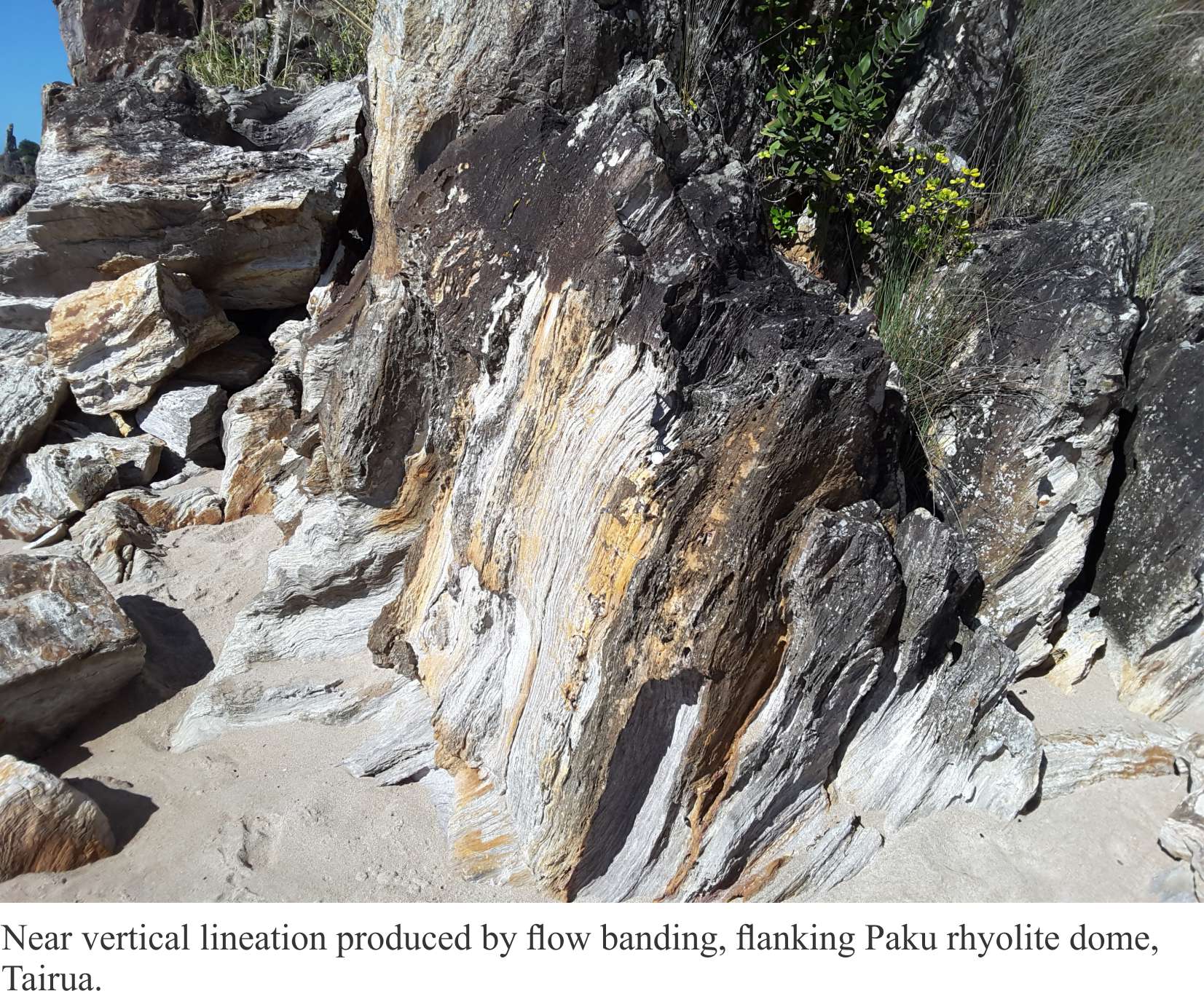
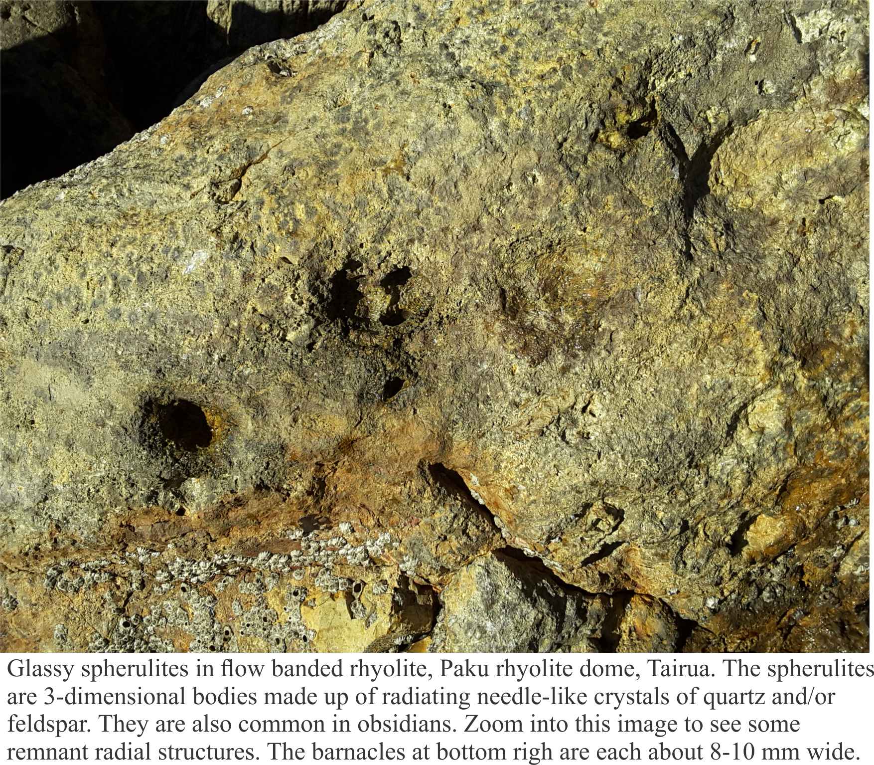
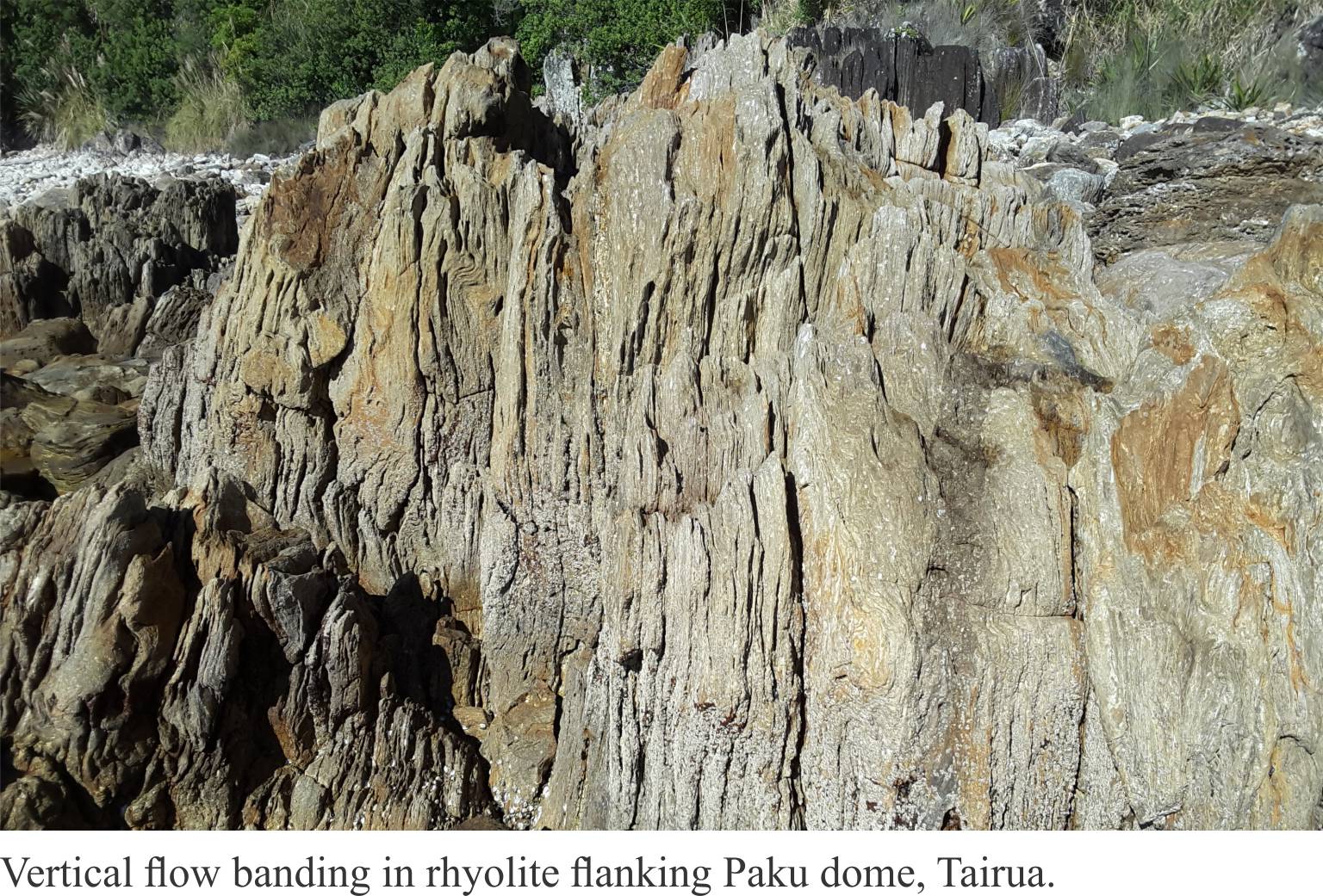
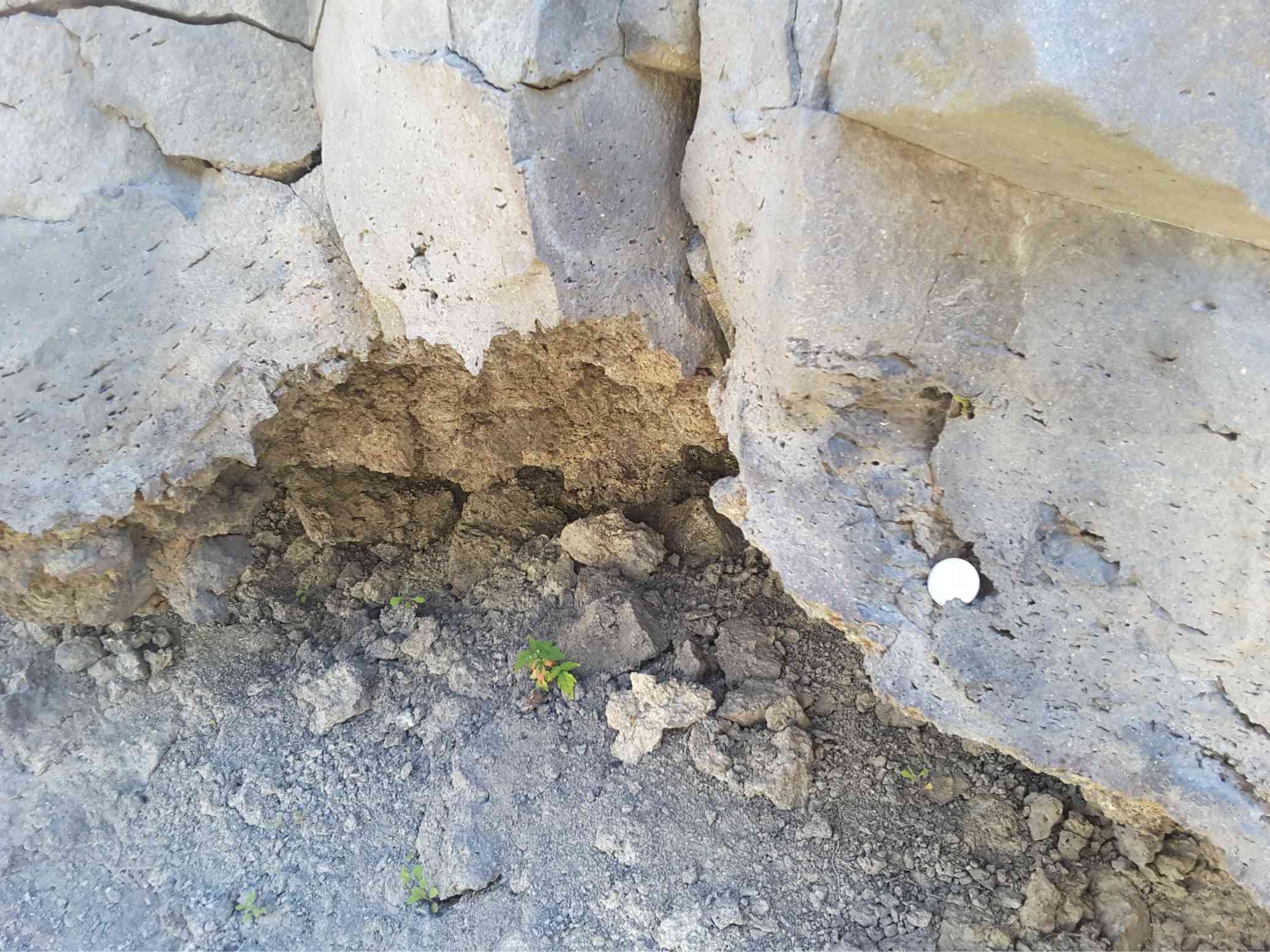
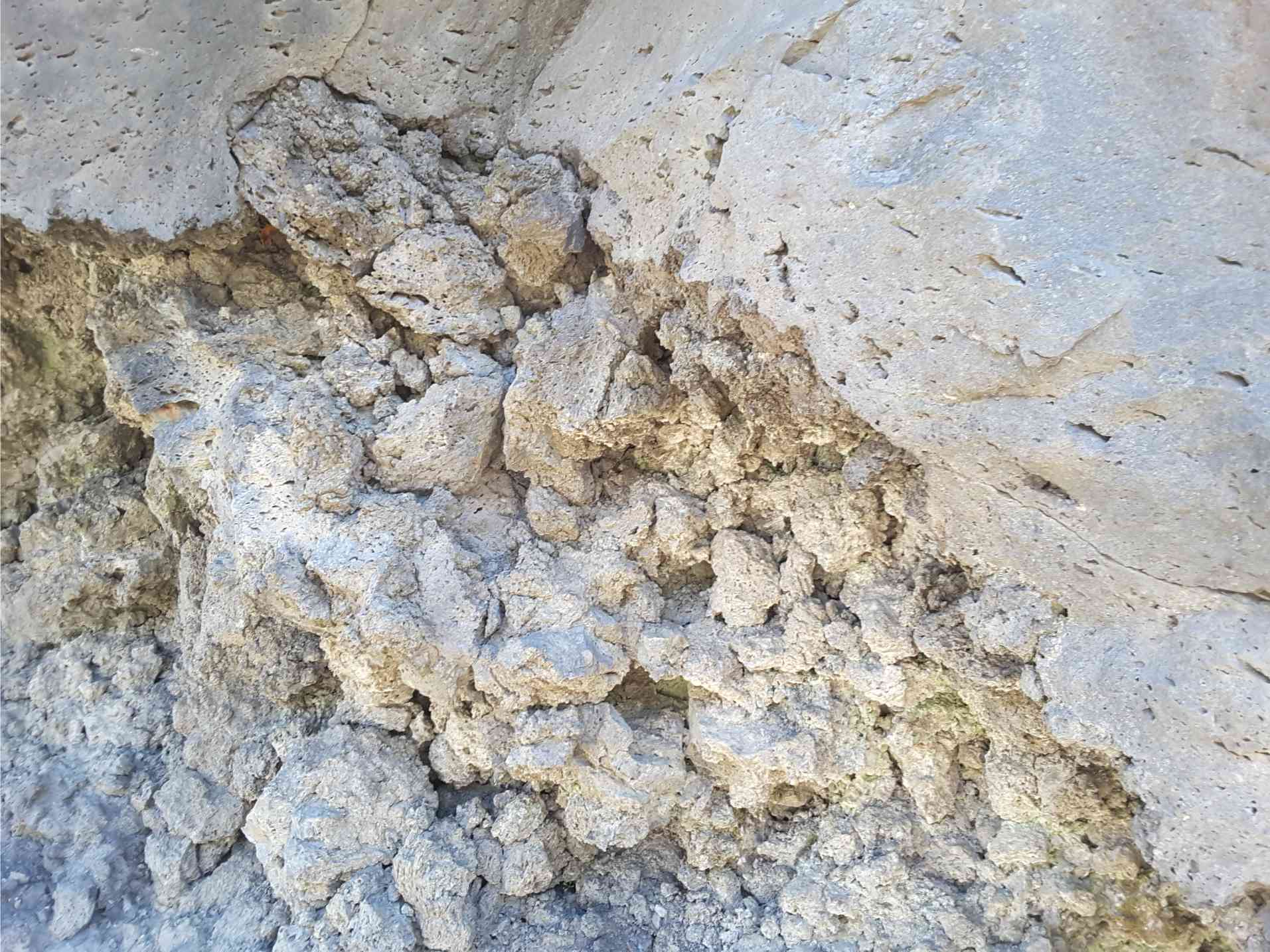
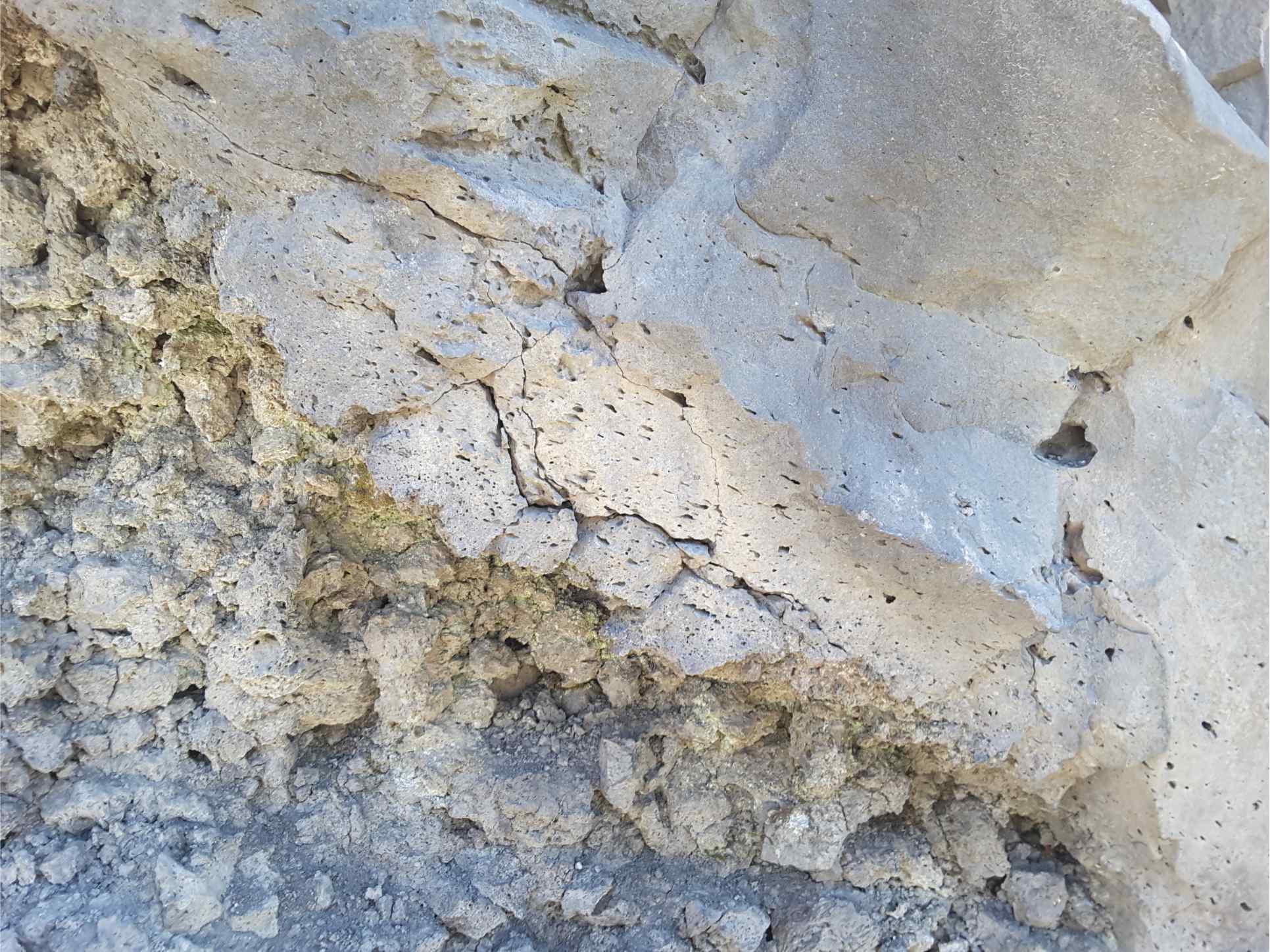
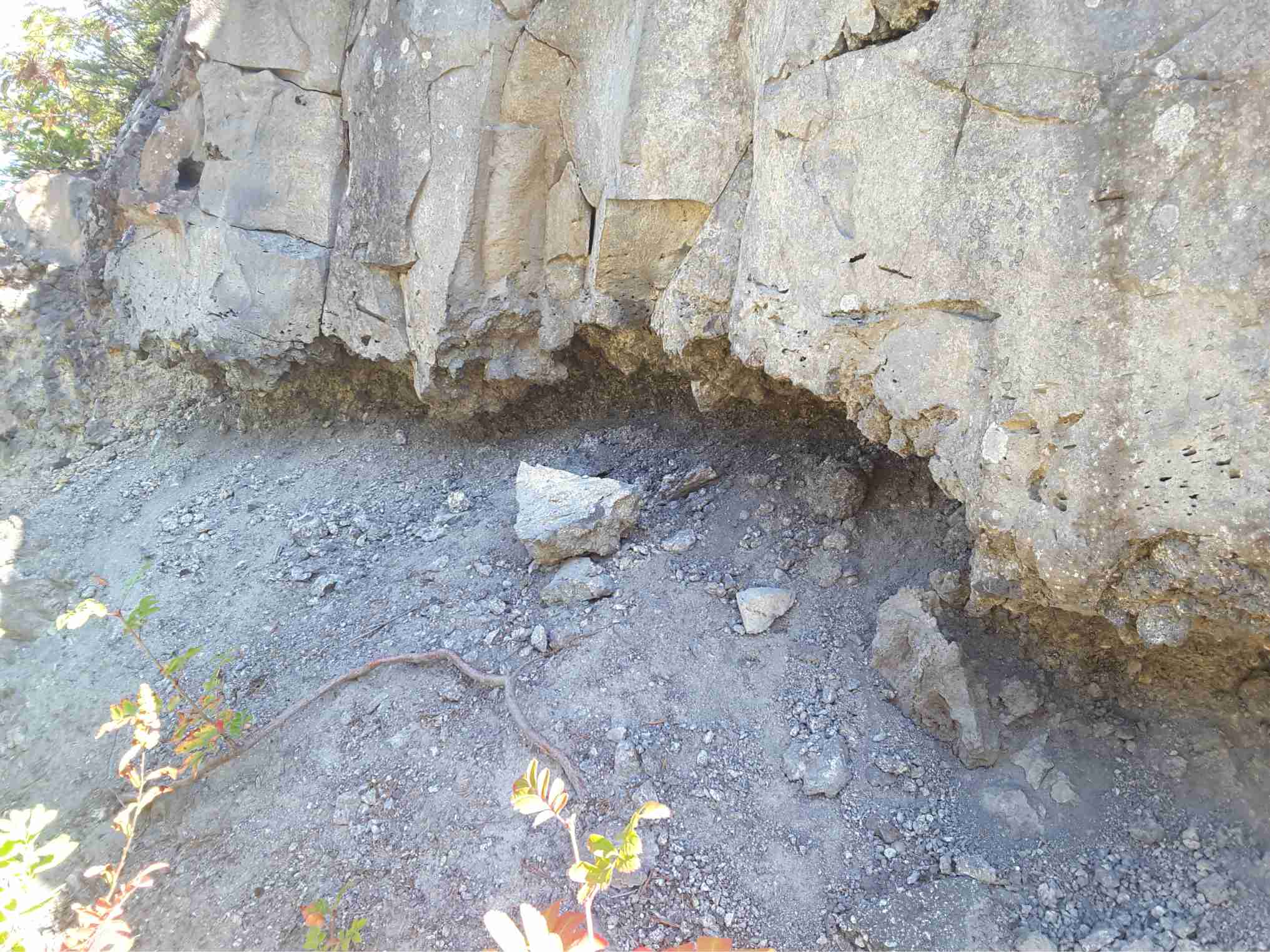
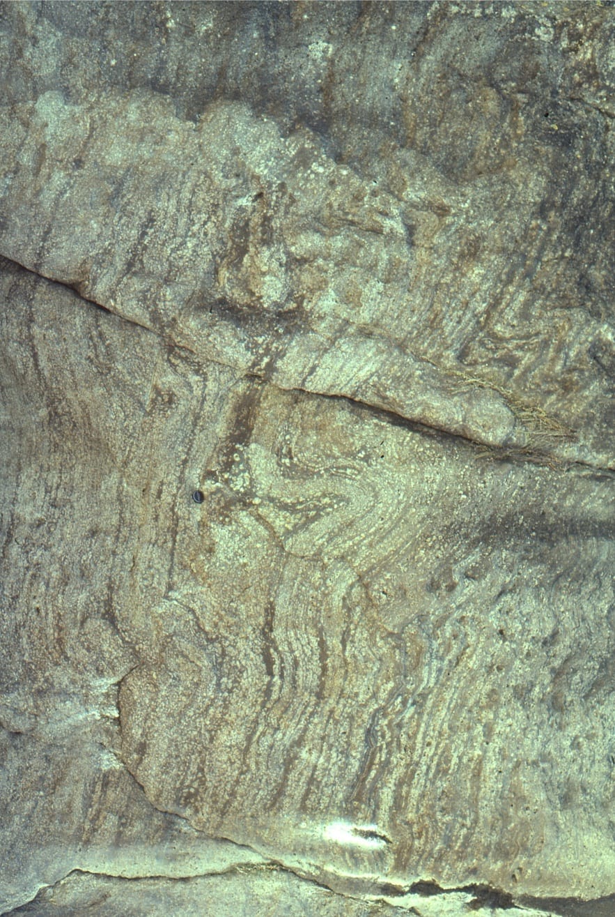
Paku Rhyolite dome, Coromandel Volcanic Zone
Paku rhyolite dome guards the entrance to Tairua Harbour and estuary, east Coromandel Peninsula, New Zealand. The Paku eruptive center was part of widespread rhyolitic and dacitic volcanism from Late Miocene to Early Pleistocene in the Coromandel Volcanic Zone. They are part of the Minden Rhyolite Group. Paku is about 7-8 million years old (Pliocene). The Paku hypersthene-hornblende-biotite rhyolites here are beautifully flow banded and spherulitic,
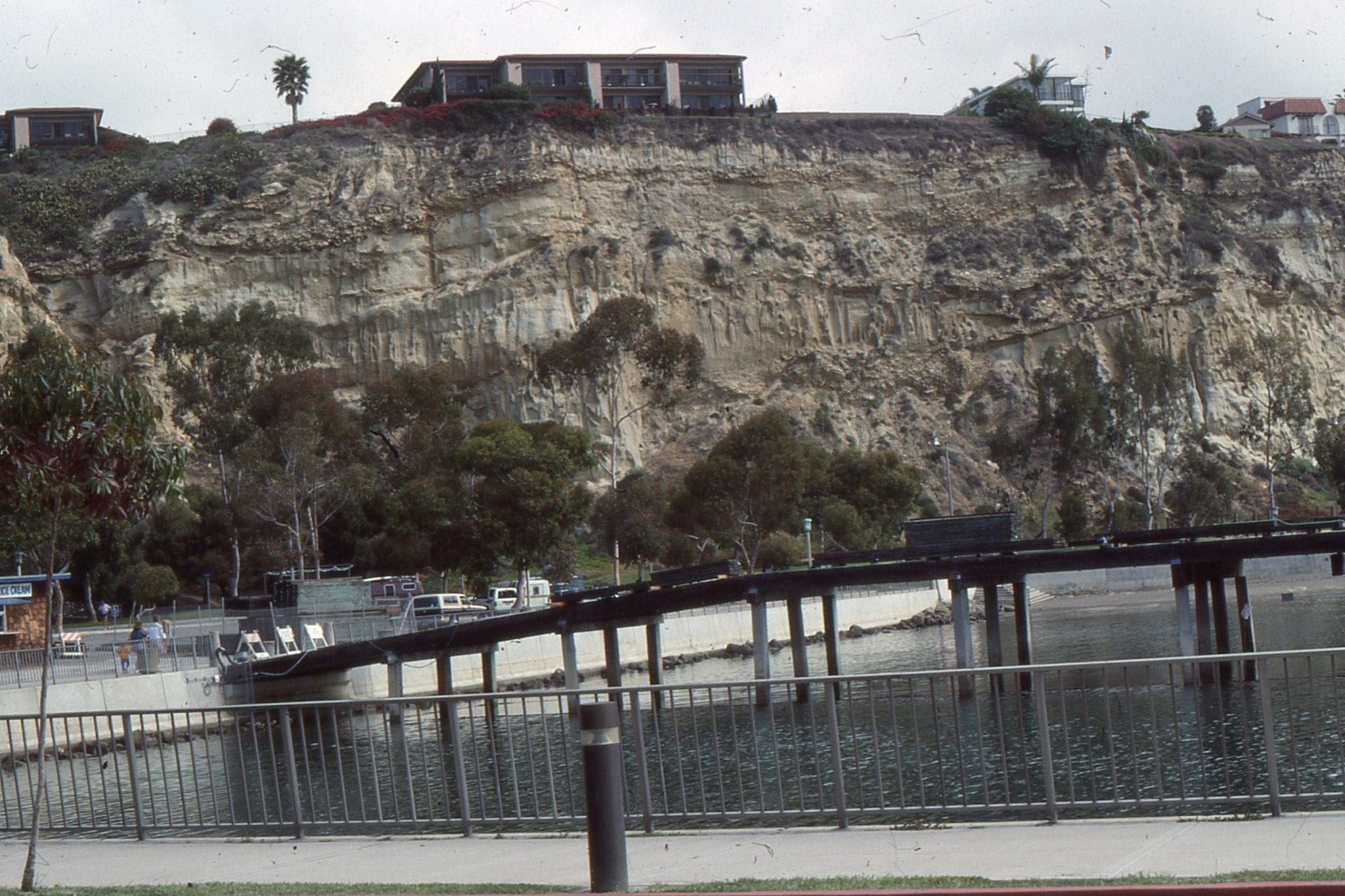
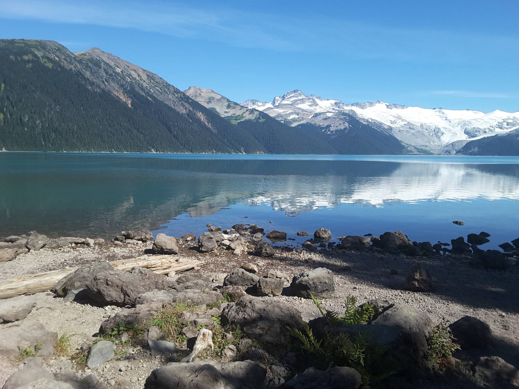
Garibaldi Volcanic Field, British Columbia
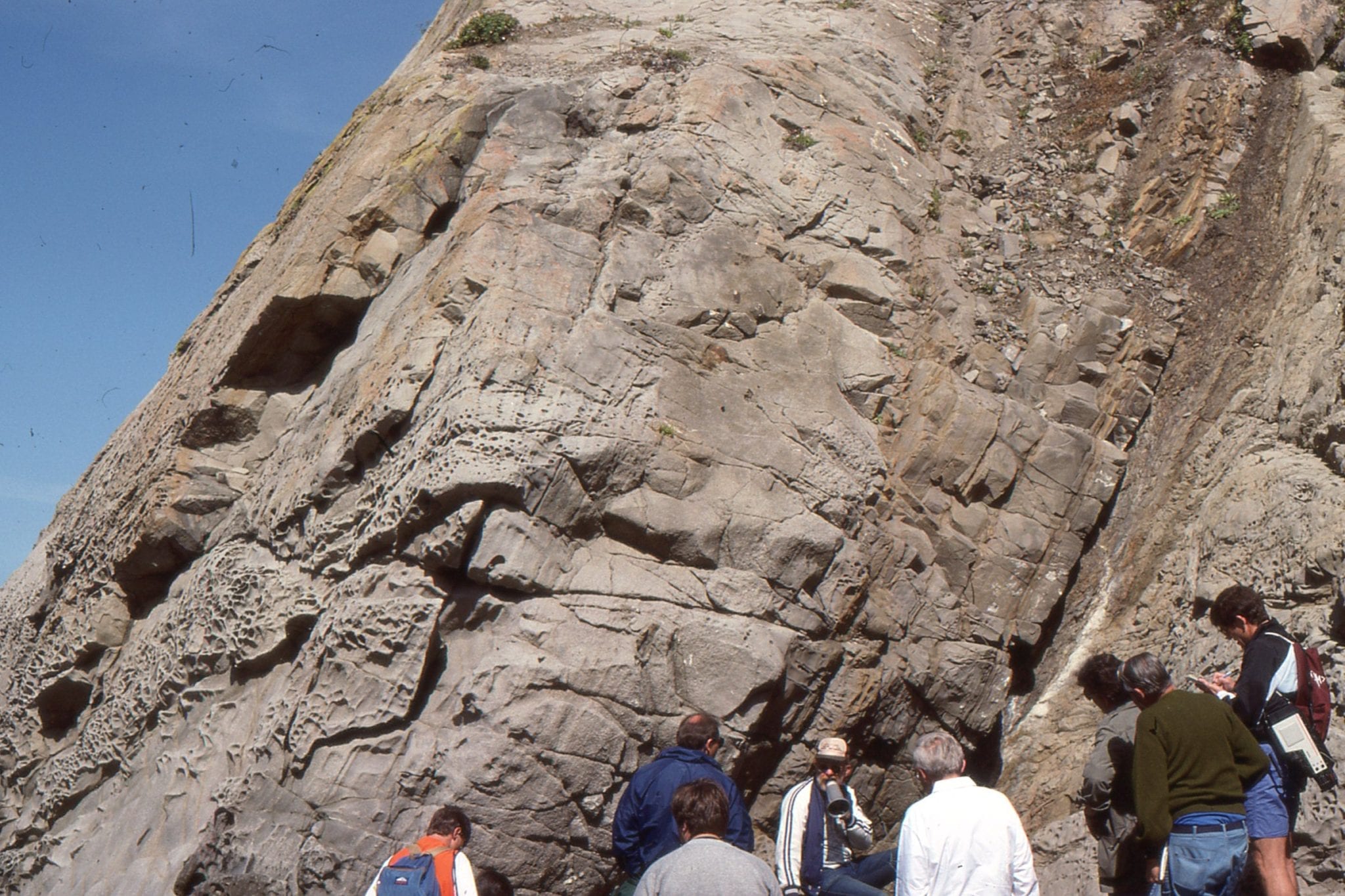
The Garibaldi and Garibaldi Lake volcanic fields contain some of the youngest eruption products in Canada; most of the activity is about mid-Pleistocene through Holocene. Most common are calc-alkaline andesites and dacites, with some basaltic rocks, associated with subduction of the Juan de Fuca Plate. They are located 60-70 km north of Vancouver. Mt. Garibaldi is a stratovolcano, with foundations as old as 1.3 Ma; Black Tusk also has old volcanic foundations, but its present form is due to much younger activity. Late Pleistocene activity took place beneath the western segment of the Laurentide-Cordilleran Ice Sheet.
Herein are a few images of Garibaldi, Tusk, and Garibaldi Lake (the latter is a really nice hike). Images of lava flows are from exposures along Highway 99 between Squamish and Pemberton.
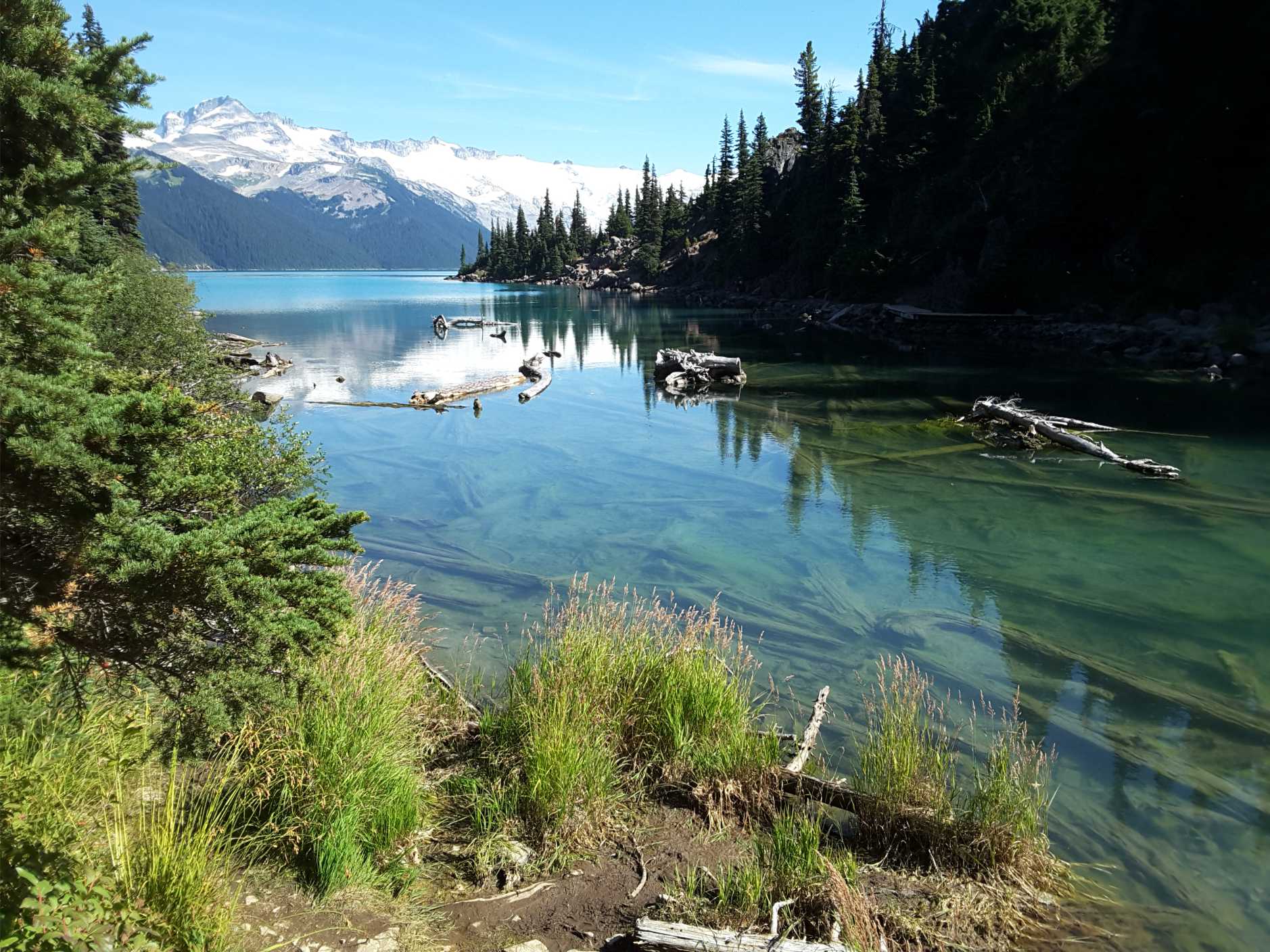
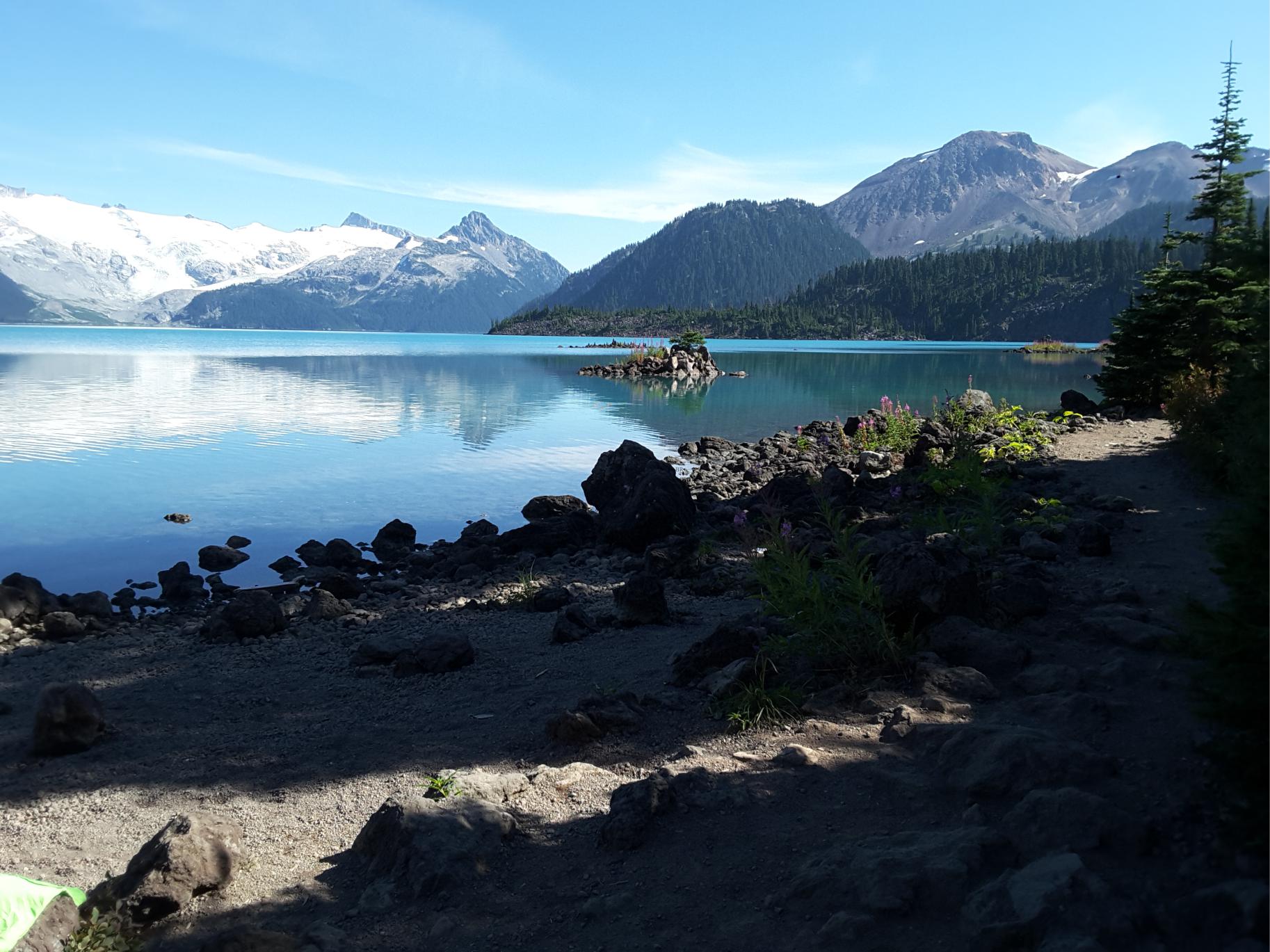
Lake Garibaldi. Sub-glacial andesite flows in the foreground
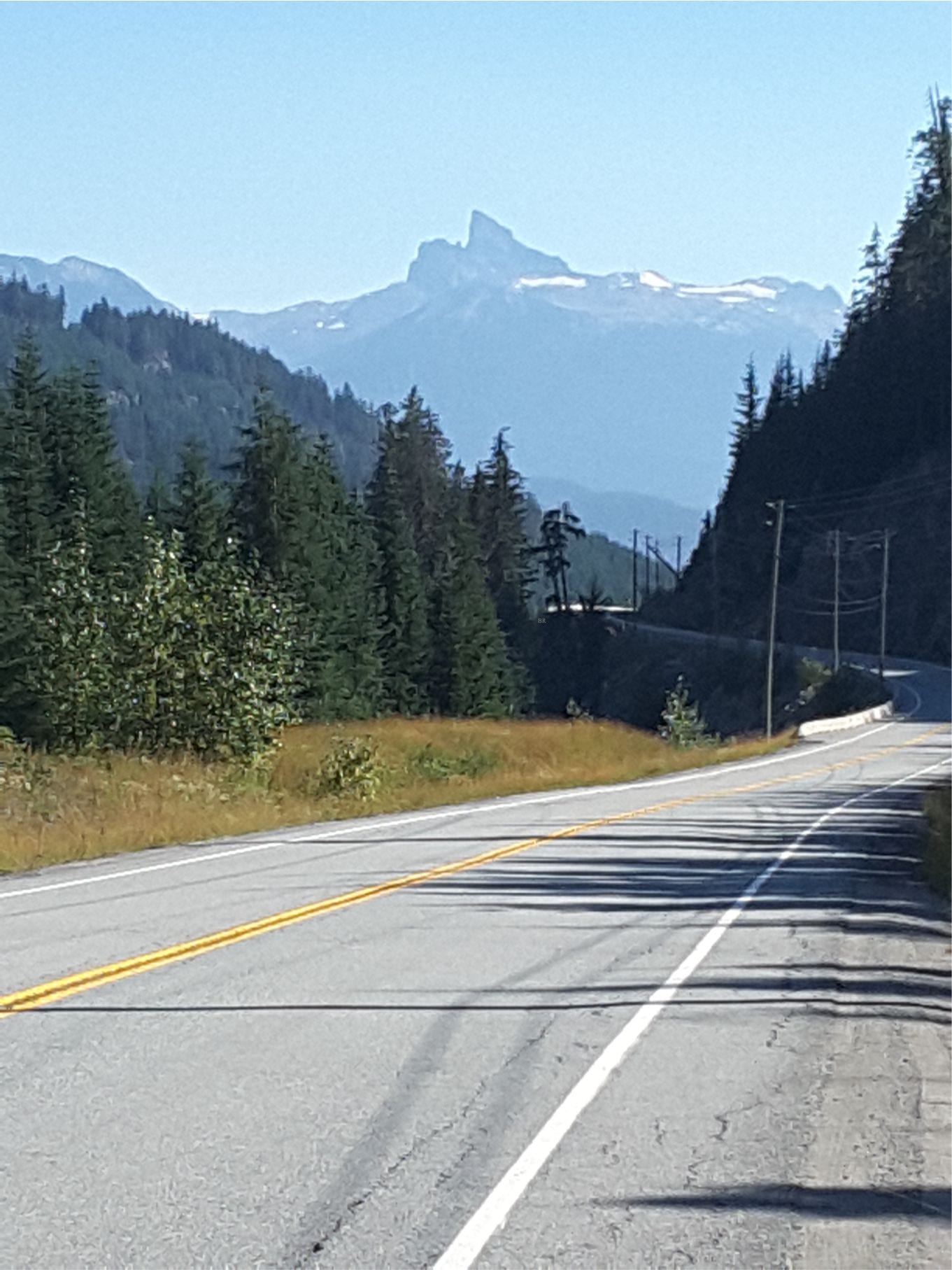
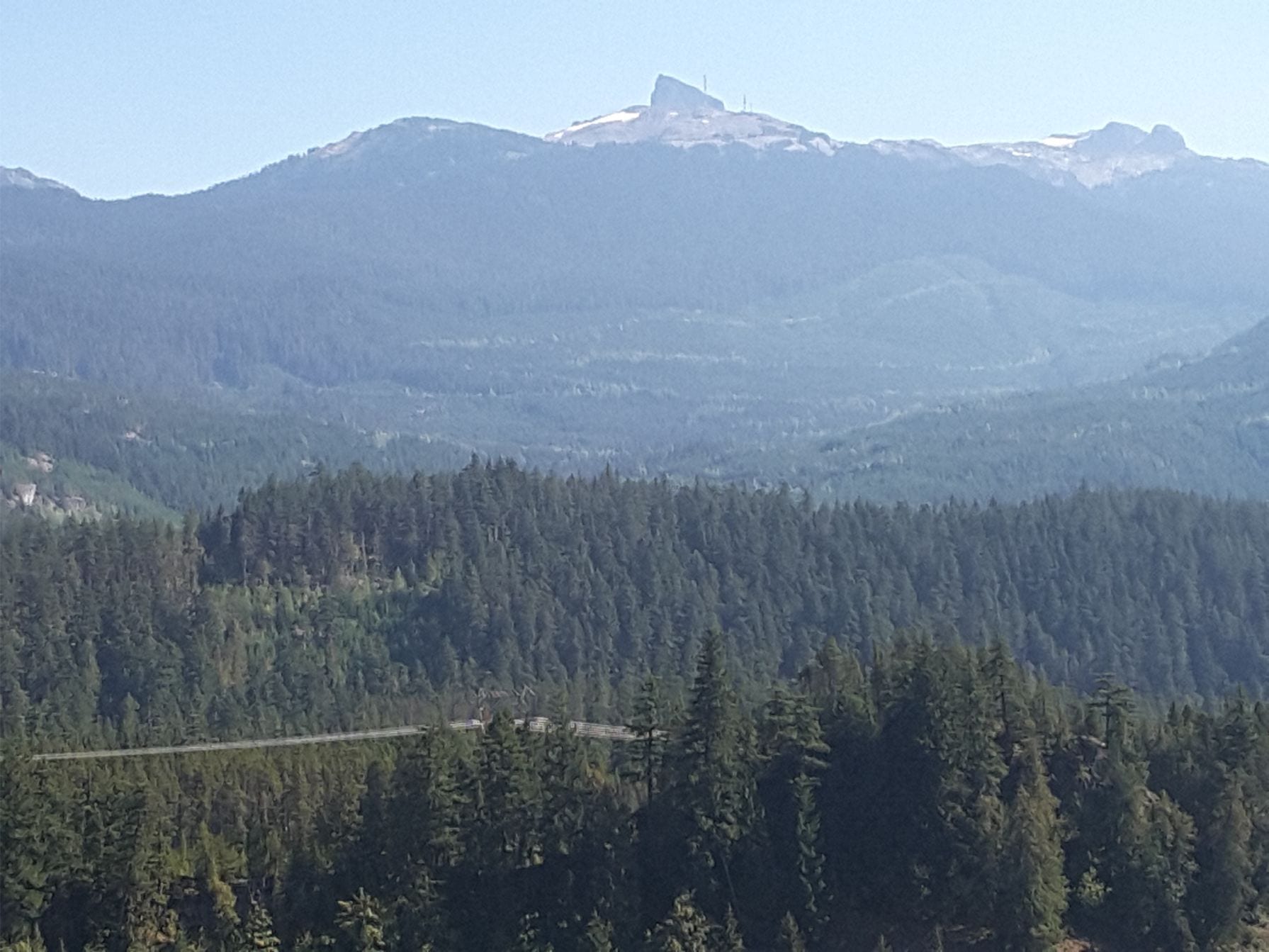
Black Tusk is the remains of an eroded stratovolcano whose foundations erupted about 1.3Ma. Rocks forming the present pinnacle were erupted about 200,000 years ago. This dome was subsequently eroded by the Cordilleran Ice sheet. Left: from the Callaghan River access road. Right: From Brandywine Falls lookout.
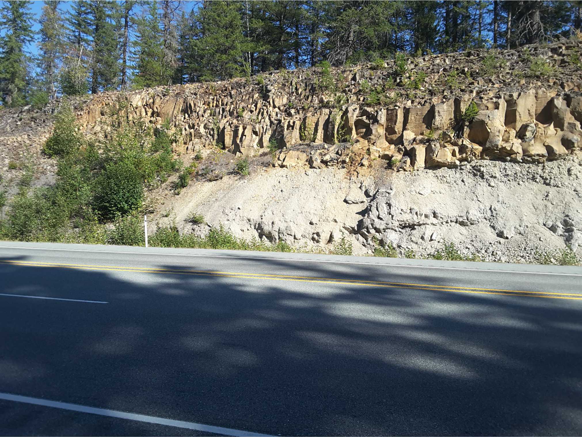
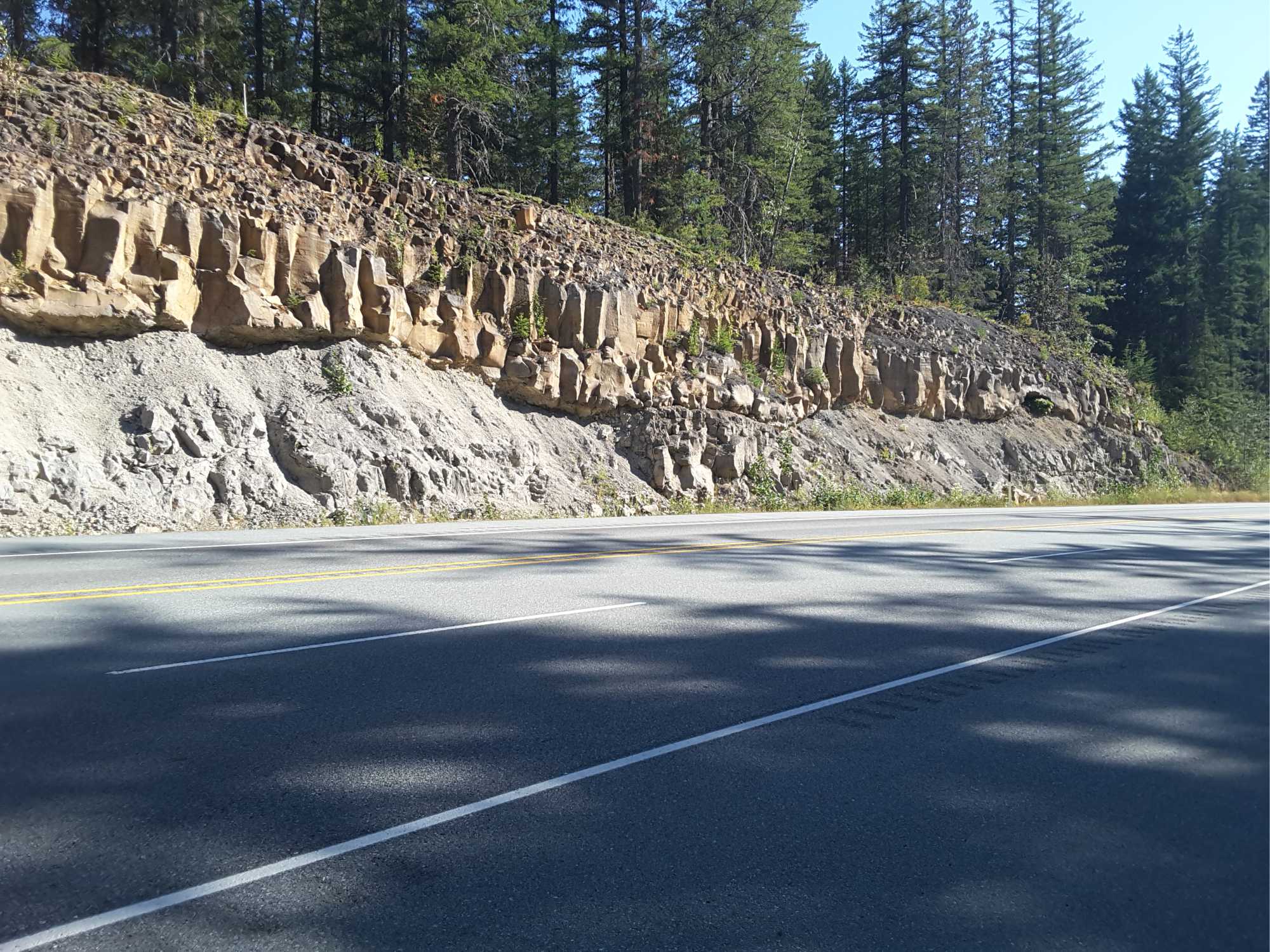
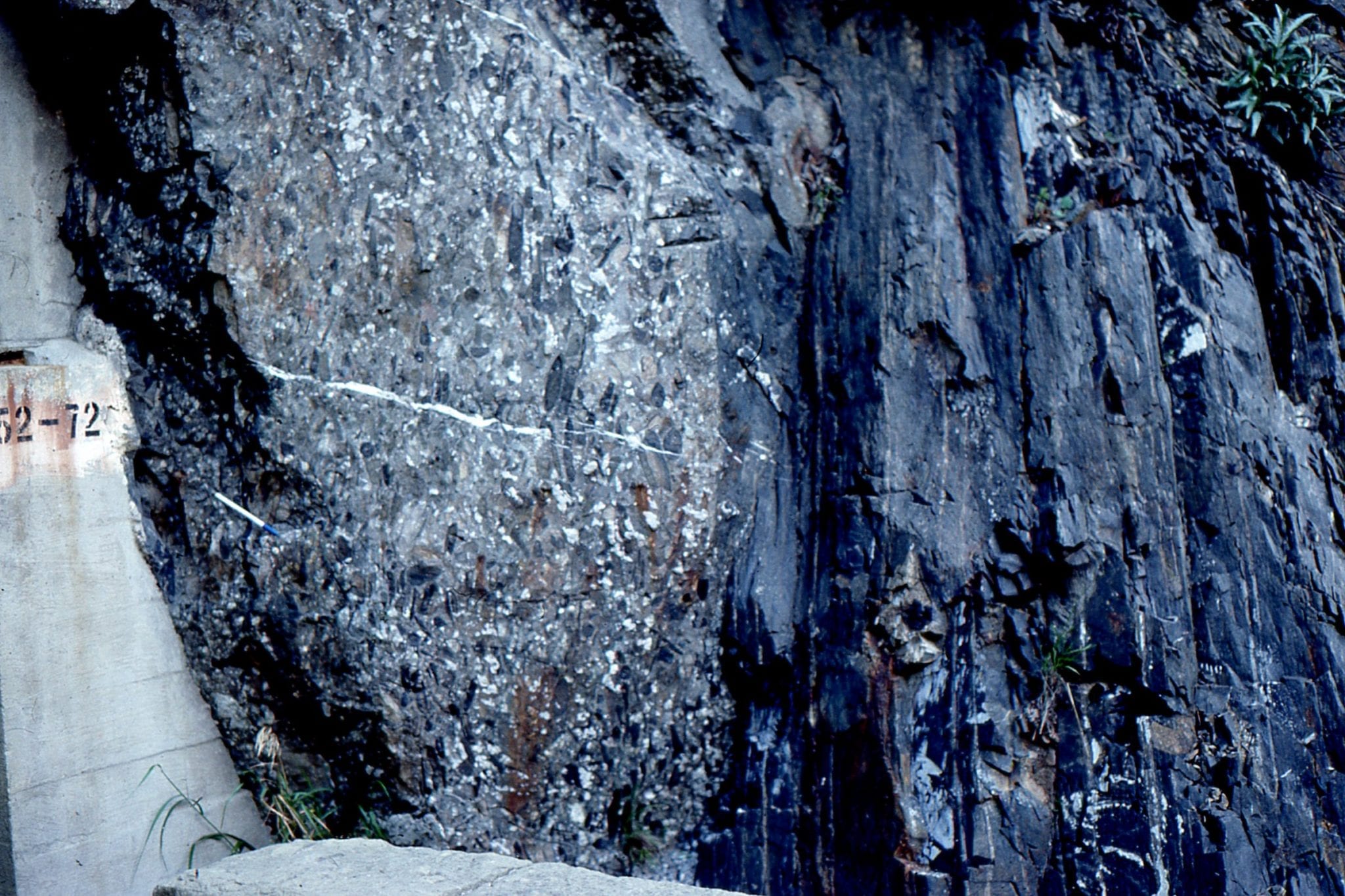
A tiered, columnar jointed flows overlying Coast Mountain granodiorite. About 10 km north of Squamish, on Highway 99
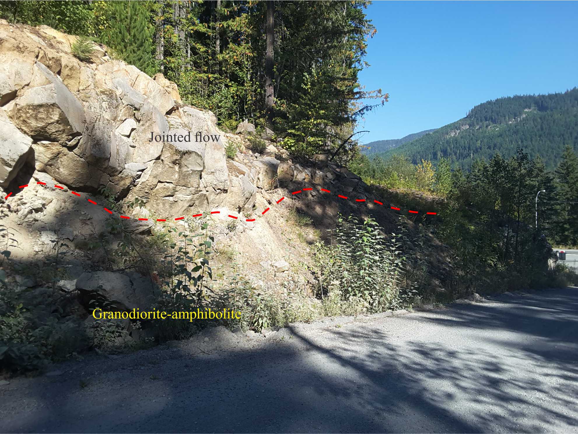
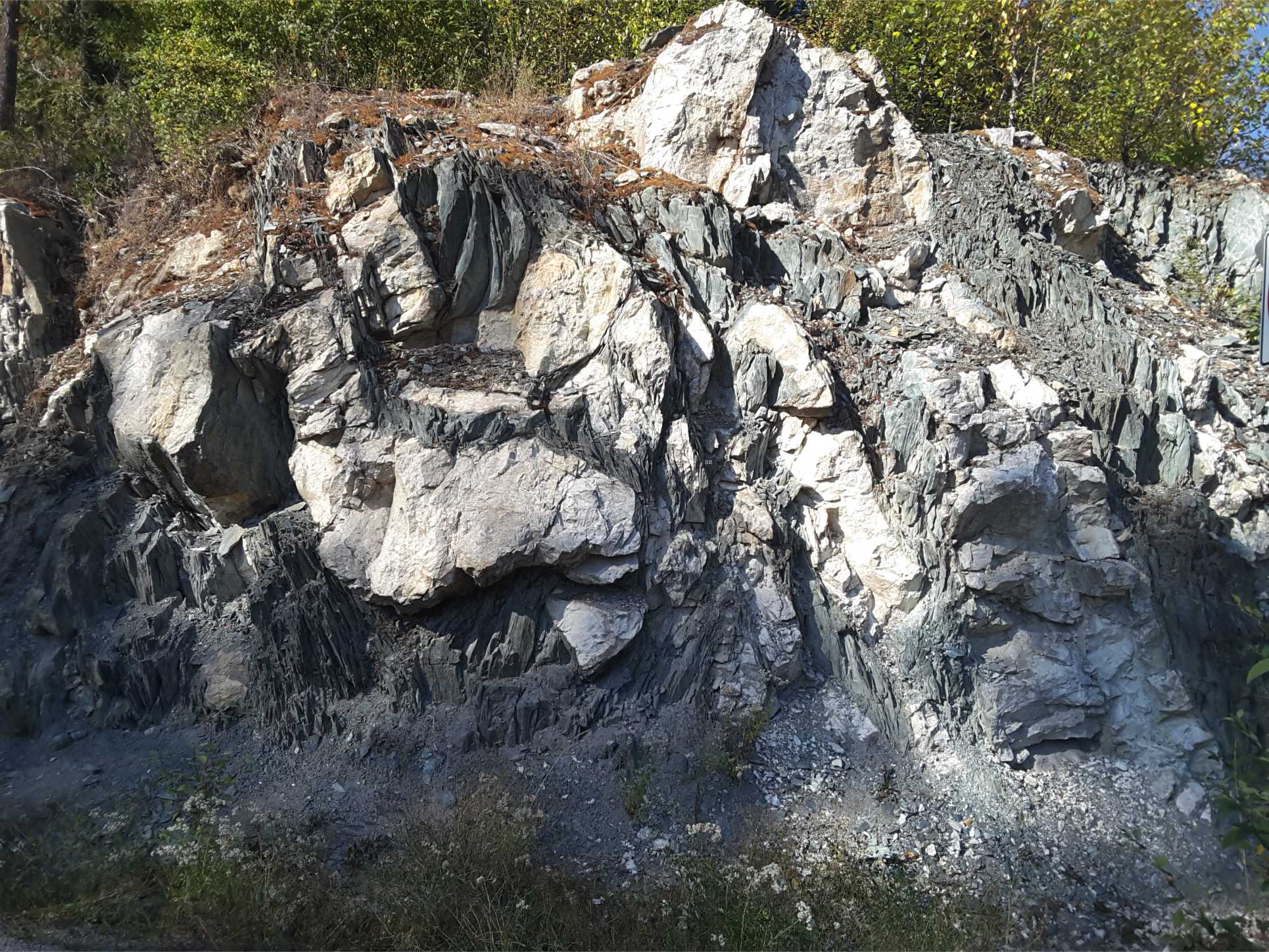
Jointed andesitic-dacitic overlying pre-existing, sub-glacial topography on eroded Coast Mountains granodiorite and metamorphic rocks. The contact is shown in red on the left image. Right image: detail of the bedrock, that here contains structurally interleaved and sheared granodiorite and amphibolite. About 10km north of Squamish, Highway 99.
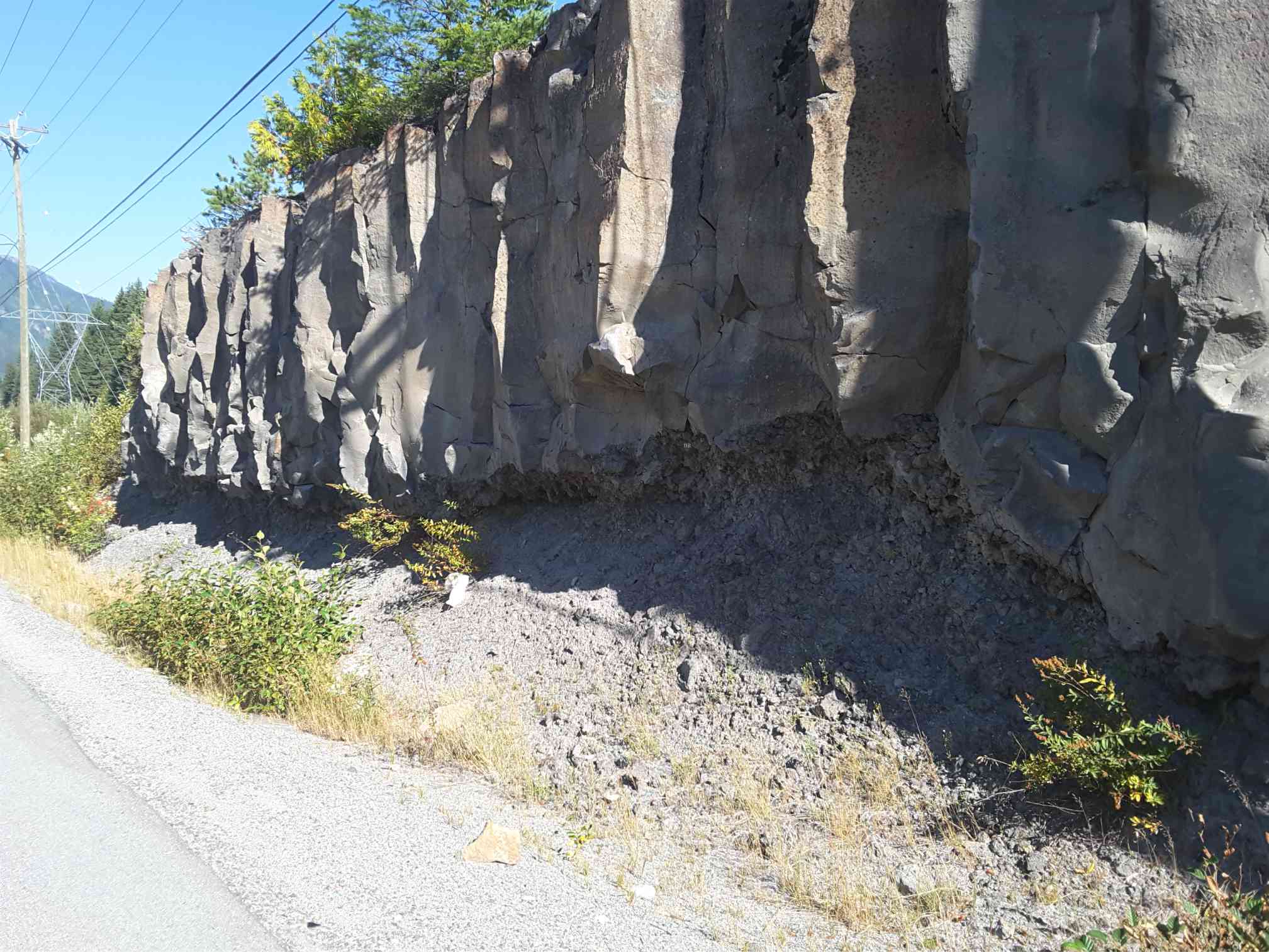
About 15 km north of Squamish on Highway 99; this jointed lava flow has over-ridden dacitic agglomerate. The flow base is lined with abundant vesicles, most of which have been stretched approximately parallel to the basal flow contact. The flow base is highly irregular, possibly following sub-glacial erosional topography.
Same location as above. The basal agglomerate here appears to be part of the original flow unit, where the lower cooled lava has been fragmented by the moving flow. Some fragments have been reincorporated into the base of the solid flow.
Precambrian volcanics
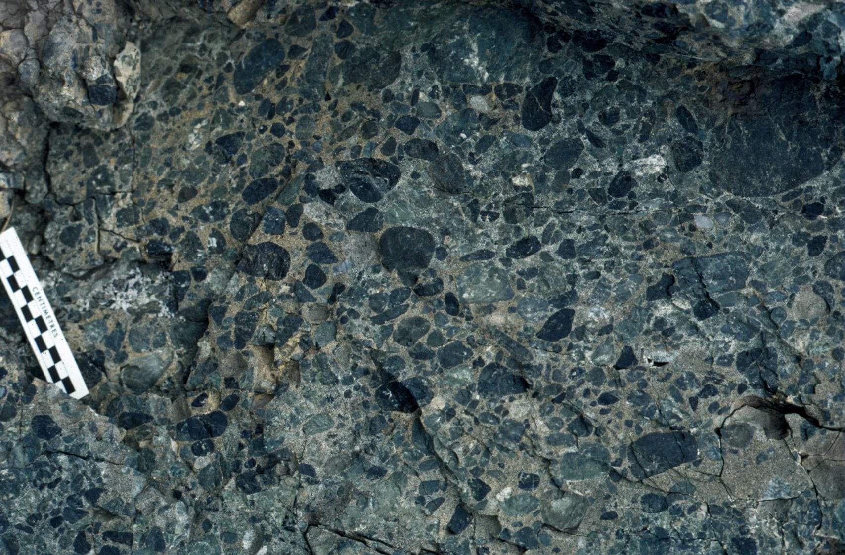
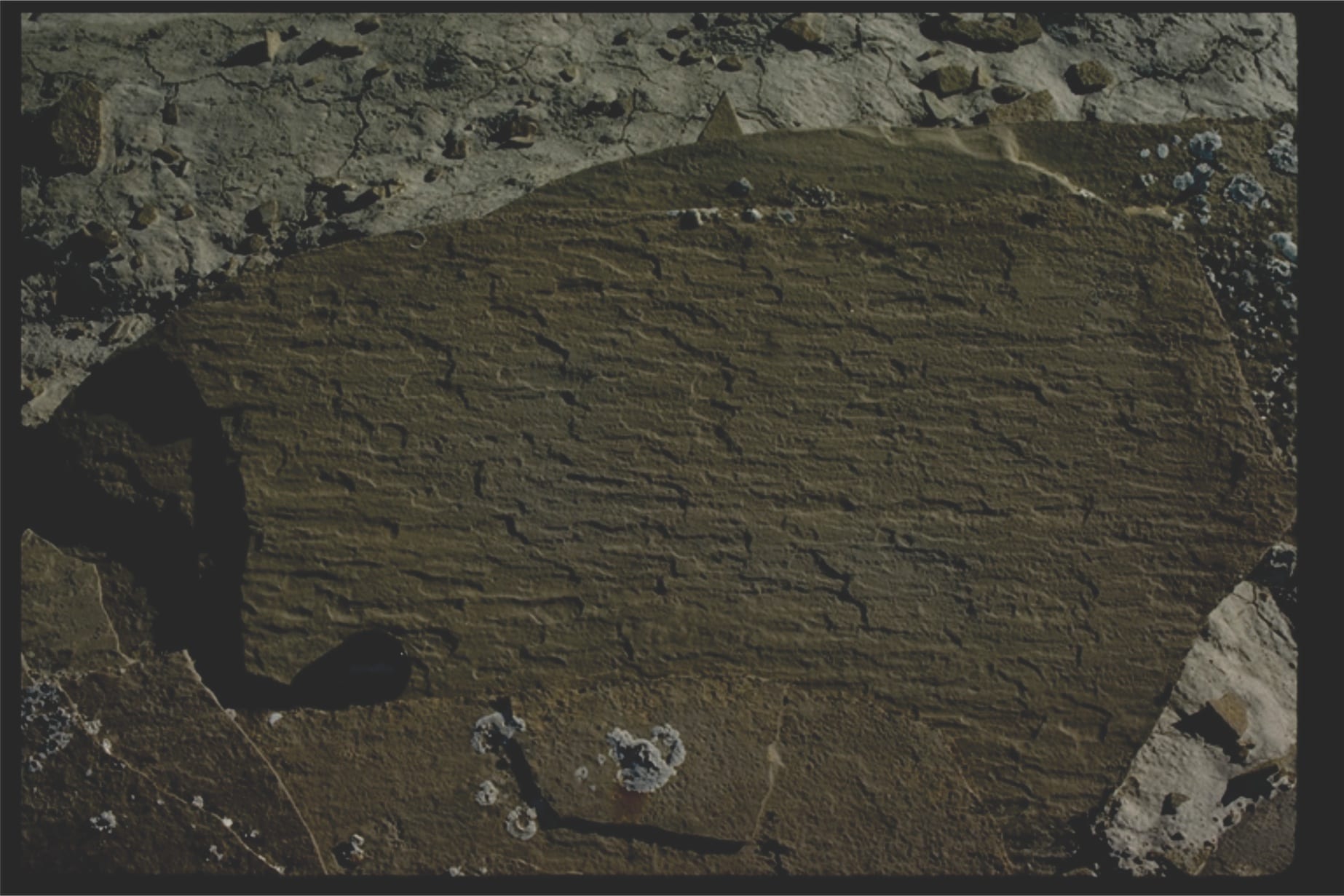
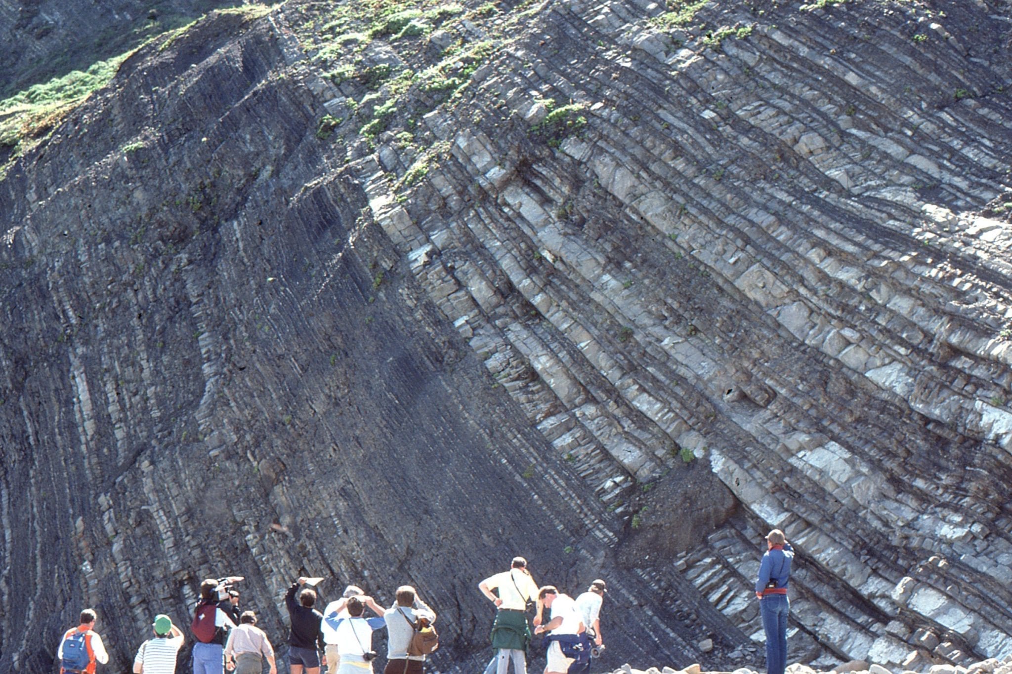
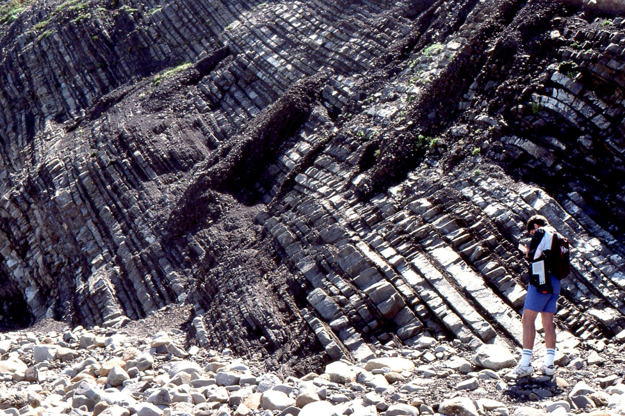
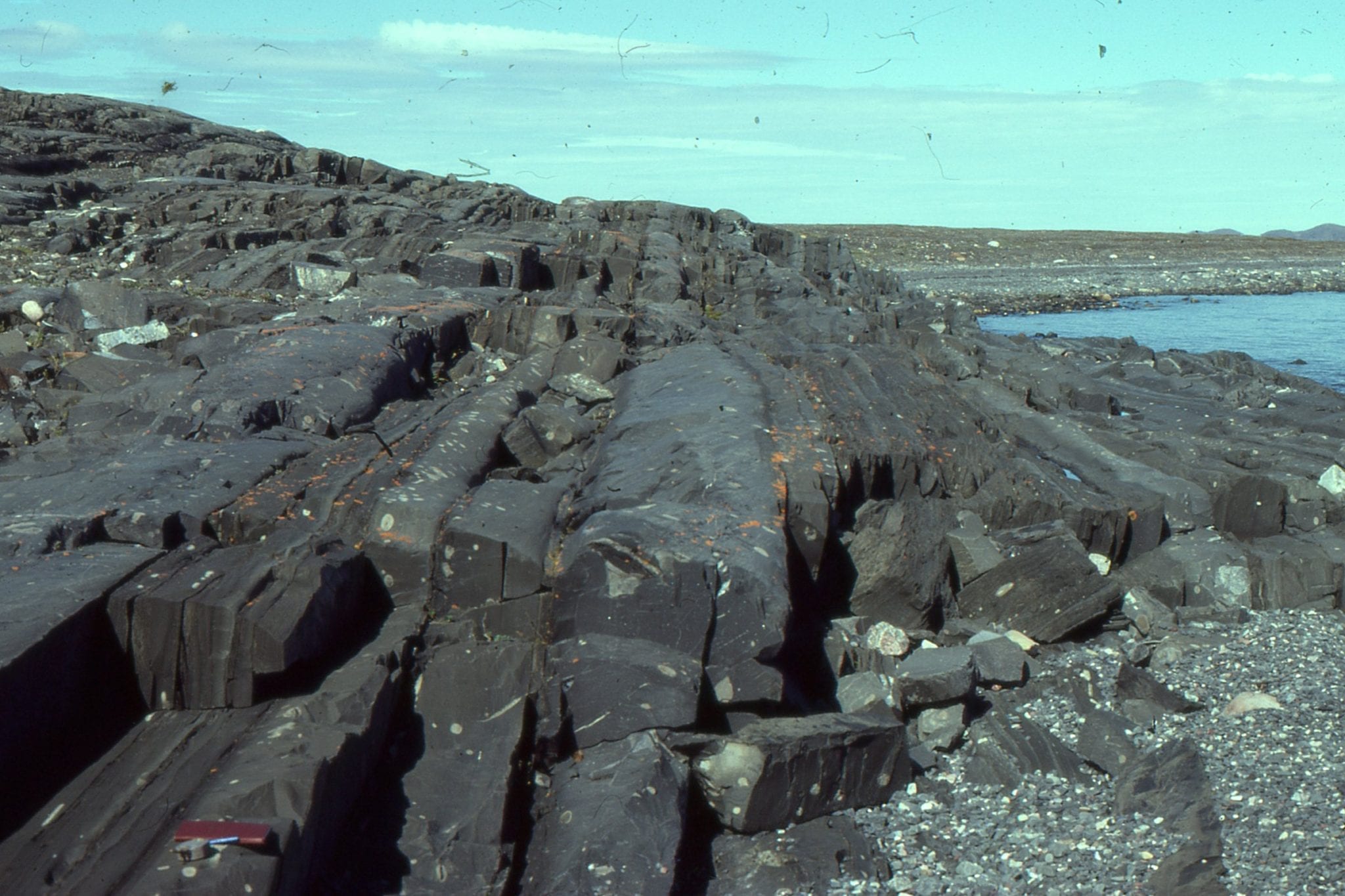
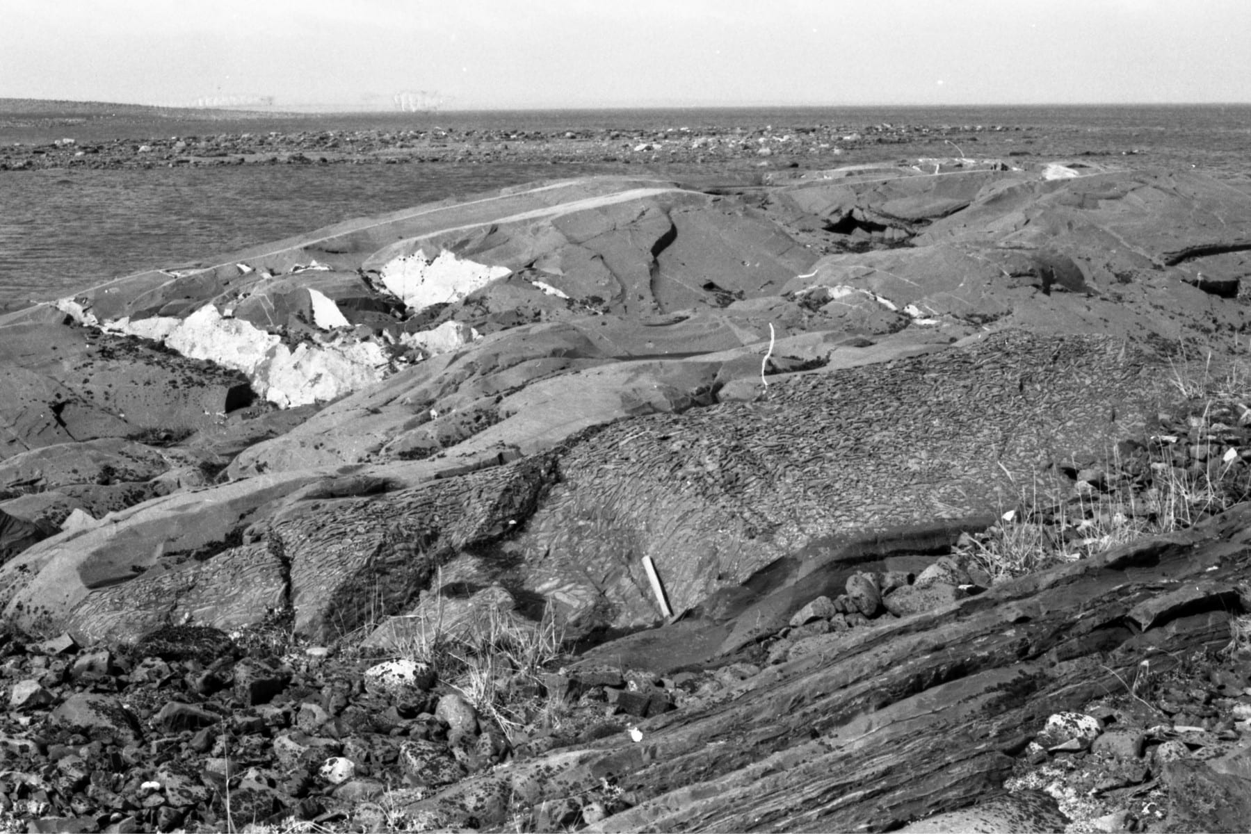
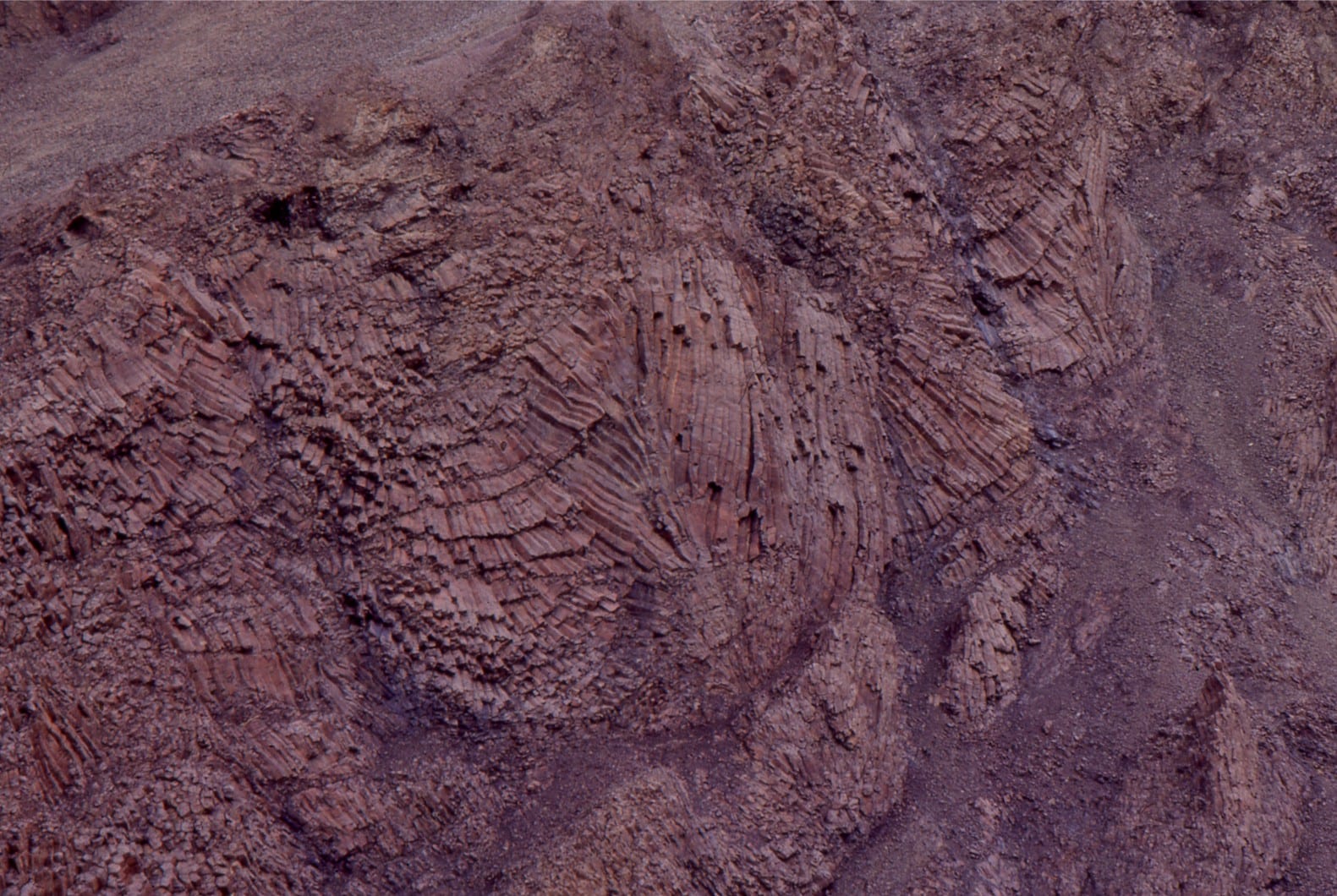
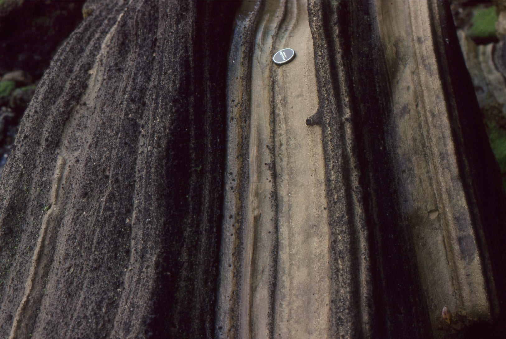
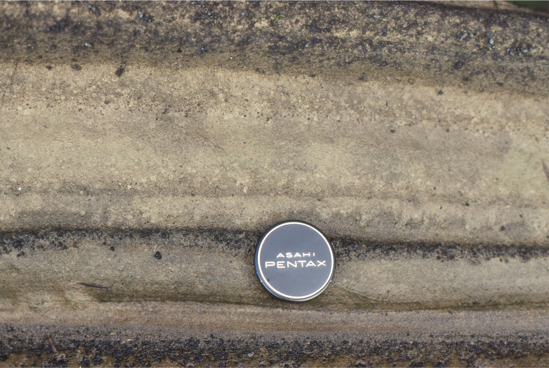
This set of images is from the Proterozoic Flaherty Formation, Belcher Islands. A small number of Rb/Sr and Pb-Pb ages indicate between 2.0-1.9 billion years. The Flaherty succession consists of interleaved tholeiitic to subalkaline basalt flows, pillowed lavas, pyroclastic and/or density current ash flows, and interflow turbidites, that accumulated mostly in a marine environment, although edifices may have extended above sea level. Metamorphism is prehnite-pumpellyite grade, and preservation of primary volcanic and volcaniclastic structures is excellent. The volcanics were extruded on Proterozoic continental crust. However it is still uncertain whether they represent some kind of mantle plume, formed during extension associated with crustal flexure, or are a hybrid of continental arcs.
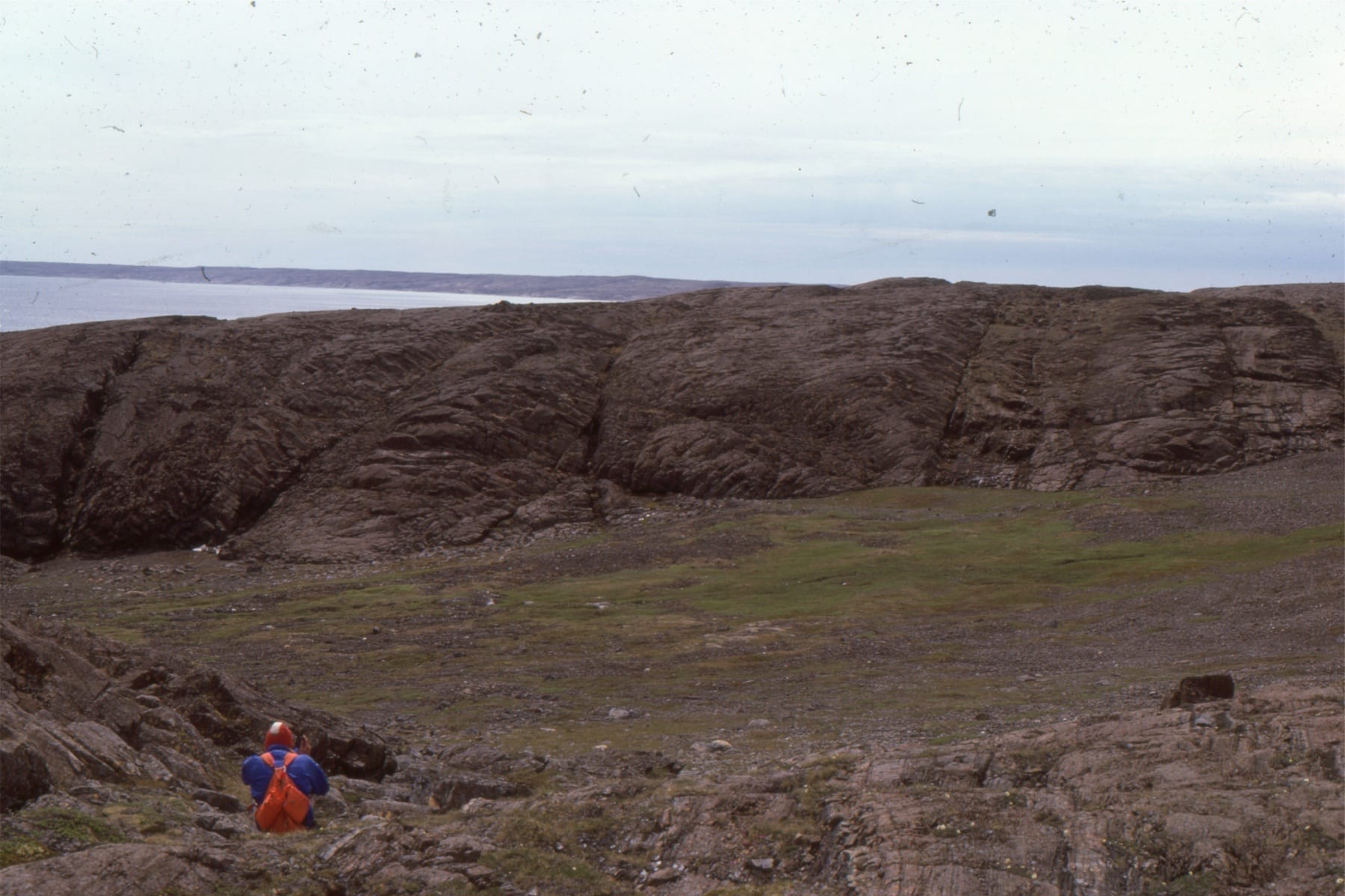
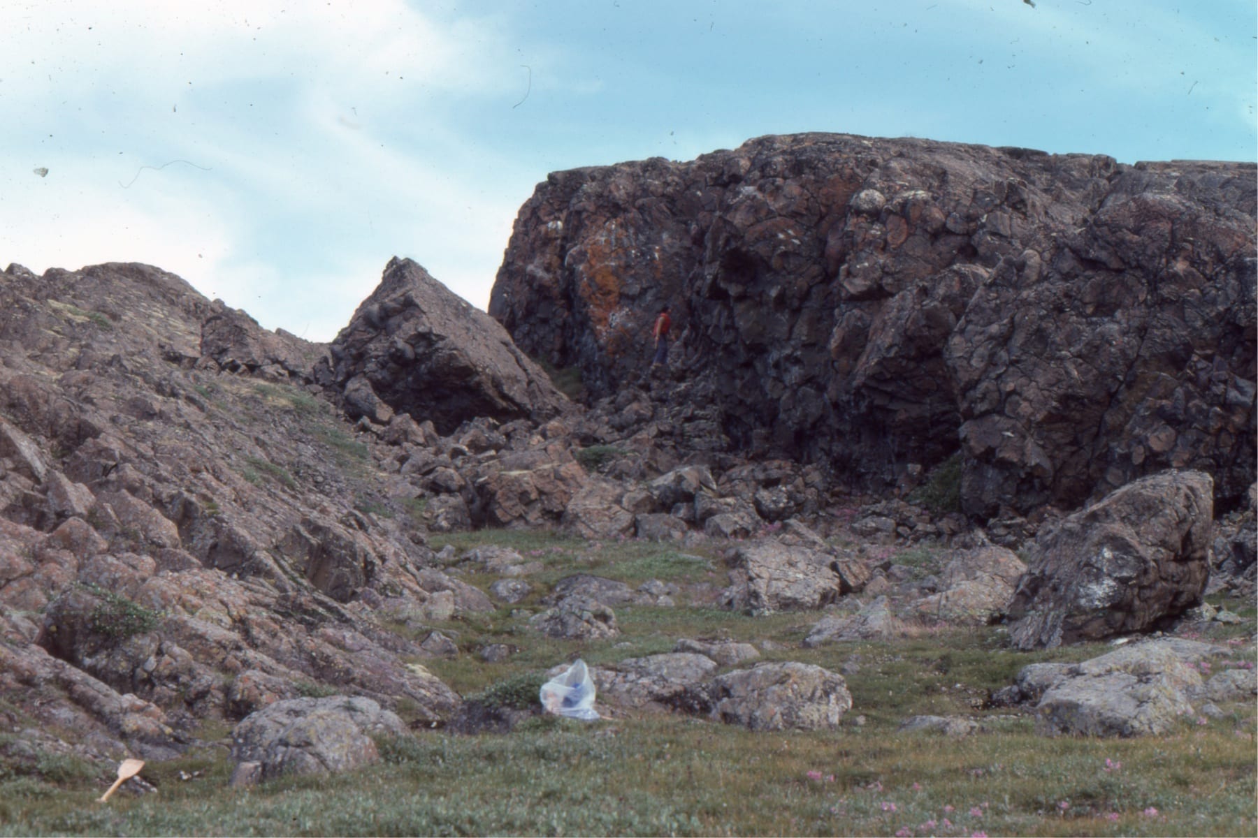
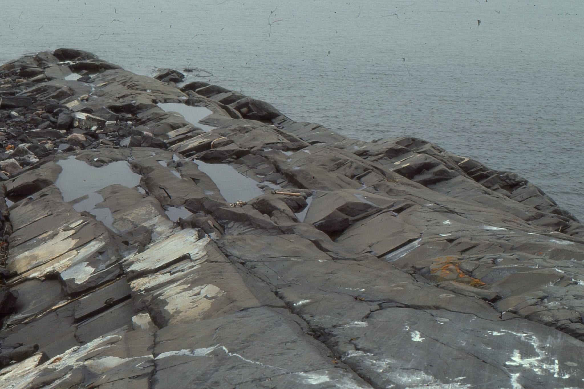
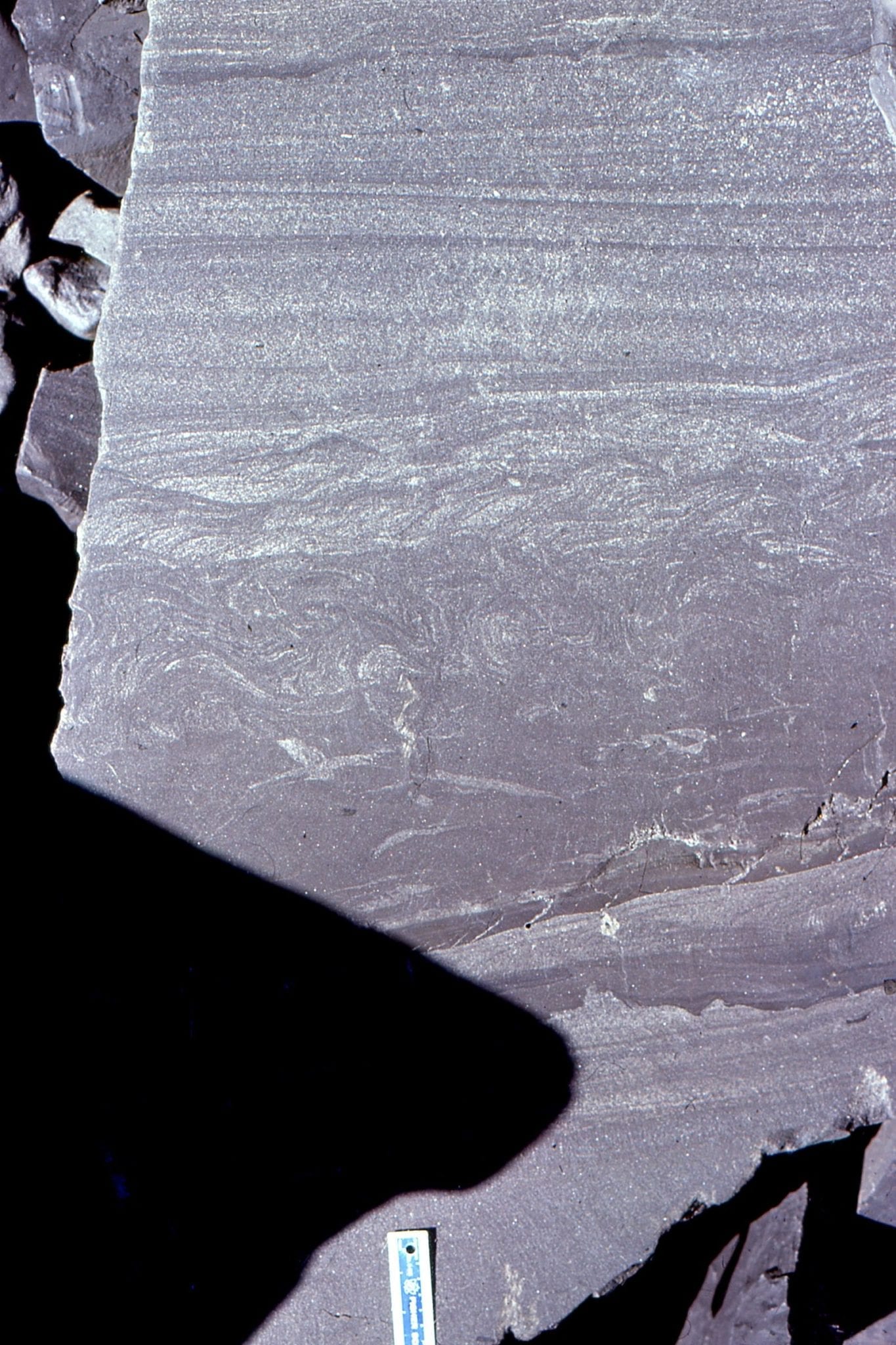
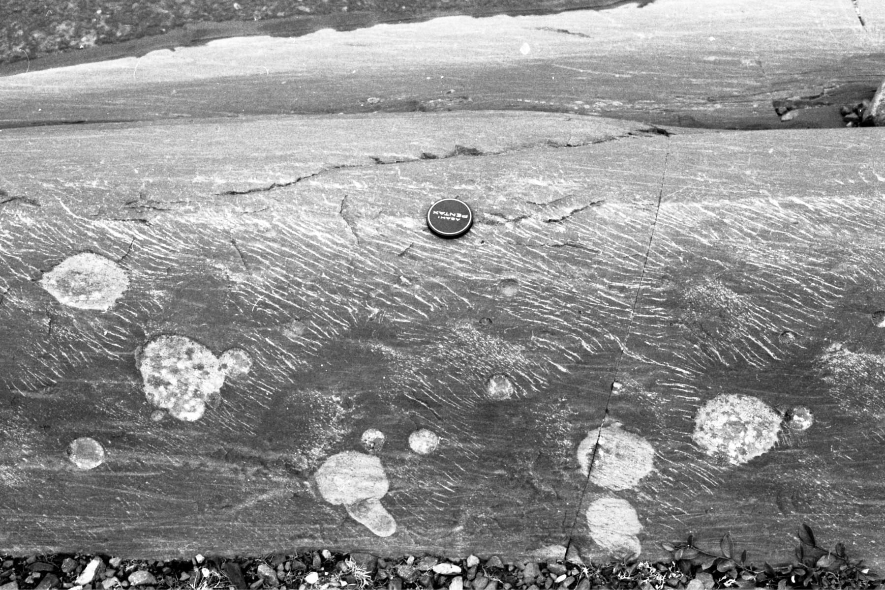
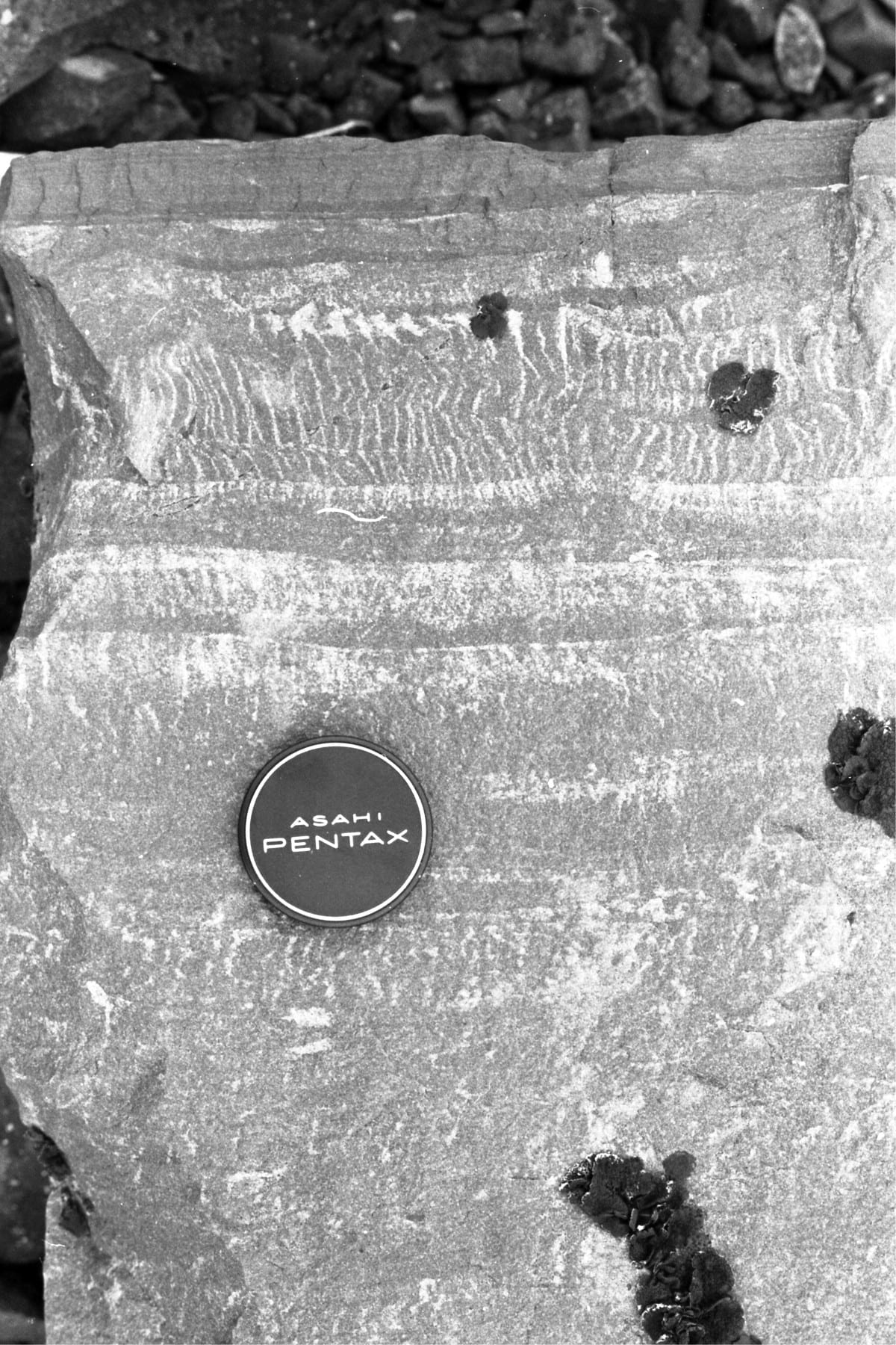
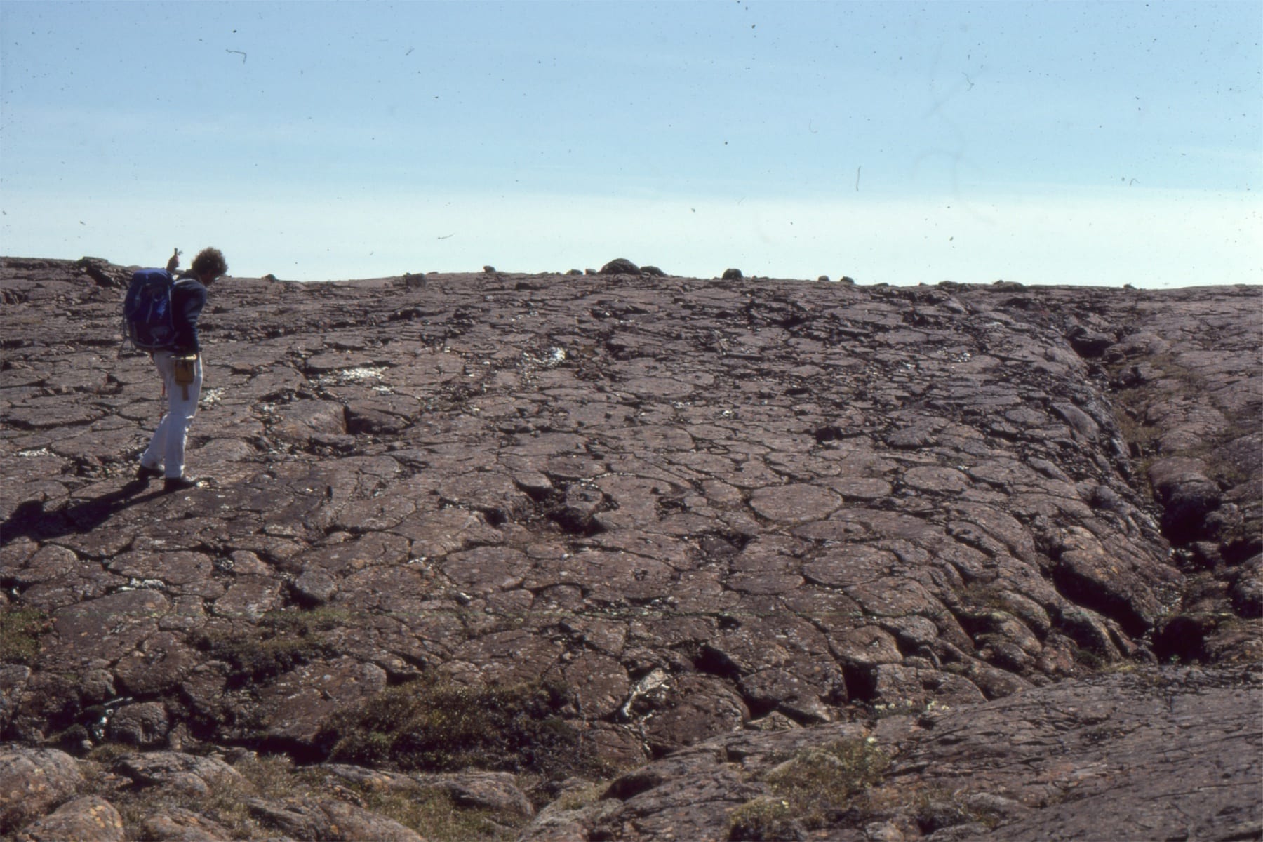
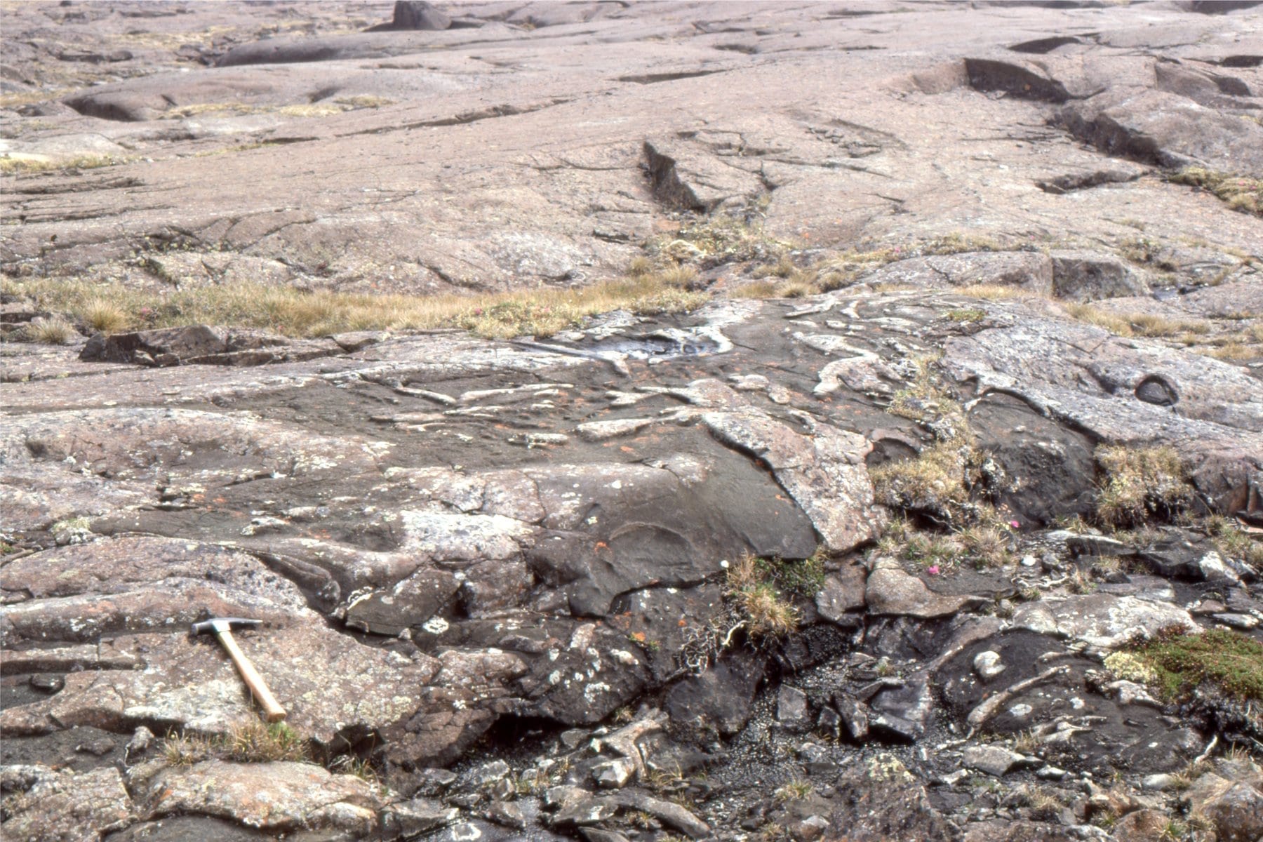
Jointed lava flows and wrap-around piles of pillow lavas on Flaherty Island. Outcrops often permit the 3-dimensional geometry of flows and pillows to be mapped.
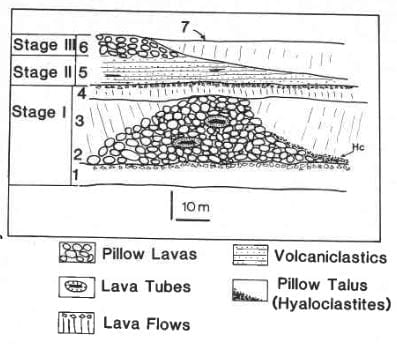 An interpretation of interleaving flows and pillowed lavas, and associated volcaniclastics. The figure is from a 1982 paper: Volcaniclastic rocks and volcaniclalstic facies in the Middle Precambrian (Aphebian) Belcher Group, Northwest Territories, Canada. Canadian Journal of Earth Sciences, v. 19, p. 1275-1294.
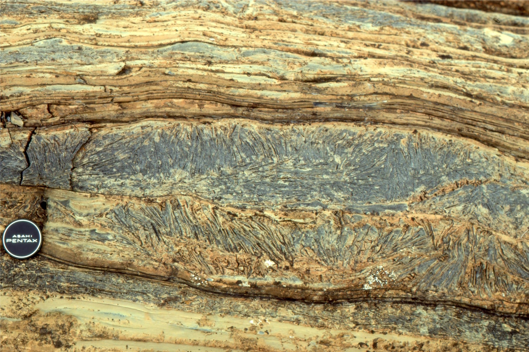
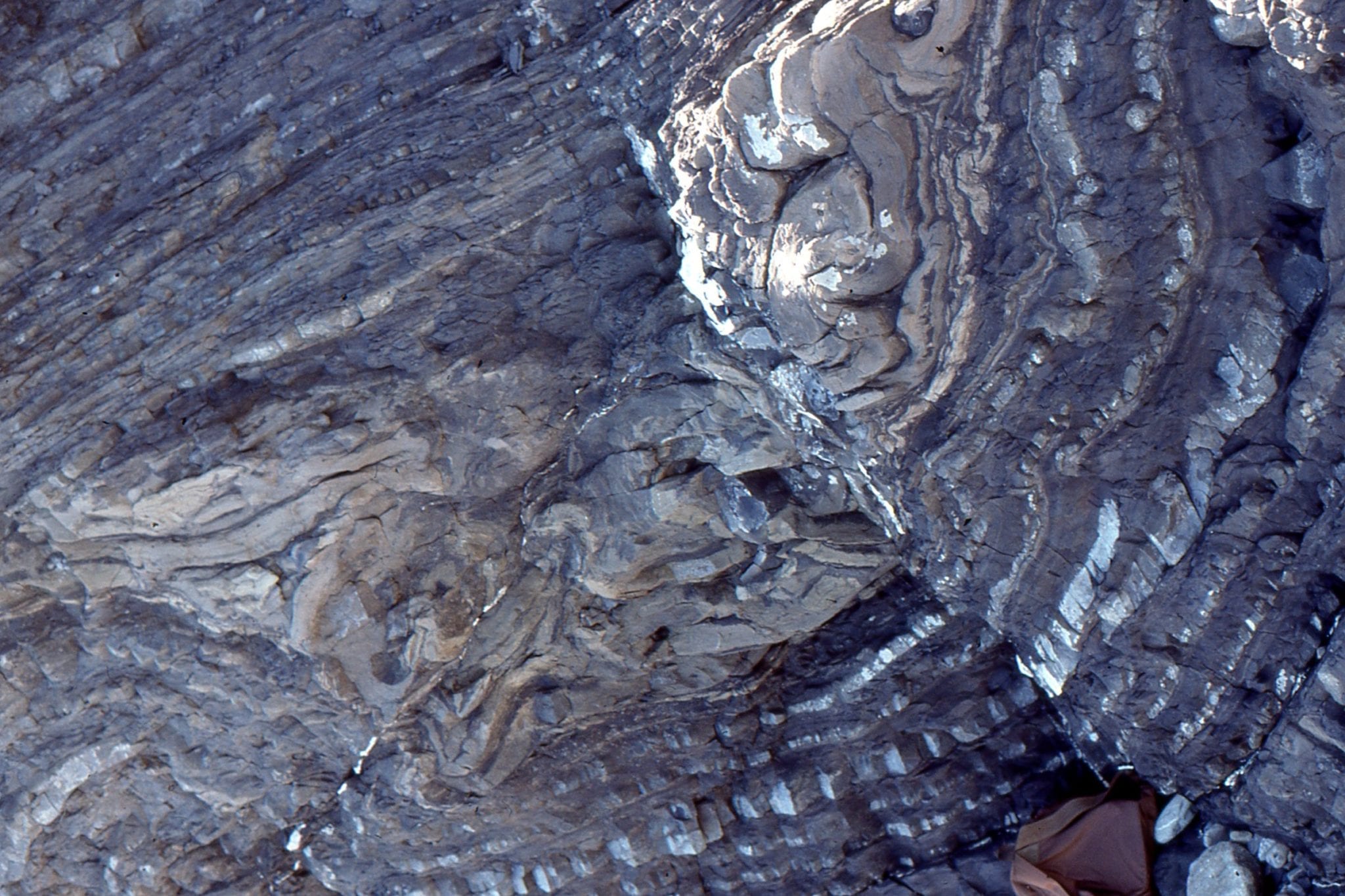
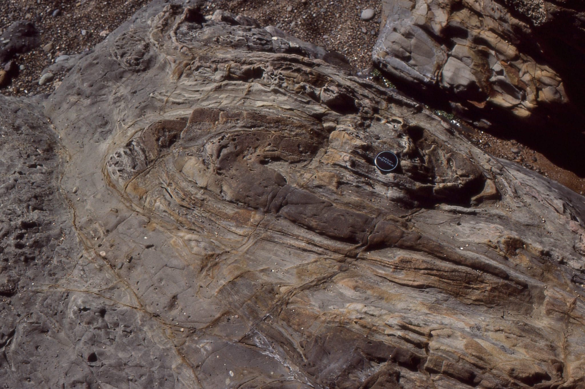
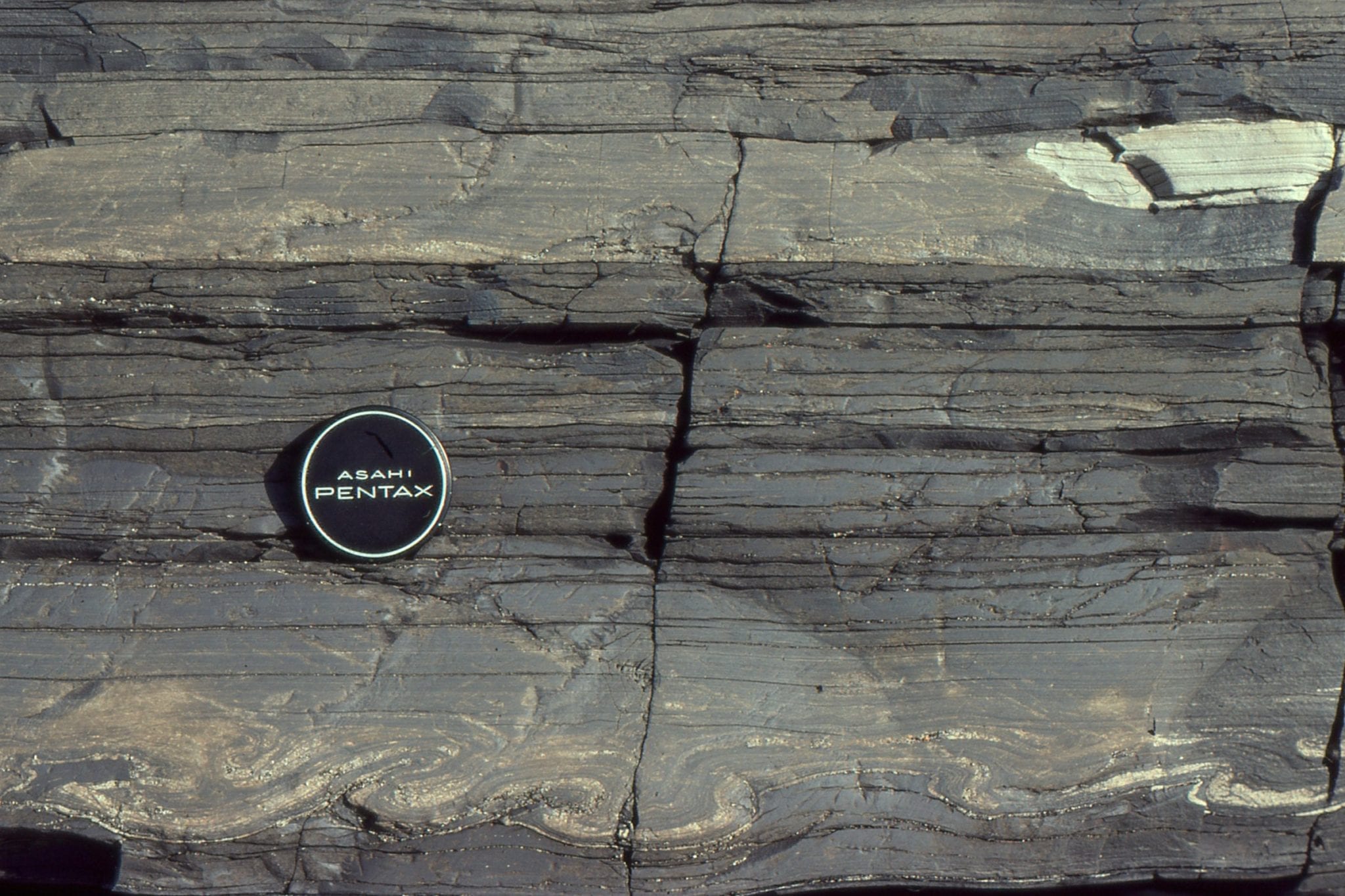
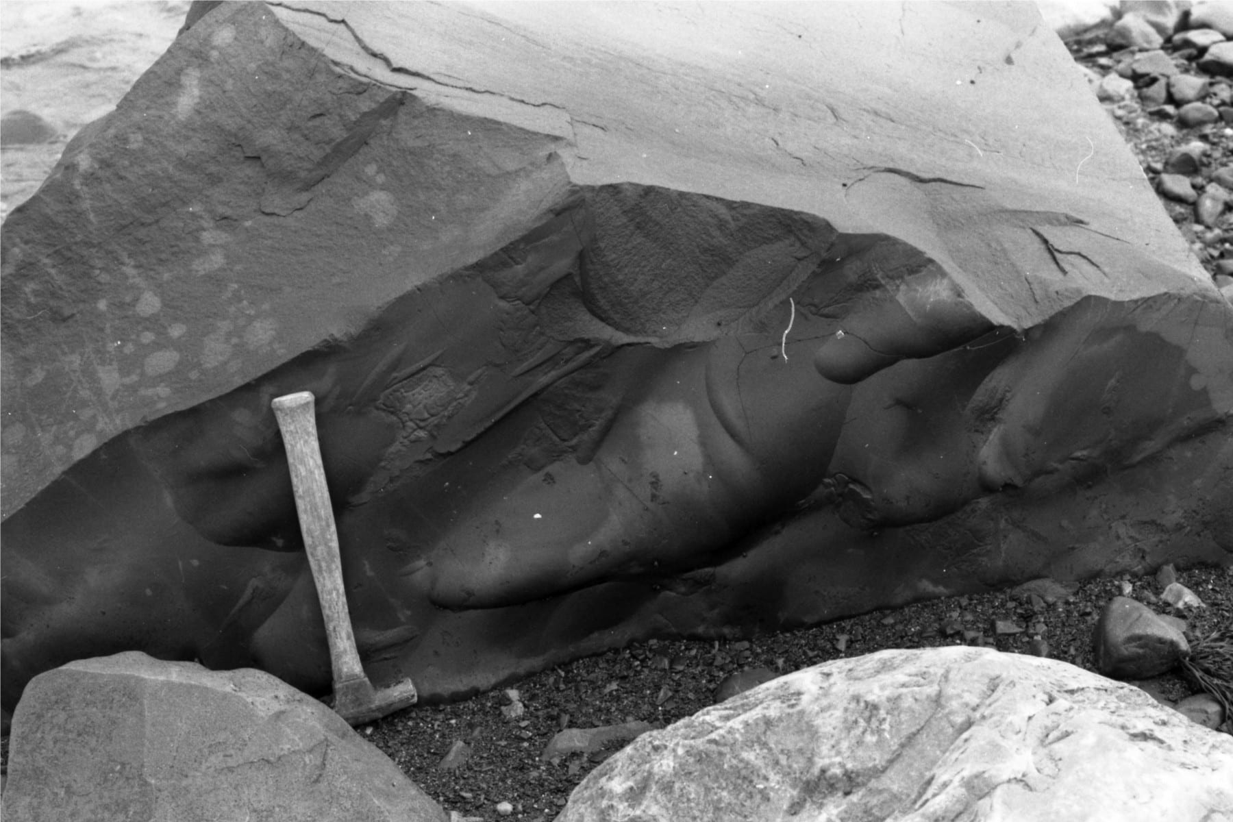
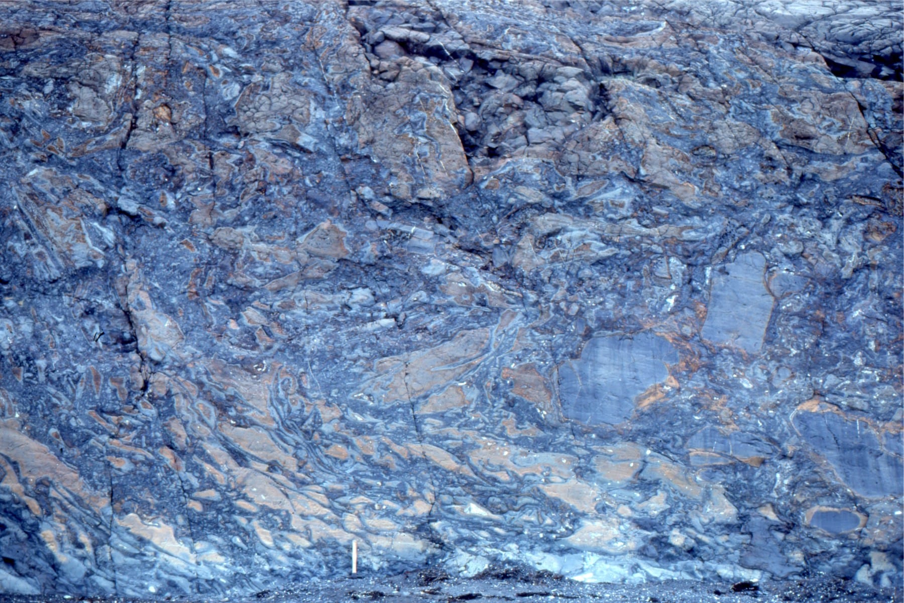
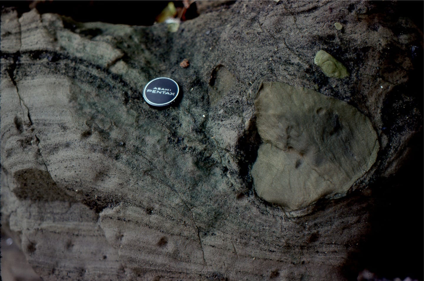
Spheroidal, lobate, and lozenge-like pillow lavas. Left: the main pile is overlain and partly amalgamated with a second pile (top to the right), separated by a layer of glassy fragments formed by thermal shock. West Flaherty Island. Right: Oblique section through pillows, shows chilled margins with small vesicle traces (formerly gas bubbles).
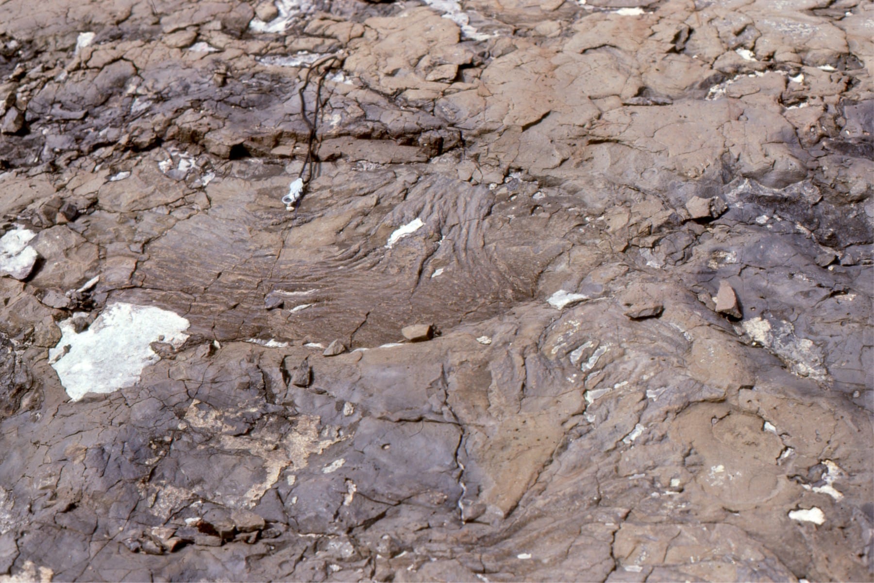
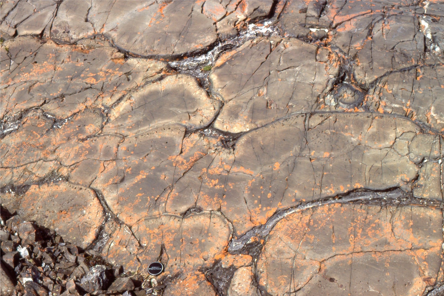
Surface structures on pillows. Left: small ropy festoons. Right: crudely polygonal crusts formed by rapid cooling in the Precambrian ocean.
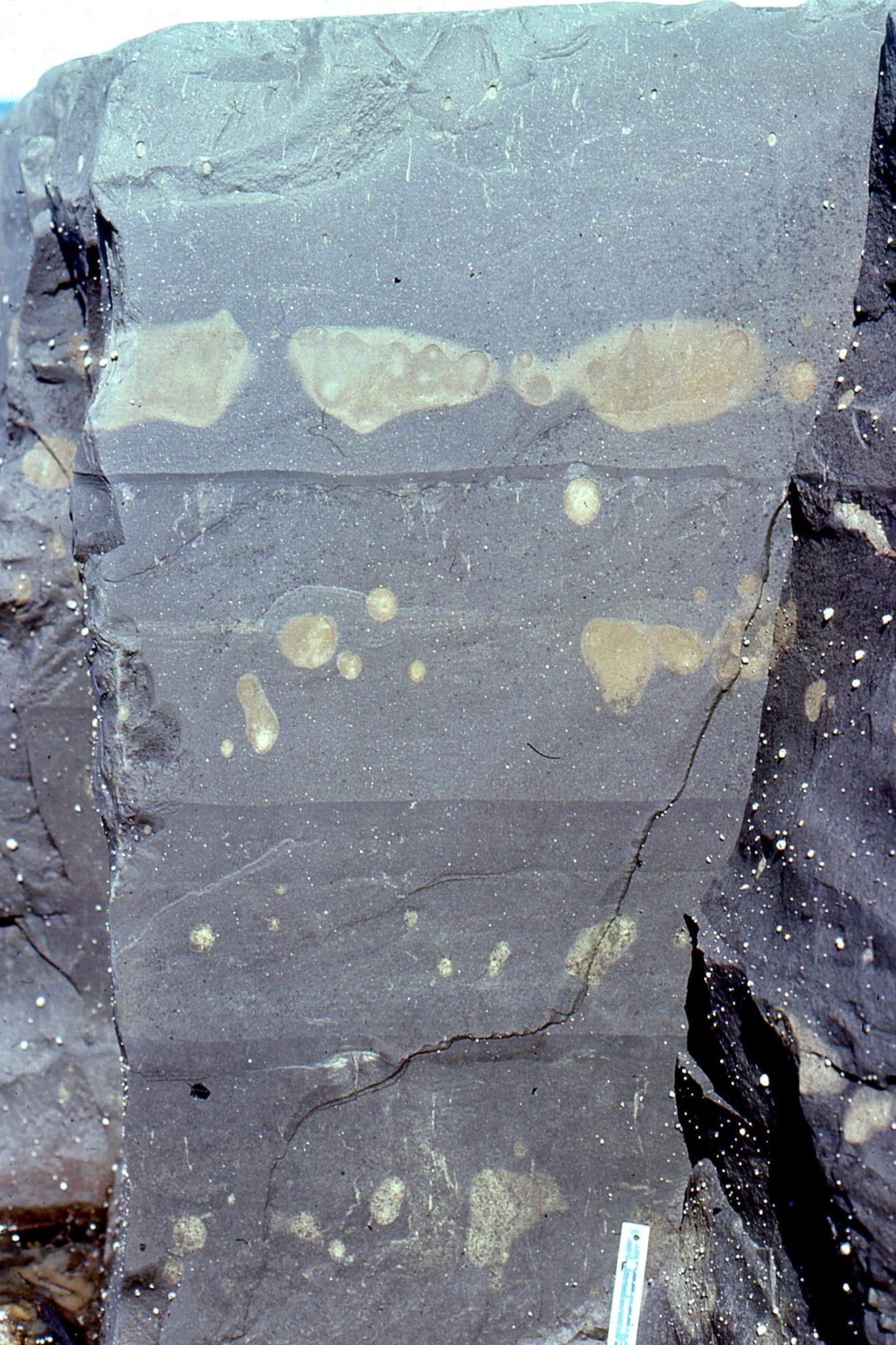
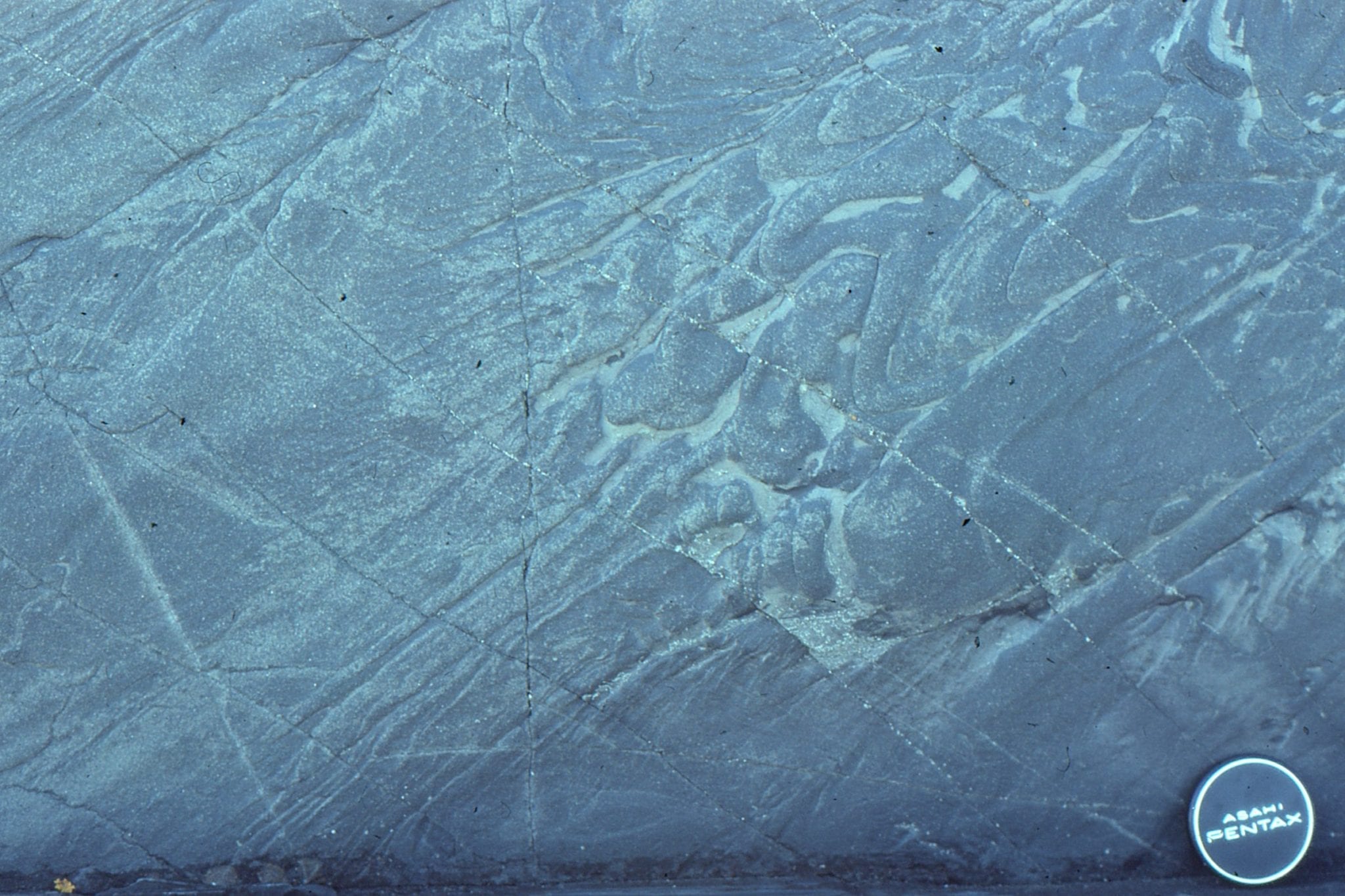
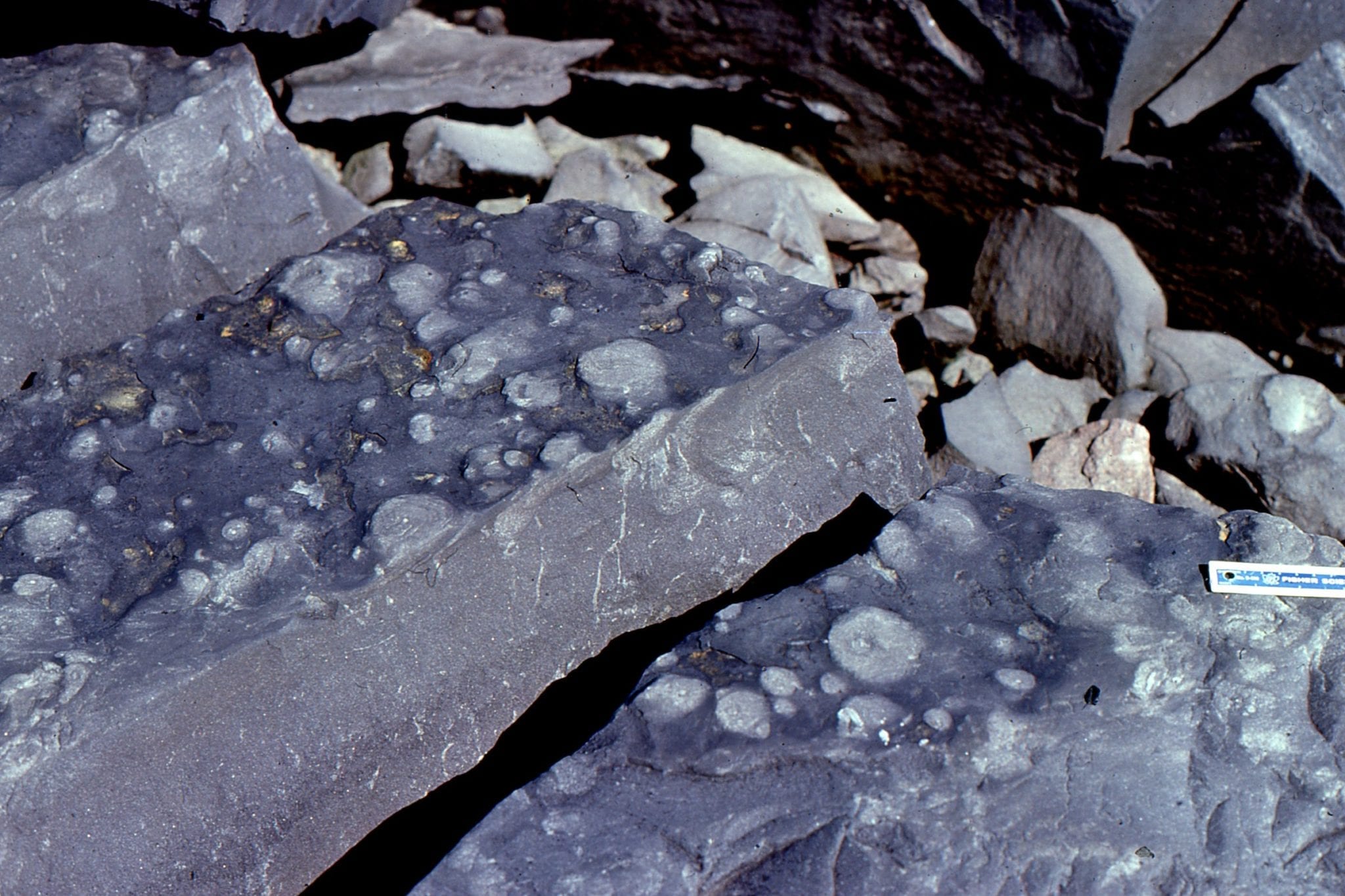
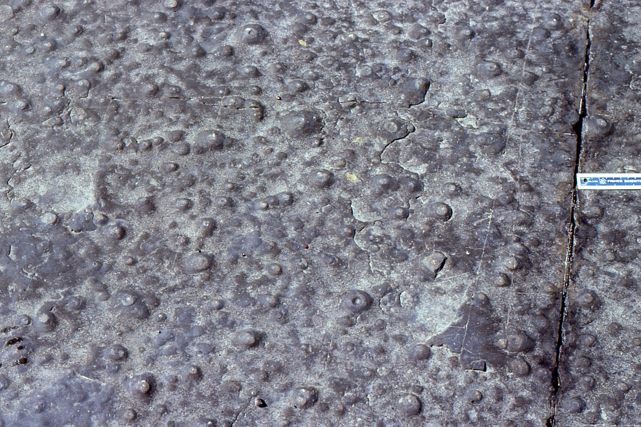
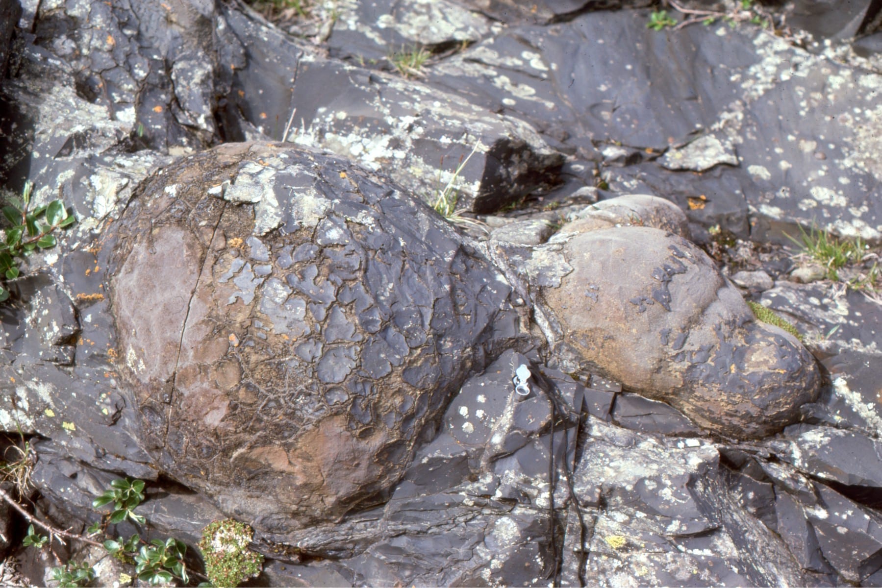
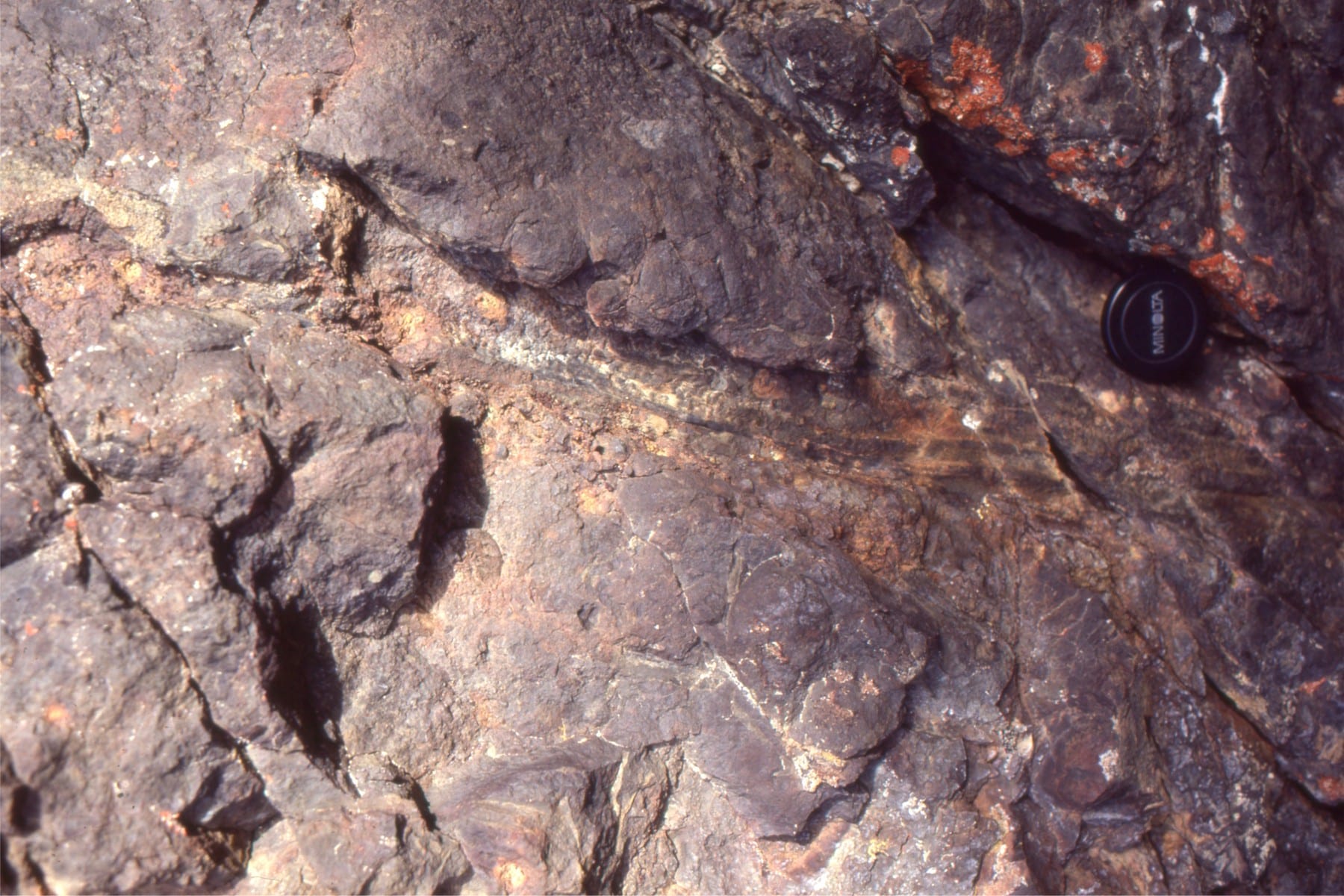
Left: Lozenge-shaped pillows with central flat-bottomed gas cavities, now filled with coarse calcite and prehnite crystals. Right: Filling of a pillow interstice with a layer of shards formed by thermal shock, overlain by coarse calcite. Look closely and you will see the first generation calcite grew in radial clusters on the pillow margin. Both structures (also called geopetal structures) are useful for determining stratigraphic way-up (top).
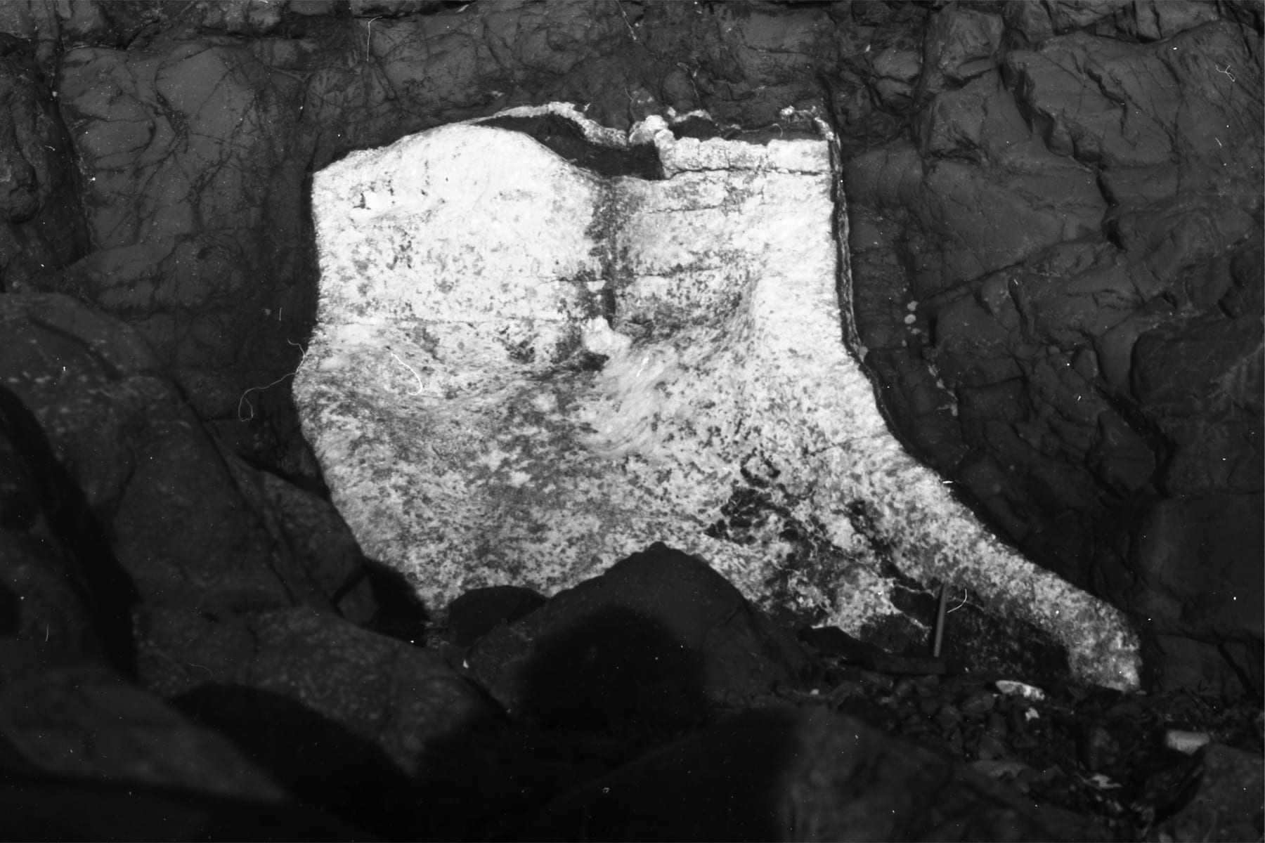
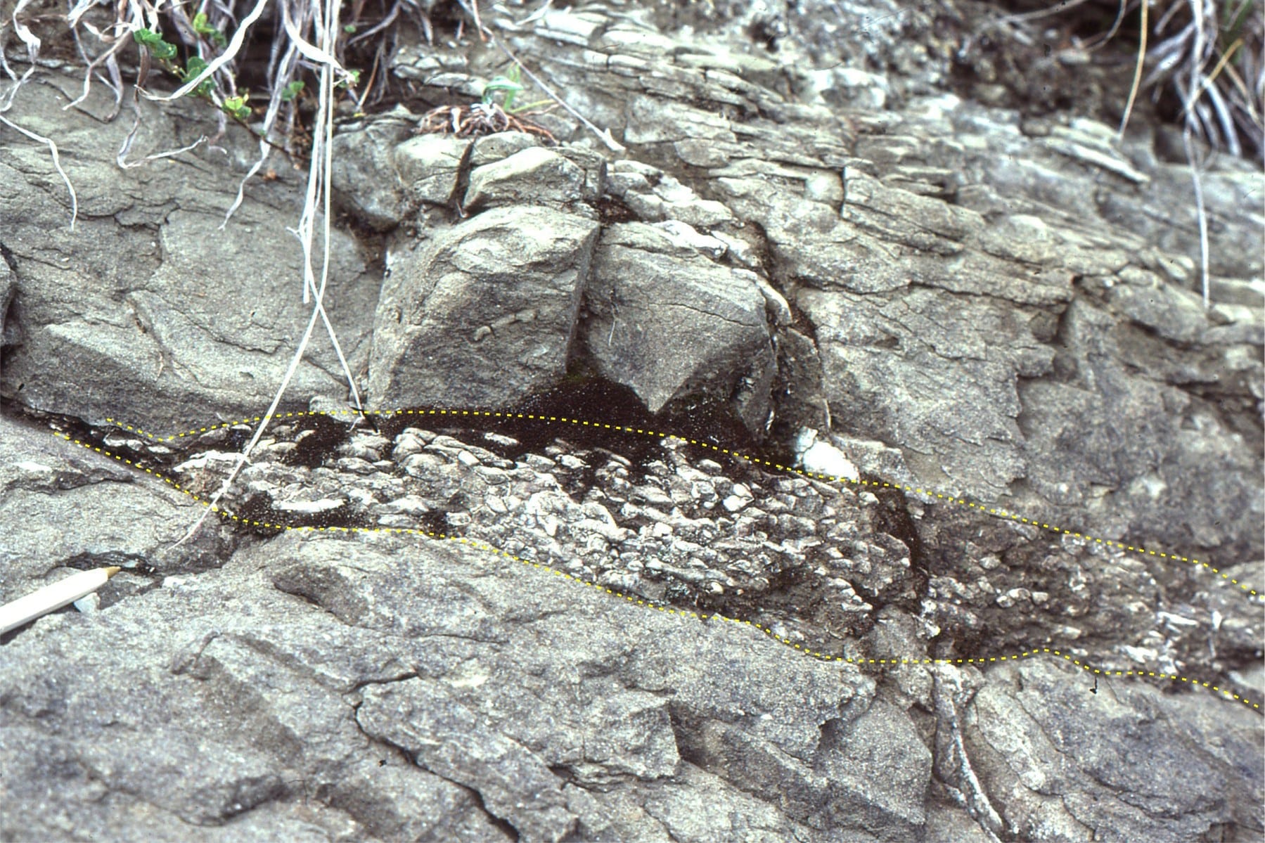
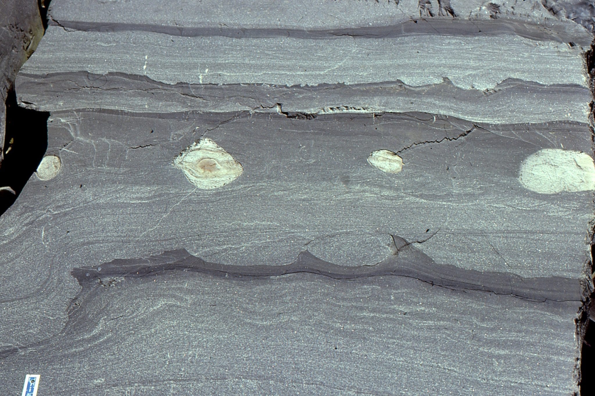
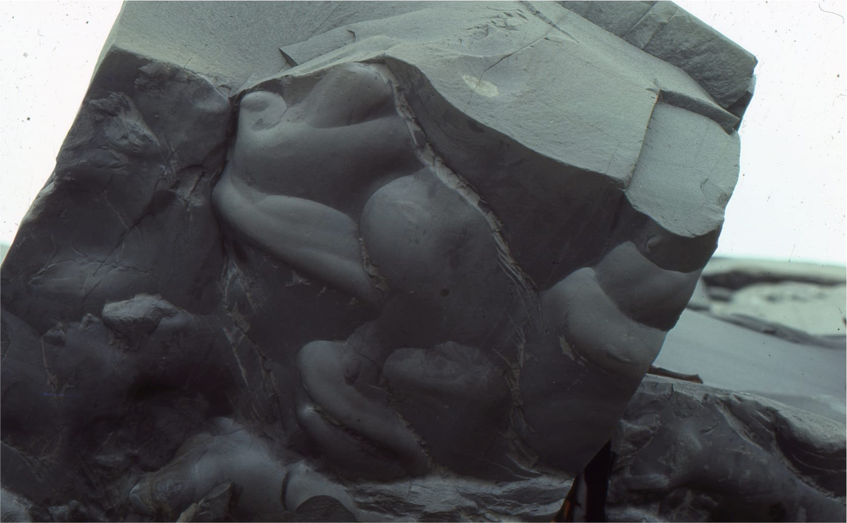
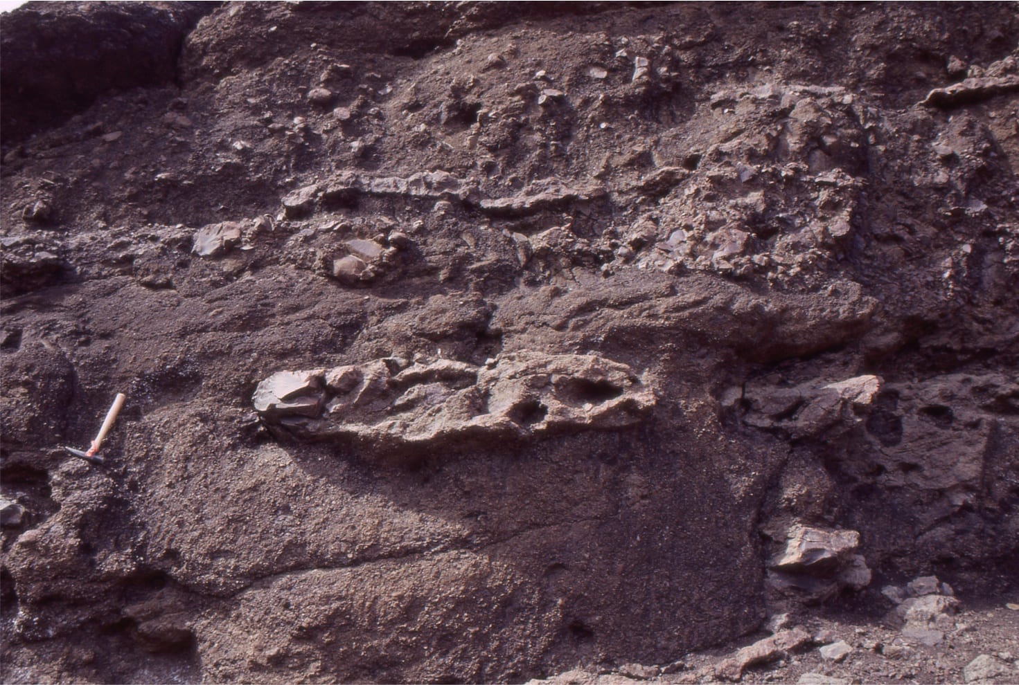
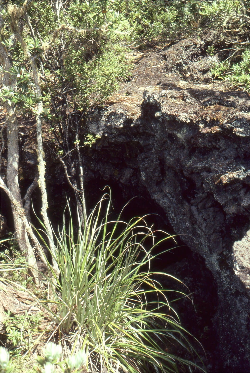
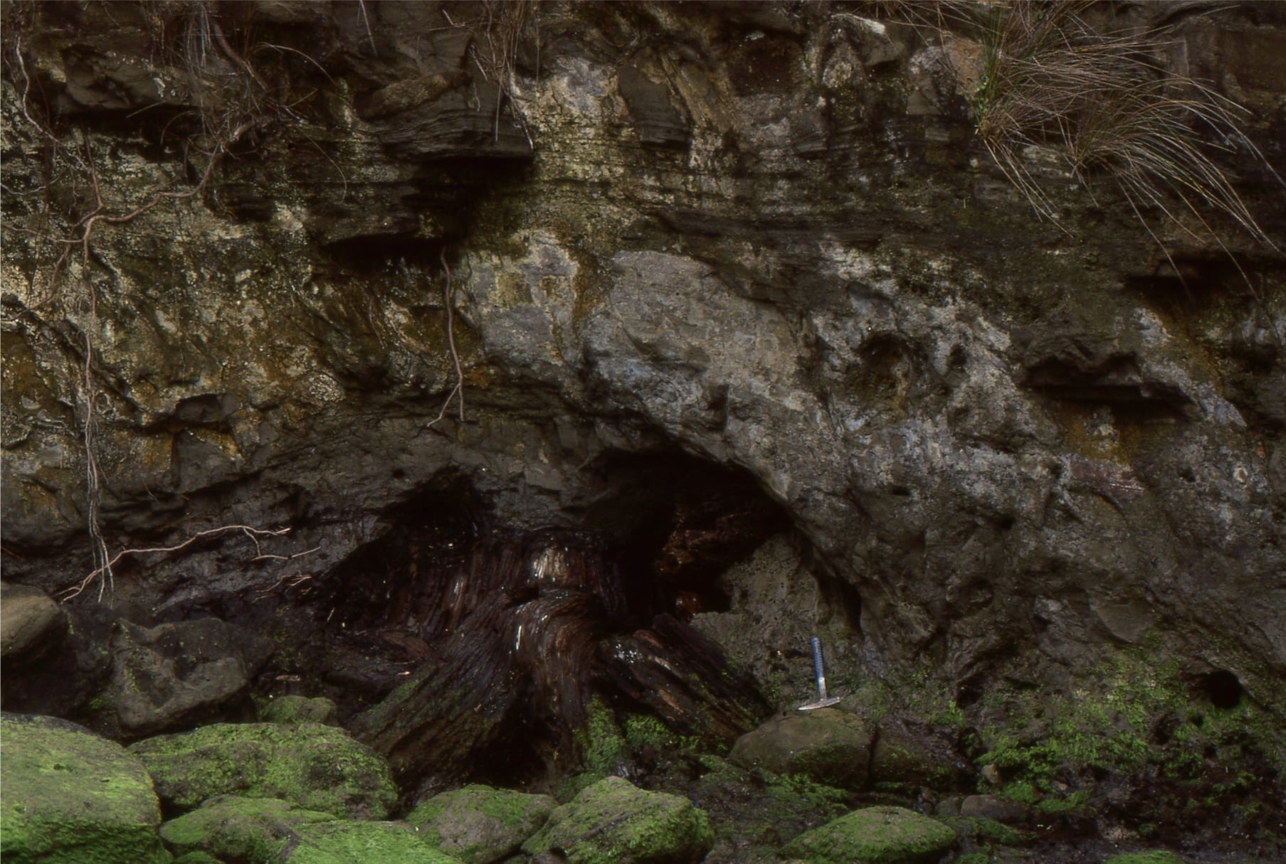
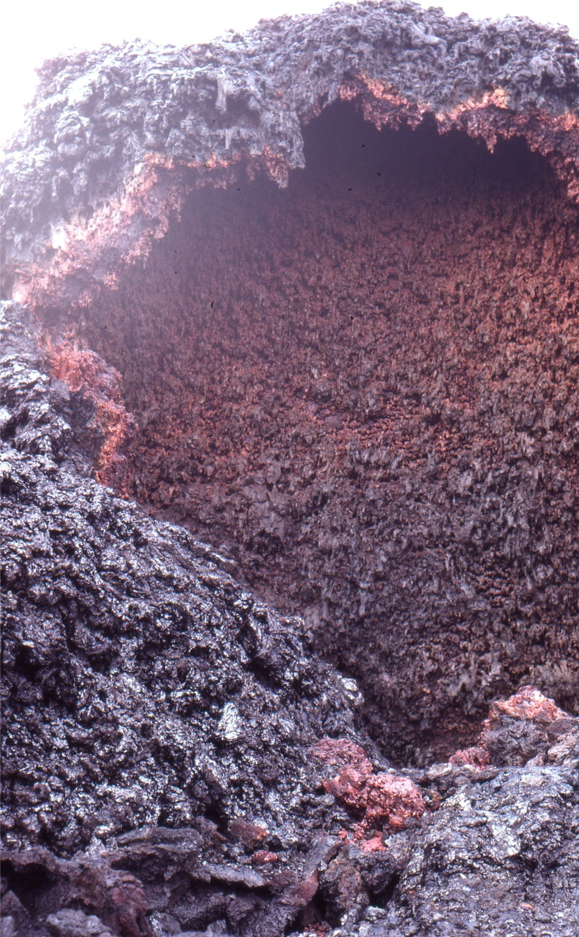
Small lava tube that acted as a feeder to the pillow lavas. Lava in the tube must have drained, leaving an open tube that was subsequently filled by very coarse calcite crystals.
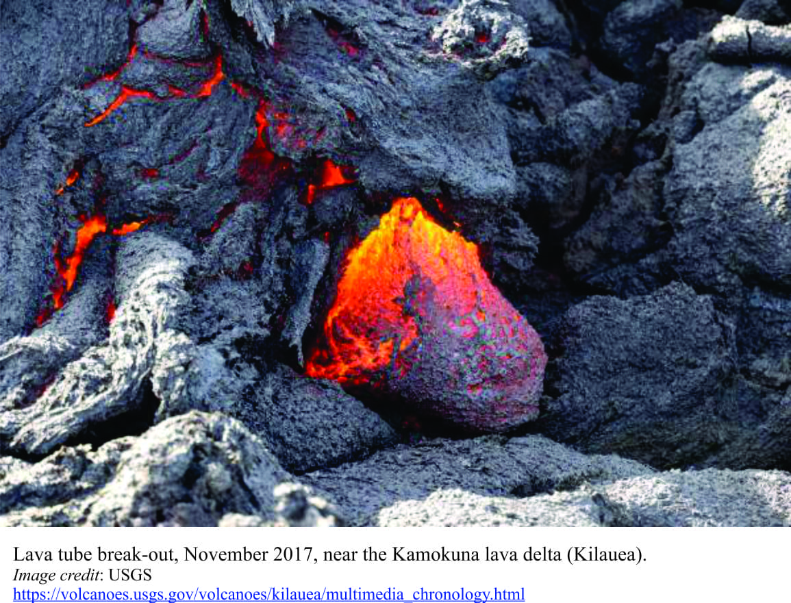 A recent lava tube breakout on Kamokuna lava delta, November 2017, Hawaii. This example is on land, but serves as a useful analogy to the submarine lava tube in the image immediately above.
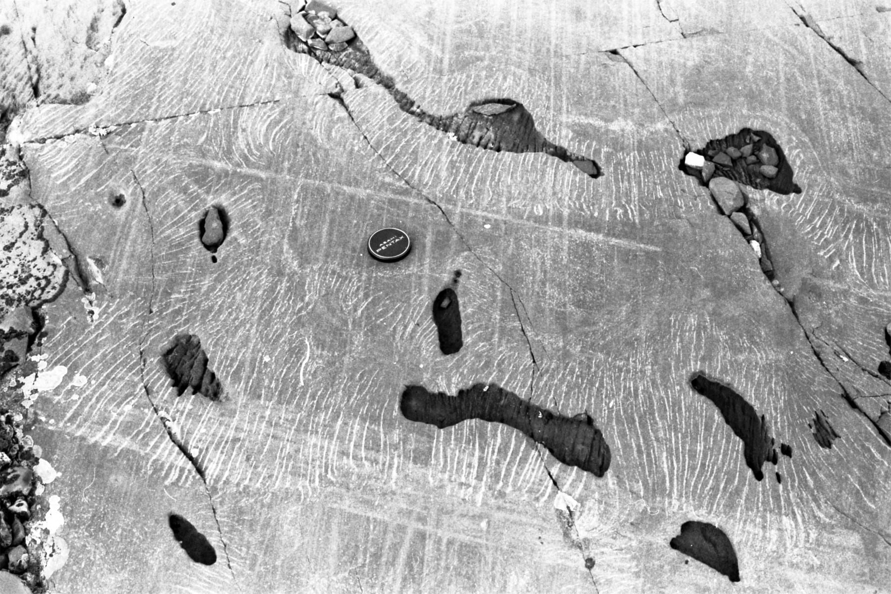
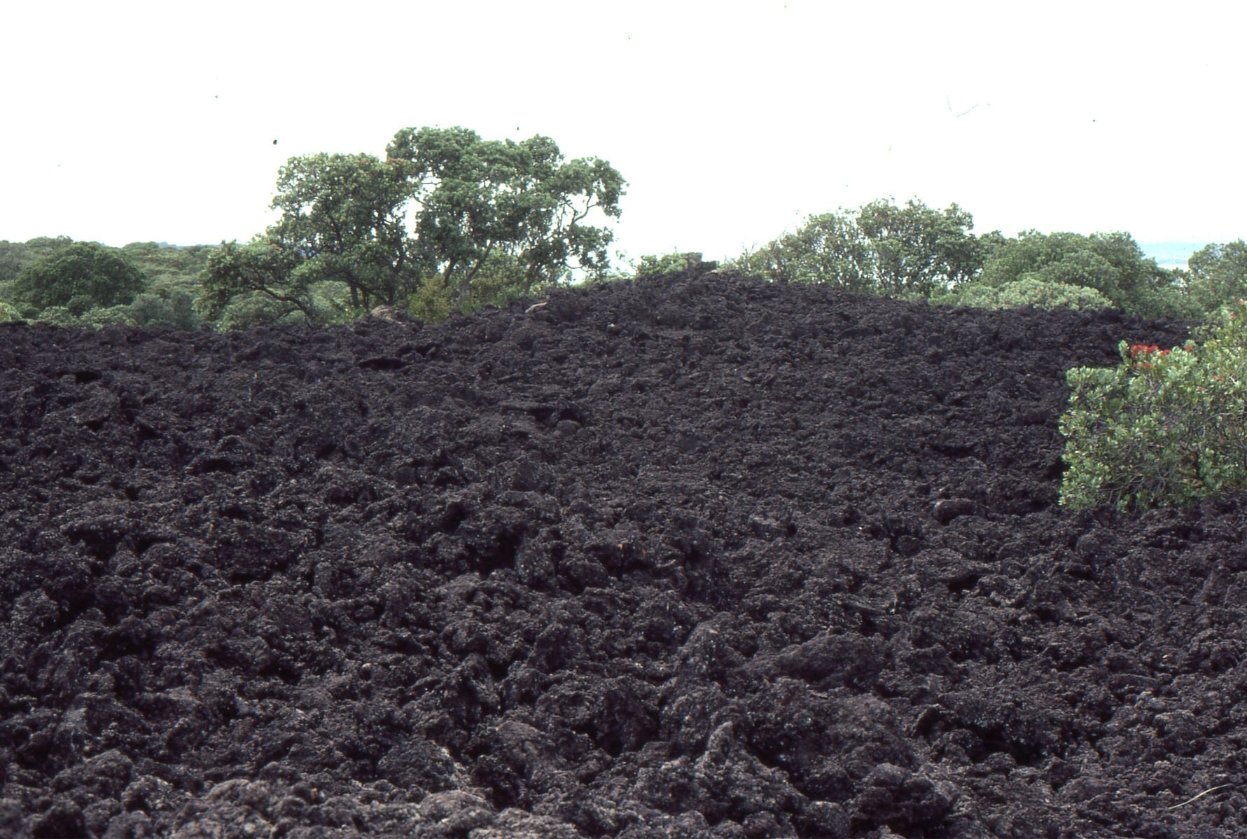
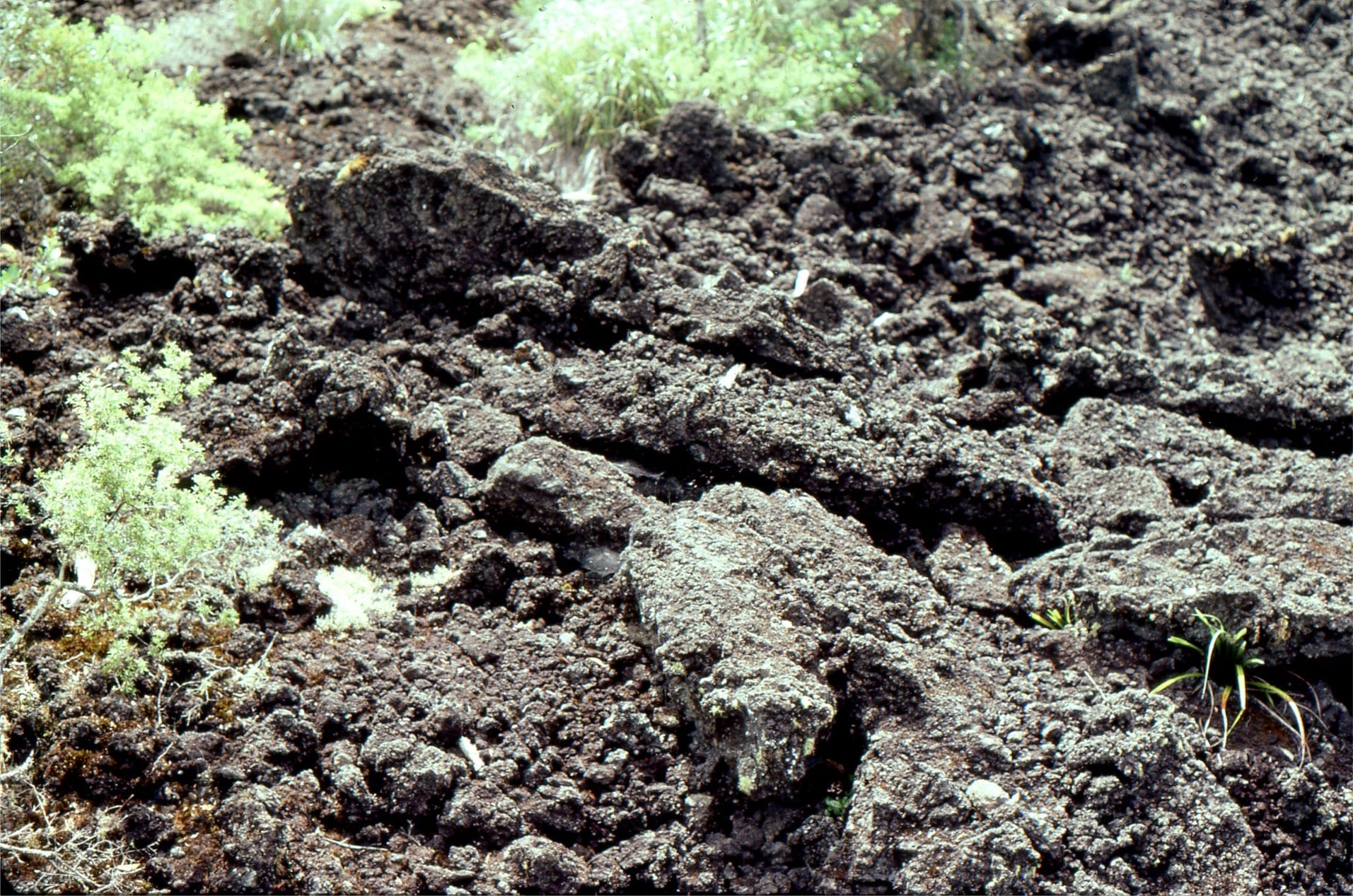
Two perspectives of the tops of lava flows. Left: A bedding view (looking down on the flow top) of brecciated, folded and generally squished basalt fragments that formed as the flow cooled, and were carried along the top of the flow. The oblique grooves across the rock face were formed by glacial scouring. Right: Cross-section through a lava flow; the upper part is completely broken up by movement as the lava solidified. More coherent, less fragmented rock occurs below this (lower right), was deeper in the flow and cooled more slowly.
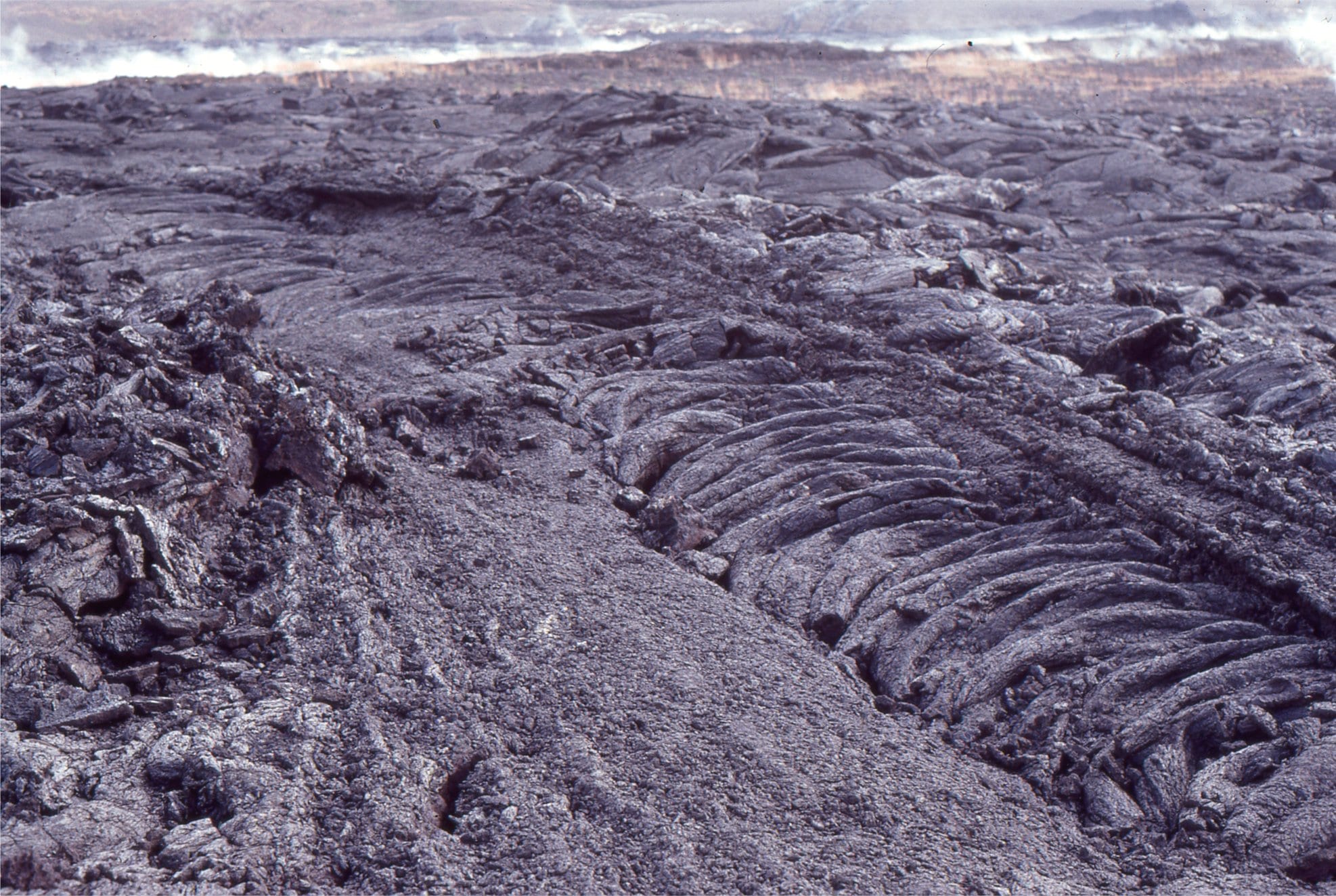
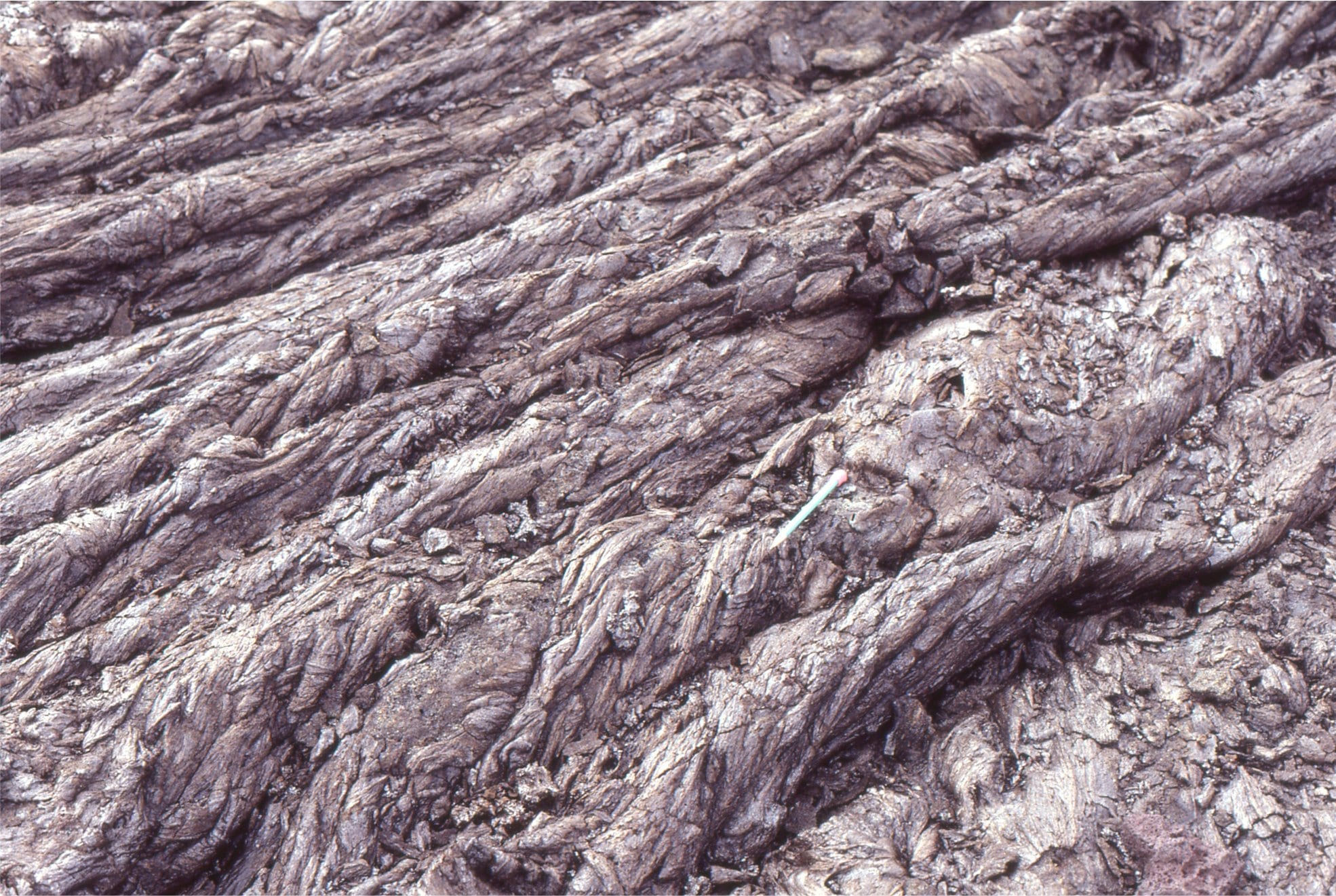
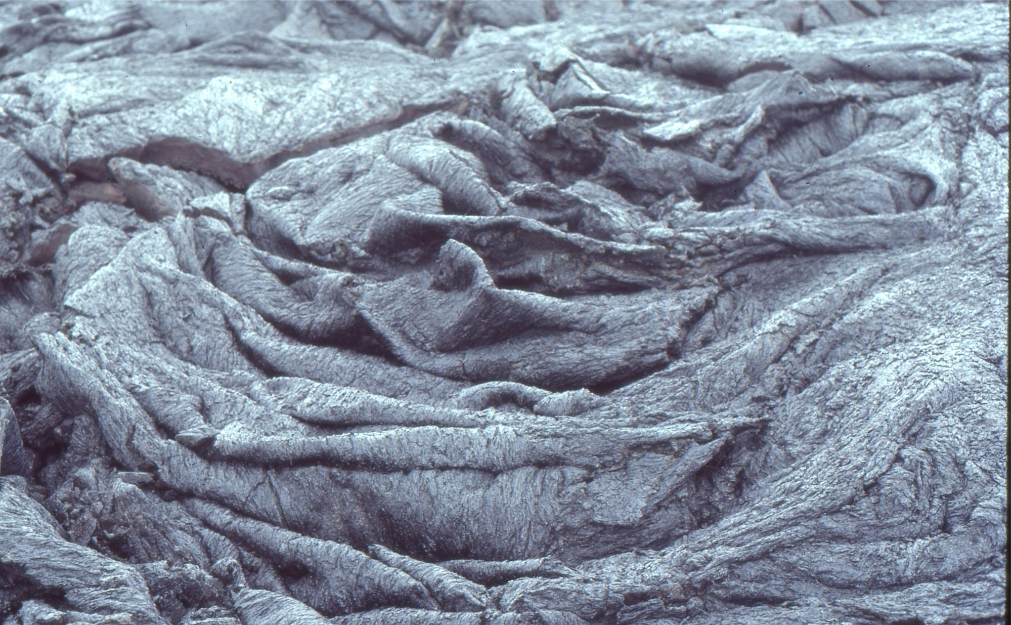
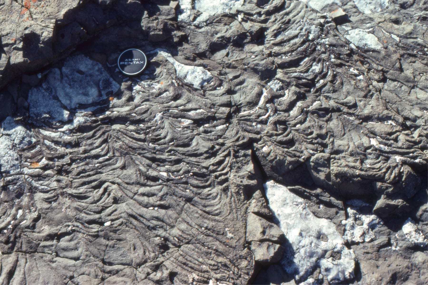 Highly fluid lava flows formed ropy festoons. Here, flow direction was approximately from upper left to lower right.
The base of a lava flow will also cool more quickly, especially if sediment or rock beneath is wet. Cooling here has resulted in rapid expansion of gas bubbles, (probably steam) that have risen into the flow forming elongated, sub-vertical, worm-like cavities, or spiracles. On the right, a larger gas bubble has risen above the flow, and subsequently evolved gas into small cavities in a crude radial pattern (arrow).
 Larger gas cavities (vesicles) also form within the flow masses, as volcanic gas (water, CO2, SO2) separates from the melt. Here, the cavities are surrounded by much smaller vesicles.
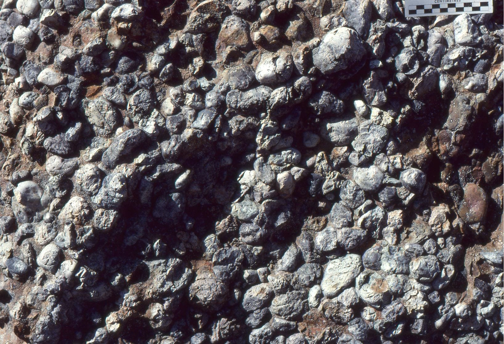
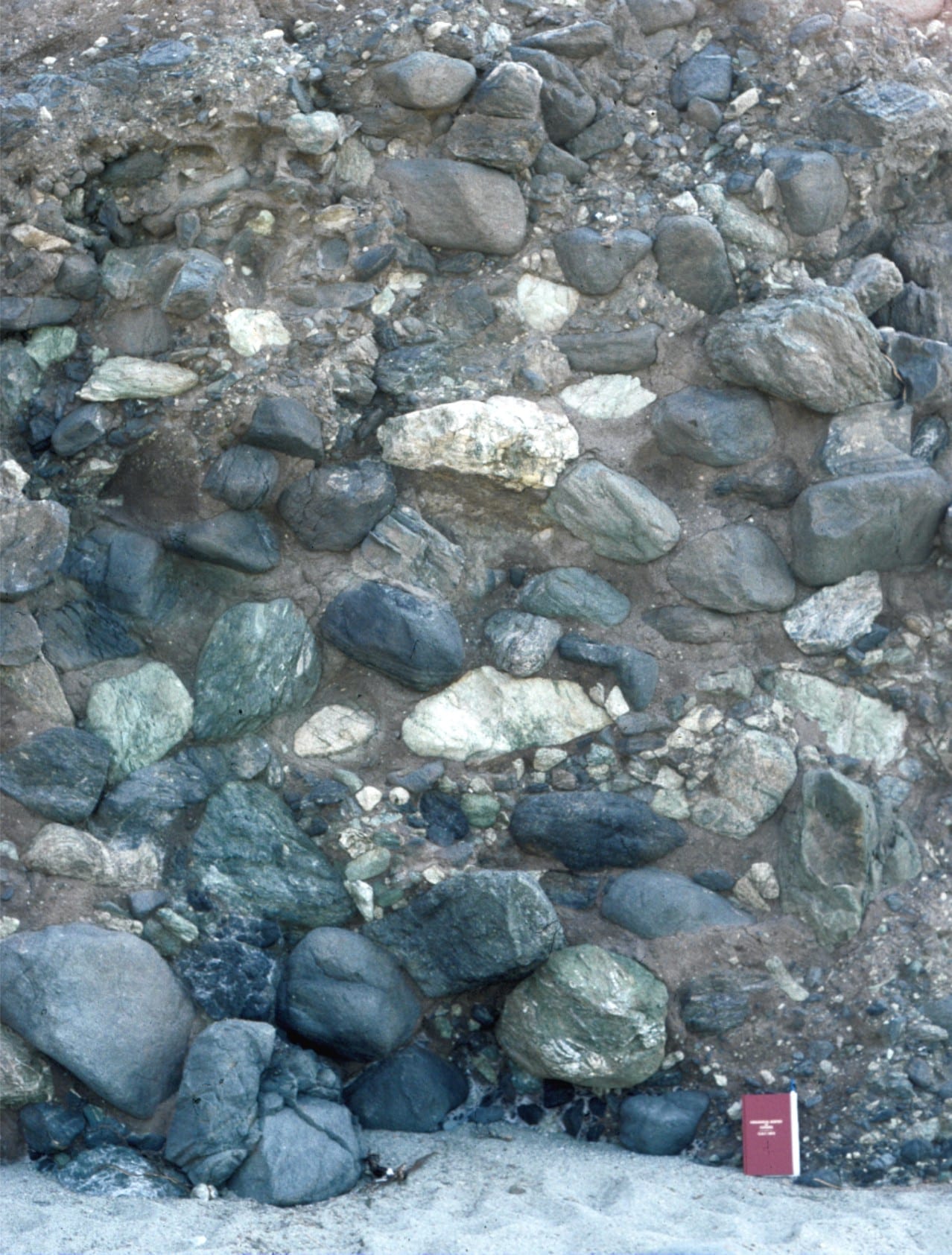
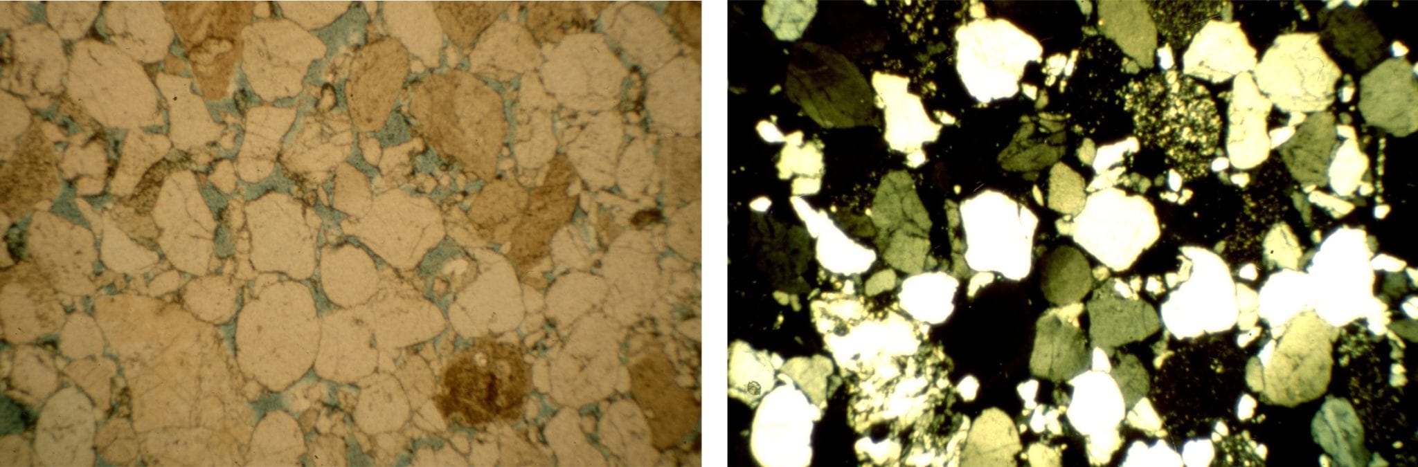
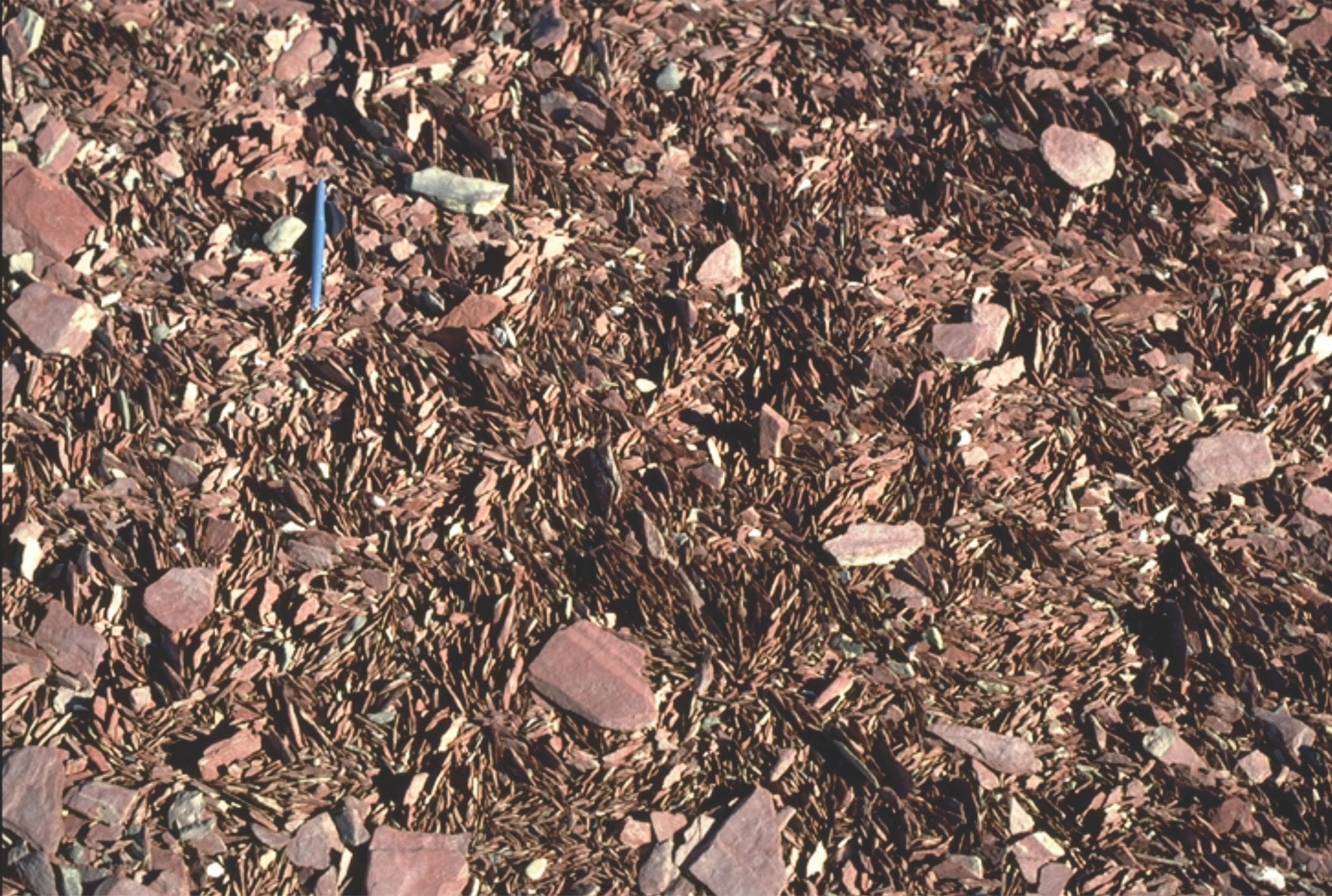
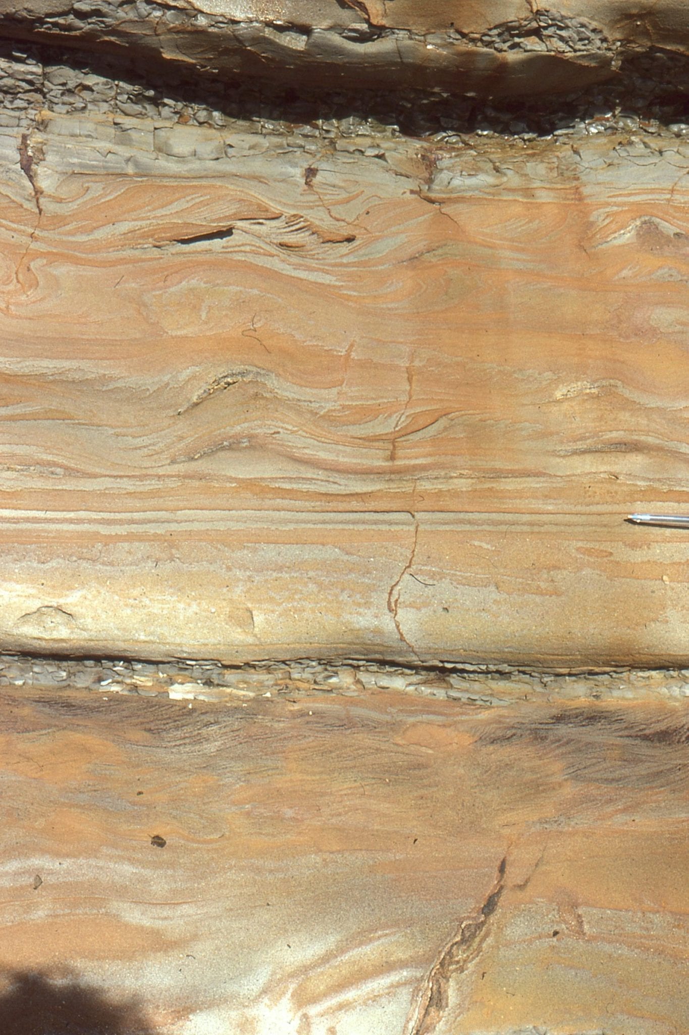
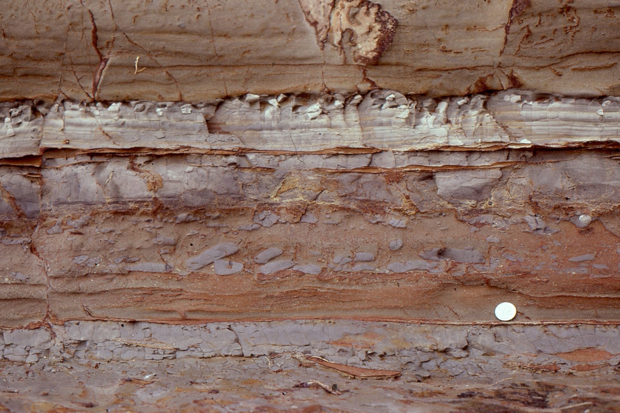
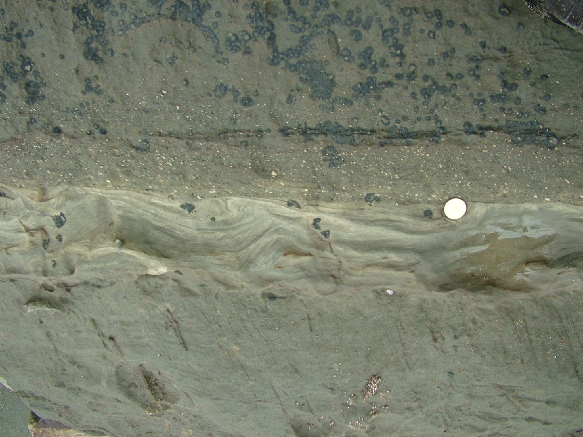
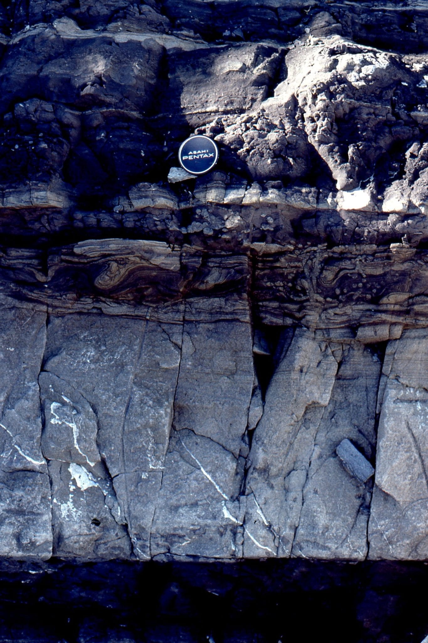
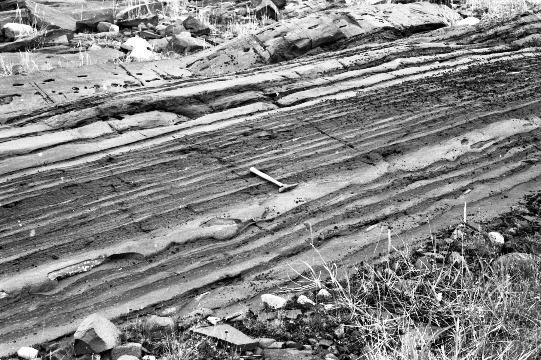
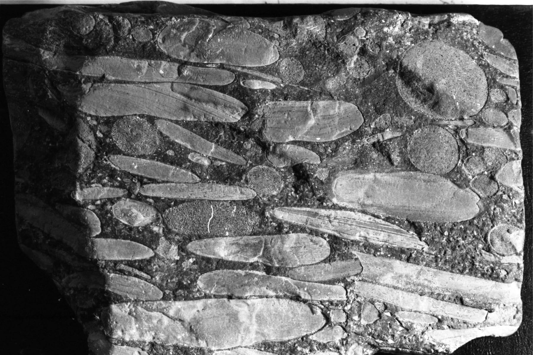
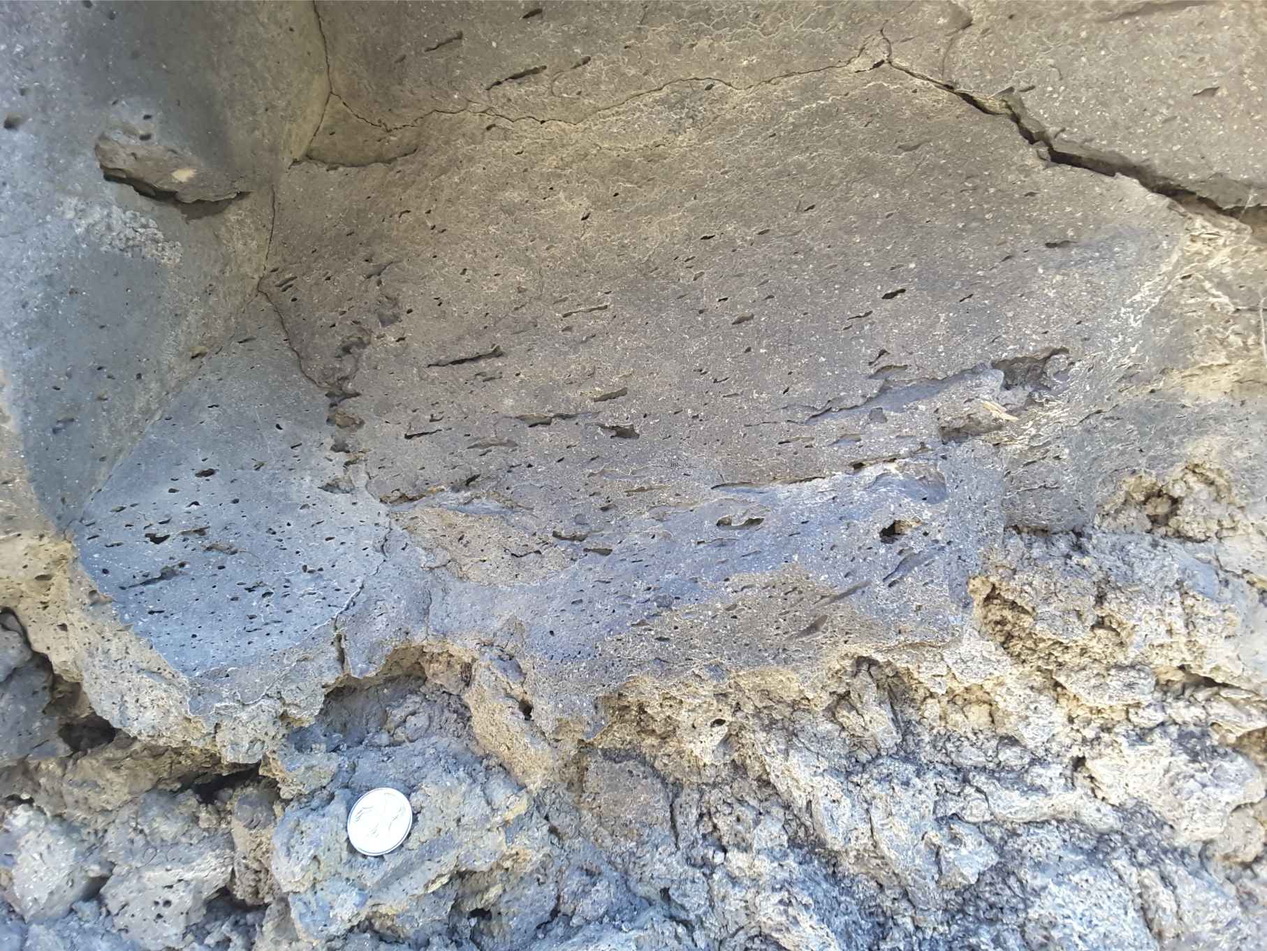
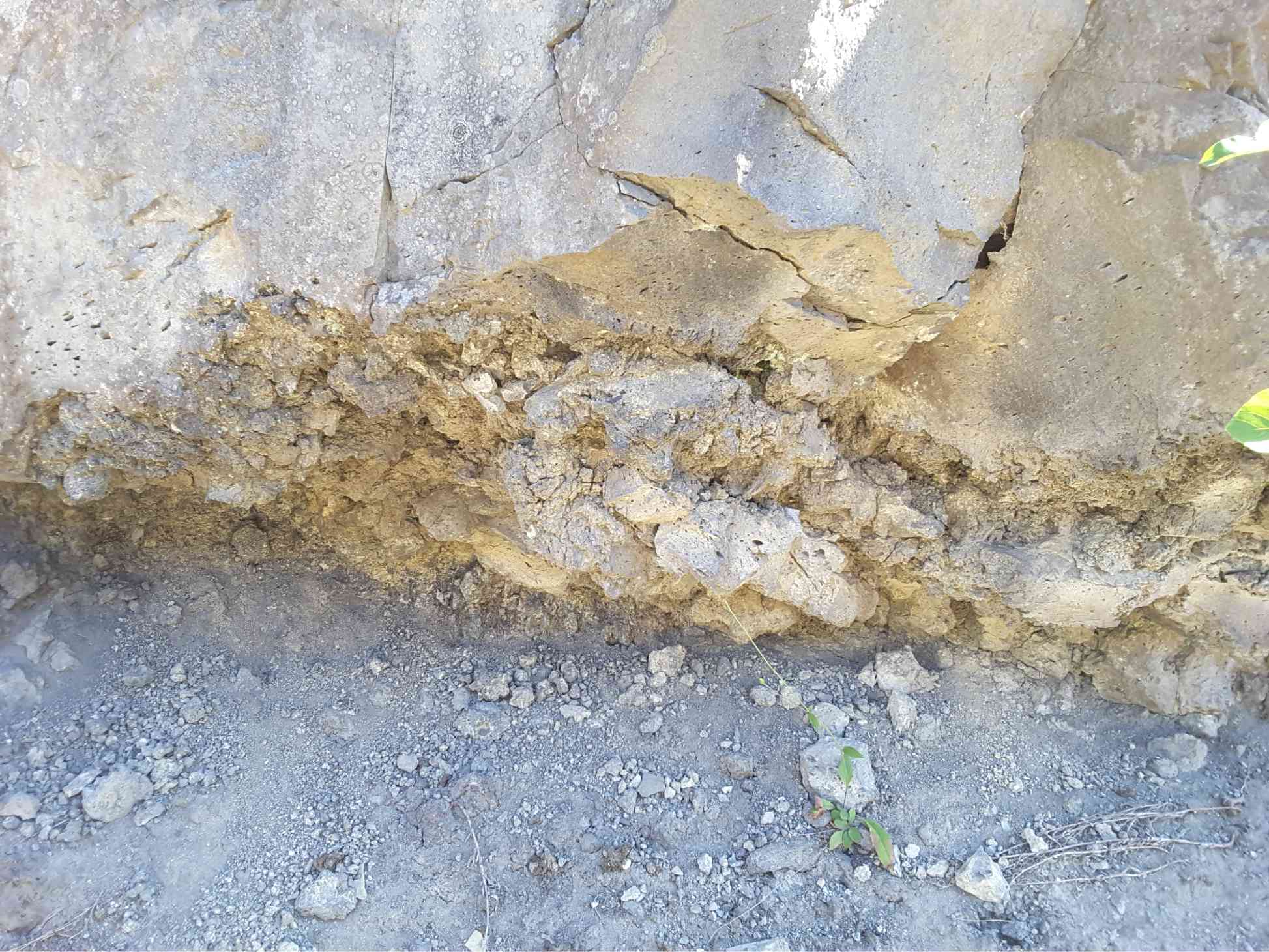
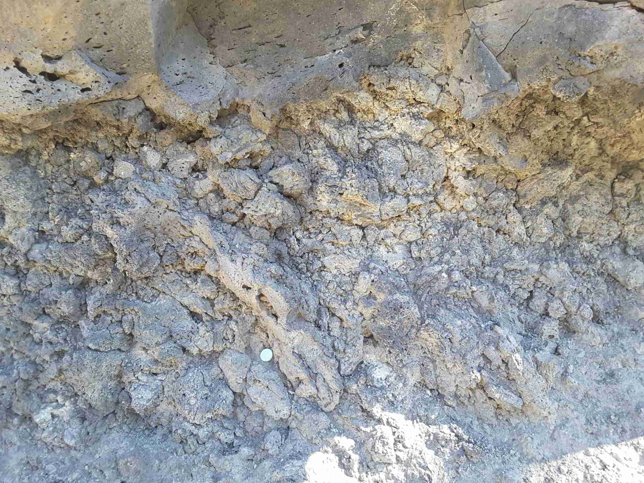
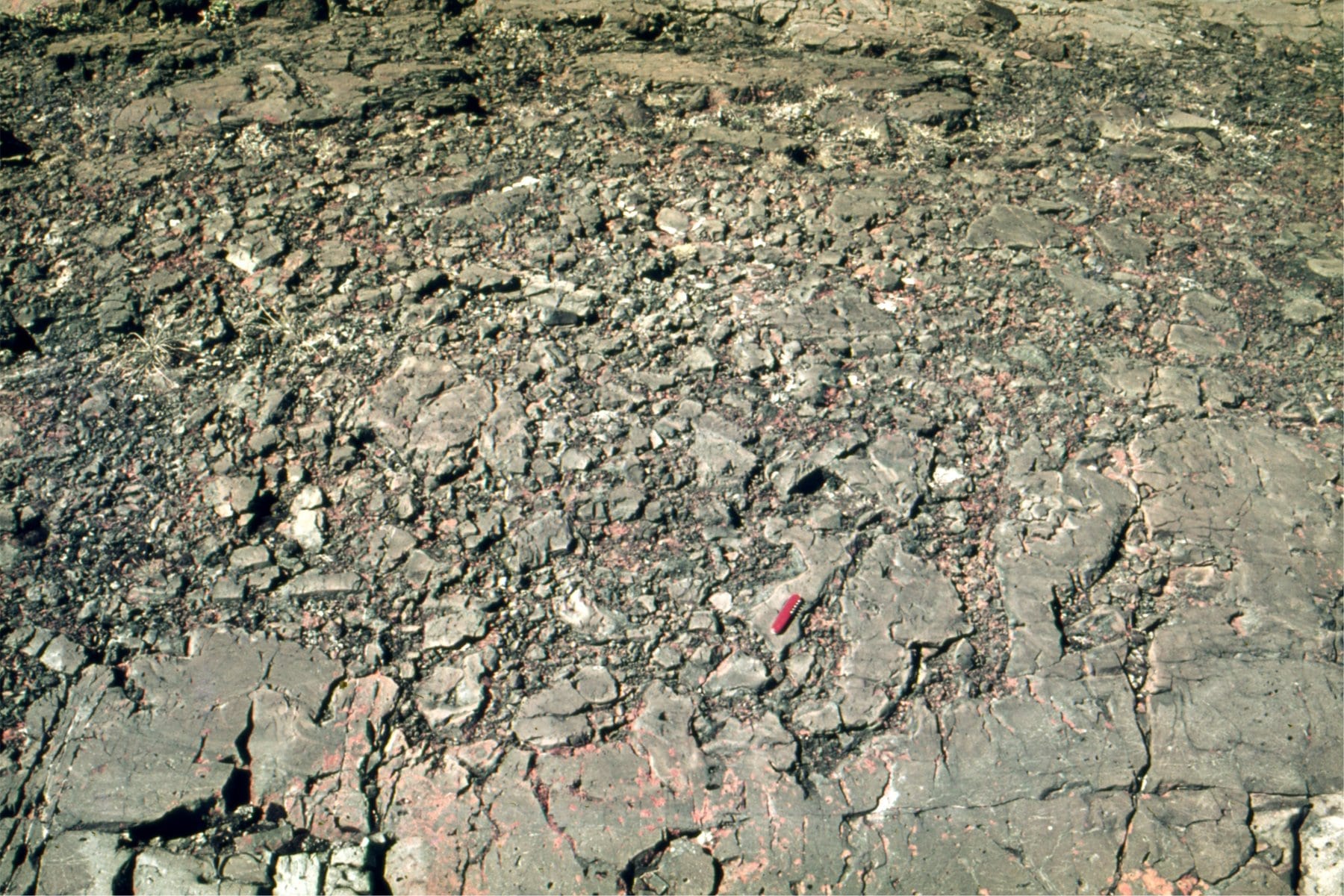
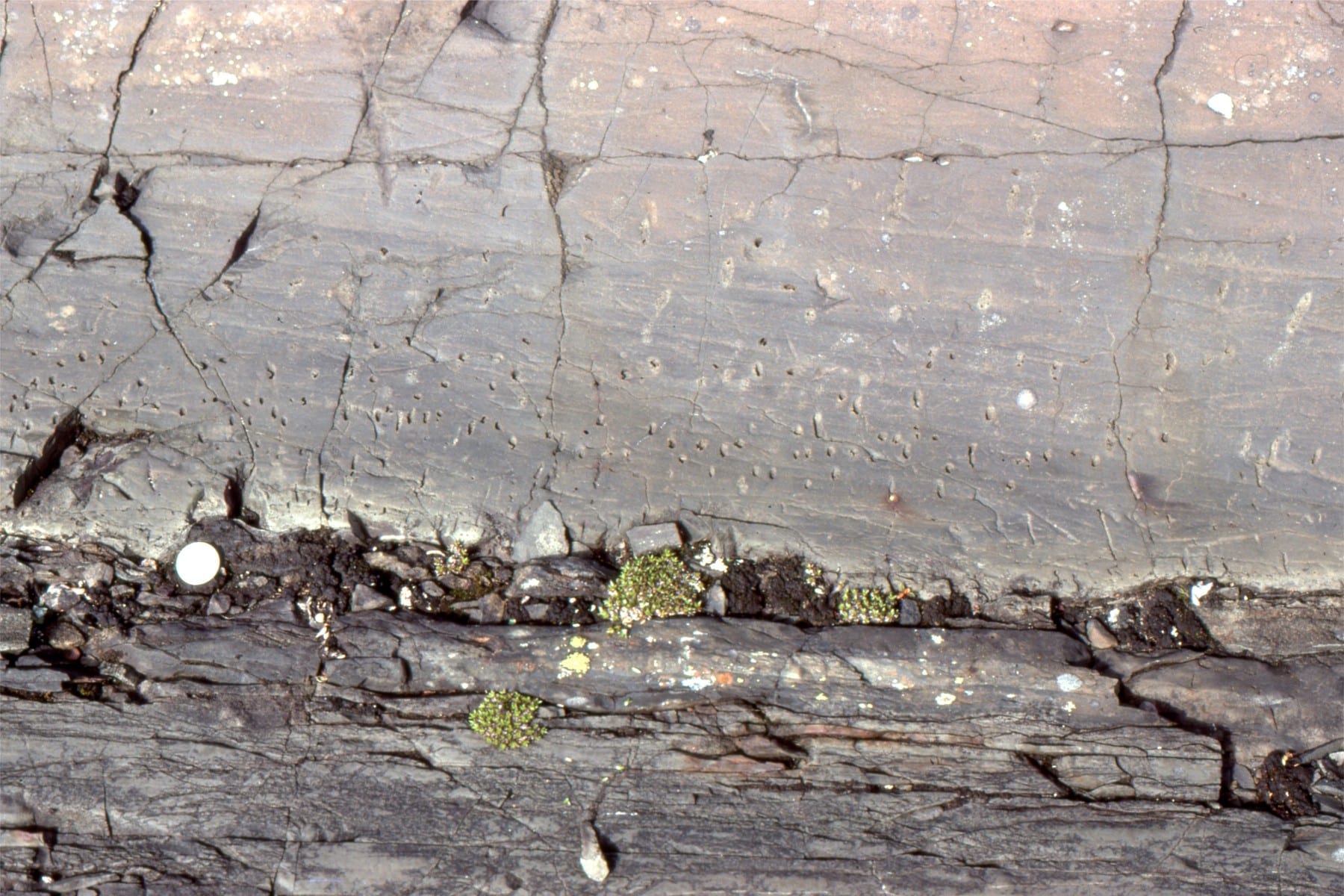
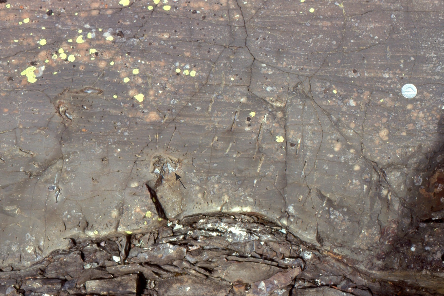
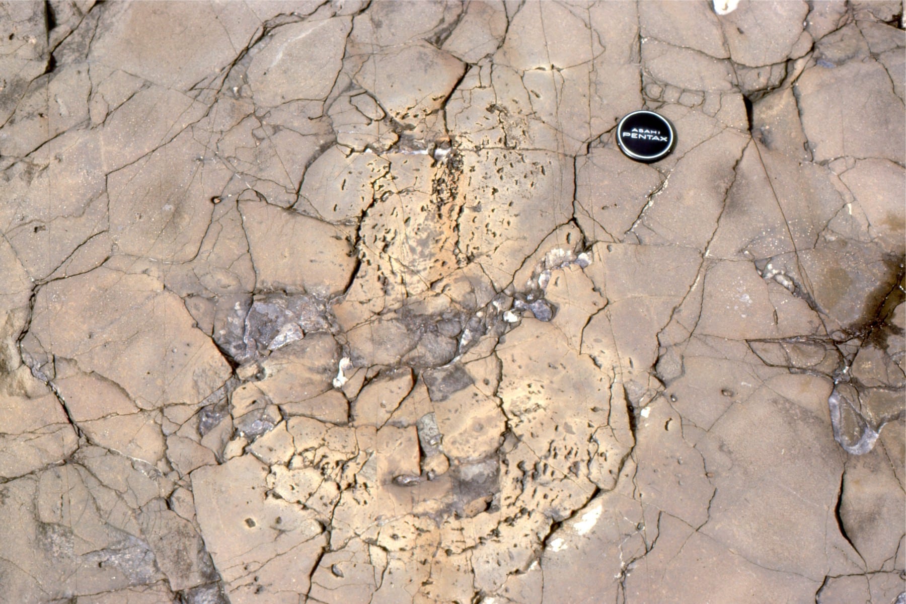
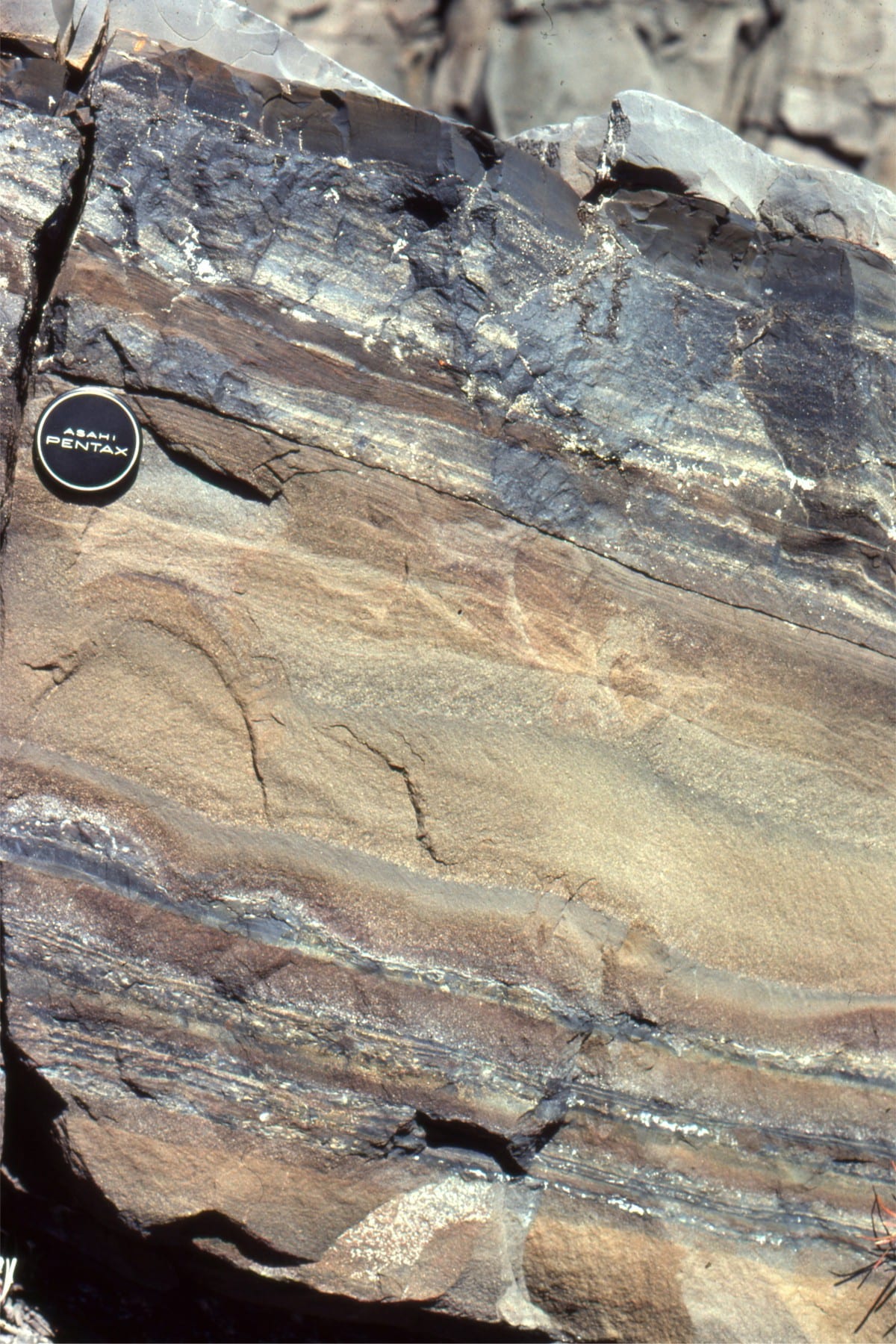
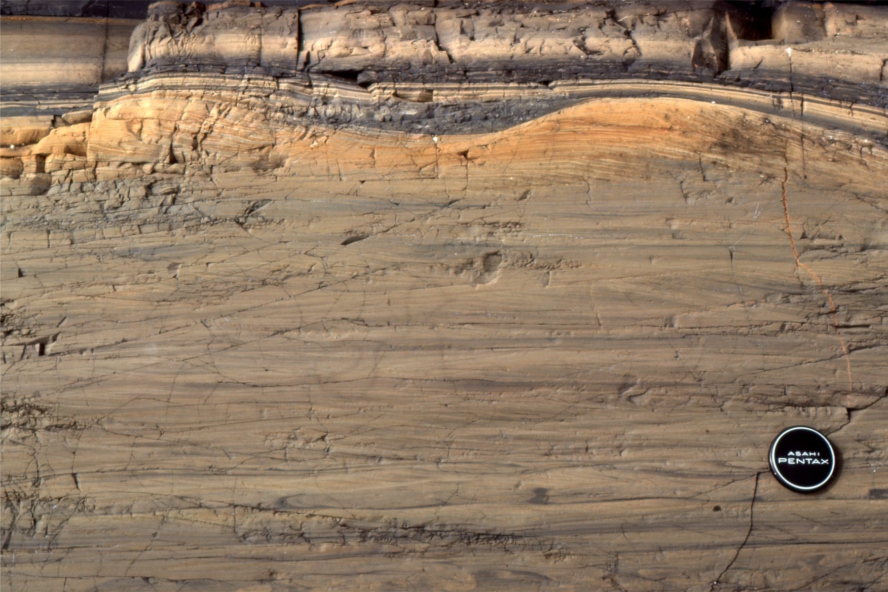
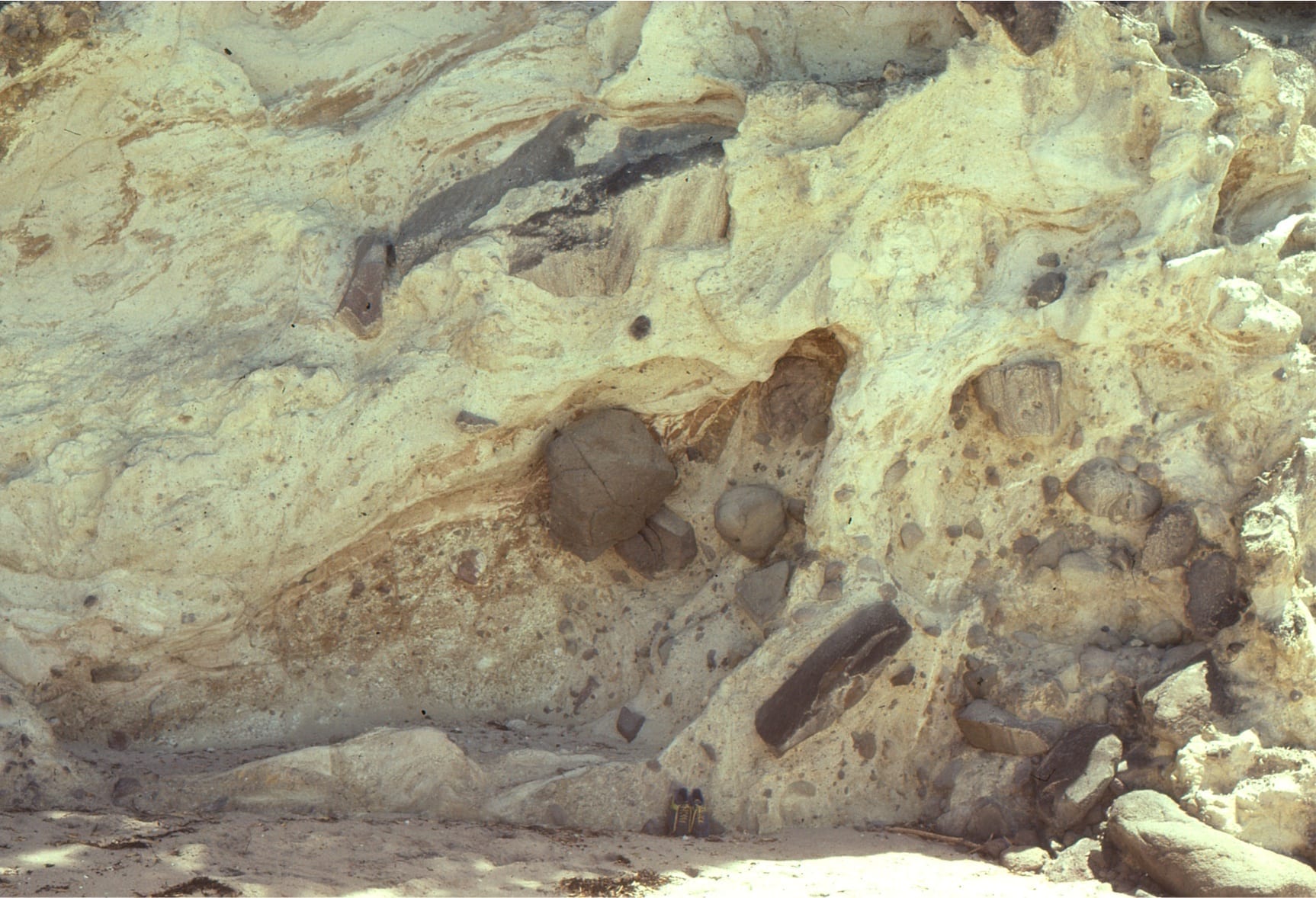
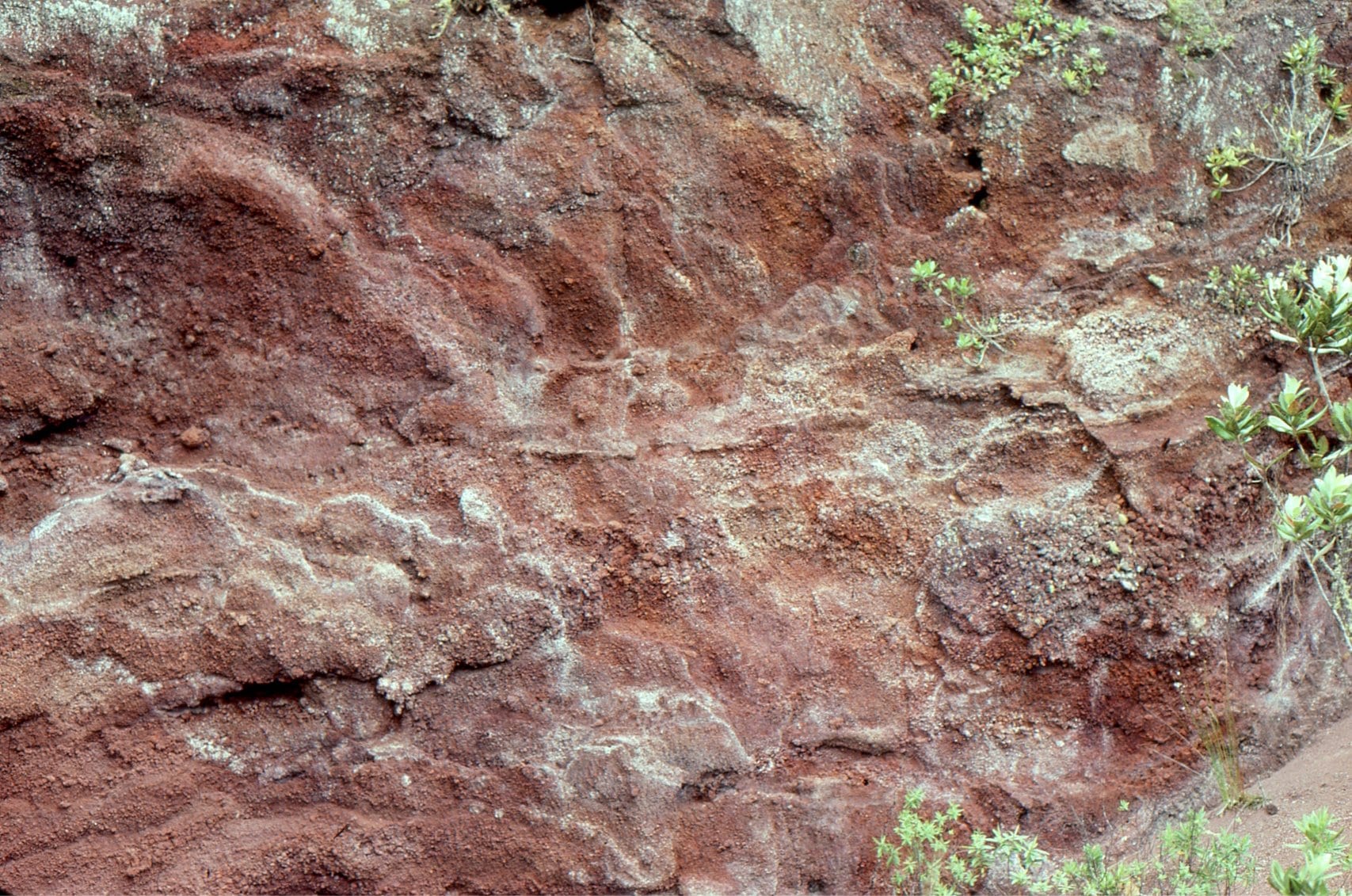
 Upper contact of a massive sediment gravity flow. Framework clasts up to a metre are mostly volcanic, but there are a few ripped up sandstone and dolomitic sandstone clasts, presumably from units underlying the Flaherty Formation. Maximum thickness is 85m; the unit covers and area greater than 3000 sq km. There are no obvious depositional or erosional breaks within the unit; there are parallel laminae, and rare crossbeds. The framework is mainly pumice fragments, shards with bubble-wall texture, and lapilli (see photomicrographs below). Pumice generally increases towards the top – density grading, but no obvious size grading. It is not welded. It is sandwiched between pillowed and jointed lava flows. It was most likely deposited subaqueously, although it is also possible that the flow originated on a subaerial edifice. Parallel laminae may indicate a degree of surging. The irregular surface patterns are due to late diagenetic silica replacement of the original volcanic glass.
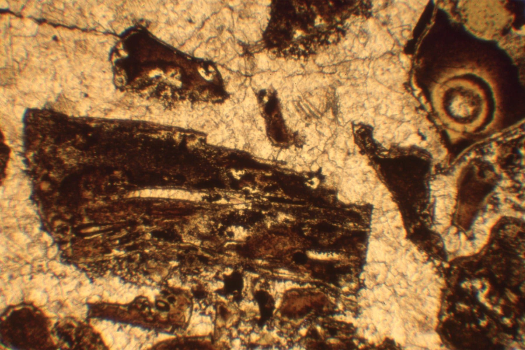
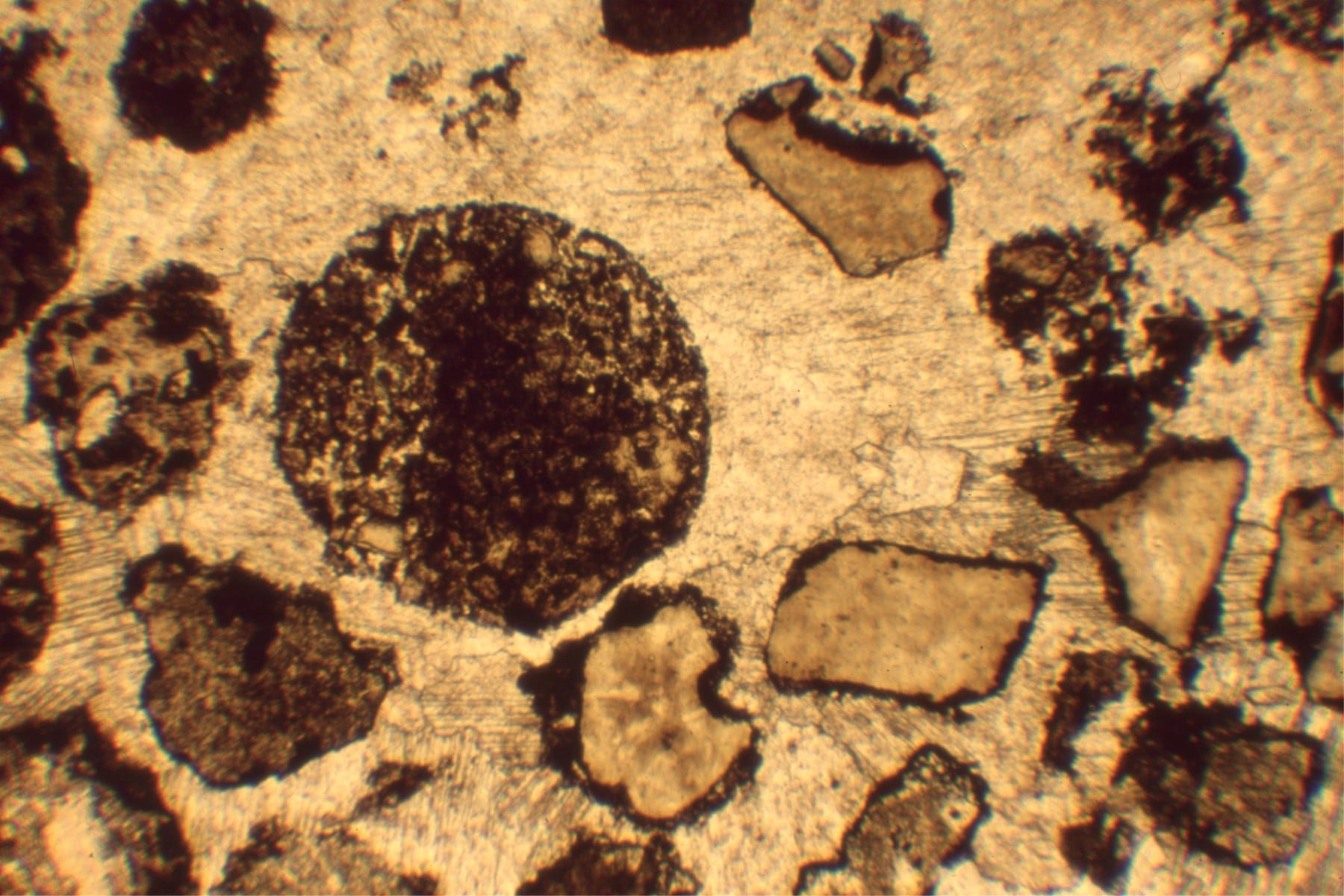
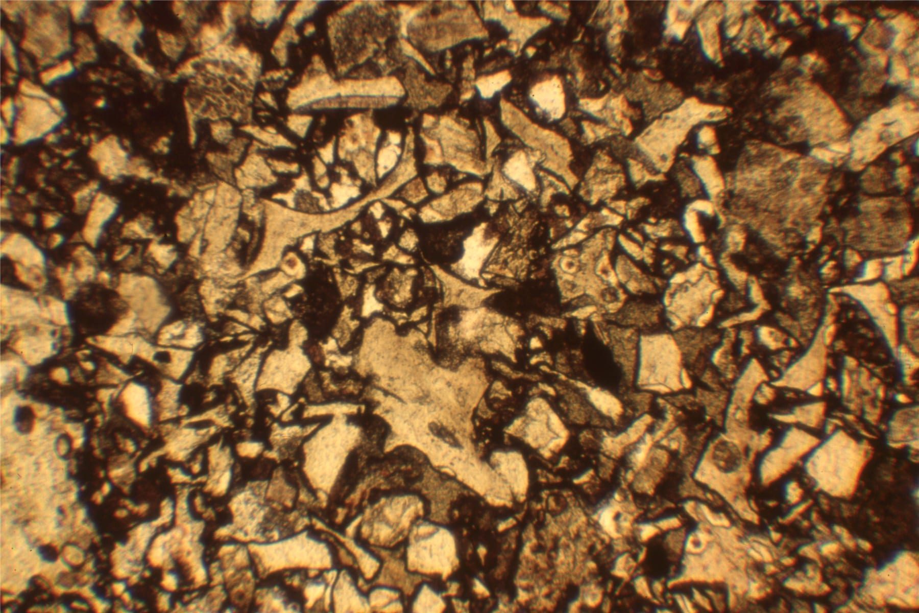
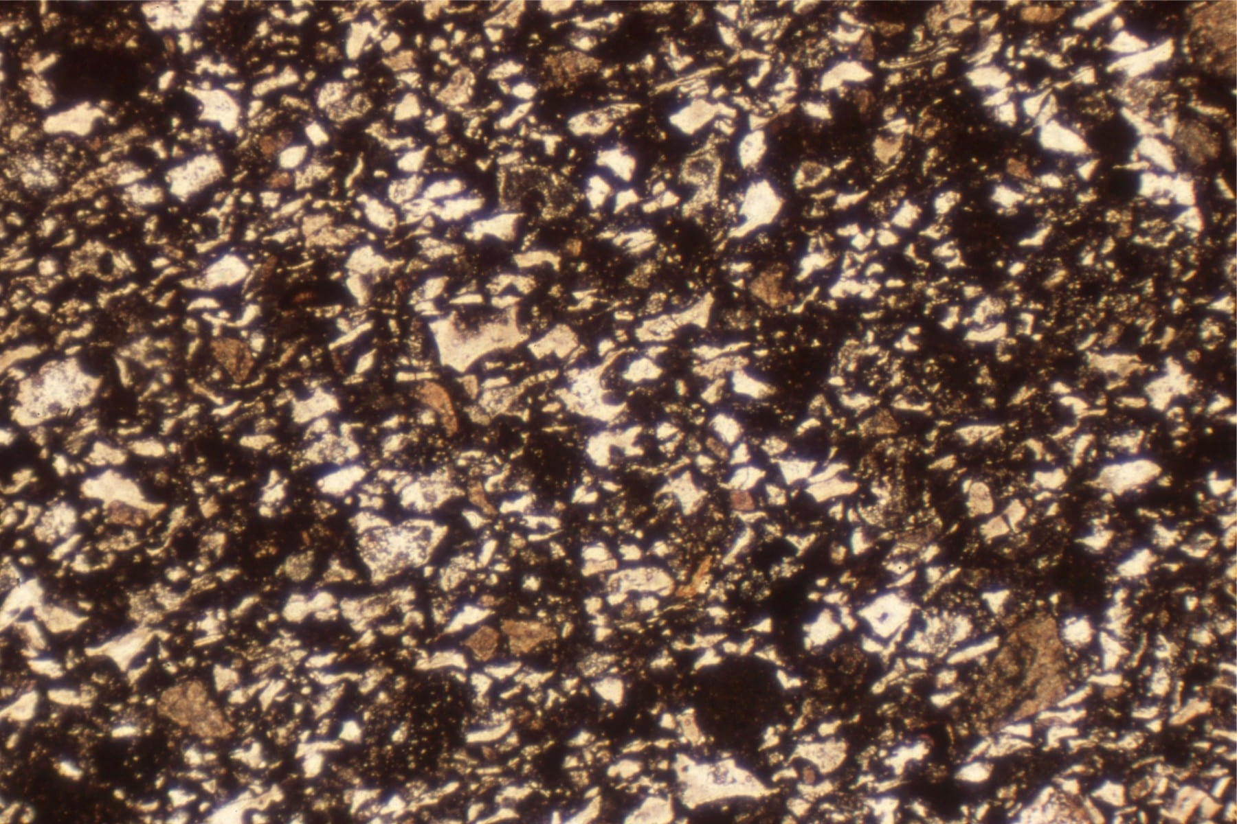
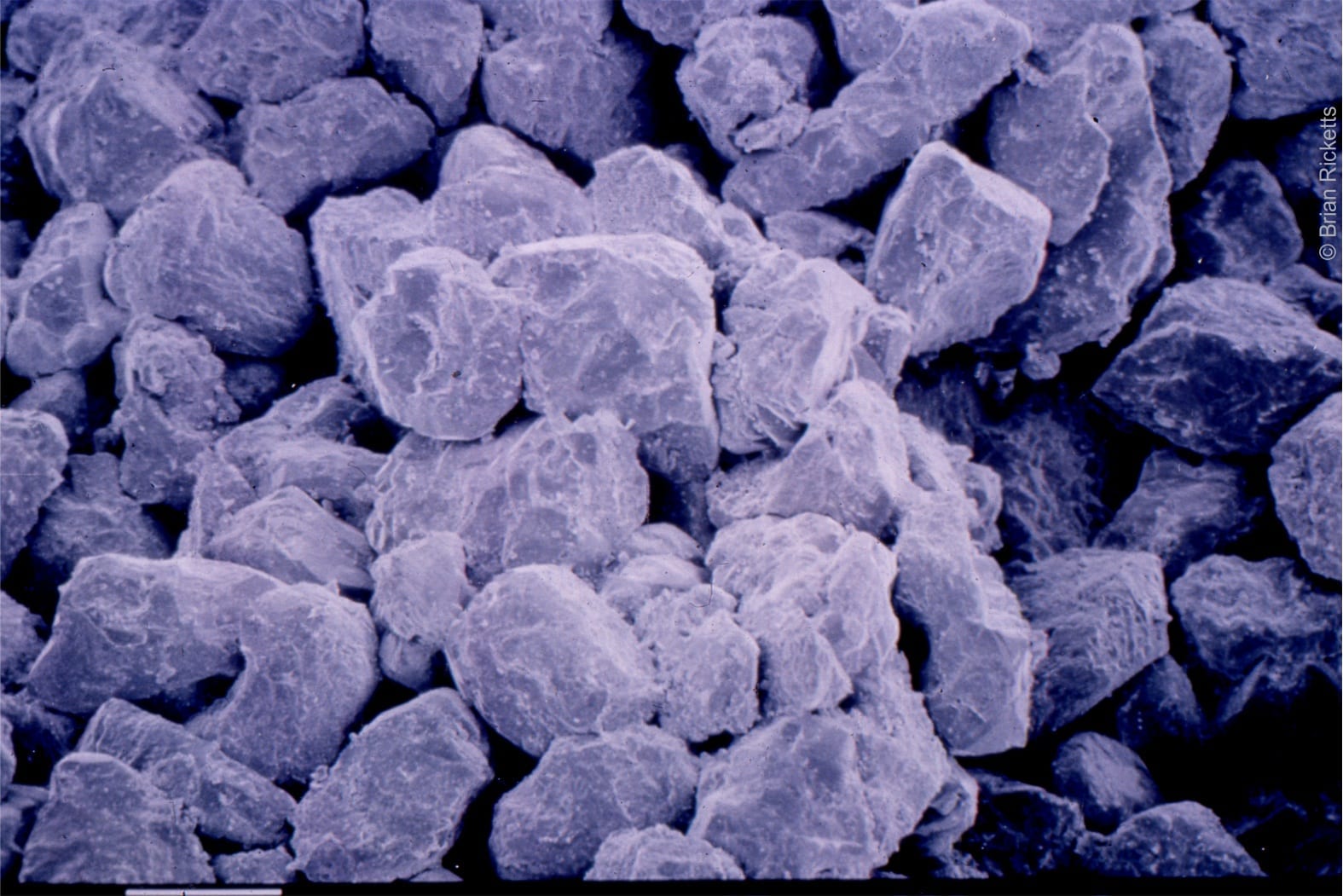
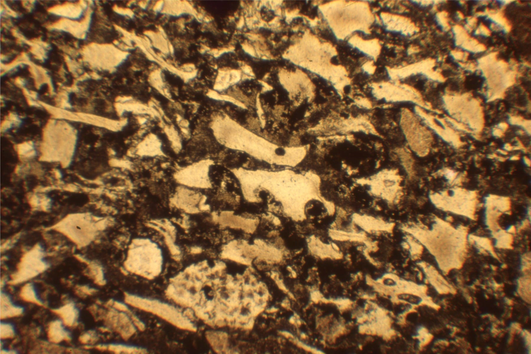
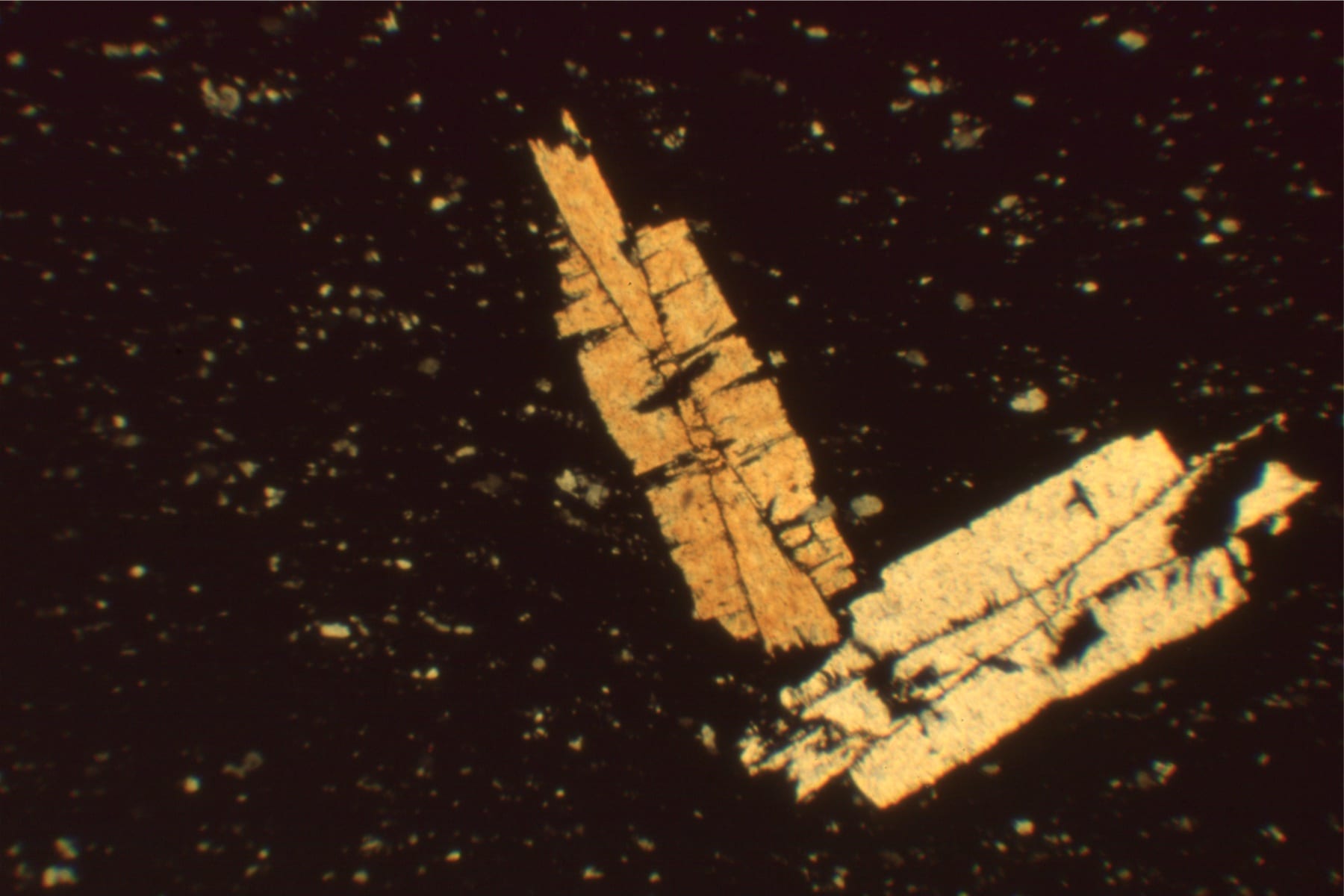
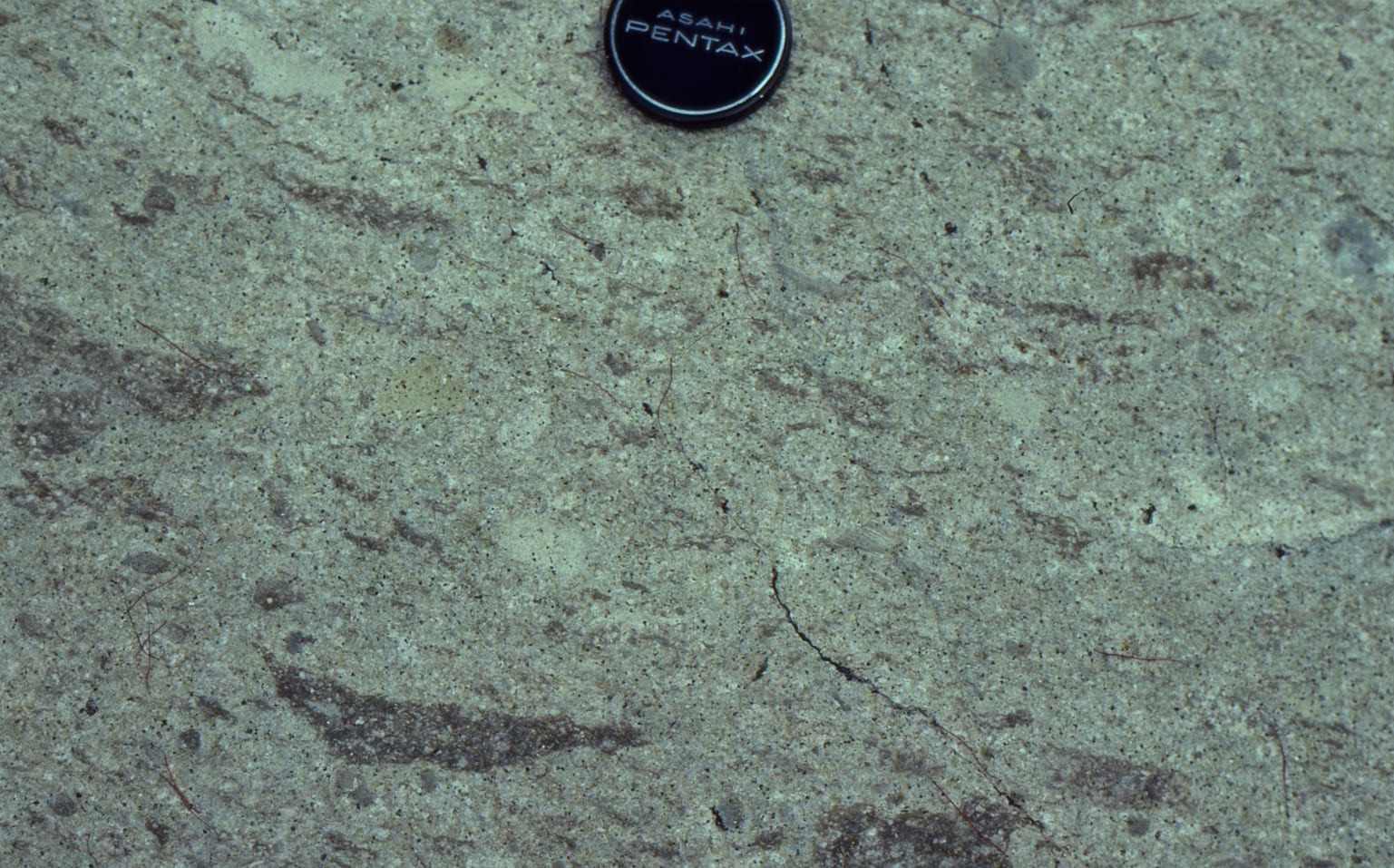
Photomicrographs from the massive volcaniclastic flow. From the Upper Left: 1. pumice with elongate gas pores, and various shards (glass replaced by silica). Field of view 8 mm. Upper right: Shards and possible accretionary lapilli. Cements are coarse calcite, that has also replaced some matrix. Field of view 8 mm. Lower Left. Bubble-wall ash shards, pumice and matrix in finer-grained part of the flow unit. Field of view 3 mm. Lower right Fine, distal flow unit, predominantly bubble-wall shards, some pumice, and basalt fragments. Field of view 8 mm.
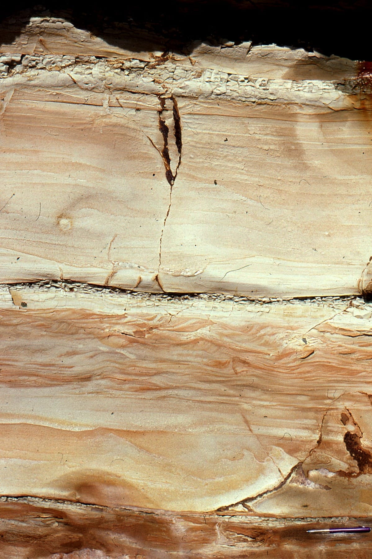
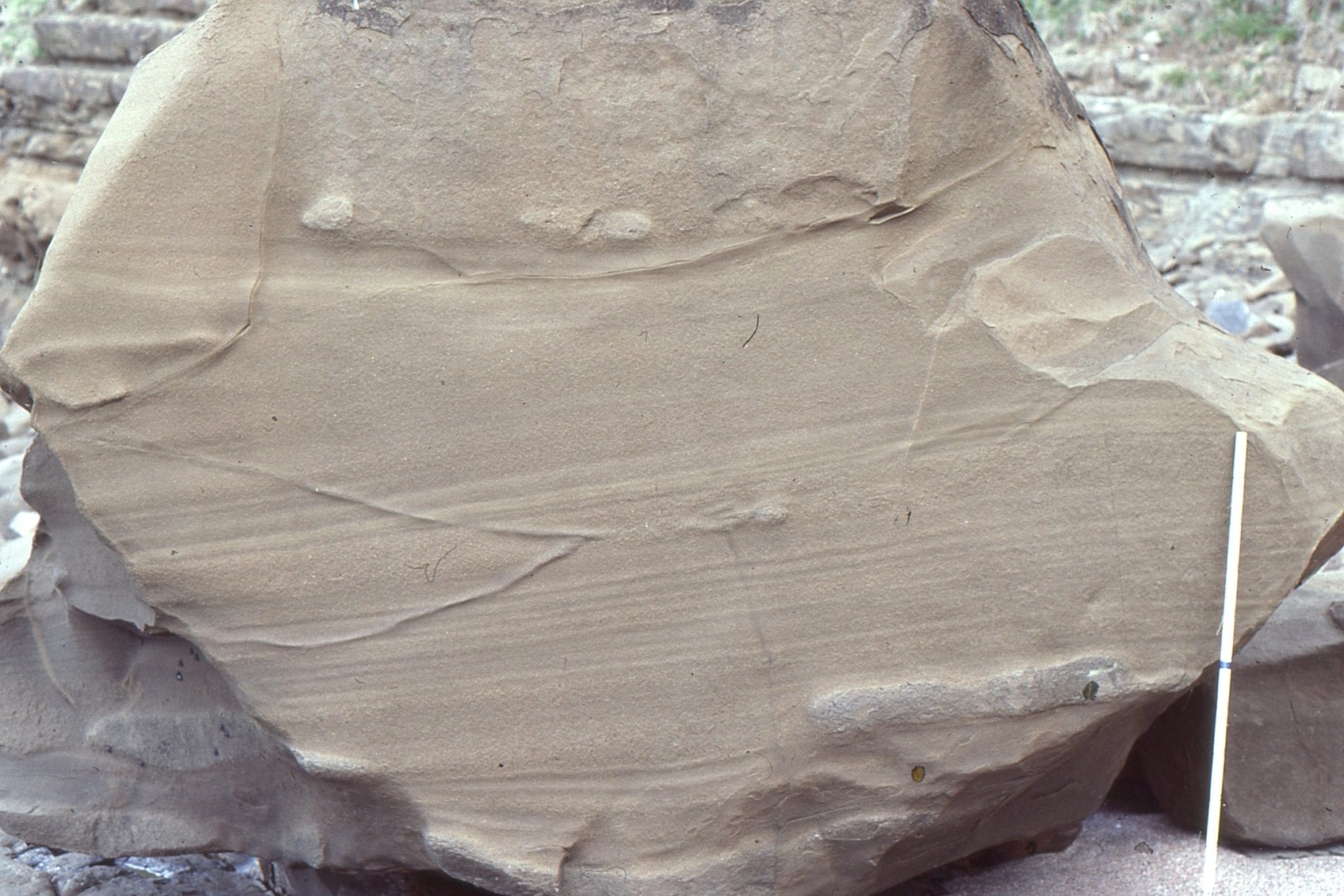
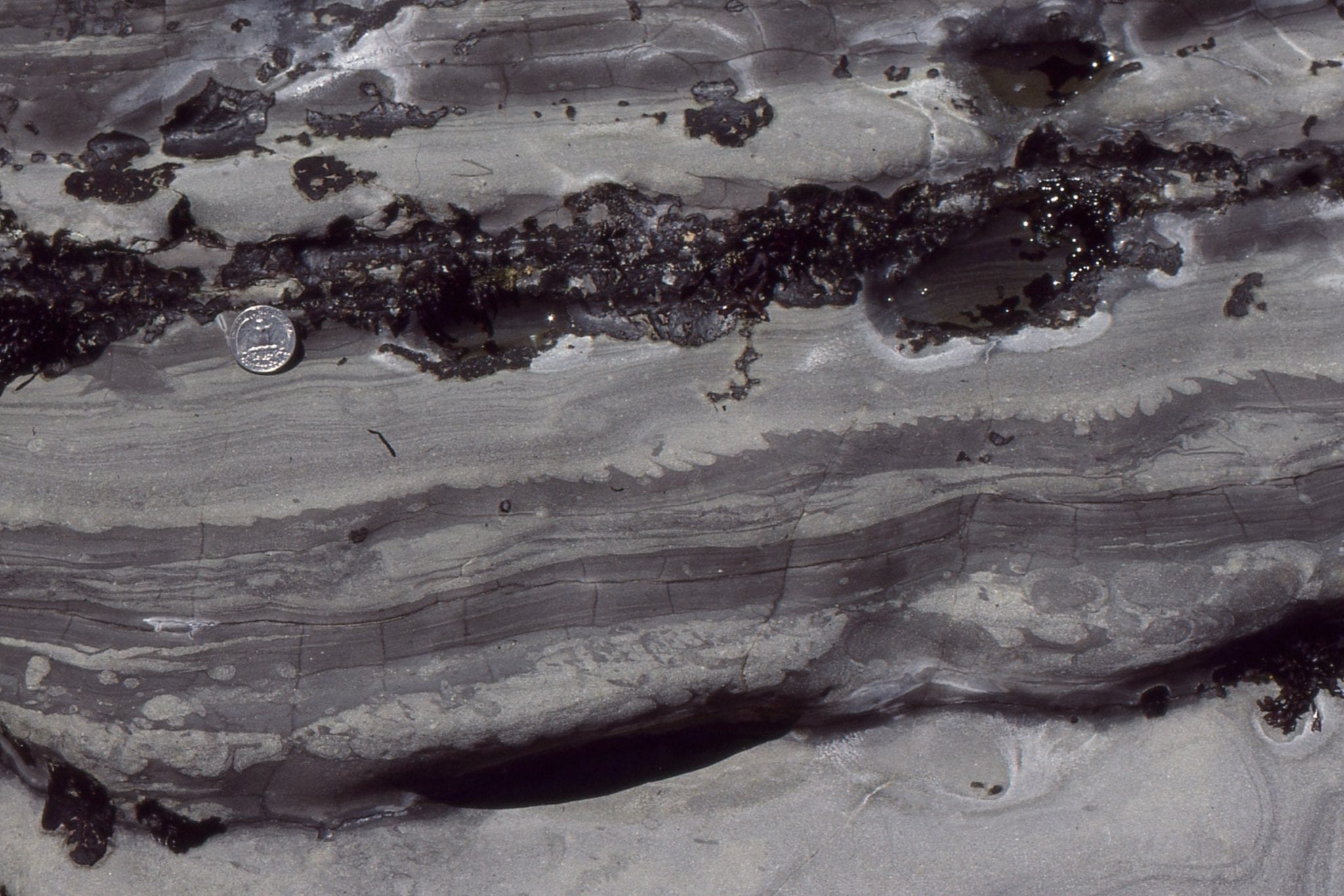
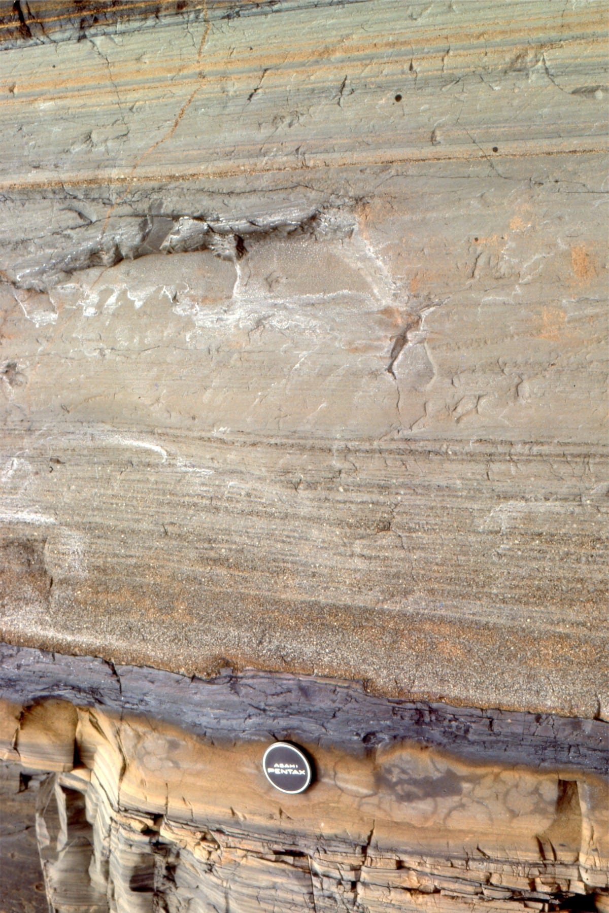
Left. Inter-flow volcaniclastic turbidites, layers of air-borne ash into water, and hemipelagic mudrock and ash. Right: detail of thin graded volcaniclastic turbidite Tb-d beds, hemipelagic ash, and highly calcareous mudstone – the latter indicating periods of very slow clastic deposition.
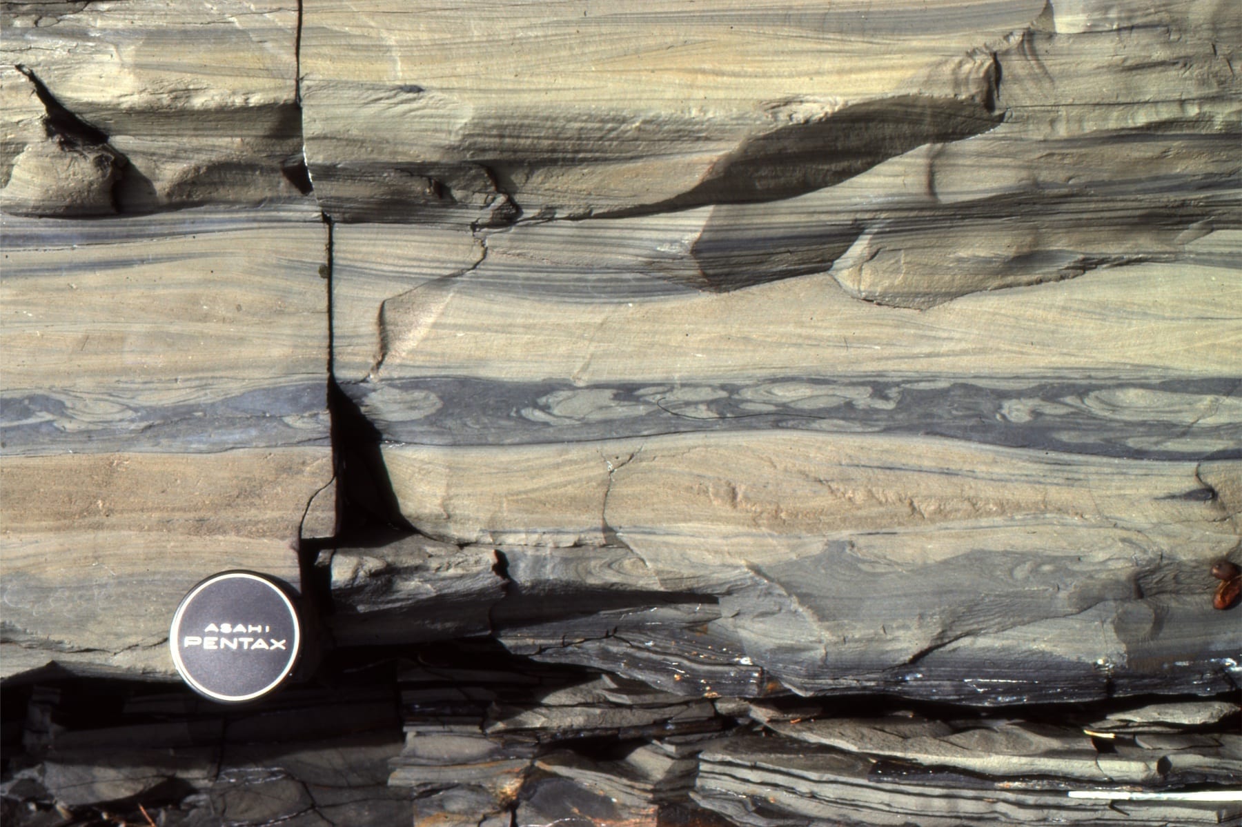
Left: Laminated and rippled volcaniclastic sandstone-siltstone. The middle bed has several load casts. Right: Volcaniclastic sandstone with ripples and climbing ripples. Bedforms in the upper orange-brown layer resemble antidunes.
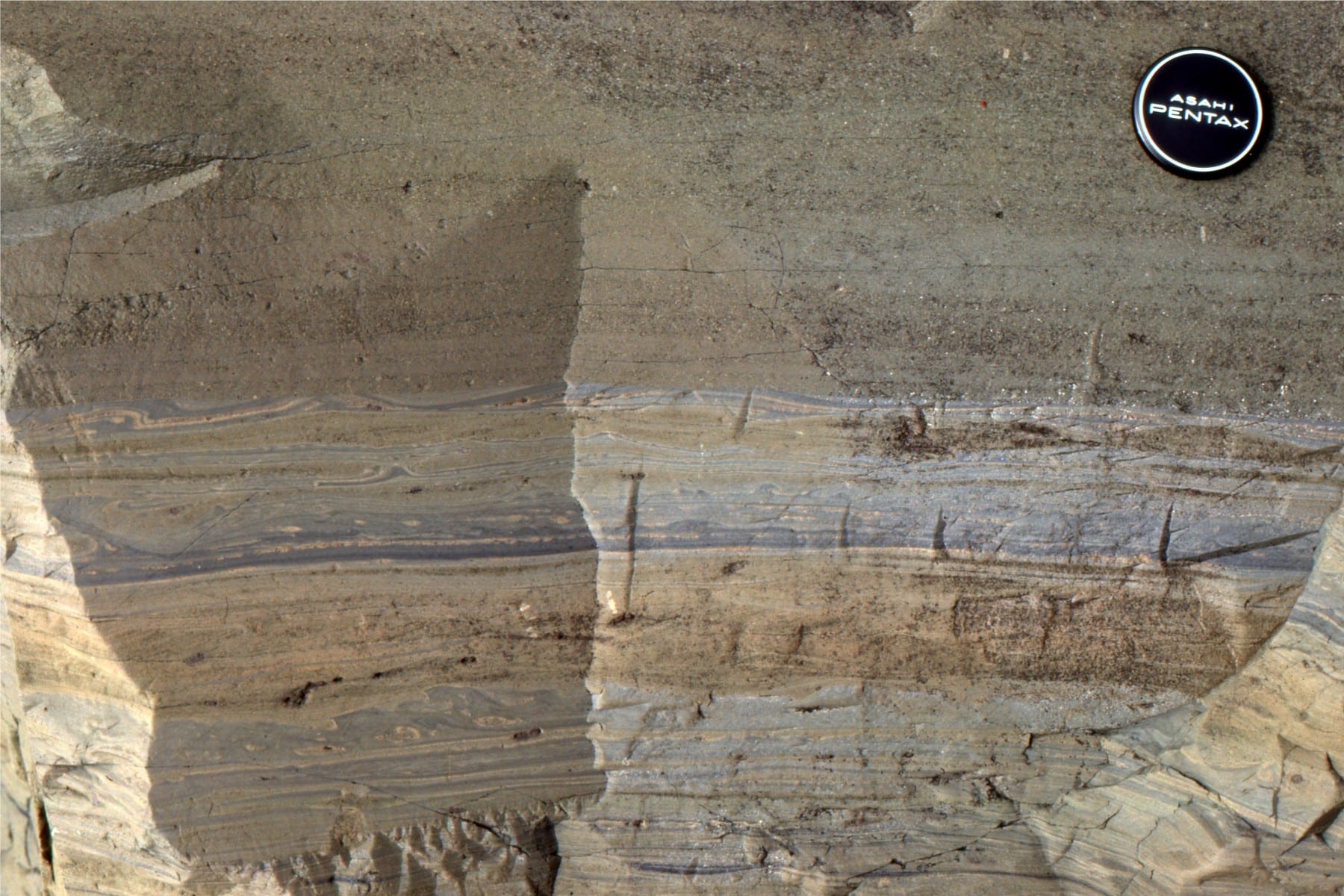
Left: Graded volcaniclastic turbidite (Tb-d divisions), in erosional contact with a (steel grey), muddy limestone calcareous mudstone. Right:Laminated and convoluted volcaniclastic Tc-d turbidite intervals. The middle graded bed truncates the convolutions below.
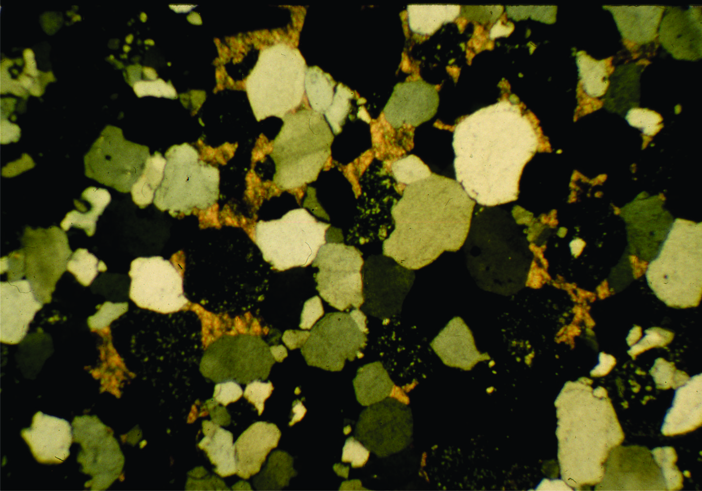
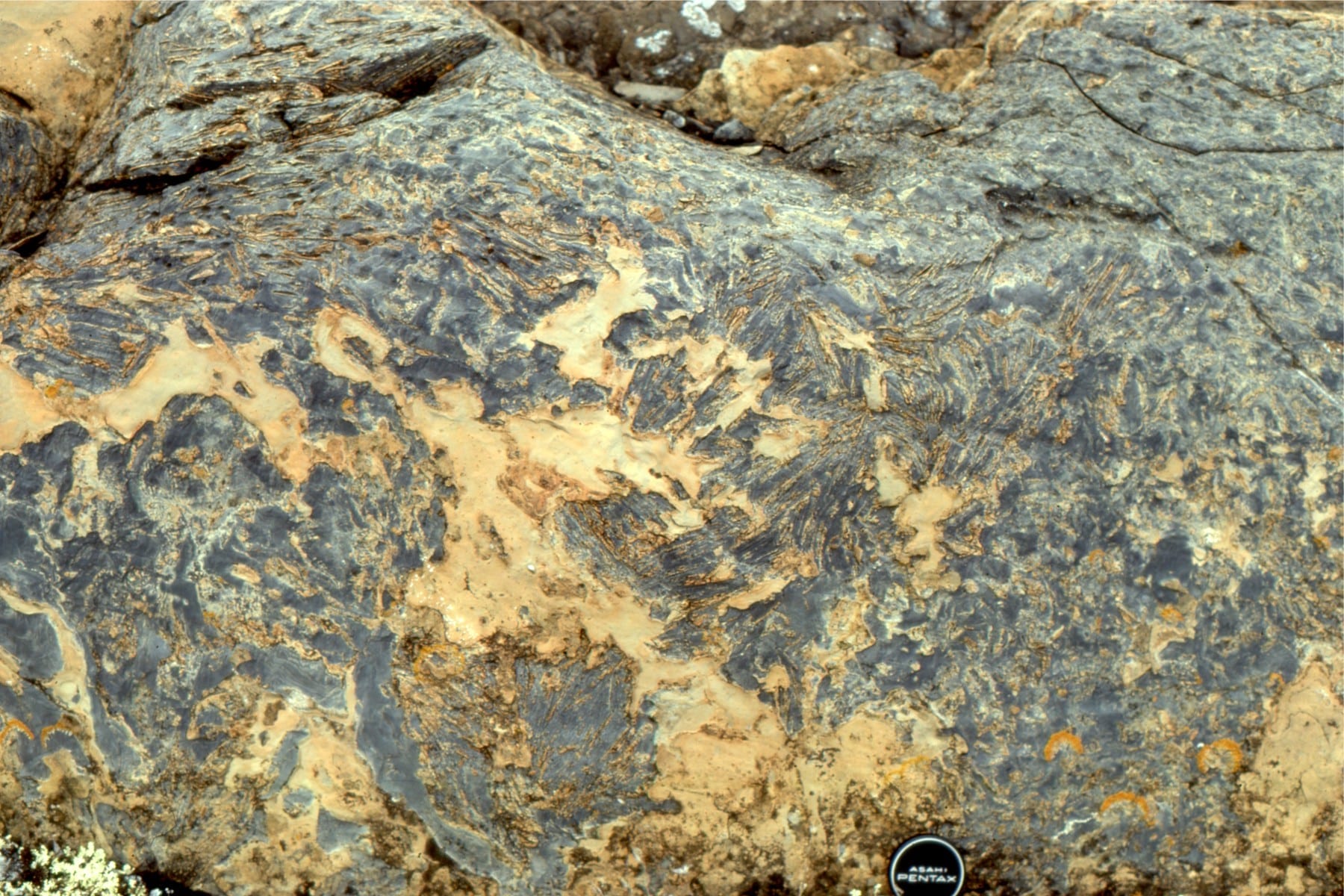
Left: Photomicrograph of turbidite volcaniclastic sandstone. Clear bubble-wall textures, some pumice, and crude alignment of shard long directions. Field of view 3 mm. Right: Prehnite in very fine-grained basalt. Field of view 3 mm.
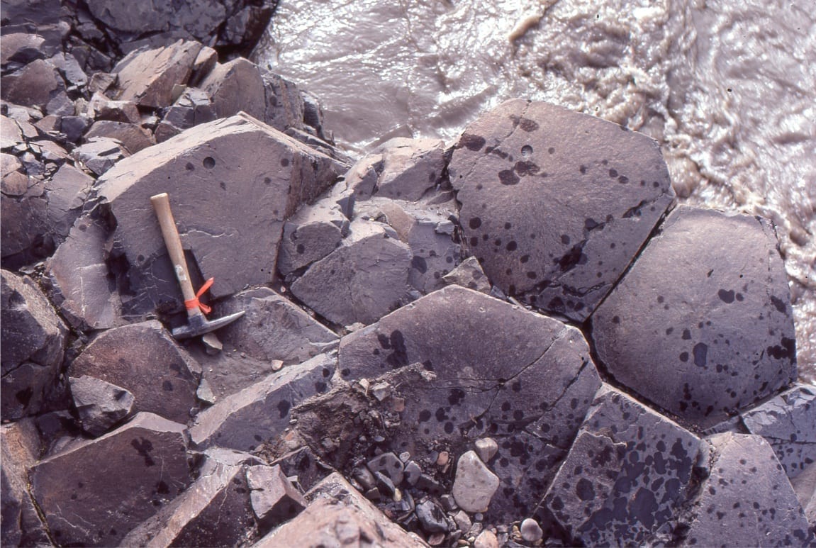
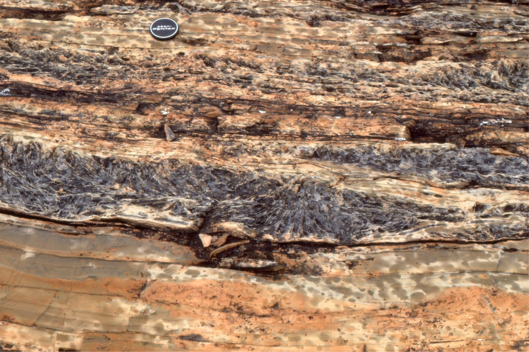
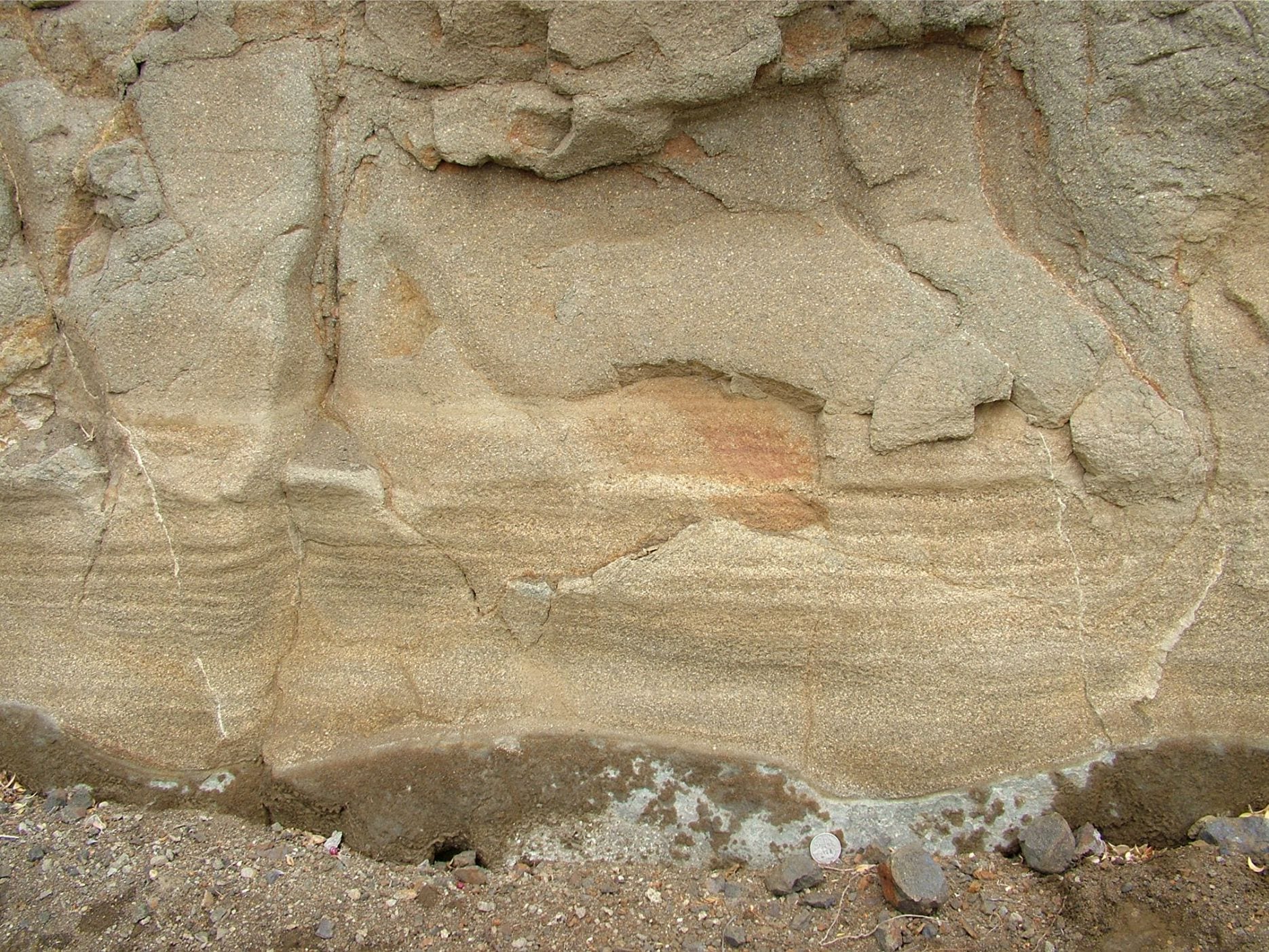
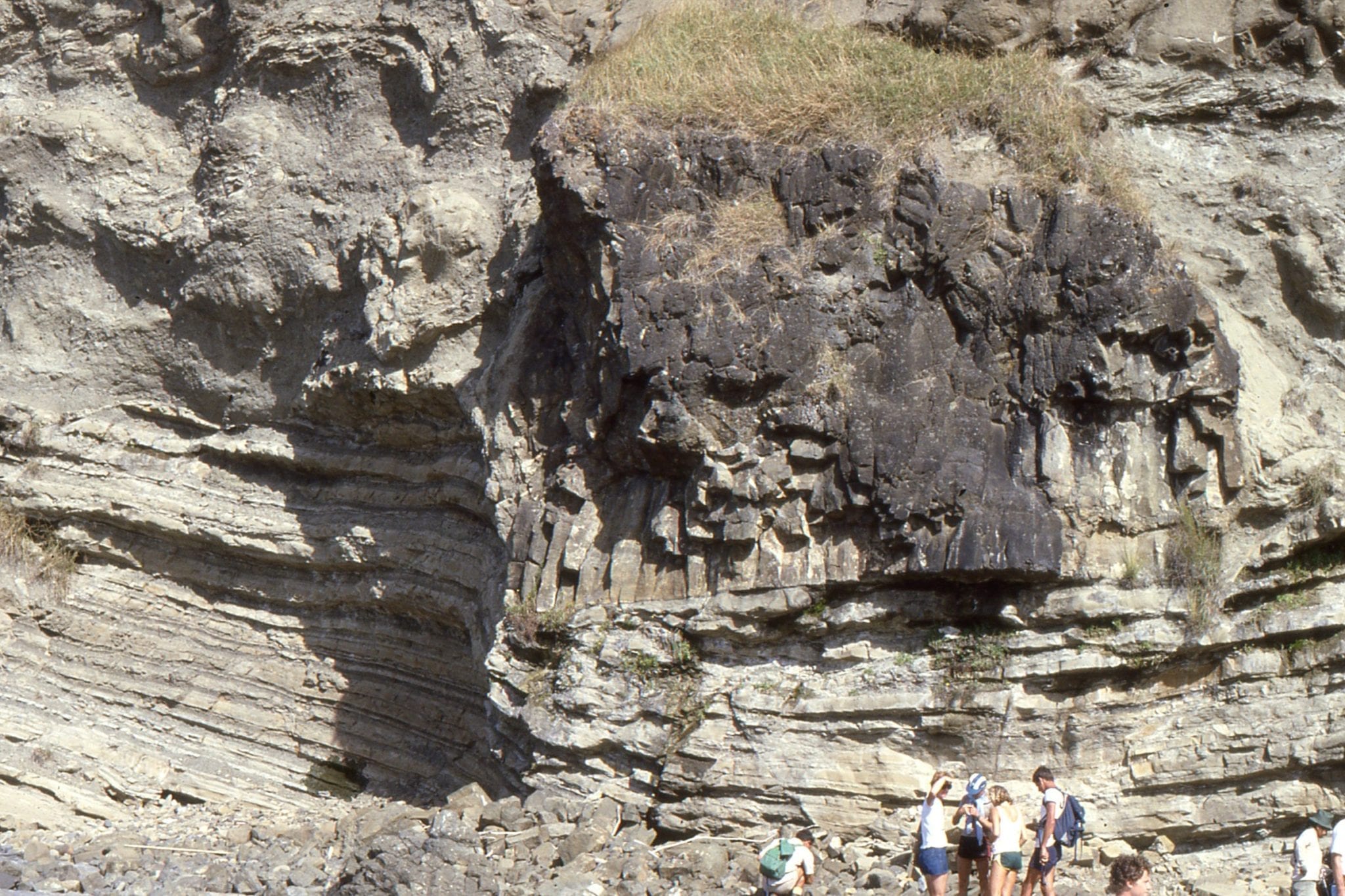
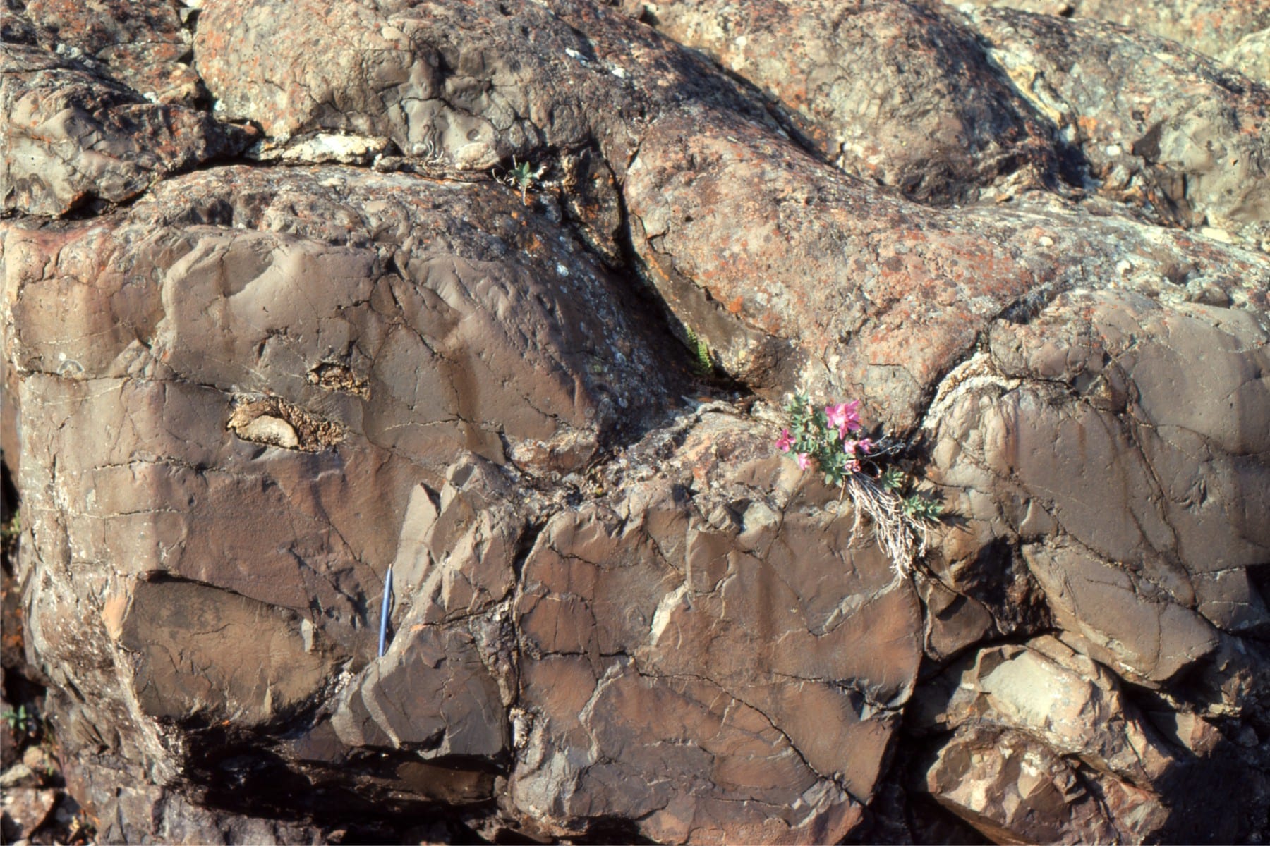
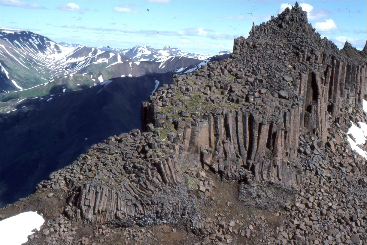
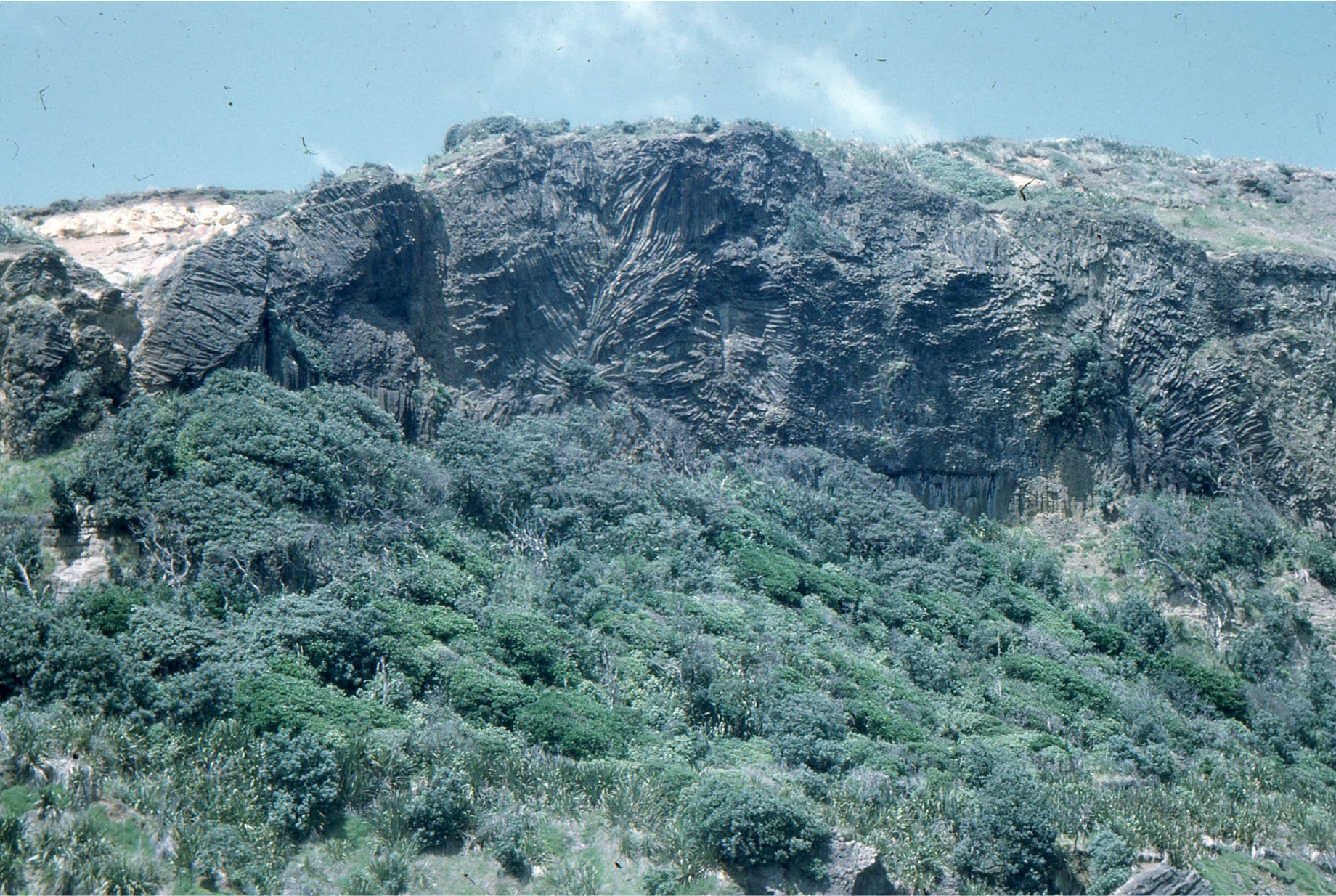
Strand Fiord volcanics, an Upper Cretaceous unit on Axel Heiberg Island, Canadian Arctic. Here an ‘organ-pipe’ array of columnar joints (4m high) have perforated the basalt during cooling. On the right, a bird’s-eye view of 4, 5 and 6-sided columns.
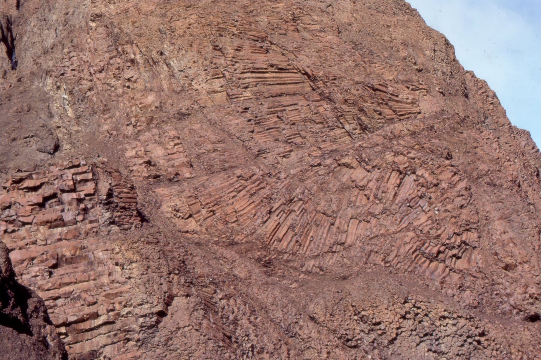
Two views of curved and radiating entablature joints in Strand Fiord basalt flows, Axel Heiberg Island. Structural dip here is about 60 degrees. Flow thickness is about 35m. The entablature on the left is underlain by bed-normal jointed basalt.
Left: Cow pat ballistics in bedded lapilli and reworked basalt gravel, attests to eruption material mixing directly with fluvial reworked debris. The right image shows a coalified tree fragment caught up in a lahar. Strand Fiord volcanics, Axel Heiberg Island.
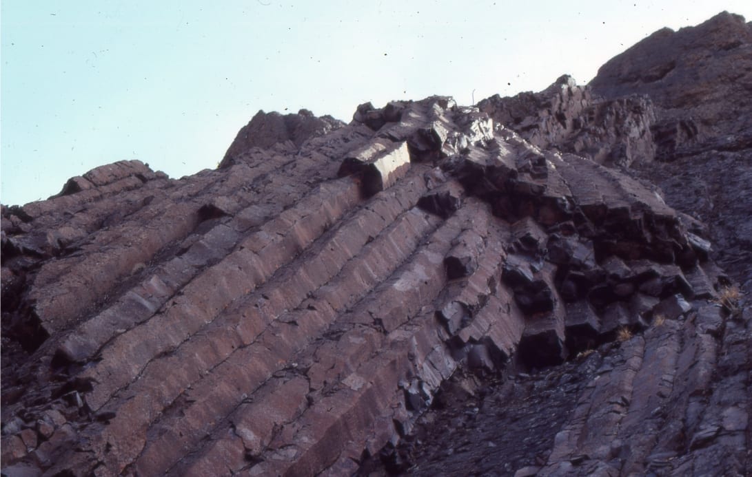
Mount Edziza volcanic field
The Mount Edziza volcanic field in Stikine, northern British Columbia began erupting 7.5 million years ago, and continued into the Pleistocene. It features large stratovolcanoes, calderas and cinder cones. Featured here is a stairway of jointed basalts, and a well preserved cinder cone.
New Zealand
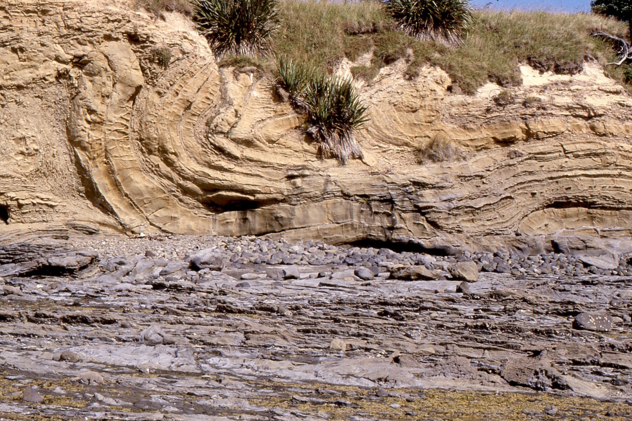
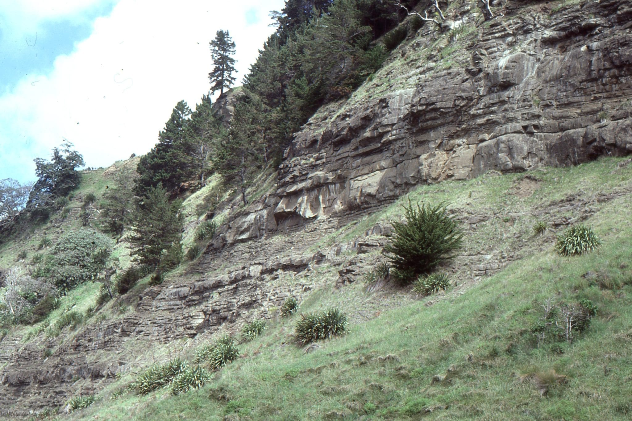
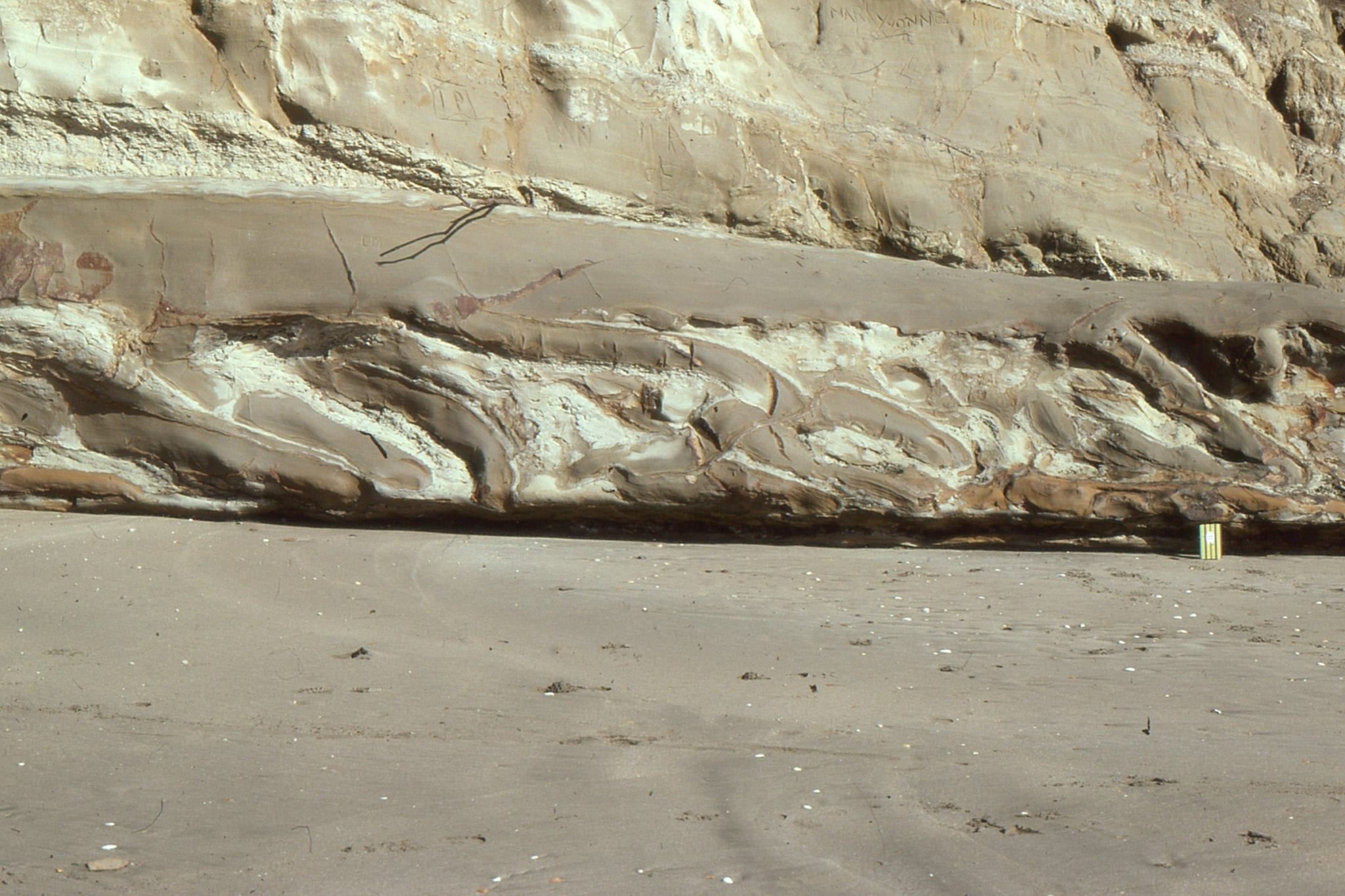
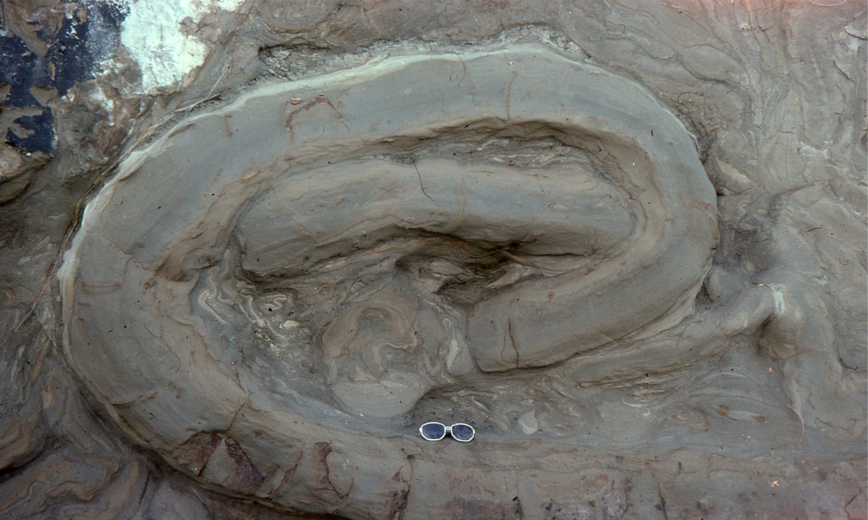
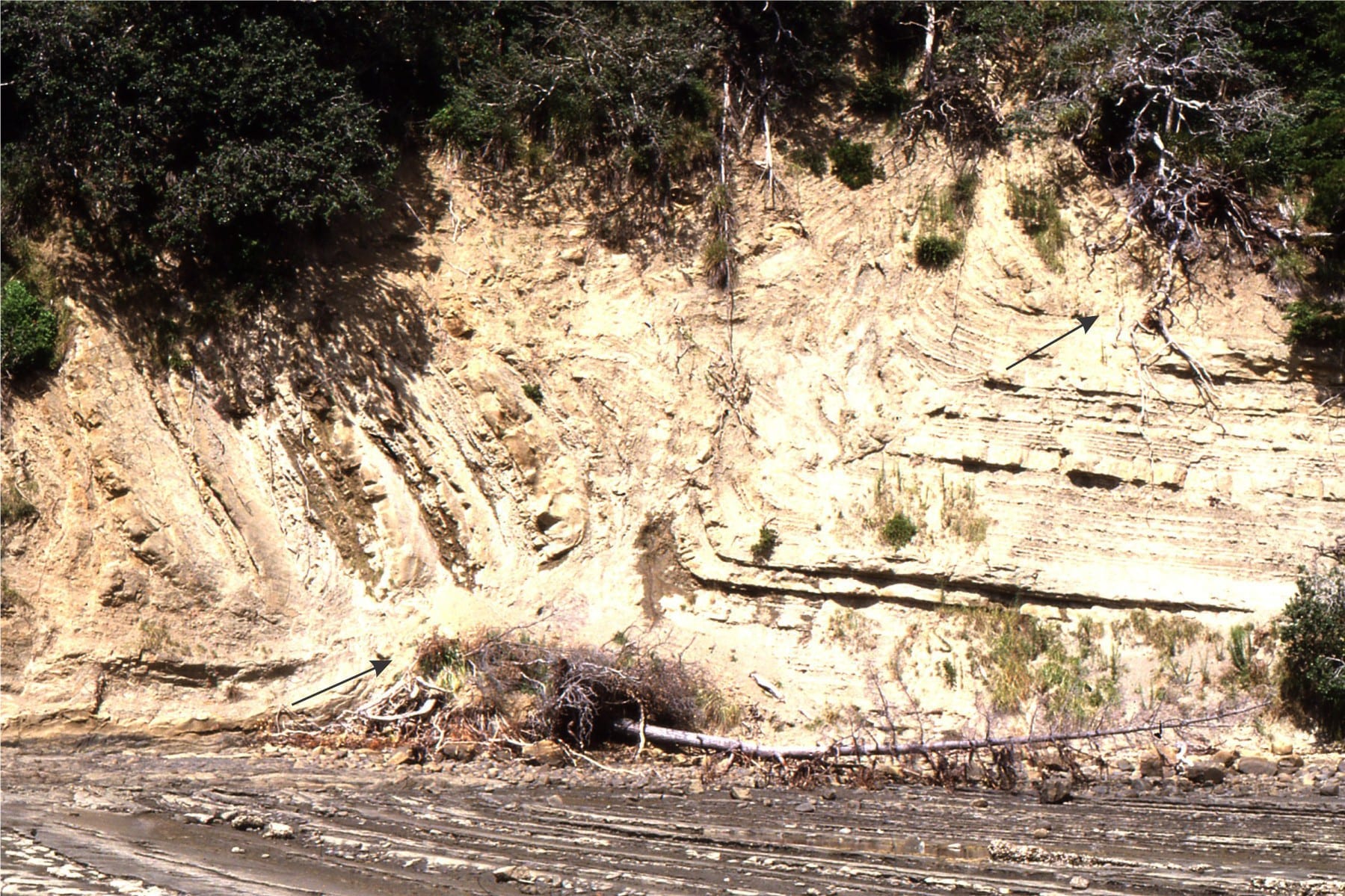
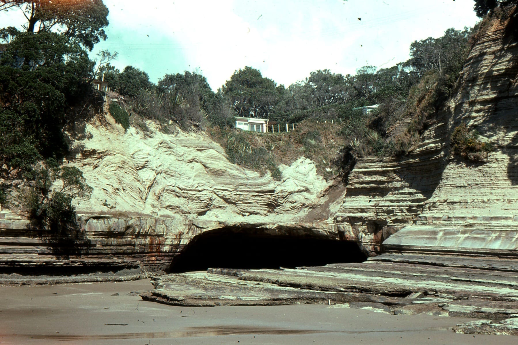
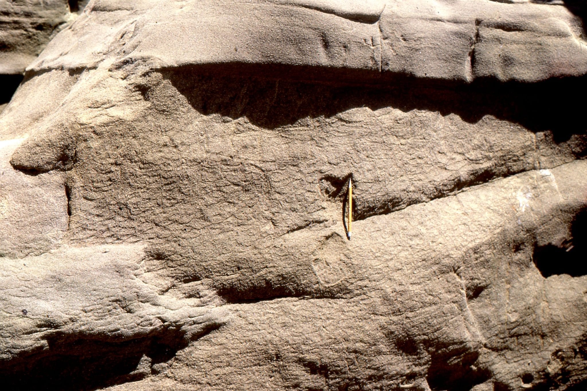
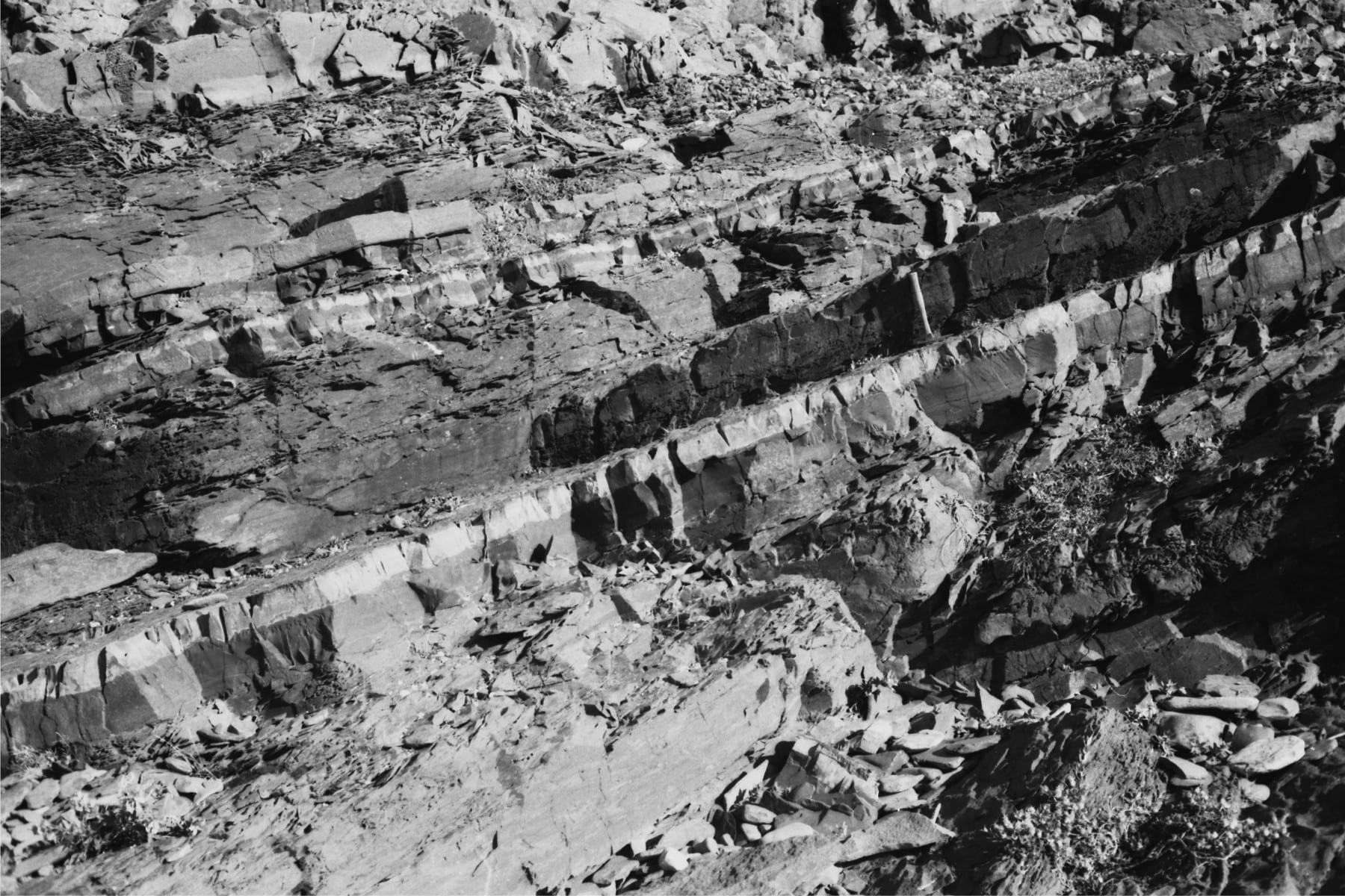
Upper Miocene Coroglen volcanics north of Whiritoa, east coast of Coromandel, New Zealand. From the Upper left: Cooling joints in ignimbrite. Upper right. Detail of ignimbrite fragmental pumice and rhyolite, and fiamme (dark fragments stretched during hot emplacement of the pyroclastic flow). Lower left. Flow banded rhyolite. Outcrop is about 5m high. Lower right. A lahar with fragments of rhyolite, ignimbrite and possible andesite, over-ridden by a flow-banded rhyolite.
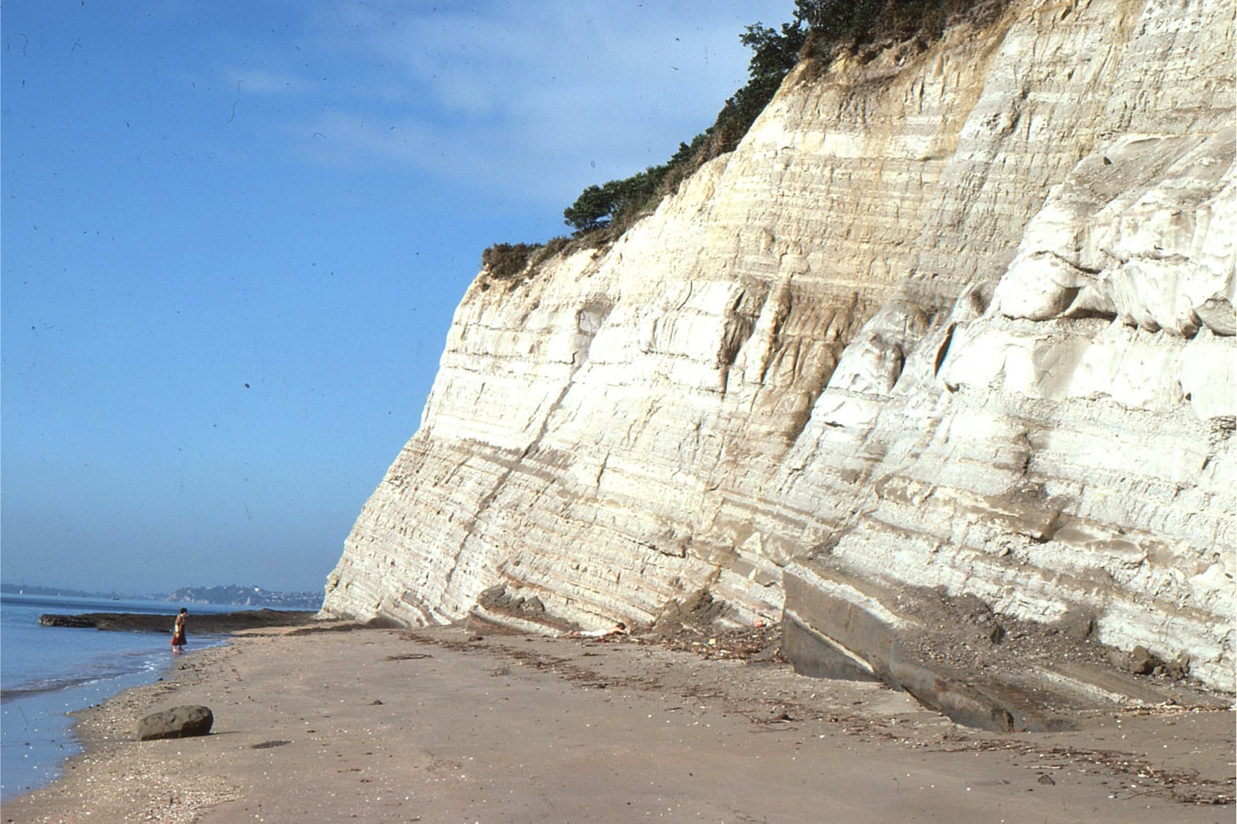
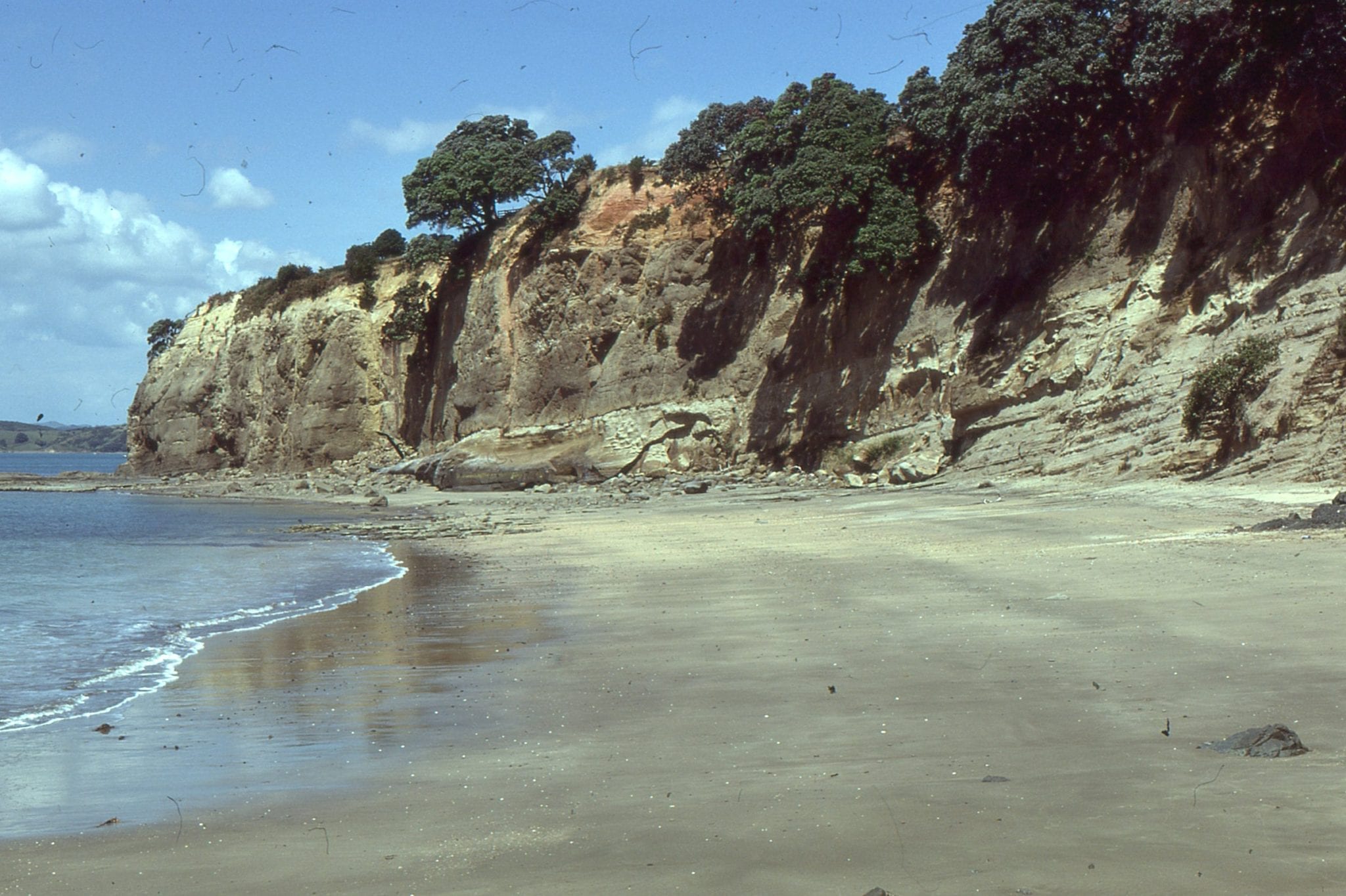
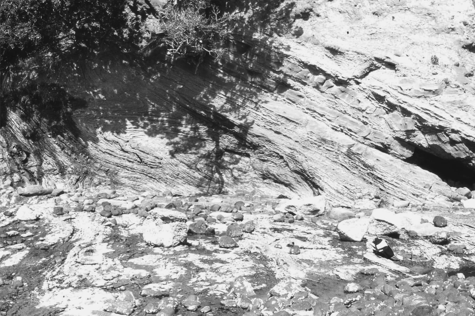
Late Pliocene flow-banded rhyolite at Mount Maunganui, New Zealand.
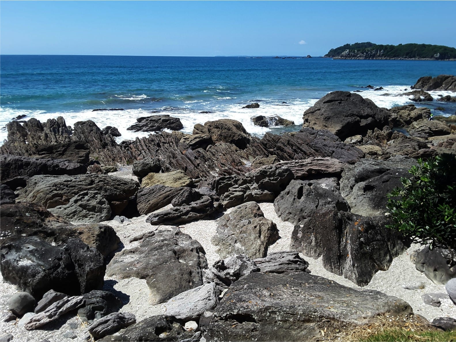
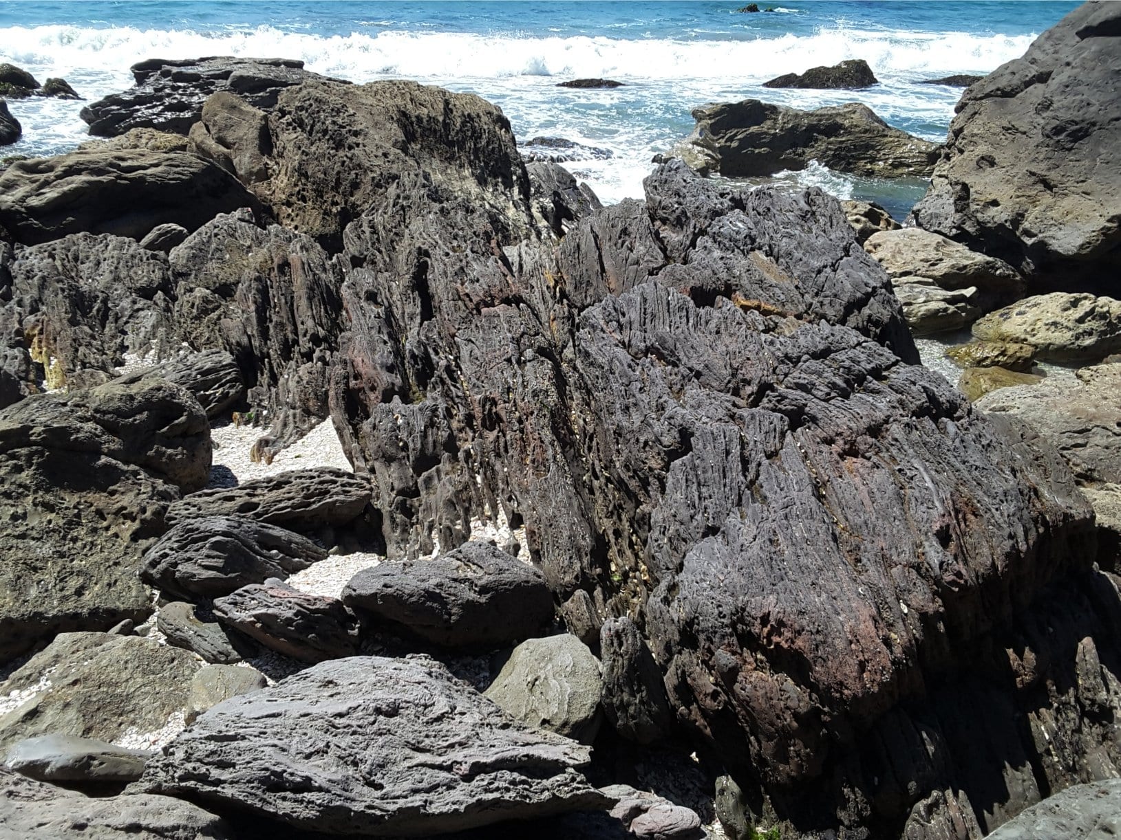
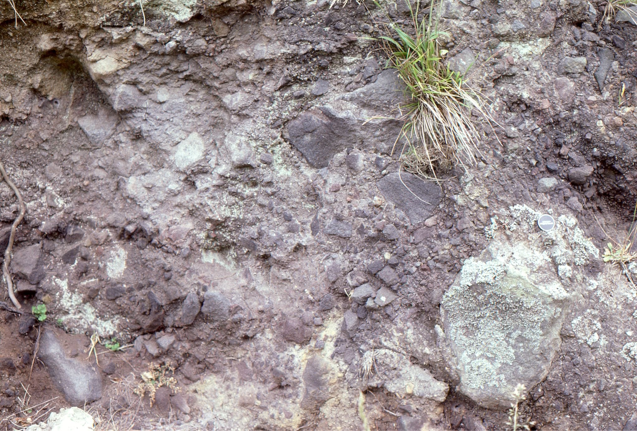
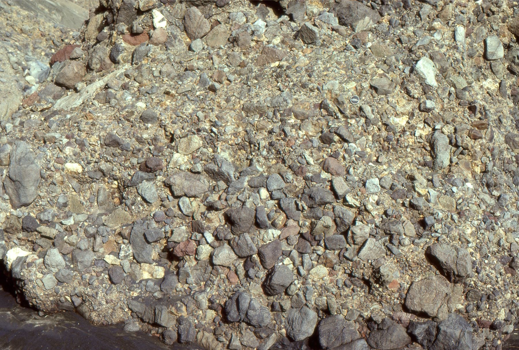
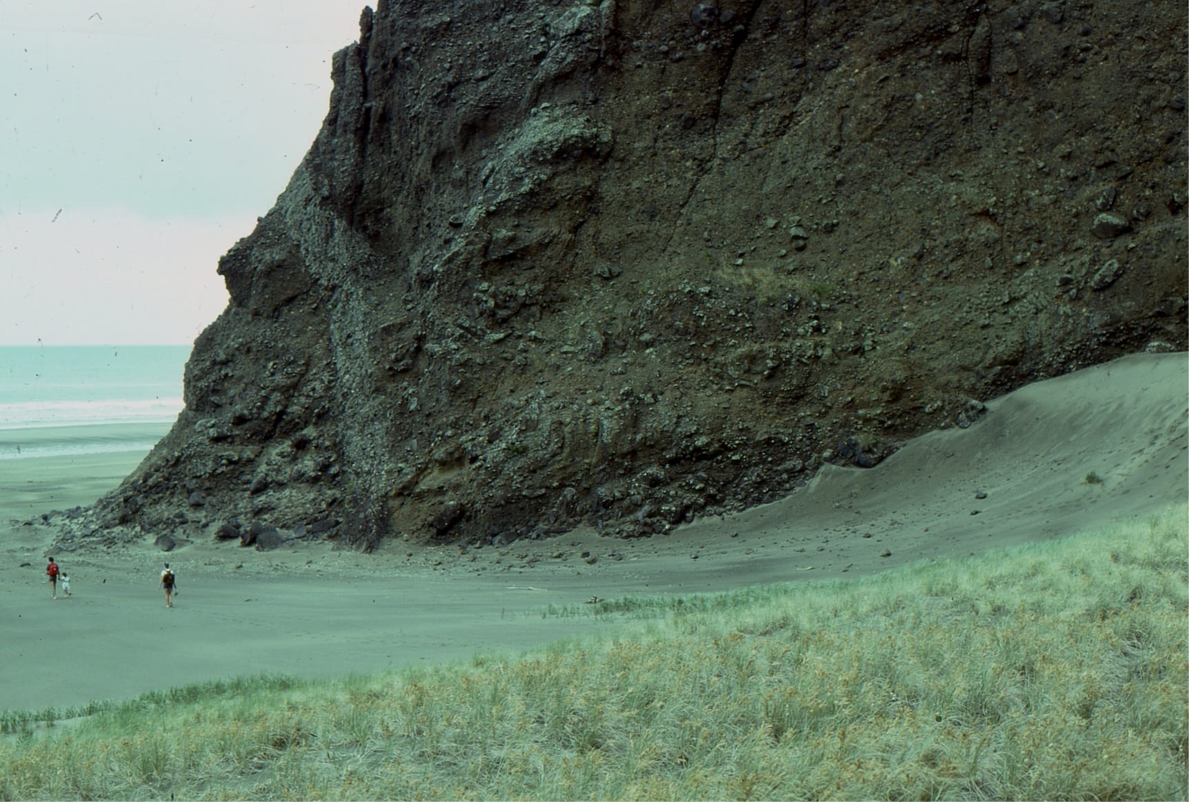
Karioi volcano, Raglan
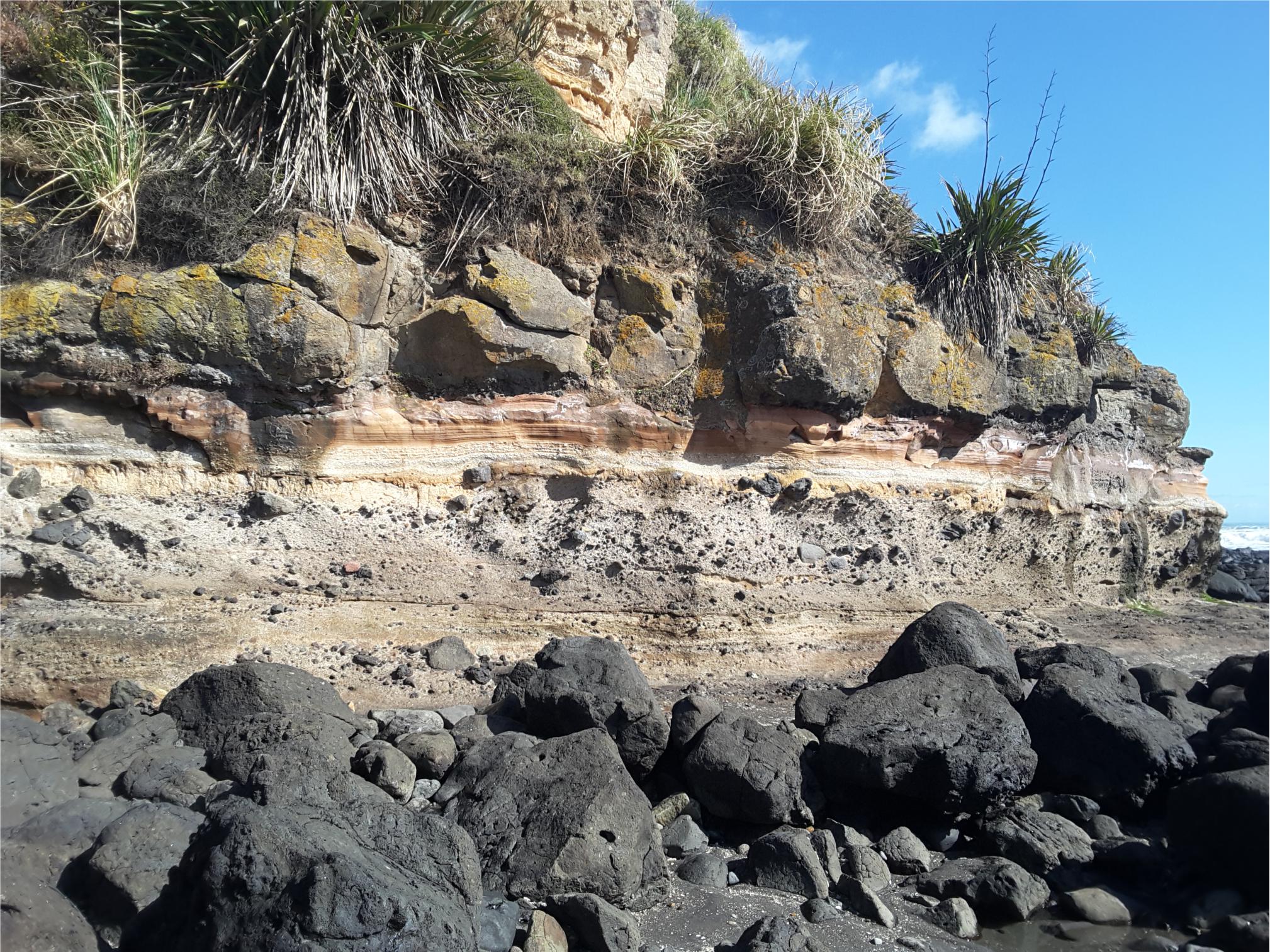
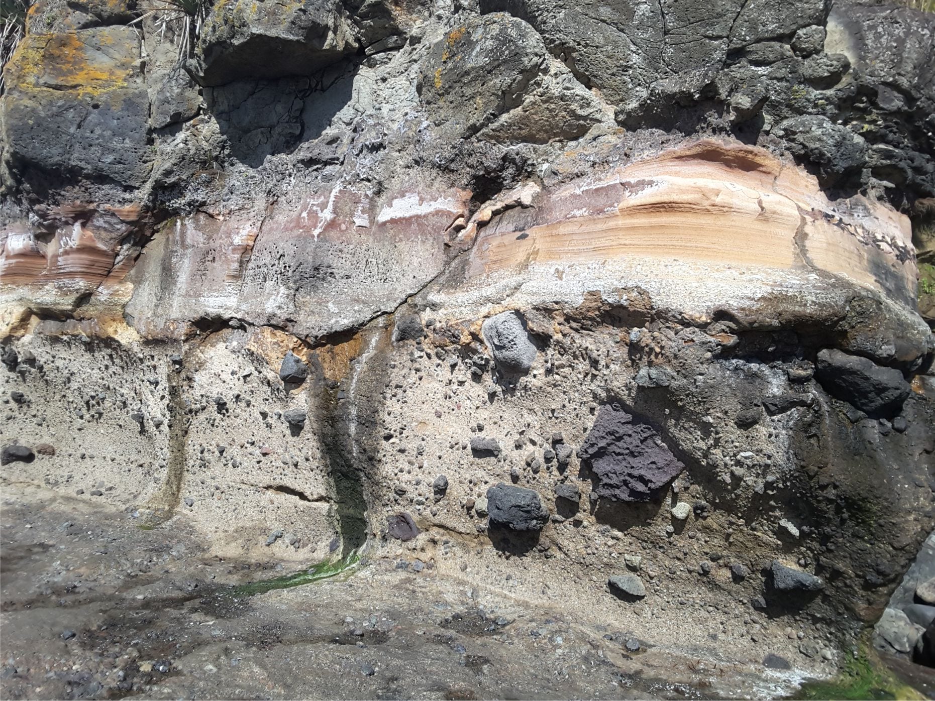
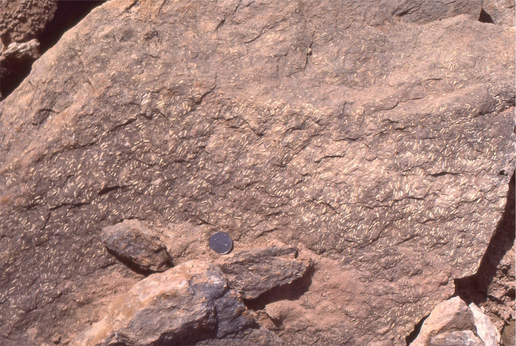
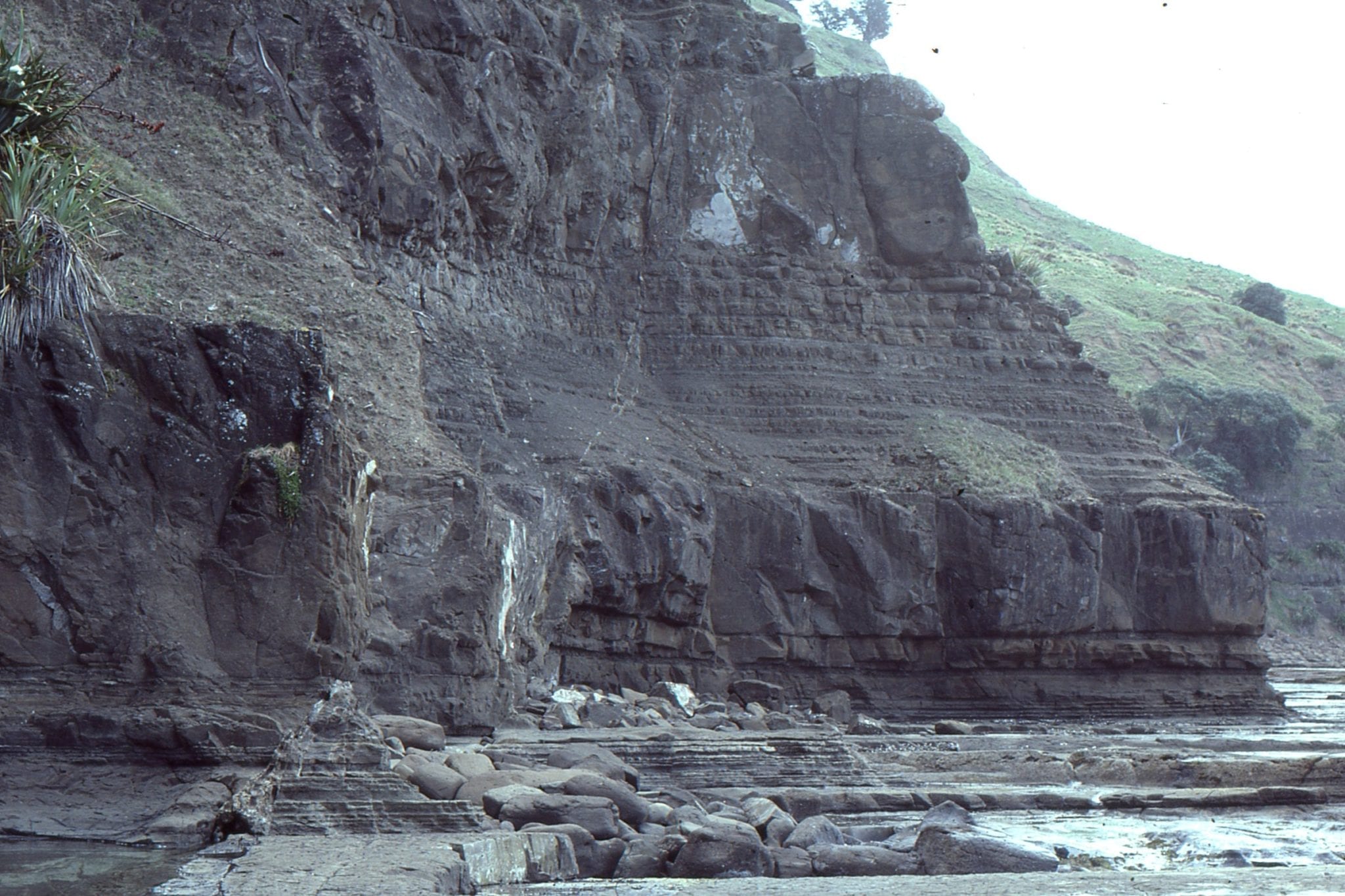
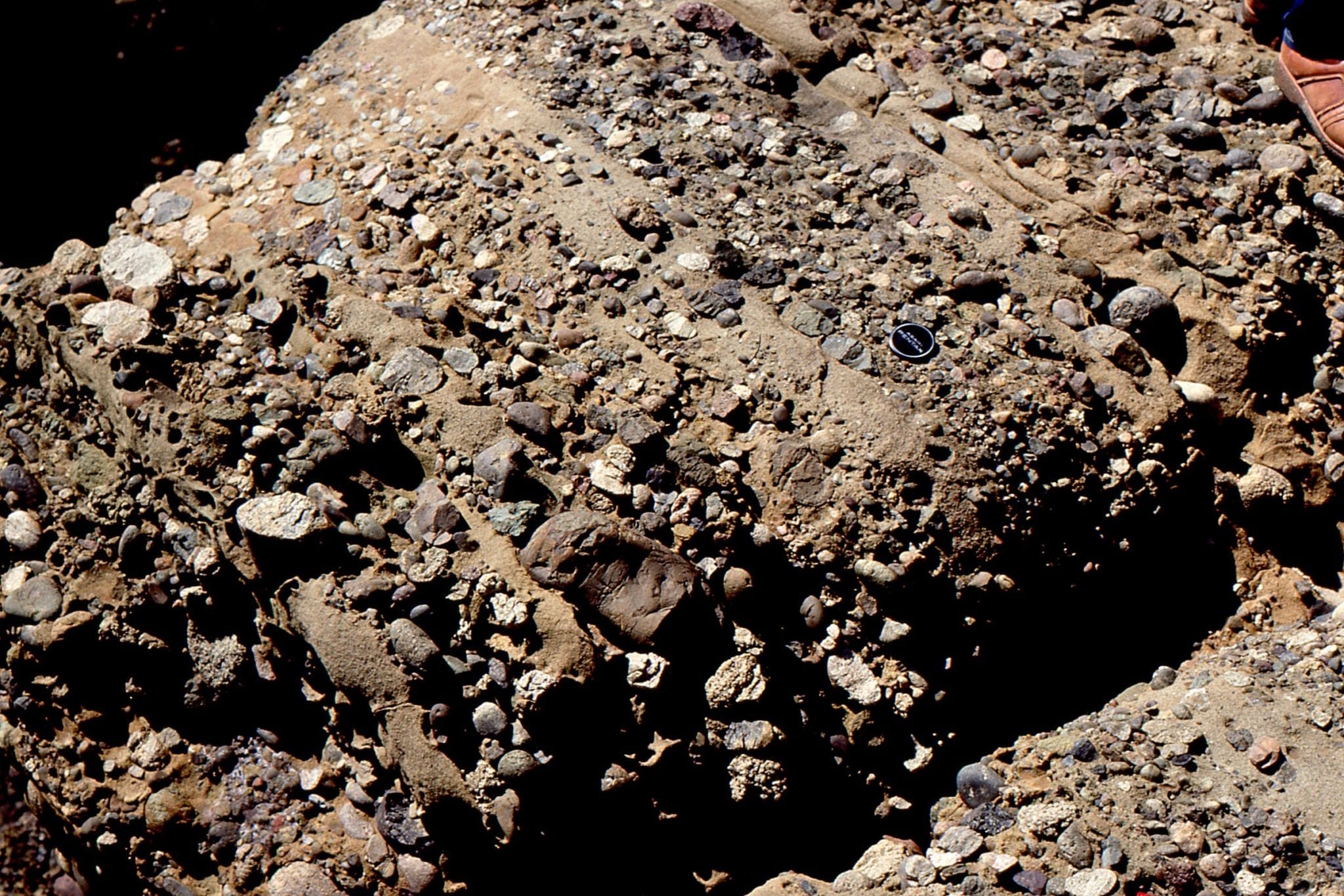
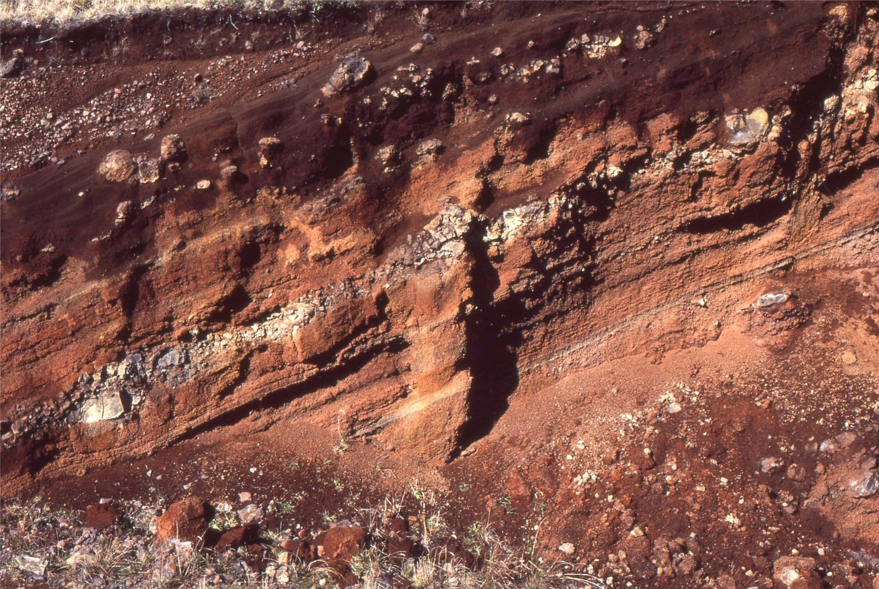
Karioi volcano is a Late Pliocene stratovolcano that dipped its toes in Tasman Sea. Upper left and right show an upper andesite flow, over airfall lapilli tuffs. Lower left detail of lapilli tuffs with a larger ballistic clast (20cm long). Lower right a laharic breccia.
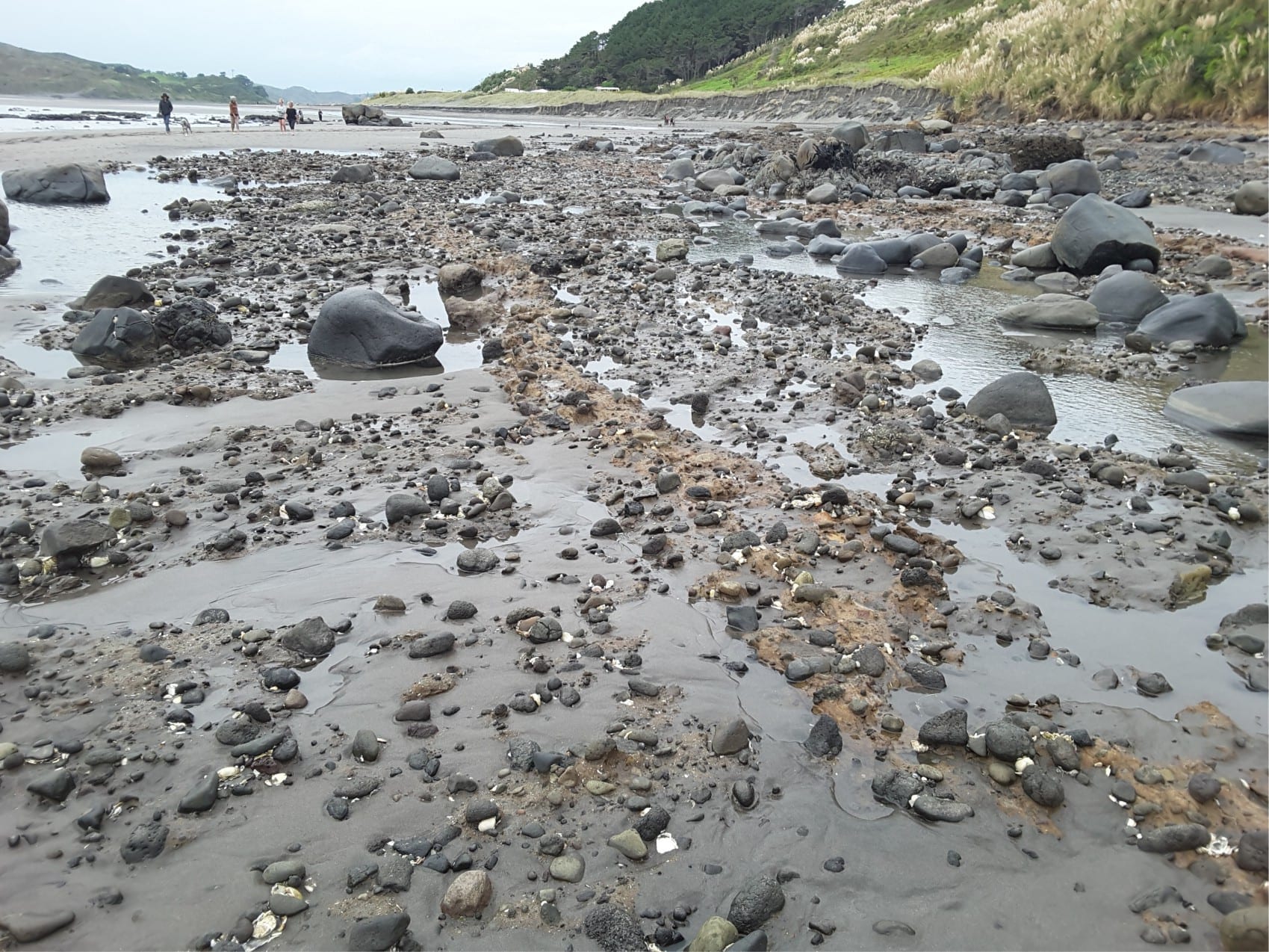
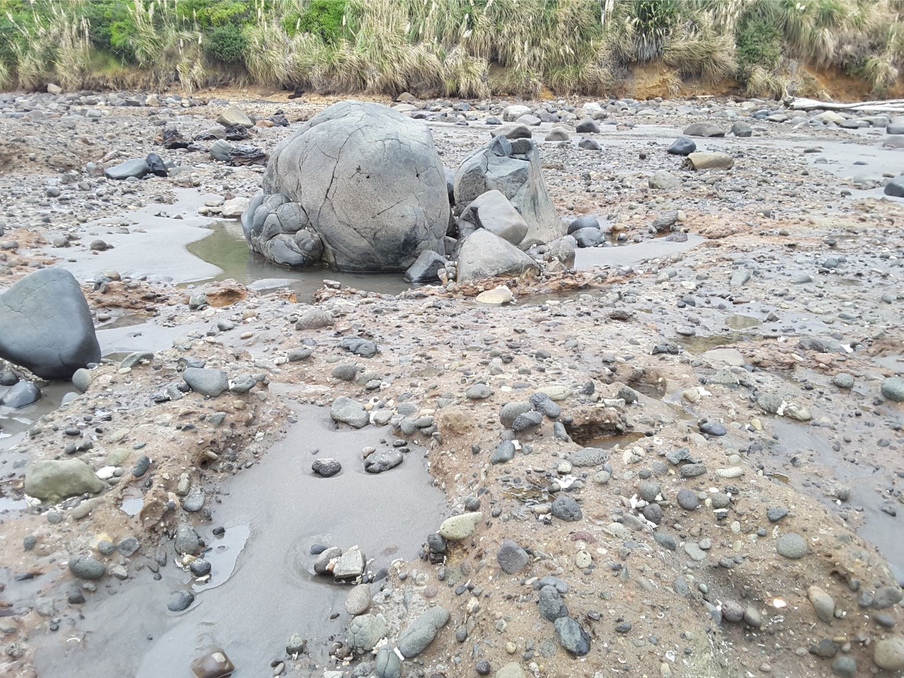
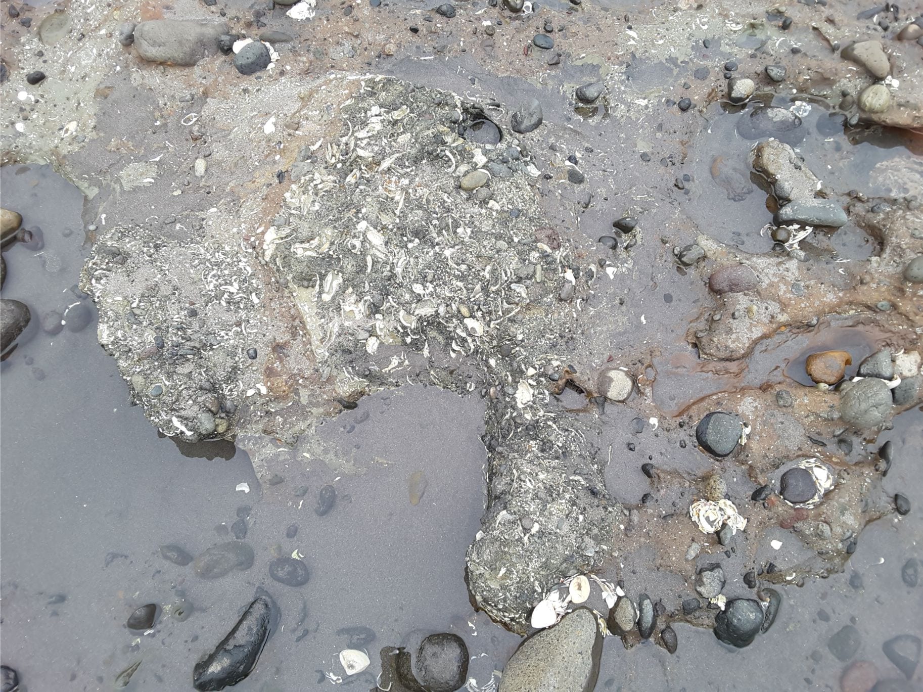
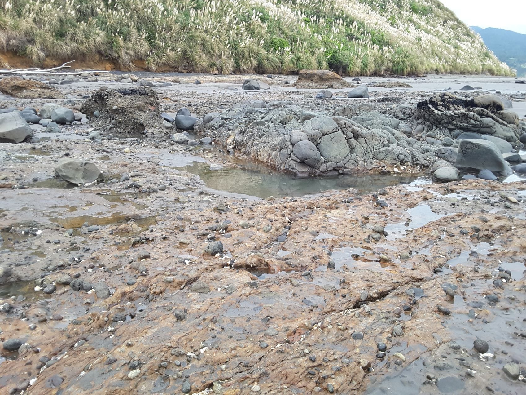
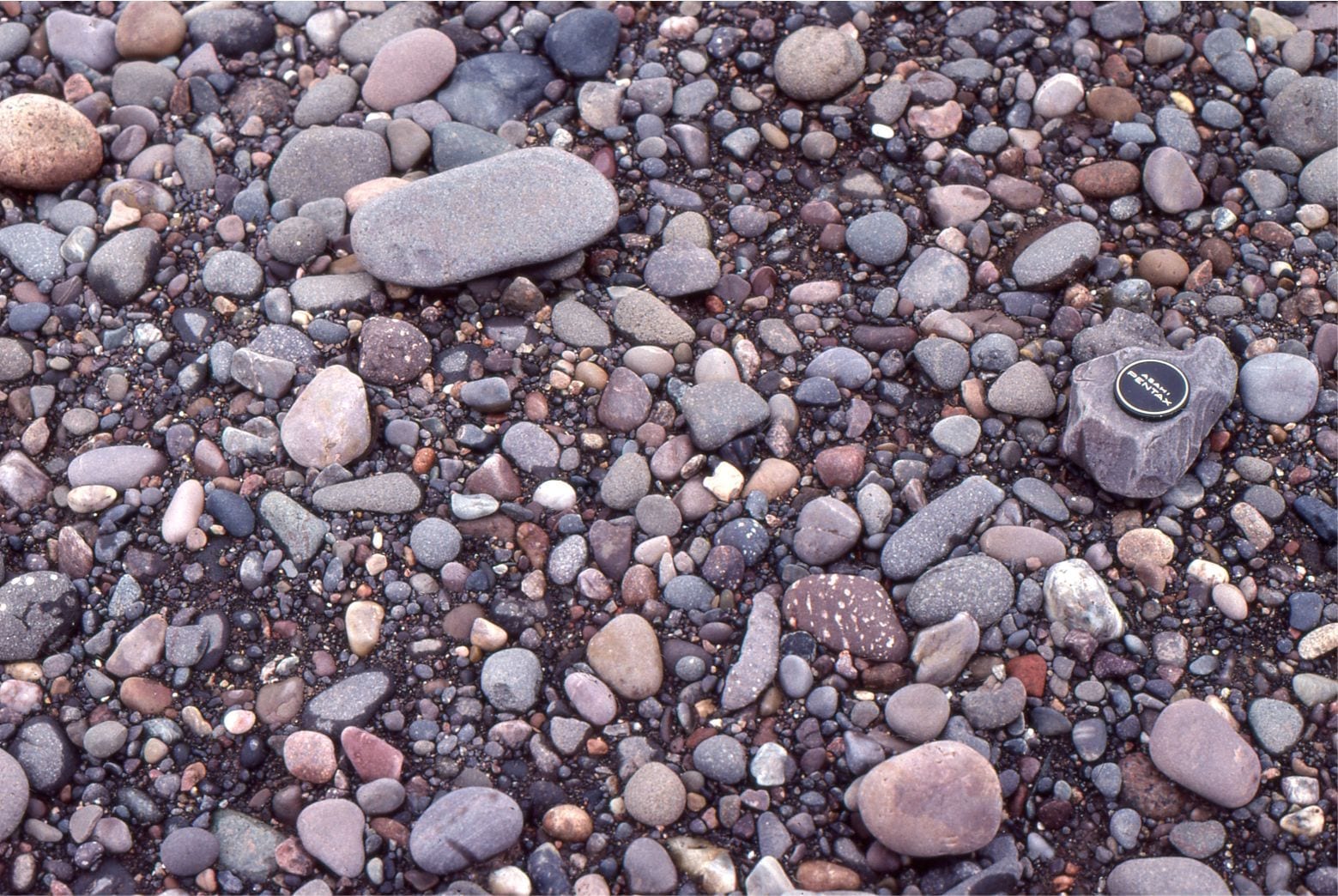
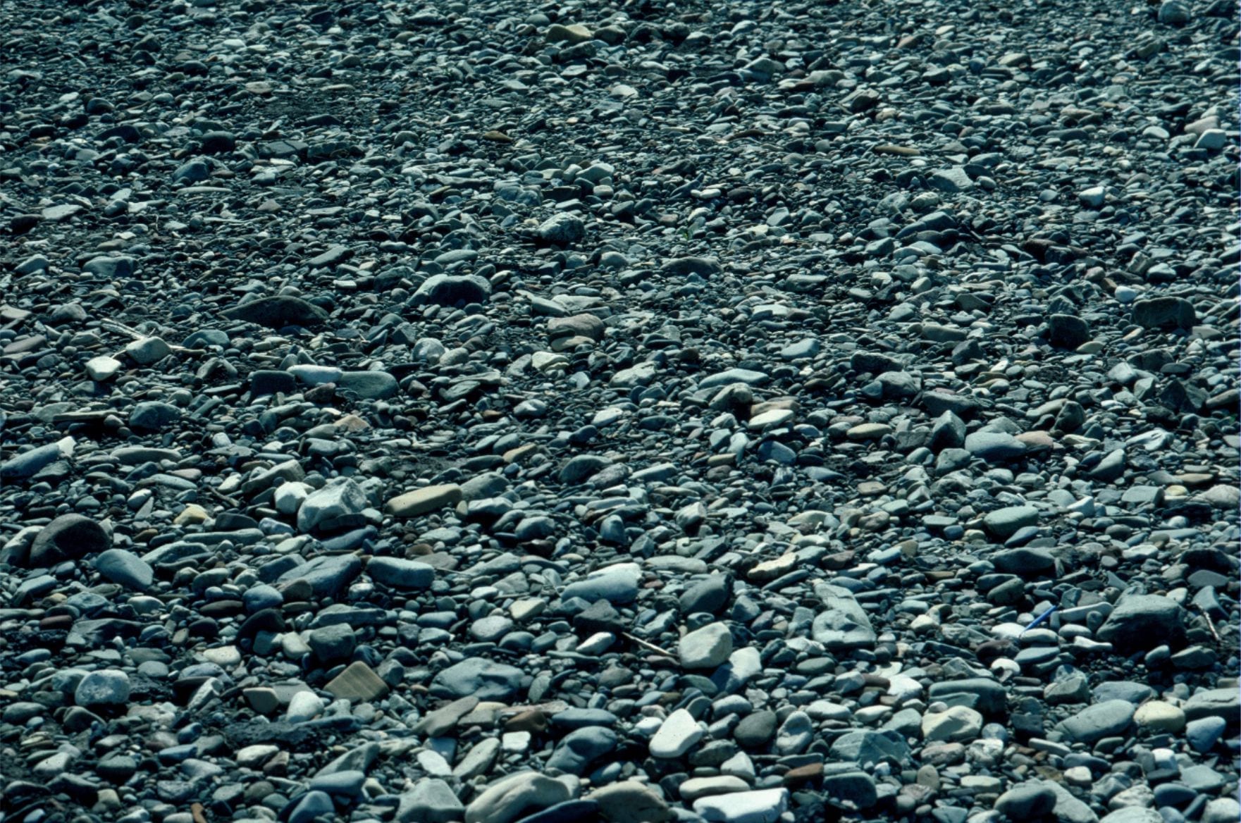
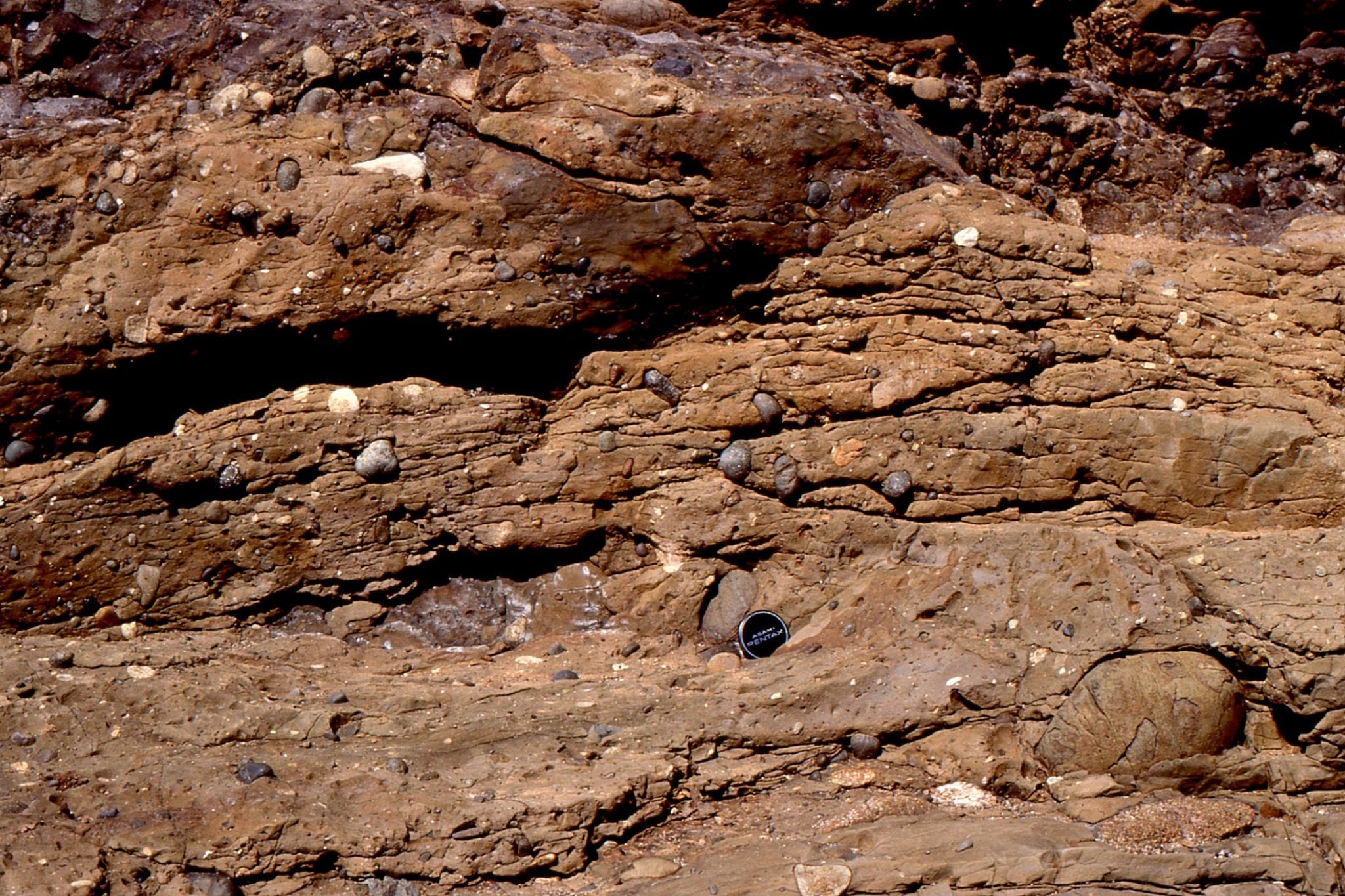
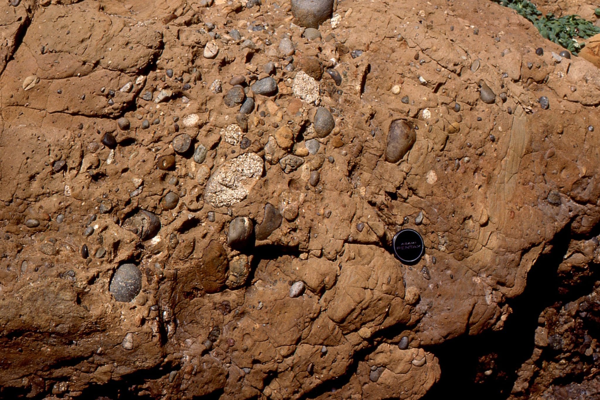
Four photos of volcanic debris subjected to stream reworking (this is where most of the clast rounding took place) and lahars from the flanks of the active volcano that delivered pebble to boulder sized debris to the Late Pliocene coast. Evidence for this is seen in pockets of fossil molluscs (mostly bivalves) that are part of the rock; don’t confuse these with modern bivalves commonly are wedged between clasts – these are not fossils. Rounding of clasts probably took place in streams and during coastal reworking. A few large boulder rafts are 3-4m across.
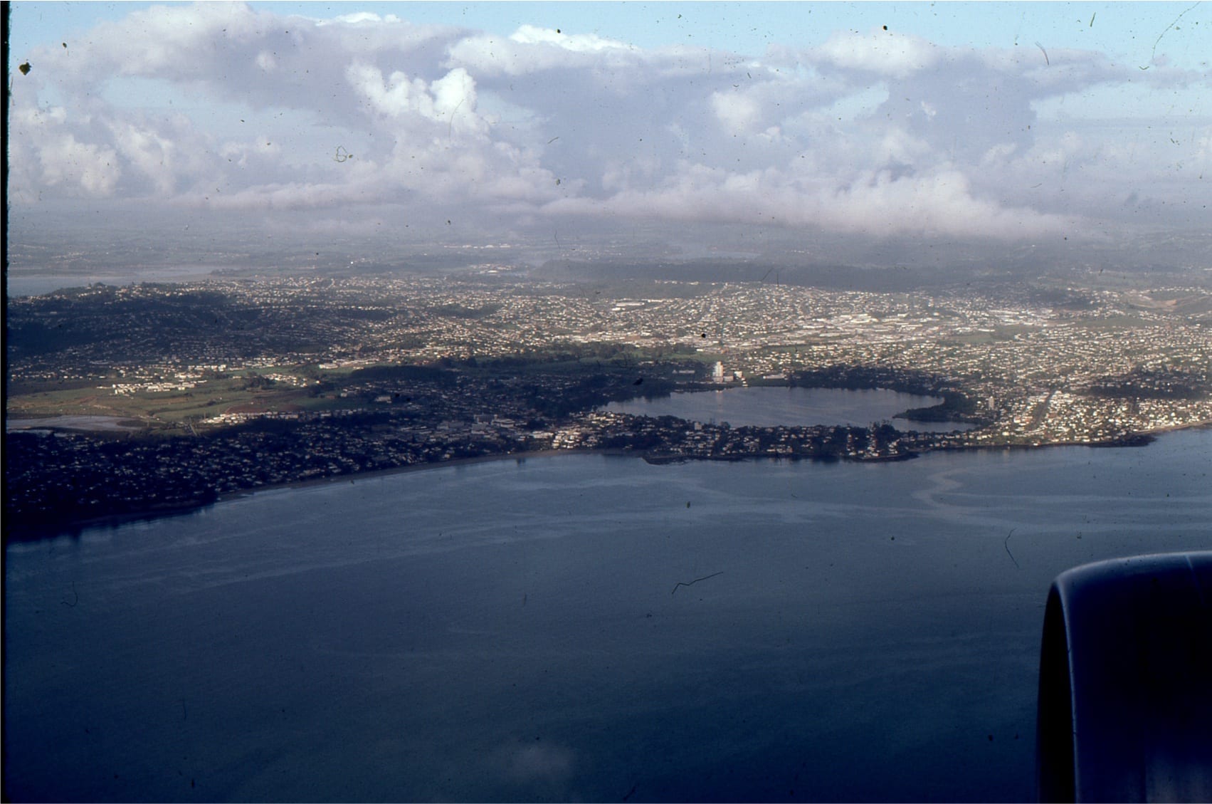
Auckland volcanic field contains about 50 known eruptive centres; scoria cones, lava flows, and craters formed by highly explosive, phreatomagmatic eruptions, concentrated in an area of metropolitan Auckland, about 360 sq km. Activity began about 250,000 years ago; the youngest is Rangitoto which erupted 600 years ago, and was witnessed by Auckland Mãori.
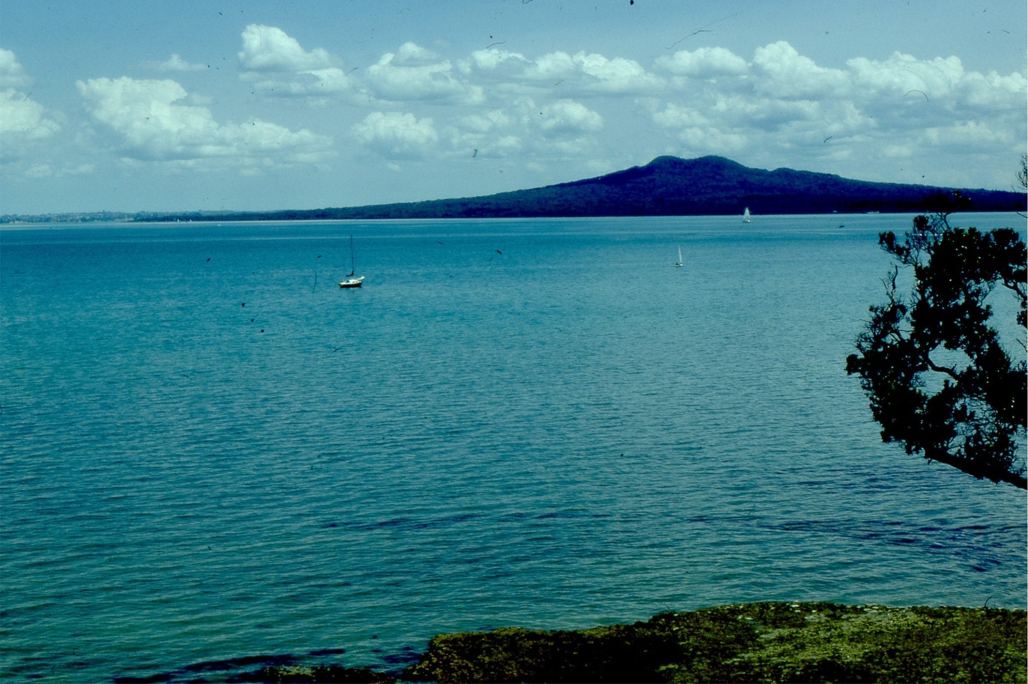
Eruption of Rangitoto in Auckland Harbour produced a circular island. The central scoria cone is flanked by aa basalt flows, air-fall scoria and lapilli. In the left image (viewed from Musik Point), Motukorea (also known as Brown’s Island) is a small cone, thought to have erupted 7000-9000 years ago. Right image of Rangitoto from Motuihi Island.
Rangitoto volcano structures: From the Upper left-right: Blocky and rubbly aa flows; Lower left a profile of weathered lapillia; Lower right, lava cave.
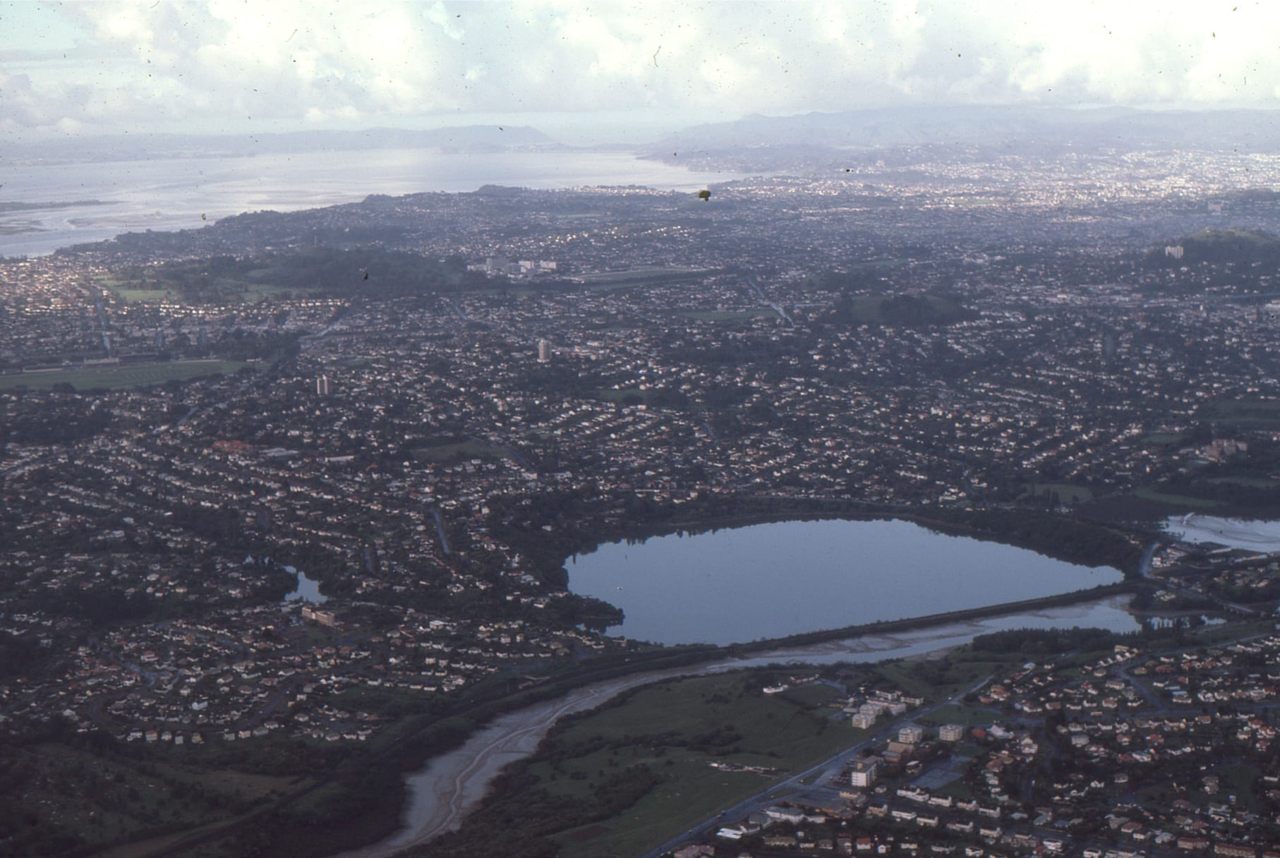
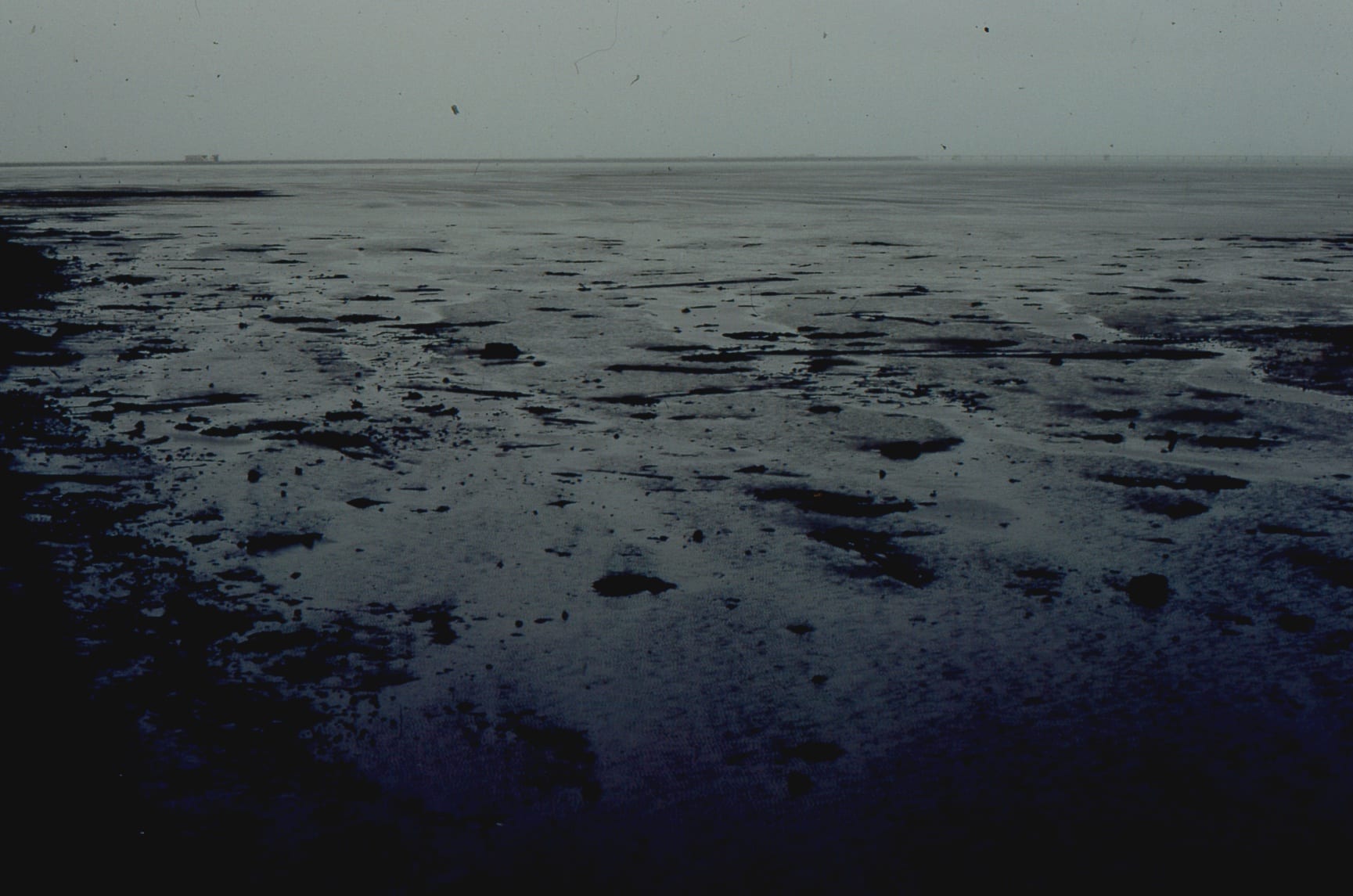
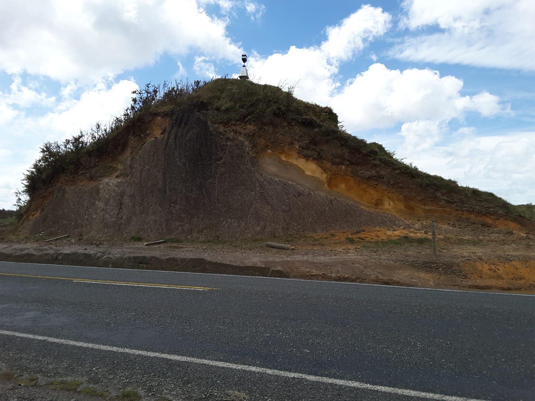
Explosion craters, or maars. Upper left, Lake Pupuke, now filled with a fresh water lake is more than 45,000 years old. Upper right, Orakei Basin is tidal – more than 83,000 years, and,
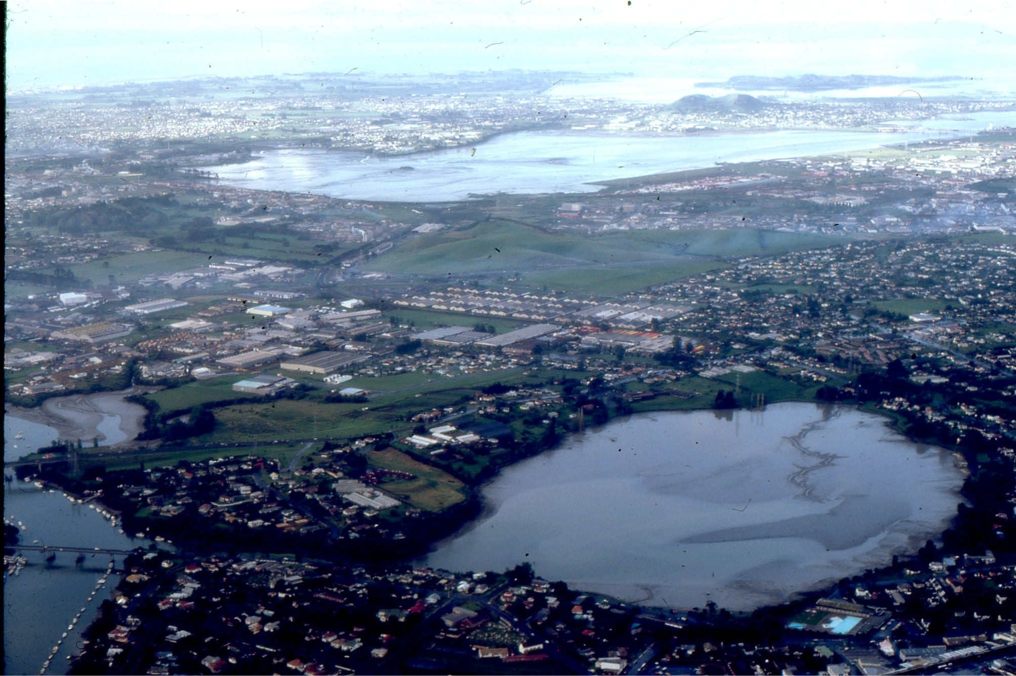
Lower left, Panmure Basin, also tidal, is older than 17,000 years. The crater entrance is a narrow rocky channel, connected to Tamaki estuary – this is the Pacific Ocean side of Auckland. The stretch of water in the distance is part of Manukau Harbour – the Tasman Sea side of Auckland. A narrow isthmus separates the two ocean water bodies. All three craters are rimmed by tephras. Lake and tidal basin sediment fill can also be used to date the events, using pollen and ash layers derived from more distant eruptions in Rotorua-Taupo.
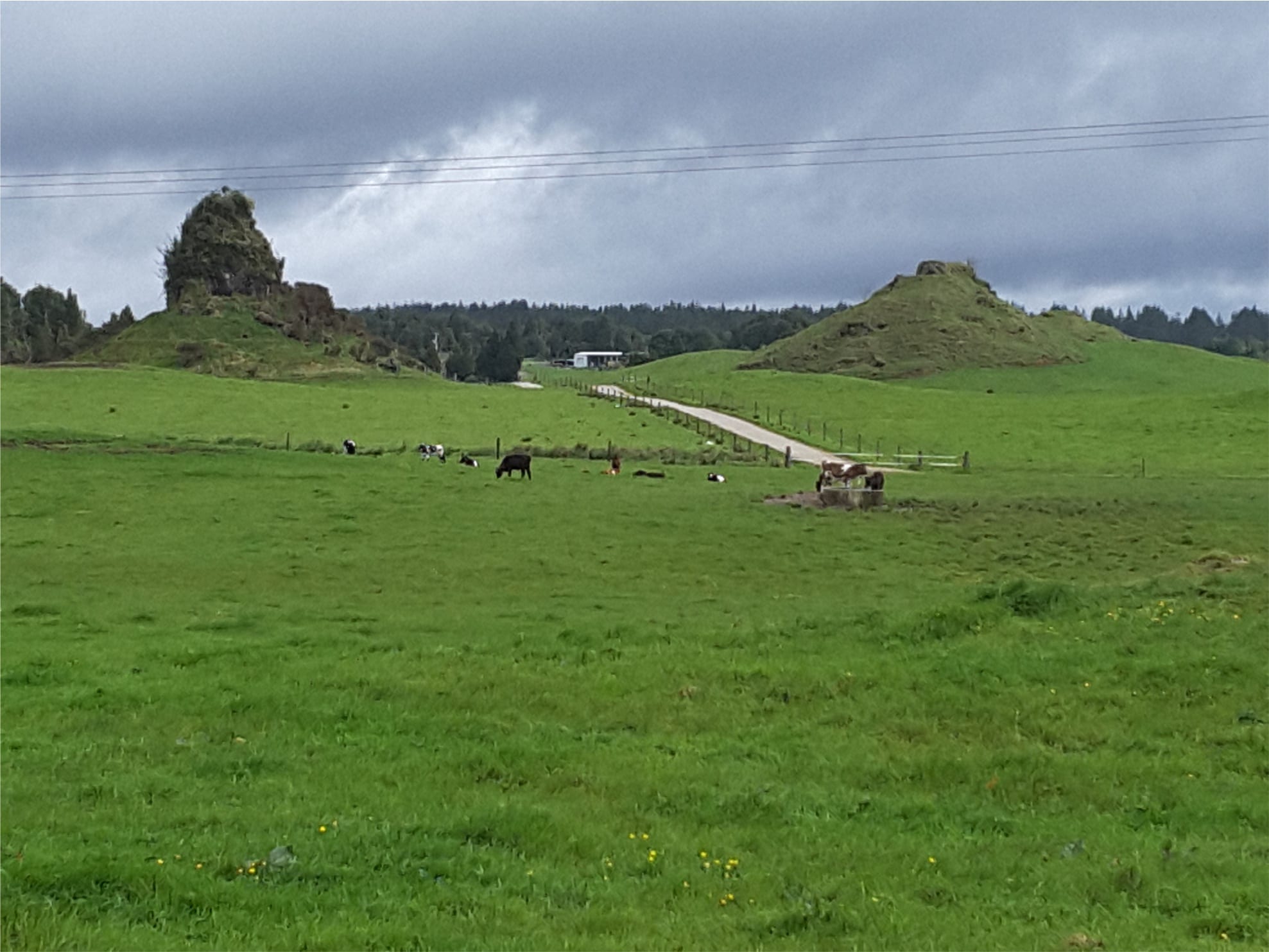
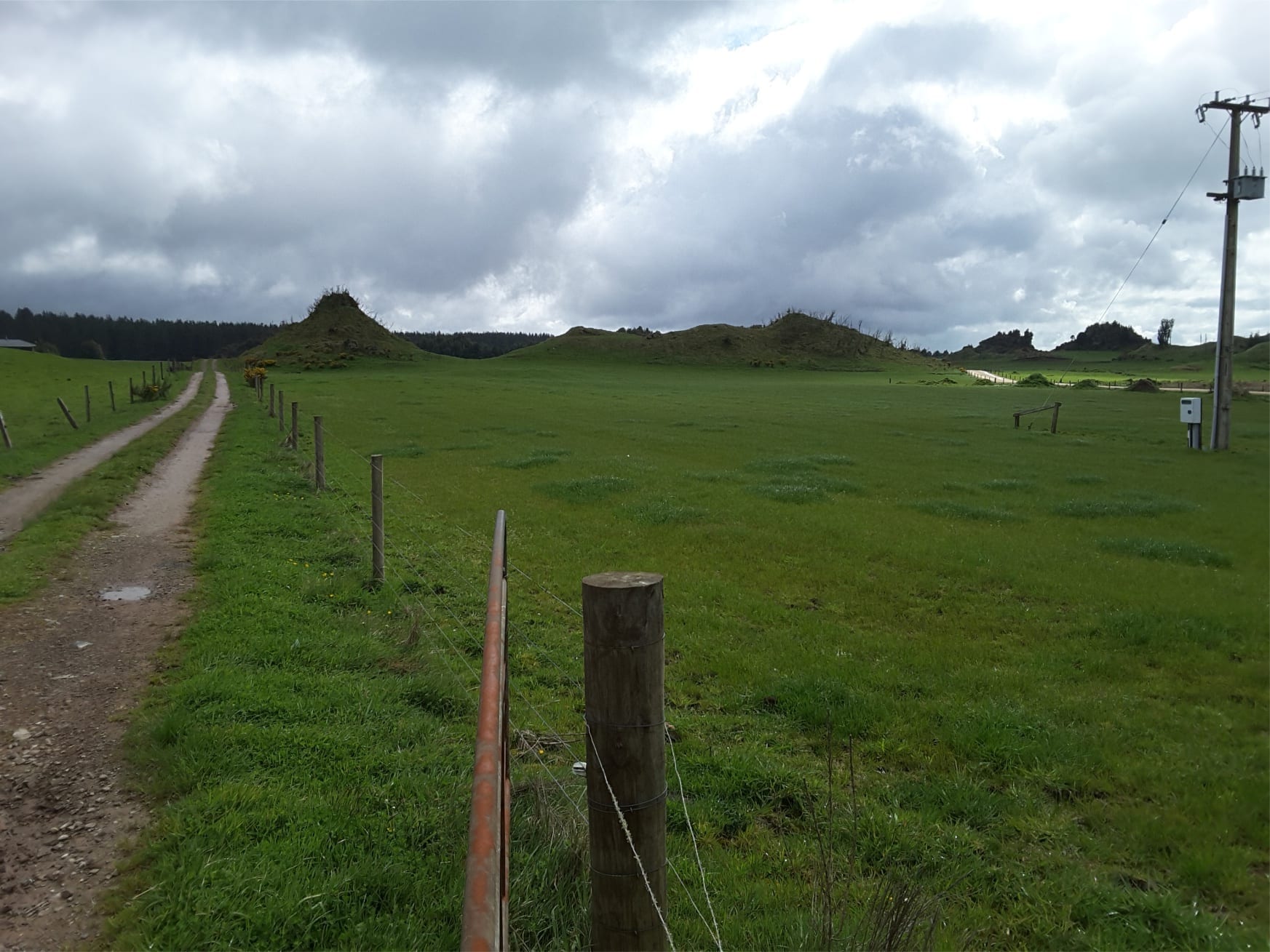
Maungataketake maar volcano
Three images show well bedded air-fall tephra layering near the outer rim of Maungataketake maar volcano, bordering Manukau Harbour, west Auckland. It is close to Auckland International Airport. Age is uncertain but could be as old as 177,000 years. Layers were also disrupted by ballistics (bomb sag, middle image).
The Maungataketake maar eruption obliterated a nearby forest – ash layers drape a stump (right), and in the modern shore platform, large tree trunks were flattened (left).
Mt Taranaki
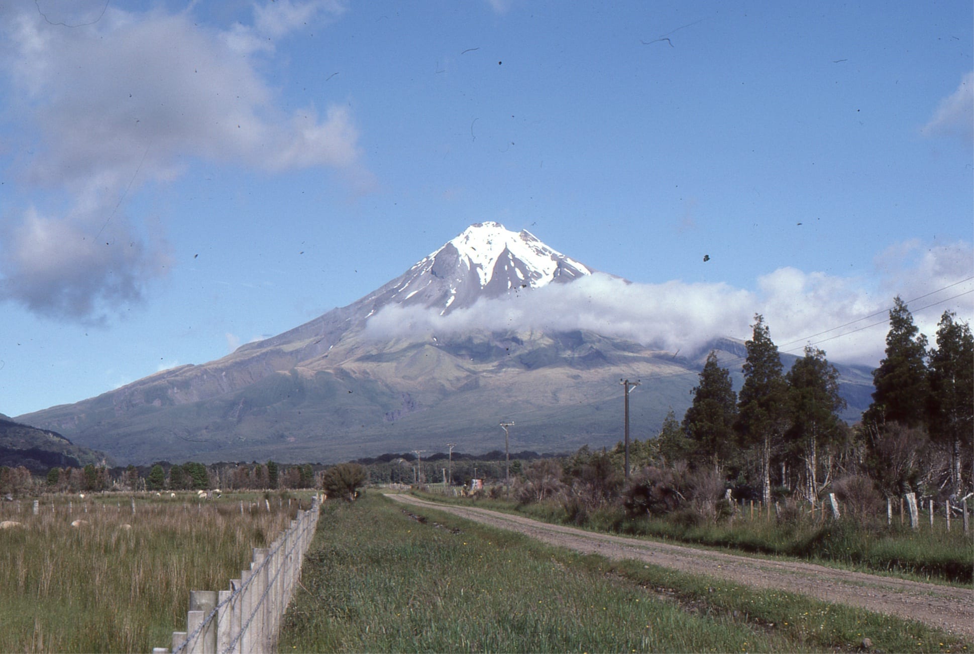
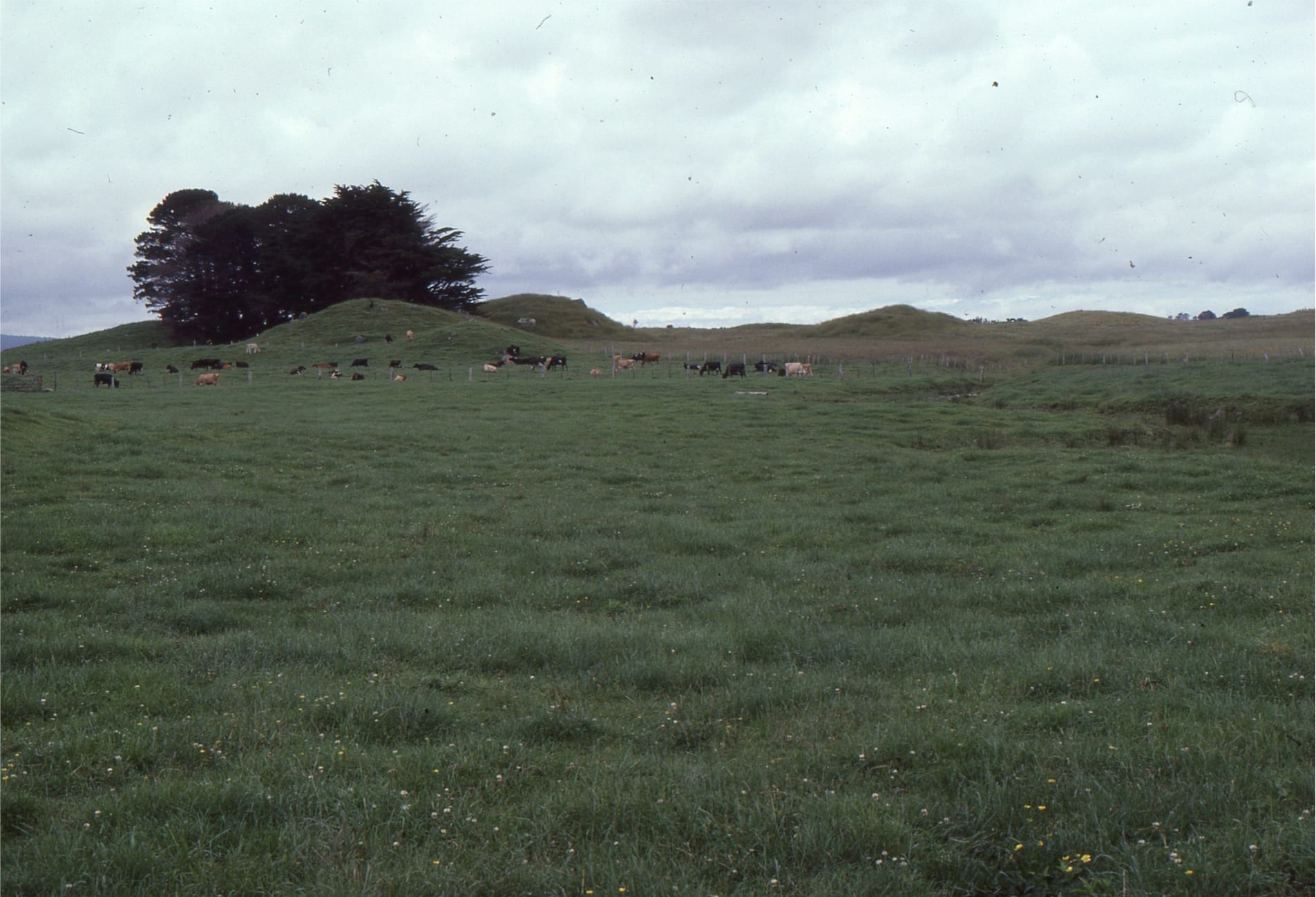
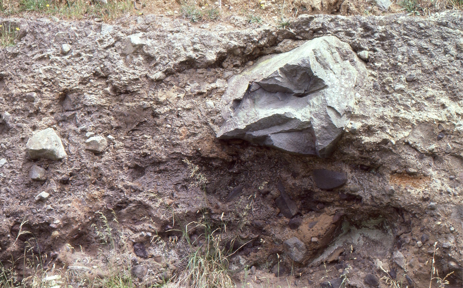
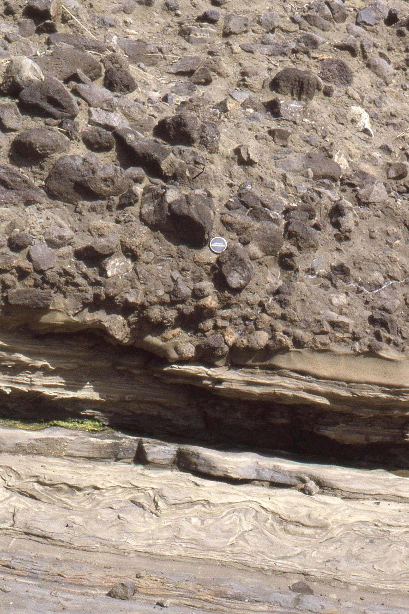
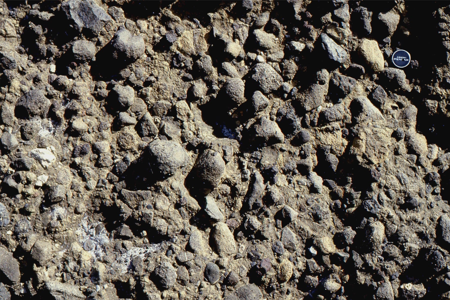
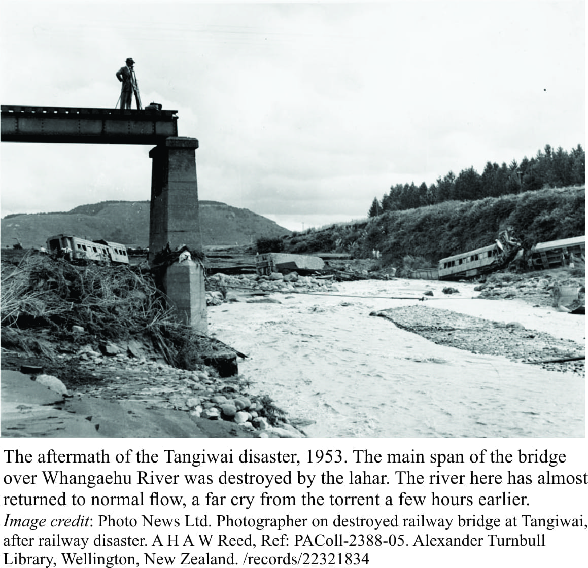
Mt Taranaki (Egmont), is an andesitic stratovolcano that began erupting 130,000 years ago. It is regarded as active. The edifice is surrounded by a spectacular ring plain, dotted with lahar mounds (upper right), testament to the destructive nature of volcanoes even when not erupting. The lahars were generated on the volcano flanks during large landslides, including possible sector collapse; loose rock, mud and water form fluid, fast-moving flows. They can travel many kilometres from their source. Conical lahar mounds commonly form around very large rafts of rock (sometimes many metres across), once the flow has come to rest. Lower left – right show typical, poorly sorted lahar textures.
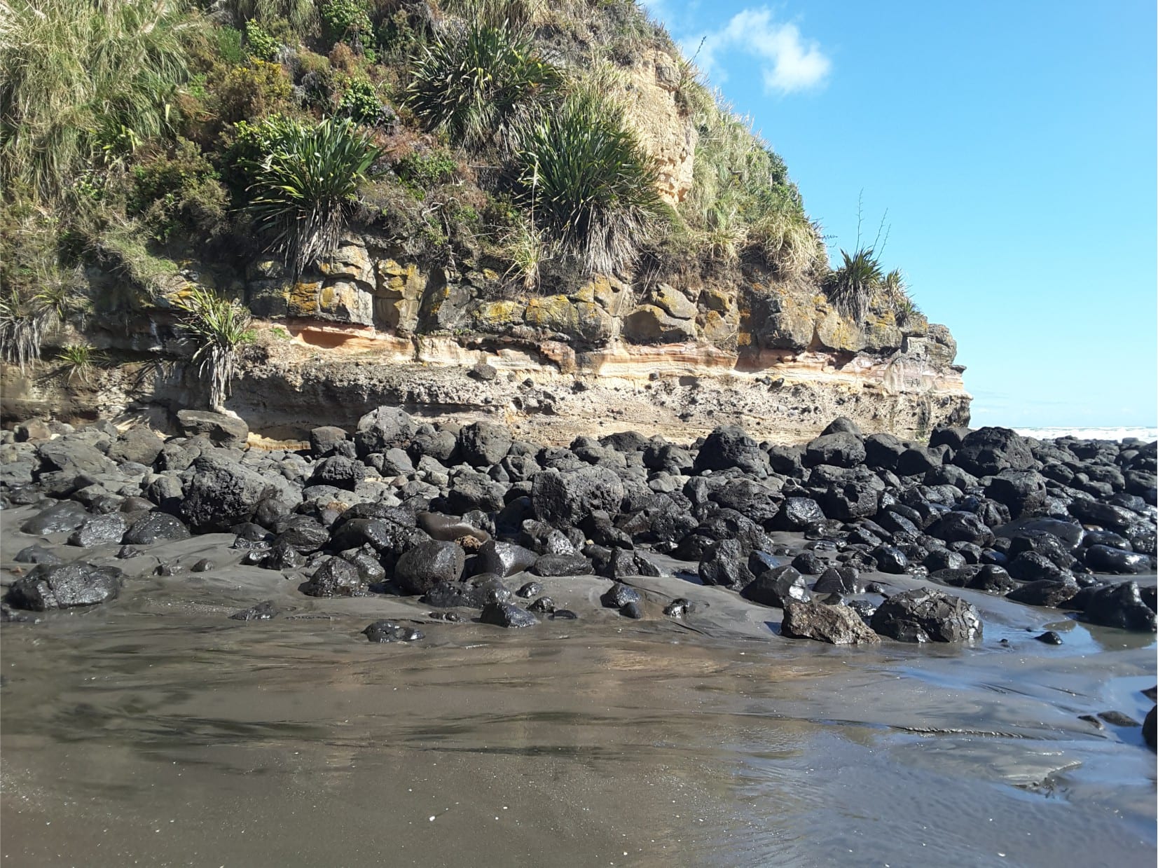
Waitakeri, Lower Miocene
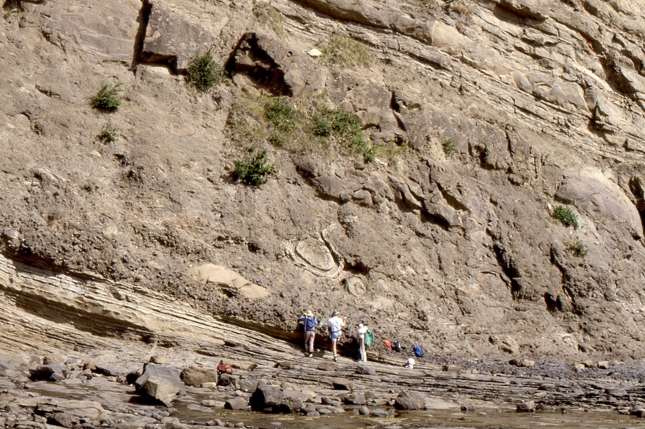
West of Auckland city, Waitakere hills are underlain by Early Miocene andesitic and basaltic flows, pillows, and debris flows, derived from volcanic centres off the west coast of New Zealand. Marine fossils are commonly caught up in the lahars and debris flows. Typical debris flow textures shown on the upper left; upper right cliff with many stacked debris flows) boulders up to 1.5m wide), intruded by a dyke – Karekare Beach. Lower left image shows two, very large lava tubes, filled with radially jointed andesite (Maori Bay), feeders from nearby Waitakere Volcano.
Mamaku Plateau, Late Pleistocene
Conical mounds on Mamaku Plateau, north of Rotorua, look superficially like lahar mounds. However, in this case the mounds formed from a hot ignimbrite (240,000 years ago) with preferential cementation and welding by hot gases. Subsequent erosion has left the harder zones upstanding (also called Tors). The image on the lower left shows this hard, central zone. (located on State Hwy 5)
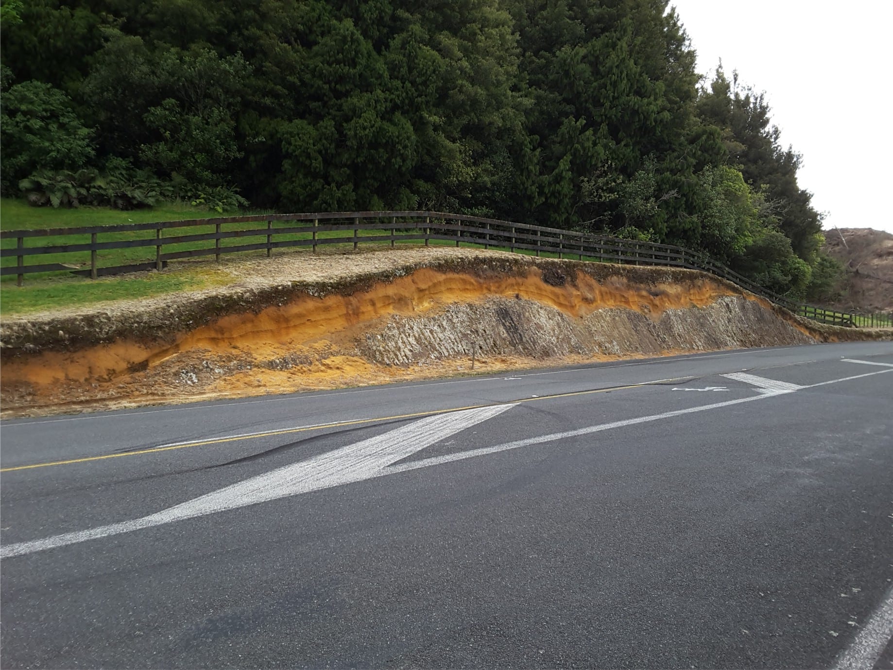
Left. A Mamaku Plateau mound with central cemented, resistant hard core (a remnant of the Mamaku Plateau Ignimbrite), draped by air-fall tephra. Right. Detail of air-fall tephras.
Mt Ngauruhoe
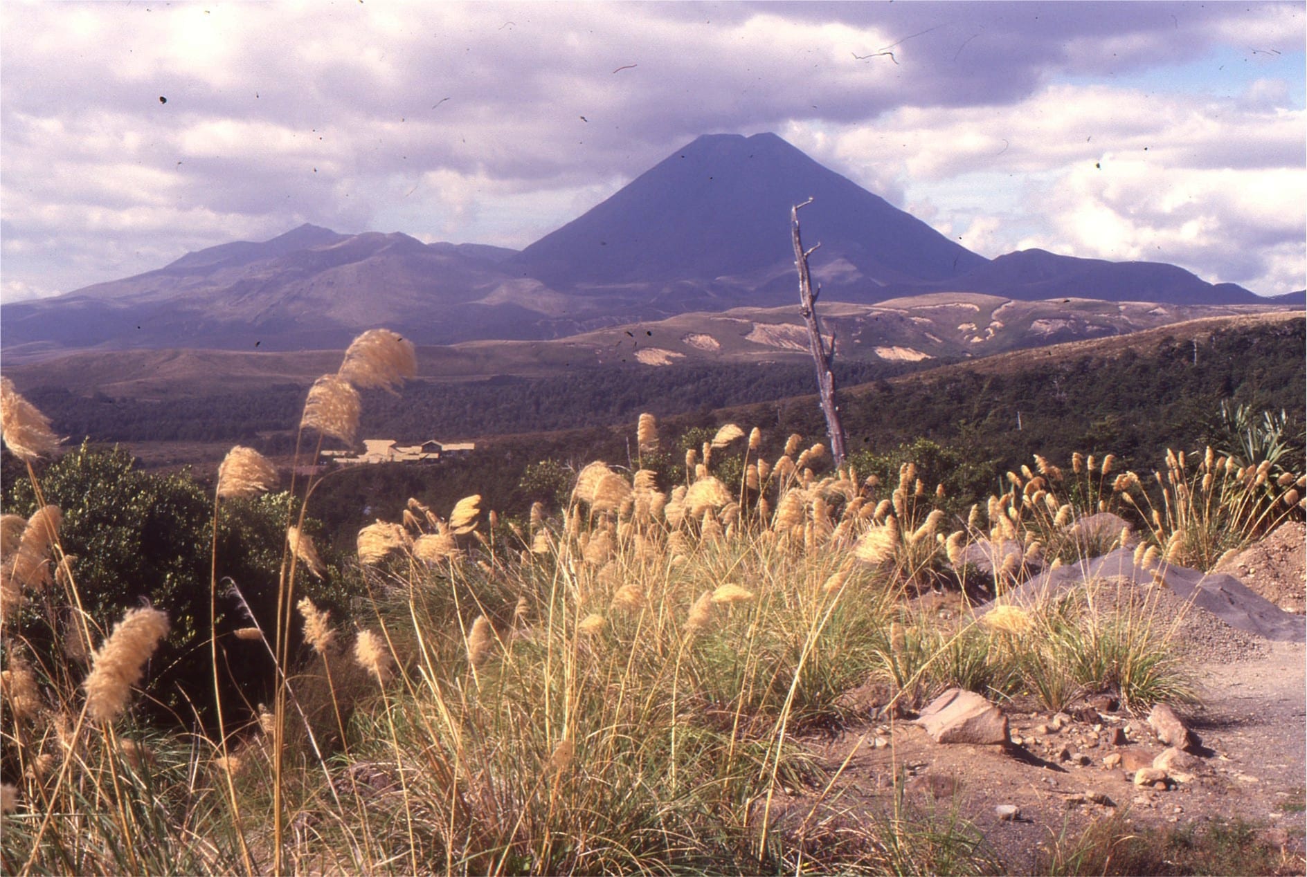
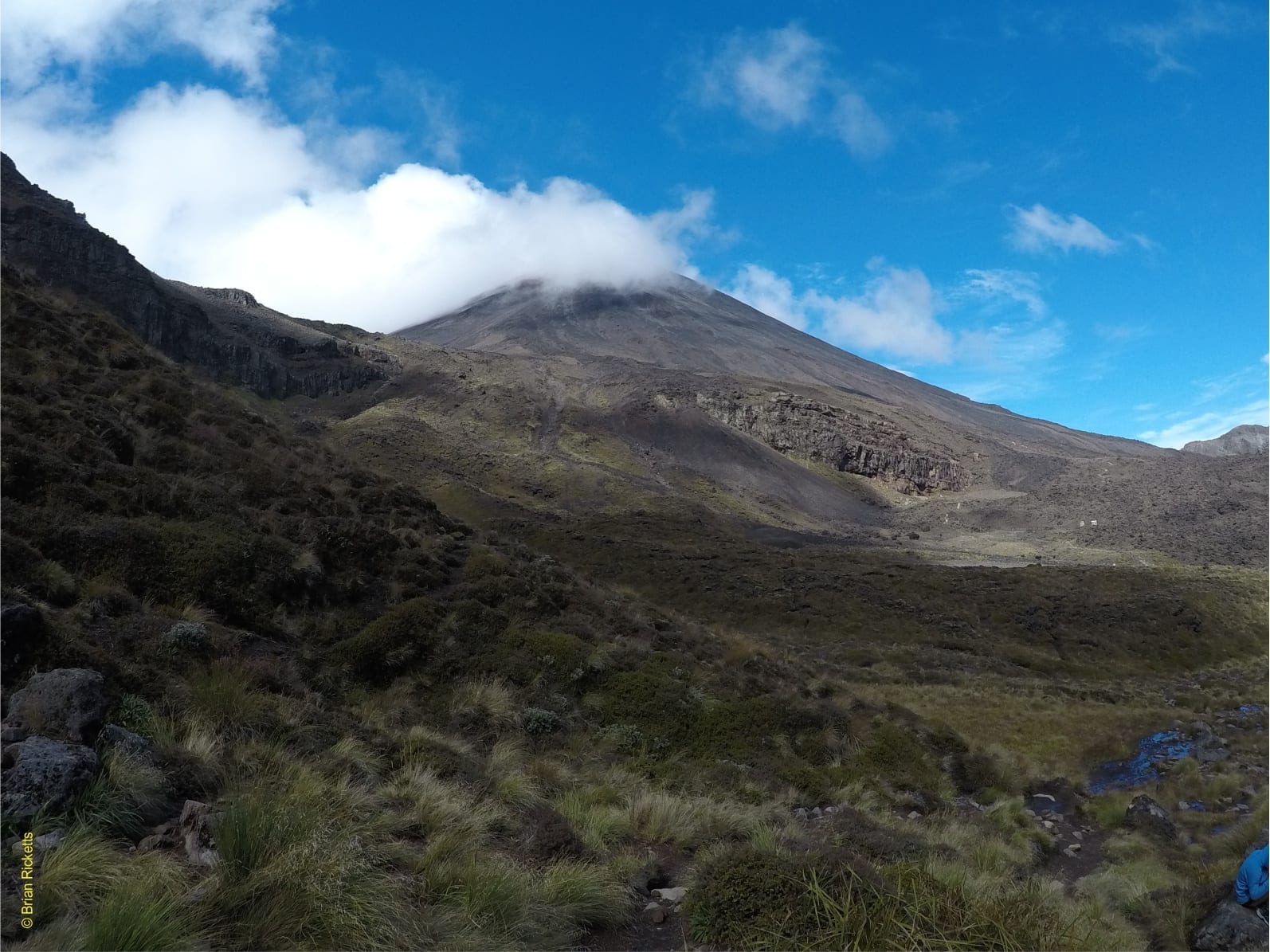
Mt Ngauruhoe (aka Mt Doom) is a stratovolcano, and the youngest component of the Tongariro volcanic complex. It may be as old as 7000 years. It is made up of andesite flows, scoria and ash. Several young lava flows extend into adjacent Mangatepopo Valley.
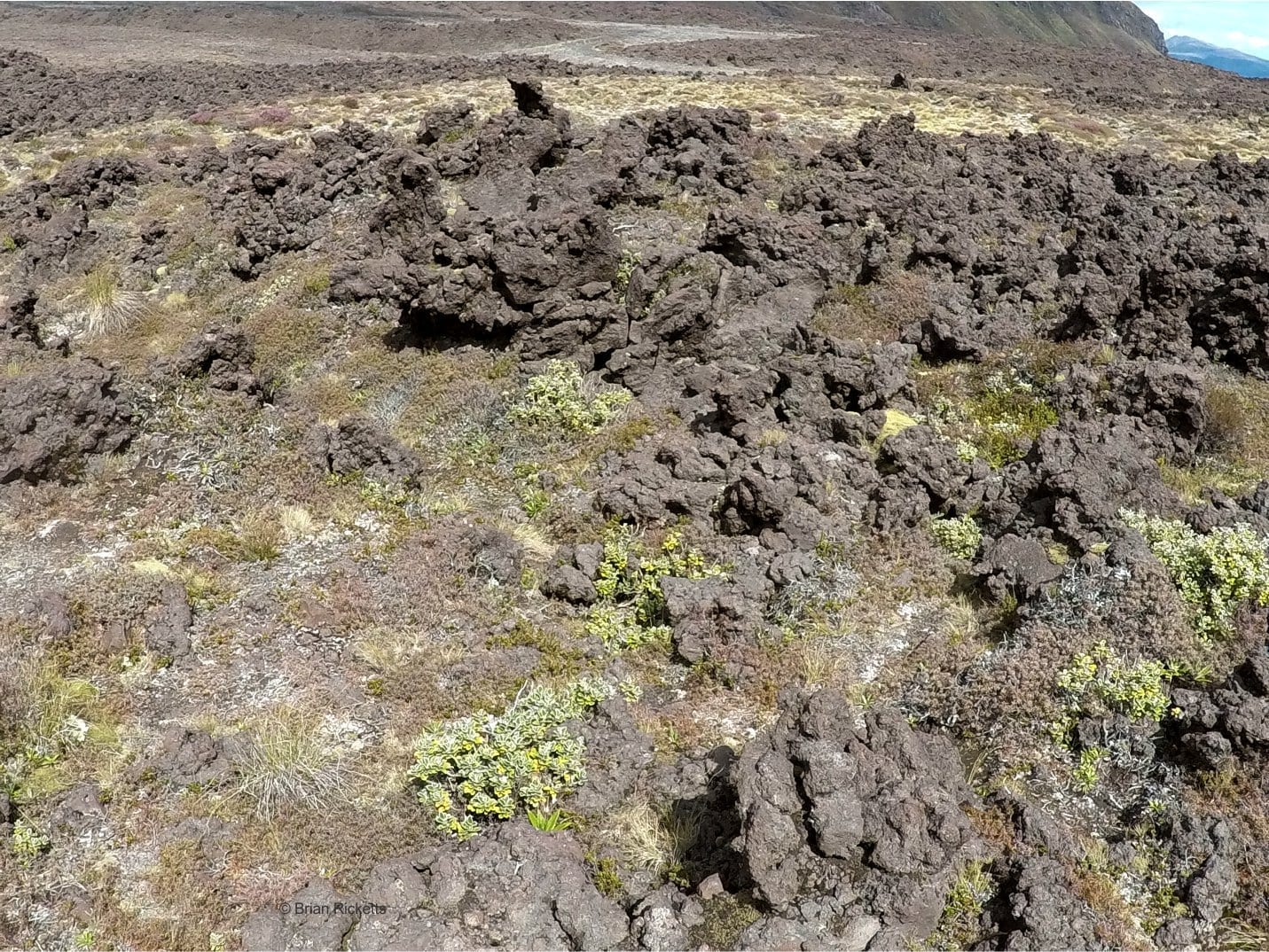
Left: Typical scoriaceous aa flow in Mangatepopo Valley. Right: Looking down the path of a pyroclastic flow generated during the 1975 eruption. The flow contains a chaotic jumble of scoria and ash, with blocks up to 2m across. In place there are distinct rubbly levees. The flow rode over part of an older lava flow – the darker grey area, upper middle of image.
Hawaii
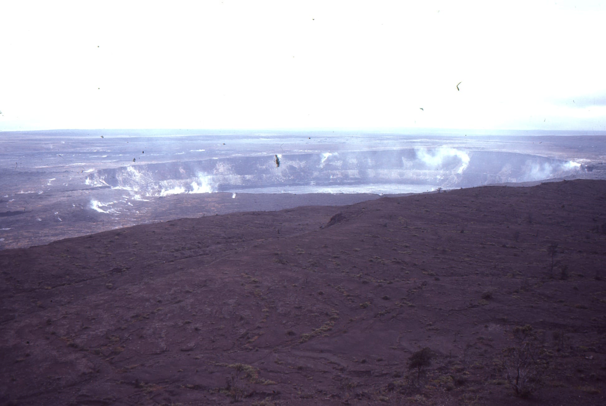
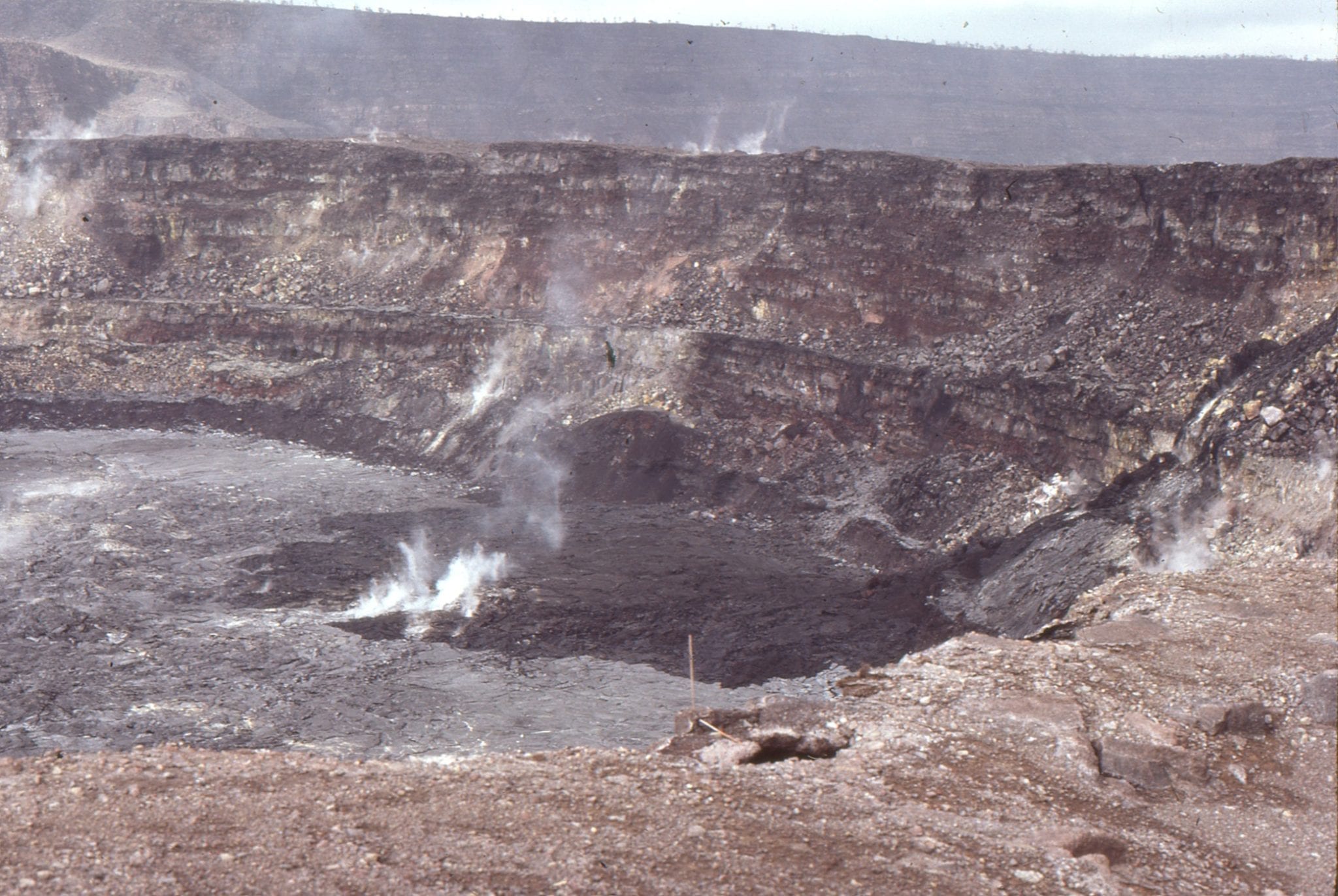
Halemaumau crater, Kilauea as it was in 1983. It looks very different now after collapse and eruption in 2019.
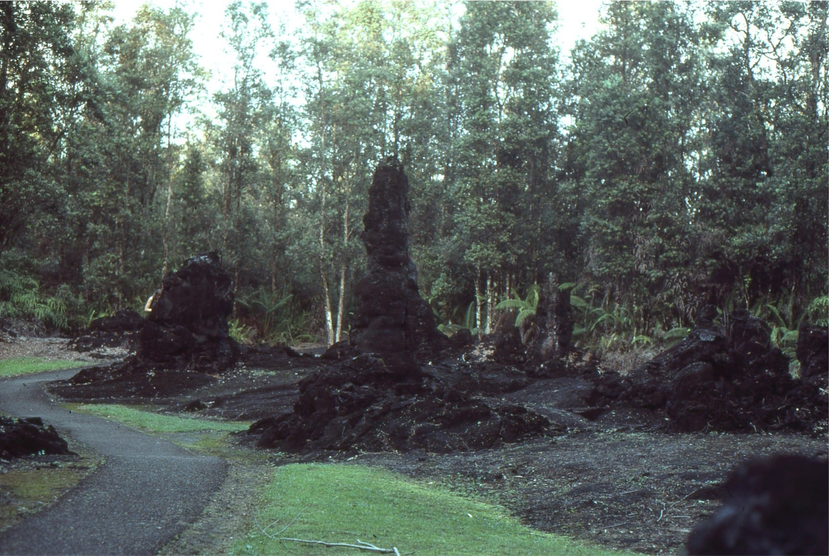
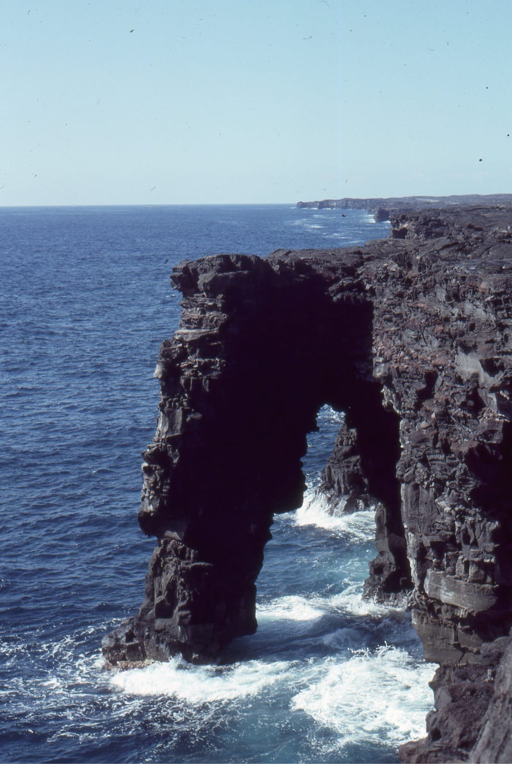
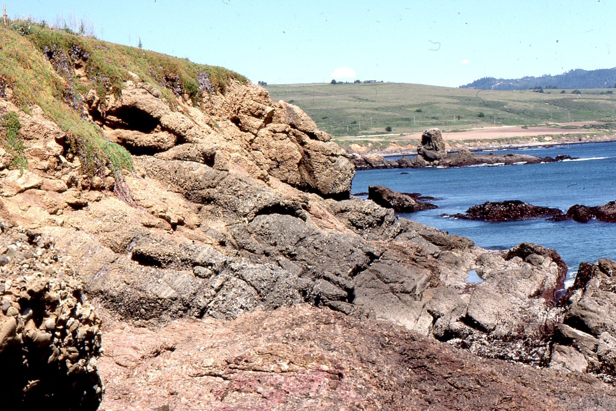
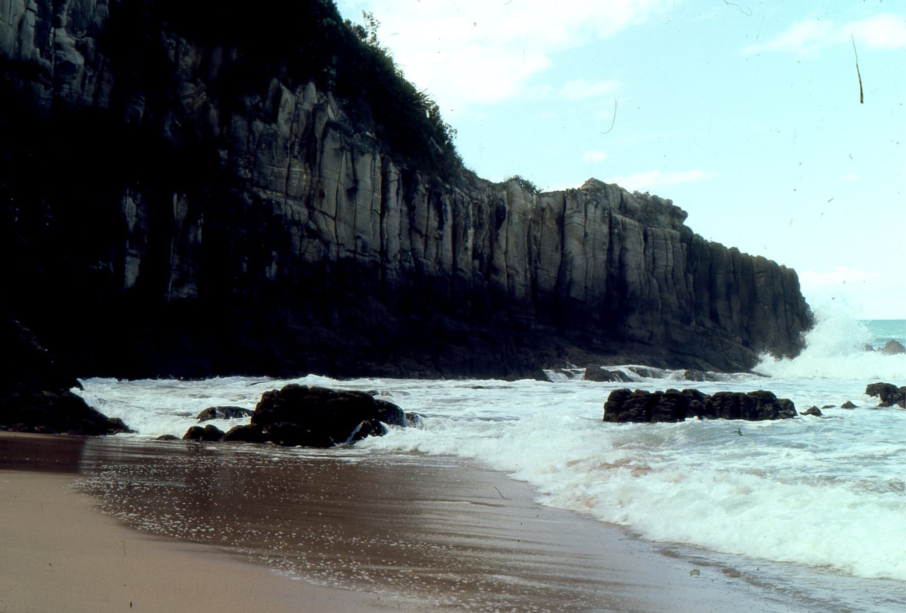
Left: Lava tree, cast during a 1790 eruption. Right: A nice sea arch eroded into layered flows.
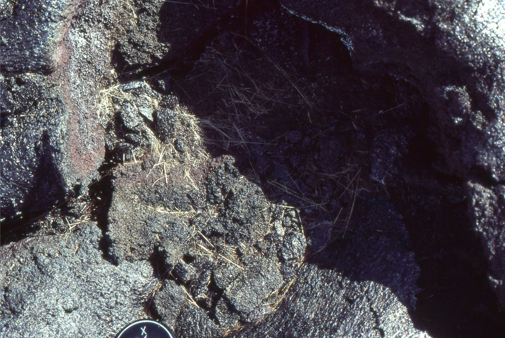
Left: Spatter on a small lava tube vent, Kilauea. Right: Pelee’s Hair – volcanic glass that has been stretched while molten. The preservation potential of such structures is very low.
A small flow with ropy central portion and raised levees of fragmented basalt.
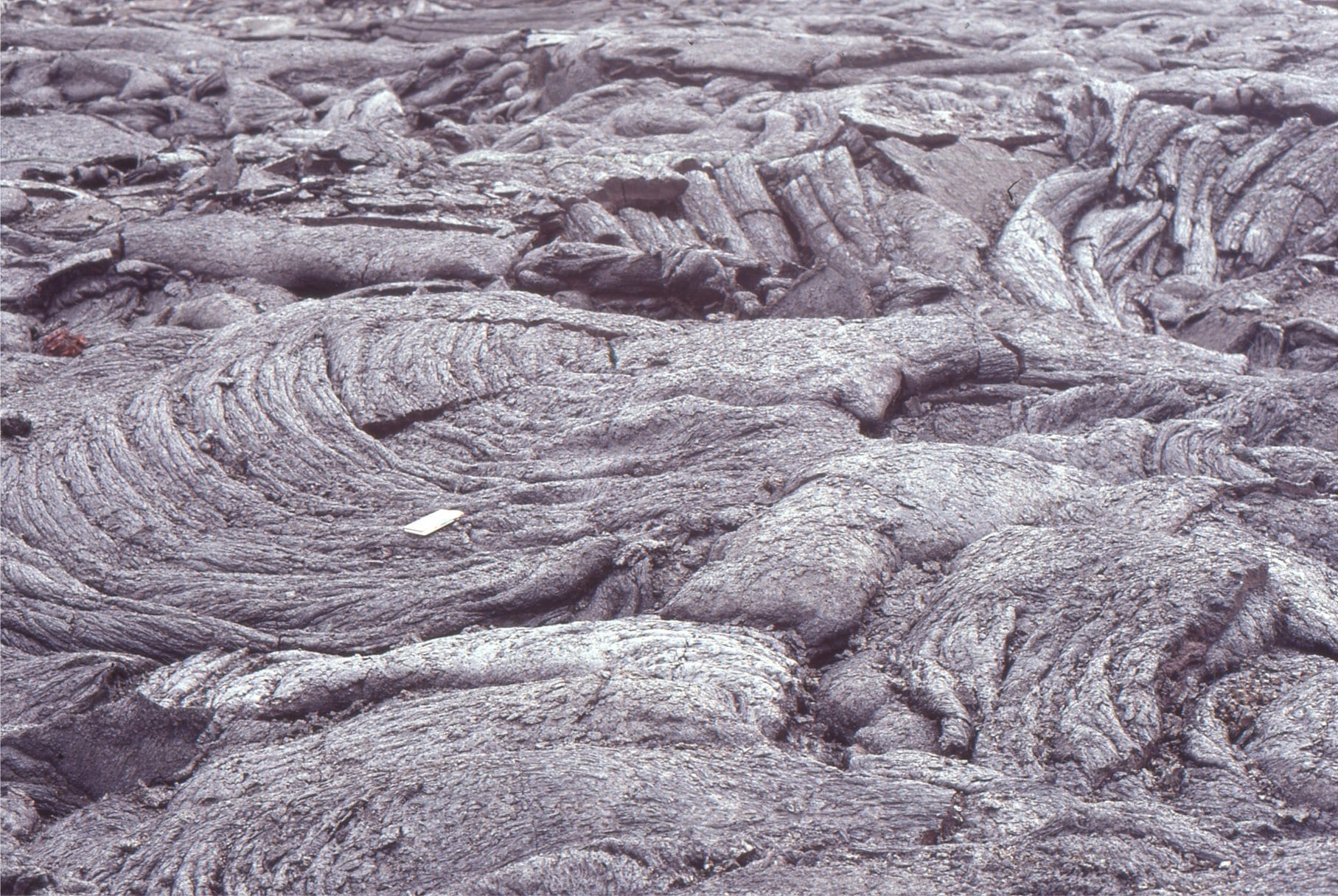
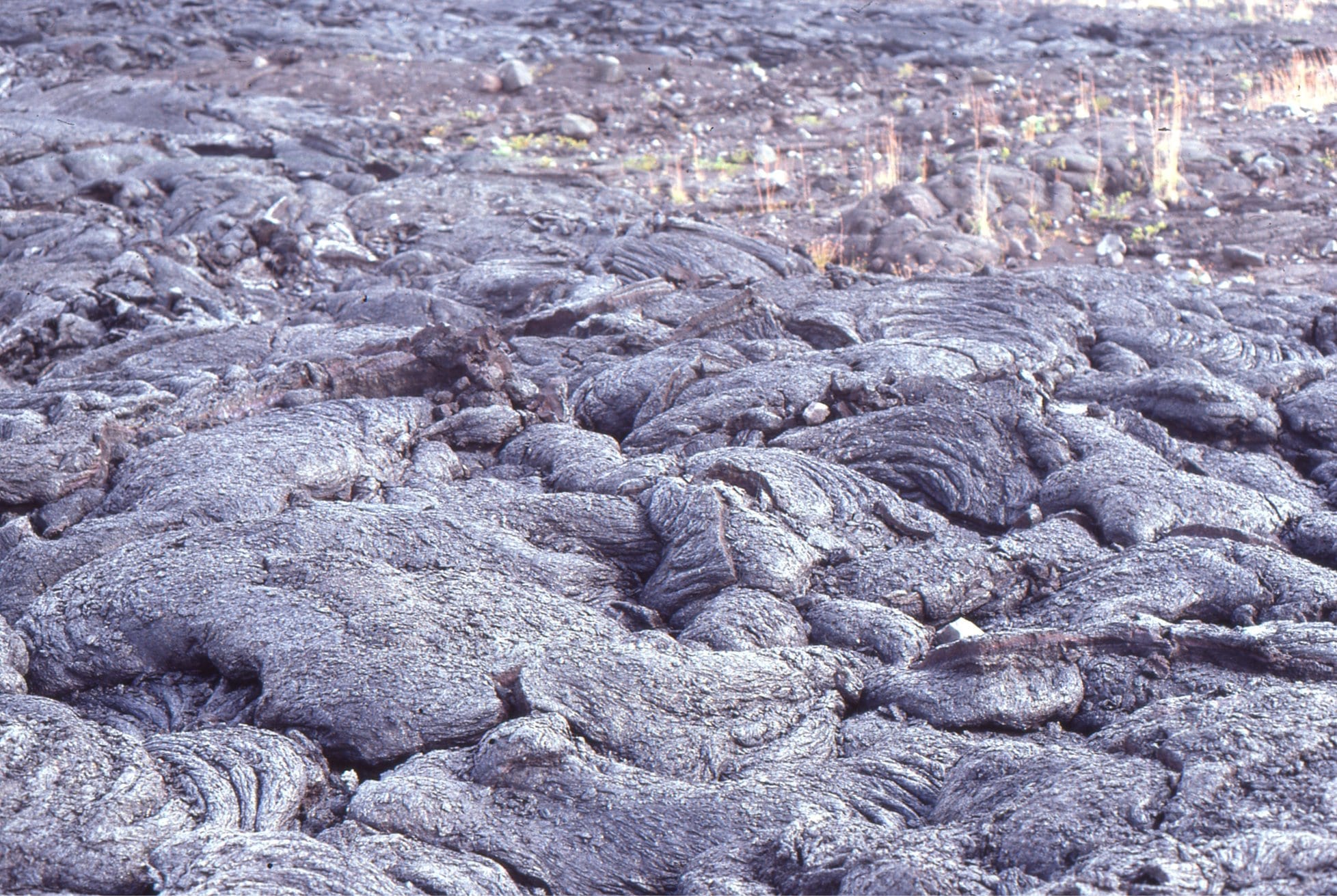
Four examples of ropy, festooned, twisted, knot-like, and folded lavas. Kilauea.
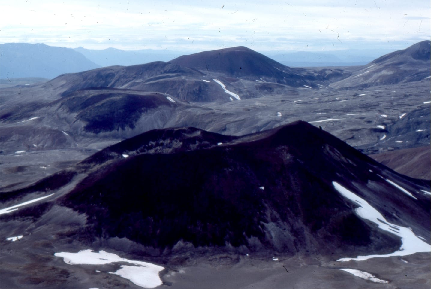
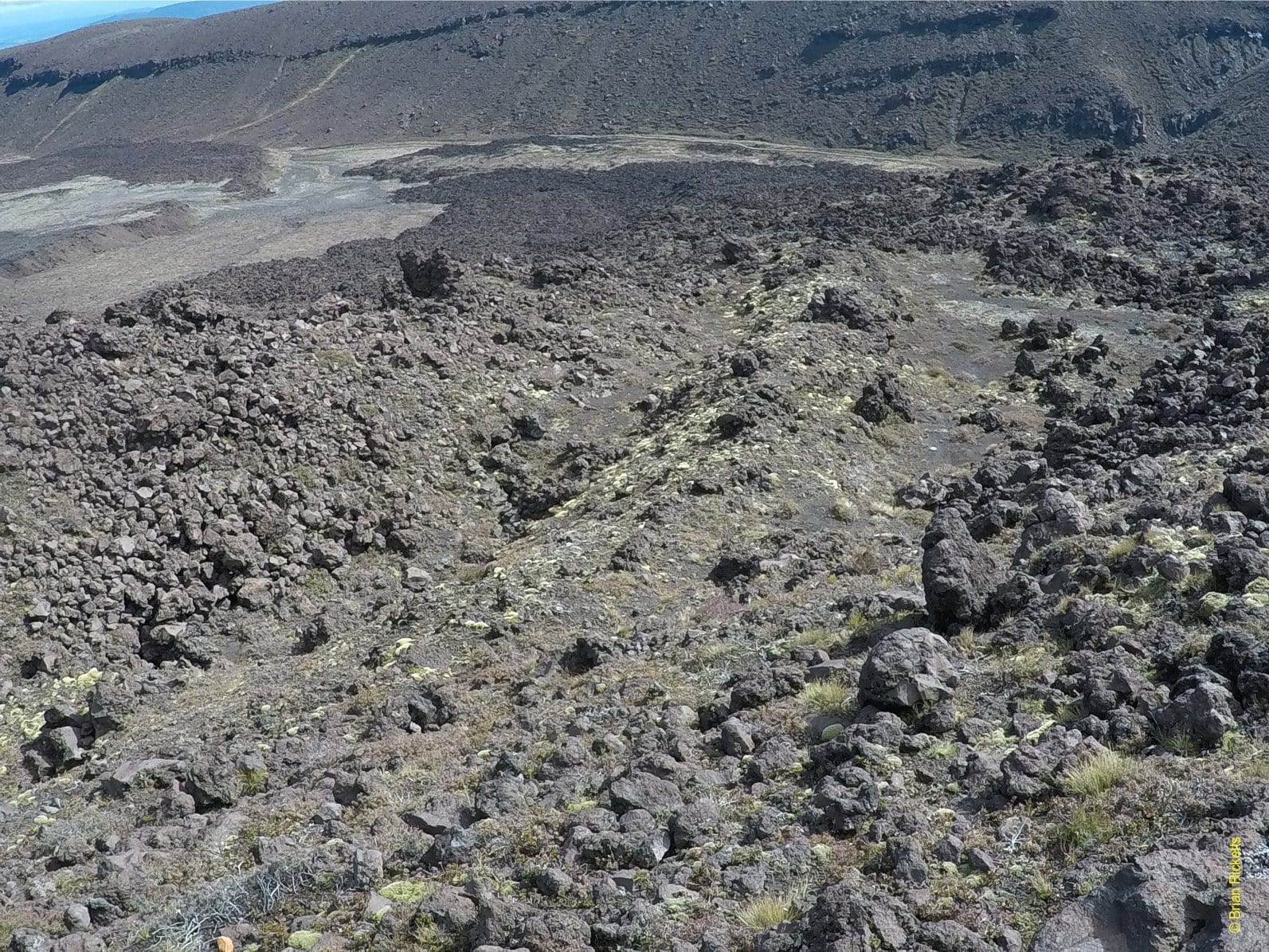
Haleakala crater, Maui
A large stratovolcano that last erupted about 500 years ago
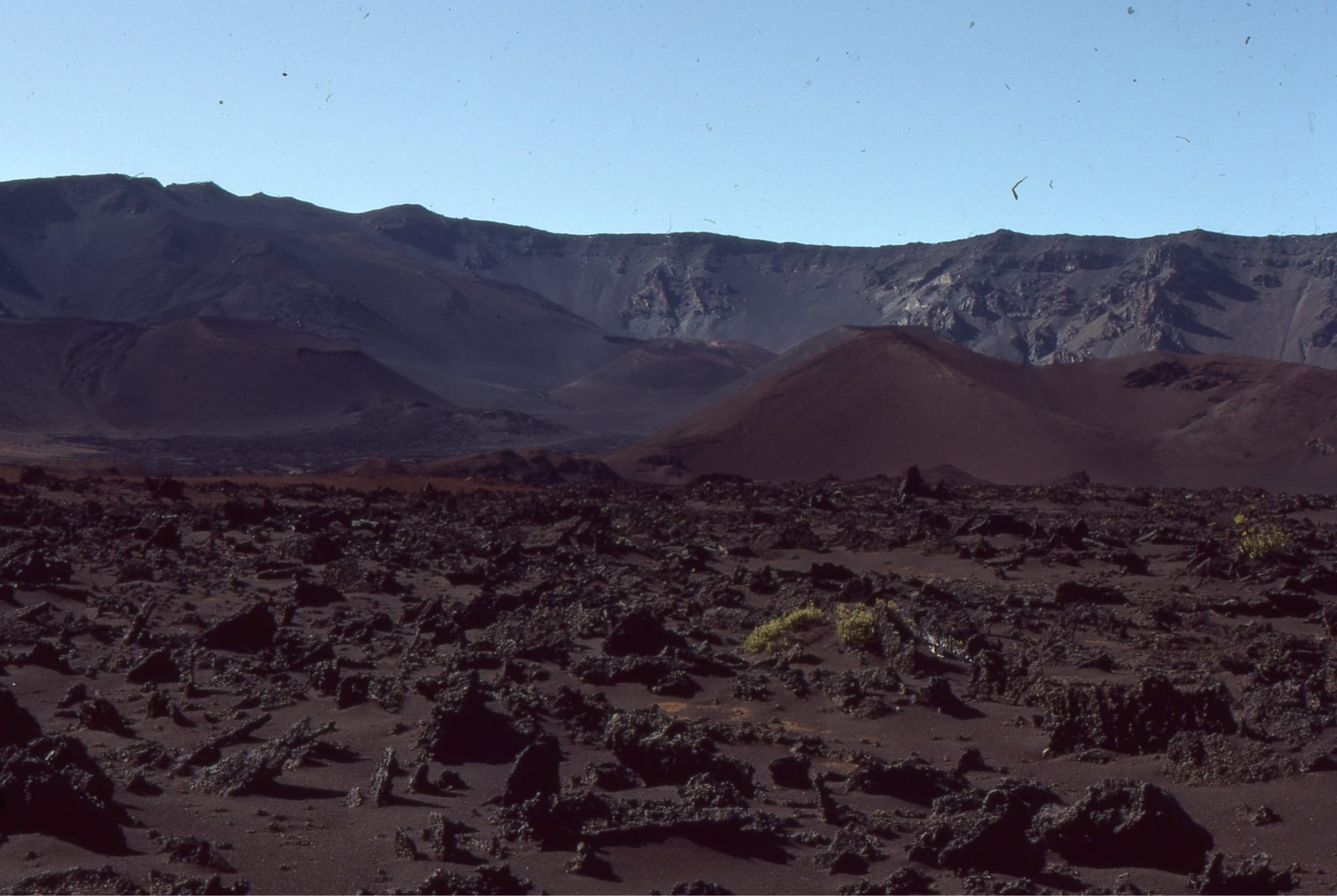
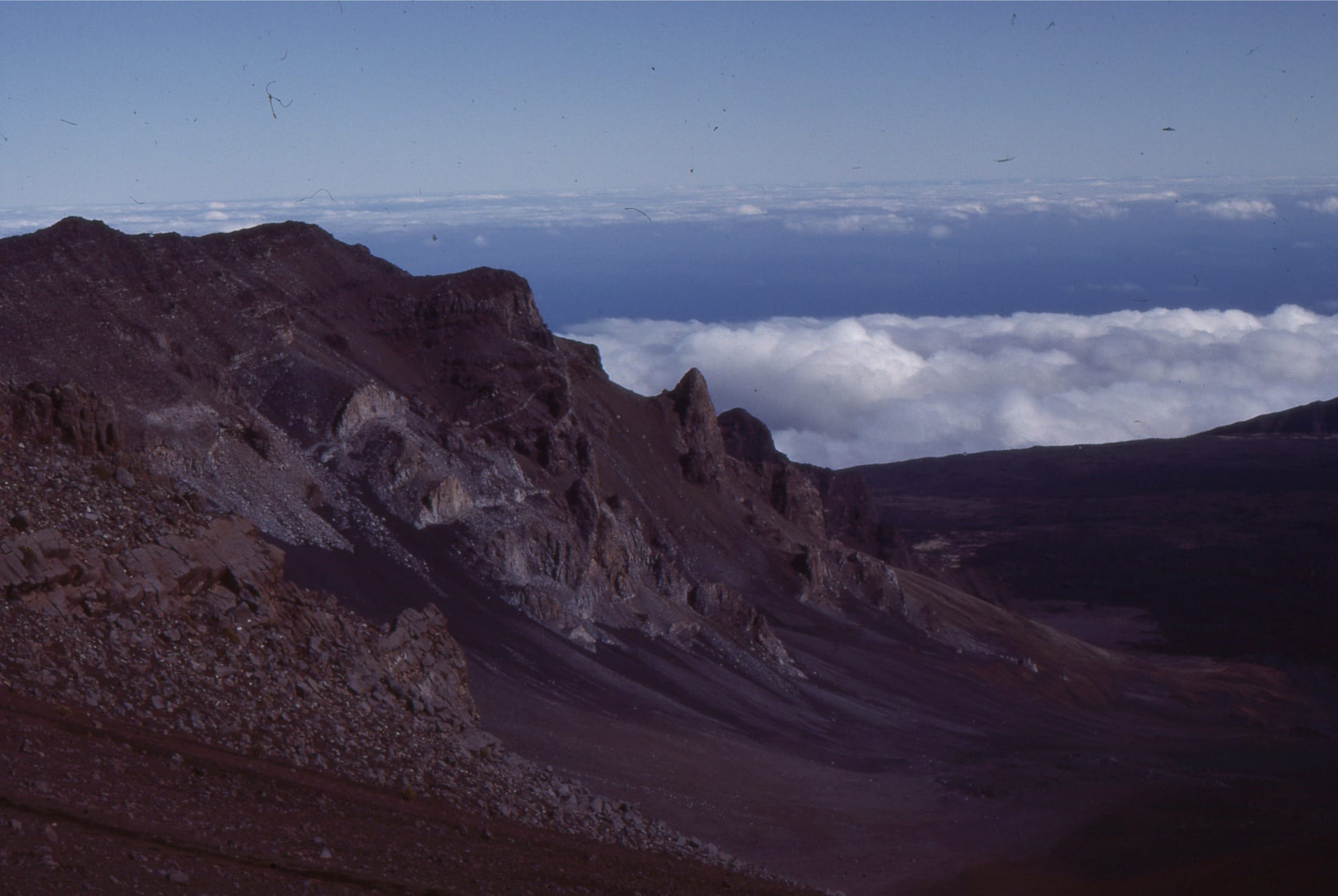
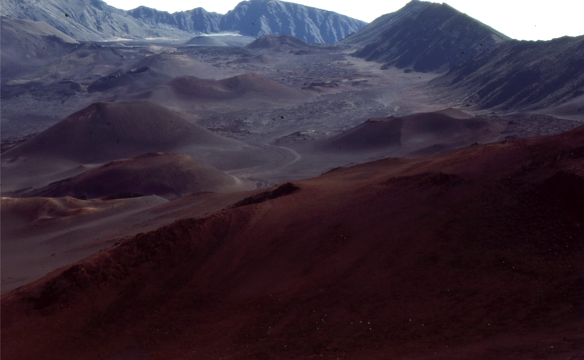
From the summit (a little over 3000m) climb down to the crater floor to a parched landscape of cinder cones, crunchy lapilli underfoot, and a myriad ballistics. The crater walls (centre) exposes multiple episodes of dyke intrusion that fed the overlapping scoria mound conduits.
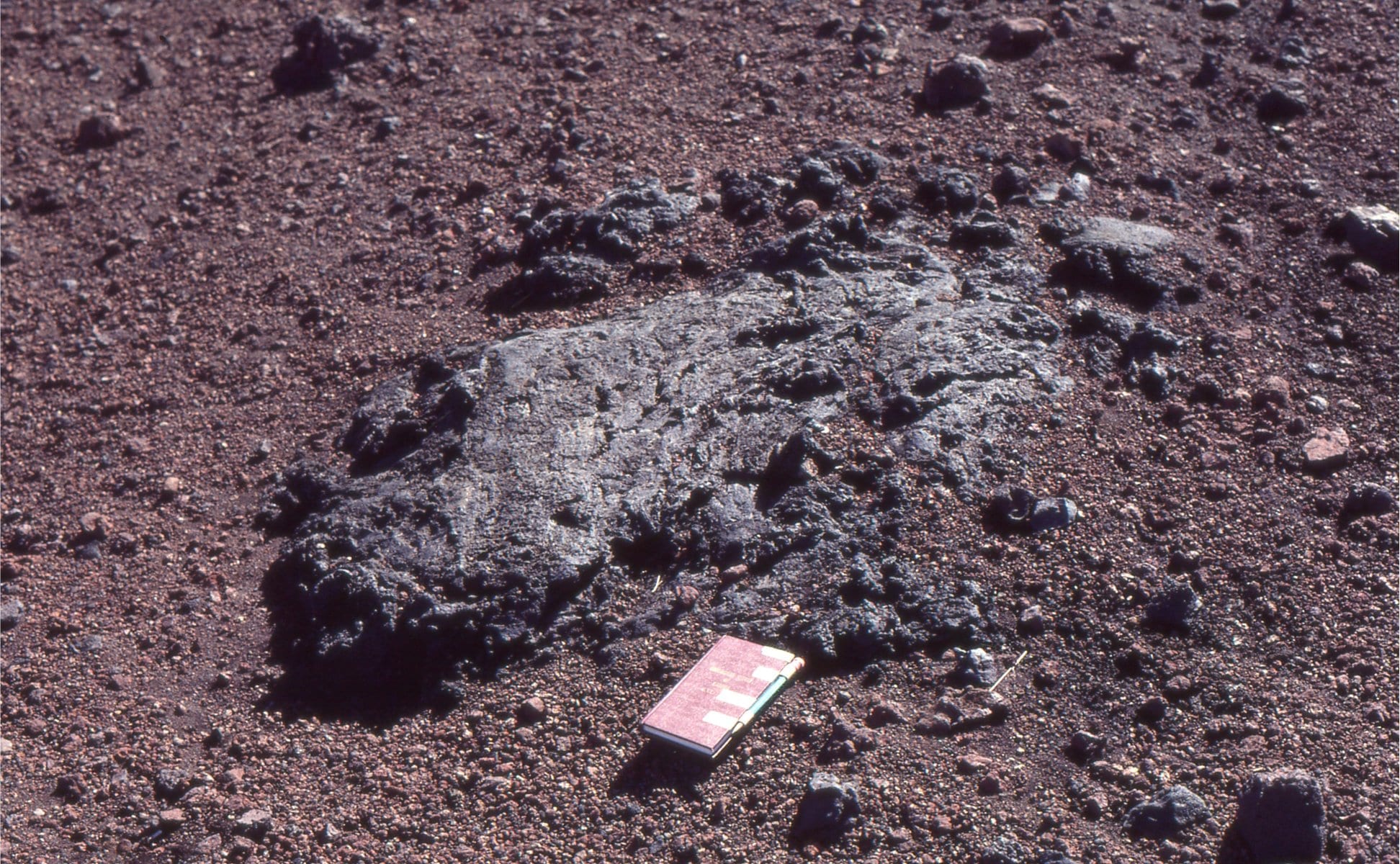
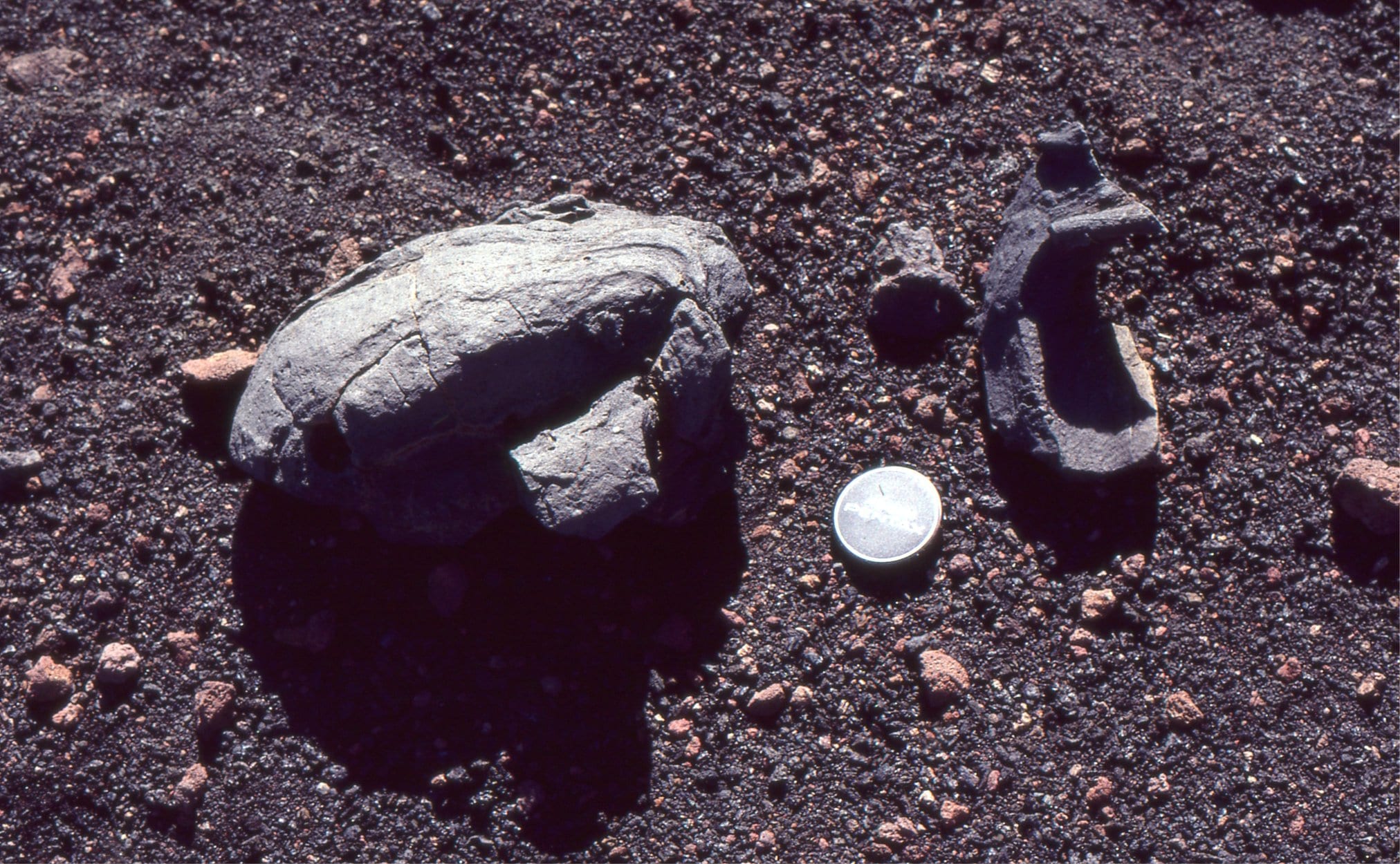
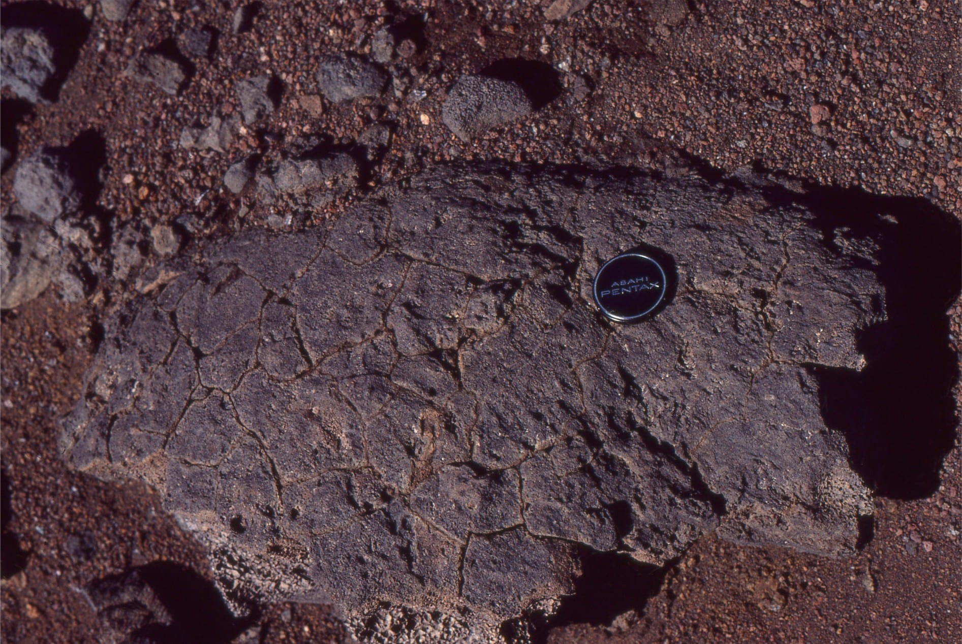
Ballistics: left is a flattened cow pat splatter. Centre a spindle bomb, twisted in flight. Right bread-crust cooling pattern on a flattened bomb.
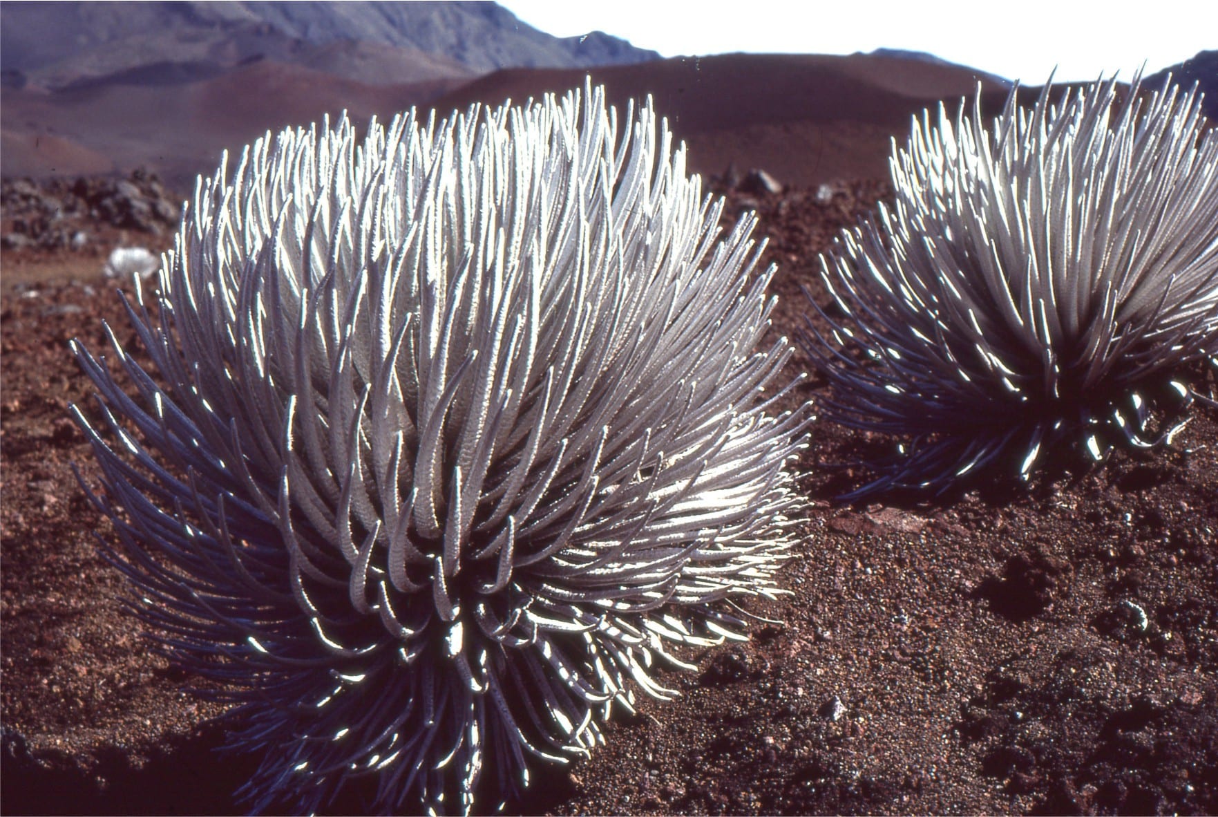
Hardy Silver Swords. Spikey
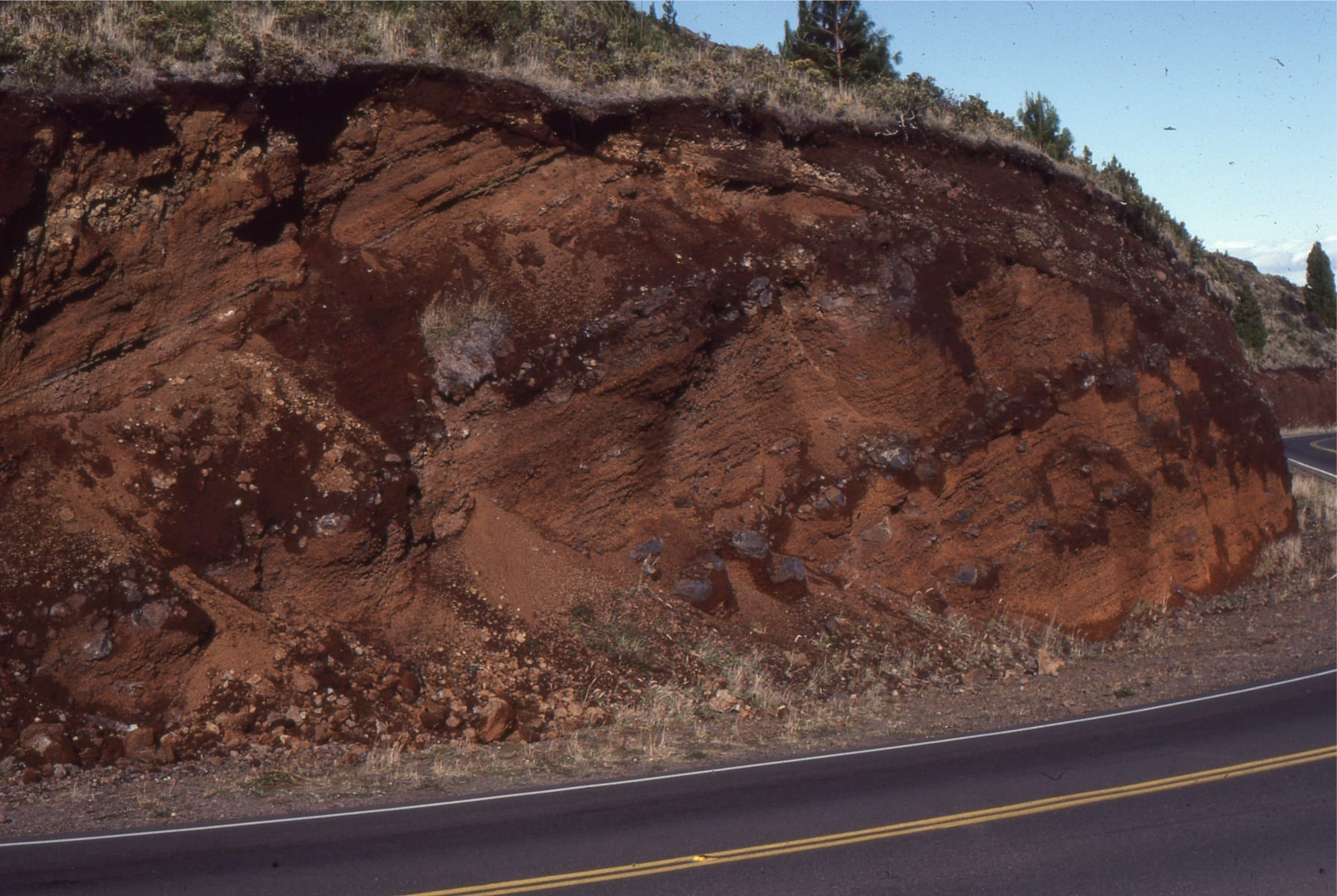
Oxidised air-fall lapilli and ash layers on older flanks of the Haleakala Volcano