Tag Archives: Mamaku Plateau

Springs and seeps

Facebooktwitterlinkedininstagram

Blue Spring in central NZ. Groundwater supplied is 50-100 years old.

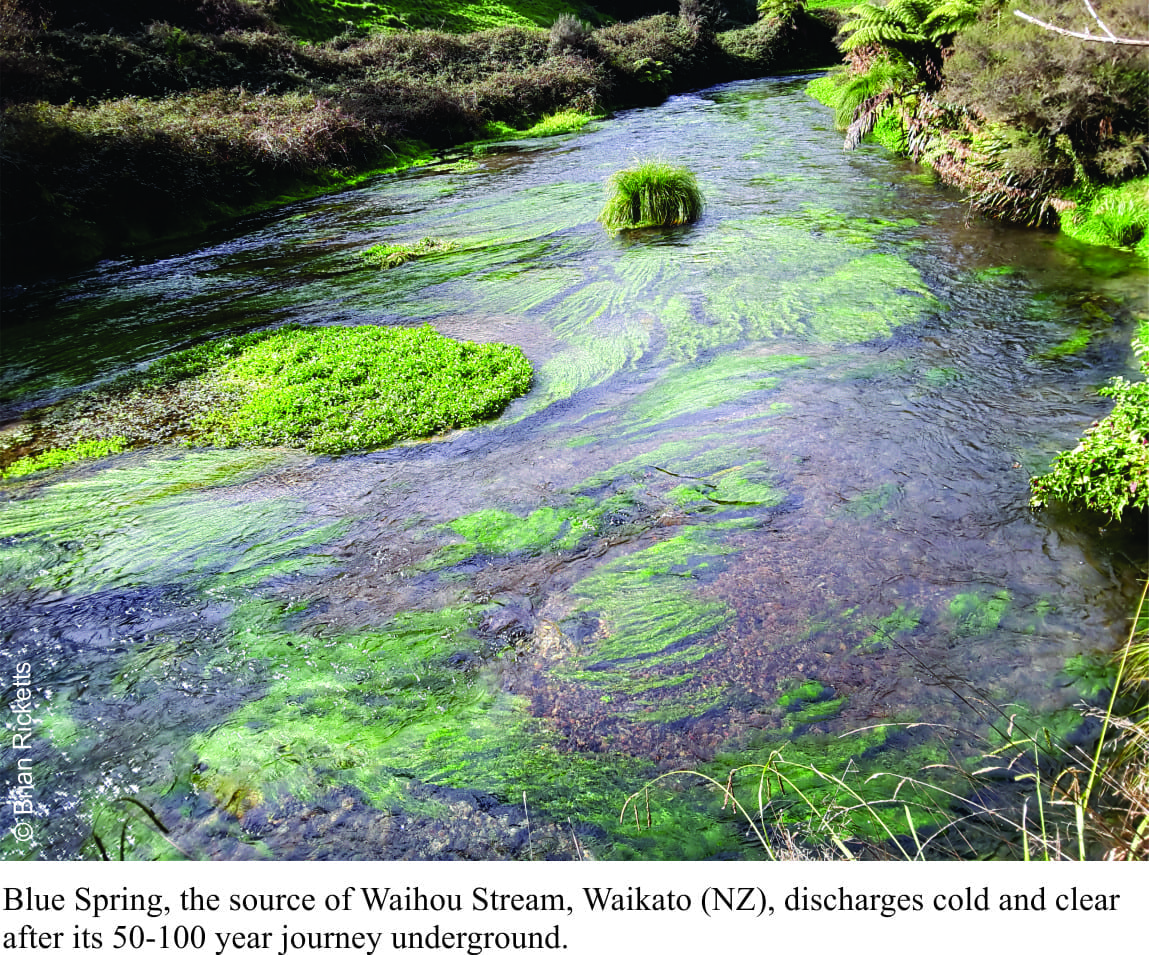
It rains quite a bit on Mamaku Plateau, the tableland underlain by volcanic debris that was  deposited violently 240,000 years ago; an eruption that also gave rise to Lake Rotorua caldera (central North Island, New Zealand). Some of that rain seeps into the myriad fractures, nooks and crannies, and heads west as groundwater. Fifty to 100 years later that same water emerges, chilled to a cool 11oC, at Blue Springs (about 40km west of Rotorua). Spring water here flows at 42 cubic metres per minute (9,240 gallons per minute), enough to maintain a decent-sized stream (Waihou Stream). Continue reading

Facebooktwitterlinkedininstagram
Facebooktwitterlinkedin

Class 5; Geology for Kayakers, Kaituna River

Facebooktwitterlinkedininstagram

Kaituna River, New Zealand

Kaituna River map, draining Lake Rotoiti, NZKaituna River is a glorious water-course that has a bit of everything for kayakers and rafters, from beginner Class 1 and 2 rapids to serious class 5 waterfalls.  It is probably one of the more popular kayaking and rafting rivers in North Island, New Zealand, in part because it is so easy to get to, and close to the Rotorua centre of tourism.

The Kaituna is an outflow of Lake Rotoiti, its headwaters next to the Highway at Okere Falls (just down the Road from Okere Falls Café); it exits at the coast in Bay of Plenty.

Continue reading

Facebooktwitterlinkedininstagram
Facebooktwitterlinkedin