This collection of images from various modern and ancient fluvial settings, includes meandering (high sinuosity) and braided (low sinuosity) rivers. Where possible I have paired modern analogues with ancient examples.
The Atlas, as are all blogs, is a publication. If you use the images, please acknowledge their source (it is the polite, and professional thing to do).
This link will take you to an explanation of the Atlas series, the ownership, use and acknowledgment of images.
Click on the image for an expanded view, then ‘back one page‘ arrow to return to the list
The images:
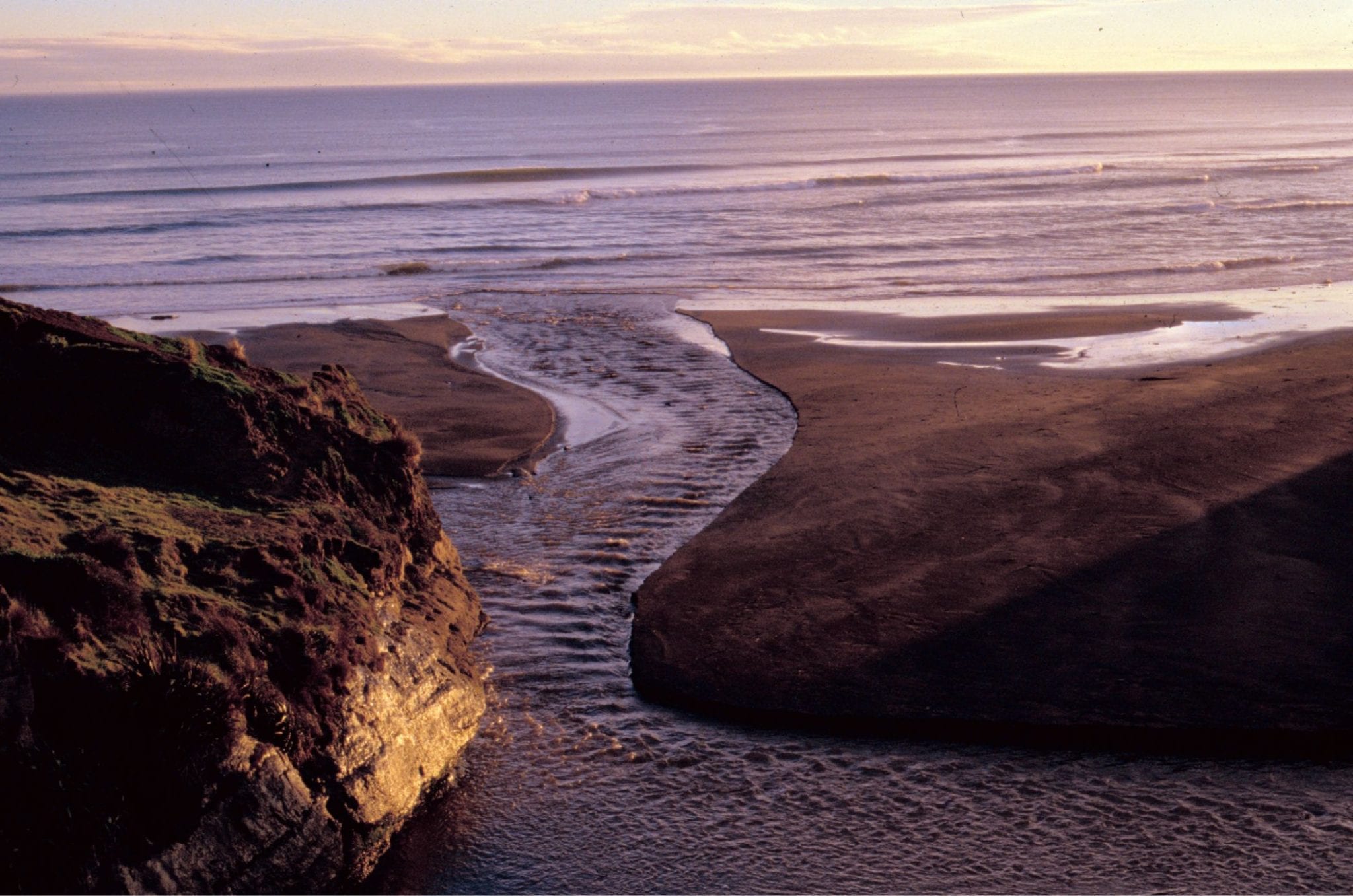
Where transverse sea-waves (generated by wind shear) meet riverine standing waves. Manawapou River, west coast NZ.

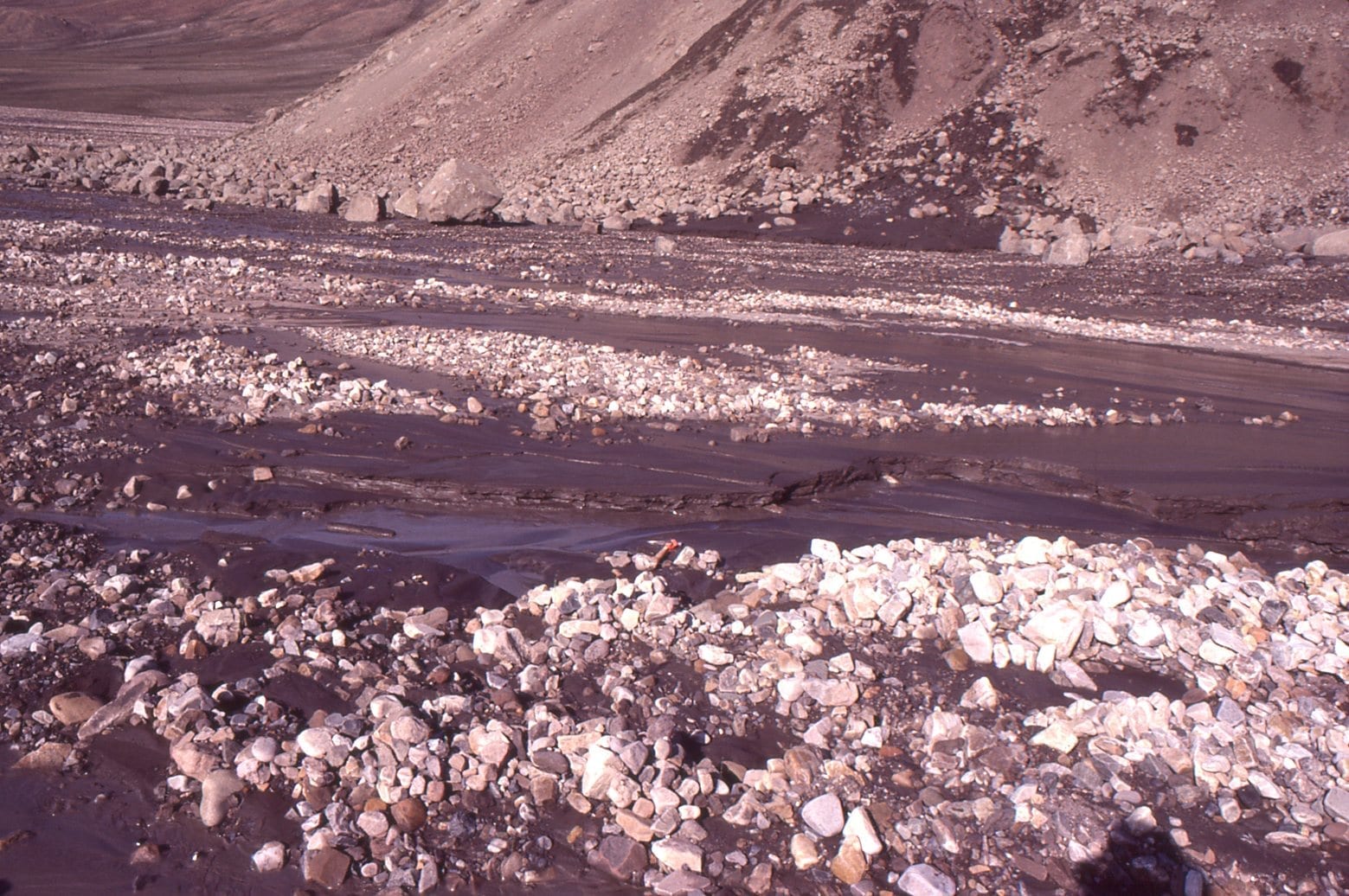
An Arctic braided river, Strand Fiord, Axel Heiberg I. Flow is seasonal, and at a maximum during spring-early summer thaw. The closer view (right) shows a bit more detail of within-channel bar surface features. The sediment load is mixed sand-gravel.
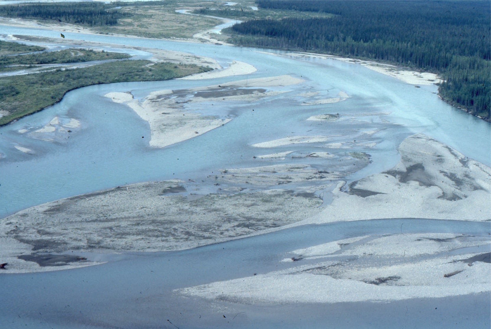
Bonnet-Plume River (Yukon) braided reaches, that, unlike high Arctic examples, are framed within vegetated overbank and some inactive gravel bars. The sediment load is mixed sand-gravel. The left image also shows an ephemeral meandering reach that cuts through inactive braid-bars.
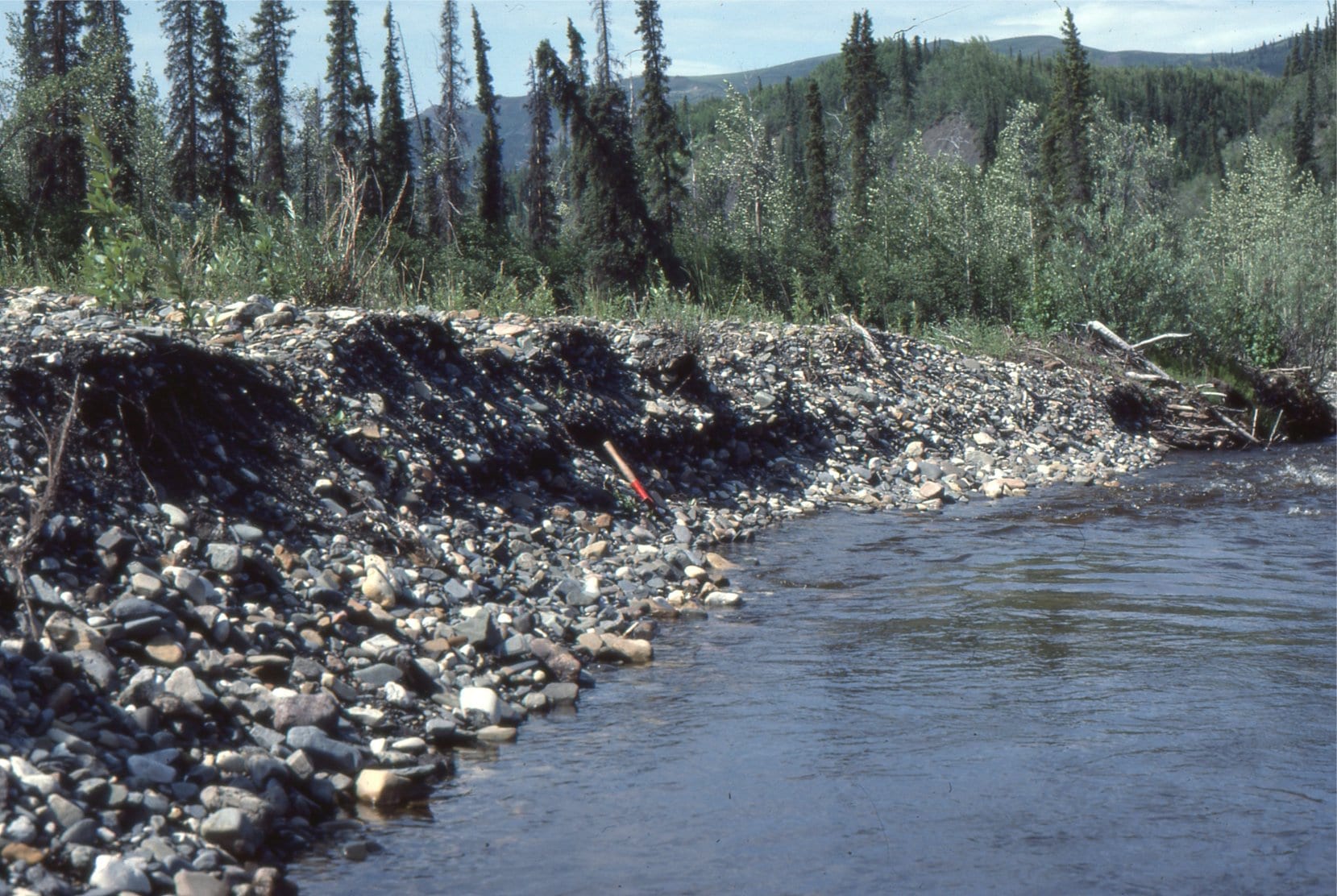 Vegetated braid bar gravels exposed in a cut bank. Bonnet-Plume River, Yukon.
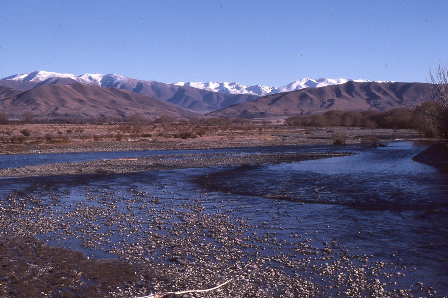 Gravelly, braided reaches of Ahuriri River, Otago, NZ. The headwaters are in the distant Southern Alps.
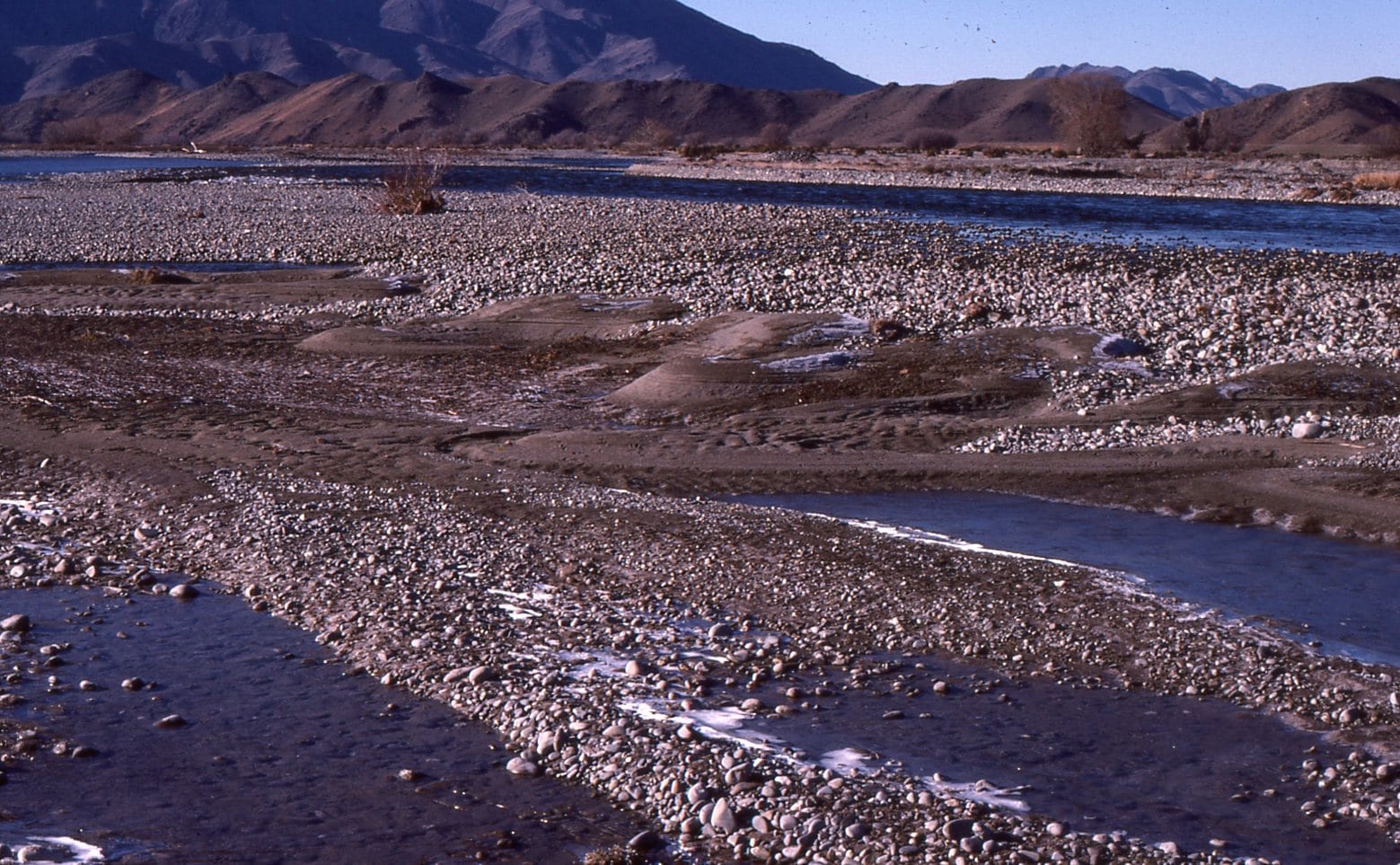 Gravel bar, Ahuriri River, Otago, New Zealand, with falling-stage sand deposits along the bar trailing edge (downstream edge).
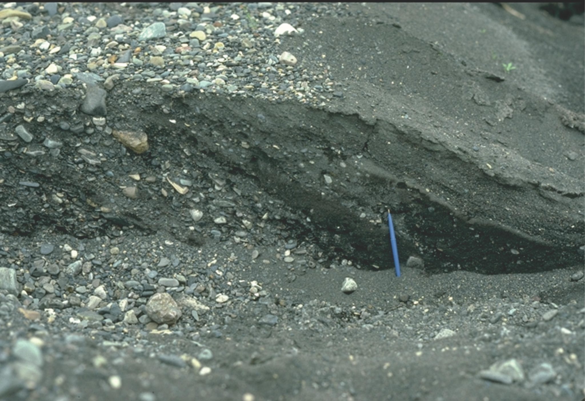
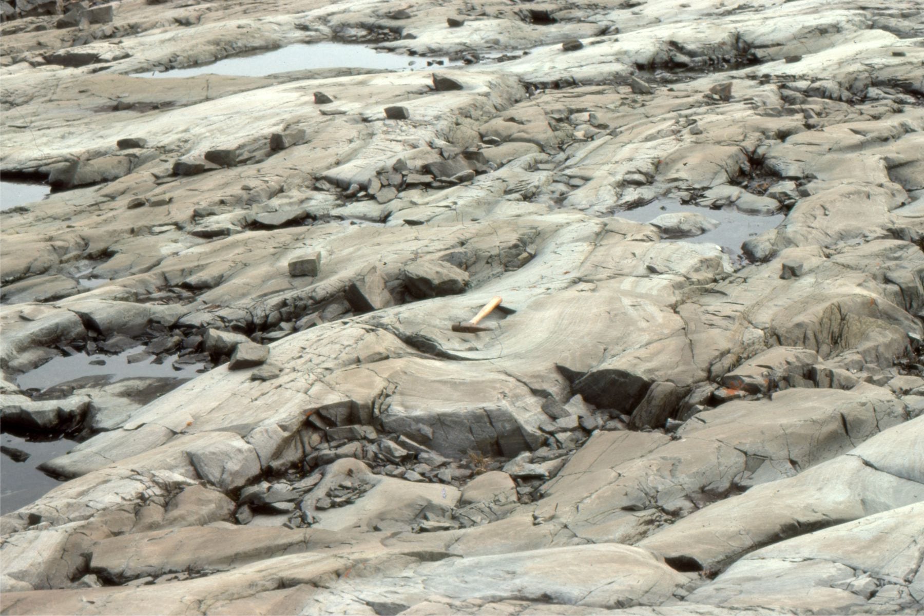
 Gravelly, braided glacial outwash near the terminus of Strand glacier, Axel Heiberg Island. Erosional chutes, that form during falling stage, are filled with crossbedded sand.

2-dimensional pebbly dunes, each with simple planar tabular crossbeds, formed along the margins of larger gravel braid bars during river falling stage. Monster River, Yukon.
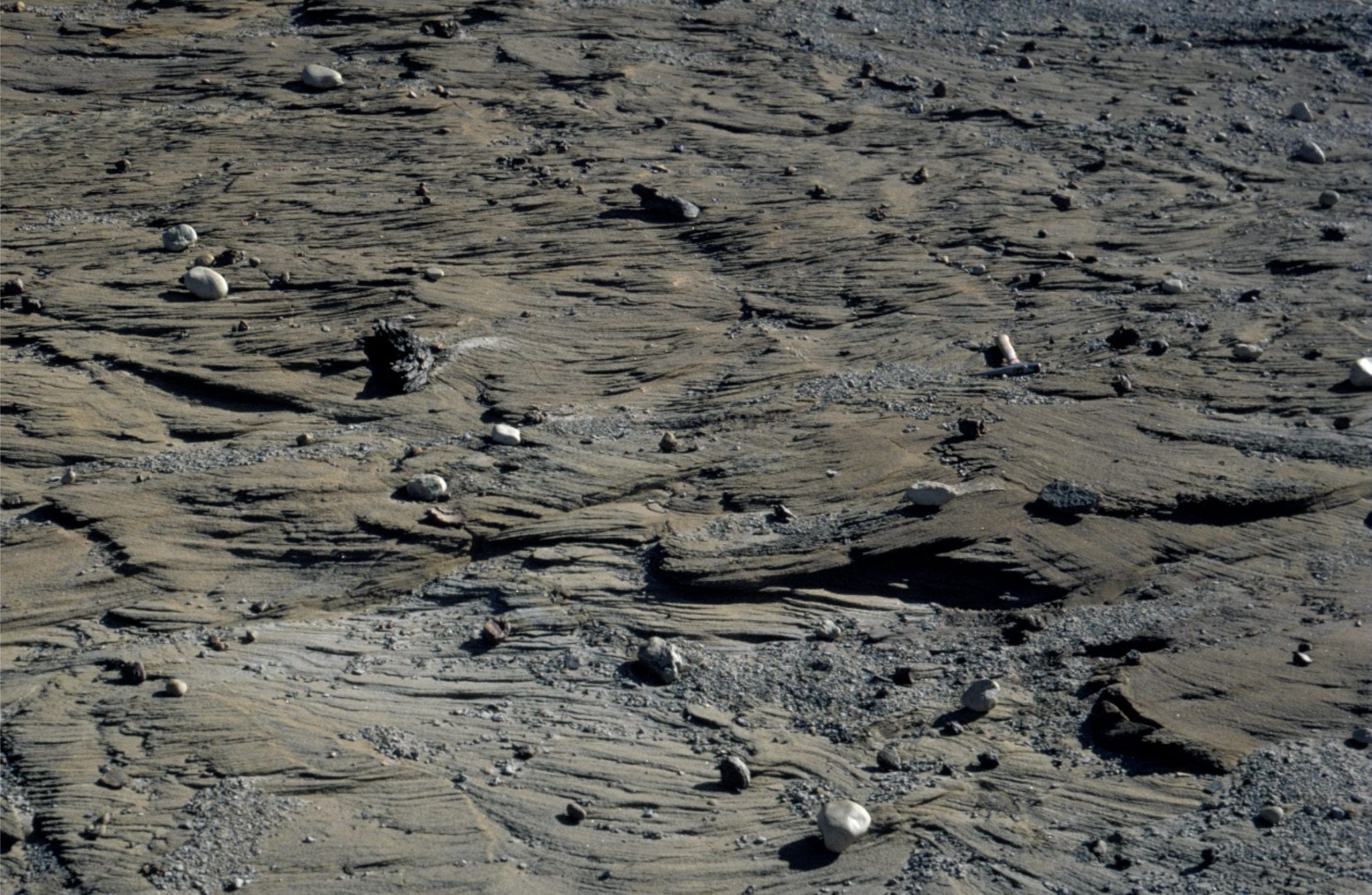
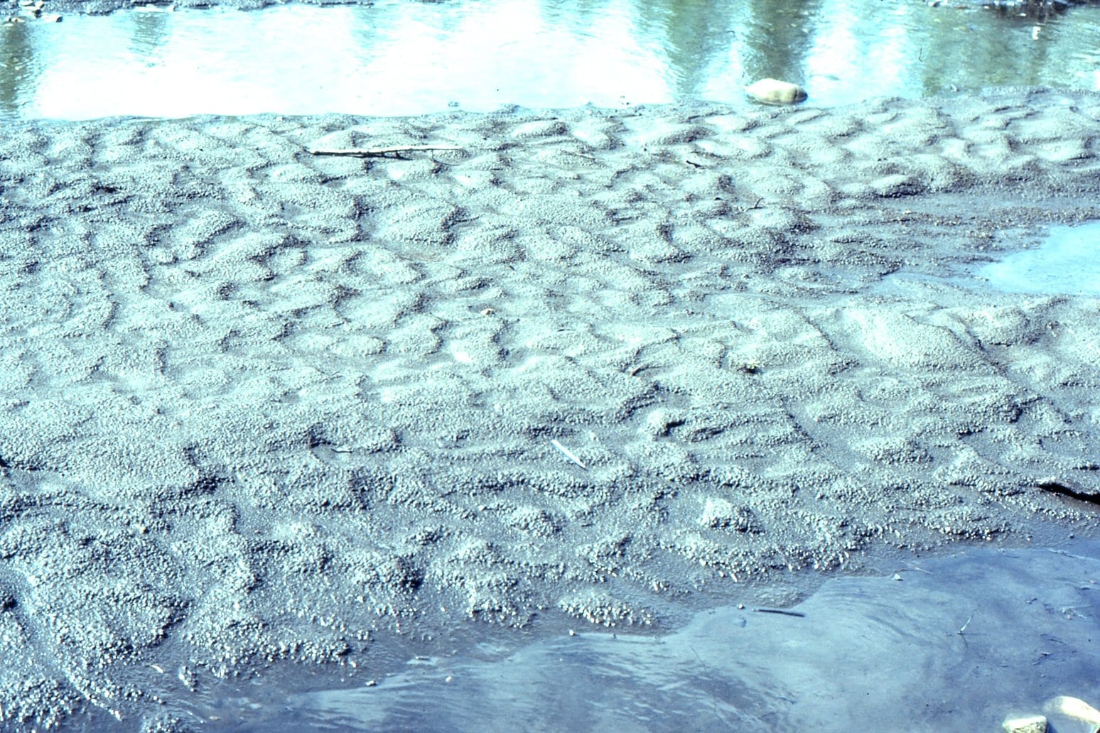 Braid bar-top ripples (flow to the right), imprinted by rain drops. Monster River, Yukon.
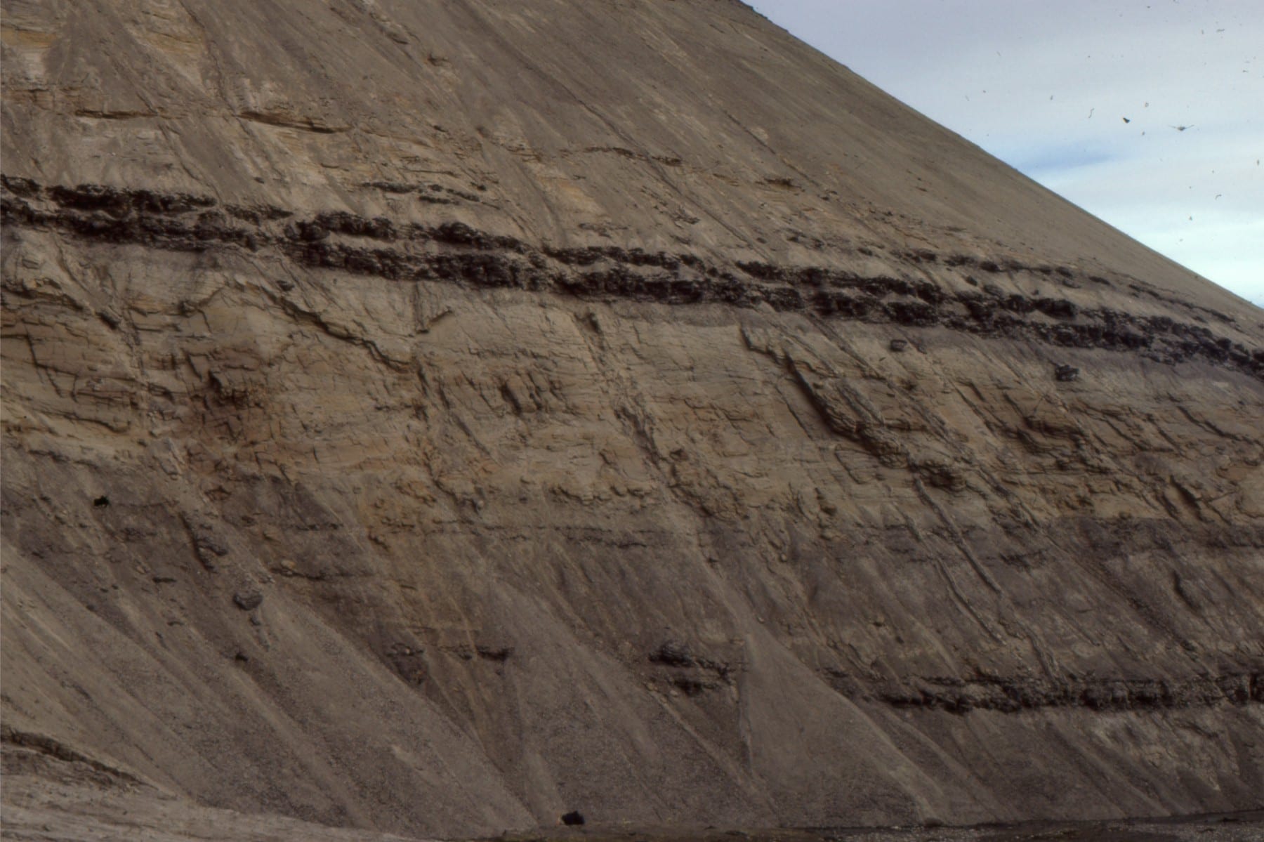
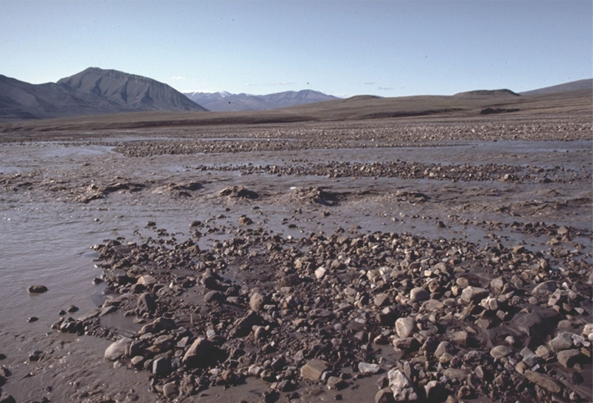 Glacial outwash flow during spring thaw, between gravel bars, Strand Glacier (Axel Heiberg Island). The water is mud-laden. The standing waves are in-phase with antidune bedforms.
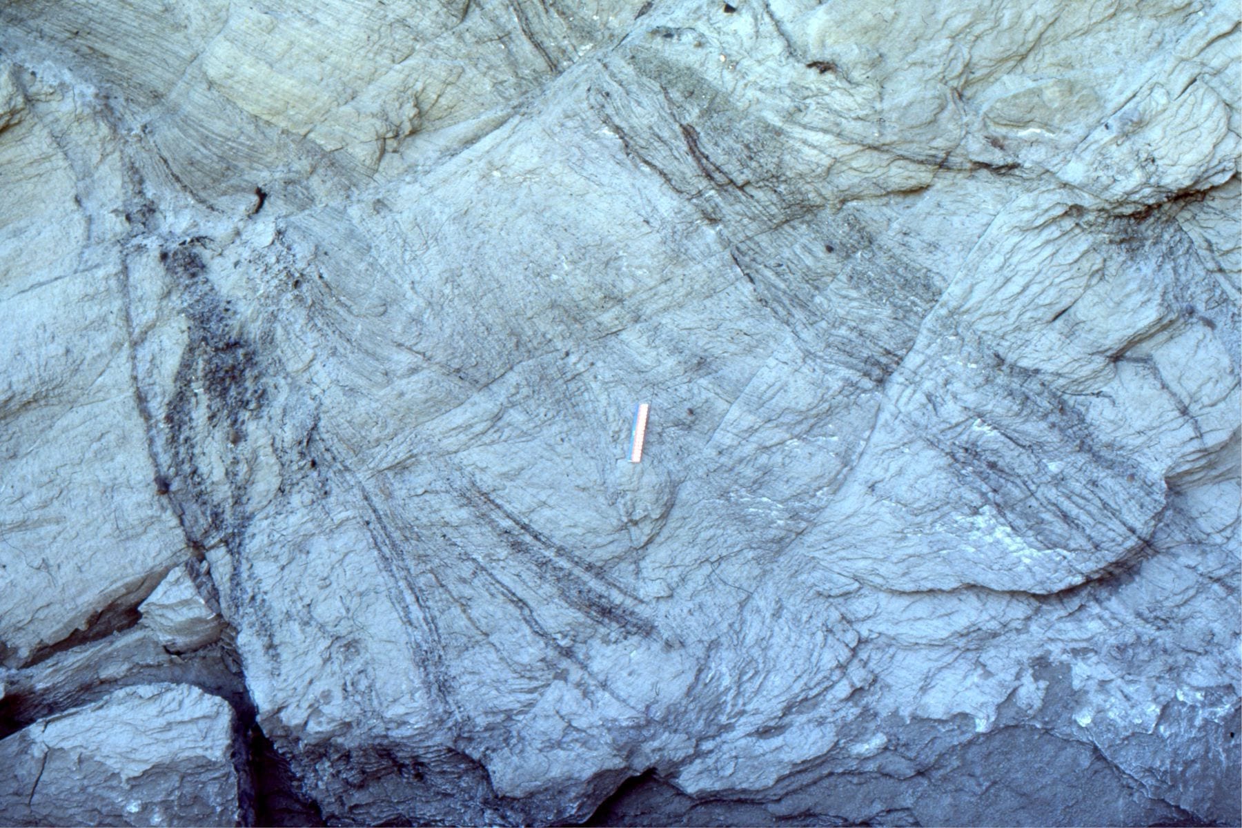
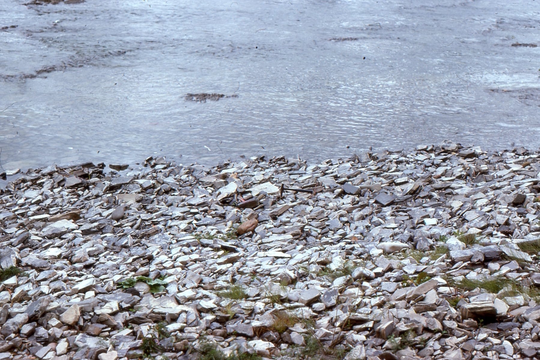 Strong imbrication of flat clasts along an exposed river bed. Flow was to the right.
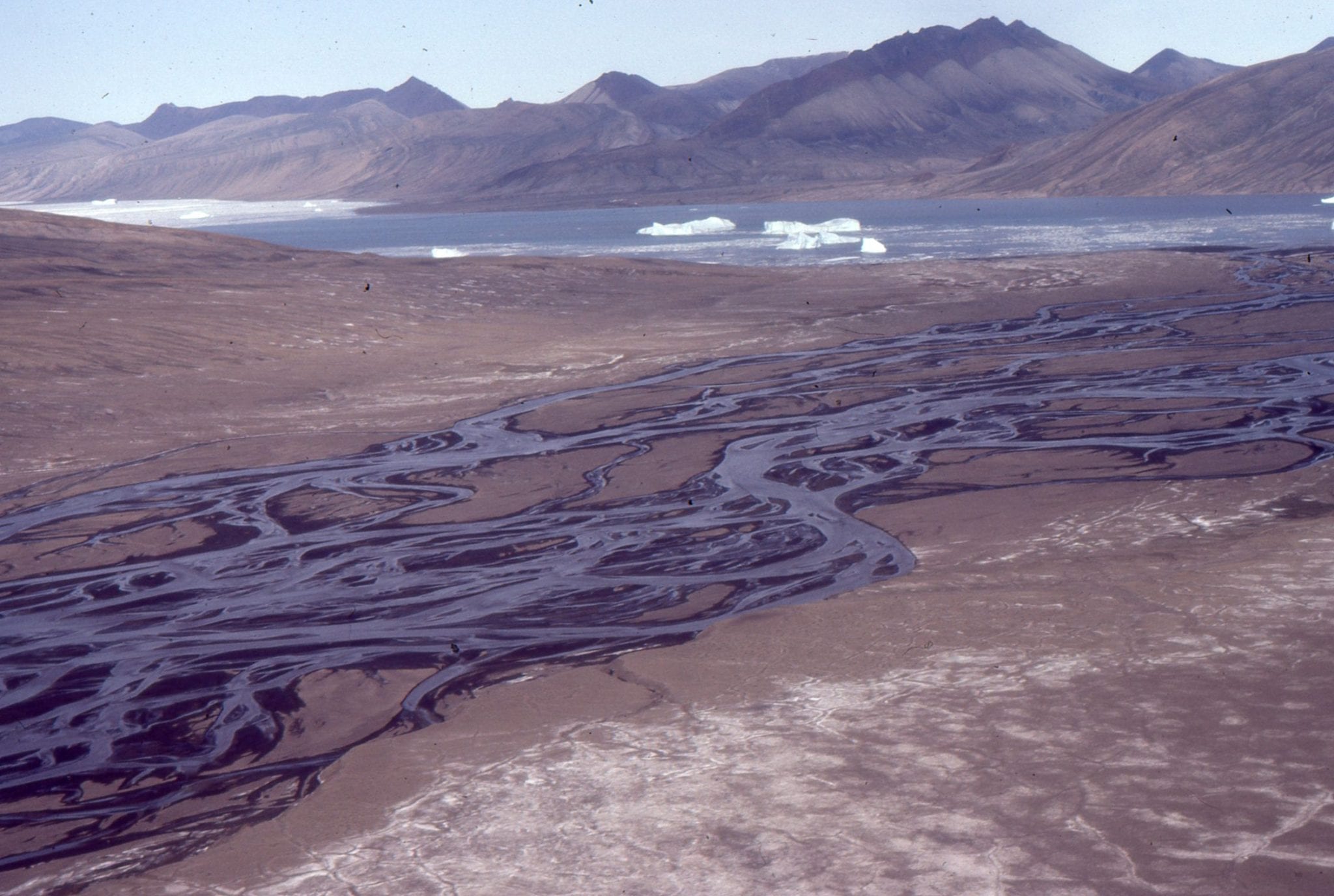
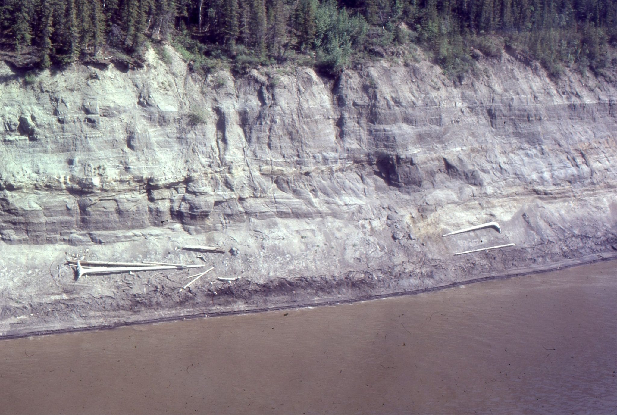
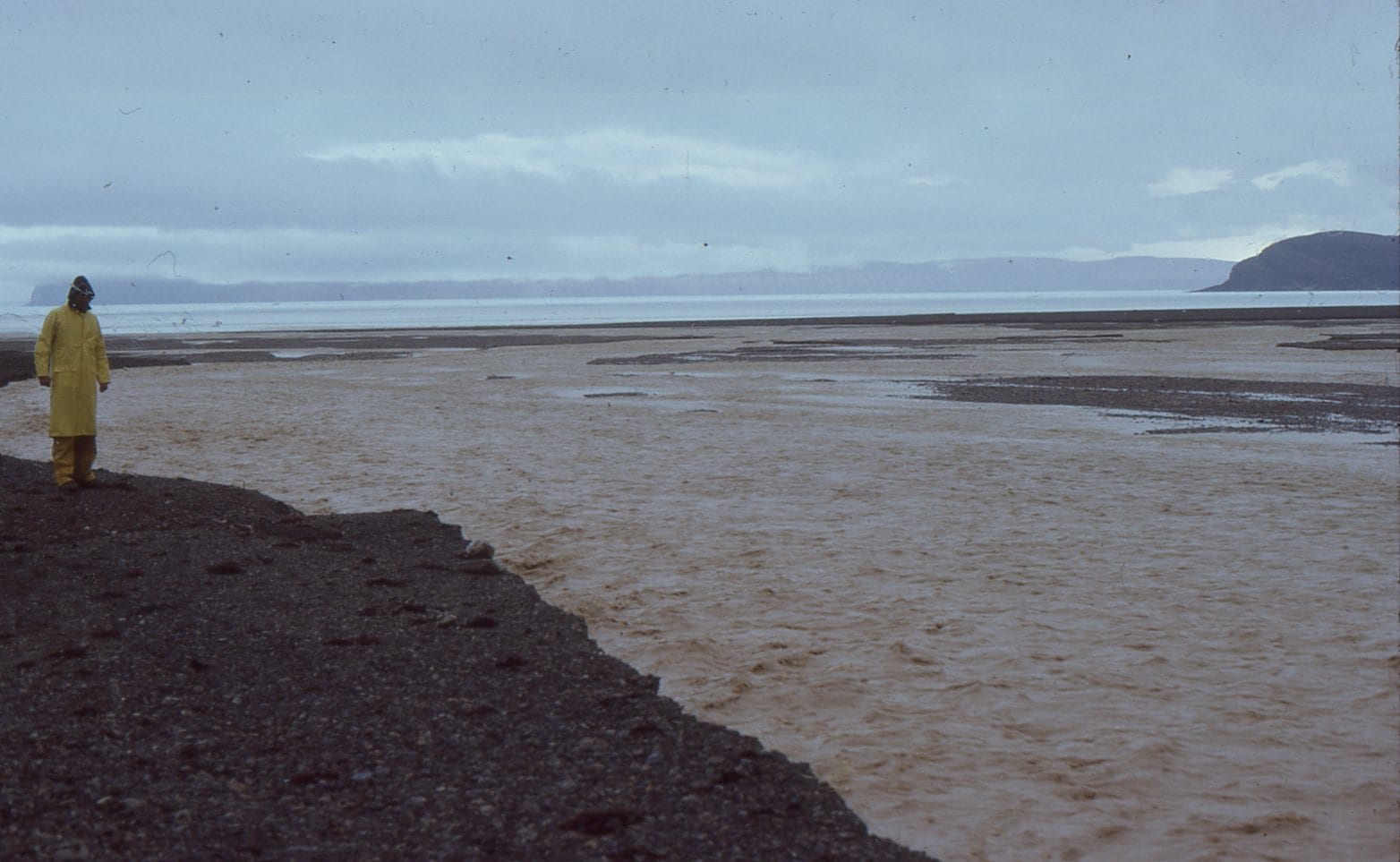 Bank-full conditions in an ephemeral, gravelly, Franklin Pierce Bay (Ellesmere Island) stream, during a rare mid summer Arctic rainstorm. About 25mm fell in a matter of hours. The stream rose very quickly and forced us to move our camp. There were many rockfalls from nearby cliffs during the storm.
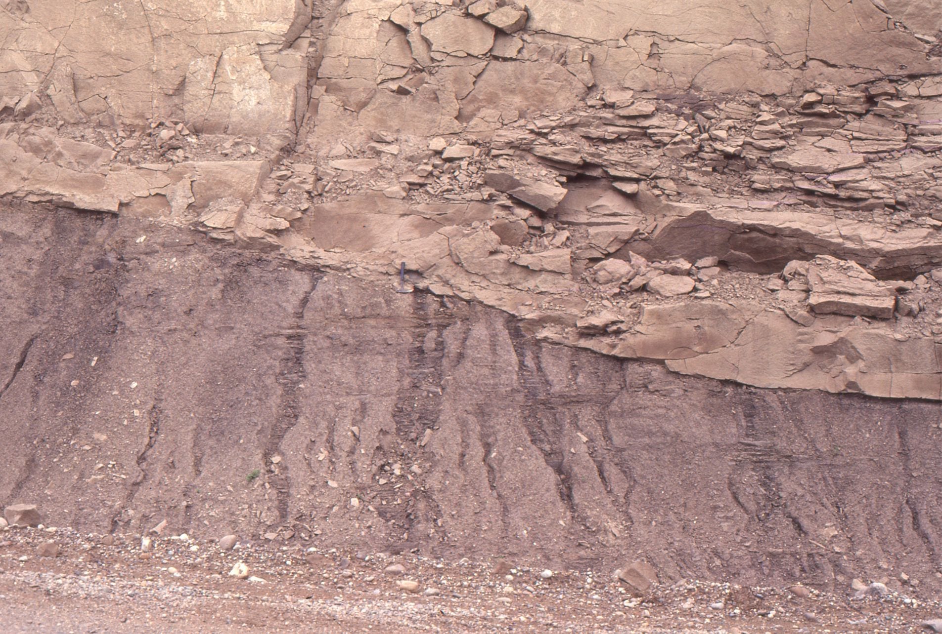
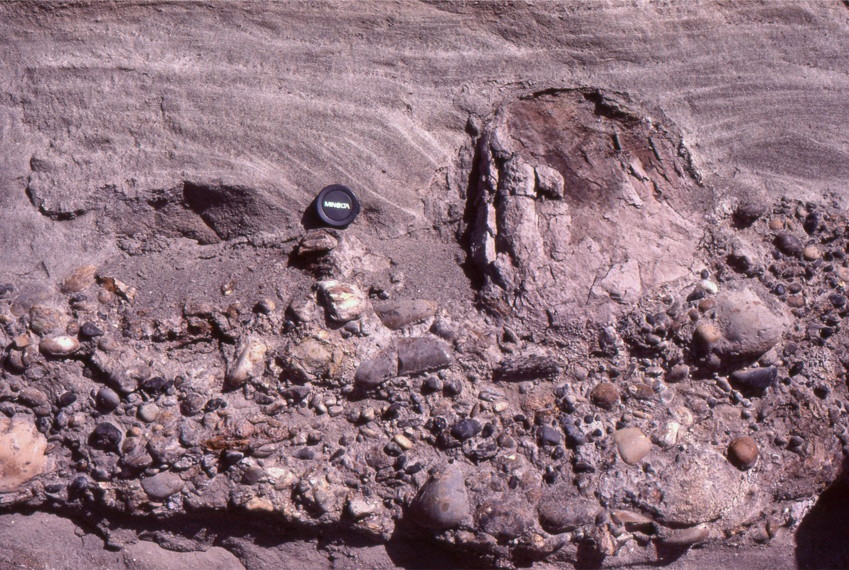
 Eocene gravel bar deposits, Otto Fiord, Ellesmere Island. The sandy interval mid-picture was interpreted as small, crossbedded, falling stage sand bars, like those shown in the modern analogues.
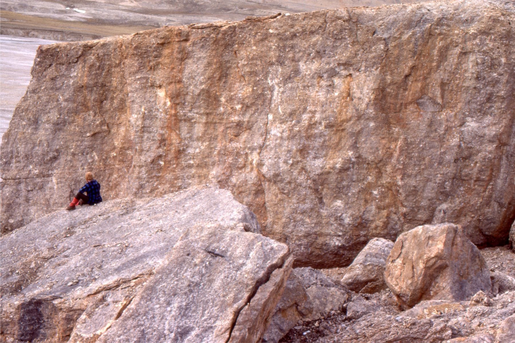
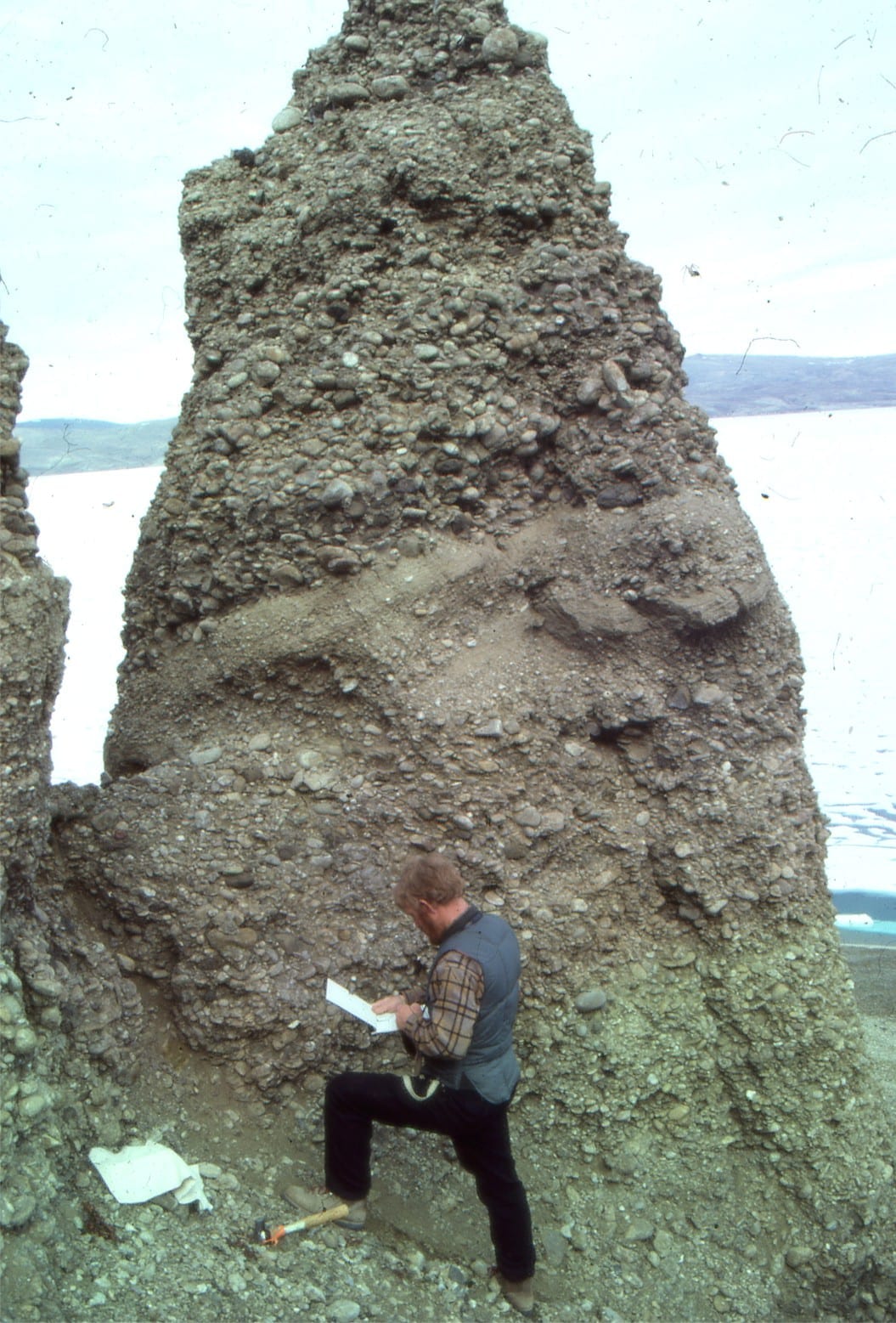
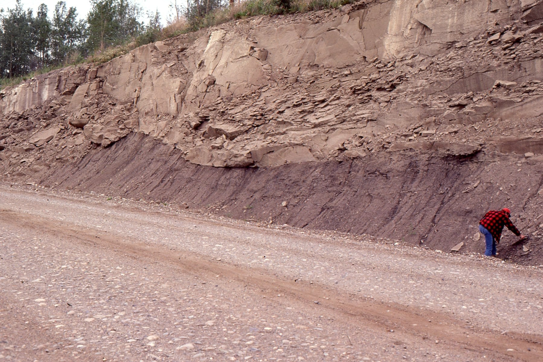
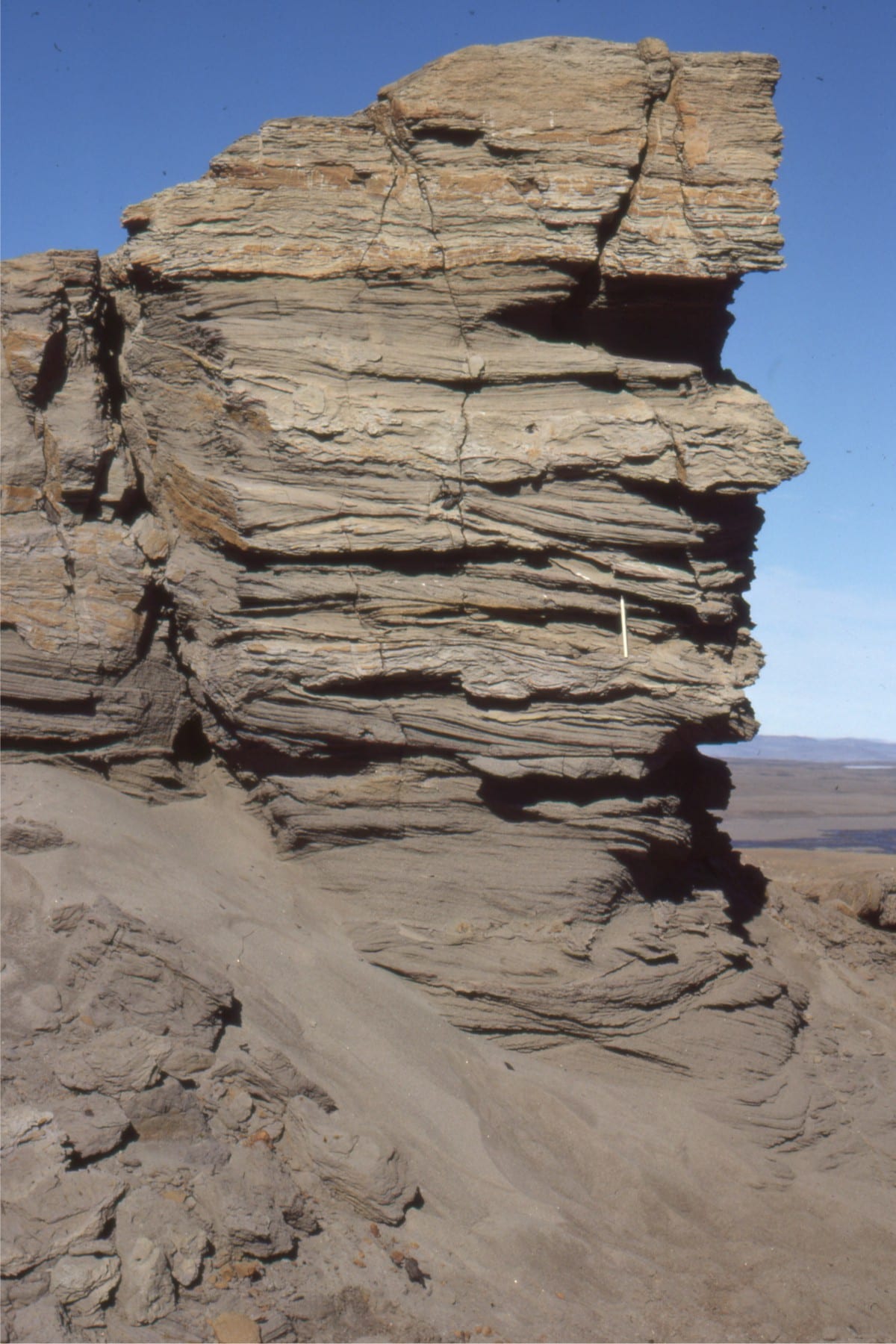
Left: Thick, Eocene, syntectonic gravelly braided river deposits (Buchanan Lake Formation; Franklin Pierce Bay, Ellesmere Island). Sediment was shed from evolving thrusts during the Eurekan Orogeny. Right: Large gravel crossbeds (up to 3m thick) in the same formation.
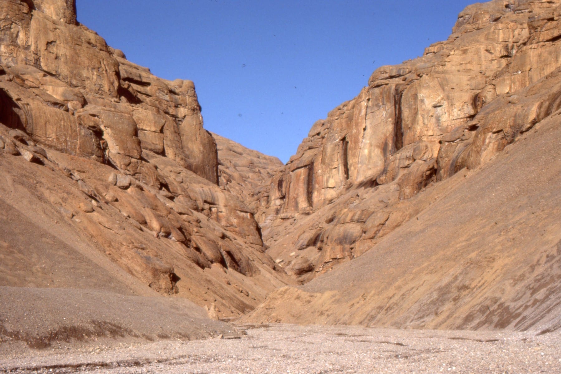
Two examples of trough crossbedded sandstone in low sinuosity channels (braided) in the Middle Eocene Buchanan Lake Fm, Axel Heiberg Island (Arctic Canada). These channels are the more distal equivalents to syntectonic gravelly deposits (Eurekan Orogeny).
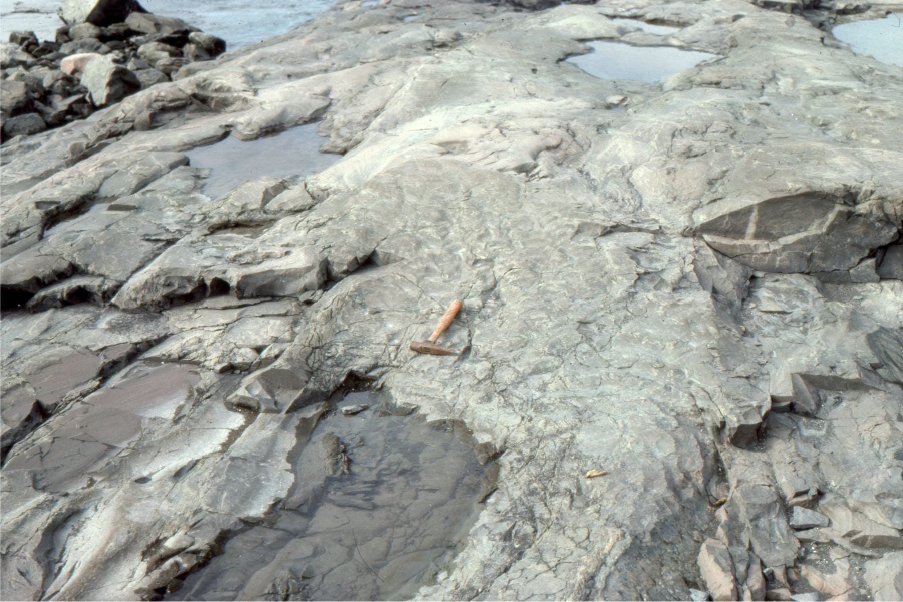
Festooned trough crossbeds in Proterozoic low sinuosity sandy channels, Loaf Fm. Belcher Islands (about 2 billion years old). The right image shows small ripples that probably developed during waning stream flow.
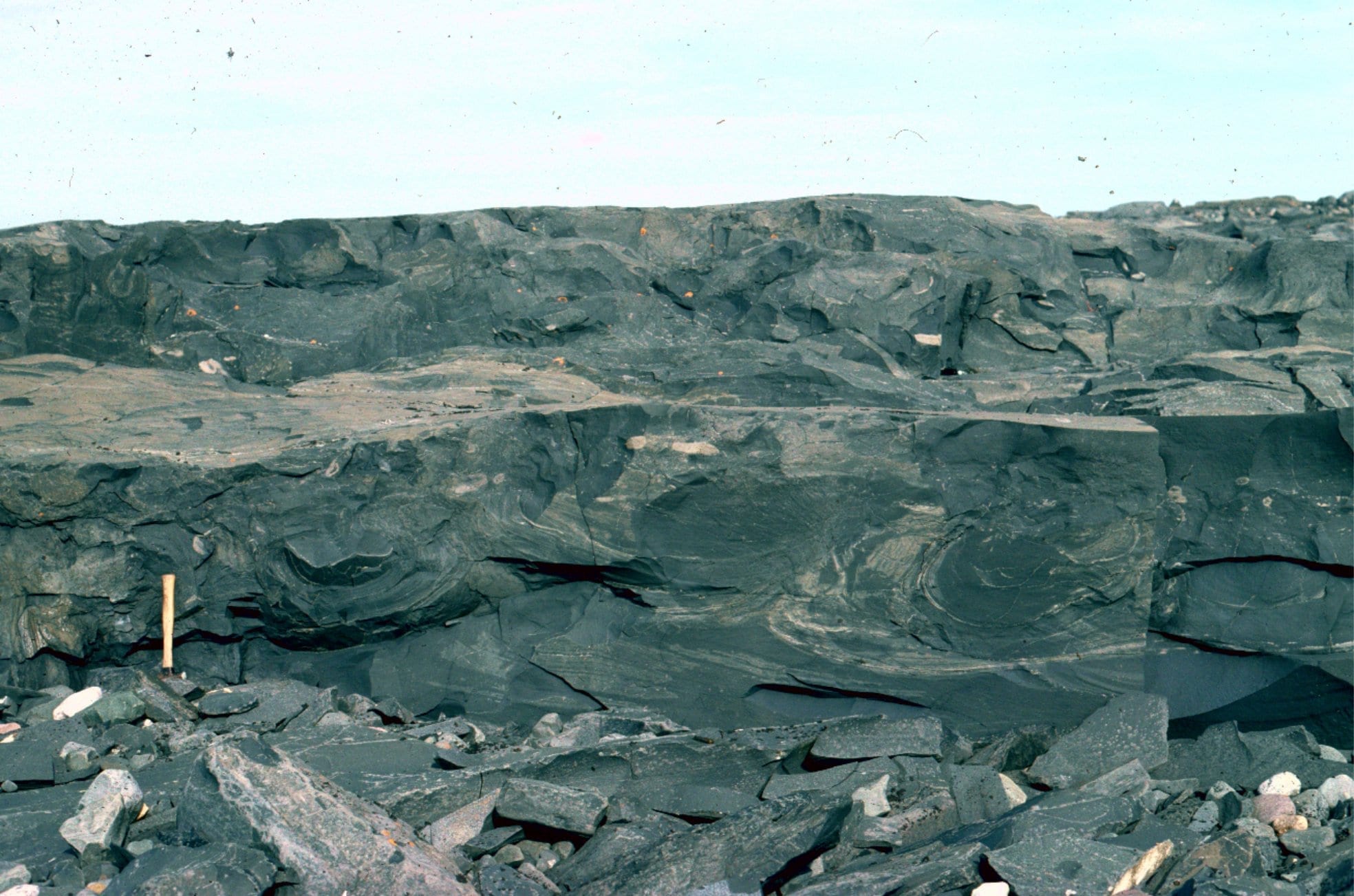 As river deposits settle and consolidate, the water between grains is forced out by the weight of the sediment (this is called dewatering). The process commonly disrupts and contorts the sedimentary laminae, forming structures that superficially resemble pillows; these structures are given the general name ball and pillow. Loaf Fm. Belcher Islands (about 2 billion years old).
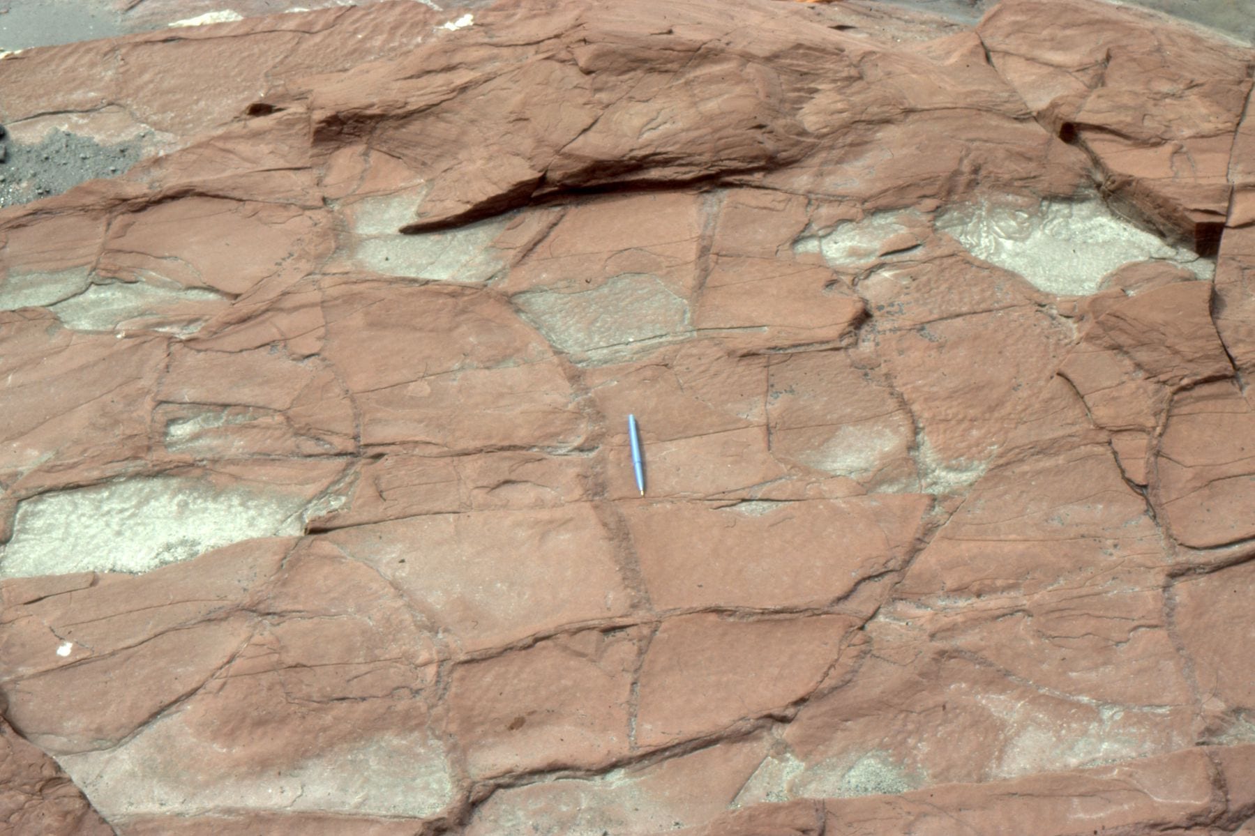 Reddened (iron oxides), desiccated mudrocks interbedded with channelized sandstone in the Proterozoic Loaf Fm, Belcher Islands; proof that the level of oxygen in the ancient atmosphere had increased significantly.
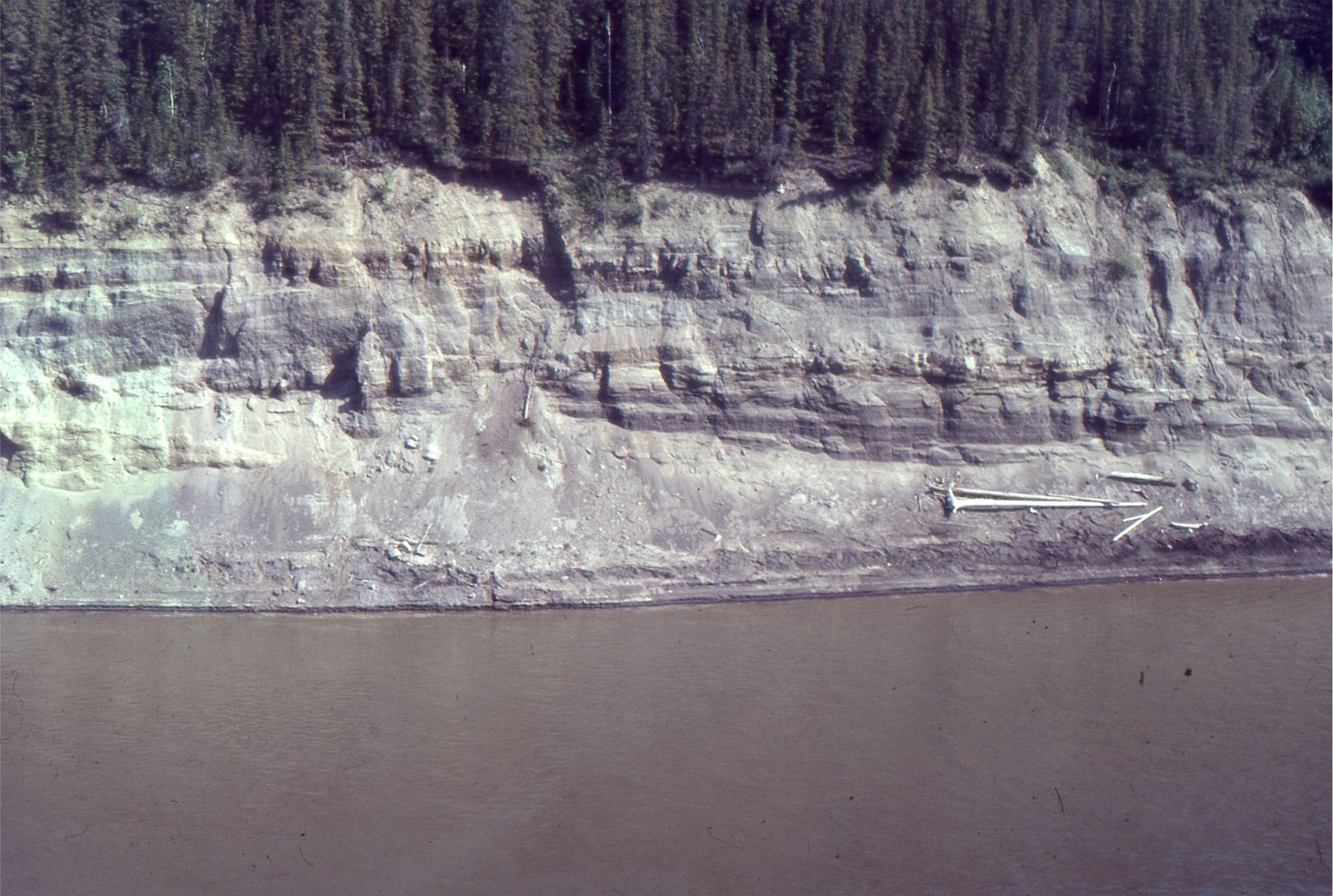
Paleocene Sandy braid channel and associated bar crossbeds (Summit Creek Fm.) exposed in right bank of MacKenzie River near Fort Norman, Northern Canada.
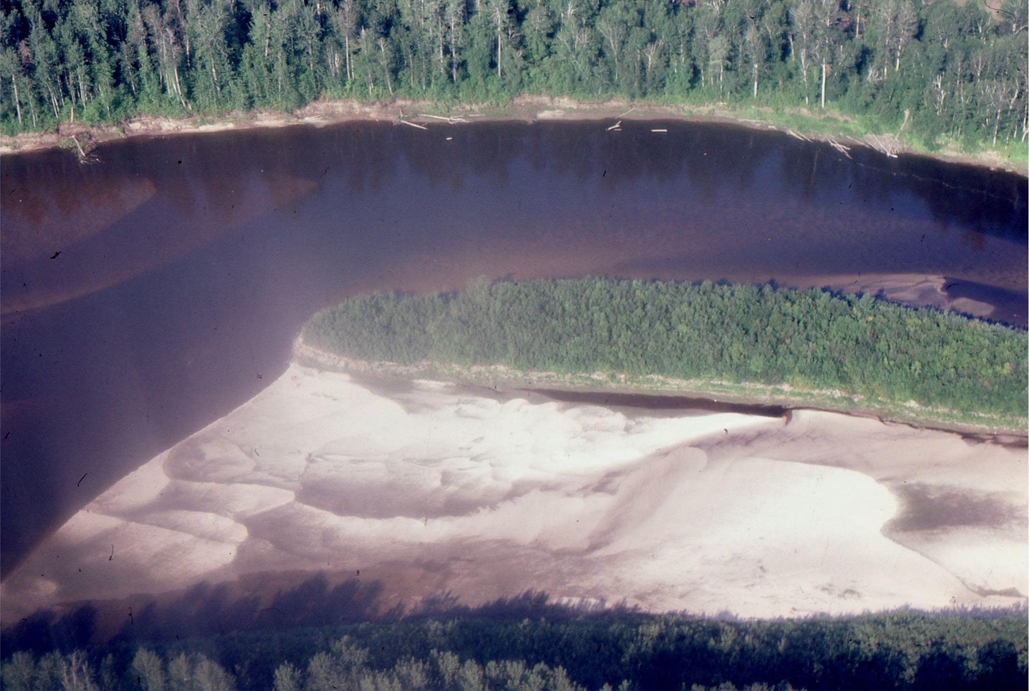
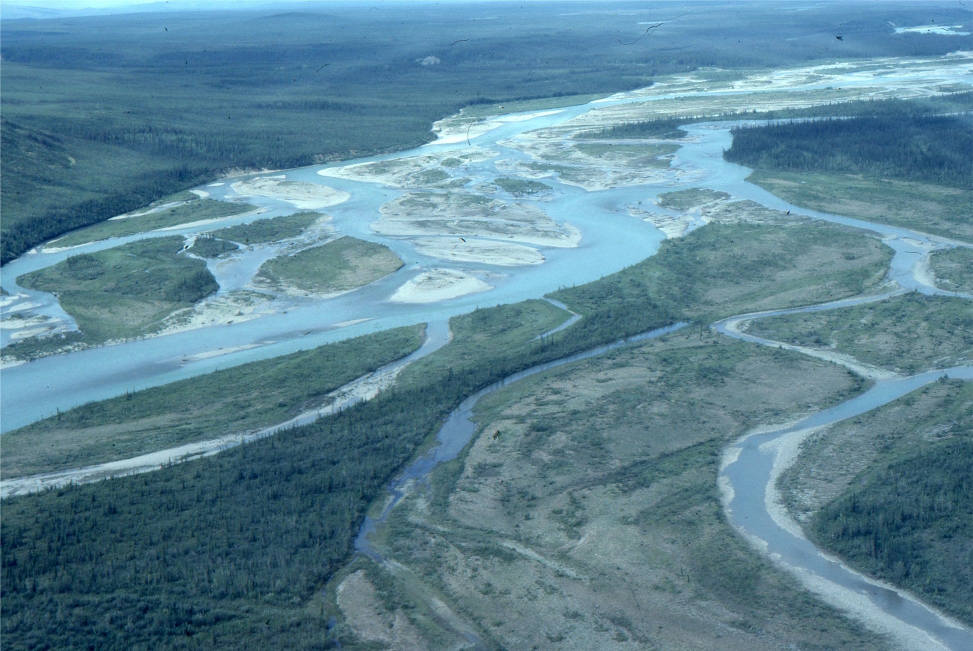
Active sand bars attached to a semi-permanent, vegetated bar, mid-stream, Clearwater River, Alberta. This is a possible candidate for an anastomosing river.
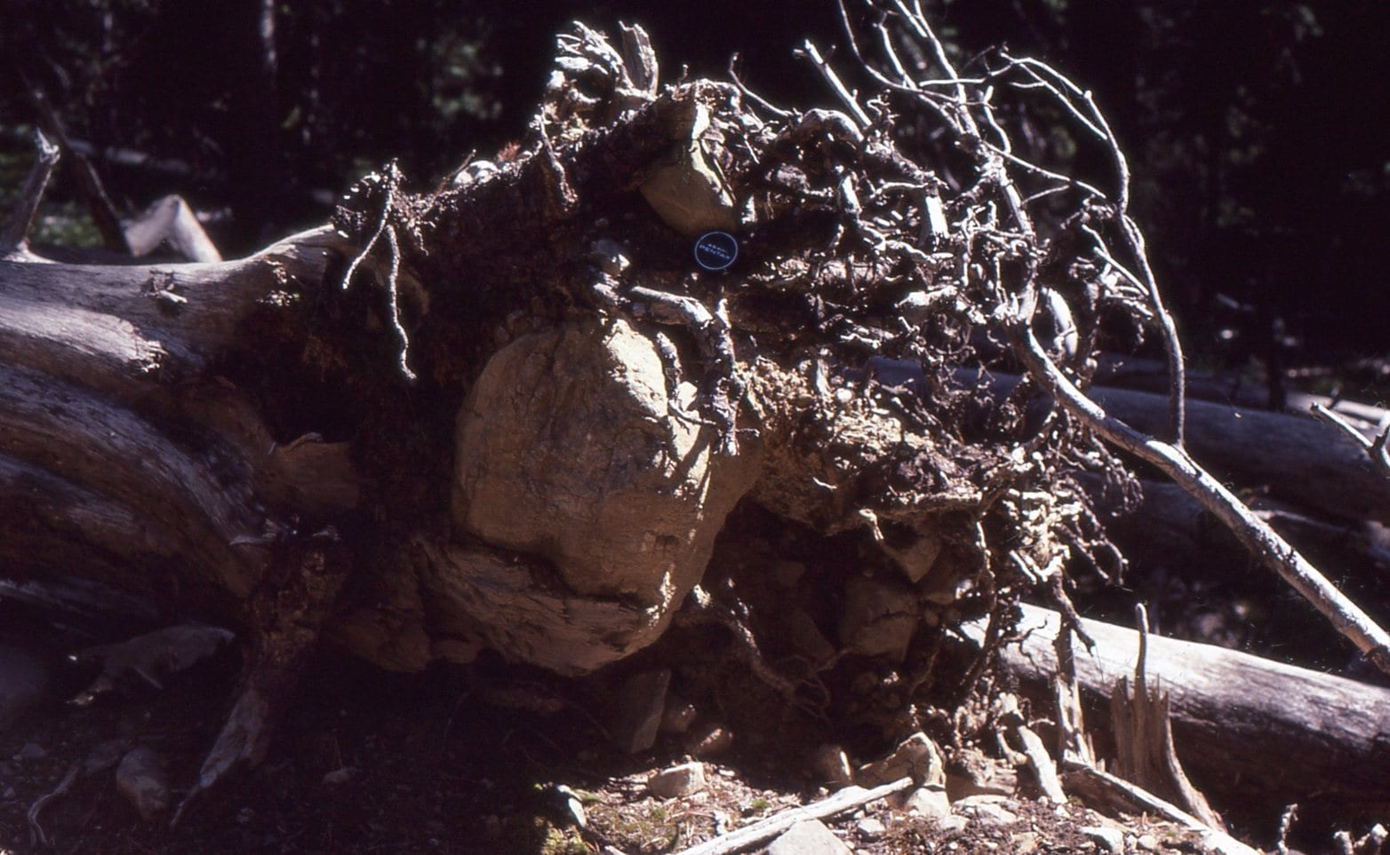 Large chunks of rock can be carried significant distances across open water while embedded in the tangle of tree roots. A possible answer to the mystery of some drop-stones.
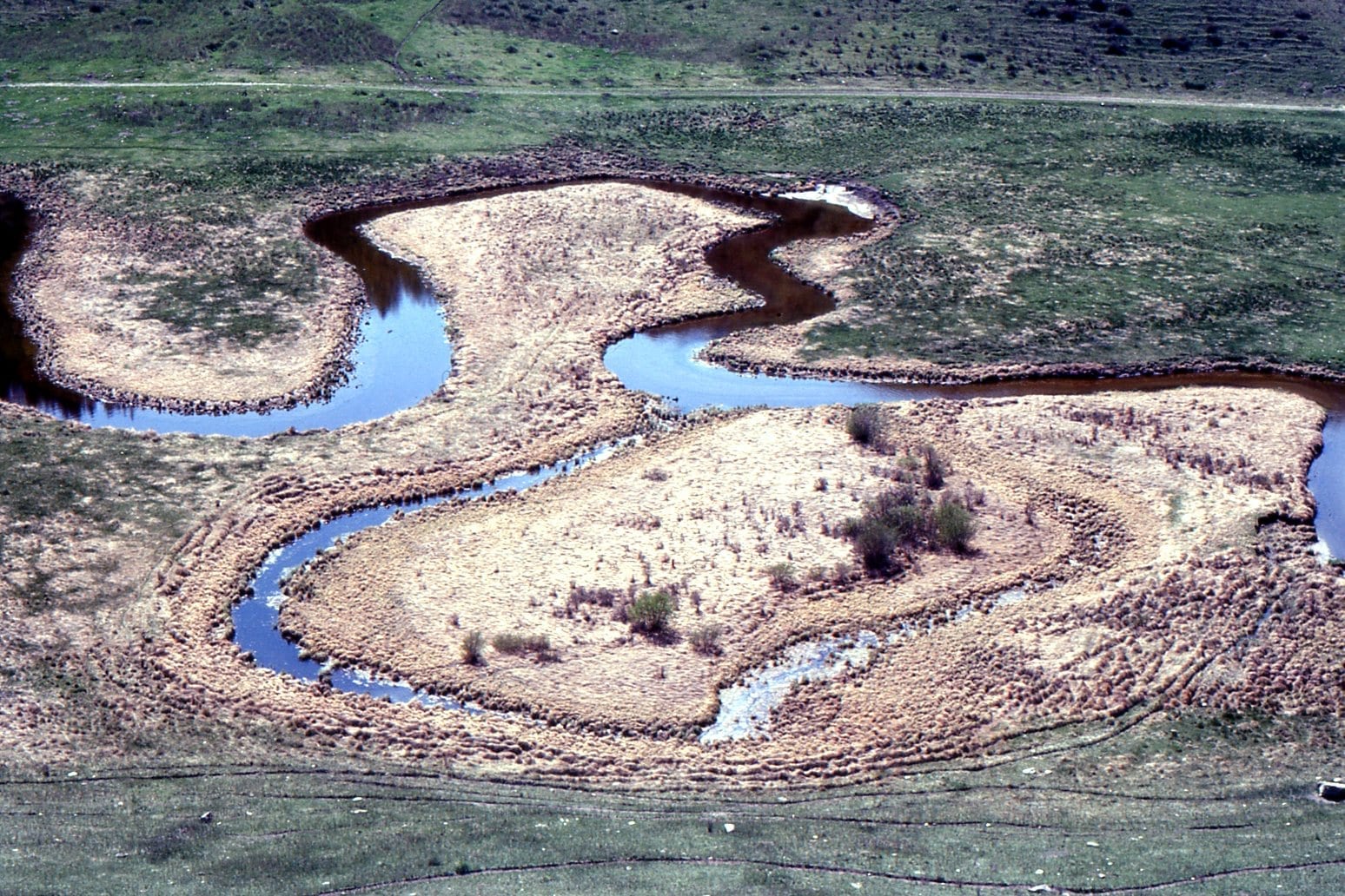 Small meandering stream, point bars, and oxbow lake, north of Calgary, Alberta.
 Point bar and overbank deposits in a high sinuosity (meandering channel) in the Upper Cretaceous Dunvegan Formation, Peace River, northeast British Columbia. Flow was to the right.
Crossbeds in Upper Cretaceous Dunvegan Formation, Peace River, northeast British Columbia. Left: stacked planar tabular crossbeds (2D subaqueous dunes); Right: Trough crossbeds (3D subaqueous dunes). Both types are associated with the Dunvegan point bar (image above), and the sand-filled channel below.
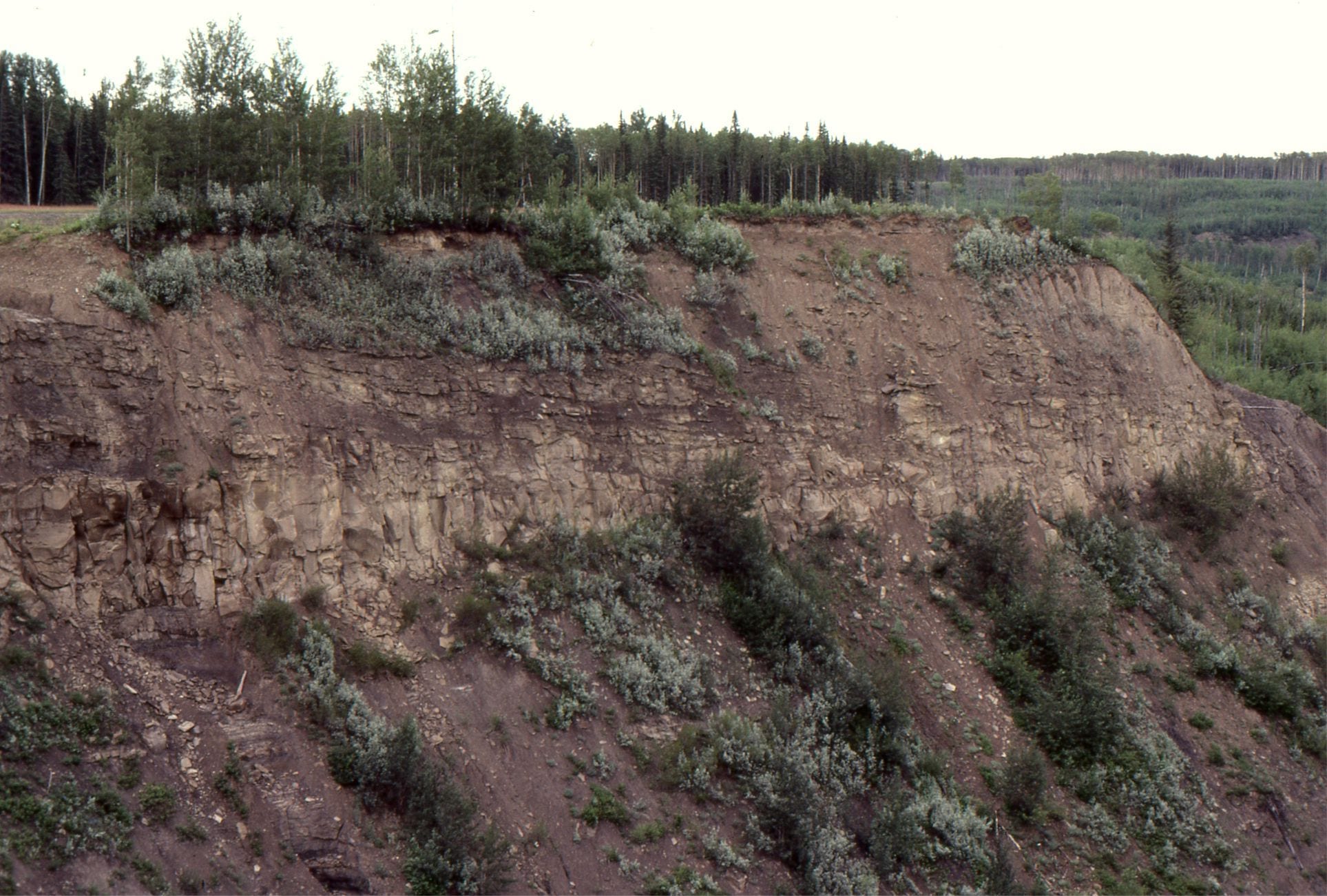
 Sandstone-filled channel in the Dunvegan Formation, Peace River, northern British Columbia. This view shows overall asymmetry of the channel.
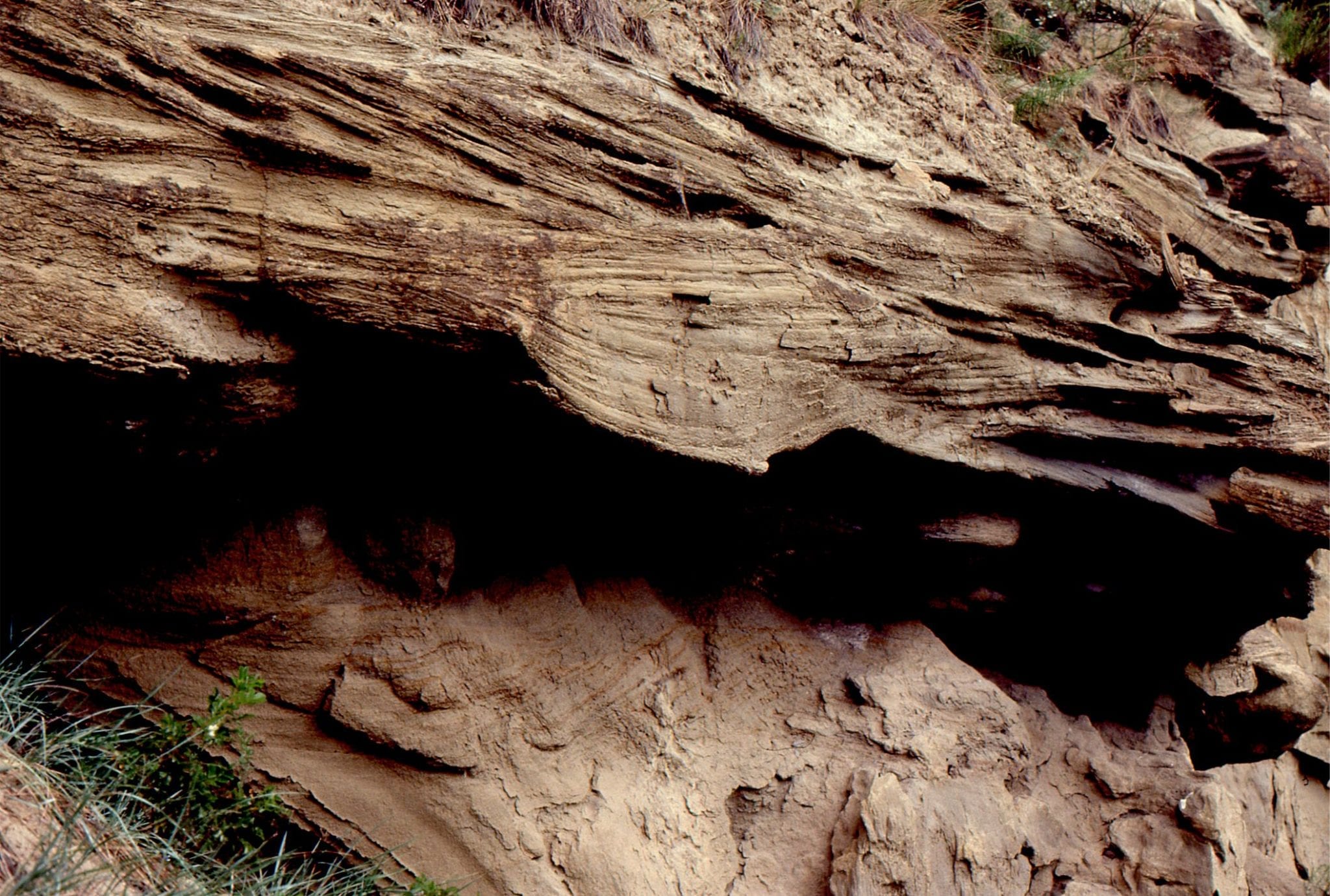
 Detail of sandstone channel cutting into slightly older, muddy overbank deposits. Upper Cretaceous Dunvegan Formation, Peace River, northeast British Columbia.
 Sandy point bar deposits in high sinuosity channel (meandering), overlain by thin floodplain lignites in the Middle Eocene Buchanan Lake Fm, Geodetic Hills, Axel Heiberg Island. The lignites contain abundant, well preserved conifers (Spruce), Hickory, and Metasequoia fronds, cones and seeds. The point bar is about 4m thick.
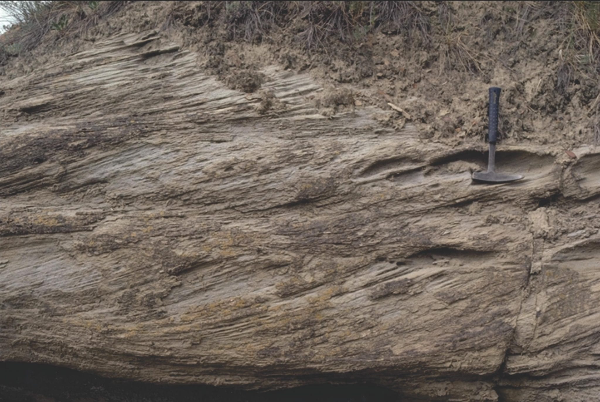
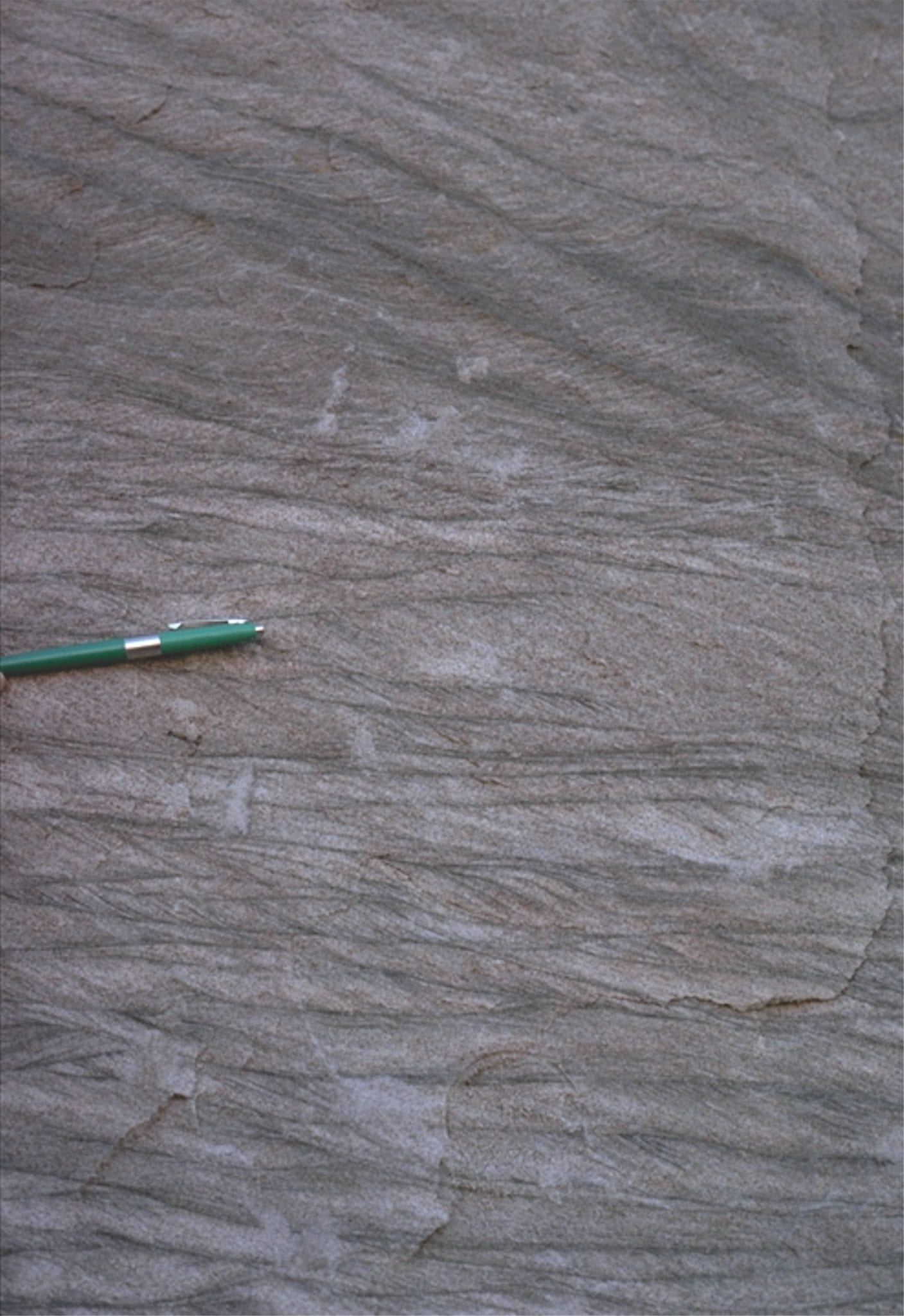
 Small crossbeds and laminated sandstone in point bar deposits, Middle Eocene Buchanan Lake Fm, Geodetic Hills, Axel Heiberg Island. There is abundant plant material throughout. Pen (mid image) is 15cm long.
 Multiple sets of climbing ripples, Middle Eocene Buchanan Lake Fm, Geodetic Hills, Axel Heiberg Island. These form when a significant suspended load of fine sand settles and becomes part of the bedload on the channel floor.
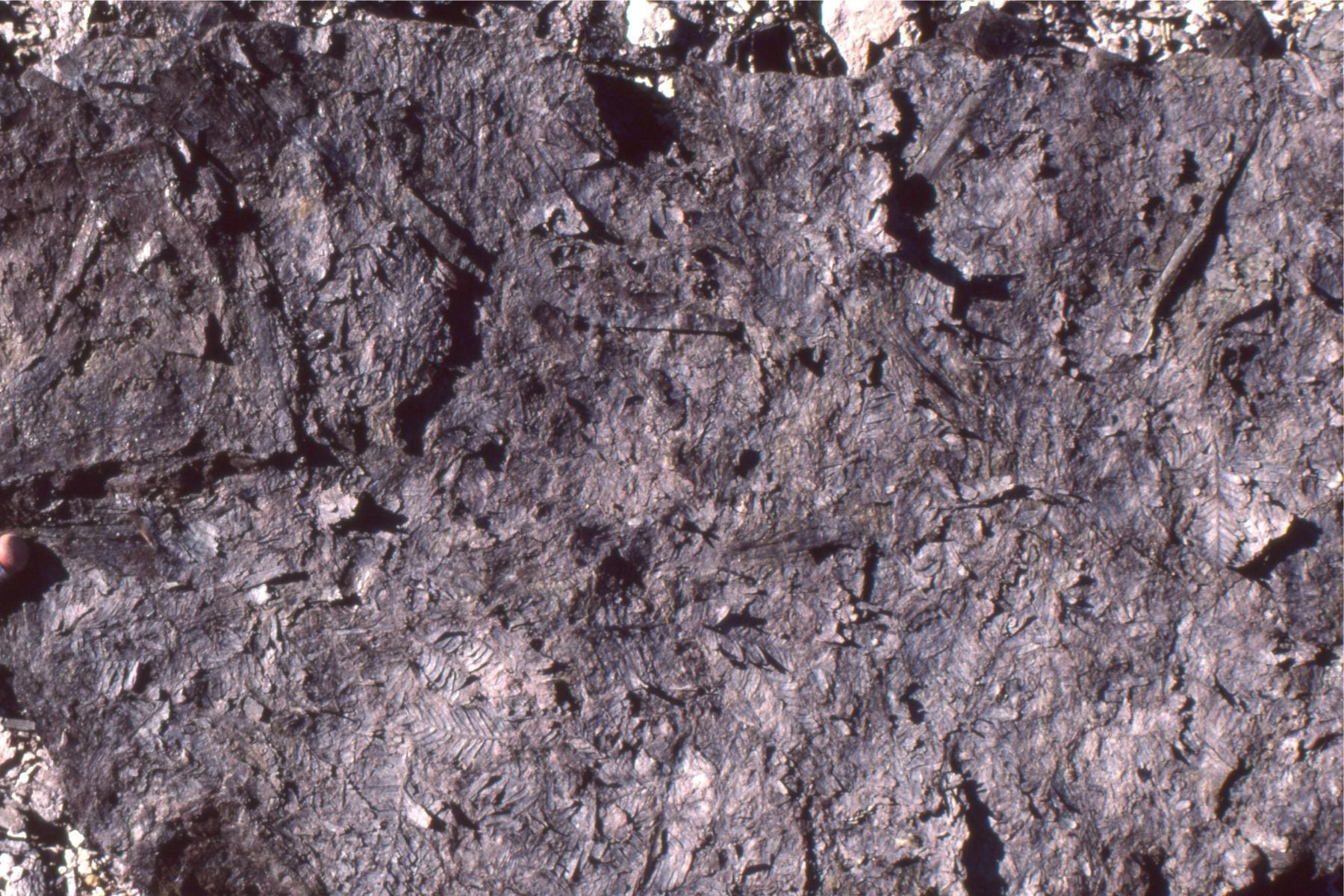
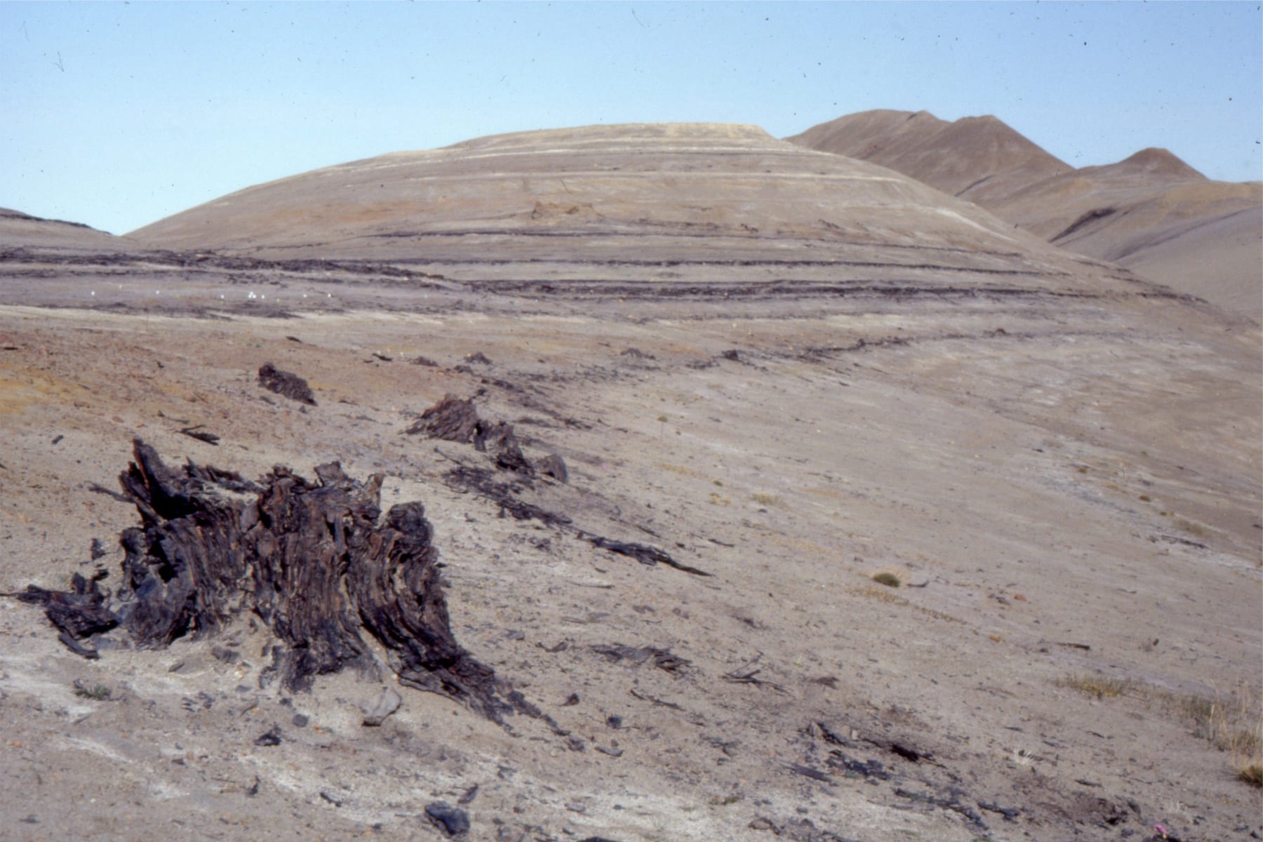 Multiple thin lignite – subbituminous coal beds with exquisitely preserved tree trunks in growth position, Middle Eocene Buchanan Lake Fm, Geodetic Hills, Axel Heiberg Island. The succession here represents a stacking of flood plain and forested areas adjacent to meandering rivers. These deposits accumulated in a more distal position to the emerging mountain front during the Eurekan Orogeny. See my post on the Fossil Forests
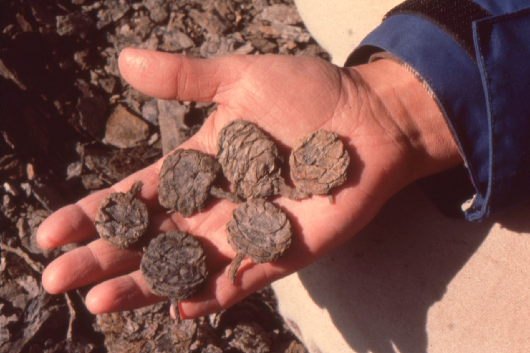
Some of the exquisitely preserved plant material from the Geodetic Hills Fossil forest. Left: Metasequoia cones looking like they were buried yesterday; Right: Metasequoia fronds and hardwood leaves. Middle Eocene Buchanan Lake Fm, Geodetic Hills, Axel Heiberg Island.
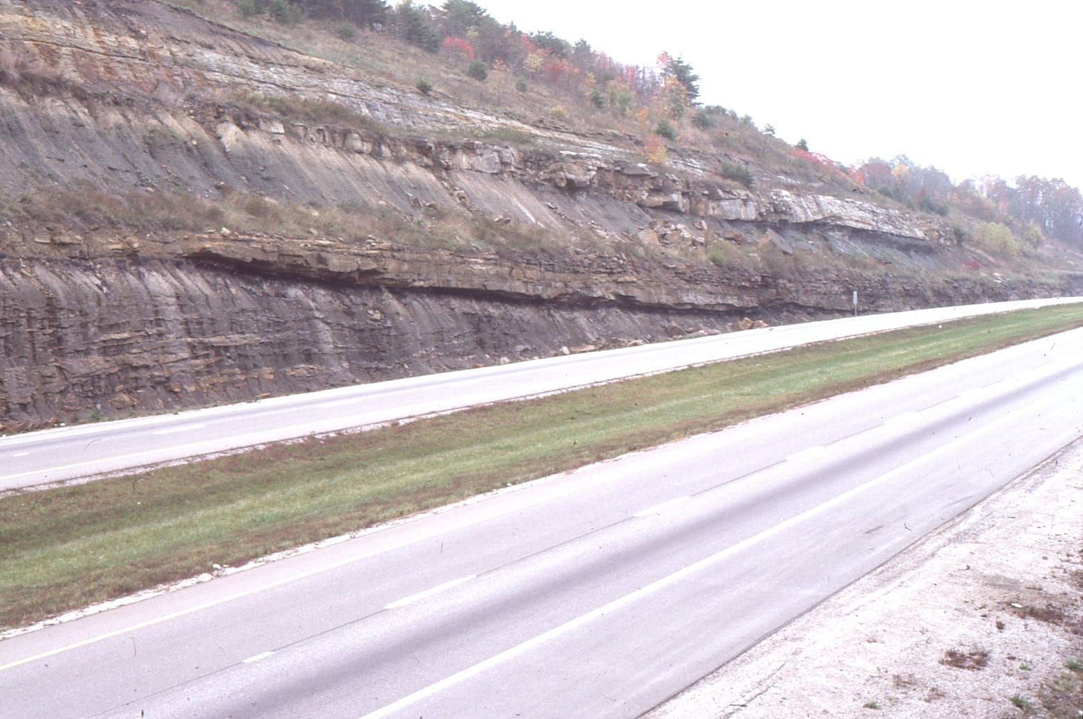

Large meandering river point bars and overlying floodplain-swamp muds, associated with the Princess Coals, Carboniferous of Kentucky, near Rush (Highway I-64). Point bar ‘foresets’ consist of very laminated, rippled, and slumped, fine grained sandstone-mudstone. I visited these outcrops during an excellent AAPG field trip run by John Horne, 1984.
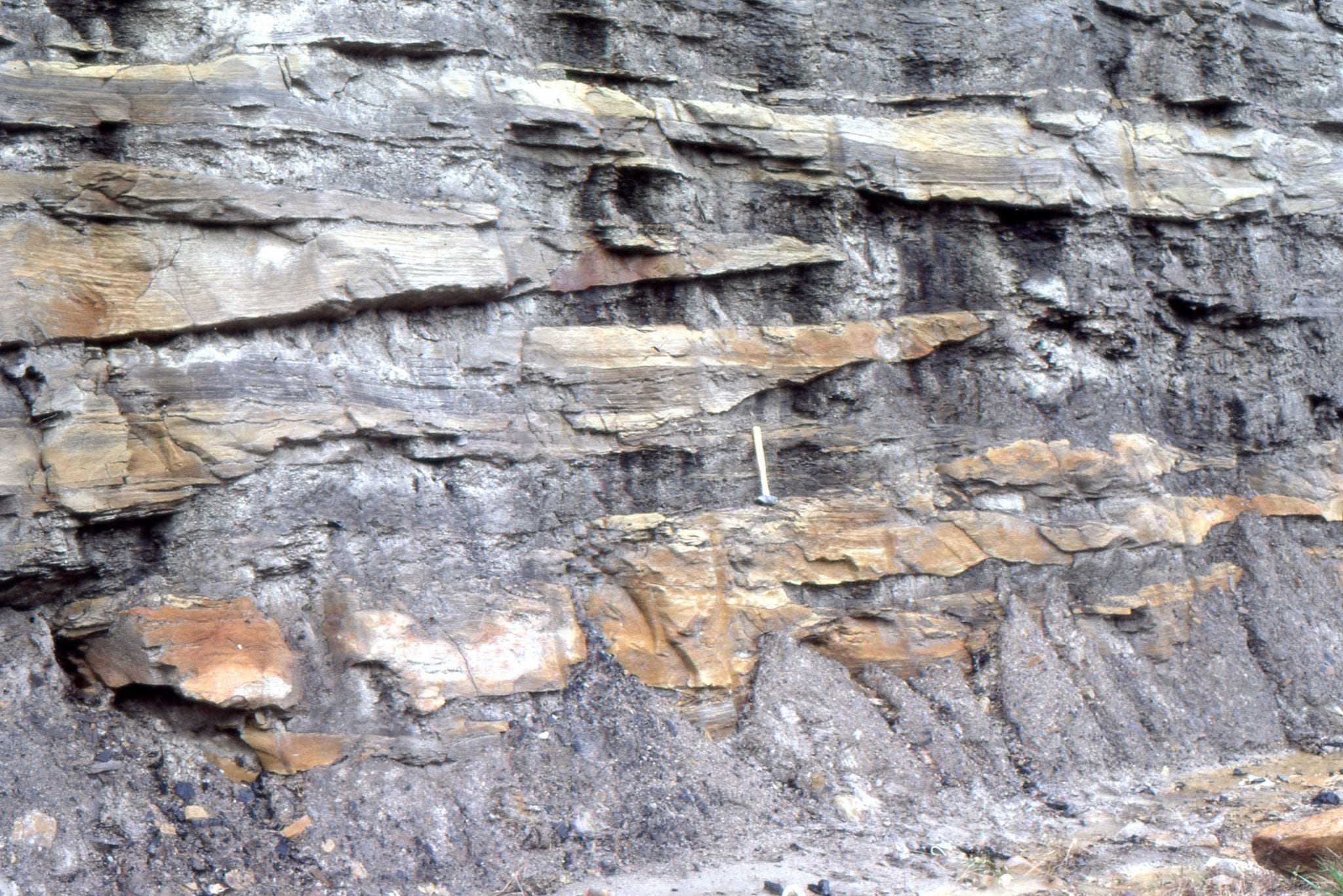 Detail of the inclined point bar layers show numerous discontinuities in sandstone lenses and wedges, and truncation surfaces that indicate shifting sediment distribution across the bar, and possibly some erosion. Carboniferous of Kentucky, near Rush (Highway I-64).
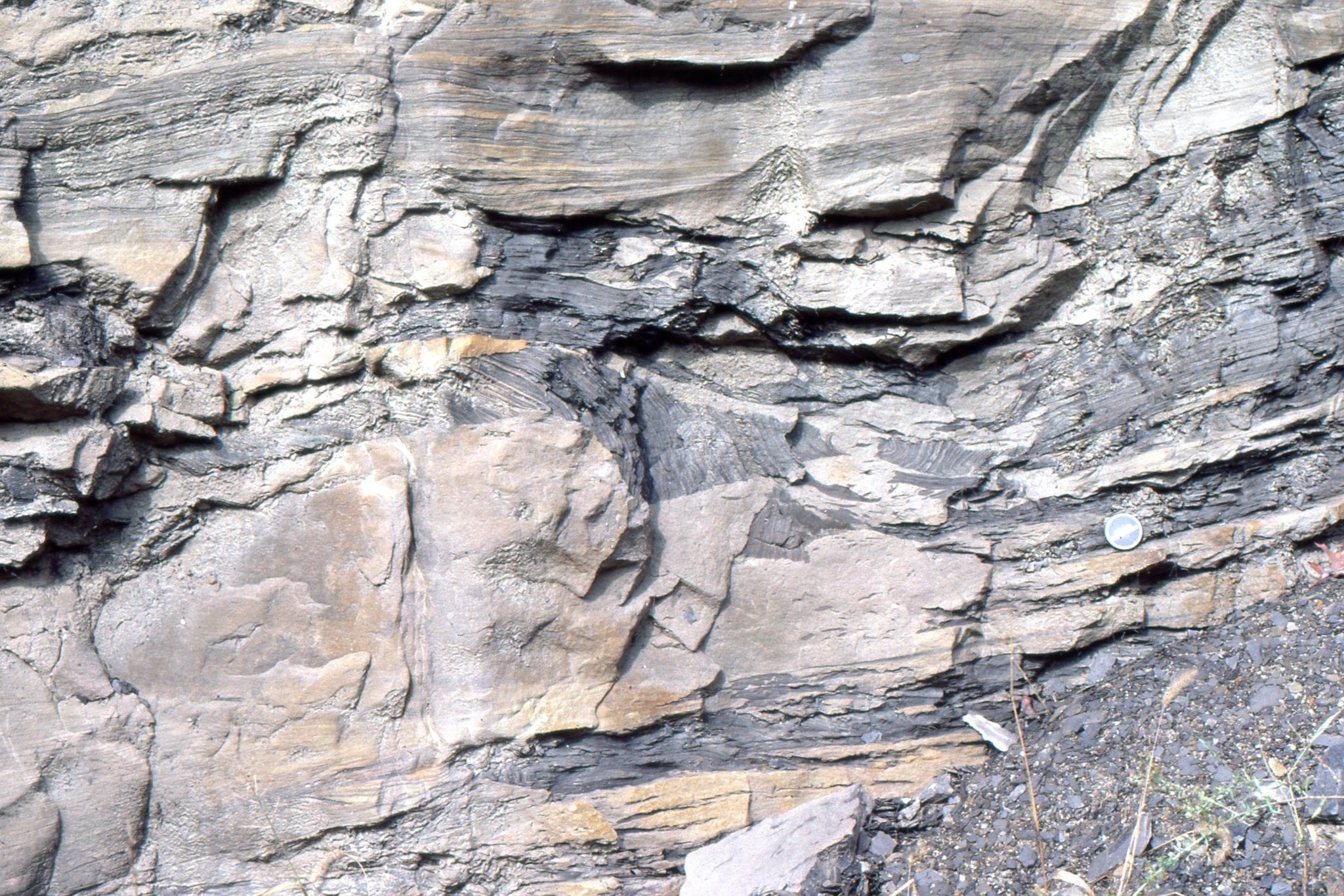 Slumping and rotation of laminated sandstone-mudstone in point bar foresets (Carboniferous of Kentucky, near Rush, Highway I-64). Small synsedimentary faults cut the middle layers.
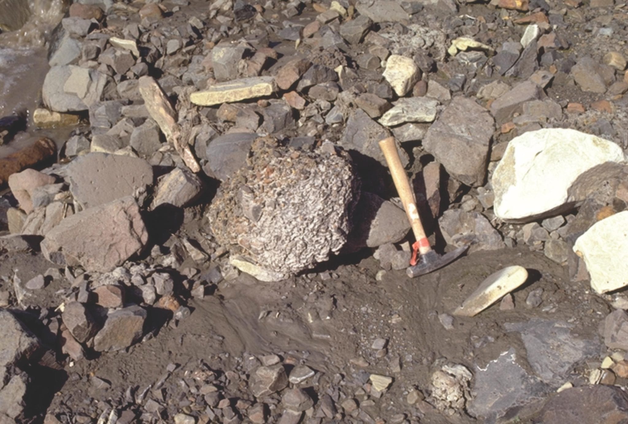
Odd-ball (sic) structure sometimes found in fluvial deposits, are armoured mudballs. These form when a chunk of sticky mud slumps from a channel margin, is rolled by currents along the channel floor, and in the process picks up small pebbles and bits of wood. The recent example on the left is from Mackenzie River, near Fort Norman. The Paleocene example, to the right of the lens cap, (right image) is from the Summit Creek Fm, in an outcrop fortuitously nearby the modern analogue – small pebbles impregnate the mud ball surface.