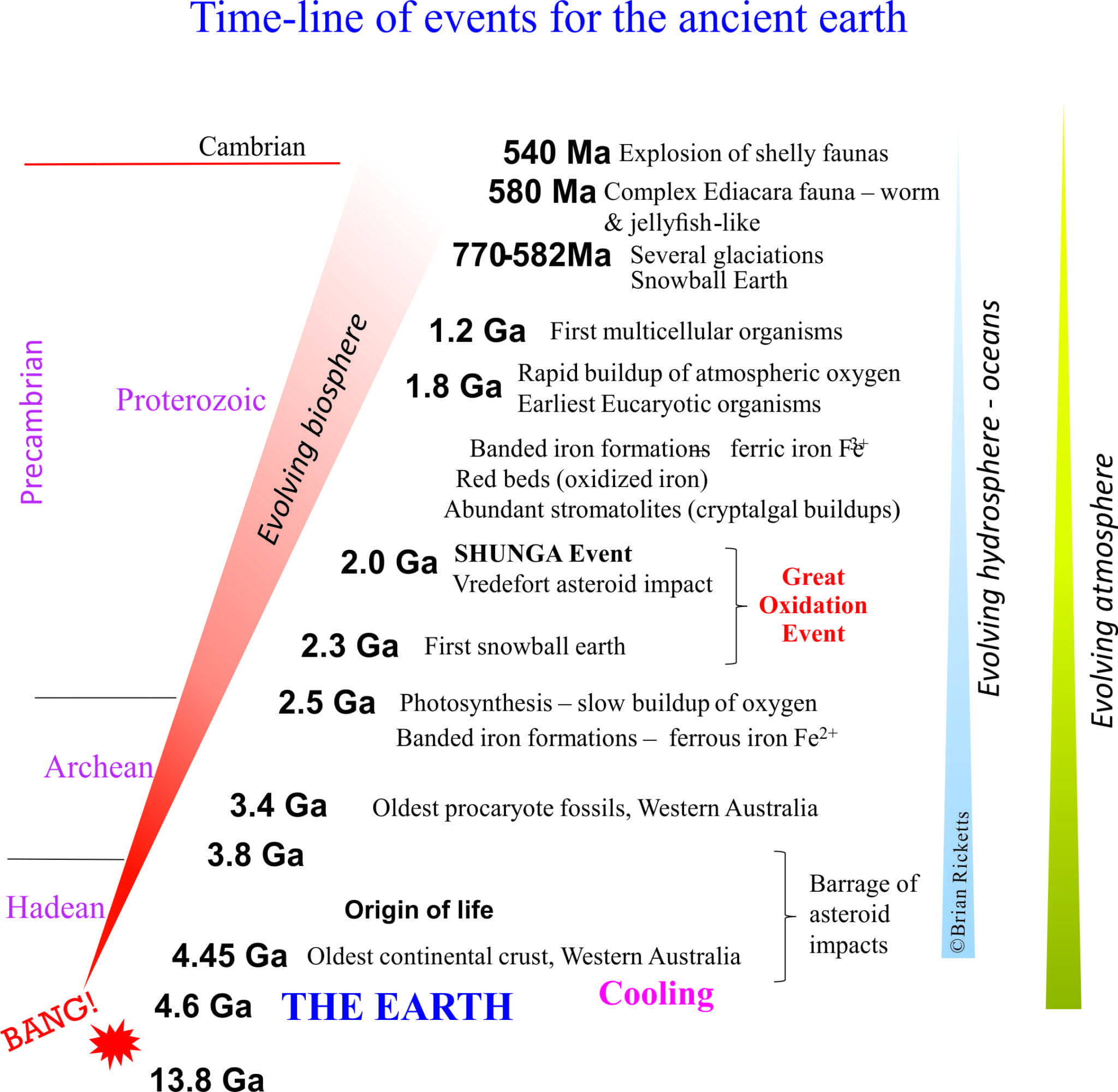
Stromatolites. The Precambrian is replete with them. In many ways they define the Precambrian, that period of earth history, about 90% of it, that set the scene for the world we currently live in – its atmosphere, hydrosphere, lithosphere, and biosphere. It’s the period when life began more than 3.4 billion years ago, taking its time (about 3 billion years) to get over that first rush of DNA replication.
The Atlas, as are all blogs, is a publication. If you use the images, please acknowledge their source (it is the polite, and professional thing to do).
Stromatolites are the sedimentary record of that really prolonged period of geological time. Some of the oldest known, bona fide cryptalgal structures are found in the 3.4 Ga North Pole deposits. They represent fossil slime – mats of photosynthetic, prokaryotic cyanobacteria. They were responsible for producing the oxygen we, and most other life forms breath.
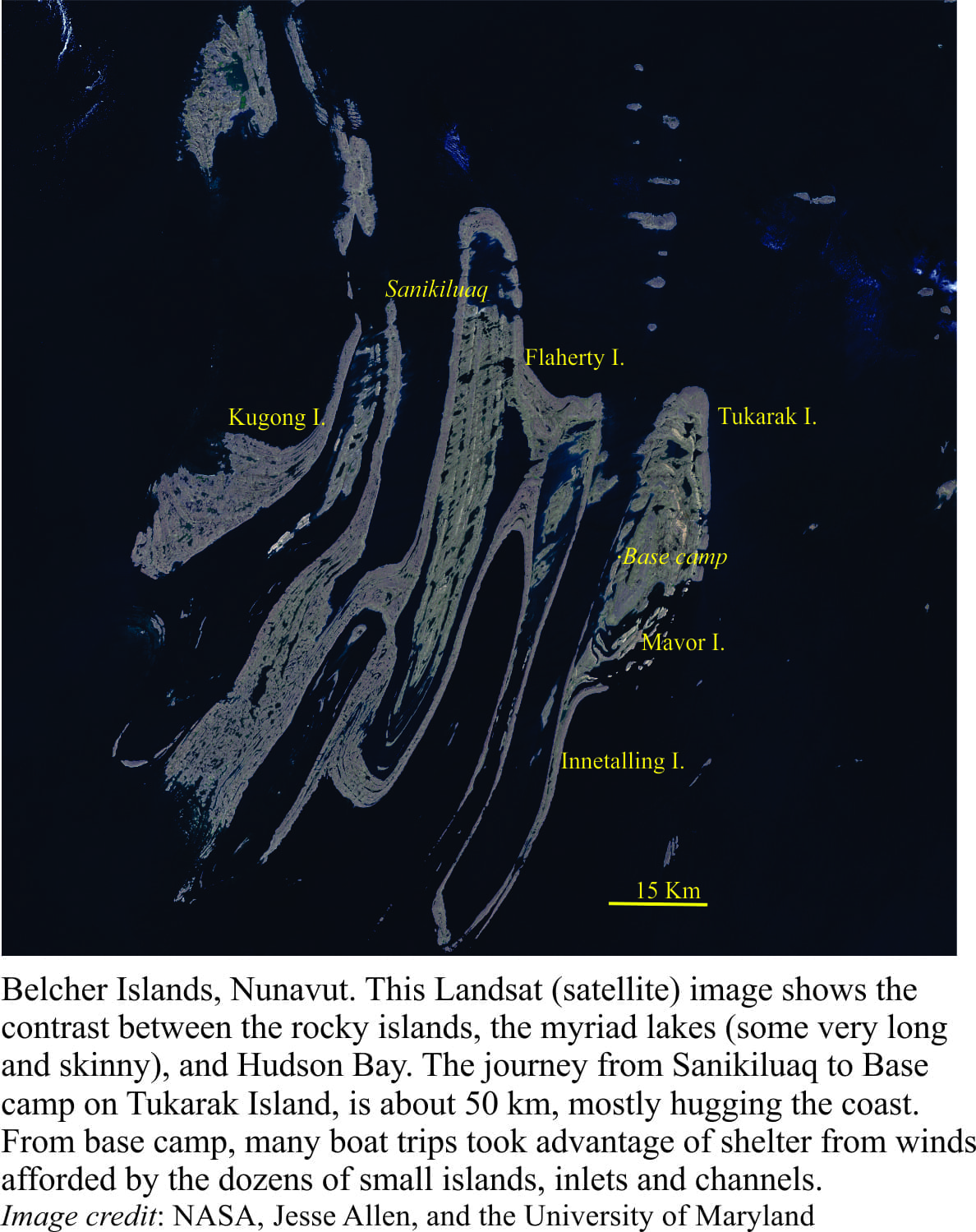
Stromatolites really came into their own by about 2.5Ga, forming extensive buildups, and reef-like structures, by slow, incremental addition, mat-by-mat, in the ancient shallow seas. Growth habits varied from broad flat domes to intricately branched columns. Stromatolite structure, shape and distribution were primarily controlled by environmental conditions such as water depth, wave and current energy, and substrate (muddy, sandy). Glacially polished rock outcrops on Belcher Islands (where all the following images are from) show these structures in exquisite detail.
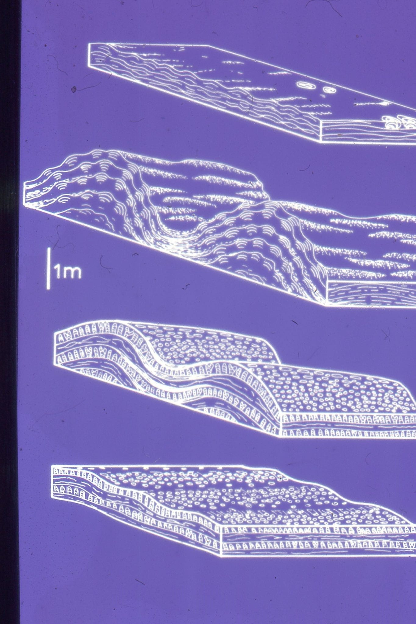
Stromatolites in outcrop commonly appear huge, as columns or domes extending vertically several metres. But their sea floor profiles, or synoptic relief during growth was low. We can visualize this when tracing individual laminae or sets of laminae (ie. the original mat surface) from one column to the next. Your average shallow shelf or platform stromatolite extended no more than a few millimeters or centimeters above the sea floor. Some large mounds, or reef-like structures had a few metres relief; but nothing like more recent coral reefs. This also means that the environmental conditions for incremental growth must have been stable for long periods of time. This needs to be kept in mind when looking at cryptalgal structures in outcrop; their apparent size can be misleading.
Check out this post for outcrop descriptions of stromatolite morphological features
This link will take you to an explanation of the Atlas series, the ownership, use and acknowledgment of images. There, you will also find links to the other categories.
Click on the image for an expanded view, then ‘back page’ arrow to return to the Atlas.
A few publications that have a bearing on the set of images below:
Ricketts, B.D. 1983: The evolution of a Middle Precambrian dolostone sequence – a spectrum of dolomitization regimes; Journal of Sedimentary Petrology, v. 53, p. 565-596.
Ricketts, B.D. and Donaldson, J.A. 1981: Sedimentary history of the Belcher Group of Hudson Bay; Geological Survey of Canada, Paper 81-10, p. 235-254. F.A.H. Campbell, Editor
Ricketts, B.D. and Donaldson, J.A. 1989: Stromatolite reef development on a mud-dominated platform in the Middle Precambrian Belcher Group of Hudson Bay; Canadian Society of Petroleum Geologists, Memoir 13, p. 113-119.
Donaldson, J.A. and Ricketts, B.D. 1979: Beachrock in Proterozoic dolostone of the Belcher Islands, Northwest Territories; Journal of Sedimentary Petrology, v. 49, p. 1287-1294.
The images:
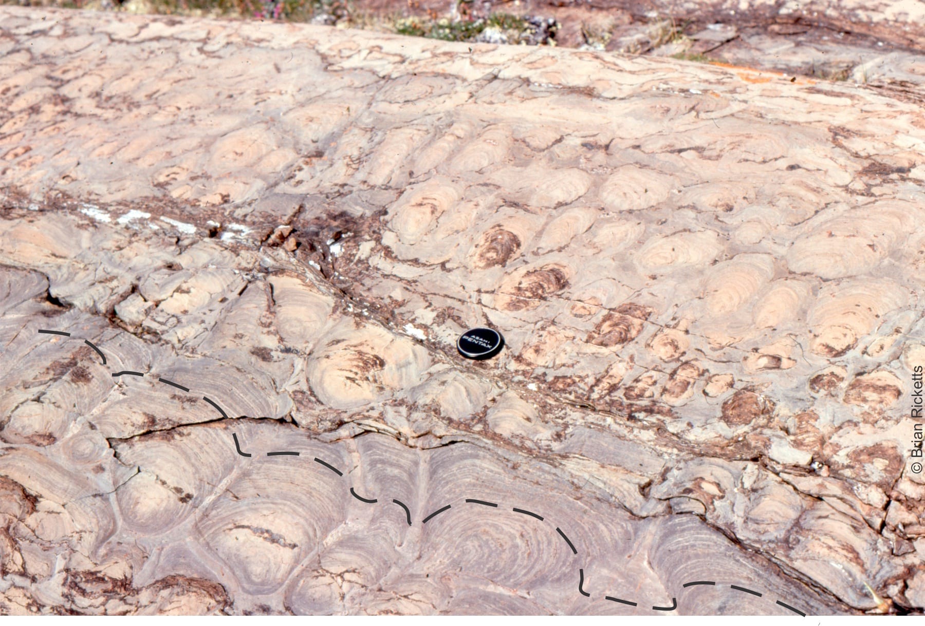
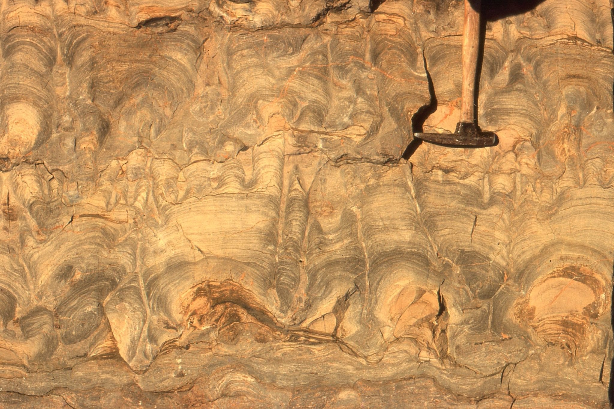
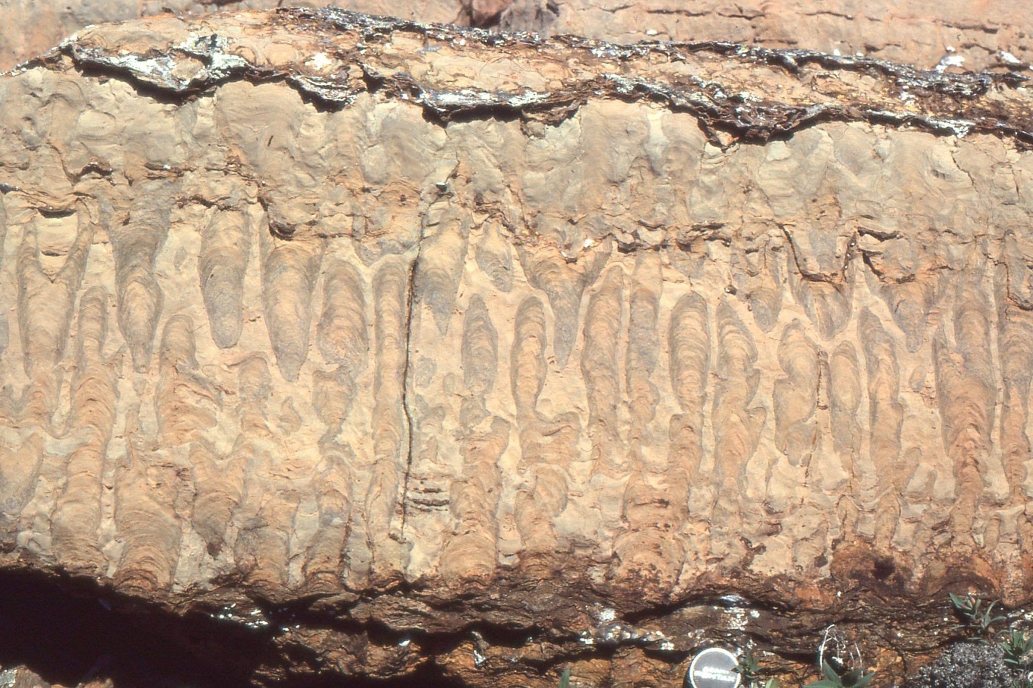
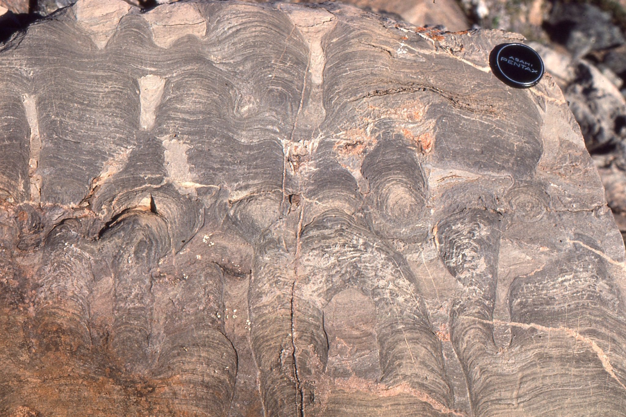
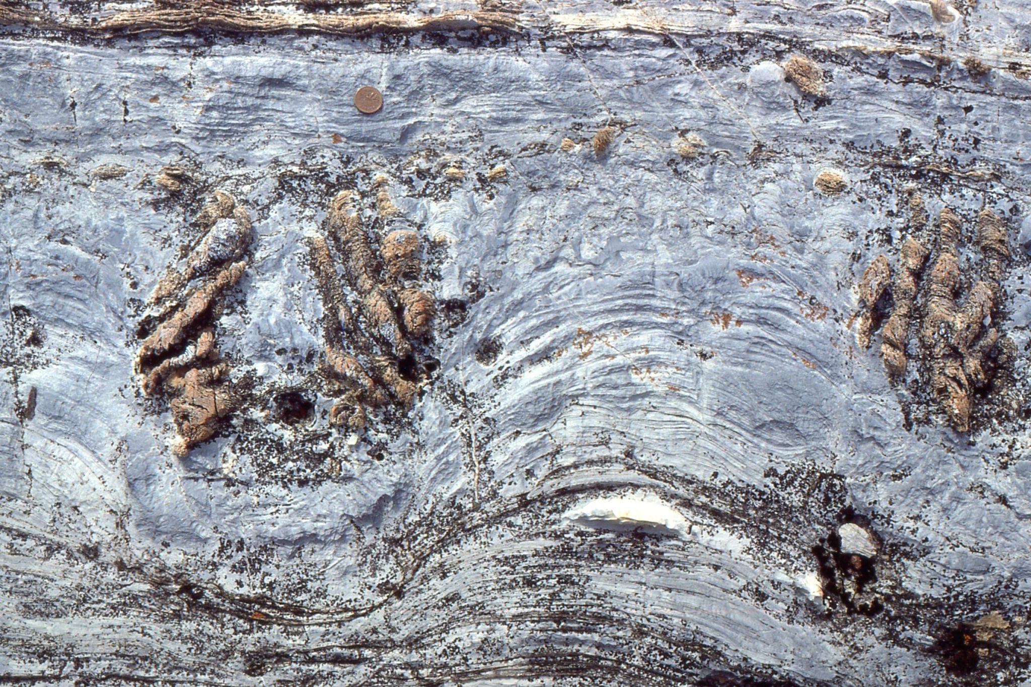
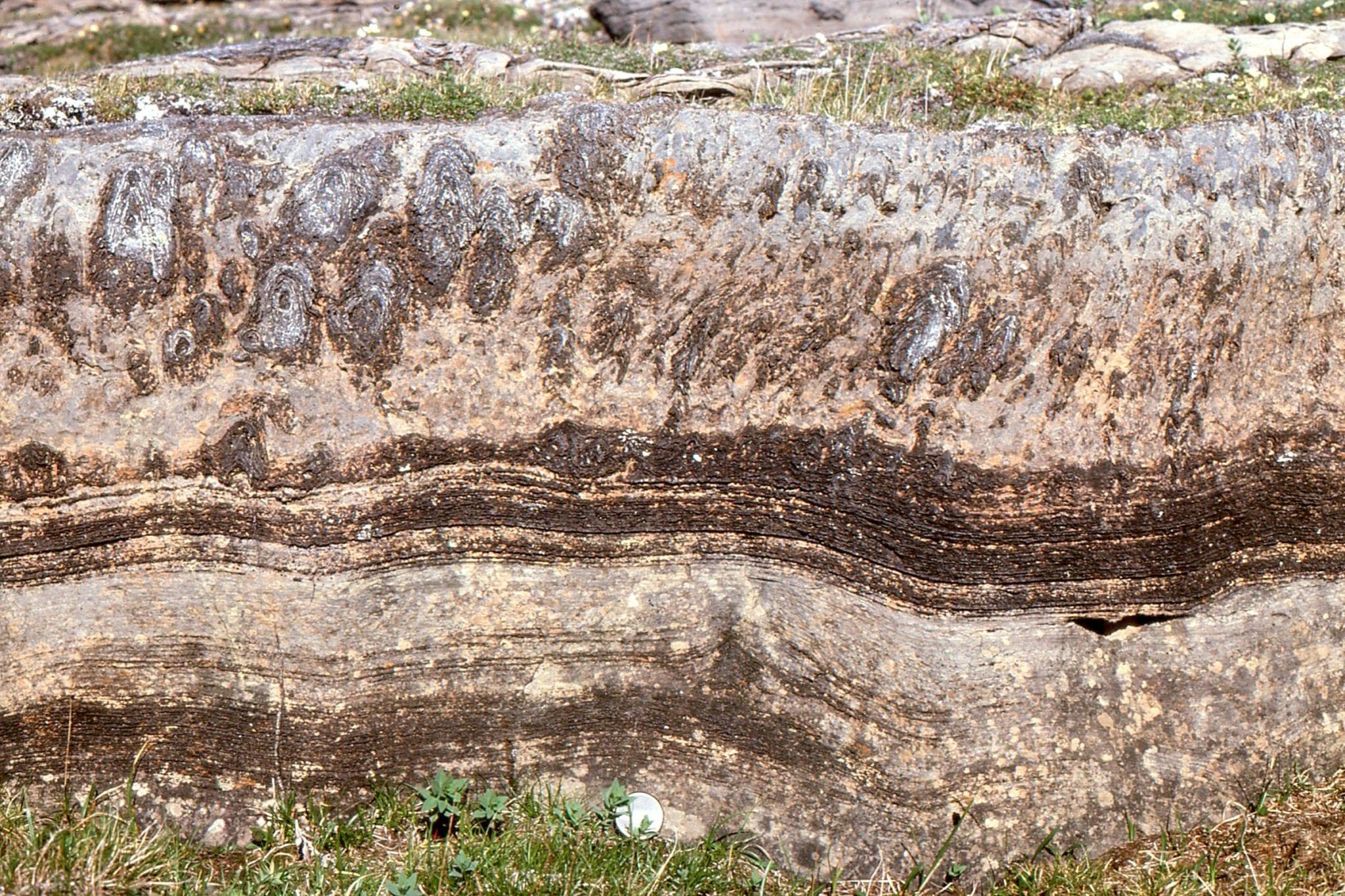
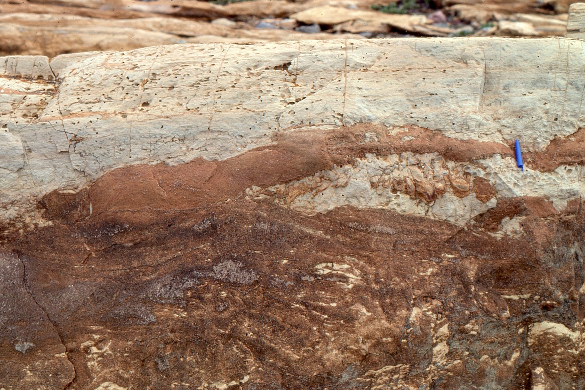
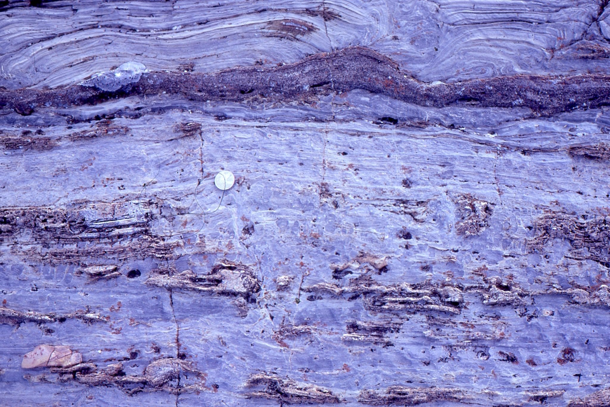
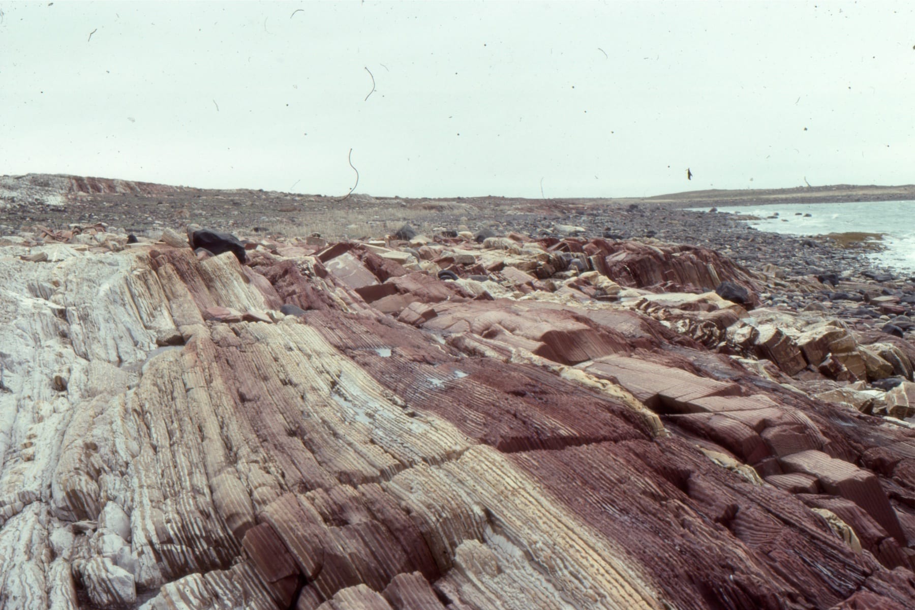
Bulbous, dolomitized stromatolites in the lower part of the outcrop become progressively more branched towards the top. The view is oblique to bedding; the surface polished by Laurentide glacial ice. McLeary Fm. Right: dashes follow the synoptic surface, which approximates the actual growing mat morphology and relief at the sea floor. Whereas the stromatolites in outcrop appear large, at the time of growth (2 billion years ago) the sea floor would have looked vaguely dimpled or domed. Bedding-parallel stylolites have thinned the rock sequence by 10-20%.
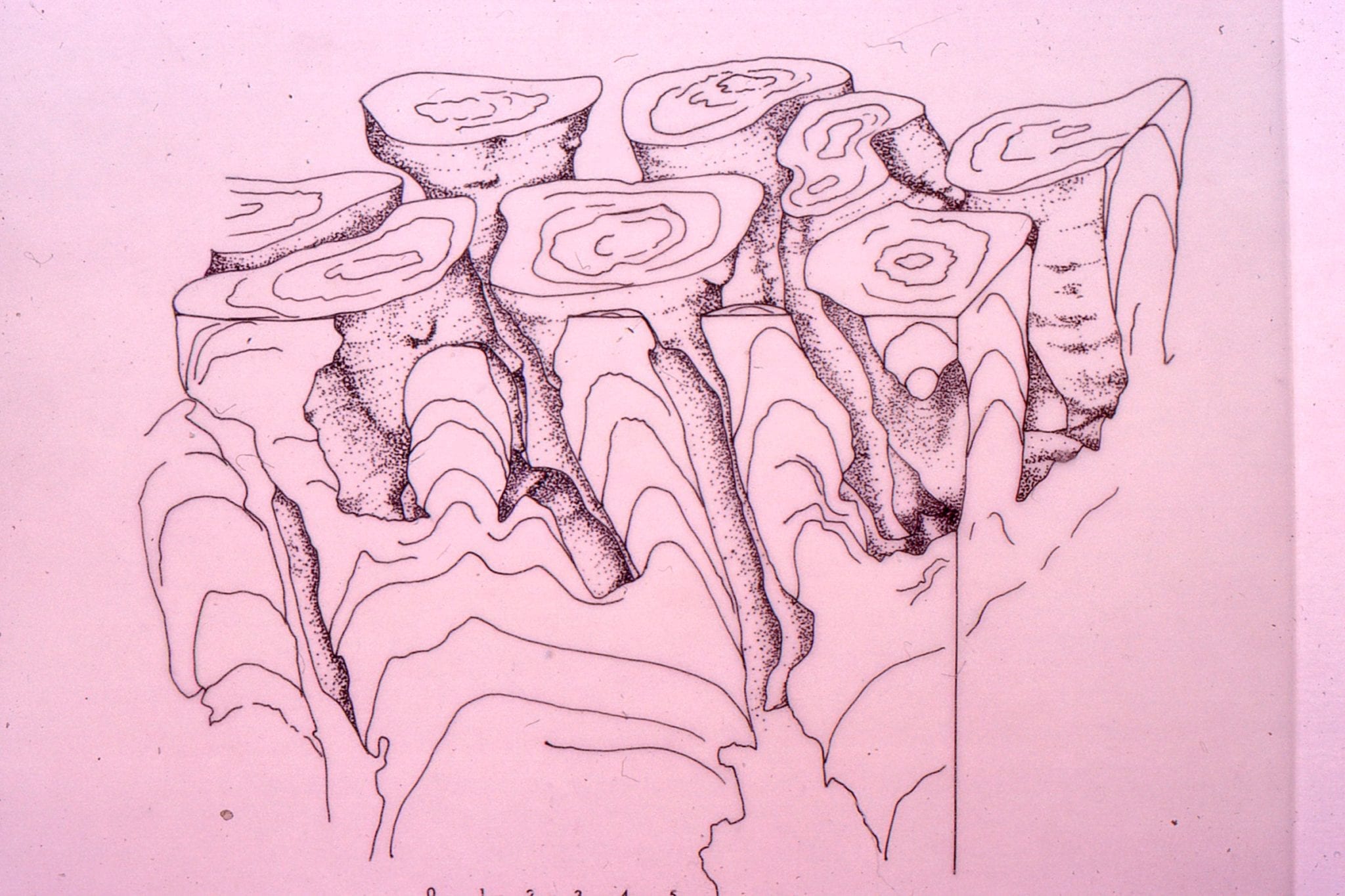
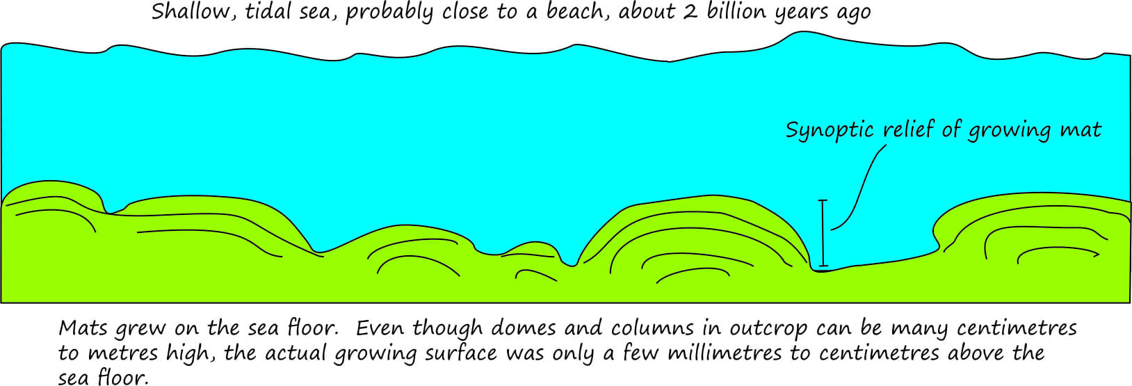 The cartoon refers to the synoptic surface outlined in the image above. Even though columns and dome appear in outcrop to be quite large (10s of cm to metres), their actual growth profiles at the sediment-water interface was measured in only millimetres to centimetres.
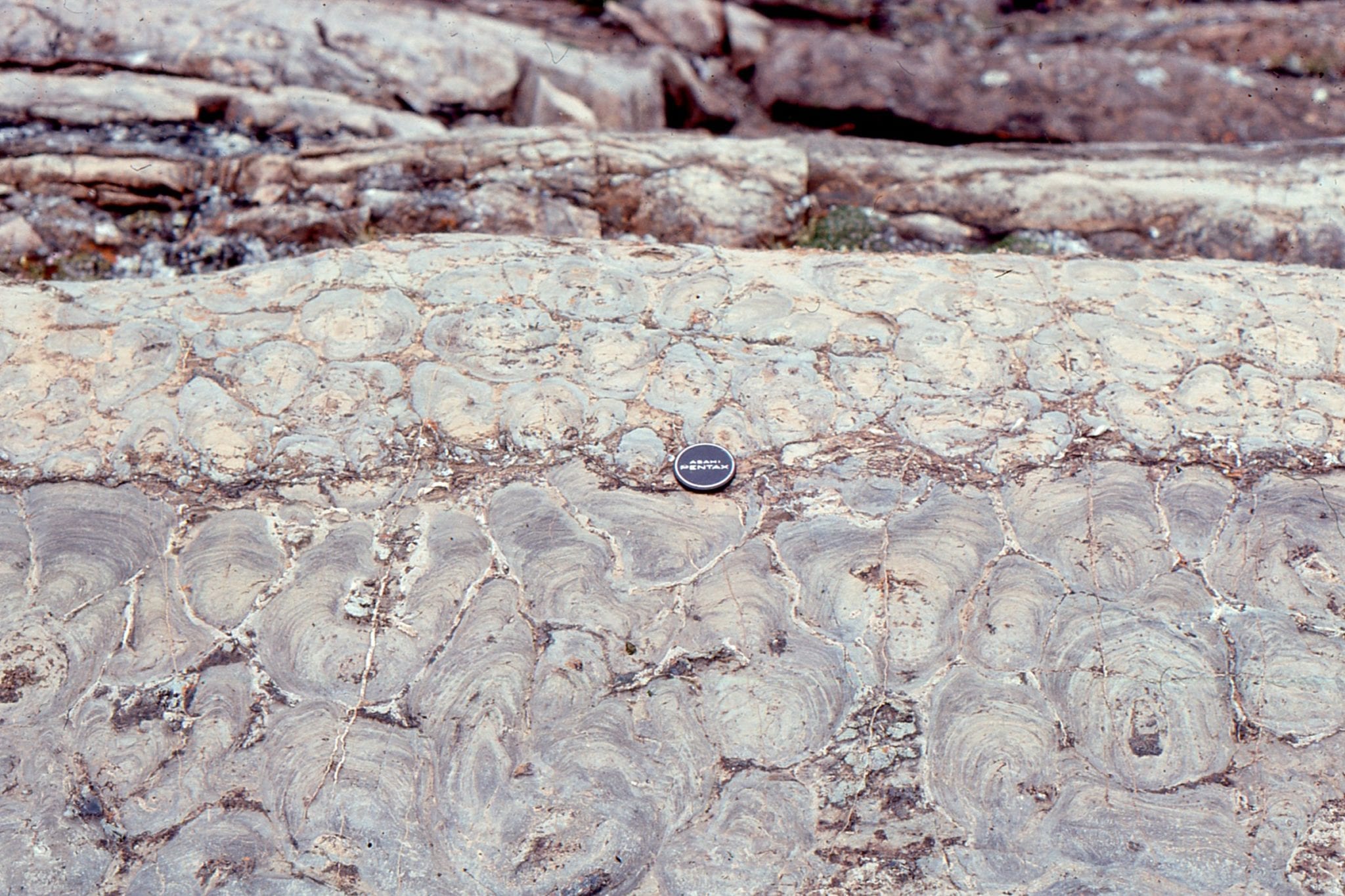
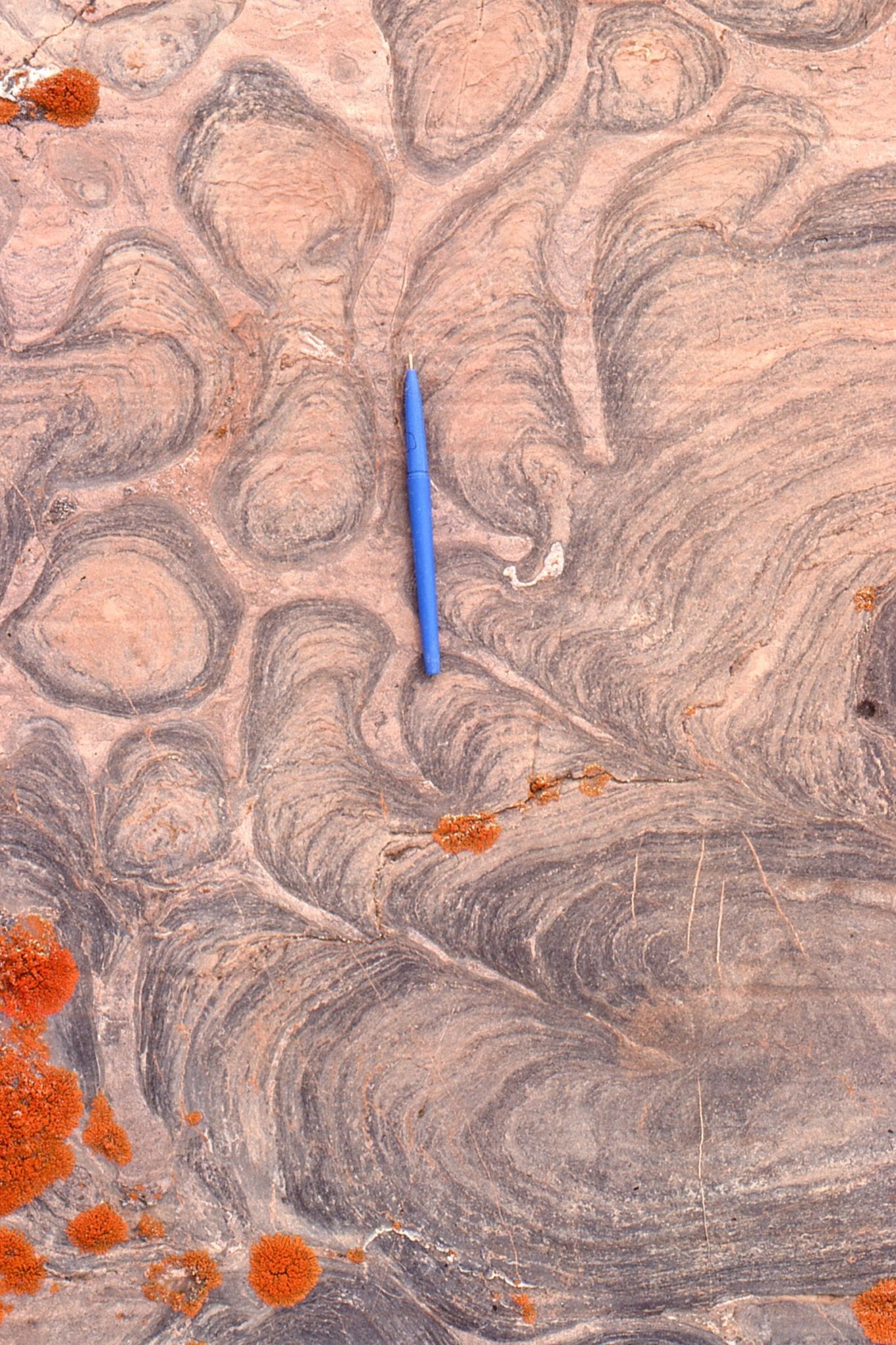
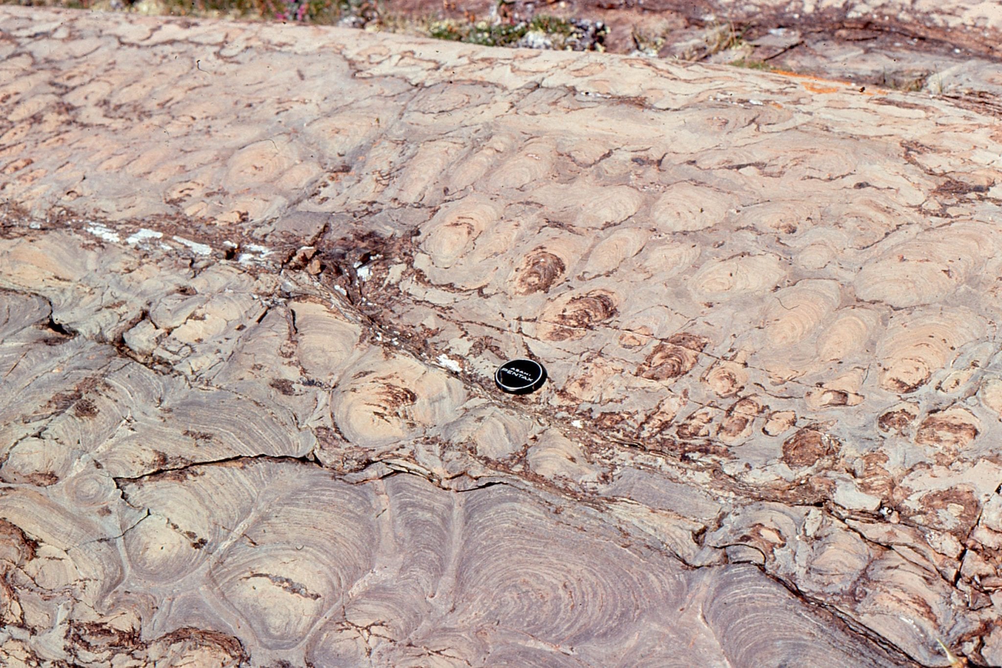
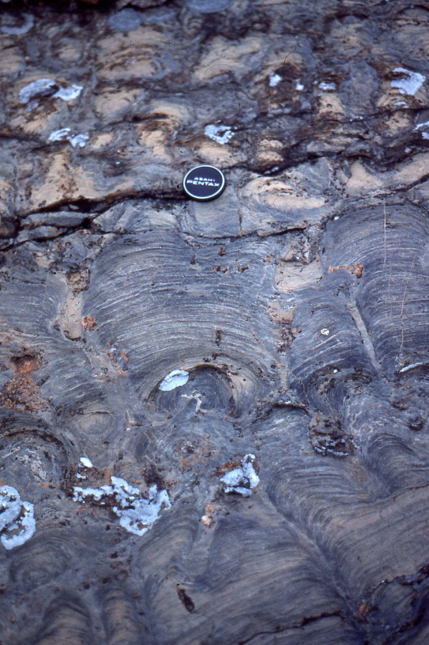
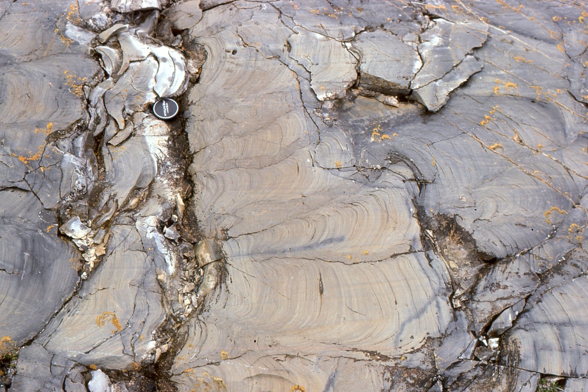
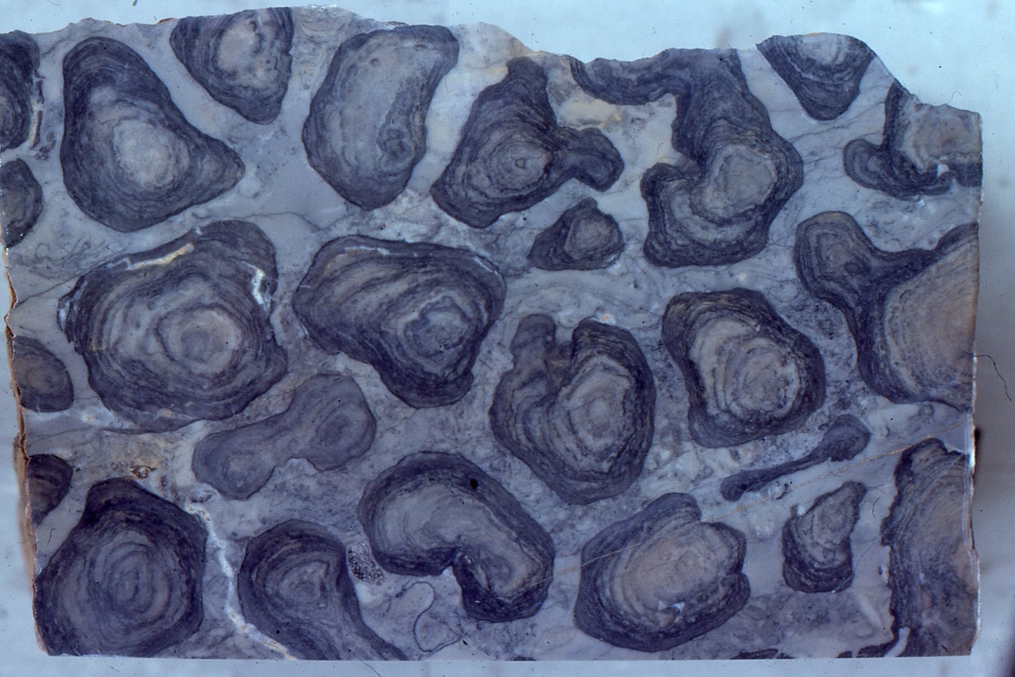
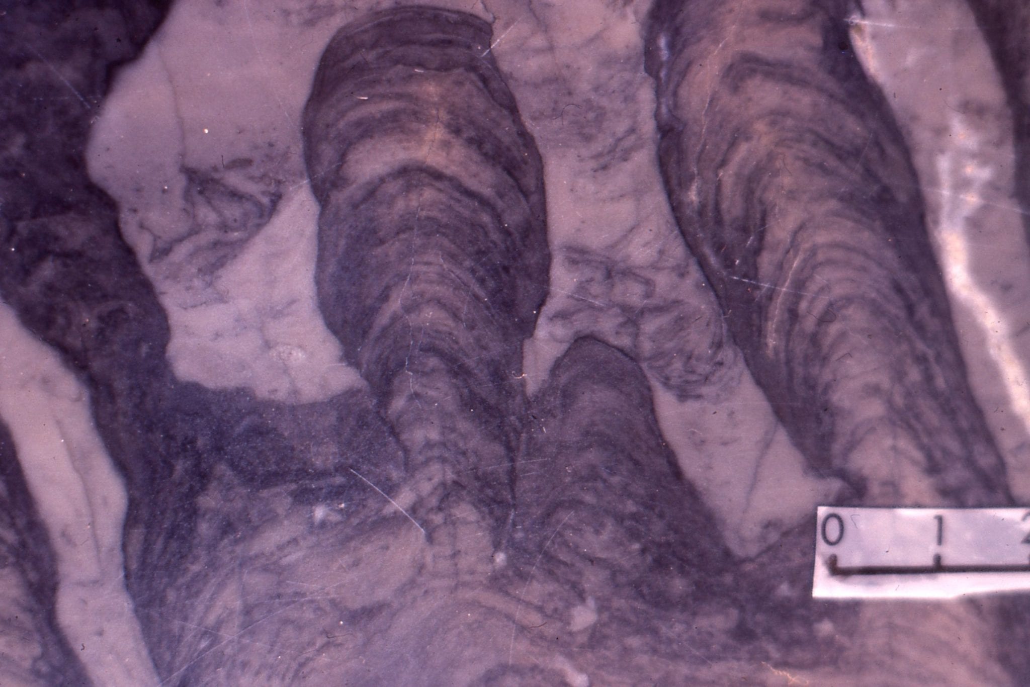
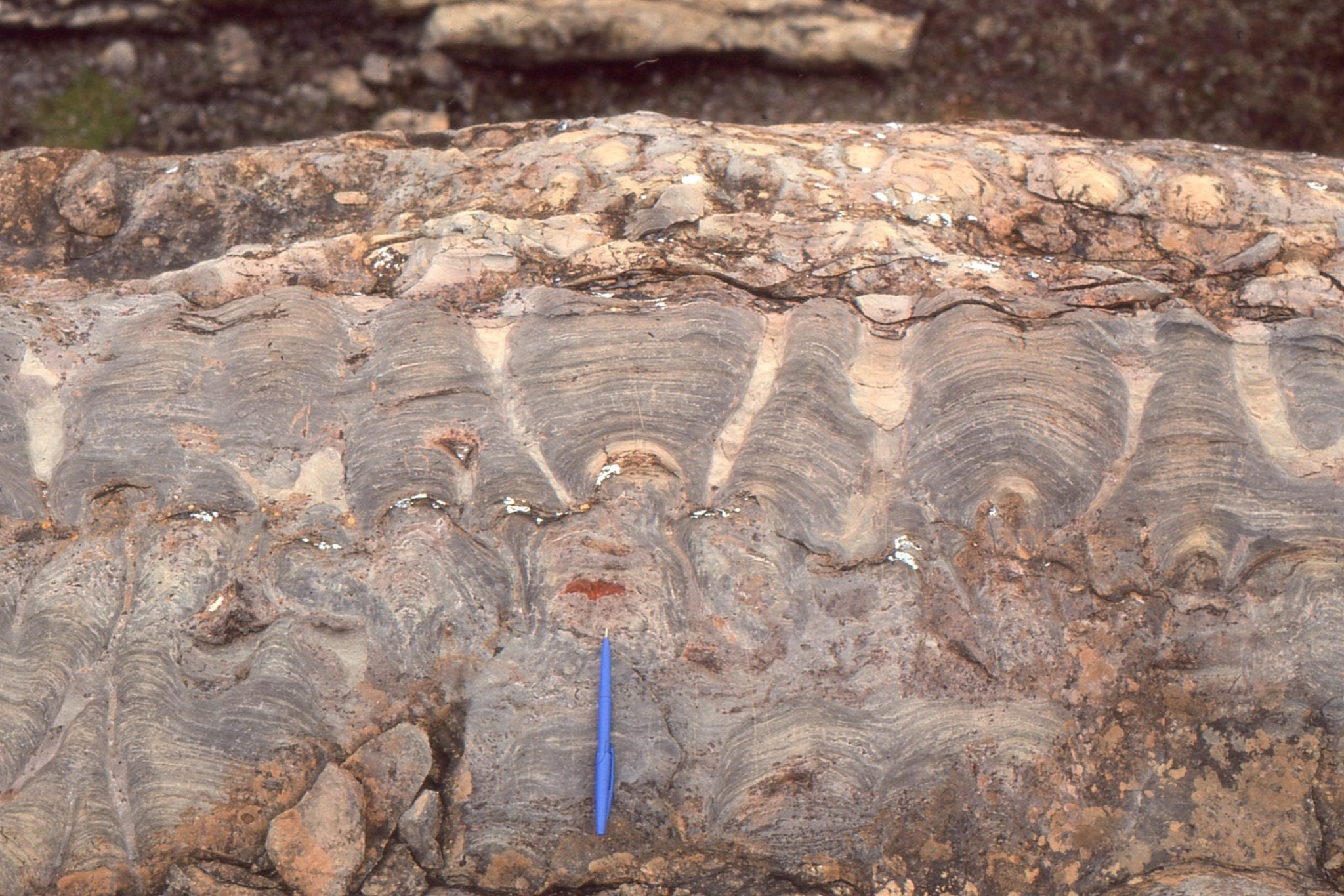
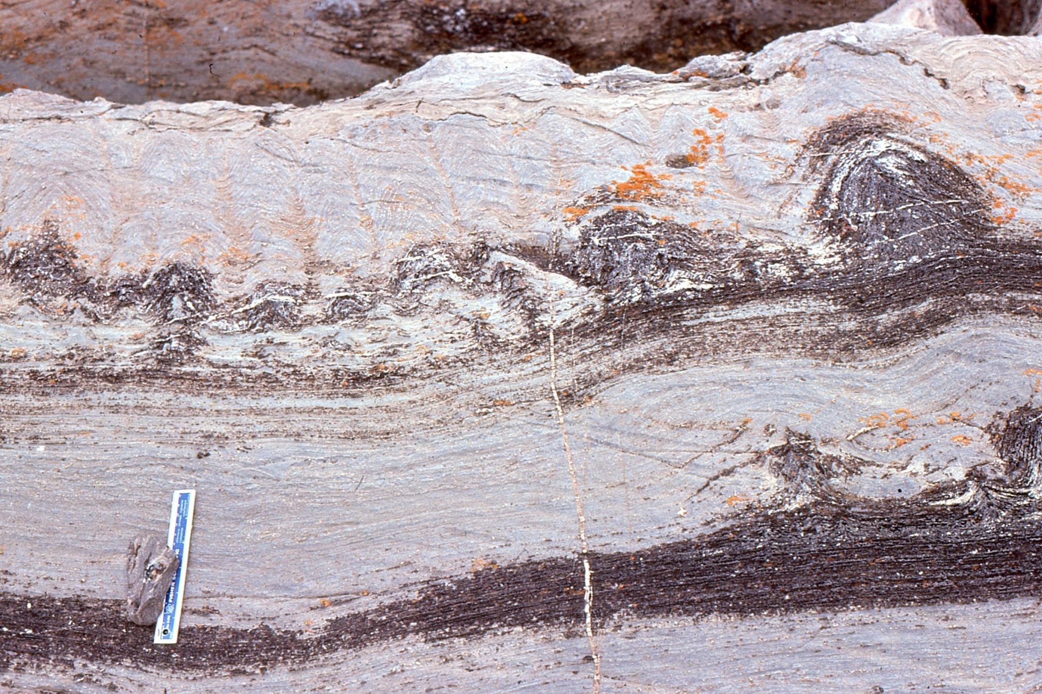
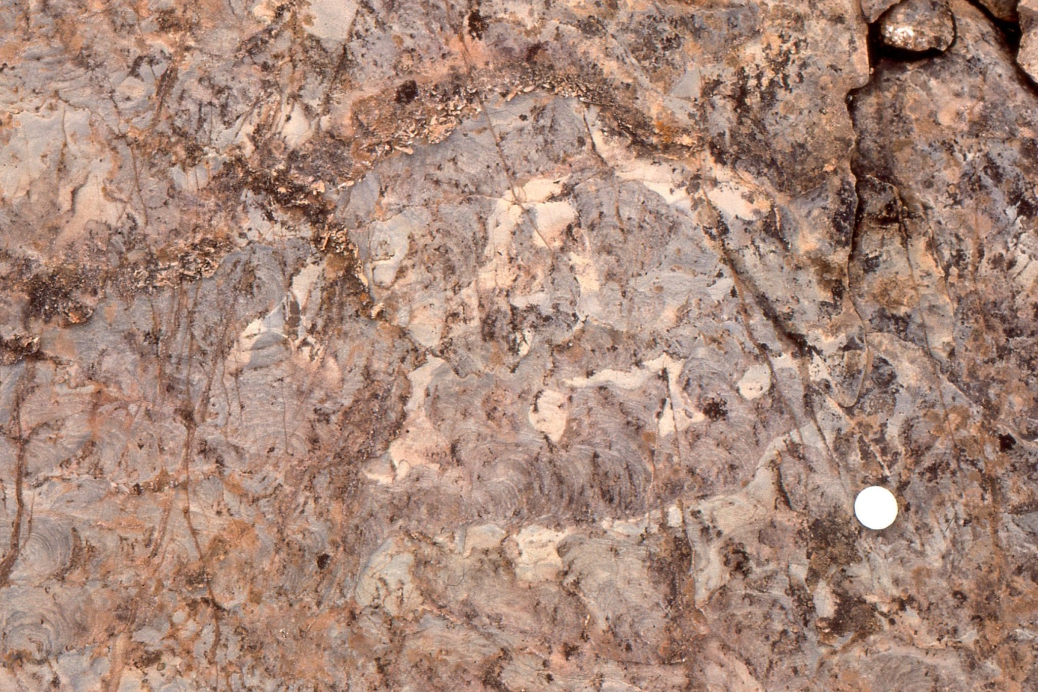
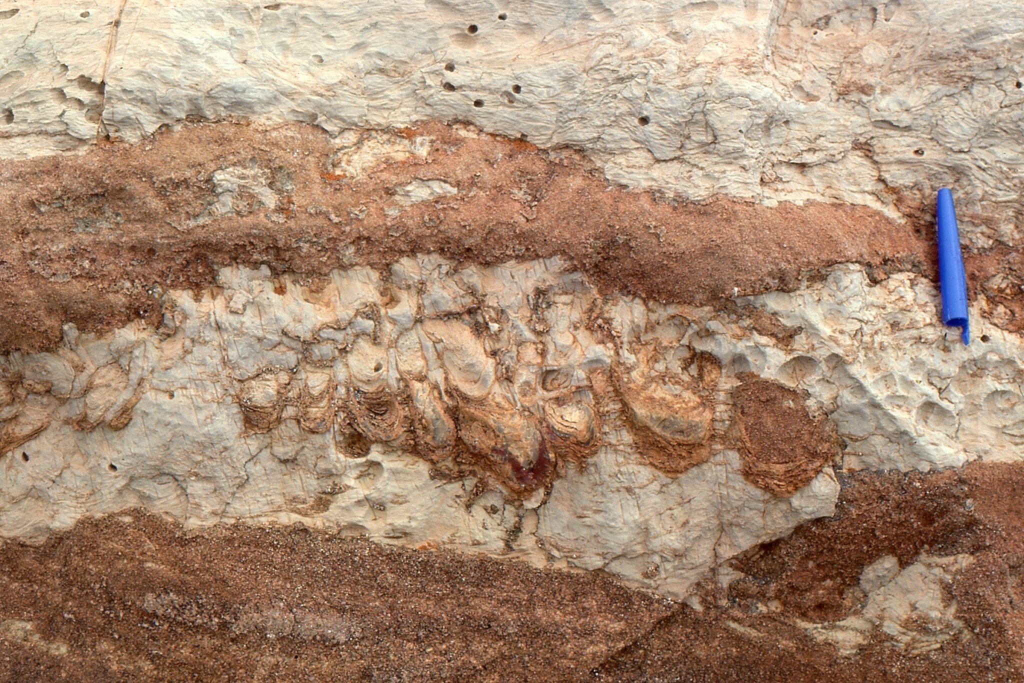
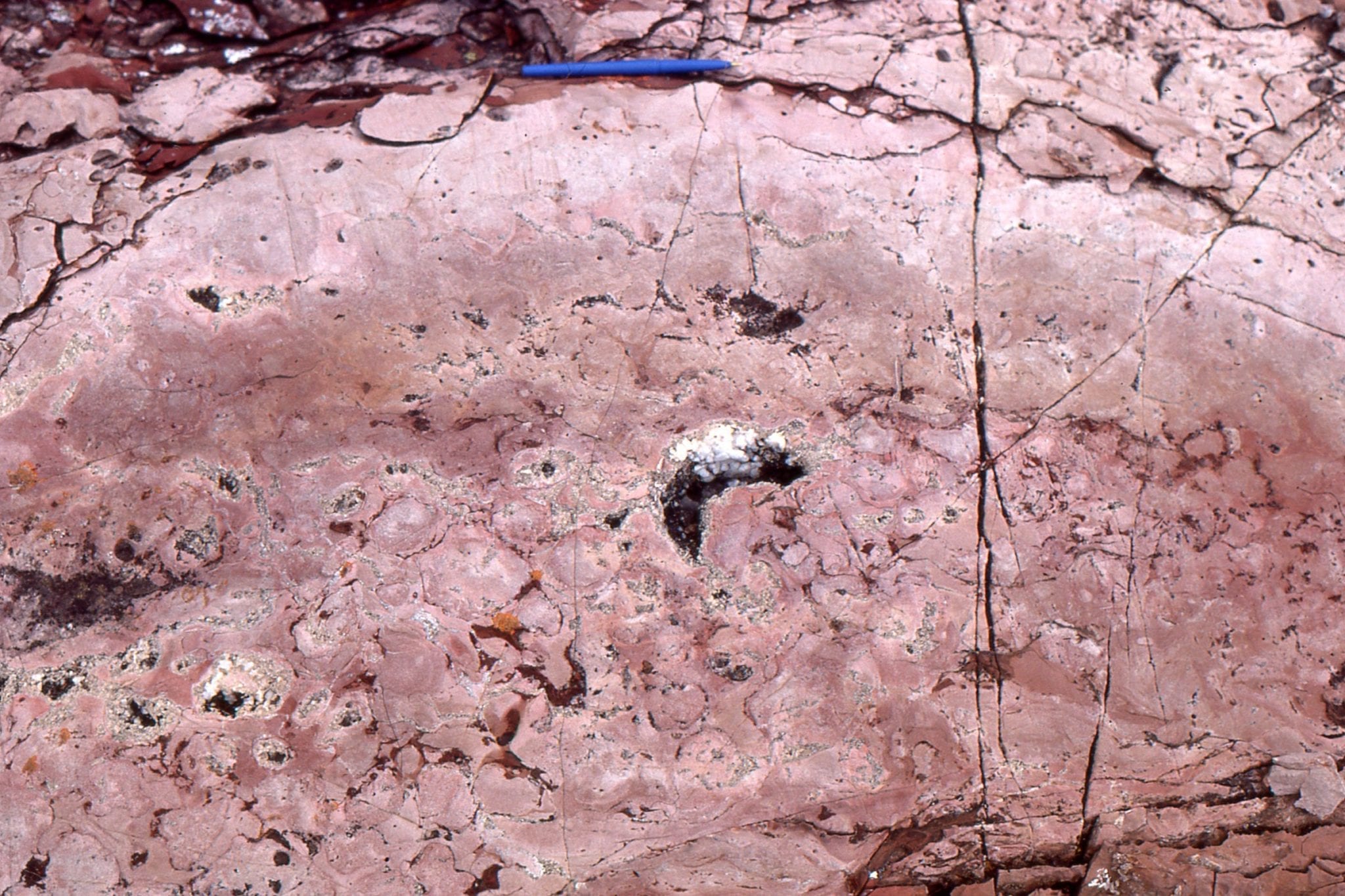
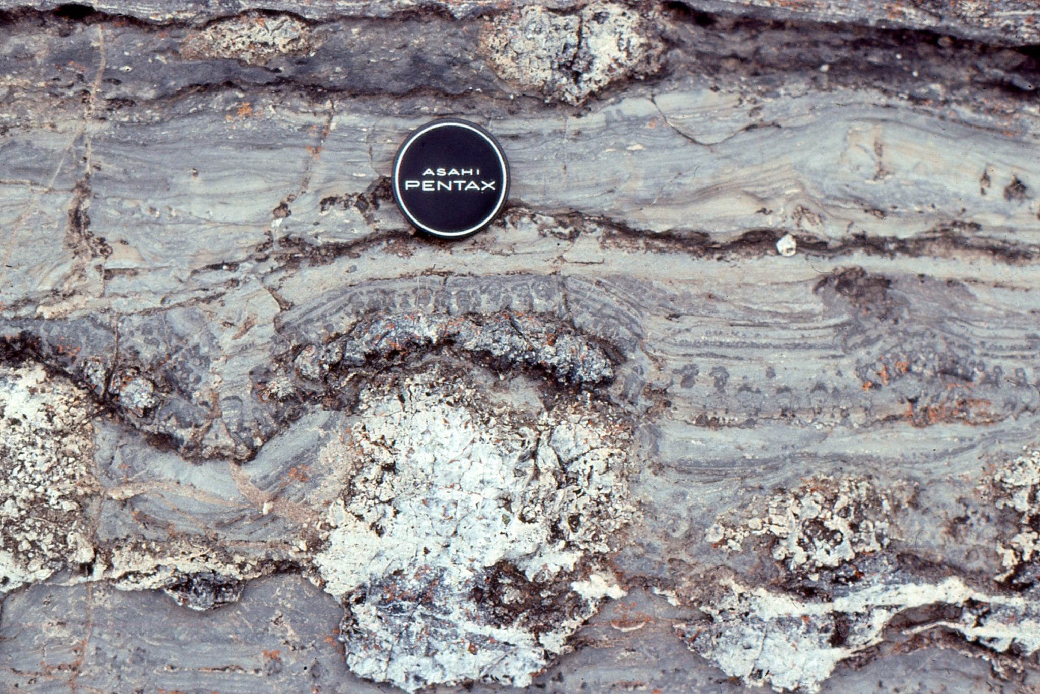
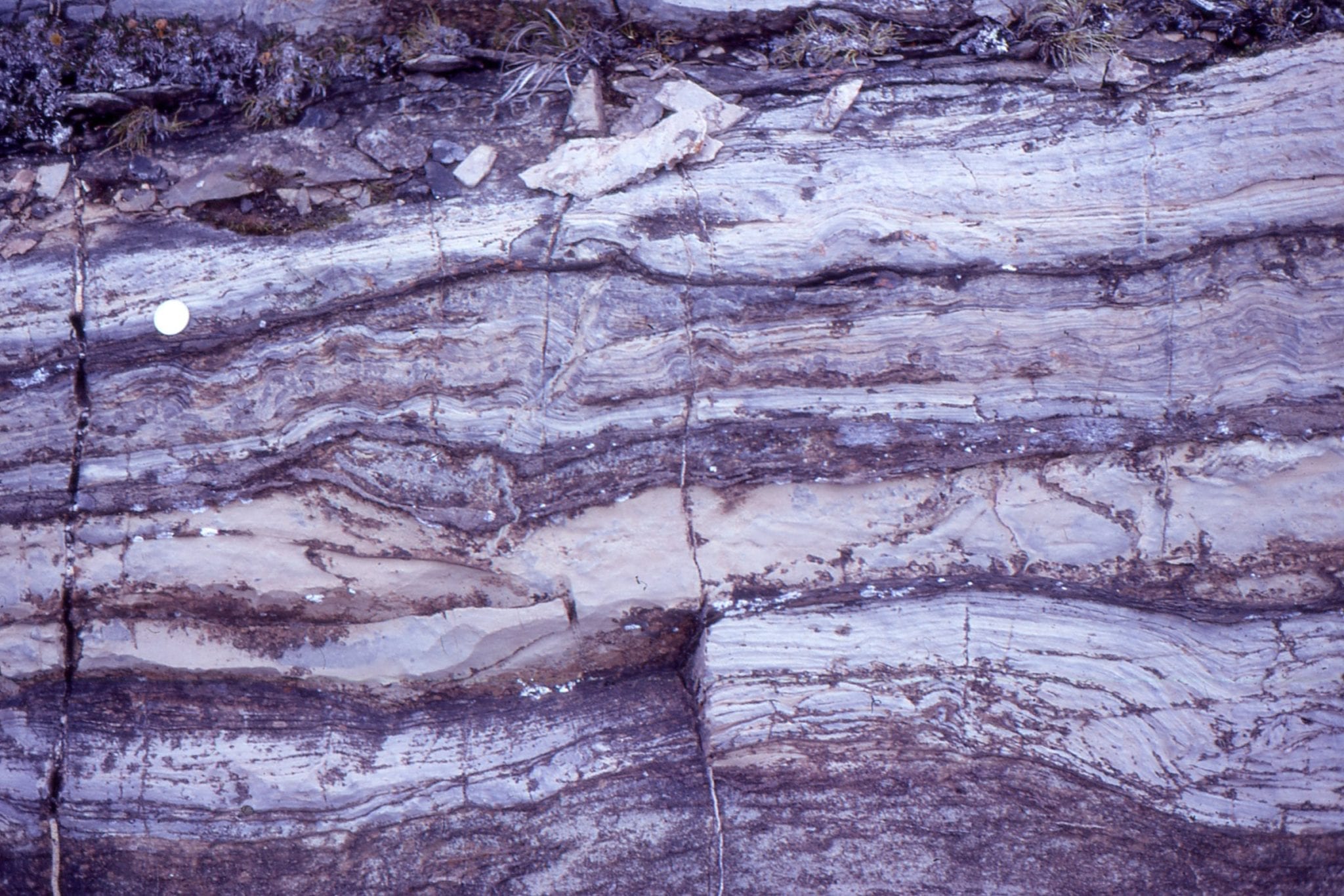
Bulbous stromatolites similar to those shown above. The original carbonate (calcite-high Mg calcite-aragonite) has been completely replaced by dolomite. Some of the upstanding, resistant edges are subsequent chert replacement. Image on the right shows excellent preservation of original laminae that in some cases can be traced across 2 and 3 branches. Both are oblique to bedding. McLeary Fm. Intercolumn sediment is dolomitized carbonate mud.
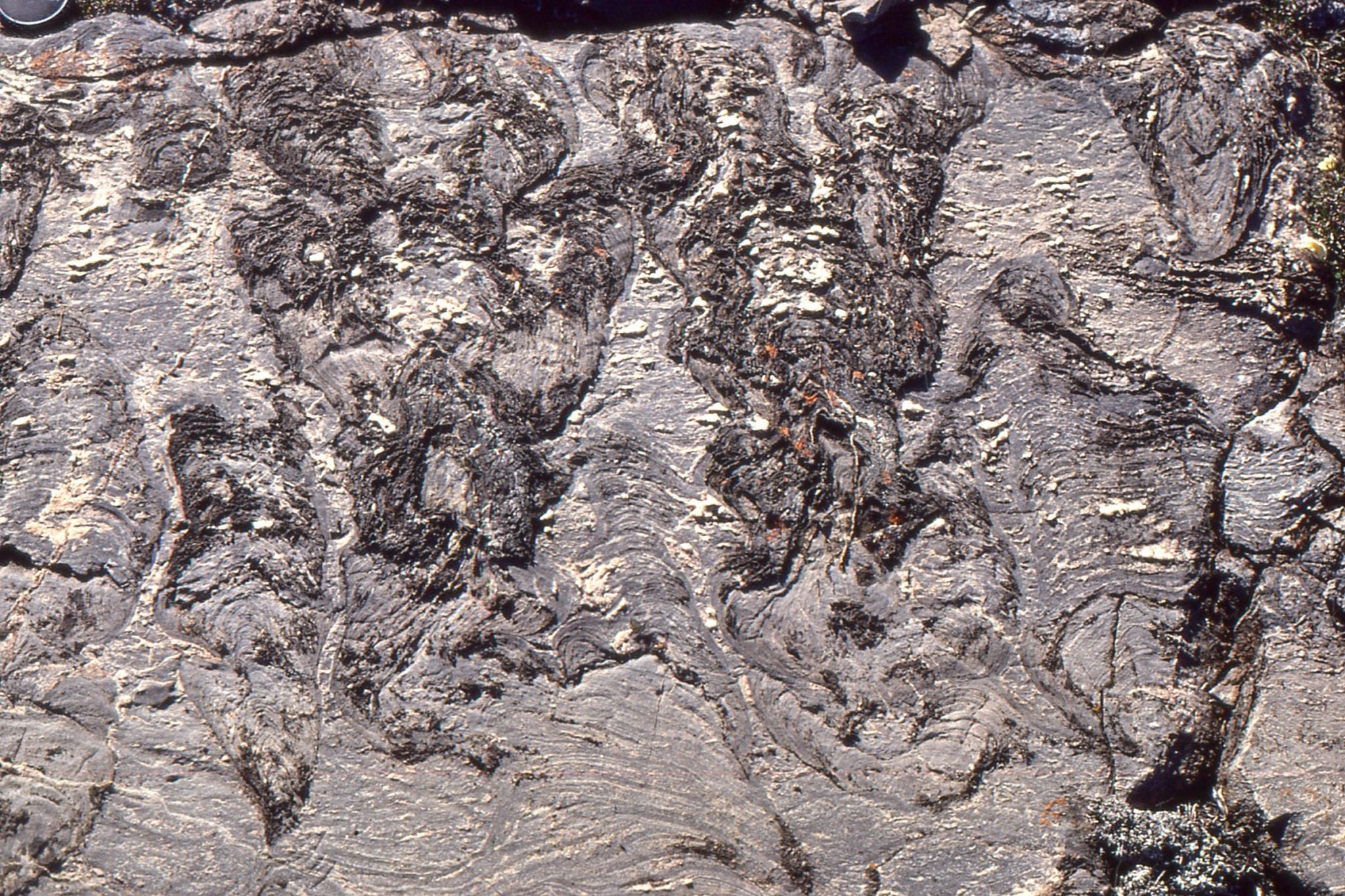
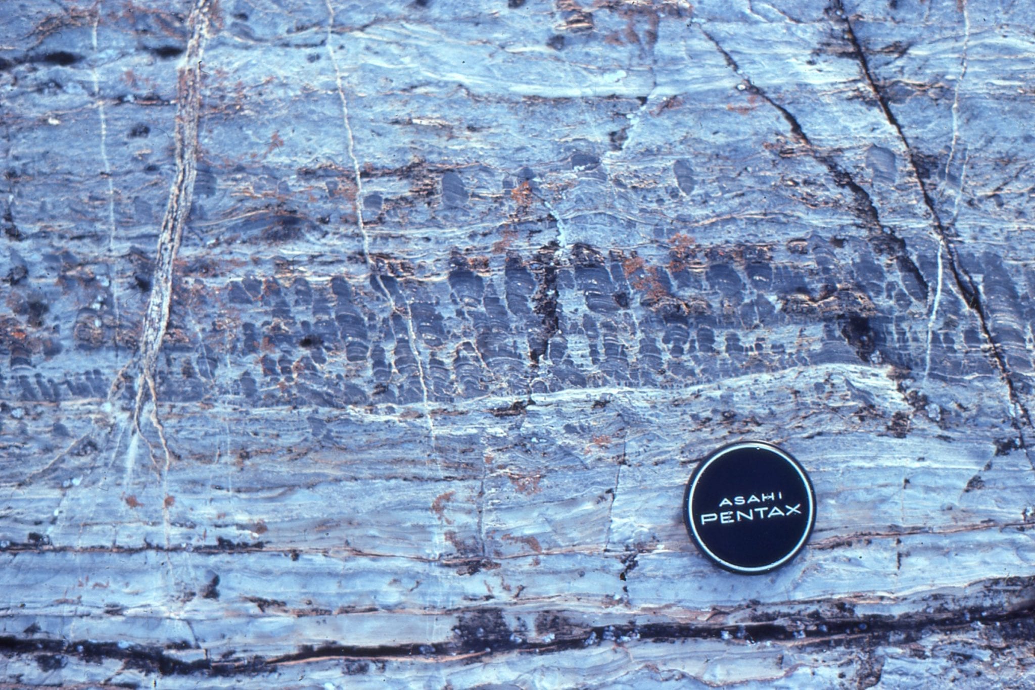
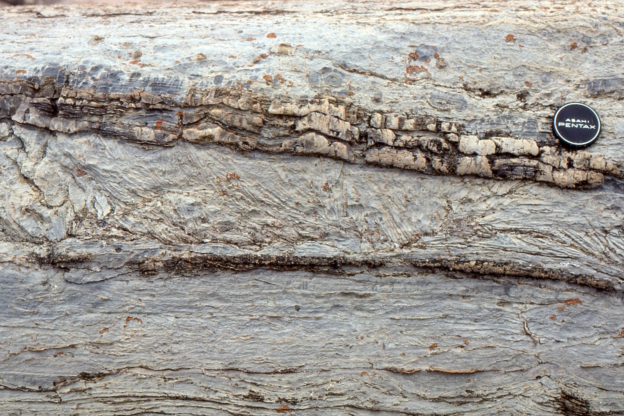
 Stromatolite form here changes from bulbous to more digitate branching, back to bulbous. McLeary Fm.
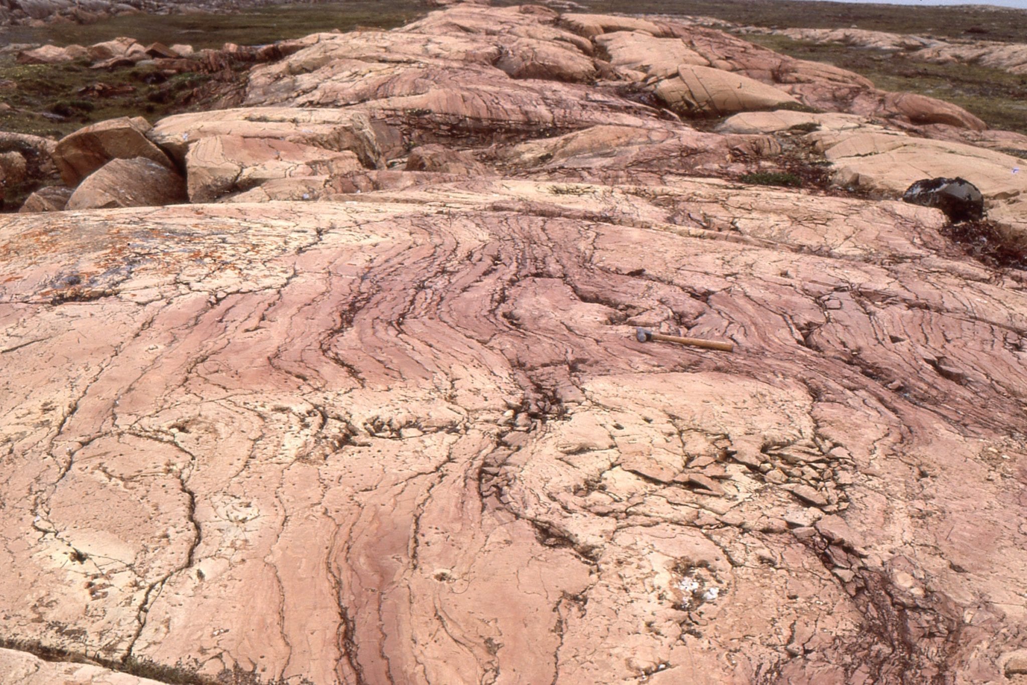
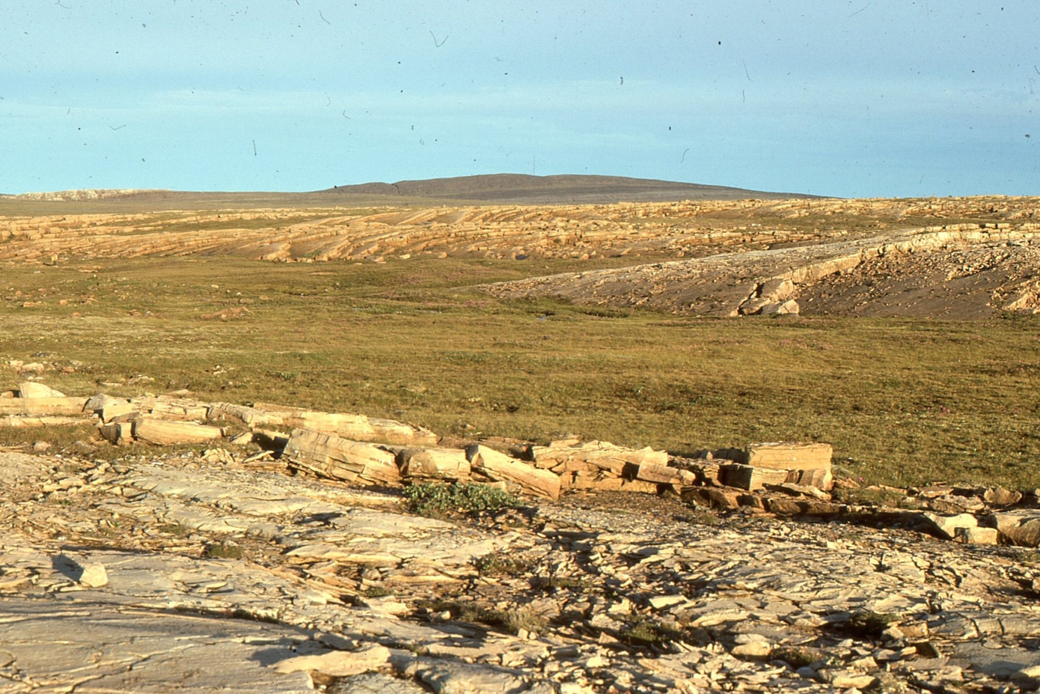
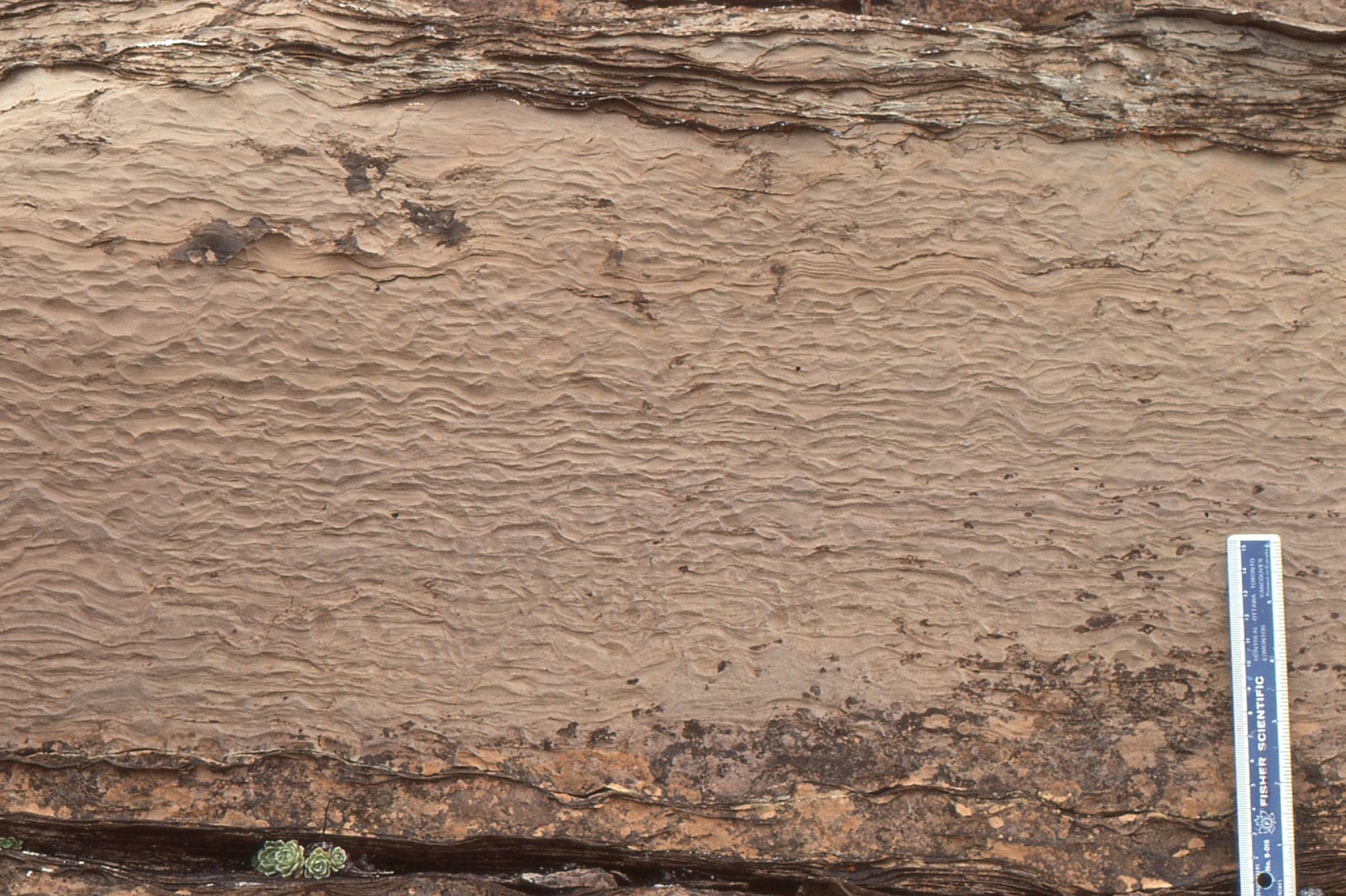
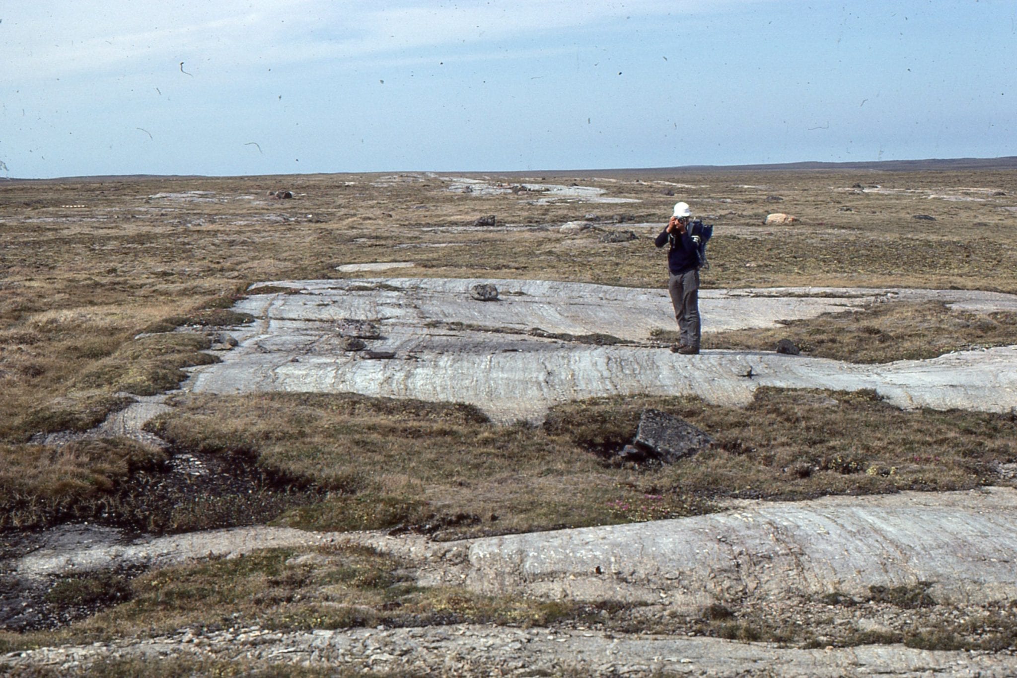 Large, laterally extensive stromatolite domes more than 8m thick, but having synoptic relief of only a few centimetres. There were very few interruptions in growth; they probably accumulated on a subtidal shelf-platform lacking strong bottom currents. Kasegalik Fm.
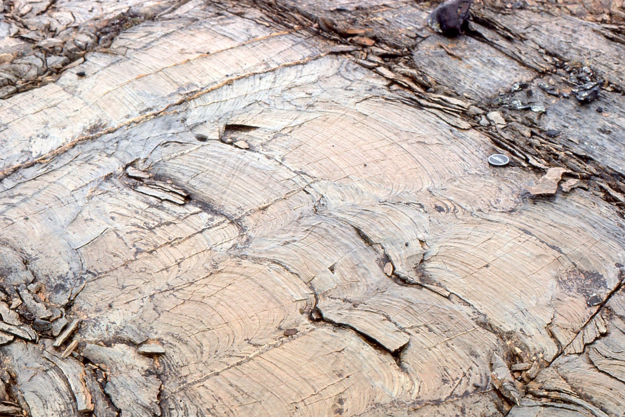
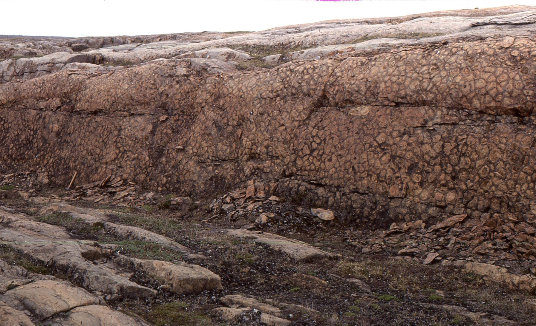
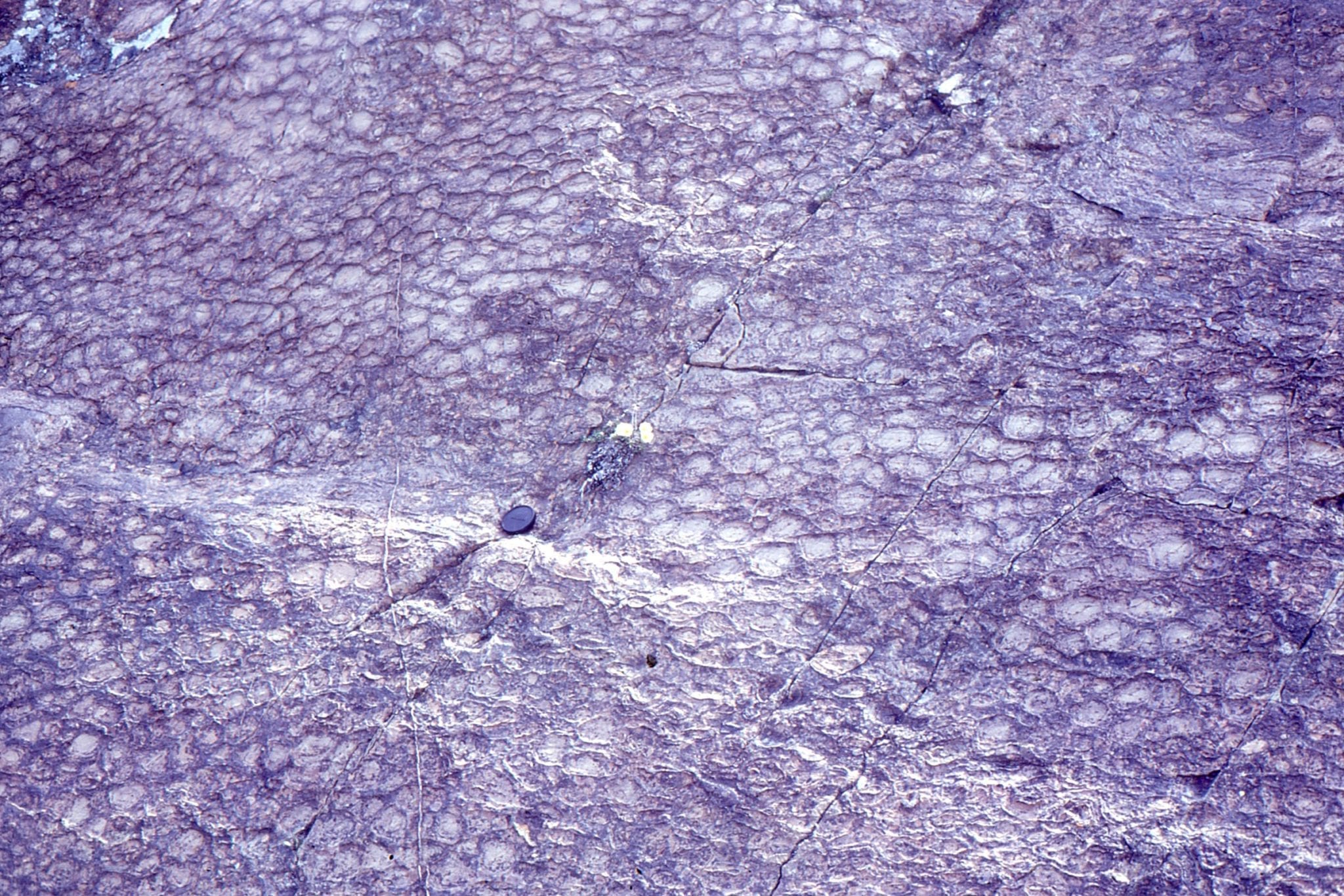
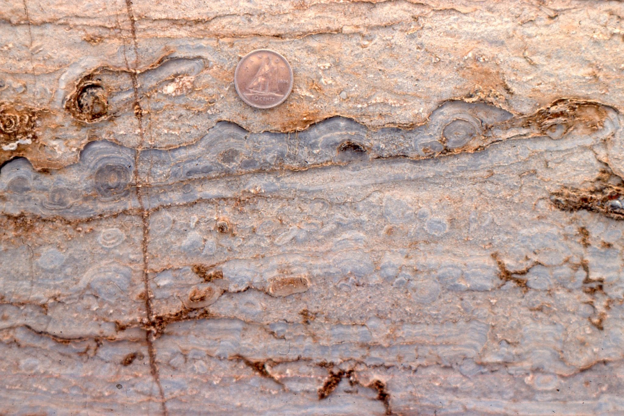
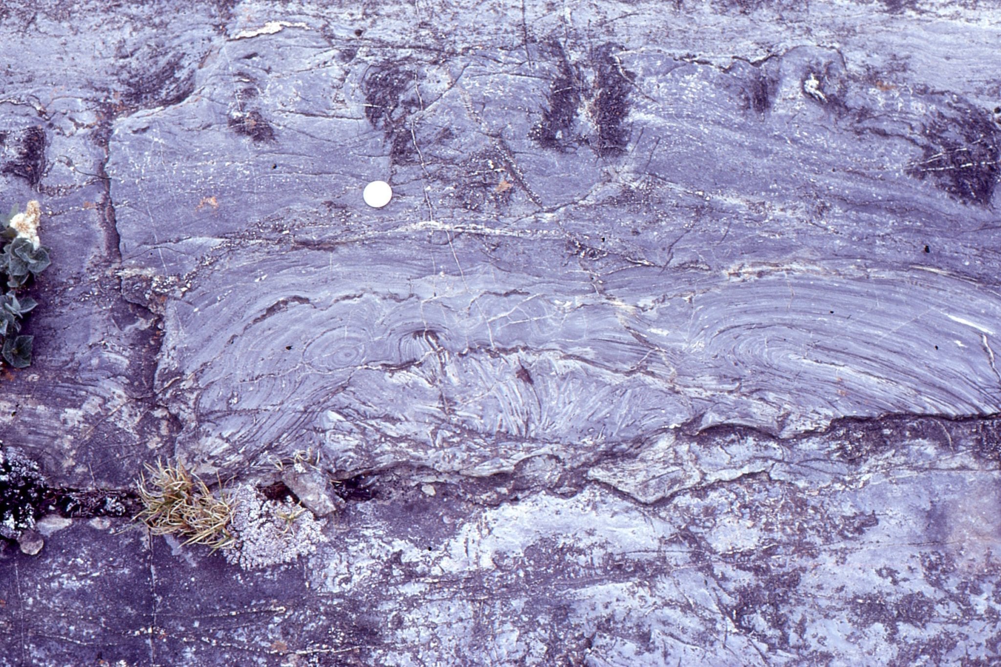
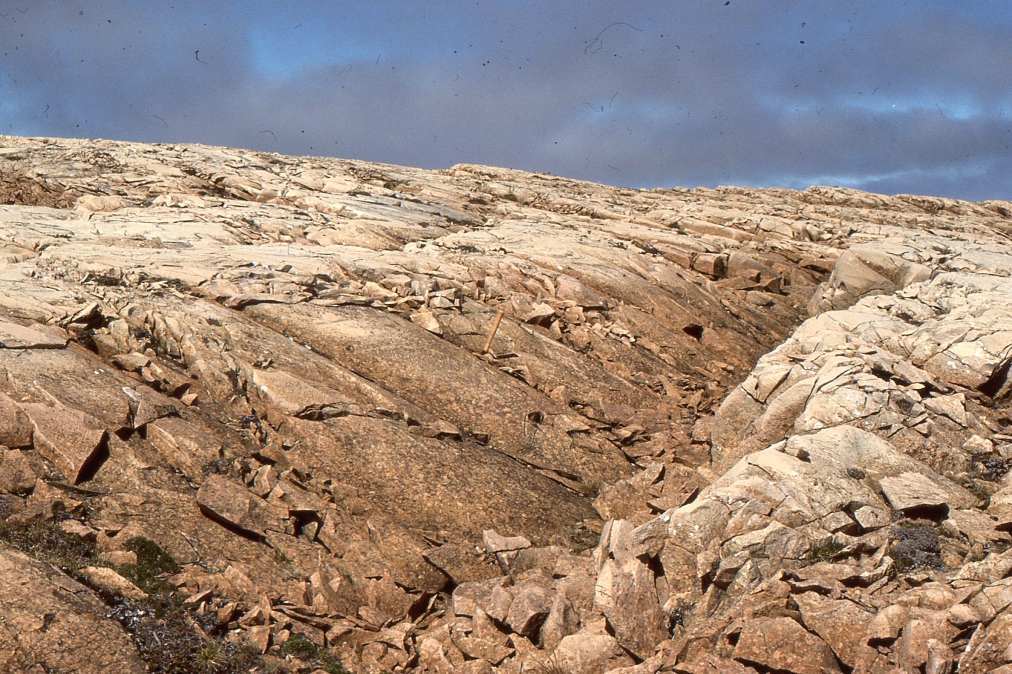
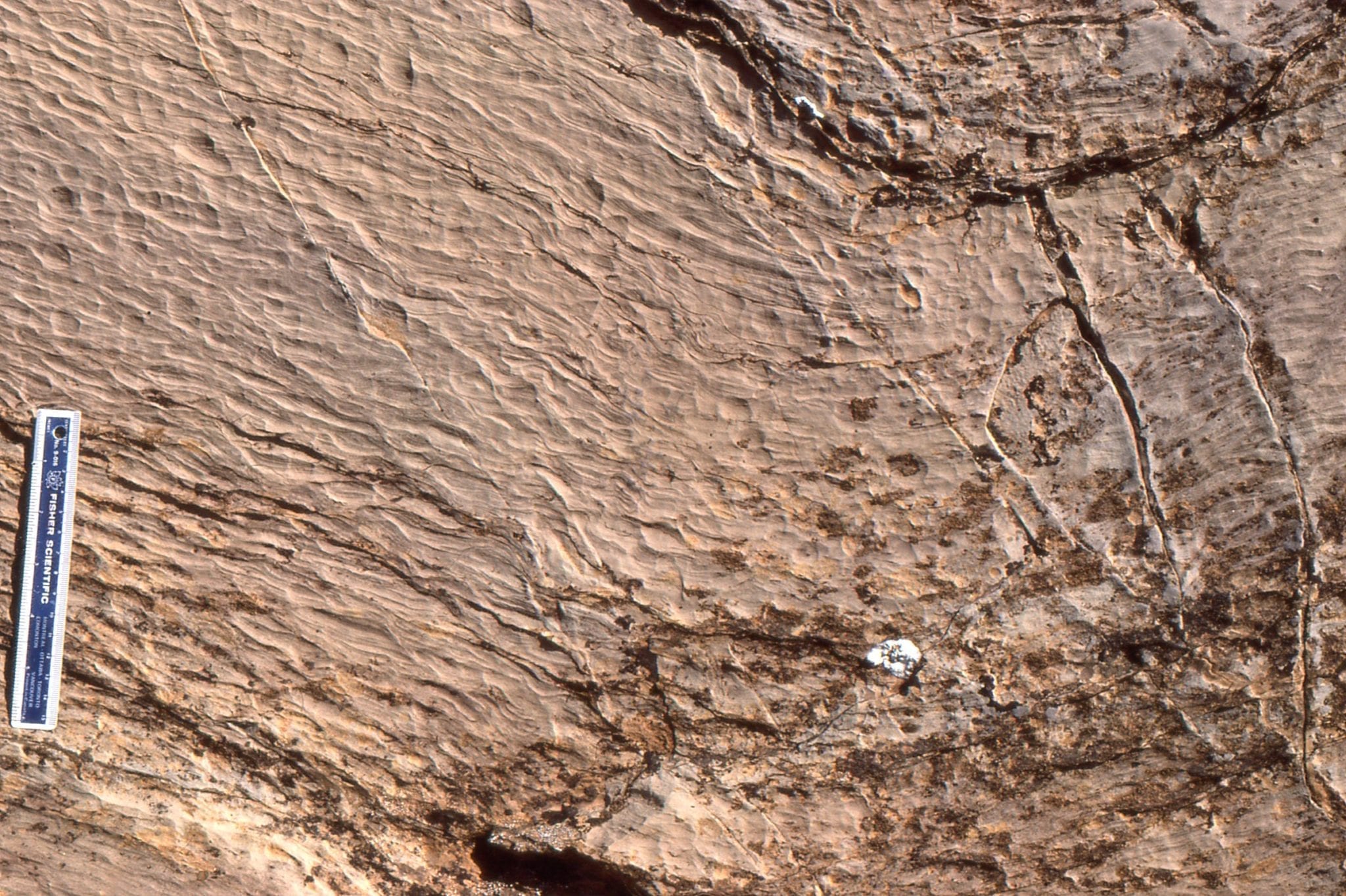
Large, closely-spaced, low relief stromatolite domes; synoptic relief was 5-8cm. Look closely at the laminae and in some you will see continuity from one dome to another, and in others discontinuities and overlaps 2-4 laminae thick. Mavor Fm.
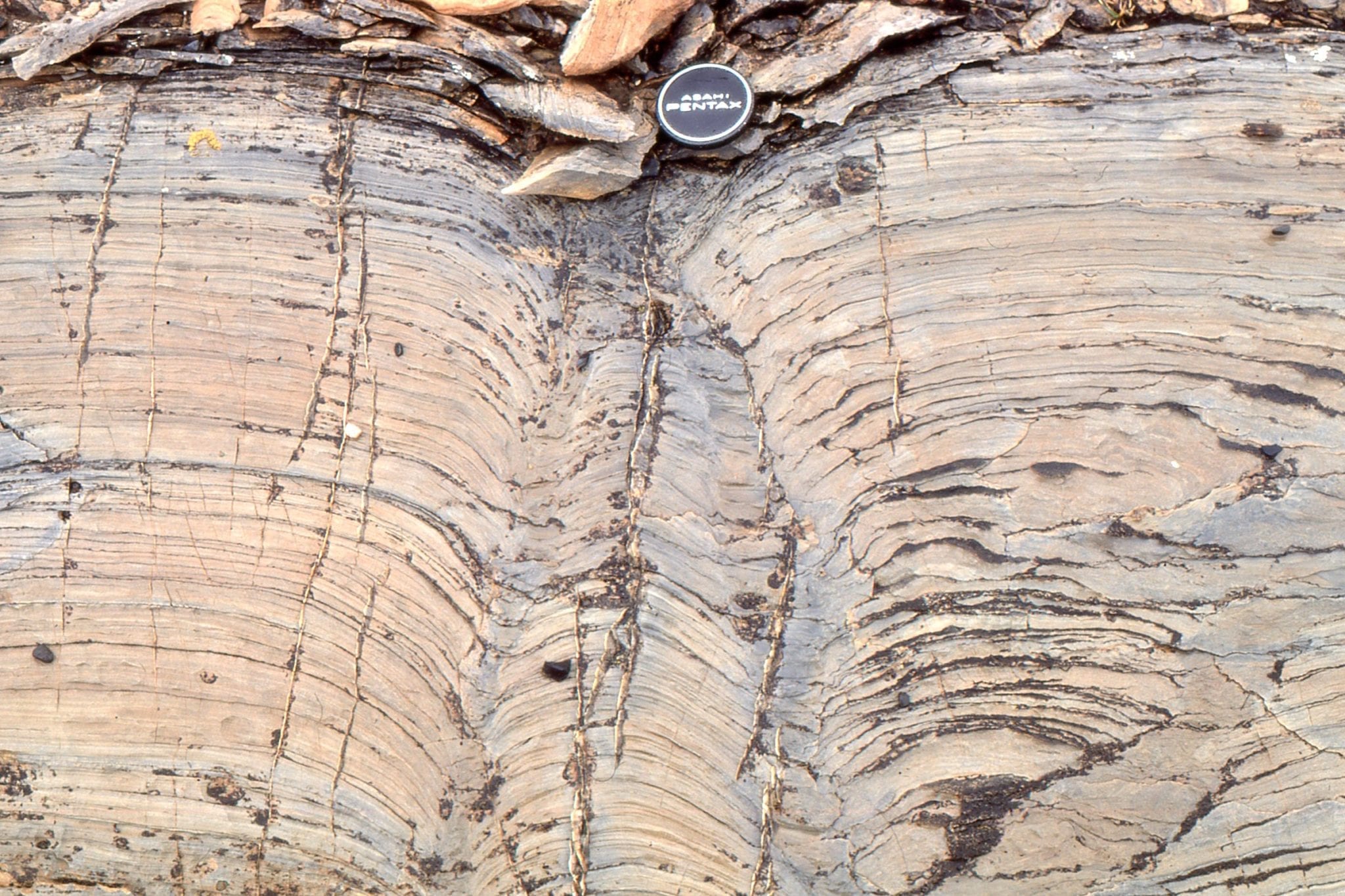
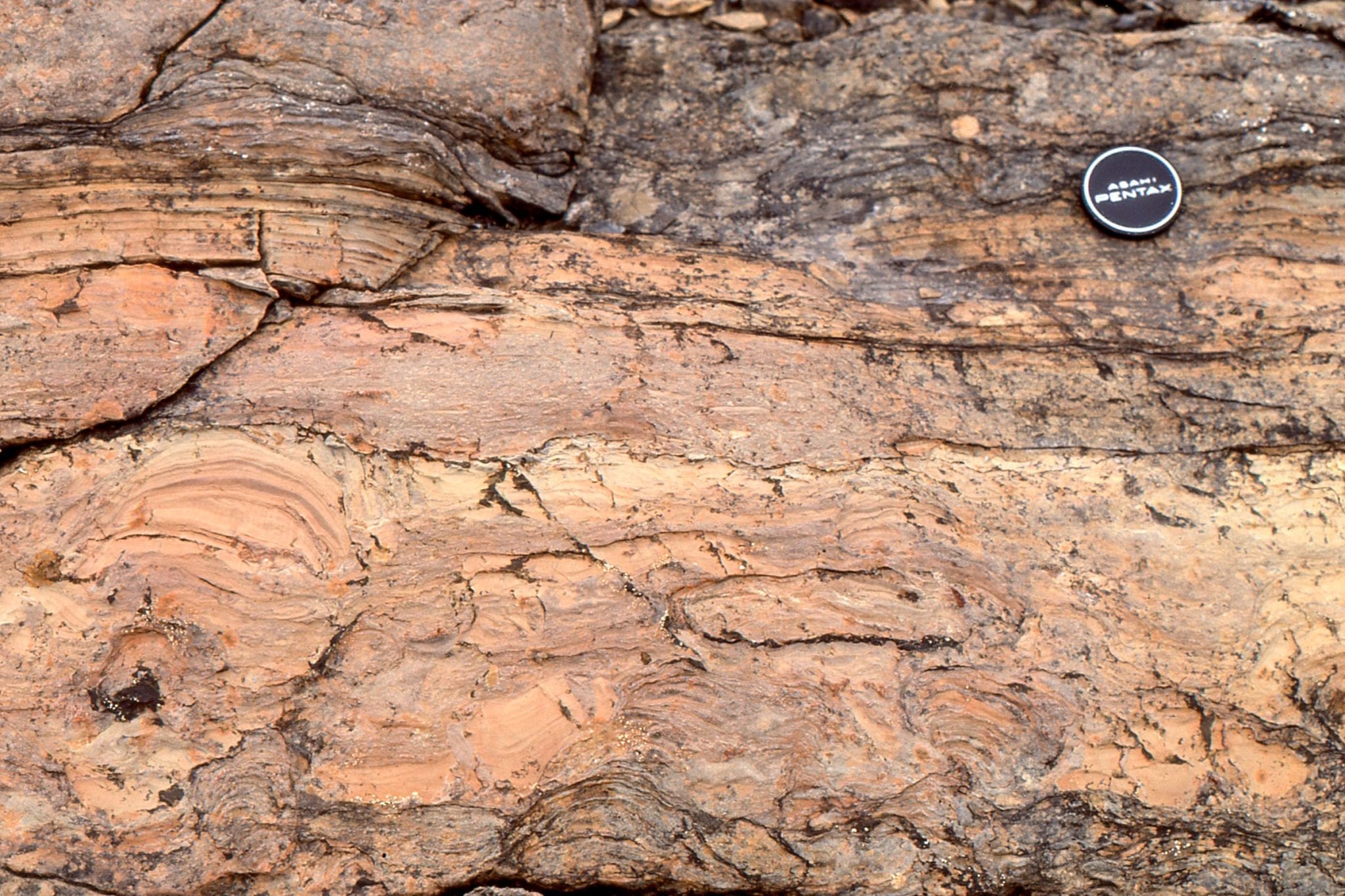
 Large stromatolite domes like those above, can transform to more digitate columns higher in the bedding unit. This probably represents subtle changes in environment, such as local bottom currents, or growth that was interrupted by storms. Mavor Fm.
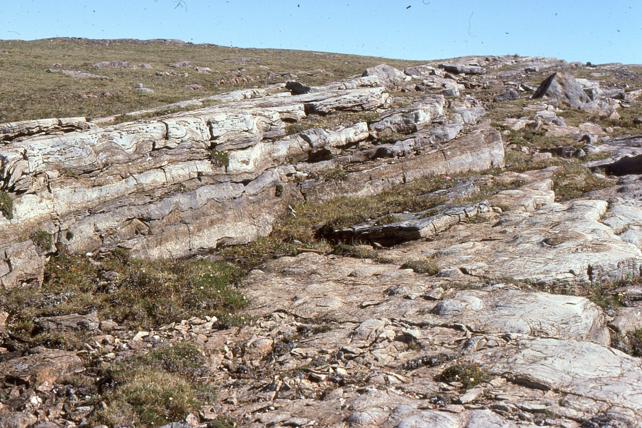
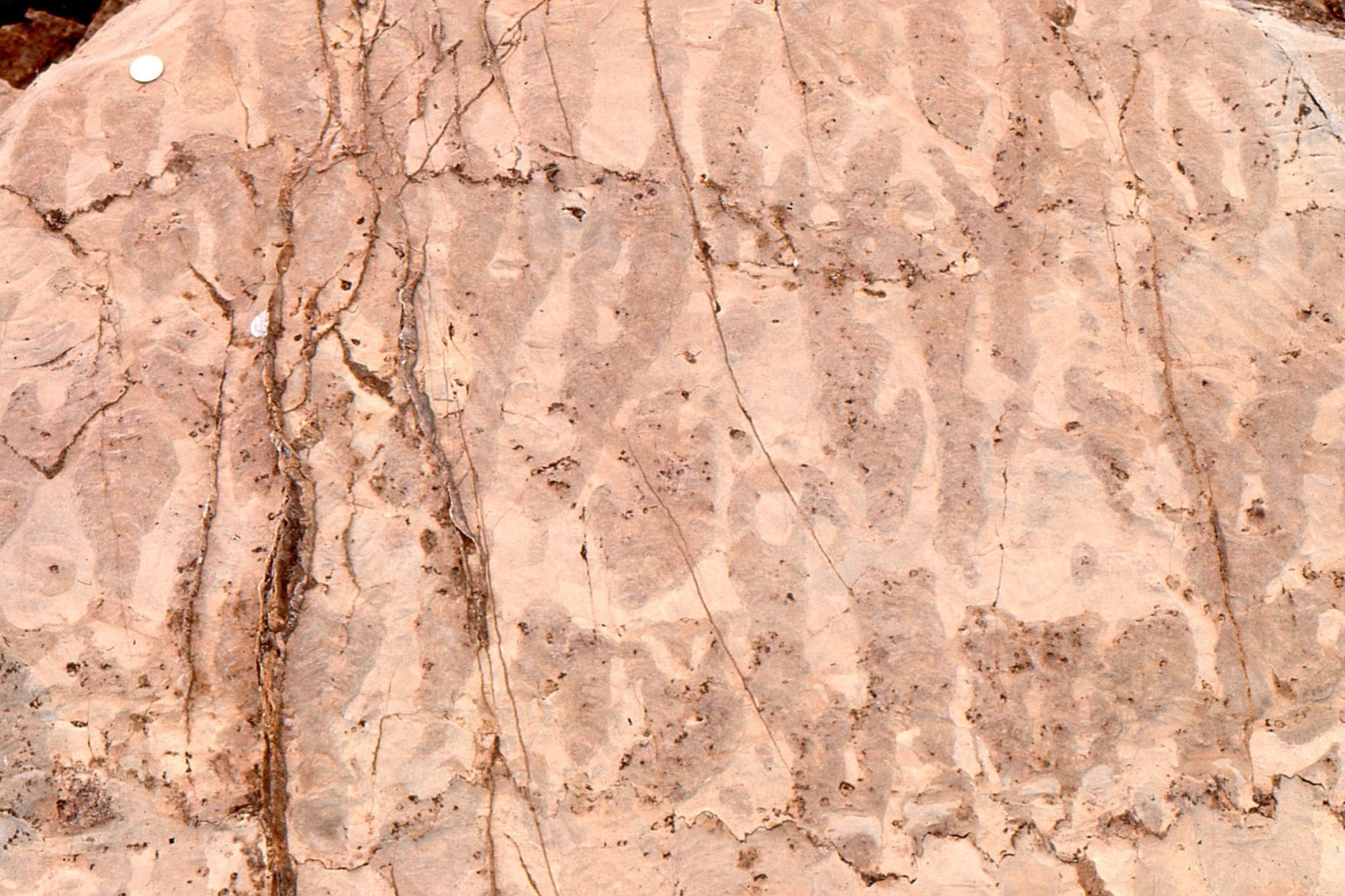
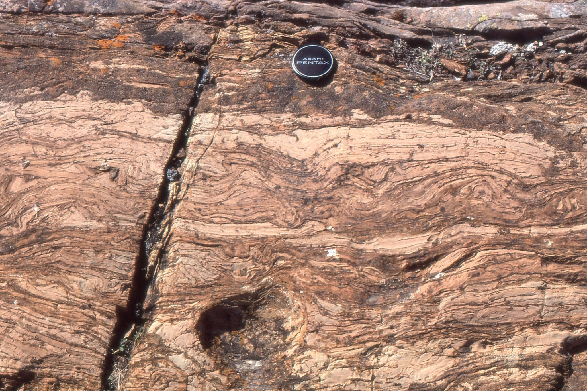
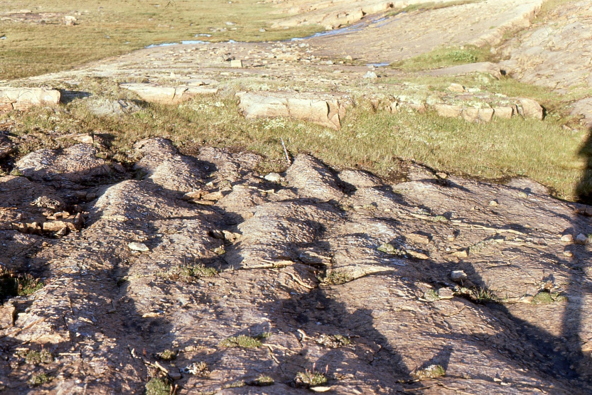
 Exhumed stromatolite domes on bedding, McLeary Fm. Their internal structure is similar to the domes shown above. The domes are slightly elongated, with long axis parallel to subtidal paleocurrents (determined from other sedimentary structures). Inter-dome sediment is dolomitized carbonate mud. Hammer, centre-right.
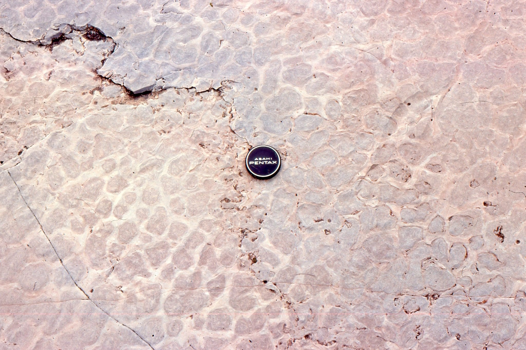
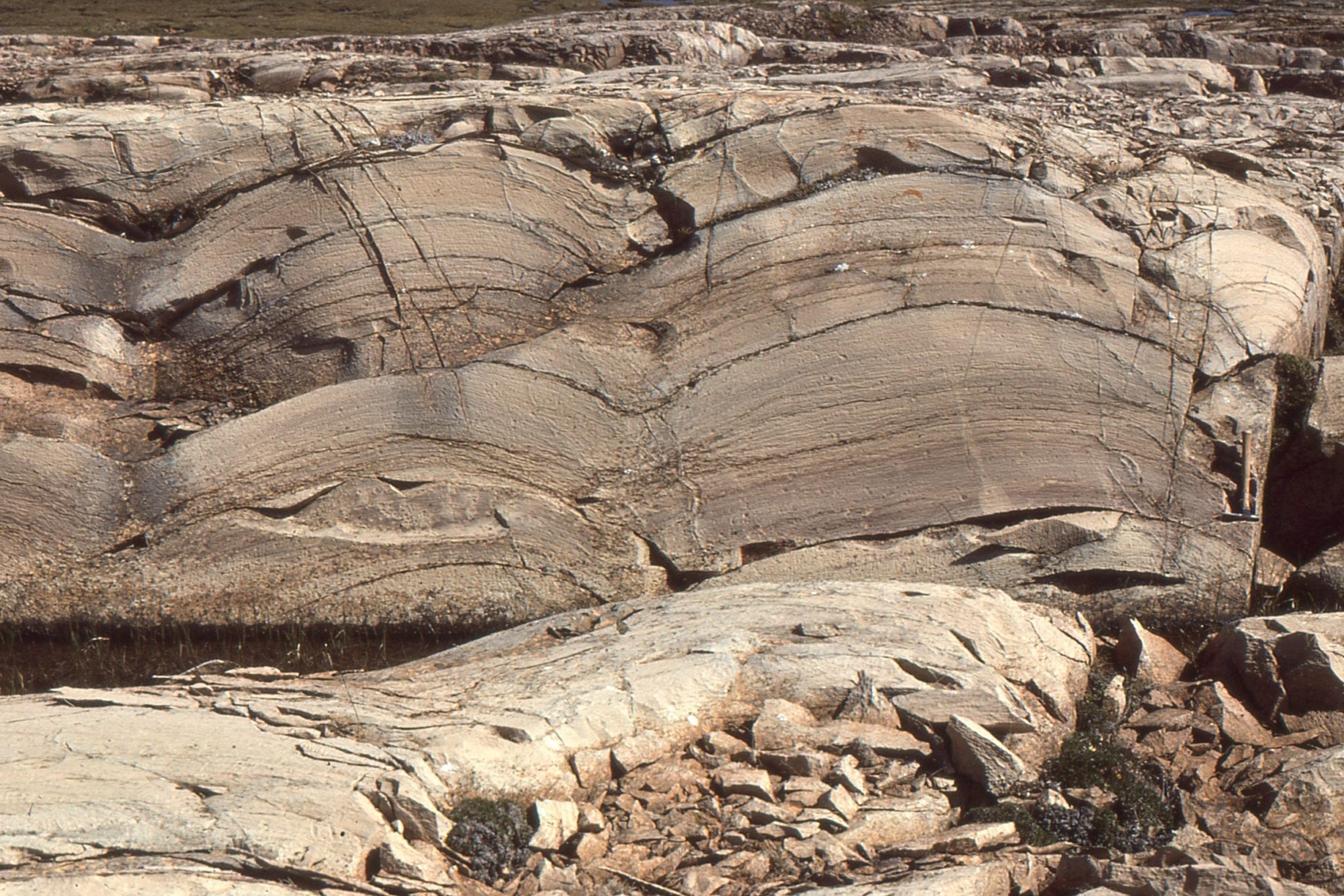
 Bedding and cross-section views of subtidal platform, domal stromatolites. Synoptic relief here is a bit less than in the image above. McLeary Fm. Stromatolites in the uppermost bed are eroded, overturned, or oversteepened, probably by storm waves.
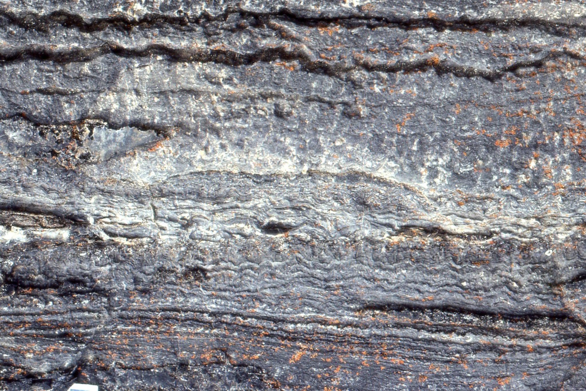
This distinctive stromatolite unit can be traced 10s of kilometres. Closely spaced vertical, digitate columns grew on a shallow subtidal platform. Columns are relatively uniform width, usually branched, with tangential laminae forming a sturdy wall. Synoptic relief was only a few millimetres. McLeary Fm.
Polished slabs of the digitate stromatolites shown above. The scale on the right is centimetres. Preserved laminae are mm to sub-mm thick. The rock has been completely dolmitized, and yet delicate structure is preserved. McLeary Fm.
 Isometric reconstruction of slabbed digitate stromatolites (based on several polished slabs like the one above). McLeary Fm. The (barely visible) scale is in centimetres.
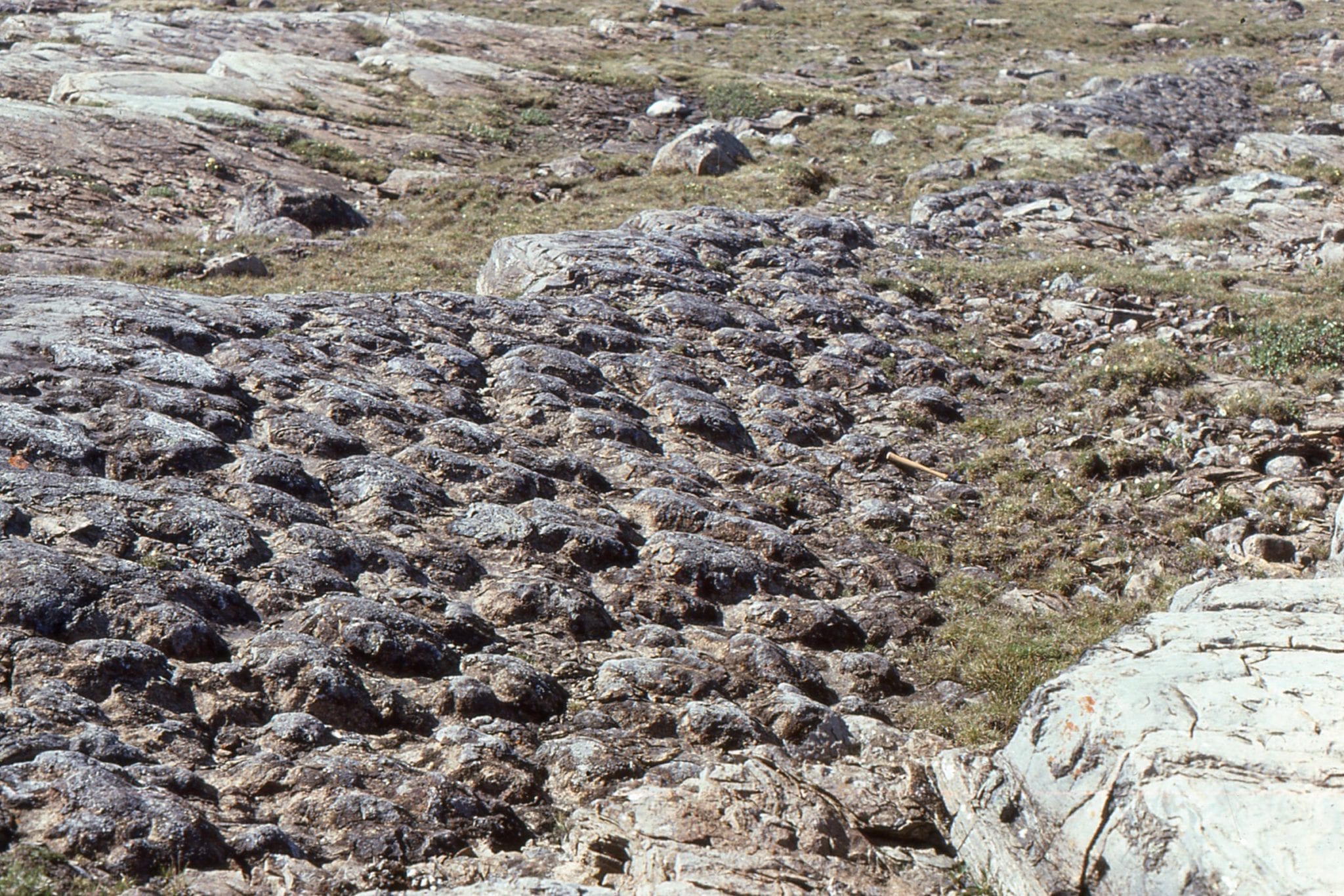
 Closely packed columnar stromatolites – bedding view. Raised rims on each column is due to silicification. McLeary Fm.
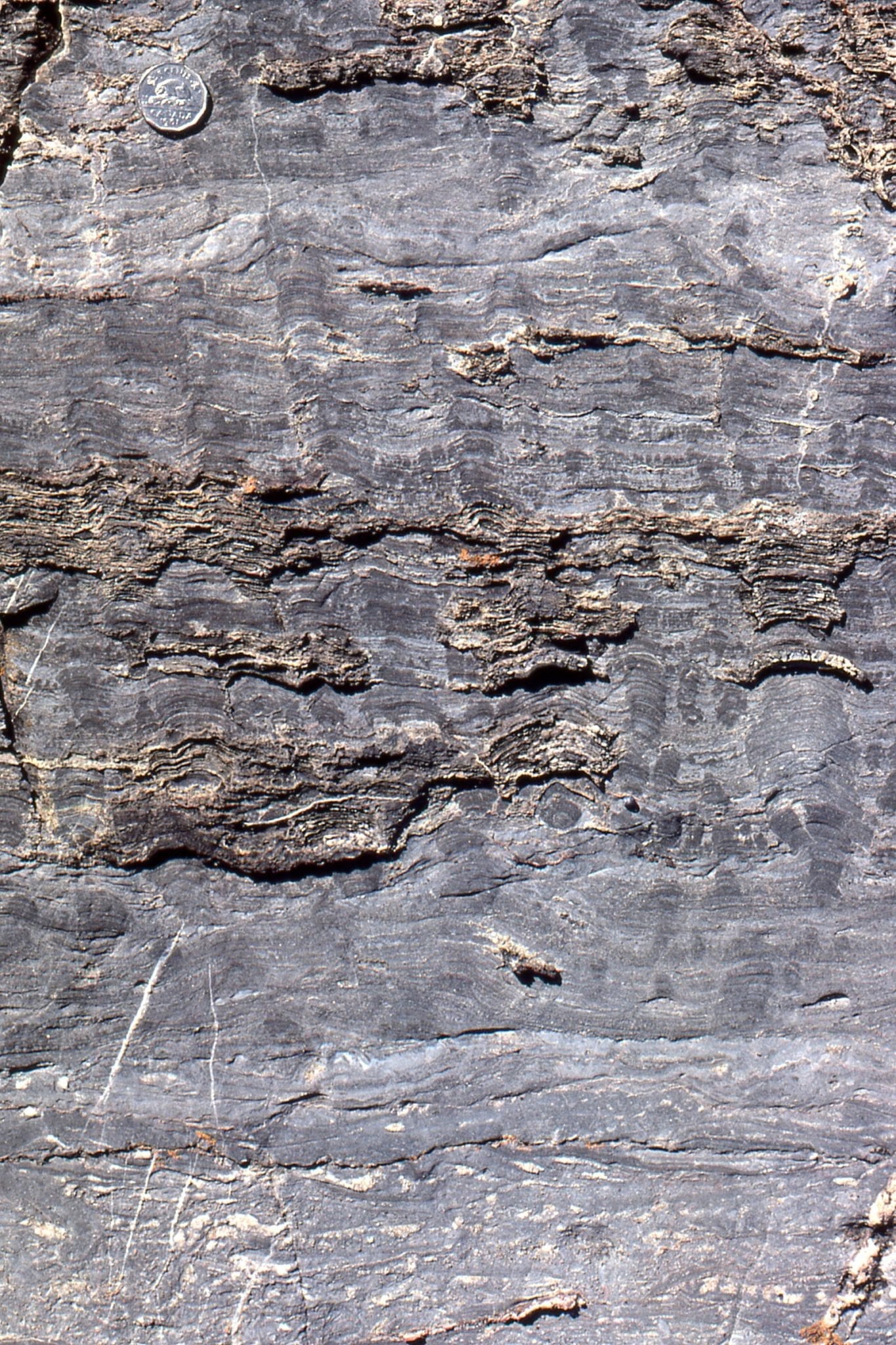
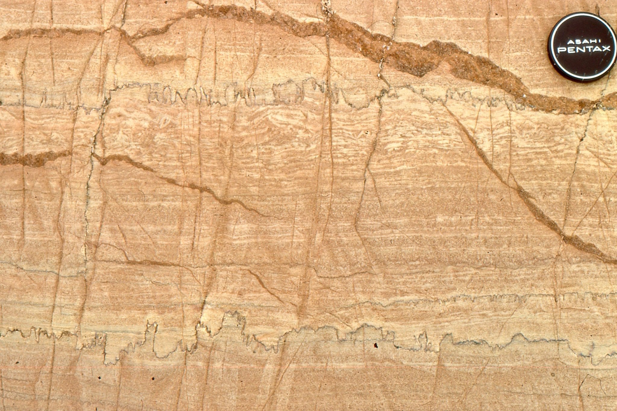
Several growth stages from domal stromatolites to narrower, closely-spaced, digitate columns, Mavor Fm. Intercolumn sediment is dolomitized mud. Three stylolites (top, centre, bottom) have reduced section thickness by 15-20%. Although completely dolomitized, mm and sub-mm scale laminae are well preserved.
 Disruption of stromatolite columns and small domes by erosion. Rip-ups include largish mudstone slabs. McLeary Fm.
Digitate stromatolite columns in cross-section (left) and bedding (right). Dolomitiztion here has produced coarse crystalline textures that have partly obliterated outlines and laminae. Mavor Fm.
Domal, digitate, and coalescing stromatolite columns, growth habits that changed with environmental conditions or interruptions in growth (e.g. storms), McLeary Fm. Image on right has an erosional discordance at the pen tip. branching began during mat regrowth.
Radiating, digitate, branching columns. Left: the radiating cluster is a solitary buildup in surrounding flat, laminated mats. Right: The digitate cluster has been disrupted and partly eroded by crossbedded sandstone, indicating a significant change in local environmental conditions (shallow subtidal to intertidal).
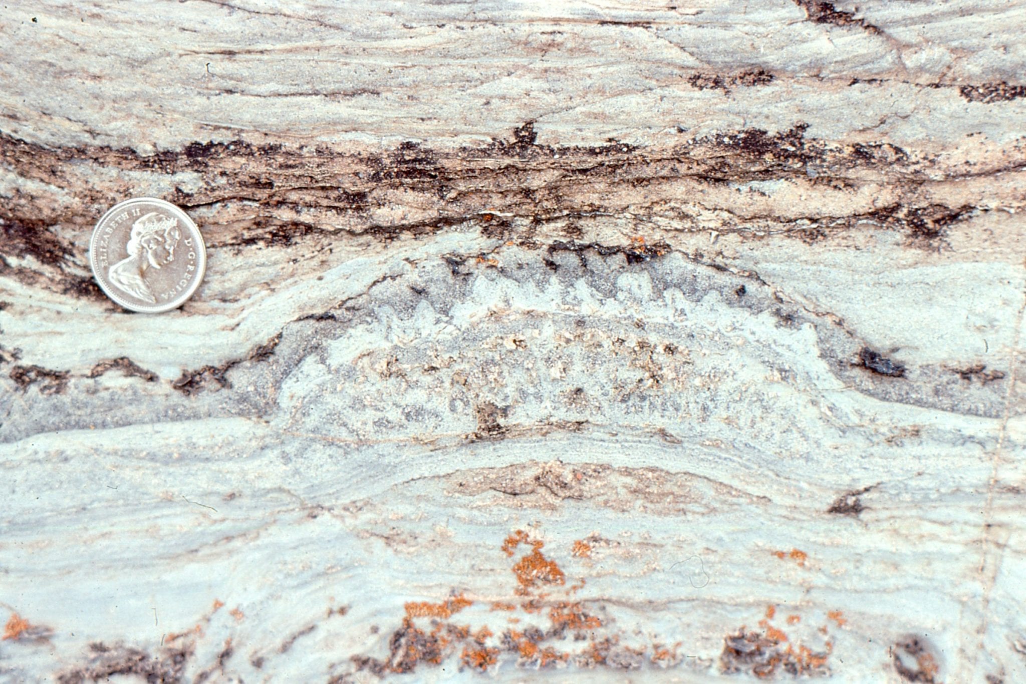
 Domal masses with silicified, subsidiary columns growing from the margins. An erosional discordance (just below the coin) terminated growth. Kasegalik Fm.
Wavy mats give way to columnar stromatolites with cone-shaped laminae. This form has historically been called Conophyton. McLeary fm.
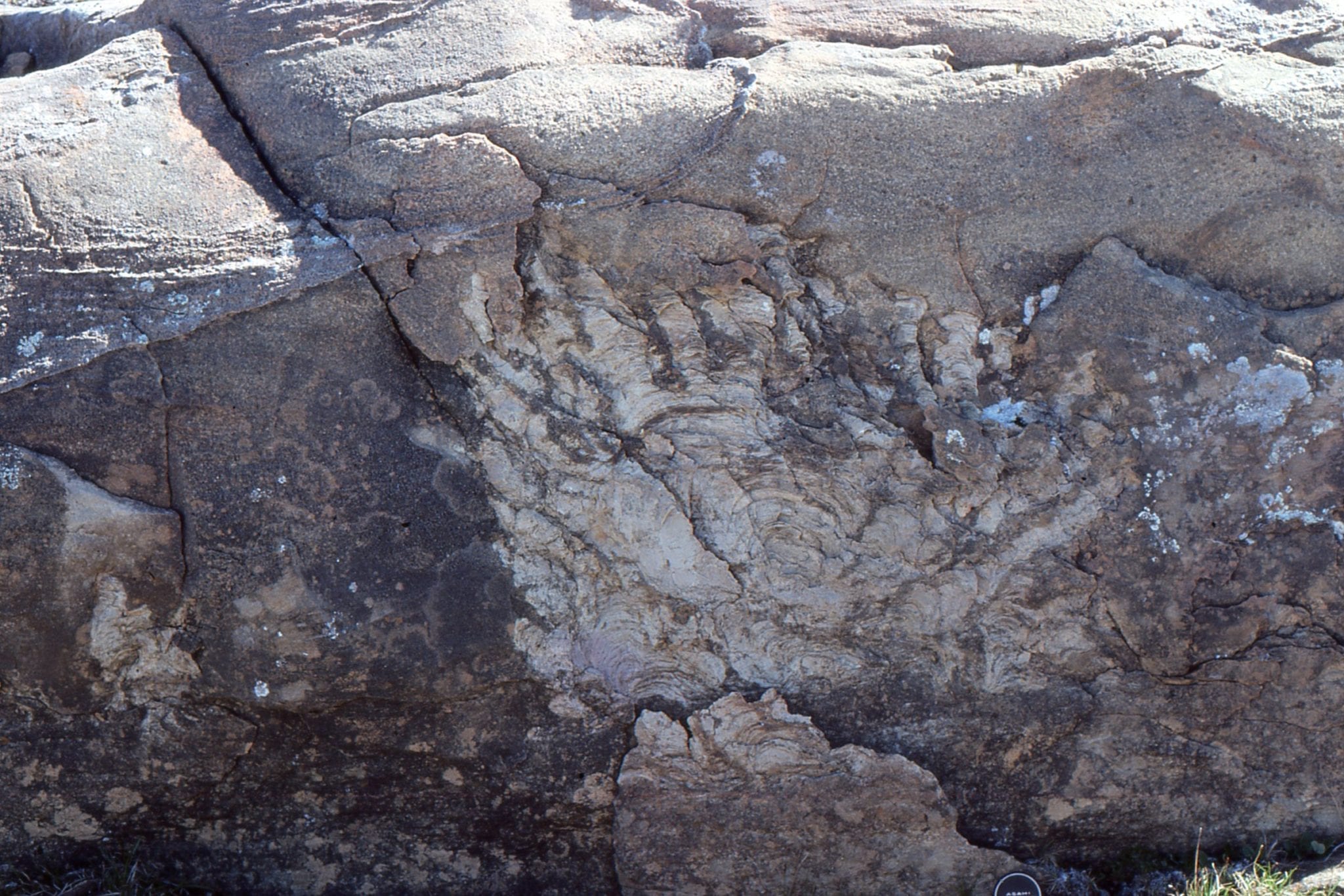
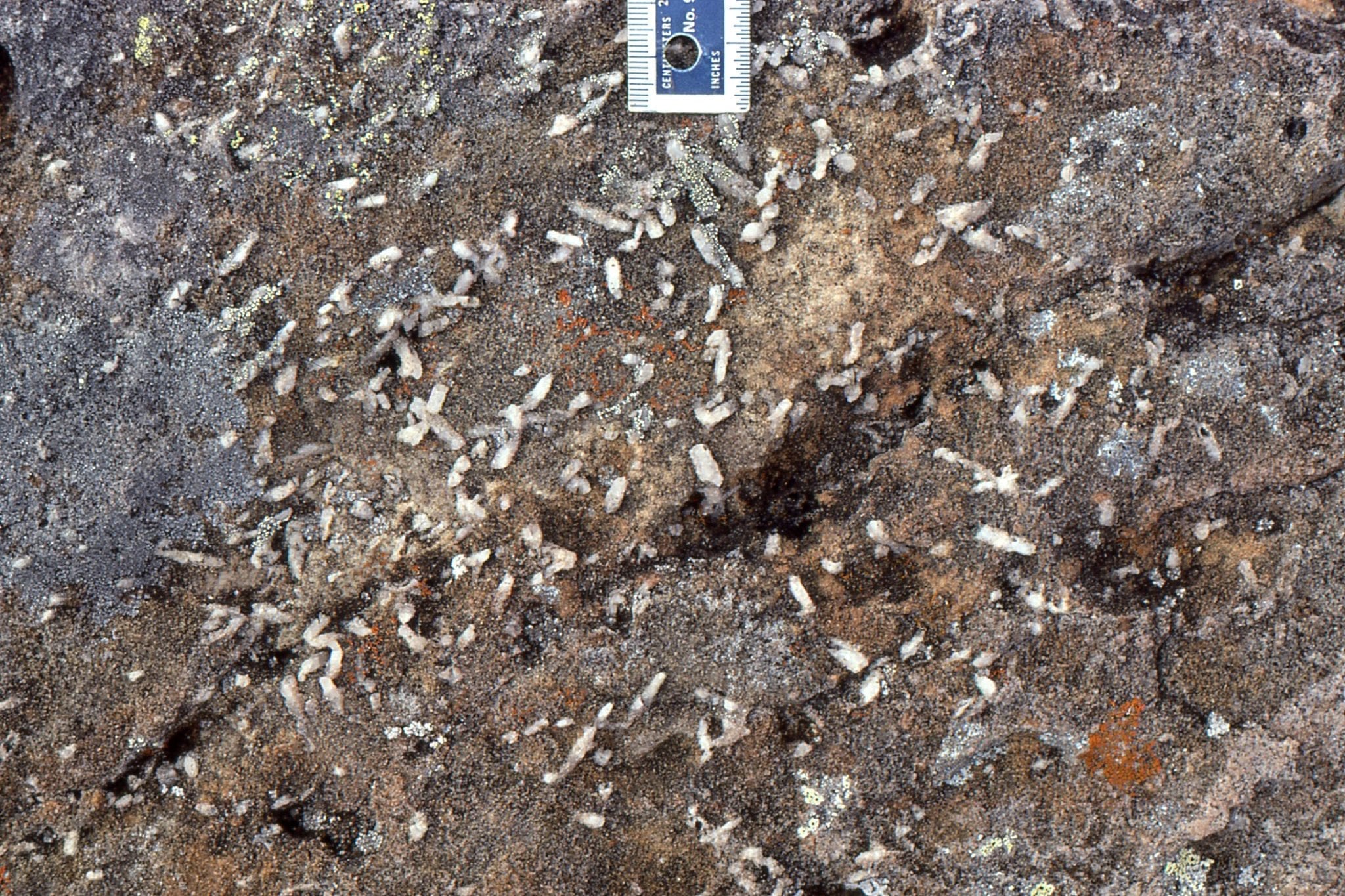
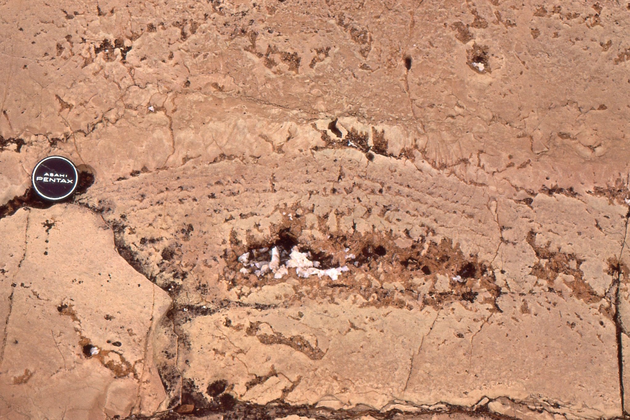
 Irregularly branched columns with significant silica replacement. The white crystals are coarse, late diagenetic dolomite
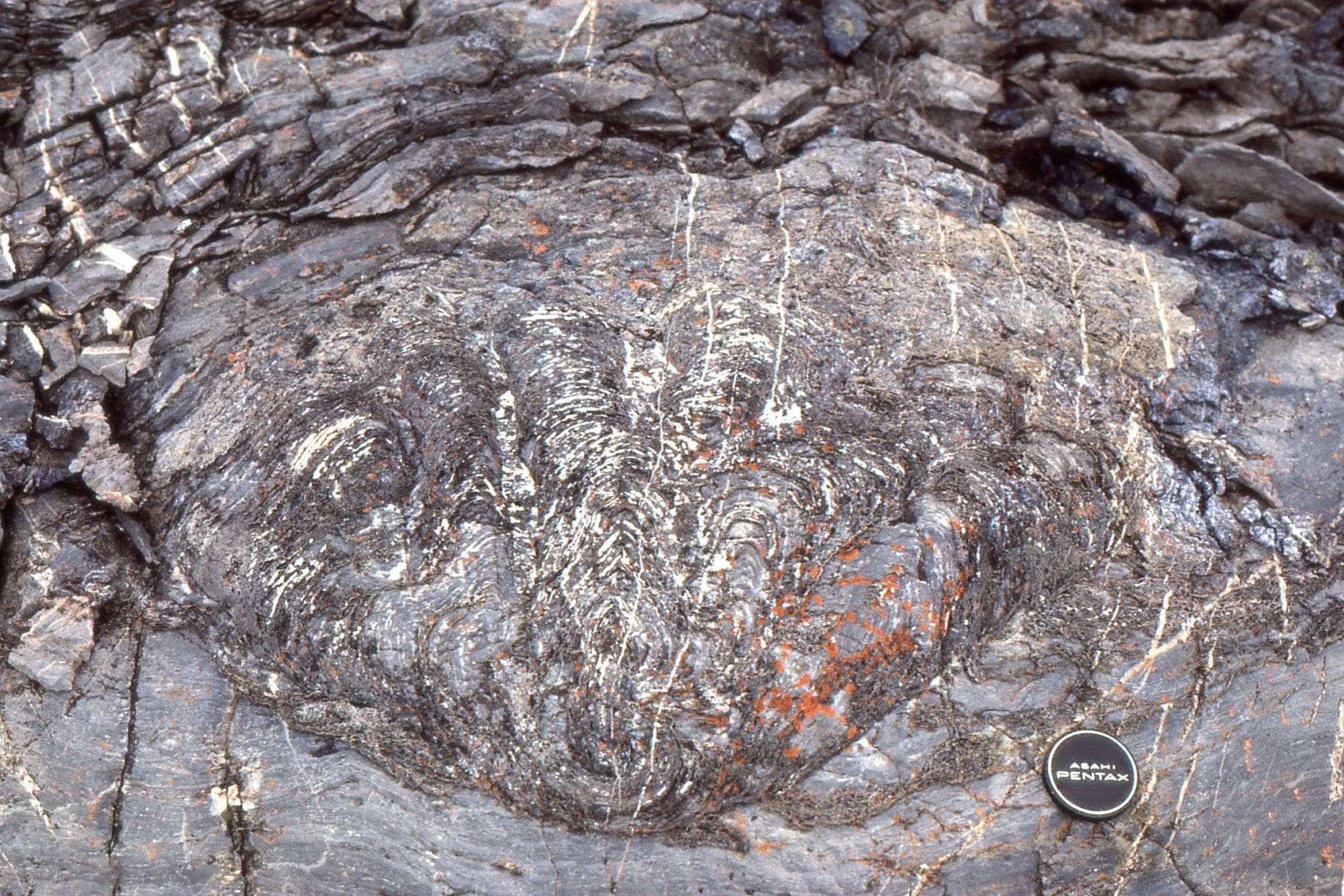
 Ornately branched stromatolite, a possible example of what historically was called Tungussia. Mavor Fm.
Left: Dolomite pseudomorphs of gypsum in dolarenite. Right: Fine-grained dolarenites interbedded with carbonate mudstone (dolomite) and simple, laminated crpytalgal mats (partly silicified). Gypsum psuedomorphs (spots) are scattered throughout. A layer of algal mat and mud rip-ups is present at the lens cap. McLeary Fm.
 Teepee structures in carbonate mudstone and laminated cryptalgal mats; disruption of the mudstone slabs was probably caused by salt-gypsum expansion. McLeary Fm.
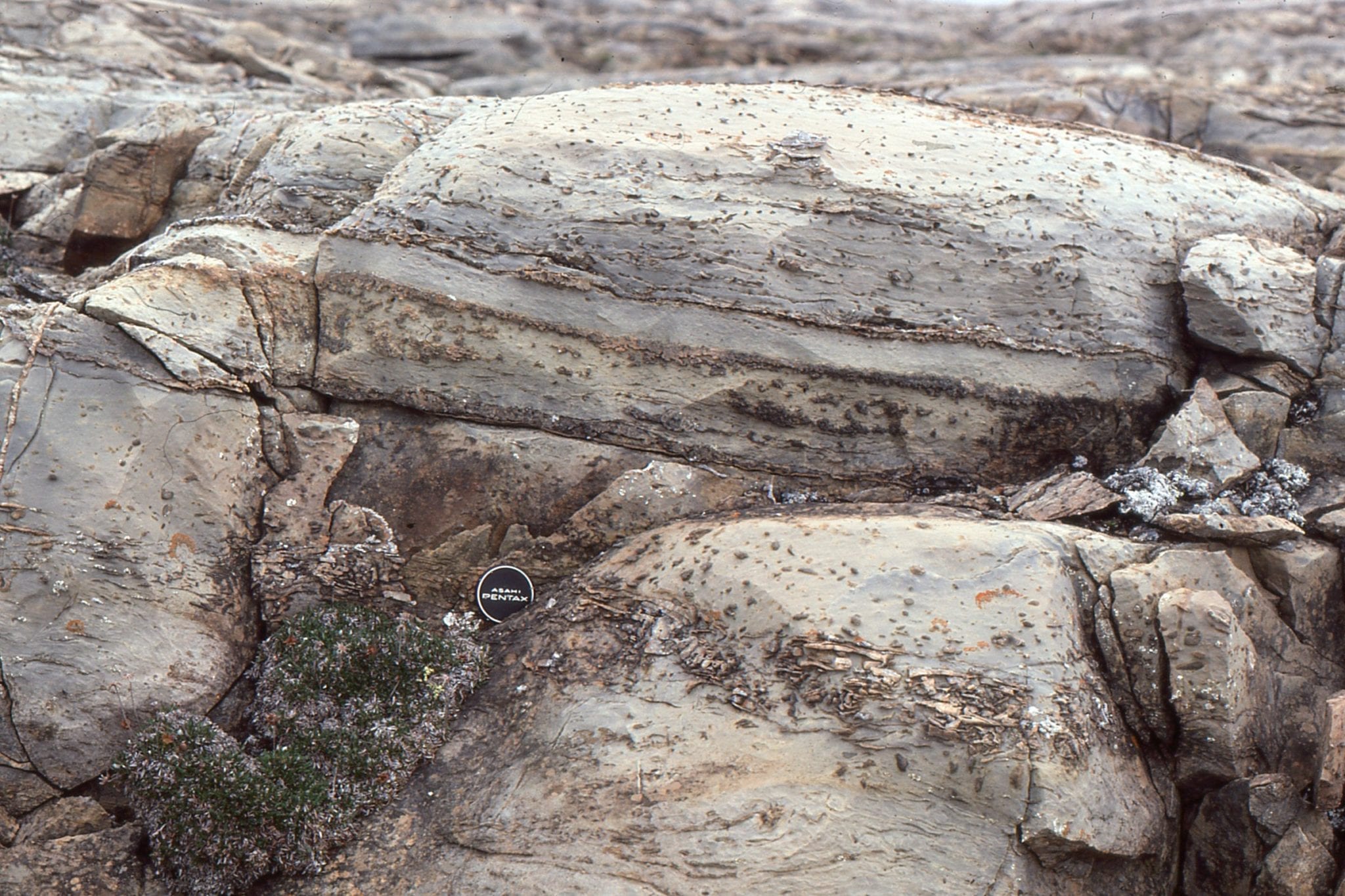
Beachrock is common in the McLeary Fm. Here, a block of dislodged beachrock (preferentially cemented dolomitic sandstone) has been overturned, as evidenced by the small, upside-down stromatolite columns.
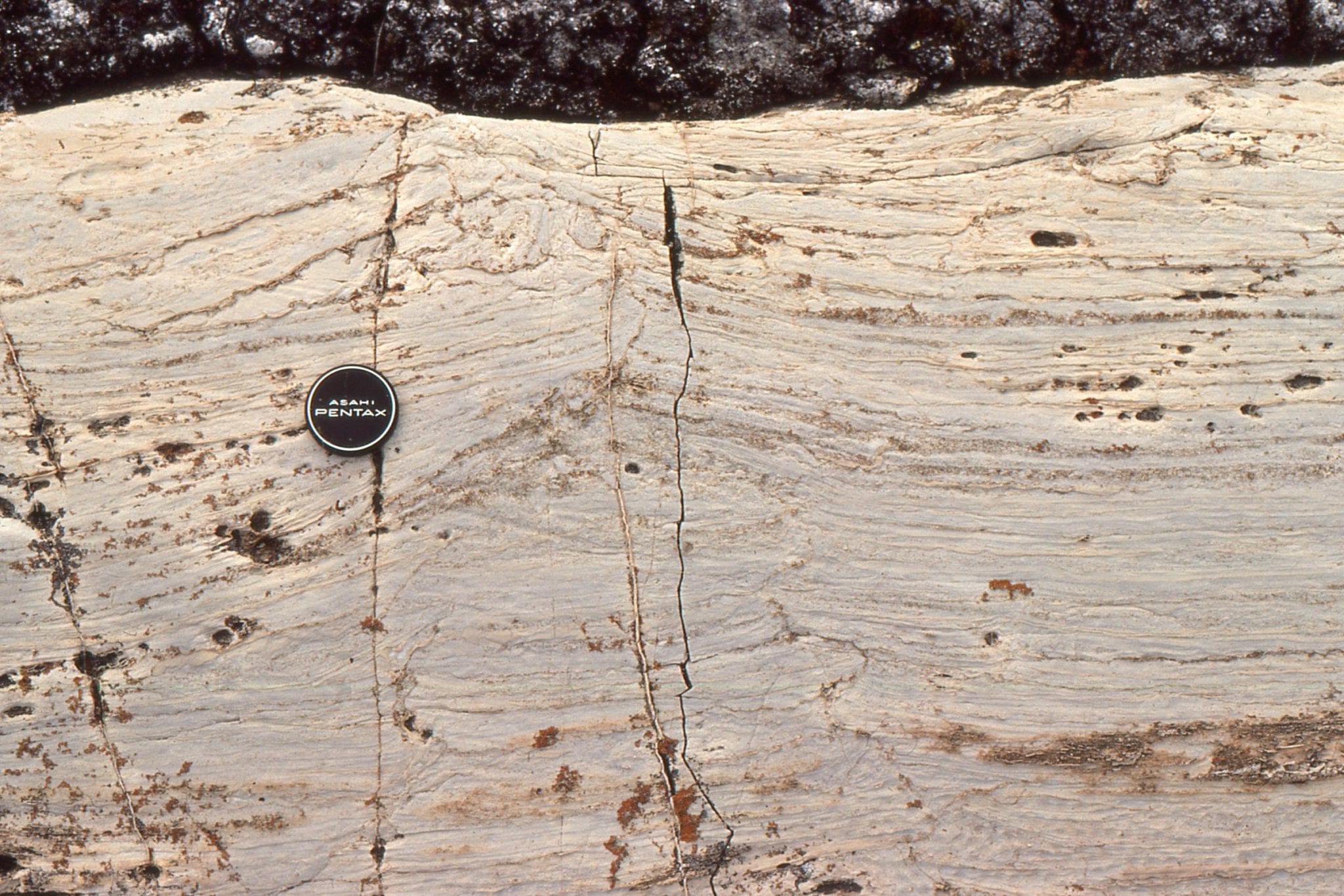
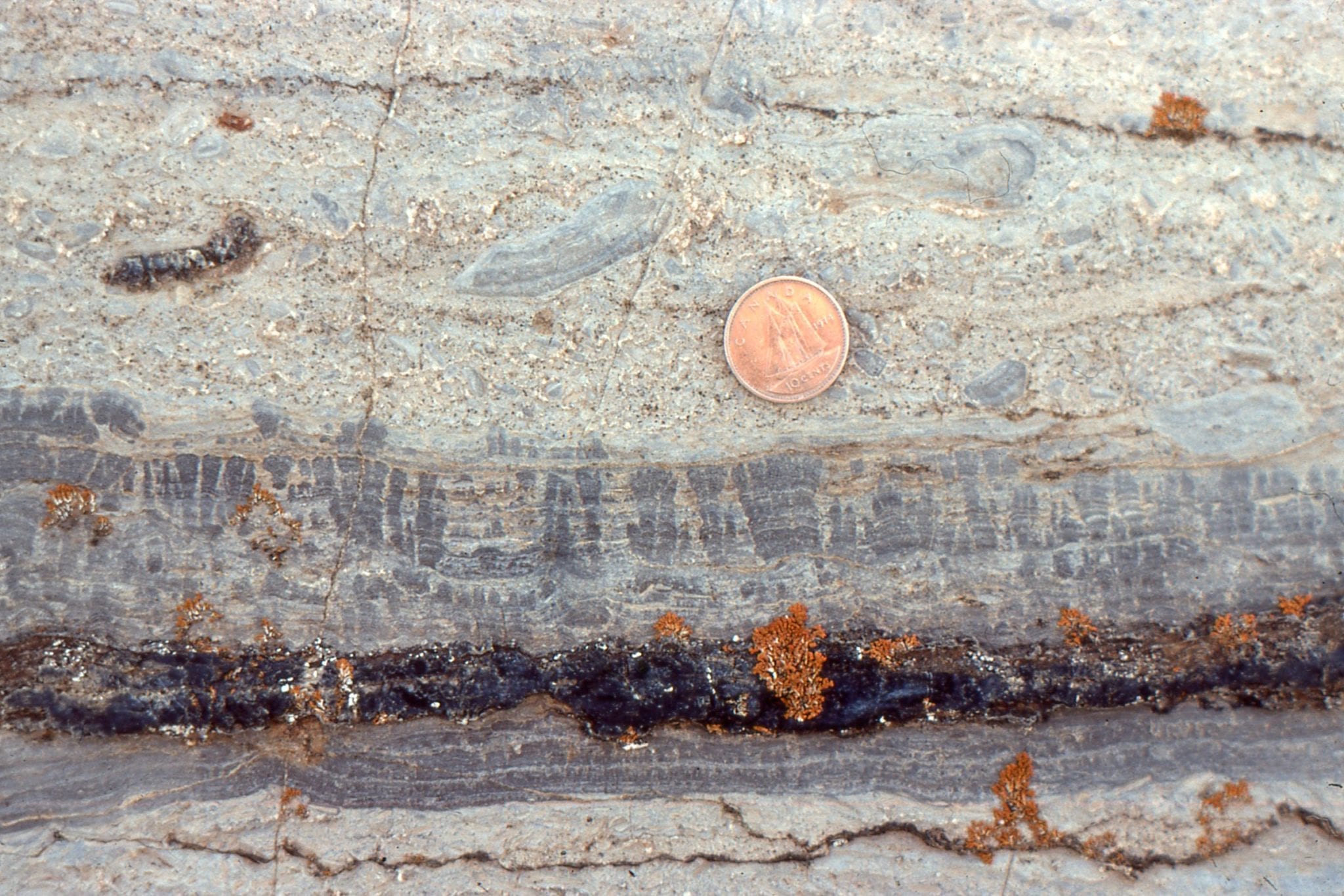
 Molar tooth structures in dolomitic mud. Their origin has been described variously as shrinkage cracks caused by changes in salinity, CO2 gas expansion (from decaying mats?), wave loading, clathrates, and seismically-induced changes in pore pressures. They are not worm burrows!
Subtidal to outer platform stromatolite mounds that have undergone more intense recrystallization during dolomite replacement of the original carbonate, such that original column-bulb outlines are partly obscured. Remnants of small columns are visible in the upper dome layers (right). There is a hint of coloumn or mat detachment, and possibly pisoliths in the centre. The vugs are secondary diagenetic features from dissolution of (?) sparry calcite and dolomite replacement. Tukarak Fm (immediately overlies the McLeary Fm).
Recrystallized, dolomitic mounds where the original carbonate has been replaced by one or two generations of dolomite spar. The void is lined with late diagenetic dolomite spar, and even later calcite (white crystals). Tukarak Fm.
Microdigitate mats, here associated with grainstone. Left: mats above the dark cherty layer show at least three stages of growth, each following an episode of erosion. Mats below the chert are more simple wavy forms. The grainstone above contains numerous mud and mat rip-ups. Right: Slightly larger, but no less delicate microdigitate mats and columns, again showing evidence of erosion and regrowth. Both examples formed in intertidal to supratidal flats. McLeary Fm.
 A coarse grainstone (completely dolomitized) containing abundant mat rip-ups, pisoliths, and a single continuous mat that has regrown over pisoliths. Subtidal to supratidal flat, McLeary Fm.
 Wavy and crinkley mats, and faintly preserved microdigitate columns, show the changes in growth habit possible over a scale of millimetres to centimetres. Scale top (bottom left) is 20 mm wide. McLeary Fm.
Left: Small dome, beginning with flat laminae at the base, and successions of microdigitate columns above. Right: Small domes capped by microdigitate columns. Laminated mudstone above are discordant and eroded. The white, silicified masses were probably larger domal structures. McLeary Fm.
 Partly silicified microdigitate mats overlying a pavement of edgewise lutite slabs, or beach rosettes. Grainstone above contains mat rip-ups and pisoliths. McLeary Fm.
 Dolomitized carbonate mudstone and thin mats, totally disrupted, ripped up, and folded by storm surges into a supratidal flat. McLeary Fm.
 Successive microdigitate columns and laminated dololutite-mat interbeds. The resistant ridges are silicified, cherty mats. McLeary Fm.
Both images show wavy mats and microdigitate columns, disrupted by supratidal desiccation, storm-loading pull-aparts, and fragmentation. The interval in the left image is capped by larger domal masses that in turn have been locally overturned. McLeary Fm.
 Bulbous to domal masses, partly disrupted and overturned, have stabilized an edgewise conglomerate (beach rosette) pavement. Slabs in the pavement are thin, probably partly lithified-cemented lutite, ripped up during earlier storm events. McLeary Fm.
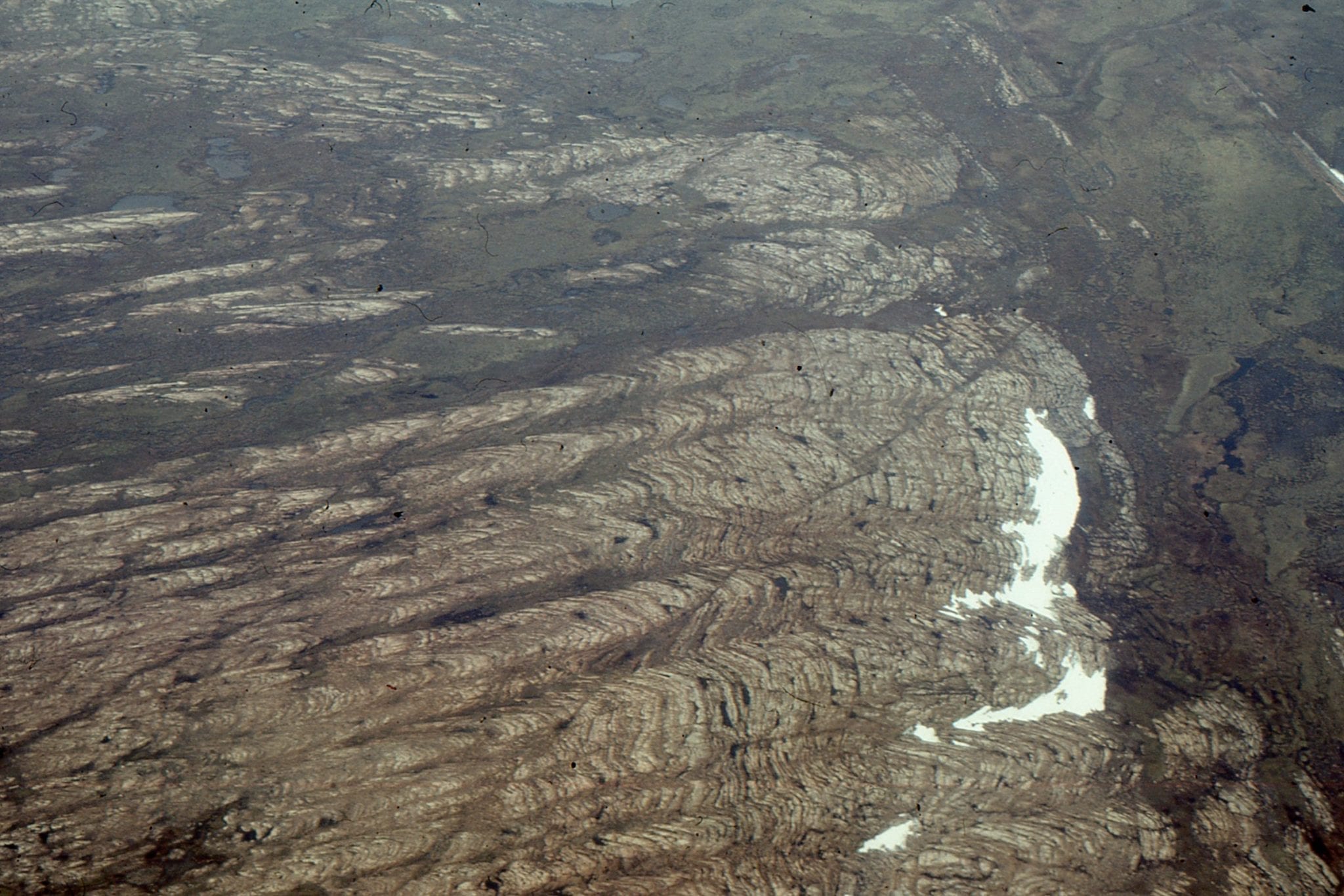 One of the more spectacular stromatolite buildups, or reefs, in the Proterozoic Mavor Formation, Belcher Group. The aerial view shows a transition from shallow subtidal, flat laminates to simple mounds, to large domes with 3-5m synoptic relief at the platform margin – slope deposits (Costello Fm) extend from the margin on the right. Smaller mounds on the left coalesce into larger mounds. Field of view along mound length is about 800m. Stratigraphic thickness is about 150m along this section of Tukarak Island.
 Slightly oblique view across several large mounds and intervening troughs. The relief here is close to synoptic relief. Keep in mind the entire structure was made up of cryptalgal laminates. There were interruptions in growth, at the scale of individual mounds, evidenced by numerous discontinuity surfaces. There is little evidence for wholesale erosion, and the conclusion is that the larger mound structures accumulated below storm wave-base. Mavor Fm.

Left: View approximately along strike. Second-order mounds are nicely exposed here (by the hammer). Right: View is slightly oblique to depositional dip. Here too we can see smaller mounds superposed on the larger structure. Mavor Fm.
 View down dip across smaller mounds that are superposed on the larger structures. Mavor Fm.
 Cross-section through the smaller mounds (hammer right centre) showing the distinctive geometry and regularity of the laminae. There are numerous stylolites (thin dark bands) that tend to mimic the mound outline. Synoptic relief is 20-40 cm. Mavor Fm.
Detail of the wavy and crinkley cryptalgal laminae, through a (2nd order) mound crest (left) and trough (right). The synoptic relief on any lamination is rarely more than a centimetre.
 Flat to wavy cryptalgal laminae in a 2nd order mound, with prominent stylolites. At least 5 seams here account for about 20% loss of stratigraphic thickness. Below the upper stylolite seam is a thin layer of mat rip-ups, evidence for briefly interrupted growth. Mavor Fm.
 Reconstruction of the progressive changes in mound amplitude and spacing, from shallow subtidal platform at the base (corresponds with the left side of the aerial image above), through coalescing mounds at the platform margin, to the slope deposits beyond (Costello Fm). For completeness, an example of the slope rocks is shown below.
 Regular bedded (that can be traced laterally for 100s to 1000s of metres) calci-dololutite and red marls in slope deposits, outboard of the Mavor Formation platform-wide buildups-reefs. There are a few slumps and the occasional small channel filled with eroded lutite and shale. There are a few thin, graded beds, likely deposited as calci-turbidites.