A rocky mound, 1500m above, and 119.44 km straight-line distance from the sea, is about as far as one can get in New Zealand from either the Tasman and Pacific coasts. The location is in central Otago, southern New Zealand, a region better known for its Pinot Noir. No one lives at this farthest point from the beach. In fact, most New Zealand folk live only a few kilometres from the sea. Hence the summer exodus. Any nostalgia for those snow-bound, icicled, northern hemisphere winter solstice festivities is short-lived, banished by squealing kids and crying gulls.
I don’t like putting a damper on this general sense of merriment but, despite all the signs that warn, all the cautions and reminders of potential dangers, people drown. New Zealand has one of the worst records for preventable drownings of any OECD country (113 in 2015). Most drownings occur at seaside beaches where rip currents are the leading cause of strife for swimmers – there were over 1300 rescues in 2015 (NZ), and most of those were plucked from rip currents. These statistics are repeated the world over.
As waves approach the shore they begin to interact with the sea floor, growing in amplitude (wave height) until they break. Waves in the surf zone move the water mass onto the beach. Gravity requires that all this water then moves down the beach slope, back to the surf zone. On all beaches, the return flow, or backwash, produces an undertow that flows beneath the incoming waves. Undertow occurs everywhere along a beach. Its influence is generally confined to the surf zone, and for the most part is not dangerous (although it can be quite a strong flow). Undertow IS NOT the same process as a rip current. Rip currents are not that same as tidal currents.
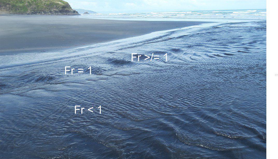
As water moves back into the surf zone, it commonly shifts sideways across the beach, a process referred to as along-shore drift. Most swimmers will have experienced this ‘drift’ when they find themselves farther along the beach from where they started (this is usually where the local surf lifeguard starts waving at you to return to the flagged swimming area). Rip currents form when the returning seawater is diverted and focused by shallow holes and sand bars on the sea floor. If the sand bars extend onto the beach, then the waterline will have a kind of point-like shape along the beach (as shown in the images here). These channel-like currents frequently extend beyond the surf zone. Rip currents are narrow flows (a few 10s of metres wide) that move rapidly offshore; current speeds of 4m/second have been recorded, speeds that are well beyond the ability of even the strongest swimmer. The currents are powerful because so much water is being focused through a relatively narrow gap. Rips can appear suddenly on any beach where there is appreciable wave activity. They can also form adjacent to rocky promontories.
Rip currents are best viewed from an elevated vantage; they are not easily seen from the water’s edge. Useful identifying features include:
- The surface waters of a rip tend to be relatively calm or rippled,
- The current cuts through the surf and is usually clear of large breaking waves,
- Currents commonly carry flotsam (including swimmers) or sediment offshore, and hence may appear cloudy, and
- A point-like, or cuspate shape to the waterline along the beach may indicated submerged sand bars – such features increase the likelihood that rip currents will form.
While swimmers and life guards tend to view rip currents with (respectful) dislike, people who study coastal processes see them as one process among many, that shape coastlines. On sandy coasts, sediment is constantly being transferred among the deeper offshore regions of the sea bed, the shore and beach, and sand dunes. Sometimes the beach or dunes are in sand deficit, and at other times in surplus. Breaking waves tend to move sand onshore, whereas undertow and rip currents tend to move sand seaward. There is generally a balance between the onshore and offshore transfer of sand, but this can be disrupted by seasonal changes in tidal currents and storm tracks, by decadal cycles in the movement of ocean water masses, and by longer-term rises or falls in sea-level. Rip currents, despite the risks they pose, are an important part of coastal sand budgeting and transfer . They are a geological phenomenon.
The advice normally given to anyone caught in a rip is DON’T PANIC (perhaps more easily said than done), and don’t try to swim against the current – you will not win that contest. Swim parallel to the beach and you will eventually exit the current. Surf life-saving folk put up flags where they assess the safest stretch of beach to be. It is common for these flags to be moved up or down the beach, as rips come and go. But these common-sense warnings are ignored by too many – if they’re lucky they won’t enter the books as another statistic.
Surf Life Saving Australia has produced this useful video


