Geological-logo
Geological-logo

Atlas of sequence stratigraphy

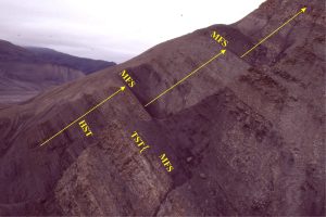
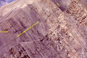
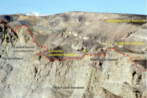
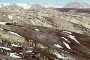
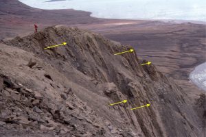
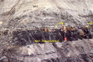
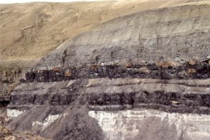
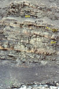
This category of Atlas images, is not intended as a comprehensive outline or set of definitions of sequence stratigraphy, but rather field examples of strata, stratigraphic trends (an essential component of systems tracts), and stratigraphic surfaces.  There are many excellent journal papers, text books, and conference short courses devoted to sequence stratigraphy, so consult them if needs be. 

The link to Sequence Stratigraphic Principles will take you to more descriptive posts.

The Atlas of Unconformities also has additional examples of sequence boundaries

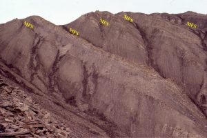
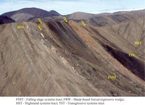
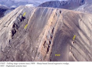
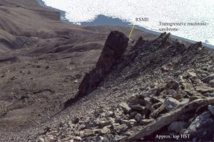
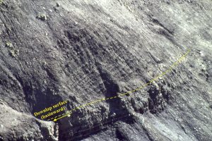
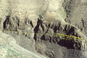
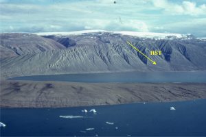
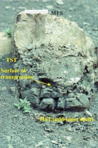
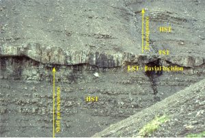
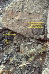
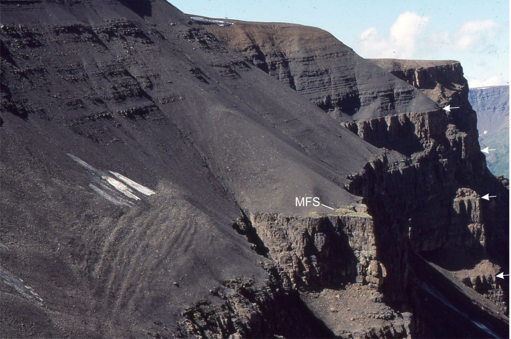
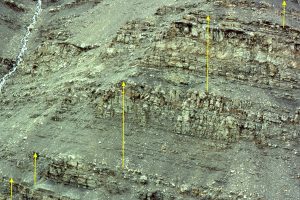
Some key sequence stratigraphic components illustrated here include (abbreviations on the images):

HST        Highstand Systems Tract (progradational-aggradational) overlies the MFS and underlies the erosion surface formed during the FSST)

FSST       Falling Stage Systems Tract (forced regression and progradation during relative sea-level fall)

LST         Lowstand systems tract (now restricted to end of relative sea-level fall and beginning of sea-level rise)

TST        Transgressive Systems Tract (above the transgressive surface; Retrogradational onlapping during rising relative sea-level and low sedimentation rates. Condensed stratigraphy).

MSF        Maximum Flood Surface (at the transition to sedimentation rates greater than creation of accommodation space. Also the base of the HST).

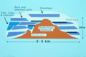
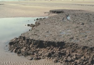
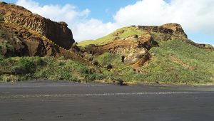
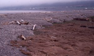
The images are taken from the Late Cretaceous Eureka Sound Group in Sverdrup Basin, Arctic Canada, and the Jurassic-Cretaceous Bowser Basin in northern British Columbia.

Eureka Sound Group
Bowser Basin
Pleistocene-Recent
Leave a Comment

Your email address will not be published. Required fields are marked *

Archives
Categories
dip and strike compass
Measuring dip and strike
sandstone classification header
Classification of sandstones
Calcite cemented subarkose, Proterozoic Altyn Fm. southern Alberta
Sandstones in thin section
poles to bedding great circles
Stereographic projection – poles to planes
froude-reynolds-antidunes-header-768x439-1
Fluid flow: Froude and Reynolds numbers
Stokes Law for particle settling in a schematic context of other fluid flow functions
Fluid flow: Stokes Law and particle settling
sedimentary-basins-distribution-1-768x711
Classification of sedimentary basins
Model are representational descriptions are written in different languages - diagrammatic, descriptive, mathematical, and conceptual. They commonly contain variables and dimensionless quantities that permit quantitative analysis of the physical systems the models represent.
Geological models
Recent Posts
Claudine picardet w Lavoisier
Claudine Picardet (1735-1820)
etymology text box
Etymology of Earth science words and phrases
Elizabeth Philpot photo
Elizabeth Philpot (1779-1857)
XES 02 slice 1520 -3 blank
Experimental sequence stratigraphy:  model results
XES 02 slice 1520 full
Experimental sequence stratigraphy:  model attributes
Charlotte Murchison photo
Charlotte Murchison (1788-1869)
seds bedload modern dunes curisoity PIA20755
Evidence for bedload deposition on Mars
Carlotta Maury photo
Carlotta Maury (1874-1938)
seds curiosity panorama PIA24937-1
Mars orbiter and lander missions
seds jezero crater and delta in 3D
Evidence for sedimentary rocks on Mars
Scroll to Top