Shallow marine – estuarine – tidal flat – lagoon and coastal dunes
This collection of images spans the shallowest marine environments including beach, lagoon-bay with all the associated environments such as sand-spits and barrier-bars, tidal flats, estuaries and coastal dunes. Where possible I have paired modern analogues with ancient examples.
The Atlas, as are all blogs, is a publication. If you use the images, please acknowledge their source (it is the polite, and professional thing to do).
This link will take you to an explanation of the Atlas series, the ownership, use and acknowledgment of images.
Click on the image for an expanded view, then ‘back one page‘ arrow to return to the list
The images:
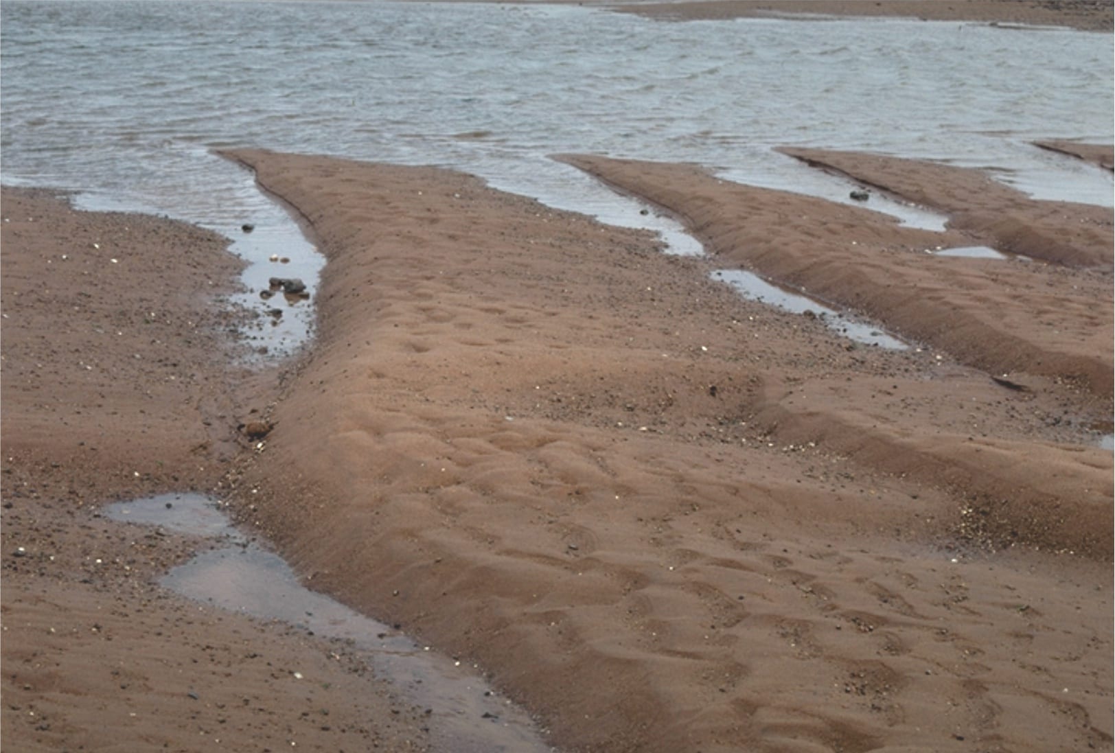
Tairua estuary, east coast Coromandel Peninsula, New Zealand. Two images taken during falling tide, exposing attached and semi-detached sand-shell bars. The main channel is at bottom of each image.
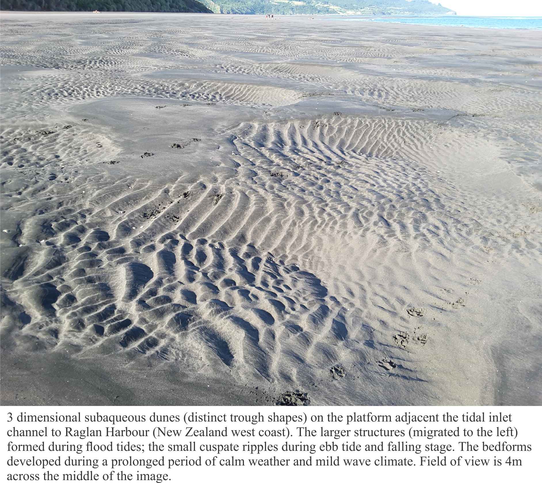
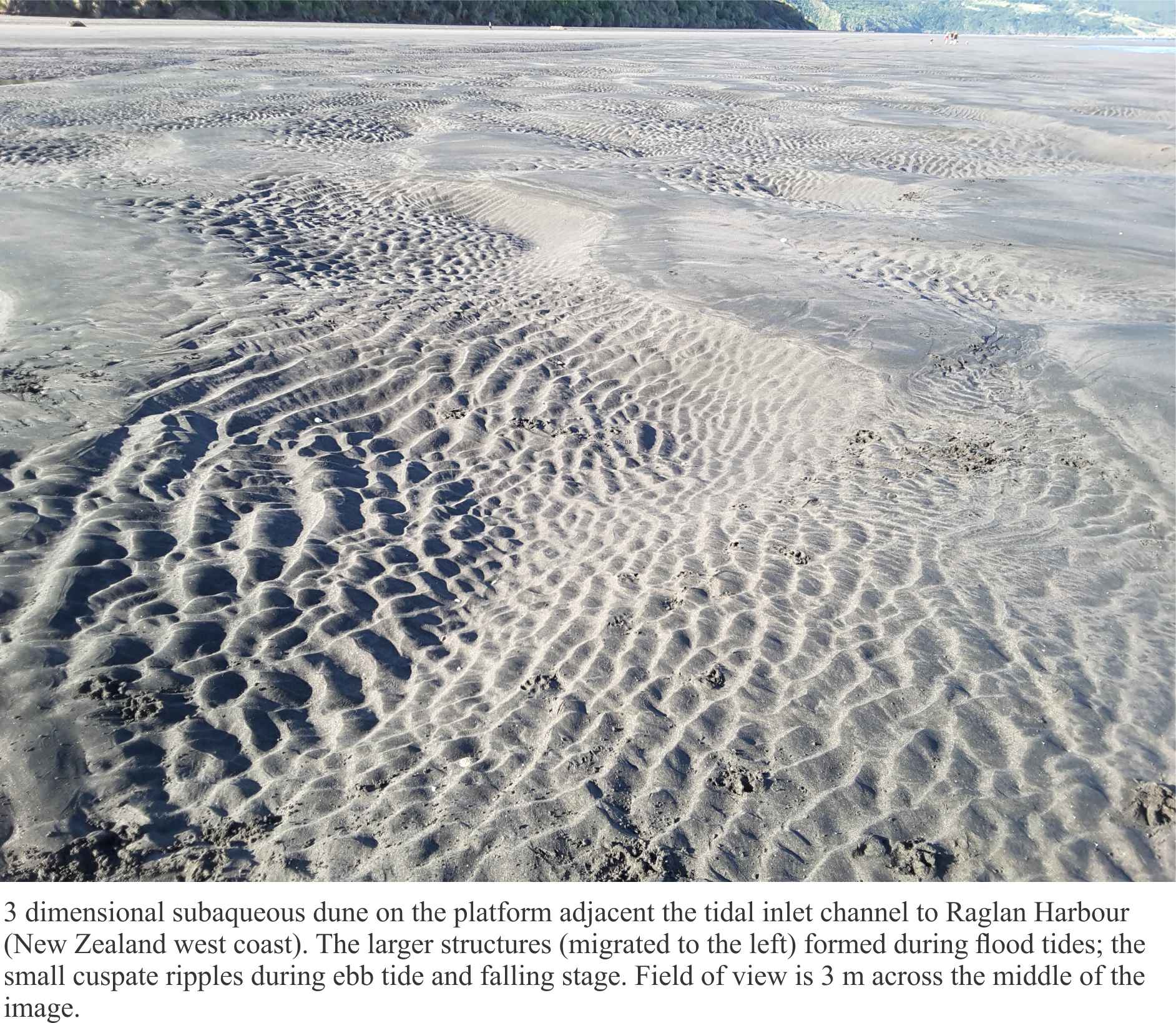
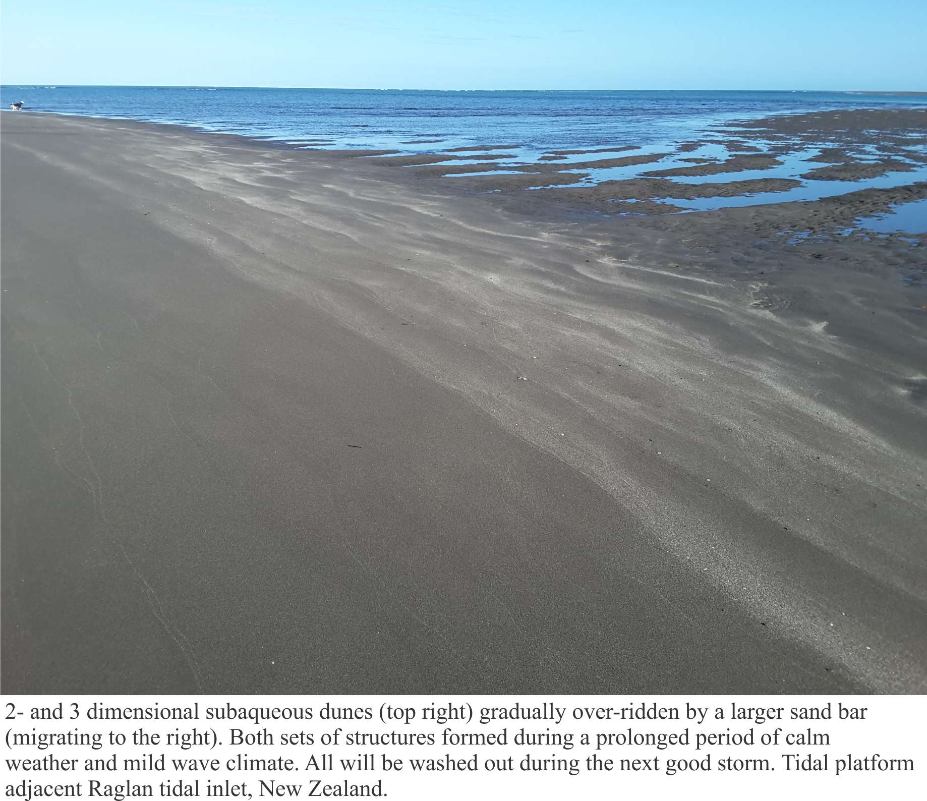
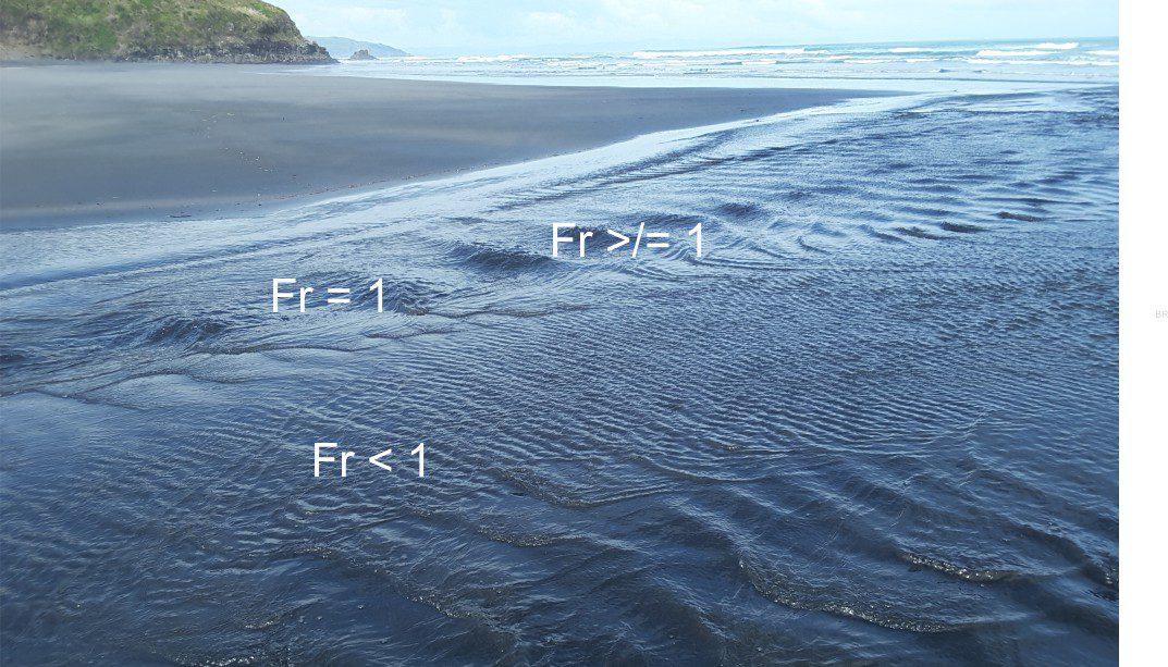
Raglan ebb tidal delta, bedforms on the platform attached to the permanent shoreface
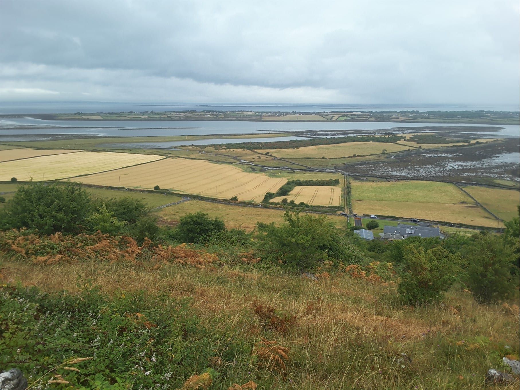
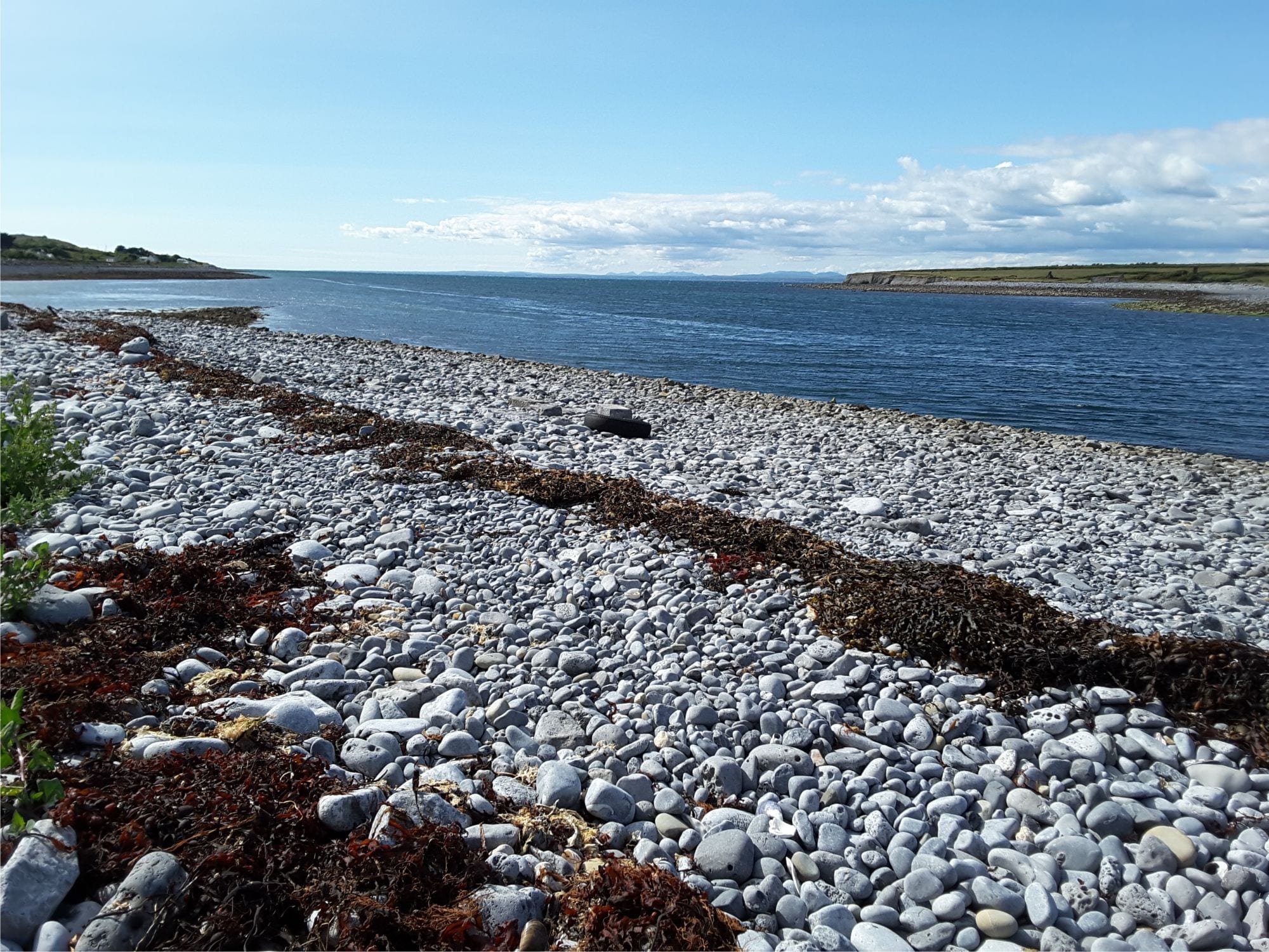
The estuary on the south side of Galway Bay, County Clare, Ireland, near New Quay. The boulder-cobble beach consists almost entirely of Burrens limestone (Carboniferous). Left view from Abbot Hill.
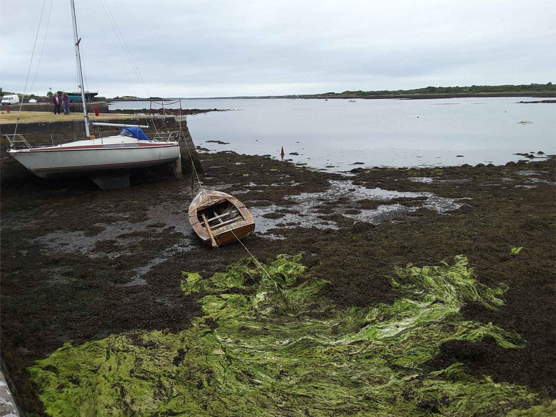
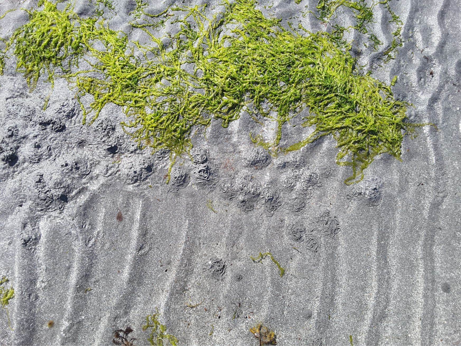
Mudflats and algae, Kinvara, at the head of the estuary, south side Galway Bay.
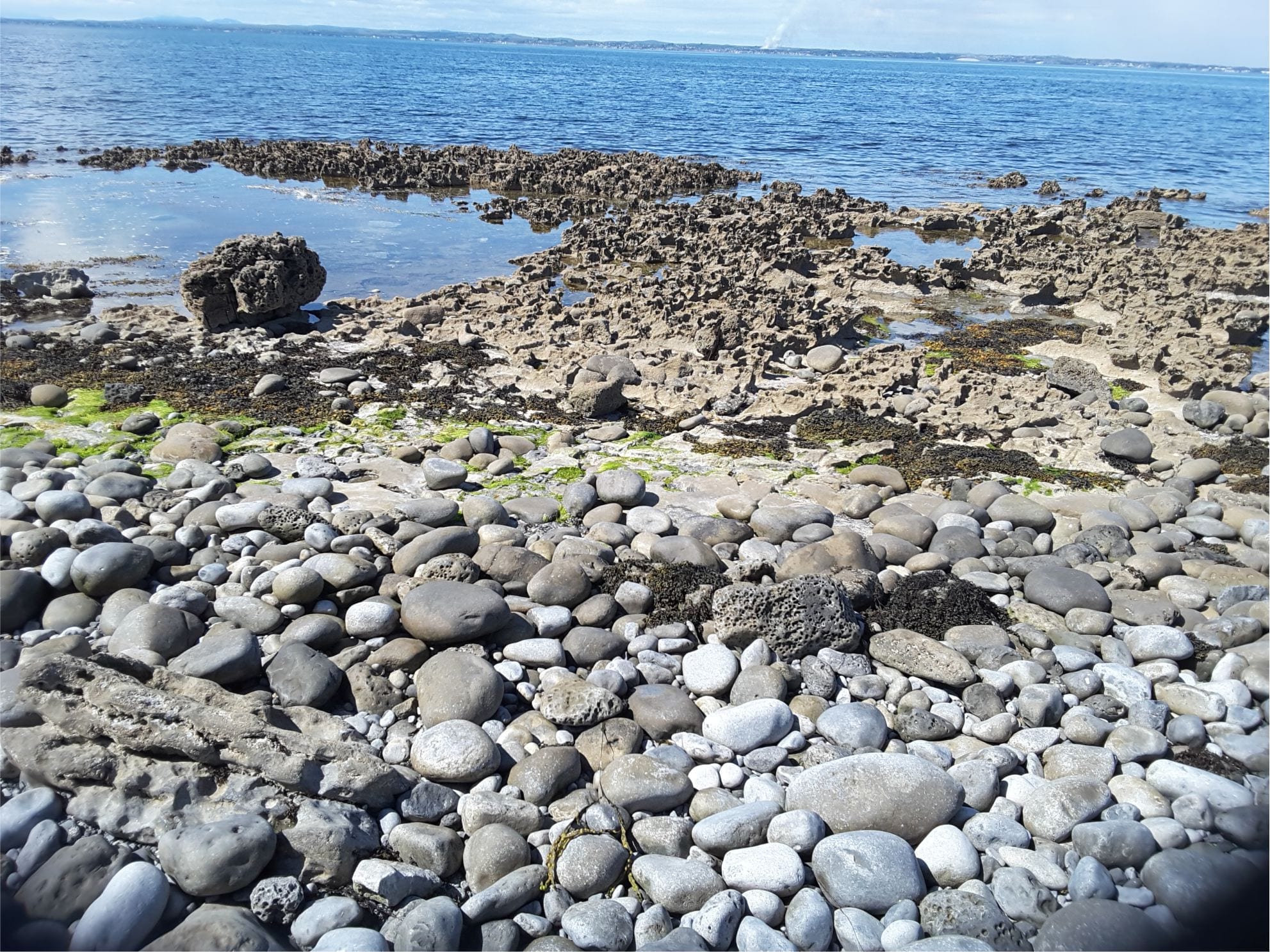
Karst in Burren Limestone at Flaggy Shore, New Quay, County Clare, has been accentuated by salt corrosion and mechanical erosion. It is overlain by boulders of locally derived Carboniferous limestone
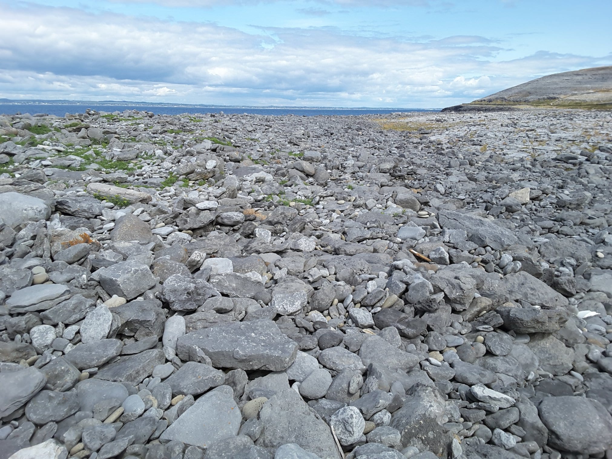
Boulder storm ridge at Black Head, County Clare – the heart of the Burrens. All boulders are locally derived Carboniferous limestone
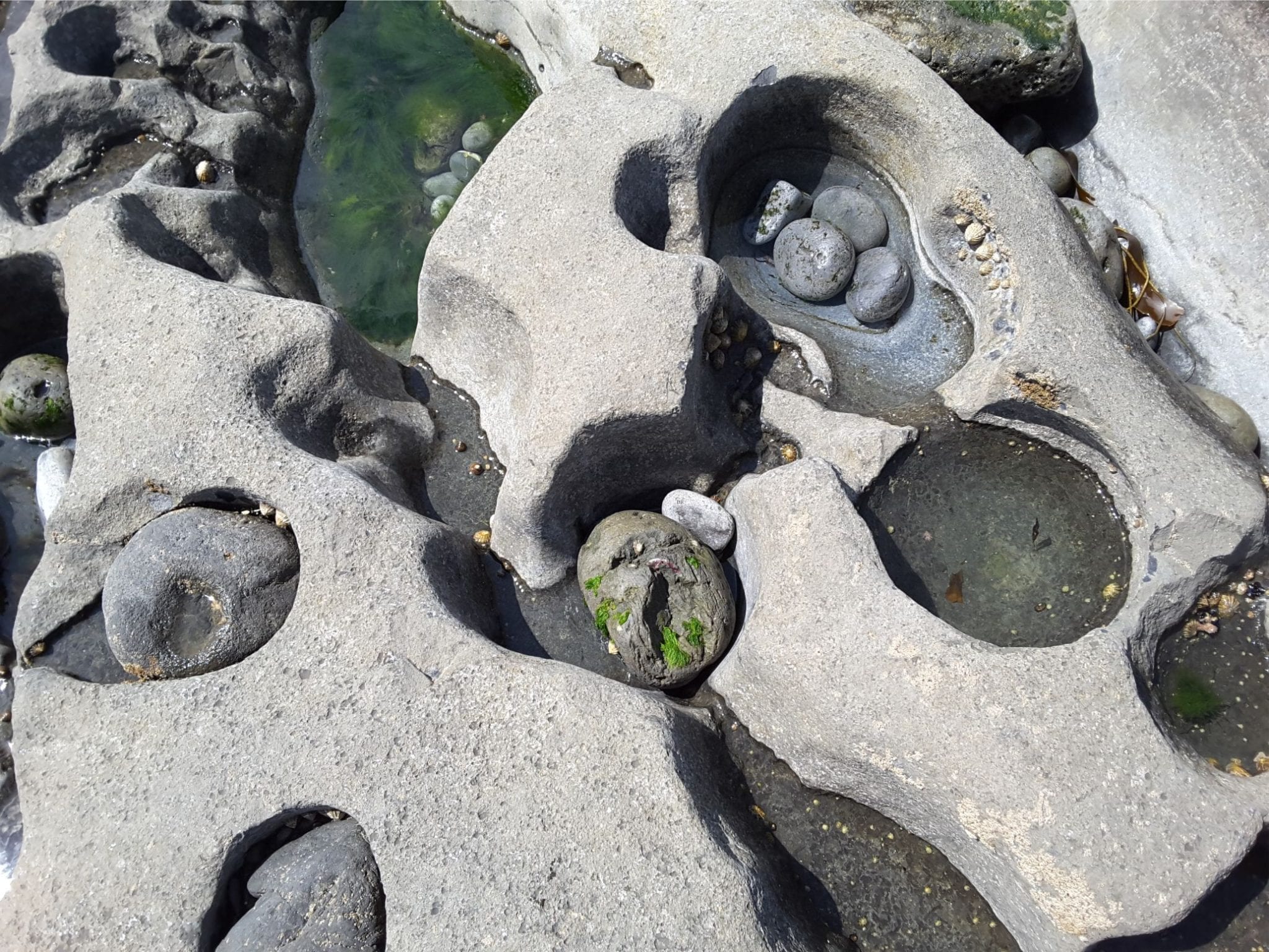
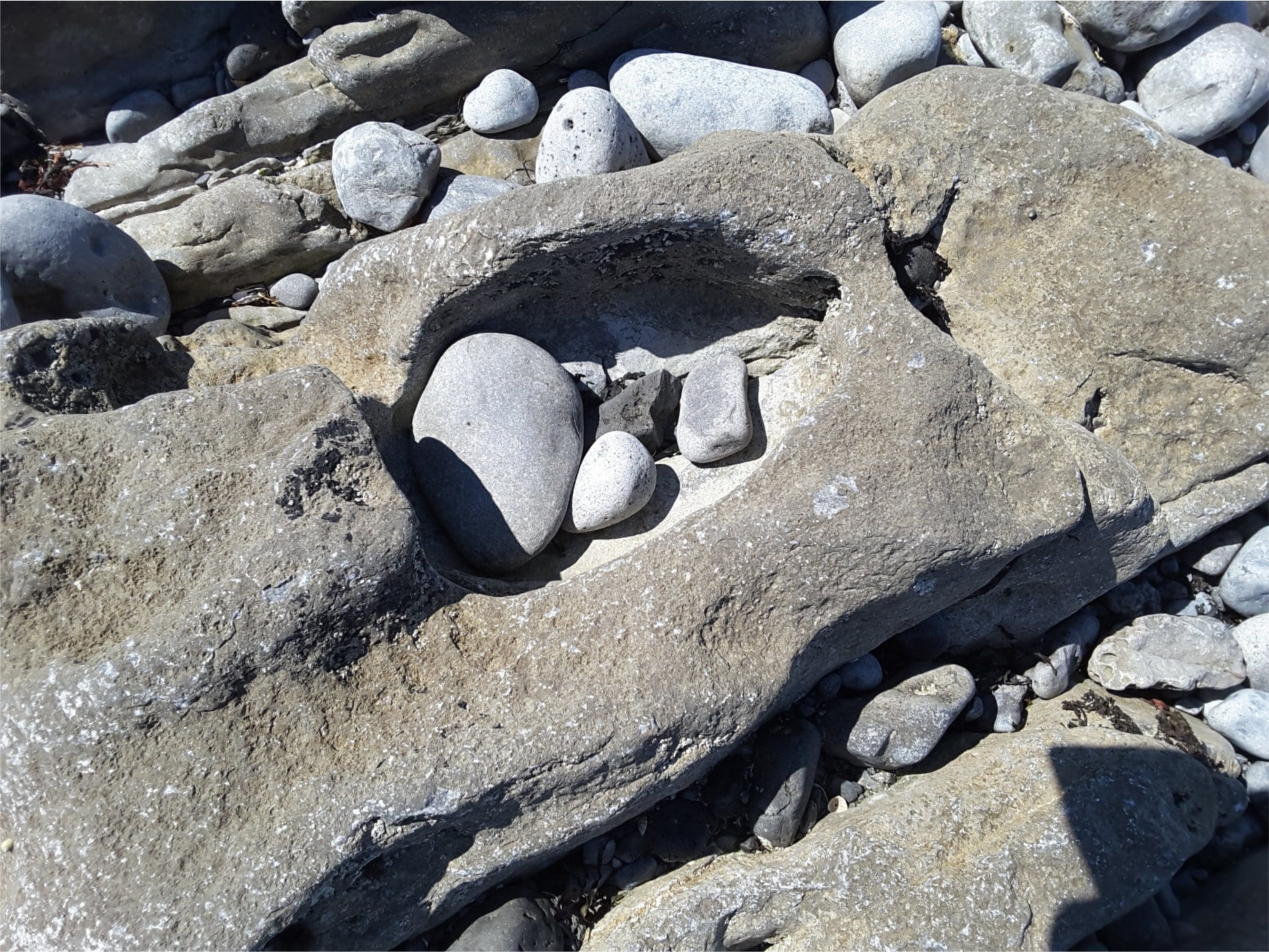
Potholes in Burren Limestone, Flaggy Shore, County Clare.
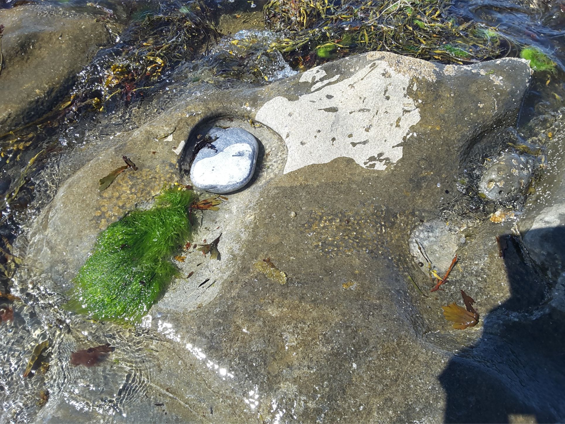
Sea grass, ripples, and burrow excavations in a tidal pool, Flaggy Shore, County Clare
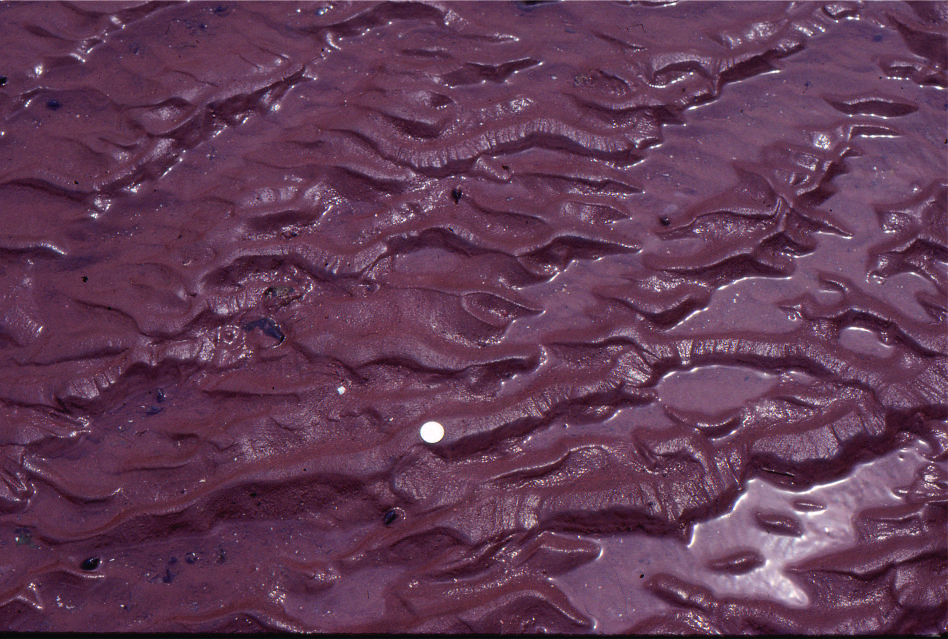
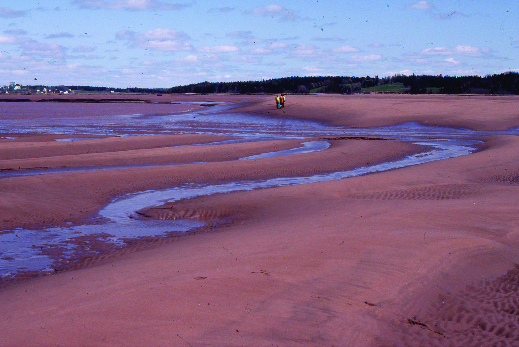 Large, 2D dunes, intertidal Minas Basin, Fundy Bay
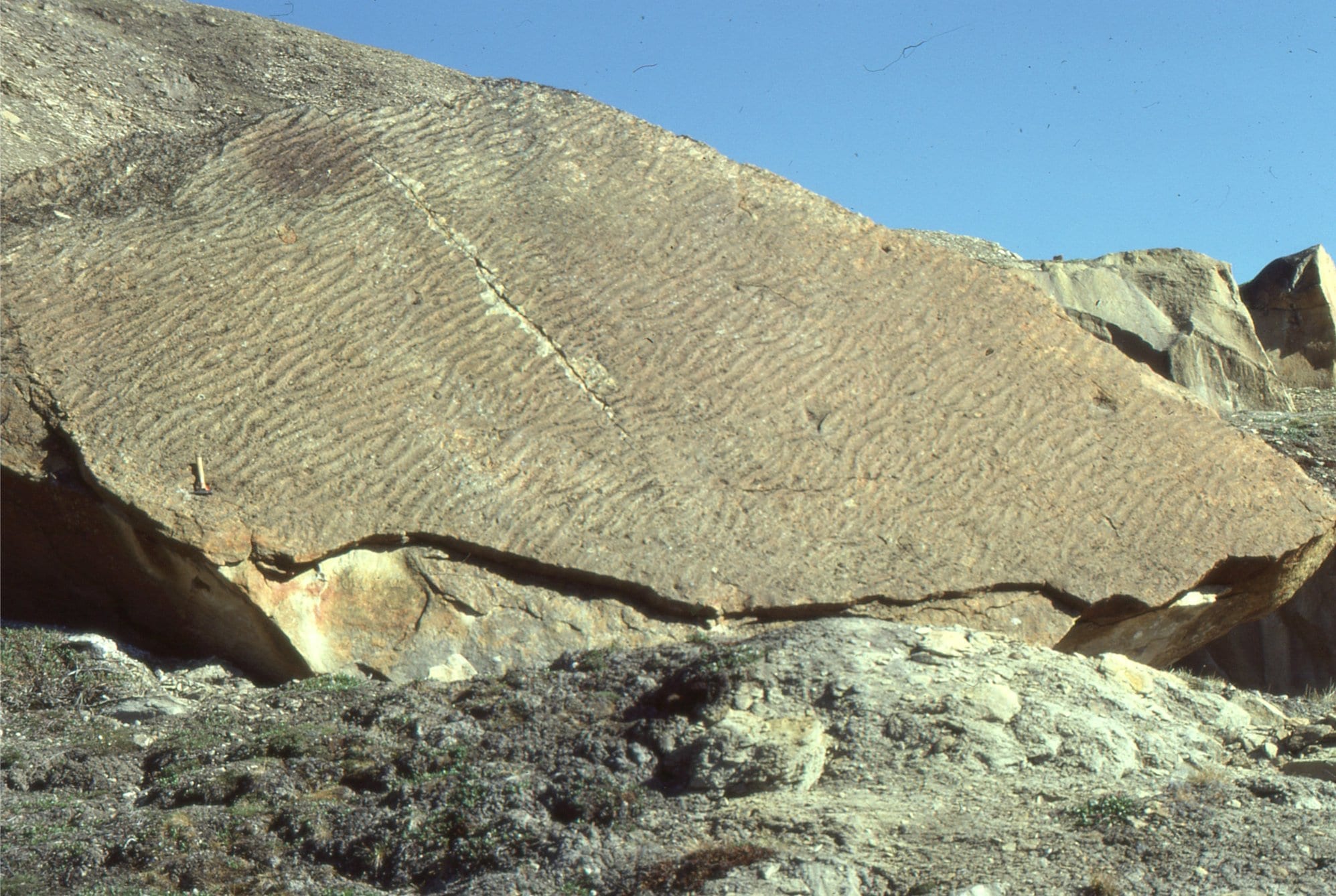
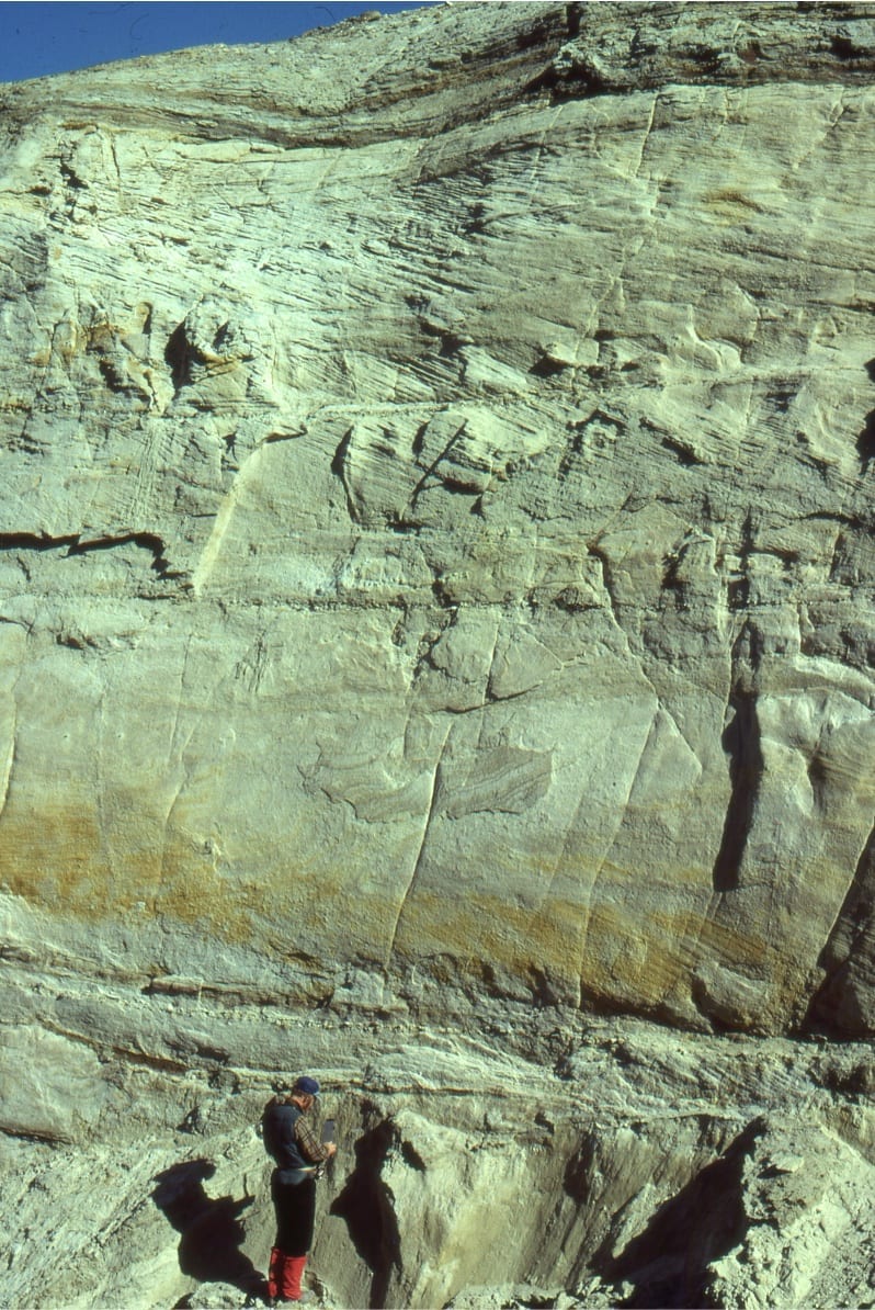
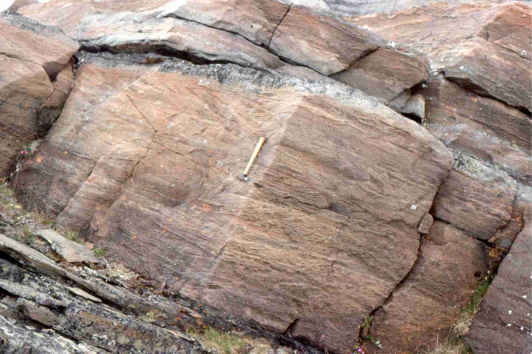
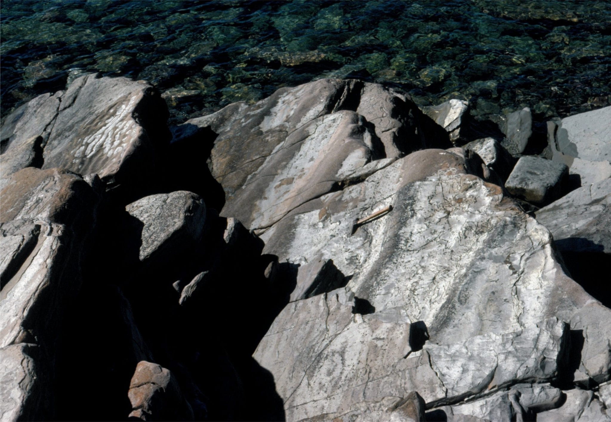 Shallow subtidal to intertidal, 2D subaqueous dunes, Rowatt Fm, Belcher Islands (Aphebian, about 2 billion years old). Hammer for scale.
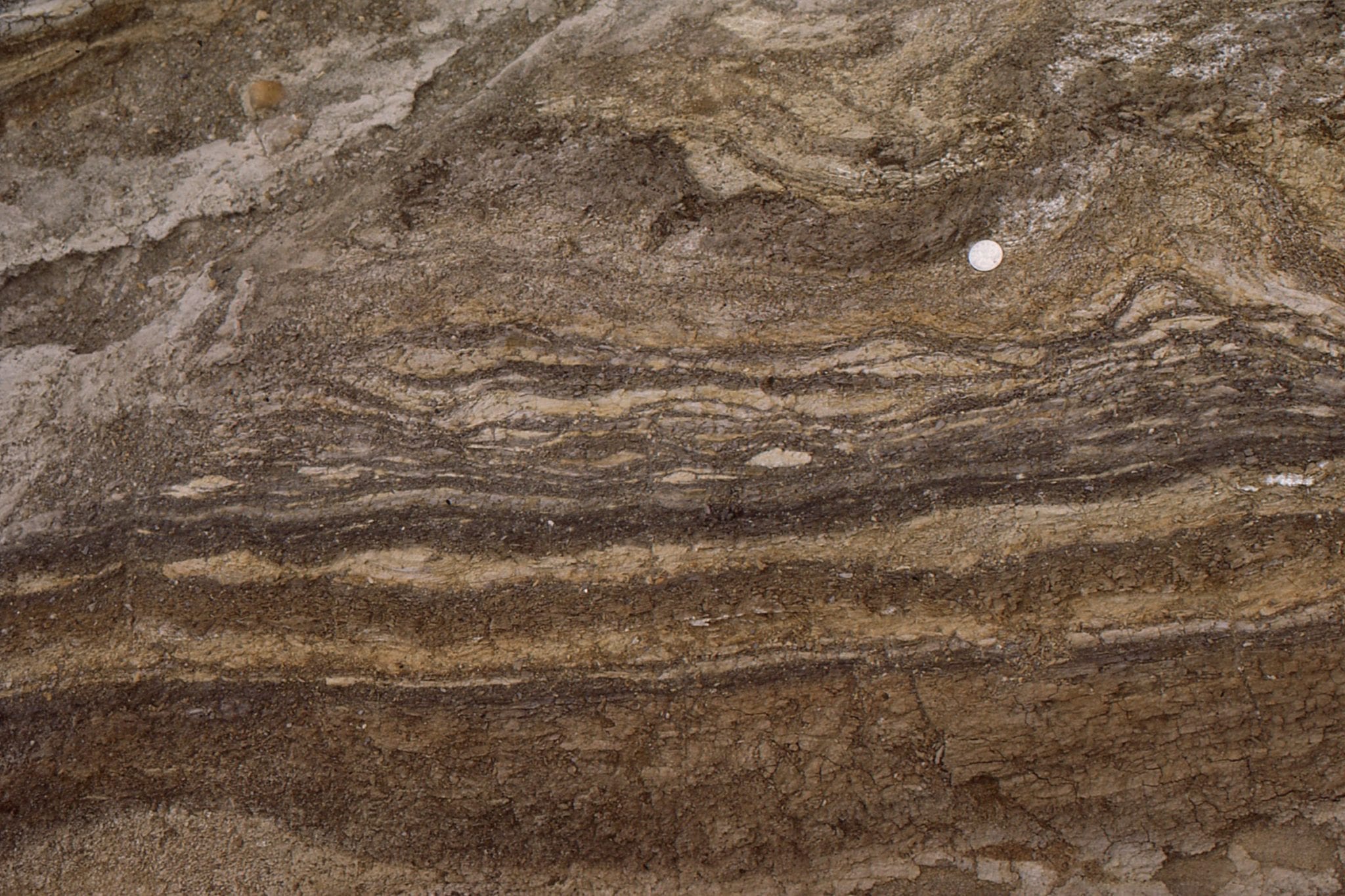
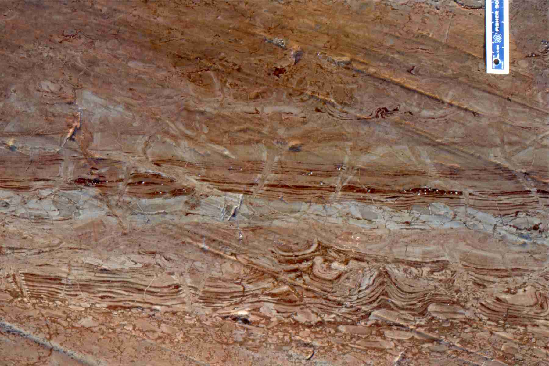
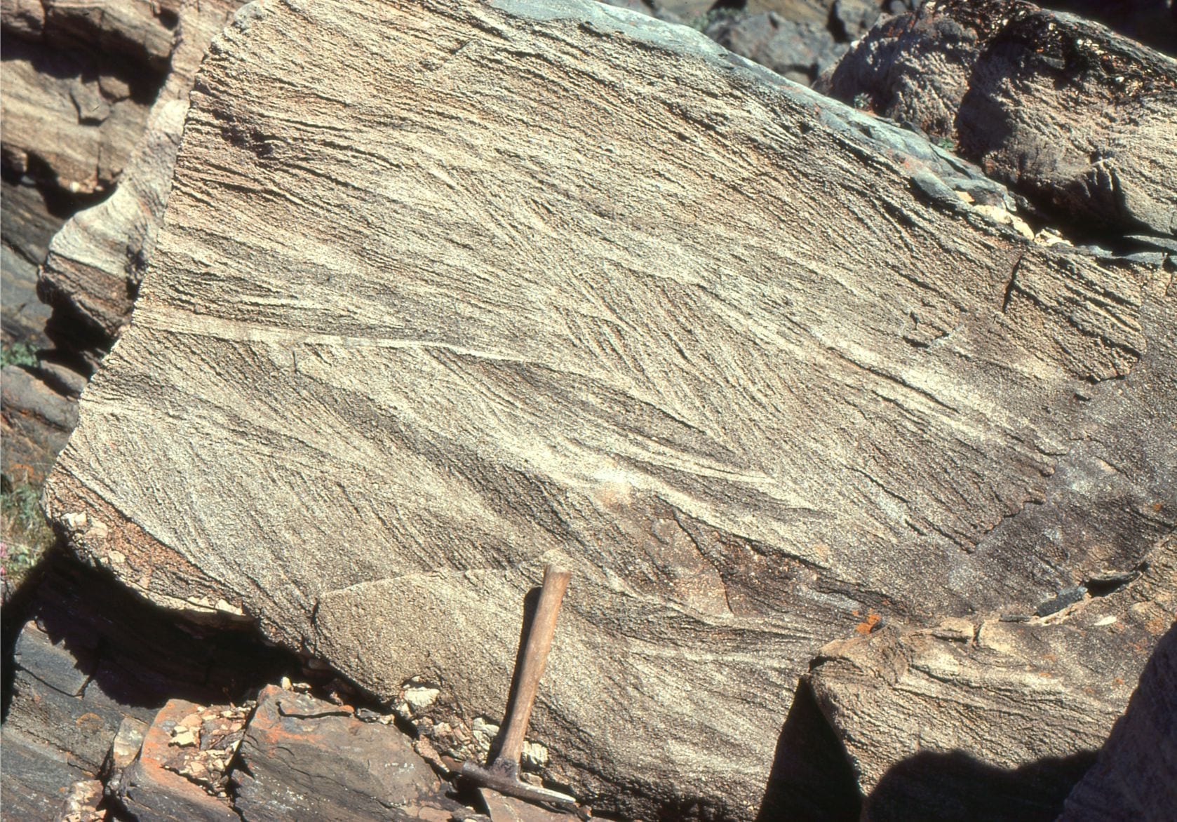 Cross-sectional view of 2D subaqueous, intertidal dunes, showing complex migrating dune-formed crossbedding, and dune reactivation, Rowatt Fm, Belcher Islands (Aphebian, about 2 billion years old). The sands are mixed siliciclastic-carbonate (dolomite).
Reactivated 2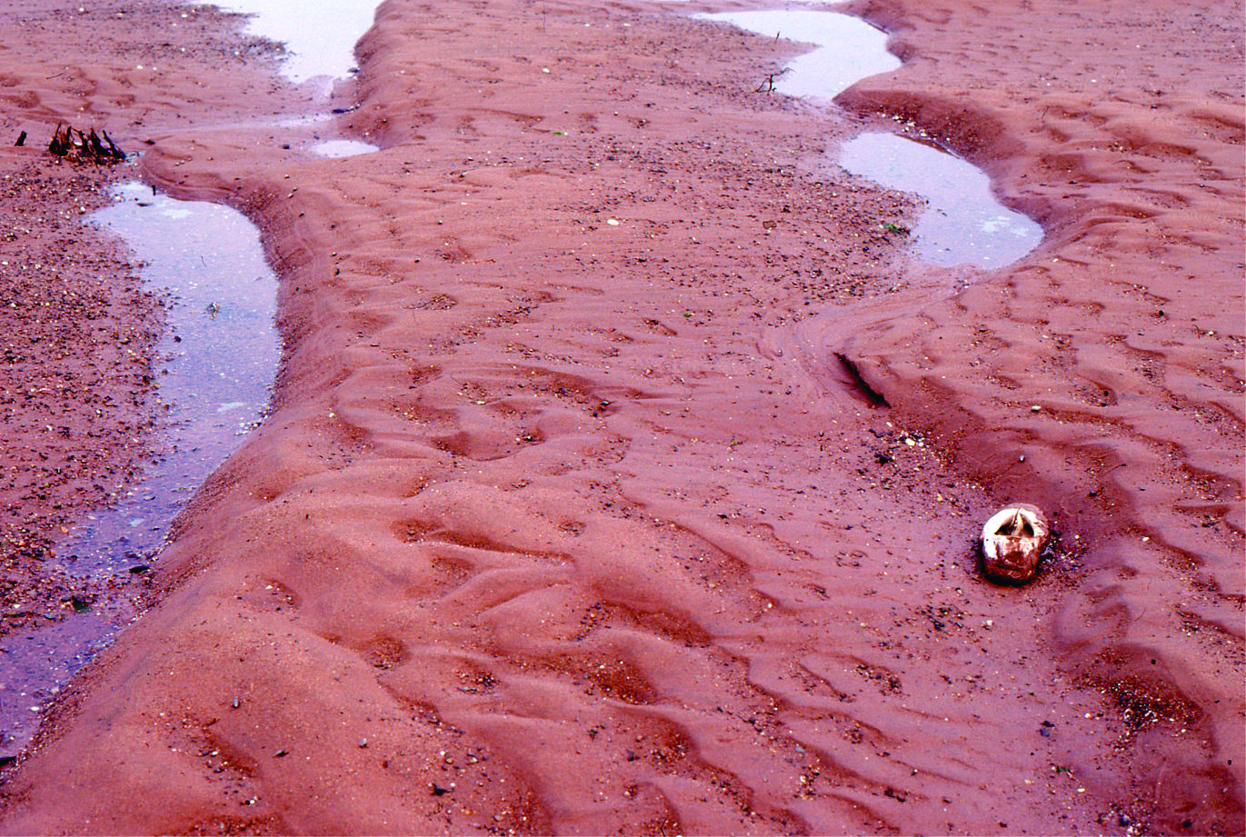 D dunes with superposed ebb tide ripples, Minas Basin, Fundy Bay
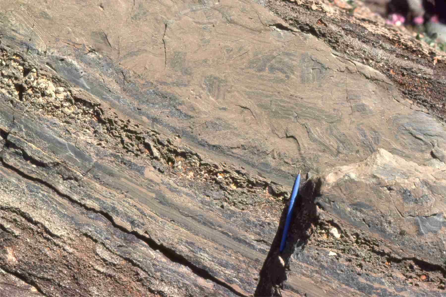
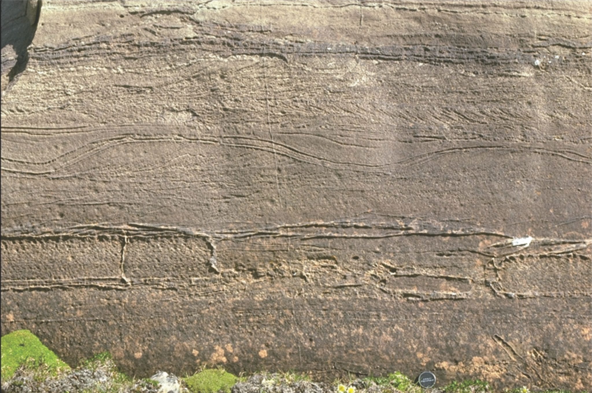 Proterozoic tidal inlet, showing cross-section of reactivated subaqueous dunes (mid image), possible herringbone crossbeds, and smaller ripples. Rowatt Fm, Belcher Islands (about 2 billion years old). Lens cap bottom right.
 Multiple dune sets, intertidal, Minas Basin, Fundy Bay
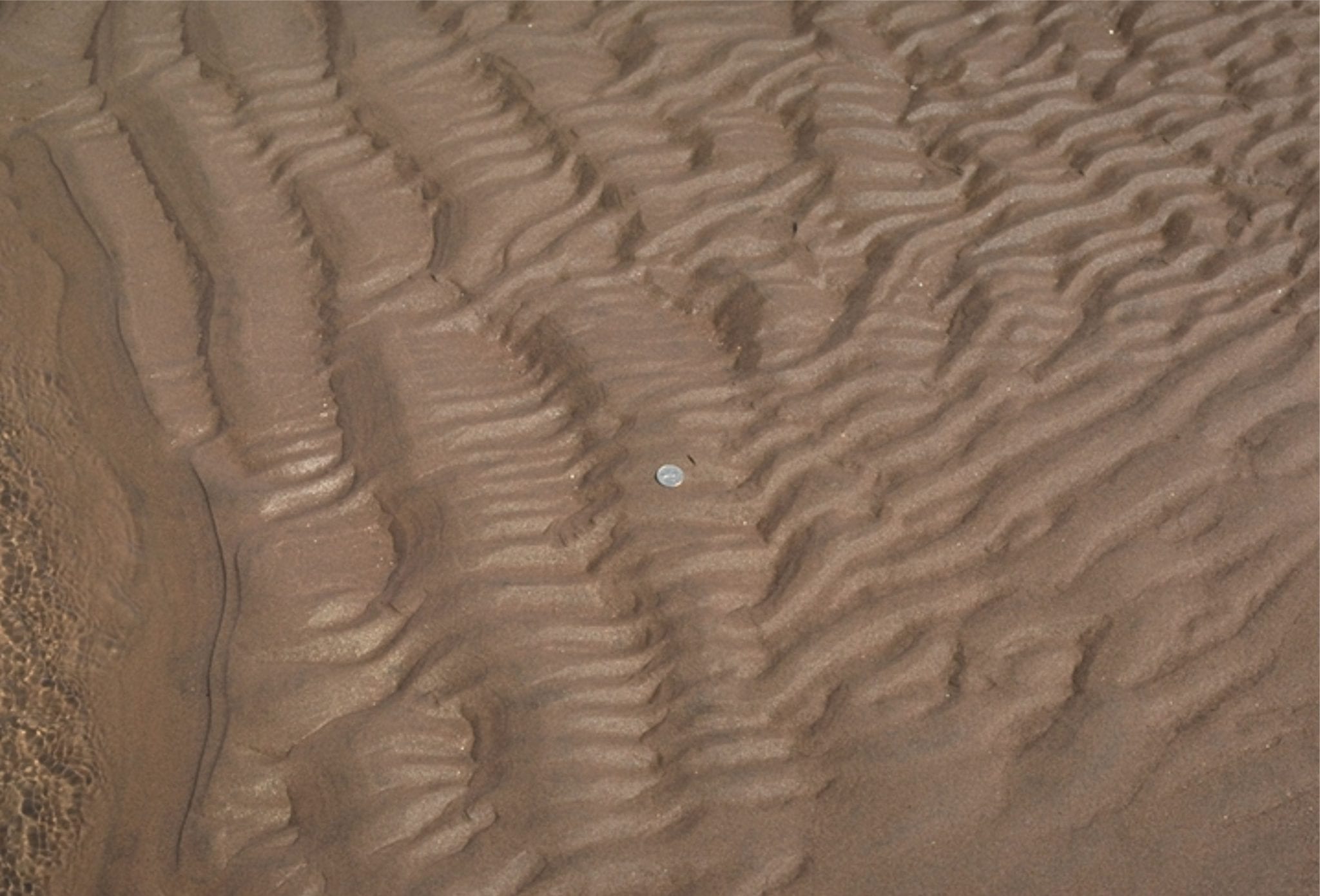
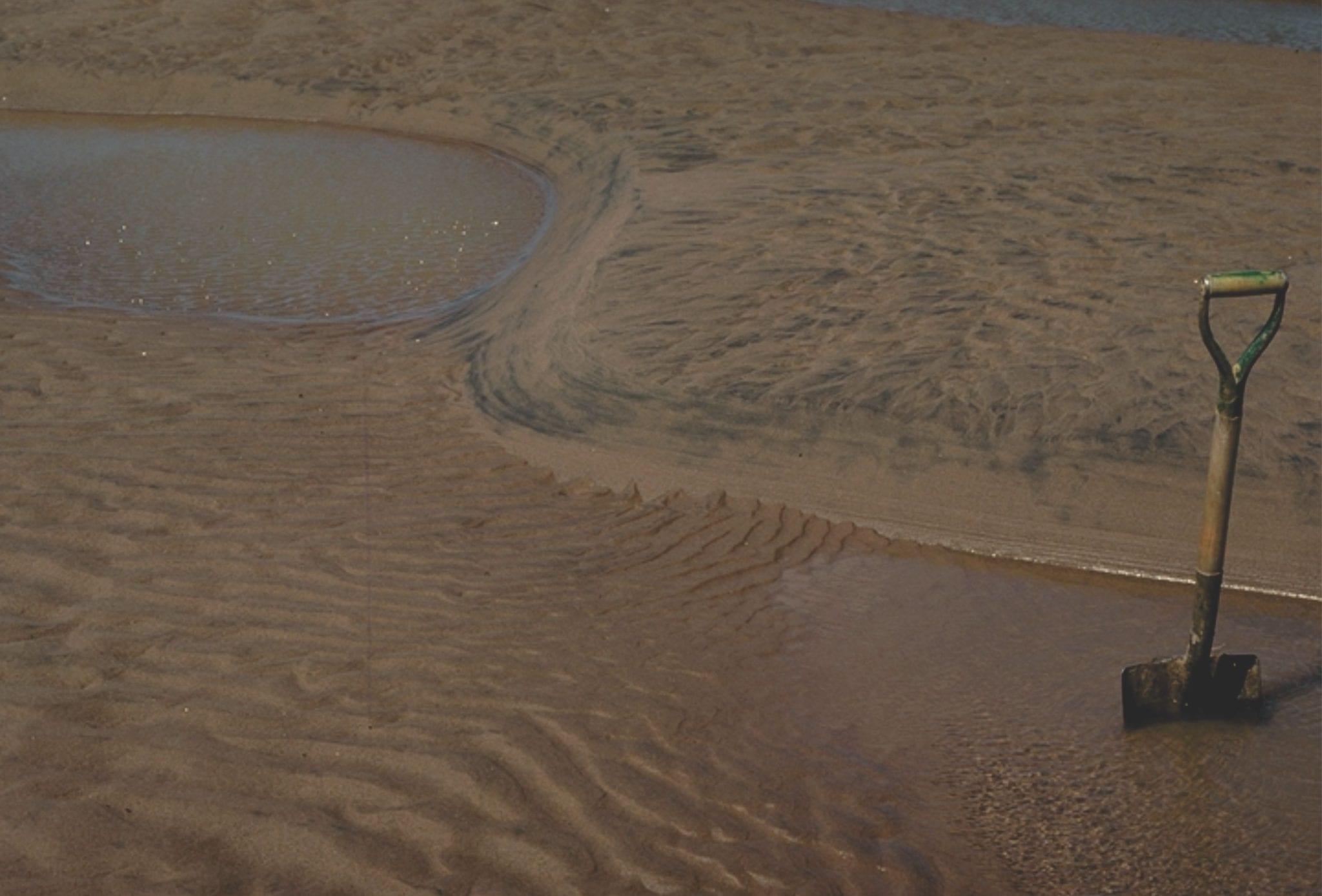
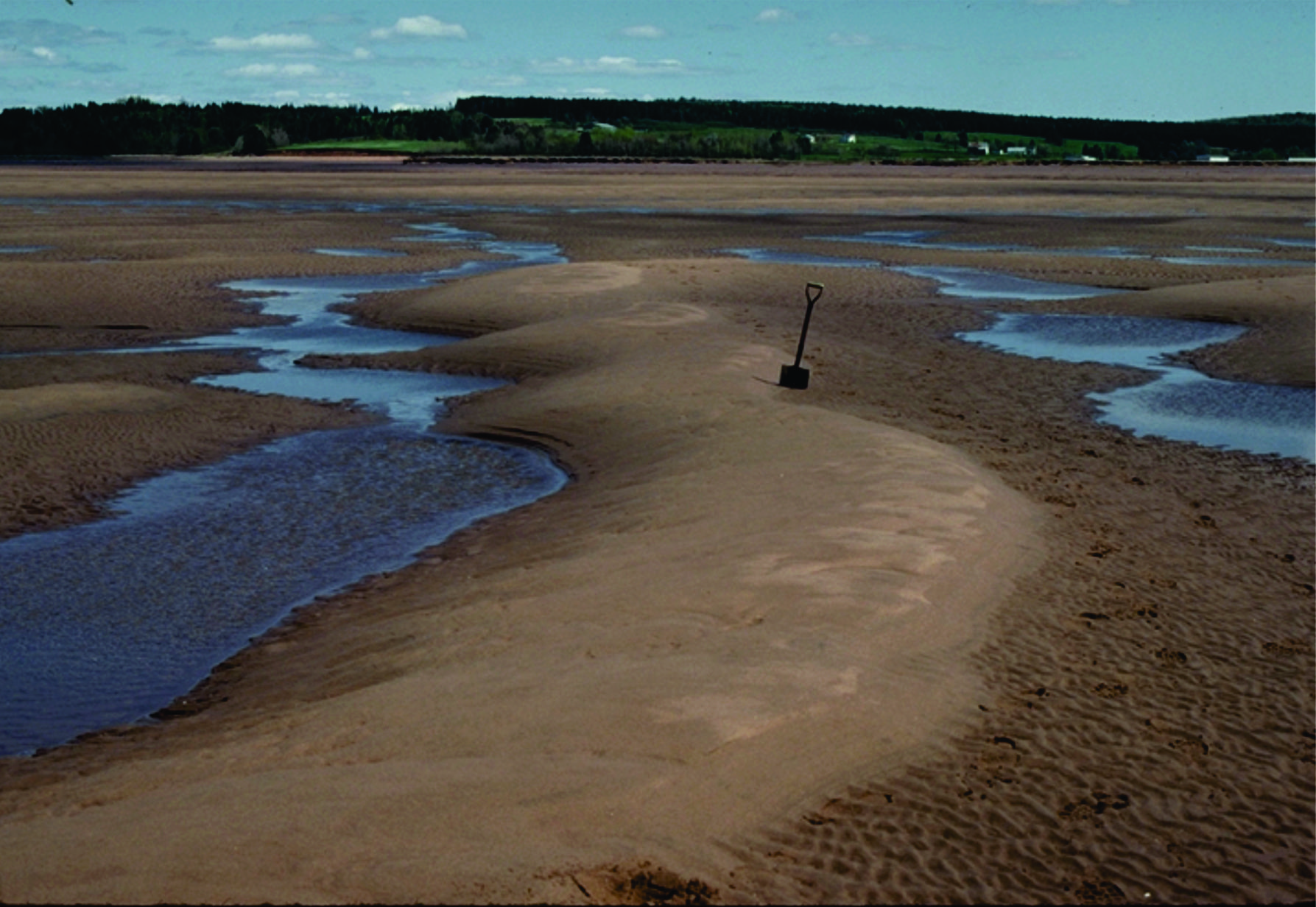
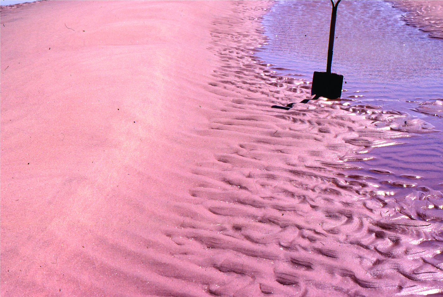
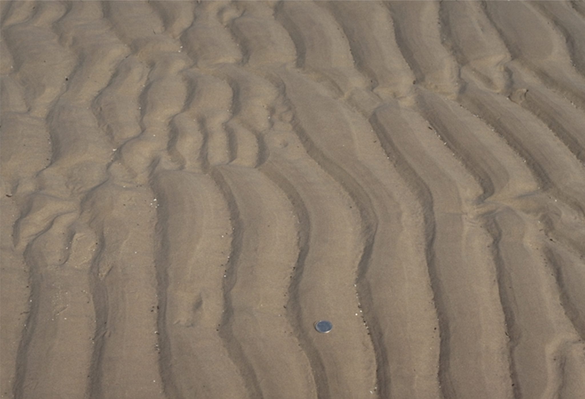 Sandy tidal flat ripples, Minas Basin, Fundy Bay
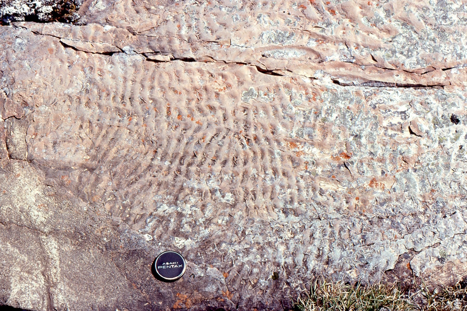
 Paleocene, straight crested and bifurcating intertidal ripples, Expedition Fm, Axel Heiberg Is;and, Canadian Arctic
 Straight-crested ripple train in Paleocene intertidal deposits, Expedition Fm, Axel Heiberg Island, Canadian Arctic. Hammer left-mid image.
 Flood tide ripples over-ridden by smaller ebb tide ripples sets. Minas Basin, Fundy Bay
 Interference ripples in Proterozoic tidal flat facies, Belcher Islands
 Large 2D and 3D dunes, and superposed run-off ripple sets, Minas Basin Fundy Bay
 Tidal flat, interference ripples, Minas Basin Fundy Bay
 Ebb tide run-off & reactivation of 3D dunes, Minas Basin Fundy Bay
 Large 3D dunes, Minas Basin Fundy Bay
 2D flood tide dunes and small ebb tide ripples, Minas Basin Fundy Bay
 2D and 3D intertidal dunes, Minas Basin Fundy Bay
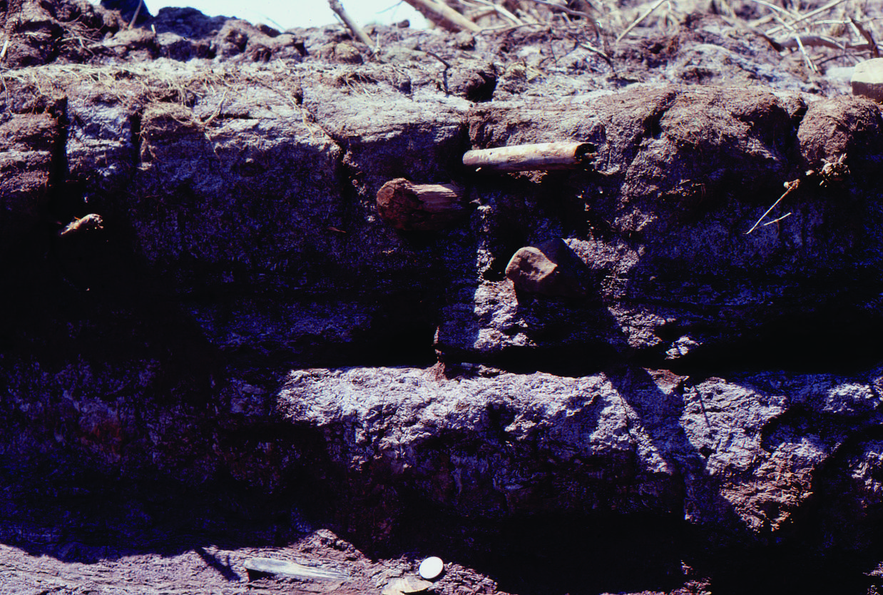
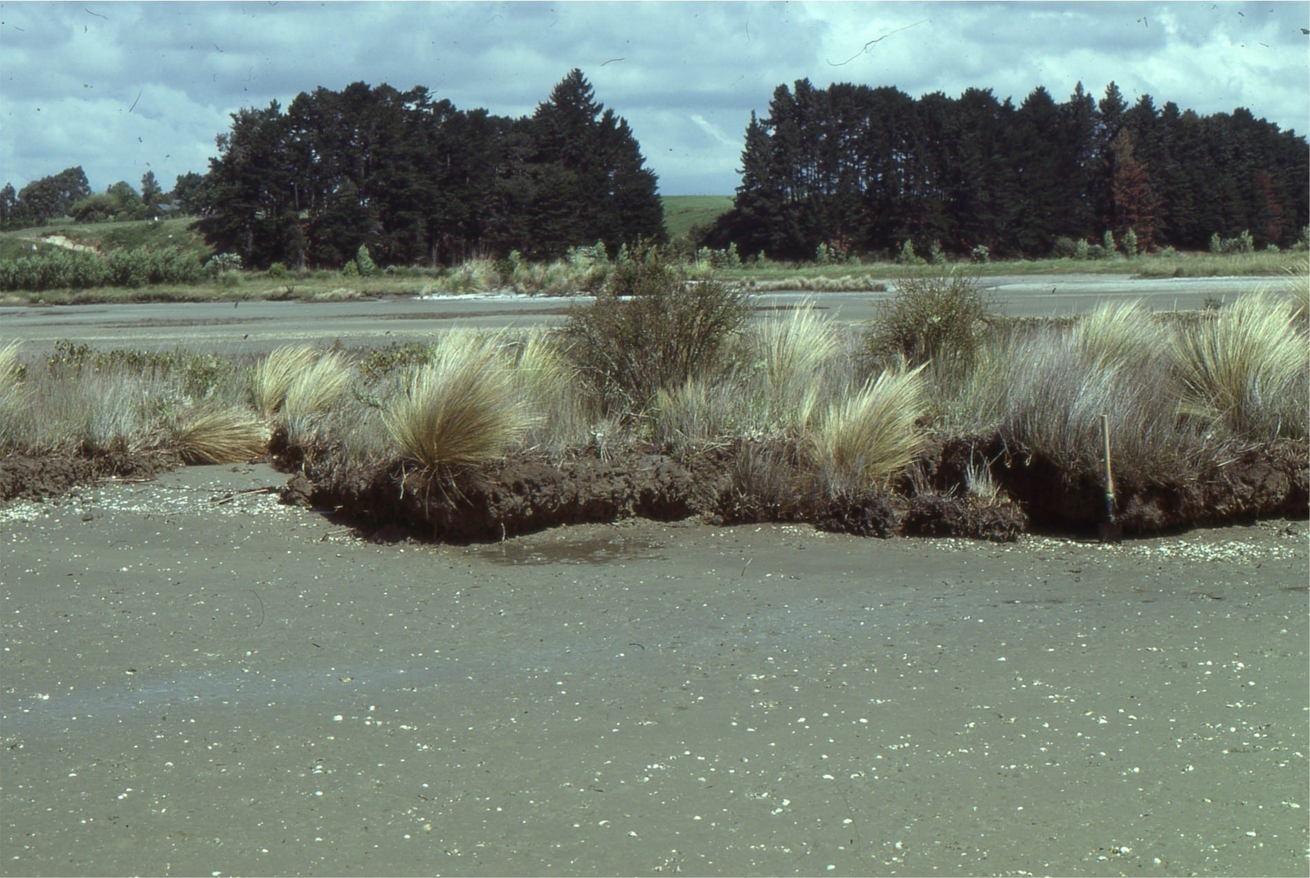
Eroded salt marsh cycles, Minas Basin Fundy Bay
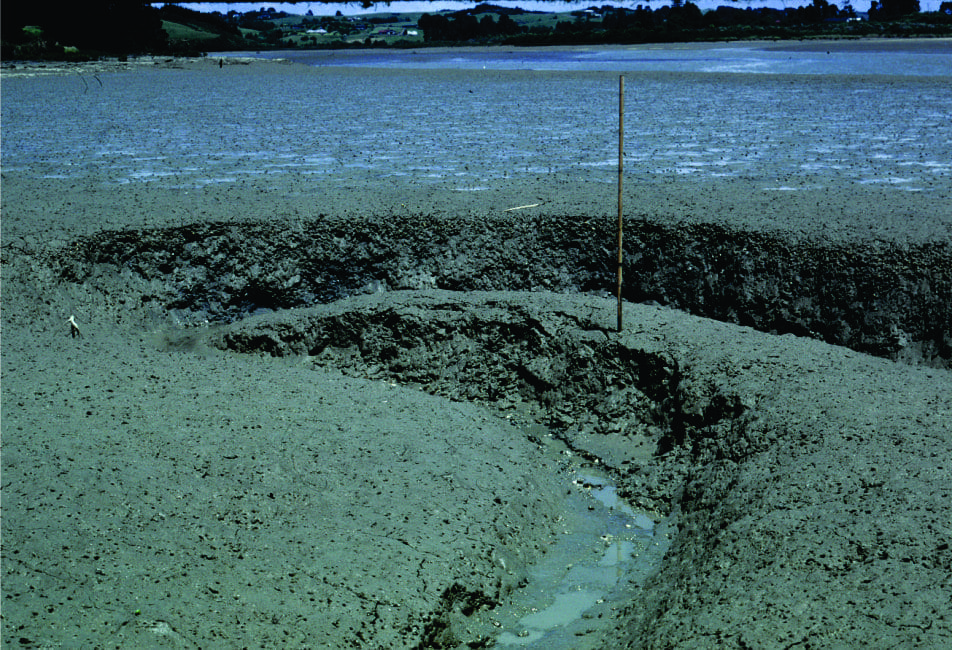 Small meandering tidal channel in very muddy estuarine tidal flats, Whitford Estuary, south Auckland. Bank failure is common.
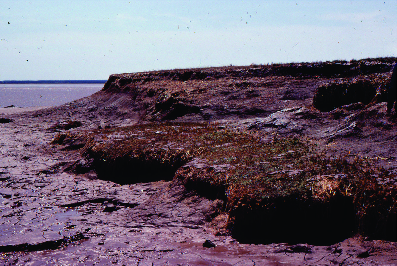
 Salt marsh, sedges and small mangroves being transgressed and eroded by tidal flat. This is a modern example of a ravinement surface. Whitford, south Auckland
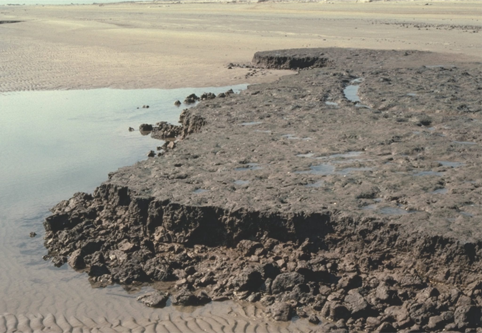 Eroded salt marsh deposits, transgressed by sandy tidal flat – beach. The erosion surface is a modern, active ravinement surface. Galveston, Texas.
Two examples of Paleocene tidal bedding (mostly lenticular and wavy bedding) interfingering with lagoon and marsh. Eureka Sound Group, Ellesmere Island
Paleocene tidal bedding interfingering with marsh-lagoon-bay sediment. On the right, the thicker sandstones may represent storm washovers into the bay. Eureka Sound Group, Ellesmere Island
 Coarsening- and sandier-upward bay or lagoon subtidal to beach, cut by small tidal channels (lenticular sandstones). Eocene, Eureka Sound Group, Ellesmere Island.
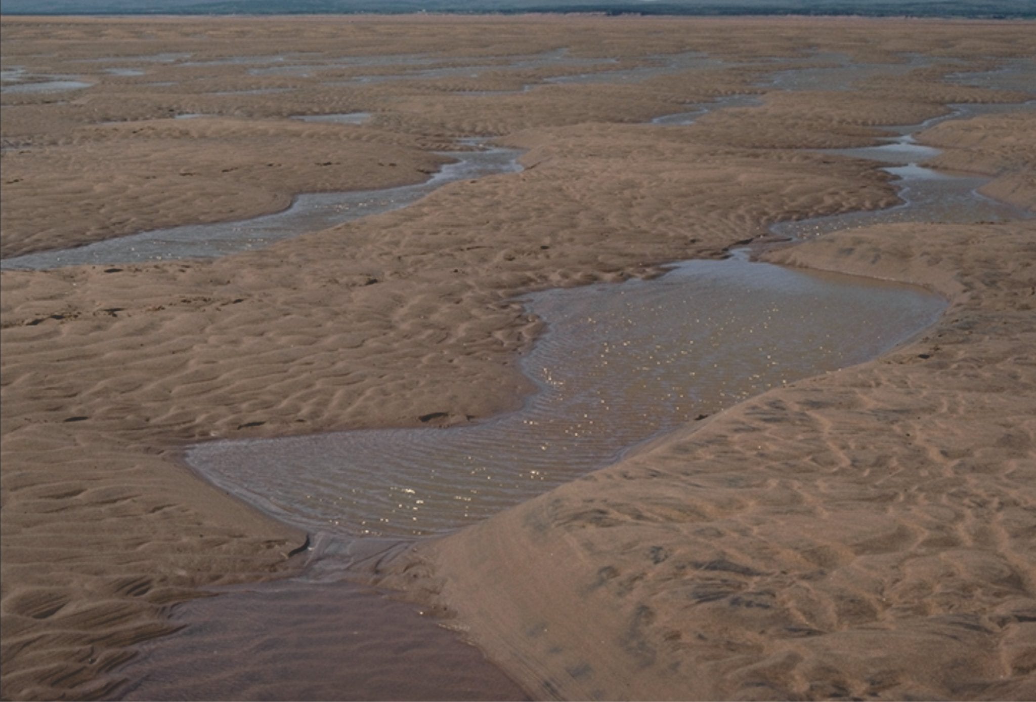
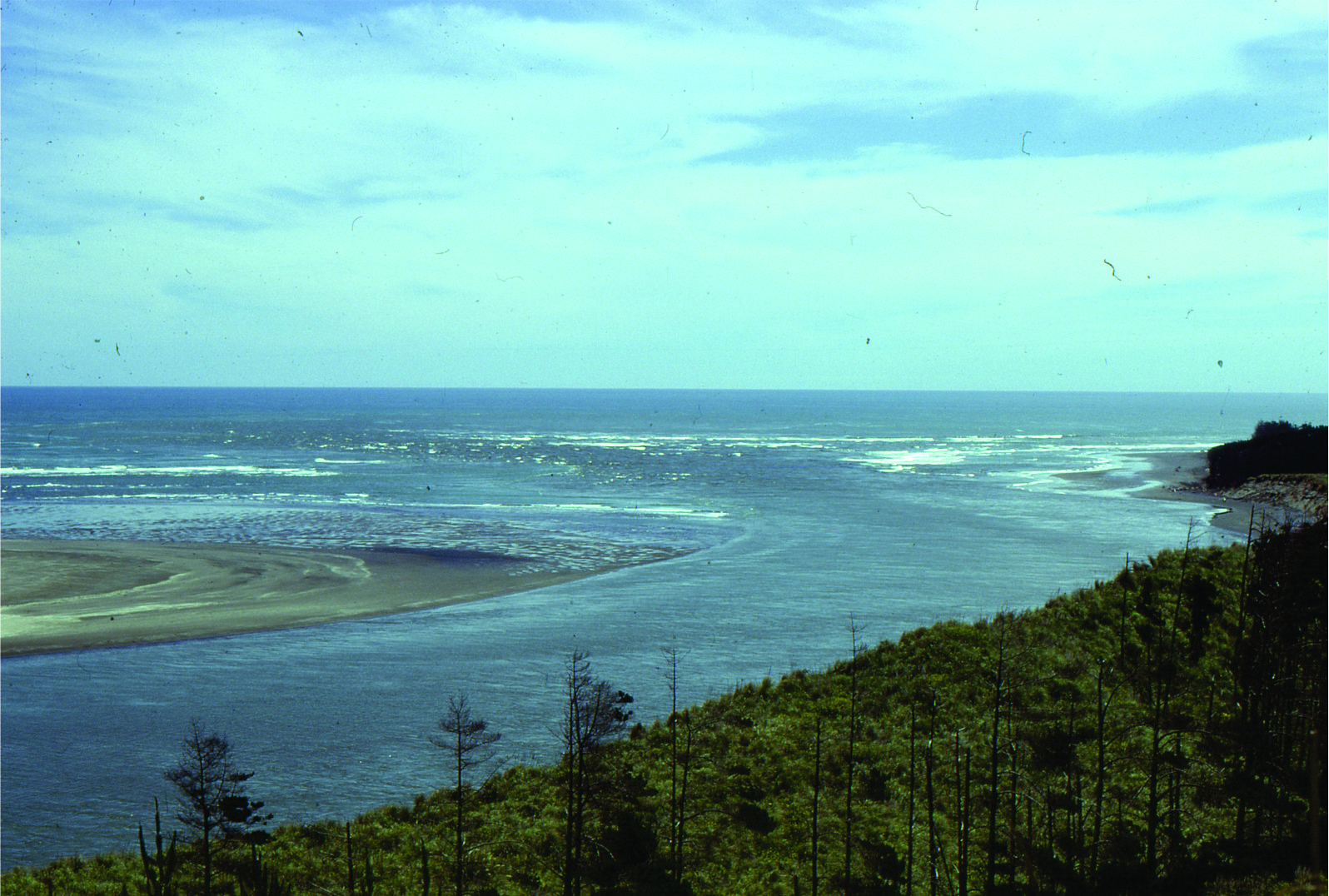 Ebb tidal delta at the mouth of Waikato River, south Auckland.
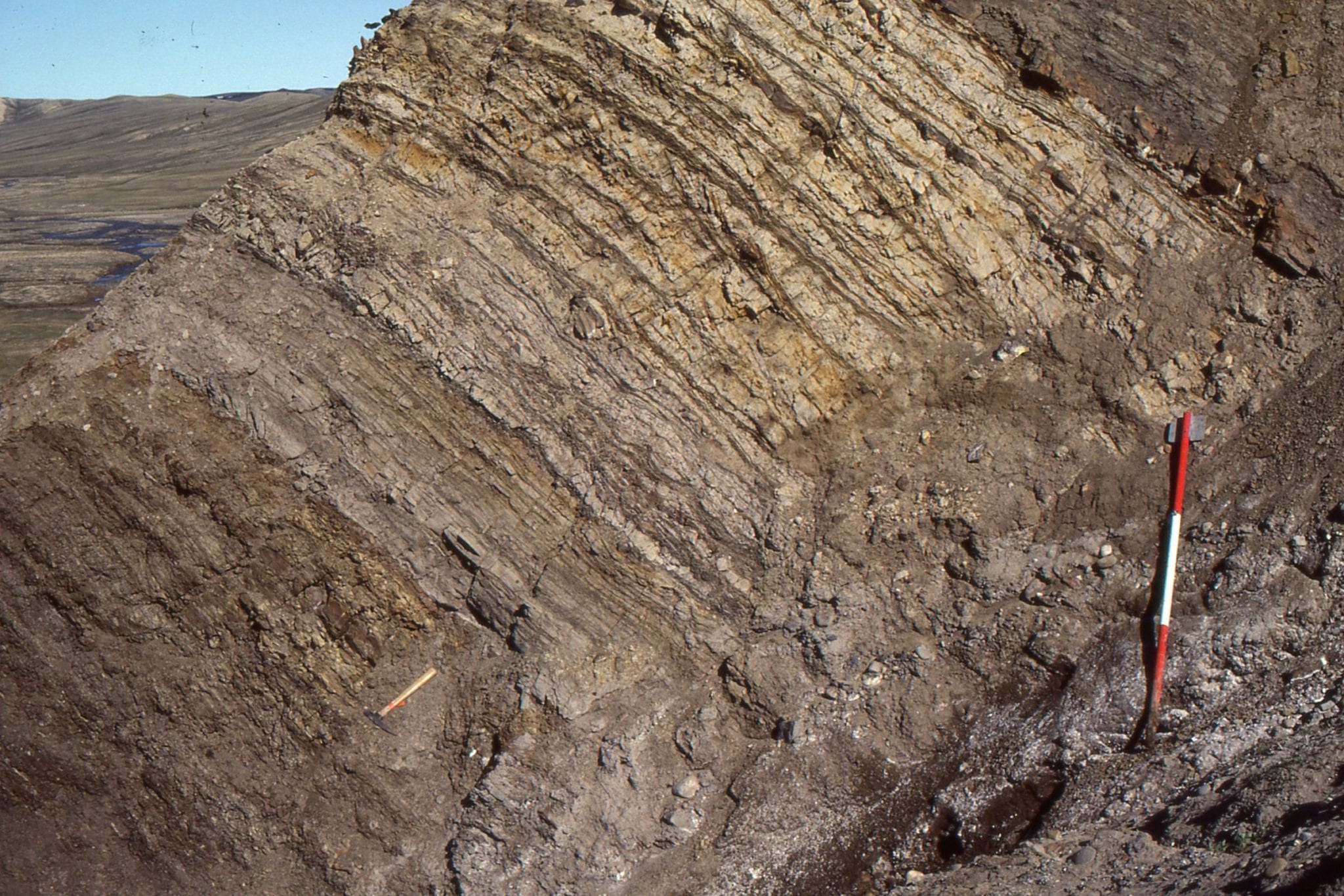
 Paleocene subaqueous dunes up to 2m amplitude, in tidal inlet-delta, overlain by thin tidal flat-salt marsh deposits. Expedition Fm, Axel Heiberg Island, Canadian Arctic
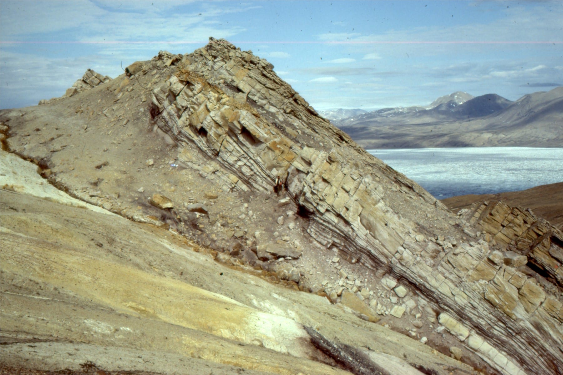
 Large within-channel dunes in a tidal inlet associated with a sand spit facies; the spits and bars were attached to (paleotopographic) headlands across an unconformity eroded into Ordovician carbonates. Paleocene, Eureka Sound Group, Ellesmere Island.
Two views of the unconformity between Ordovician carbonates and Paleocene estuarine-tidal channel-spit facies. Eureka Sound Group, Ellesmere Island.
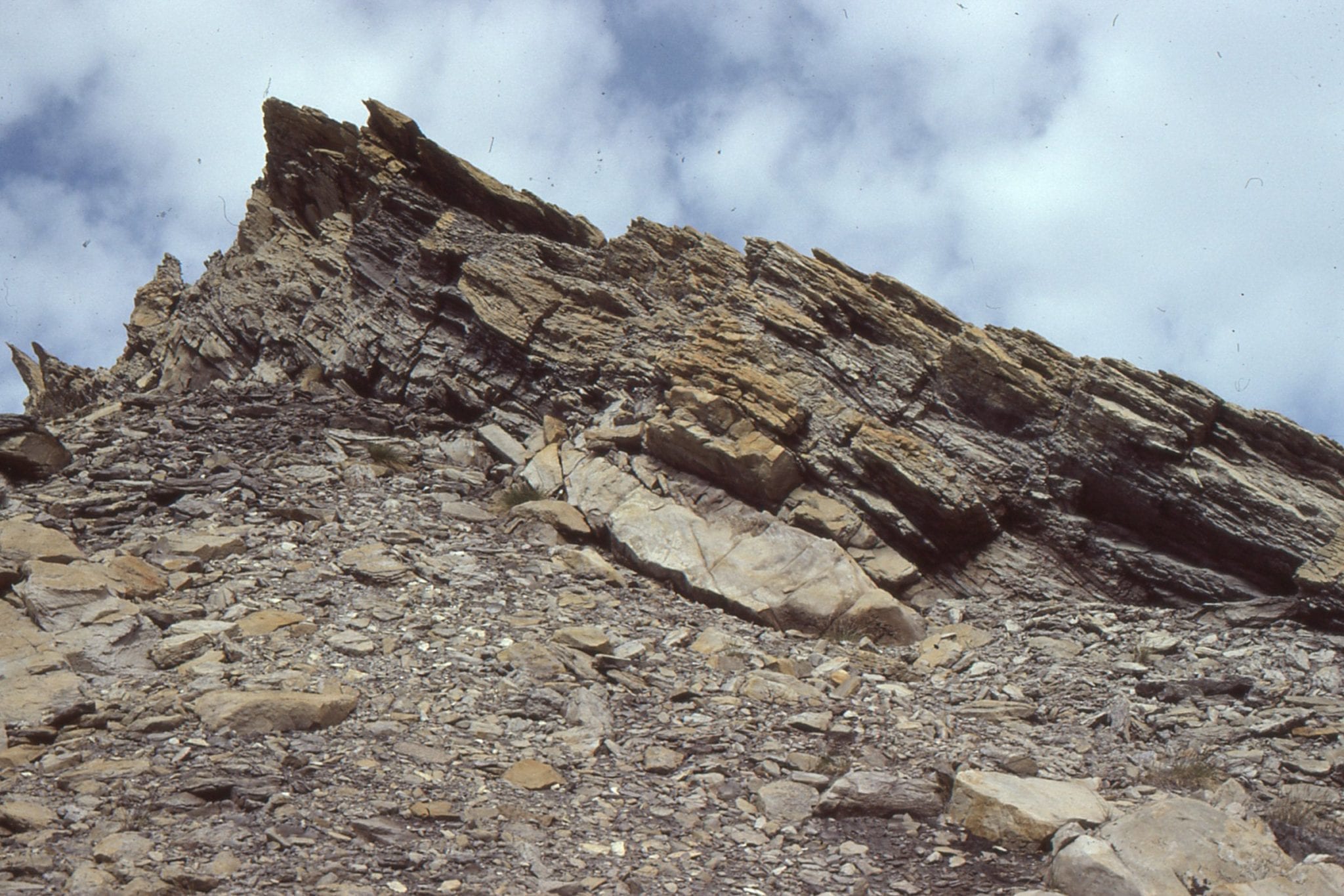
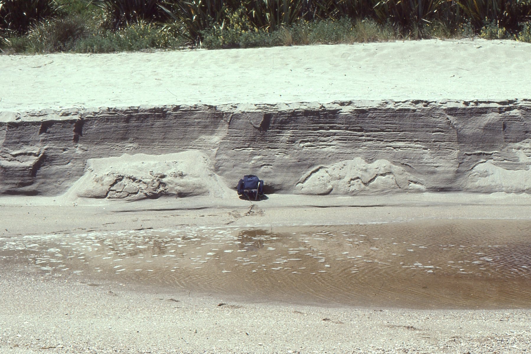 Typical beach stratification in an eroded berm; primarily laminated sets with low-angle truncations, parallel, or slightly inclined to the beach face.
Tidal inlet standing waves (antidunes) in an outgoing tide, Mangawhai Heads, north Auckland. The antidunes migrate up-current (against the current) and gradually build until they break, subsequently reforming.
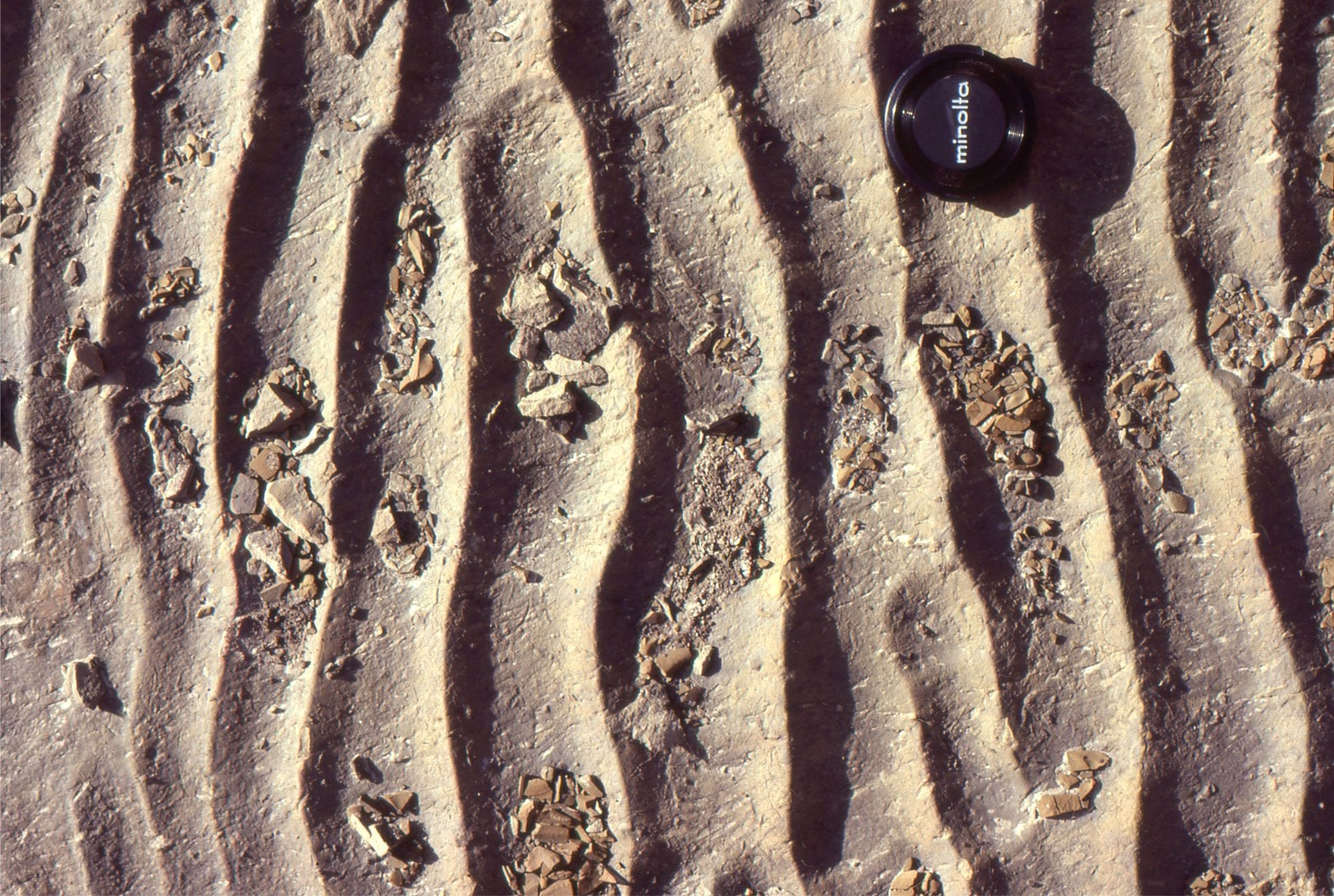
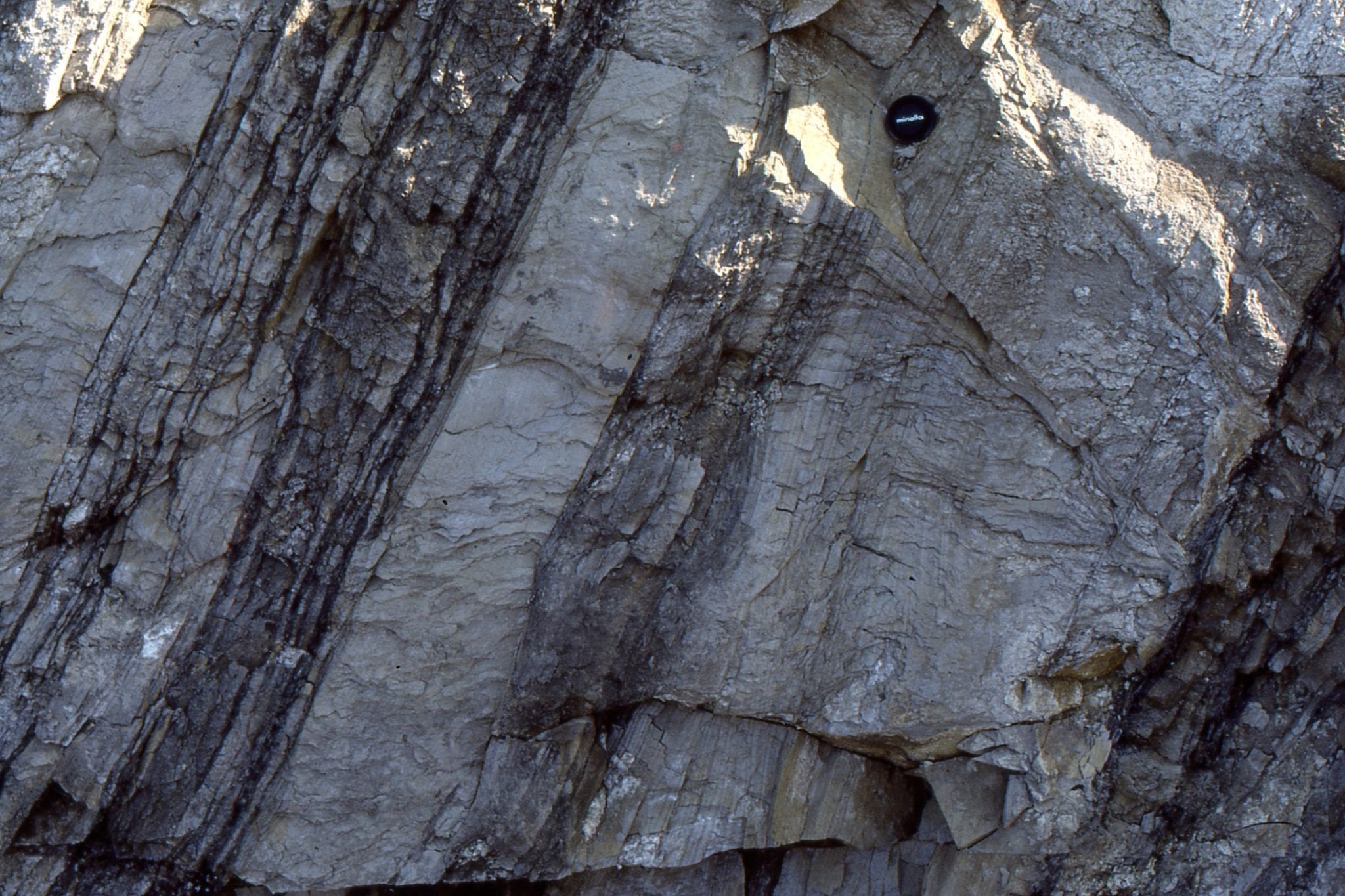
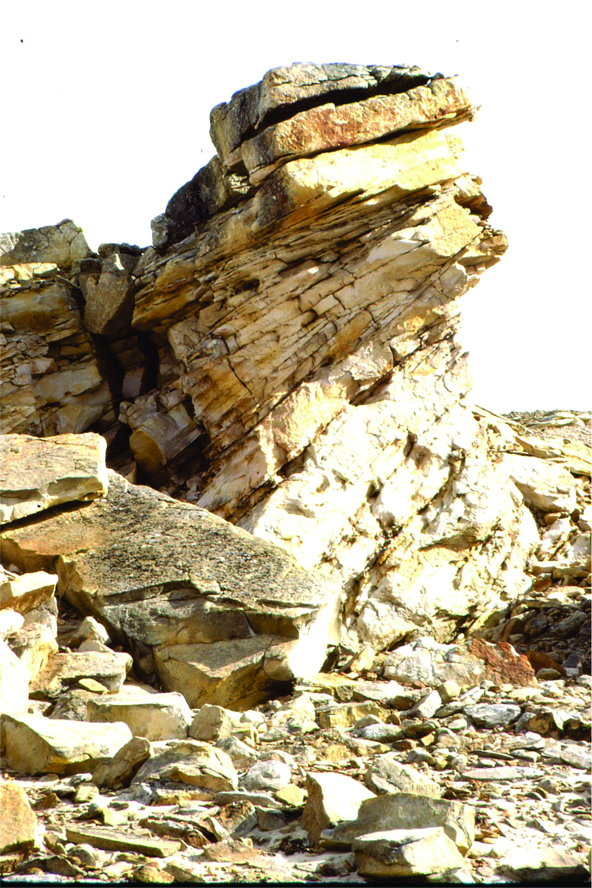
 Proterozoic tidal channel – inlet trough crossbeds; this outcrop gives a 3-dimensional view of individual sets. Paleoflow was into the image. Rowatt Fm. Belcher Islands.
 Flaser, lenticular and wavy bedding in late Pleistocene deposits near Ihumatao, Auckland. White muddy sediment overlies and envelopes grey sandy ripples, and fills troughs between ripples.
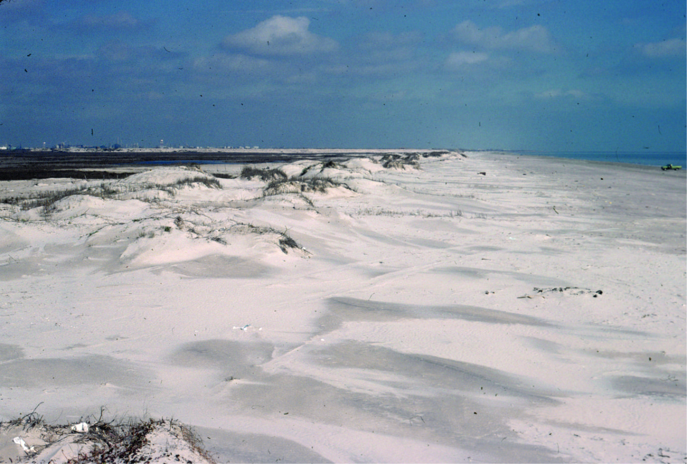 Coastal dunes, Galveston coast, Texas
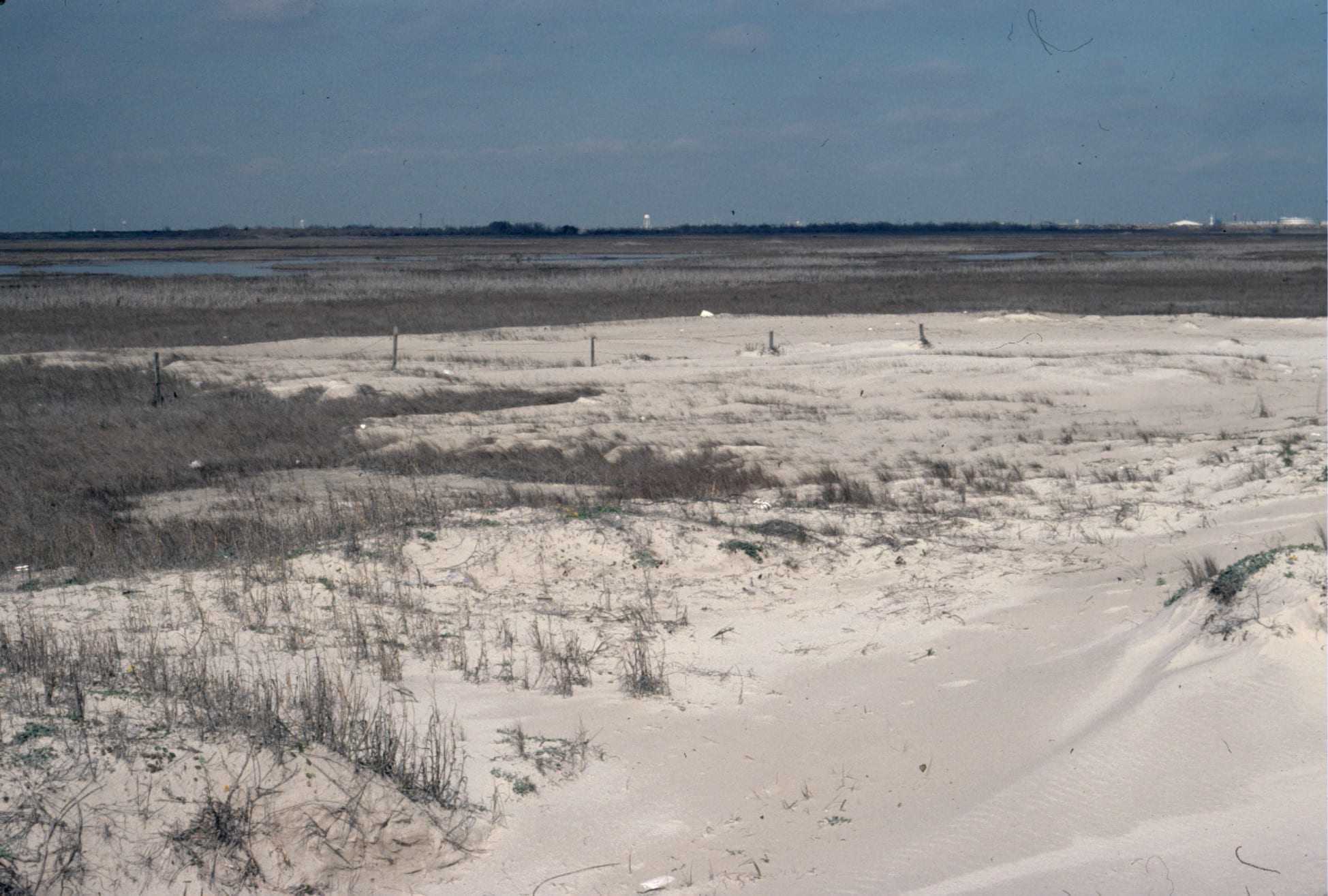 Washover fan breaching coastal dunes, Galveston coast, Texas
 Paleocene washover fan sandstone associated with barrier island and tidal inlets (see images above from the same formation), Expedition Fm, Axel Heiberg Island, Canadian Arctic.
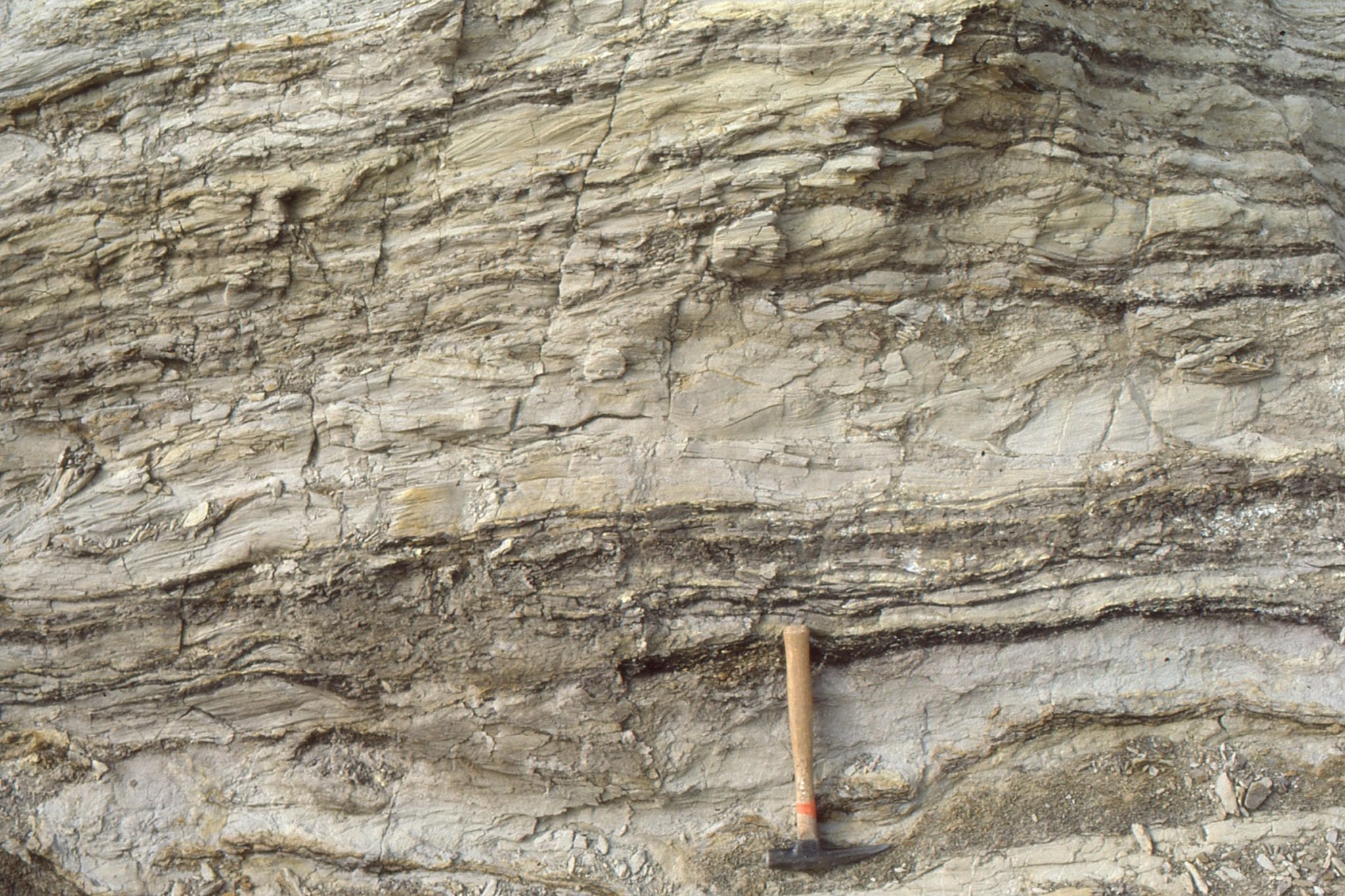
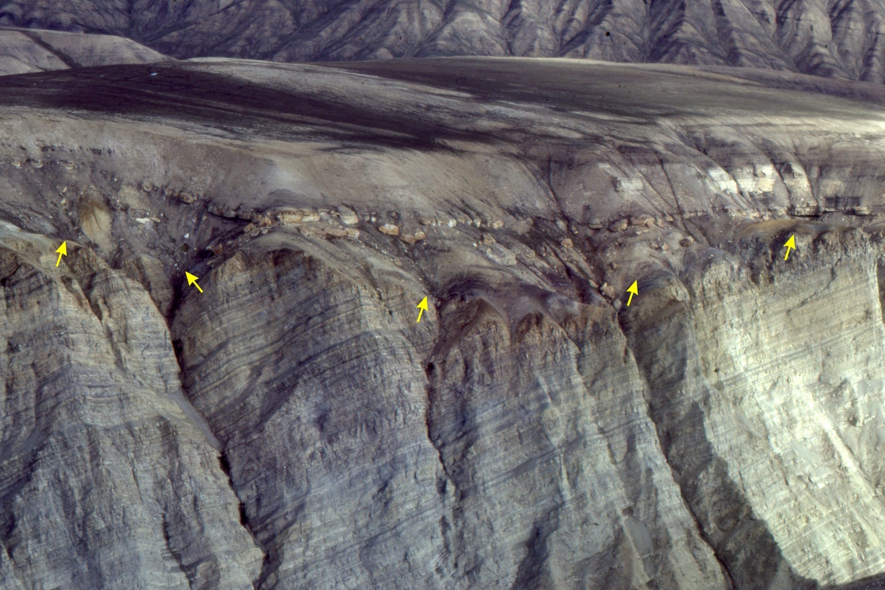
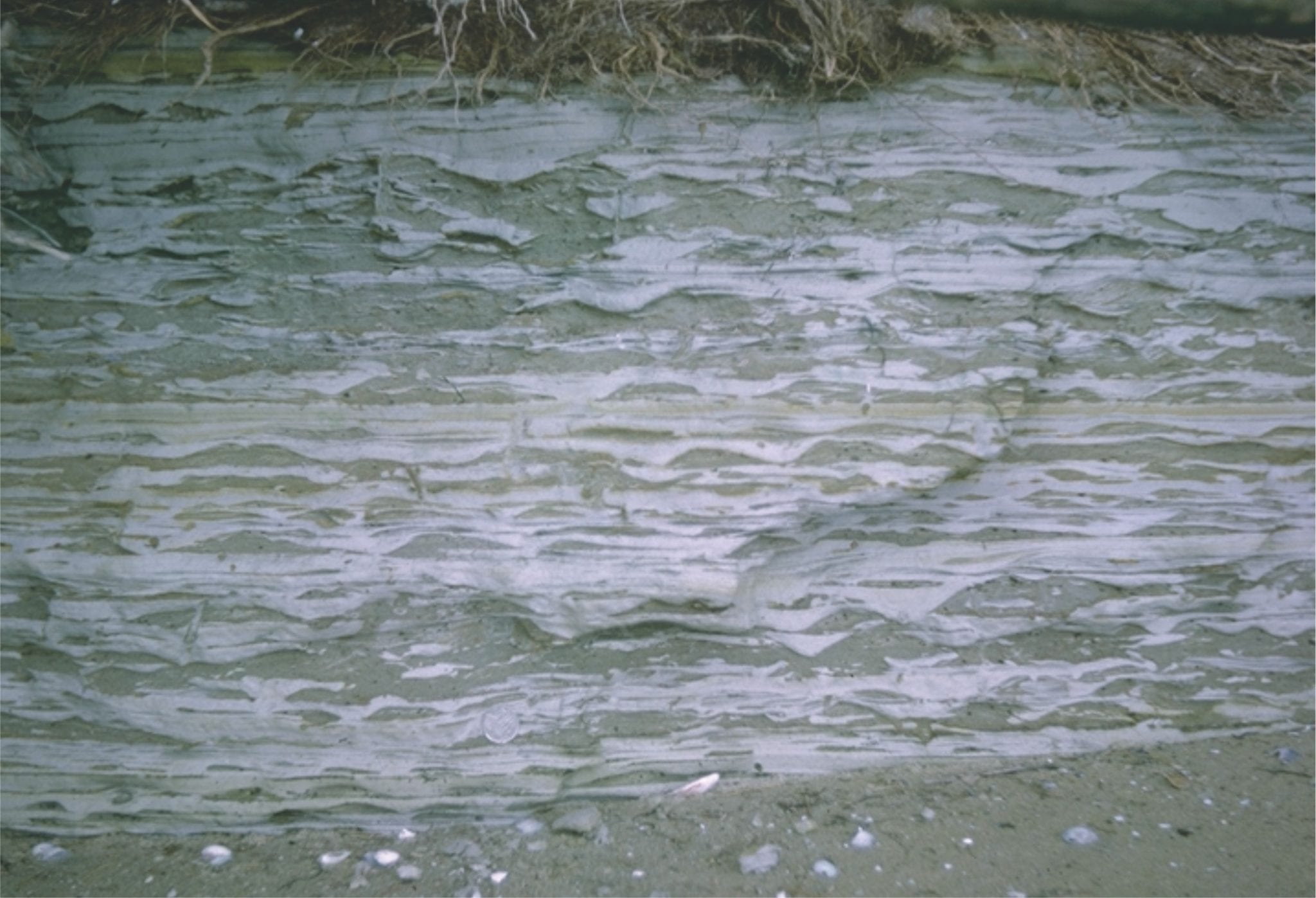
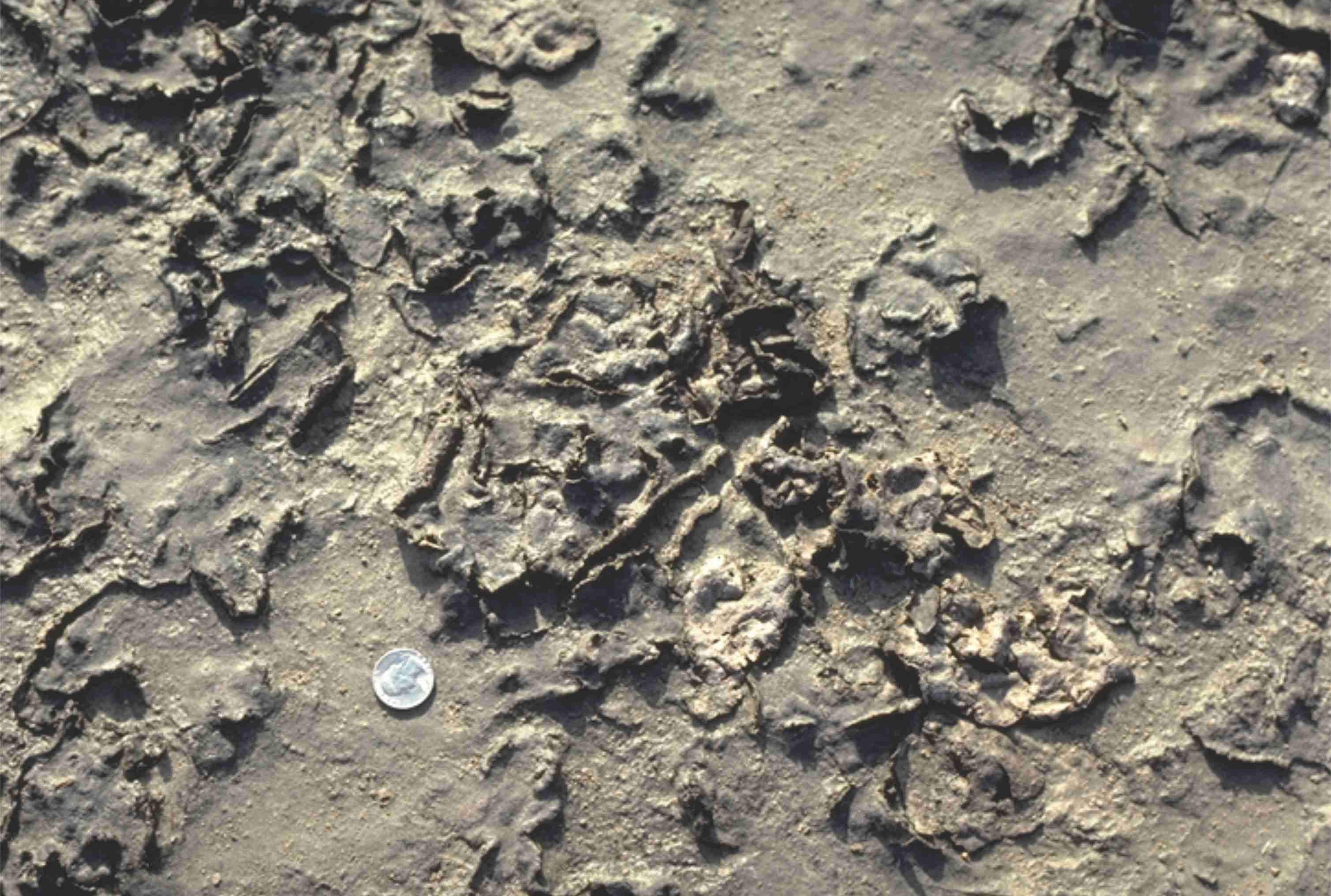
 Stacked storm deposits associated with an upper tidal flat, each layer consisting of ripped up muds. Rowatt Fm, Belcher Islands. Proterozoic.
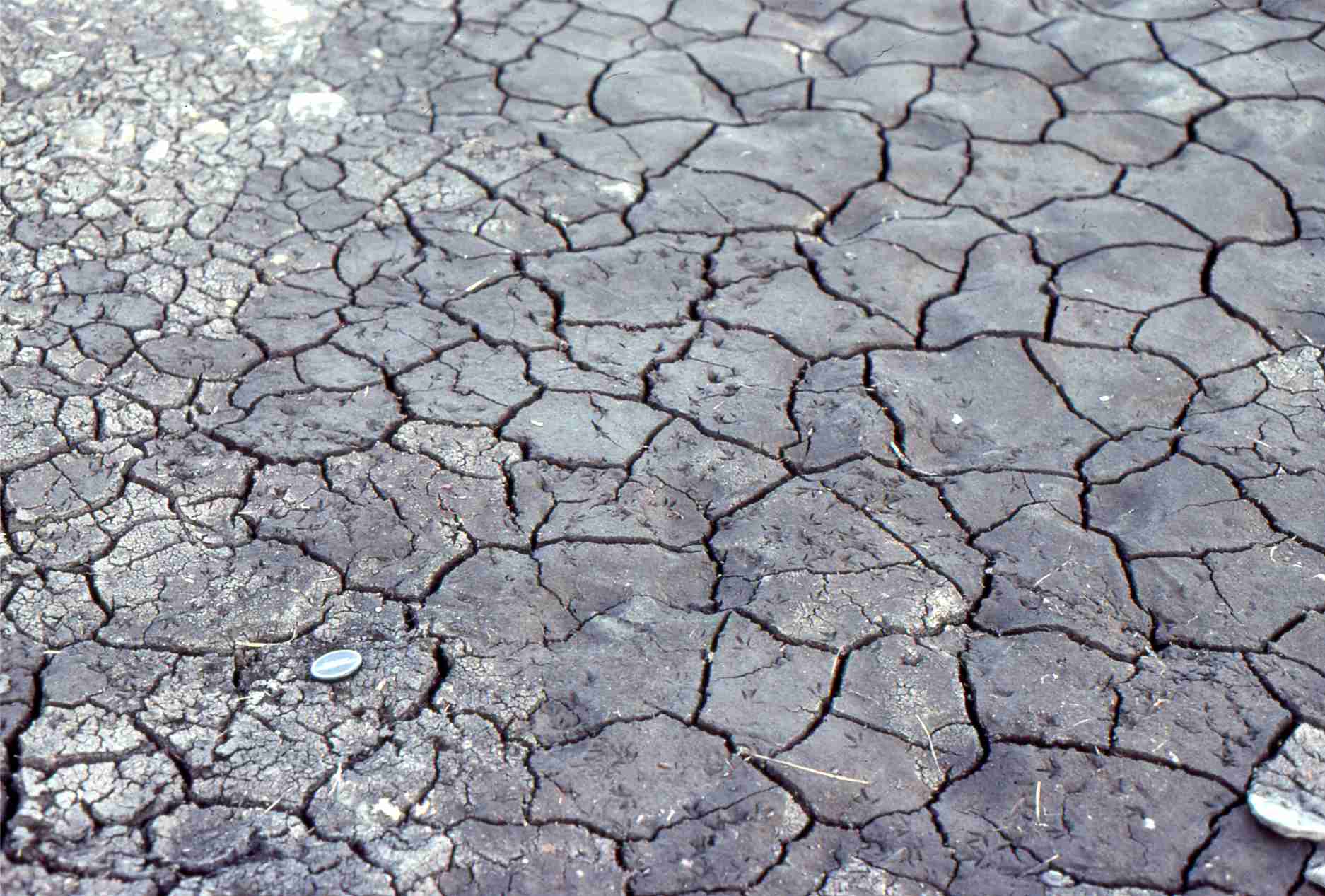 Mudcracks in salt marsh, Kaiua, NZ
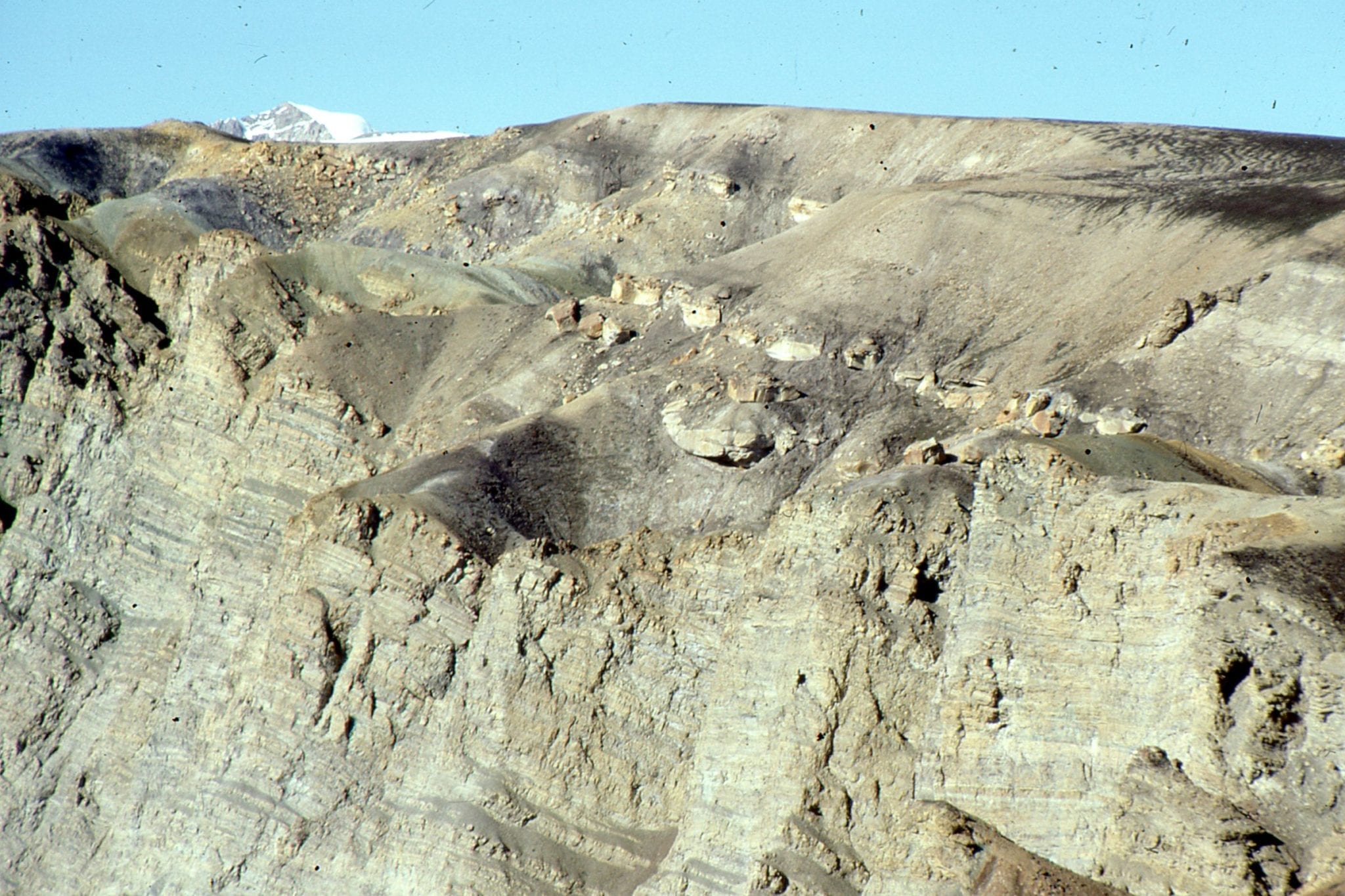
 Proterozoic supratidal desiccation cracks and voids in multiple layers of delicately laminated dololutite. Some curled slabs may be coated with crpytalgal laminae. A layer of storm-derived lutite rip-ups at the bottom of the image. Rowatt Fm. Belcher Islands. See below for a modern analogue.
 Desiccated, curled, algal mats from a salt marsh near Galveston Texas. The mats are easily disturbed during high or storm tides.
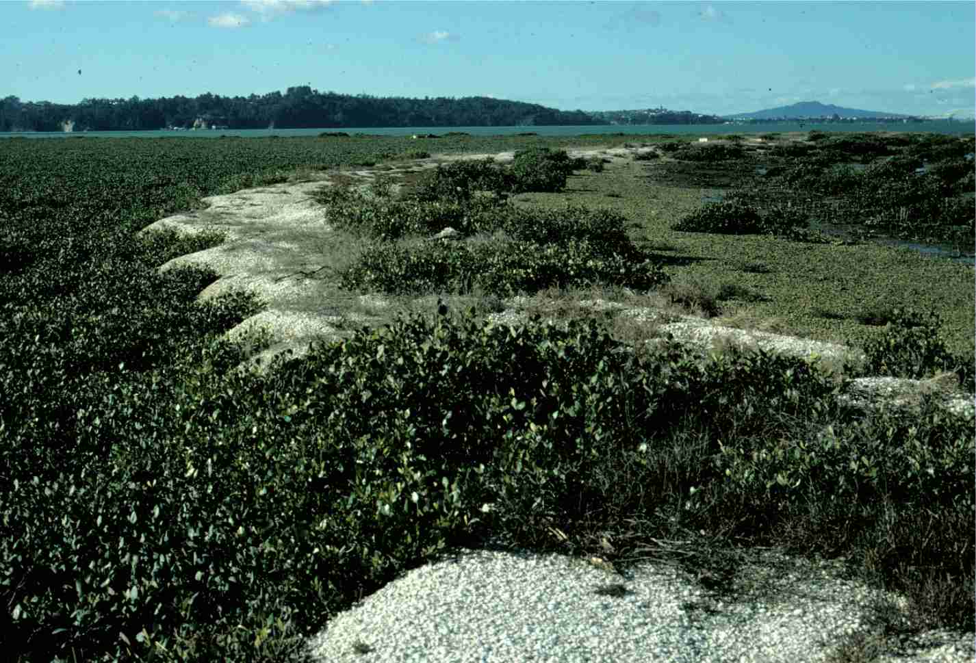
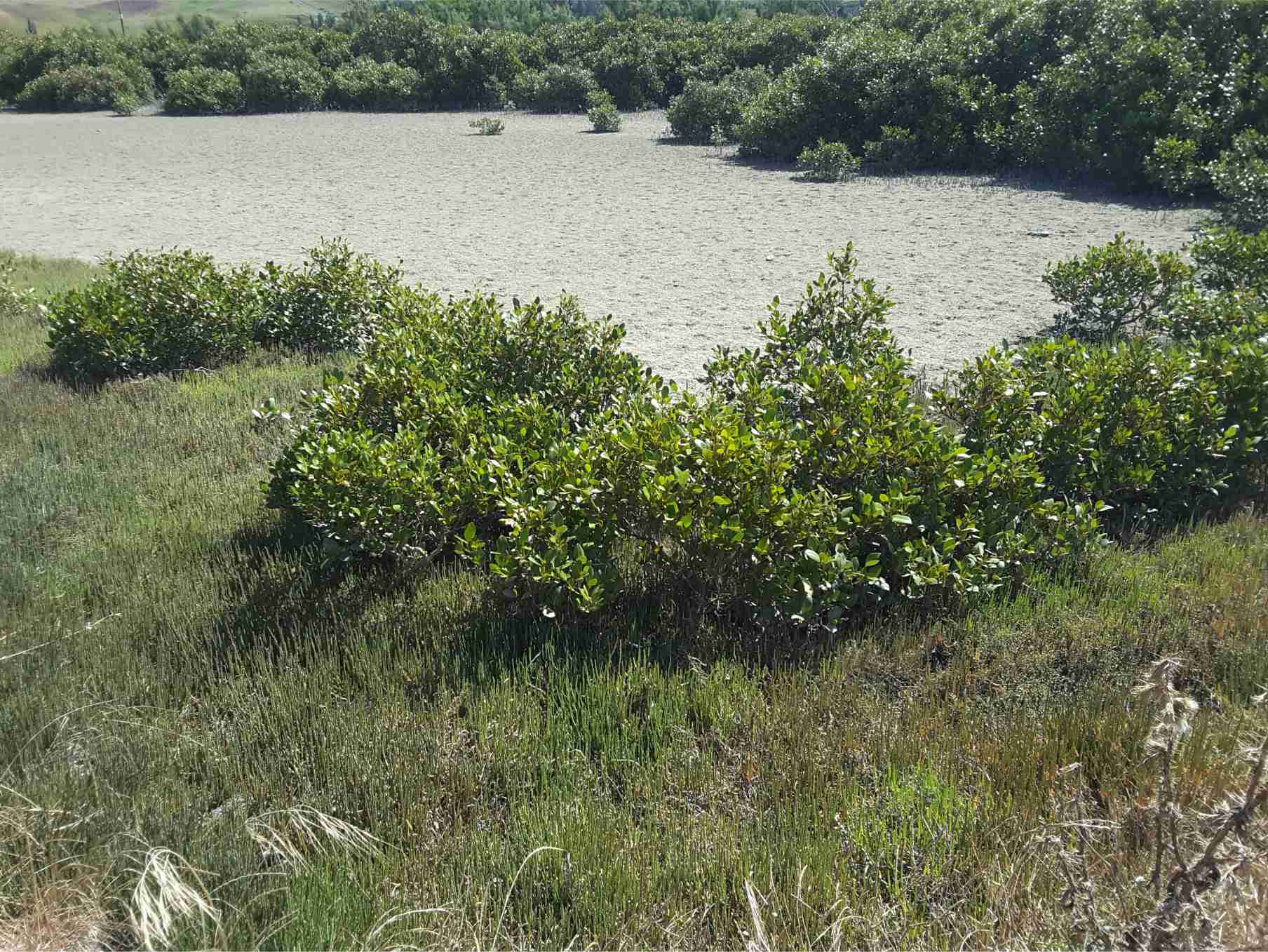
Mangroves: Left image: stabilizing shell banks (storm ridges) adjacent a tidal Inlet, Auckland Harbour; Right image: in a salt marsh, Kaiua, bordering Hauraki Gulf.
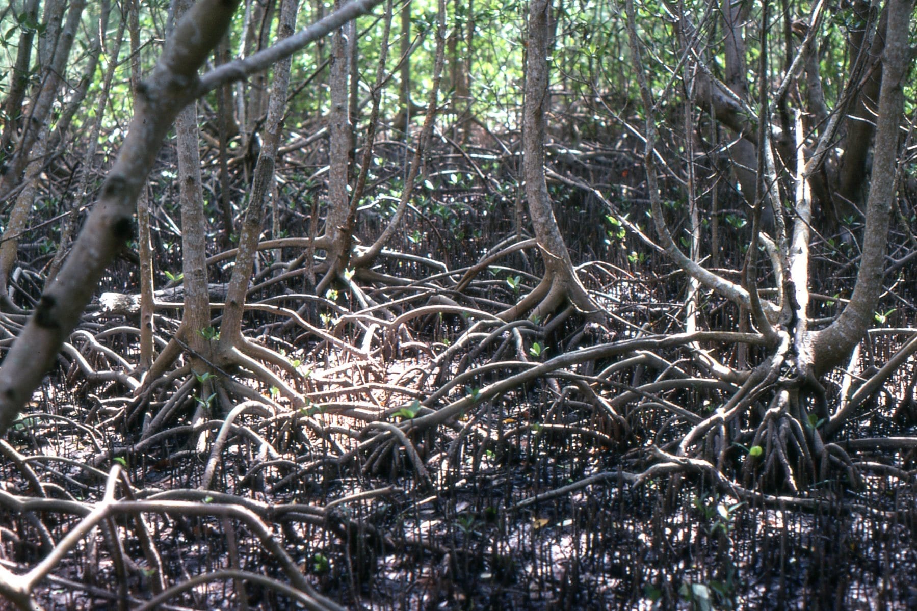
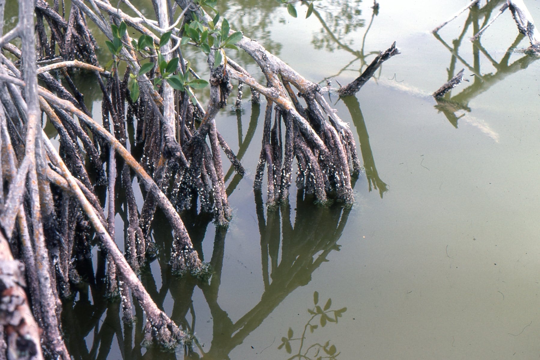
Everglades Mangroves, Florida. A tangle of roots and pneumatophores that are living quarters for so many species. On the right, an epifauna of barnacles, small snails and bryozoa.
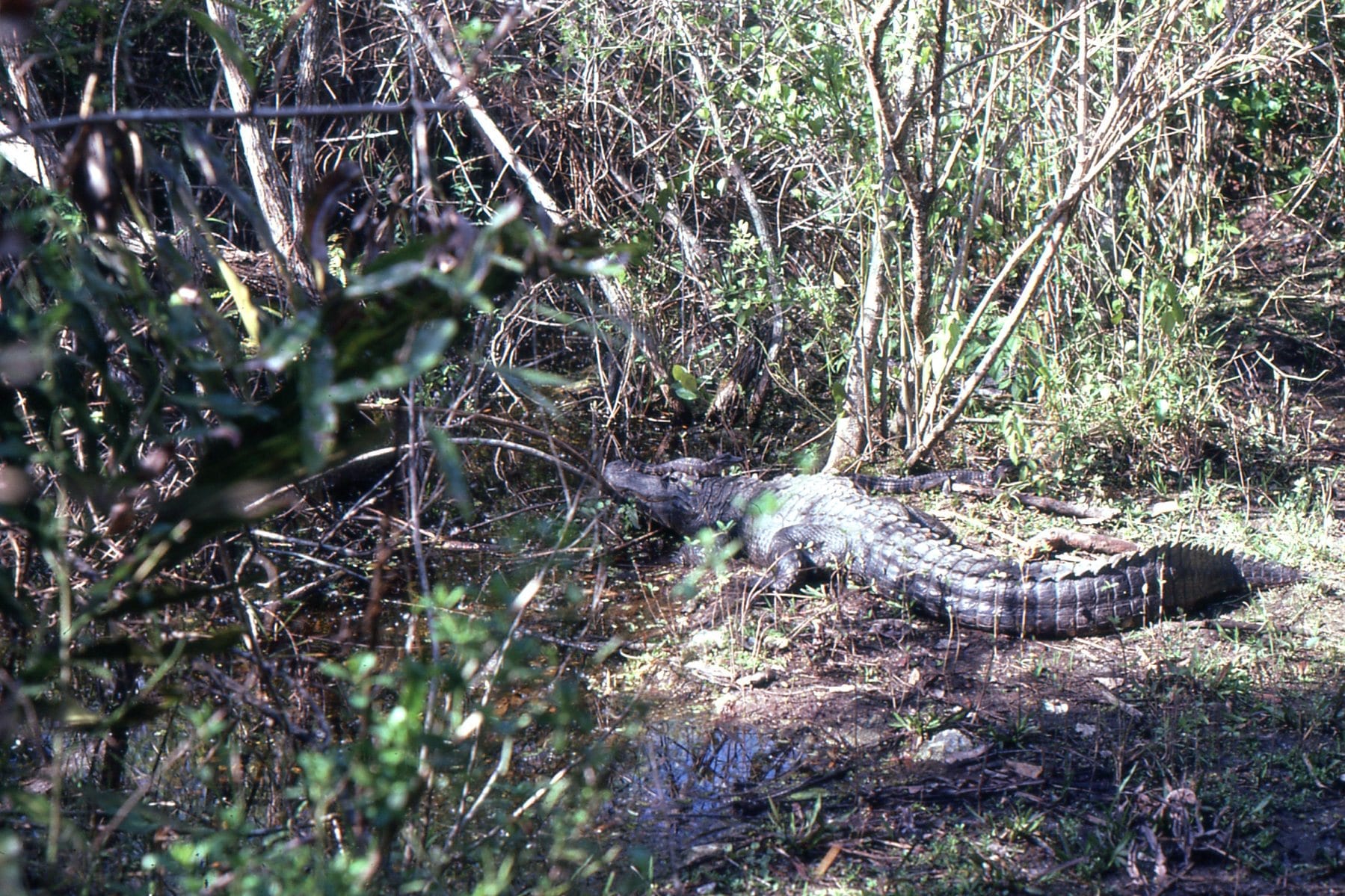 Everglades alligators, including the little guy on its parent’s head.
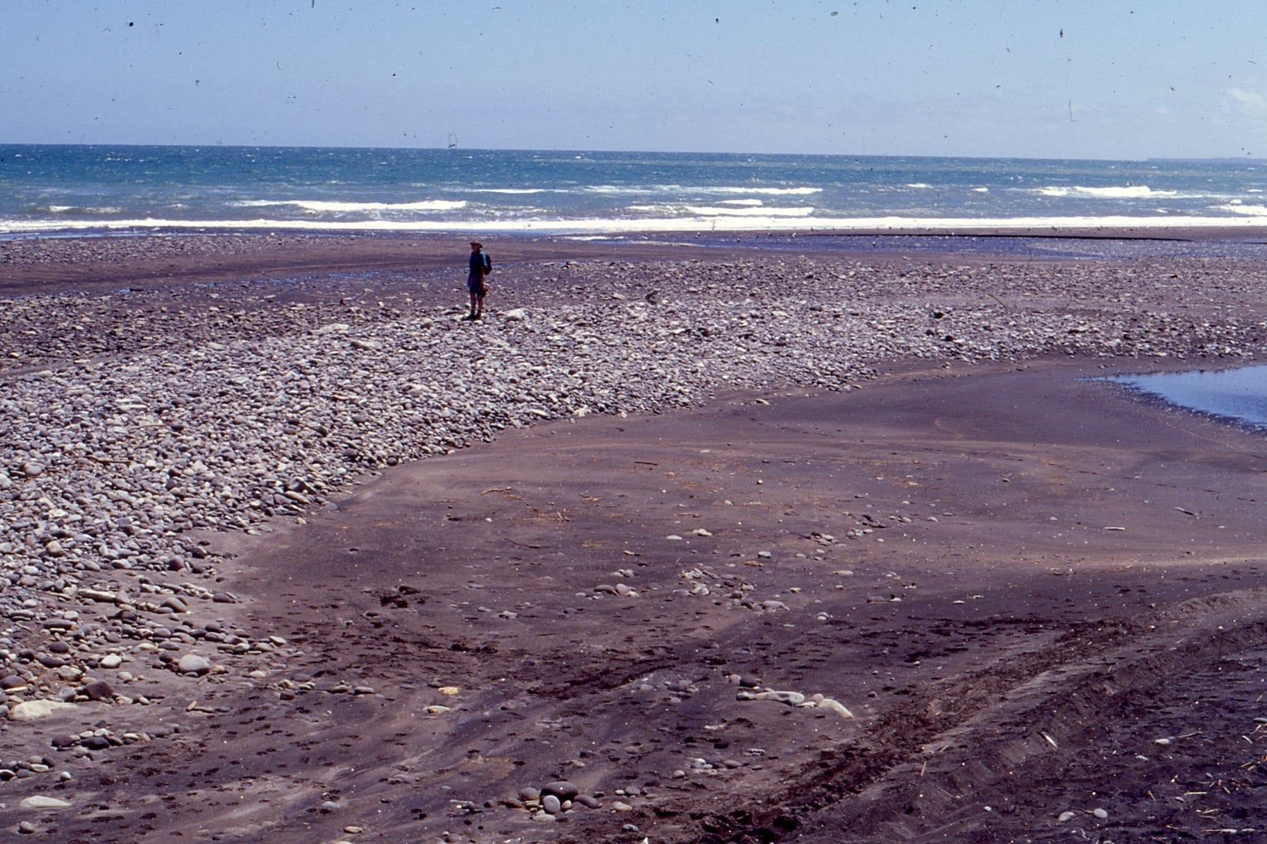 Gravel bar formed at the intersection between a high energy, West coast New Zealand beach, and the Tangahoe River mouth
Ripples on a sand flat, with concentration of heavy minerals from local rhyolites and dacites. Little Bay, Coromandel.