How do we know which way is up? #1. Getting started

How Geologists Interpret Ancient Environments. 1 Getting started

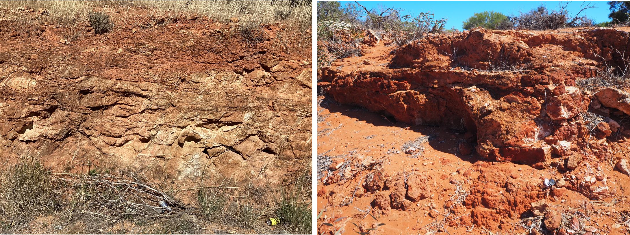
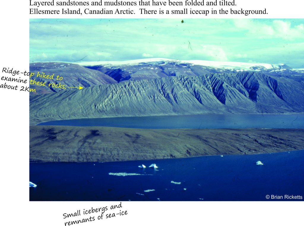
You are confronted with rock formations that might look something like this…

Folded sandstone exposed on a ridge - great place to examine the rocks

The local geologist tells you that the rocks you see here originally were deposited as sands and muds in shallow seas, where beaches and broad coastal tidal flats passed seawards to deeper waters, and landwards to marshes and scrubby coastal plains across which rivers and streams coursed. How did our geologist figure this out? What is it that geologists see in the rocks that help them paint this picture of an idyllic world that existed so many millions of years ago – a world beyond memory, where, in a different eon, a summer cottage would have been rather nice.
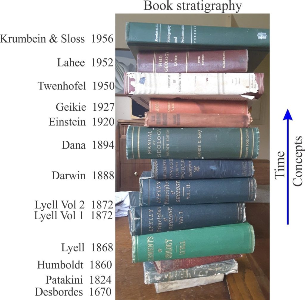
Book stratigraphy
Evolution of ideas through books

Rocks to a geologist are like books and ancient manuscripts are to an historian. Rocks contain a record of past events and places. The rock record is incomplete. So part of the puzzle is to also try and figure out what is missing. Is it time? Is it other rocks that have since disappeared or perhaps been moved to another location? These are the scientific puzzles that excite geologists.

What kinds of information can geologists tease from the rocks?

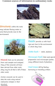
What tools do geologists use?  The diagram below shows some of the more common types of data obtained from sedimentary rocks.

We will look at some of these attributes in future posts.


The kinds of information we use to interpret ancient sedimentary rocks

Which layers came first?

Sedimentary rocks usually occur in layers. One of the first tasks is to figure out the general order in which these layers formed – this is the science of Stratigraphy. The images above show many layers of sandstone, mudstone and conglomerate that are stacked one on the other. Which layer is the oldest?

Steno's ideas about the ordering of rock layers - superposition

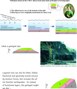
In the 17th Century, a chap named Nicholaus Steno, a Danish scientist, devised some geological principles that still guide our thinking today. The first of these (The Law of Superposition) basically states that when one layer of sediment is deposited on top of another, the one at the bottom is the oldest. This may seem obvious, but in fact it is really fundamental because it gives us a starting point for our investigations; it gives us a point in time, not necessarily in exact years (like 65 million years), but time in a relative sense. We can say that any particular layer is older or younger than other layers, which also means that we can say certain events (that we see in each layer) took place before or after other events.
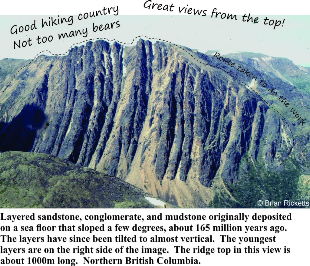
Tilted sedimentary layers - dotted line shows where we workedNick Steno’s clear thinking and enthusiasm for unraveling the natural world means we can identify a time-line of events; this was a monumental step in scientific thinking, from both a conceptual and practical point of view .

The image opposite is a great illustration of the importance of Steno’s ideas.  In a general way the sequence of events that led to this fascinating scene was:

1  Sediment was deposited in layers

Those deposits were buried beneath many 100s of metres of other sediment and volcanic rock, where they hardened.

3  Tectonic forces acting several kilometres below the earth’s surface folded, tilted and fractured the hardened deposits.

4  The contorted strata were pushed towards the surface; erosion, glaciation and other weathering processes produced the steep mountainous terrain we see today.

5  Local geologist feels lucky to have had the opportunity to unravel part of this history.  But it was people like Steno and others that followed who set the stage for modern earth sciences (and science in general).

The next post in the series deals with some of the structures we see in the rocks.
Leave a Comment

Your email address will not be published. Required fields are marked *

Archives
Categories
Most Popular
Conjugate fractures and en echelon tension gashes – indicators of brittle failure in Old Red Sandstone, Gougane Barra, County Cork, Ireland.
Mohr-Coulomb failure criteria
A montage of stress transformation paraphernalia and rock deformation
Mohr circles and stress transformation
The Marlborough strike-slip fault array extends north from the dextral Alpine Fault transform; faults continue across Cook Strait to join the North Island Dextral Fault Belt in the Wellington region (central Aotearoa New Zealand). In Marlborough and beneath Cook Strait there are several pull-apart basins formed at releasing bend stepovers. Sandbox analogue models can help us decipher the mechanical and kinematic processes that produce structures like these. Base image from NASA – International Space Station 2003.
Strike-slip analogue models
Scaled sand-box experiments are an ideal medium to observe rock deformation that, in this example, involves synkinematic deposition during rift-like crustal extension. The choice of model materials, in addition to imposed boundary conditions such as strain rates, will determine the outcome of the experiment. Dry sand was chosen for this model because its brittle behaviour under the model conditions is a good representation of natural rock failure. Diagram modified slightly from Eisenstadt and Sims, 2005, Figure 3a.
Analogue structure models: Scaling the materials
The relationship between inertial and gravitational forces expressed by the Froude number (Fr) is reflected by the changes in surface flows and the formation-decay of stationary (standing) waves. Fr < 1 reflects subcritical (tranquil) flow; Fr>1 supercritical flow. Although the Froude number can be determined experimentally, it can also be eased out of a dimensional analysis of the relevant hydrodynamic variables.
Model dimensions and dimensional analysis
Recent Posts
Conjugate fractures and en echelon tension gashes – indicators of brittle failure in Old Red Sandstone, Gougane Barra, County Cork, Ireland.
Mohr-Coulomb failure criteria
A montage of stress transformation paraphernalia and rock deformation
Mohr circles and stress transformation
The Marlborough strike-slip fault array extends north from the dextral Alpine Fault transform; faults continue across Cook Strait to join the North Island Dextral Fault Belt in the Wellington region (central Aotearoa New Zealand). In Marlborough and beneath Cook Strait there are several pull-apart basins formed at releasing bend stepovers. Sandbox analogue models can help us decipher the mechanical and kinematic processes that produce structures like these. Base image from NASA – International Space Station 2003.
Strike-slip analogue models
Scaled sand-box experiments are an ideal medium to observe rock deformation that, in this example, involves synkinematic deposition during rift-like crustal extension. The choice of model materials, in addition to imposed boundary conditions such as strain rates, will determine the outcome of the experiment. Dry sand was chosen for this model because its brittle behaviour under the model conditions is a good representation of natural rock failure. Diagram modified slightly from Eisenstadt and Sims, 2005, Figure 3a.
Analogue structure models: Scaling the materials
The relationship between inertial and gravitational forces expressed by the Froude number (Fr) is reflected by the changes in surface flows and the formation-decay of stationary (standing) waves. Fr < 1 reflects subcritical (tranquil) flow; Fr>1 supercritical flow. Although the Froude number can be determined experimentally, it can also be eased out of a dimensional analysis of the relevant hydrodynamic variables.
Model dimensions and dimensional analysis
Scroll to Top