 Please note – I no longer maintain Glossaries by alphabet; A, B, C… etc. All items on these pages have been moved to subject-specific glossaries such as Volcanology, Sedimentary facies and processes, and so on. The list of subject-based glossaries can be viewed in the drop-down menu on the navigation bar. These glossaries are continually updated.

Unconfined aquifer: see Aquifer-unconfined
Unconformity: A stratigraphic surface that indicates a break in deposition, and across which there is a significant hiatus. The full meaning of unconformities was discovered in the late 18th century by James Hutton. Their importance lies in the unravelling of major geological events such as mountain building or rifting continents and breaks in the sedimentary record resulting from changes in climate, tectonic events, or fluctuations in sea level. Subaerial unconformities define the boundaries of stratigraphic sequences. See angular unconformity, disconformity, non-conformity.
Undaform: A term introduced by John Rich (1951) to encompass the region between the shoreline and wave base of a shelf or platform – what we now call the shoreface. Undaform was part of his system that included clinoform and fondoform. The terms undaform and fondoform have all but faded into obscurity.
Underexcavation: A geotechnical method used to stabilise faltering or sinking building foundations; The method has been used successfully to stabilise the Leaning Tower of Pisa. Soil extraction tubes are drilled obliquely, at low angles to the surface, to points below the foundations. Soil is removed, leaving a cylindrical cavity that collapses. Sufficient amount of collapse can cause the foundations to rotate to a more stable positions.
Undertow: On all beaches, the return flow of water produces an undertow that flows beneath the incoming waves. Undertow occurs everywhere along a beach. Its influence is generally confined to the surf zone, and for the most part is not dangerous. Cf. rip current.
Uniaxial minerals: Anisotropic minerals where plain polarized light entering at any angle other than along a single optic axis, is resolved into two planes of polarized light; these two planes contain the fast and slow rays. The resulting colour depends on the different in the refractive indices of these two light paths – i.e., the birefringence. Note that mineral sections where the optic axis is vertical will appear isotropic under crossed polars. However, when the Bertrand lens is inserted, you will see a dark cross that is also centered. The N-S axis of the interference cross parallels the fast (extraordinary) ray, and the E-W axis the slow (ordinary) ray. Minerals may be positively or negatively uniaxial, depending on the orientation of fast and slow rays.
Uniformitarianism: One of the most important statements made by James Hutton in 1785, https://www.geological-digressions.com/a-chance-encounter-with-james-ussher-circa-1650/ was that the natural processes that today produce landscapes, mountain belts and oceans, progressed with the same intensity and as uniformly in the distant past (a past that he understood to have “…no vestige of a beginning…”). This is the principle of uniformity. In 1832, William Whewell coined the cumbersome extension uniformitarianism. Later still, Archibald Geikie coined the phrase The Present is the Key to the Past. Stephen J Gould has argued that the principle goes much further than using the present as analogy for past events and processes – it provides us with the philosophical warrant, or justification for induction to rationalise the past. See also Actualism.
Unit cell: At the atomic scale, the arrangement of atoms that represents the fundamental structure of a mineral in crystal form. The crystals we see consist of a three-dimensional array of stacked unit cells. This means that the overall shape of the crystal mimics its unit cell.
Unroofing (tectonics): Describes the uplift and erosion of rocks that in stratigraphic successions records the order that successive rock types or layers were exposed. For example, the stratigraphic expression of unroofing of a magmatic arc will be an initial pulse of volcanic and volcaniclastic sediment, overlain successively by exposure and erosion of progressively deeper intrusive igneous rocks.
Unsaturated zone: The portion of an unconfined aquifer above the watertable where pore spaces are air-filled (and approximately at atmospheric pressure). It is synonymous with vadose zone.
Ultrabasic (igneous petrology): Igneous rocks that are poor in feldspar and have abundant, mafic, ferromagnesian minerals like olivine, pyroxene, and amphibole
Ultraplinian eruption: With a VEI of 7-8, these are the most powerful eruptions known. They occur in viscous siliceous magmas and produce eruption columns to 50 km altitude (into the stratosphere). The volume of material erupted ranges from 100-1000 cubic kilometres. Eruptions of this magnitude, including some larger Plinian eruptions, can have a significant effect on global climates because of the volume of fine ash and aerosols in the upper atmosphere. Geologically young examples include Yellowstone supervolcano (632 Ka) falls into the latter category, as did Toba (northern Sumatra, 74Ka), and the most recent event at Taupo a mere 1800 years ago.
Ussher, Bishop James: Bishop of Amargh, Primate of all Ireland and noted scholar, he is best known to the geological world for his scholarly “Annals of the Old Testament, deduced from the first origins of the world” (1650) where he concluded that the universe, and everything in it, began at noon, October 23, 4004 BC. His deduction was based on a careful teasing apart of Biblical genealogy.

Vadose zone: The portion of an unconfined aquifer above the watertable where pore spaces are air-filled (and approximately at atmospheric pressure). It is synonymous with unsaturated zone.
Vesicularity: Vesicles are subspherical to elongate pores that form during the rise and eruption of magma, as volatile gasses and water vapour, that originally were dissolved in the magma, depressurise. Vesicles are the frozen remnants of these gas bubbles. An extreme example of vesicularity is pumice, that originates as magma ‘froth’. During burial, vesicles are filled with minerals like zeolites and calcite – filled vesicles are called amygdaloids.
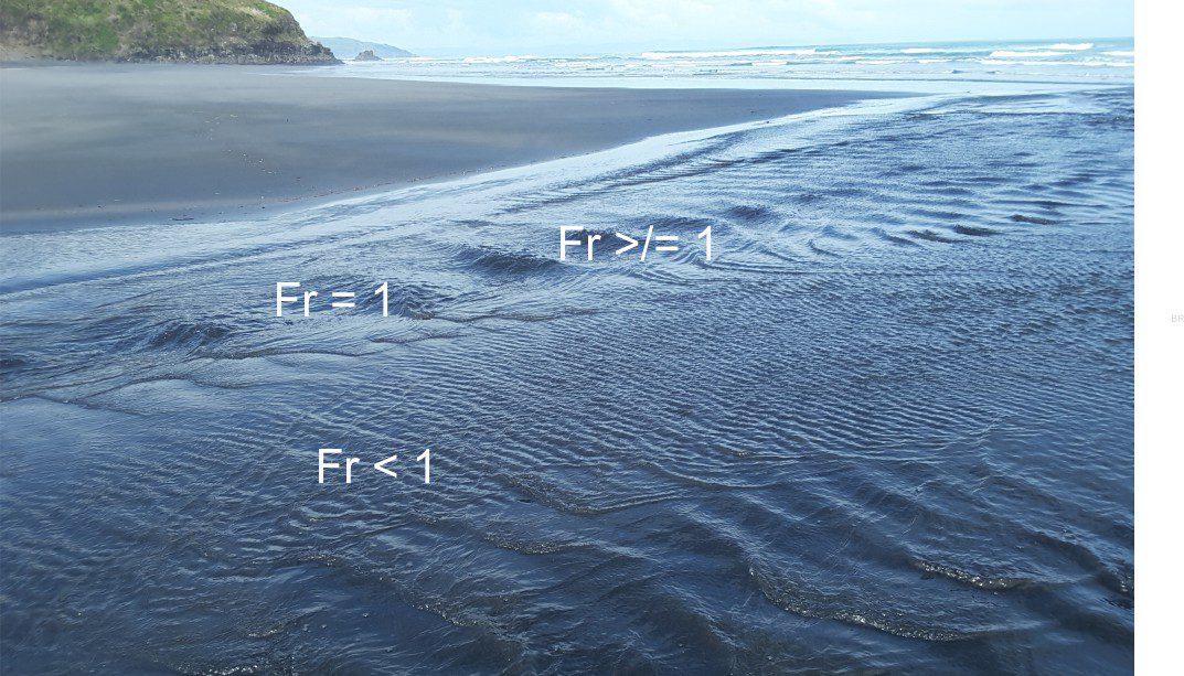
Viscosity: Viscosity is used to describe a material in which its strength depends on the rate of deformation, or strain rate. From a practical point of view, it is a measure of its resistance to deformation, or flow. It is normally applied to fluids, including rocks that may behave as fluids under high confining pressures and low strain rates. In the Earth sciences, viscosity is applied to phenomena like surface water flows (as in Reynolds numbers), sediment gravity and pyroclastic flows, lava flows and ice sheets, and to rocks-magmas in the lithosphere and asthenosphere.
Vitrinite reflectance: Vitrinite is a component of coal that forms by thermal alteration of plant tissues. The intensity of reflection from a polished surface of vitrinite samples increases with coal rank. The reflectance is measured and compared with standard values d to determine coal rank..
Volcanic ash: Sedimentary particles derived directly from volcanic eruptions, ranging from clay-sized material to 2 mm. Subdivisions into fine, medium, coarse, very coarse ash are analogous to Wentworth sand size scale. Cf. lapilli, Wentworth grain size.
Volcanic explosivity index (VEI): A measure of the explosiveness of eruptions, or the amount of kinetic energy involved (Newhall & Self, 1982), based on the erupted volume (as lava or fragmental debris), eruption column height, and the degree of particle fragmentation. The scale is logarithmic. Each category is labelled according to its ‘appearance’, ranging from non-explosive, quietly effusive lava flows (zero explosivity), to colossal super-eruptions (Yellowstone, Toba, Taupo) at 8.
Volcaniclastic: Fragmental debris derived from volcanic eruptions. This includes air-fall ash (tephras), ballistics, and pyroclastic flow and surge deposits (e.g. hot and cold ignimbrites) that are derived directly from eruption events such as collapsing eruption plumes; also called primary volcaniclastics. Material that is redeposited by terrestrial lahars or subaqueous sediment gravity flows (turbidites, debris flows), or redistributed by rivers are secondary volcaniclastics.
Volcanic gas: All active volcanic centers emit gas, pre-, post- and during euptions. On average, 96% of volcanic gases are water vapour, the remaining components being CO2, SO2 (most common), plus a little helium, nitrogen, carbon monoxide, hydrogen sulphide, and a few halides. Under normal circumstances, volcanic CO2, helps maintain the balance from the perspective of greenhouse forcing.
Volcanic quartz: A variety of monocrystalline quartz that typically shows well developed crystal faces and pointy, pyramid-like terminations. It is common in acid volcanic rocks like rhyolite and dacite. Crystal margins may show small bubble-like indentations. This variety of quartz is a good provenance indicator.
Vulcanian eruption: Magmas tend to be more viscous than Hawaiian and Strombolian eruption, and involve more violent phreatic and phreatomagmatic events that produce ash to bomb sized ejecta. Eruption plumes can reach 10 km altitude and more. Airfall tephra is more widespread; pyroclastic flows develop from collapse of eruption columns. VEI = 2-4.

Wacke: A sandstone with 15-75% matrix; less than 15% matrix and it is an arenite. The carbonate version is called a wackestone. The most frequently cited example in siliciclastic rocks is greywacke. The induration of greywackes renders the distinction between matrix and diagenetic minerals difficult, particularly distinguishing between detrital and diagenetic clays, with the added overprint of micas (particularly muscovite), chlorite, and variable amounts of calcite.
Wackestone: A mud-supported framework with >10% coarser than mud grade, but less than 10% coarser than 2 mm. The Folk equivalent is a micrite qualified with the dominant allochem, such as bioclasts or ooids.
Dunham’s (1962) limestone classification scheme reviewed and modified by Lockier and Junaibi (2016).
Watertable: The level to which groundwater rises in an unconfined aquifer. It is a special kind of potentiometric surface – it is real in that it can be revealed by drilling or excavation. Watertables always have a gradient, sloping in the direction of groundwater flow. Watertables can be mapped from water level intersections in boreholes. A watertable is at atmospheric pressure for any location. Watertables tend to fluctuate seasonally as a function of recharge and natural discharge. They can also fluctuate as a result of pumping. See Equipotential
Wave base: The maximum water depth where wave orbitals impinge and interact with the sea/lake floor. The distinction is made between fairweather wave base, and storm wave base. Wave base depth is about half the wavelength.
Wave-dominated delta: More common along high wave-energy coastlines where sand-prone sediment delivered to the coast by distributary channels, is reworked and redistributed by marine processes. Distributary mouth bars form at channel exits; long-shore movement of sand provides sediment nourishment for beaches, sandspits, and barrier islands. The delta edge tends to be lobate and smoothed or locally straightened by these processes. A classic modern example is Nile delta. See river-dominated deltas, tide-dominated deltas.
Wave orbitals: The circular motion of water beneath transverse waves. Orbital diameter is greatest beneath the wave crest and diminishes with depth. The maximum depth that orbitals interact with the sea/lake floor is called the wave base.
Wavelength (Oceanography): The distance between crests or troughs of successive water waves; the same definition applies to bedform – the distance between crests of successive ripples.
Weak acid – strong acid: A general classification that depends on how easily an acid donates a proton (H+ ) to a water molecule to form H3O+ . A weak acid will partially dissociate (i.e. split into its constituent H+ and anion, leaving some of the acid in solution. All the reactions involving carbonate and carbonic acid are weak acid reactions. Strong acids dissociate completely – they donate all their H+ . Common examples include hydrochloric acid (HCl) and sulphuric acid (H2SO4).
Well drawdown: During borehole pumping, the water level will fall relative to its equilibrium level that in an unconfined aquifer is the watertable, and in a confined aquifer the potentiometric surface. When pumping ceases, the water level will recover to its pre-pumping position.
Wentworth grain size scale: Also called the Udden-Wentworth scale (1922). A scale based on the geometric progression of grain size, centred on the sand size-range: Thus, very coarse sand is 1-2 mm; coarse sand 0.5-1.0 mm; medium sand 0.25 – 0.5 mm; fine sand 0.125 – 0.25 mm, and so on. Krumbein’s Phi scale is a Log2 conversion of these size ranges.
Window: A location that allows one to look through an (allochthonous) thrust sheet into the underlying autochthon.
Winnowing: Removal of lighter grains by wind or flowing water, leaving denser material behind. The degree of winnowing depends on the strength, or carrying capacity of air/water flow. Borrowed from an old English agricultural term for removing wheat from the chaff. Derived from Old English windwian, meaning ‘from the wind’.

Waiting….

Yarkovsky effect: A correction to determining an asteroid orbit. Asteroids that approach the Sun will heat up; they will cool as their orbit takes them farther away. This heating and cooling effect can produce small changes to an object orbit. Very small changes in orbit can produce significant differences in the closeness of approach to earth.
Younging direction: The direction in which beds become progressively younger. Also called ‘way up’ and ‘stratigraphic top’. It can be determined by examining a variety of sedimentary and volcanic structures, and fossil biozones. It is a critical piece of information for any stratigraphic or structural analysis.

Zircon geochronology: Zircon is a ubiquitous trace mineral in sedimentary and volcanic rocks. It utilises 238U→206Pb (the half-life of 4.47 Ga is almost the same as the age of the Earth), 235U→207Pb (half-life of 0.70 Ga), and 232Th→208Pb (half-life 14.01 Ga – getting close to the age of the universe) (1 Ga = 1 billion years). Methods are now available to measure ages not just in single zircon crystals, but in crystal zones, where each zone from the crystal centre outwards has a progressively younger age.