Monthly Archives: April 2016

A 40 Million Year Old Forest, Looking Like it Formed Yesterday

Facebooktwitterlinkedininstagram

The Stunning Preservation of an Arctic Fossil Forest

Location map for Geodetic Hills, Canadian Arctic 
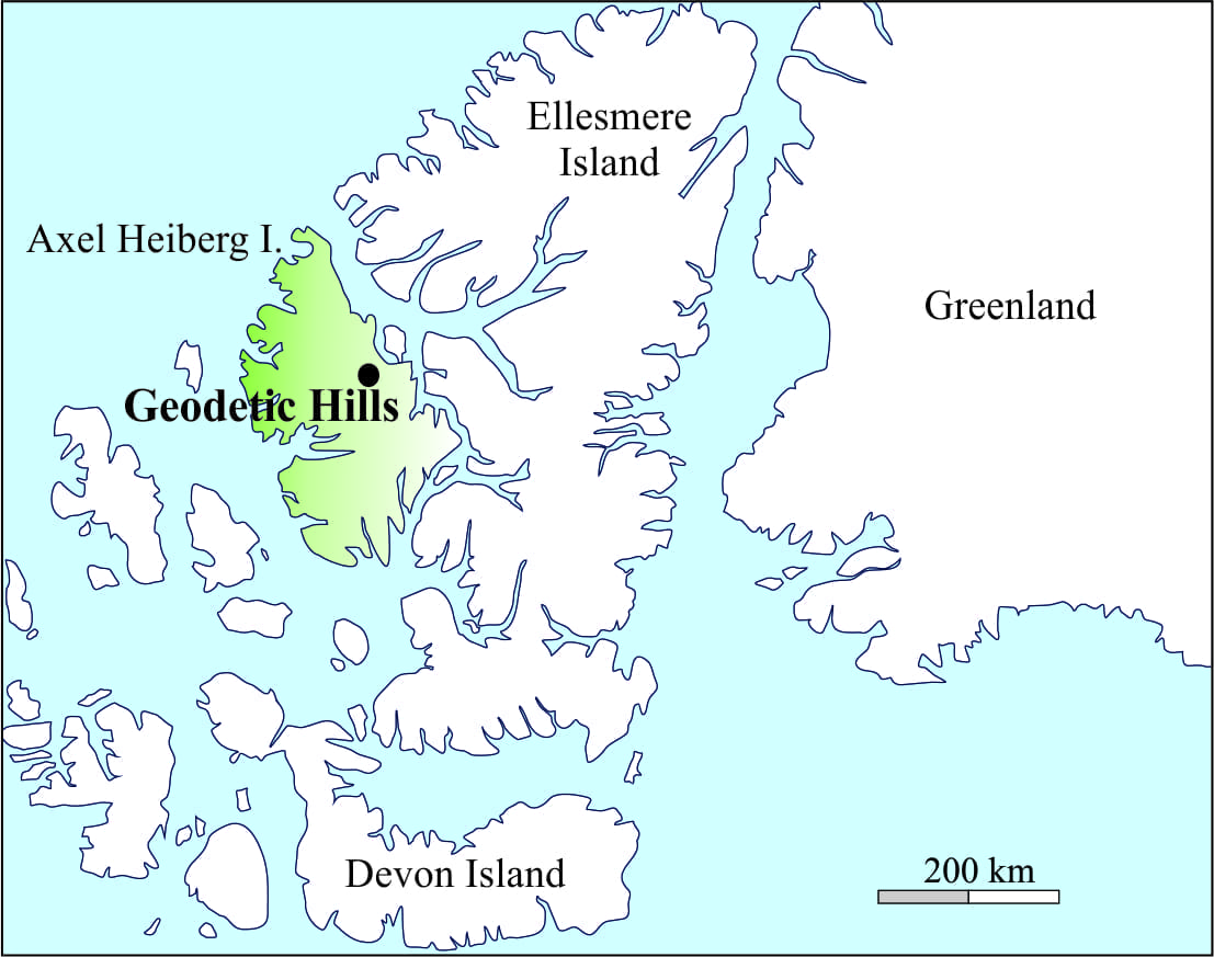
In 1985, my field assistant and I were examining sedimentary rocks on central Axel Heiberg I. in the Canadian Arctic.  The project was part of a broader science program being run by the Geological Survey of Canada. I had surmised, from some of my earlier work that the deposits here had formed in response to tectonic upheaval in the region about 40 to 45 million years ago (a geological time called the middle Eocene); we were on the look-out for additional information to assess this hypothesis.  Our helicopter had dropped us off at the base of a gentle ridge, known as Geodetic Hills. Continue reading

Facebooktwitterlinkedininstagram
Facebooktwitterlinkedin

Class 5; Geology for Kayakers, Kaituna River

Facebooktwitterlinkedininstagram

Kaituna River, New Zealand

Kaituna River map, draining Lake Rotoiti, NZKaituna River is a glorious water-course that has a bit of everything for kayakers and rafters, from beginner Class 1 and 2 rapids to serious class 5 waterfalls.  It is probably one of the more popular kayaking and rafting rivers in North Island, New Zealand, in part because it is so easy to get to, and close to the Rotorua centre of tourism.

The Kaituna is an outflow of Lake Rotoiti, its headwaters next to the Highway at Okere Falls (just down the Road from Okere Falls Café); it exits at the coast in Bay of Plenty.

Continue reading

Facebooktwitterlinkedininstagram
Facebooktwitterlinkedin

Walking to Great Barrier Island

Facebooktwitterlinkedininstagram

A short hike to the beach 20,000 years ago

The Last Glaciation began about 110,000 years ago with massive expansion of ice-sheets in northern Europe, north Asia, North America and Antarctica.  The source of water for the ice-sheets was the oceans.  Based on geological mapping, dating of glacial deposits, and other physical evidence for ice movement it has been determined that the maximum extent of glacial ice from a global perspective occurred about 20000 years ago; this is referred to as the Late Glacial Maximum or (LGM).  Mapping also indicates that global sea-level was on average about 100m -120m below present sea-level. Continue reading

Facebooktwitterlinkedininstagram
Facebooktwitterlinkedin

Budget Surpluses and Budget Deficits

Facebooktwitterlinkedininstagram

  Coastal Supply and Demand

Sand storage along a modern beach and coastal dune system, northern NZ

Budget Surpluses and Budget Deficits

How often have you heard or seen it; the owners of prime, sandy beach-front real estate complaining that the beach is encroaching on their backyard patios.  Their piece of land has just been truncated by processes that erode sand along the beach and sand dunes.  The sand itself has disappeared beneath the now much closer waves. Continue reading

Facebooktwitterlinkedininstagram
Facebooktwitterlinkedin