
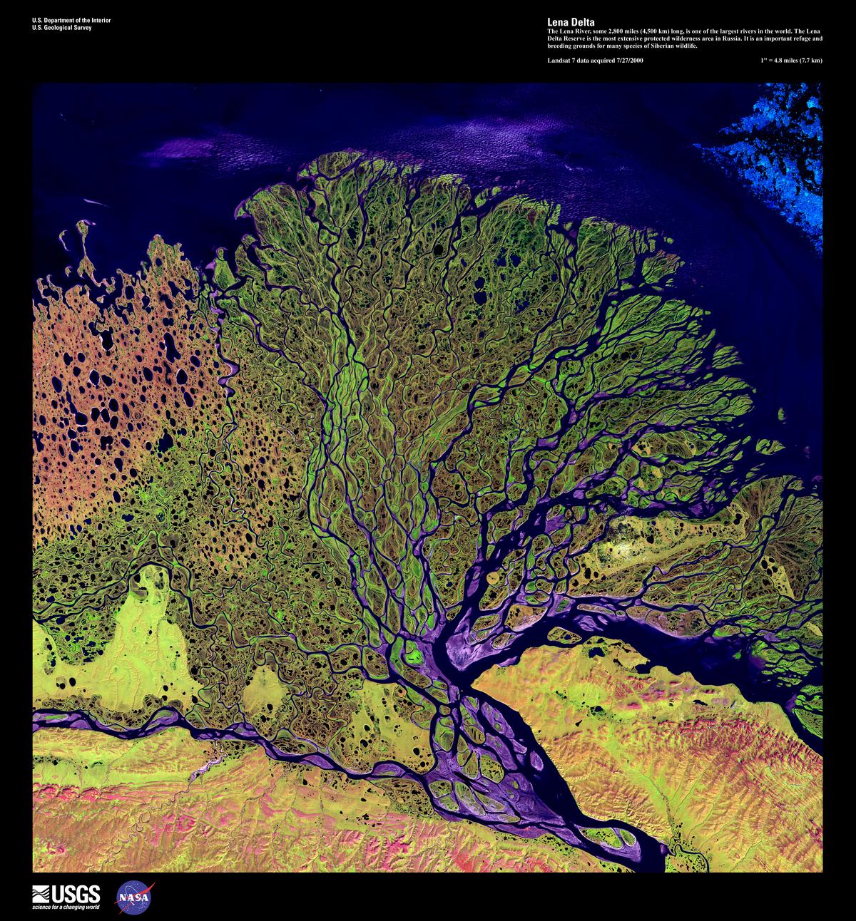
A beautiful Landsat image of Lena River Delta, Siberian Russia. The entire delta complex
is about 200 km wide. At present, the most active part is the right-center lobe.
Image credit: https://remotesensing.usgs.gov/gallery//gallery-nojs.php?id=133&cat=7
Deltas come (and go) in all shapes and sizes. They form where a trunk river discharges into a largish body of water – mostly shallow seas, but modern and ancient deltas also form in large lakes. Early delta facies models (1960s-70s in particular) were based primarily on the Mississippi birds-foot delta. As time, and alternative models were developed, it became apparent that the classic river-dominated birds-foot geometry was part of a much larger spectrum of deltas, including those that are tide-dominated and wave-dominated. The resulting facies tend to be quite different in each of the categories, particularly at the seaward margin of delta accumulations. For example, wave-dominated deltas tend to be higher energy environments at the point where river-derived sediment is dispersed at the seaward margin.
The term ‘delta’ is also a kind of catchall – there are many different kinds of sedimentary facies in deltas, ranging from strictly fluvial to strictly marine. So, for example where fluvial deposits are clearly associated with a delta, they are included in the latter category.
The examples here include the classic Carboniferous, river-dominated deltas from Kentucky; and Late Cretaceous – Paleogene wave and river-dominated types from the Canadian Arctic . I have a few examples from the lacustrine deltas in Ridge Basin, although the field trip to that wrench basin focused on sediment gravity flow deposits (a great AAPG 10-day trip to several ‘turbidite’ basins in California, led by Tor Nilsen, 1988).
This link will take you to an explanation of the Atlas series, the ownership, use and acknowledgment of images. There are a couple of NASA images that are in the public domain. If you copy these please credit NASA accordingly.
Click on the image for an expanded view, then the ‘back page’ arrow to return to the Atlas
The images:
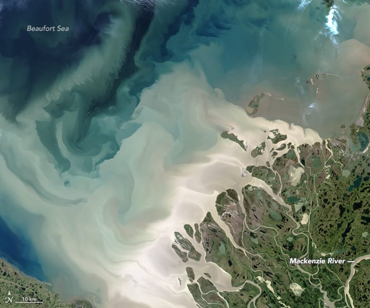 Sediment plumes discharged from Mackenzie Delta, Yukon, into Beaufort Sea, are a maximum during spring-early summer thaw . The locus of mouth-bar deposition is probably in the whitish region immediately outboard of the lower delta plain. Taken July 19, 2017 by the Operational Land Imager on Landsat 8.
Image credit: NASA Earth Observatory, image by Jesse Allen. Landsat data from the U.S. Geological Survey. https://earthobservatory.nasa.gov/IOTD/view.php?id=90703
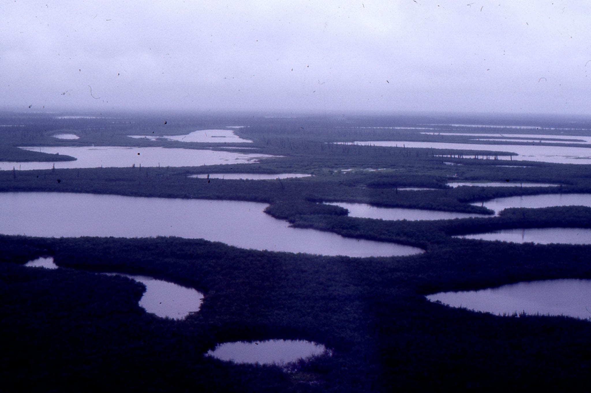 Aerial view of Mackenzie delta plain, in less clement weather. Not far from the northern Yukon town of Inuuvik.
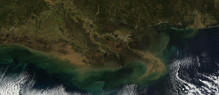 A spectroradiometer image of Mississippi Delta, January 17, 2016 shows sediment plume distribution at the iconic birds-foot, and at other drainage points along the coast.
Image credit: NASA, MODIS sensor on Terra satellite, https://earthdata.nasa.gov/new-orleans-and-the-mississippi-river-delta.
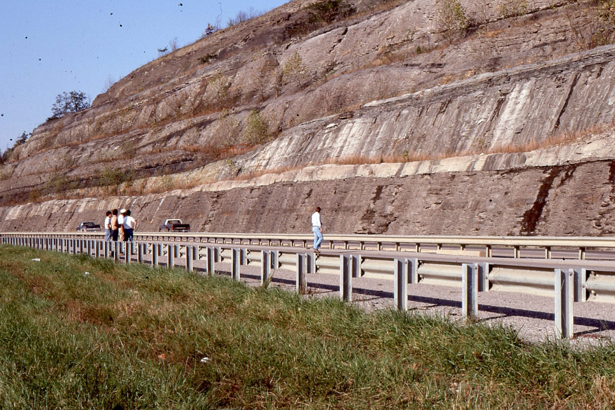
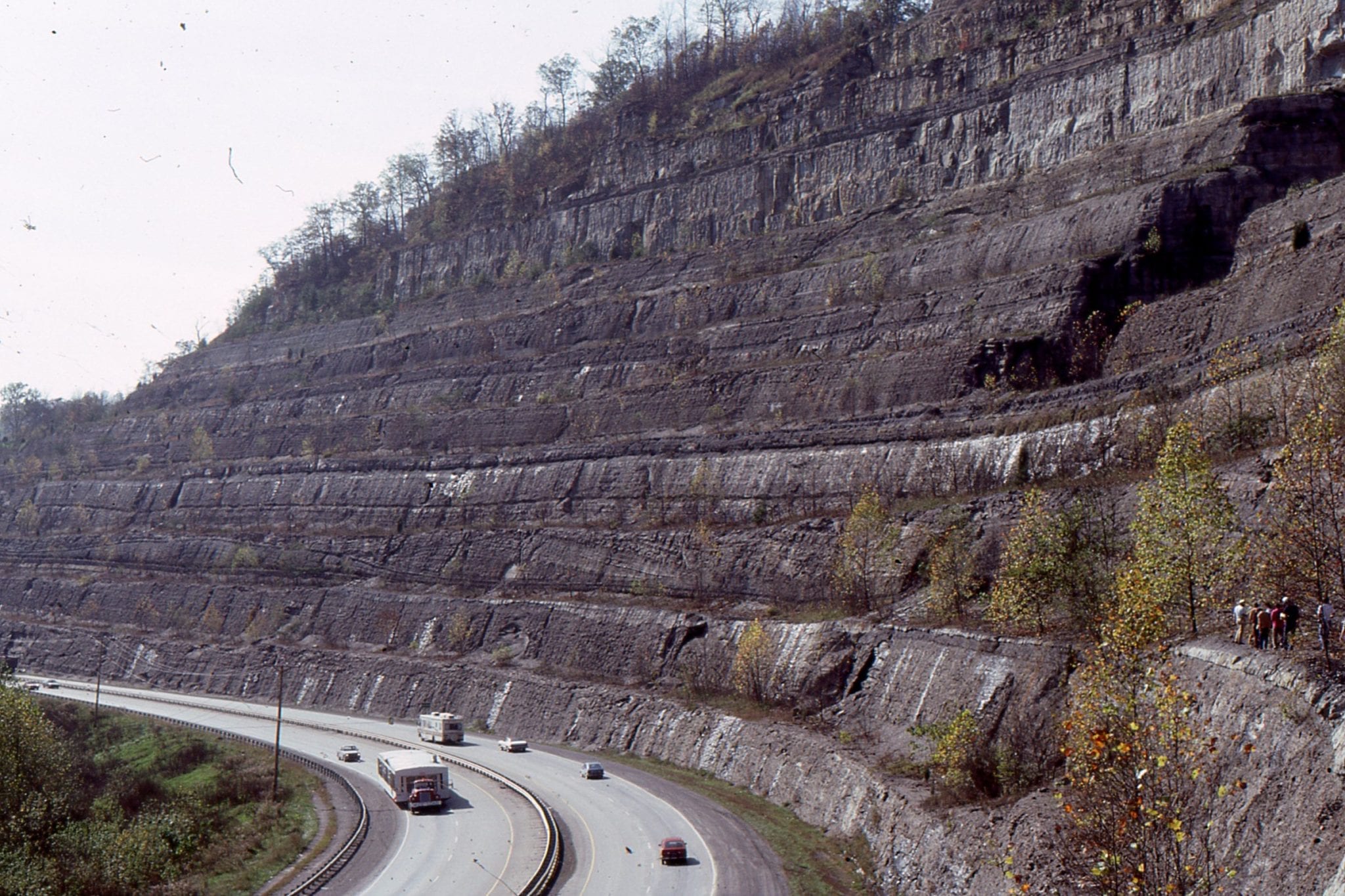
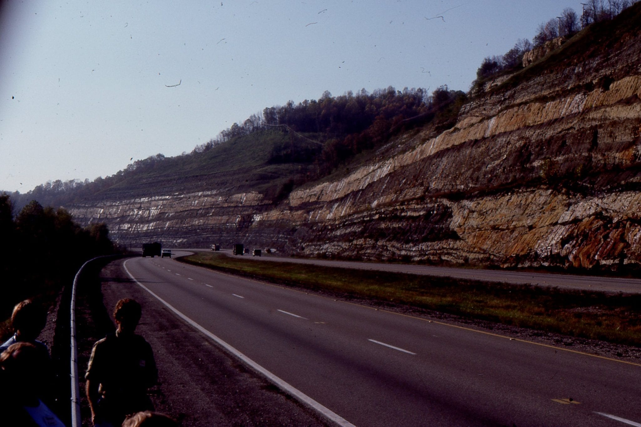 A classic Kentucky Carboniferous highway exposure of channel sandstone cutting into floodplain siltstone-mudstone and thin overbank sandstone. This is overlain by point-bar accretionary foresets (building away from viewer). Mostly upper delta plain.
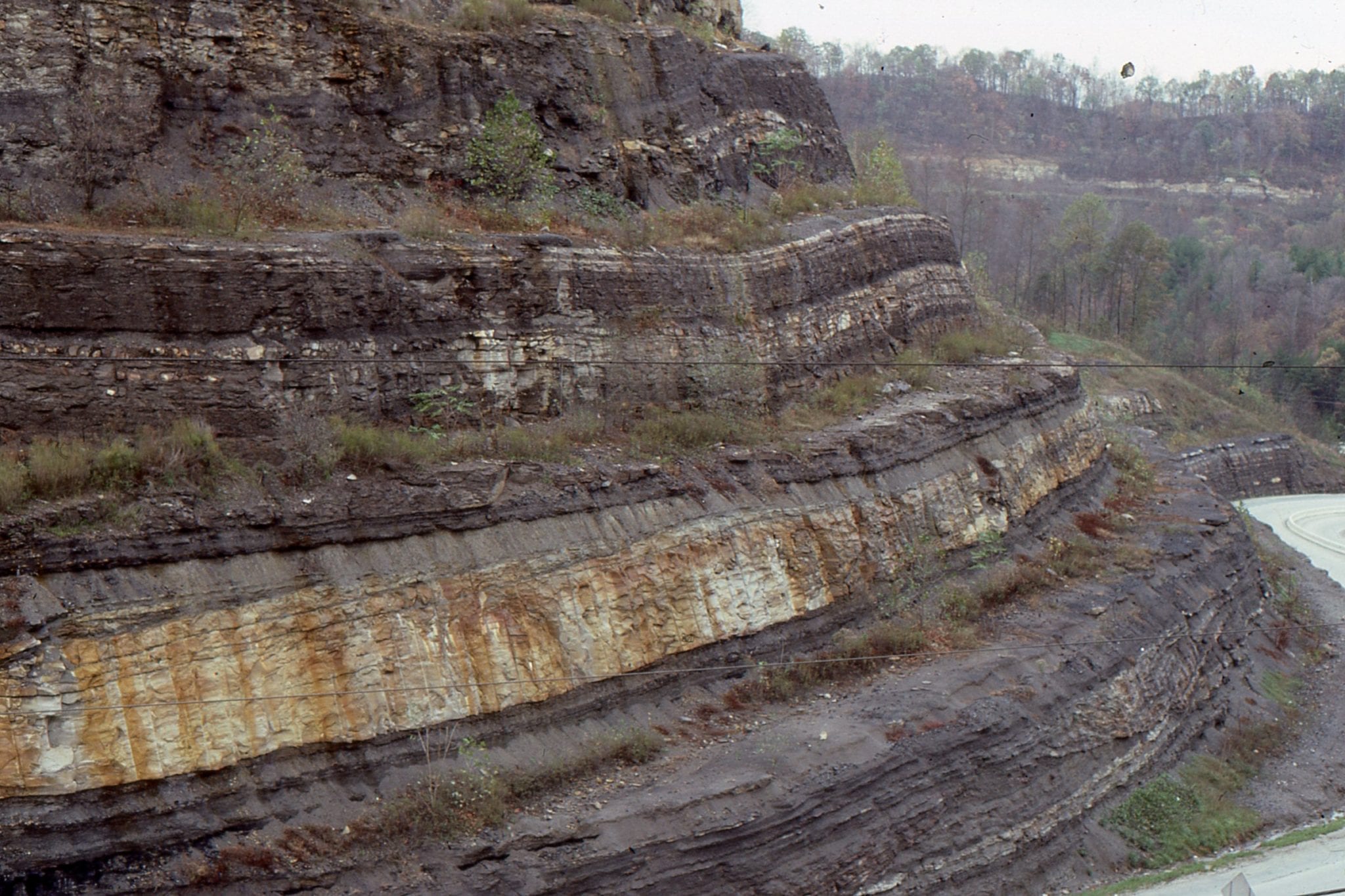
These two images create a kind of panorama of Carboniferous of point bar – channel sandstones overlain by interdistributary bay mudstone-siltstone. The point bar overlies and is partly equivalent to thin floodplain coal (left image, base of outcrop).
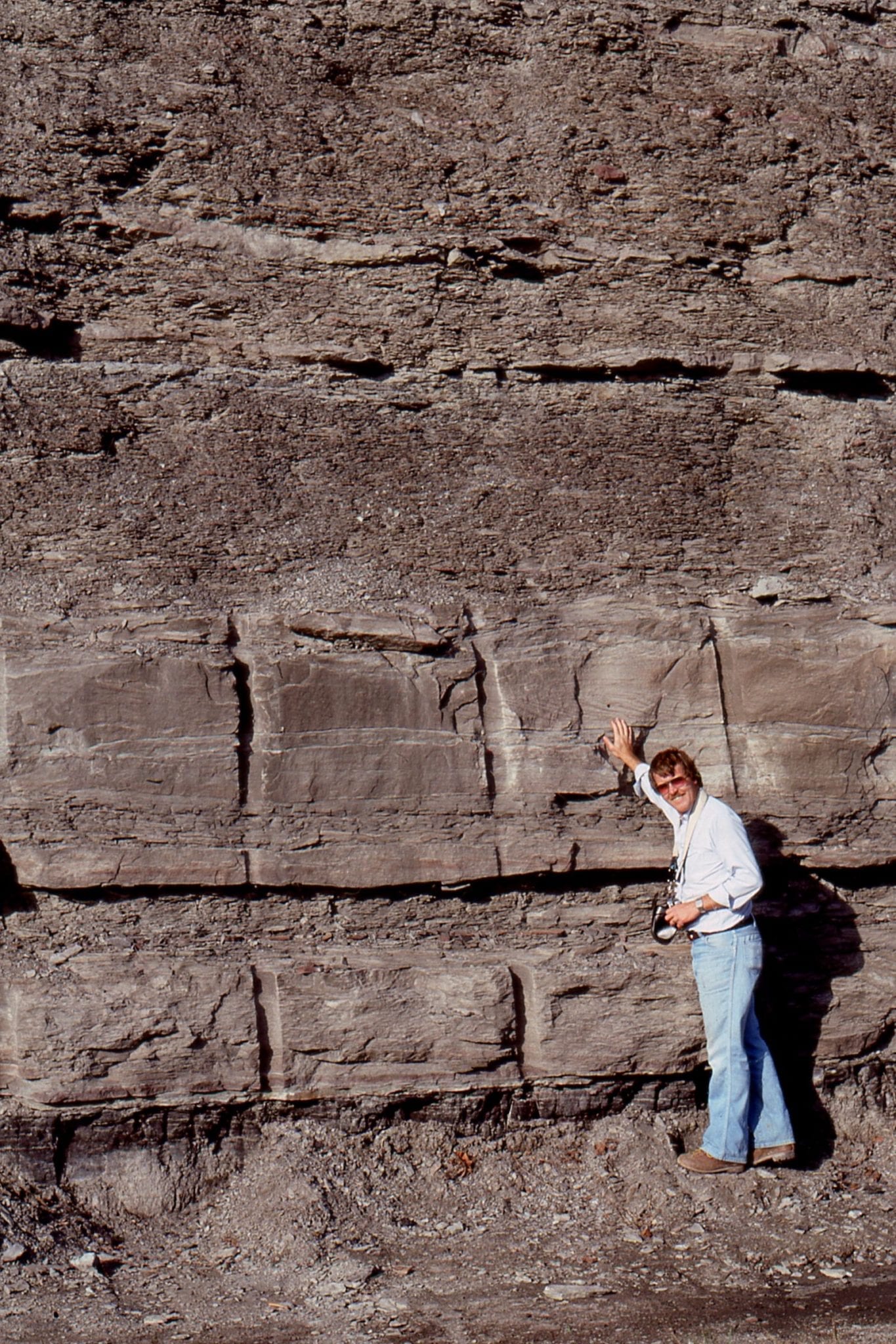
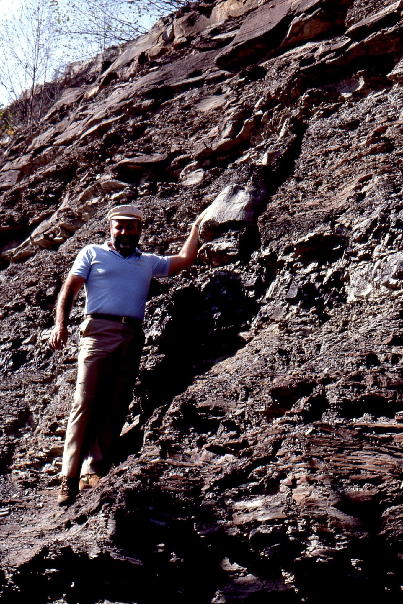 Lepidodendron log in fine-grained floodplain deposits, Carboniferous, Kentucky. A much younger John Horne adding know how and levity to the field trip stop.
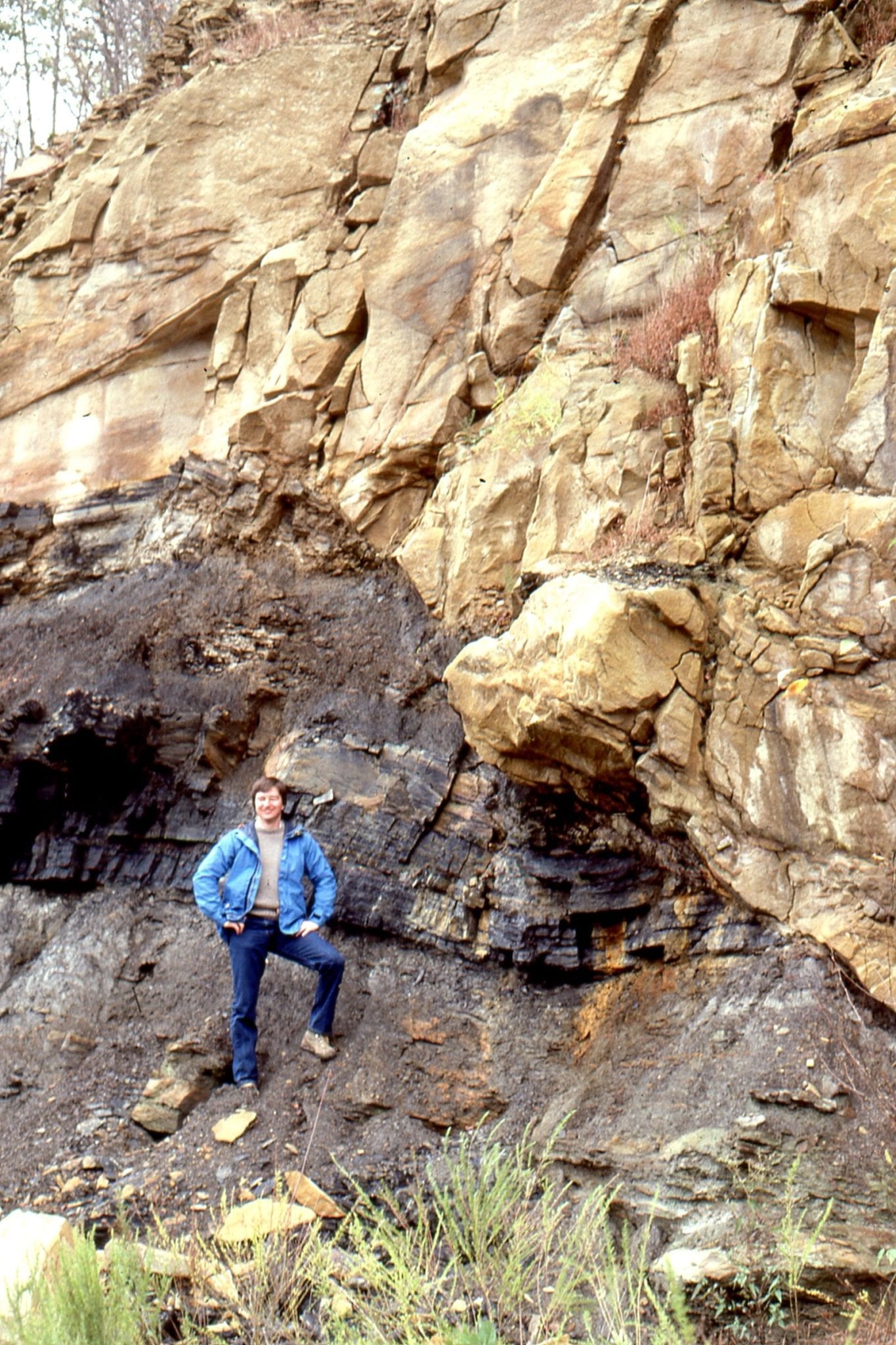 A compaction fault has juxtaposed Carboniferous delta plain channel sandstone against floodplain silts and muds. Near Hazard, Kentucky.
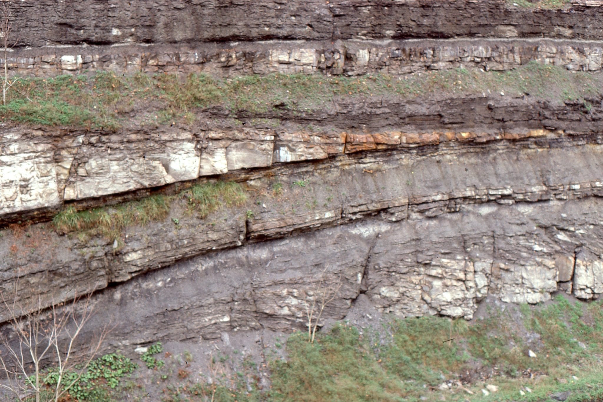
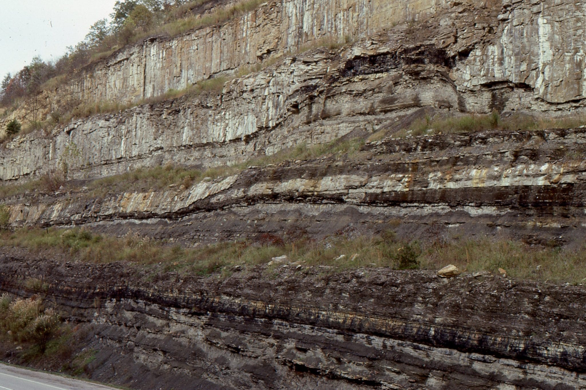 Delta plain channel migration and down-cutting has left this coal ‘island’ (top right) (Number 7 seam). The channel overlies interdistributary bay muds. Daniel Boon Parkway, near Hazard, Kentucky.
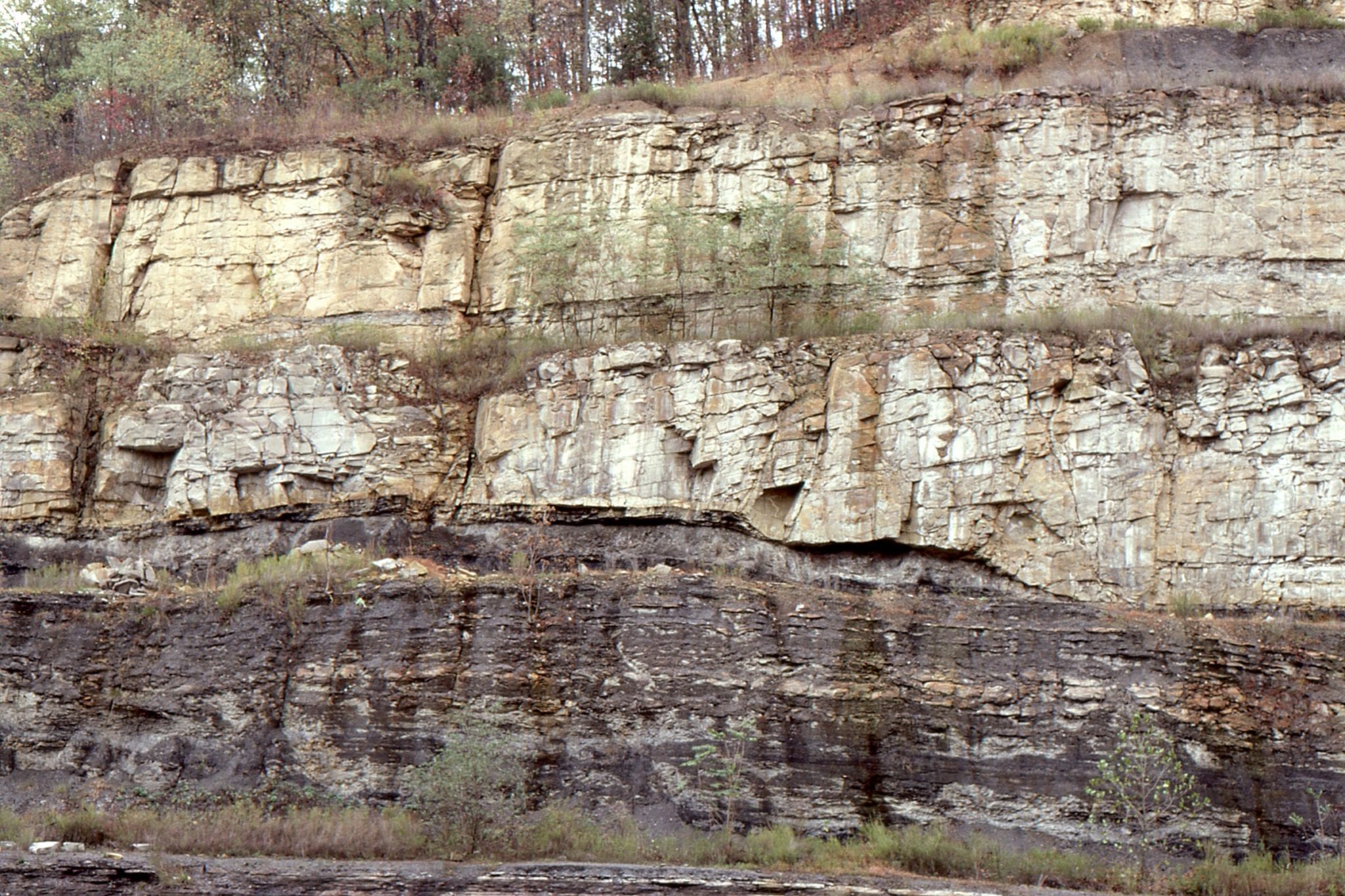 Channel down-cutting of the Carboniferous Number 8 coal, subsequently overridden by accretionary point bar foresets. Hazard, Kentucky.
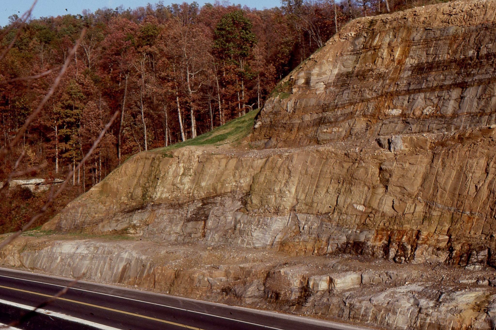
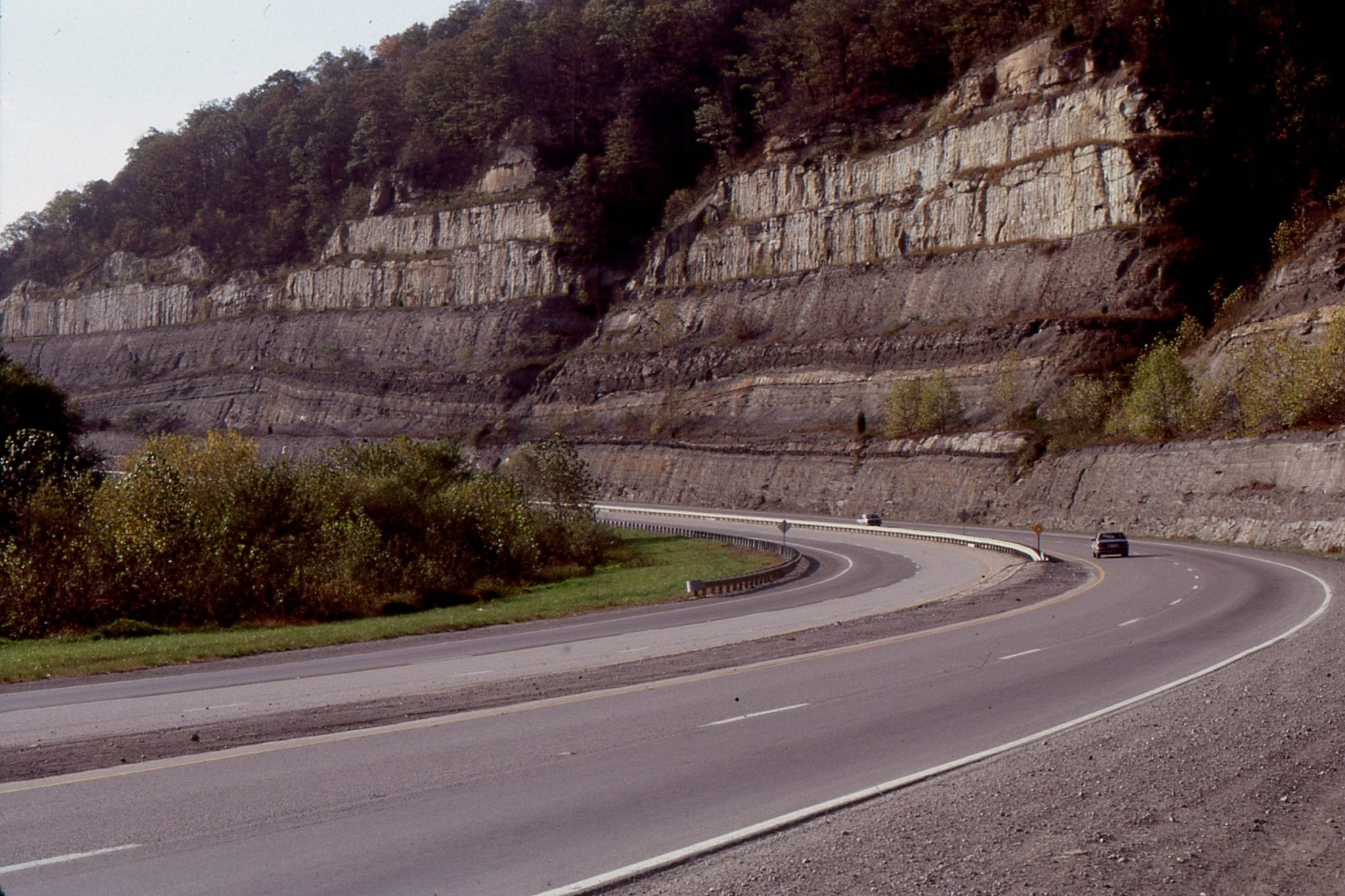
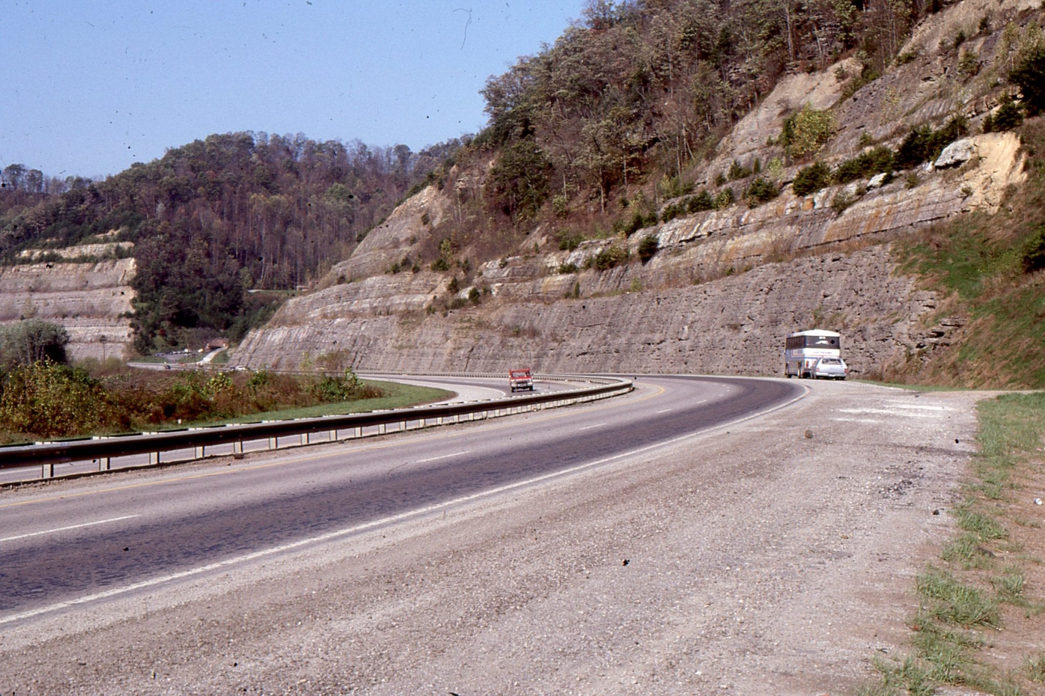
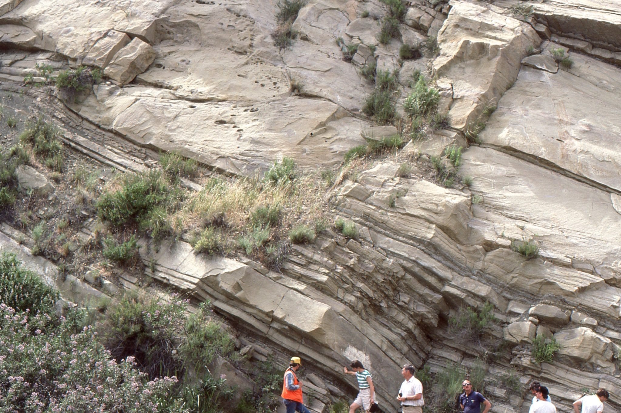
Proximity to a basement fault has focused sedimentation, resulting in the stacking of successive delta plain fluvial channel-point bars. Point bar accretion was to the right. Carboniferous, near Louisa South, Kentucky
 Channel margin and low-relief levee, overlying floodplain silts and muds. Carboniferous, Hazard, Kentucky.
 This is the only example I have seen of a channel and twin levees. The levees are overlain by interdistributary bay muds, and at the top of the outcrop, distributary channels. Ivel, Kentucky
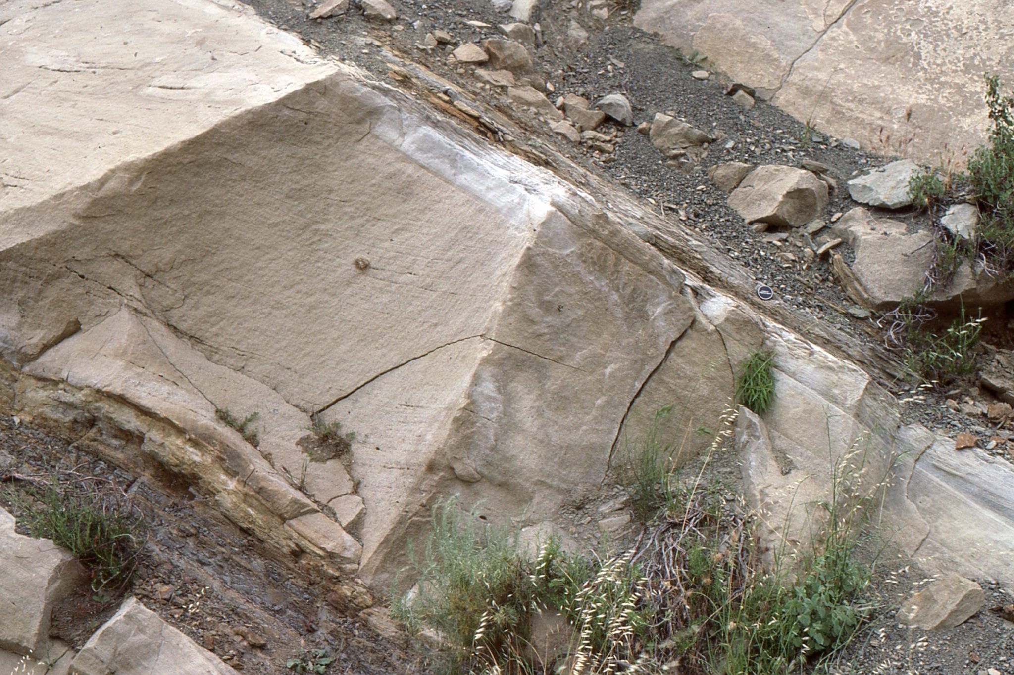
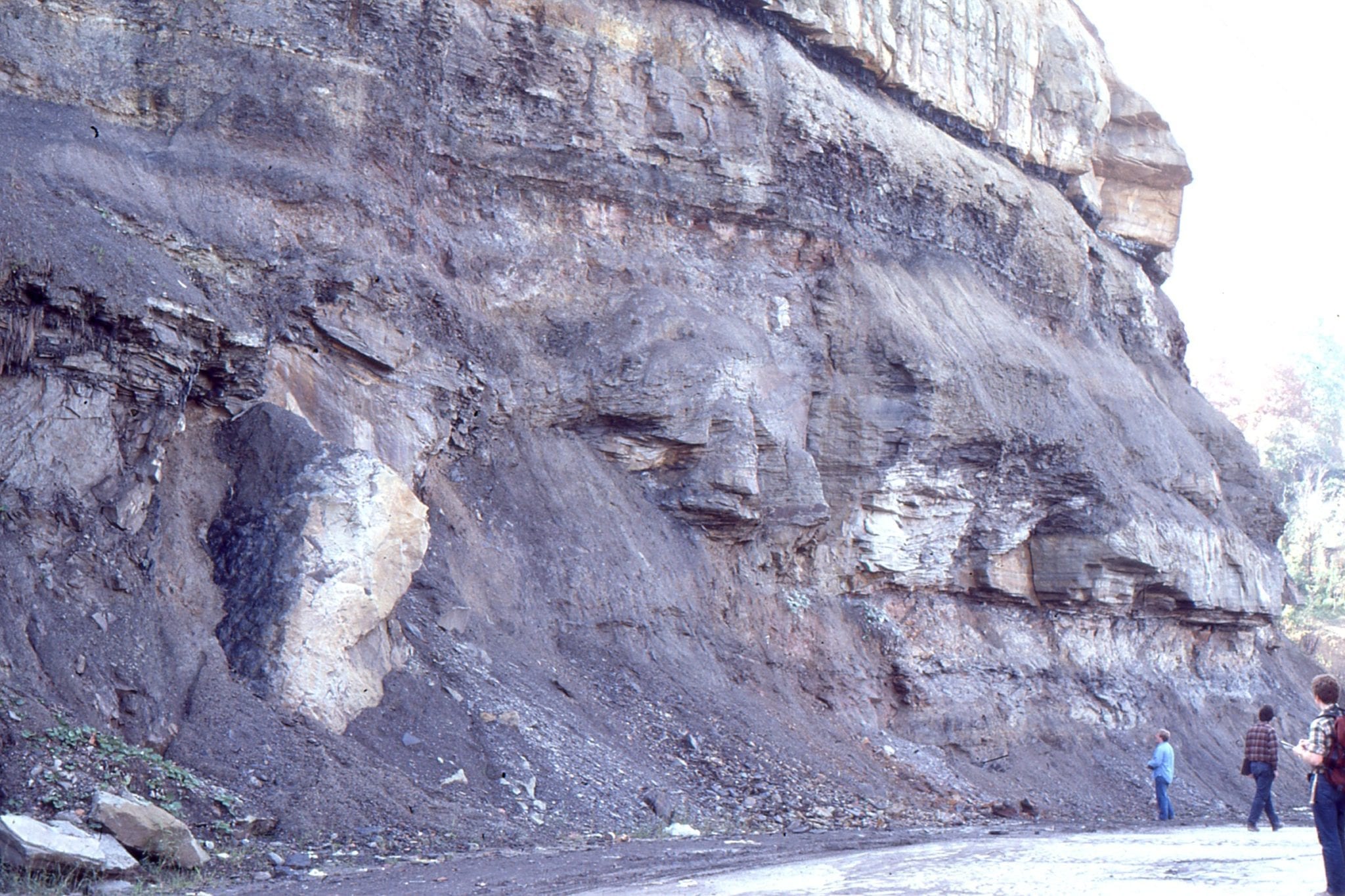 Channel margin slump block, delta plain, near Rush, Kentucky
Crevasse splay (whitish unit above bus in left image), that has broken through a distributary channel levee and distributed fine sand, silt and mud across the interdistributary bay. Right image shows a more general view. Below the splay is bay fill muds. Above are more bay fill muds and thin coal seams. Betsy Layne, Kentucky.
 Broader view of thin crevasse splay (people standing on it), overlain here by accretionary point-bar foresets. Betsy Layne, Kentucky
 Crevasse splays tend to be thicker near the breached levee. Here, two splays are overlain by interdistributary bay muds. Ivel, Kentucky.
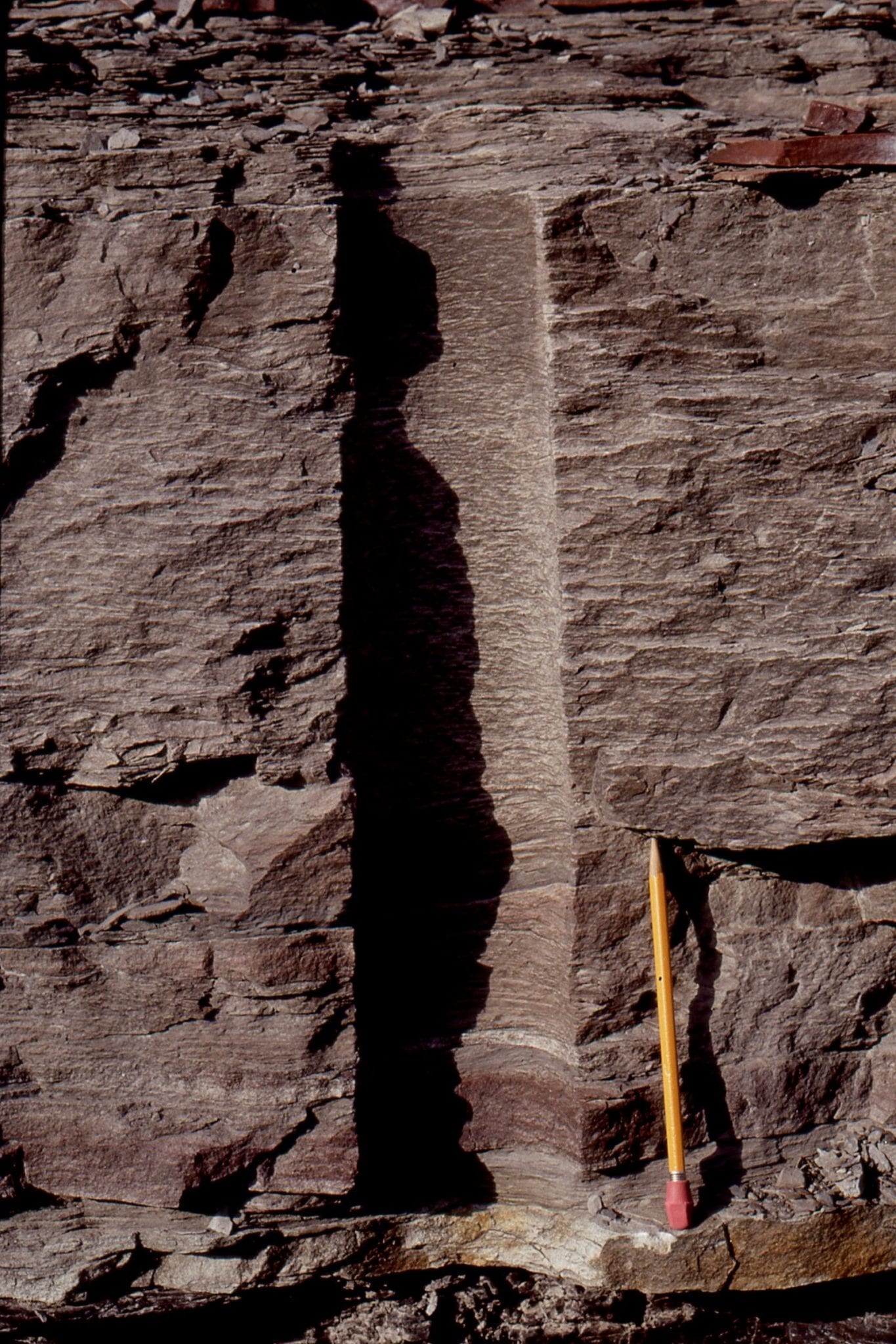
 The distal section of a crevasse splay (i.e. farther into the interdistributary bay) – the pencil (right of center) spans the entire splay thickness. It is sandwiched between two coals. Betsy Layne, Kentucky.
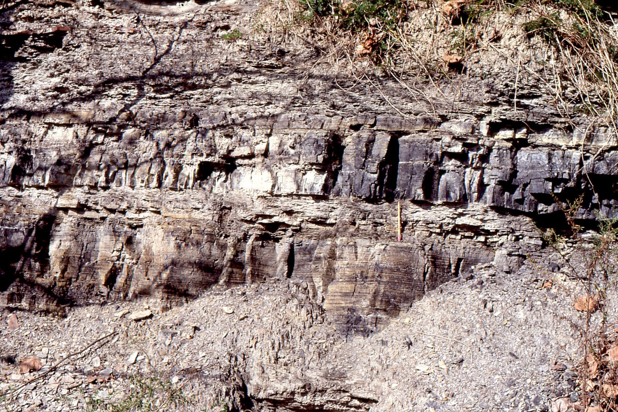
 Detail of crevasse splay deposits, shows laminations of fine-grained sandstone-siltstone, and abundant bioturbation that commonly obliterates primary layering. Betsy Layne, Kentucky.
 Prodelta siltstone – mudstone overlain by distributary mouthbar sandstone, near Pikeville Kentucky.
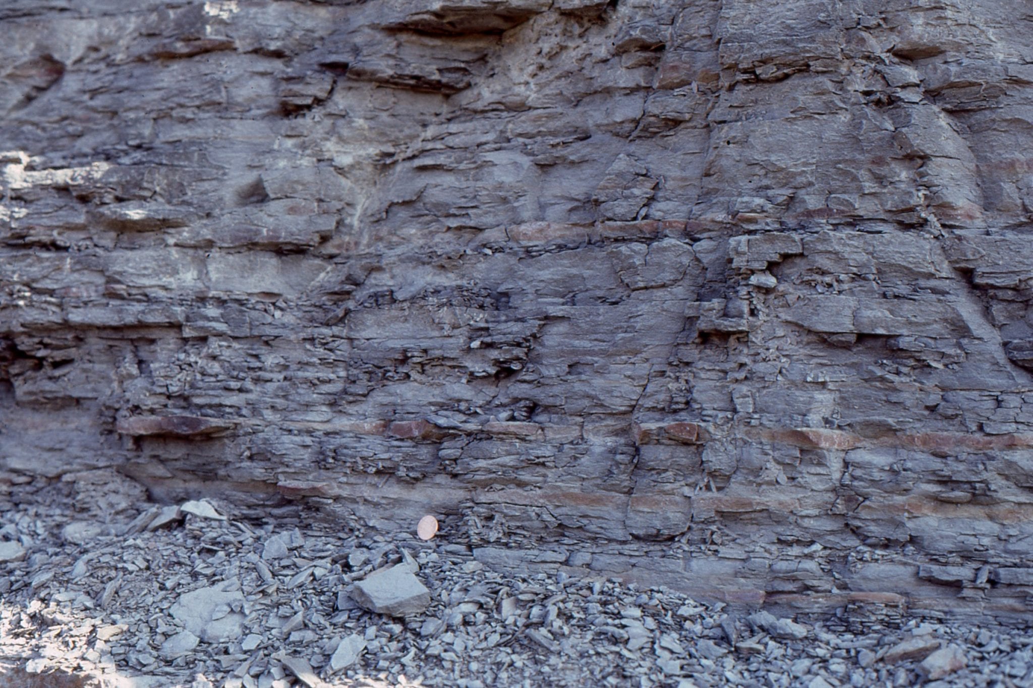 Prodelta mudrocks, with a few thin fine-grained sandstone lenses. Pikeville, Kentucky.
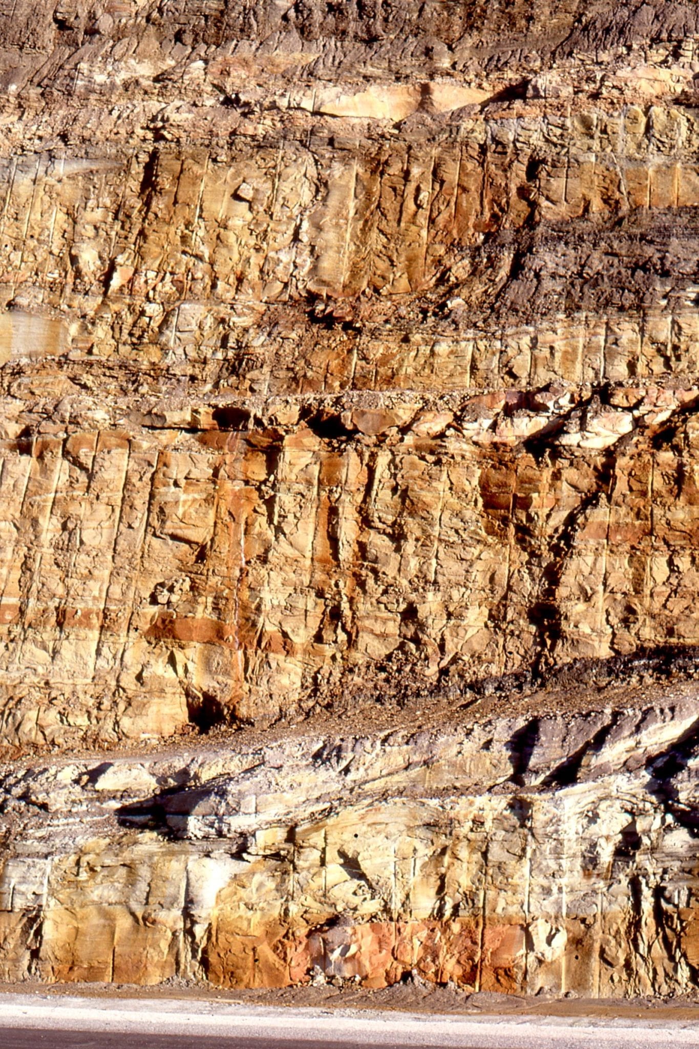
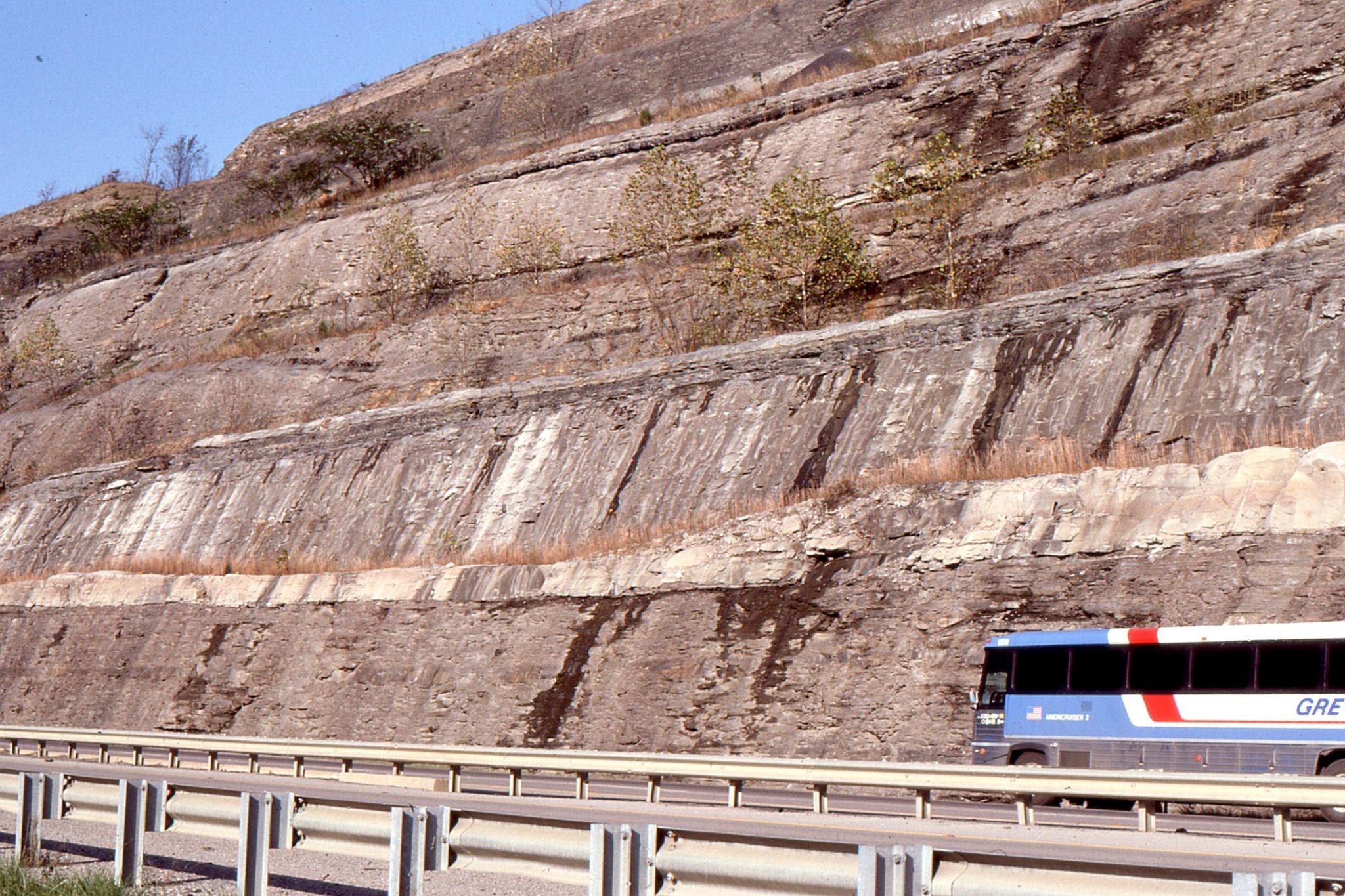
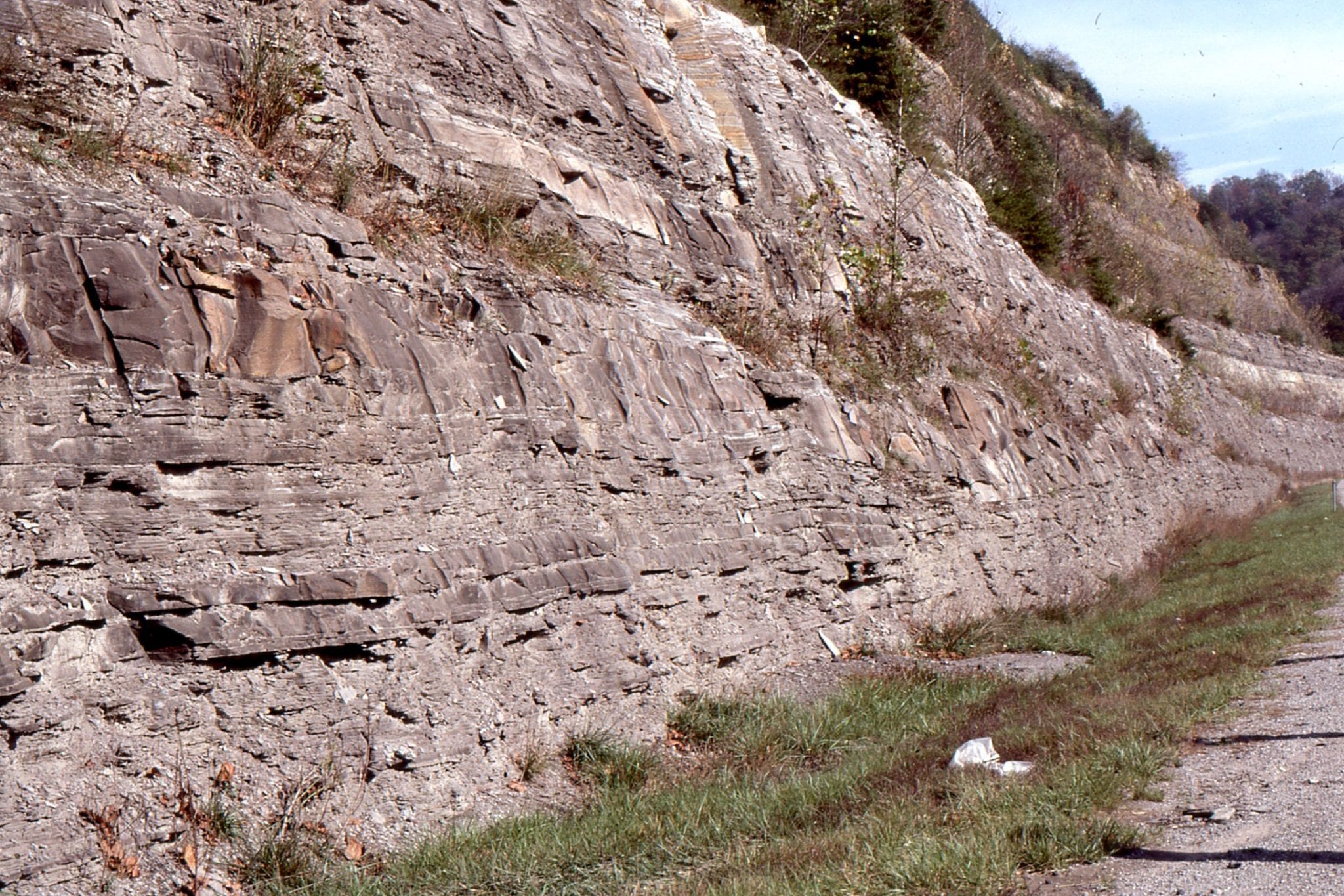 The frequency and thickness of sandstone beds increases towards the distributary mouth bar. Pikeville, Kentucky.
 Laminated and thin-bedded fine sandstone, with a few crossbeds and ripples that may indicate mouth-bar deposition above wave base. Pikeville, Kentucky.
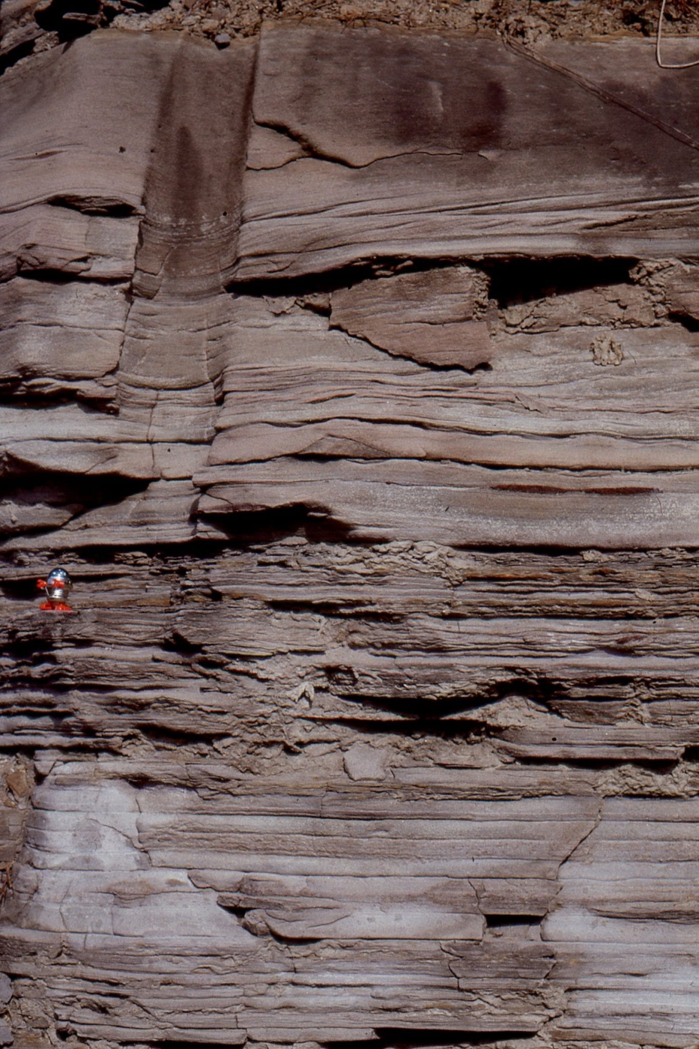
![]() Thin, graded sandstone beds are more common in the transition from distributary mouth-bar to prodelta. Pikeville, Kentucky.
Thin, graded sandstone beds are more common in the transition from distributary mouth-bar to prodelta. Pikeville, Kentucky.
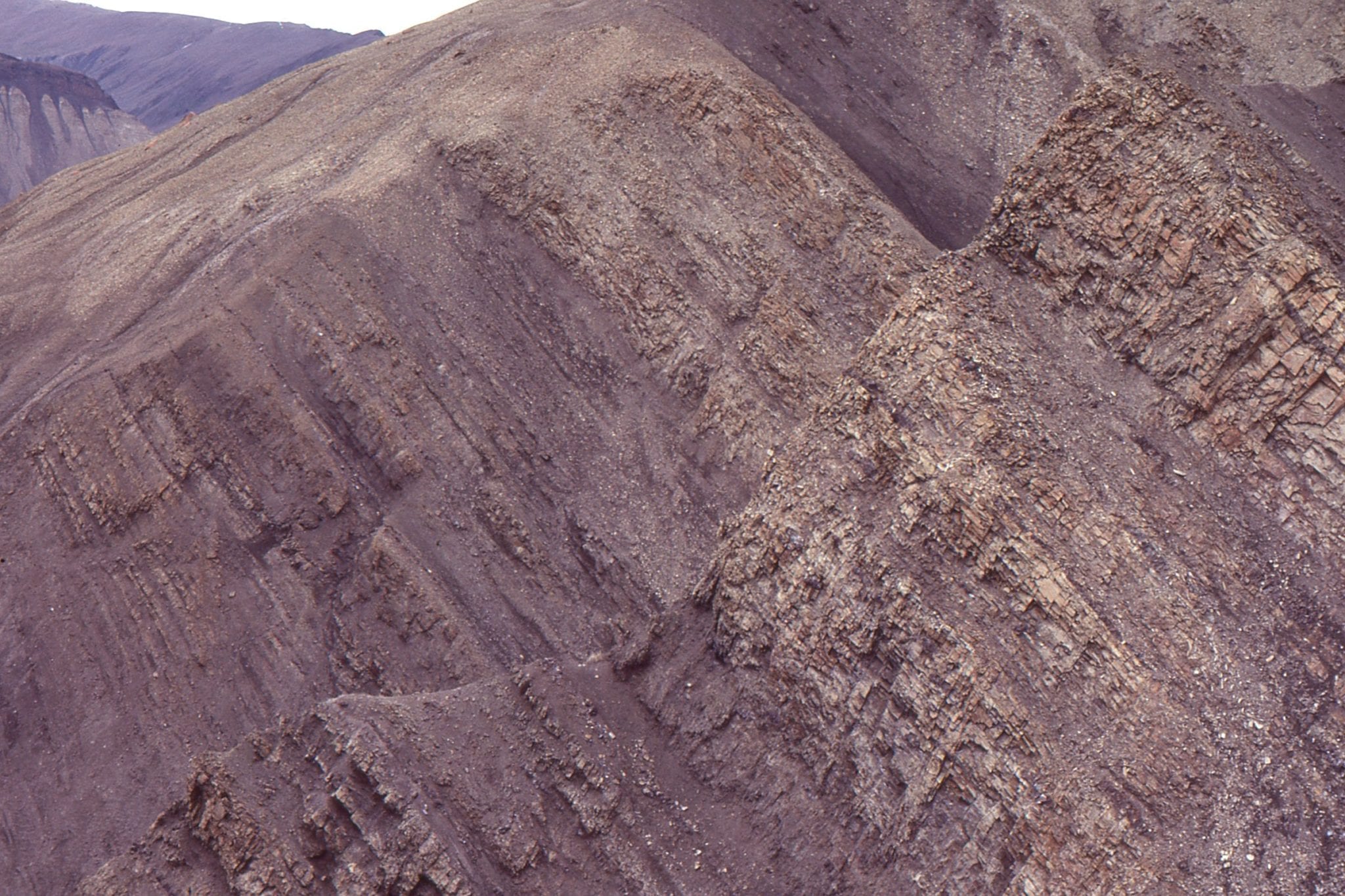
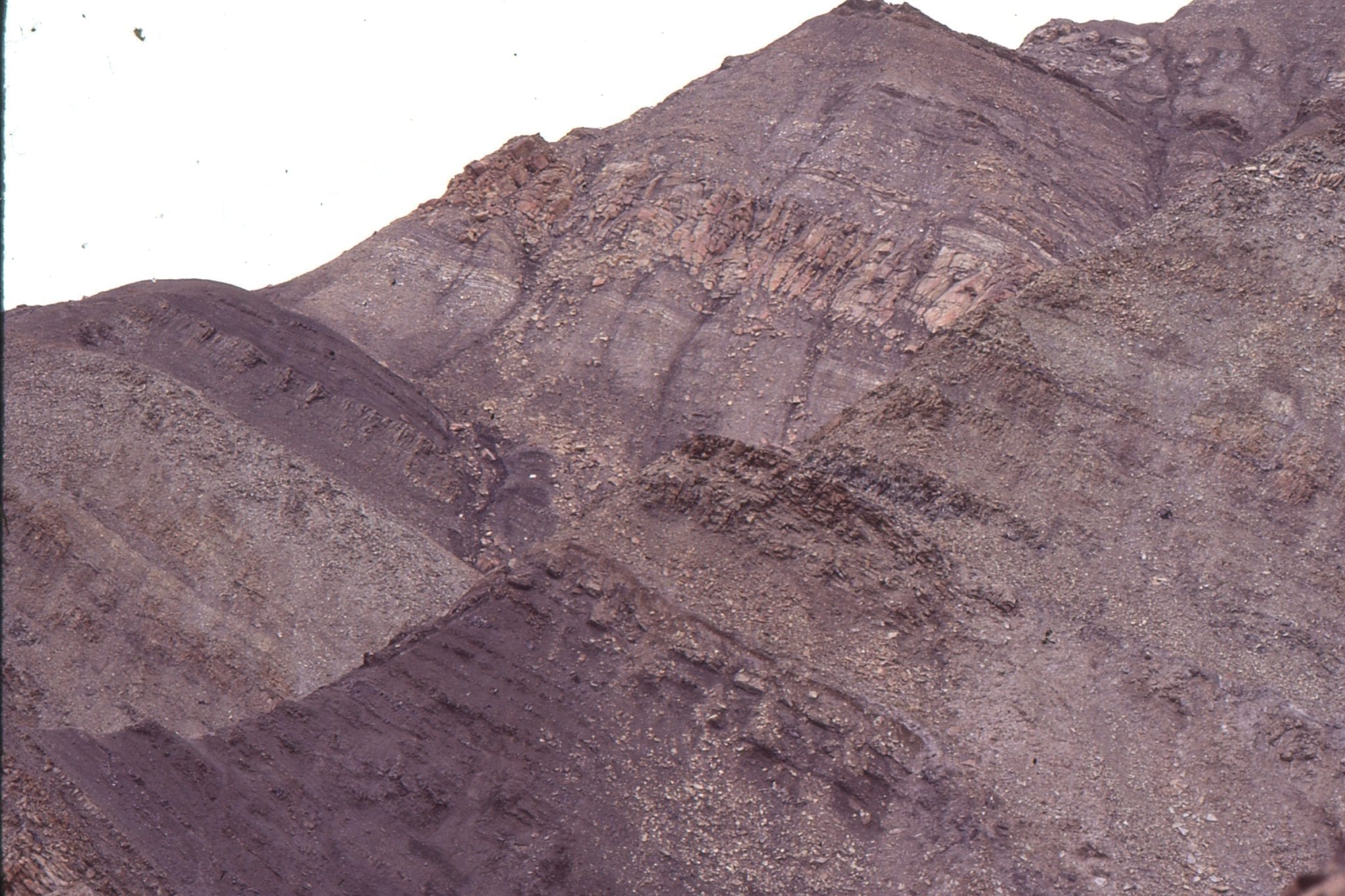 A late Cretaceous-Paleocene wave-dominated delta in the Canadian Arctic. Here coarsening- and bed thickening-upward units cycle through prodelta to slower shoreface, with abundant evidence of traction currents, including hummocky cross-bedding. Expedition Fm. Eureka Sound Group, Axel Heiberg Island.
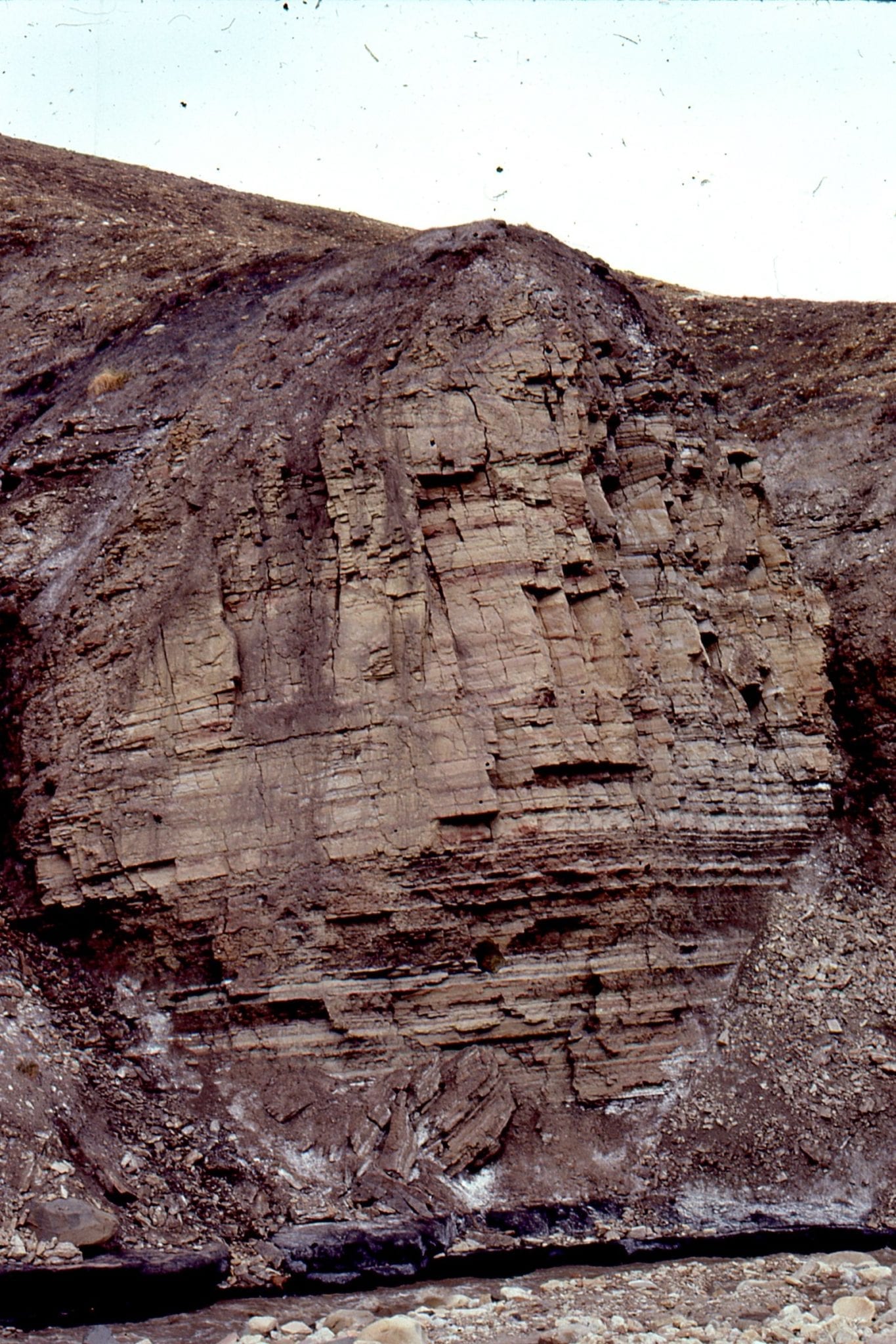
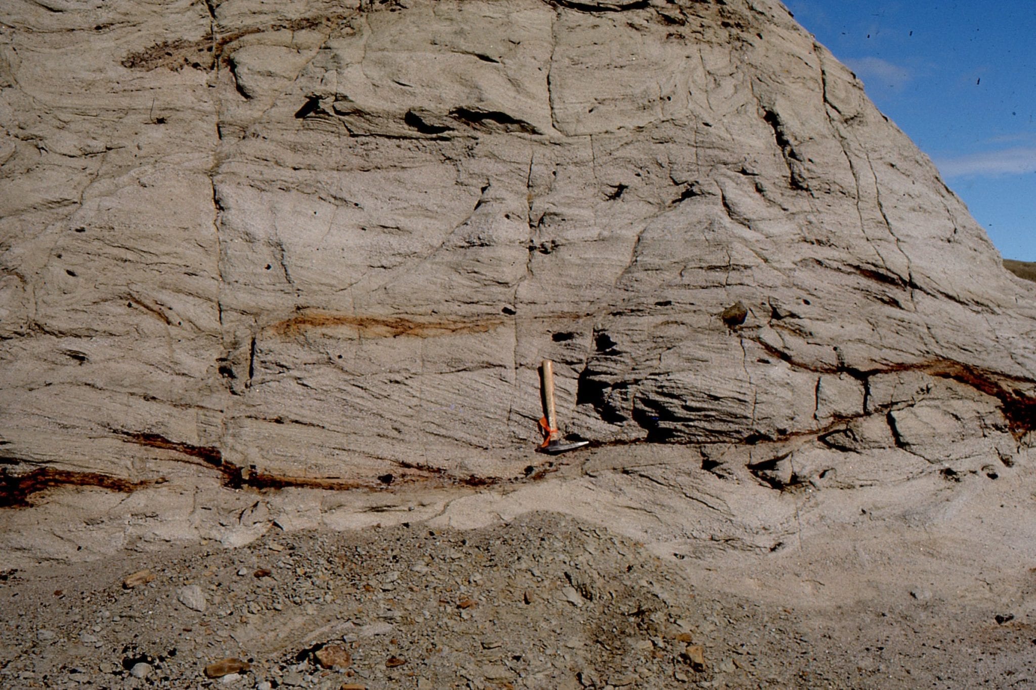
 Closer view of a coarsening-upward prodelta-shoreface cycle, Strand Fiord, Axel Heiberg Island. Hummocky cross-bedding occurs with associated with ripples, small sand waves, and current scours. The abrupt upper surface (top right) marks the beginning of transgression,with a maximum flood surface about 1m above.
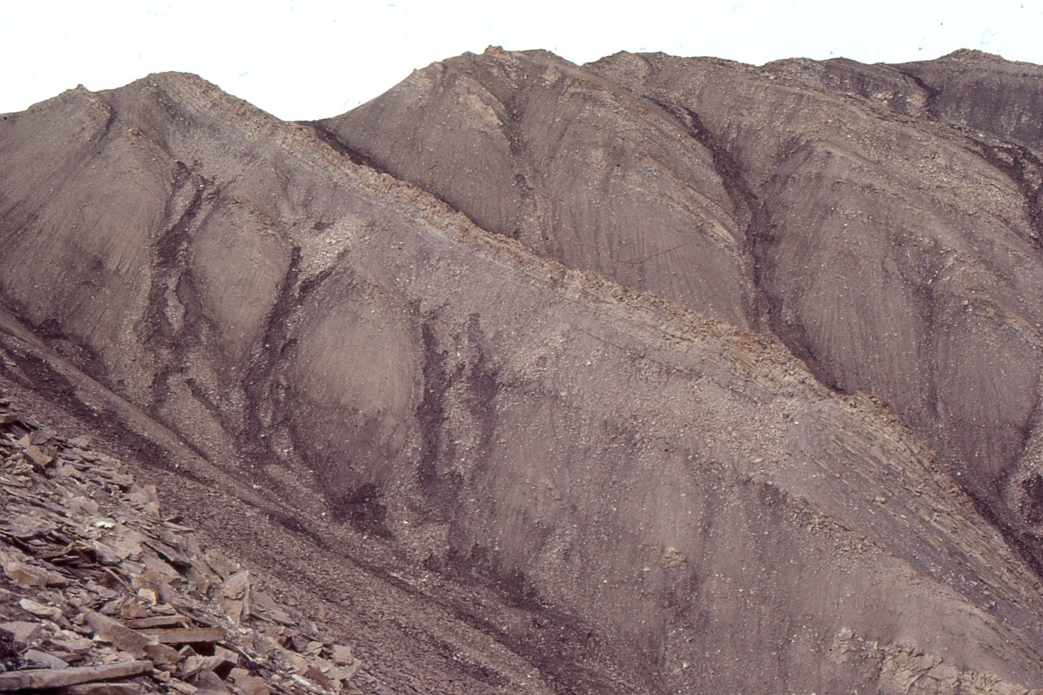
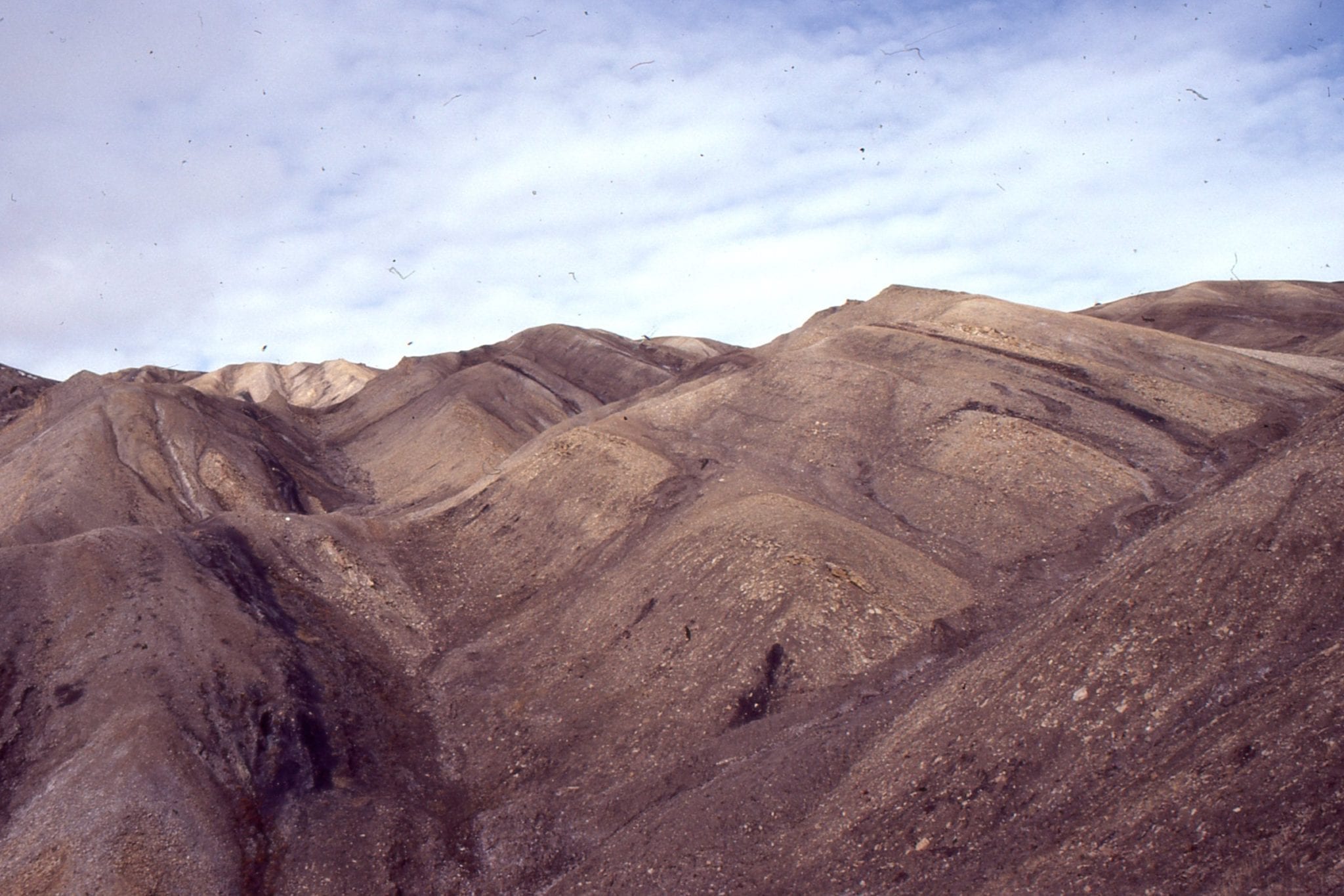
Coarsening-upward cycles, from prodelta to lower delta plain, in an Eocene river-dominated delta, Axel Heiberg Island. Channel sandstone and thin overbank coals occur in the upper part of each cycle. Iceberg Bay Fm, Eureka Sound Group. The river-dominated system is separated from the earlier wave-dominated system by a 3rd-order transgression that influenced deposition through the entire basin.
 Small coarsening upward, shoreface cycle capped by coal, representing marine incursion of the min river-dominated delta. Eocene Iceberg Bay Fm, Axel Heiberg Island. Coal at the base of outcrop is the top of the preceding cycle.
 Trough crossbedded fluvial channel, delta plain, in the Eocene Iceberg Bay Fm. Ellesmere Island
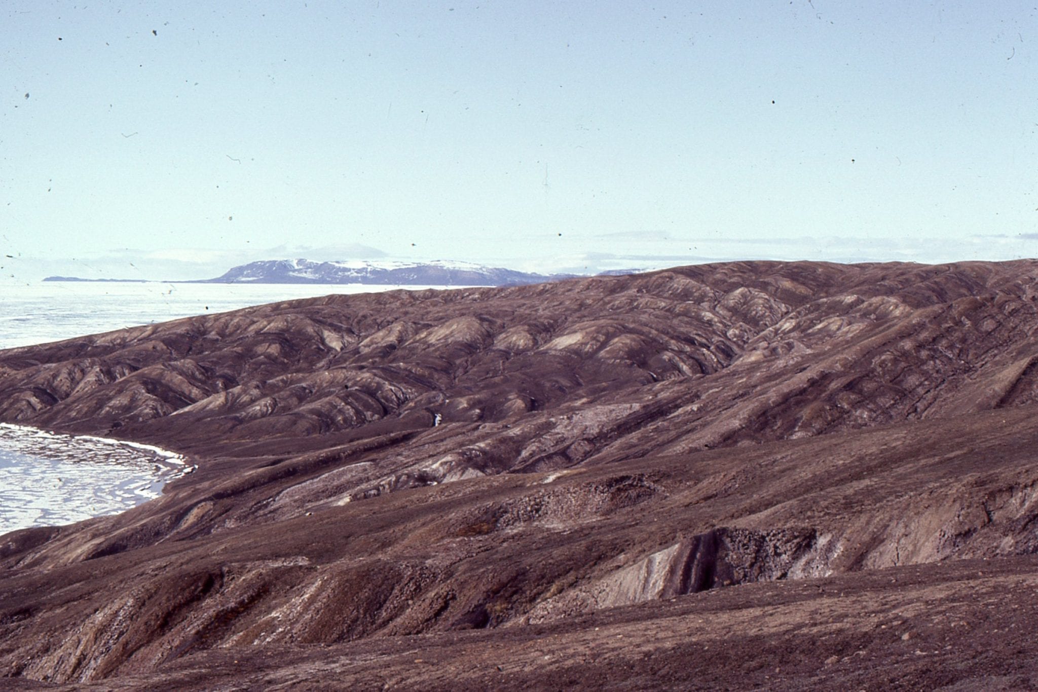 Panorama of multiple fluvial channel-swamp-bog coal cycles composing the main Eocene delta plain, Iceberg Bay Fm, Axel Heiberg Island.
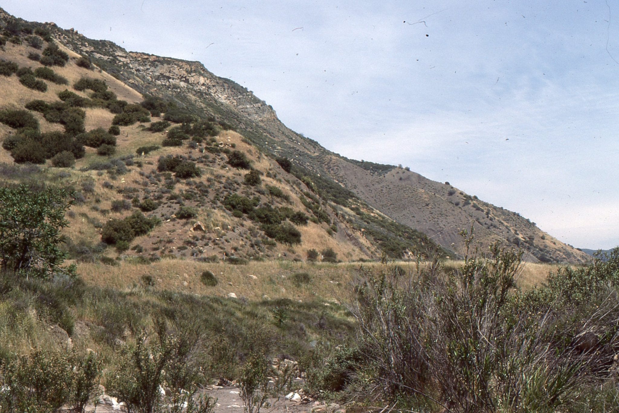 Late Miocene, lacustrine prodelta (base) to distributary channel-bar facies, Ridge Basin. Ridge Basin is a strike-slip basin wrenched by the San Gabriel fault strand of the San Andreas transform. The delta, on one side of the basin, is equivalent to the Violin Breccia that formed continuously along the active faulted margin.
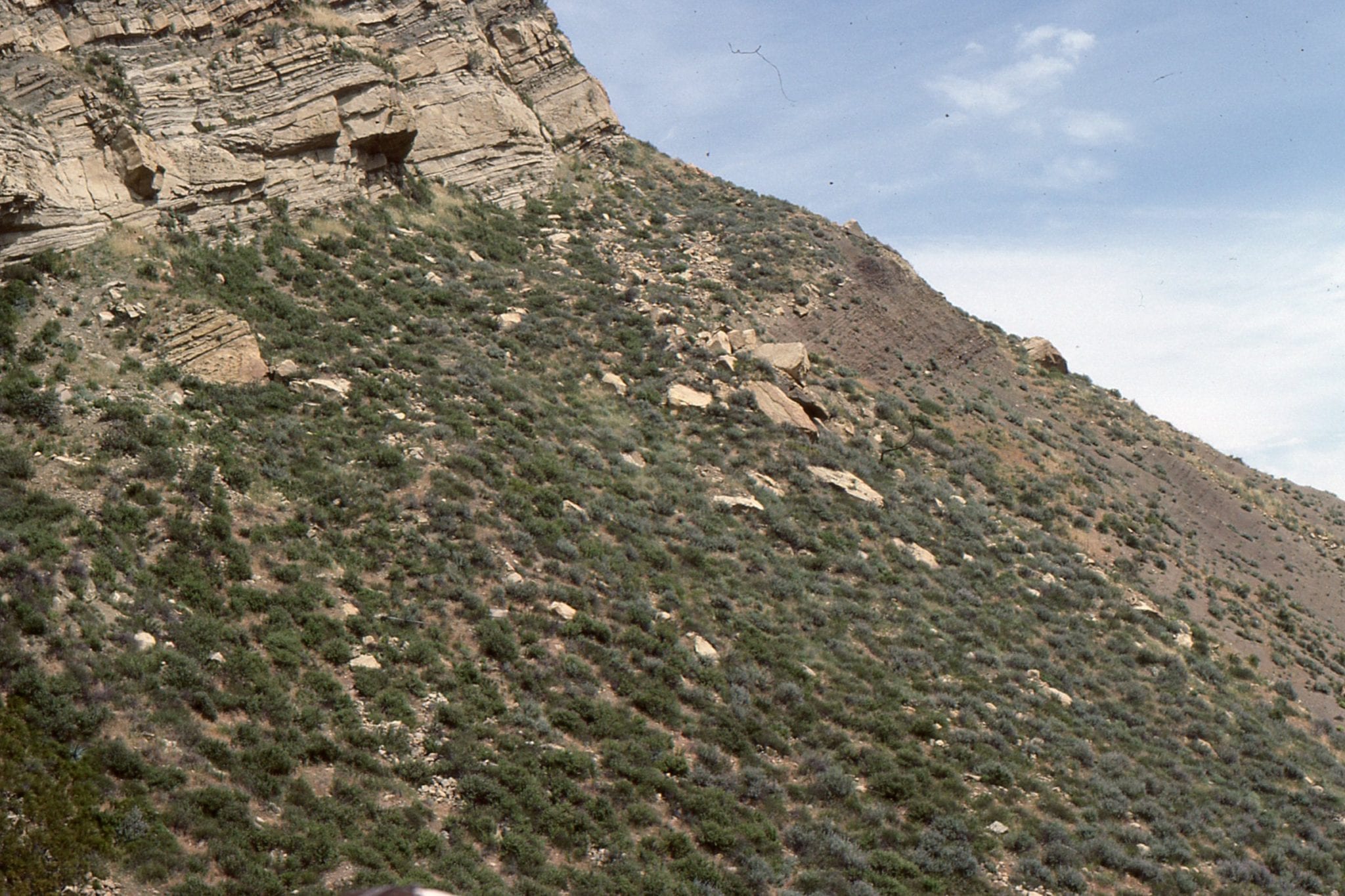 Prodelta to channel and mouth-bar sandstone, Late Miocene Ridge Basin, California.
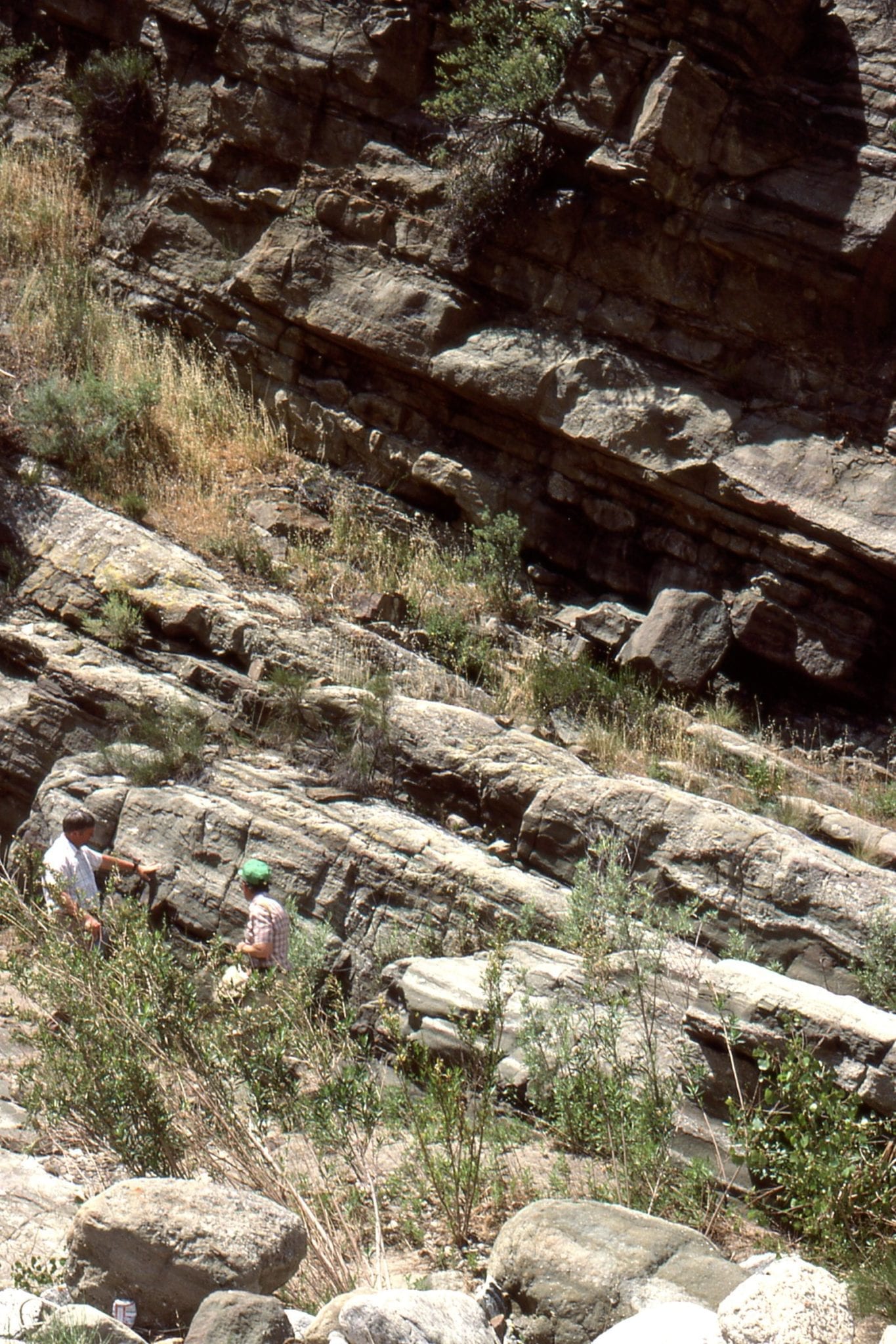
 Trough crossbedded channel and pebble lags, lacustrine delta plain, Ridge Basin California.
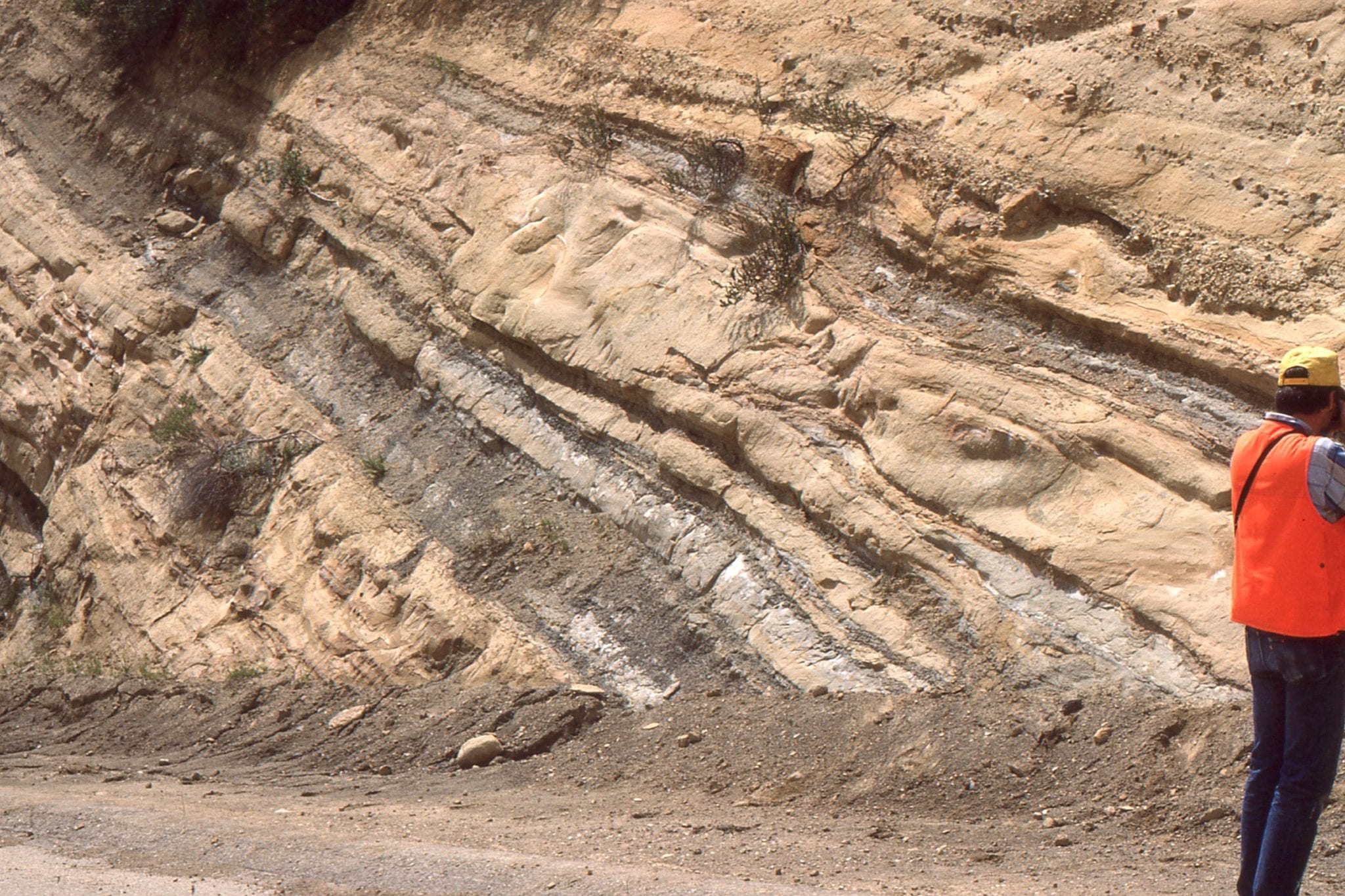
Late Miocene delta top, channel – mouth-bar sandstone, lacustrine delta, Ridge Basin, California. Interfingering pebble and cobble bands in the left image were derived from the Violin Breccia
 Crossbedded delta top sandstone, Ridge Basin California.