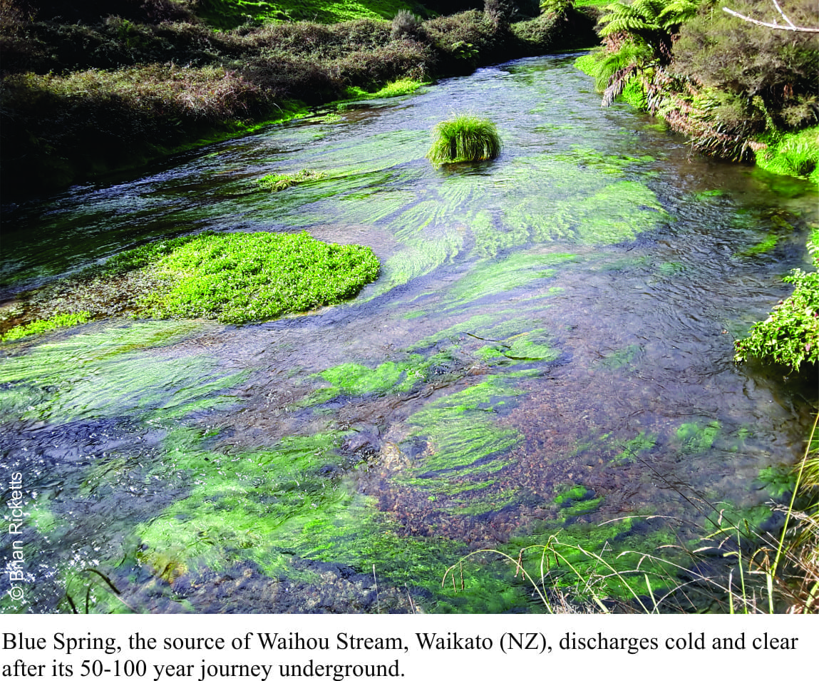
It rains quite a bit on Mamaku Plateau, the tableland underlain by volcanic debris that was deposited violently 240,000 years ago; an eruption that also gave rise to Lake Rotorua caldera (central North Island, New Zealand). Some of that rain seeps into the myriad fractures, nooks and crannies, and heads west as groundwater. Fifty to 100 years later that same water emerges, chilled to a cool 11oC, at Blue Springs (about 40km west of Rotorua). Spring water here flows at 42 cubic metres per minute (9,240 gallons per minute), enough to maintain a decent-sized stream (Waihou Stream).
Fresh water springs have been sources of life, driven conflicts and kindled the imagination for thousands of years. Greek muses frolicked in the Pierian Spring (somewhere in Macedonia); its waters a fount of knowledge. After spending a lifetime underground in,
A secret system of caves and conduits; hear the springs
That spurt out everywhere with a chuckle… (W.H. Auden, In Praise of Limestone, 1948).
Gleeful emergence.
Springs may be cold or hot (thermal); they sometimes have dissolved minerals that are deposited near or at the surface where the spring exits. Dissolved silica or calcium carbonate (tufa) are common in thermal springs. Thermal springs are also fed by groundwater but are heated by deep external sources like magma chambers. Buoyancy and convection (hot water rises, cold water sinks) play important roles in driving the hot fluids to the surface.
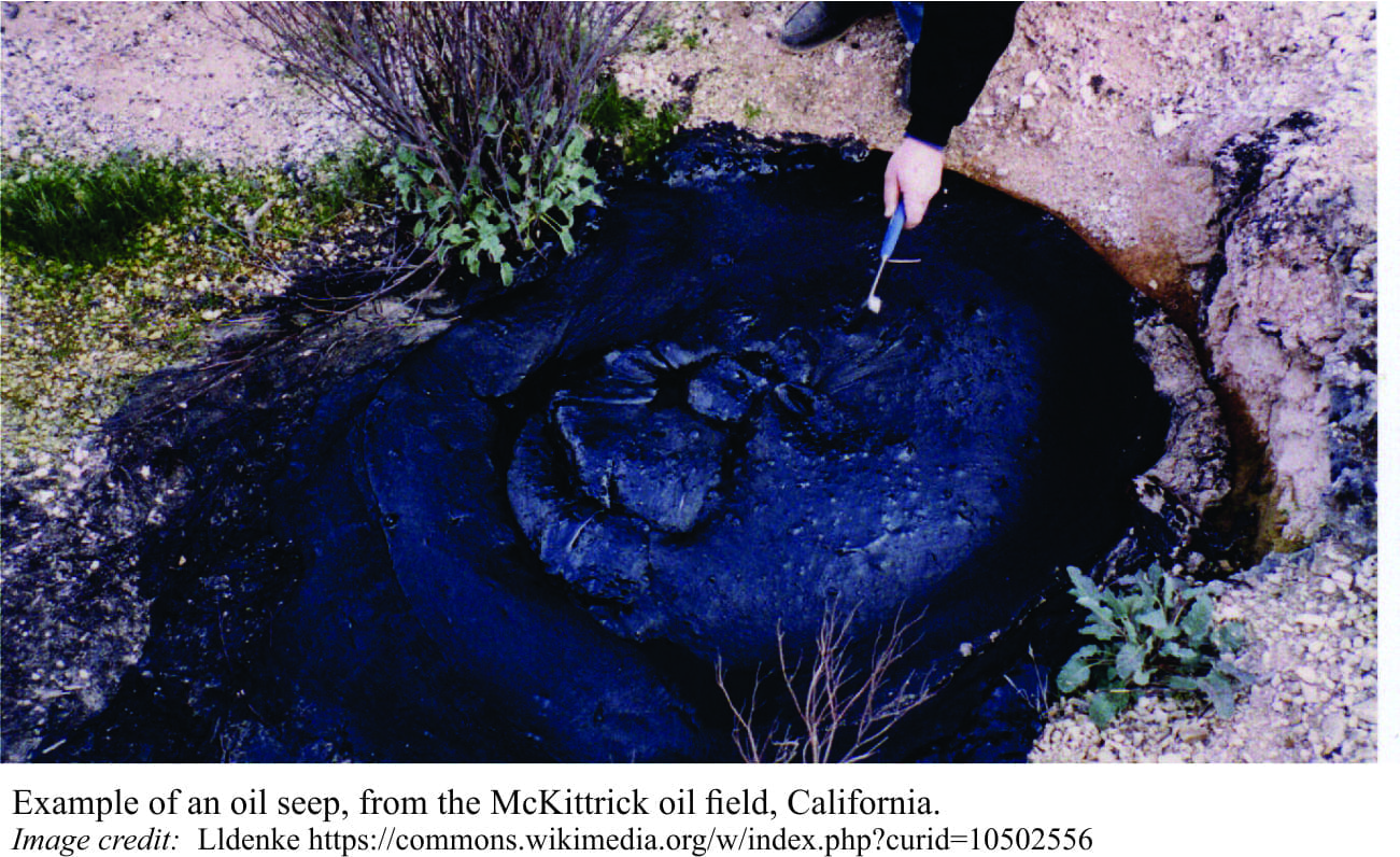
Some springs, like the Devil’s Postpile National Monument in California have naturally dissolved carbon dioxide, providing a kind of backyard sodastream. Buoyancy forces are also important for driving oil and gas to the surface (hydrocarbons seeps). In this case, the hydrocarbons are derived from oil or gas prone rocks at depth.
Fresh water springs commonly emerge where the watertable intersects the ground surface (water from an unconfined aquifer). In some regions, particularly those in limestone country, springs discharge from aquifers at depth that have elevated pressure (confined aquifers), where the water flows through conduits such as faults and fractures; this is also referred to as artesian flow. Sinkholes are an extreme expression of this kind of groundwater seepage.
The different kinds of fresh water spring all have one thing in common – the direction of flow is dictated by a decrease in pressure, or in more technical terms from high to low hydraulic head.
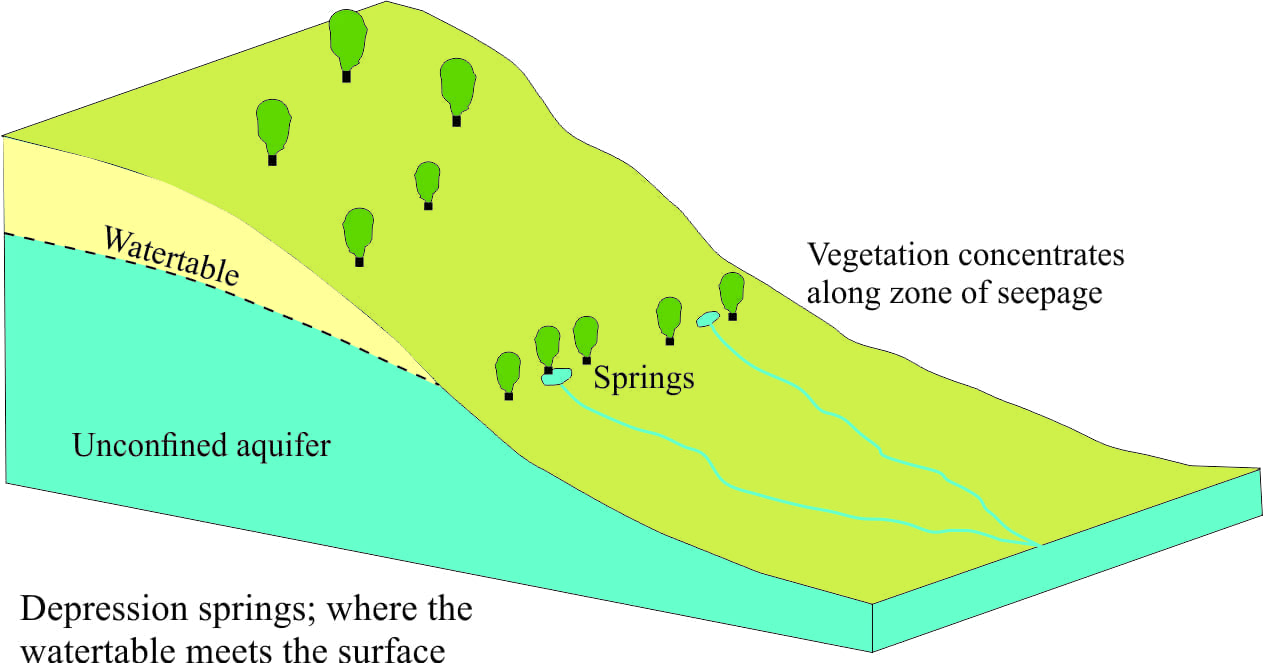 Gravity is the dominant driving force for groundwater flow in most groundwater systems, including spring flow. The easiest way to grasp this is to look at surface topography; groundwater at high elevations has greater hydraulic potential, or gravitational energy, than that at lower elevations. Thus, if an upland watertable intersects the surface at a lower elevation, for example along a valley, then springs will develop at or below that point of contact – this is illustrated in the block diagram.
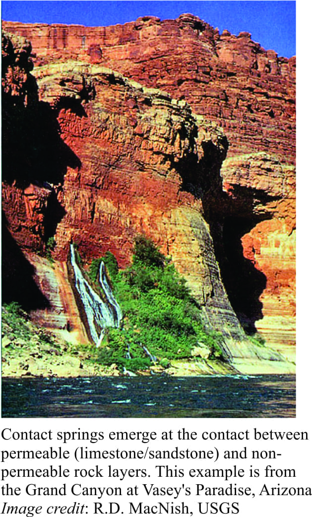 In layered rock groundwater can seep through a permeable aquifer until it reaches an impermeable barrier such as a mudstone or shale. If the contact between the two layers is exposed, the groundwater can emerge as contact springs. In the example shown here from Grand Canyon, Arizona, springs emerge at the contact between an impermeable limestone below and the permeable limestone above through which groundwater has percolated.
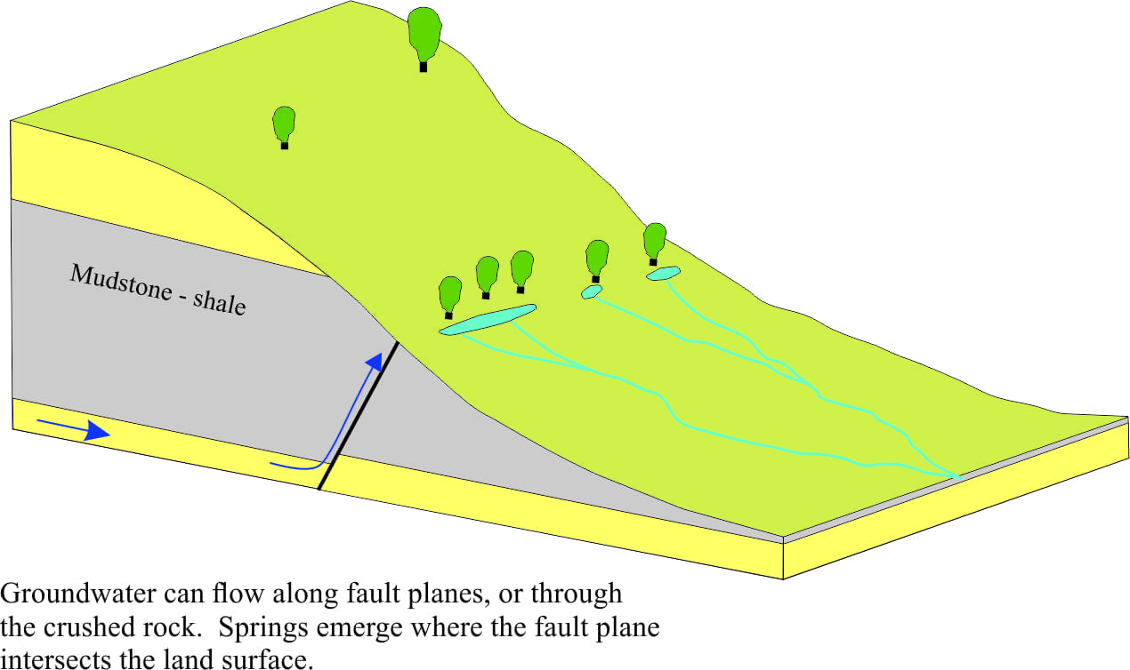
Conduits for groundwater flow and spring discharge are provided by fault planes that in some circumstances may tap into several aquifers. In the diagram above, groundwater flow in the sand aquifer is diverted by a fault plane. If there is sufficient hydraulic head in the aquifer (think of this as the potential energy available from the force of gravity), the groundwater will emerge where the fault plane intersects the surface.
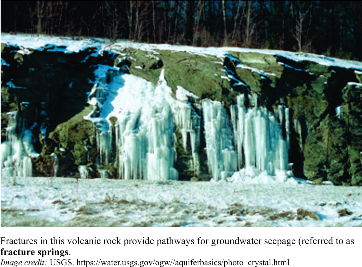 Fractures and joints are common in hard rock. Most igneous and metamorphic rocks typically have little or no permeability, except where they have been fractured by tectonic forces or jointed during cooling (typical of lava flows). Groundwater can flow through these crevices and emerge as springs. Seepage is common on exposed rock faces; freezing during the winter can produce some spectacular ice shows.
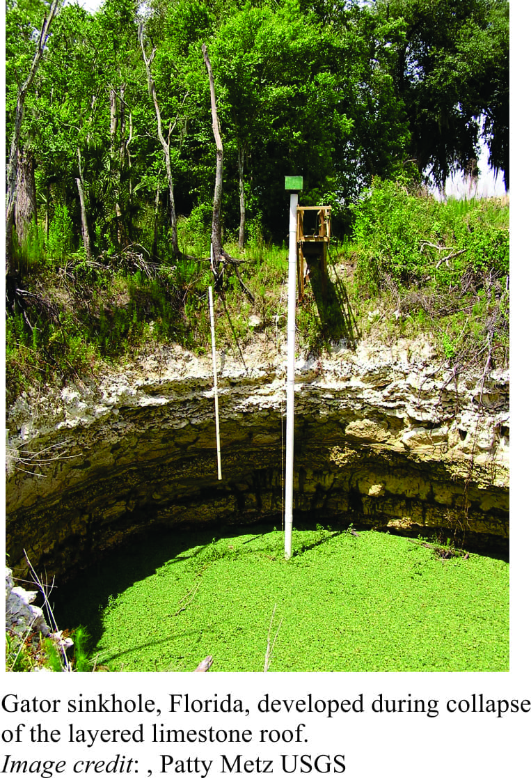
Perhaps one of the more extreme expressions of groundwater seepage and spring discharge occurs in regions underlain by limestone and salt. Both rock types tend to dissolve with groundwater seepage, enlarging fractures and creating underground caverns and waterways (formation of stalactites and stalagmites is part of this process). As caverns become larger, the roof rock becomes unstable and collapses; the surface manifestation of this is a sinkhole. Florida is a region particularly prone to sinkhole formation and it is not uncommon for entire houses to be swallowed by the collapsing surface. Sinkholes commonly fill with water derived from the aquifer below. And while local governments and individuals may find such geological structures a nuisance, it seems that local alligator populations are thrilled with the opportunity for a new beach or swimming hole.