Tag Archives: Hudson Bay

In the field: Windows into two billion year-old rocks

Facebooktwitterlinkedininstagram

My early geological education was very much New Zealand centered; the gamut of sedimentary, igneous and metamorphic rocks (there are no Precambrian rocks in New Zealand), in the context of a landmass (and attached submerged bits) still rent by active faults and erupting volcanoes. The timing was fortuitous. We were taught at the cusp of the ‘new tectonics’, sea-floor spreading, and the morphing of continental drift into plate tectonics.  The fixists were a disappearing breed; now everything was on the move, attached in some way to one tectonic plate or another, rifted, drifted, and eventually subducted. Now, the rock formations, faults (particularly the Alpine Fault), and the volcanoes, were all connected in one, all-encompassing global, plate tectonic system.  Geologically active New Zealand had a place in this grand scheme.

Admittedly, not all our professors found it easy to teach these revolutionary ideas. We would be exhorted to go and read the latest journal papers, and come back with questions – I guess this gave the teachers time to read the articles themselves. But it was an exciting time, reading the claims and counterclaims. It really was a (Thomas Kuhn) paradigm shift.

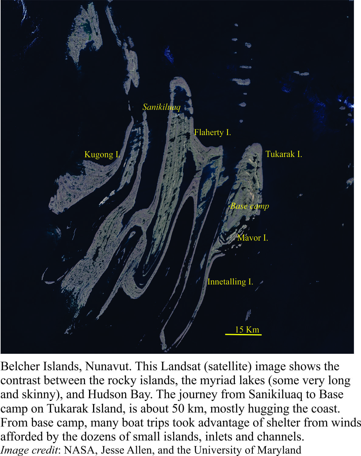
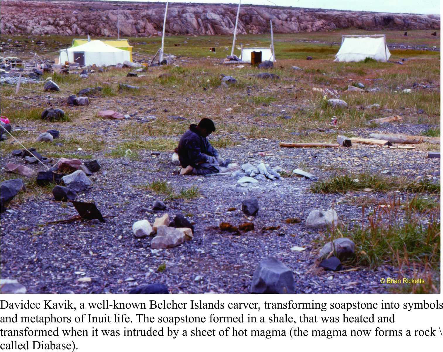
Landing on the shores of Belcher Islands (Hudson Bay) was also something of a mind warp; from a country that straddles a plate boundary, has a volcanic rift zone in central North Island, and faces a subduction zone within a stone’s throw of the east coast, to a part of the Canadian Shield where not much has happened over the last two billion years.  Perhaps that’s a bit of an exaggeration, but this prolonged period of stasis had its advantages.  The rocks, despite being about 2000 million years old, are loaded with beautifully preserved structures and fossils.  They were not cooked by metamorphism during the time they spent being buried, nor fractured beyond recognition by tectonic forces. Basically, everything was intact. Stunning.

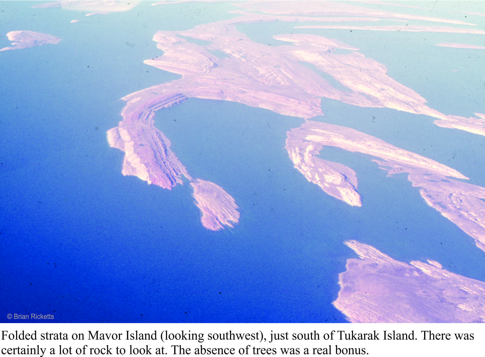
For someone interested in deciphering ancient sedimentary environments, being parachuted into the Belchers and being told to take the rocks apart, layer by layer, sequence by sequence, was initially a tad scary; an emotional response that quickly dissipated once the measuring, observation, and interpretations had begun. On finishing the work on one set of exposures, we couldn’t wait to get to the next, and the next.

Ancient and modern stromatolite domes

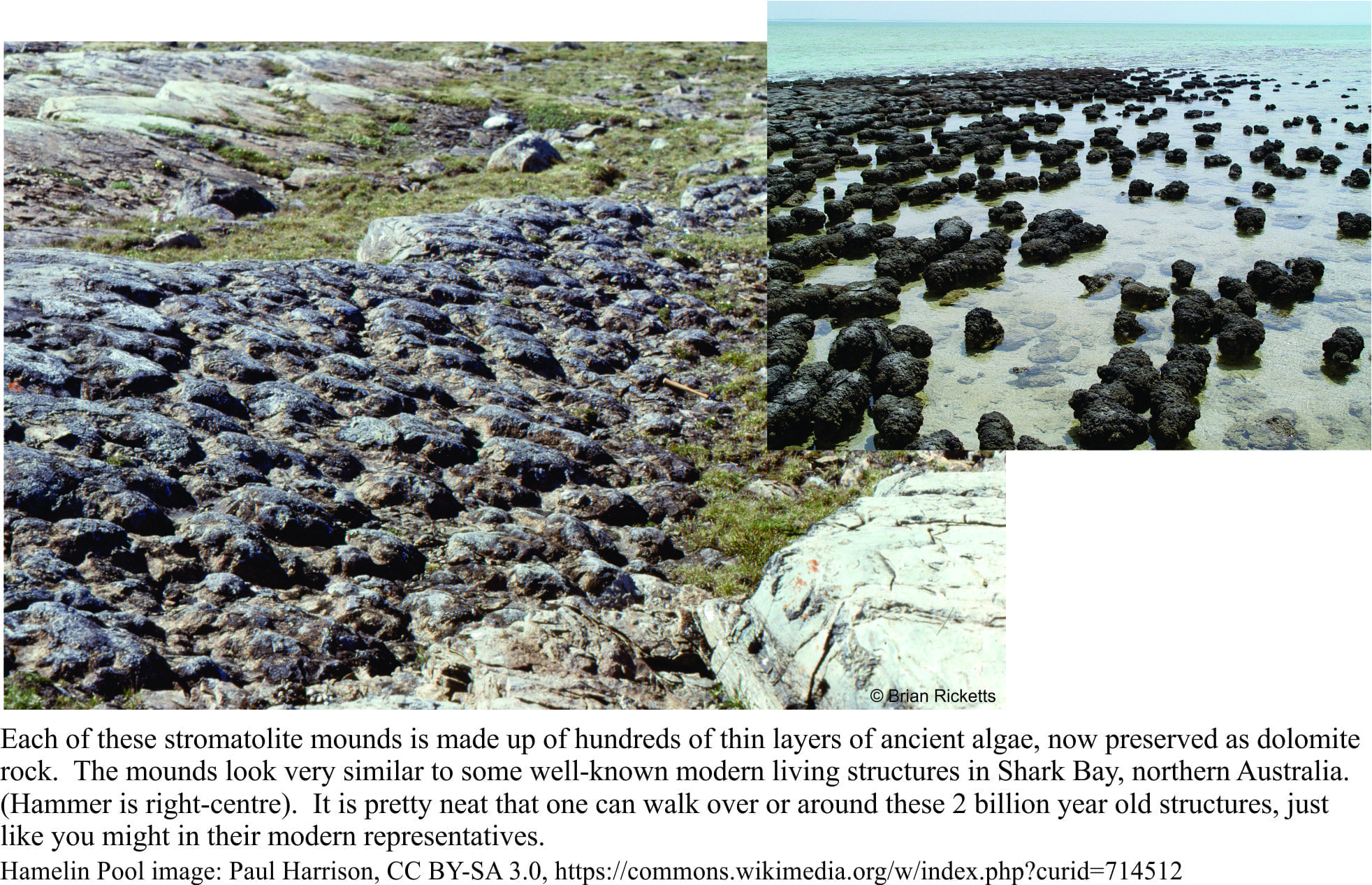
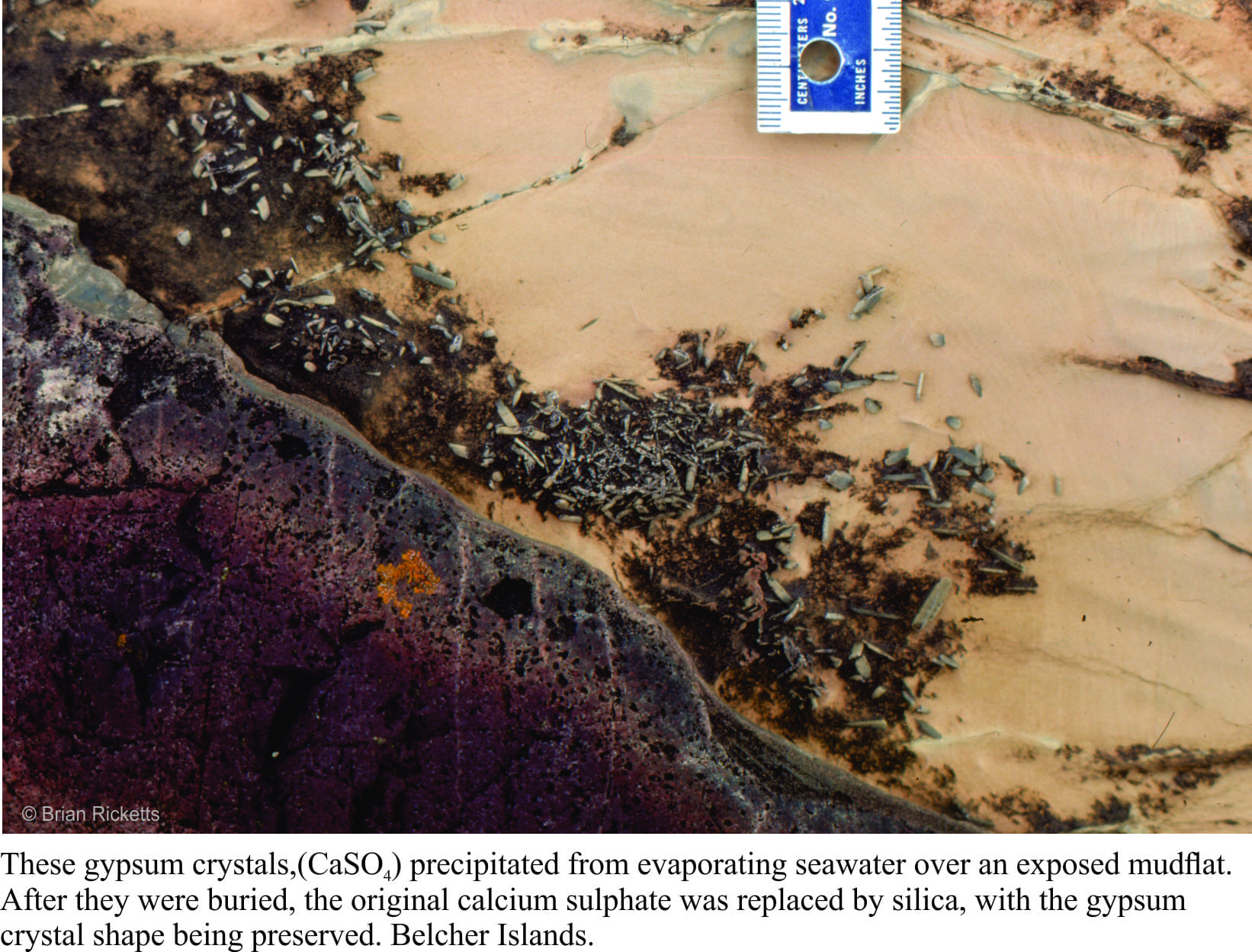
If you were to stand all the Belcher strata in a single pile, it would be almost 9 km thick. But this pile was subsequently tipped on its side. Over the eons, the rocks were eroded by rivers and scraped by ice, fortuitous levellers that provided windows into each layer. Geologists are enticed to enter these portals, at least in their mind’s eye; the rewards are huge.  We can envisage times when there were broad platforms of limestone (now all converted to the mineral dolomite), that harboured a massive biomass of primitive algae, stromatolites of all shapes and sizes; layers as thin as a fingernail, and reefs 10s of metres high. The platforms were covered by warm, seas that shoaled into tidal flats and (deserted) beaches. Some areas infrequently inundated by high tides, became desiccated; there are remnants of minerals like gypsum and halite (common salt) that attest to salty seas. Walking over rocks like these kindles the imagination; a beach stroll, waves rolling in like they have done for billions of years, or parched landscapes exposed to the full effects of sunlight uninhibited by oxygen and the UV dampening effects of ozone (the incidence of UV light must have been intense). The experience is humbling.

Gypsum (replaced by dolomite) in a Paleoproterozoic tidal-supratidal flat

However, idylls have a tendency to dissipate in the fog of time or, as was the case here, a smothering by erupting ash columns and lava flows. Now we get to walk across the tops of really ancient lava flows, around piles of pillow lavas, or along catastrophic pyroclastic flows of ash and pumice.  The earlier tropical paradise had been obliterated, but even in this volcanic brutality there is wonder.

Mud cracks in a 2 billion year river deposit

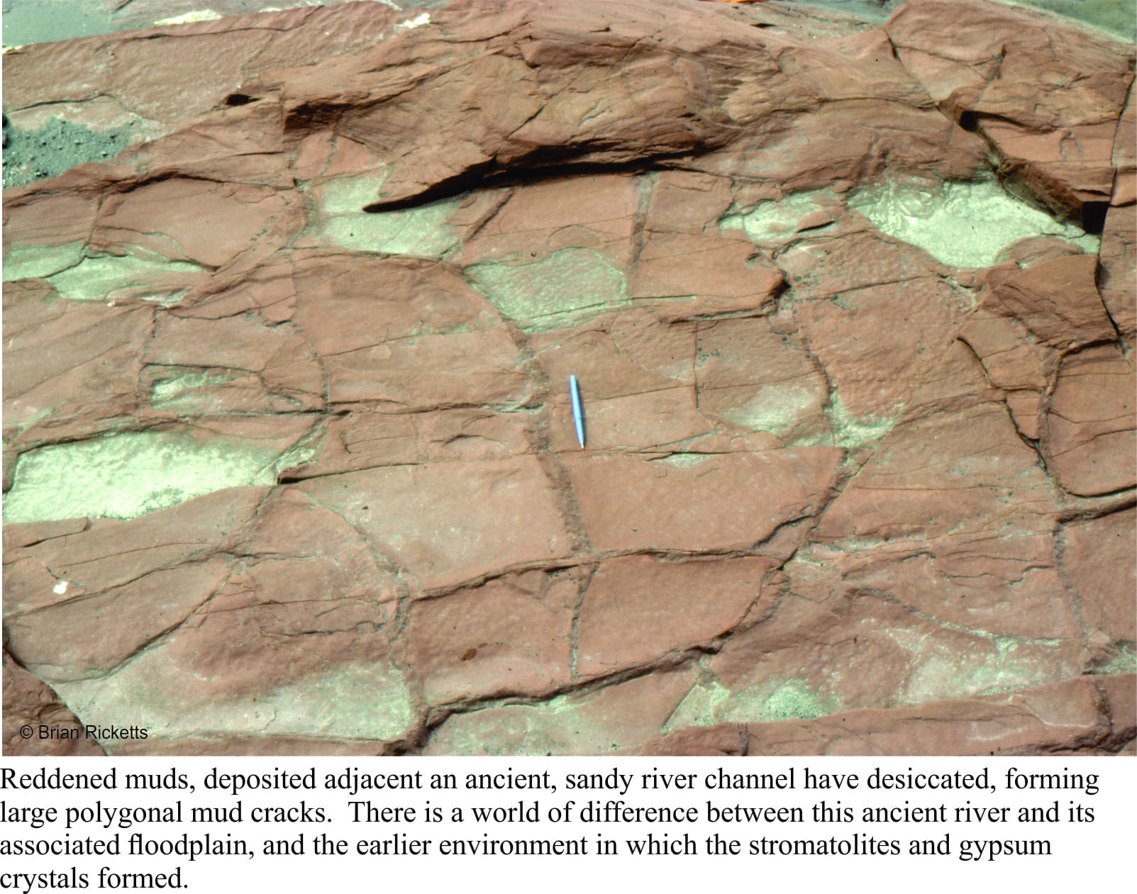
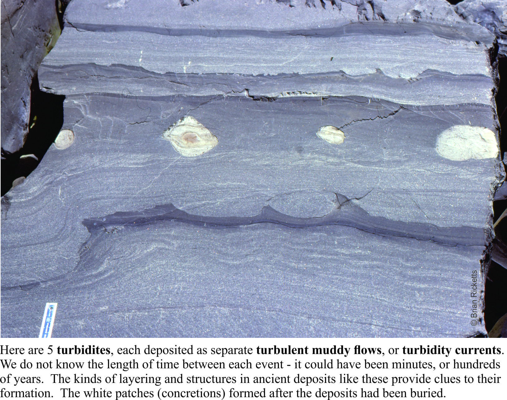
Other strata tell of deep seas fed by turbulent mud flows cascading down an ancient submarine slope, and of sandy rivers turned red by iron oxidized by the gradually increasing levels of oxygen in the ancient atmosphere (deposits like this are commonly referred to as red beds). In every layer, every rock we looked at, there were mysteries waiting to be unravelled. A geologist cannot hope to solve all such questions, but finding a solution to even one of them is incredibly satisfying.

Lots of turbidites in a deep, Paleoproterozoic basin

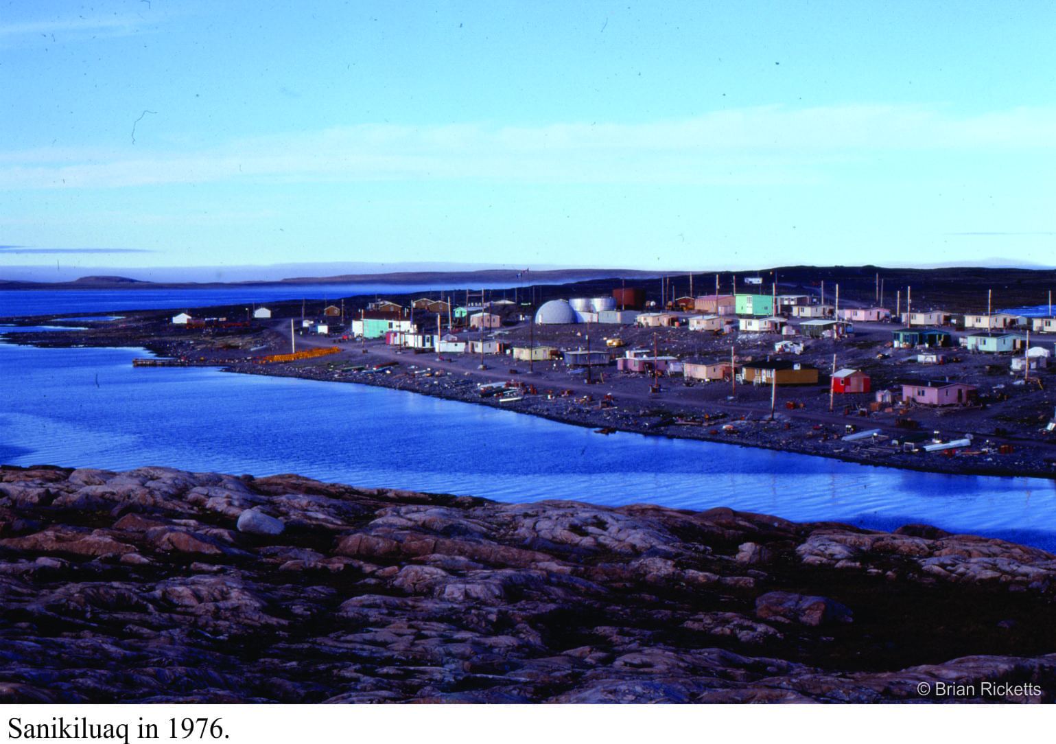
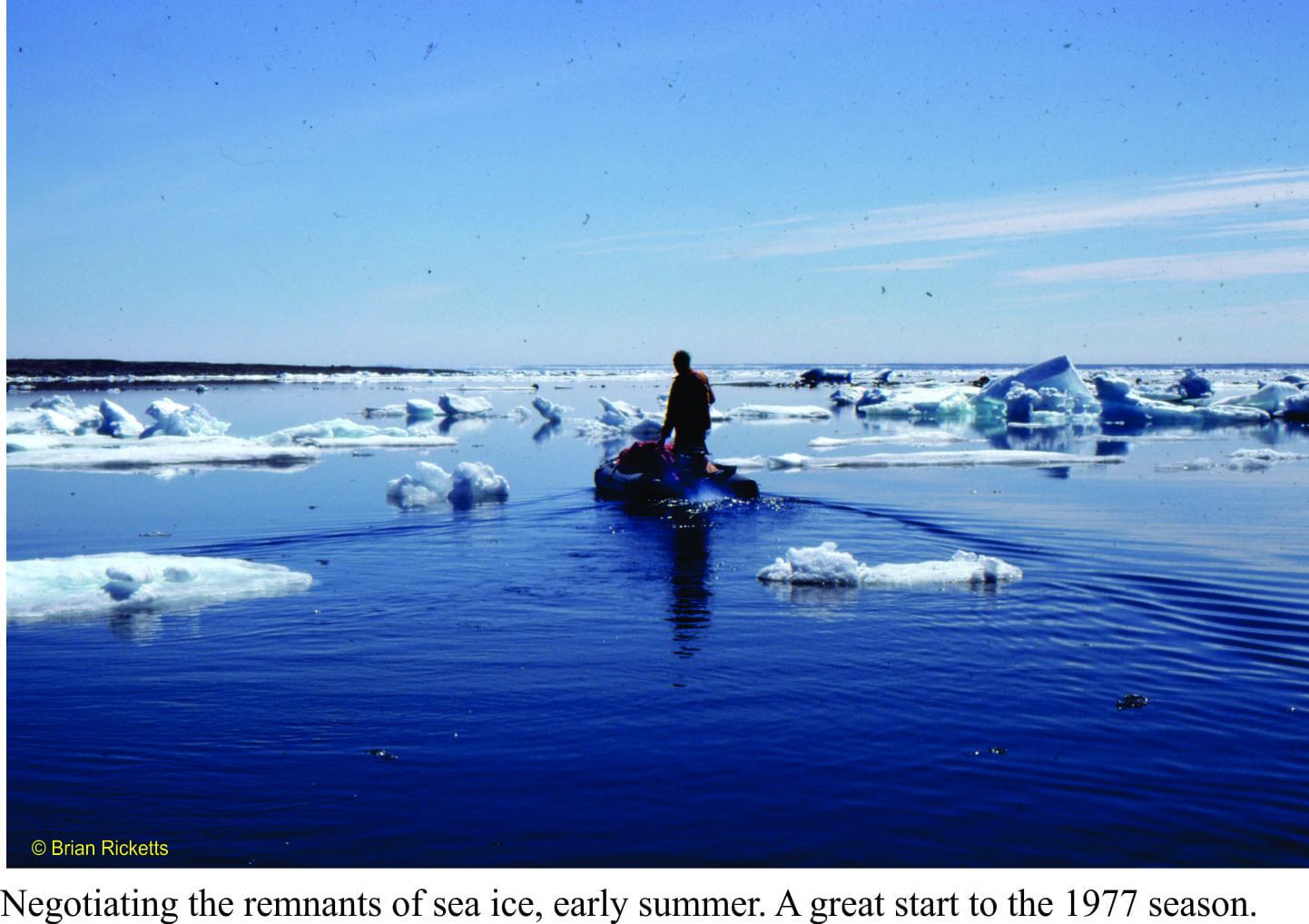
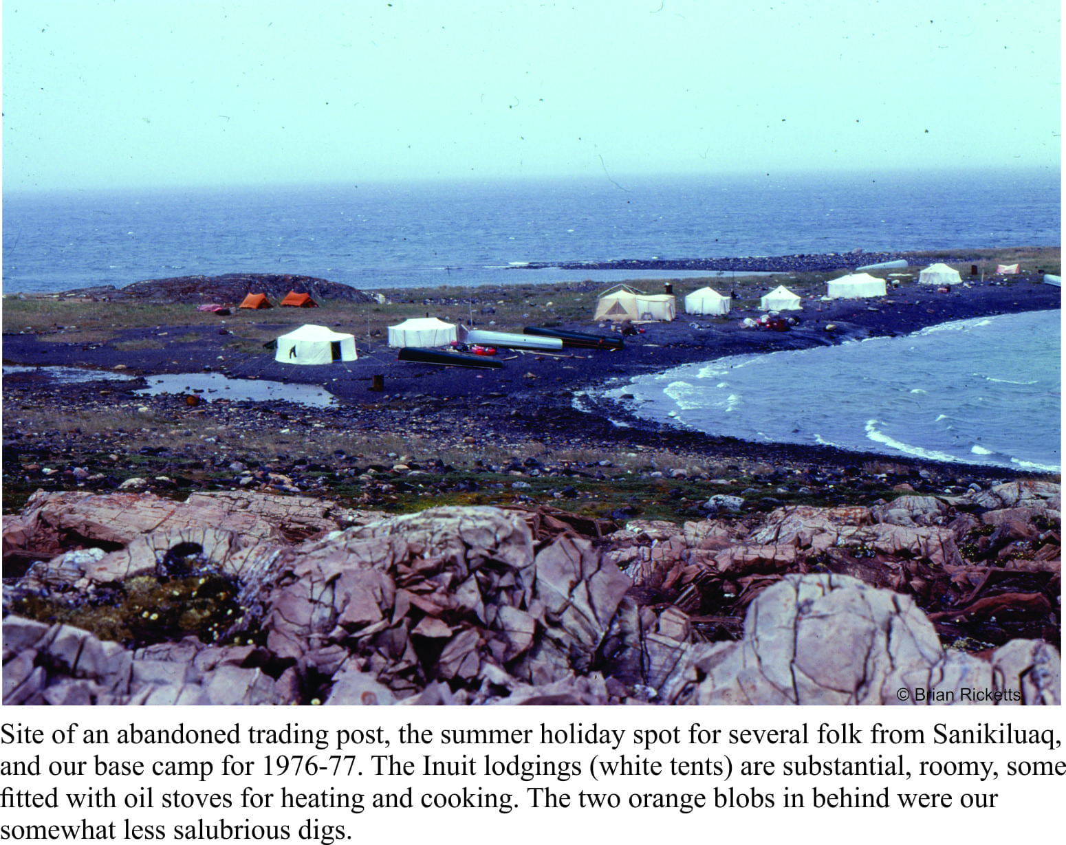
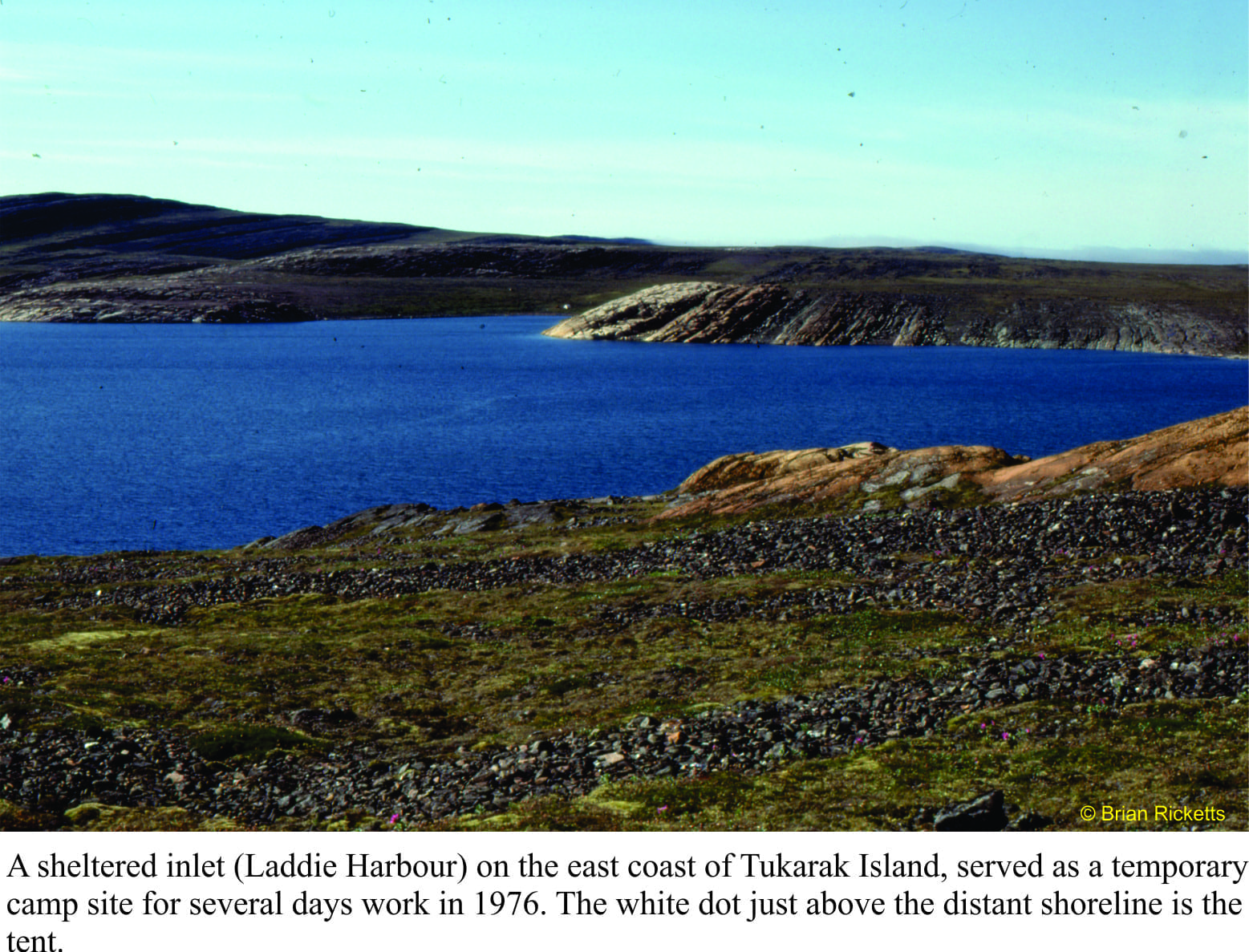
I spent a total of 5 months in the field during the 1976-77 summers. This was not the kind of location where, if I’d forgotten to do something, I could whip back for a couple of days to sort things out. Several of my student colleagues were doing similar kinds of research in remote parts of the country – field seasons were long. Once you had arrived, you were there for the duration. And despite the sense of excitement and discovery, it was always good to get back home.

Some details of turbidite beds showing complete and partial Bouma intervals

Facebooktwitterlinkedininstagram
Facebooktwitterlinkedin

In the field: from one extreme to another

Facebooktwitterlinkedininstagram

Aerial photo of Belcher Islands, Hudson Bay

Have you ever looked at some locale on a map or photograph and thought “that looks like an intriguing place to work”, only to find, sometime later that you are smack in the middle of that same spot?  Time-warp? Some god’s lap?

I was preparing to travel to Canada. The plan was to do a PhD, and because I had not long completed a Masters thesis on geologically very young sedimentary deposits, had entertained the idea that research on very old rocks would add a kind of symmetry to my geological outlook – from one end of the geological time-scale to the other.  In preparation, I borrowed The Geology of Canada, a weighty tome, and homed in on the Precambrian system (basically everything older than 540 million years).  What caught my attention were some squiggly-shaped islands about 150km off the southeast coast of Hudson Bay; the Belcher Islands.  Their shape belied some interesting geological structures, and the strata a mix of sedimentary and volcanic rocks about 2 billion years old. What a neat place to work, although I envisioned the islands to be treed.

I arrived in Ottawa (early January, 1976) to minus 25oC and snow; I had never seen so much snow. I thought it quite beautiful, which elicited wry comments from the Ottawans I was meeting who were sick of shovelling driveways and digging vehicles out of snow drifts. Destination – Carleton University. My supervisor was to be Alan Donaldson, well-known in Precambrian geology circles. Following the introductions, he announced that my project, unless I had some objection, was to focus on the Belcher Islands.  LOL. I was to spend 5 months there in total over the summers of 1976-77.  The social environment, the weather, and the geology were remarkable.

Plunging anticline-syncline folds, Mavor Island

Getting to the islands was a milk run: a drive to Montreal airport, a flight to Moosonee near the southern shores of James Bay (northern Ontario), a very noisy DC3 leg to Umiujaq (Quebec) where we picked up field equipment (kindly loaned to us by the Geological Survey of Canada), then Twin Otter across the 150 km to Sanikiluaq, the sole village on Belcher Islands. We were able to stay in a small house owned by the Hudson’s Bay Company for the two days needed to sort gear, buy food, and make sure the two inflatable Zodiacs and outboards worked. My assistants (John McEwan in 1976, Mike Ware in 1877) and I always used two boats as a safety measure (and for visitors).

Sanikiluaq in 1976

The seas around the islands are mostly ice-free during the summer months, but the water is still only a few degrees above freezing, and the air close to the water cold. Even in the summer, we had to bundle up with wet-gear, fleeces, and life jackets (I was told the life jackets were necessary for insurance purposes – so they could retrieve the bodies). The islands and intervening channels are also elongated north, so that wave set-up could change drastically any time there was a wind shift.  We were caught out a few times with unfavourable seas, but there was always somewhere to shelter.

Negotiating sea ice, 1977

Belcher Islands are mostly held together by a thick volcanic unit that creates more or less linear coastlines. The strata were folded, like a series of waves, into simple anticlines and synclines, such that the package of sedimentary rocks is exposed in the anticlines, while the synclines are drowned by major channels and inlets.  The terrain is subdued with low relief – the islands were scraped clean by the Laurentide Ice Sheet during the Last Glaciation.

Base camp on Tukarak Island - the local Inuit holiday spot

Our base camp was to be in a small, relatively sheltered inlet along the western shore of Tukurak Island (one of the largest and easternmost island).  It was a 3-4 hour journey, depending on weather.  This is the site of an abandoned Hudson’s Bay post. It was also the favoured summer holiday spot for local Inuit, primarily because it is close to their source of soapstone.  Belcher Island soapstone has an enviable reputation amongst northern communities, because of its uniform, deep green colour, and general lack of fractures that would render carving difficult. Whenever we were in base camp, we would watch the elders carving, and teaching their younger folk the same skills. They would also bring us bannock and Arctic Char. And there was never a shortage of Inuit kids around, checking in, telling stories, or simply hanging out. We would spend 4-5 days away from base camp, returning to stock up and cache samples. Time in base camp was always a delight.

Camp visitors, 1976


Davidee Kavik, soapstone carver on holiday on Tukarak Island

Belcher Islands sit well below the Arctic Circle at 56oN (latitude), and yet the landscape is typically Arctic. The northern Canada tree-line is located south of Hudson Bay, such that the Islands have a typical Arctic flora (especially wild flowers), and no trees – so much for my earlier, wistful image of the place.

The weather alternated between gorgeous, with light winds and clear skies, and abysmal. On more than one occasion we returned to camp from a day’s work to find tents down and sleeping bags soaked.  High winds also prevented longer excursions with the boats, unless we were riding through sheltered channels and inlets.  With the boats, there was always one eye kept on the weather.

During the first couple of weeks in 1976, Bill Morris (Geological Survey of Canada) had joined us to sample rocks for geophysical measurements (looking for ancient magnetic poles). The day he was to leave base camp (and fly out of Sanikiluaq) was particularly inclement. He insisted on attempting the trip, but instead of using our inflatable boats, I decided to rent one of the larger, sturdier, Inuit canoes with twin outboard motors (I was the only one with boating experience). We ventured out of the sheltered inlet, into the maelstrom – at least that’s what it looked like from the perspective of our small craft. I doubt we got any further than 50m from the inlet entrance; a lull in the waves, a quick decision to about-face, a beeline back to calmer waters, and the colour returned to the faces of my two passengers.

“Guess I’m going to miss my flight”. We all new he probably would have missed it, even if we had continued. Back to base camp to drain what was left of a bottle of scotch, and cogitate on an earlier field season on a warm New Zealand Pacific coast.

This is the first blog on my Belcher Islands episode

Facebooktwitterlinkedininstagram
Facebooktwitterlinkedin

The sea level equation

Facebooktwitterlinkedininstagram

Raglan bar

Sea levels have risen and fallen countless times over geological history.  We see this in the way successive strata are arranged and in the kind of ancient environments that each sedimentary layer or group of layers represents.  For example, we may observe that layers deposited in relatively deep water are overlain by layers that indicate successively shallower conditions, then inundated once again by deeper seas.  Geologists consider cycles of sea level change like this to be the ‘norm’.  However, deciphering the causes of sea level change remains problematic; has global sea level risen or fallen (for example because of changing icecap volumes), or has the land surface and sea floor subsided or uplifted?  Or have both processes been active?  When we attempt to answer these questions, we need to remind ourselves of what processes are actually involved in changing actual and relative sea level.  This post summarizes the most common causes.   They are relevant not only for geologists trying to solve stratigraphic puzzles, but for anyone considering the effects and potential risks of changing sea levels as they take place today. Continue reading

Facebooktwitterlinkedininstagram
Facebooktwitterlinkedin