The Atlas, as are all blogs, is a publication. If you use the images, please acknowledge their source (it is the polite, and professional thing to do).
The glaciofluvial-periglacial category refers to pretty well anything sedimentological, that is associated with glaciations, glaciers, ice caps, and ice sheets. It includes the ice itself, outwash sediment in fluvial and lacustrine environments, and ice-related phenomena like permafrost and patterned ground. Most of my examples are from Canada, the Arctic, and Laurentide Icesheet locations like Ottawa, Ontario, and Fraser Lowlands, British Columbia.
This link will take you to an explanation of the Atlas series, the ownership, use and acknowledgment of images.
Click on the image for an expanded view, then ‘back one page’ arrow to return to the Atlas
The images:
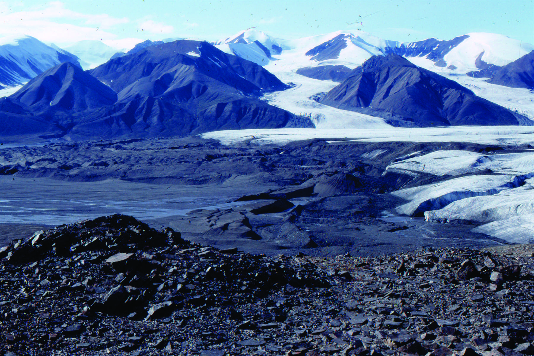
Terminal moraines ahead of a retreating Strand Glacier, Axel Heiberg Island, as it was in 1983.
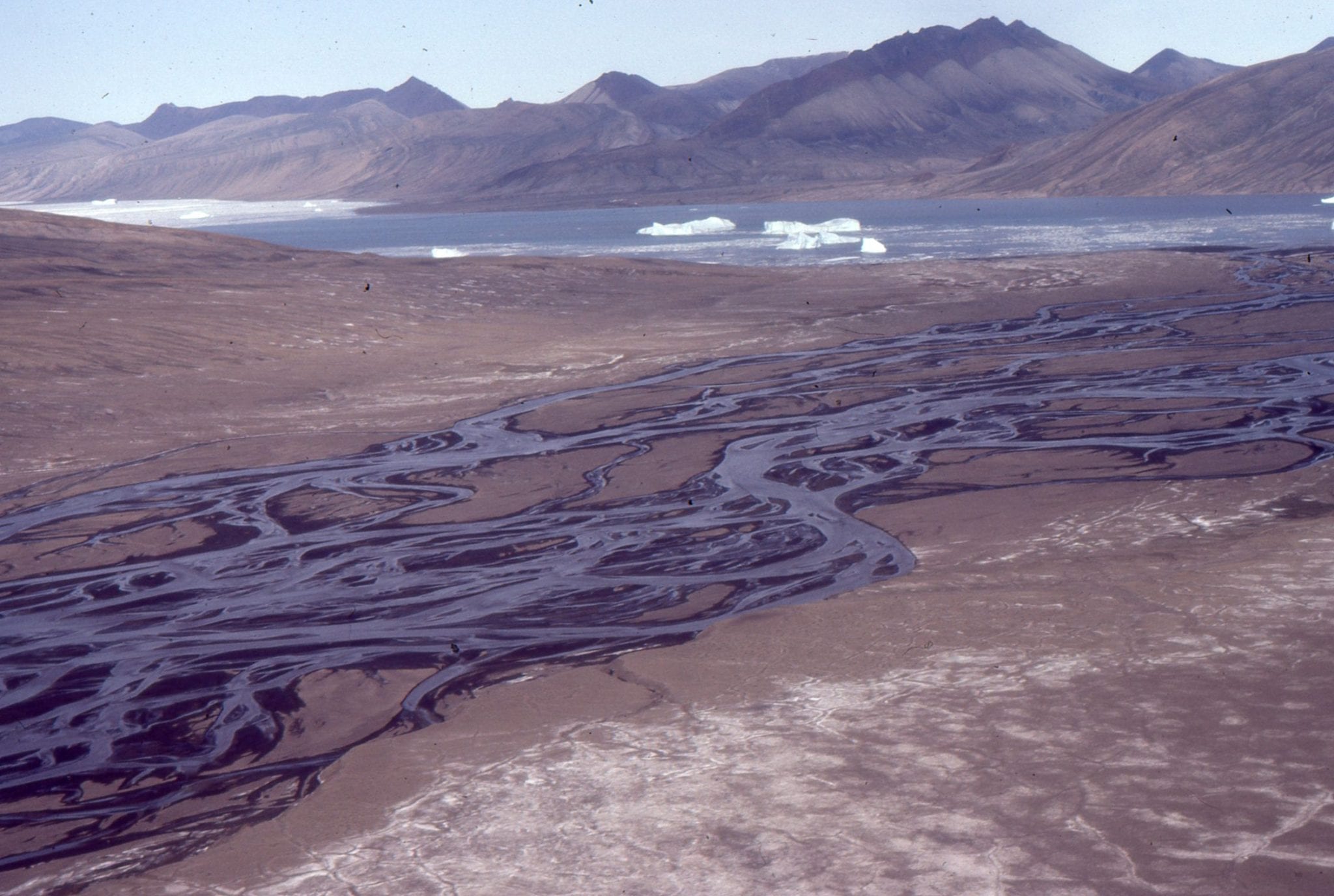
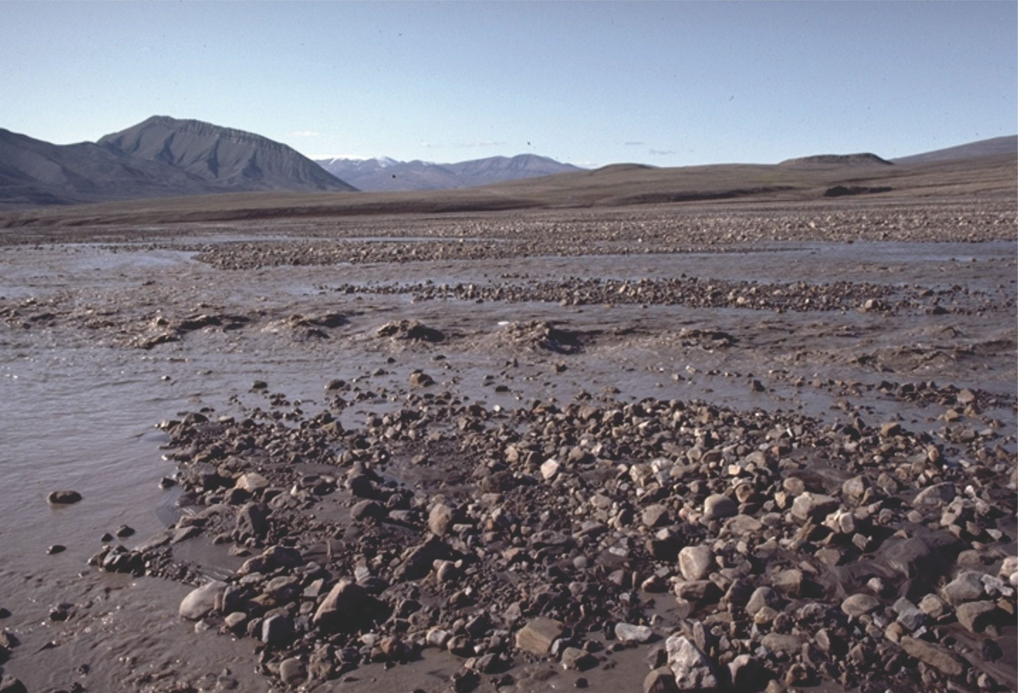
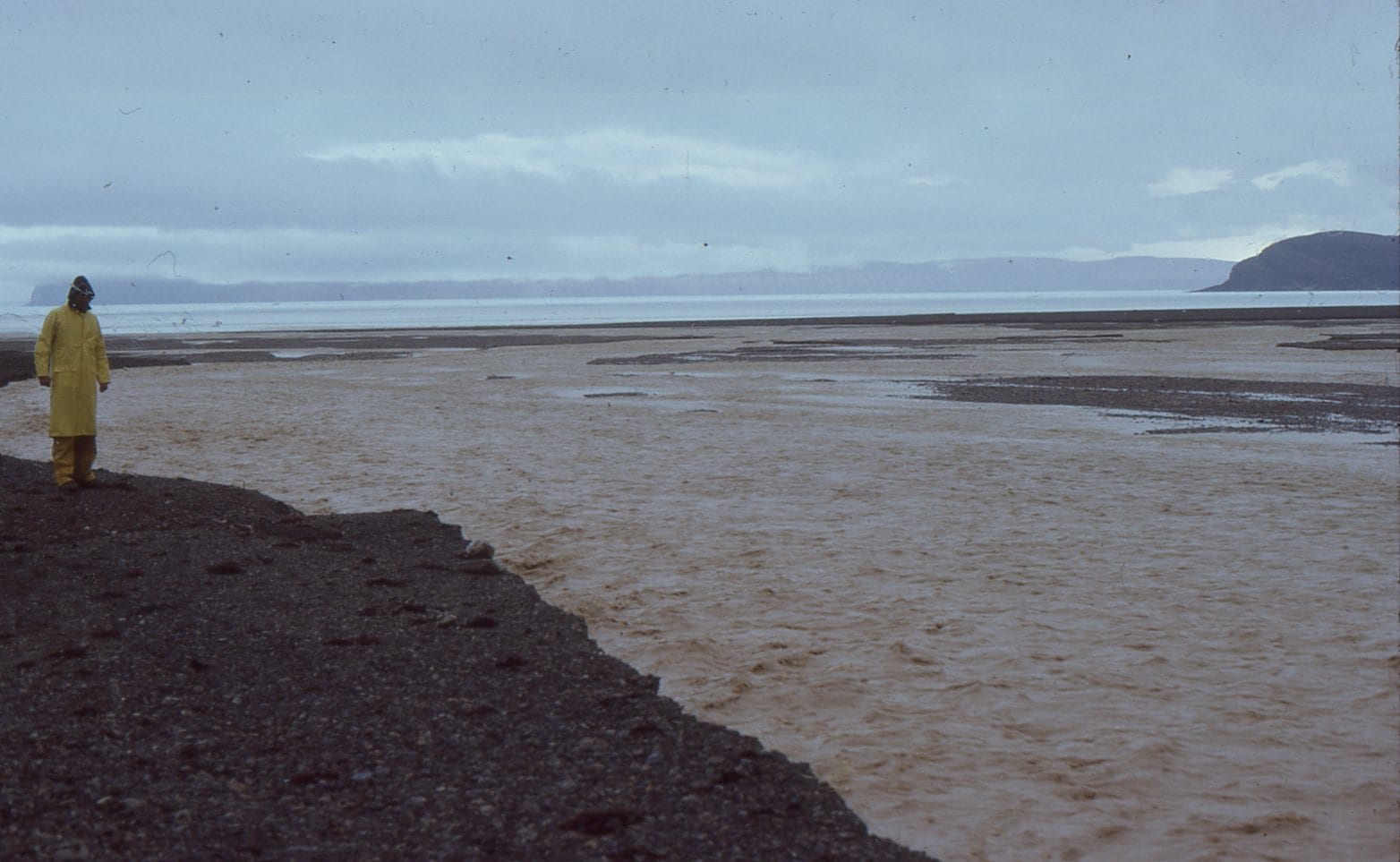
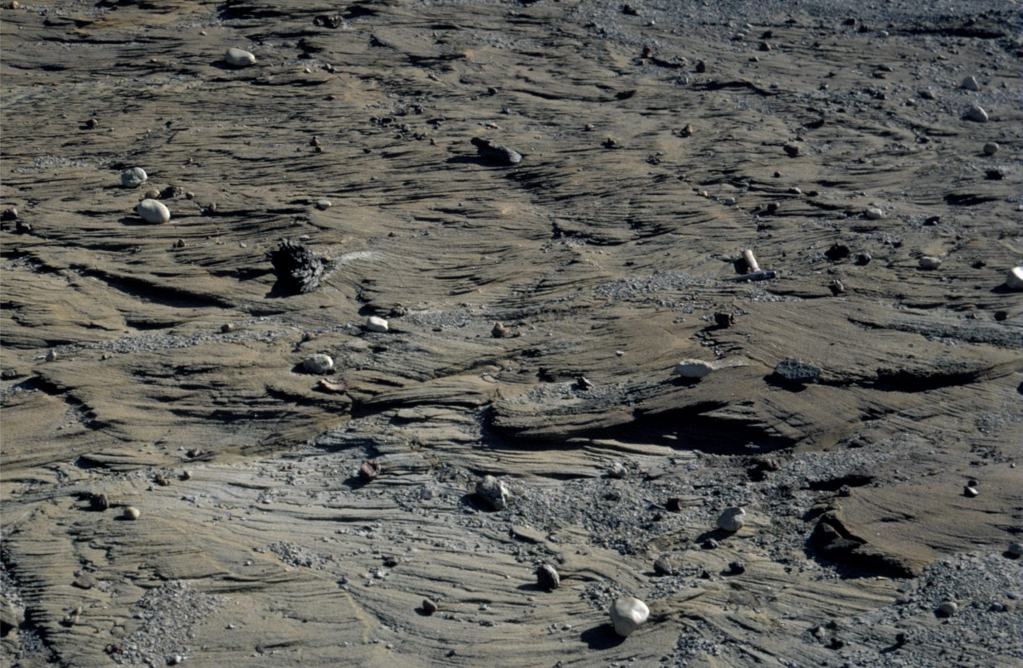
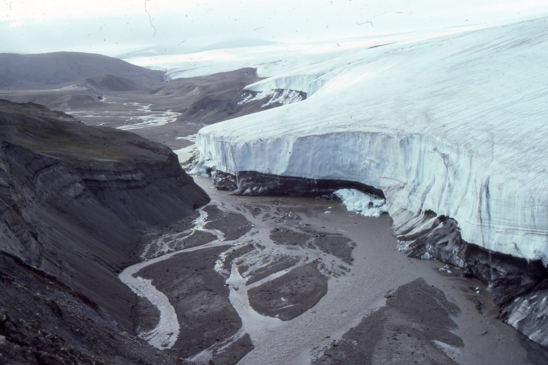
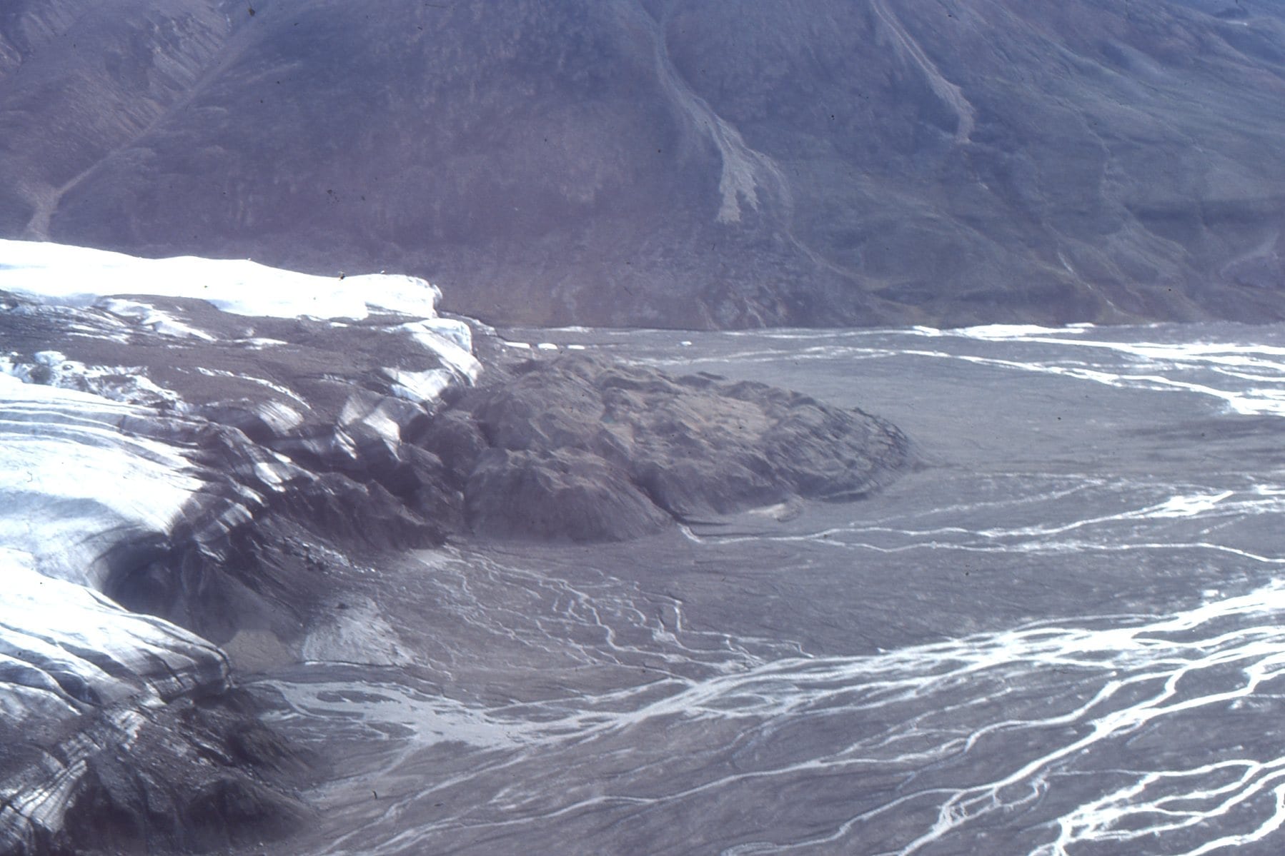 Part of the Strand Glacier terminal moraine, the meltwater, and outwash channels. The sediment eventually finds its way to Strand Fiord.
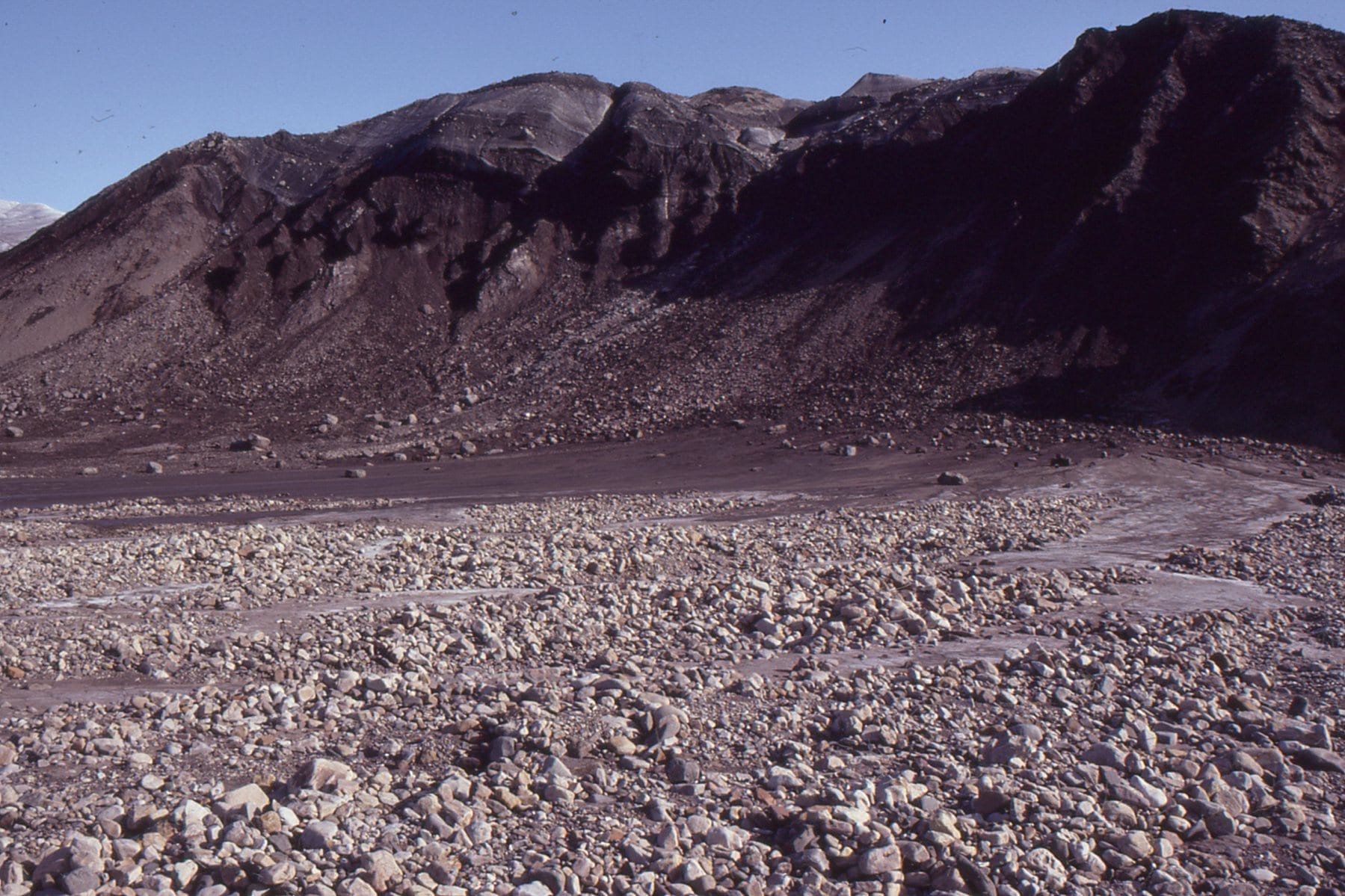 Mixed sediment and ice at the snout of Strand Glacier, Axel Heiberg Island
![]() Tanquary Fiord, Ellesmere Island – a typical Arctic fiord, rimmed by steep terrain and small, coastal fan deltas. The arrow locates a Geological Survey of Canada base camp in 1988.
Tanquary Fiord, Ellesmere Island – a typical Arctic fiord, rimmed by steep terrain and small, coastal fan deltas. The arrow locates a Geological Survey of Canada base camp in 1988.
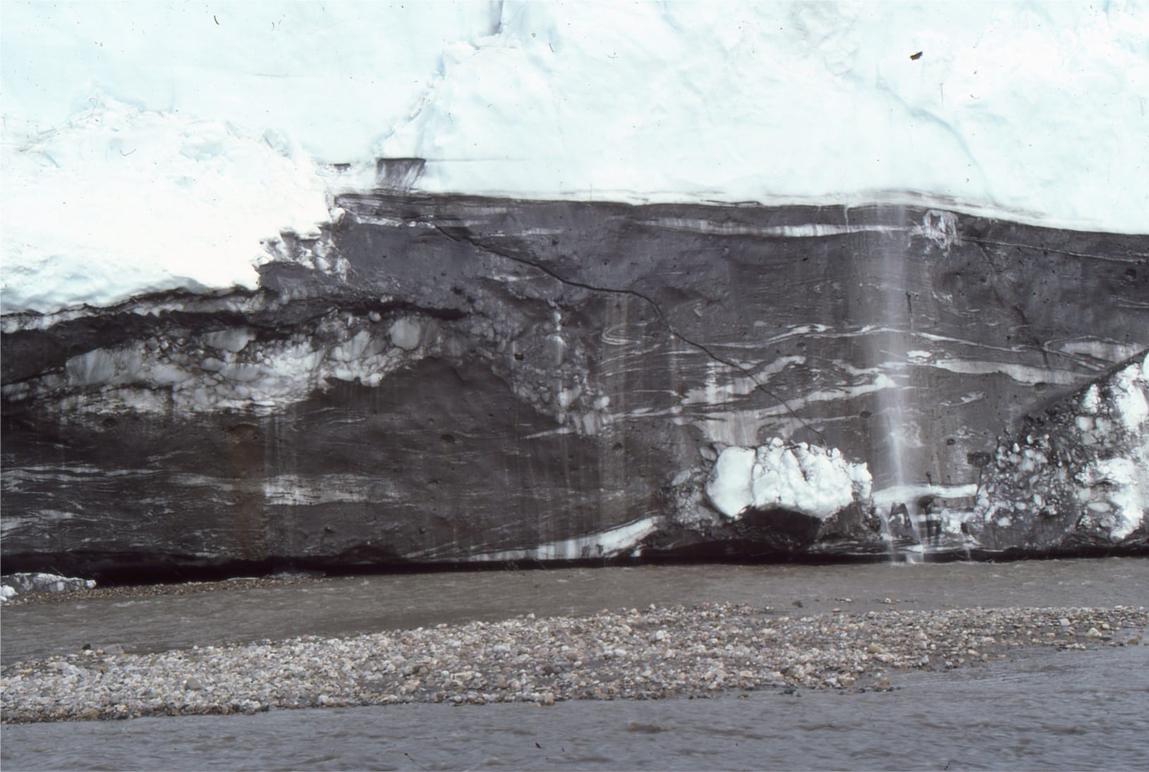 The edge of an ice cap on central Axel Heiberg Island, eroded by the outwash stream. Deformation of ice is accentuated by dark mud and sand in the ice (clear ice lies above the darker foundation. Ice rheology here includes ductile and brittle deformation.
 Aerial view of the ice cap edge shown in the image above.
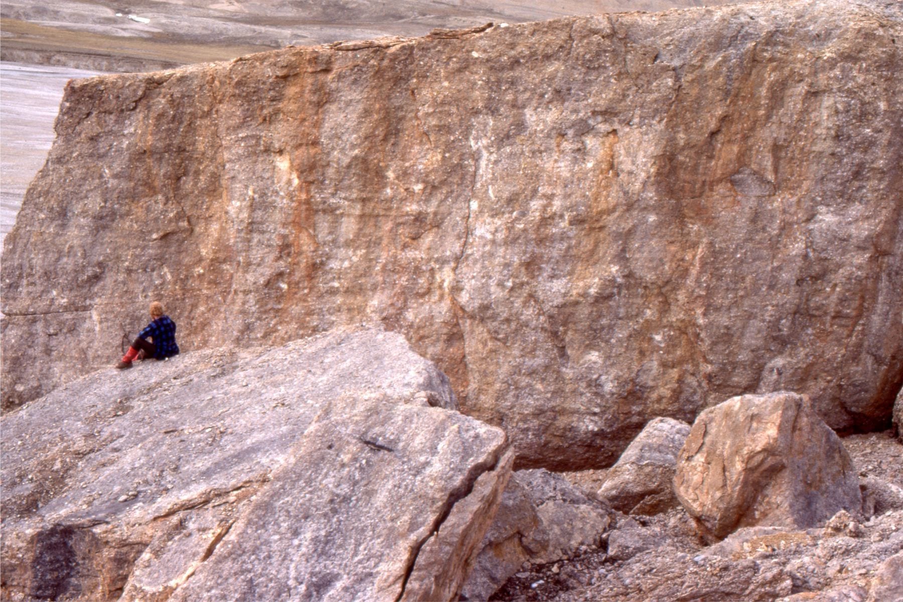
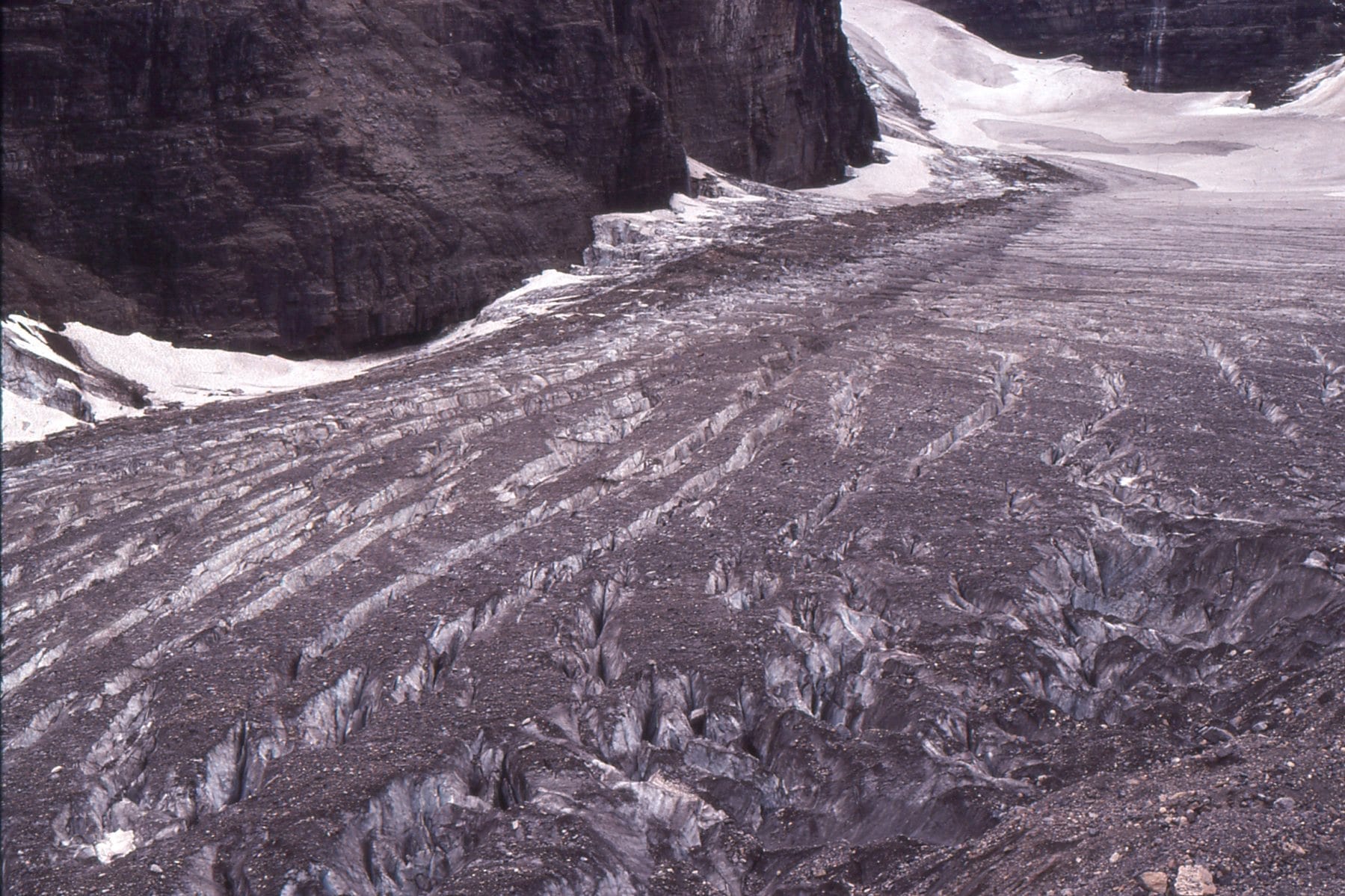 Lateral moraine and crevasses at the Valley of the Six Glaciers, Lake Louise, Alberta
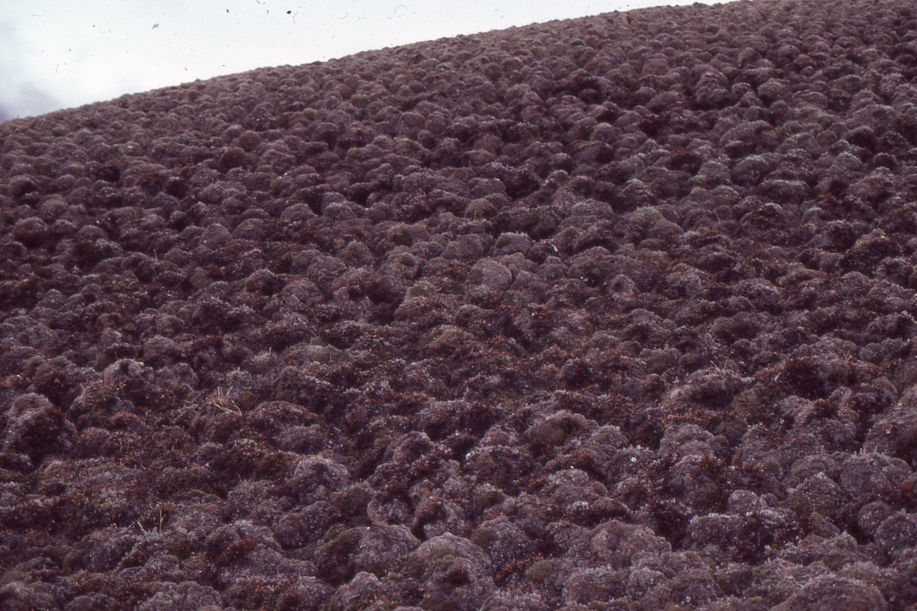 Polygonal surface in trundra formed by freeze and thaw of surface permafrost. This stuff is really difficult to walk on.
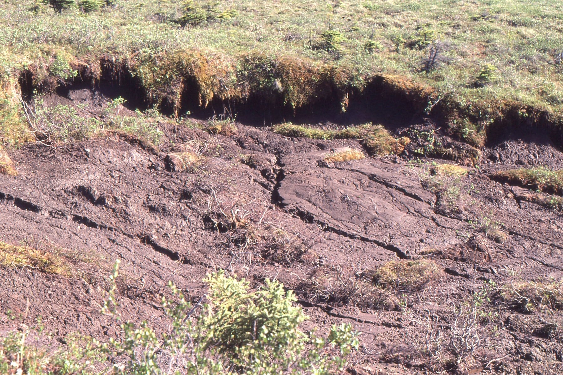 Thermokarst slumping, caused by melting permafrost
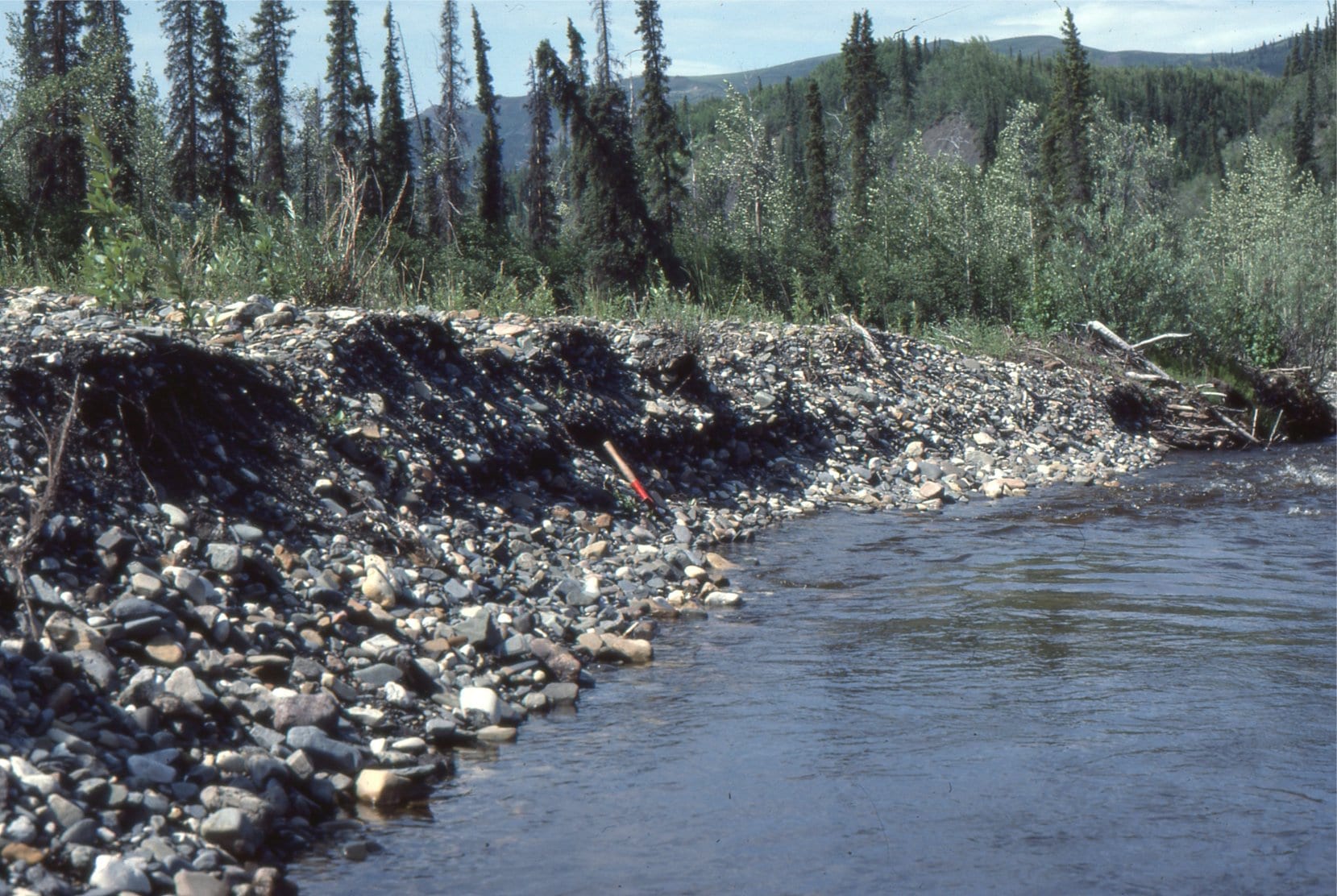
 Deformed ground ice within the permafrost, probably caused by ice expansion. The trees above are 3-4m high. The ice fold was exposed in the slip face of a thermokarst slump. North Yukon.
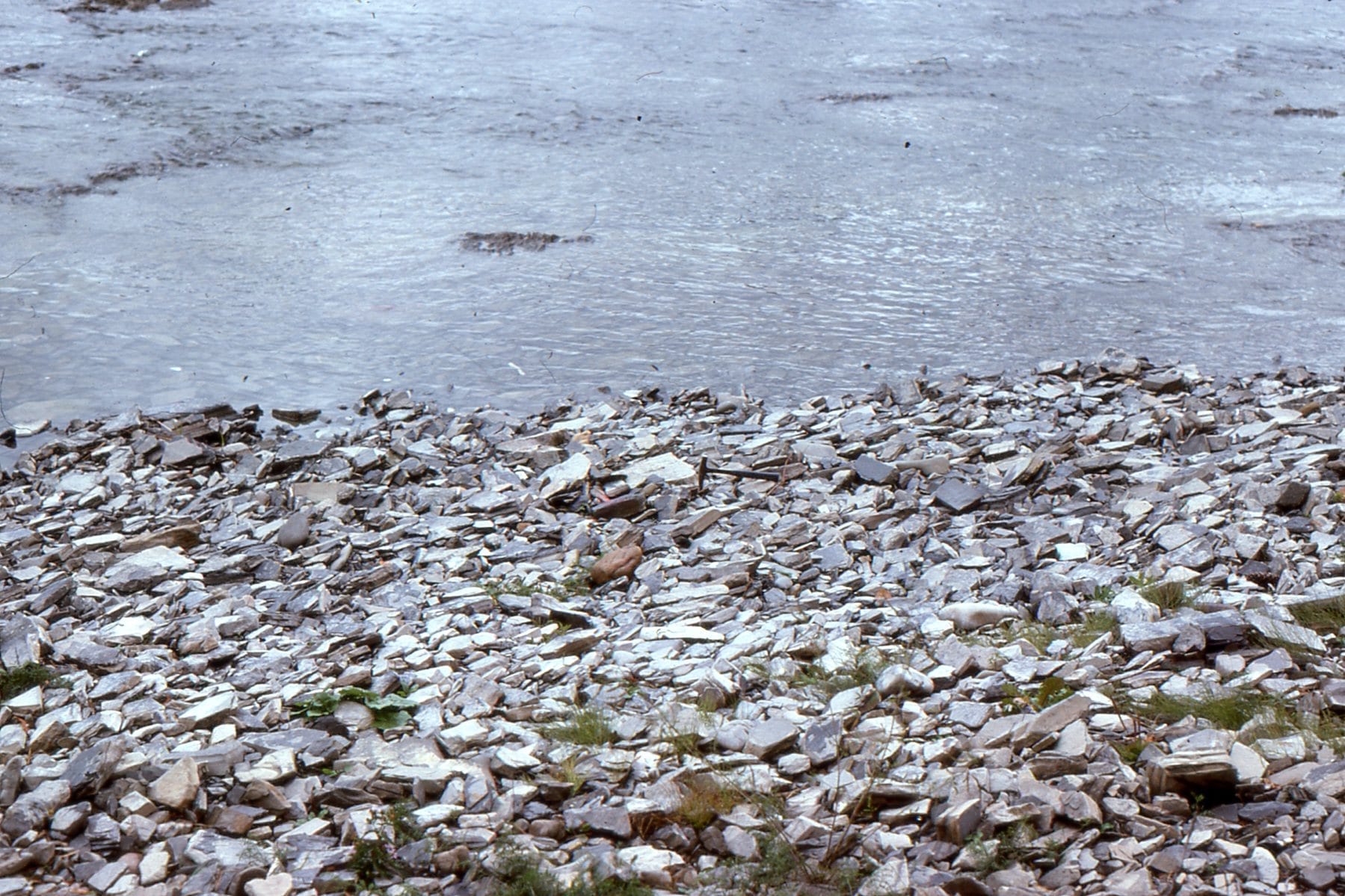
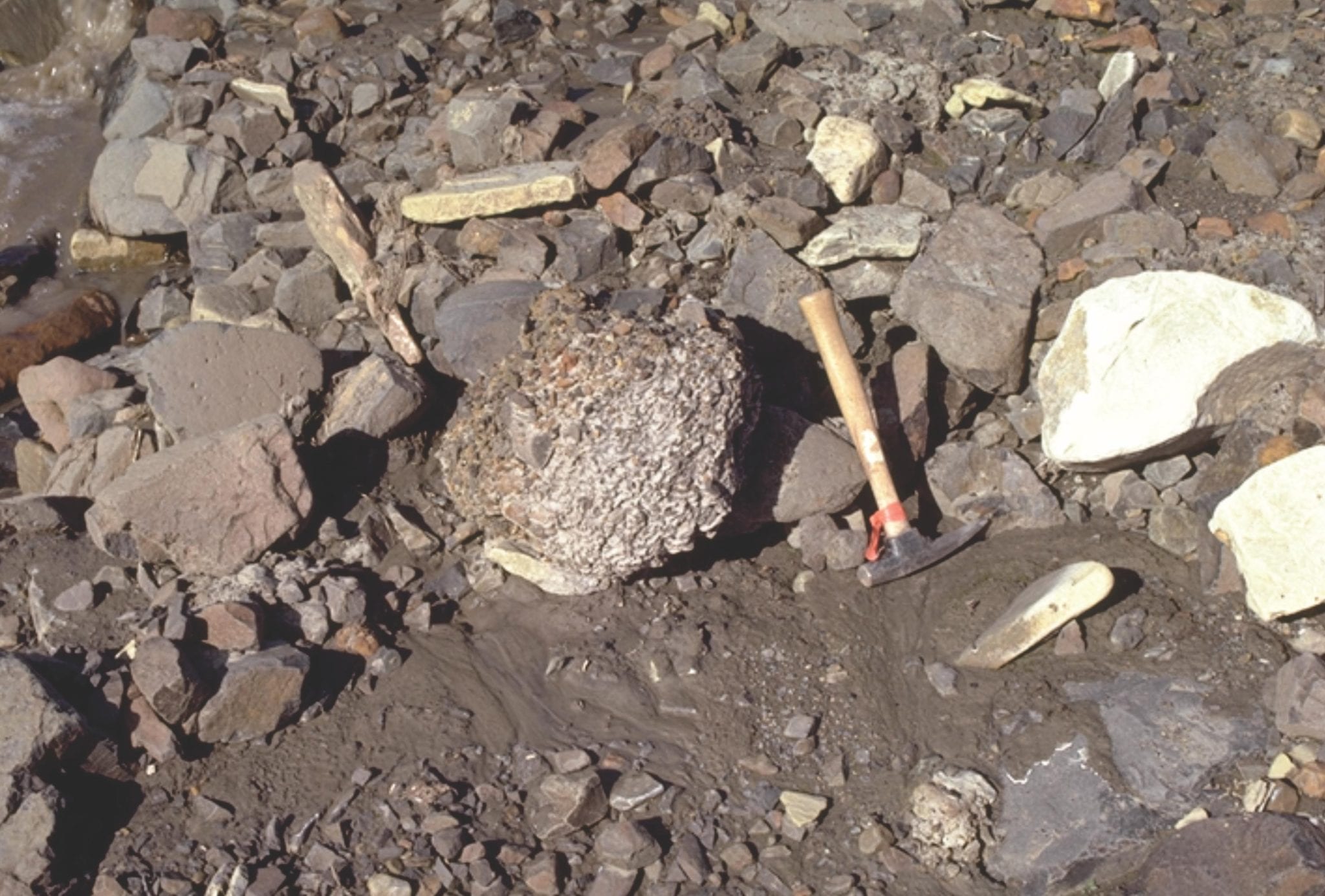
 Frost heaved blocks of greywacke; the shape of the blocks is governed by intersecting fractures in the bedrock. Belcher Islands.
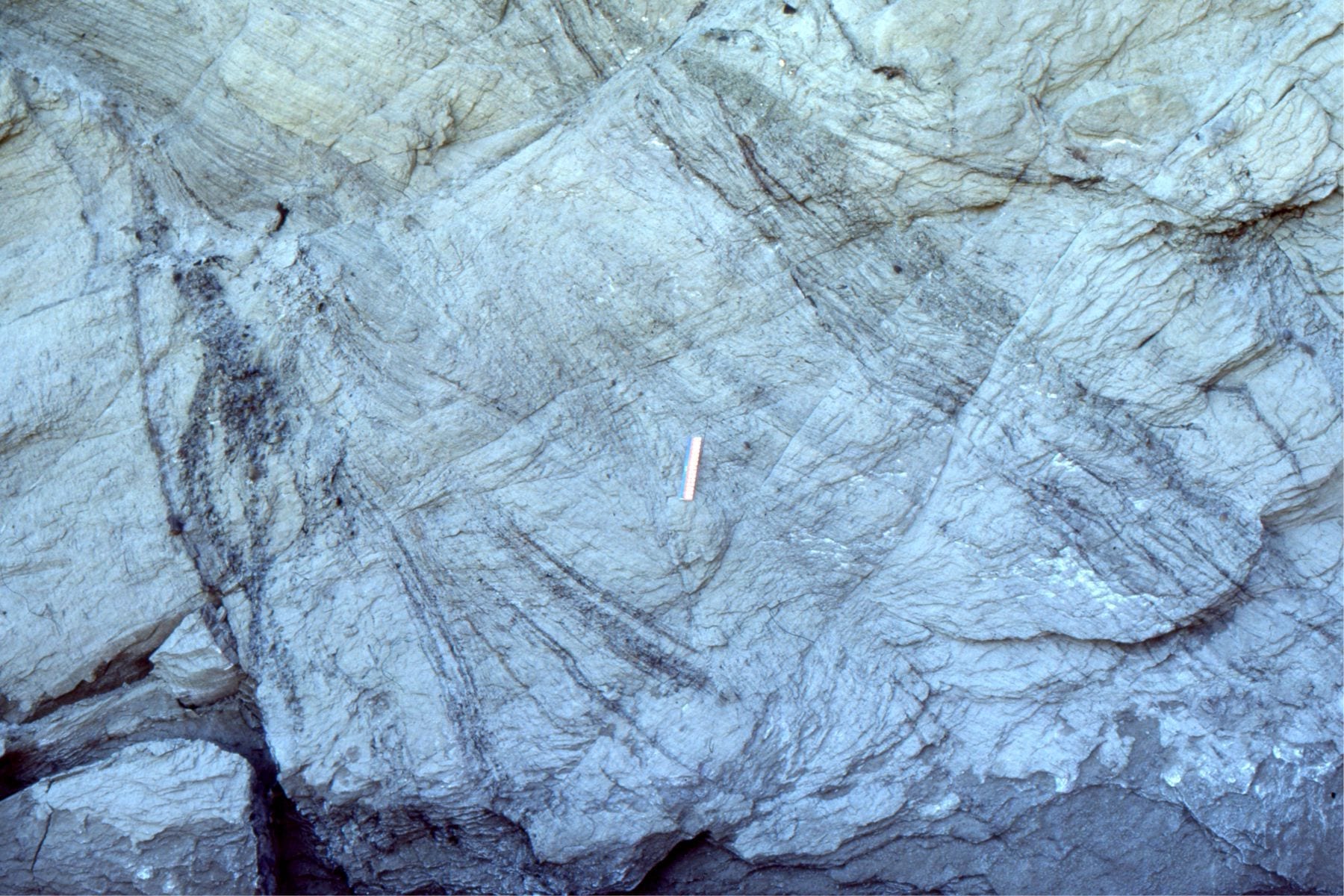
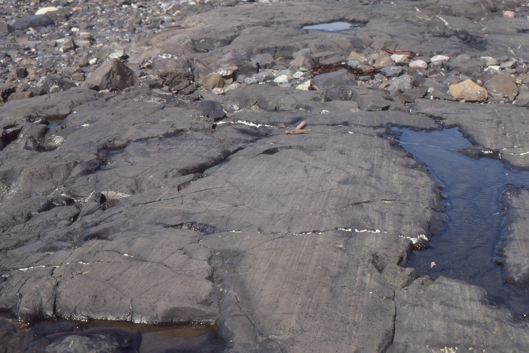 Glacial striae on greywacke; scratches formed as rock fragments are dragged across the bedrock surface by flowing ice during the Last Glaciation (Laurentide Icesheet).
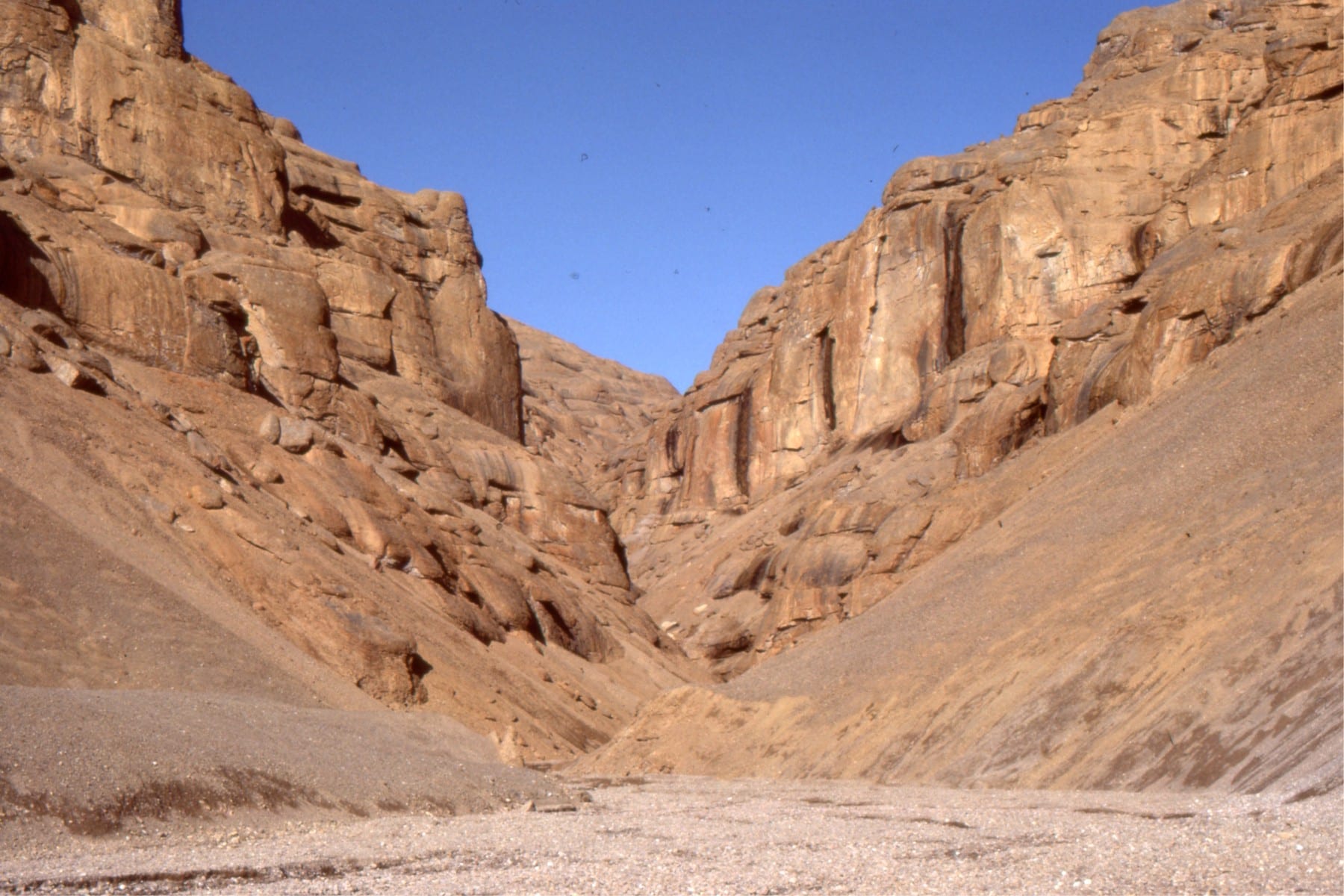
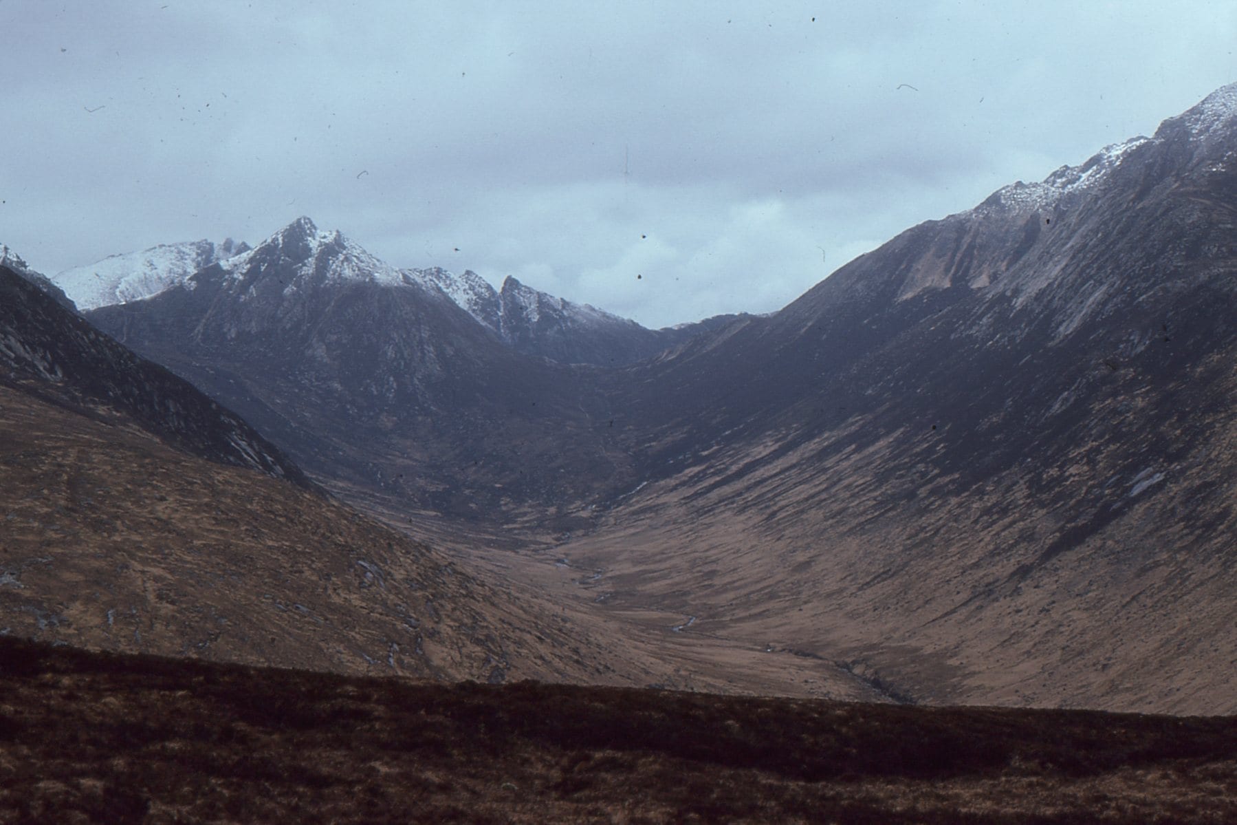 A beautiful U-shaped valley at Glen Rosa, Arran (Scotland), gouged by a glacier during the Last Ice Age.
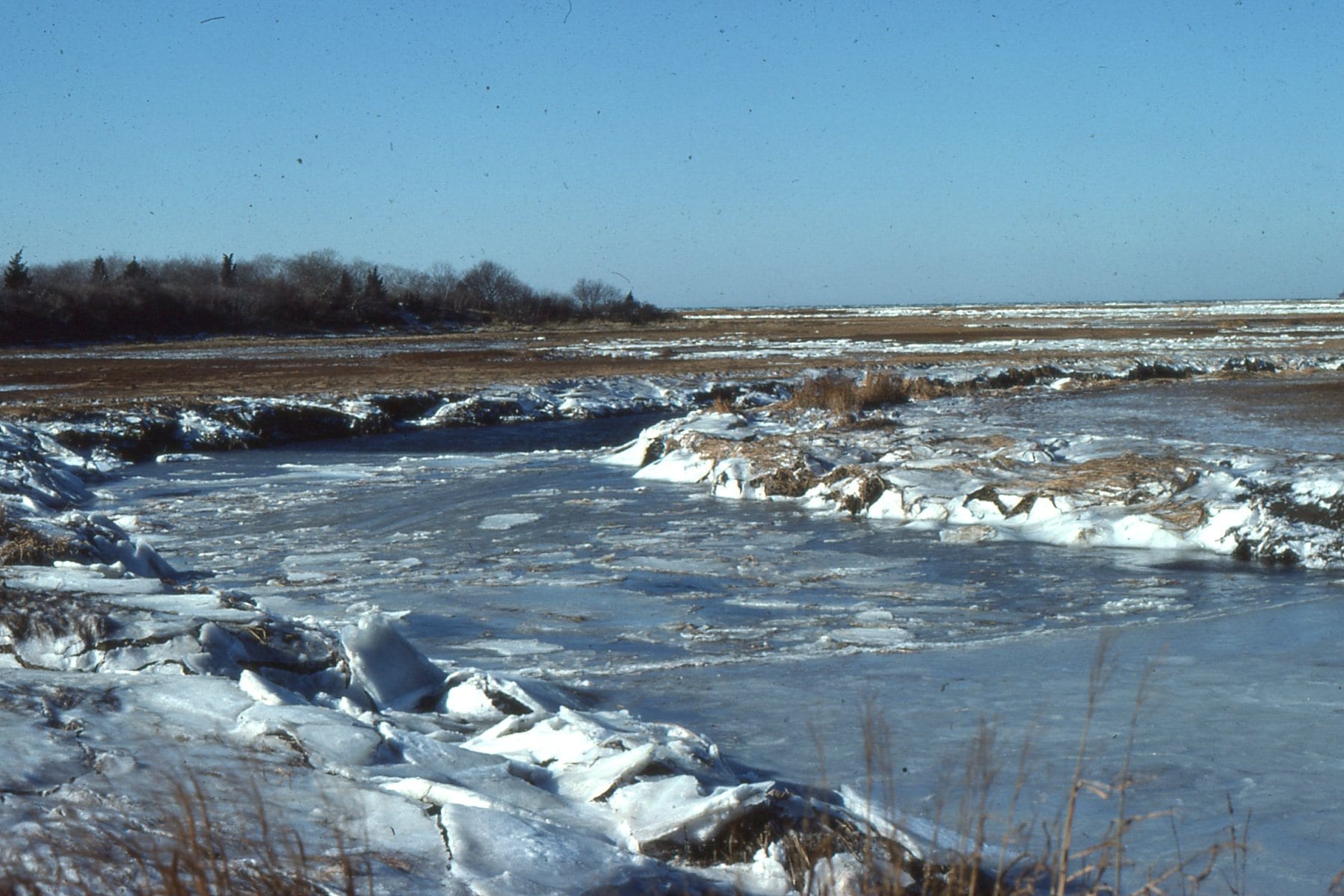 Winter freezing of an estuary at Cape Cod, Massachusetts.
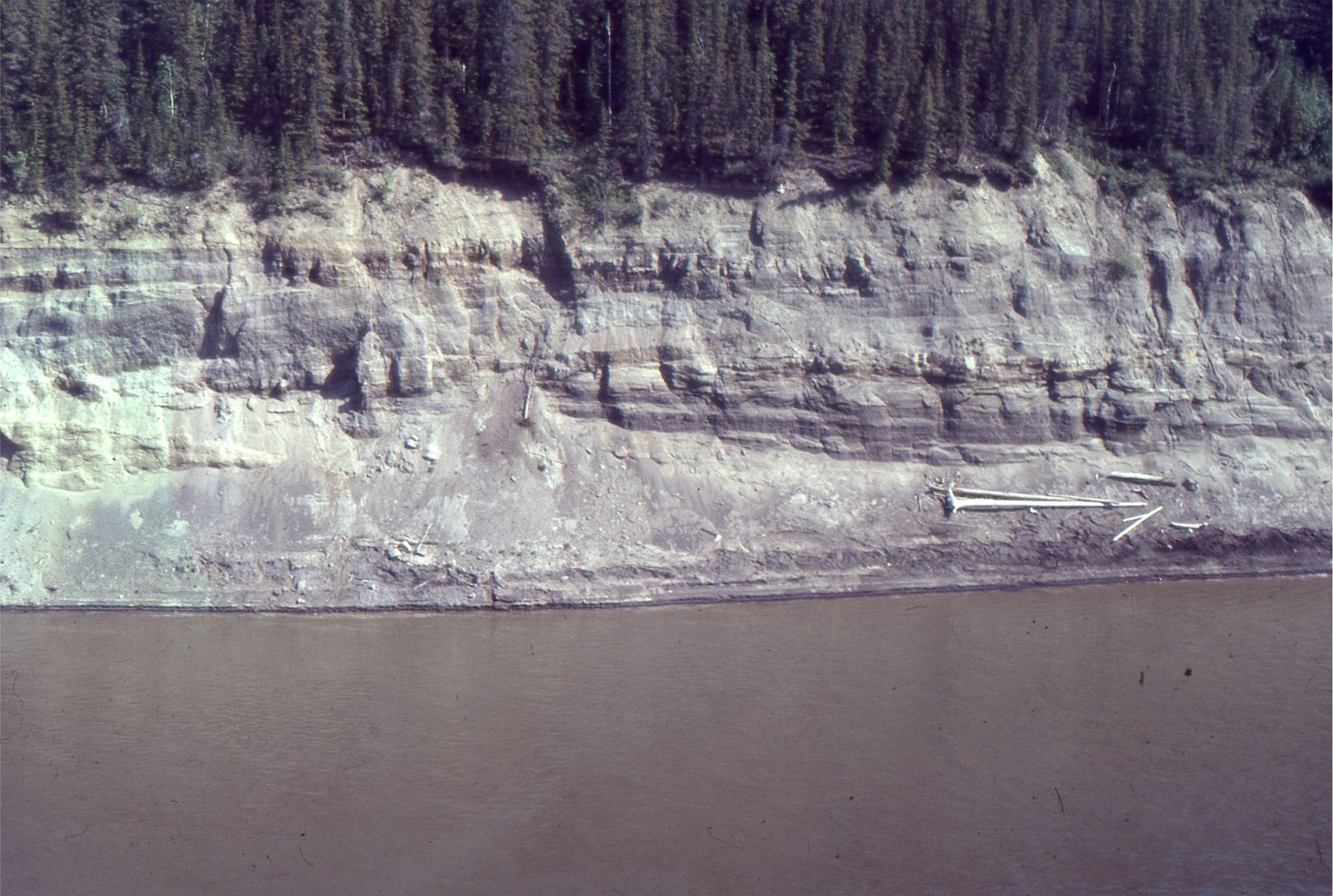
 Late Pleistocene, crossbedded glacial outwash channel deposits; the channel base is lined with boulders. Bradner Road pit, Fraser Valley
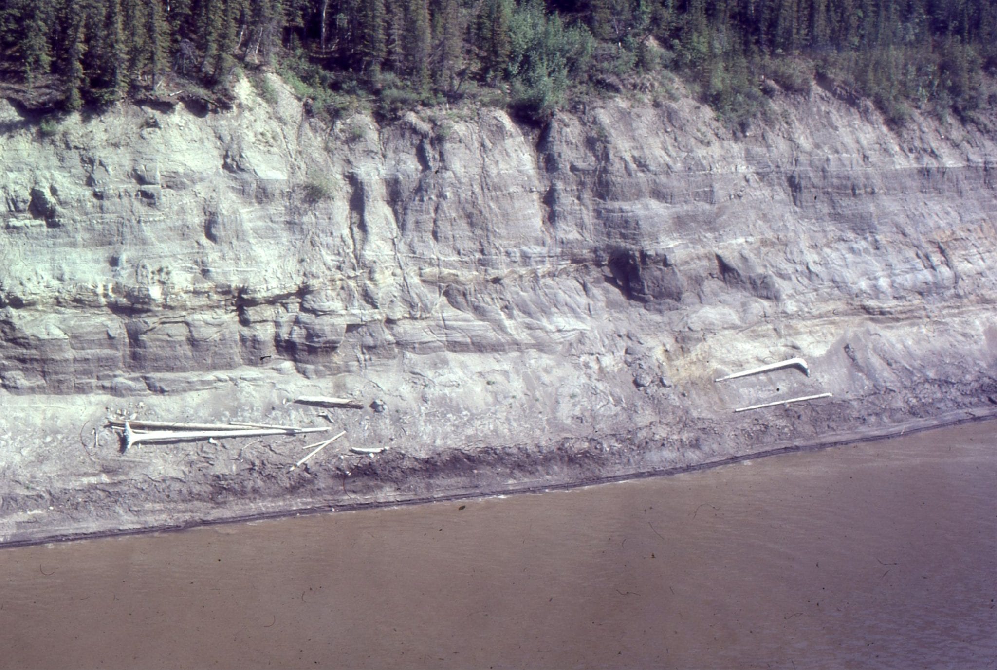
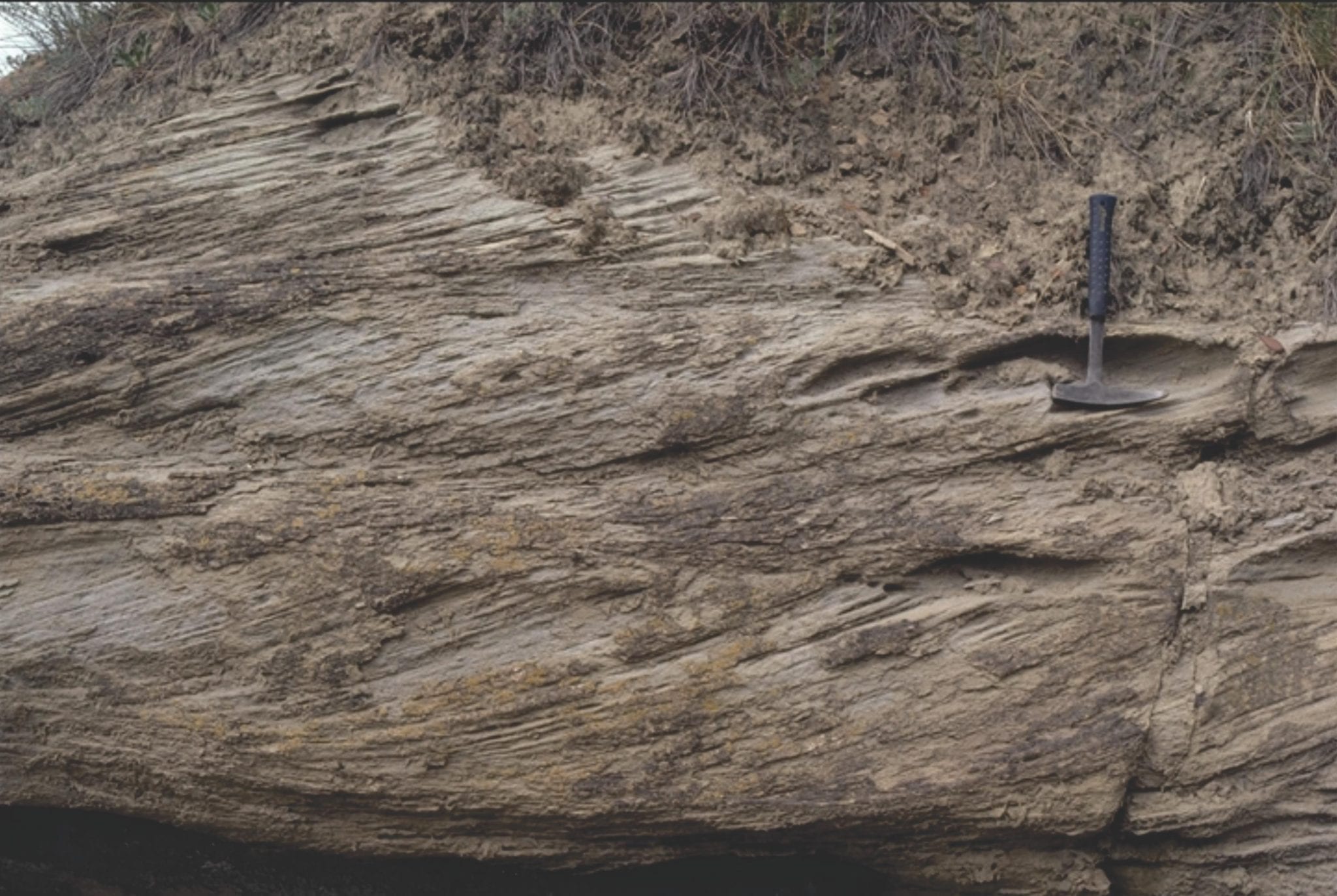
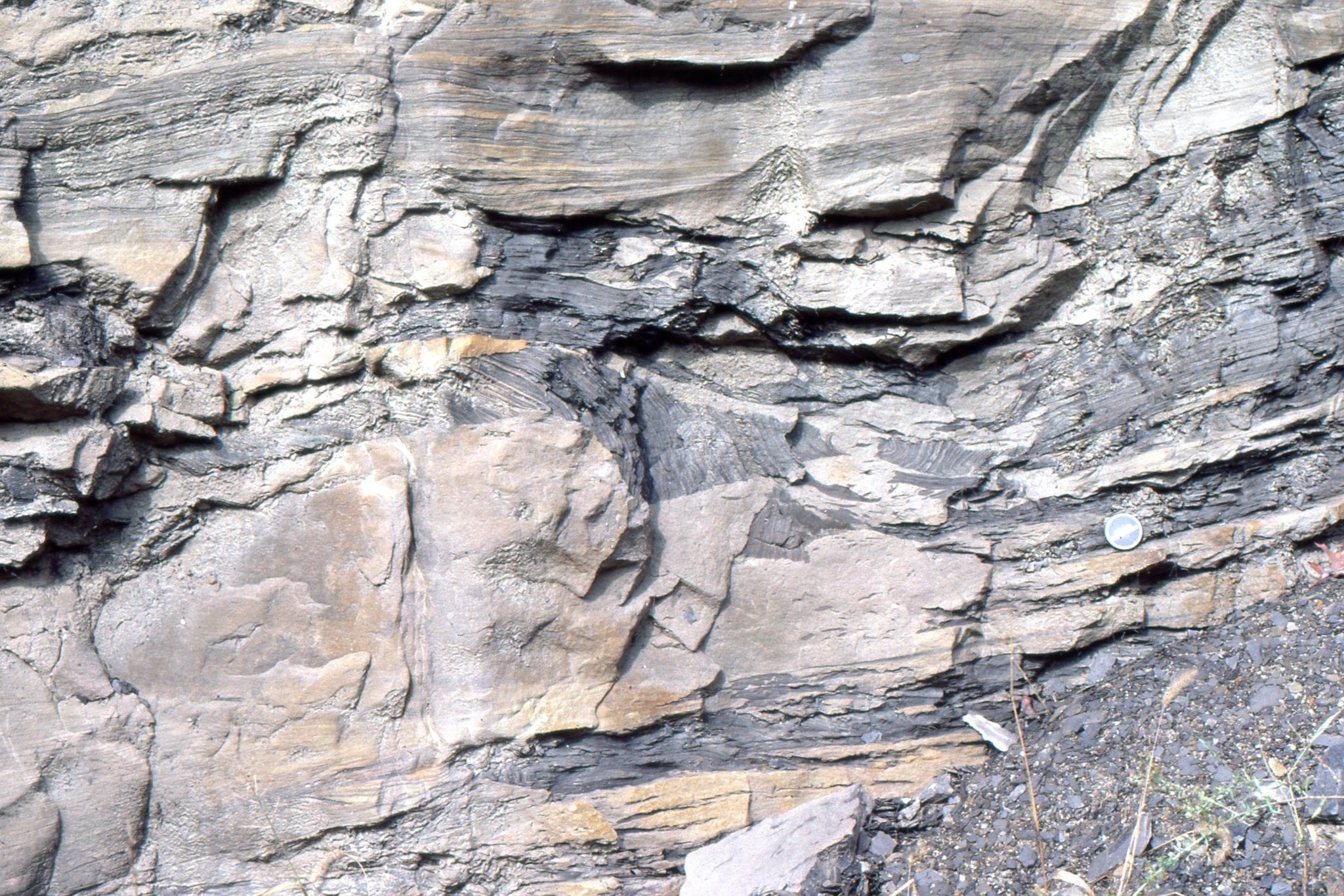
 Detail of trough crossbeds in a glacial outwash channel, Stokes pit, Fraser Valley, British Columbia.
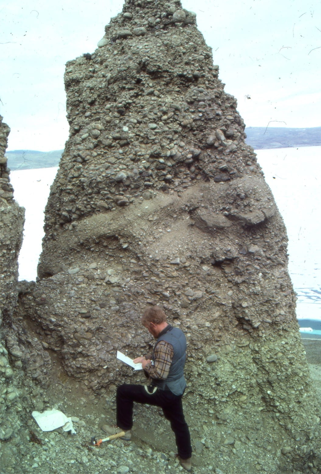
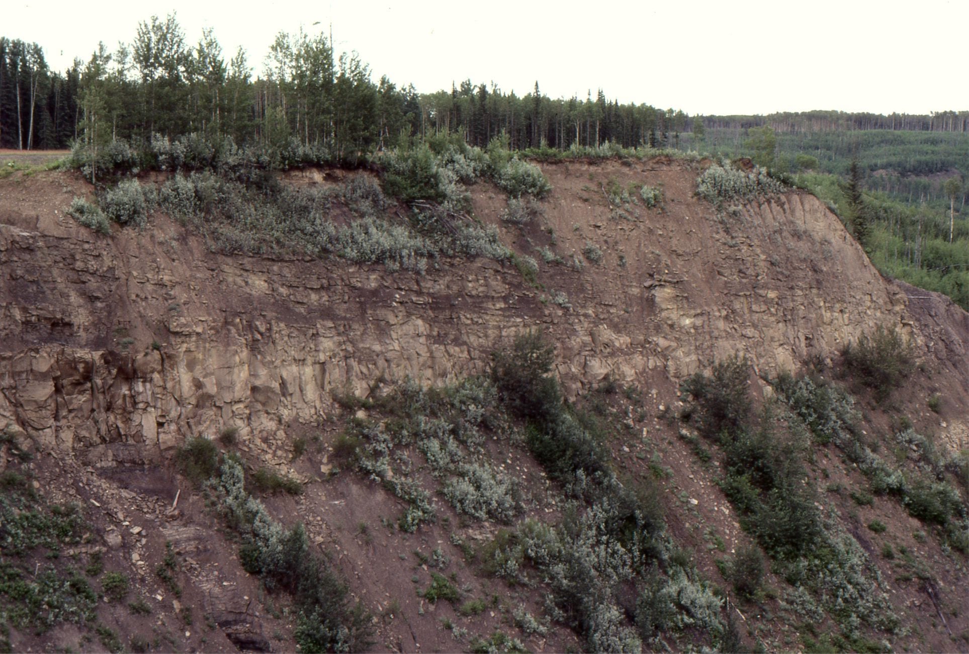
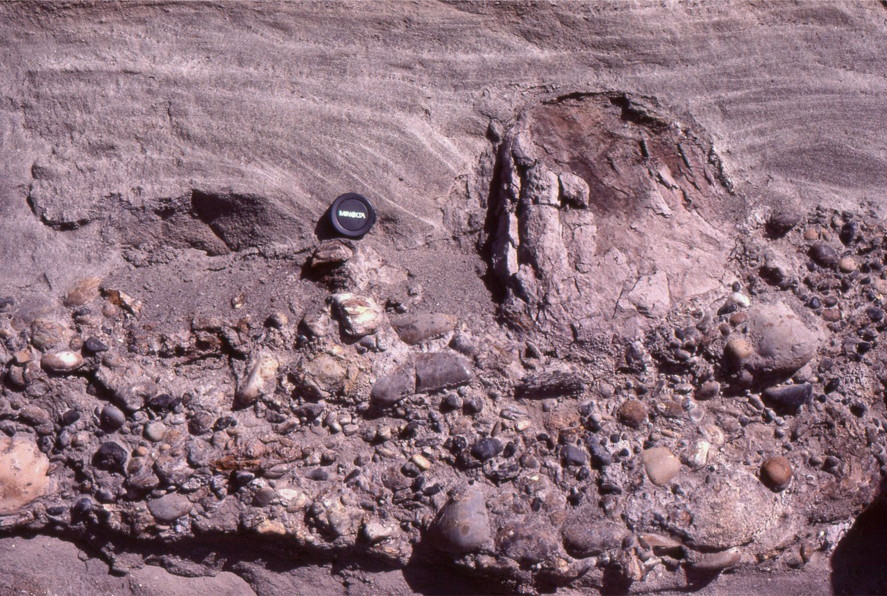
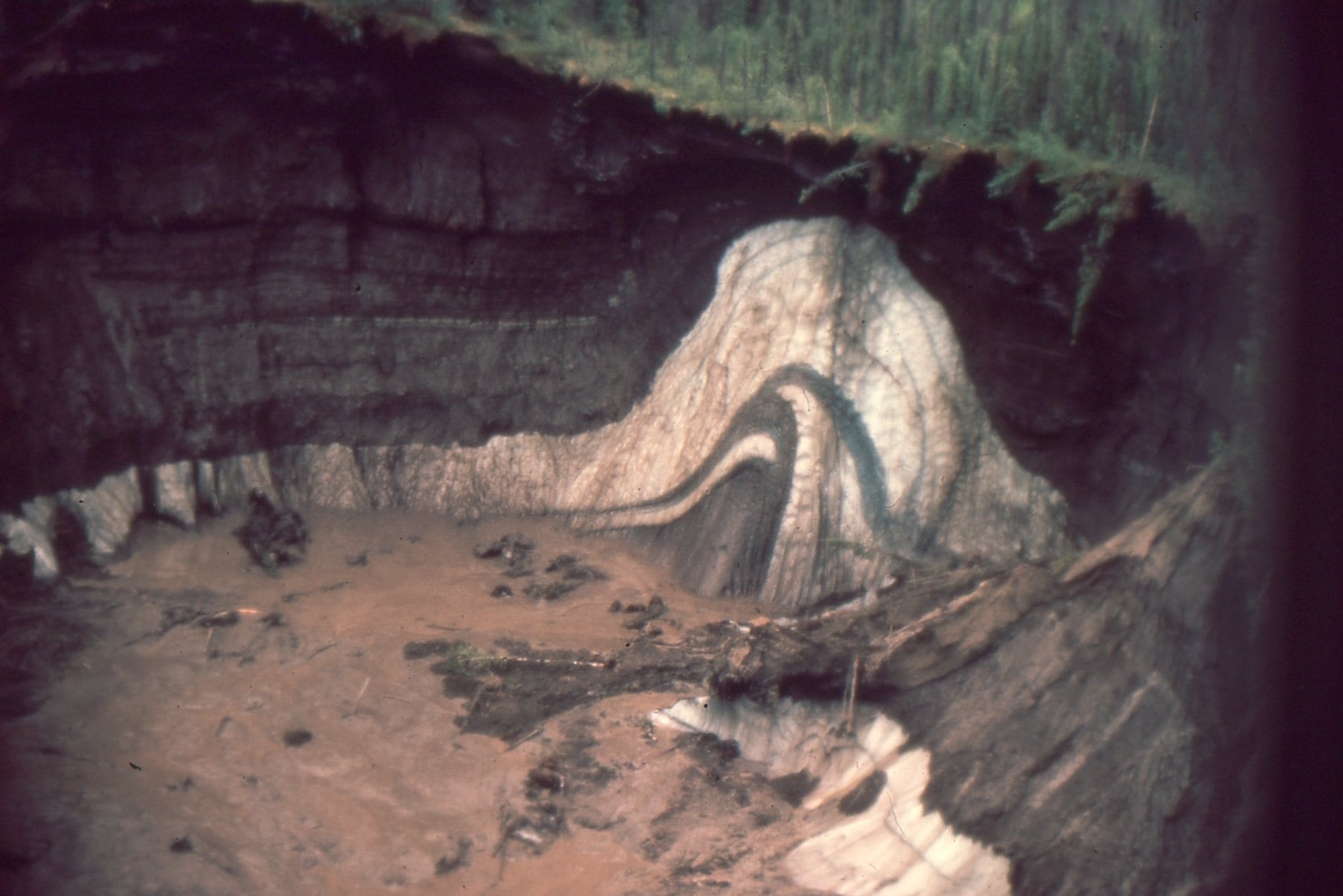
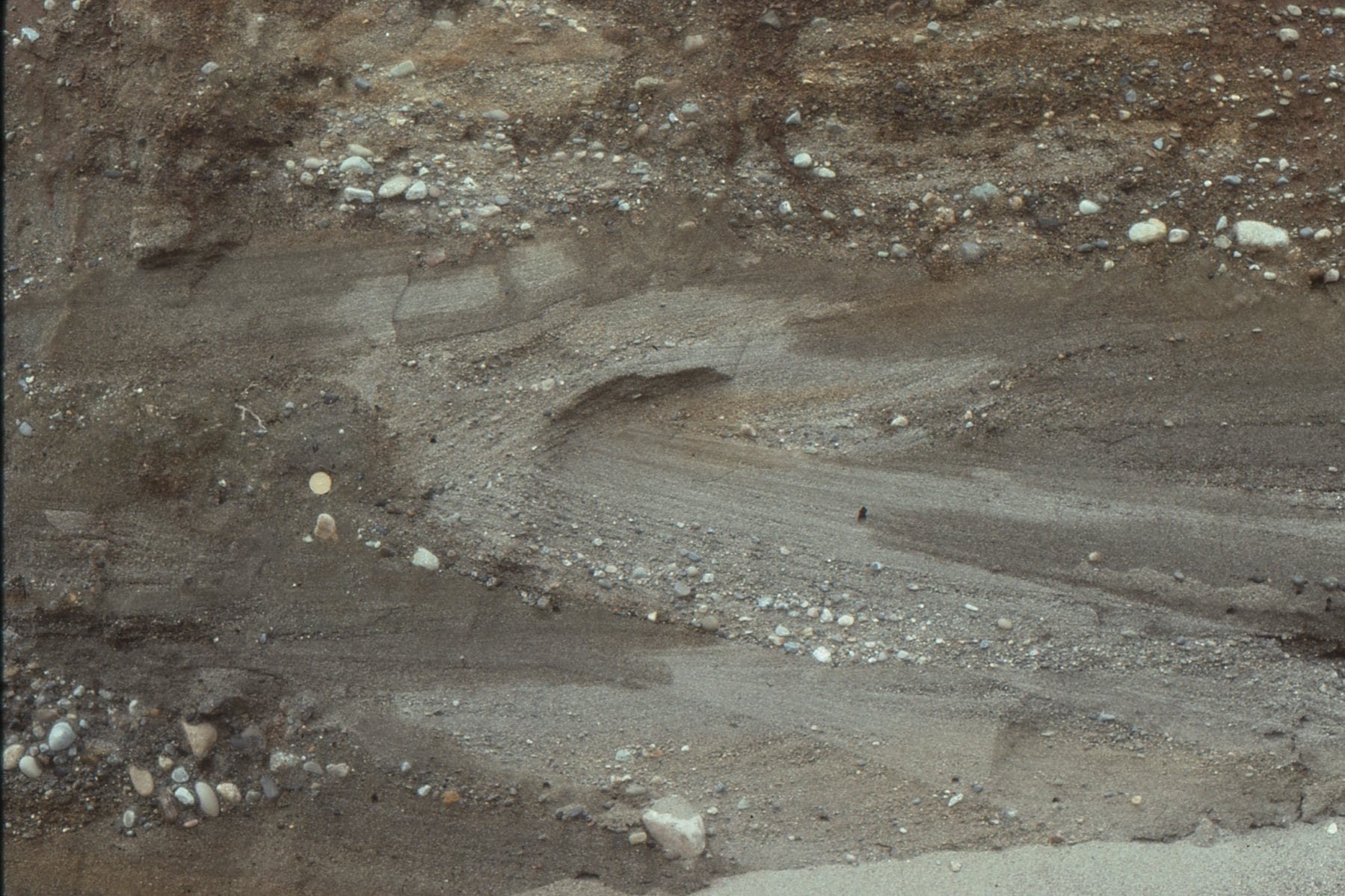
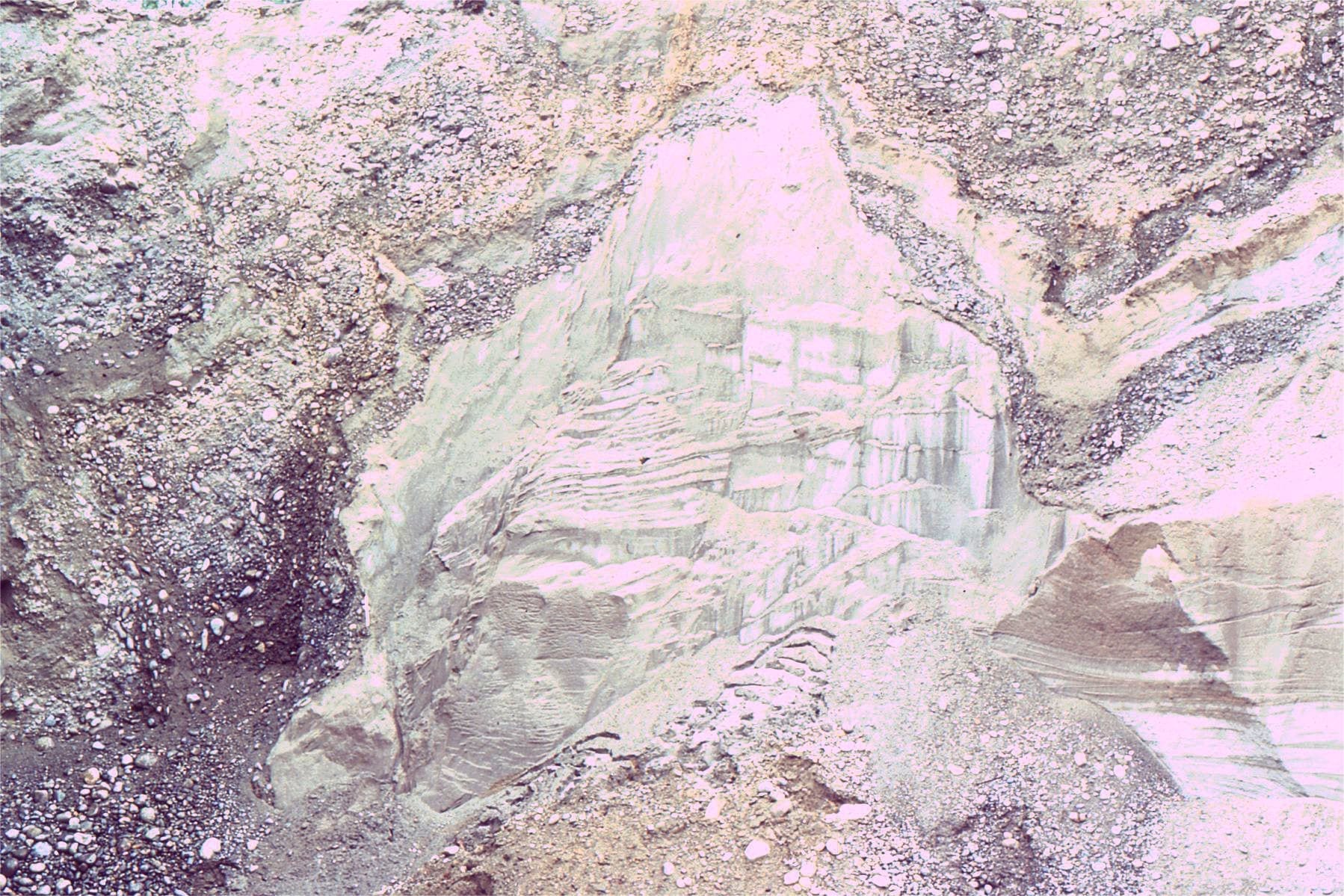
 Large foresets (4-5m thick) in glacial outwash, may have formed as a small Gilbert-type delta in an outwash lake of meltwater pond. The overlying topset sand is about 1.5m thick, that, in turn was overridden by a diamictite during ice advance.Bradner Road pit, Fraser Valley.
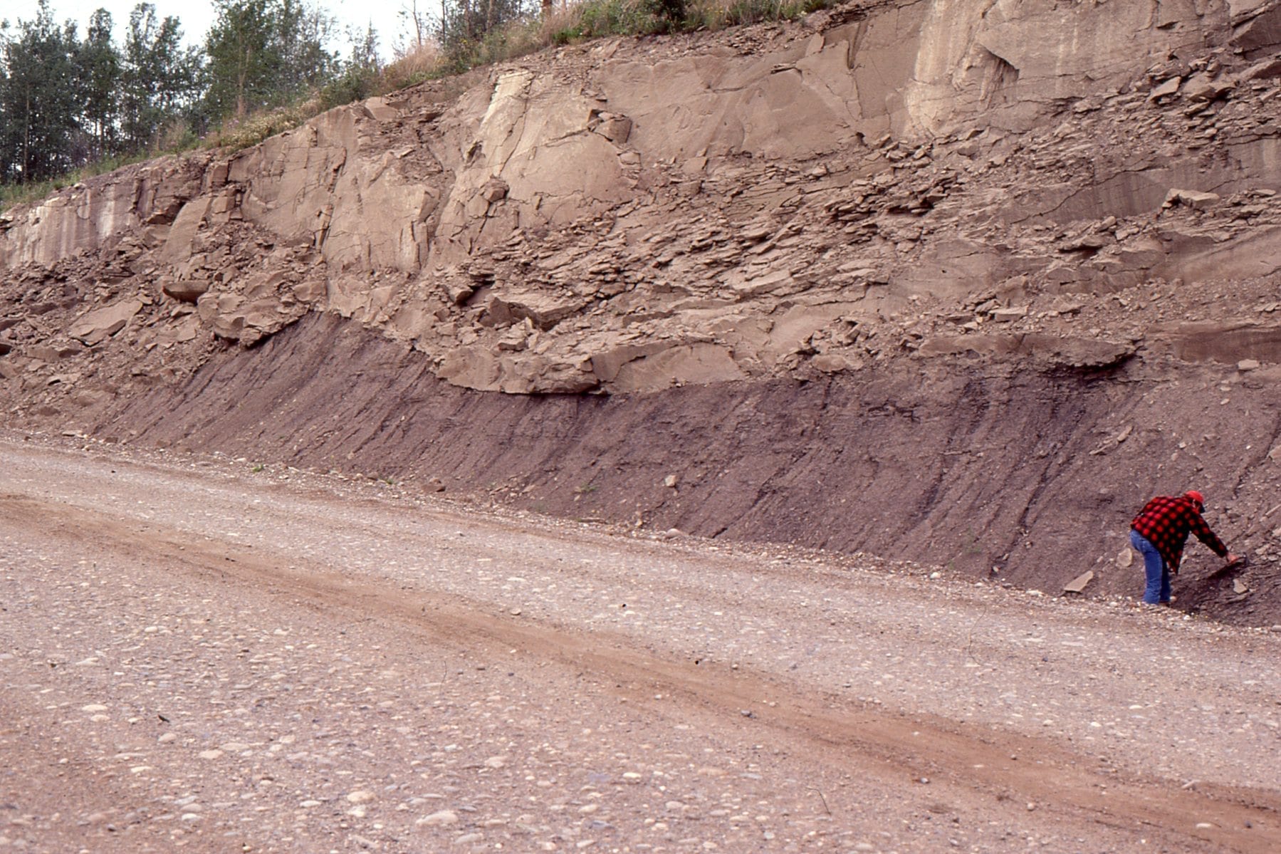
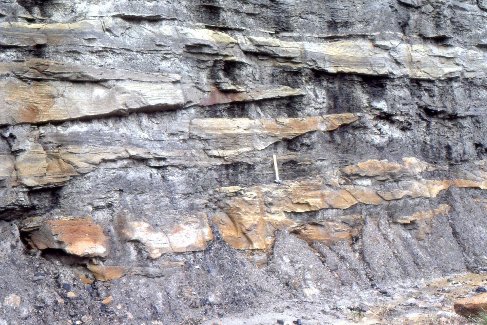
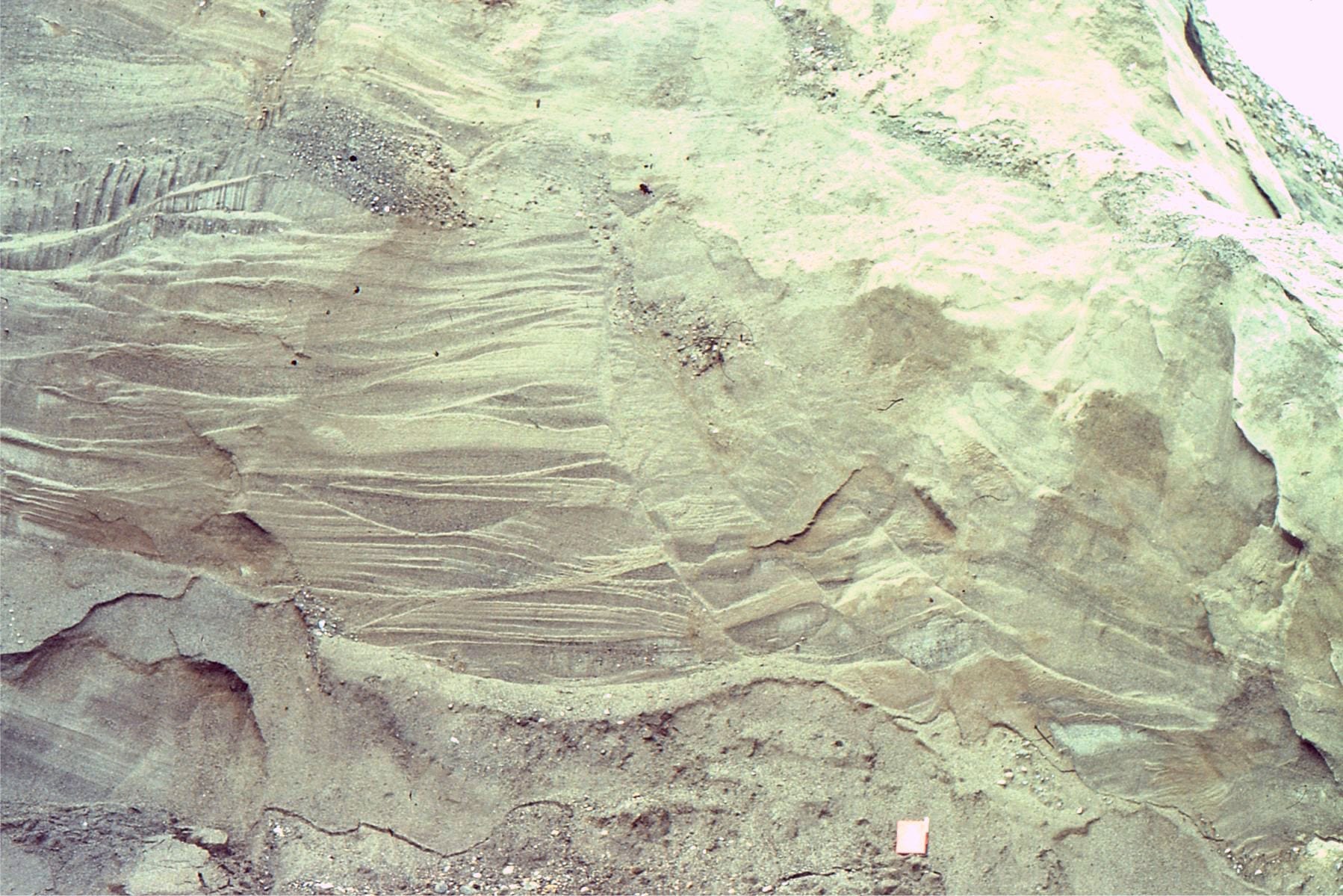
 A complex array of trough and planar crossbeds in Late Pleistocene glacial outwash channels. Bradner Road pit, Fraser Valley.
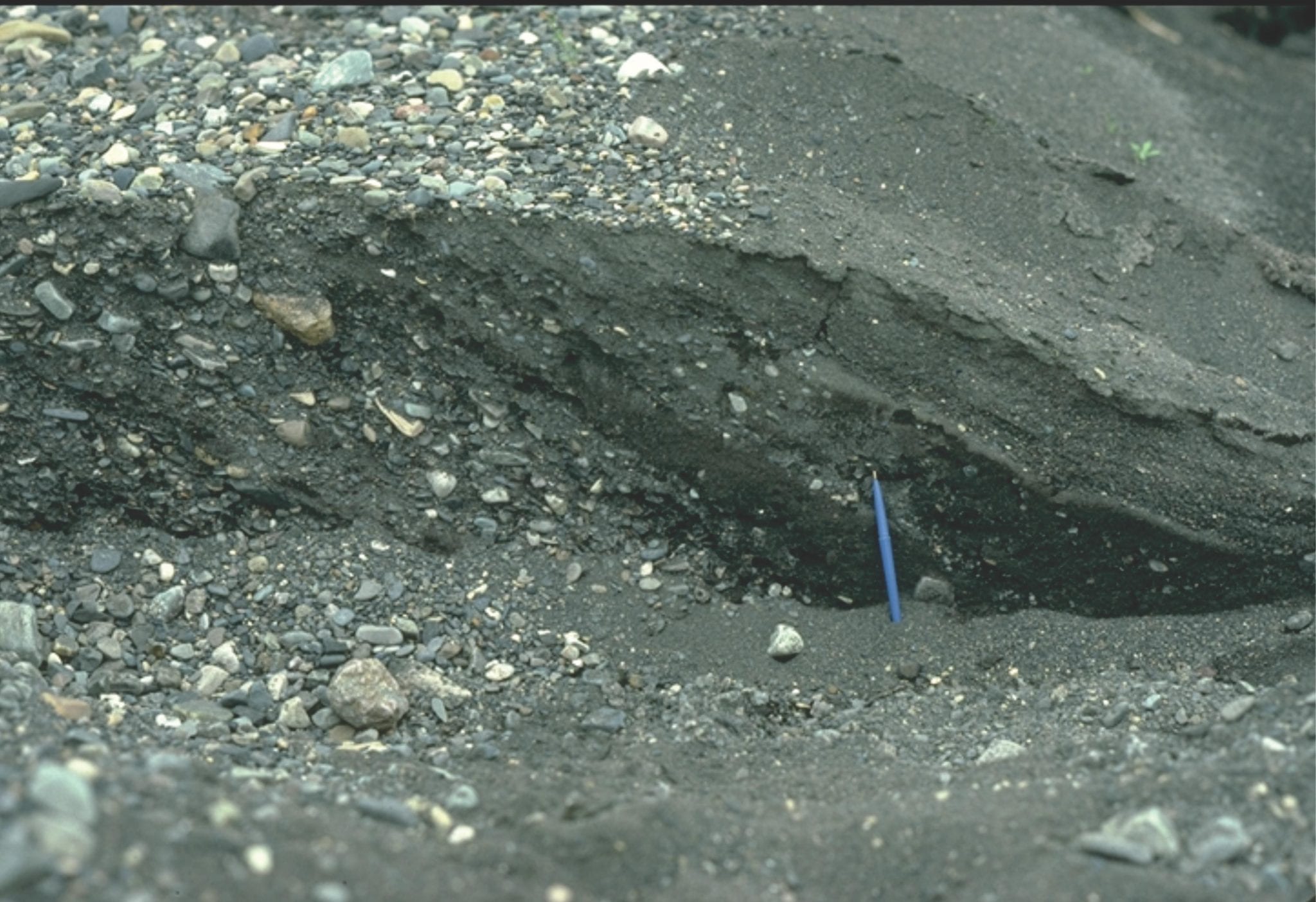
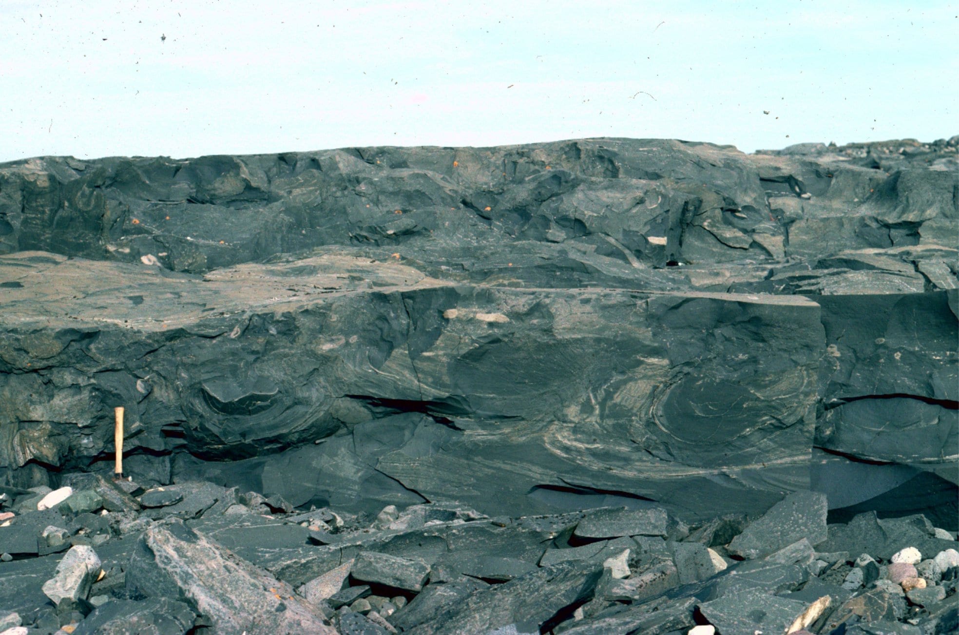
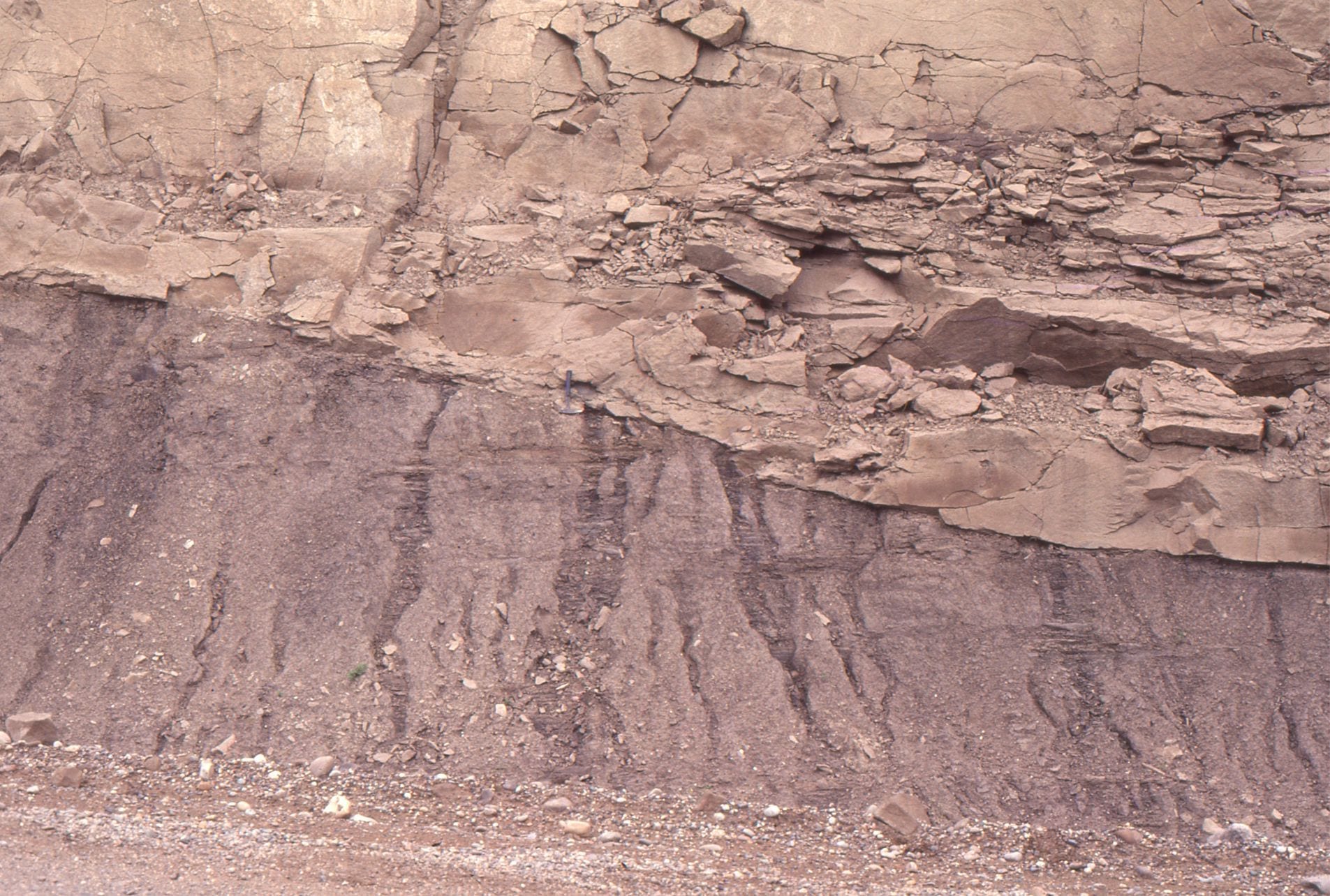
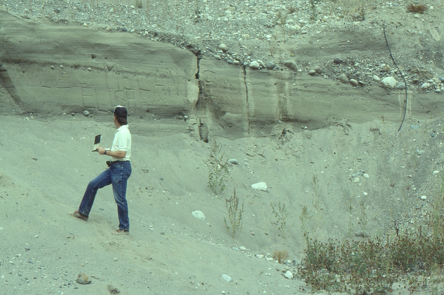
 Ice-contact deformation of outwash sands along small listric faults, that appear to detach at the contact with pebbly sand below. Field note book for scale. Bradner Road pit.
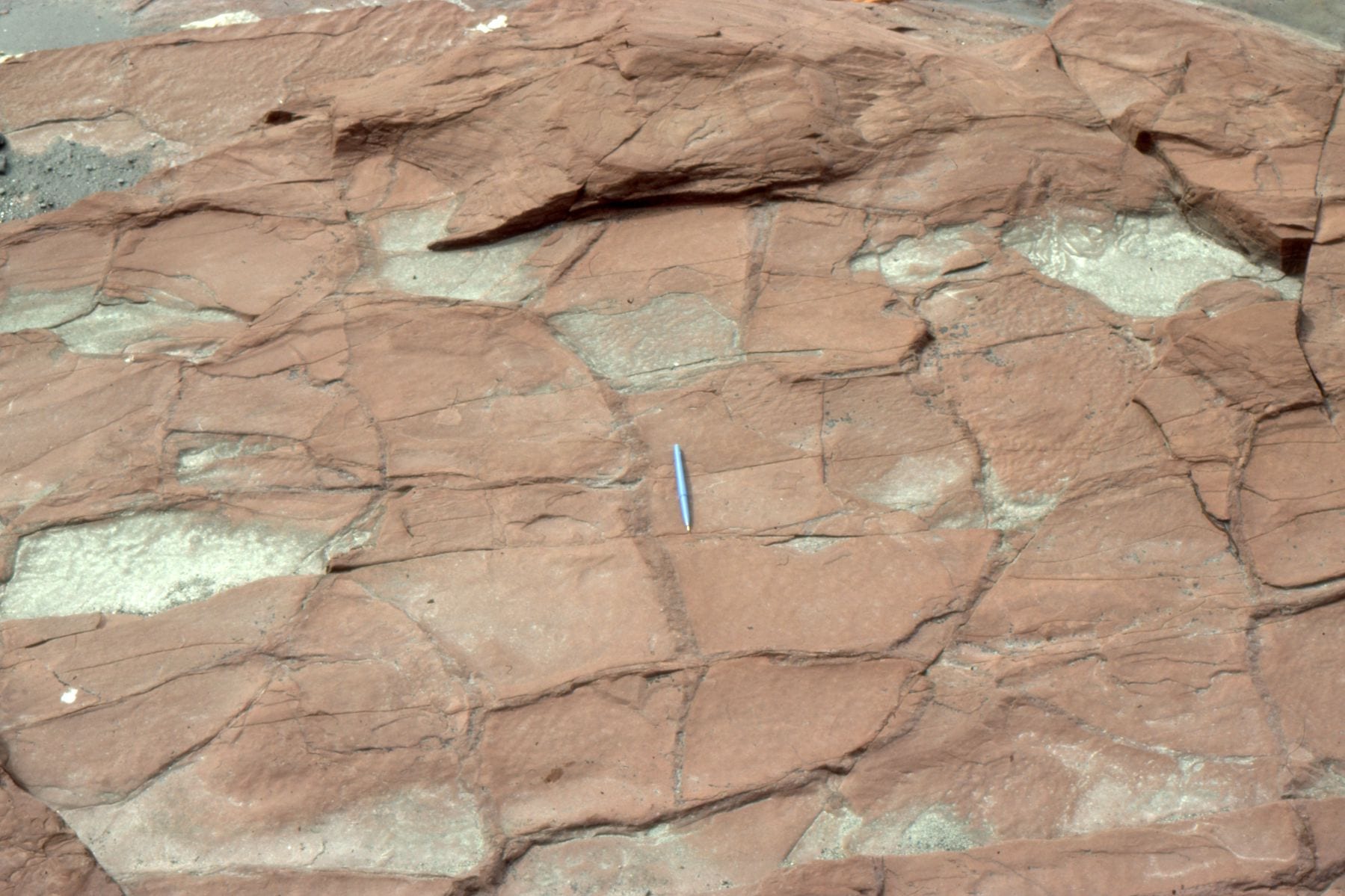
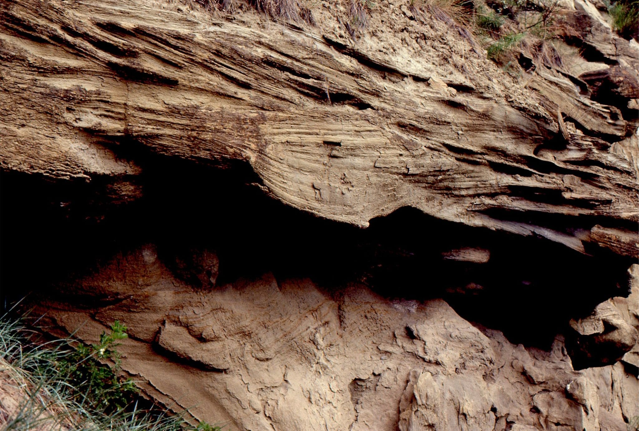
 Detached slump block, draped by outwash gravels. The block is also cut be several small faults. Deformation was probably caused by ice loading. Bradner Road pit, Fraser Valley.
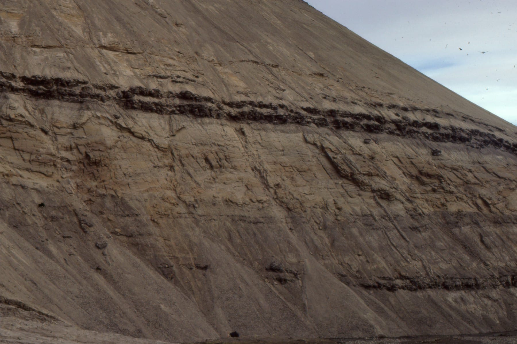
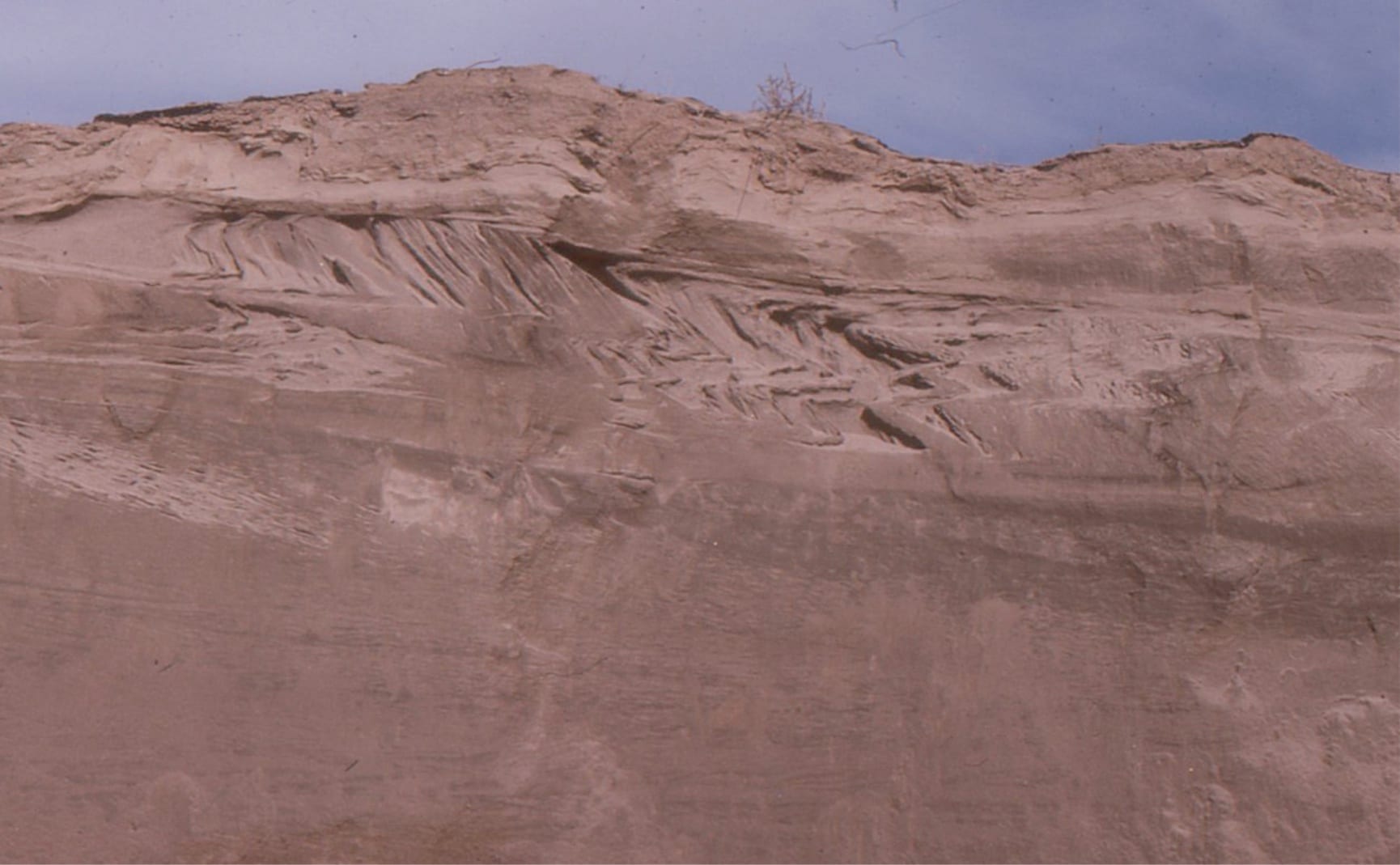
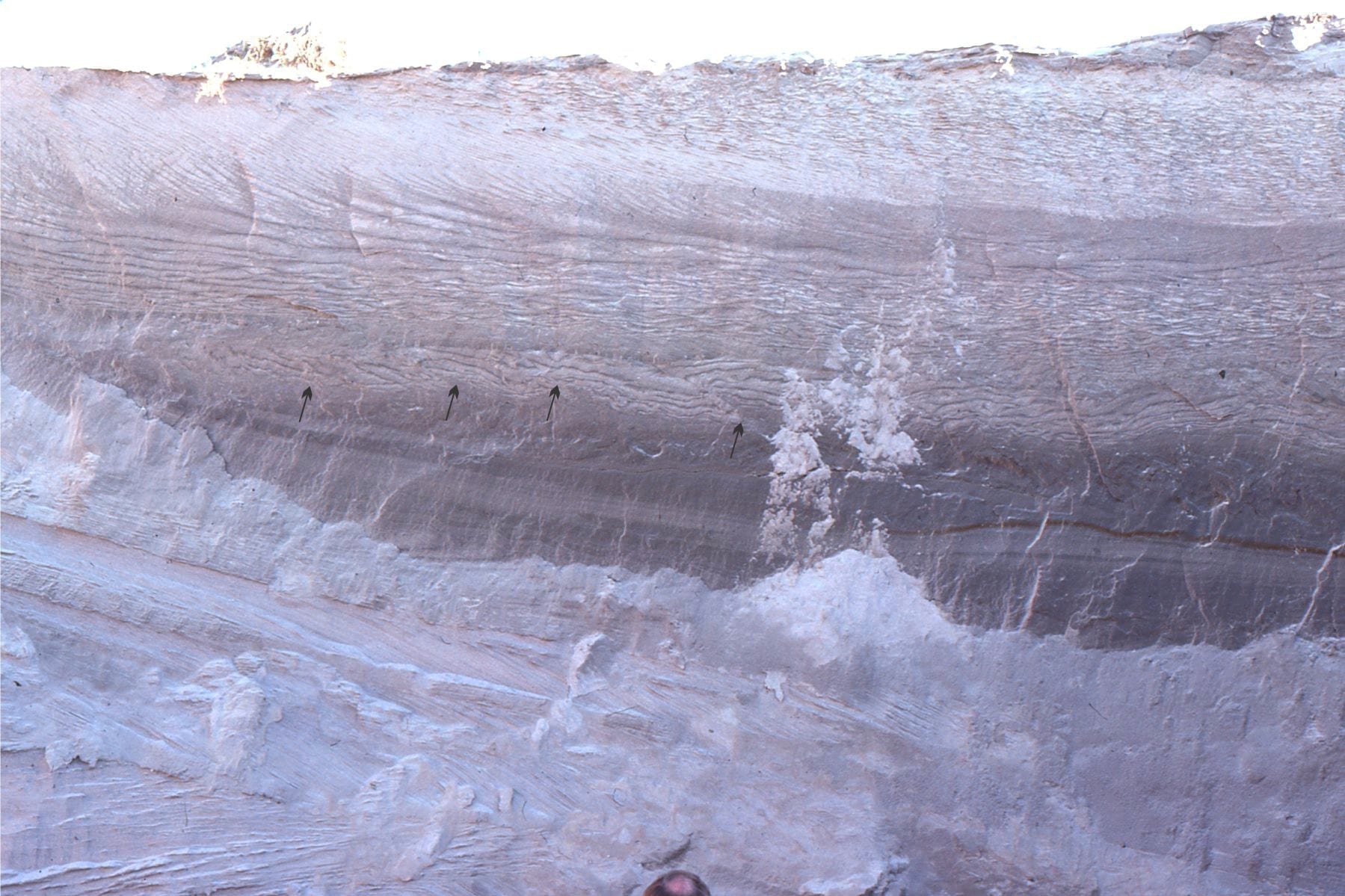 Crossbedded and rippled glacial outwash in a gravel pit at Kanata, Ottawa. Arrows point to small thrust faults (movement to the left) probably caused by ice loading prior to deposition of the thicker crossbedded unit above (the faults do not extend into the overlying unit).
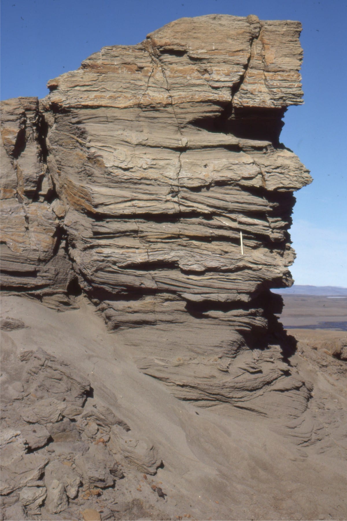
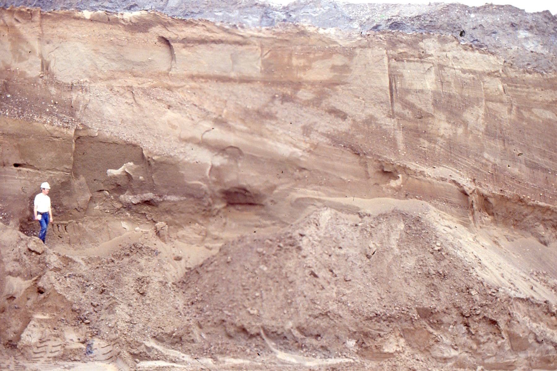
 Thick trough crossbeds in an outwash channel, Kanata, Ottawa. The channel seems to have been filled by at least three stages of sediment influx, and scouring of the channel floor.
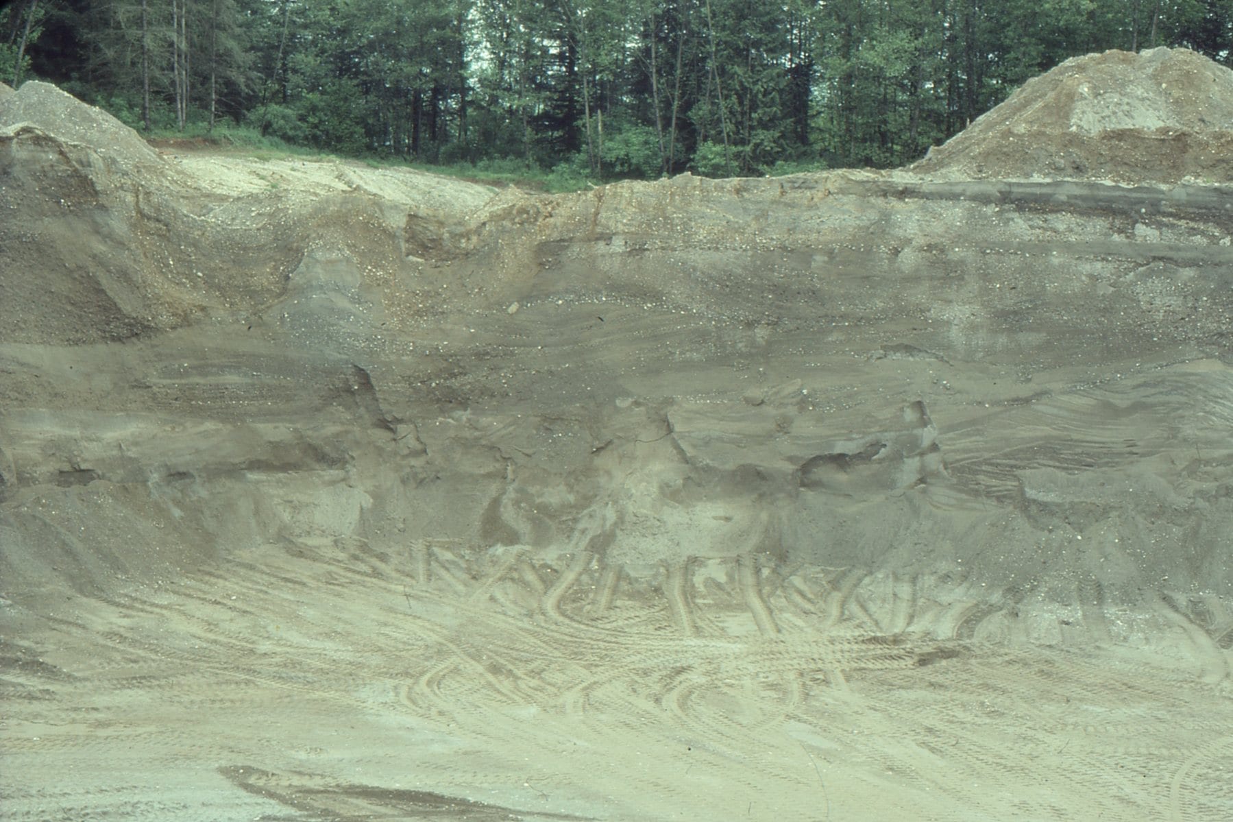
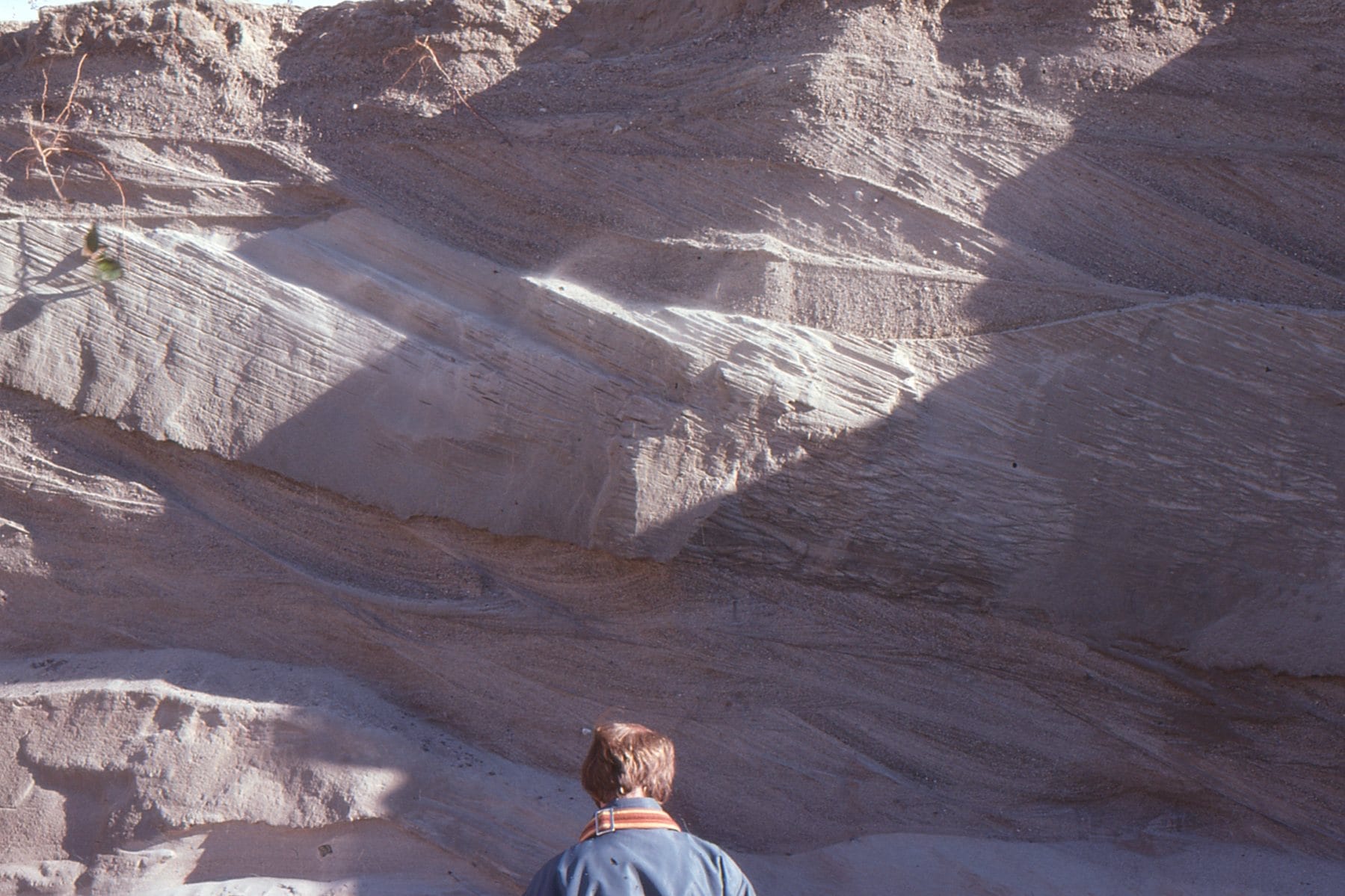
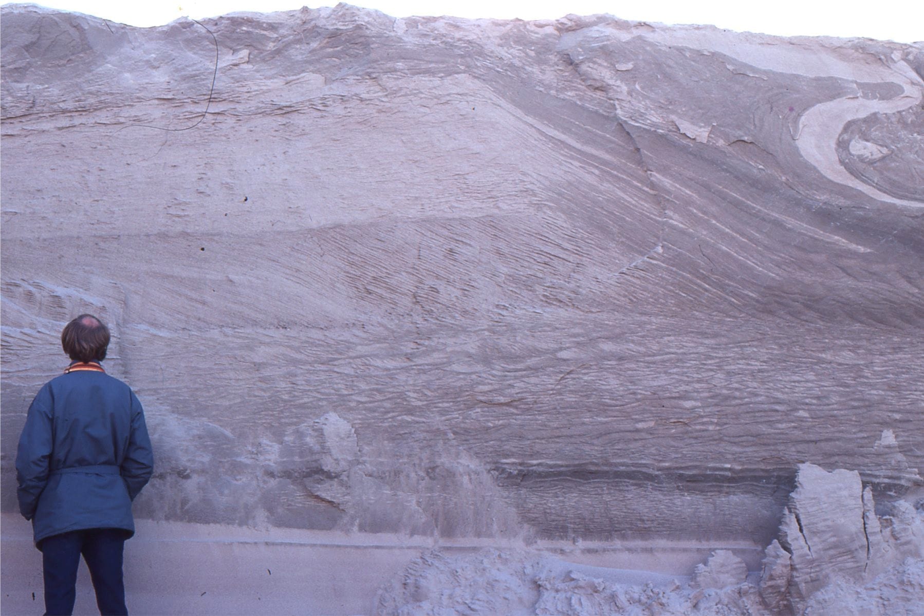 Outwash sand, deposited in large migrating dunes (upper half of outcrop), and multiple sets of climbing ripples (about level with the geologist). The topmost layer contains sandy muds folded and contorted by ice loading. Kanata, Ottawa
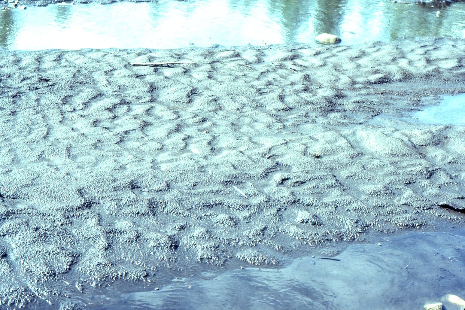
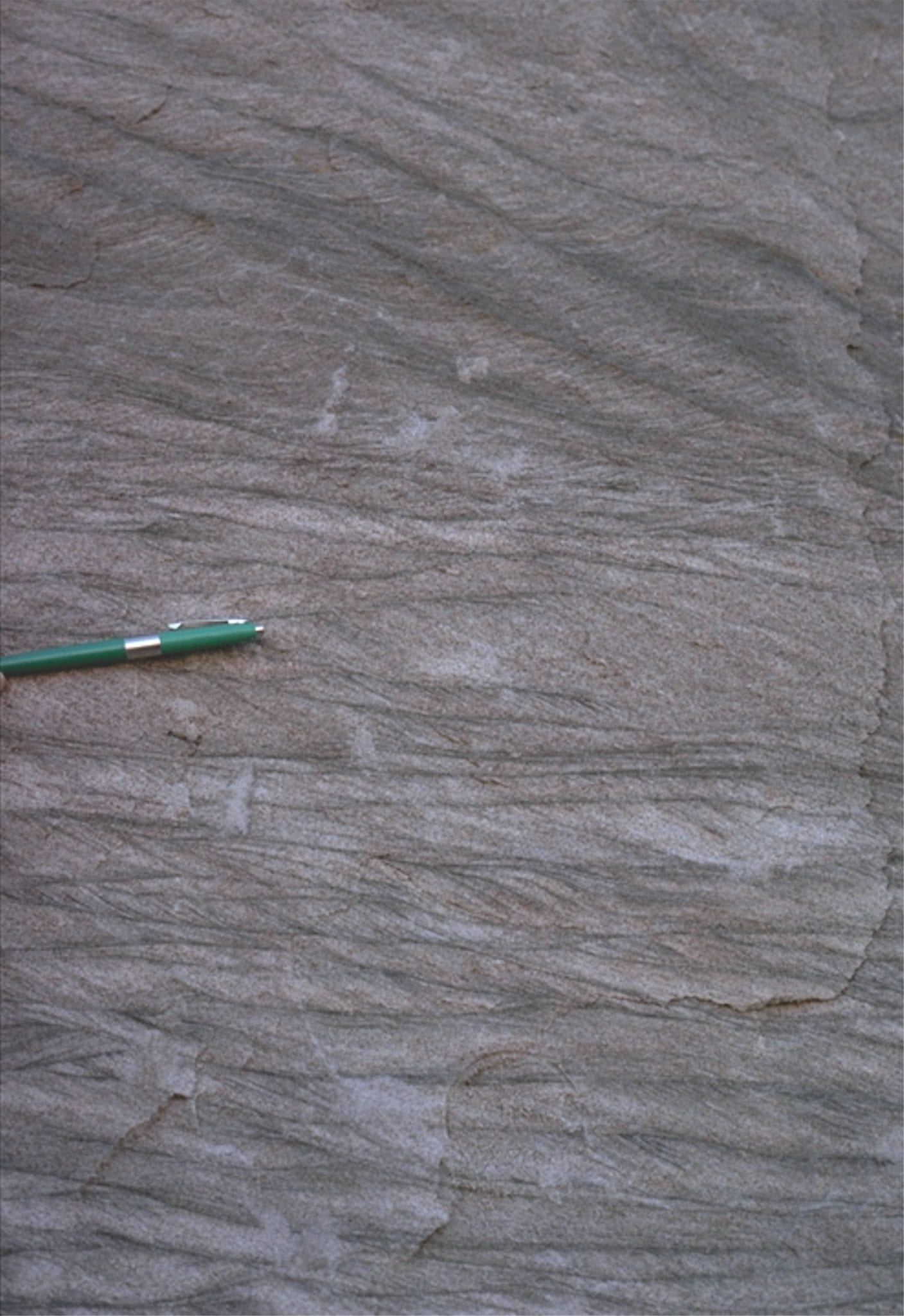
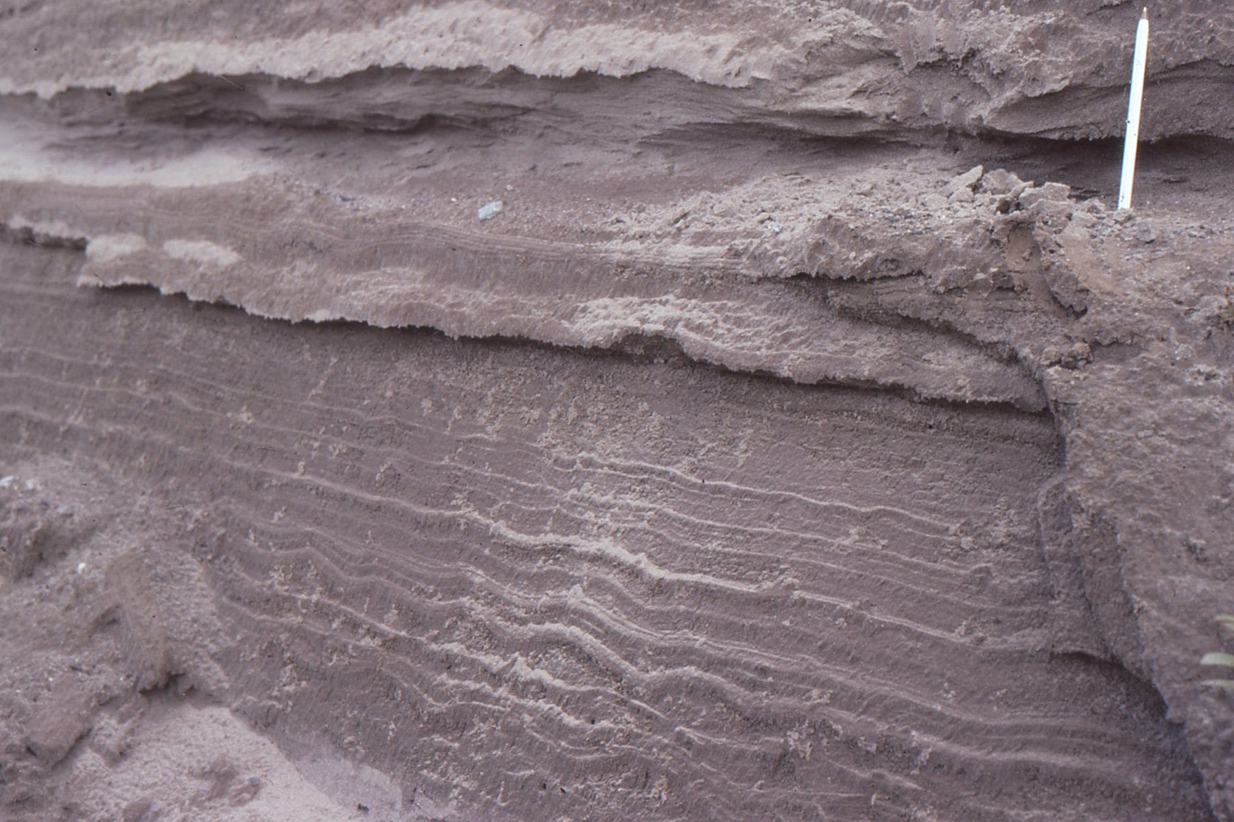 A nice example of in-phase ripples in fine-grained, outwash sand, Kanata, Ottawa
Kink folds in semi-consolidated outwash sand, formed during ice-contact, Kanata, Ottawa