A look at coarse-grained, braided rivers in outcrop
This is part of the How To…series on describing sedimentary rocks – in this post describing and interpreting coarse-grained fluvial (braided river) deposits in outcrop.
The images shown here illustrate some of the outcrop features associated with coarse-grained fluvial deposits; In most cases they relate to ancient low sinuosity, braided channel systems and floodplains. Alluvial fans also share some of the characteristics of braided rivers – many fans contain braided rivers. However, I have focused here on rivers sensu stricto.
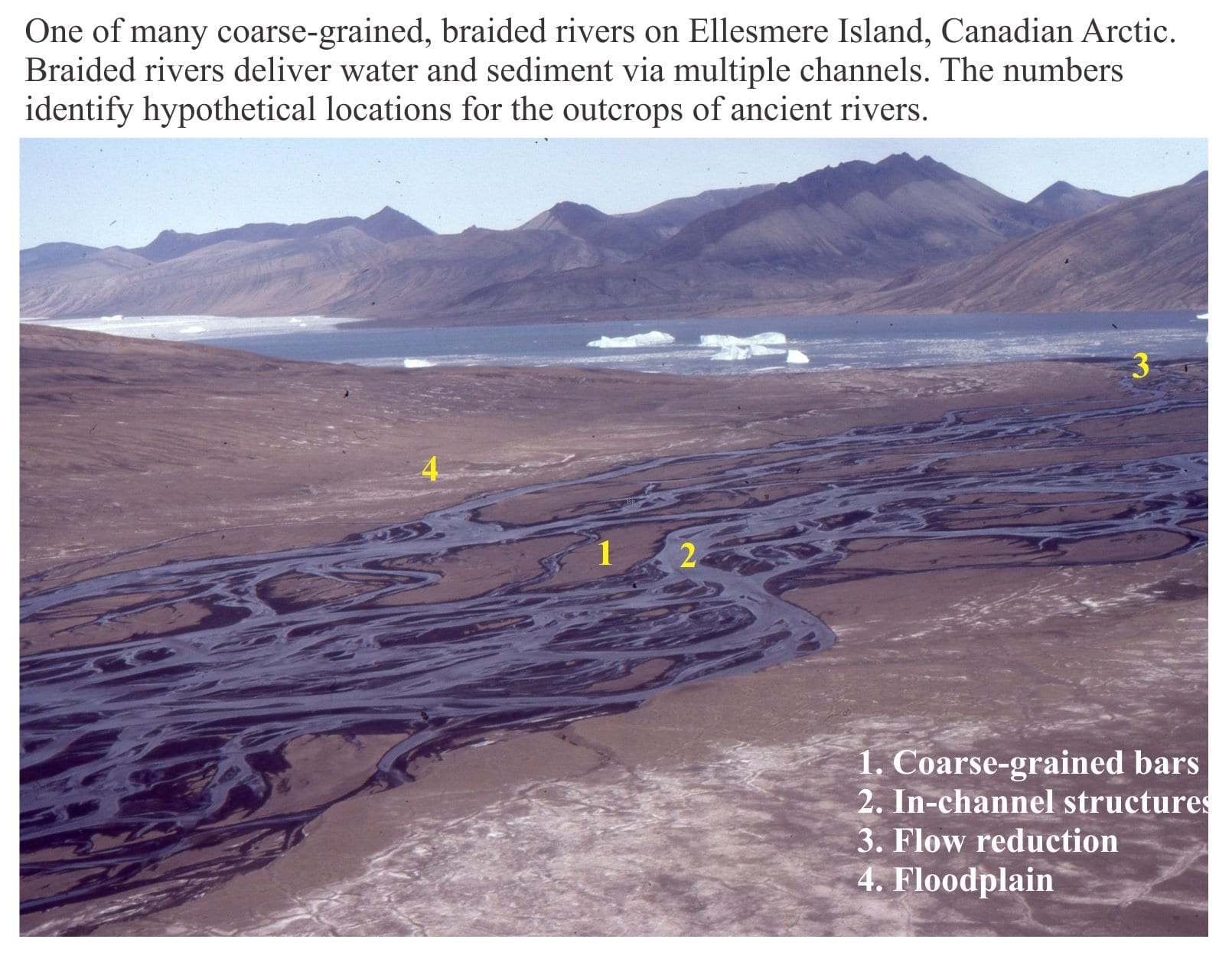
The images are divided into 4 categories, shown on the Arctic scene at the top of the page. They represent four different depositional elements of this braided river, although there is some overlap of process and deposit.
Related links in this series on outcrop description
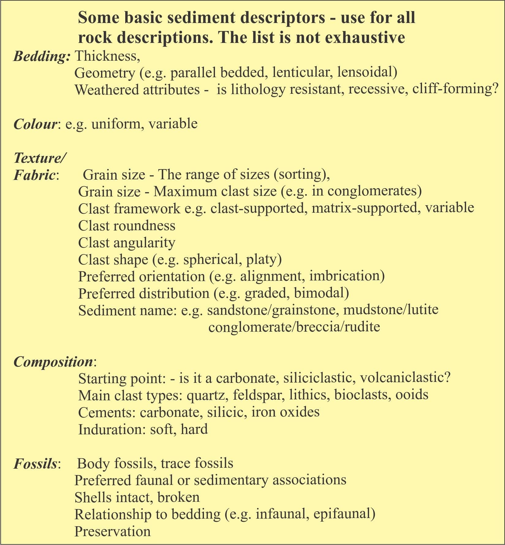
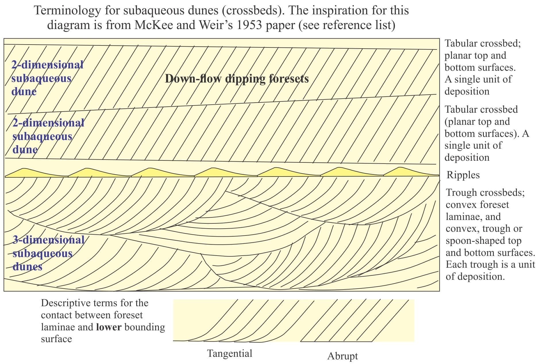
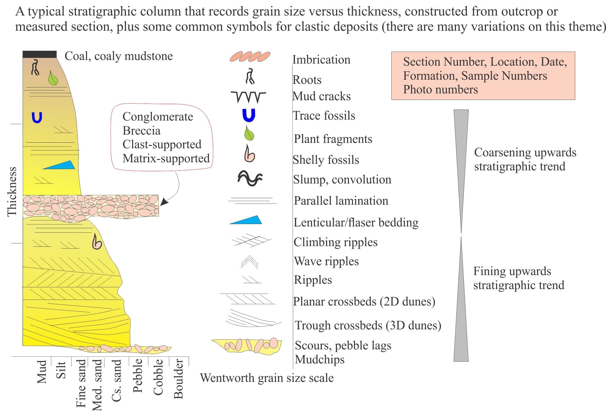
The first three diagrams show some basic sediment descriptors and terminology, and a typical stratigraphic column drawn from outcrop data. These are your starting points for describing and interpreting sedimentary rocks and sedimentary structures in outcrop, hand specimen, and core.
References
The publications cited below apply to the spectrum of fluvial deposits, including meandering river systems (previous post). The literature on fluvial systems and their deposits is vast (actually, this also applies to most other sedimentological domains); the accumulation of two centuries of knowledge and excellent science. The 1970s and 80s were heydays for facies models based on modern-ancient analogues; many of these papers are cited in the references here.
J.S. Bridge, 2006. Fluvial facies models: Recent developments. In: Posamentier H W, Walker R G. (Eds.), Facies models revised. SEPM Special Publication 84, 2006: 85–170. This is a revision of the iconic volume Facies Models, originally published by the Geological Association of Canada (Geoscience Canada) (1976-79). Currently Open Access
S.K. Davidson, S.Leleu, and C.P. North (Eds.). 2011. From River to Rock Record: The preservation of fluvial sediments and their subsequent interpretation. SEPM Special Publication 97. 21 papers on many aspects of fluvial sedimentology.
A.D. Miall, 1977. A review of the braided-river depositional environment. Earth Science Reviews, v. 13, p. 1-62. An older but excellent summary of processes and models
A.D. Miall, 2006. The Geology of Fluvial Deposits: Sedimentary Facies, Basin Analysis, and Petroleum Geology. Springer.
G.S. Weissmannet al.2011. Alluvial facies distributions in continental sedimentary basins – distributive fluvial systems. In: DavidsonS.K., LeleuS. & NorthC.P. (eds) From River to Rock Record. SEPM, Special Publications, 97, 327–355. Free access
G.S. Weissmann et al. 2015. Fluvial geomorphic elements in modern sedimentary basins and their potential preservation in the rock record: A review. Geomorphology, v.250, p. 187-219
This collection of images from various modern and ancient fluvial settings, includes meandering (high sinuosity) and braided (low sinuosity) rivers. Where possible I have paired modern analogues with ancient examples.
The Atlas, as are all blogs, is a publication. If you use the images, please acknowledge their source (it is the polite, and professional thing to do).
This link will take you to an explanation of the Atlas series, the ownership, use and acknowledgment of images.
Click on the image for an expanded view, then ‘back one page‘ arrow to return to the list
The images:
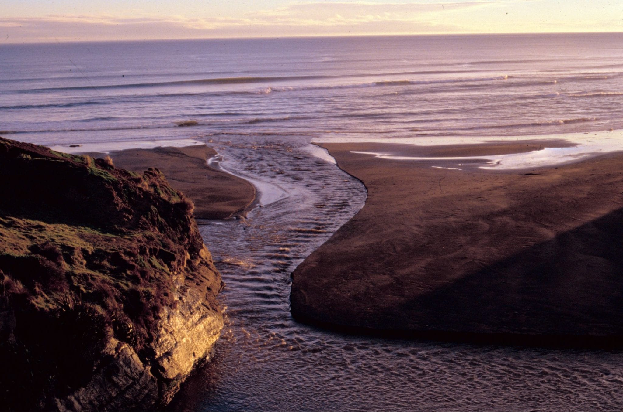
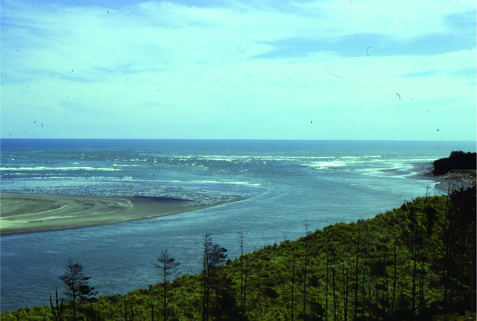
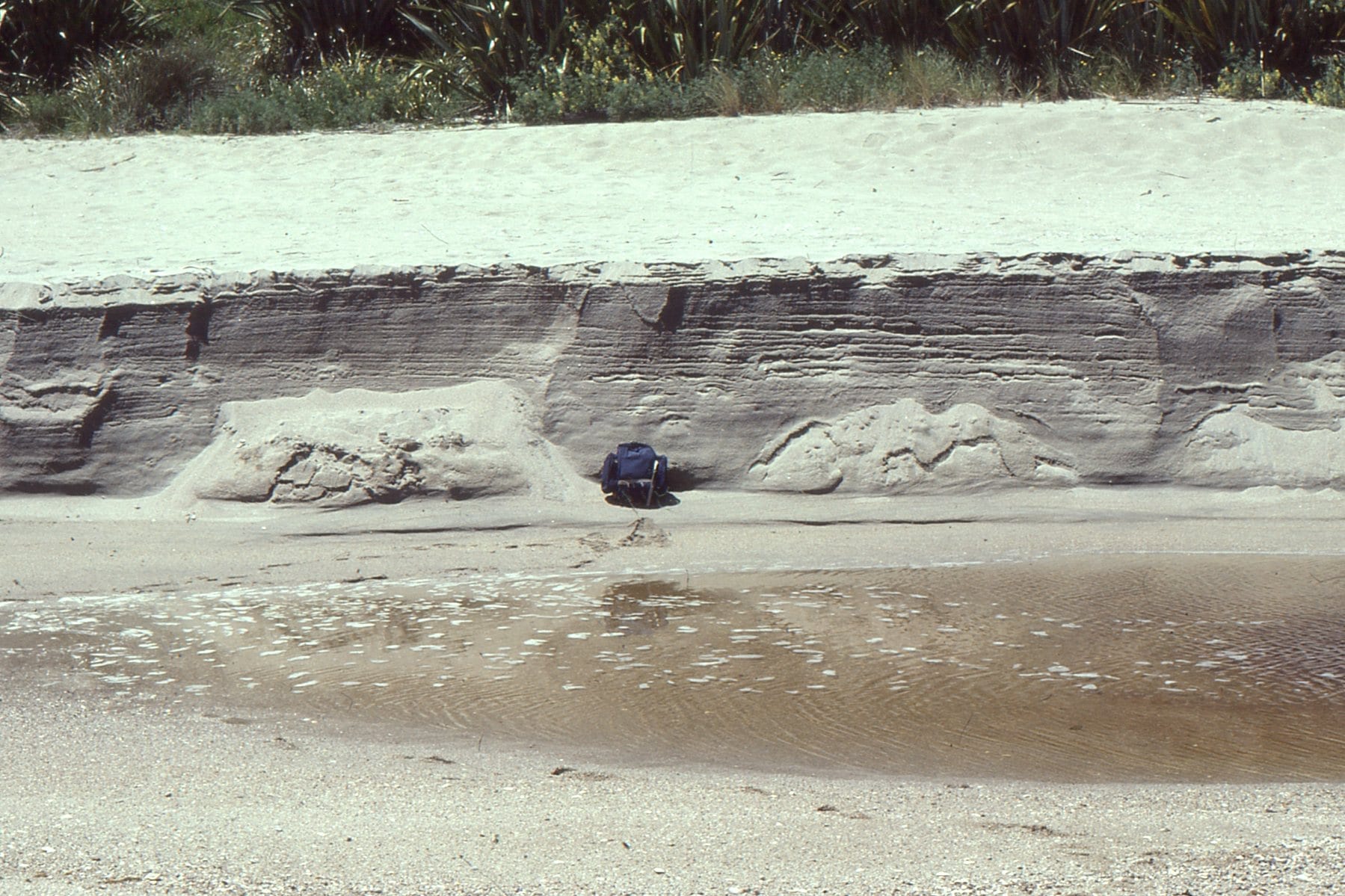
Where transverse sea-waves (generated by wind shear) meet riverine standing waves. Manawapou River, west coast NZ.
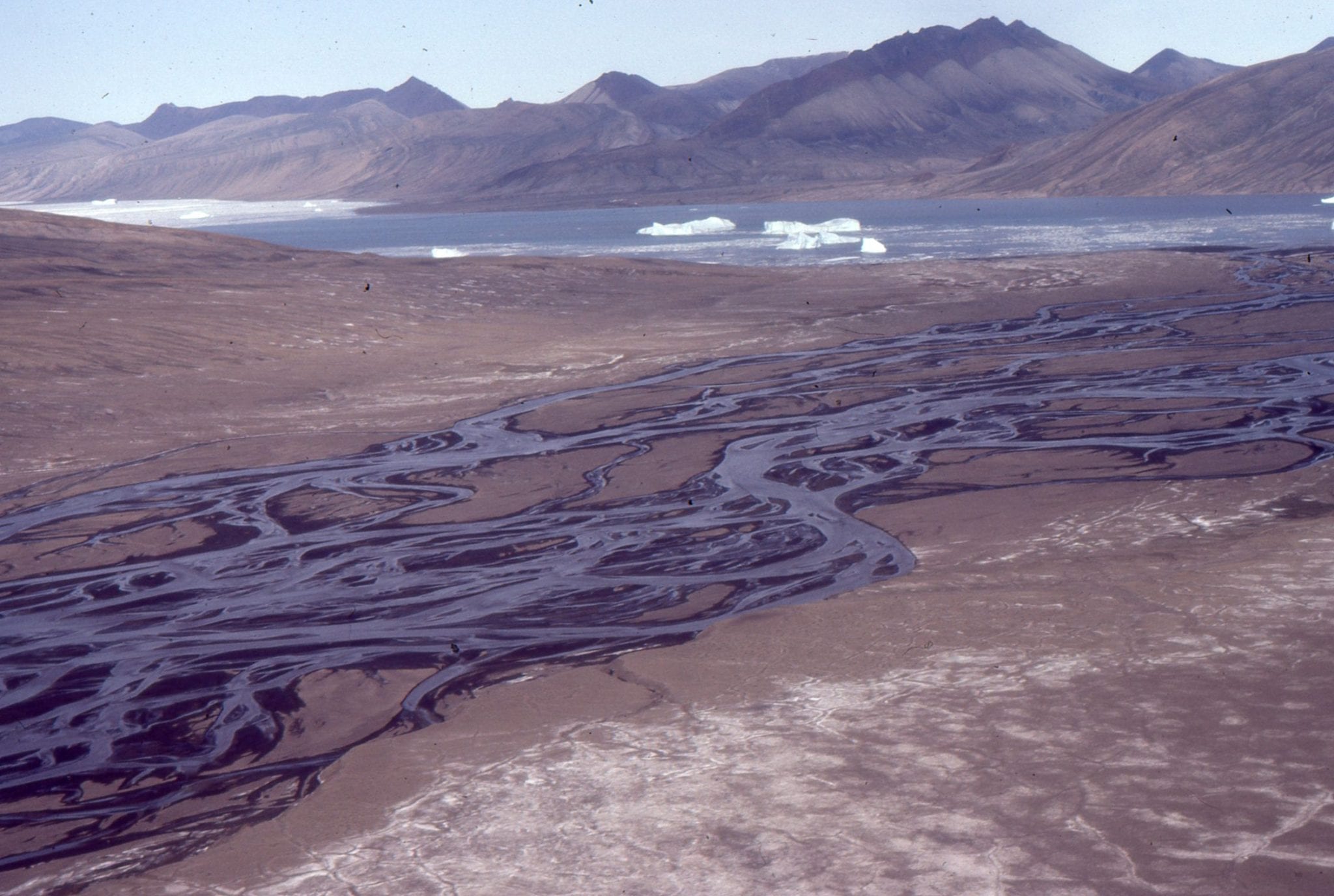
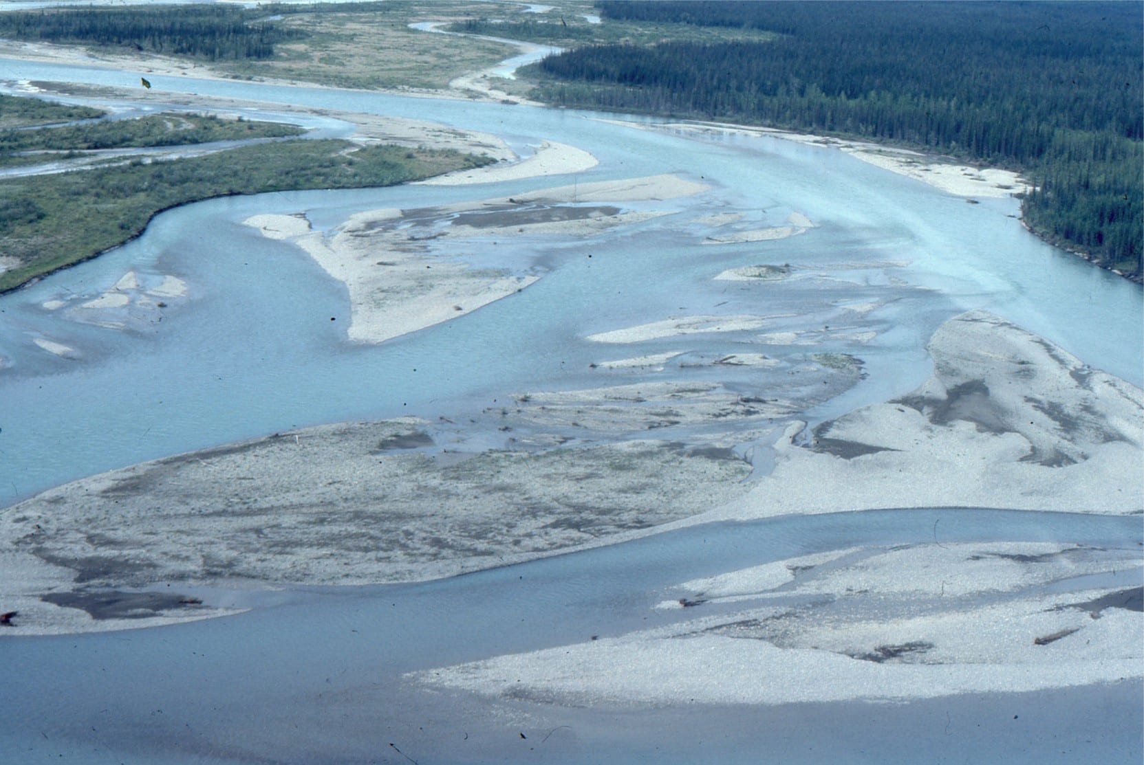
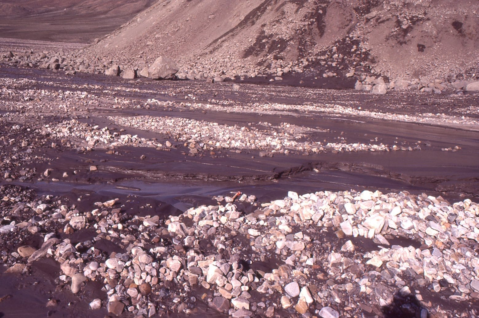
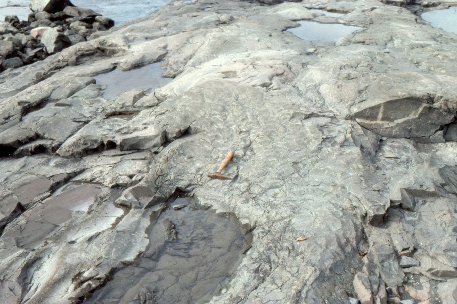
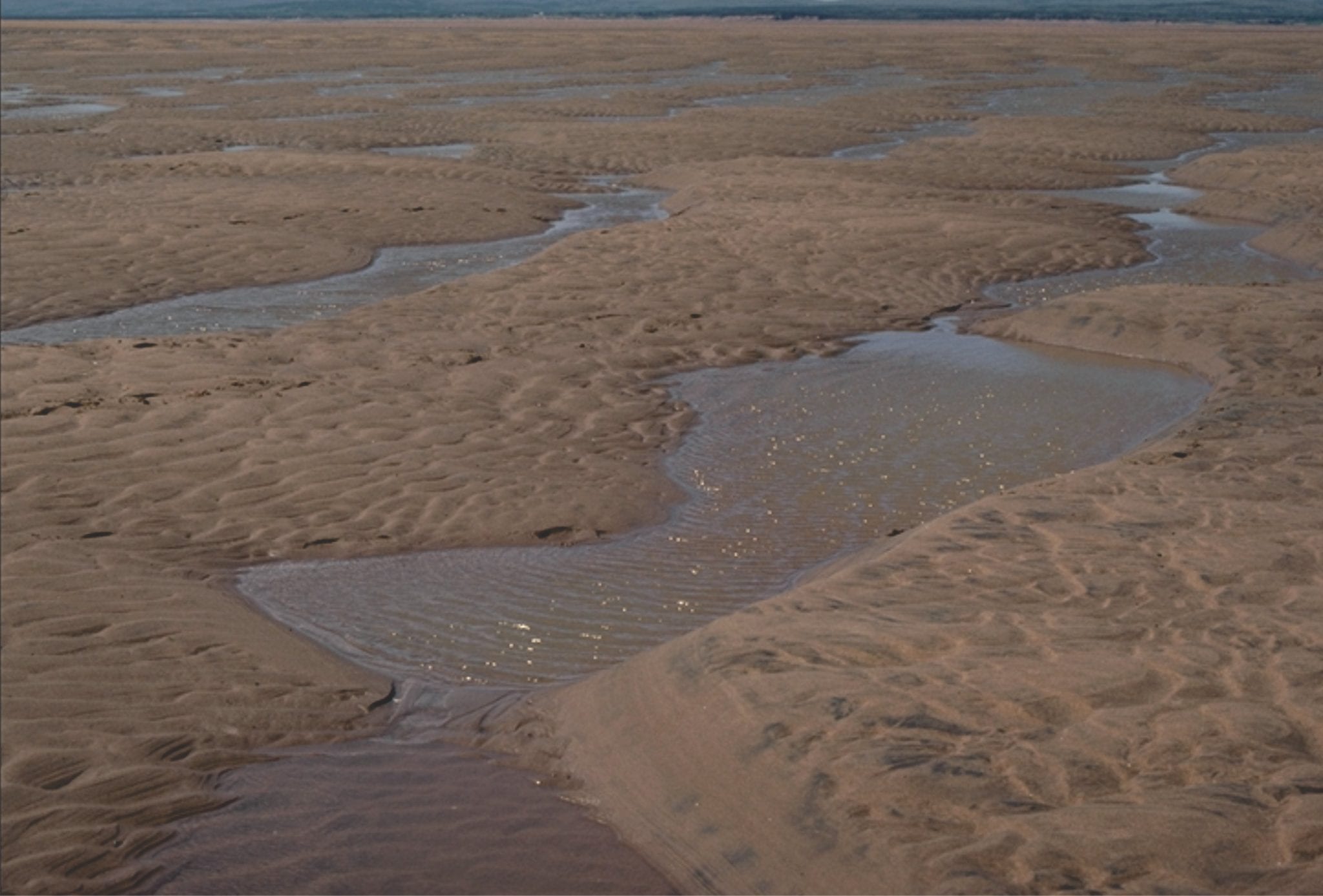
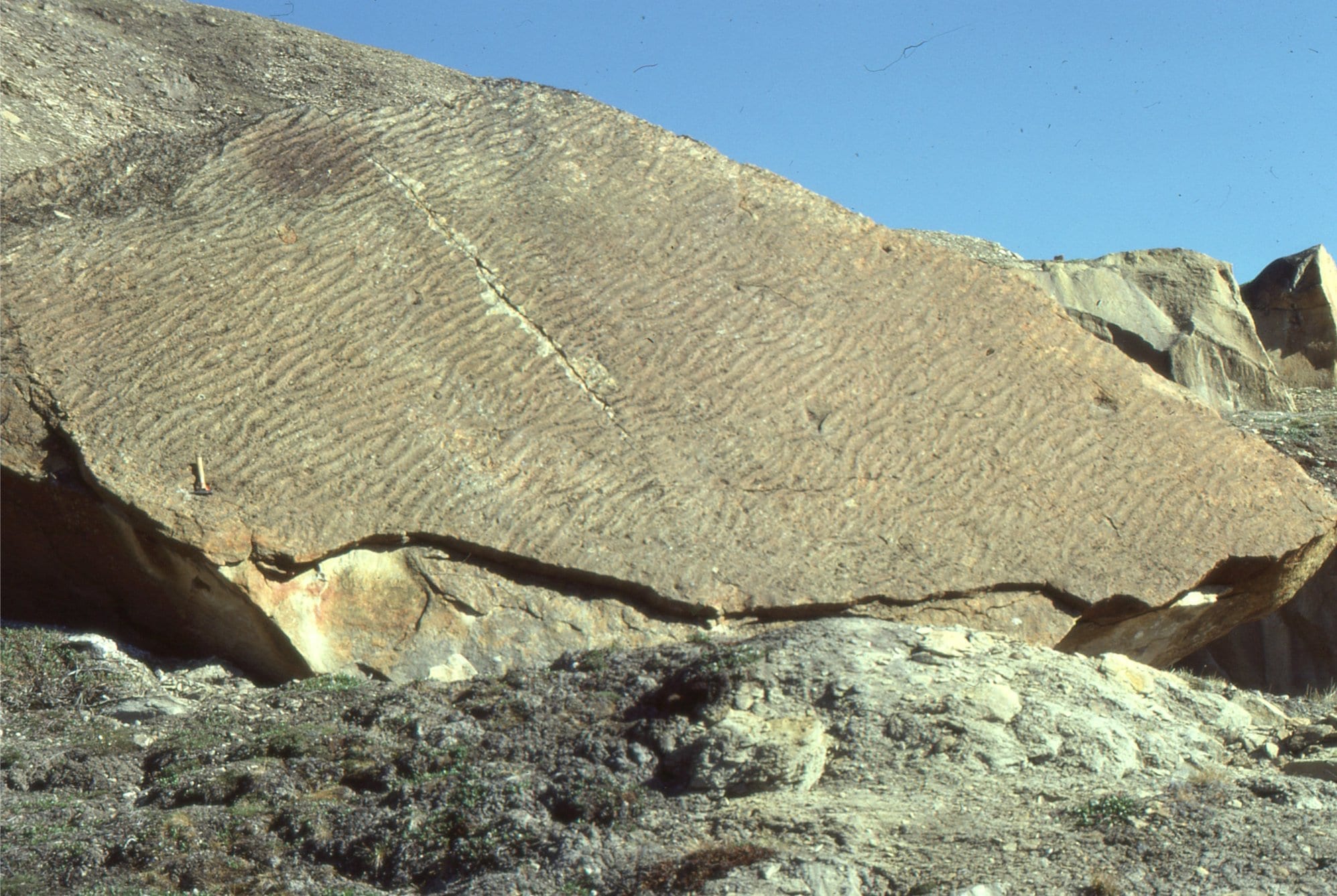
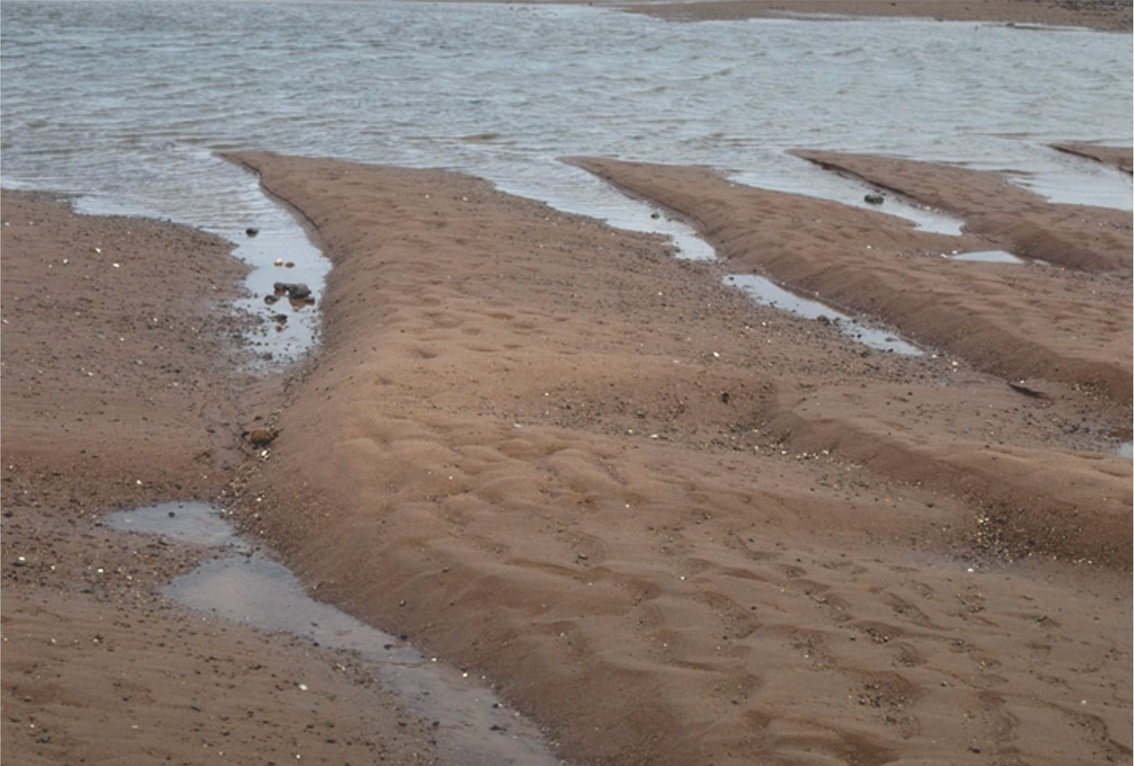
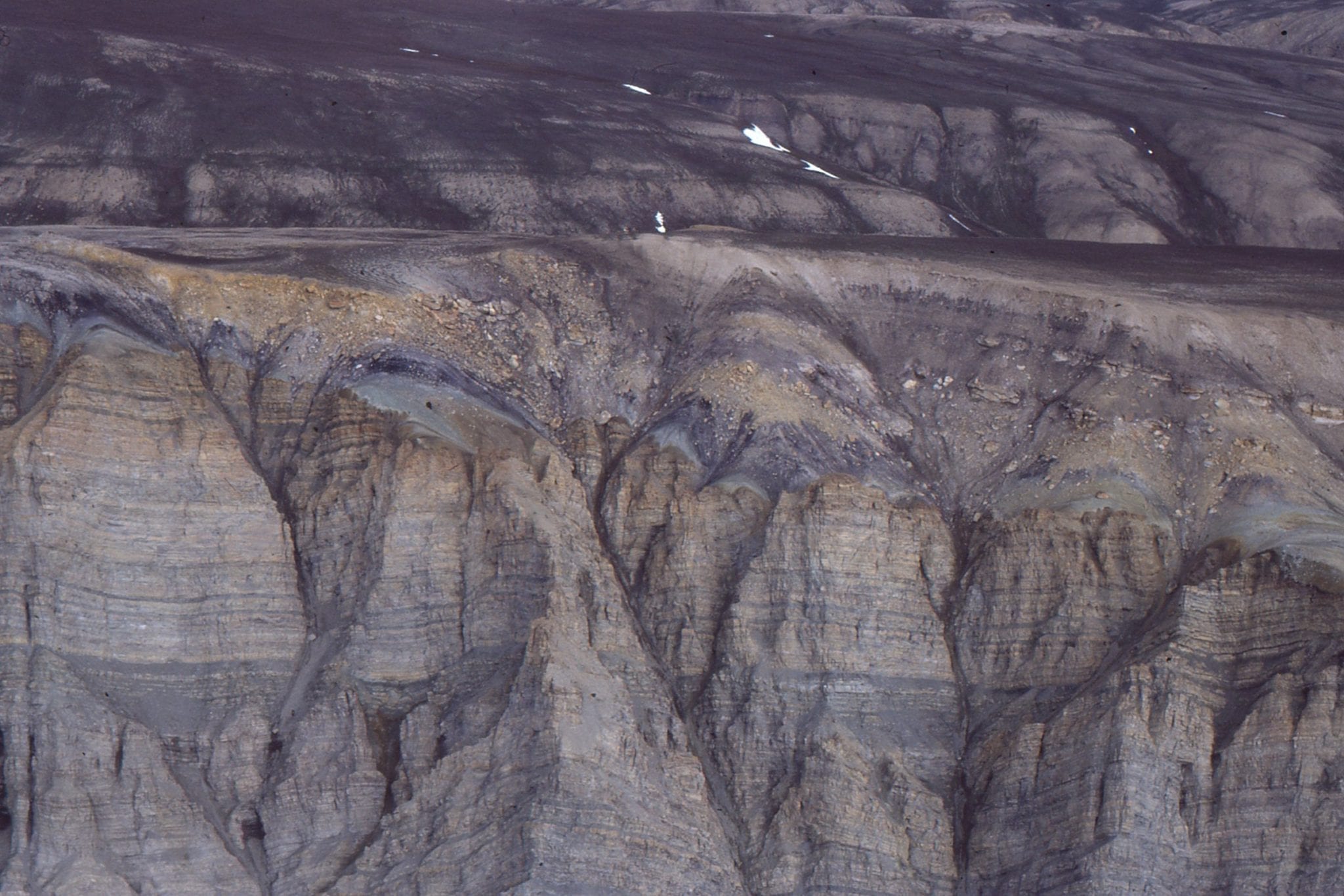
An Arctic braided river, Strand Fiord, Axel Heiberg I. Flow is seasonal, and at a maximum during spring-early summer thaw. The closer view (right) shows a bit more detail of within-channel bar surface features. The sediment load is mixed sand-gravel.
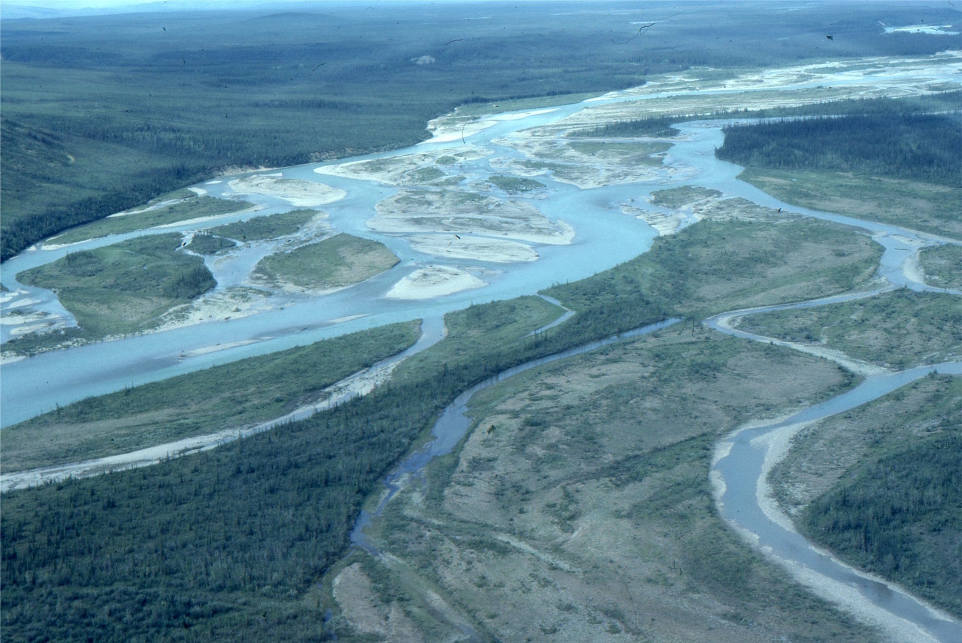
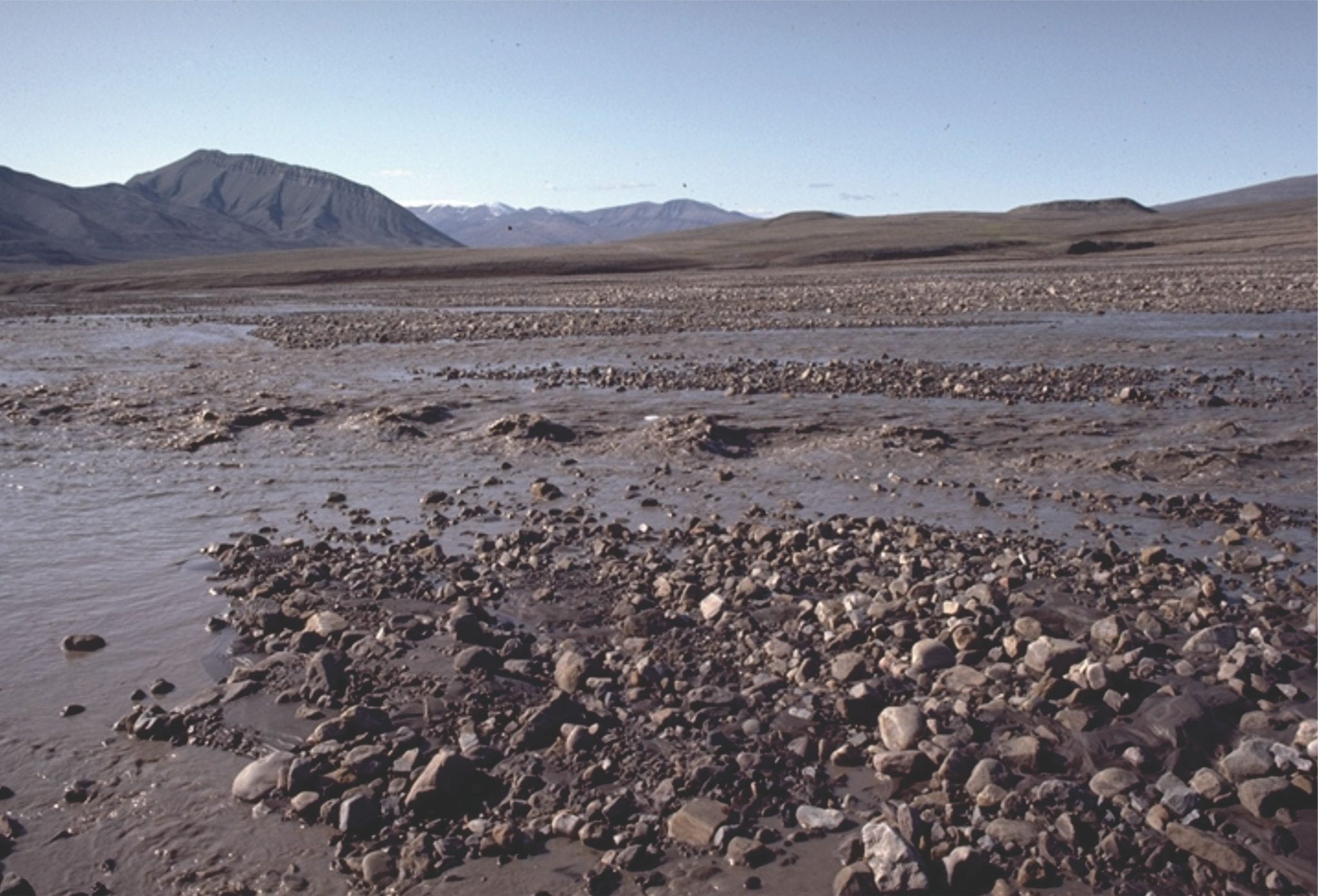
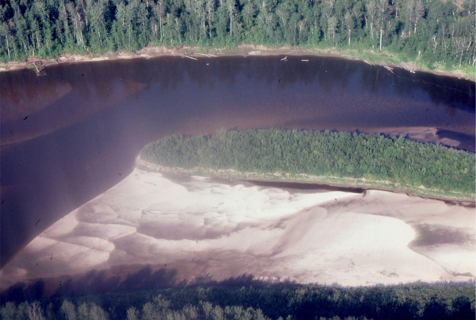
Bonnet-Plume River (Yukon) braided reaches, that, unlike high Arctic examples, are framed within vegetated overbank and some inactive gravel bars. The sediment load is mixed sand-gravel. The left image also shows an ephemeral meandering reach that cuts through inactive braid-bars.
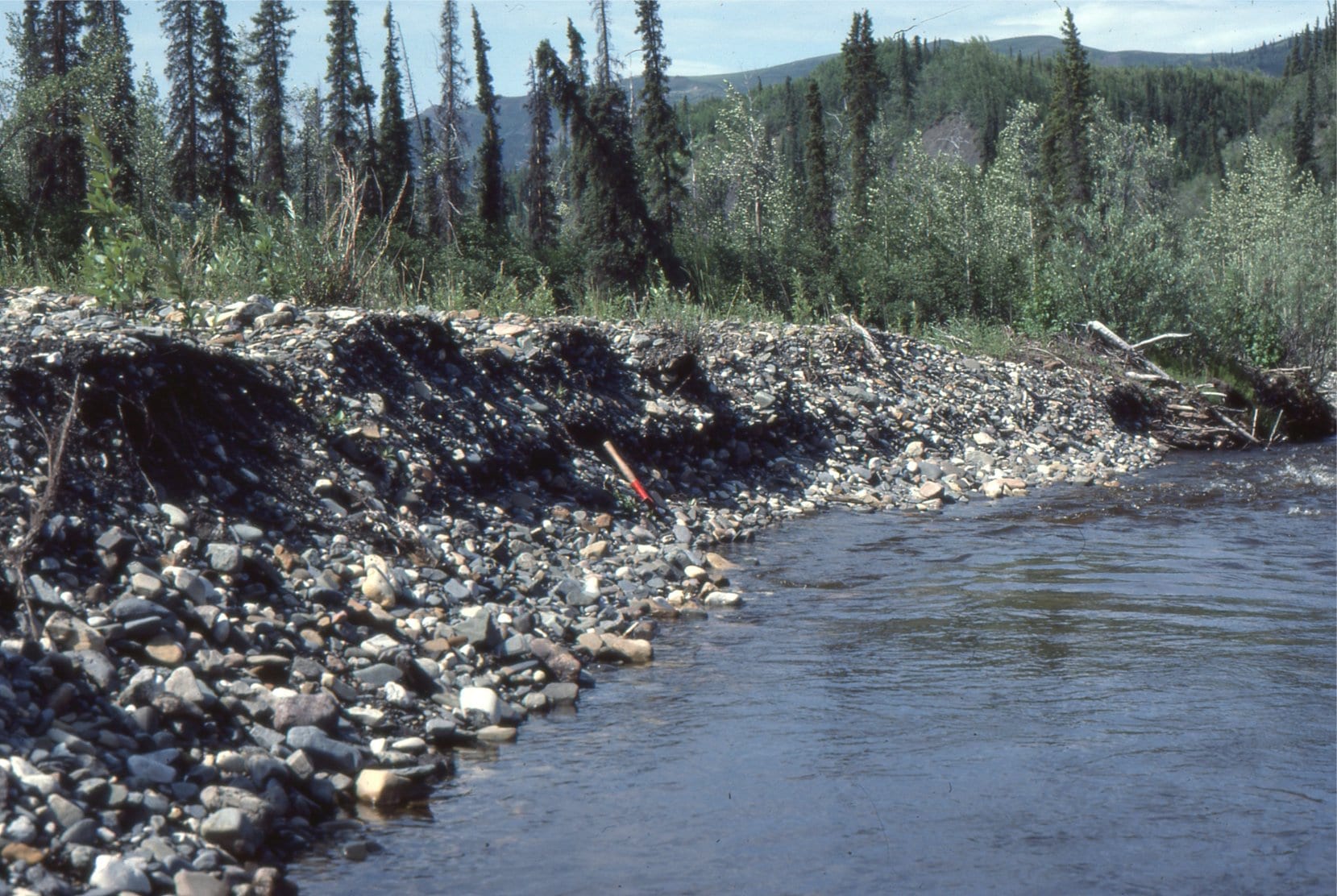
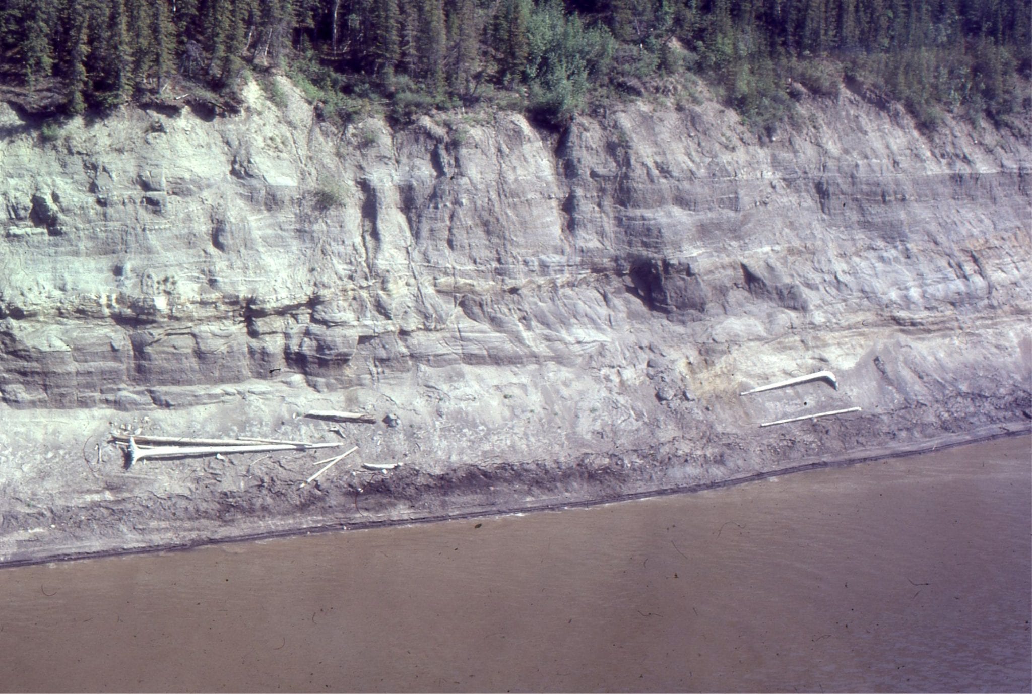
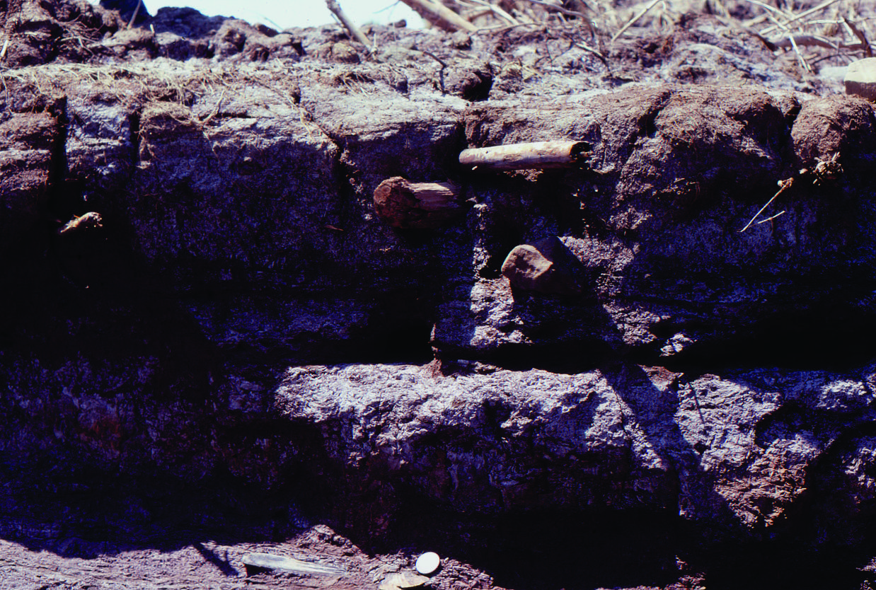
Vegetated braid bar gravels exposed in a cut bank. Bonnet-Plume River, Yukon.
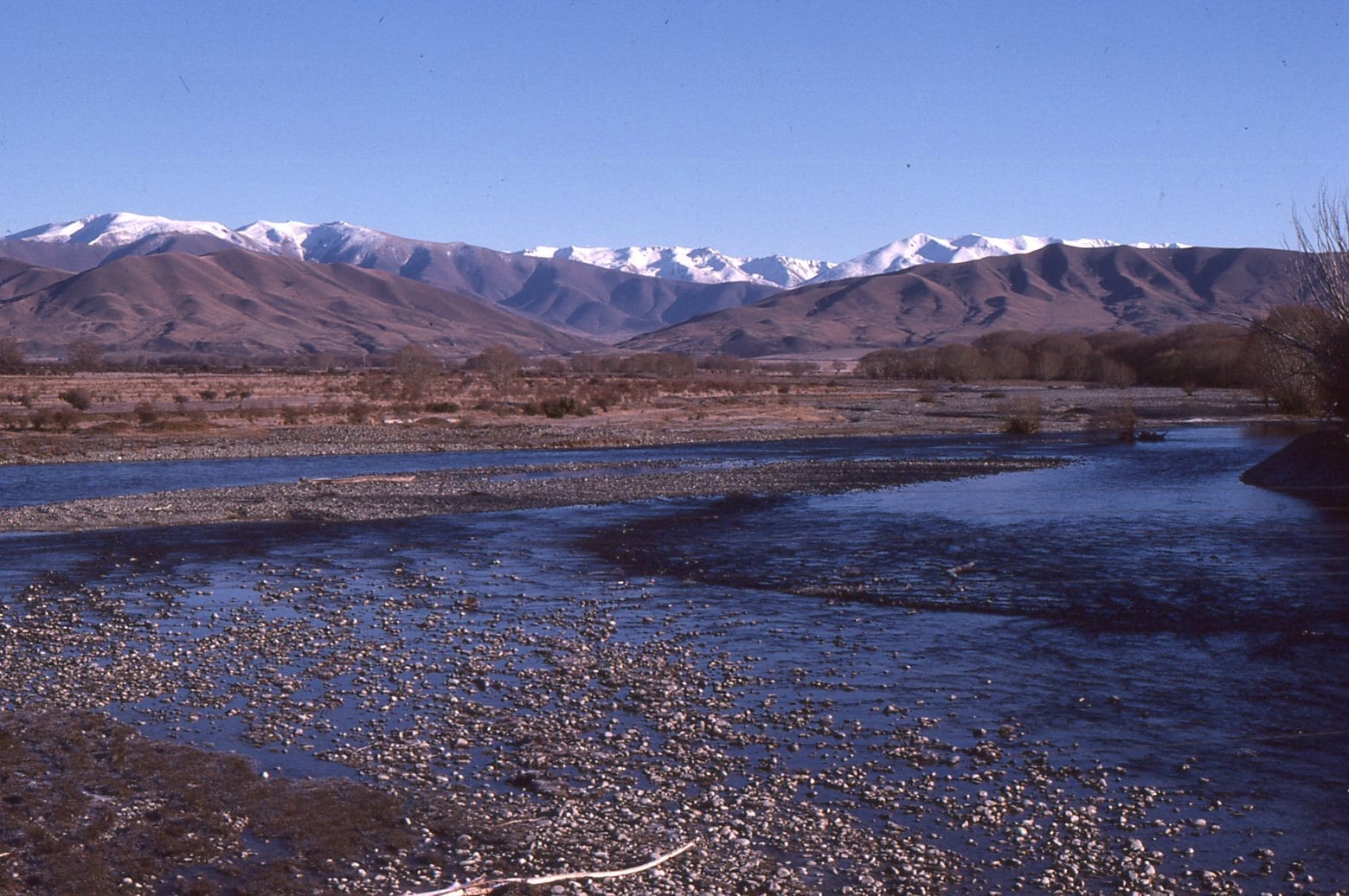
Gravelly, braided reaches of Ahuriri River, Otago, NZ. The headwaters are in the distant Southern Alps.
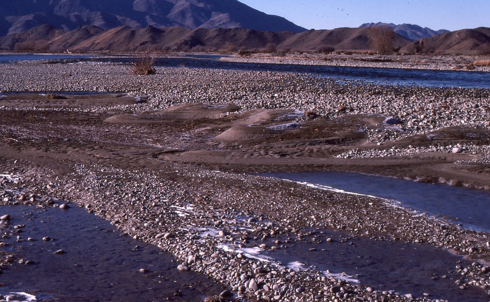
Gravel bar, Ahuriri River, Otago, New Zealand, with falling-stage sand deposits along the bar trailing edge (downstream edge).
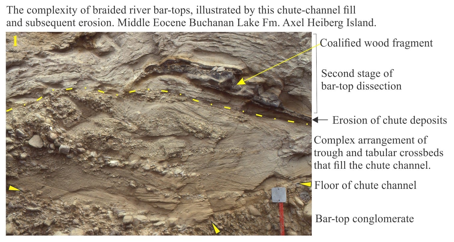
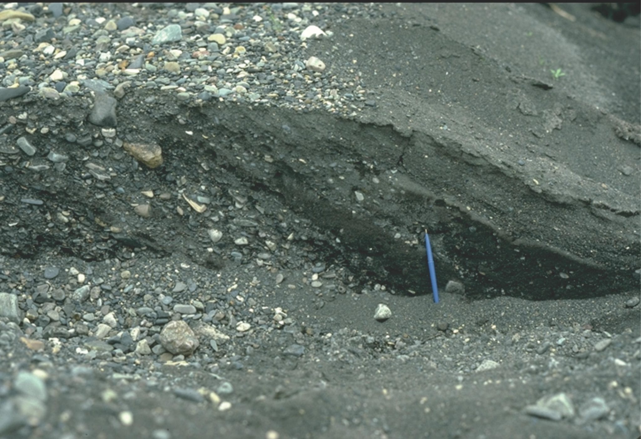
Gravelly, braided glacial outwash near the terminus of Strand glacier, Axel Heiberg Island. Erosional chutes, that form during falling stage, are filled with crossbedded sand.
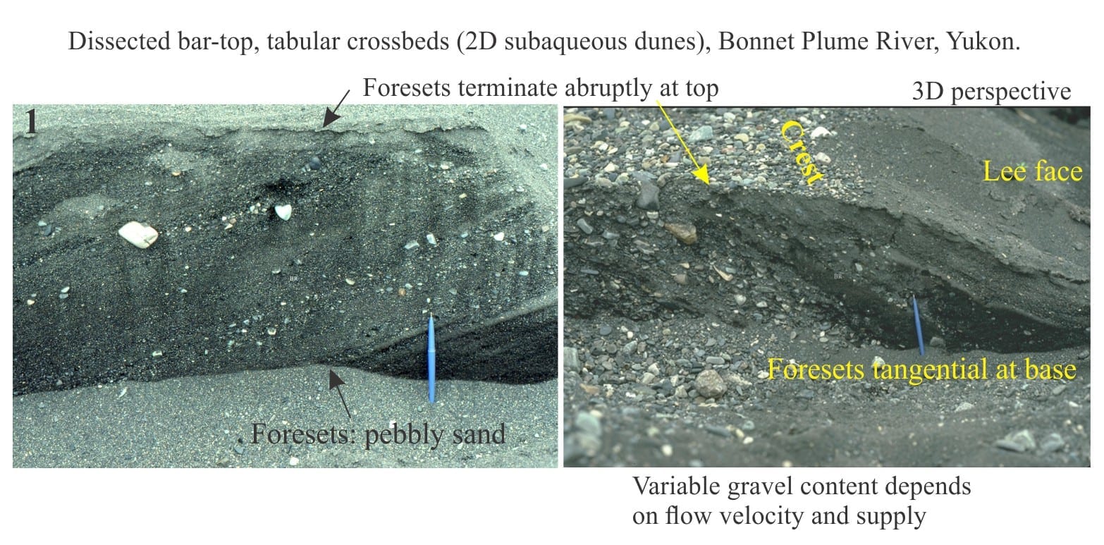
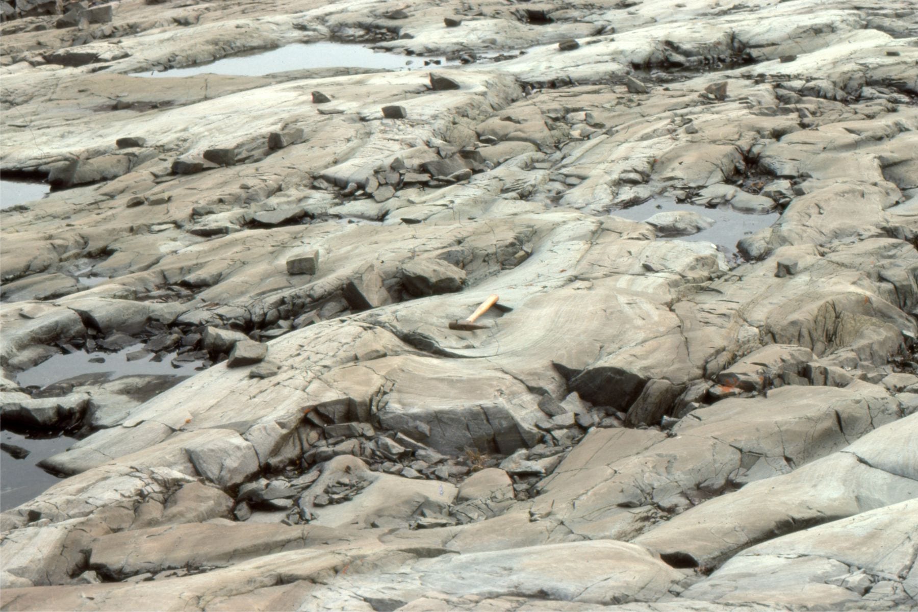
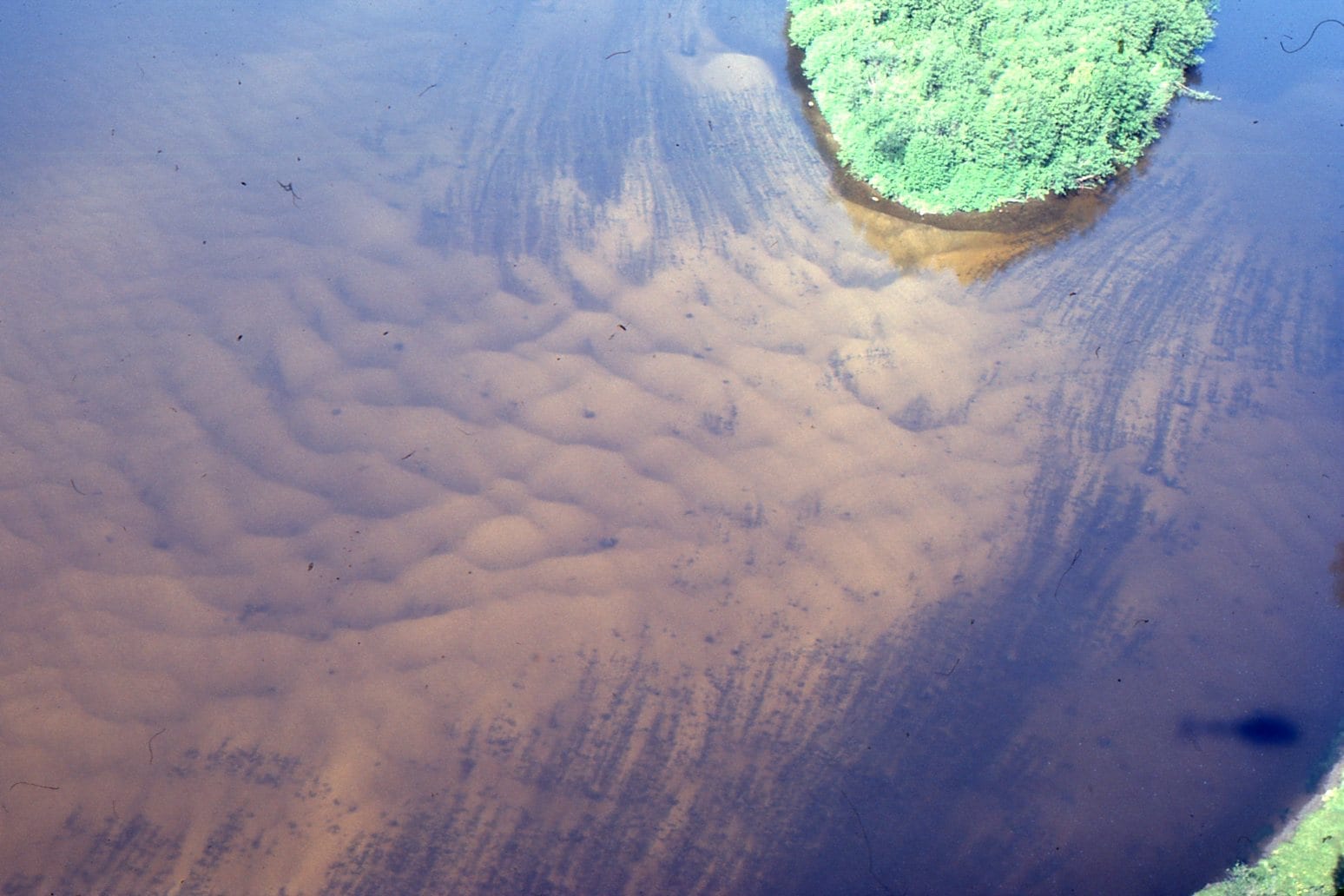
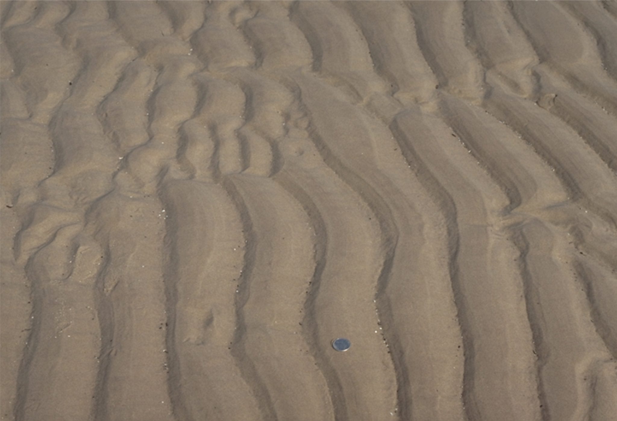
2-dimensional pebbly dunes, each with simple planar tabular crossbeds, formed along the margins of larger gravel braid bars during river falling stage. Monster River, Yukon.
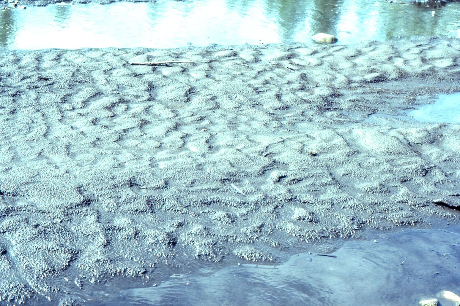
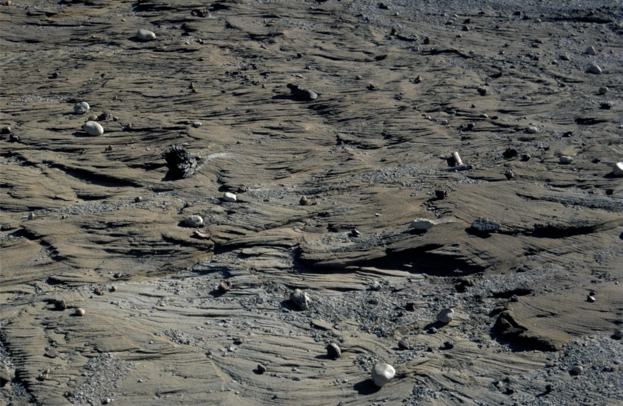
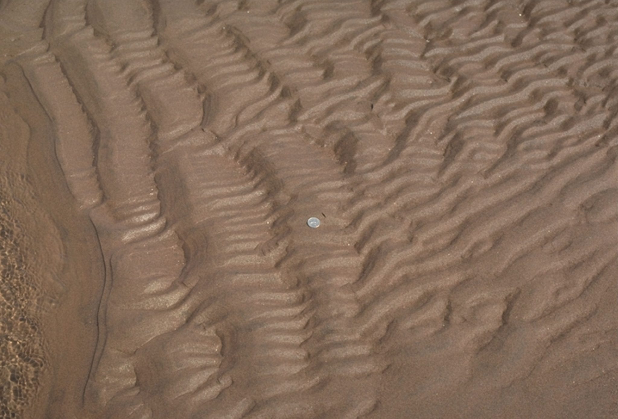
Braid bar-top ripples (flow to the right), imprinted by rain drops. Monster River, Yukon.
Glacial outwash flow during spring thaw, between gravel bars, Strand Glacier (Axel Heiberg Island). The water is mud-laden. The standing waves are in-phase with antidune bedforms.
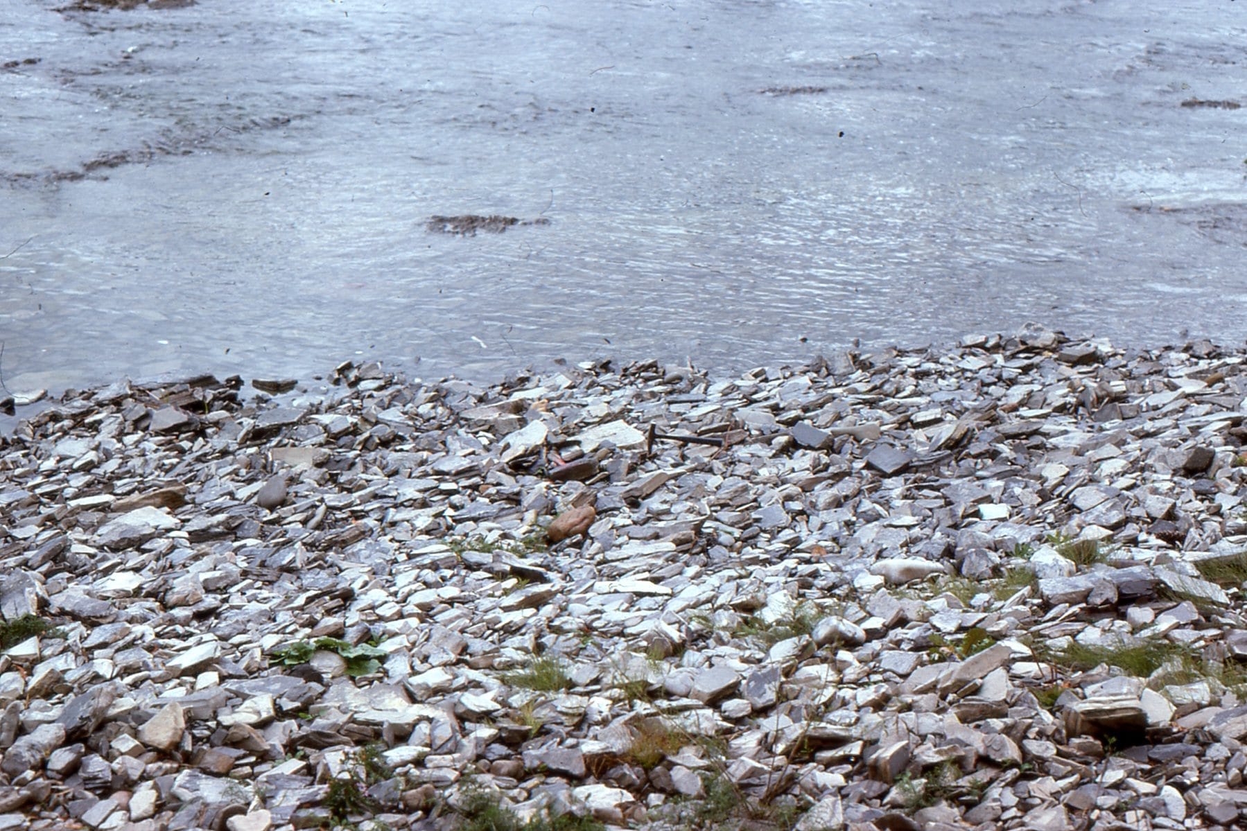
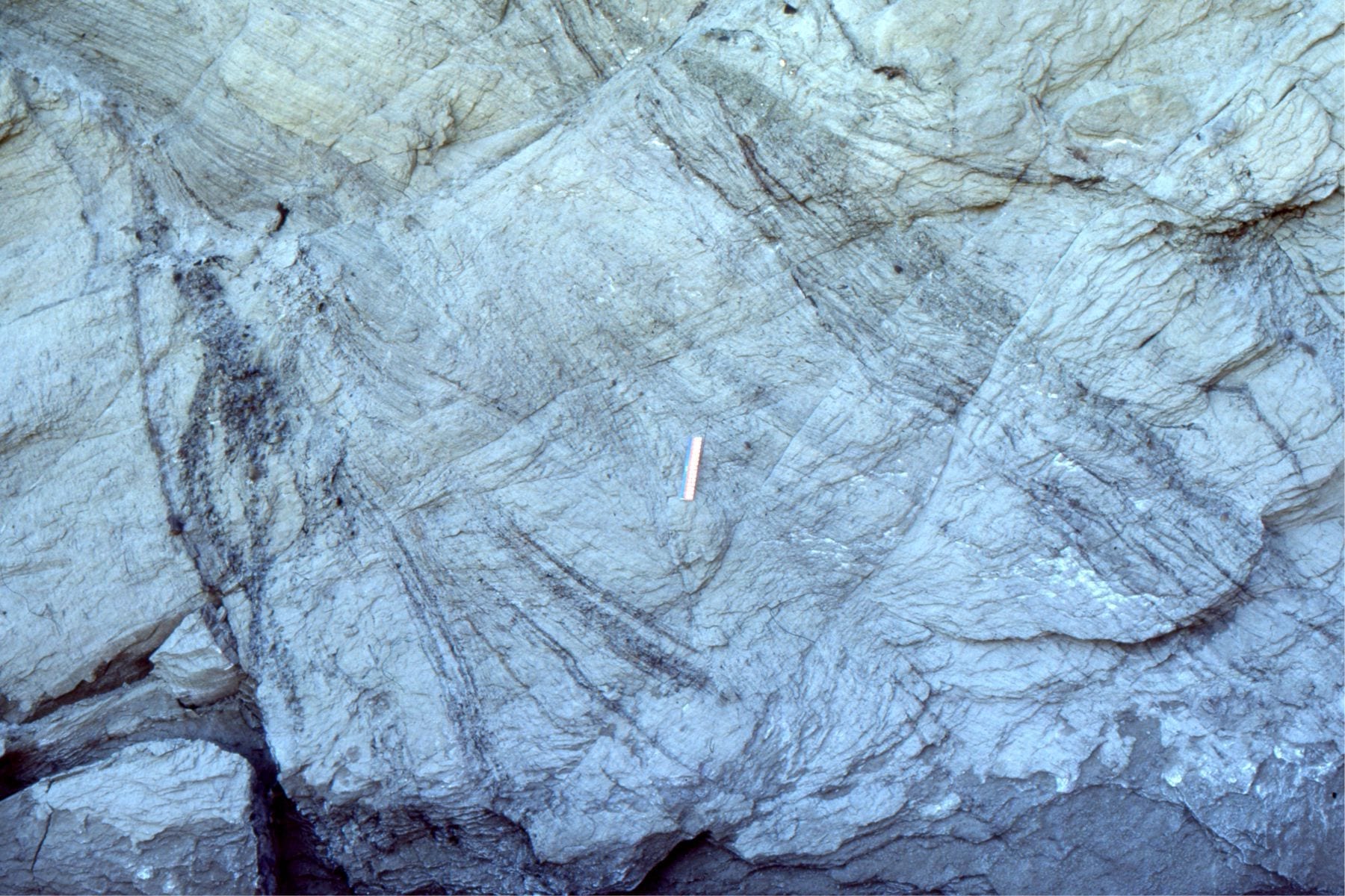
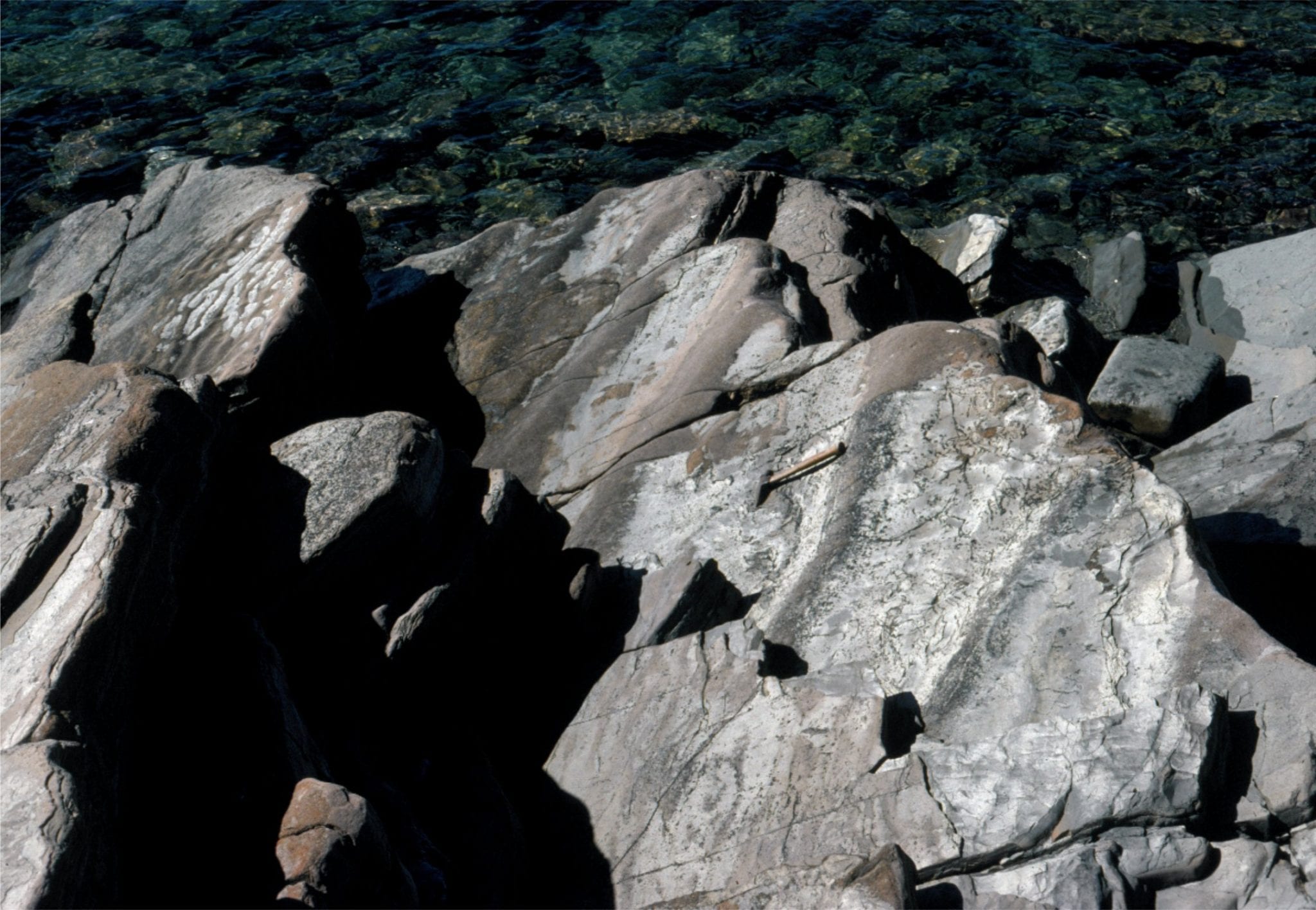
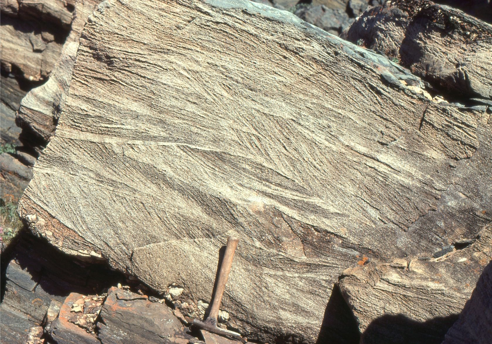
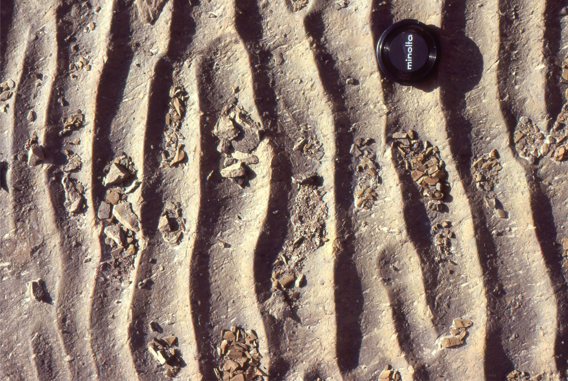
Strong imbrication of flat clasts along an exposed river bed. Flow was to the right.
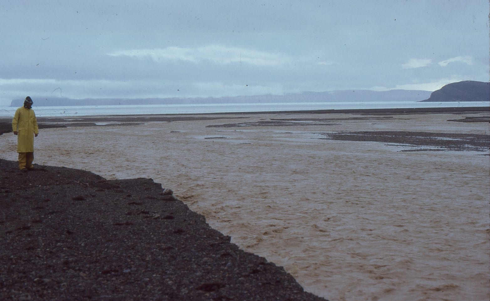
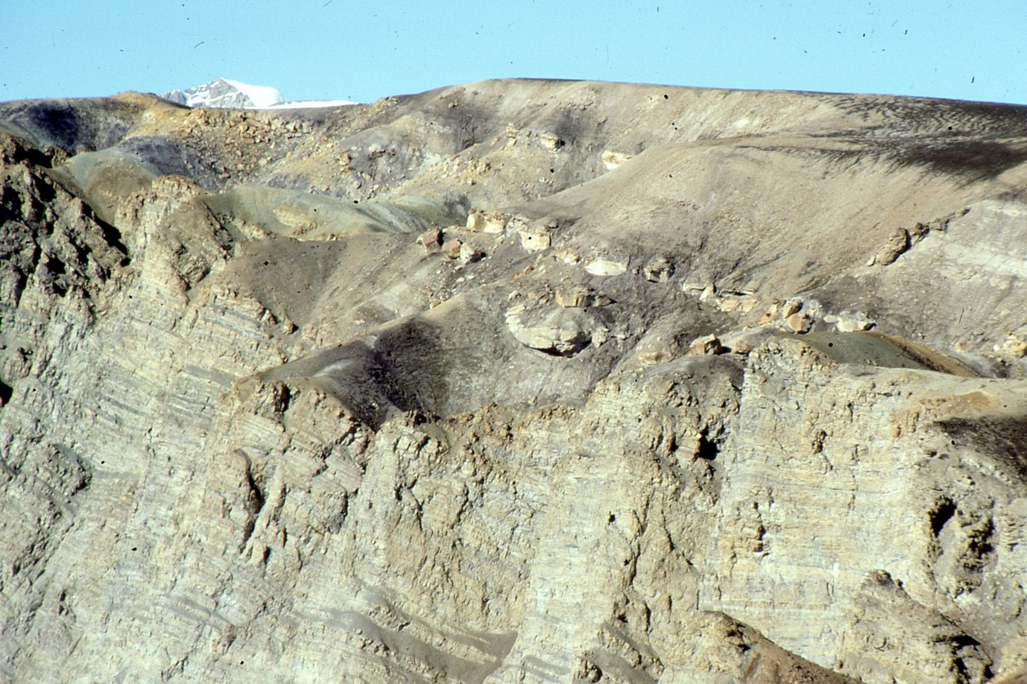
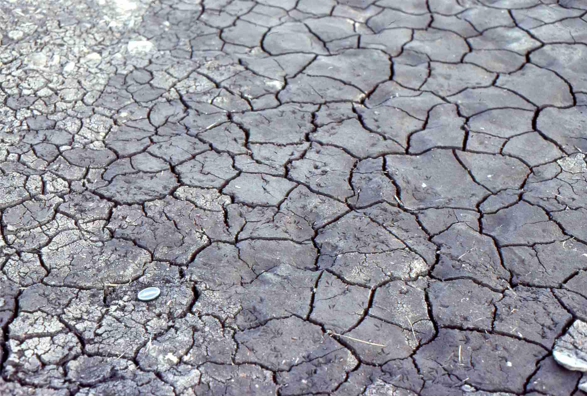
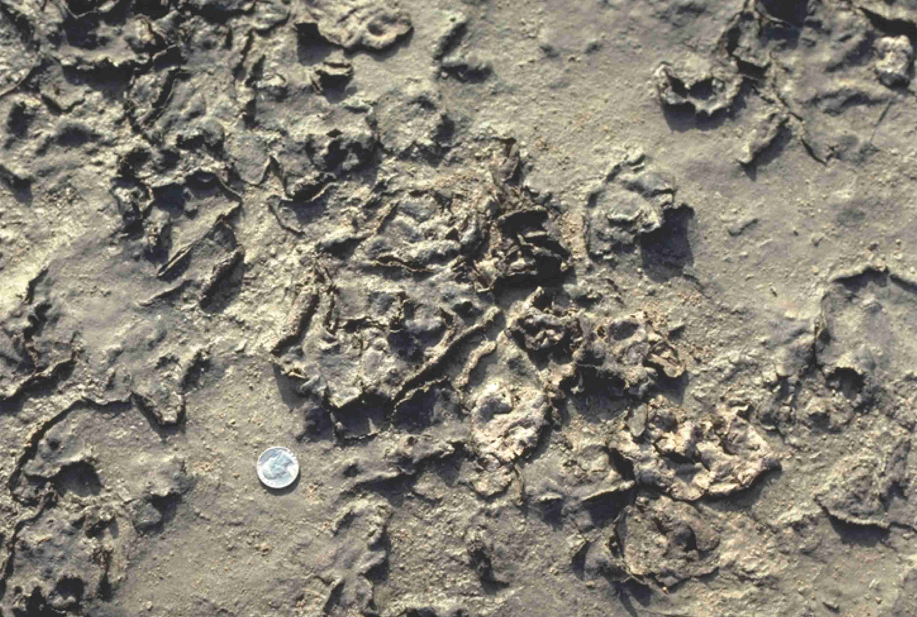
Bank-full conditions in an ephemeral, gravelly, Franklin Pierce Bay (Ellesmere Island) stream, during a rare mid summer Arctic rainstorm. About 25mm fell in a matter of hours. The stream rose very quickly and forced us to move our camp. There were many rockfalls from nearby cliffs during the storm.
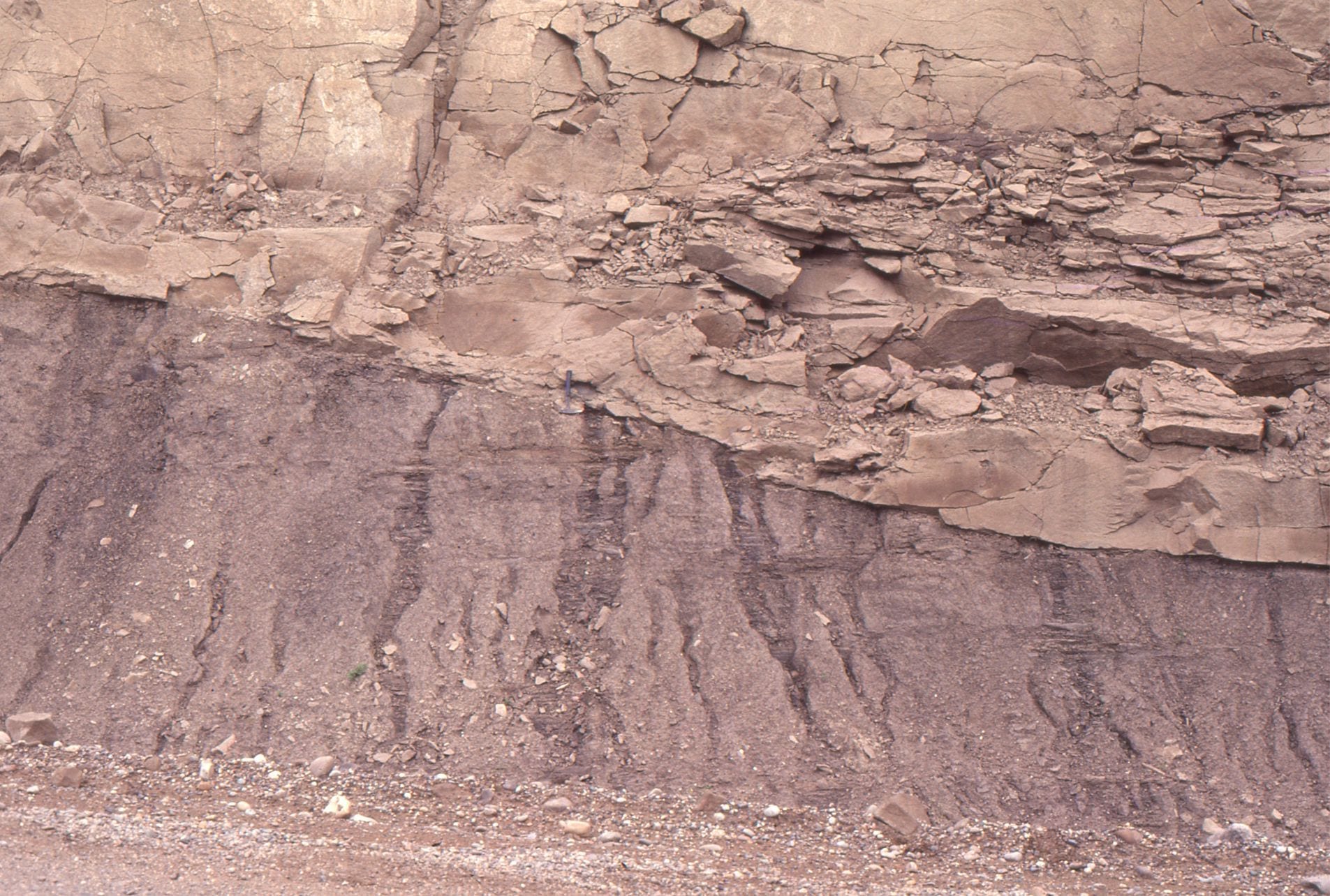
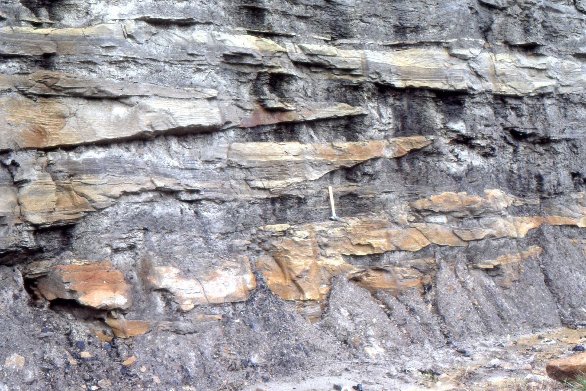
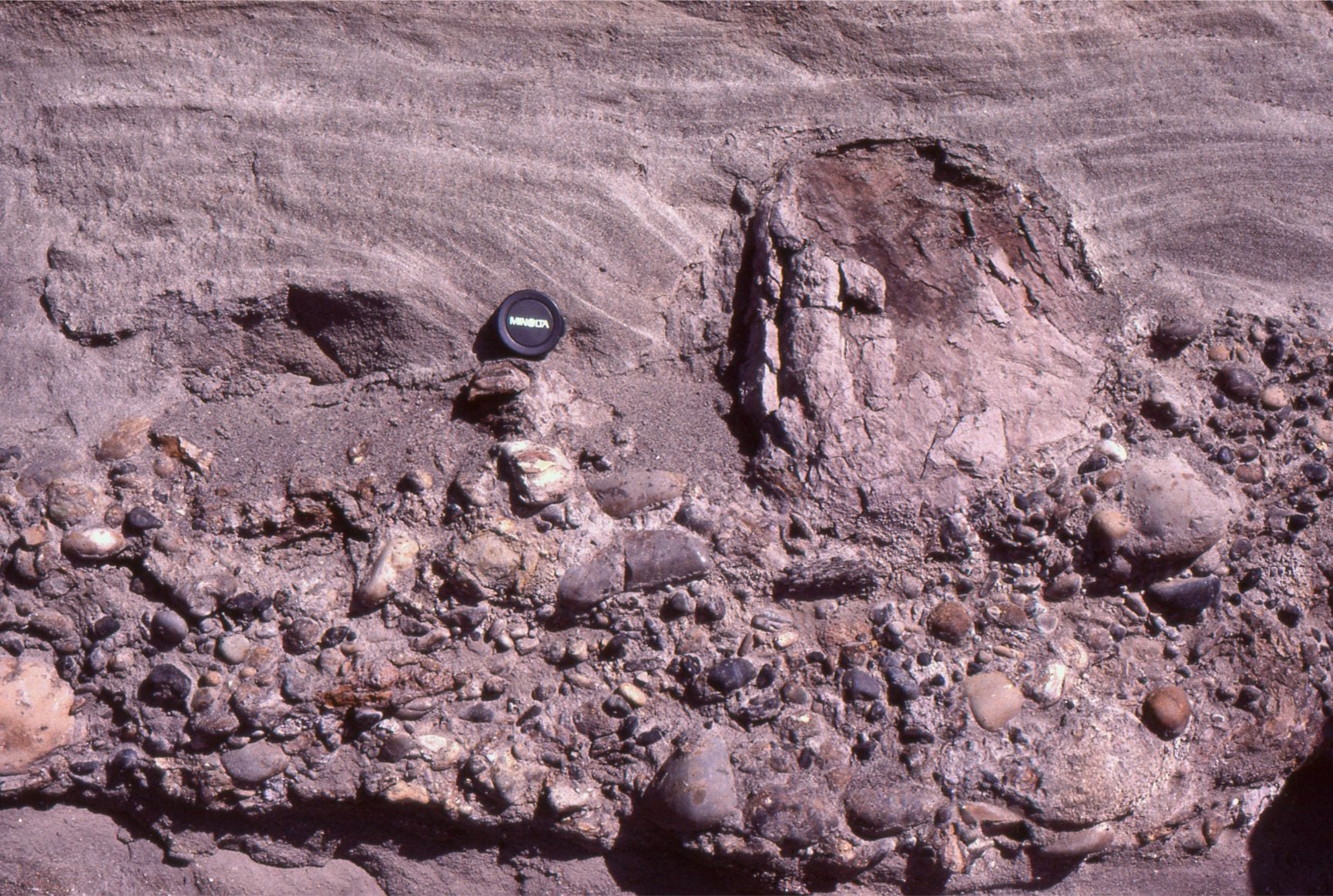
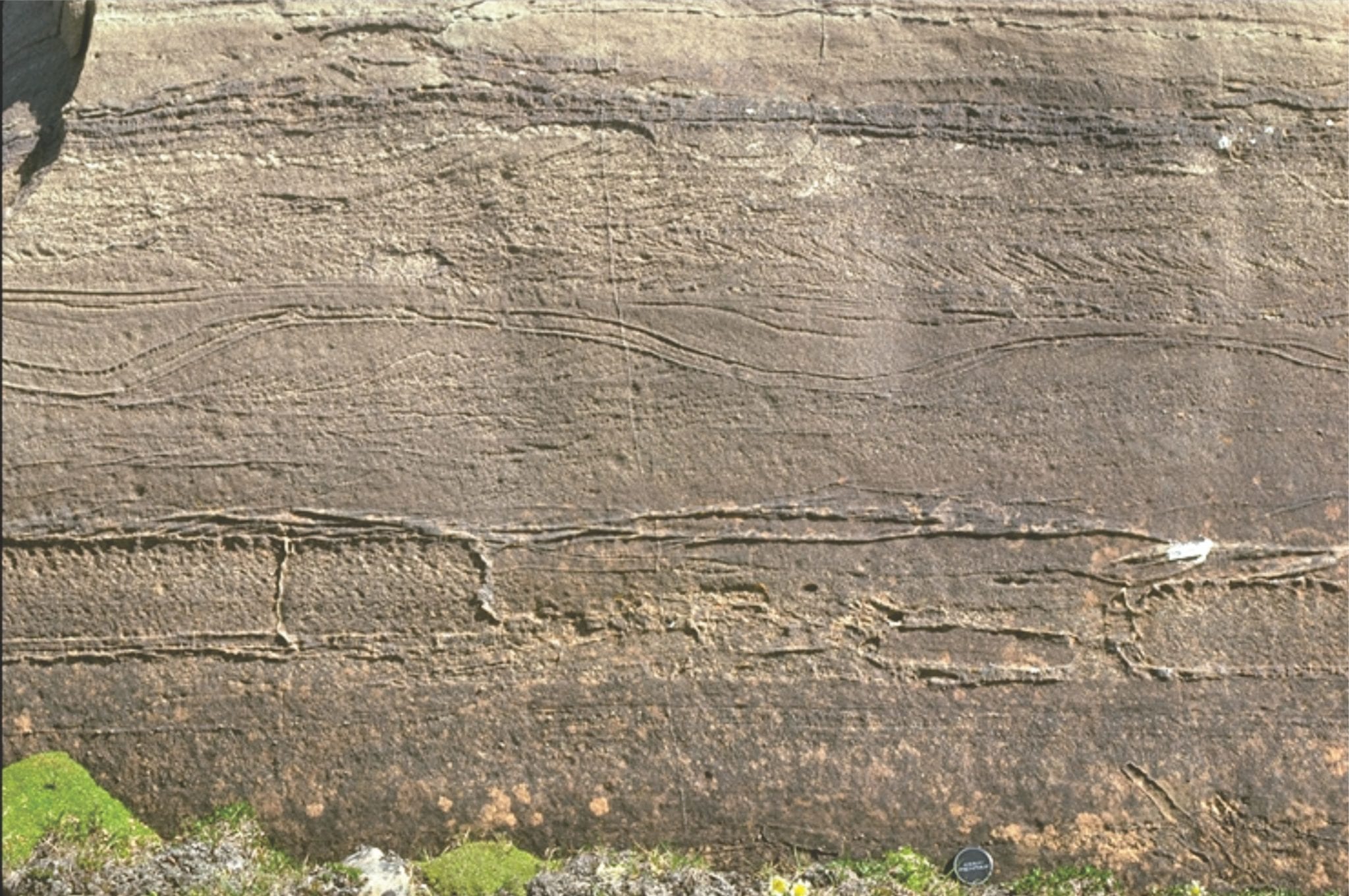
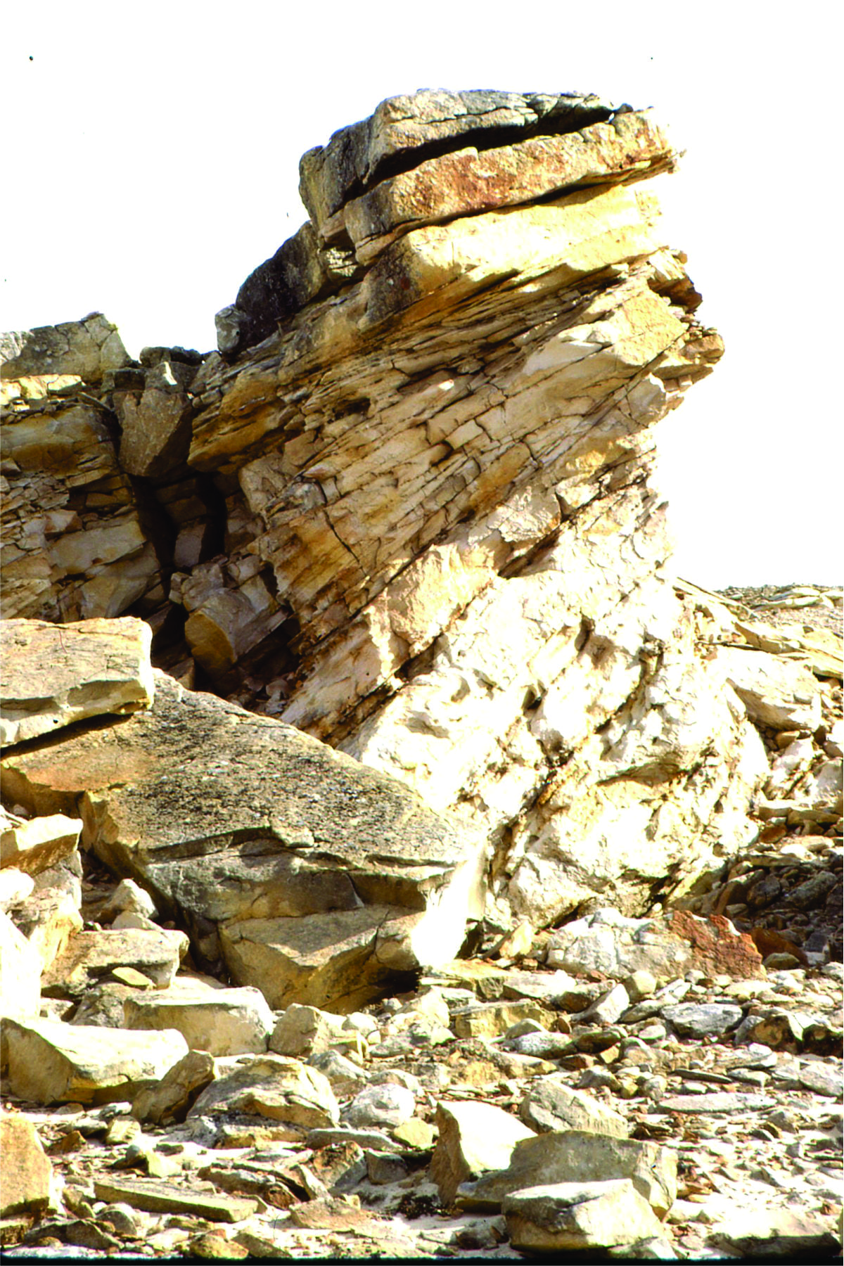
Eocene gravel bar deposits, Otto Fiord, Ellesmere Island. The sandy interval mid-picture was interpreted as small, crossbedded, falling stage sand bars, like those shown in the modern analogues.
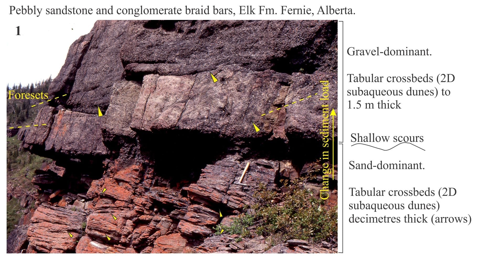
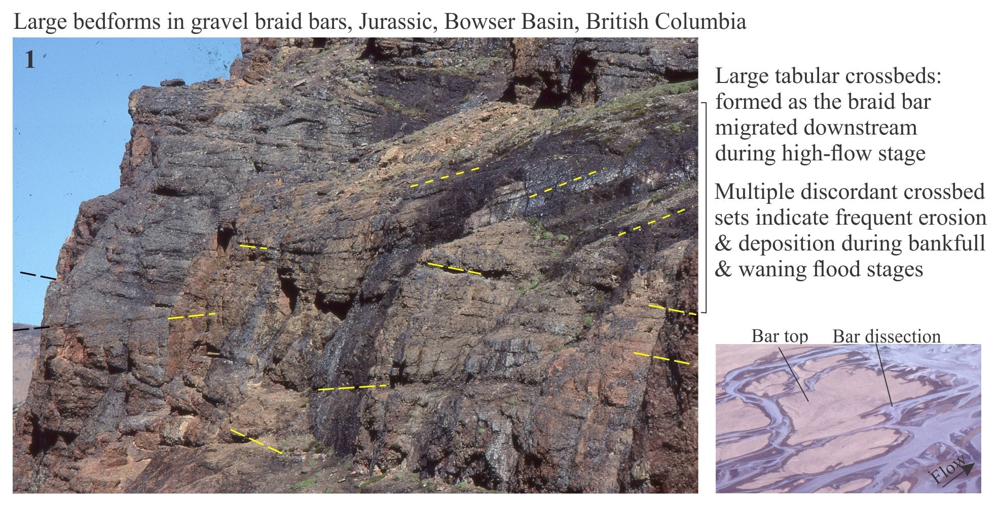
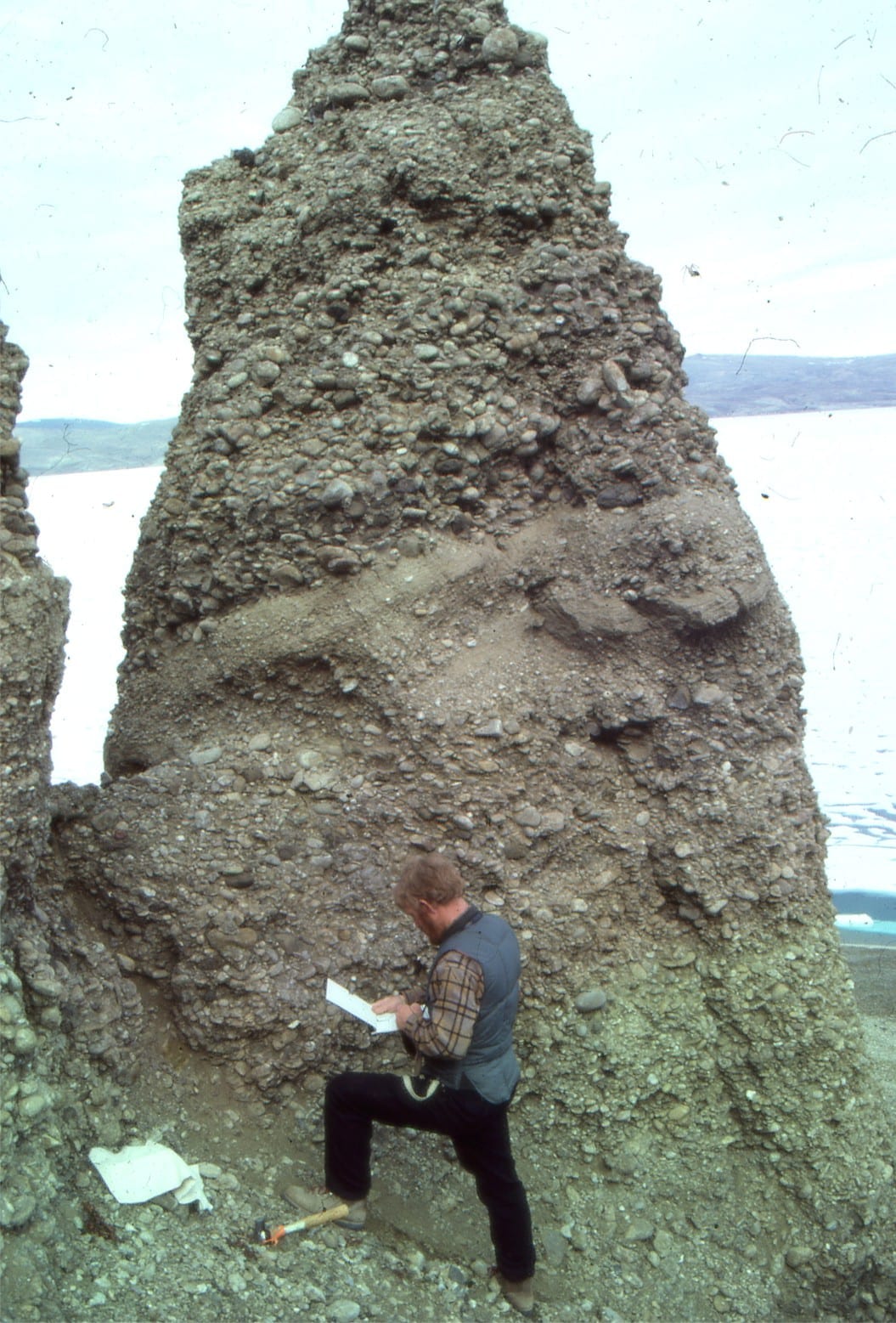
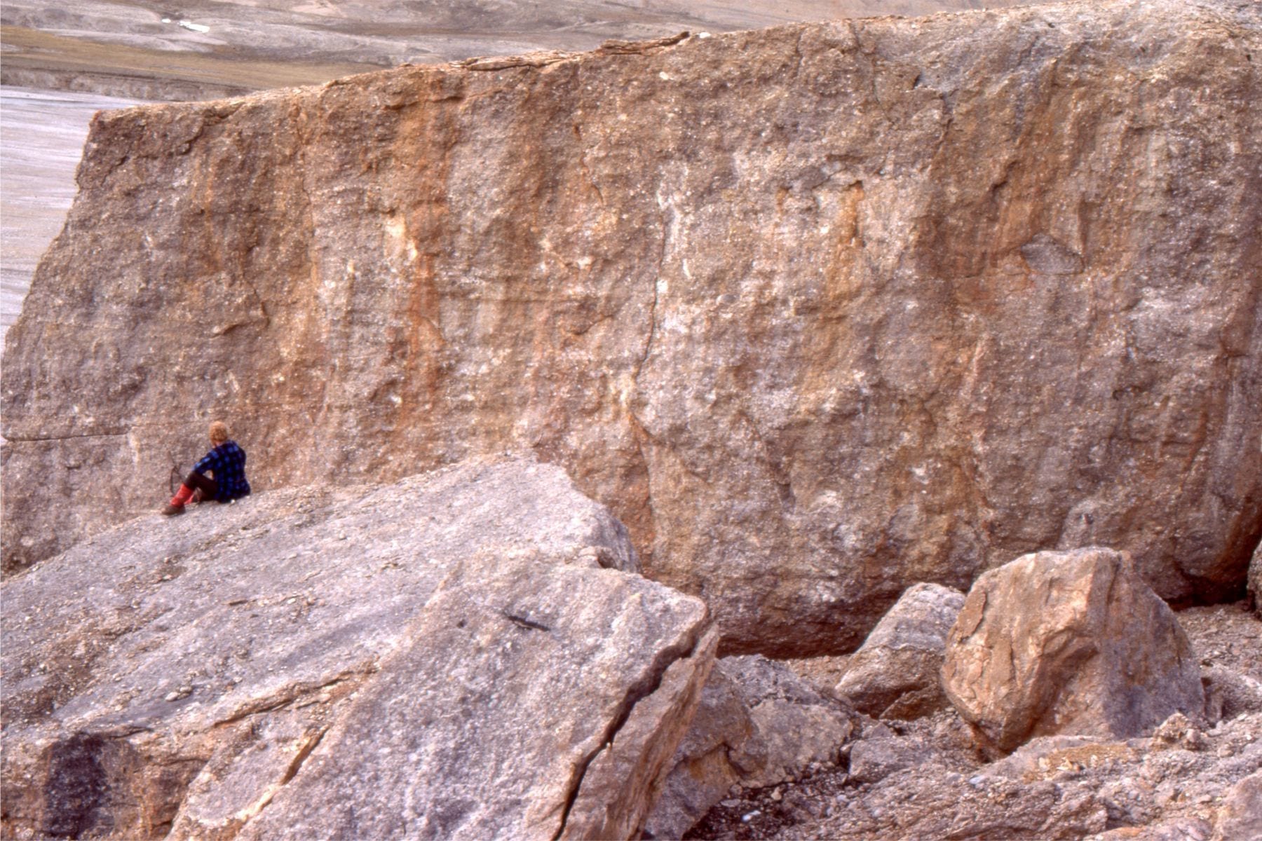
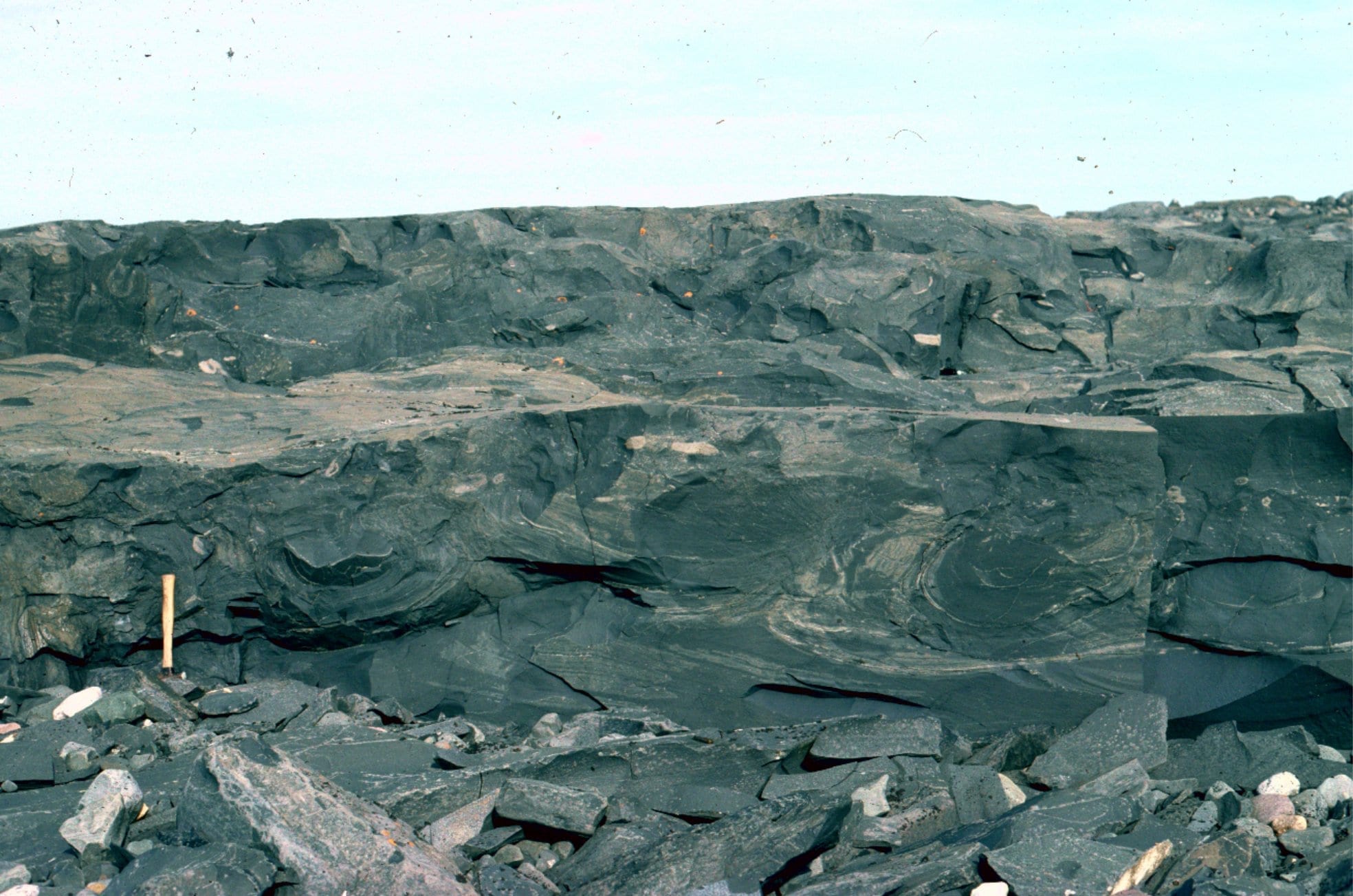
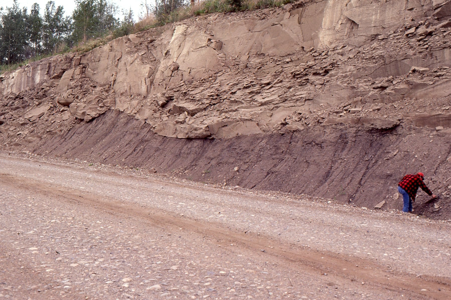
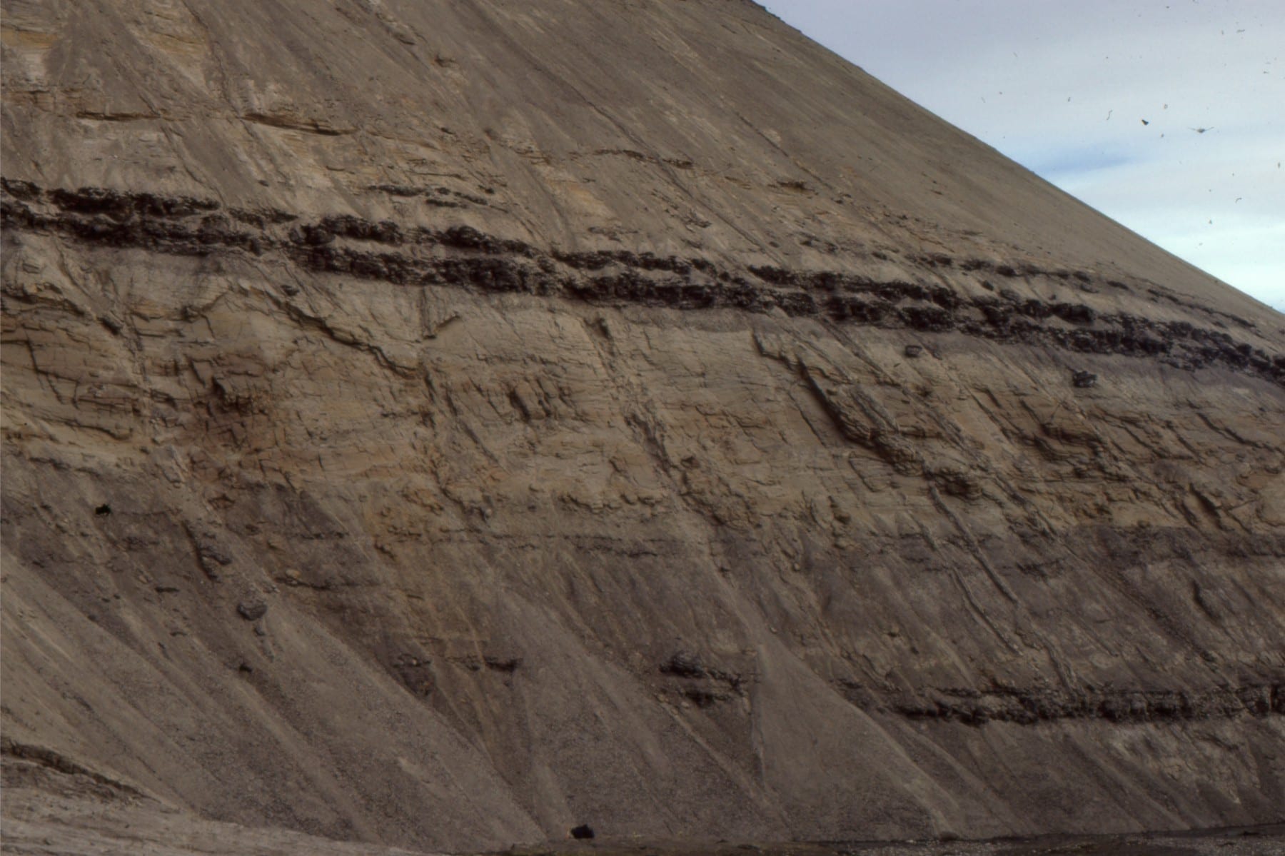
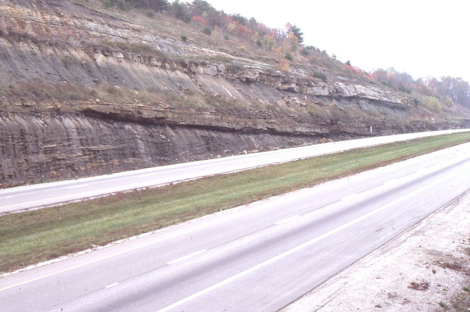
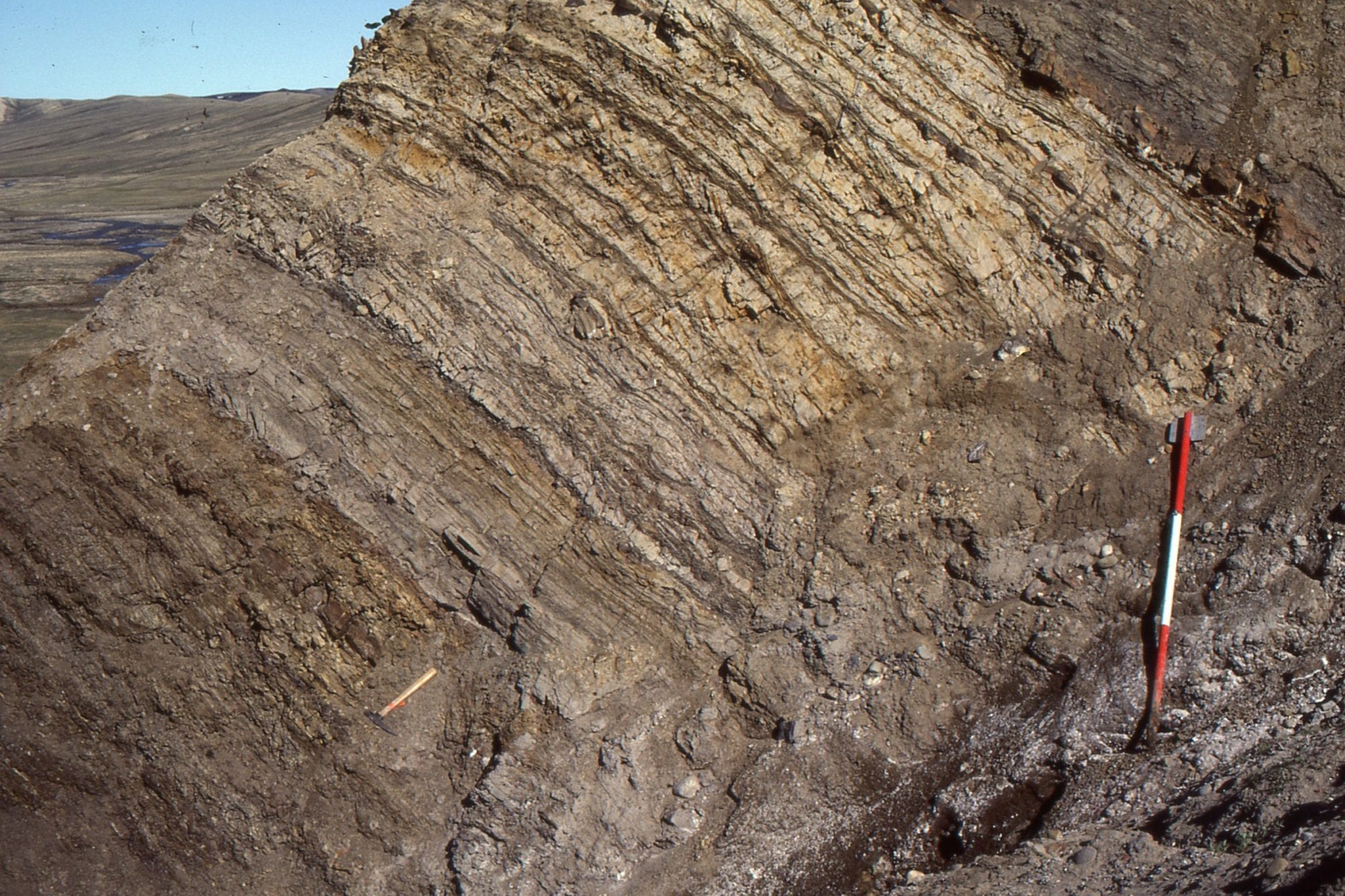
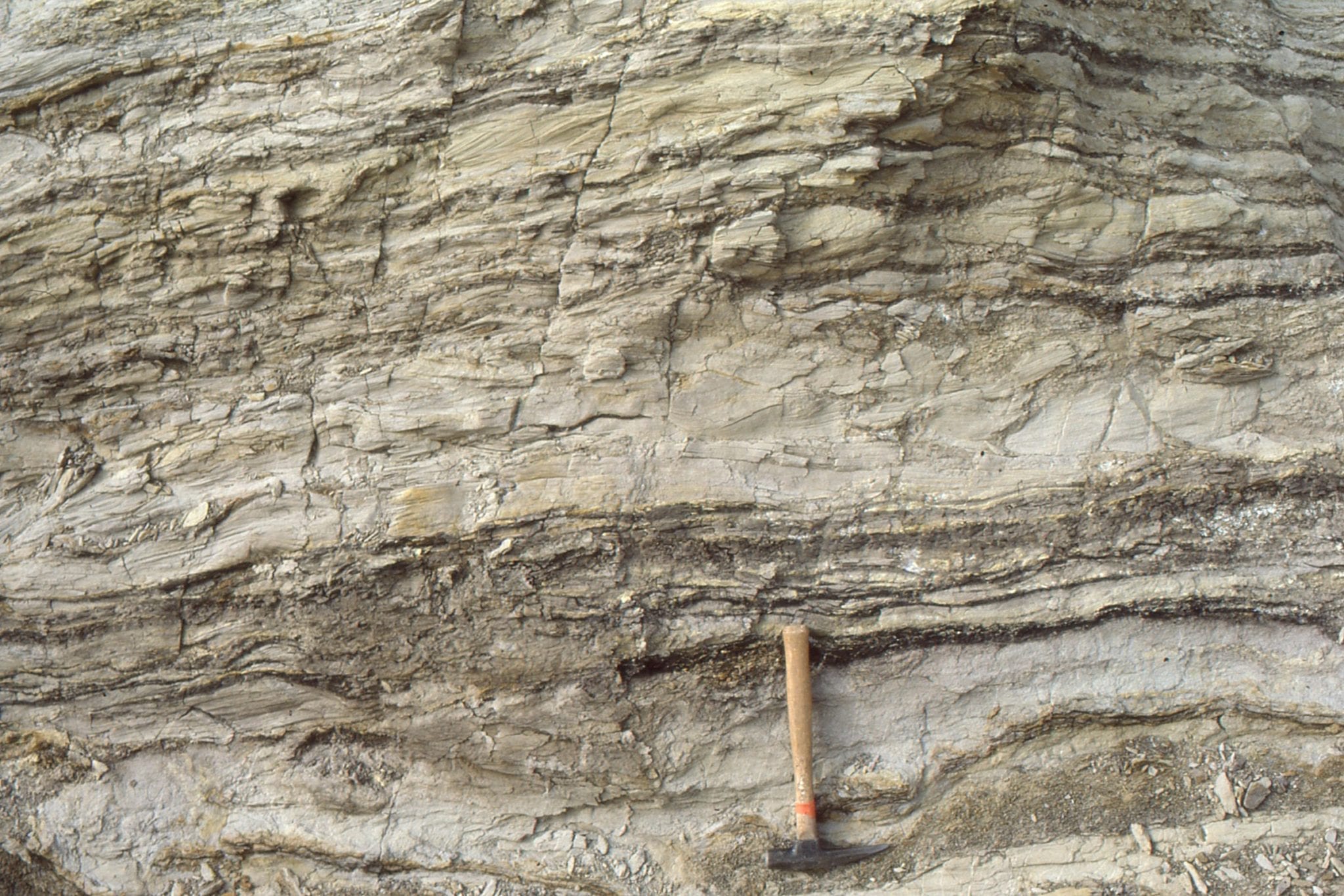
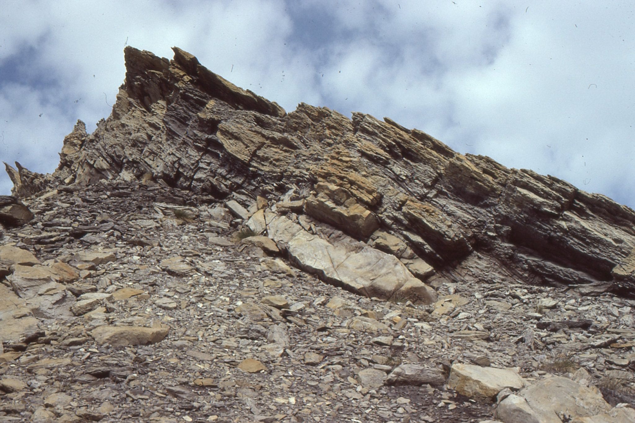
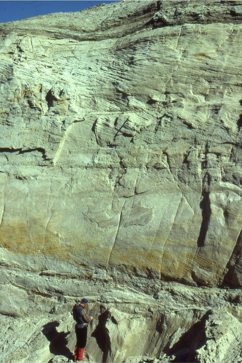
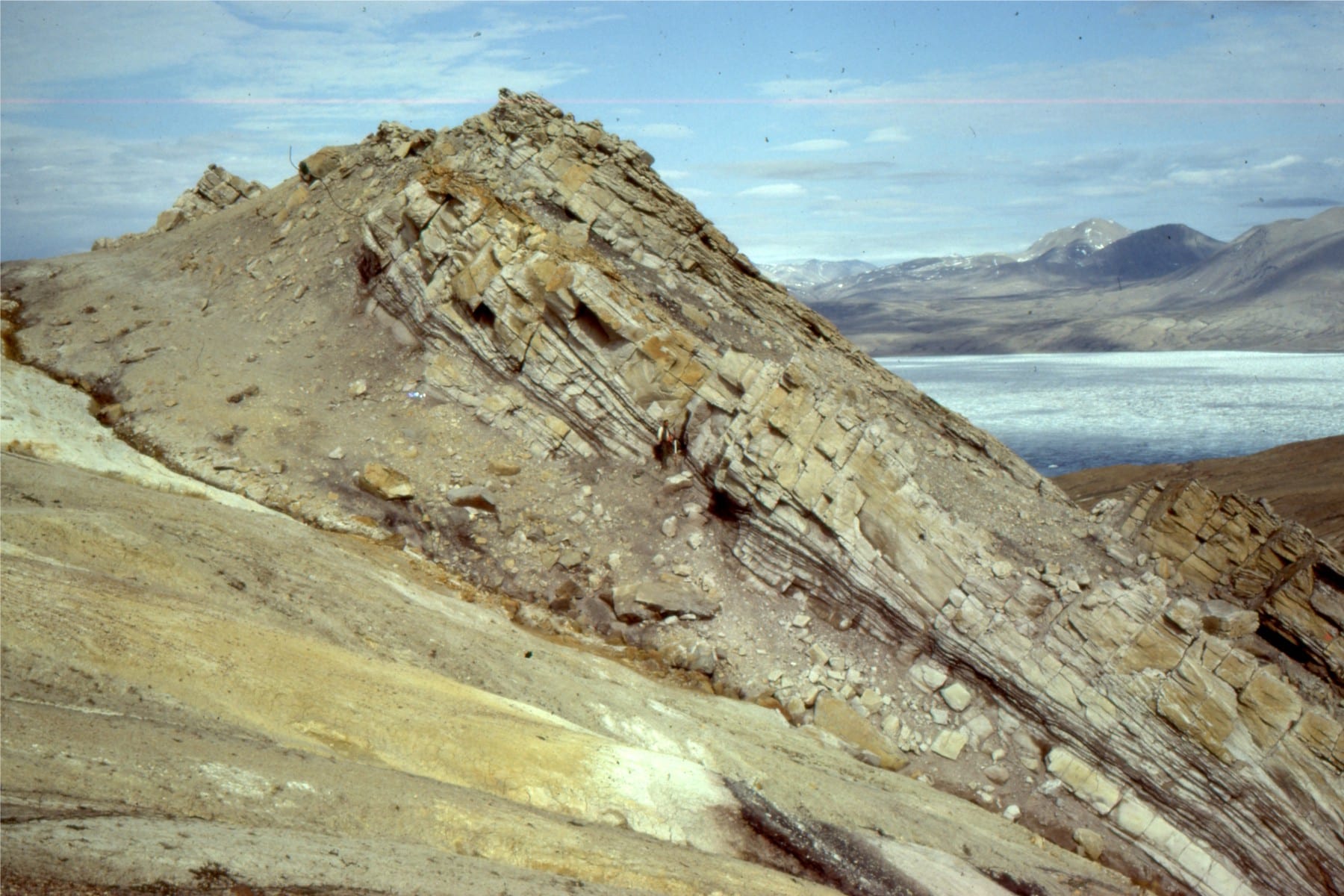
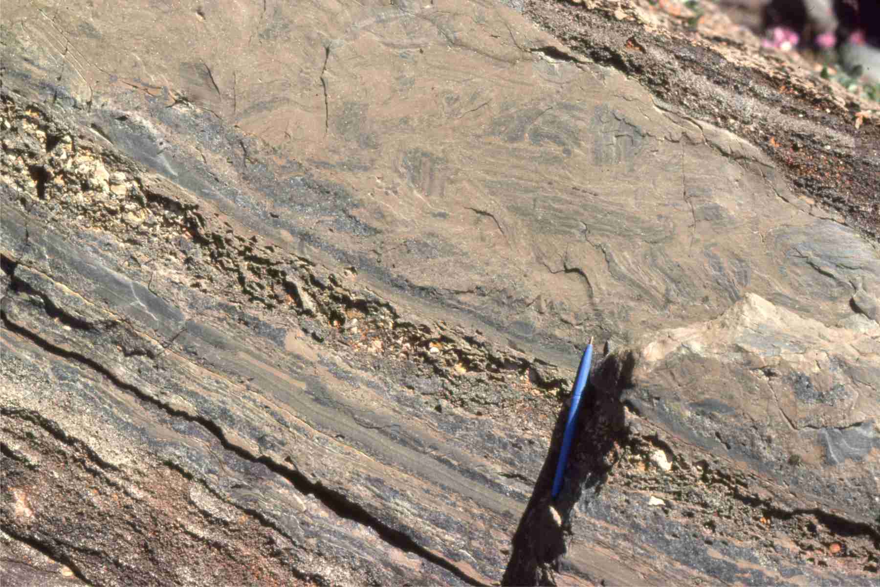
Left: Thick, Eocene, syntectonic gravelly braided river deposits (Buchanan Lake Formation; Franklin Pierce Bay, Ellesmere Island). Sediment was shed from evolving thrusts during the Eurekan Orogeny. Right: Large gravel crossbeds (up to 3m thick) in the same formation.
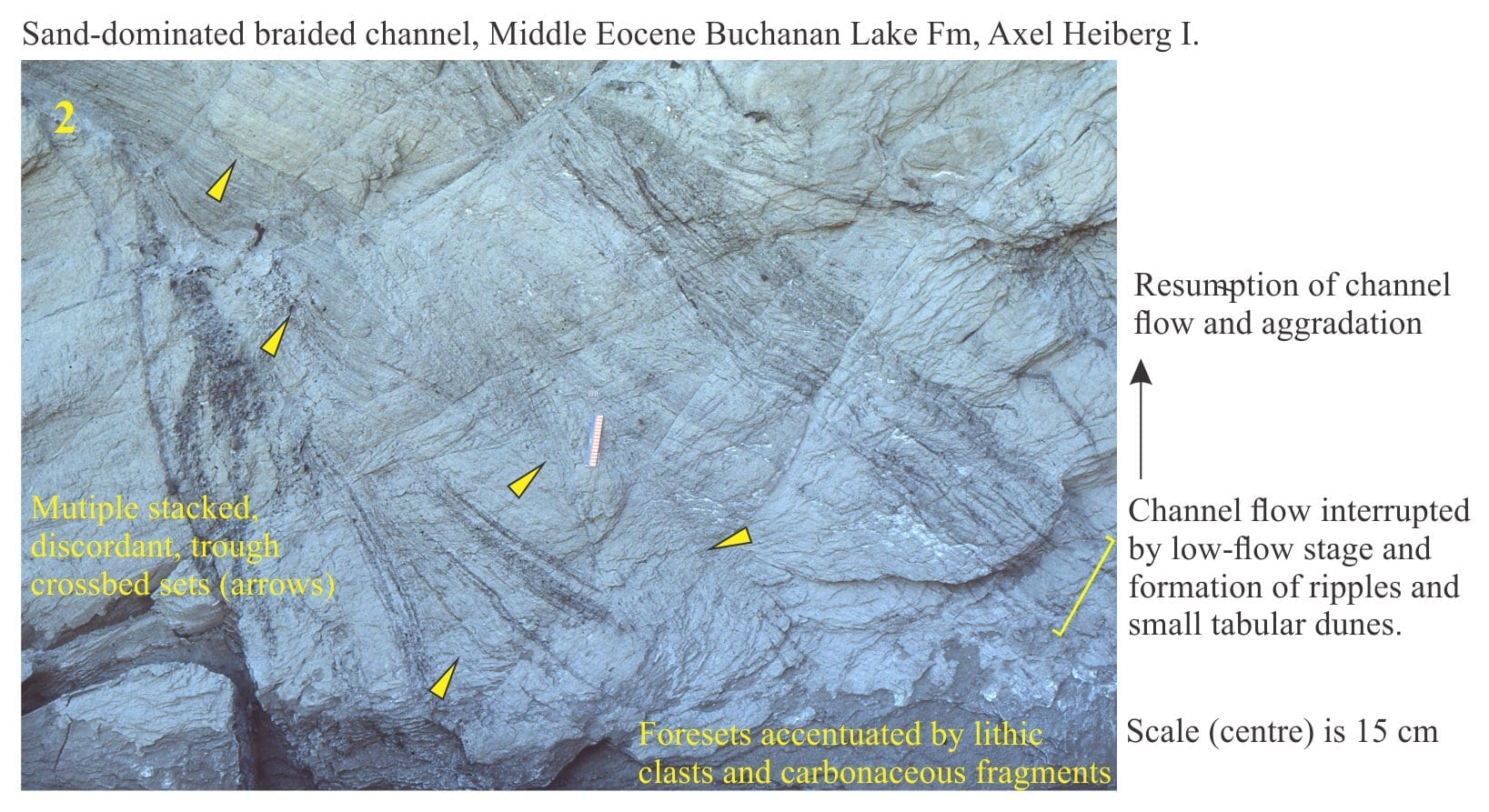
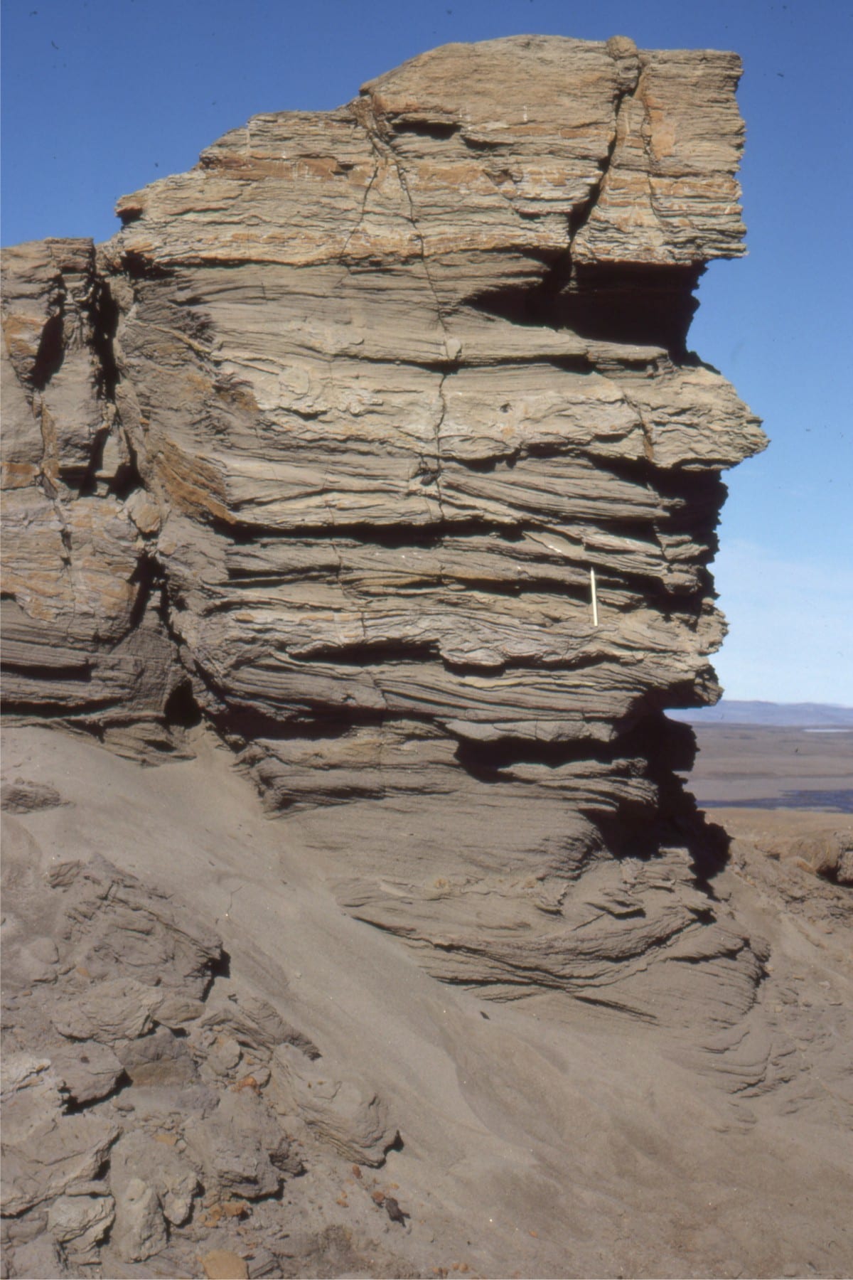
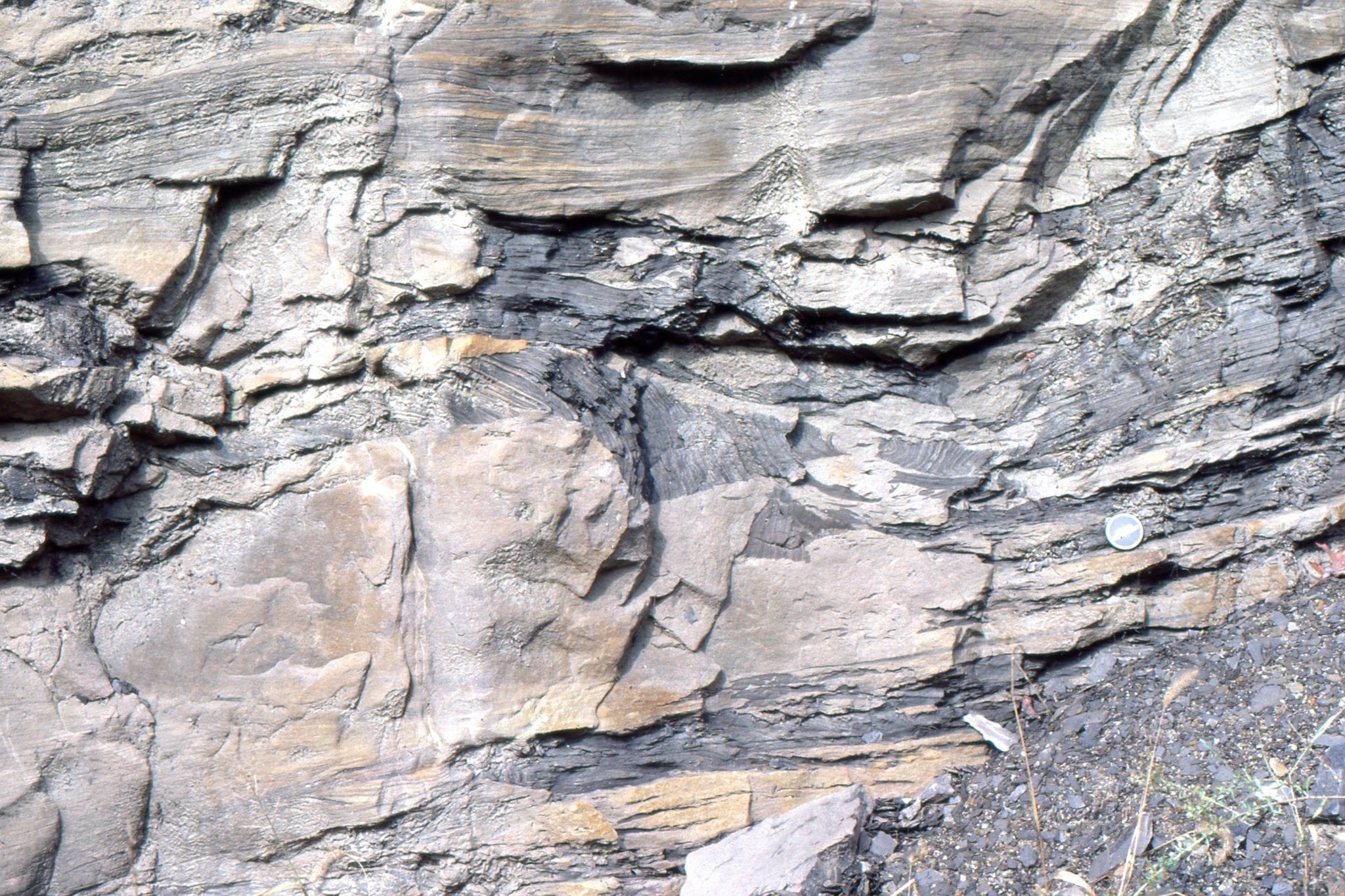
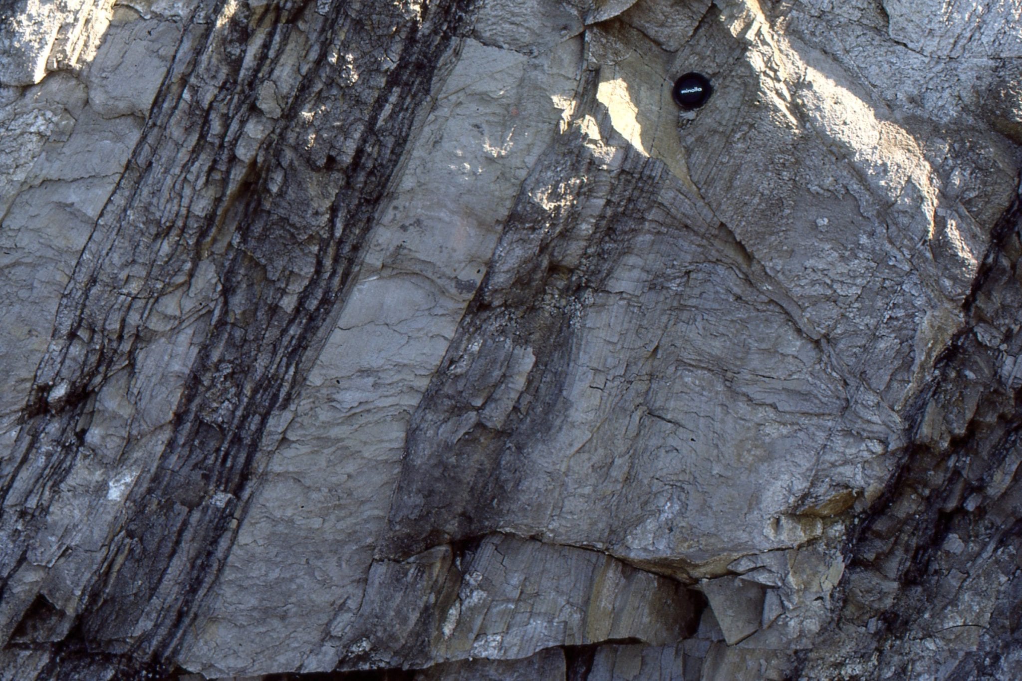
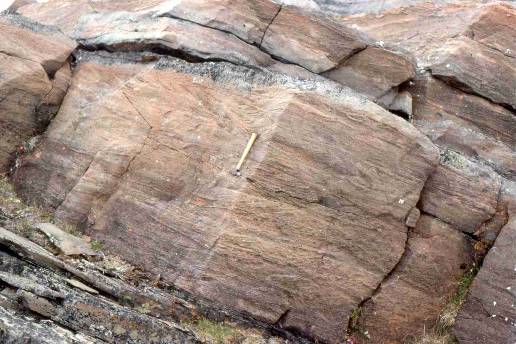
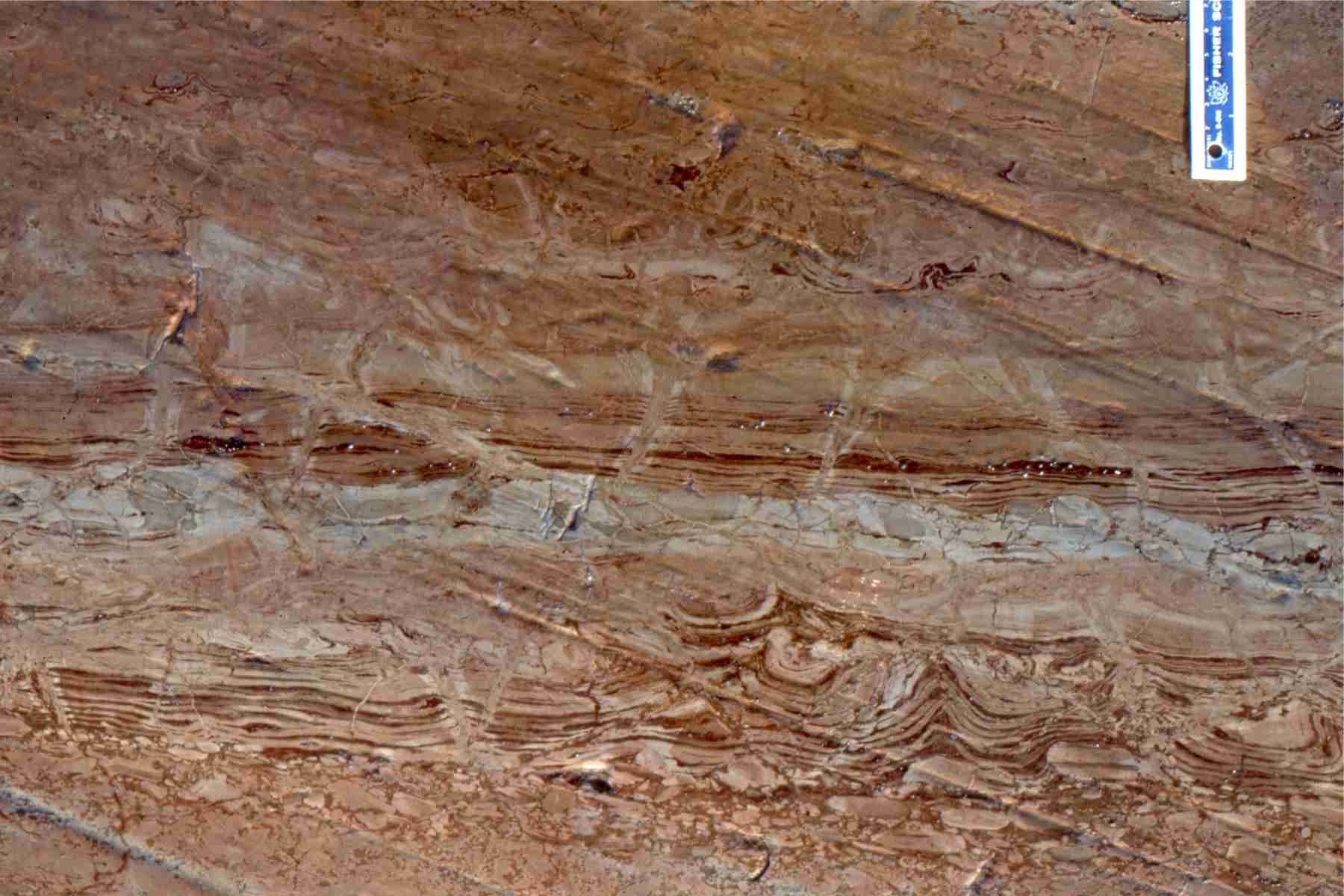
Two examples of trough crossbedded sandstone in low sinuosity channels (braided) in the Middle Eocene Buchanan Lake Fm, Axel Heiberg Island (Arctic Canada). These channels are the more distal equivalents to syntectonic gravelly deposits (Eurekan Orogeny).
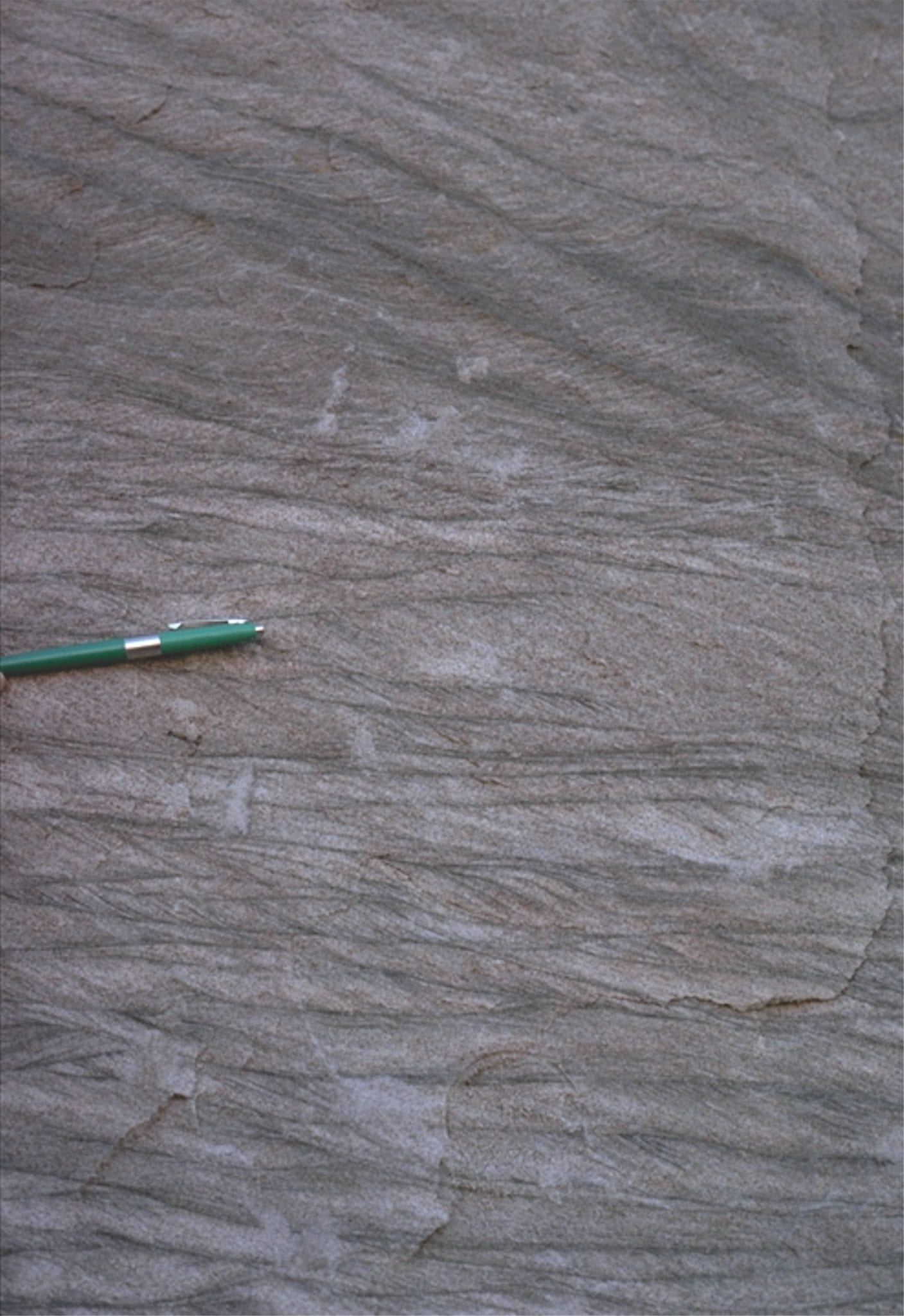
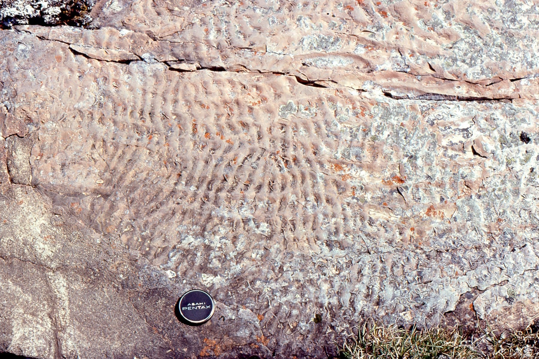
Festooned trough crossbeds in Proterozoic low sinuosity sandy channels, Loaf Fm. Belcher Islands (about 2 billion years old). The right image shows small ripples that probably developed during waning stream flow.
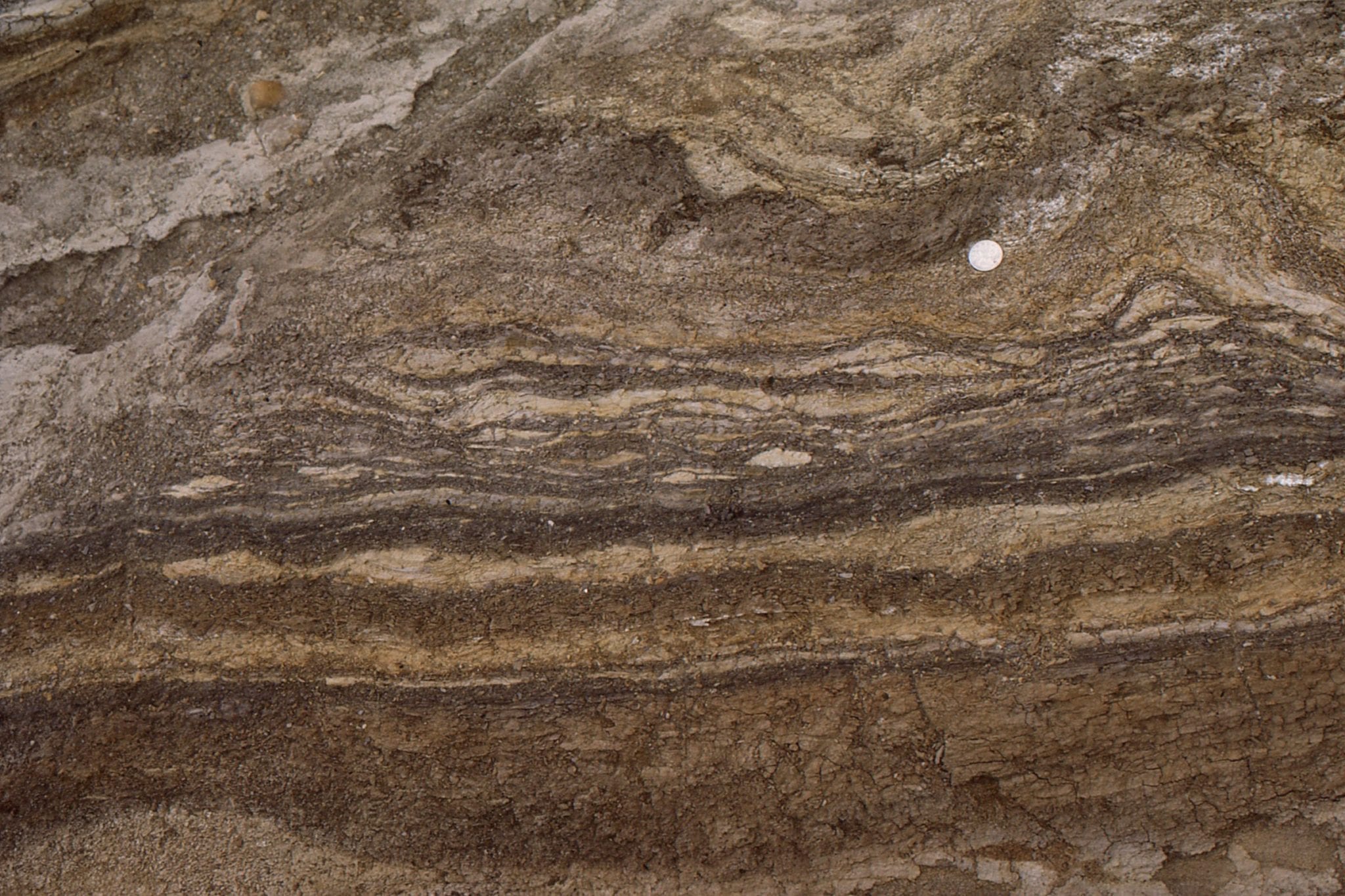
As river deposits settle and consolidate, the water between grains is forced out by the weight of the sediment (this is called dewatering). The process commonly disrupts and contorts the sedimentary laminae, forming structures that superficially resemble pillows; these structures are given the general name ball and pillow. Loaf Fm. Belcher Islands (about 2 billion years old).
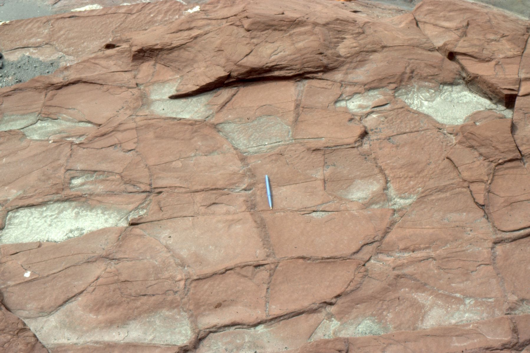
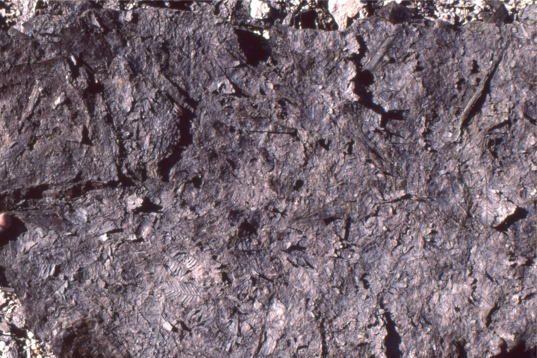
Reddened (iron oxides), desiccated mudrocks interbedded with channelized sandstone in the Proterozoic Loaf Fm, Belcher Islands; proof that the level of oxygen in the ancient atmosphere had increased significantly.
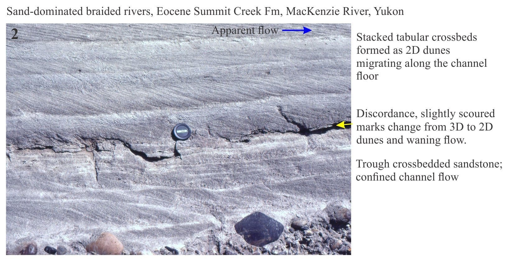
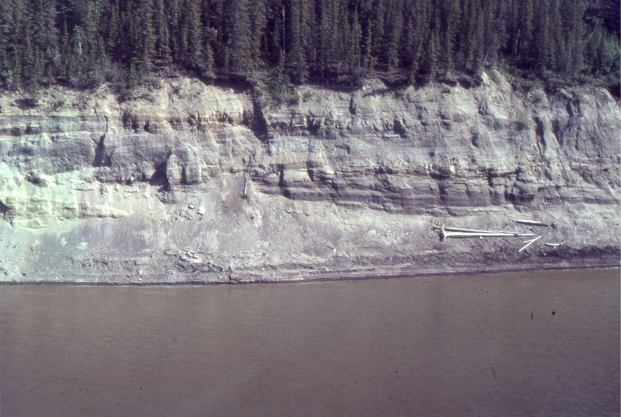
Paleocene Sandy braid channel and associated bar crossbeds (Summit Creek Fm.) exposed in right bank of MacKenzie River near Fort Norman, Northern Canada.
Active sand bars attached to a semi-permanent, vegetated bar, mid-stream, Clearwater River, Alberta. This is a possible candidate for an anastomosing river.
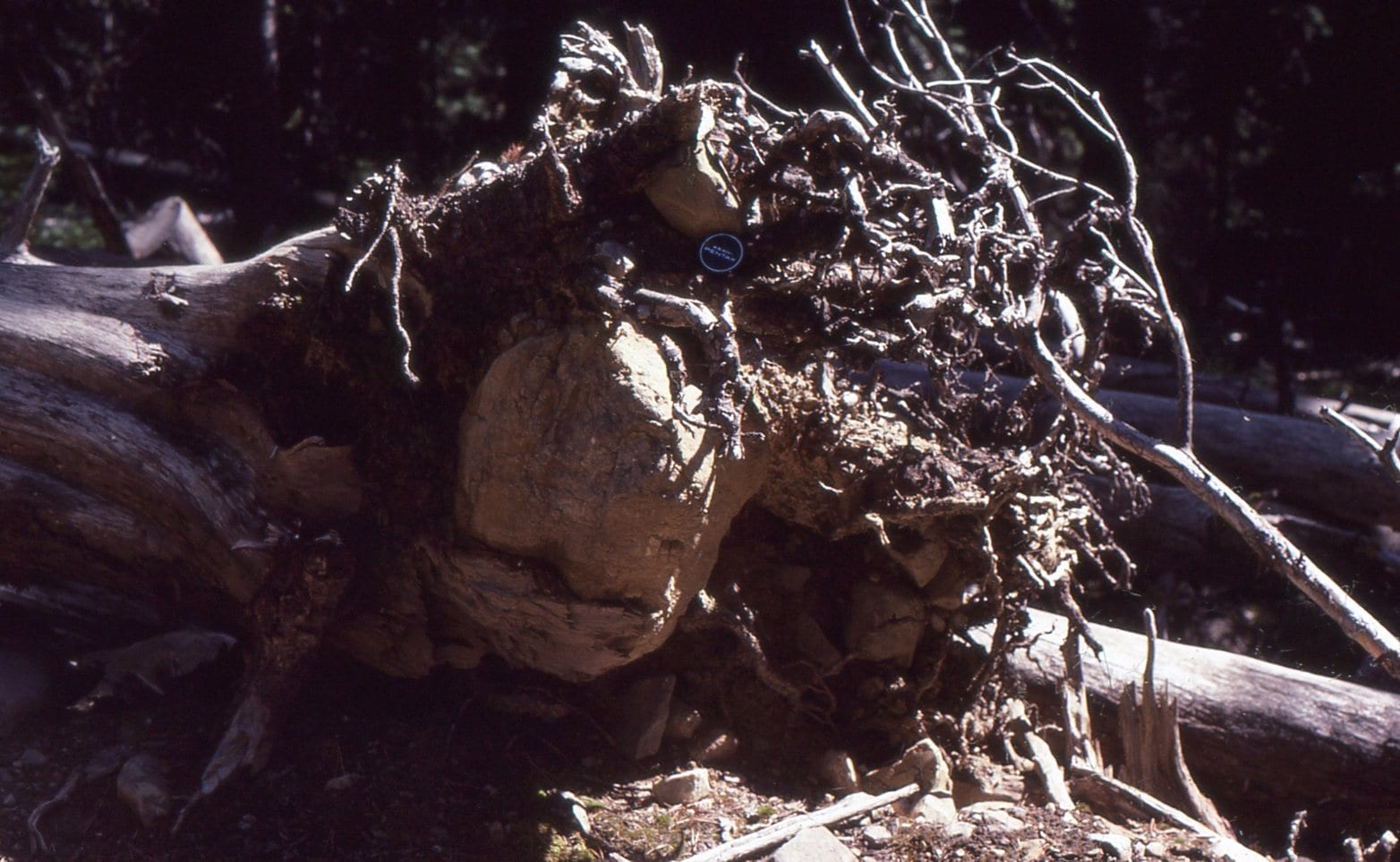
Large chunks of rock can be carried significant distances across open water while embedded in the tangle of tree roots. A possible answer to the mystery of some drop-stones.
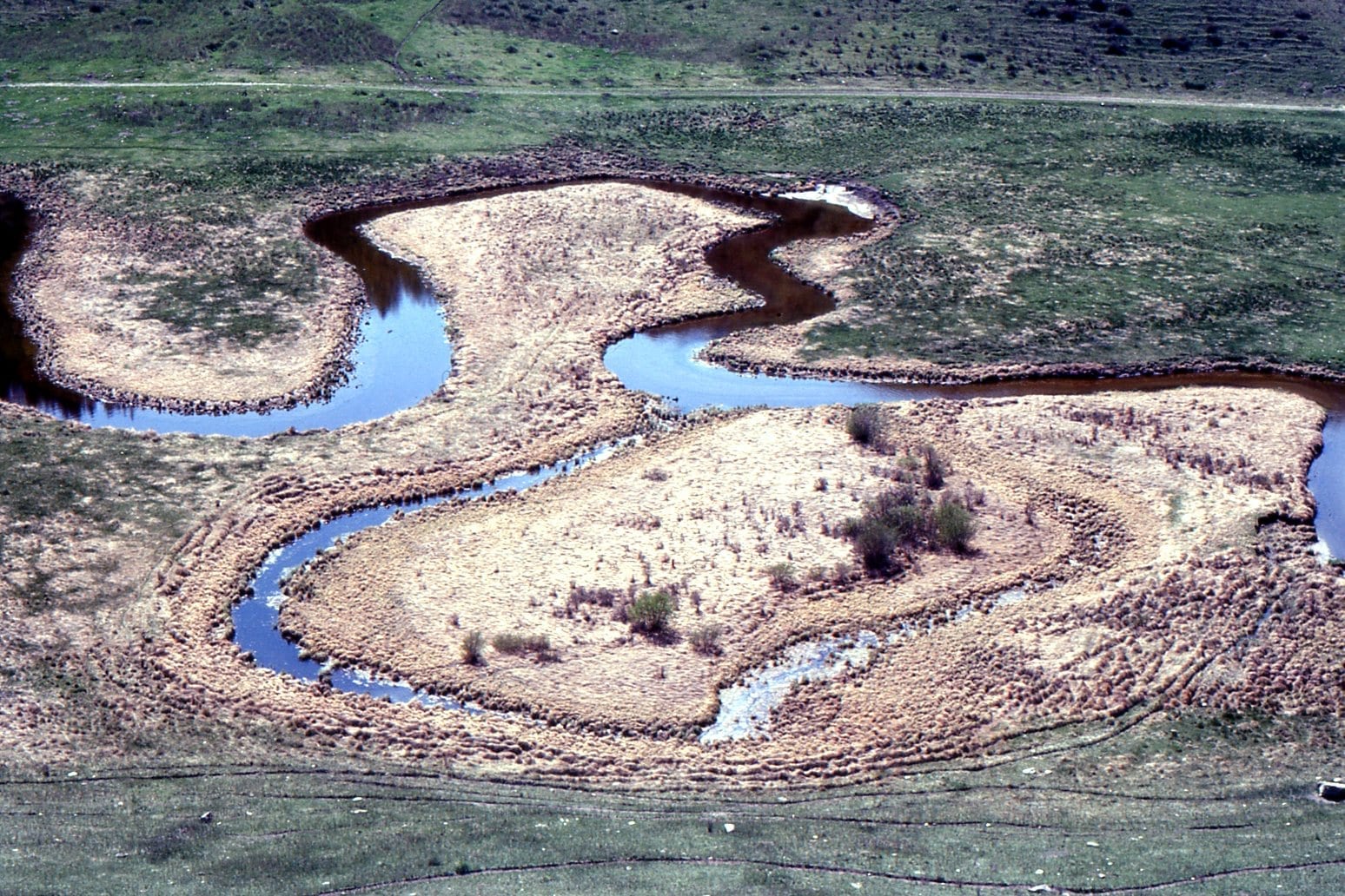
Small meandering stream, point bars, and oxbow lake, north of Calgary, Alberta.
Point bar and overbank deposits in a high sinuosity (meandering channel) in the Upper Cretaceous Dunvegan Formation, Peace River, northeast British Columbia. Flow was to the right.
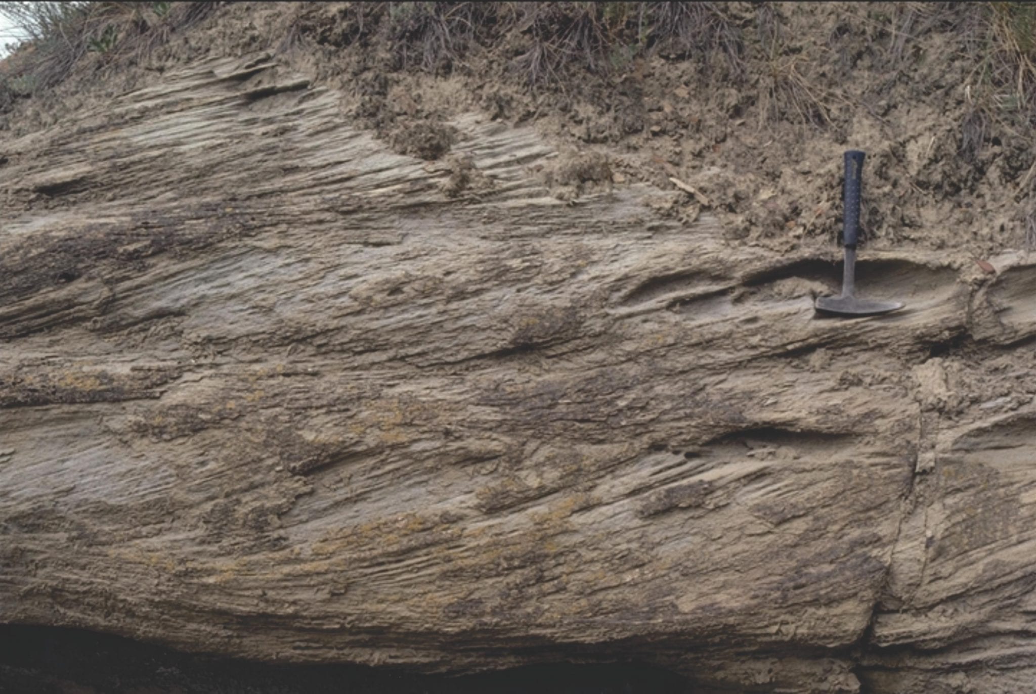
Crossbeds in Upper Cretaceous Dunvegan Formation, Peace River, northeast British Columbia. Left: stacked planar tabular crossbeds (2D subaqueous dunes); Right: Trough crossbeds (3D subaqueous dunes). Both types are associated with the Dunvegan point bar (image above), and the sand-filled channel below.
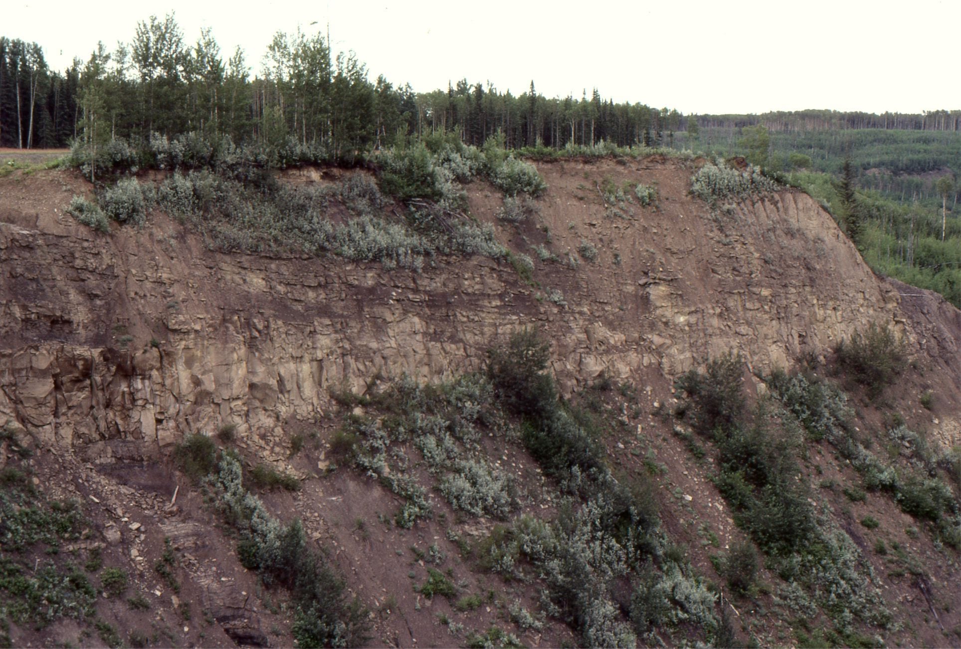
Sandstone-filled channel in the Dunvegan Formation, Peace River, northern British Columbia. This view shows overall asymmetry of the channel.
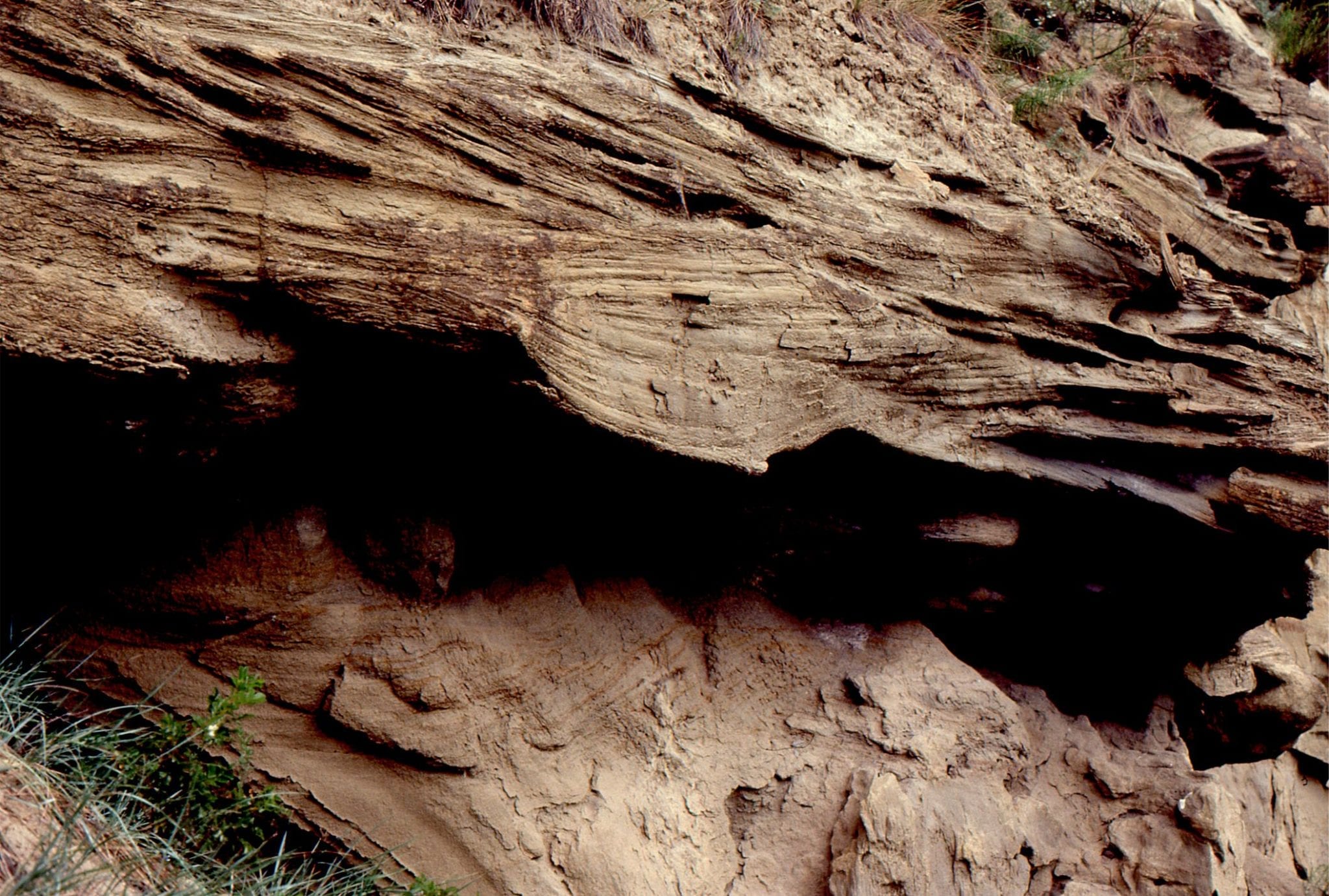
Detail of sandstone channel cutting into slightly older, muddy overbank deposits. Upper Cretaceous Dunvegan Formation, Peace River, northeast British Columbia.
Sandy point bar deposits in high sinuosity channel (meandering), overlain by thin floodplain lignites in the Middle Eocene Buchanan Lake Fm, Geodetic Hills, Axel Heiberg Island. The lignites contain abundant, well preserved conifers (Spruce), Hickory, and Metasequoia fronds, cones and seeds. The point bar is about 4m thick.
Small crossbeds and laminated sandstone in point bar deposits, Middle Eocene Buchanan Lake Fm, Geodetic Hills, Axel Heiberg Island. There is abundant plant material throughout. Pen (mid image) is 15cm long.
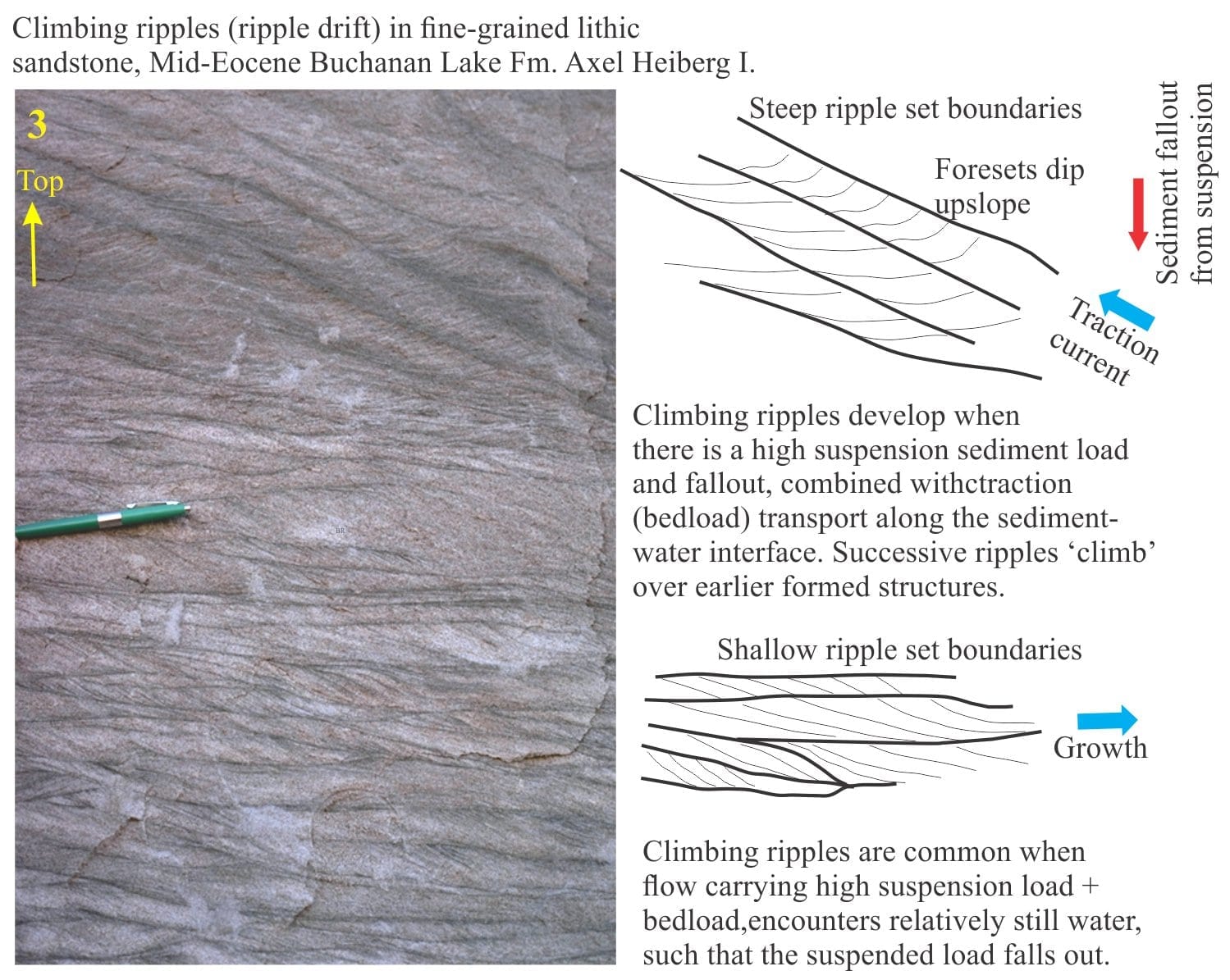
Multiple sets of climbing ripples, Middle Eocene Buchanan Lake Fm, Geodetic Hills, Axel Heiberg Island. These form when a significant suspended load of fine sand settles and becomes part of the bedload on the channel floor.
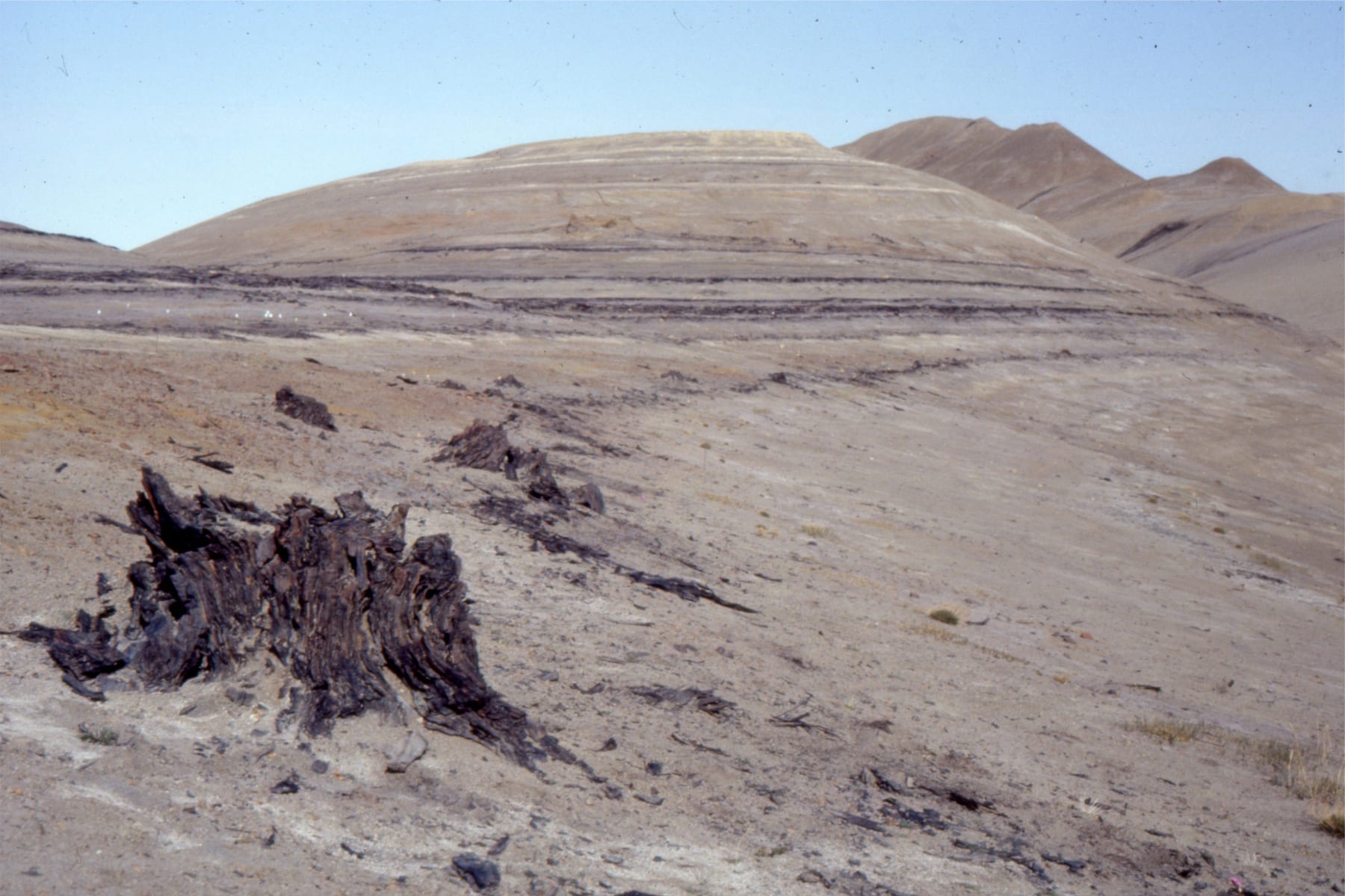
Multiple thin lignite – subbituminous coal beds with exquisitely preserved tree trunks in growth position, Middle Eocene Buchanan Lake Fm, Geodetic Hills, Axel Heiberg Island. The succession here represents a stacking of flood plain and forested areas adjacent to meandering rivers. These deposits accumulated in a more distal position to the emerging mountain front during the Eurekan Orogeny. See my post on the Fossil Forests
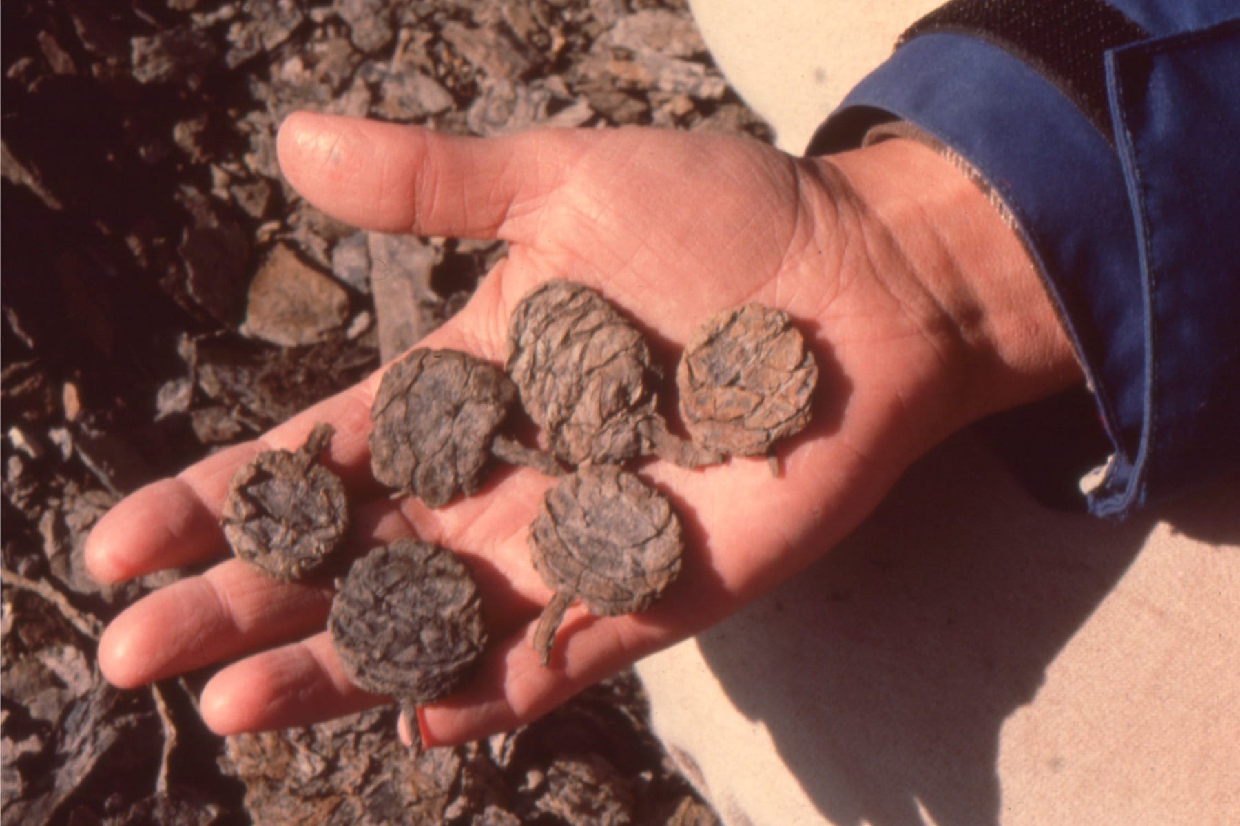
Some of the exquisitely preserved plant material from the Geodetic Hills Fossil forest. Left: Metasequoia cones looking like they were buried yesterday; Right: Metasequoia fronds and hardwood leaves. Middle Eocene Buchanan Lake Fm, Geodetic Hills, Axel Heiberg Island.
Large meandering river point bars and overlying floodplain-swamp muds, associated with the Princess Coals, Carboniferous of Kentucky, near Rush (Highway I-64). Point bar ‘foresets’ consist of very laminated, rippled, and slumped, fine grained sandstone-mudstone. I visited these outcrops during an excellent AAPG field trip run by John Horne, 1984.
Detail of the inclined point bar layers show numerous discontinuities in sandstone lenses and wedges, and truncation surfaces that indicate shifting sediment distribution across the bar, and possibly some erosion. Carboniferous of Kentucky, near Rush (Highway I-64).
Slumping and rotation of laminated sandstone-mudstone in point bar foresets (Carboniferous of Kentucky, near Rush, Highway I-64). Small synsedimentary faults cut the middle layers.
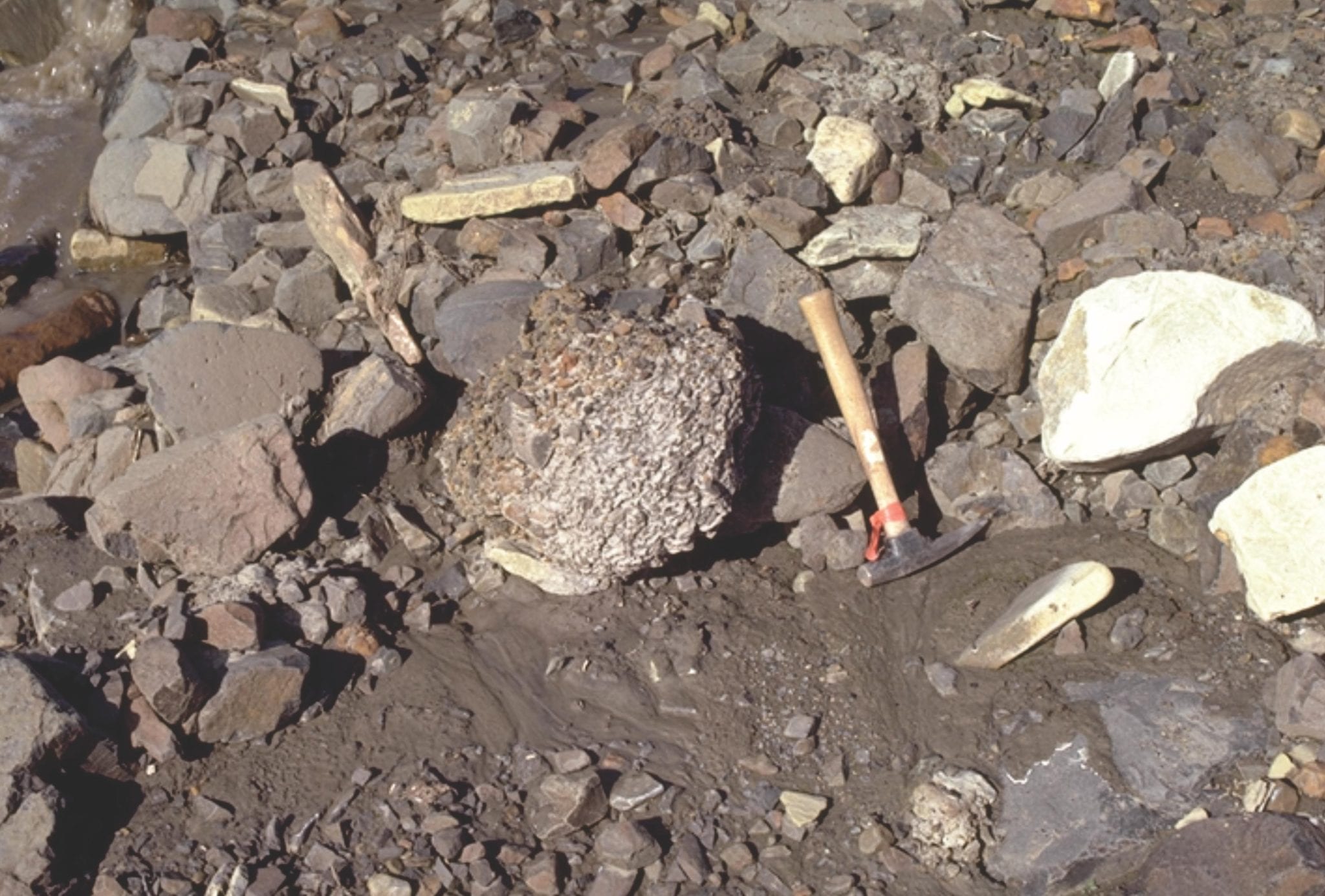
Odd-ball (sic) structure sometimes found in fluvial deposits, are armoured mudballs. These form when a chunk of sticky mud slumps from a channel margin, is rolled by currents along the channel floor, and in the process picks up small pebbles and bits of wood. The recent example on the left is from Mackenzie River, near Fort Norman. The Paleocene example, to the right of the lens cap, (right image) is from the Summit Creek Fm, in an outcrop fortuitously nearby the modern analogue – small pebbles impregnate the mud ball surface.
This collection of images spans the shallowest marine environments including beach, lagoon-bay with all the associated environments such as sand-spits and barrier-bars, tidal flats, estuaries and coastal dunes. Where possible I have paired modern analogues with ancient examples.
The Atlas, as are all blogs, is a publication. If you use the images, please acknowledge their source (it is the polite, and professional thing to do).
This link will take you to an explanation of the Atlas series, the ownership, use and acknowledgment of images.
Click on the image for an expanded view, then ‘back one page‘ arrow to return to the list
The images:
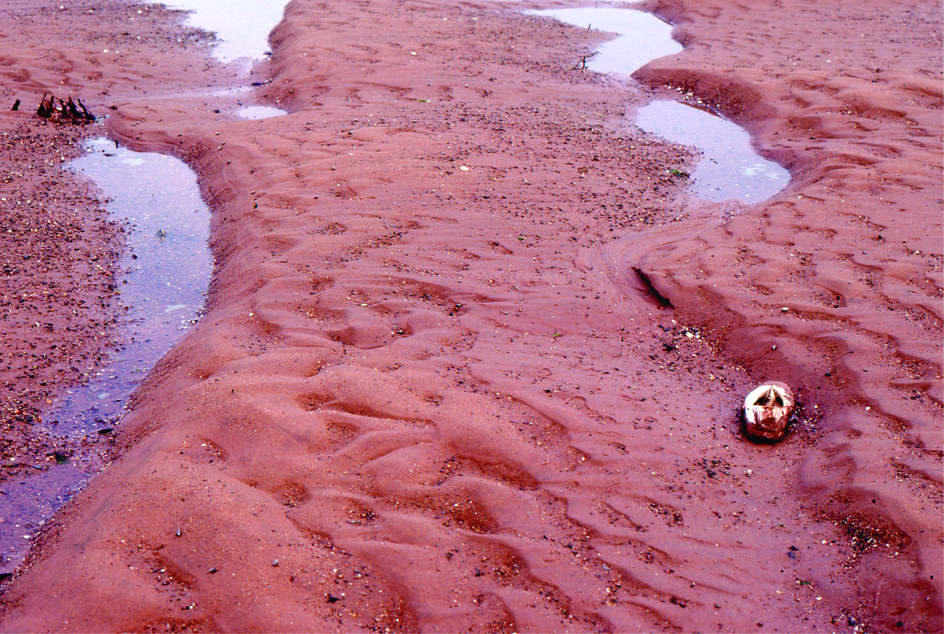
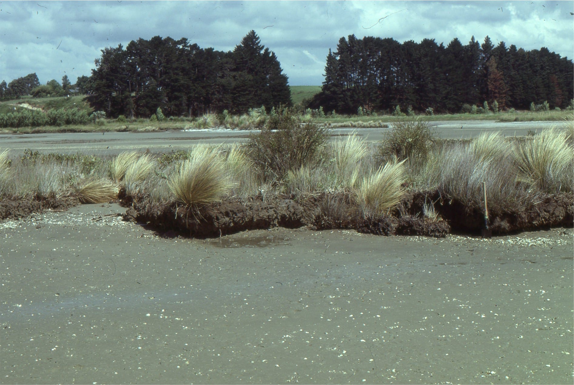
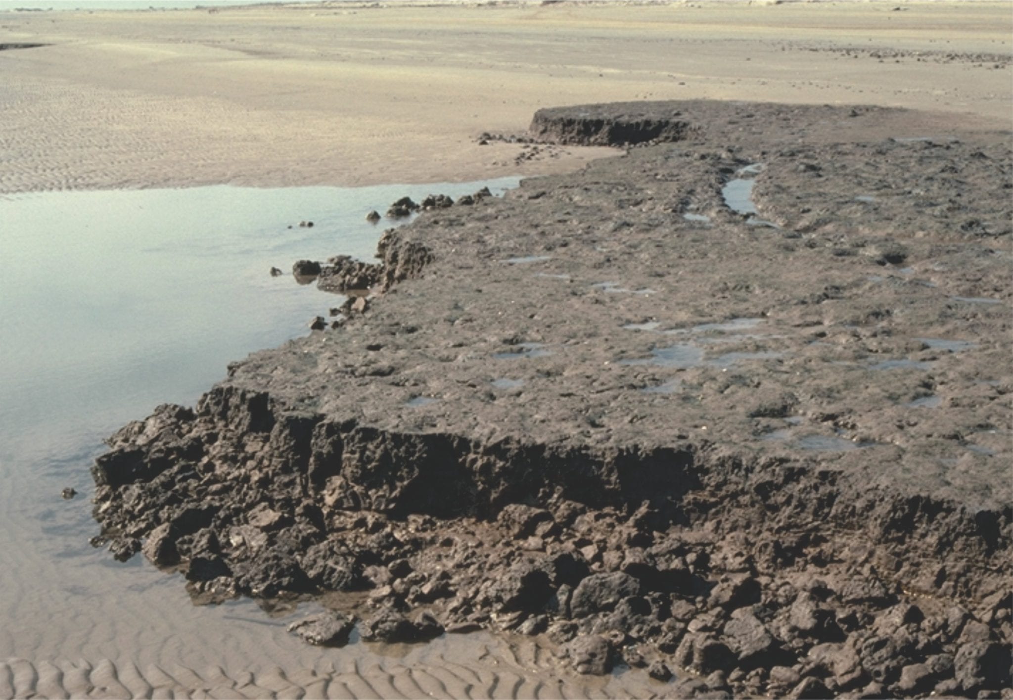
Tairua estuary, east coast Coromandel Peninsula, New Zealand. Two images taken during falling tide, exposing attached and semi-detached sand-shell bars. The main channel is at bottom of each image.
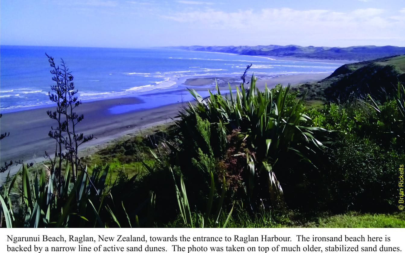
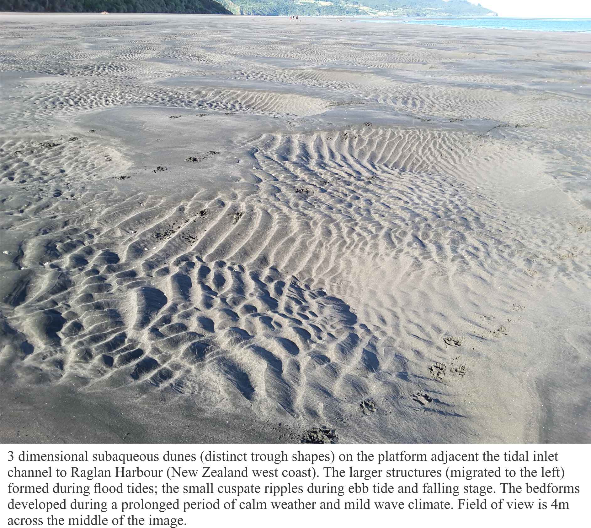
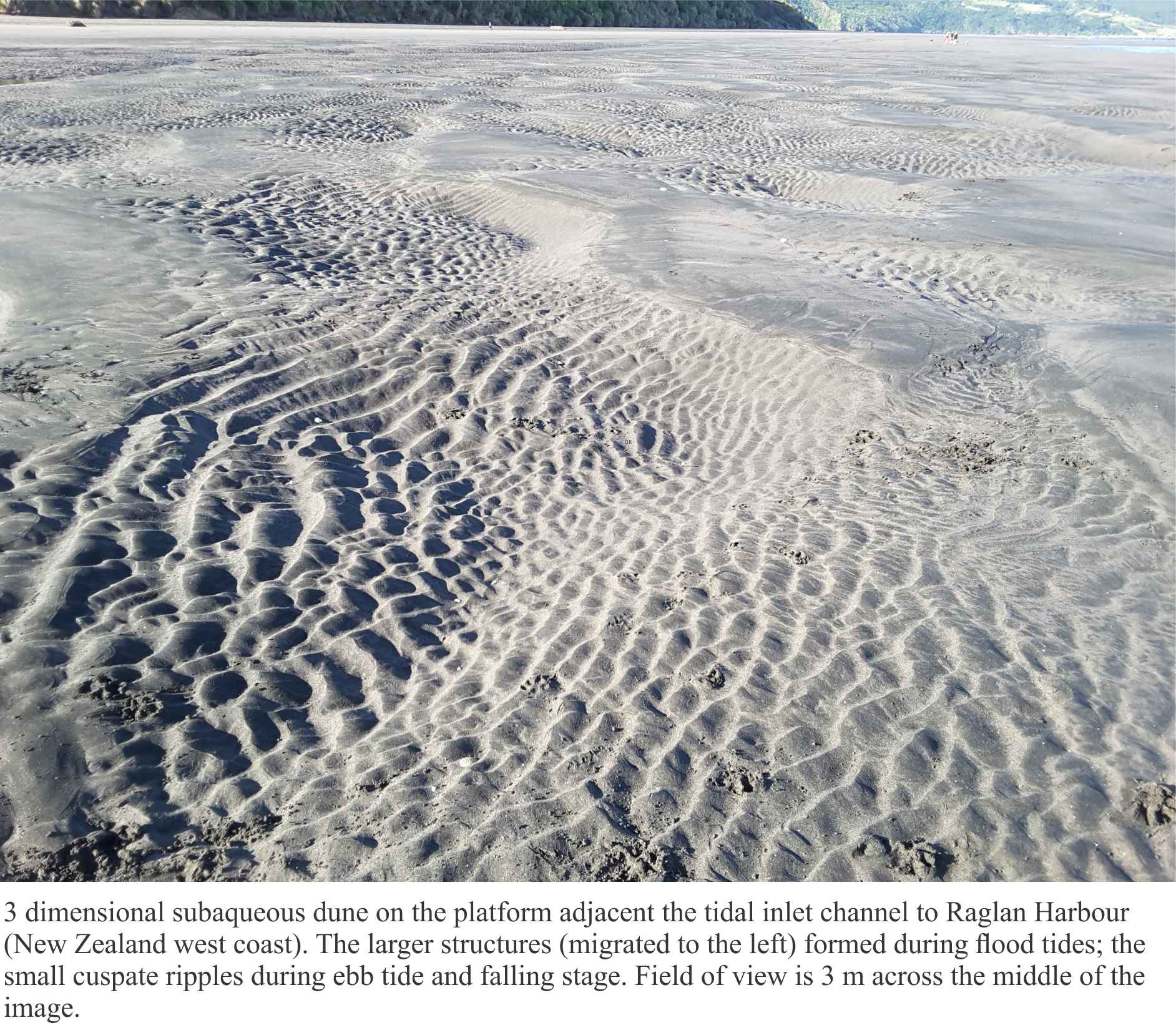
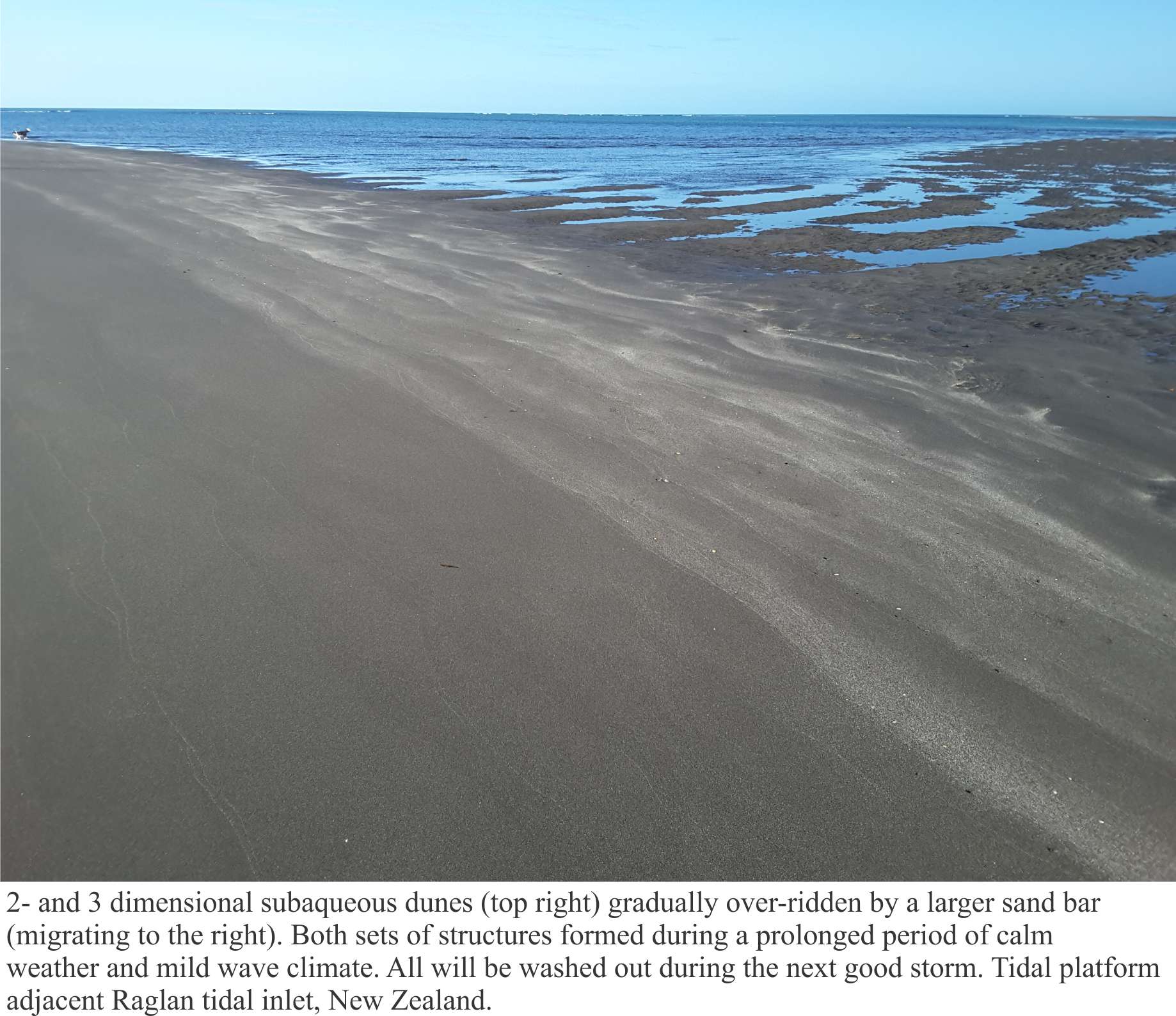
Raglan ebb tidal delta, bedforms on the platform attached to the permanent shoreface
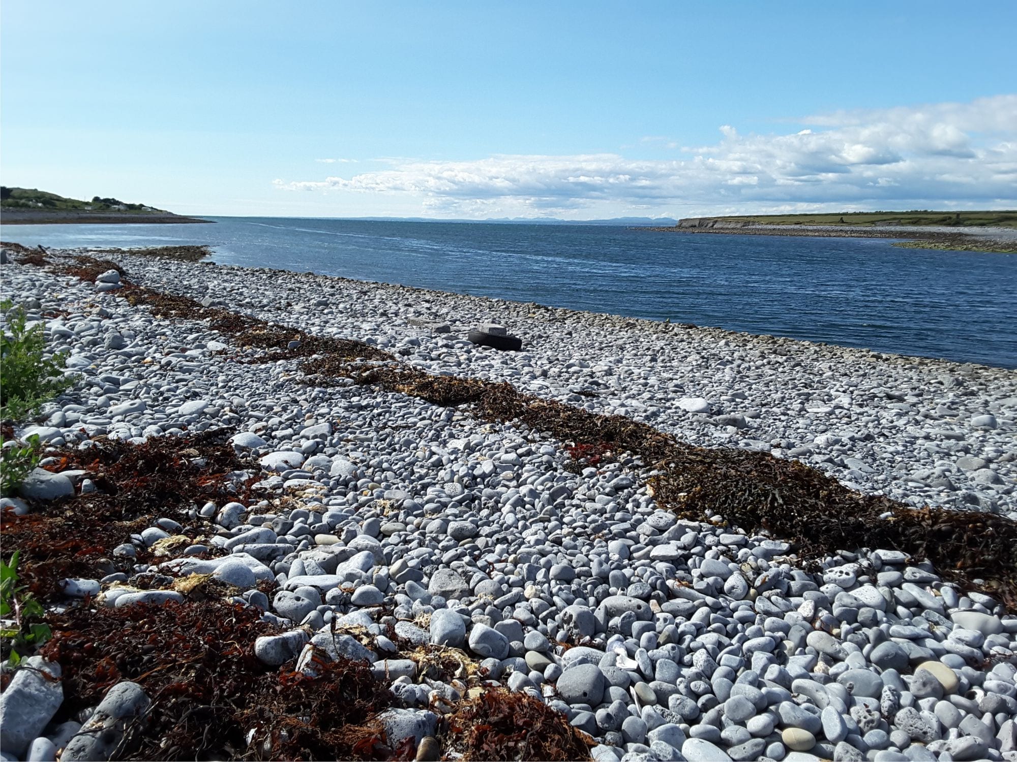
The estuary on the south side of Galway Bay, County Clare, Ireland, near New Quay. The boulder-cobble beach consists almost entirely of Burrens limestone (Carboniferous). Left view from Abbot Hill.
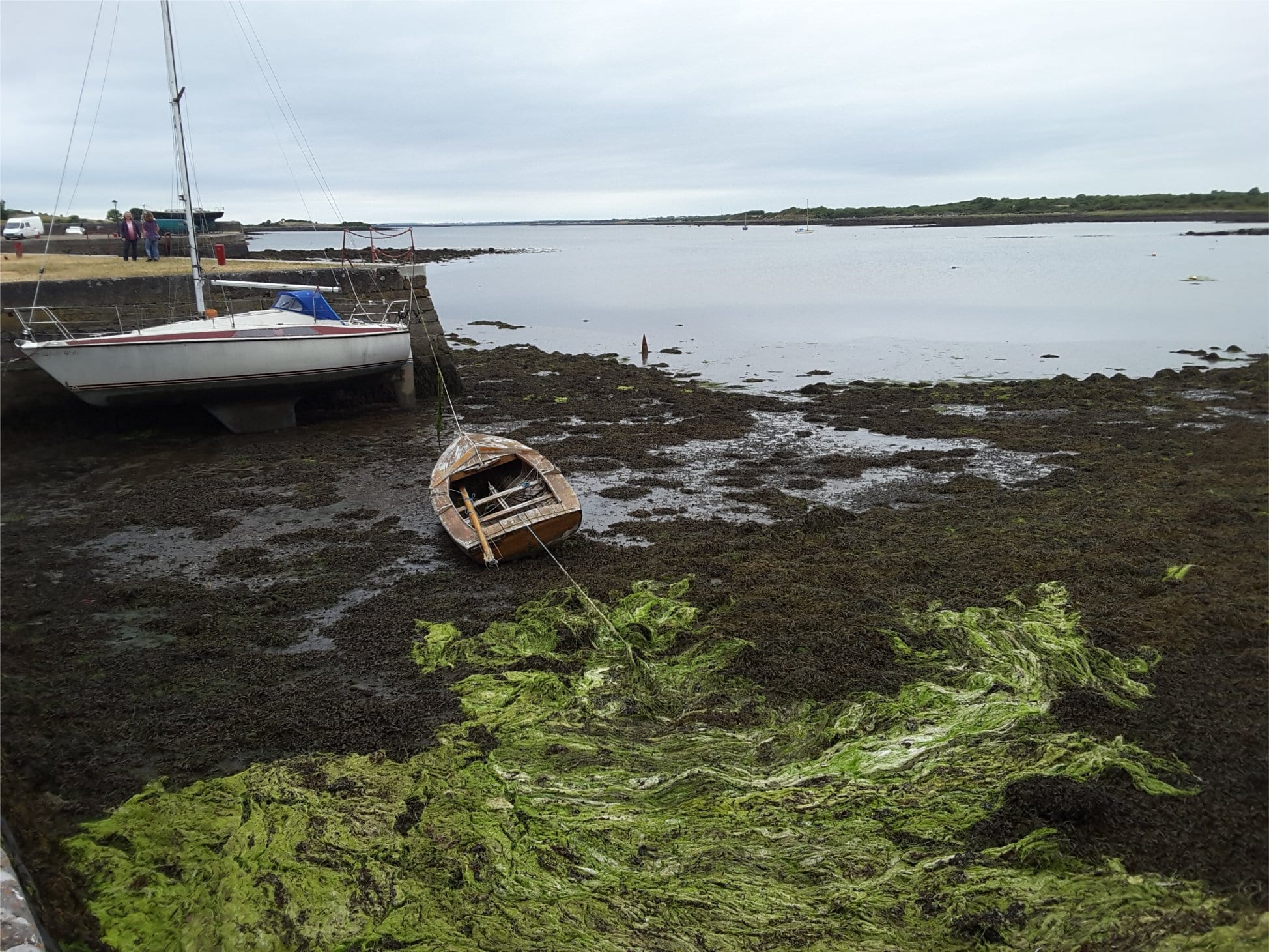
Mudflats and algae, Kinvara, at the head of the estuary, south side Galway Bay.
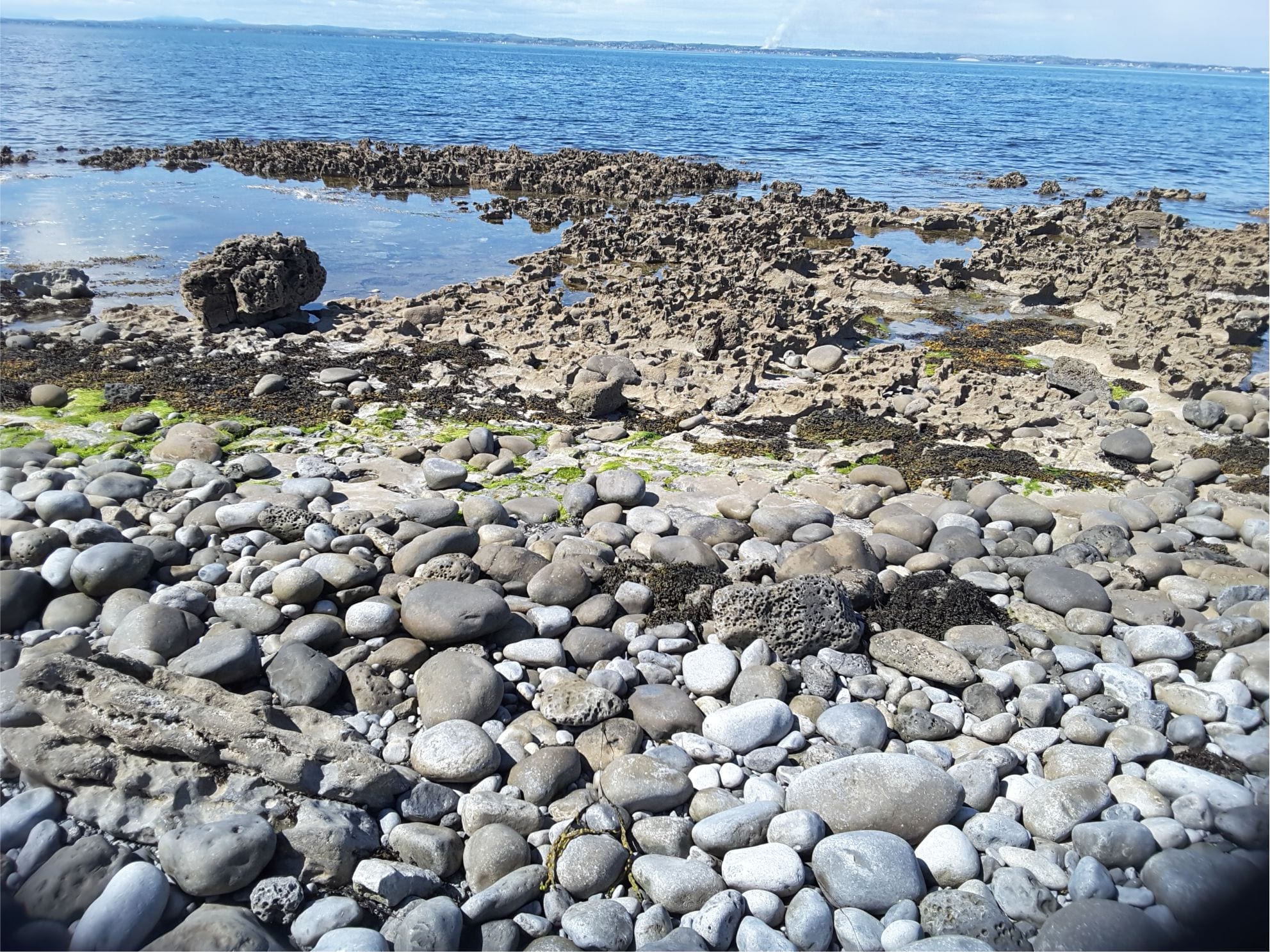
Karst in Burren Limestone at Flaggy Shore, New Quay, County Clare, has been accentuated by salt corrosion and mechanical erosion. It is overlain by boulders of locally derived Carboniferous limestone
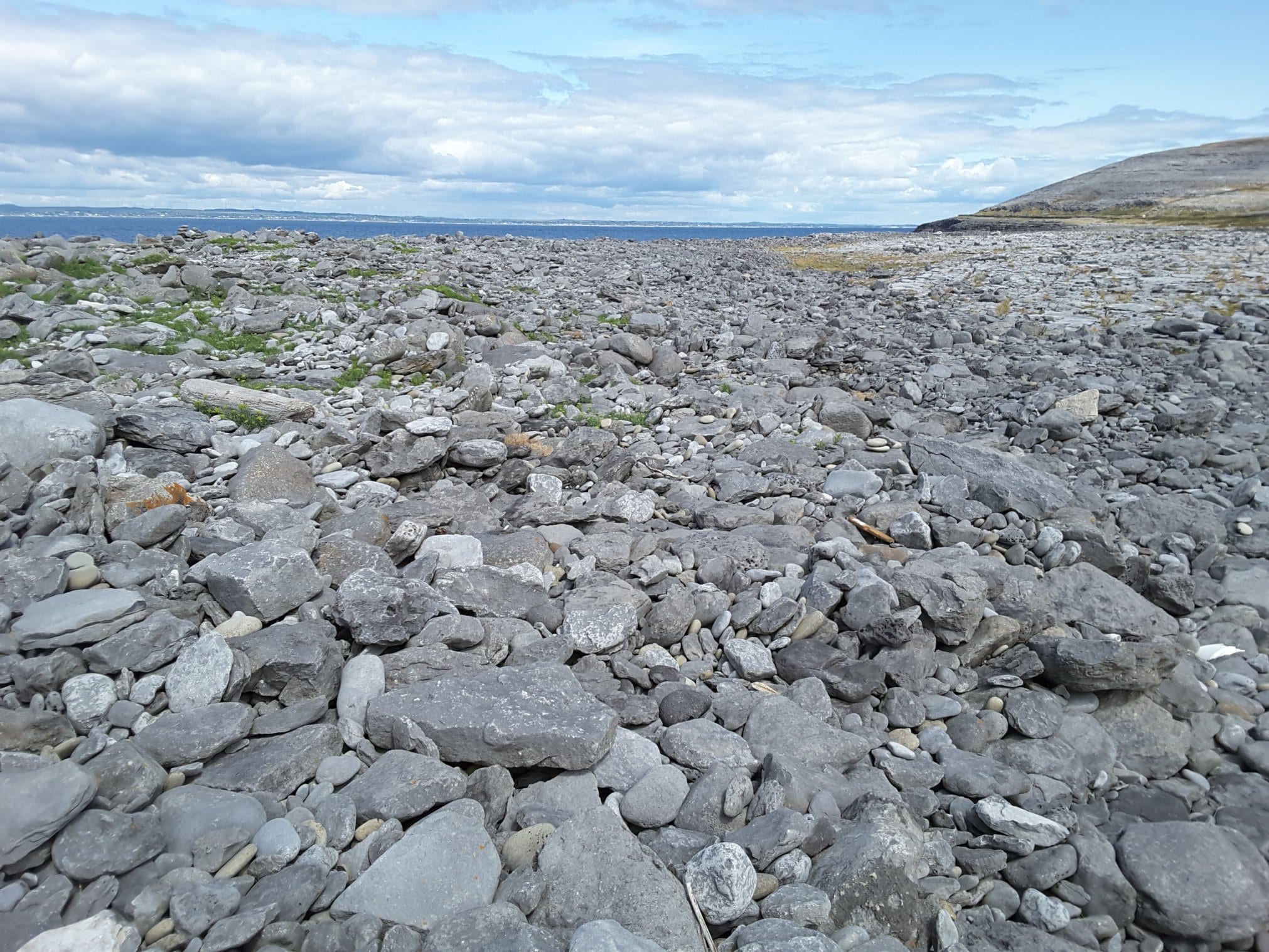
Boulder storm ridge at Black Head, County Clare – the heart of the Burrens. All boulders are locally derived Carboniferous limestone
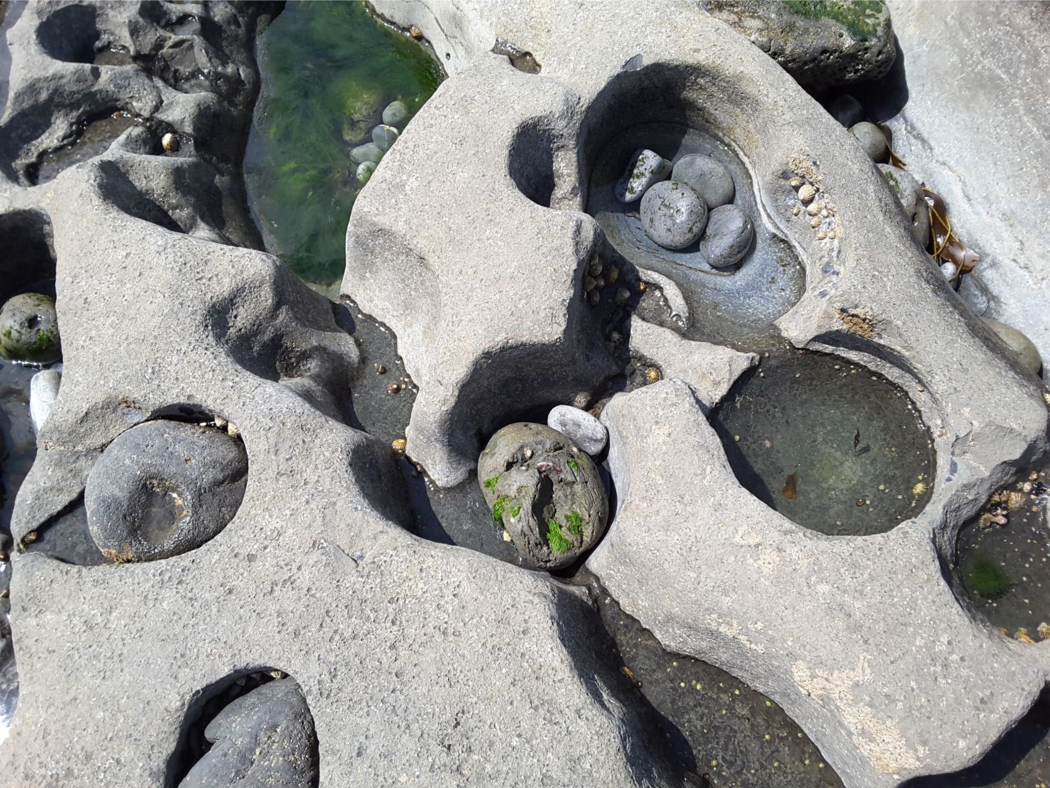
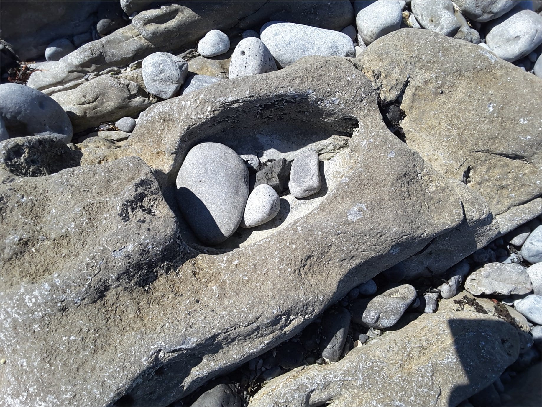
Potholes in Burren Limestone, Flaggy Shore, County Clare.
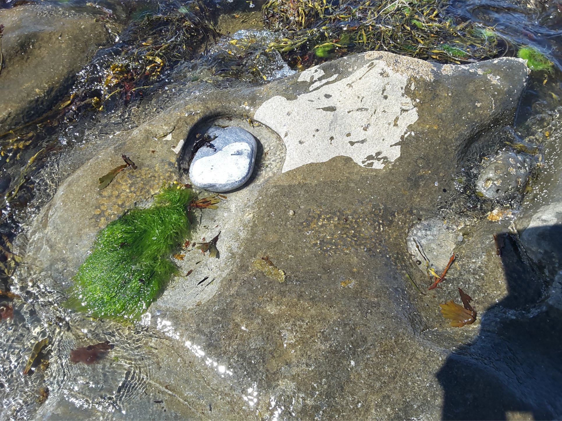
Sea grass, ripples, and burrow excavations in a tidal pool, Flaggy Shore, County Clare
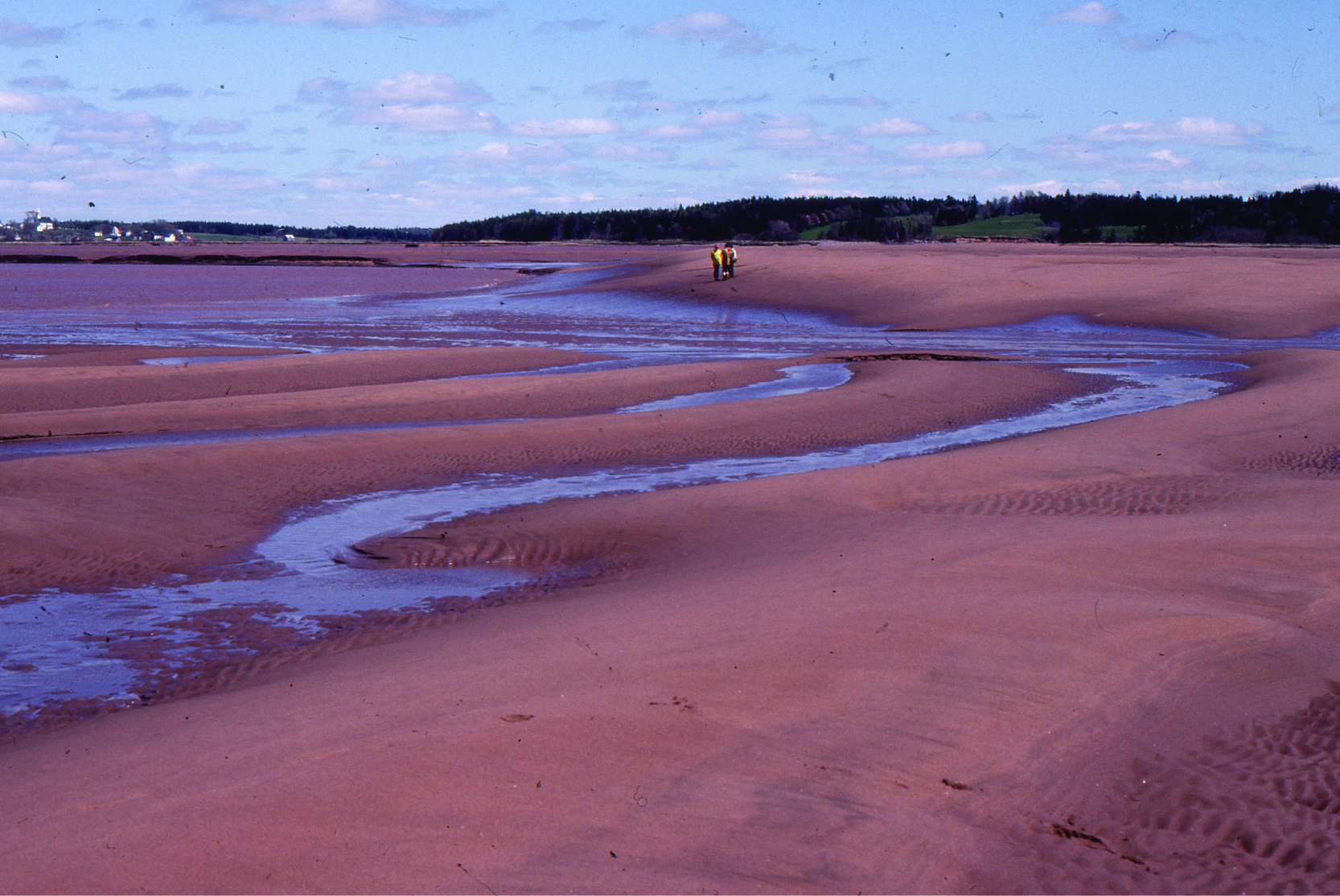
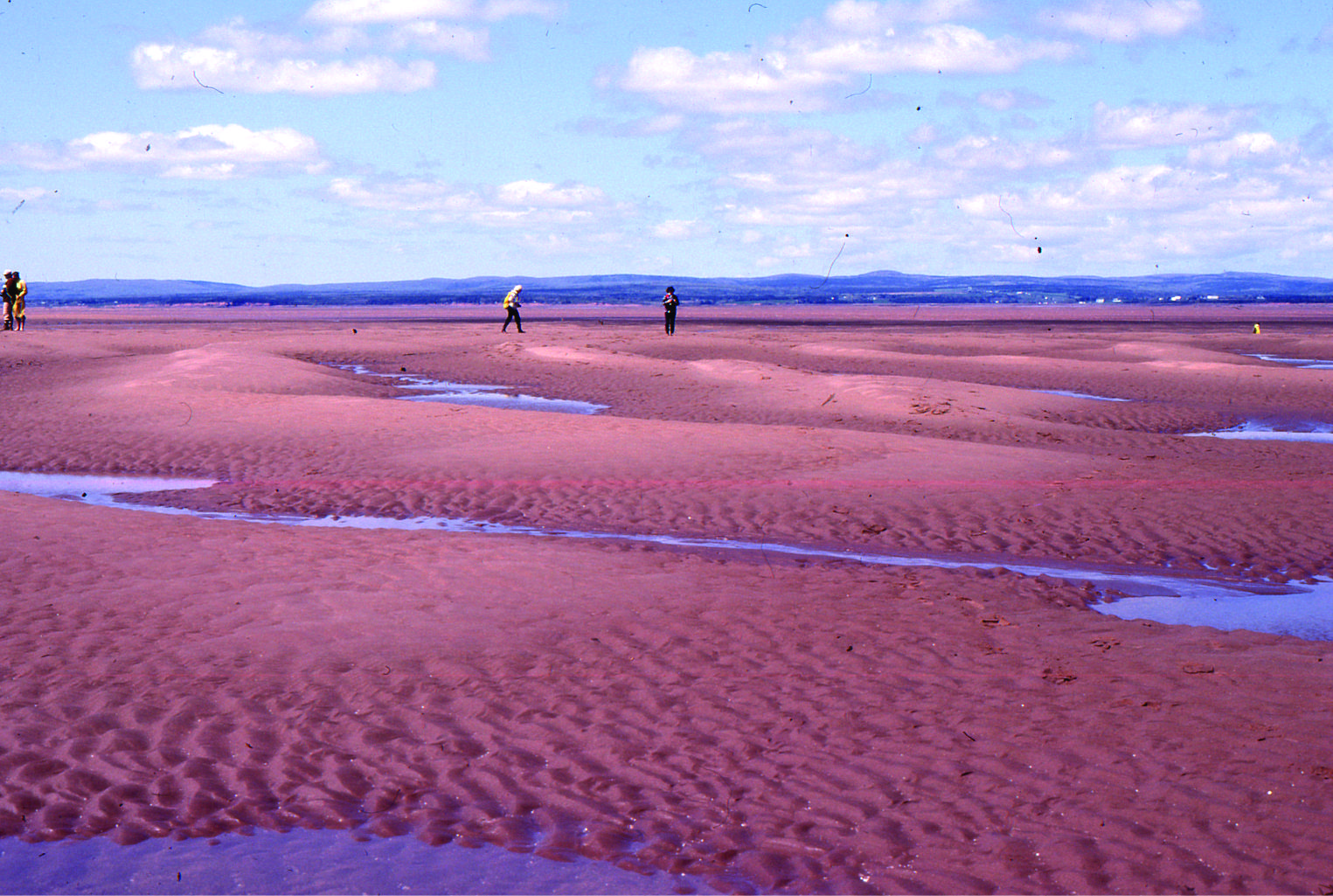
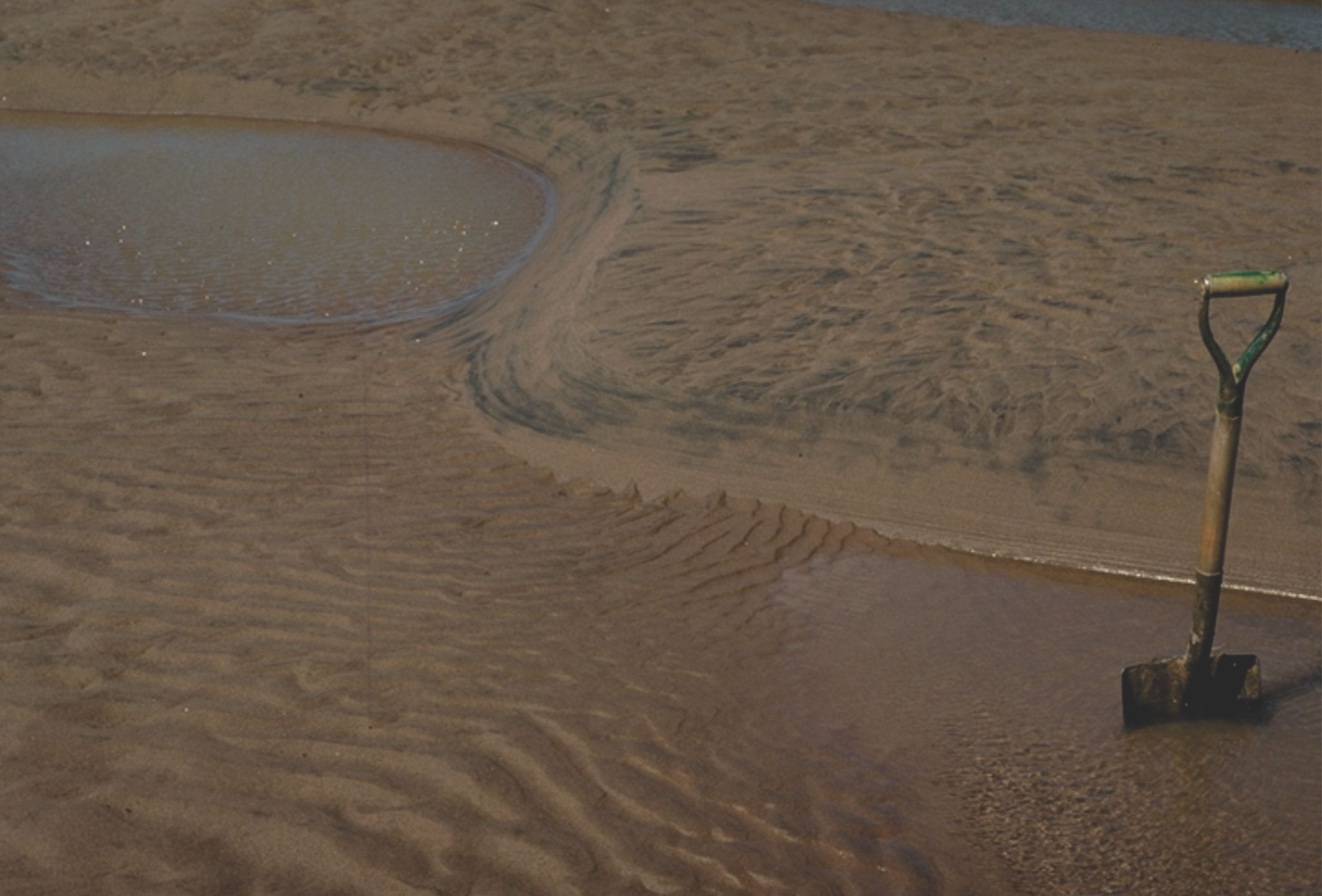
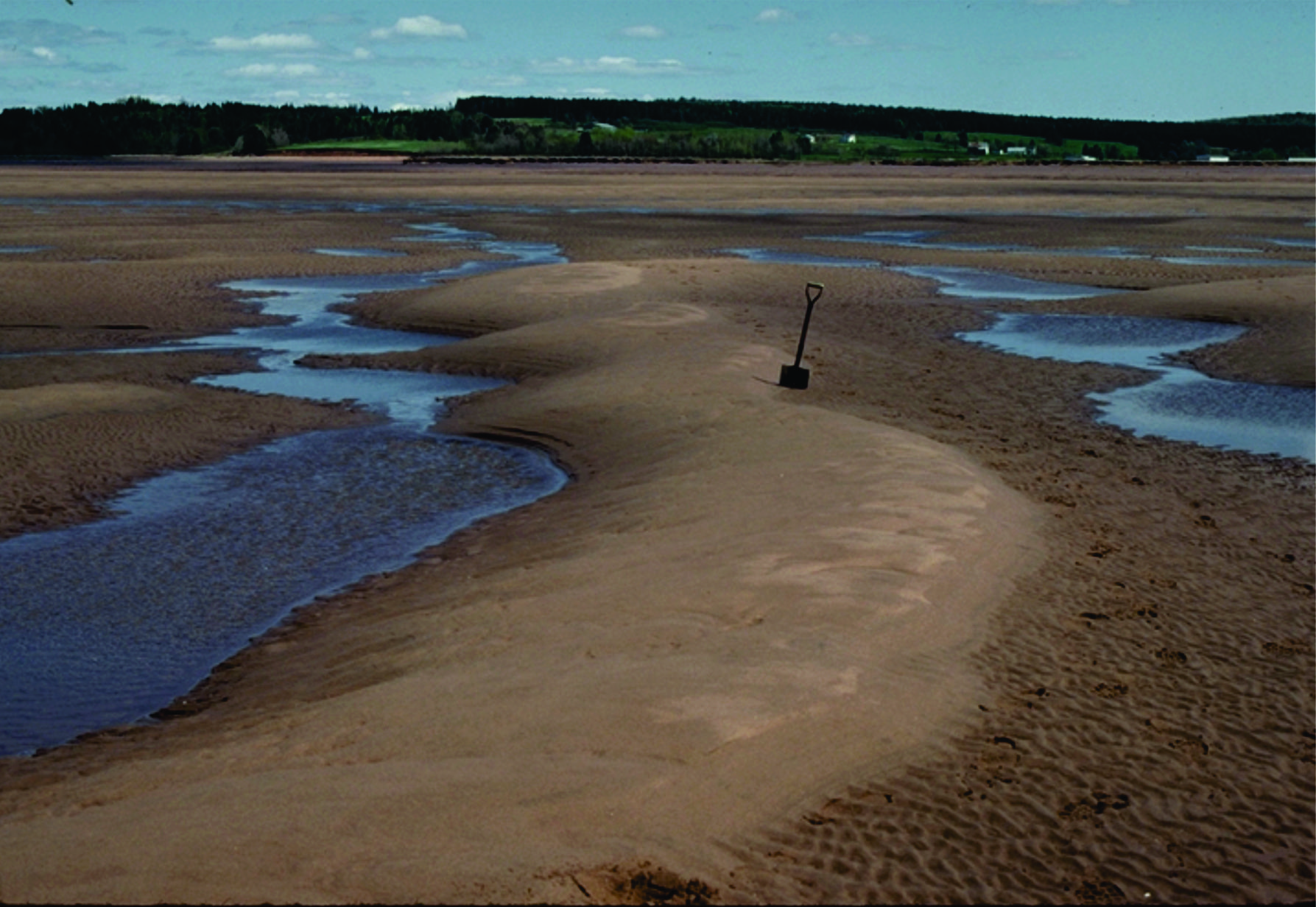
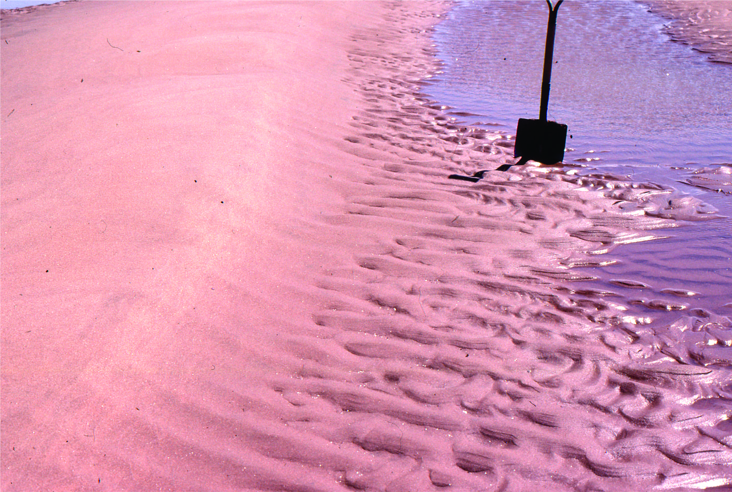
Large, 2D dunes, intertidal Minas Basin, Fundy Bay
Shallow subtidal to intertidal, 2D subaqueous dunes, Rowatt Fm, Belcher Islands (Aphebian, about 2 billion years old). Hammer for scale.
Cross-sectional view of 2D subaqueous, intertidal dunes, showing complex migrating dune-formed crossbedding, and dune reactivation, Rowatt Fm, Belcher Islands (Aphebian, about 2 billion years old). The sands are mixed siliciclastic-carbonate (dolomite).
Reactivated 2D dunes with superposed ebb tide ripples, Minas Basin, Fundy Bay
Proterozoic tidal inlet, showing cross-section of reactivated subaqueous dunes (mid image), possible herringbone crossbeds, and smaller ripples. Rowatt Fm, Belcher Islands (about 2 billion years old). Lens cap bottom right.
Multiple dune sets, intertidal, Minas Basin, Fundy Bay
Sandy tidal flat ripples, Minas Basin, Fundy Bay
Paleocene, straight crested and bifurcating intertidal ripples, Expedition Fm, Axel Heiberg Is;and, Canadian Arctic
Straight-crested ripple train in Paleocene intertidal deposits, Expedition Fm, Axel Heiberg Island, Canadian Arctic. Hammer left-mid image.
Flood tide ripples over-ridden by smaller ebb tide ripples sets. Minas Basin, Fundy Bay
Interference ripples in Proterozoic tidal flat facies, Belcher Islands
Large 2D and 3D dunes, and superposed run-off ripple sets, Minas Basin Fundy Bay
Tidal flat, interference ripples, Minas Basin Fundy Bay
Ebb tide run-off & reactivation of 3D dunes, Minas Basin Fundy Bay
Large 3D dunes, Minas Basin Fundy Bay
2D flood tide dunes and small ebb tide ripples, Minas Basin Fundy Bay
2D and 3D intertidal dunes, Minas Basin Fundy Bay
Eroded salt marsh cycles, Minas Basin Fundy Bay
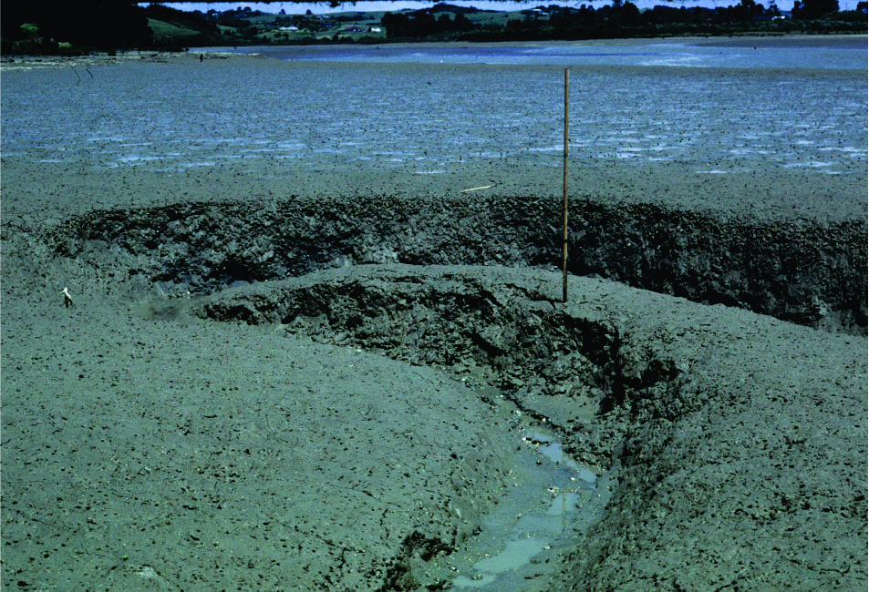
Small meandering tidal channel in very muddy estuarine tidal flats, Whitford Estuary, south Auckland. Bank failure is common.
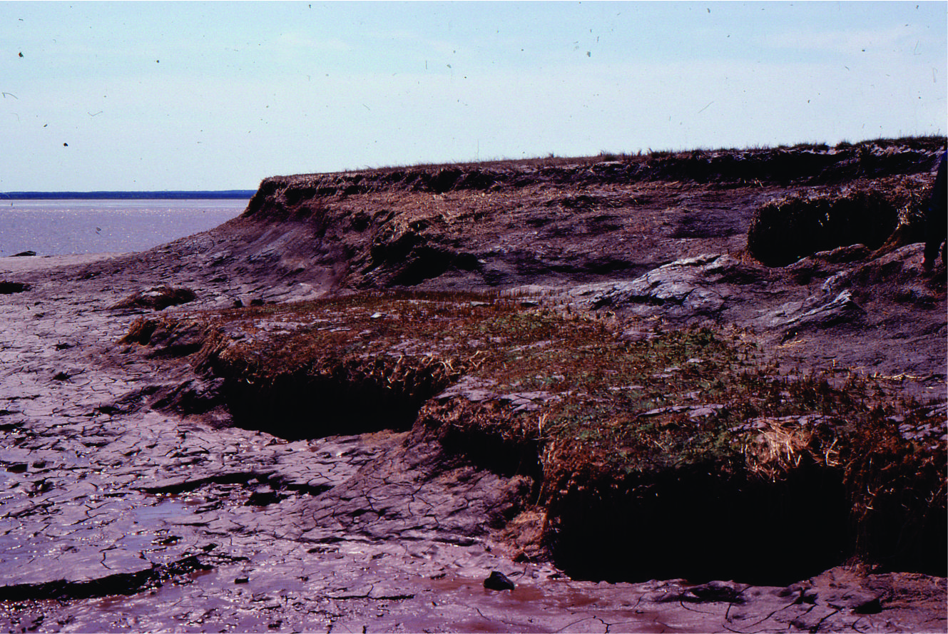
Salt marsh, sedges and small mangroves being transgressed and eroded by tidal flat. This is a modern example of a ravinement surface. Whitford, south Auckland
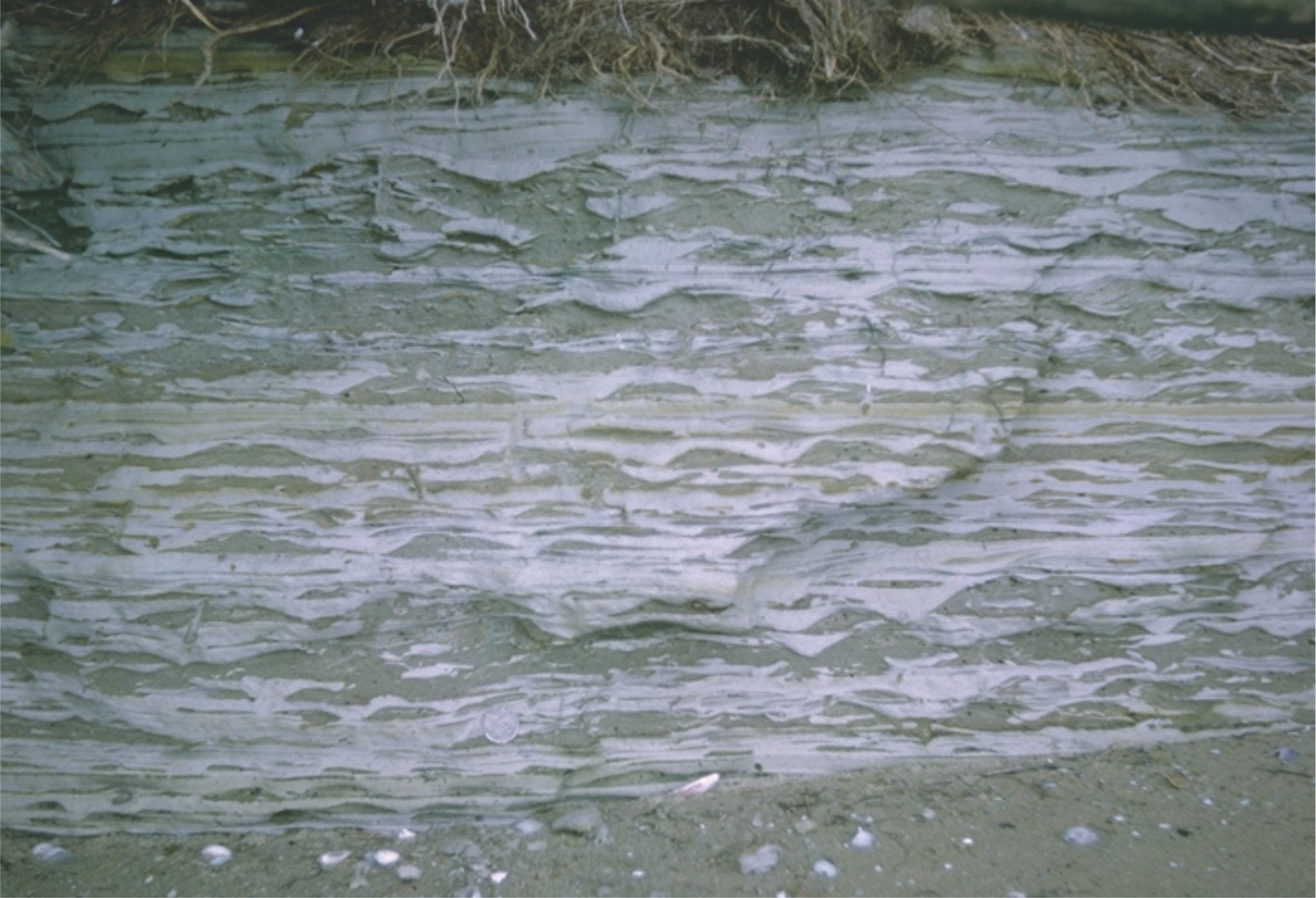
Eroded salt marsh deposits, transgressed by sandy tidal flat – beach. The erosion surface is a modern, active ravinement surface. Galveston, Texas.
Two examples of Paleocene tidal bedding (mostly lenticular and wavy bedding) interfingering with lagoon and marsh. Eureka Sound Group, Ellesmere Island
Paleocene tidal bedding interfingering with marsh-lagoon-bay sediment. On the right, the thicker sandstones may represent storm washovers into the bay. Eureka Sound Group, Ellesmere Island
Coarsening- and sandier-upward bay or lagoon subtidal to beach, cut by small tidal channels (lenticular sandstones). Eocene, Eureka Sound Group, Ellesmere Island.
Ebb tidal delta at the mouth of Waikato River, south Auckland.
Paleocene subaqueous dunes up to 2m amplitude, in tidal inlet-delta, overlain by thin tidal flat-salt marsh deposits. Expedition Fm, Axel Heiberg Island, Canadian Arctic
Large within-channel dunes in a tidal inlet associated with a sand spit facies; the spits and bars were attached to (paleotopographic) headlands across an unconformity eroded into Ordovician carbonates. Paleocene, Eureka Sound Group, Ellesmere Island.
Two views of the unconformity between Ordovician carbonates and Paleocene estuarine-tidal channel-spit facies. Eureka Sound Group, Ellesmere Island.
Typical beach stratification in an eroded berm; primarily laminated sets with low-angle truncations, parallel, or slightly inclined to the beach face.
Tidal inlet standing waves (antidunes) in an outgoing tide, Mangawhai Heads, north Auckland. The antidunes migrate up-current (against the current) and gradually build until they break, subsequently reforming.
Proterozoic tidal channel – inlet trough crossbeds; this outcrop gives a 3-dimensional view of individual sets. Paleoflow was into the image. Rowatt Fm. Belcher Islands.
Flaser, lenticular and wavy bedding in late Pleistocene deposits near Ihumatao, Auckland. White muddy sediment overlies and envelopes grey sandy ripples, and fills troughs between ripples.
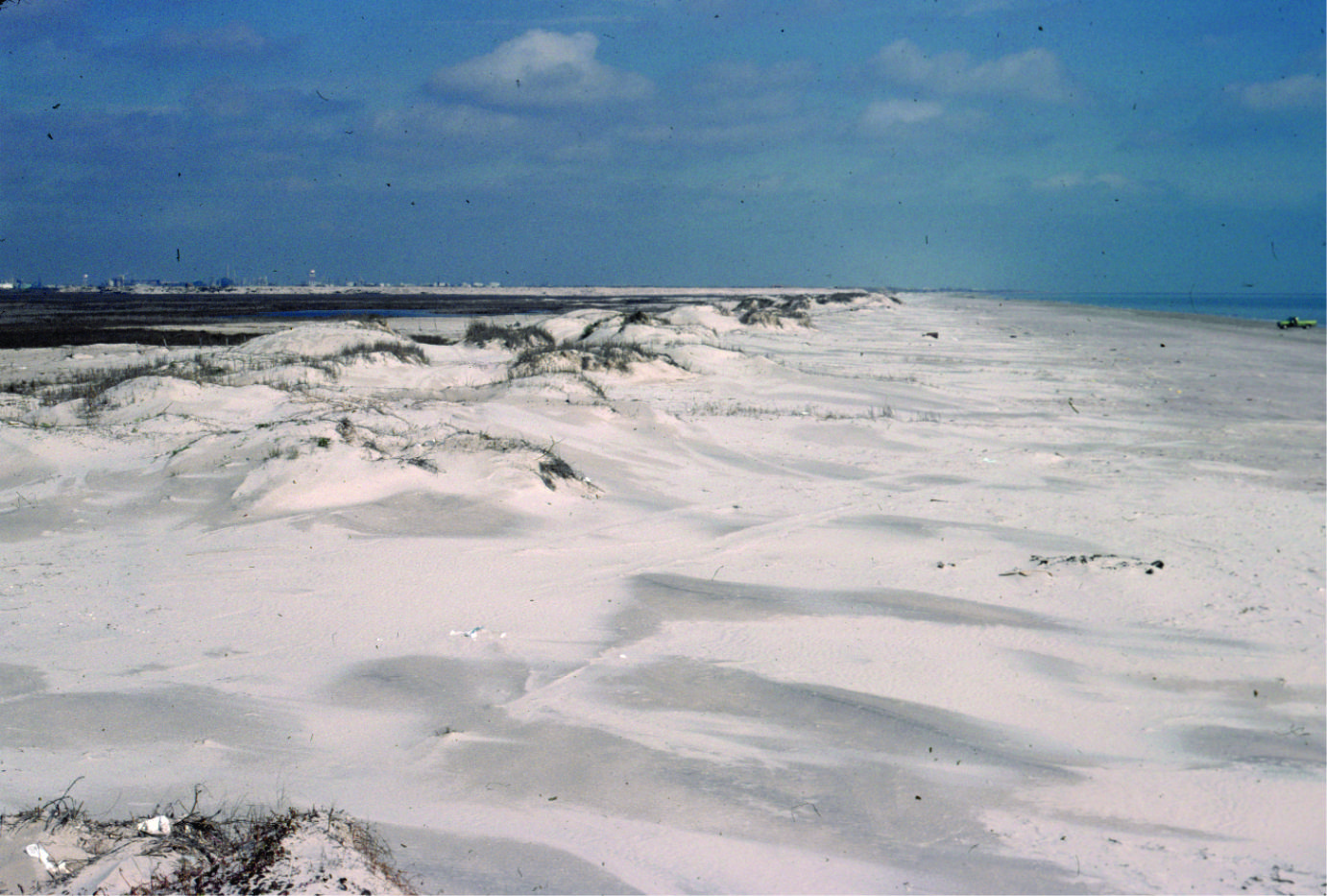
Coastal dunes, Galveston coast, Texas
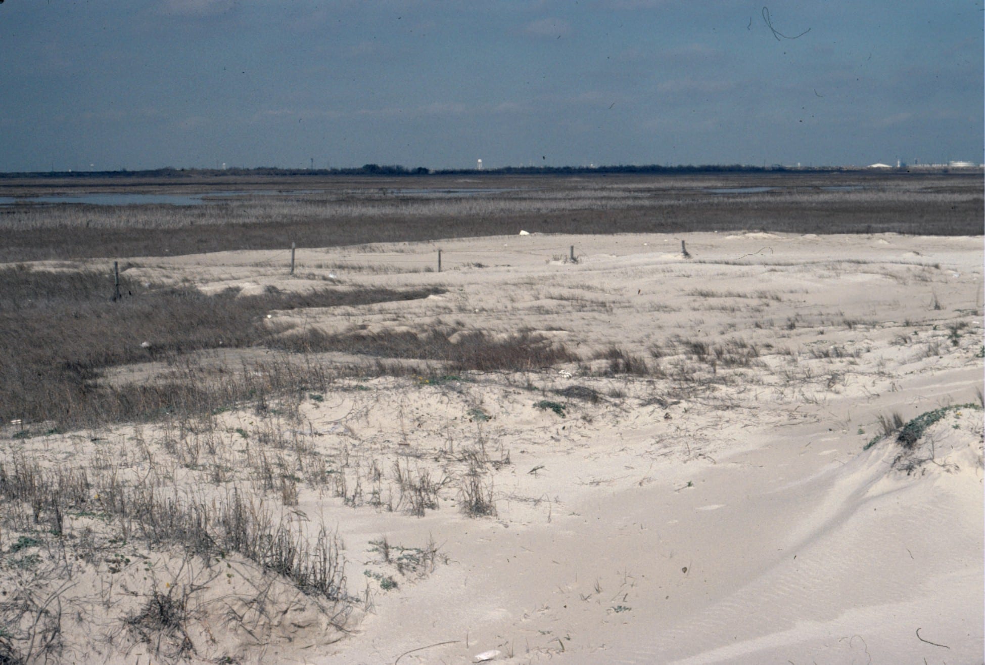
Washover fan breaching coastal dunes, Galveston coast, Texas
Paleocene washover fan sandstone associated with barrier island and tidal inlets (see images above from the same formation), Expedition Fm, Axel Heiberg Island, Canadian Arctic.
Stacked storm deposits associated with an upper tidal flat, each layer consisting of ripped up muds. Rowatt Fm, Belcher Islands. Proterozoic.
Mudcracks in salt marsh, Kaiua, NZ
Proterozoic supratidal desiccation cracks and voids in multiple layers of delicately laminated dololutite. Some curled slabs may be coated with crpytalgal laminae. A layer of storm-derived lutite rip-ups at the bottom of the image. Rowatt Fm. Belcher Islands. See below for a modern analogue.
Desiccated, curled, algal mats from a salt marsh near Galveston Texas. The mats are easily disturbed during high or storm tides.
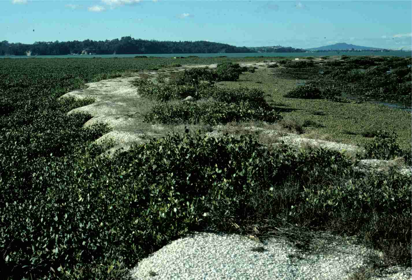
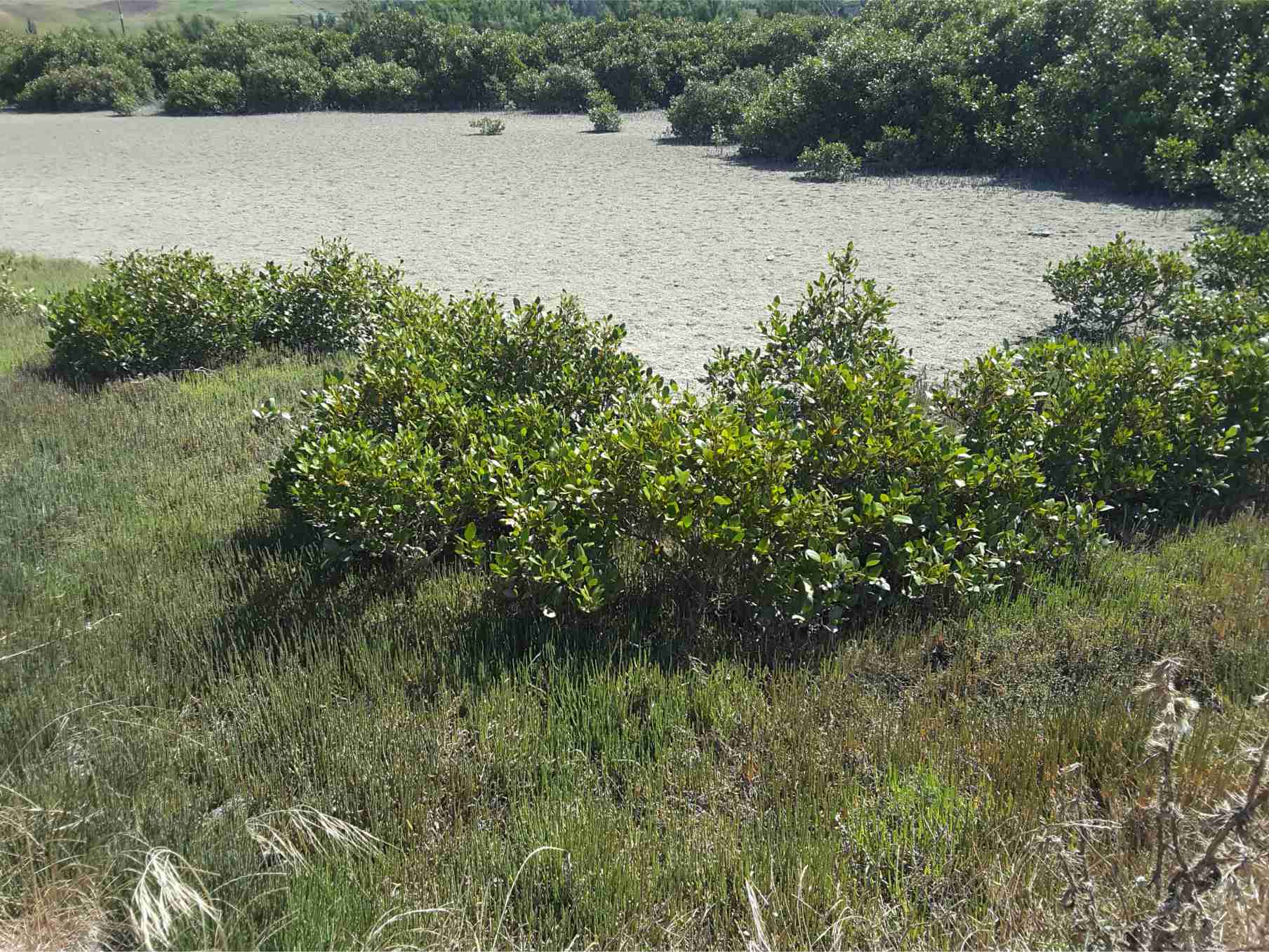
Mangroves: Left image: stabilizing shell banks (storm ridges) adjacent a tidal Inlet, Auckland Harbour; Right image: in a salt marsh, Kaiua, bordering Hauraki Gulf.
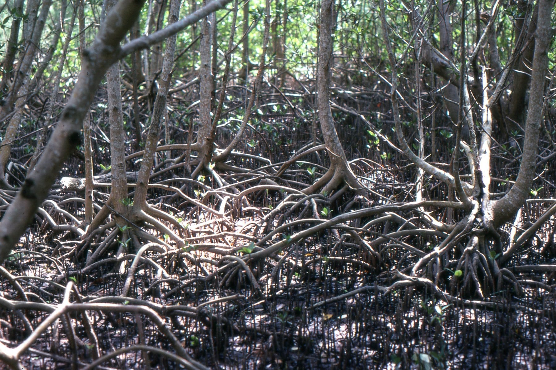
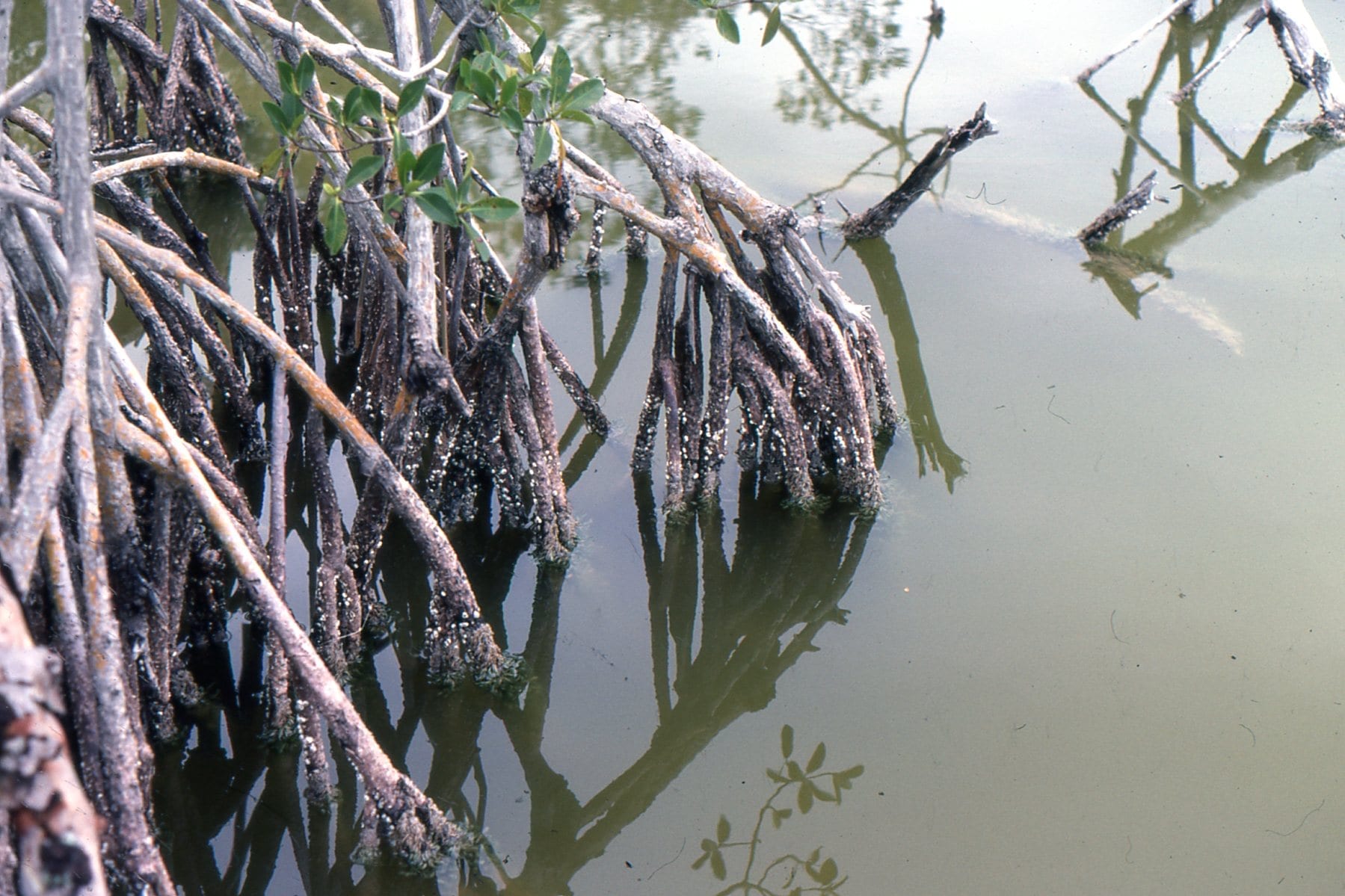
Everglades Mangroves, Florida. A tangle of roots and pneumatophores that are living quarters for so many species. On the right, an epifauna of barnacles, small snails and bryozoa.
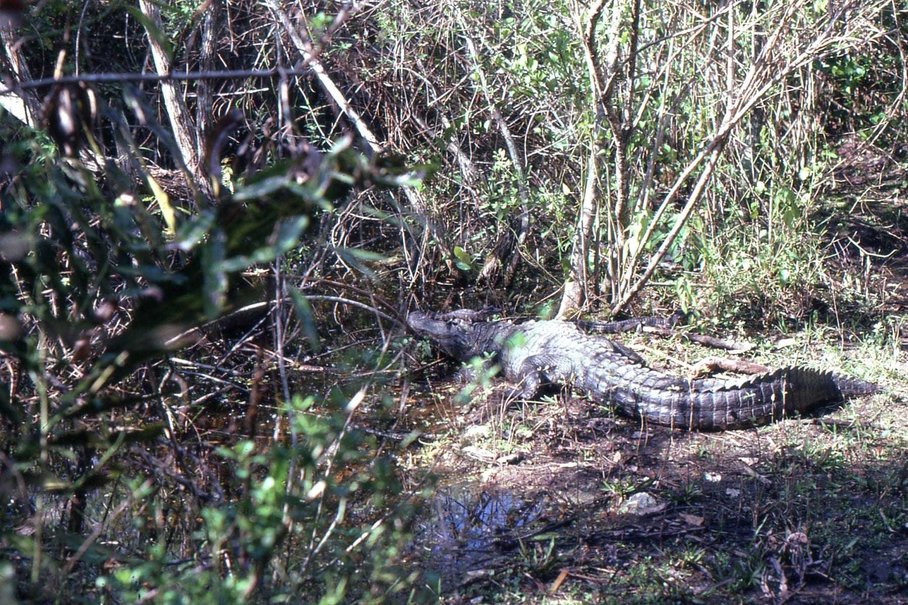
Everglades alligators, including the little guy on its parent’s head.
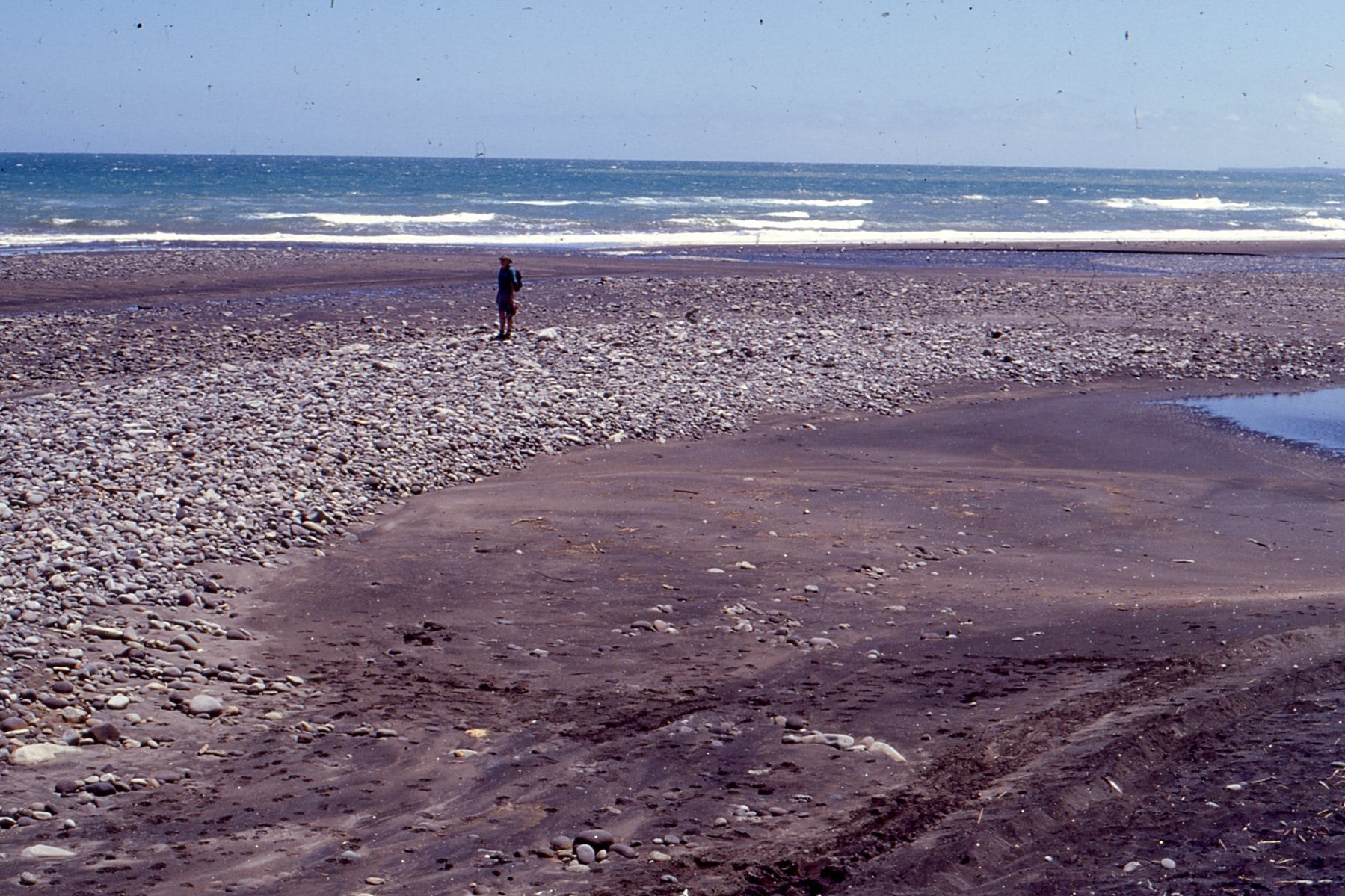
Gravel bar formed at the intersection between a high energy, West coast New Zealand beach, and the Tangahoe River mouth
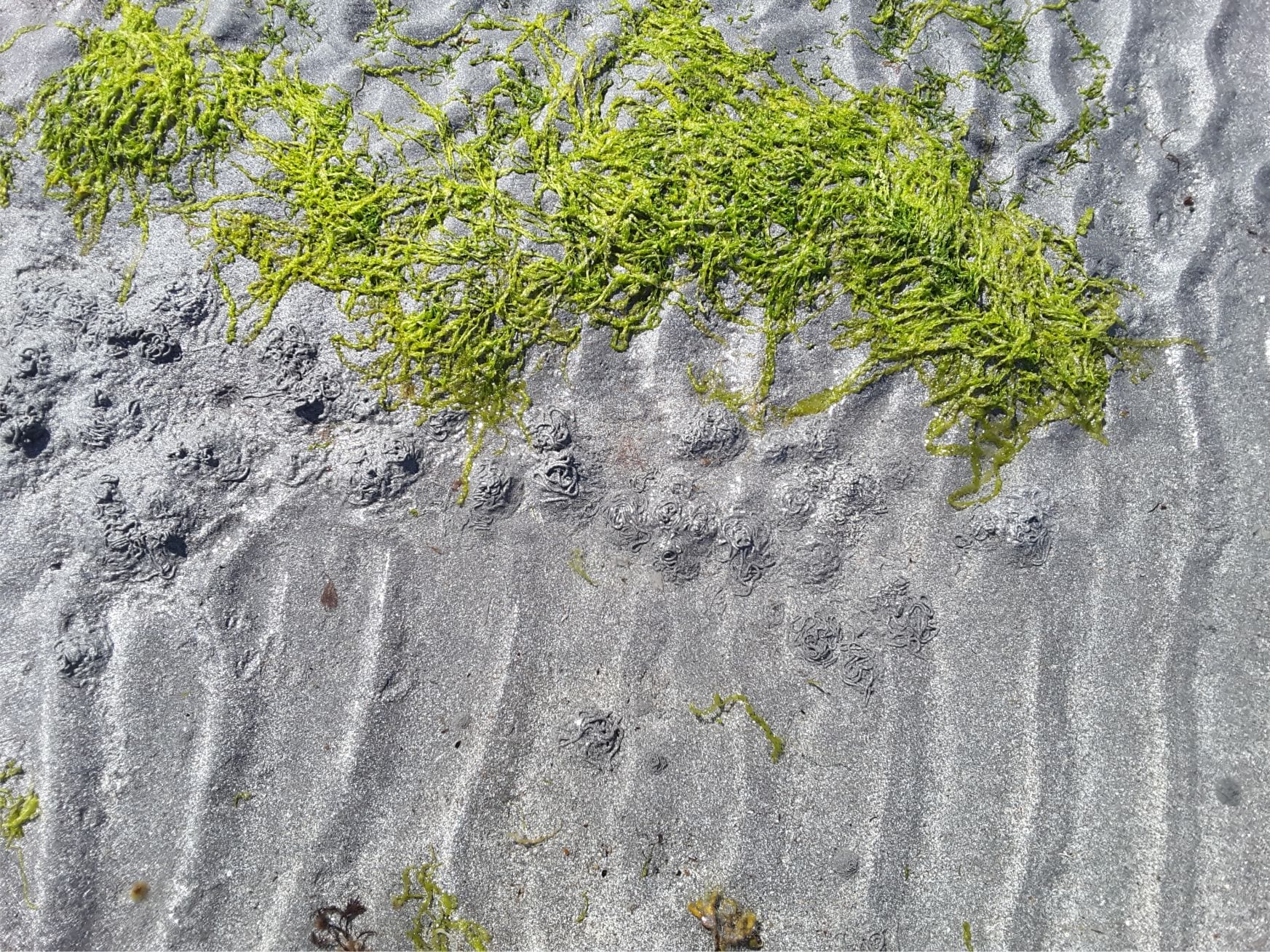
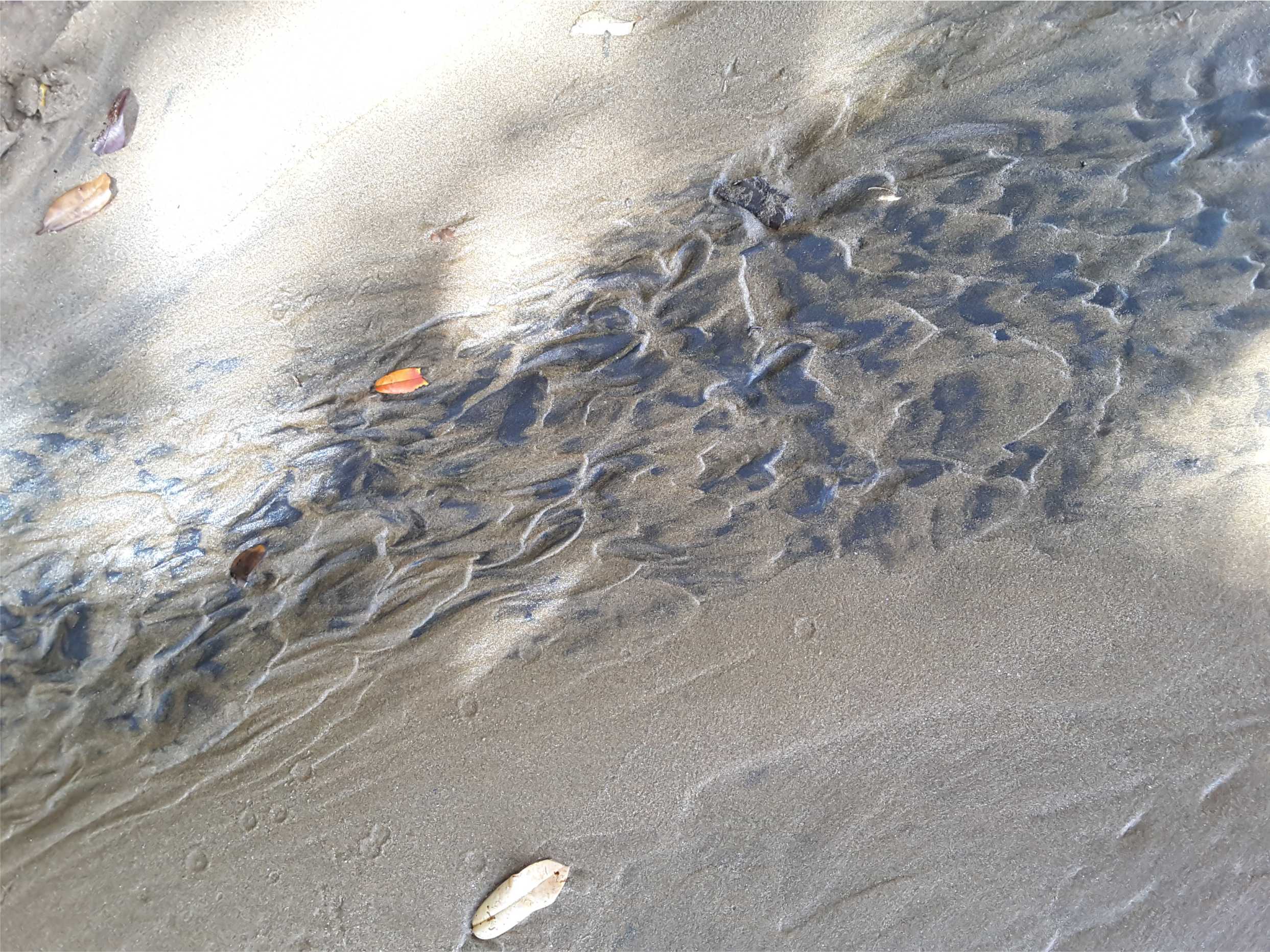
Ripples on a sand flat, with concentration of heavy minerals from local rhyolites and dacites. Little Bay, Coromandel.