A look at intertidal through subtidal deposits in outcrop
This is part of the How To…series on describing sedimentary rocks – outcrops of shallow marine deposits and their sedimentary structures.
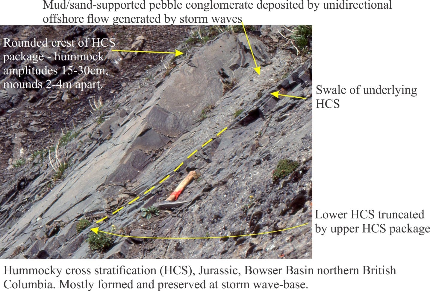
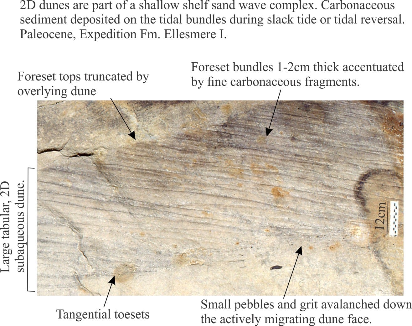
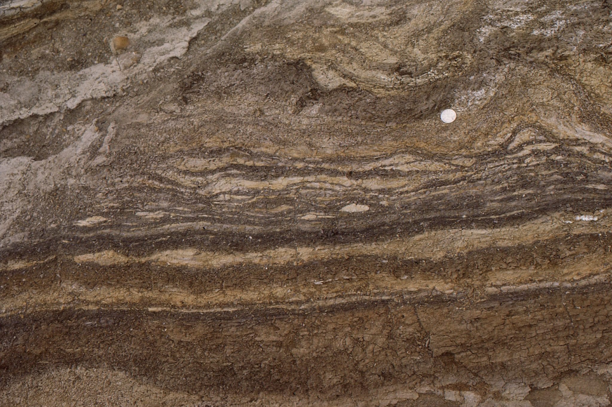
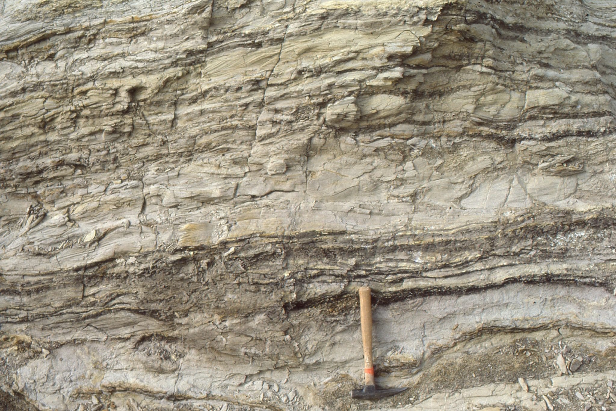
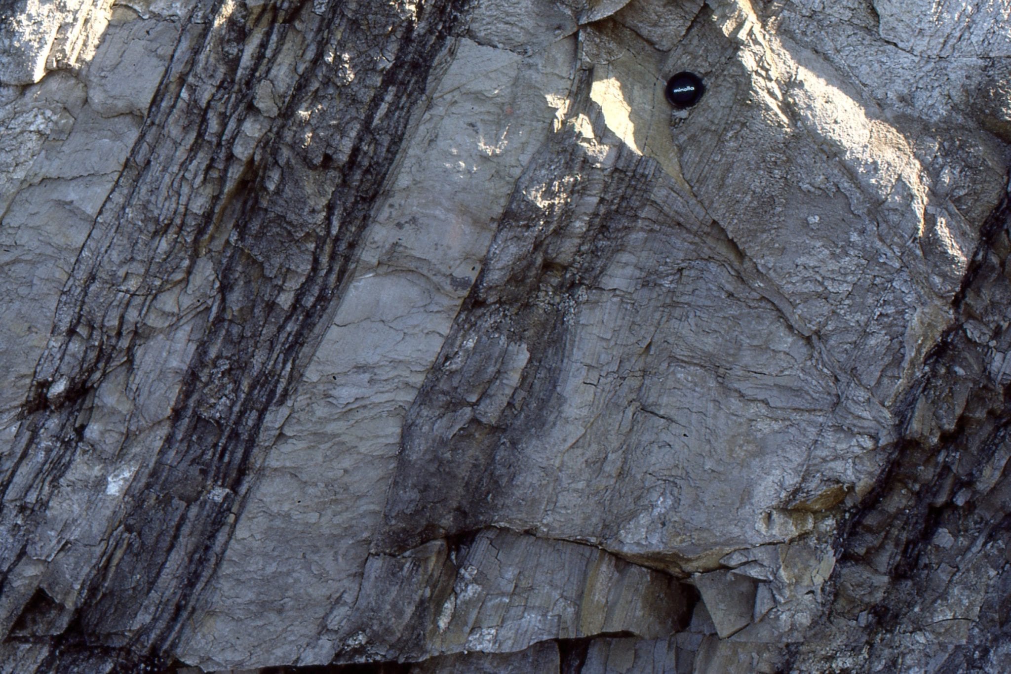
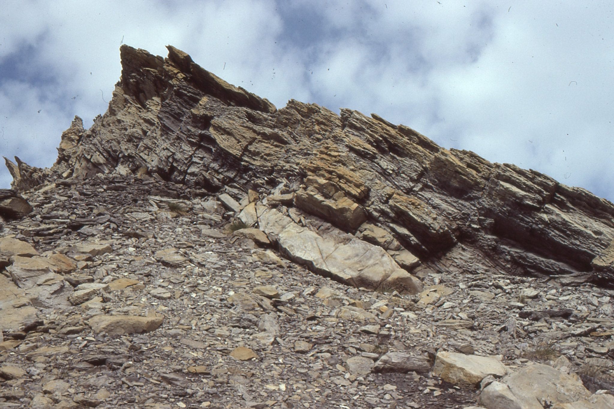
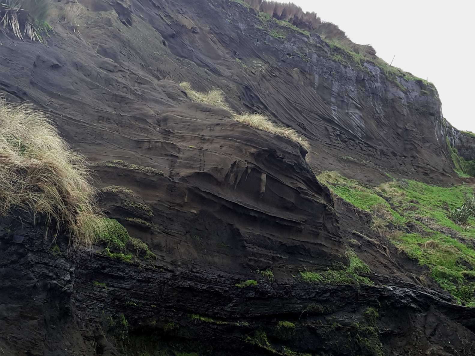
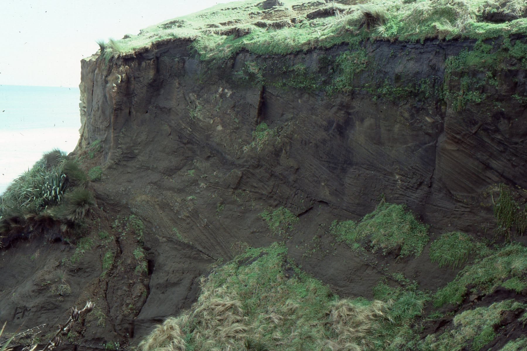
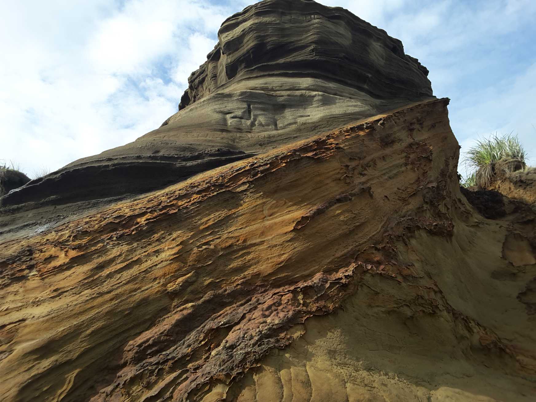
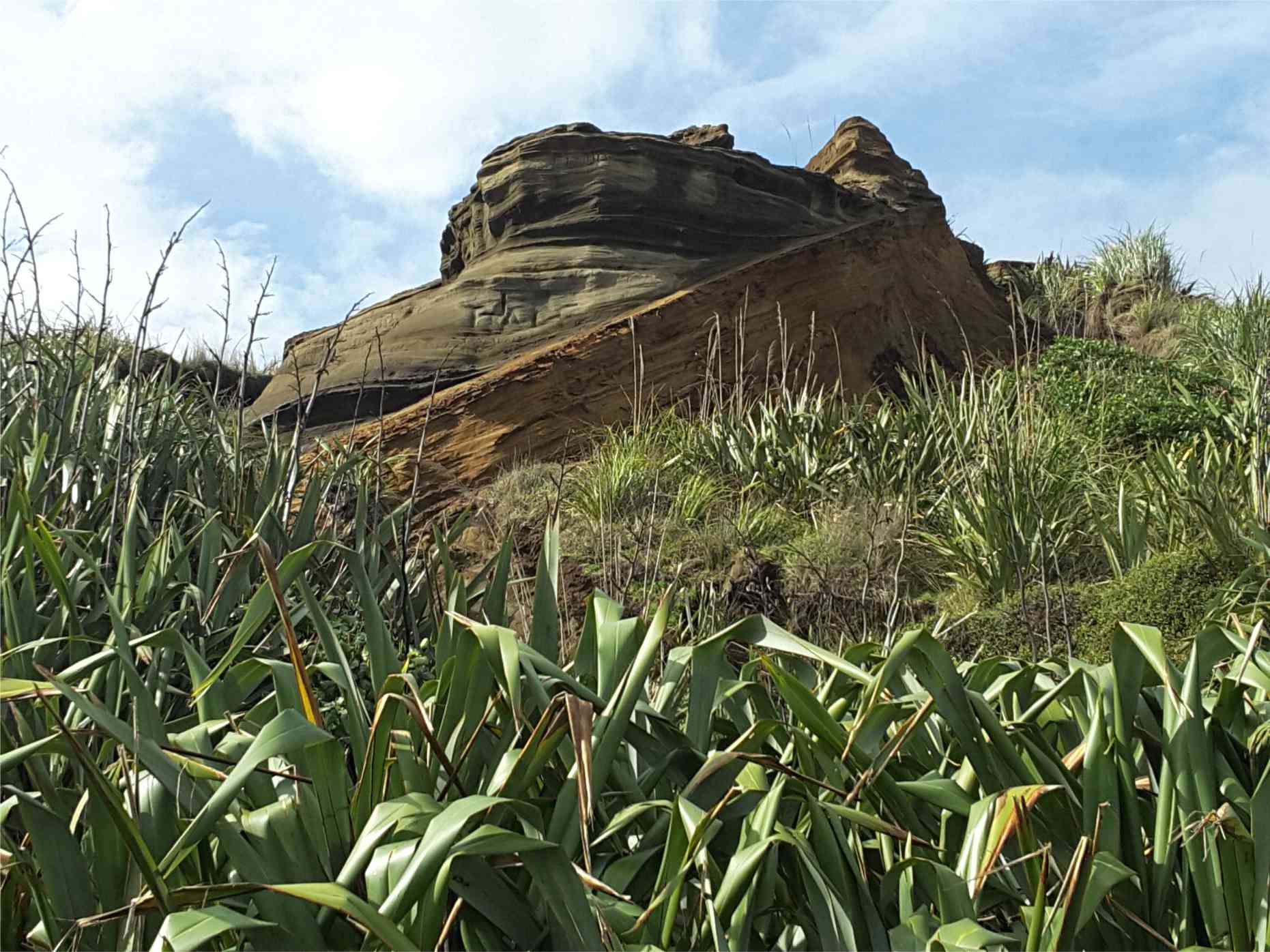
Here are some annotated, close-up outcrop images showing details of sedimentary structures – mostly bedforms from ancient shoreface, tidal flat and channel, and shallow shelf environments. The two guides to crossbed nomenclature have been borrowed from a previous post on crossbed terminology (link below). Most of these images have been cropped from originals featured in the Atlas of shelf deposits, and Atlas of beach-lagoon-bar-estuary-tidal flat deposits. The Atlases also show examples of modern analogues to these structures.
Related links in this series on outcrop descriptions
Click on an image to zoom in, then back arrow to return to this page
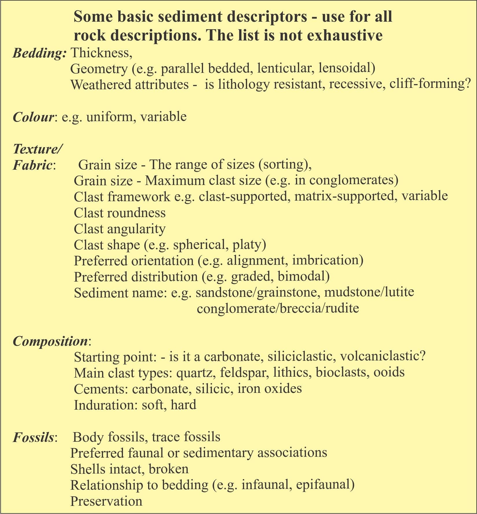
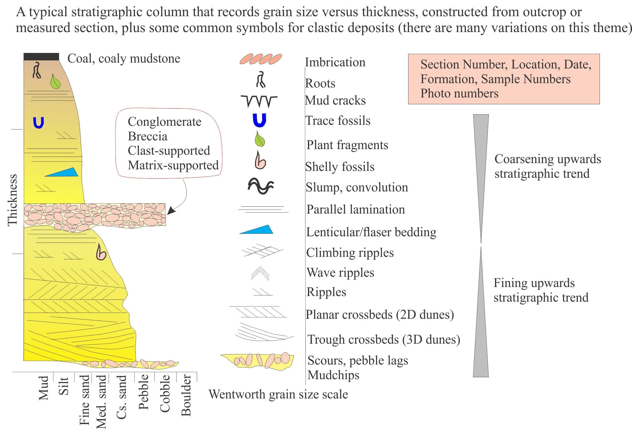
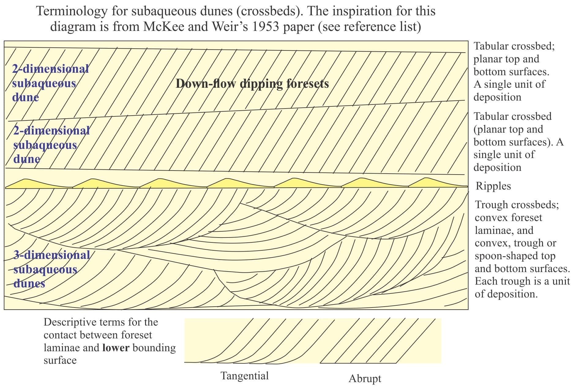
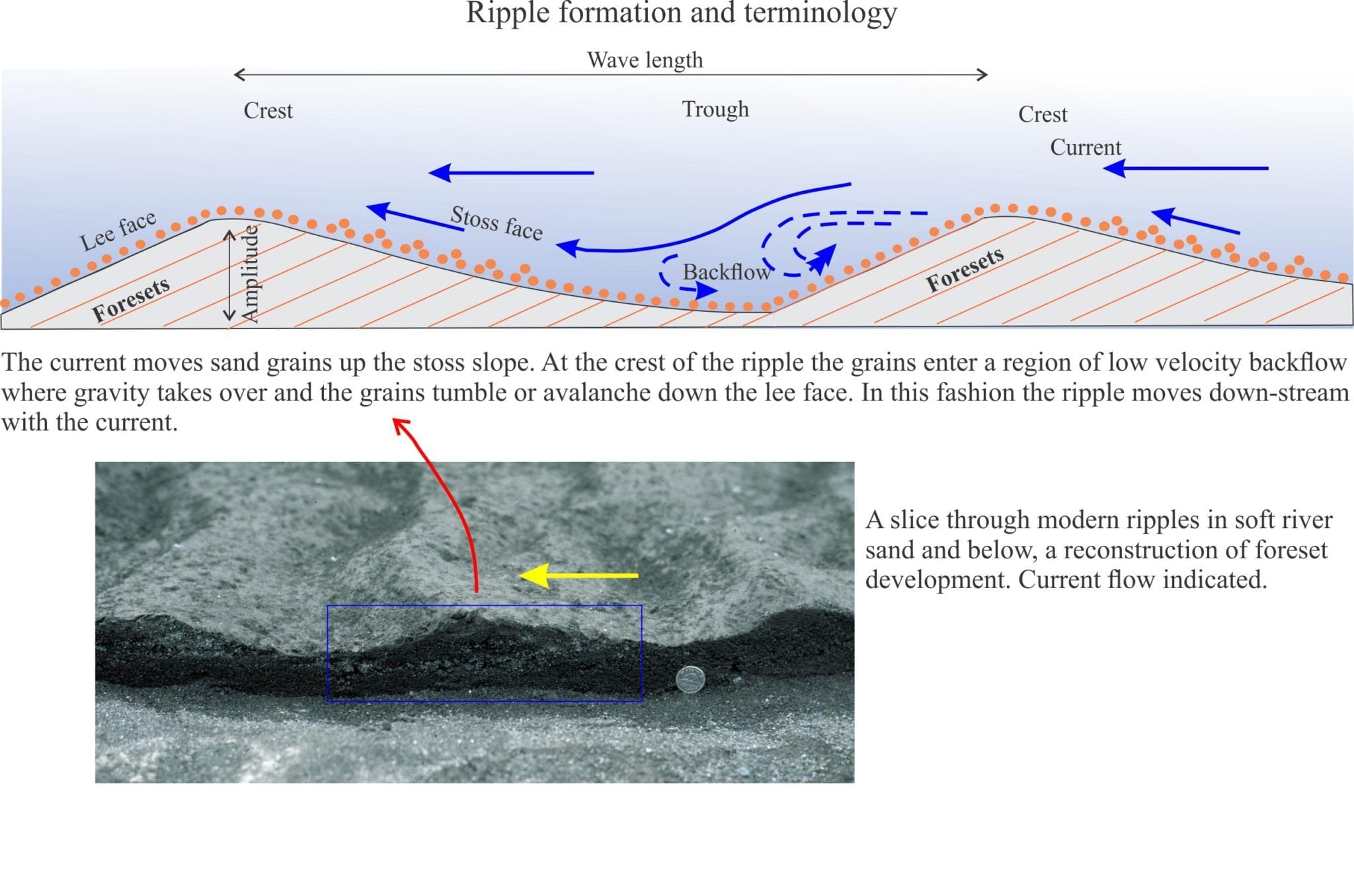
The first four diagrams show some basic sediment descriptors and terminology, and a typical stratigraphic column drawn from outcrop data. These are your starting points for describing and interpreting sedimentary rocks and sedimentary structures in outcrop, hand specimen, and core.
A few references on published sedimentary structure atlases and glossaries
J.C. Harms, 2003. Primary Sedimentary Structures. Annual Review of Earth and Planetary Sciences v. 7(1):227-248
A.W. Martinius and J.H. Van den Berg. 2011. Atlas Of Sedimentary Structures In Estuarine and Tidally-Influenced River Deposits of the Rhine-Meuse-Scheldt System. Their Application to the Interpretation of Analogous Outcrop and Subsurface Depositional Systems EAGE Publications. Available for download
We introduce some basic hydraulics of sediment movement, bedforms and the concept of Flow Regime.
Ripples and dunes form when a fluid (usually water or air) flows across a sediment surface. Structures formed by air flow are called subaerial ripples or dunes; those in water have the qualifier subaqueous. These structures are given the general name bedform. The construction of bedforms requires certain conditions:
– The sand must be cohesionless (i.e. grains do not stick together).
– Flow across the sediment surface must overcome the forces of gravity and friction, and
– There is a critical flow velocity at which grain movement will begin; this also depends on the mass of individual grains, and to some extent their shape.
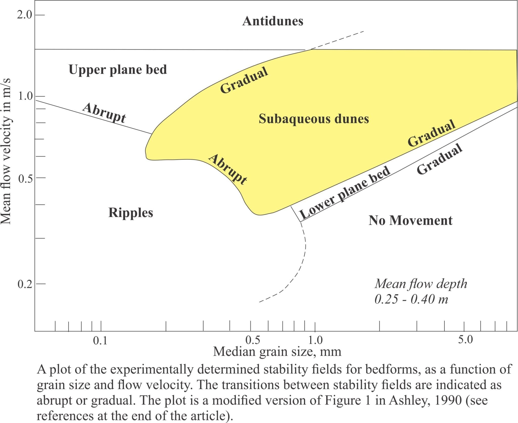
Ripples and dunes form under a relatively limited range of flow conditions. We can illustrate this in a graph of flow velocity against grain size, plotting areas on the graph that correspond to bedform growth. Most of the data for plots like this are derived from flumes where experimental flow conditions can be monitored closely. The plotted distribution shows that bedforms can be categorized according to flow and sediment conditions. This partitioning of bedforms was used to construct the Flow Regime hydraulic model, first published in the now classic 1965 paper by J.C. Harms & R.K. Fahnestock and used widely ever since.
The Flow Regime model considers three fundamentally different states of flow:
No bed movement where there is too little energy in the system to initiate and maintain sand grain movement,
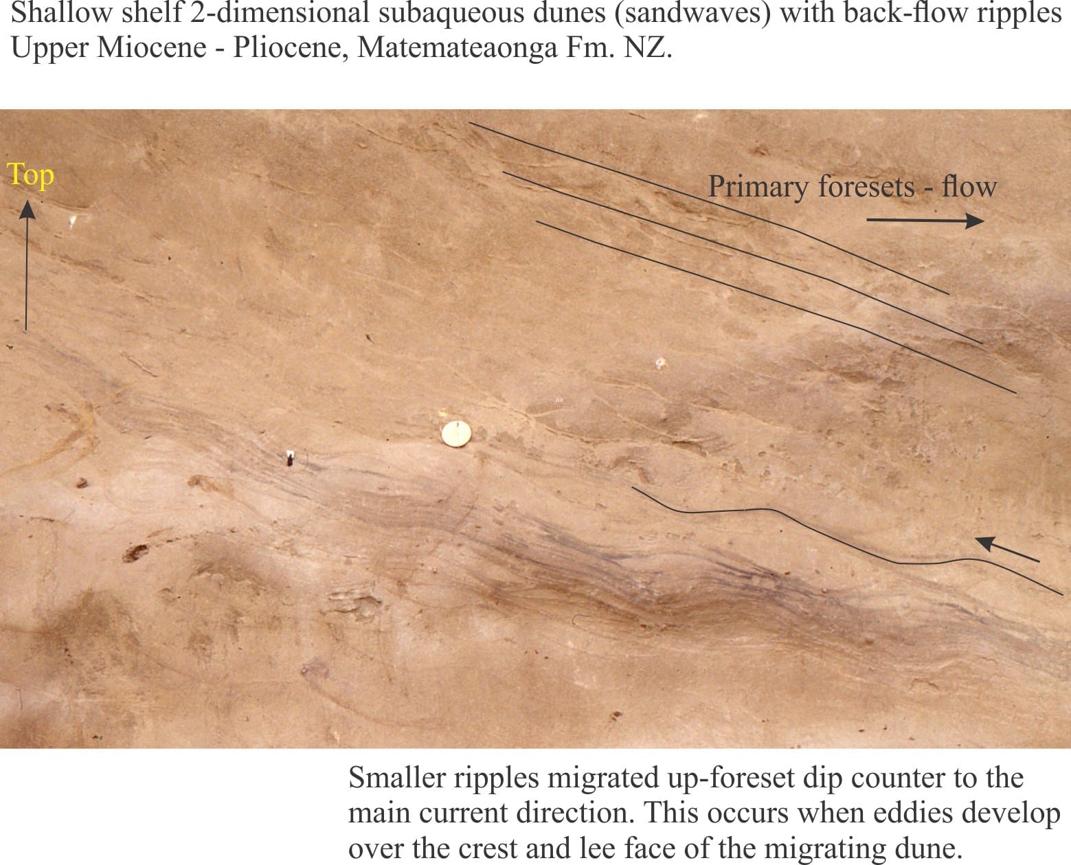
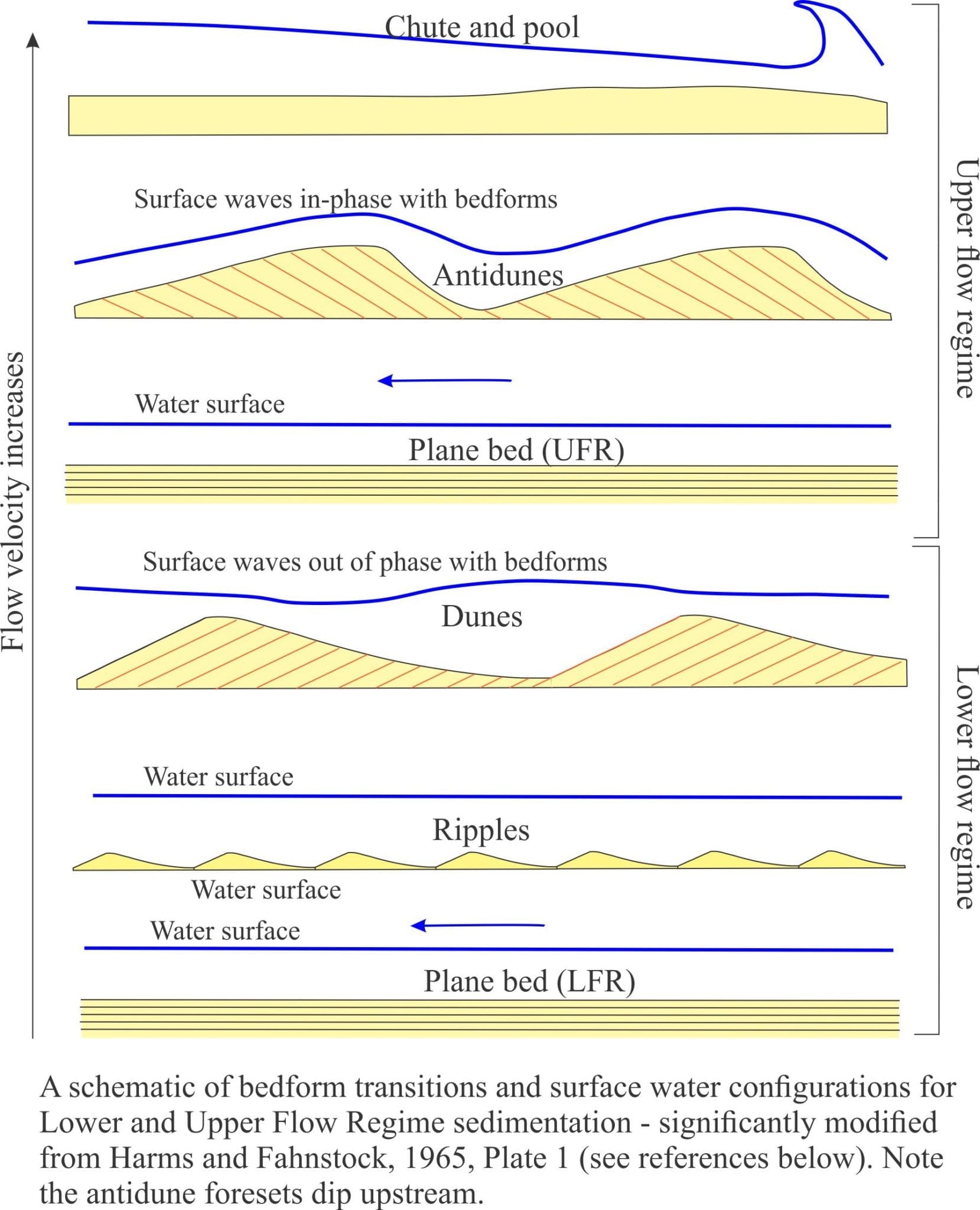
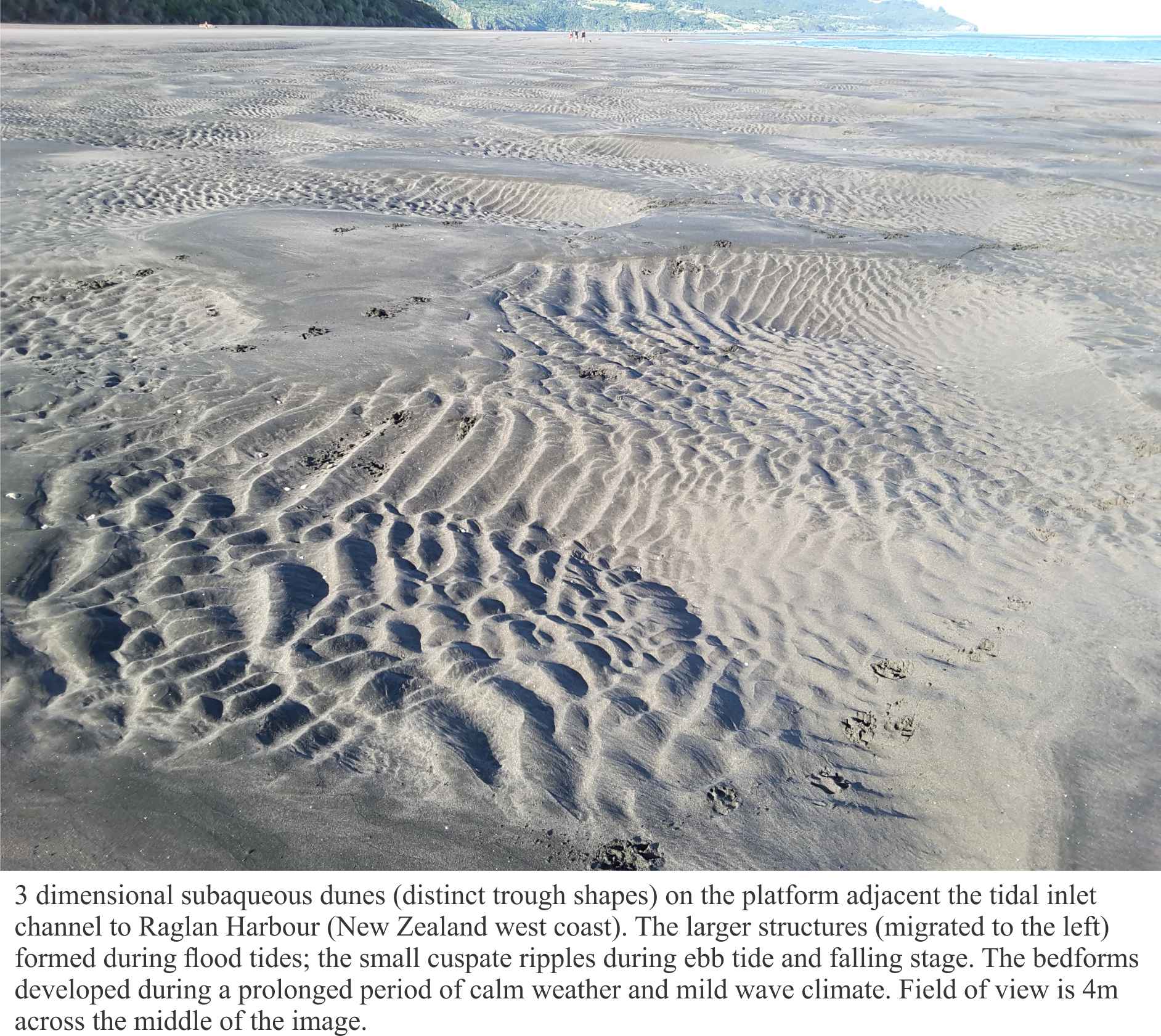
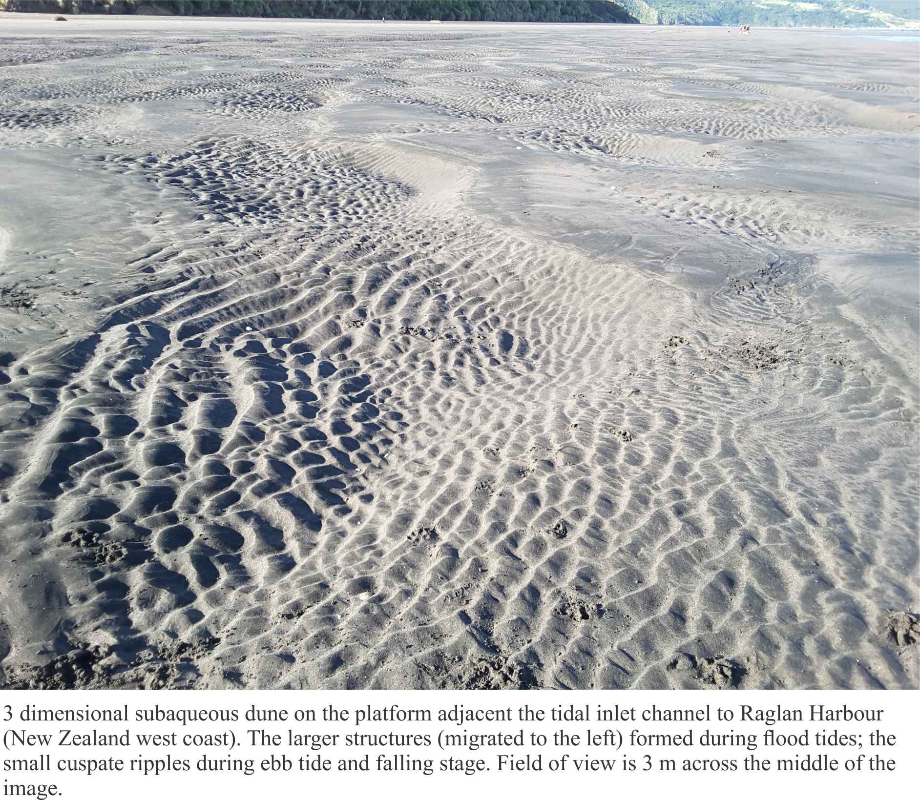
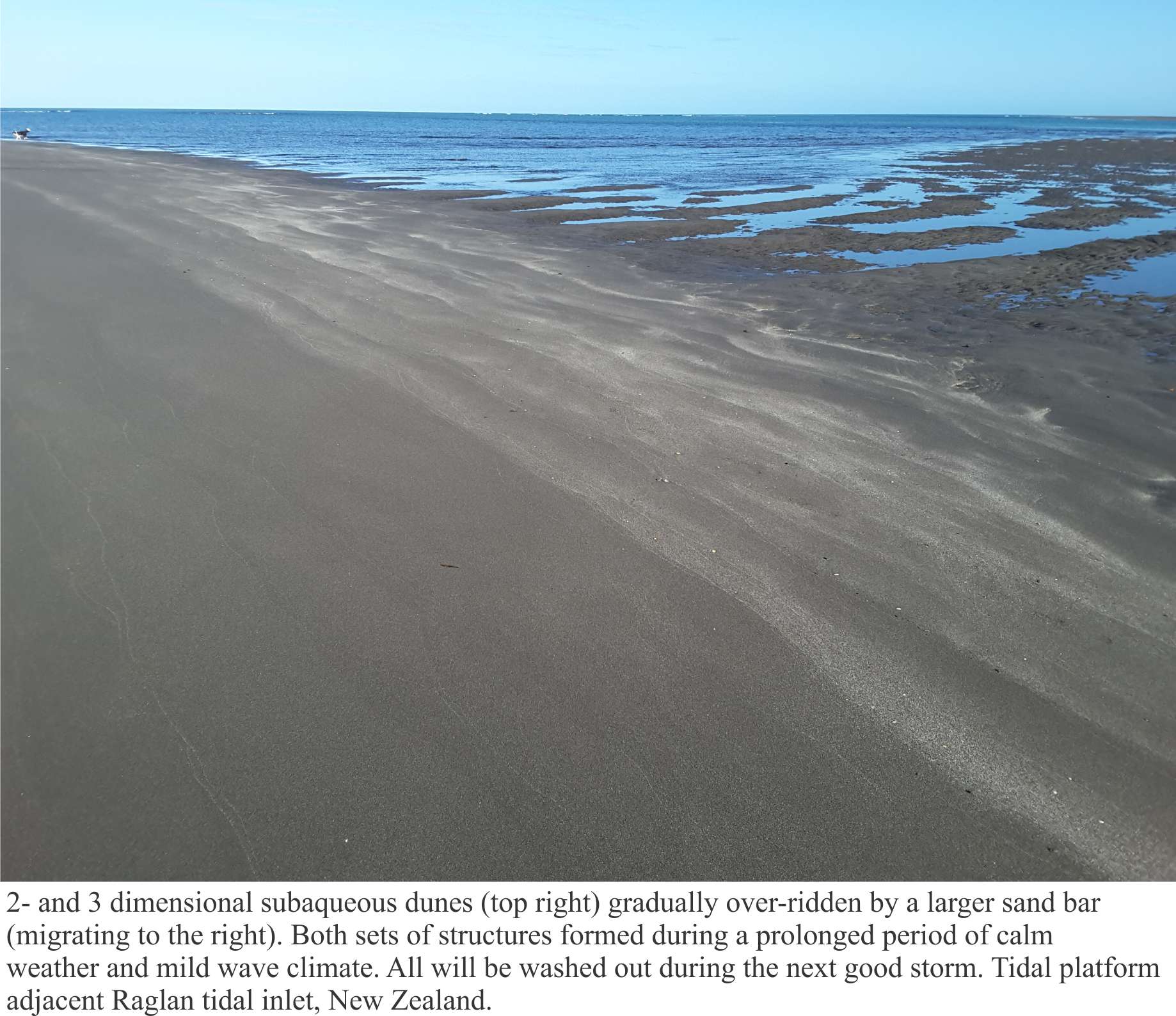
A Lower Flow regime in which all common bedforms develop. Here, plane bed (basically parallel, planar laminae with no ripples) represents the lowest velocity, or energy conditions where sediment movement is initiated. It has been observed in flumes and in natural channels that the size of bedforms increases from ripples to large subaqueous dunes in concert with flow velocity. Dune type also changes from two dimensional structures (straight crests and planar crossbed bounding surfaces), to three dimensional structures that have sinuous, arcuate and lunate outlines and spoon or scour-shaped bounding surfaces (commonly seen as trough crossbeds).
An Upper Flow Regime where the power of stream flow washes out ripples and dunes, replacing them with plane bed (this kind of plane bed commonly has parting lineations), plus antidunes, and erosional chutes and pools.
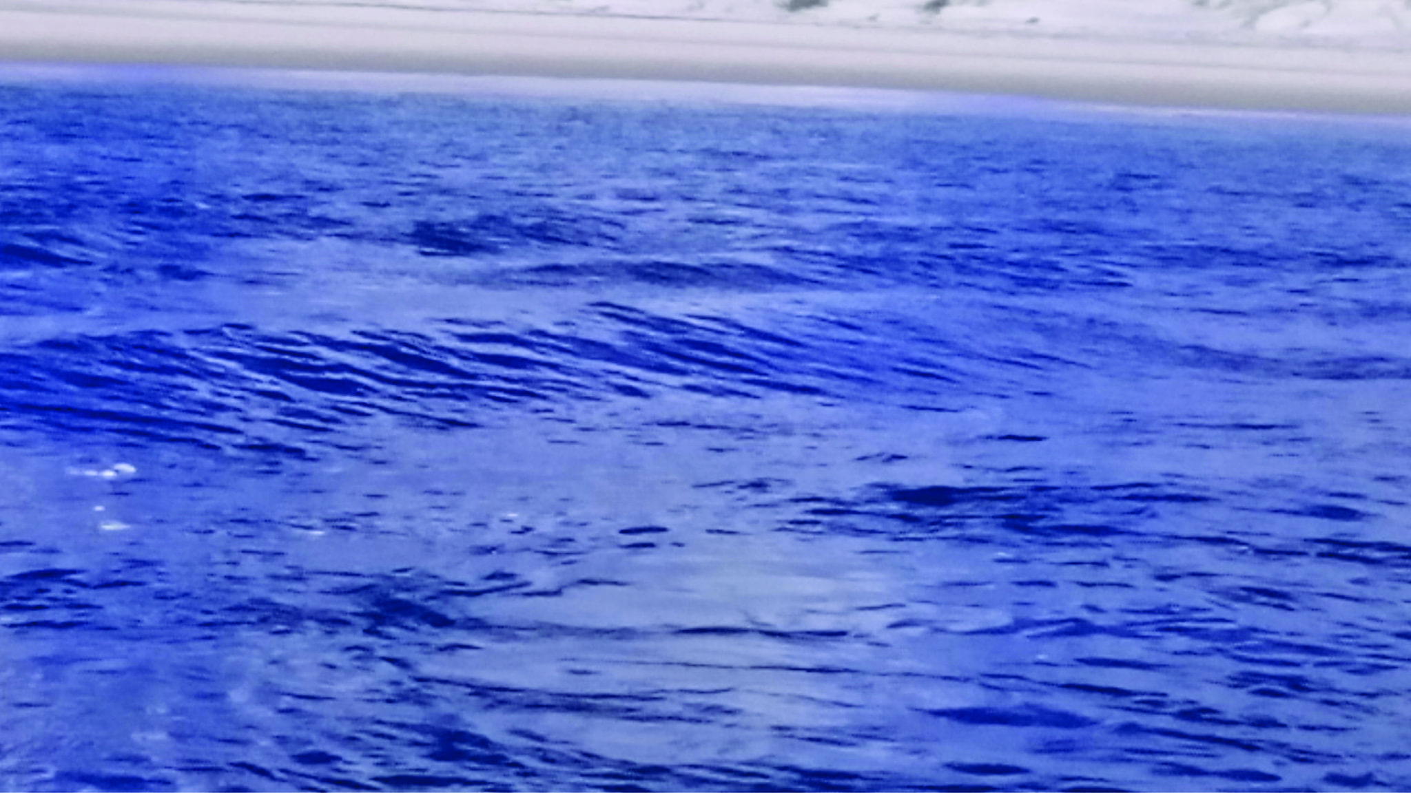
As stream flow increases the transition from Lower to Upper flow regime produces one of the more interesting bedforms – antidunes. They are mostly found in shallow channels (e.g. fluvial and tidal channels). You can recognize that this transition has taken place when you see standing surface waves – watch closely and you will see the waves migrate upstream. Antidunes are the bedforms that develop immediately below standing waves (the two are in-phase). If high flow is maintained, the antidunes will also migrate upstream. However, once flow slackens they tend to wash out; the preservation potential of antidunes is low.
The example above shows standing waves in a tidal channel on an out-going tide. Tidal flow is to the left; standing wave migration is to the right (Mangawhai Heads, North Auckland).
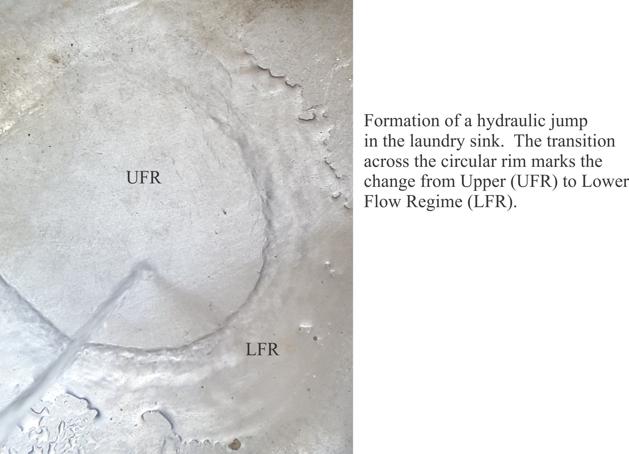
Hydraulic jumps: The transition from Lower to Upper flow regime passes with a change in bedform, in particular washing out of subaqueous dunes, but there is no sudden break in surface flow – the transition is reasonably smooth. This is not the case for an Upper to Lower flow regime transition that is marked by an abrupt increase in water level and turbulence – a hydraulic jump. Hydraulic jumps can be thought of as standing waves. They are caused by a reduction in Upper Flow Regime velocity, a change in stream-bed gradient or water depth, or combinations of all three.
You can generate a hydraulic jump in your kitchen or laundry sink, so long as the sink floor is reasonably flat. Turn on the tap until you see a flow pattern like the one in the image above. Flat laminar flow is generated by the downward force of tap water – this is the plane bed. The hydraulic jump is located where the flow changes abruptly, with an increase in surface amplitude. Beyond the jump is lower flow regime flow.
We can use the Flow Regime concept in the field as a quantitative indicator of changes in paleoflow in time (i.e stratigraphically) and space (laterally). For example, a stratigraphic sequence that shows a layer of ripples overlain by a layer of trough crossbeds indicates that flow velocities, and hence stream power increased abruptly. What kind of paleoenvironment might this have occurred in? This is one of the central questions for any sedimentological analysis.
Here are a couple of important references:
Ashley, G.M. 1990. Classification of large-scale subaqueous bedforms: A new look at an old problem. Journal of Sedimentary Petrology, v.60, p. 160-172.
Harms, J.C. and Fahnestock, R.K. 1965. Stratification, bed forms, and flow phenomena (with an example from the Rio Grande). S.E.P.M. Special Publication 12, p. 84-115.
This collection of images spans the shallowest marine environments including beach, lagoon-bay with all the associated environments such as sand-spits and barrier-bars, tidal flats, estuaries and coastal dunes. Where possible I have paired modern analogues with ancient examples.
The Atlas, as are all blogs, is a publication. If you use the images, please acknowledge their source (it is the polite, and professional thing to do).
This link will take you to an explanation of the Atlas series, the ownership, use and acknowledgment of images.
Click on the image for an expanded view, then ‘back one page‘ arrow to return to the list
The images:
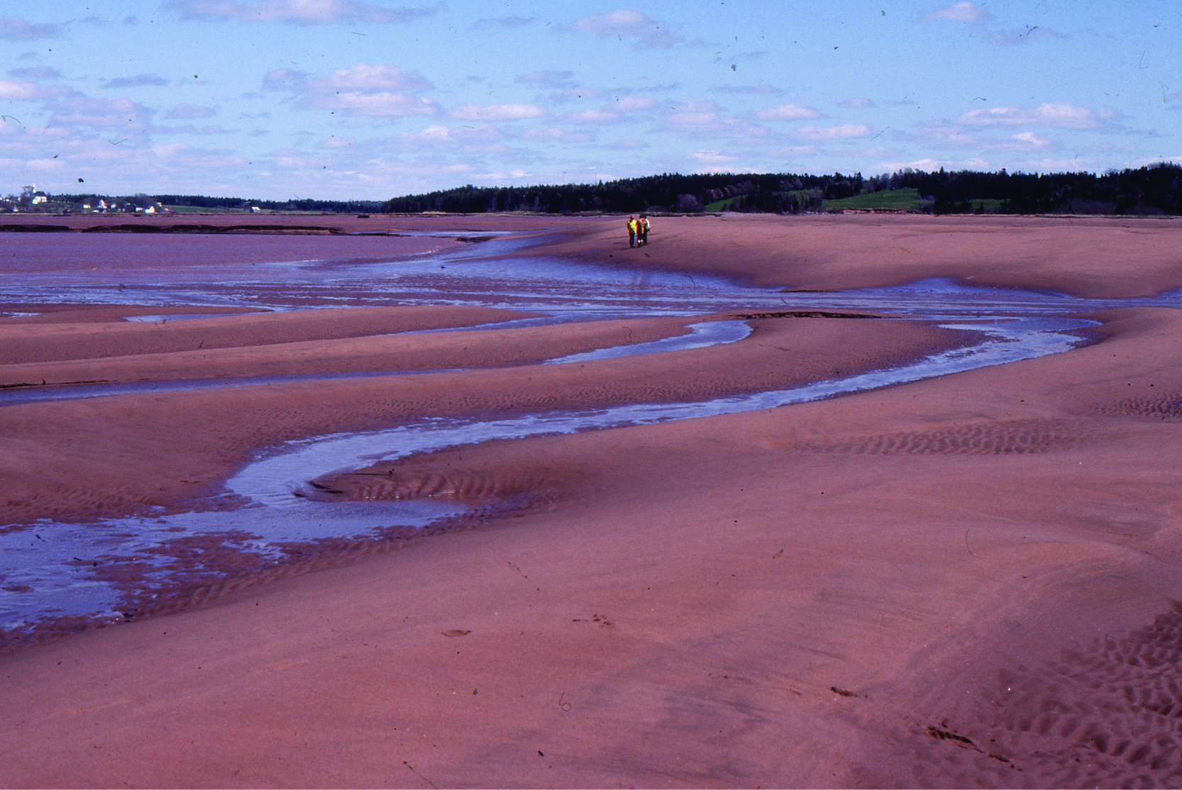
Tairua estuary, east coast Coromandel Peninsula, New Zealand. Two images taken during falling tide, exposing attached and semi-detached sand-shell bars. The main channel is at bottom of each image.
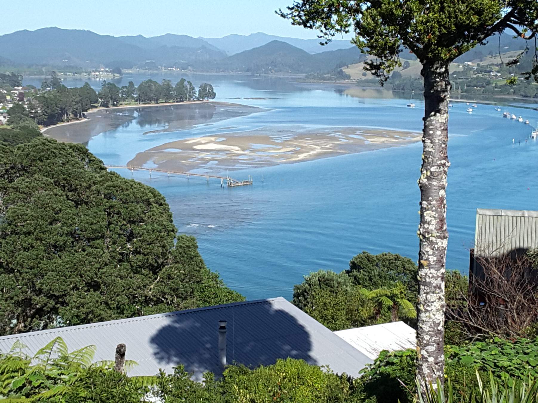
Raglan ebb tidal delta, bedforms on the platform attached to the permanent shoreface
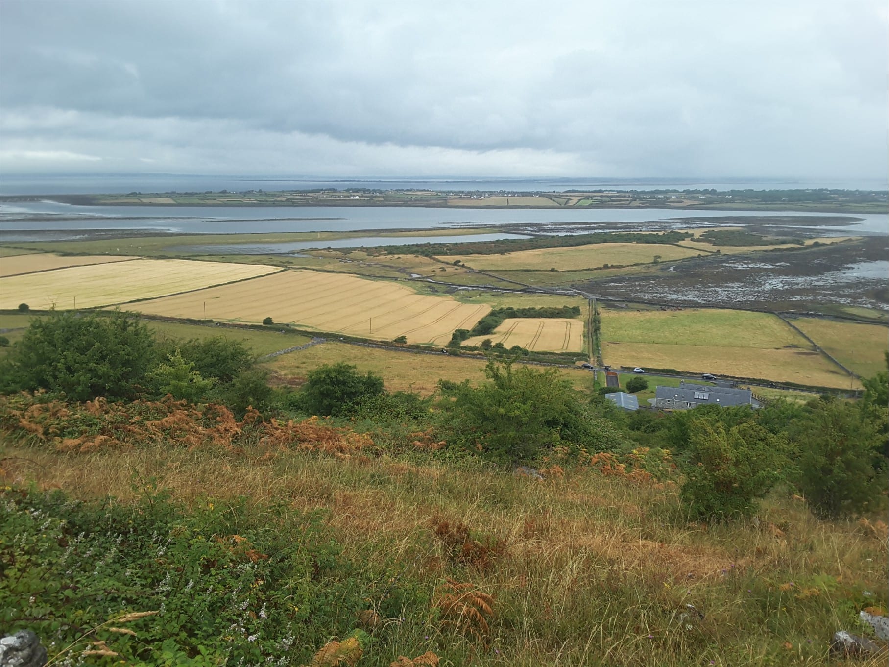
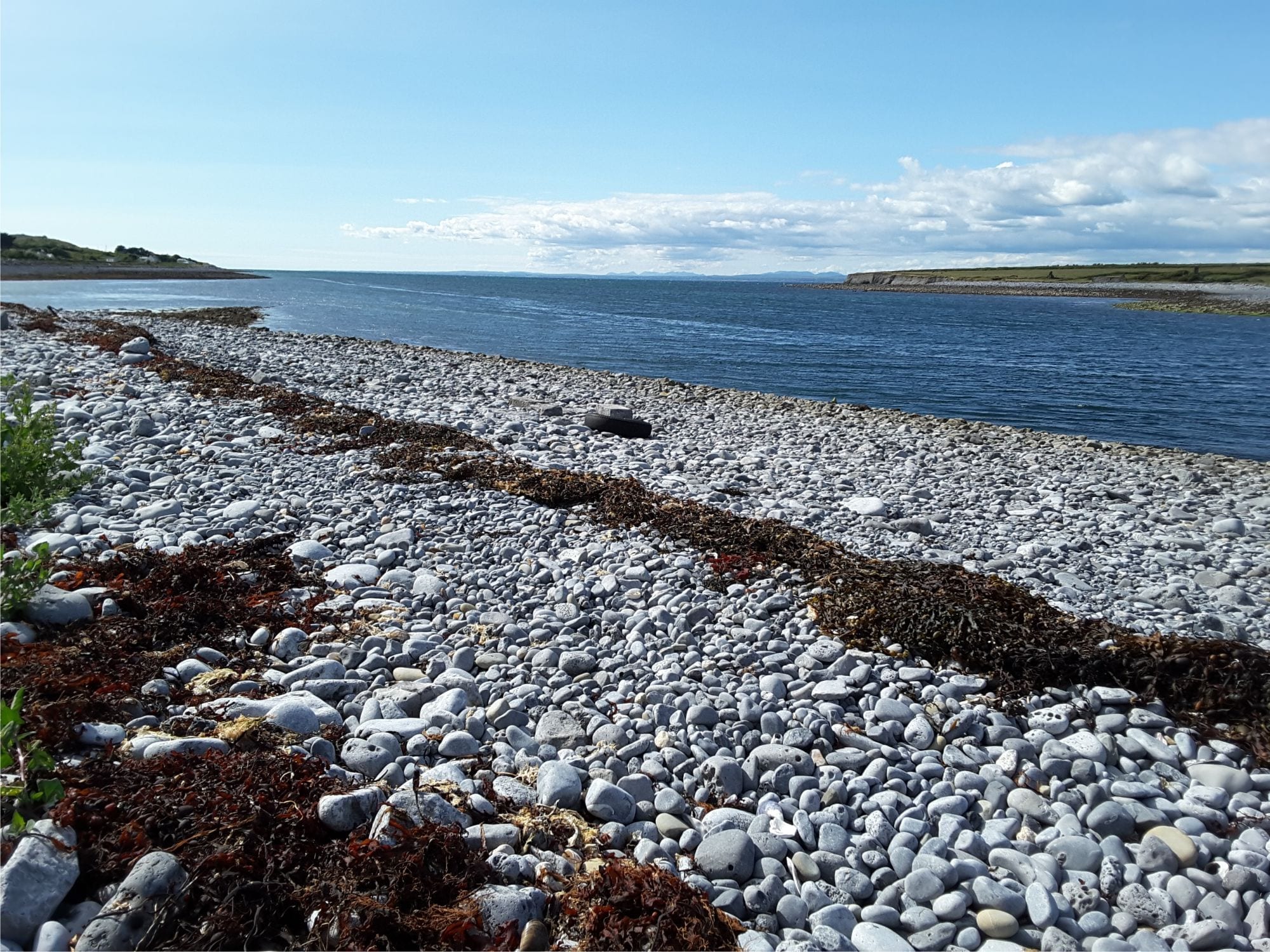
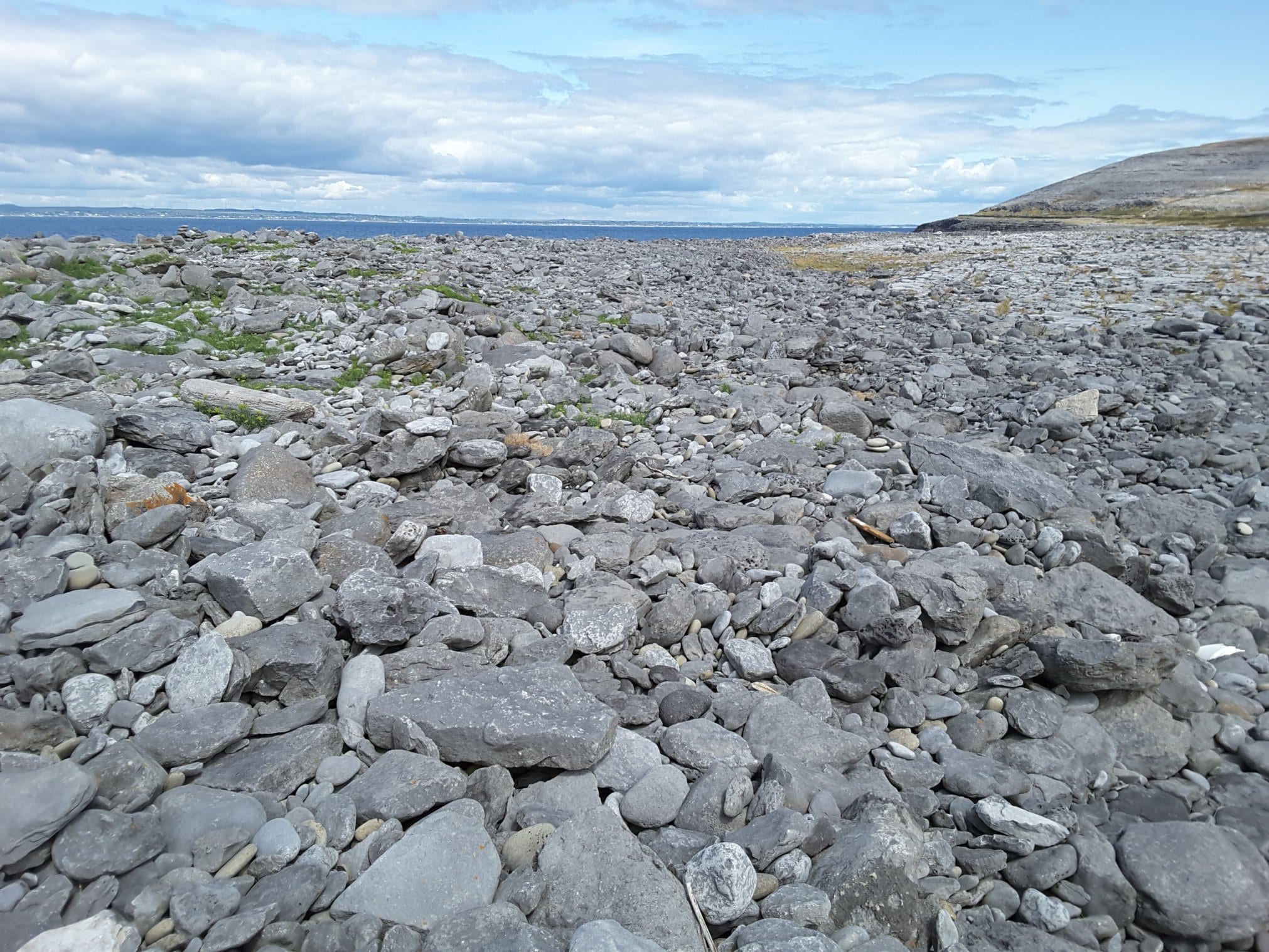
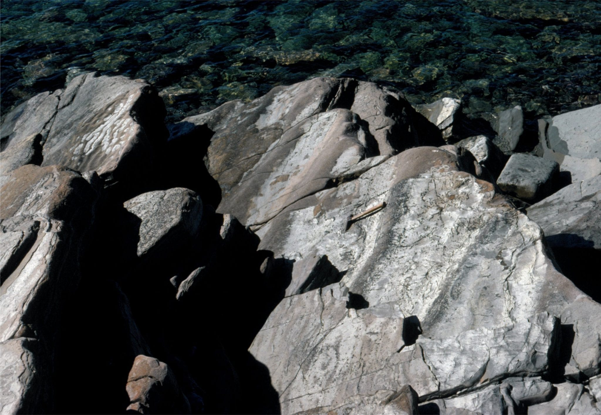
The estuary on the south side of Galway Bay, County Clare, Ireland, near New Quay. The boulder-cobble beach consists almost entirely of Burrens limestone (Carboniferous). Left view from Abbot Hill.
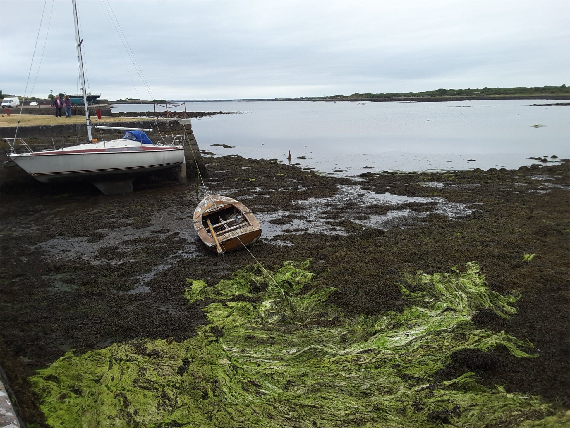
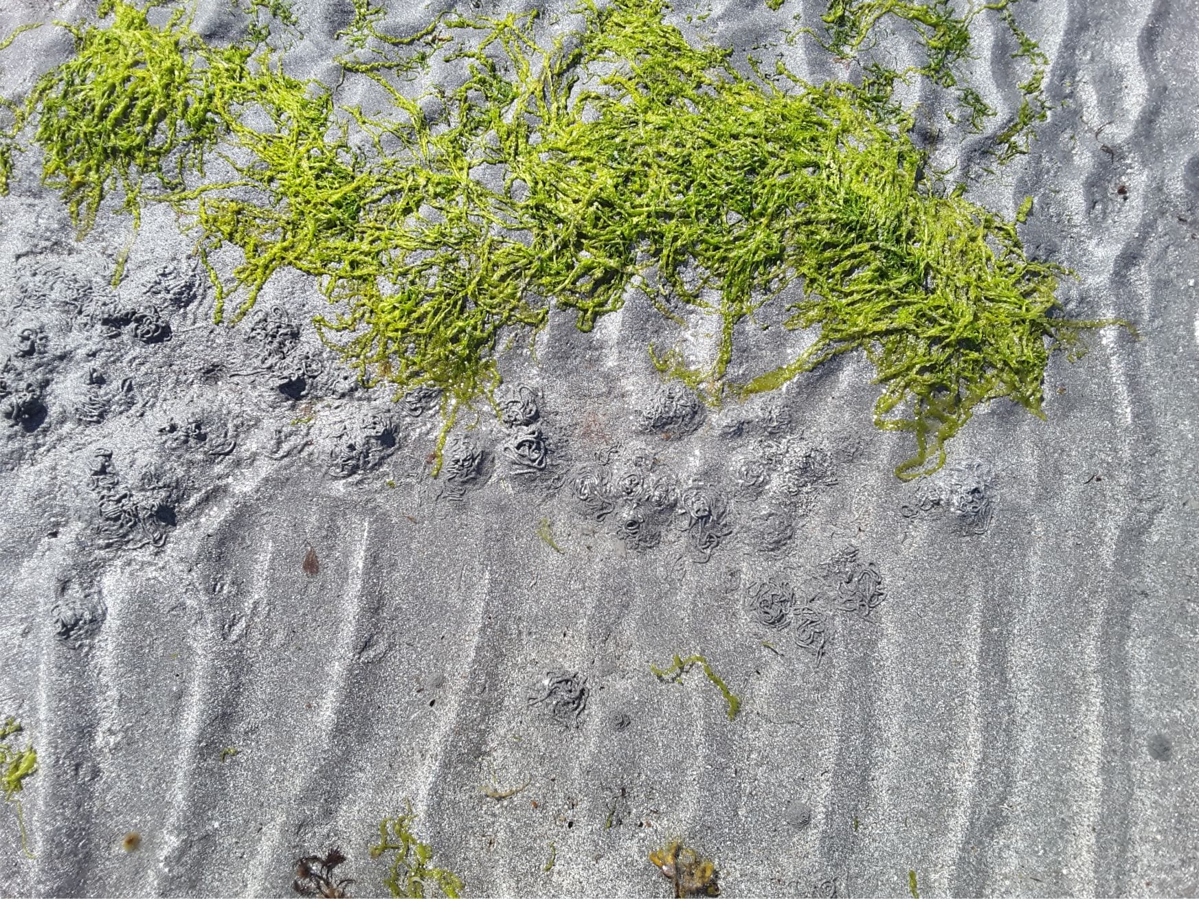
Mudflats and algae, Kinvara, at the head of the estuary, south side Galway Bay.
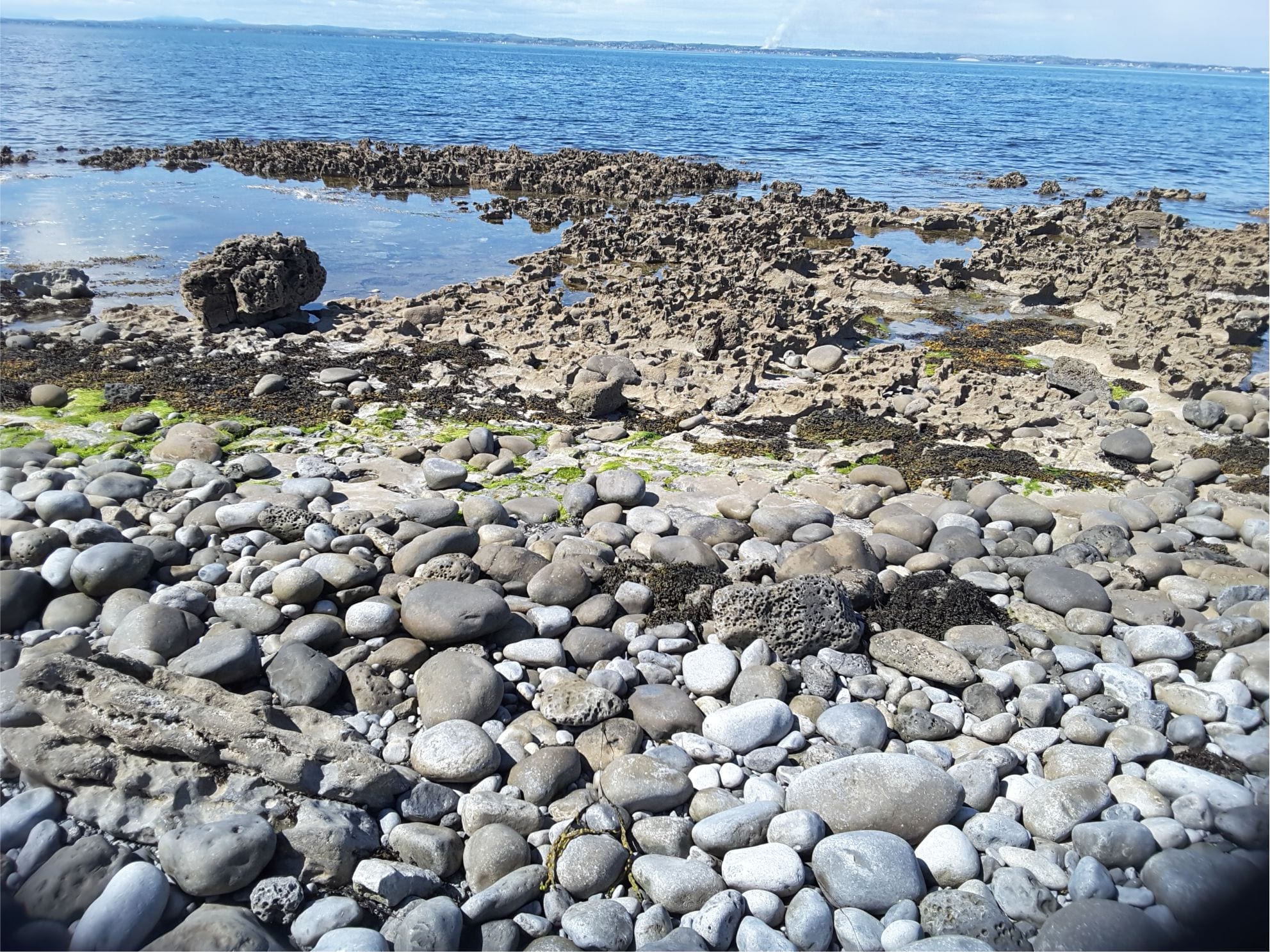
Karst in Burren Limestone at Flaggy Shore, New Quay, County Clare, has been accentuated by salt corrosion and mechanical erosion. It is overlain by boulders of locally derived Carboniferous limestone
Boulder storm ridge at Black Head, County Clare – the heart of the Burrens. All boulders are locally derived Carboniferous limestone
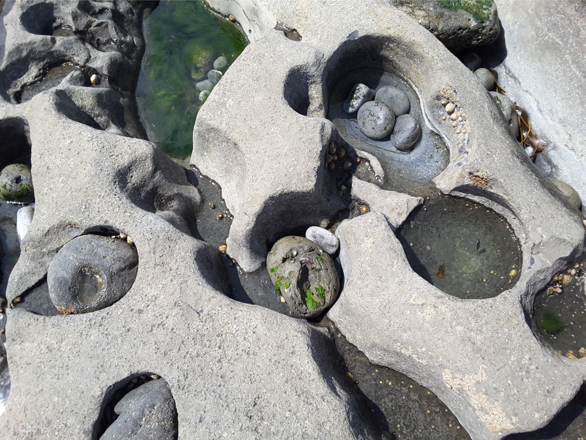
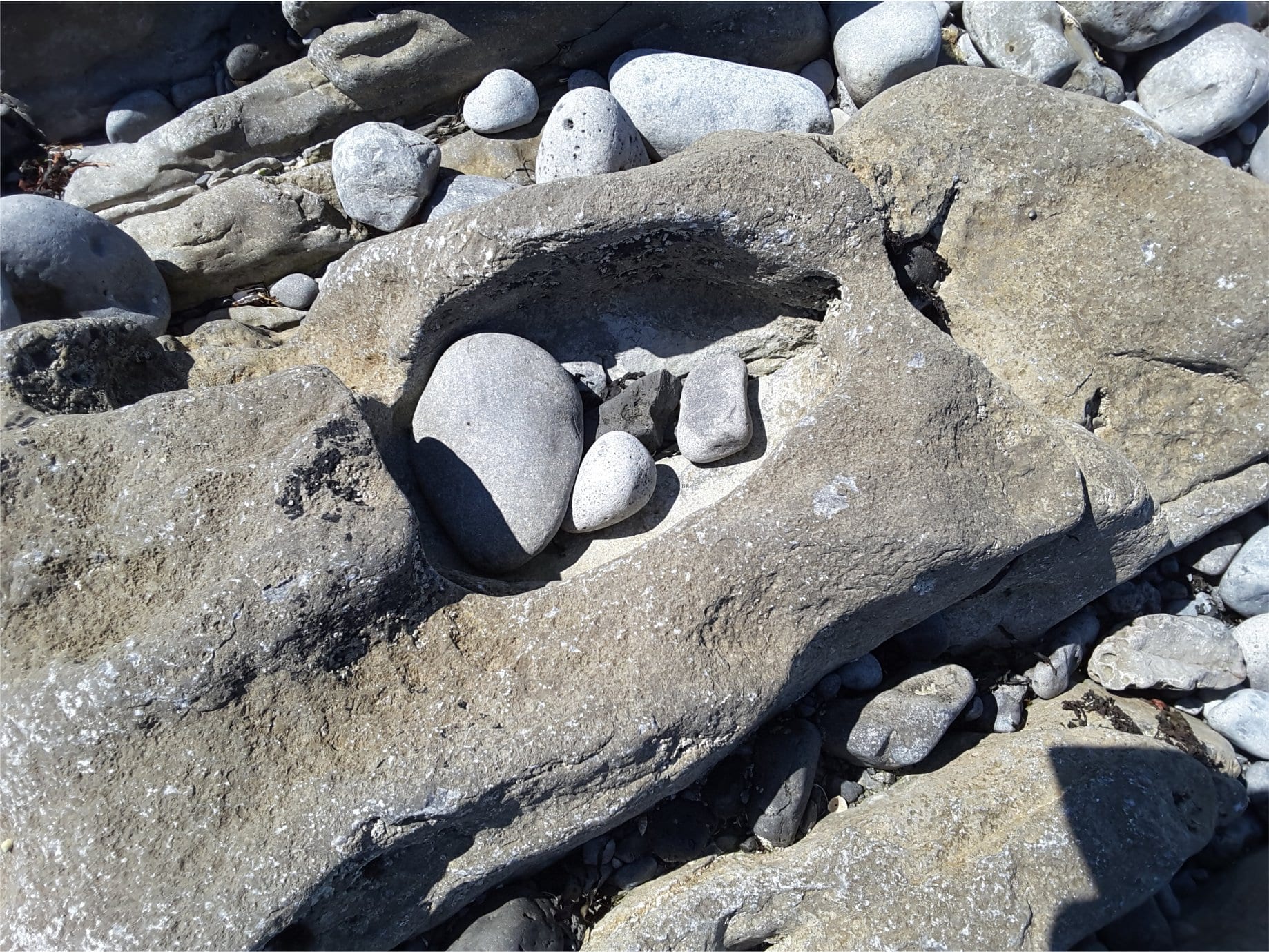
Potholes in Burren Limestone, Flaggy Shore, County Clare.
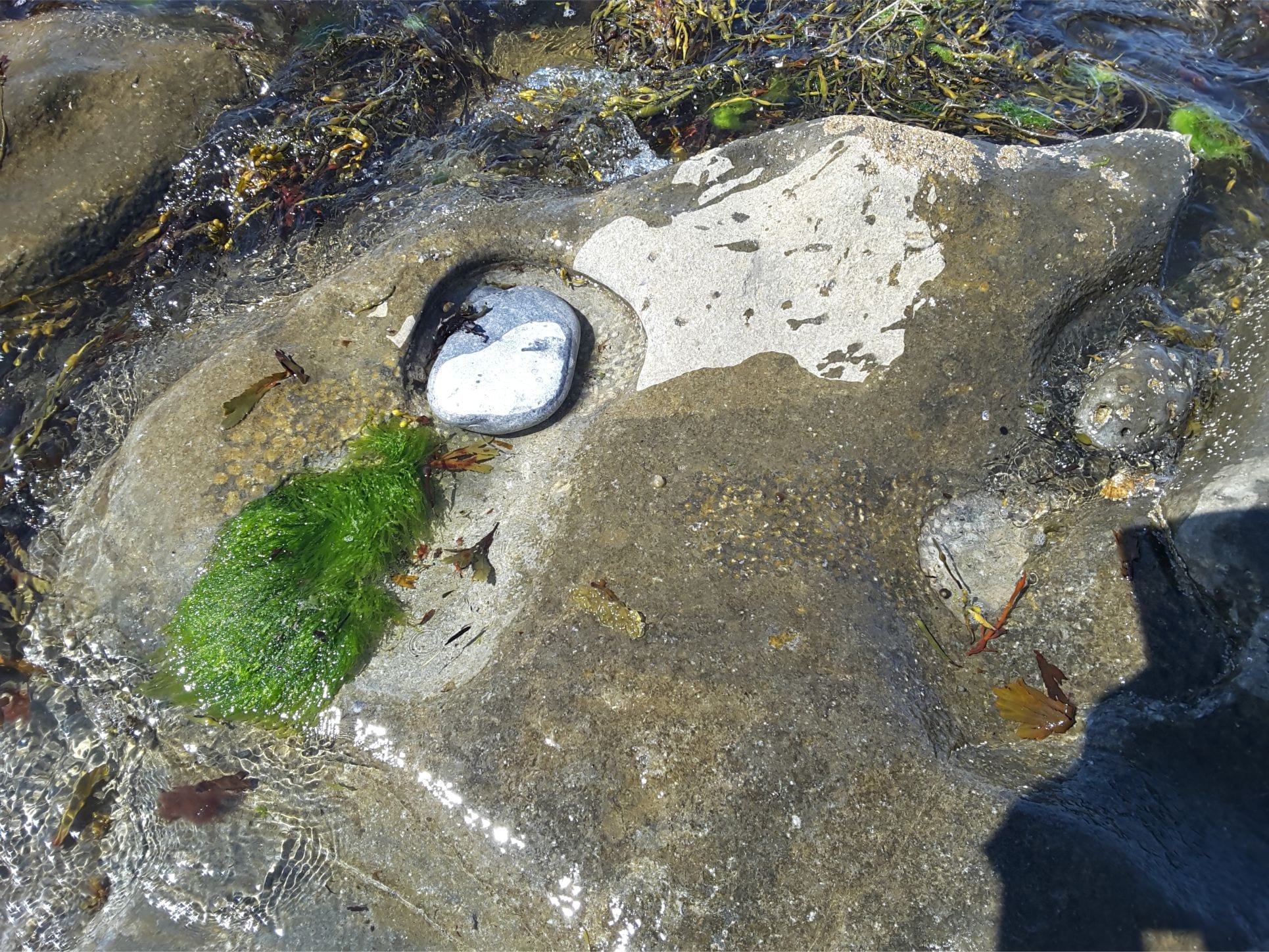
Sea grass, ripples, and burrow excavations in a tidal pool, Flaggy Shore, County Clare
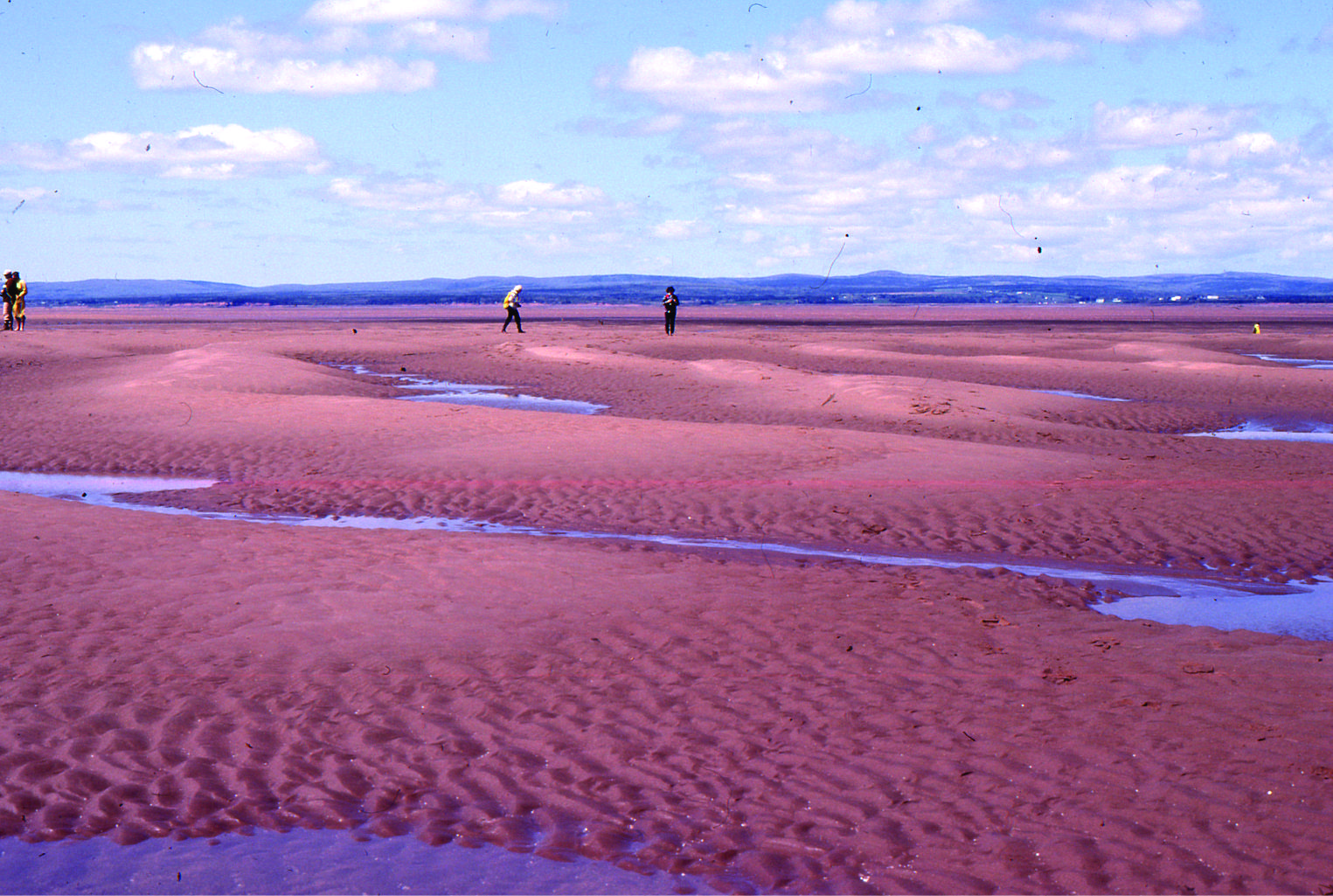
Large, 2D dunes, intertidal Minas Basin, Fundy Bay
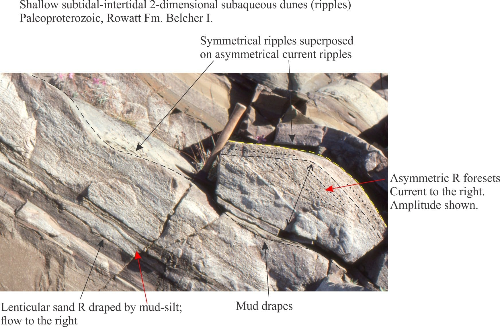
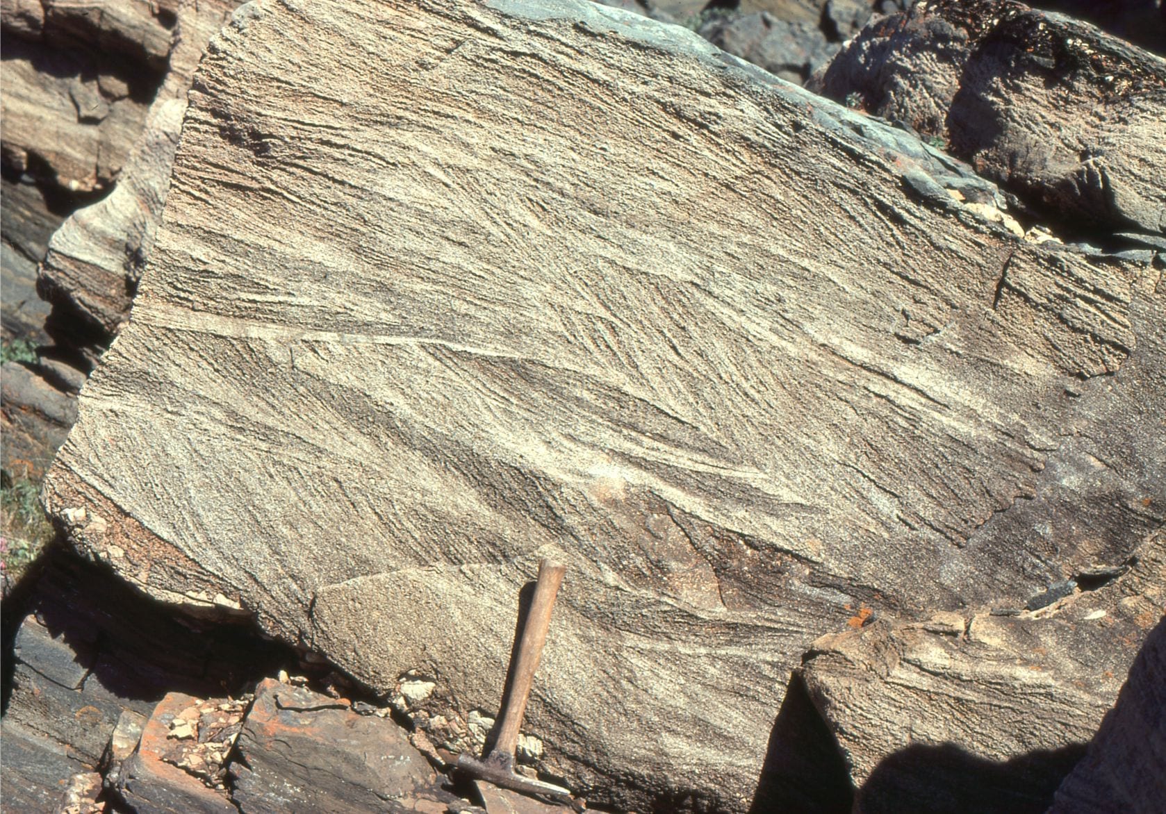
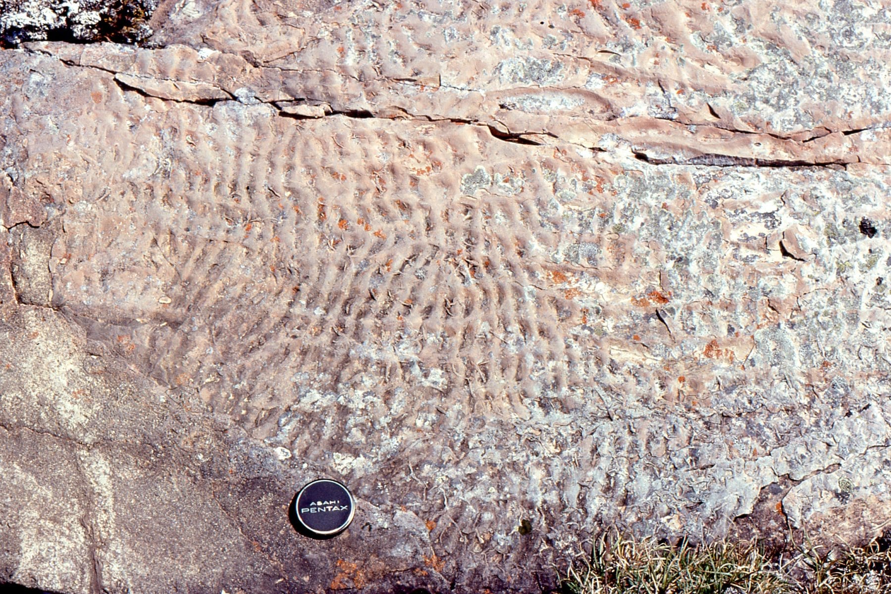
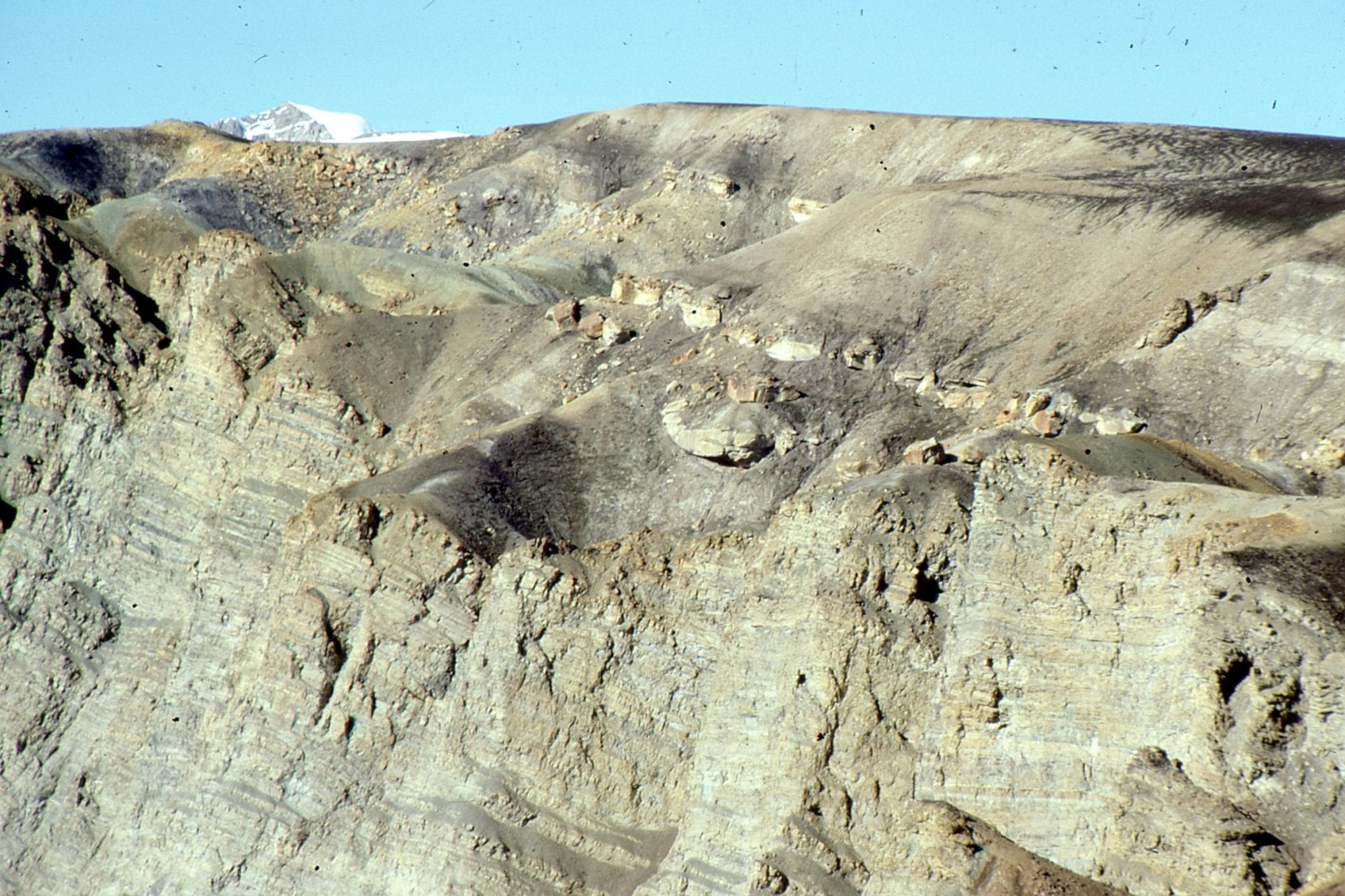
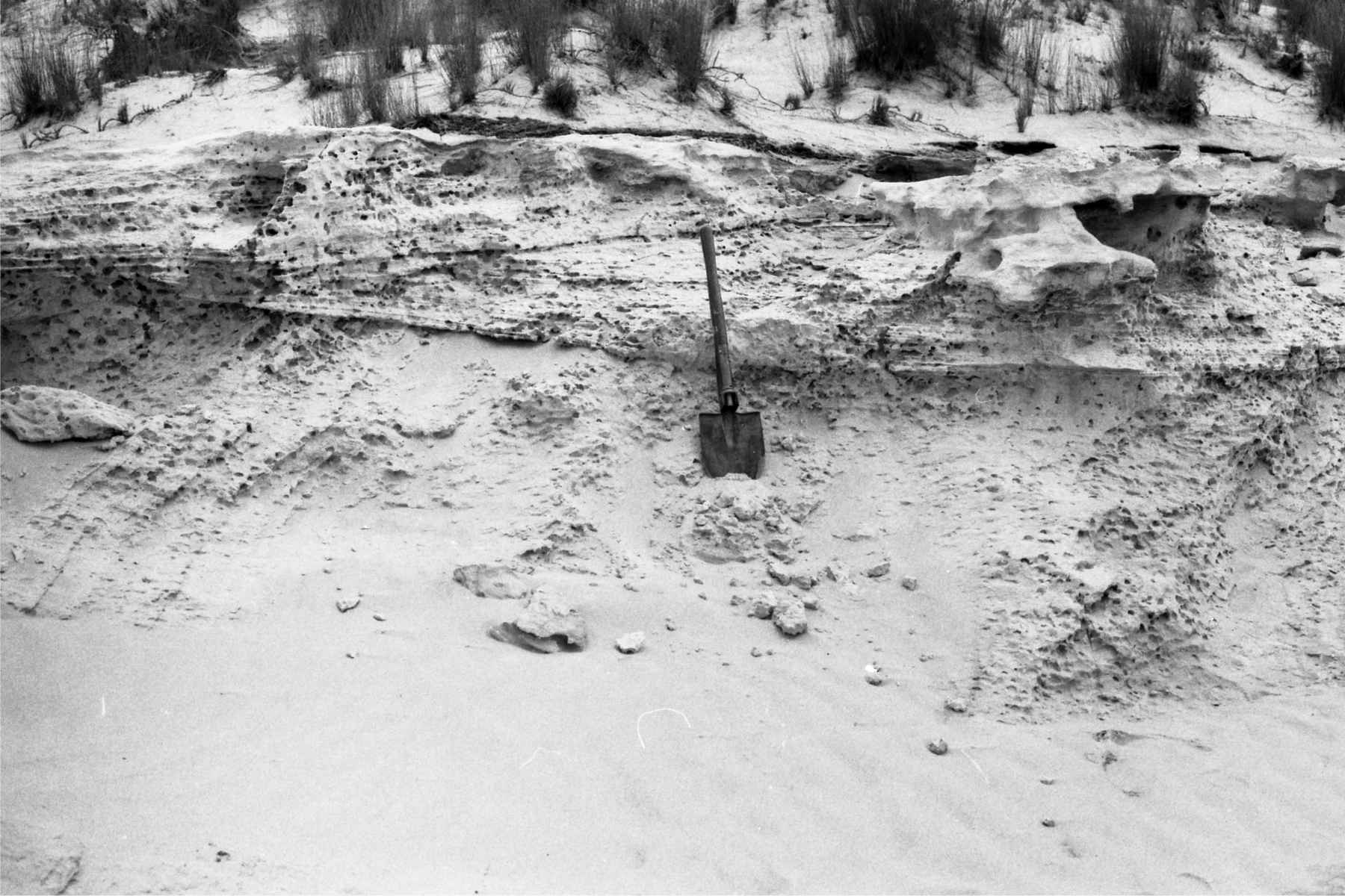
Shallow subtidal to intertidal, 2D subaqueous dunes, Rowatt Fm, Belcher Islands (Aphebian, about 2 billion years old). Hammer for scale.
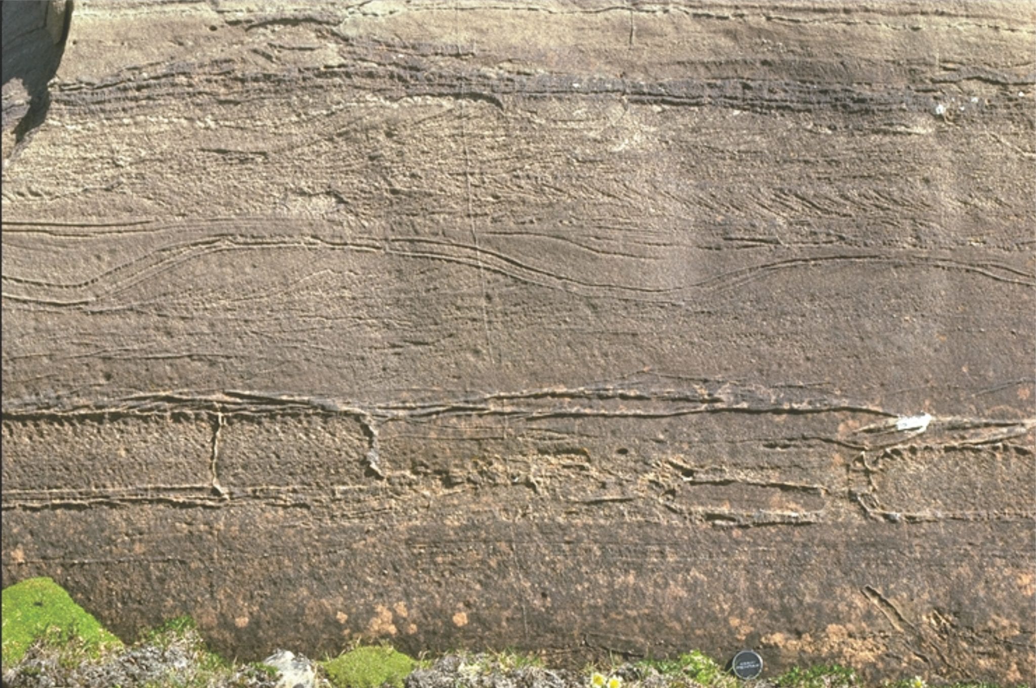
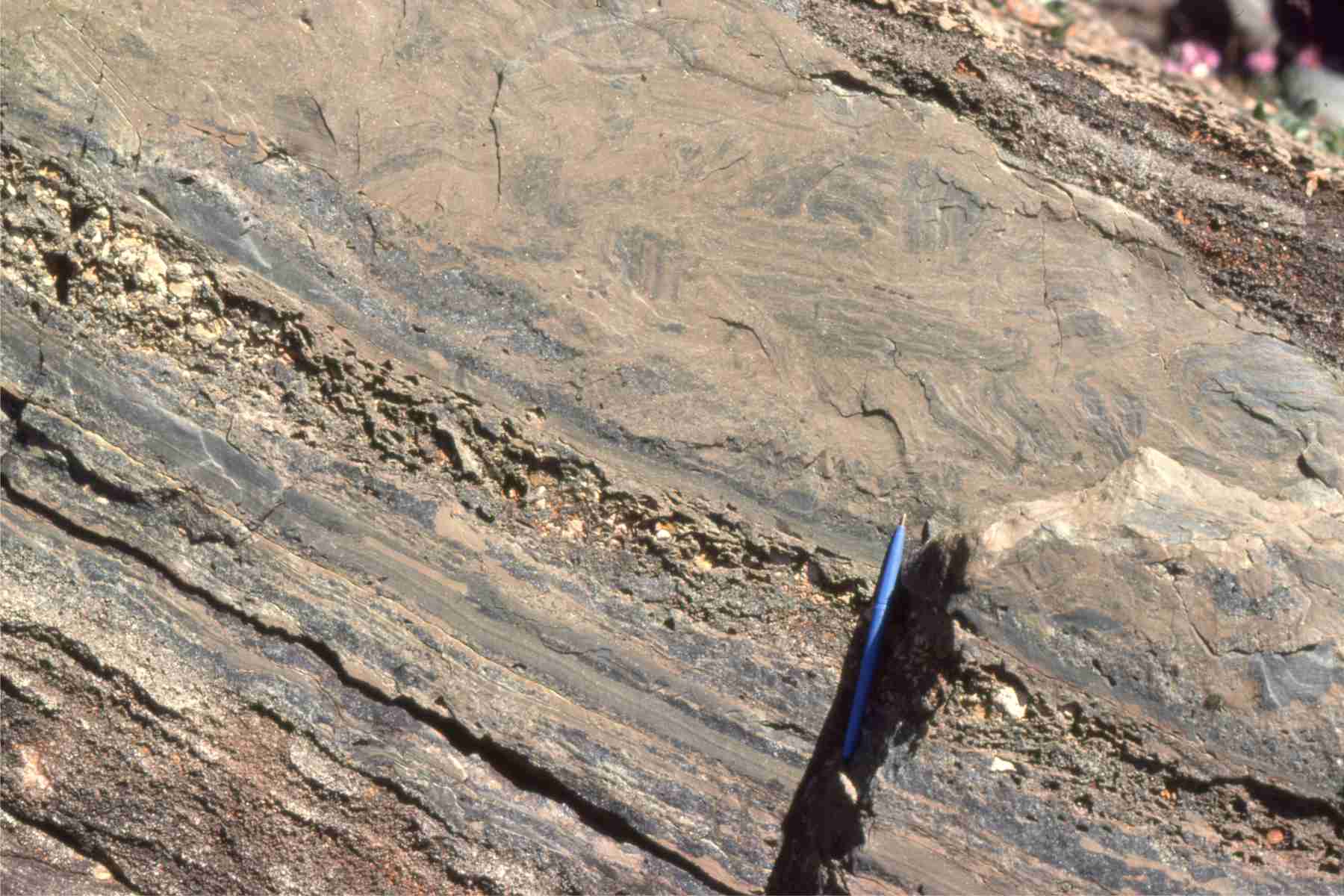
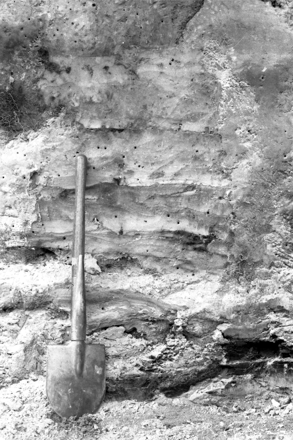
Cross-sectional view of 2D subaqueous, intertidal dunes, showing complex migrating dune-formed crossbedding, and dune reactivation, Rowatt Fm, Belcher Islands (Aphebian, about 2 billion years old). The sands are mixed siliciclastic-carbonate (dolomite).
Reactivated 2D dunes with superposed ebb tide ripples, Minas Basin, Fundy Bay
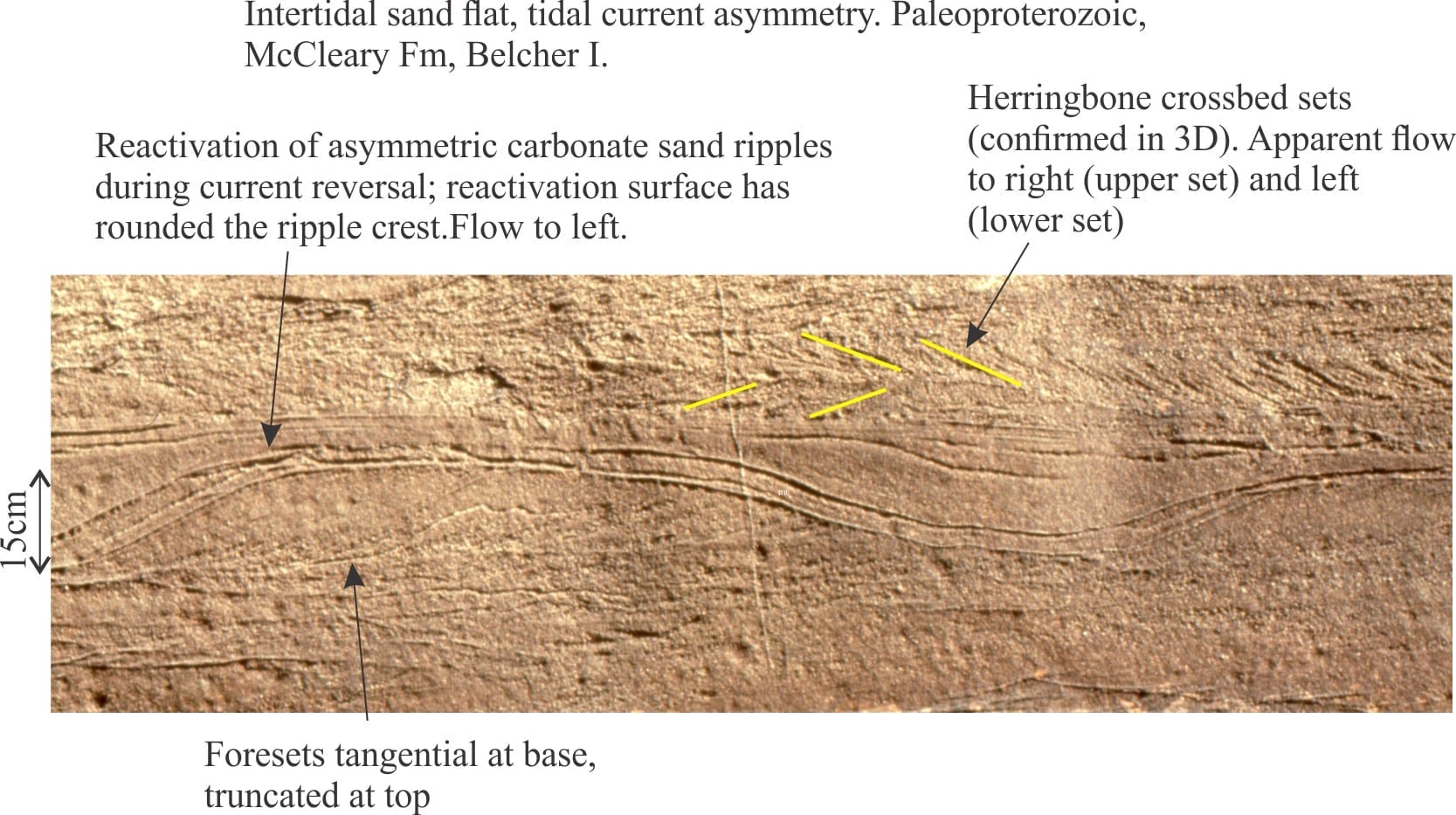
Proterozoic tidal inlet, showing cross-section of reactivated subaqueous dunes (mid image), possible herringbone crossbeds, and smaller ripples. Rowatt Fm, Belcher Islands (about 2 billion years old). Lens cap bottom right.
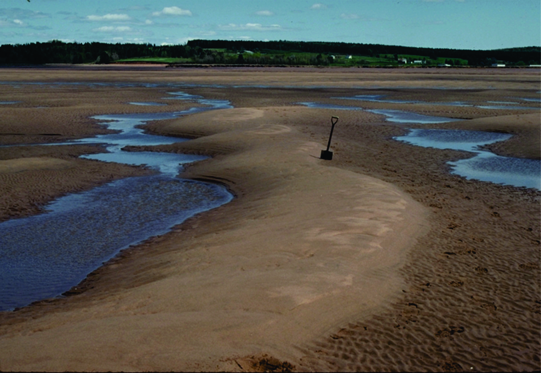
Multiple dune sets, intertidal, Minas Basin, Fundy Bay
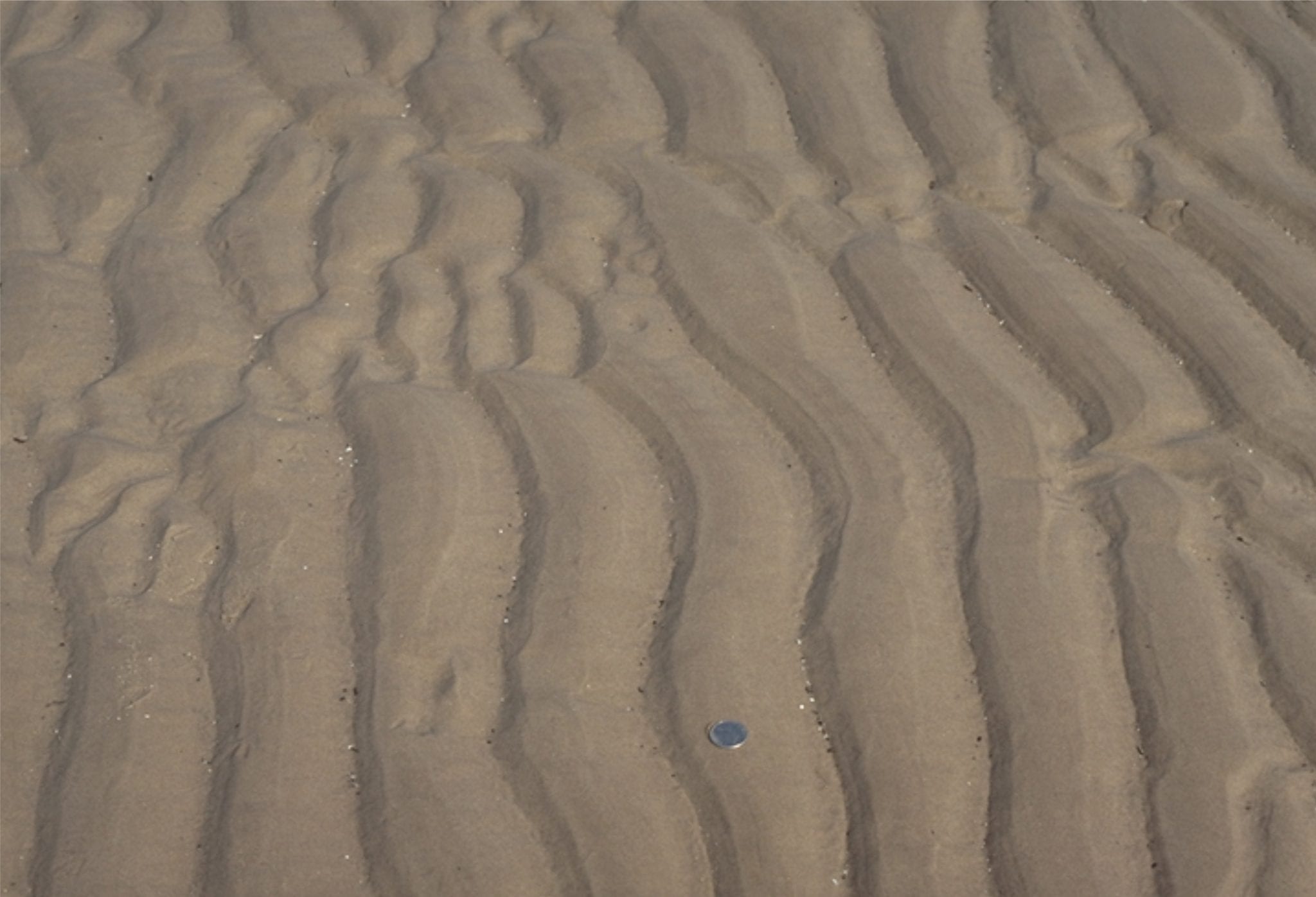
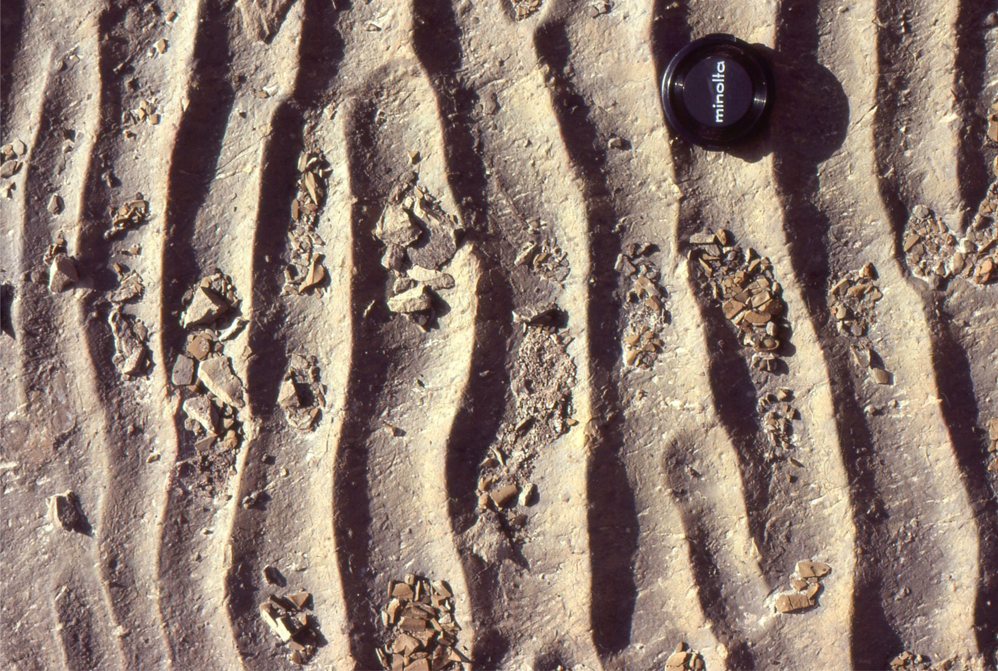
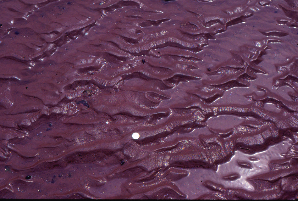
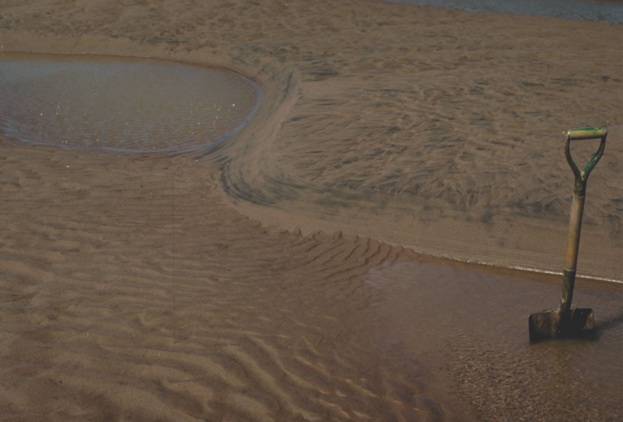
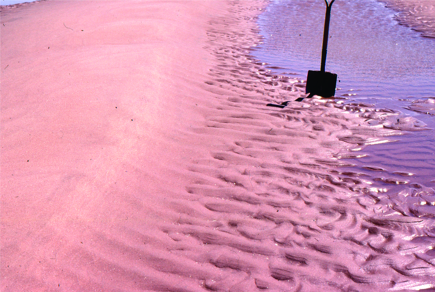
Sandy tidal flat ripples, Minas Basin, Fundy Bay
Paleocene, straight crested and bifurcating intertidal ripples, Expedition Fm, Axel Heiberg Is;and, Canadian Arctic
Straight-crested ripple train in Paleocene intertidal deposits, Expedition Fm, Axel Heiberg Island, Canadian Arctic. Hammer left-mid image.
Flood tide ripples over-ridden by smaller ebb tide ripples sets. Minas Basin, Fundy Bay
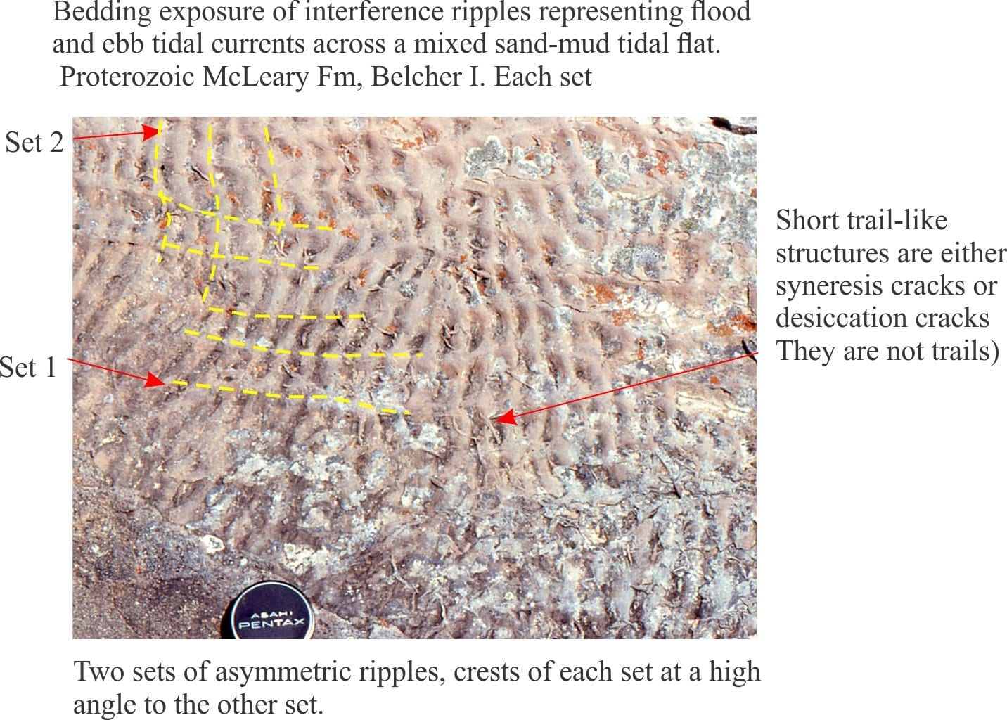
Interference ripples in Proterozoic tidal flat facies, Belcher Islands
Large 2D and 3D dunes, and superposed run-off ripple sets, Minas Basin Fundy Bay
Tidal flat, interference ripples, Minas Basin Fundy Bay
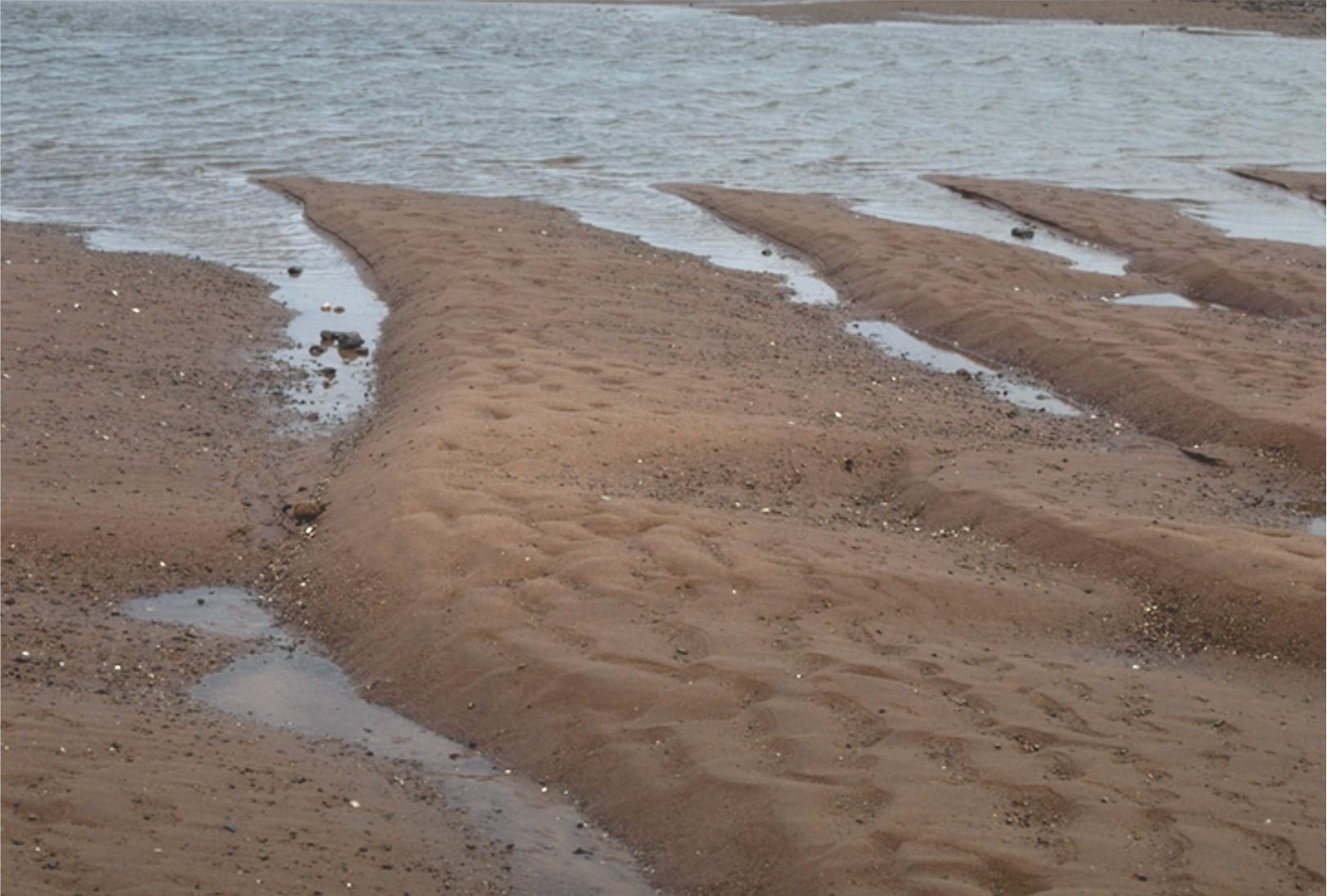
Ebb tide run-off & reactivation of 3D dunes, Minas Basin Fundy Bay
Large 3D dunes, Minas Basin Fundy Bay
2D flood tide dunes and small ebb tide ripples, Minas Basin Fundy Bay
2D and 3D intertidal dunes, Minas Basin Fundy Bay
Eroded salt marsh cycles, Minas Basin Fundy Bay
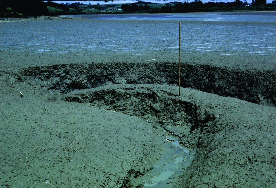
Small meandering tidal channel in very muddy estuarine tidal flats, Whitford Estuary, south Auckland. Bank failure is common.
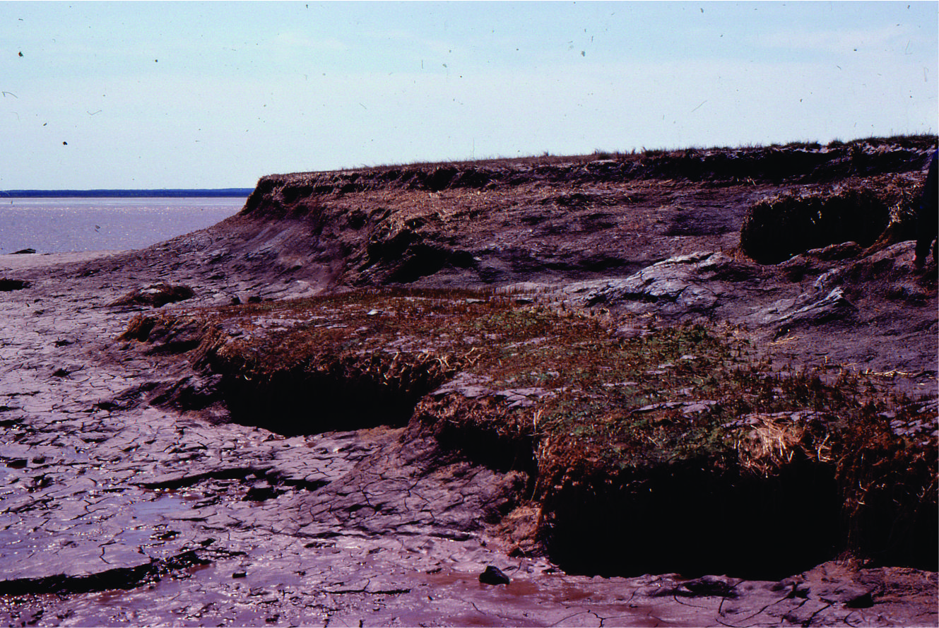
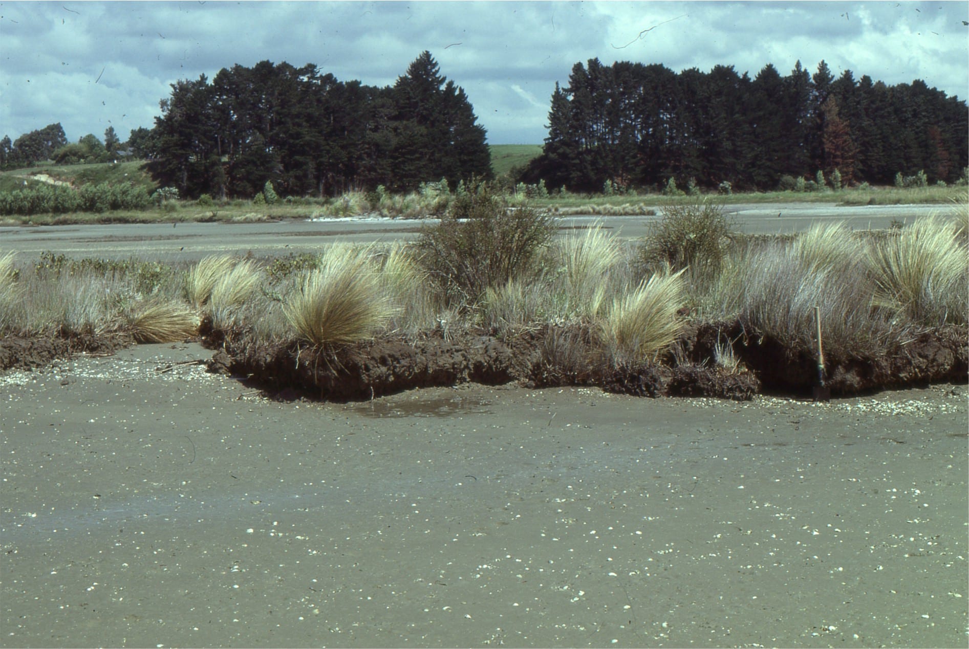
Salt marsh, sedges and small mangroves being transgressed and eroded by tidal flat. This is a modern example of a ravinement surface. Whitford, south Auckland
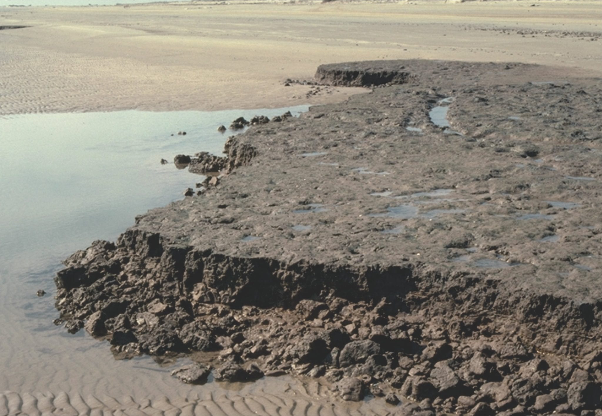
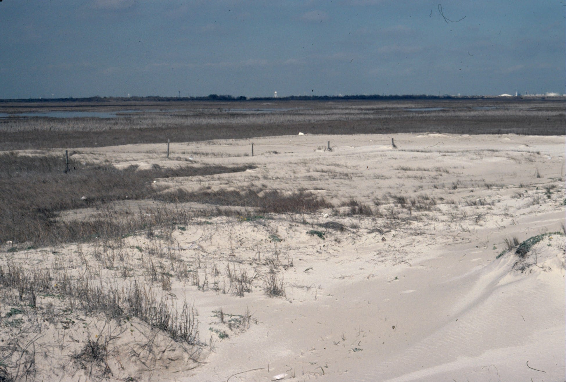
Eroded salt marsh deposits, transgressed by sandy tidal flat – beach. The erosion surface is a modern, active ravinement surface. Galveston, Texas.
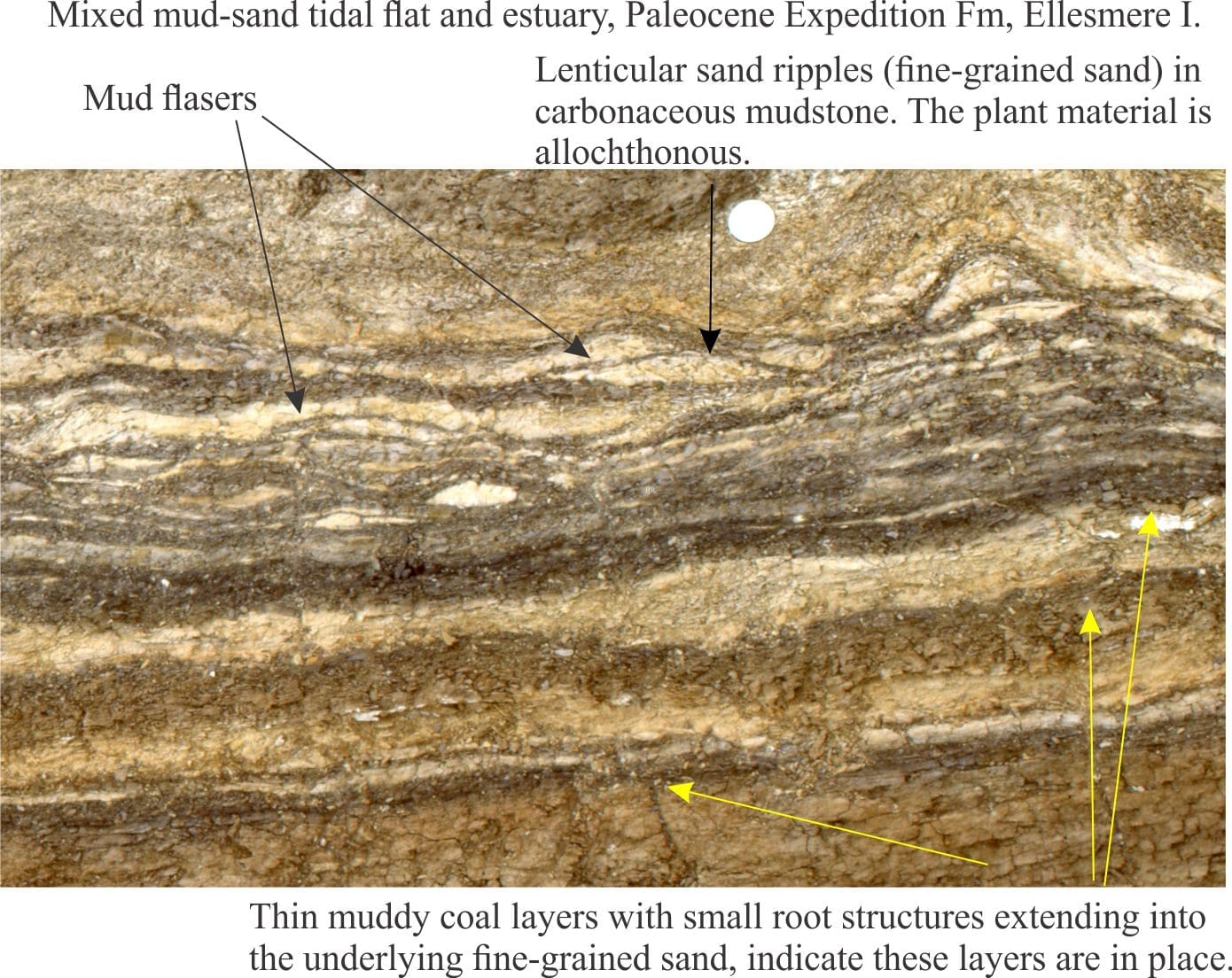
Two examples of Paleocene tidal bedding (mostly lenticular and wavy bedding) interfingering with lagoon and marsh. Eureka Sound Group, Ellesmere Island
Paleocene tidal bedding interfingering with marsh-lagoon-bay sediment. On the right, the thicker sandstones may represent storm washovers into the bay. Eureka Sound Group, Ellesmere Island
Coarsening- and sandier-upward bay or lagoon subtidal to beach, cut by small tidal channels (lenticular sandstones). Eocene, Eureka Sound Group, Ellesmere Island.
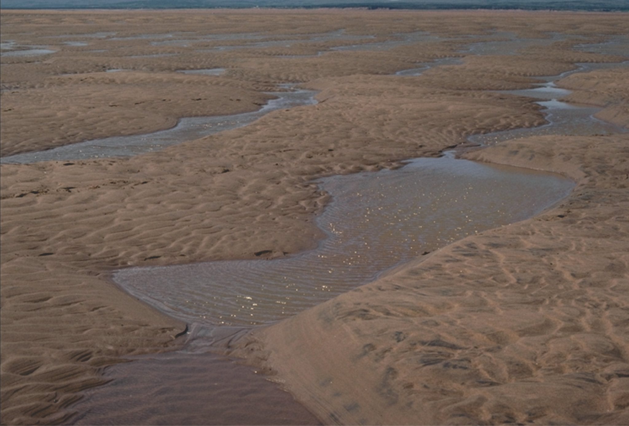
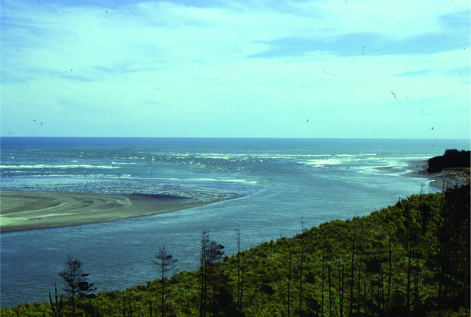
Ebb tidal delta at the mouth of Waikato River, south Auckland.
Paleocene subaqueous dunes up to 2m amplitude, in tidal inlet-delta, overlain by thin tidal flat-salt marsh deposits. Expedition Fm, Axel Heiberg Island, Canadian Arctic
Large within-channel dunes in a tidal inlet associated with a sand spit facies; the spits and bars were attached to (paleotopographic) headlands across an unconformity eroded into Ordovician carbonates. Paleocene, Eureka Sound Group, Ellesmere Island.
Two views of the unconformity between Ordovician carbonates and Paleocene estuarine-tidal channel-spit facies. Eureka Sound Group, Ellesmere Island.
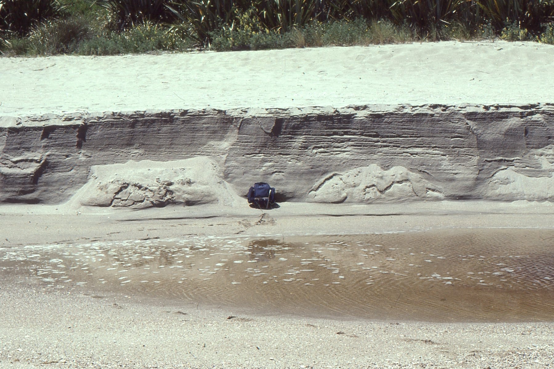
Typical beach stratification in an eroded berm; primarily laminated sets with low-angle truncations, parallel, or slightly inclined to the beach face.
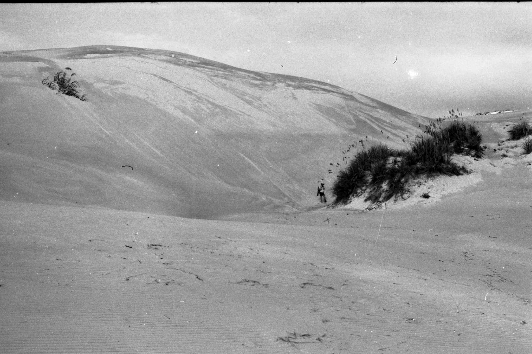
Tidal inlet standing waves (antidunes) in an outgoing tide, Mangawhai Heads, north Auckland. The antidunes migrate up-current (against the current) and gradually build until they break, subsequently reforming.
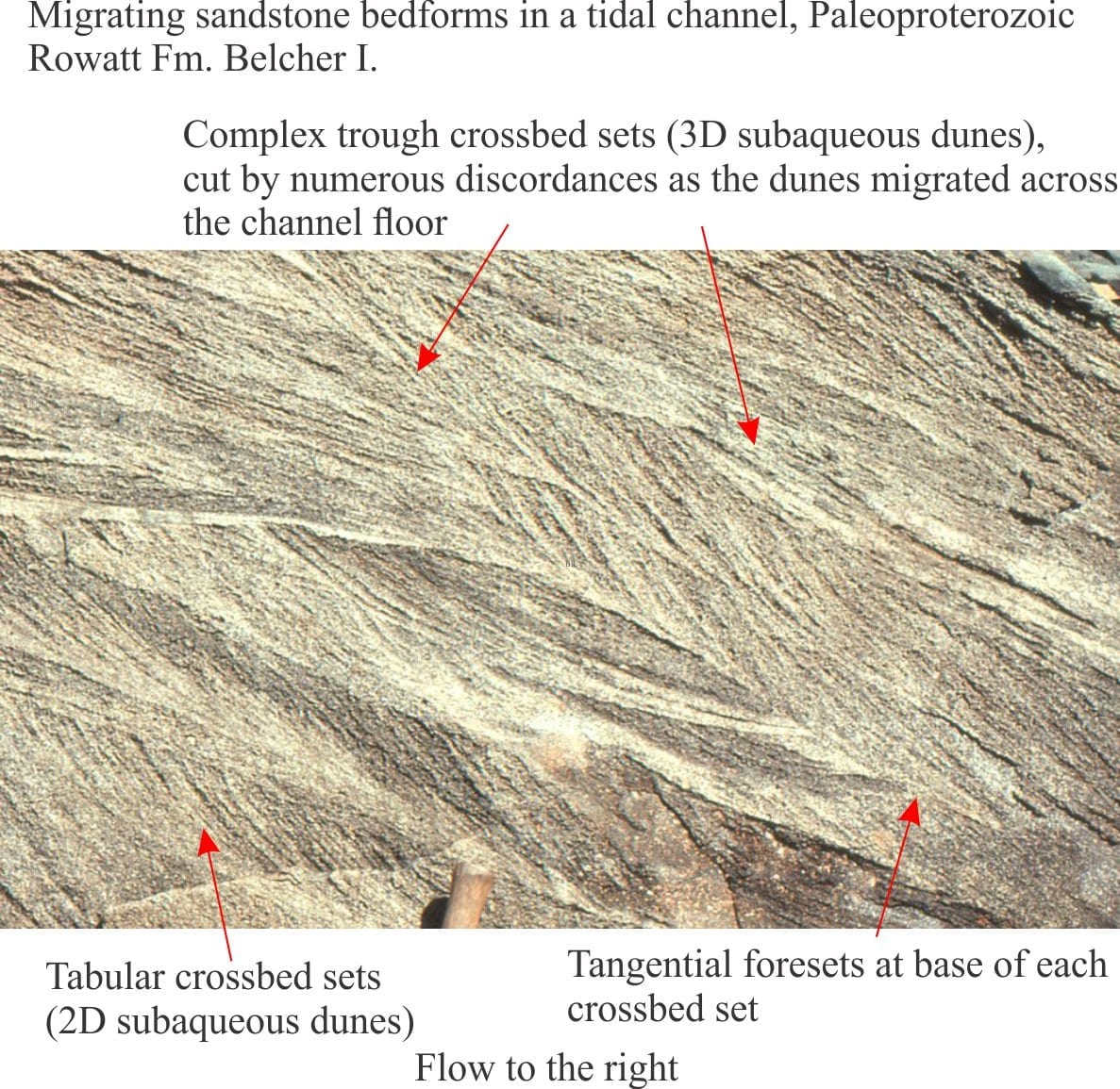
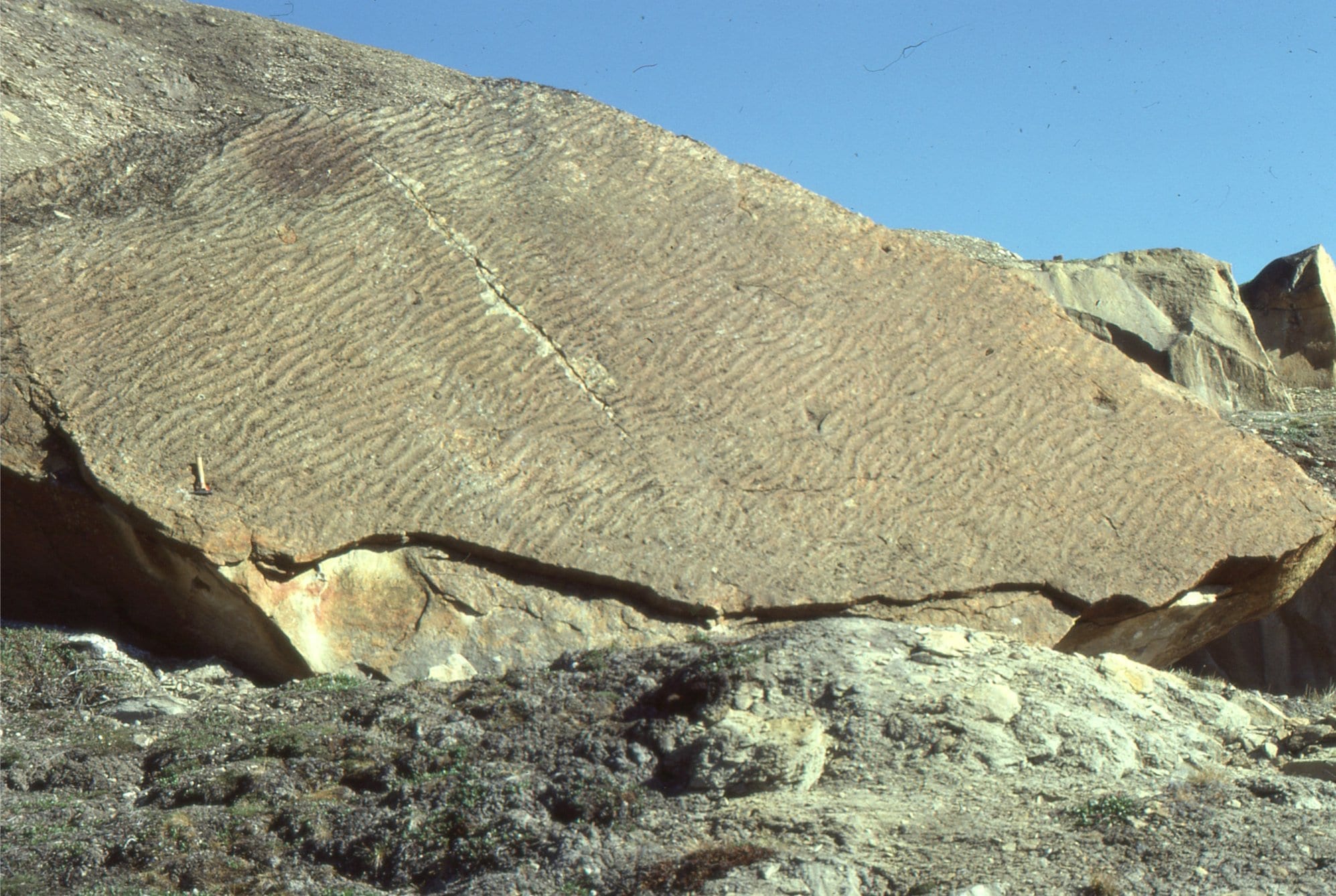
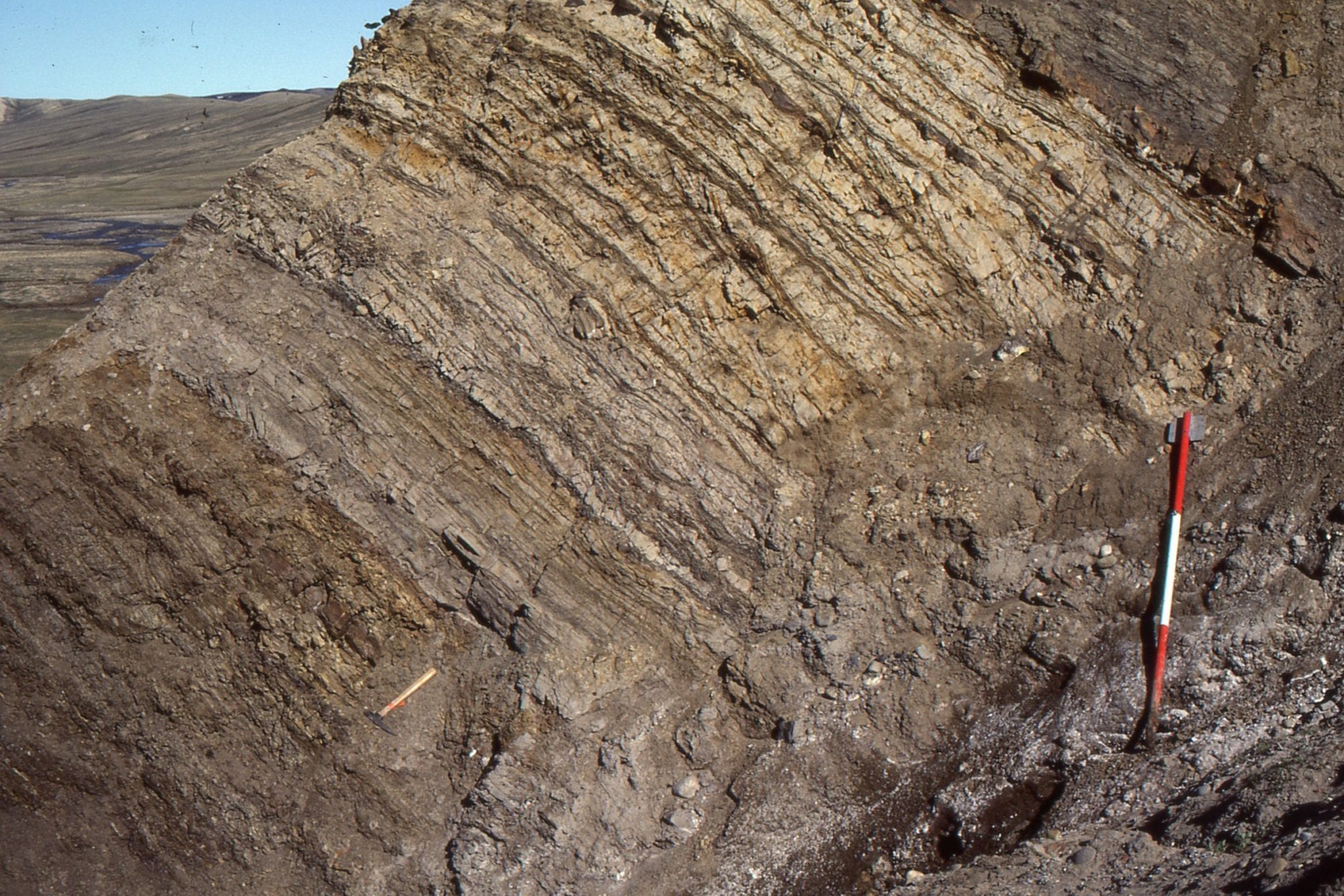
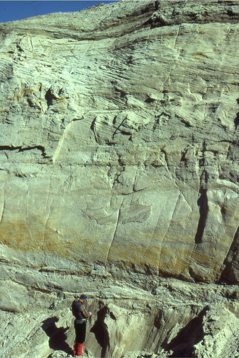
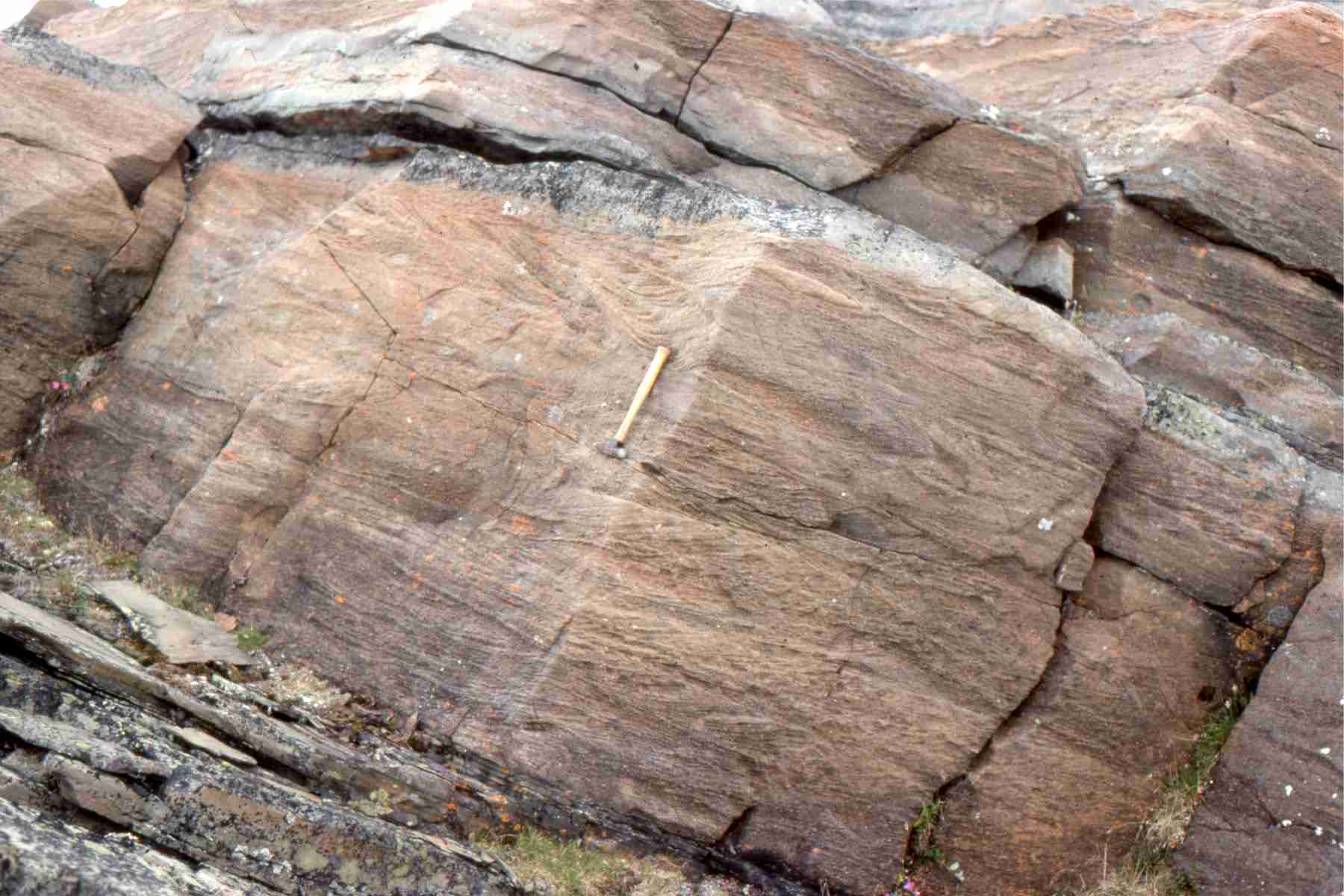
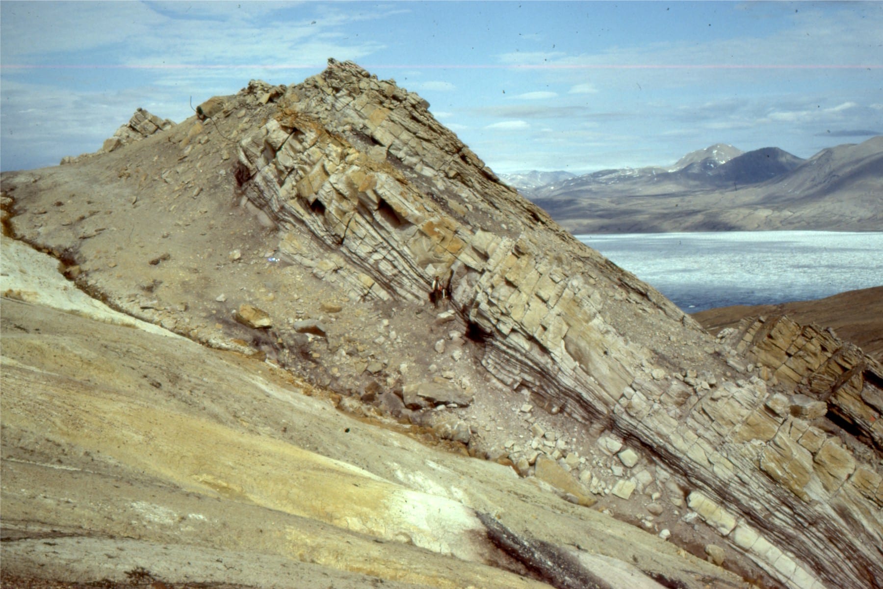
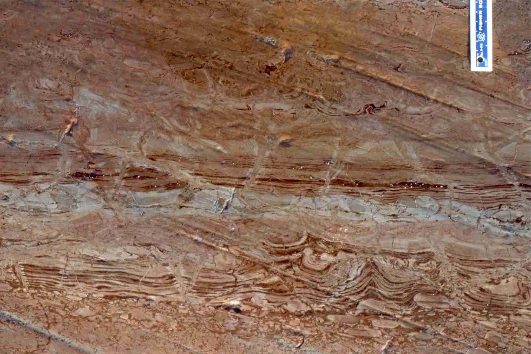
Proterozoic tidal channel – inlet trough crossbeds; this outcrop gives a 3-dimensional view of individual sets. Paleoflow was into the image. Rowatt Fm. Belcher Islands.
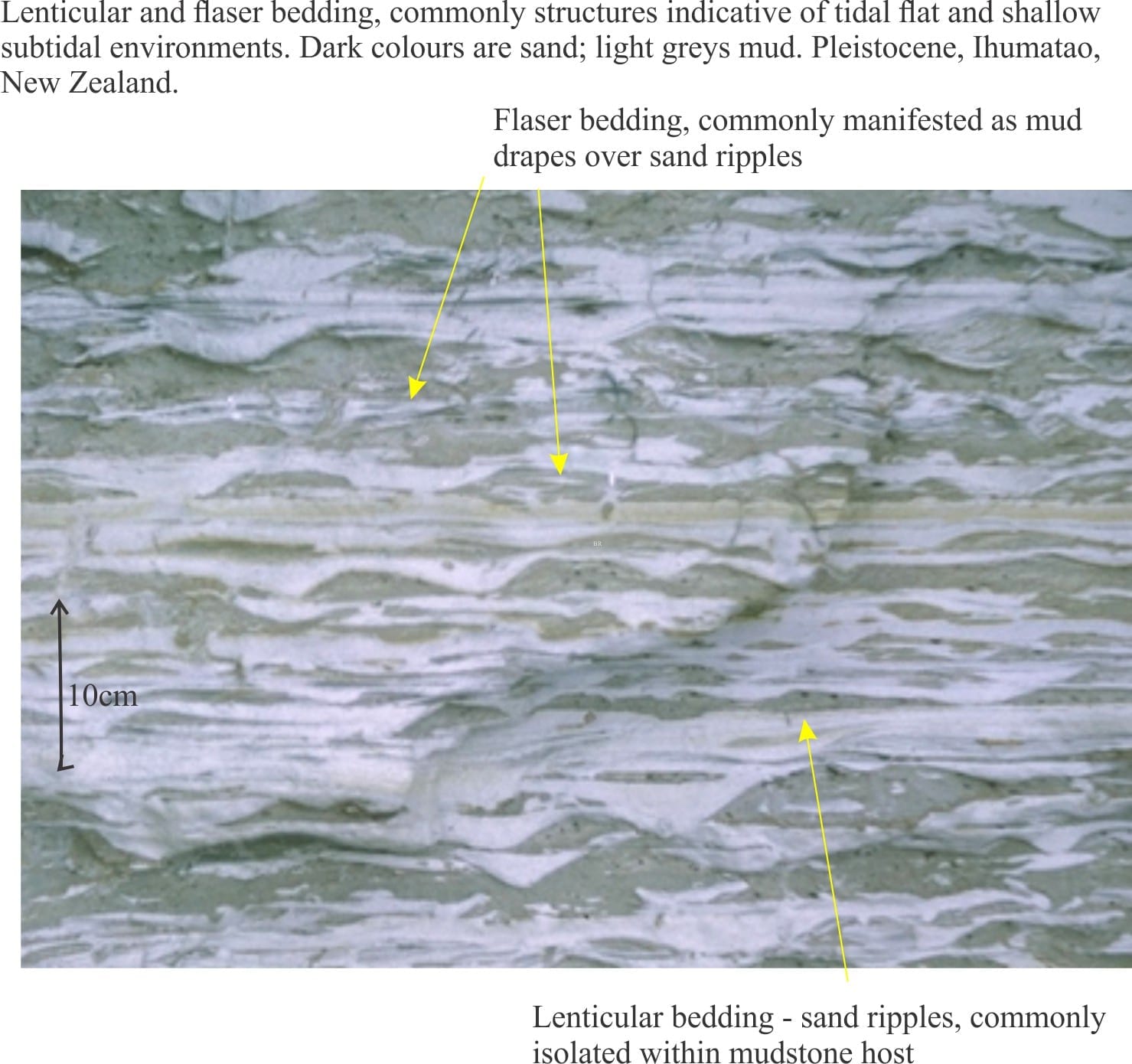
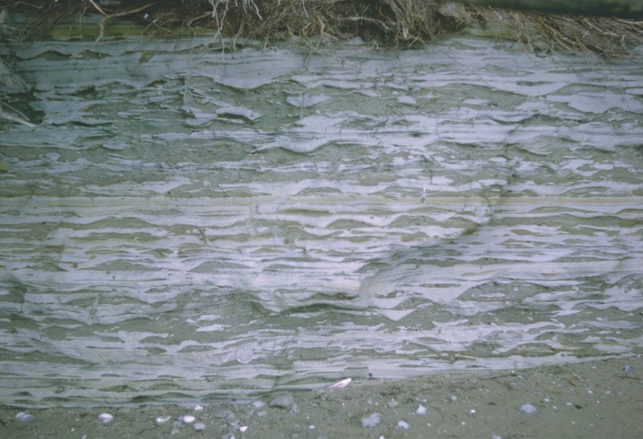
Flaser, lenticular and wavy bedding in late Pleistocene deposits near Ihumatao, Auckland. White muddy sediment overlies and envelopes grey sandy ripples, and fills troughs between ripples.
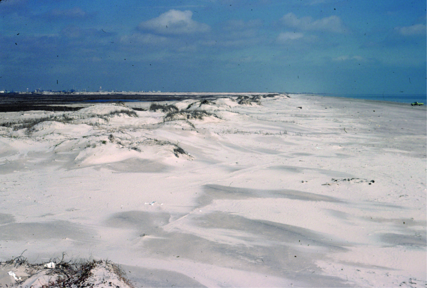
Coastal dunes, Galveston coast, Texas
Washover fan breaching coastal dunes, Galveston coast, Texas
Paleocene washover fan sandstone associated with barrier island and tidal inlets (see images above from the same formation), Expedition Fm, Axel Heiberg Island, Canadian Arctic.
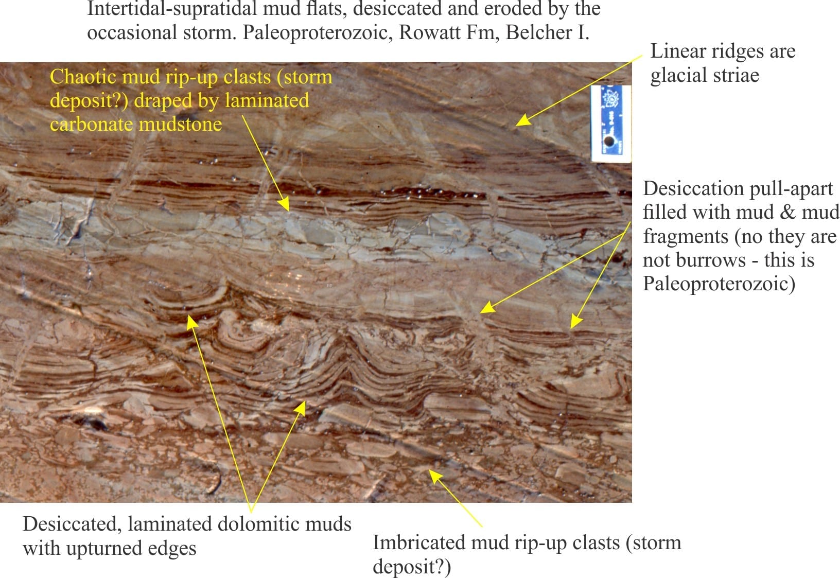
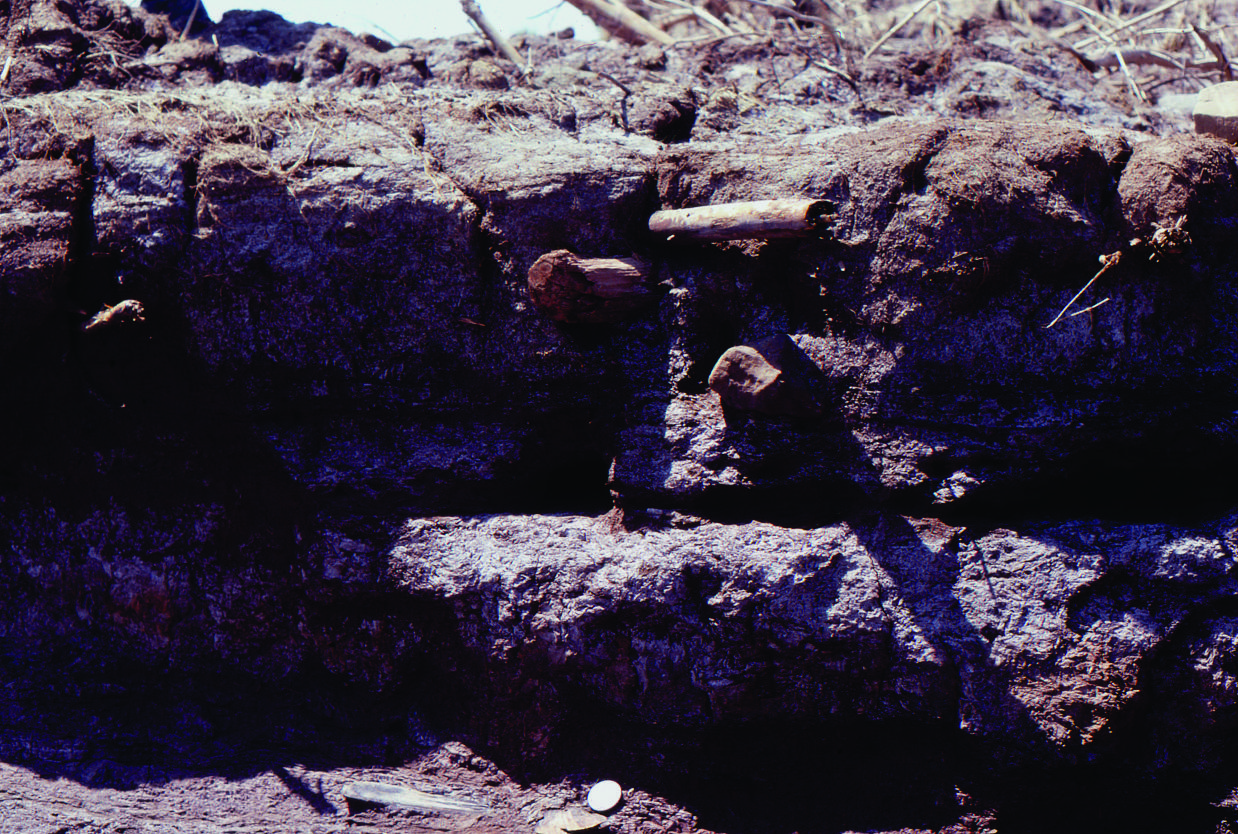
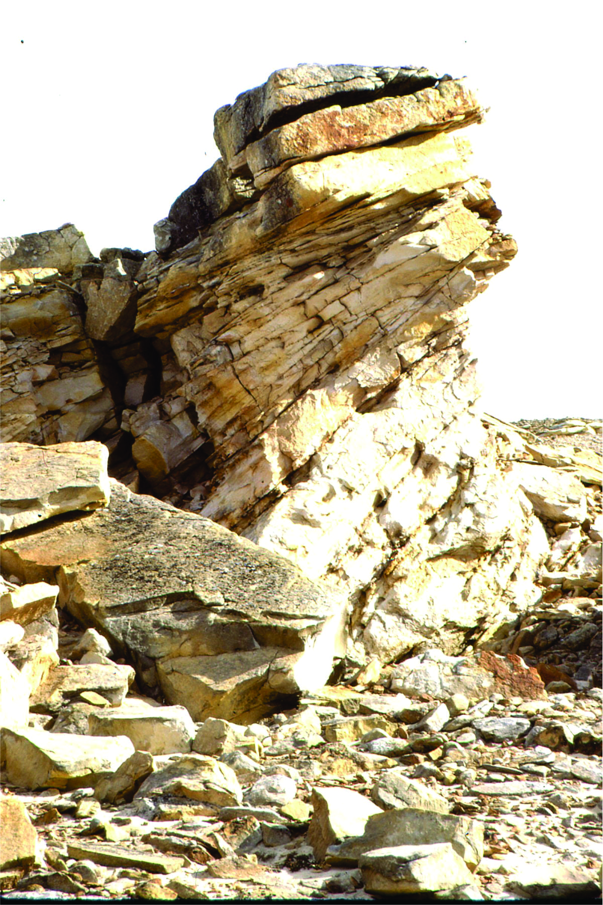
Stacked storm deposits associated with an upper tidal flat, each layer consisting of ripped up muds. Rowatt Fm, Belcher Islands. Proterozoic.
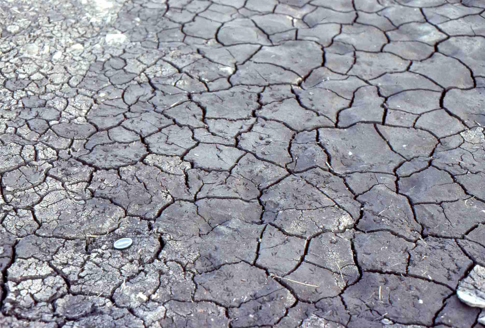
Mudcracks in salt marsh, Kaiua, NZ
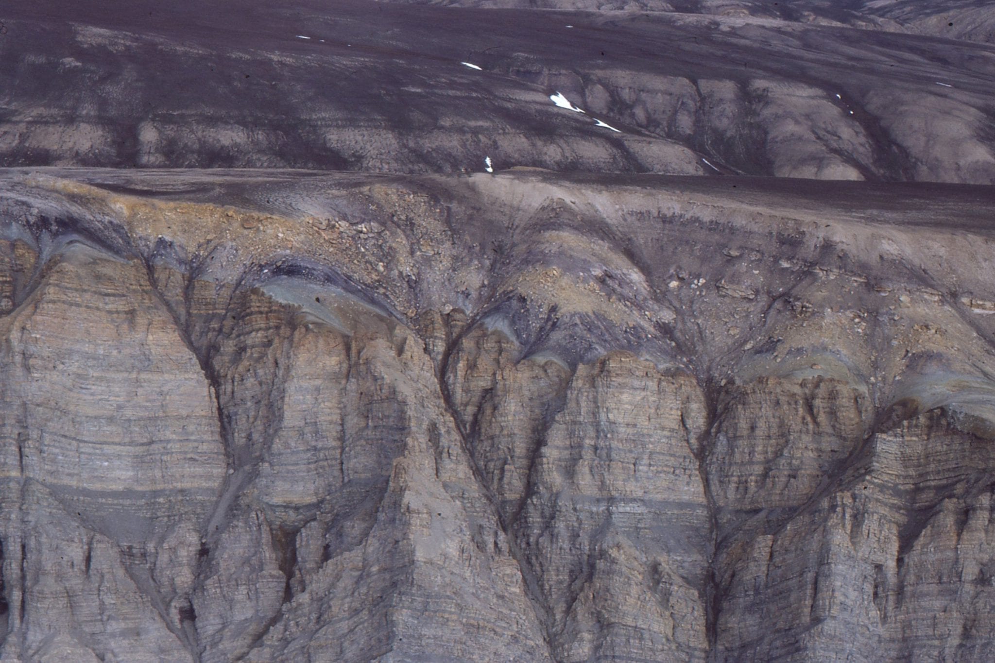
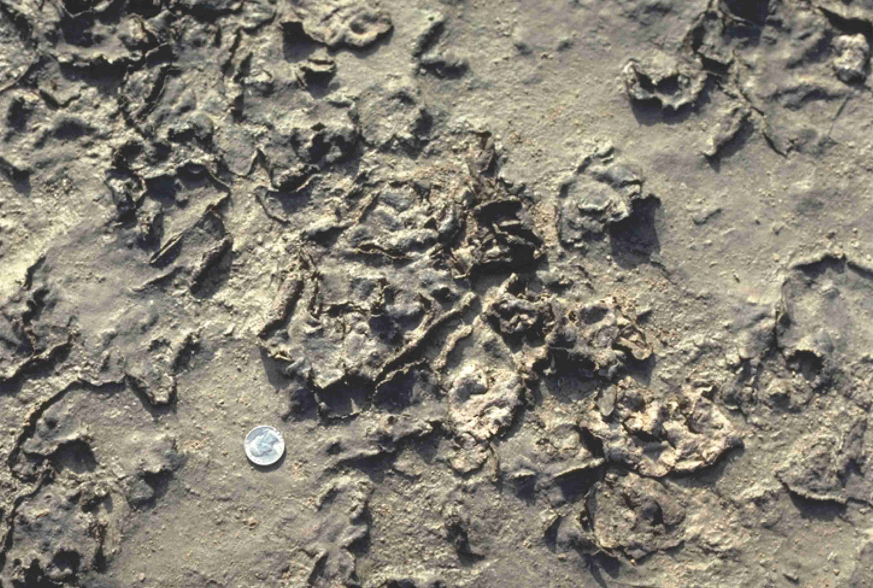
Proterozoic supratidal desiccation cracks and voids in multiple layers of delicately laminated dololutite. Some curled slabs may be coated with crpytalgal laminae. A layer of storm-derived lutite rip-ups at the bottom of the image. Rowatt Fm. Belcher Islands. See below for a modern analogue.
Desiccated, curled, algal mats from a salt marsh near Galveston Texas. The mats are easily disturbed during high or storm tides.
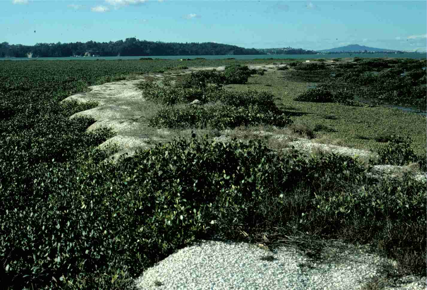
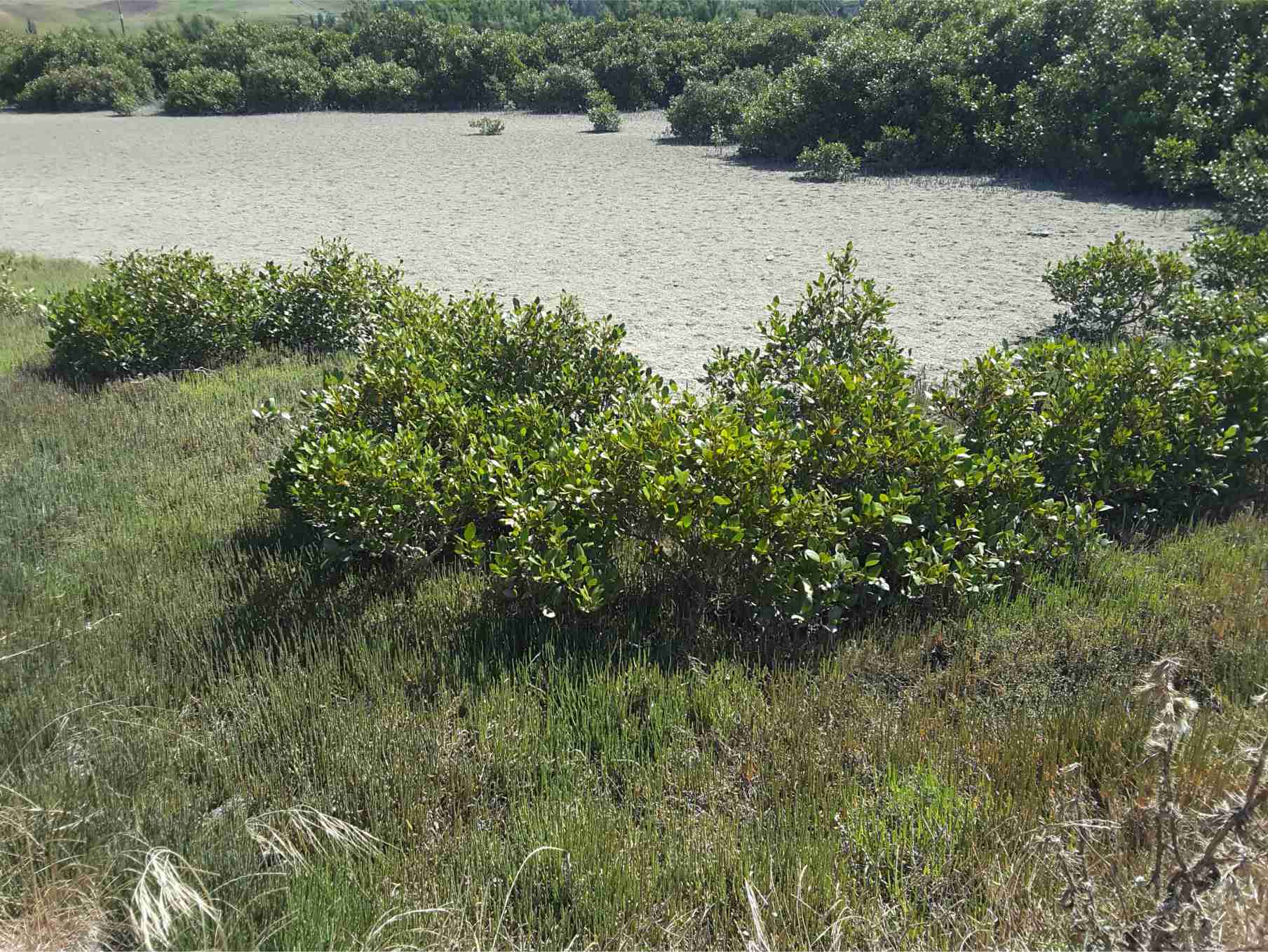
Mangroves: Left image: stabilizing shell banks (storm ridges) adjacent a tidal Inlet, Auckland Harbour; Right image: in a salt marsh, Kaiua, bordering Hauraki Gulf.
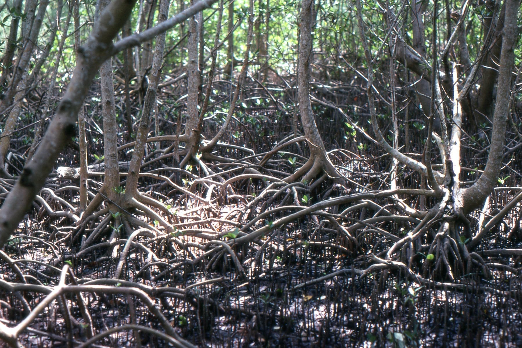
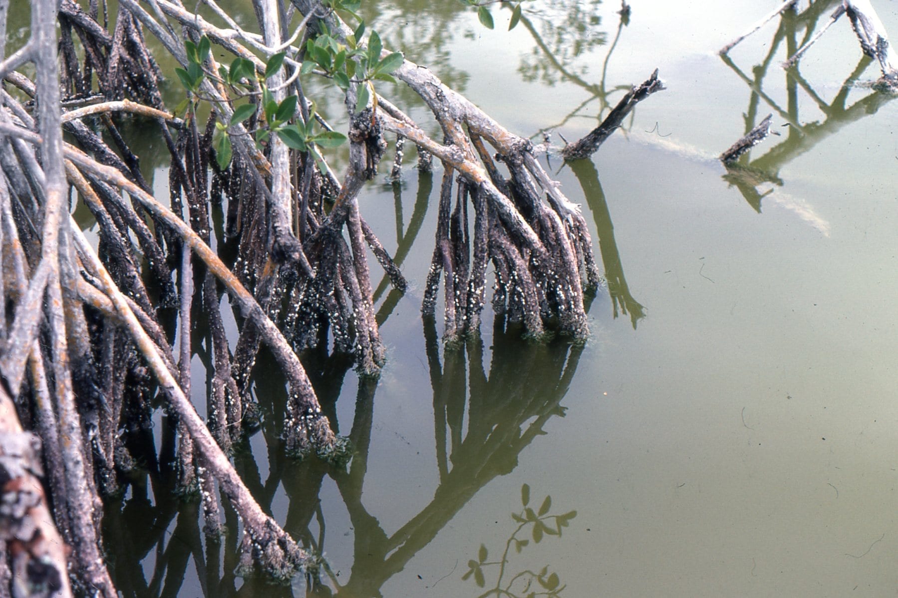
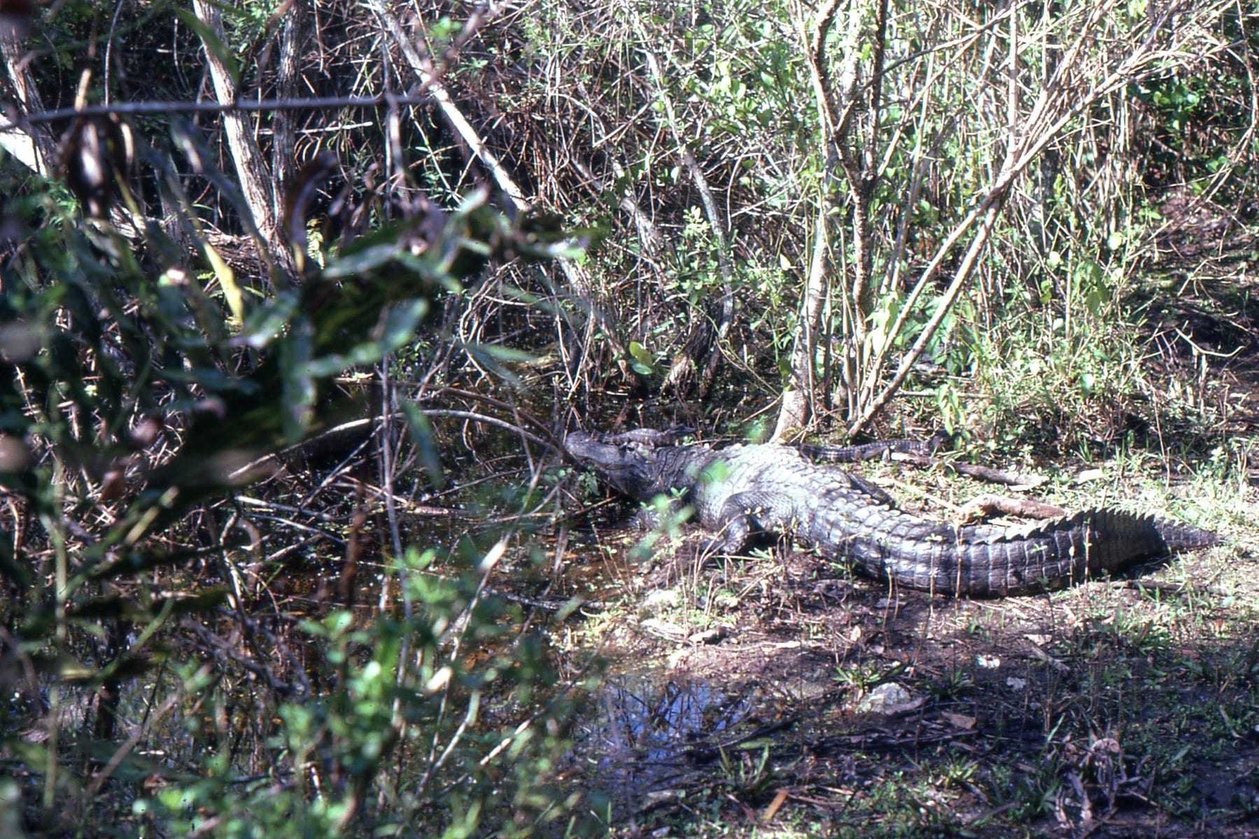
Everglades Mangroves, Florida. A tangle of roots and pneumatophores that are living quarters for so many species. On the right, an epifauna of barnacles, small snails and bryozoa.
Everglades alligators, including the little guy on its parent’s head.
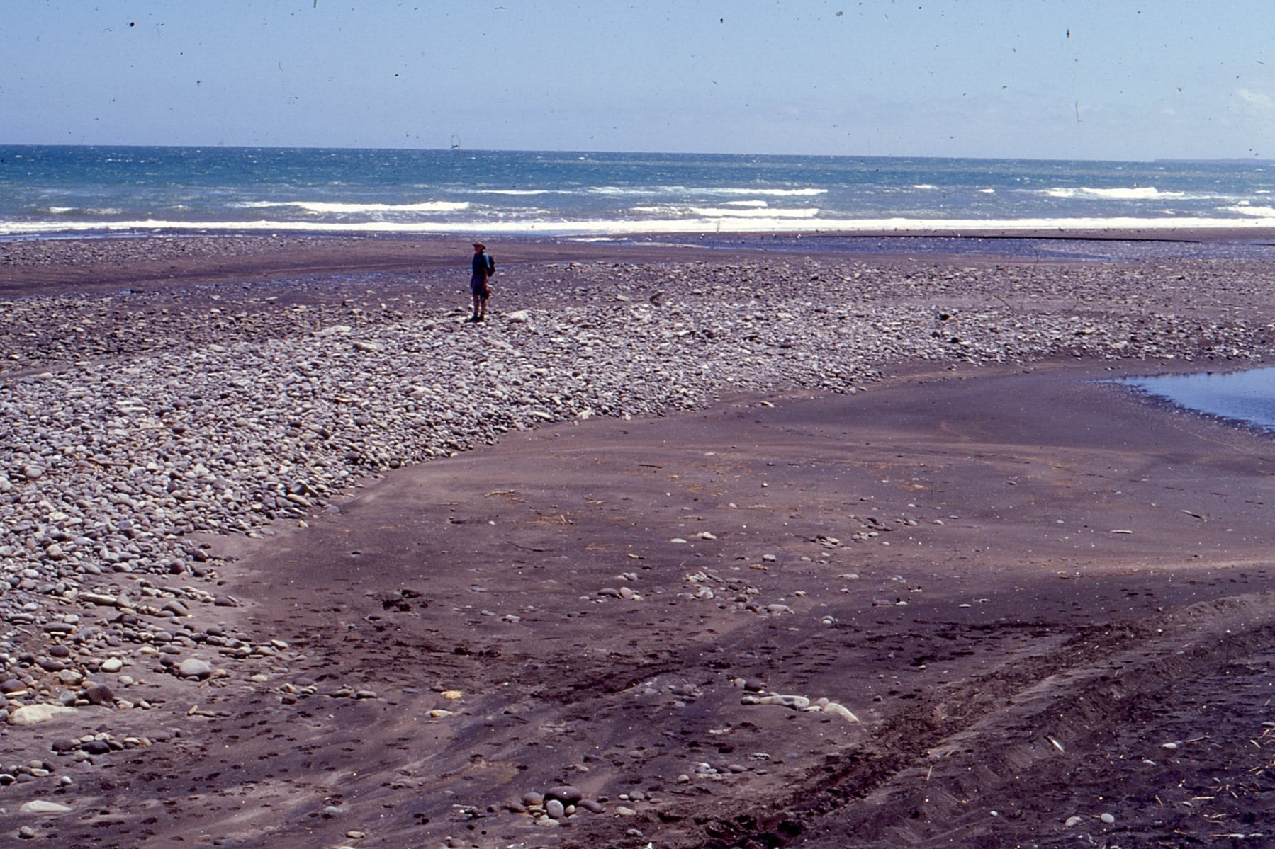
Gravel bar formed at the intersection between a high energy, West coast New Zealand beach, and the Tangahoe River mouth
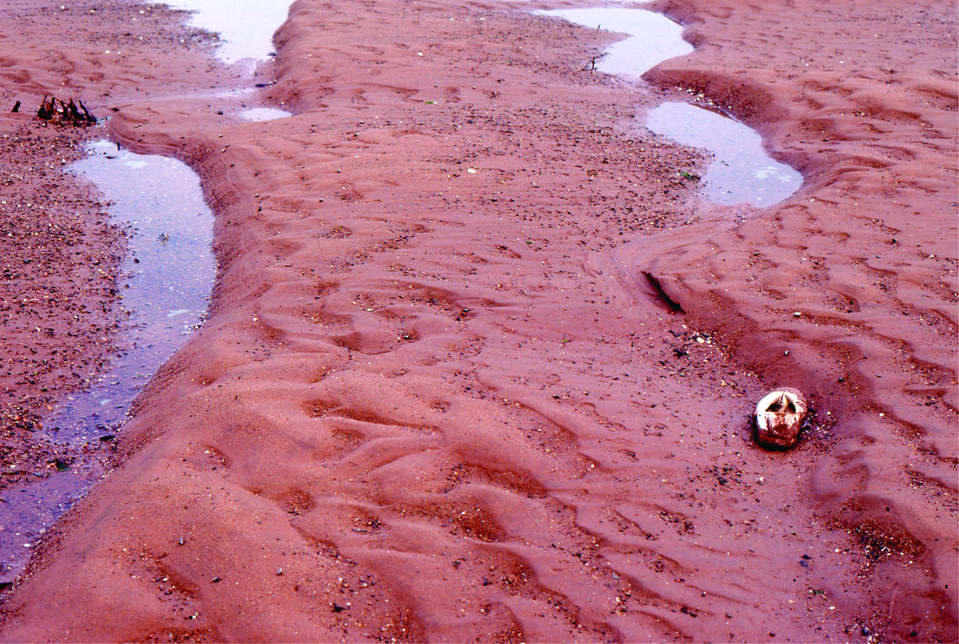
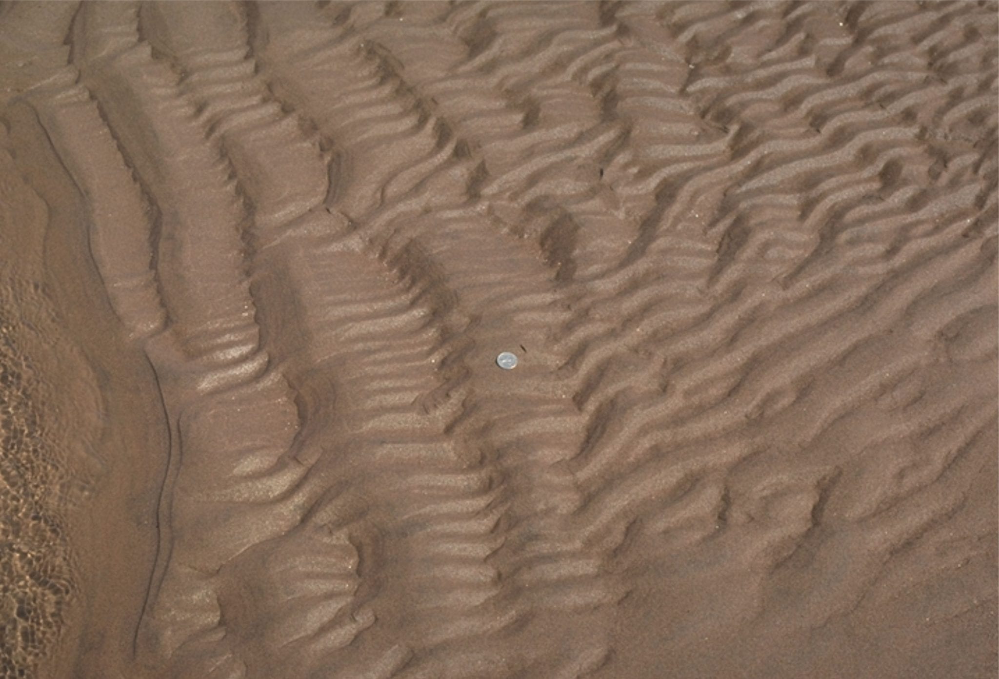
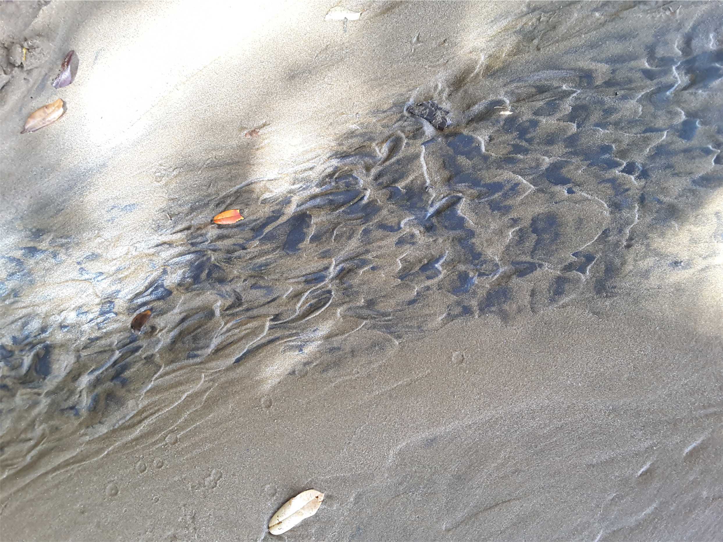
Ripples on a sand flat, with concentration of heavy minerals from local rhyolites and dacites. Little Bay, Coromandel.
Here are some examples of modern and ancient sand dunes from continental and coastal settings. Click on the images for an expanded view.
The Atlas, as are all blogs, is a publication. If you use the images, please acknowledge their source (it is the polite, and professional thing to do).
This link will take you to an explanation of the Atlas series, the ownership, use and acknowledgment of images.
Click on the image for an expanded view, then ‘back one page‘ arrow to return to the list
The images:
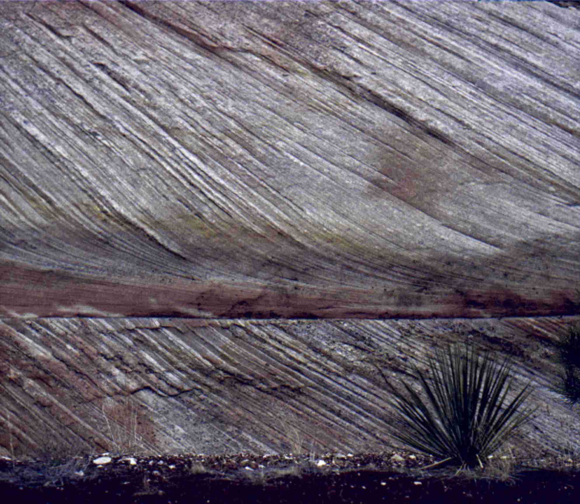
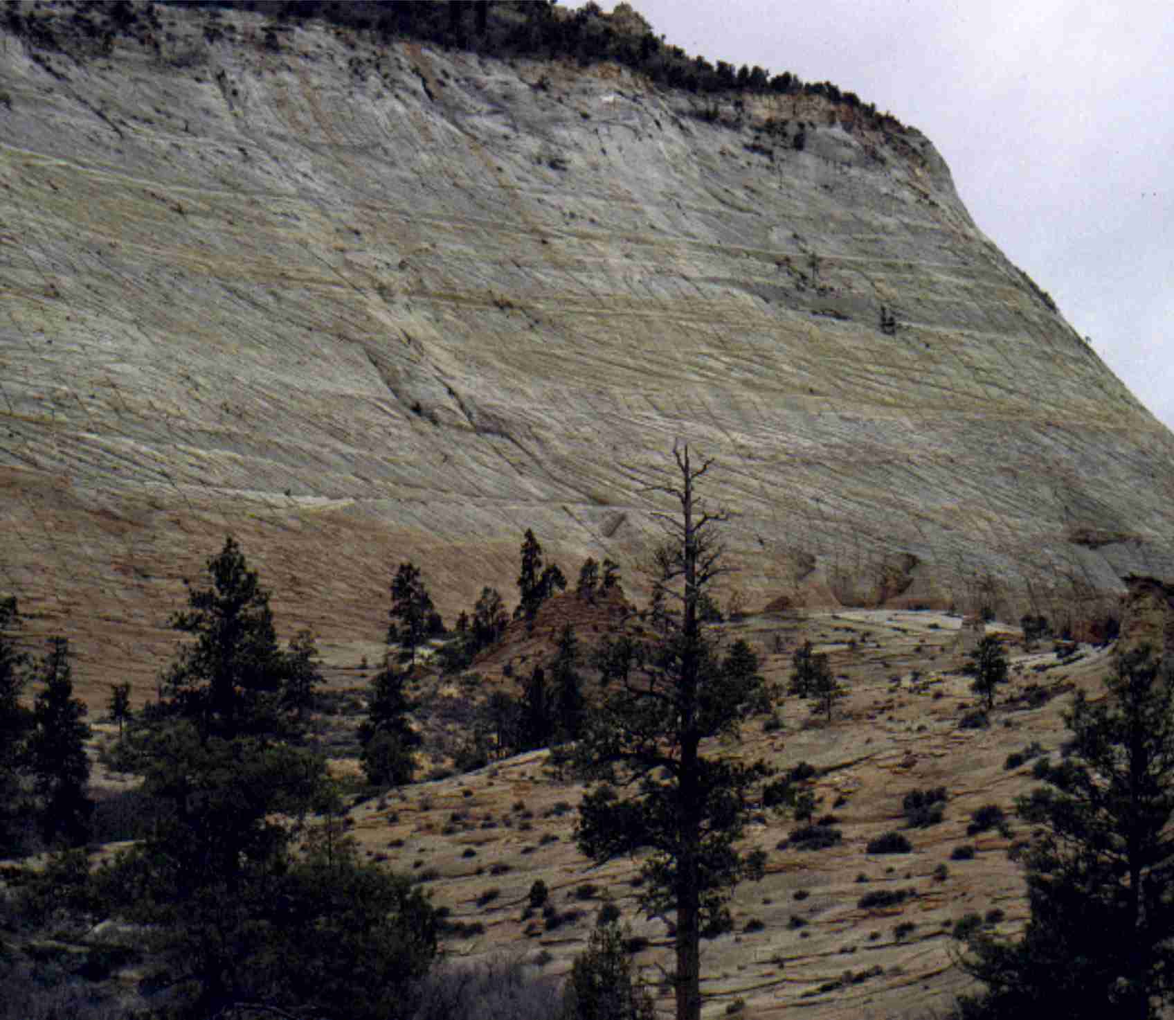
Close up of Jurassic Navajo Sandstone dune crossbeds with tangential toe-sets, Zion National Park, Utah. Image height is about 2m. Large sand dune complexes in a continental desert, about 180 million years ago.
Really big dune foresets (lee-face deposits) in the Jurassic Navajo Sandstone, Zion National Park, of southern Utah
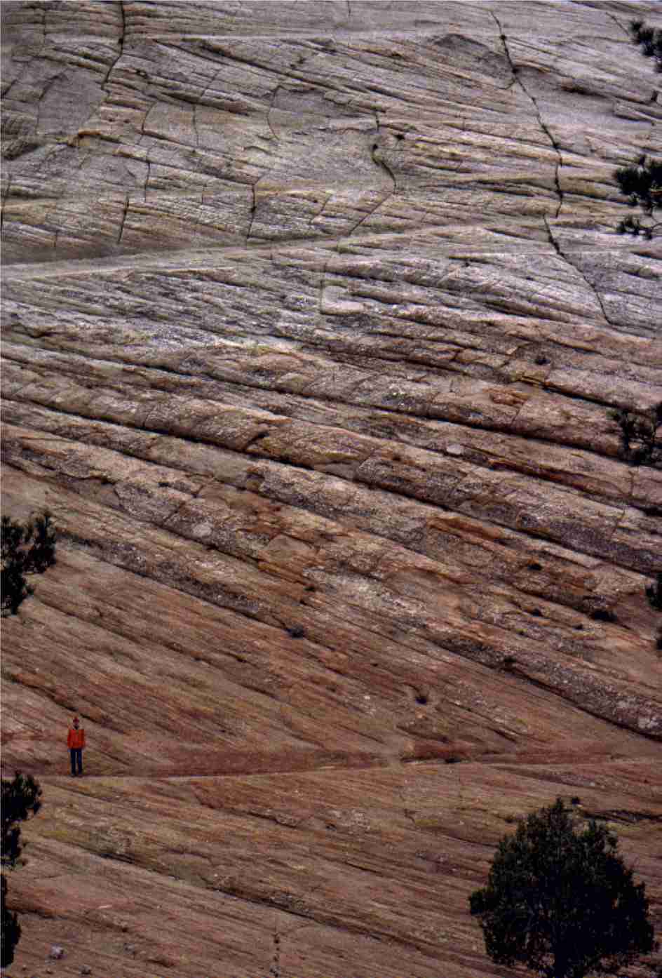
Closer view of the exposure in above image, showing large foresets and individual dune truncation. The person (bottom left) is about 2m tall. Navajo Sandstone, Zion National Park, Utah
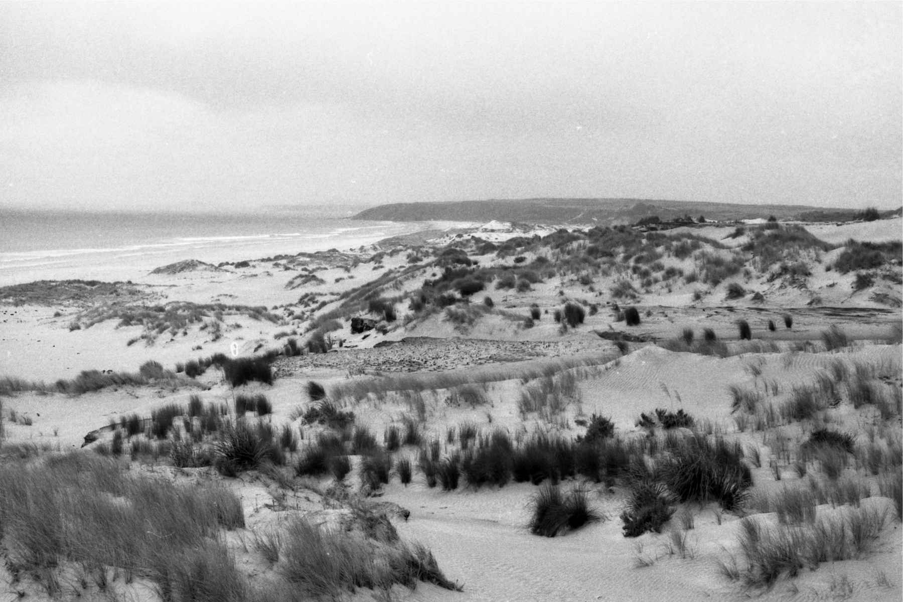
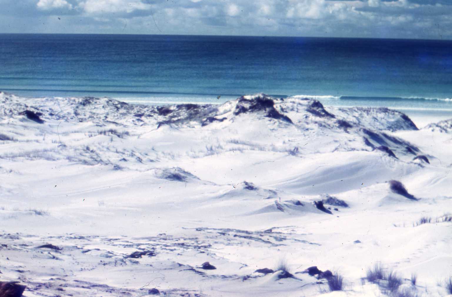
Coastal dunes bordering Great Exhibition Bay, northernmost New Zealand. The white sand contains 90-95% quartz. Much of the sand for the modern dunes comes from reactivation of late Pleistocene dune complexes, and sand stored on the sea floor.
Dune sets in Late Pleistocene deposits, Great Exhibition Bay, northernmost New Zealand.
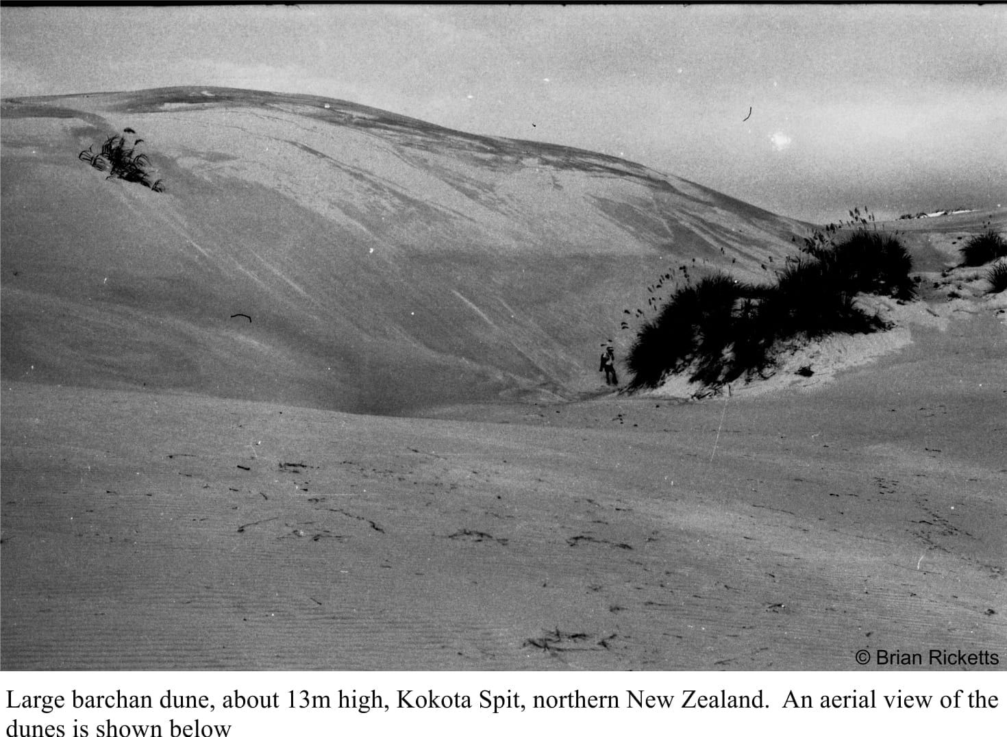
Large, active barchan dunes traverse Kokota sandspit that forms a protextive barrier to Parengarenga Harbour, northernmost New Zealand. This view is of the main lee face. The dune is about 8m high.
Small lakes and ponds that are sometimes perched between sand dunes, accumulate mud, sand and peaty material from plants. Here are at least 6 interdune pond mud layers, some with fossil roots (also replaced by clays). See also the image below. Late Pleistocene, Great Exhibition Bay.
Interdune lake near the inland margin of stabilized, Pleistocene sand dunes, Kariotahi, south Auckland, NZ.
Multiple dune sets in a Pleistocene sand barrier, Kariotahi, south Auckland. Formation of the old sand barrier and dune field eventually created the straightened coastline that typifies the west coast of North Island. The barrier formed during repeated rises and falls in sea level over about 2 million years.
Multiple dune sets in Pleistocene sands (Same cliff face as image above), indicating a fairly consistent orientation of the preserved lee faces, and the direction of dune migration (to the left – east). Kariotahi, Southwest Auckland, New Zealand.
Barrier and dune sands, Kariotahi, south Auckland. Here an older set of dunes (orange weathering) are capped by an thin soil and bands of iron oxide (along the surface that slopes steeply to the left). The soil would have stabilized the older dune sands. A younger set of dunes formed over the top of the old soil.
A more panoramic view of the old soil and dunes in the image above.
The landward margin of Pleistocene sand dunes, now stabilized. The steep slopes are the old lee slopes (the steep surface of the dune that faces down-wind). When active, the dunes would have migrated towards the viewer. Kariotahi, south Auckland.
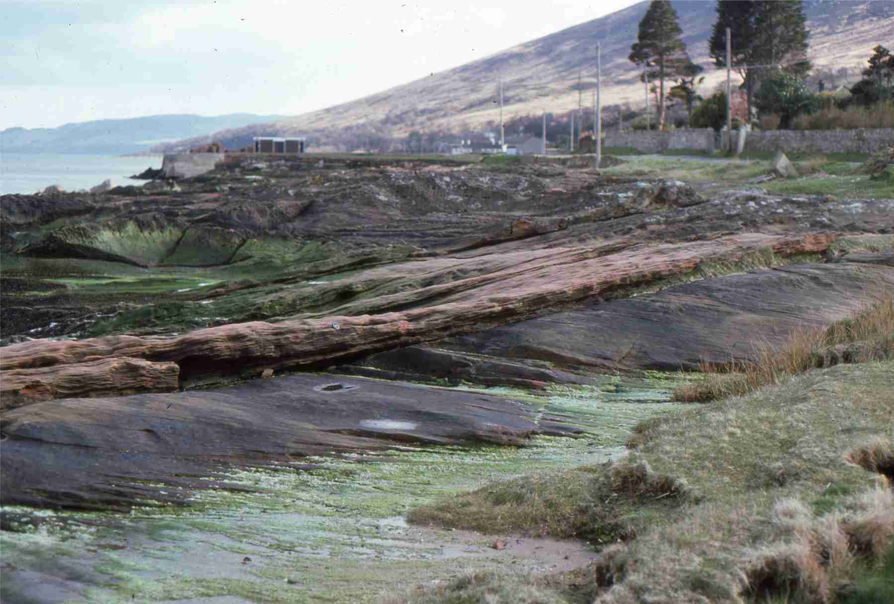
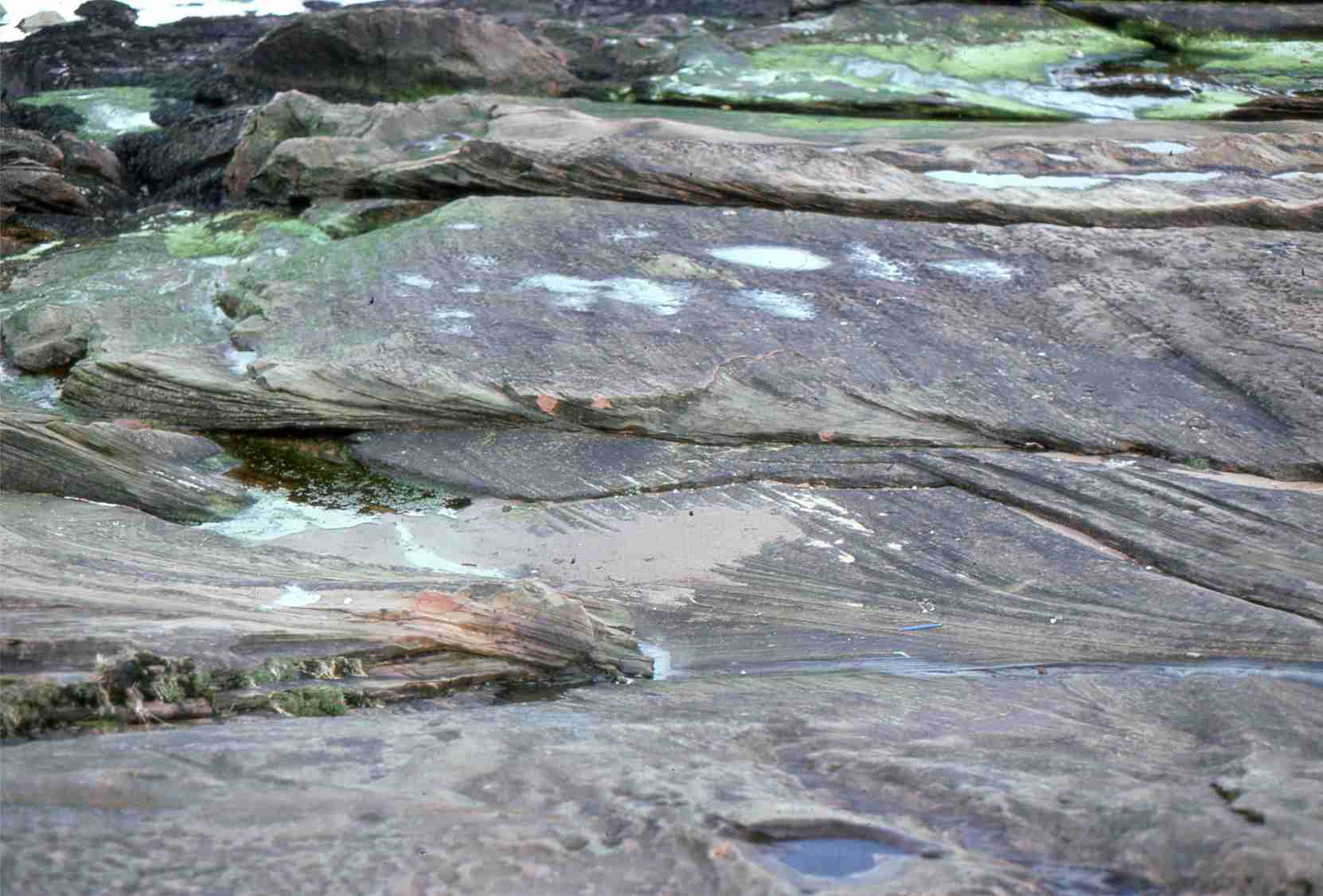
Reddened sandstone with large dune crossbedding, in the New Red Sandstone on Arran, west Scotland. The red colours are formed by iron oxides, after the sand was deposited during the Permian through Triassic – 280 to 200 million years ago.
Multiple dune crossbed sets in New Red Sandstone, Arran, west Scotland, 280 to 200 million years old.
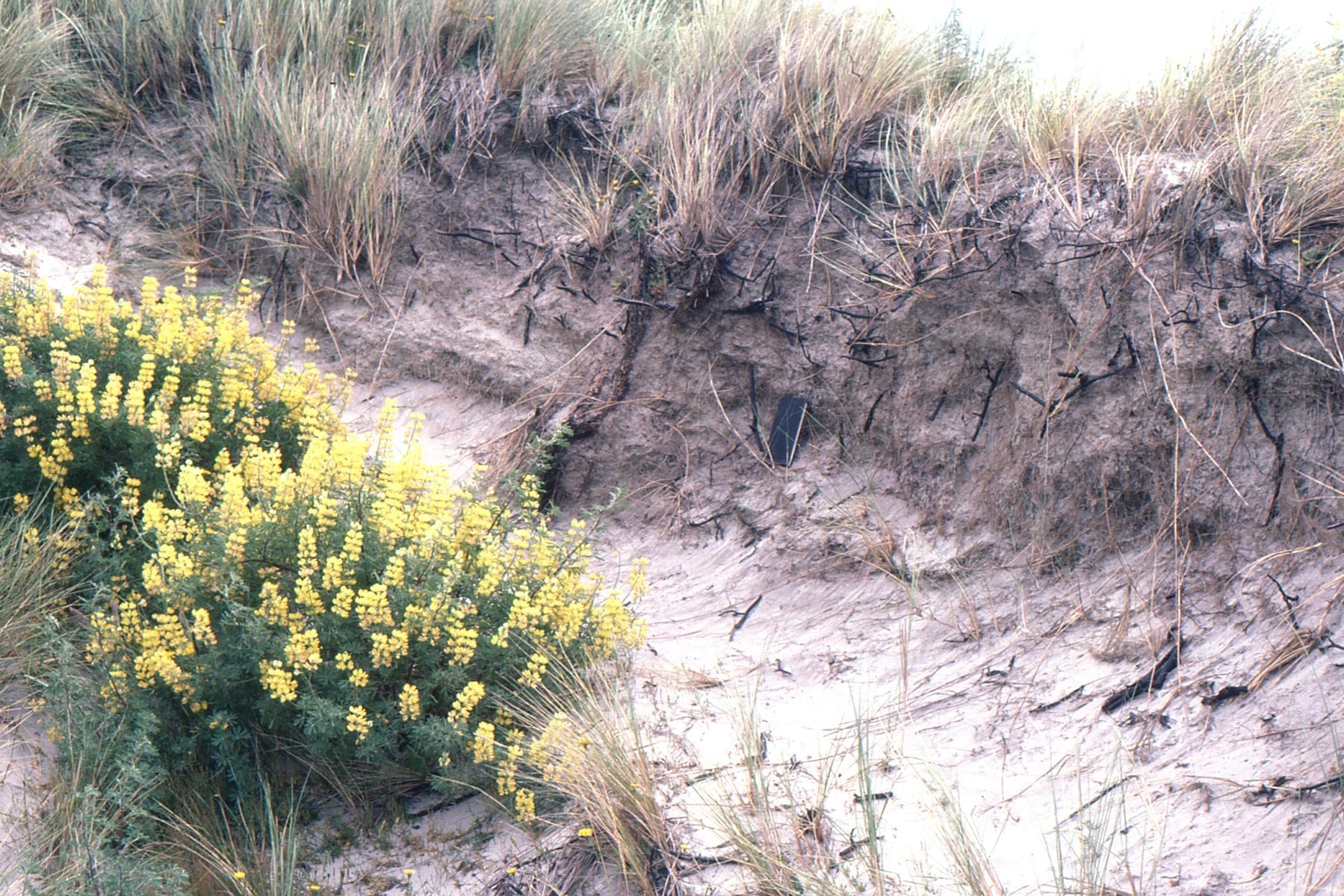
Salt-tolerant grasses and shrubs extend their roots deep into the dunes to capture as much moisture as possible, and in so doing help to stabilize the dune.
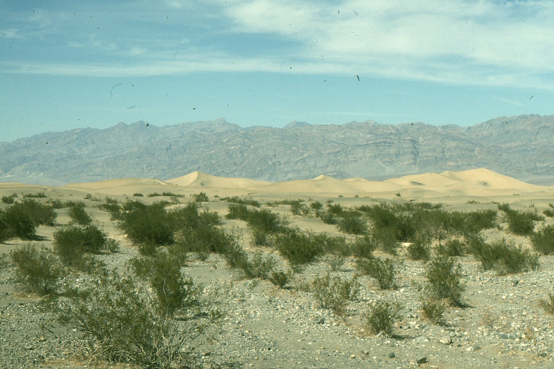
Mesquite Flat dunes, Death Valley, near Stovepipe Wells. An inland ‘sea’ of sand, usually organized as dunes, is called an erg.
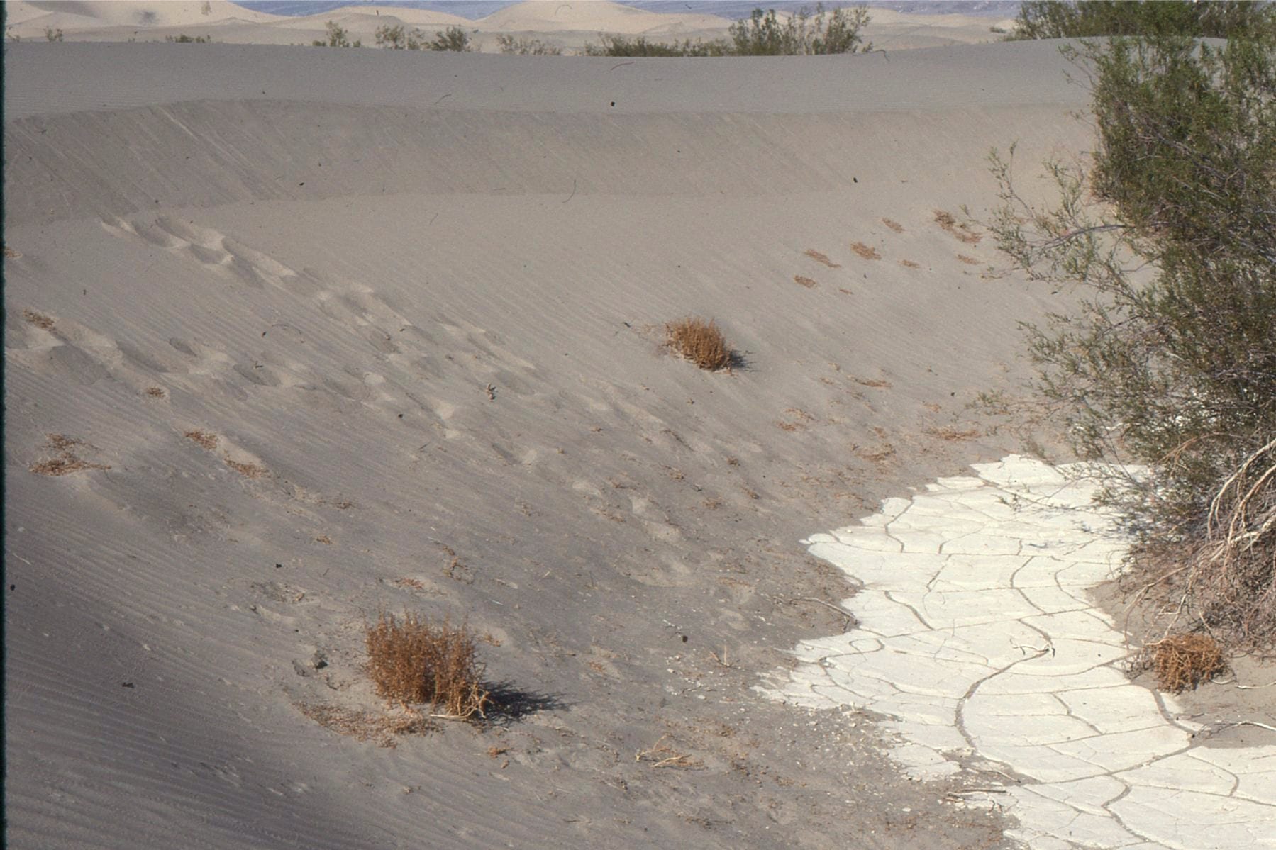
Dune sand at Mesquite Flat, migrating over desiccated pond silts. Death Valley
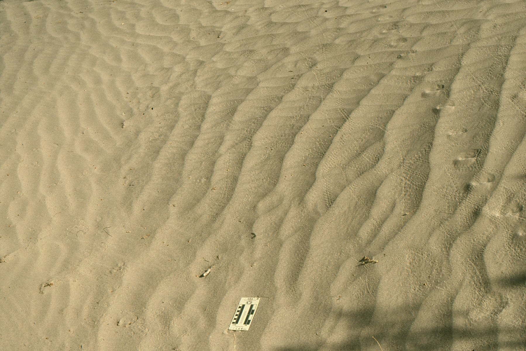
At least two generations of wind ripples in Mesquite Flat dunes. All those trails attest to numerous insects and the larger critters that hunt them.
When James Hutton in 1785 presented to the Royal Society of Edinburgh his ideas on the uniformity of earth processes (over vast tracts of time), he did so with both feet planted firmly on good Scottish ground. Hutton’s Principle, for which Archibald Geikie later (1905) coined the phrase “The present is the key to the past” gave to geologists a kind of warrant to interpret the geological past using observations and experiments of processes we see in action today (see an earlier post for a bit more discussion on this philosophy). One wonders whether either of these gentlemen gave thought to the Principle being used to interpret processes elsewhere in our solar system.
There is of course, no logical reason why we cannot use terrestrial environments and physical-chemical-biological processes to unravel the geology on our solar neighbours. We may need to extend our thinking beyond purely earth-bound processes, but the Principle remains a starting point for scientific thinking, interpretation, and discovery. Mars provides the perfect opportunity for this scientific adventure.Continue reading →
How Geologists Interpret Ancient Environments. 2 Ruffles and desiccation
Nearly all sedimentary rocks contain structures – fabrics, planes, contortions. If properly identified these sedimentary structures provide important clues to how the original sediments were deposited.
There are many different kinds of sedimentary structures formed by layers of sediment oriented at different angles, or layers that have been contorted and squished, structures formed by wetting and drying of sediment, structures formed by slip and slide, and by animals leaving tracks and traces as evidence of their activity.
All of these structures can be thought of as contributing to the architecture of sediments and sedimentary rocks.
We are going to examine two of the more common kinds of sedimentary structure – Ripples, and Mud Cracks (sometimes called Desiccation Cracks).