
The Atlas, as are all blogs, is a publication. If you use the images, please acknowledge their source (it is the polite, and professional thing to do).
The term ‘shelf’ is used here loosely – it covers a range of submarine settings, mostly shallower than about 300m, from the upper slope to shoreline, the shoreface, fairweather and storm wave-base. There is some overlap with the ‘Paralic’ category, but the context of the shallowest examples (like beach, shallow subtidal) is in their relationship to their deeper counterparts. The separation of the ‘Shelf’ and ‘Paralic’ categories is a bit artificial, and one of convenience.
This link will take you to an explanation of the Atlas series, the ownership, use and acknowledgment of images.
Click on the image for an expanded view, then ‘back page’ arrow to return to the Atlas.
The images:
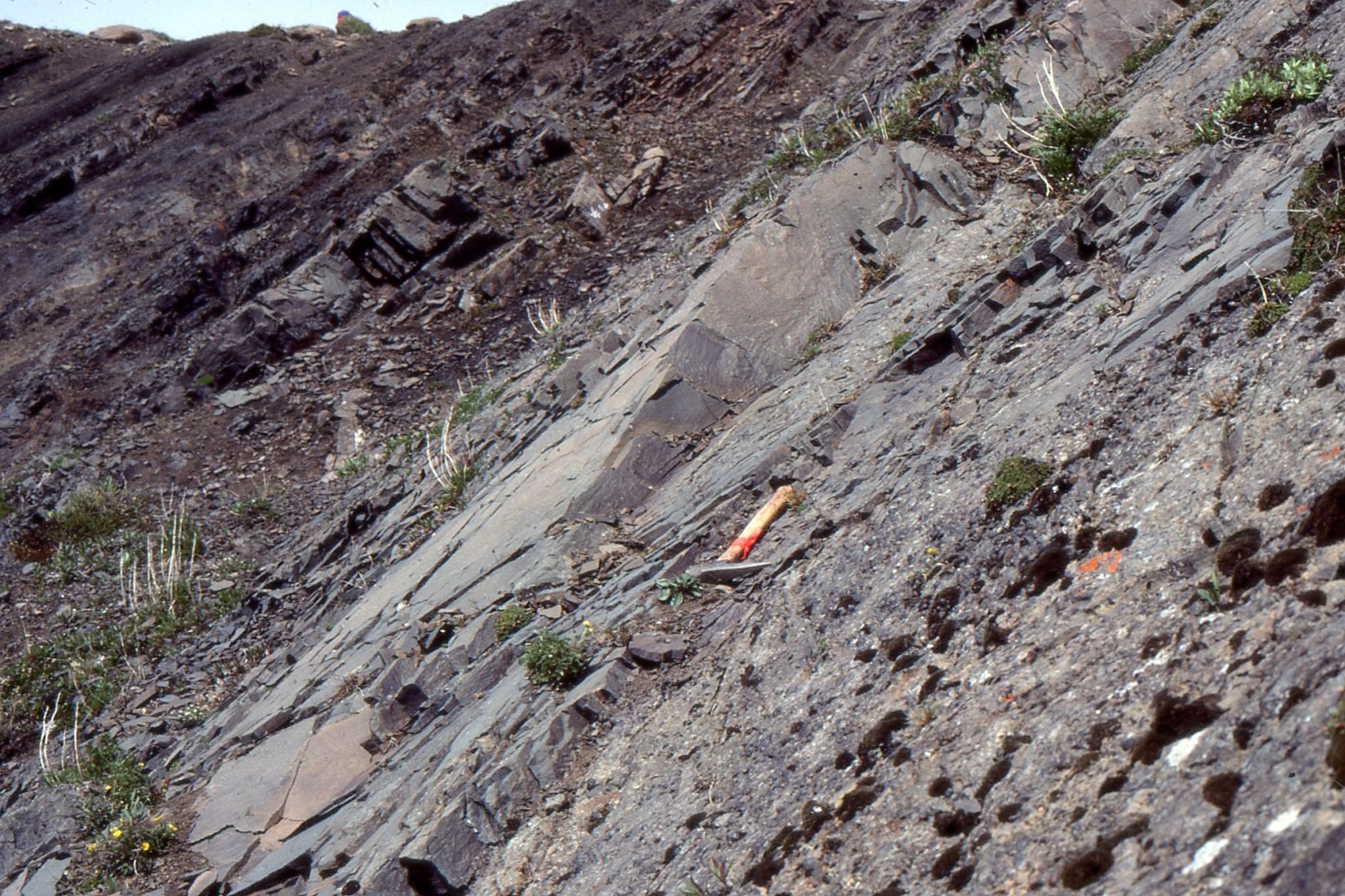
 Coarsening- and bed-thickening upwards shelf (about mid shelf) to shoreface cycle, Jurassic Bowser Basin, northern British Columbia. The coarser facies contains hummocky crossbeds (HCS) at storm wave-base, and subaqueous dune-ripples above fairweather wave-base. There are numerous trace fossils indicative of high energy,
such as Ophiomorpha, Rosellia, and Thalassinoides.
 Coarsening=upward cycle at about outer- to mid-shelf – some HCS at the top of the sandstone. This is a more seaward cycle to that shown above. Jurassic Bowser Basin, northern British Columbia.
![]() This shale to thinly bedded sandstone cycle occurs close to the shelf edge, at the transition to slope deposits. There are a few bottom current ripples, but no HCS or larger dune structures. Jurassic Bowser Basin, northern British Columbia.
This shale to thinly bedded sandstone cycle occurs close to the shelf edge, at the transition to slope deposits. There are a few bottom current ripples, but no HCS or larger dune structures. Jurassic Bowser Basin, northern British Columbia.
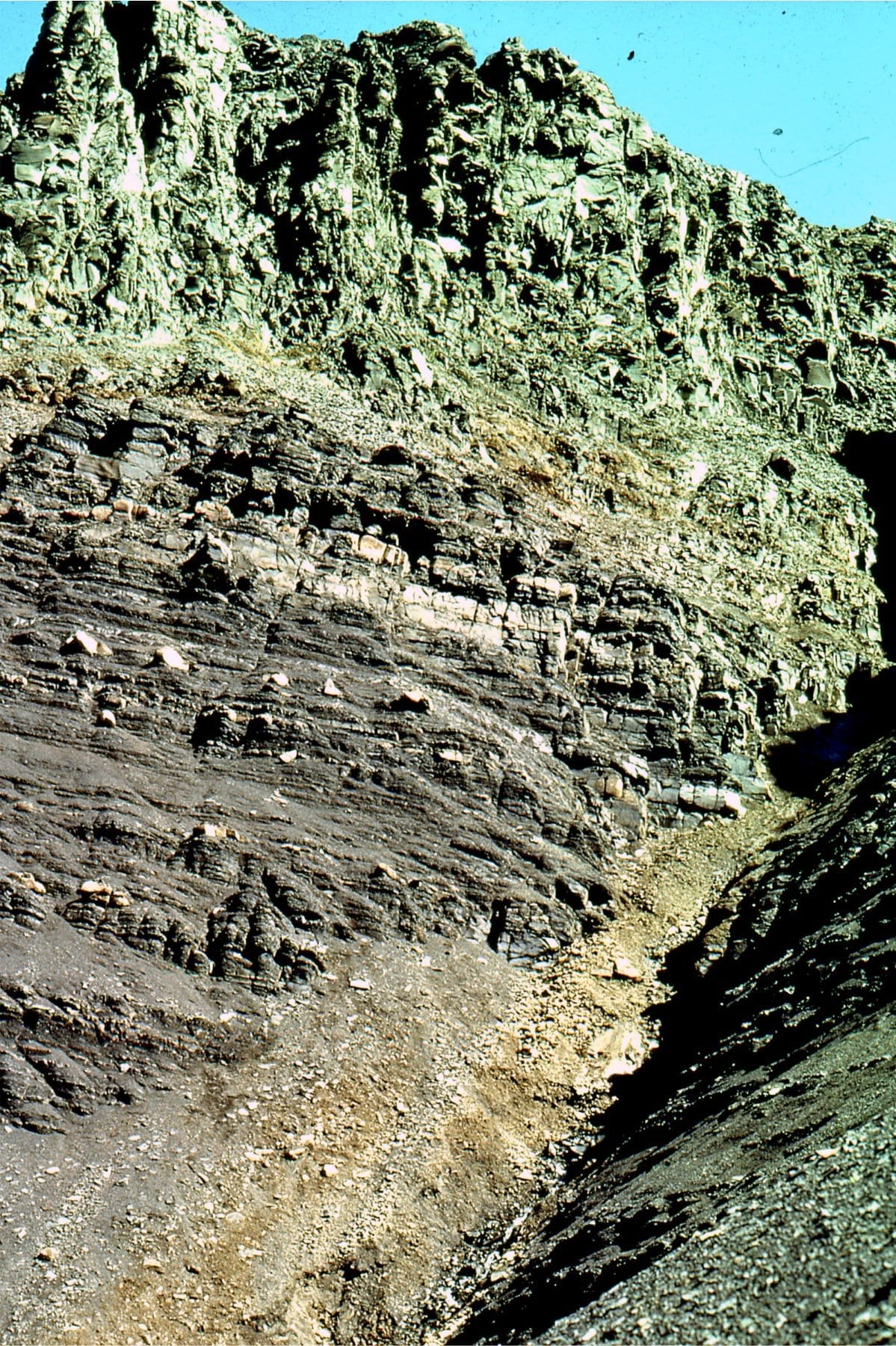
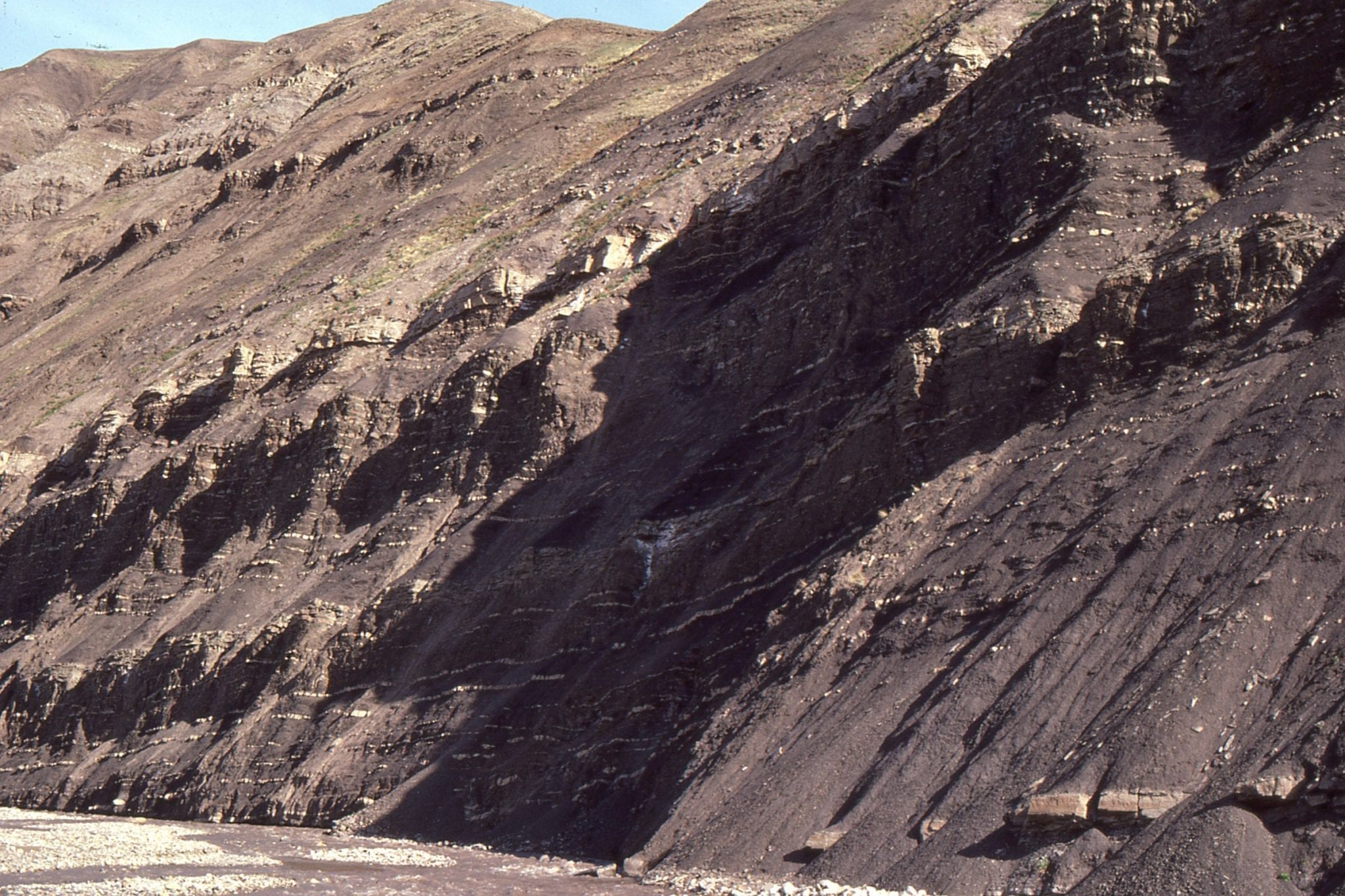
 The chert-pebble conglomerate accumulated in a shelfbreak gully. The uninterrupted transition from shale-dominated slope to shelf is located immediately to the right of the gully margin. Jurassic Bowser Basin, northern British Columbia. Details of the gullies have been published here: Shelfbreak gullies; Products of sea-level lowstand and sediment failure: Examples from Bowser Basin, northern British Columbia. 1999, Journal of Sedimentary Research 69(6):1232-1240
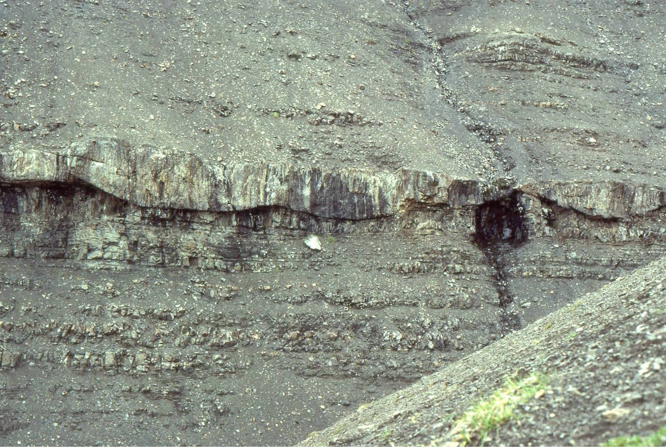
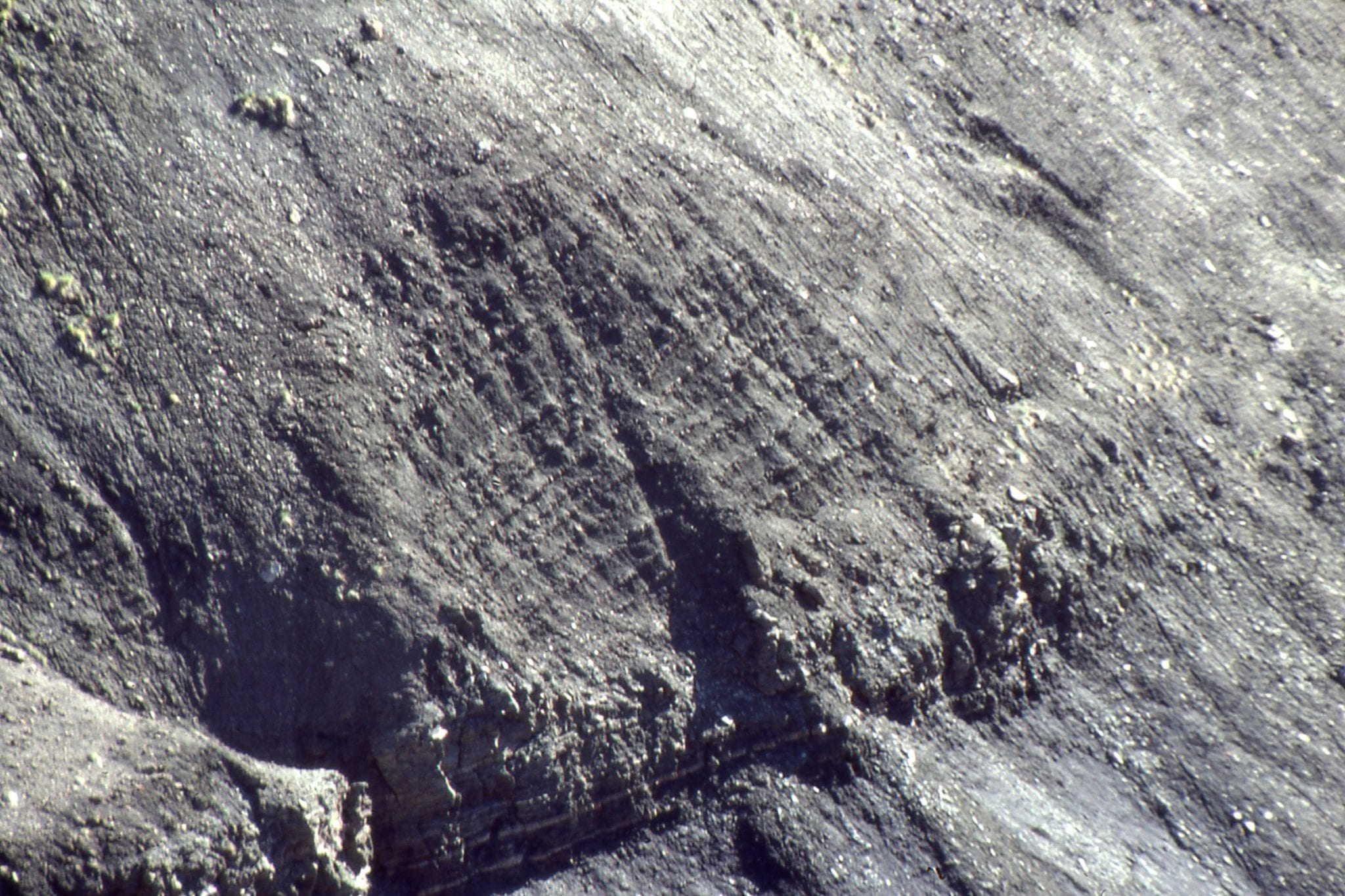
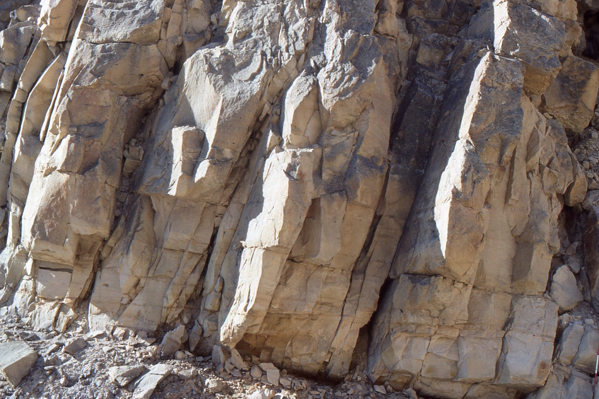
 Hummock cross stratification (HCS) in a typical lower shoreface shelf cycle (storm wave-base), Jurassic Bowser Basin, northern British Columbia. Hammer rests on a thin pebbly debris flow that immediately underlies the HCS unit. It is generally thought that HCS forms during storms, from the combination of a unidirectional flowing bottom current, possibly as a sediment gravity flow, that is simultaneously moulded by the oscillatory motion of large storm waves.
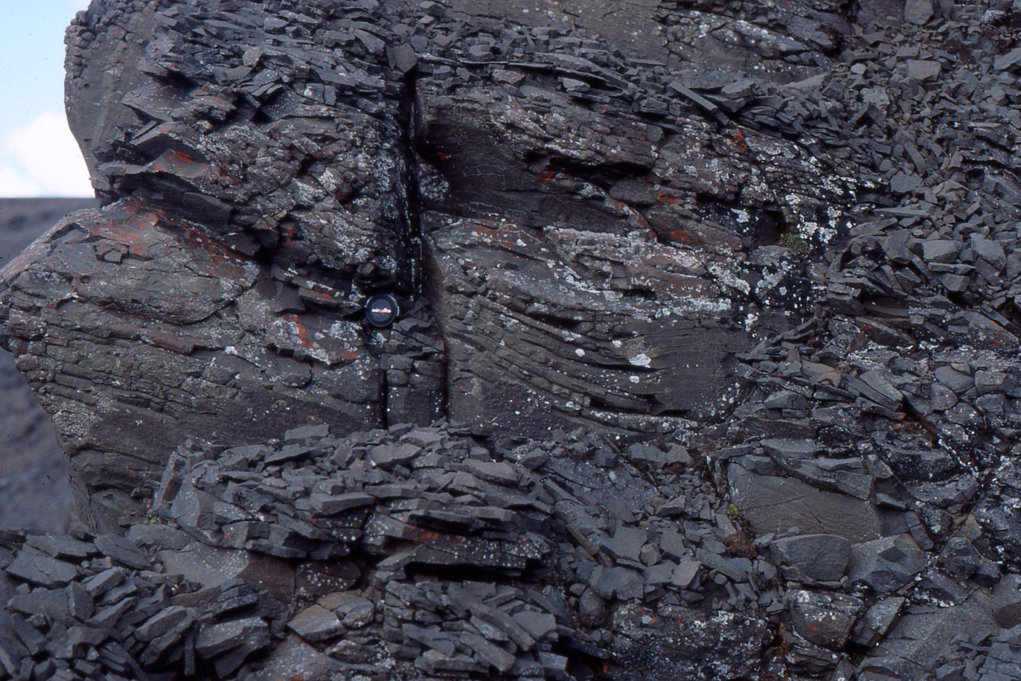 Possible swaley bedding, formed in much the same way as HCS, but where the hummocks have been eroded leaving the concave-upward swales. Jurassic Bowser Basin, northern British Columbia.
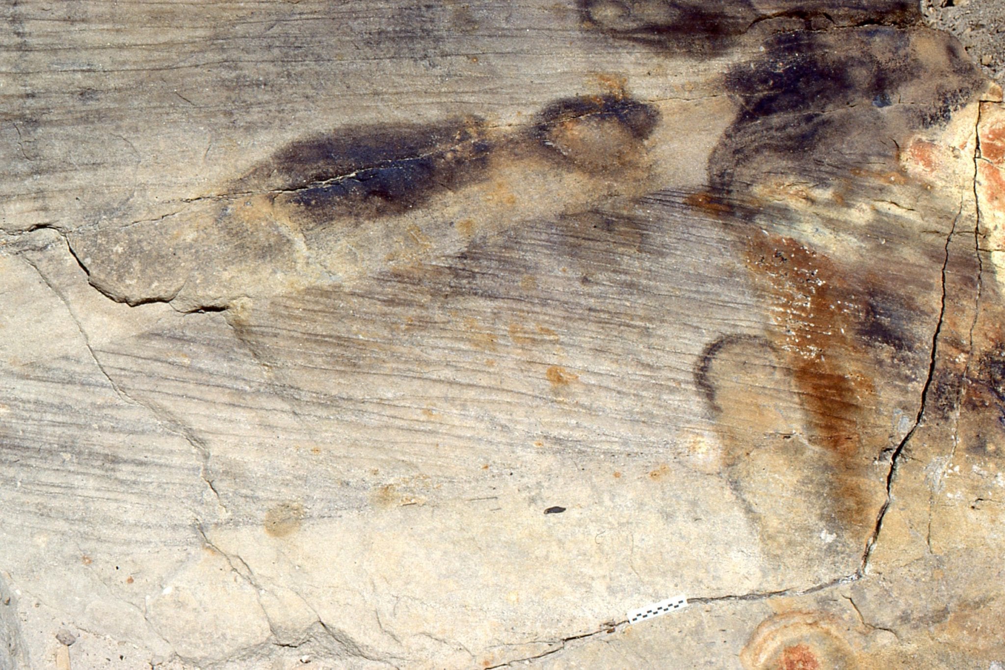
 Storm rip-ups of shelf muds in a mid-shelf cycle. Jurassic Bowser Basin, northern British Columbia.
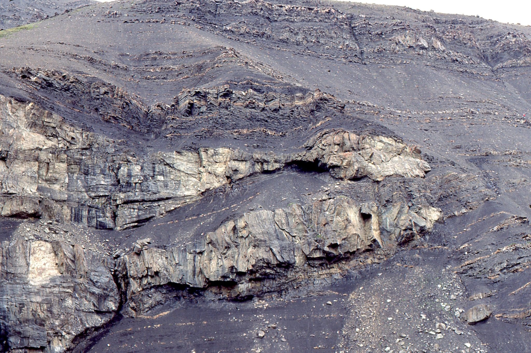
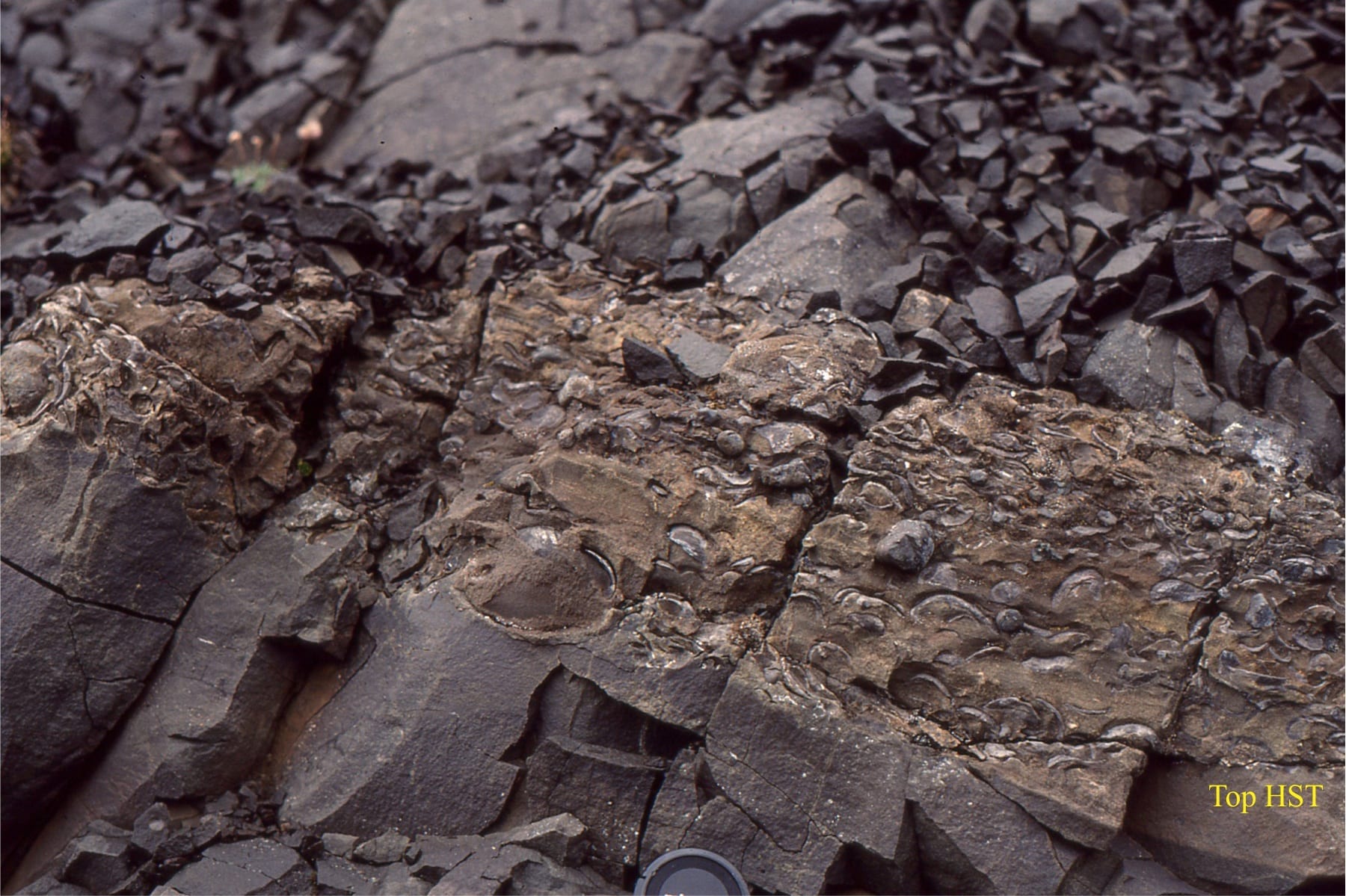 Many shelf cycles in the Bowser Basin succession, terminate abruptly and are overlain by a bed of fossiliferous (ammonites, trigoniids and other molluscs), pebbly, mudstone. This marks the transition form a highstand (HST) to succeeding transgression; the mudstone is the TRansgressive Systems Tract (TST).
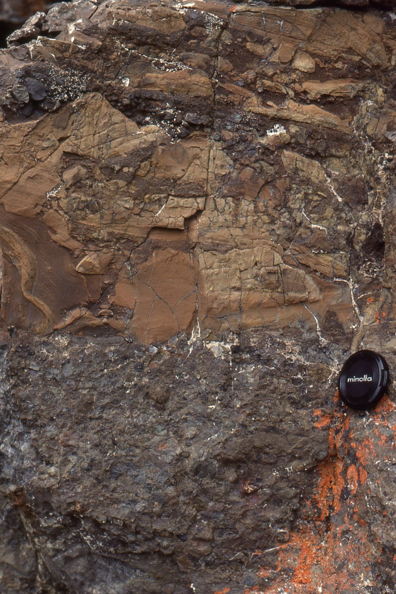
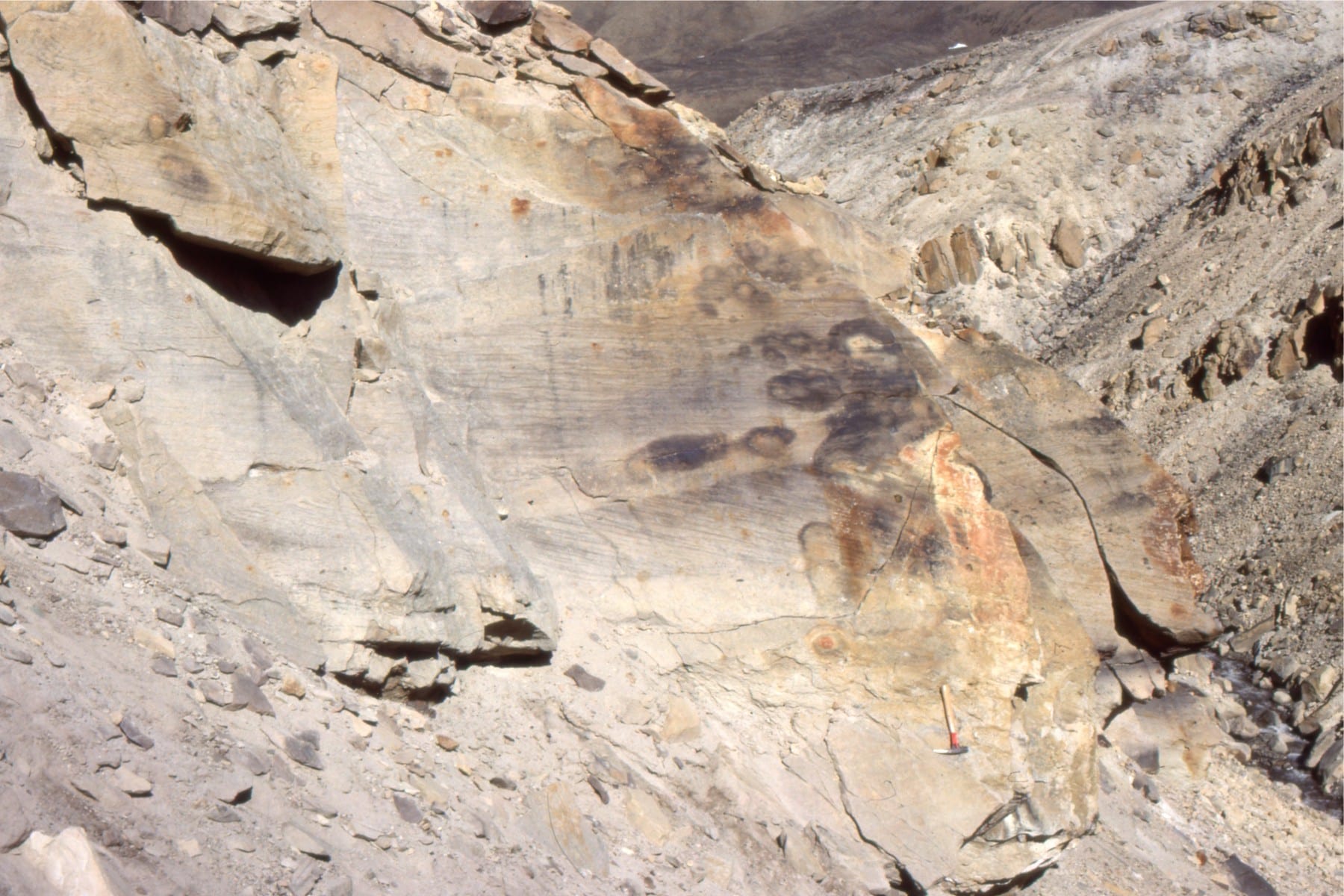
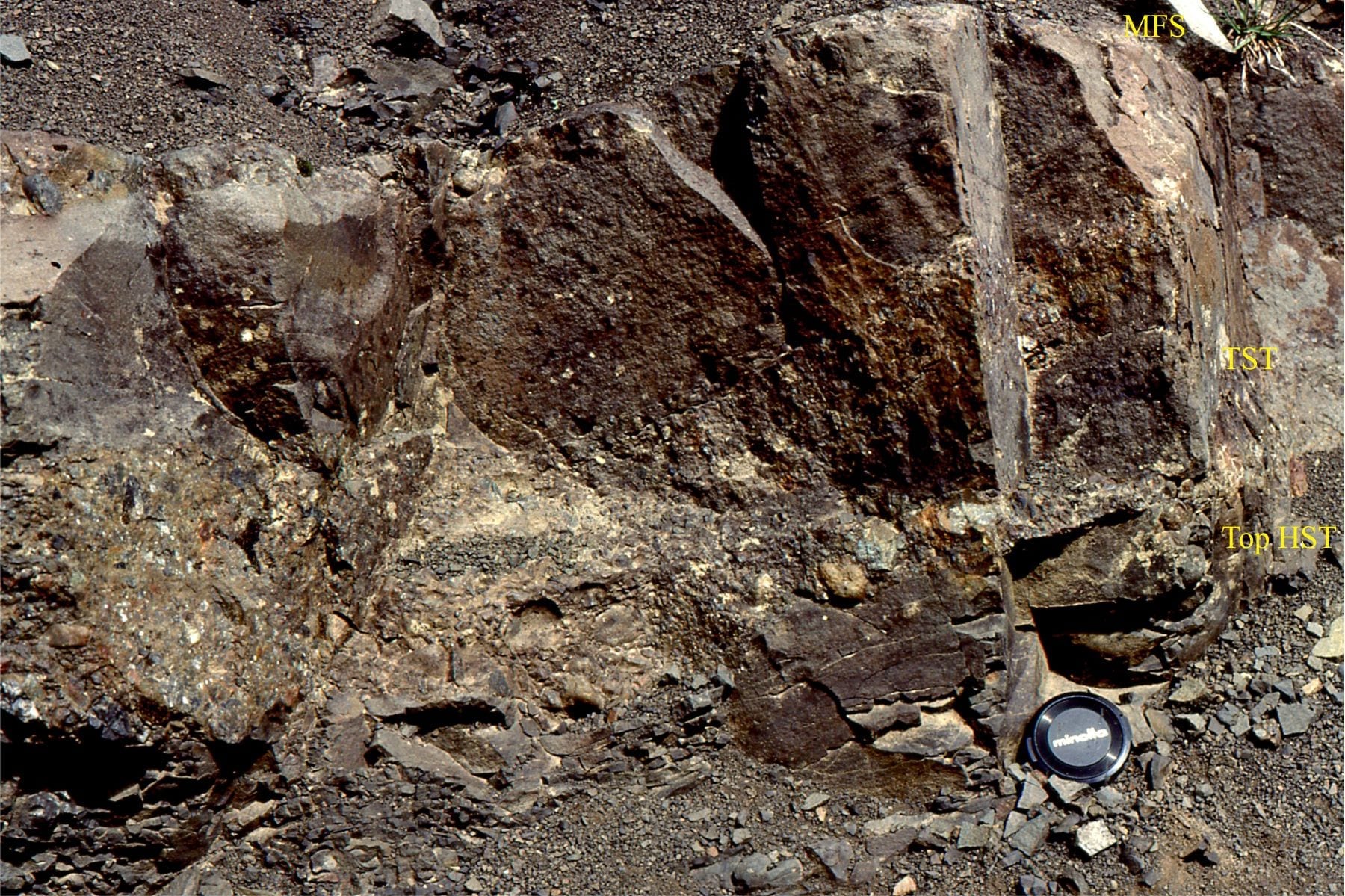 Transition from a sandy HST, to fossiliferous mudstone (small ammonite near the lens cap) of the TST. The top of the TST corresponds to a maximum flooding surface (MFS) – the stratigraphic record of maximum transgression. Jurassic Bowser Basin, northern British Columbia.
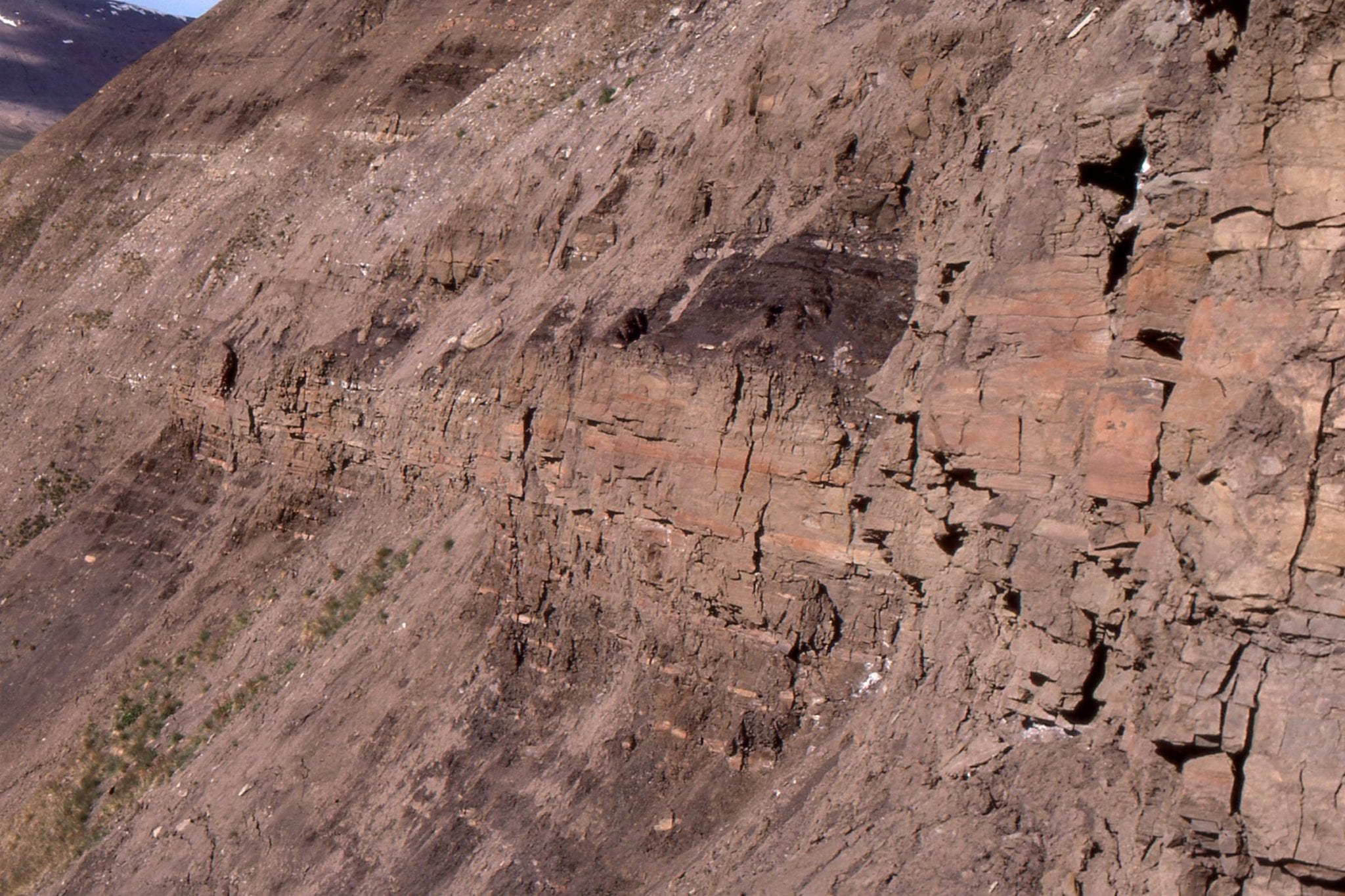
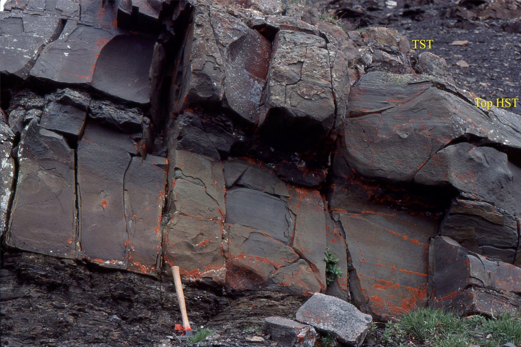 The upper portion of this coarsening upward shelf cycle, the highstand systems tract, contains low-angle planar lamination and some hummocky cross-stratification (HCS). The base of the transgressive unit (TST) is an erosional surface. Jurassic Bowser Basin, northern British Columbia.
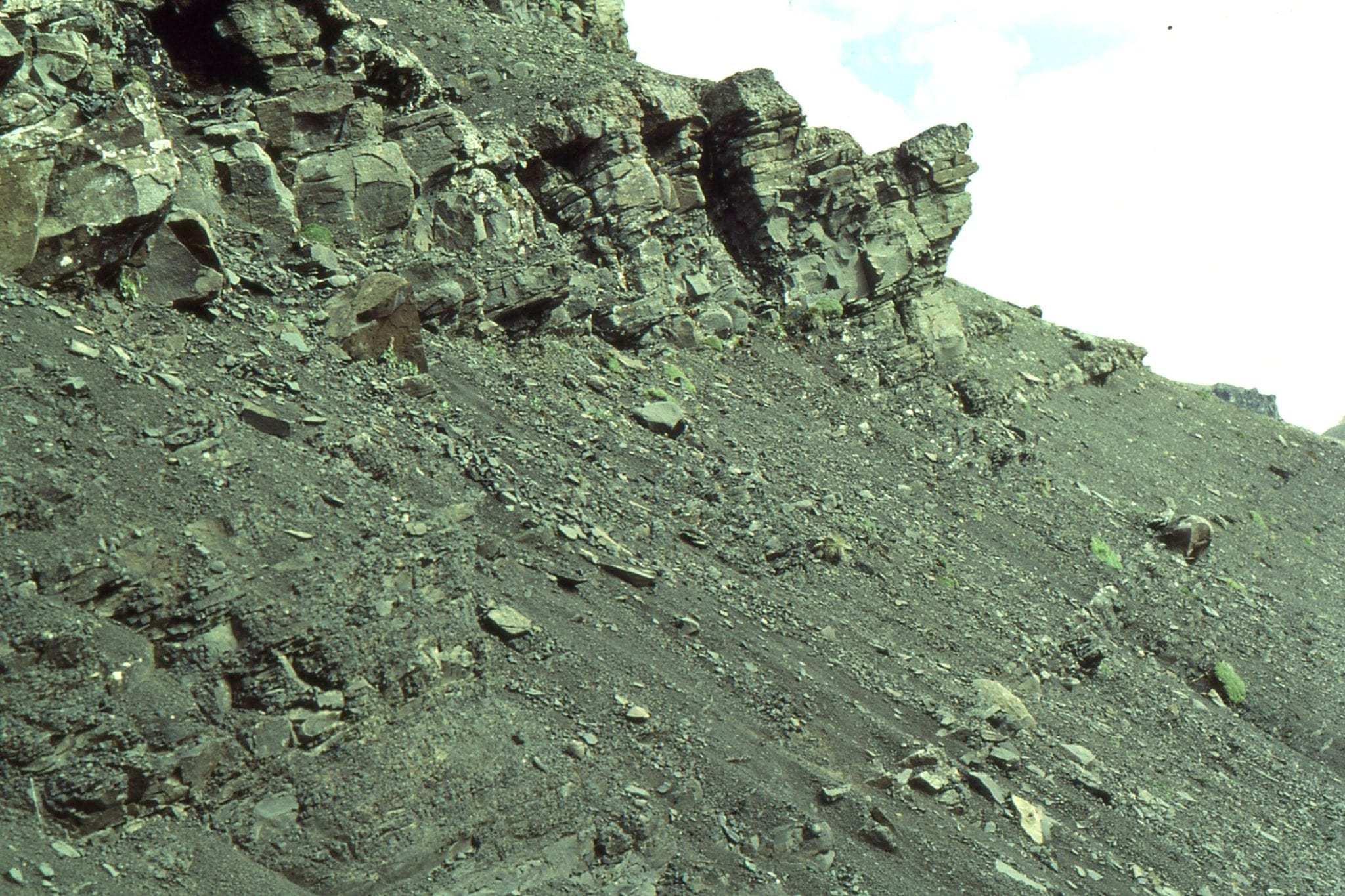
Two views of a lenticular, trough crossbedded pebbly sandstone that has cut into the top of a shelf cycle. This has been interpreted as a lowstand fluvial channel, that traversed and eroded the shelf as it was exposed during falling sea level. This was one mechanism for transporting gravel and sand to the slope and deeper basin, via shelfbreak gullies (like the one pictured above). Jurassic Bowser Basin, northern British Columbia.
 The same fluvial, lowstand channel shown in the images above. The channel is about 2m thick. Jurassic Bowser Basin, northern British Columbia.
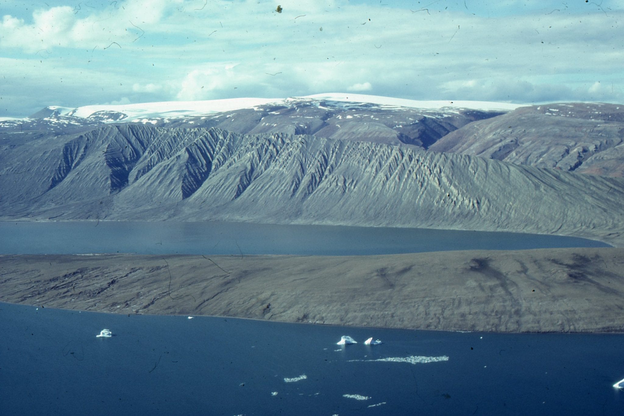
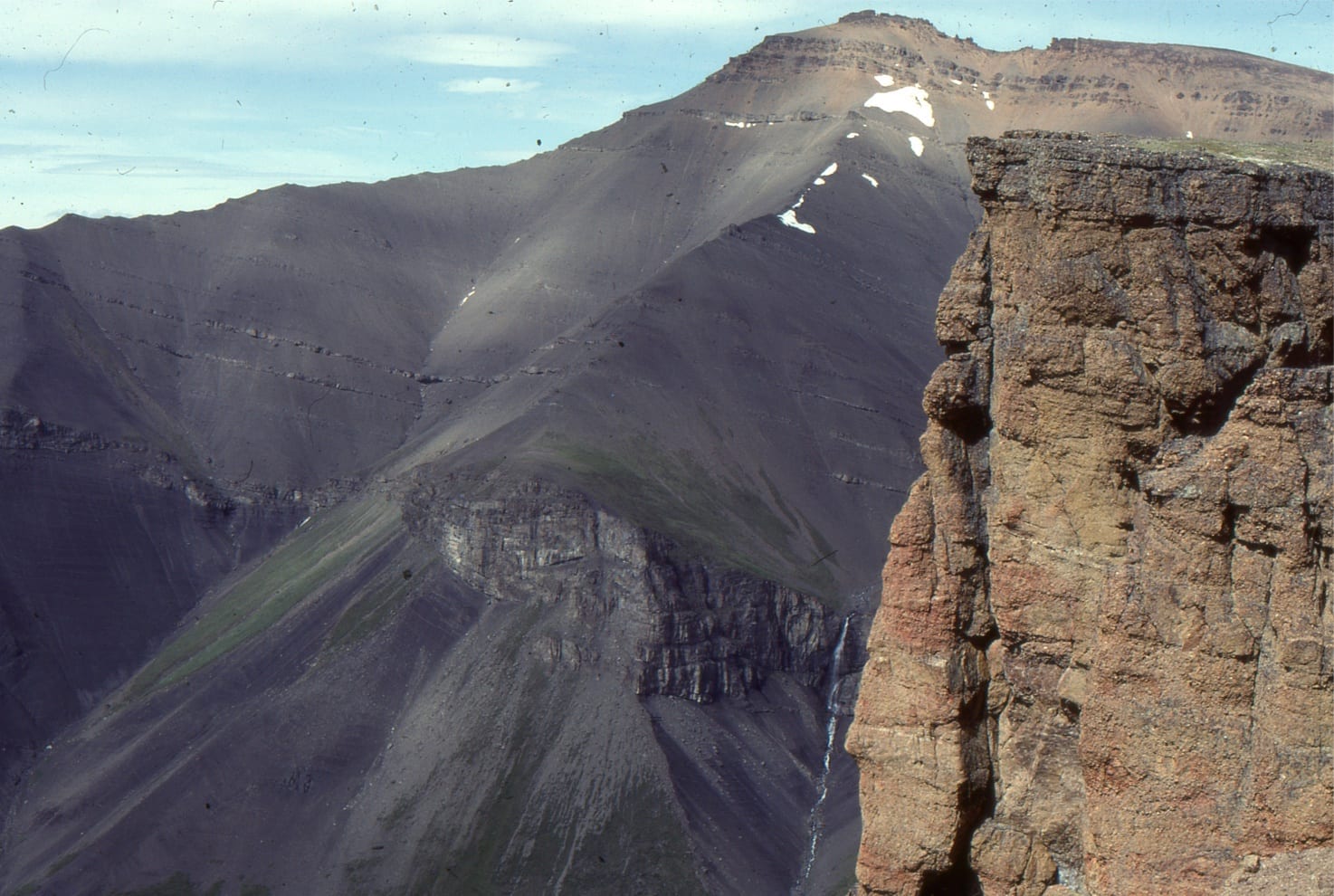 Panorama of a slope-shelfbreak gully-shelf-to fluvial transition, beautifully exposed at Mt Tsatia, Jurassic Bowser Basin, northern British Columbia. Conglomerate on the immediate right are equivalent to the rusty beds near the opposite summit. The shelfbreak is located at the top of the wedge-shaped gully (corresponds to the top of the waterfall) – below the gully are slope deposits. The thickness of strata in this view is more than a kilometre.
A really nice (folded) succession of coarsening upward shelf cycles, Eocene Eureka Sound Group, South Bay, Ellesmere Island. The Eocene shelf was laterally equivalent to river-dominated deltas (Iceberg Bay Fm.) to the north and east.
Coarsening upward mid-shelf – shoreface cycles at South Bay, Ellesmere Island (same location as image above). Small subaqueous dunes, ripples and HCS are common.
Coarsening upward muddy shelf cycles, mostly below storm wave-base, but the occasional cycle extending into lower shoreface (some HCS). Eocene, Eureka Sound Group, Ellesmere Island
 Downlap of muddy outer shelf siltstone and mudstone, Eocene Strand Bay Fm, Ellesmere Island
Sandy, Paleocene shelf dunes forming part of large sandwave complexes. Most of the crossbeds are the planar, or 2D type. The right image shows detail of crossbed foresets, with some reactivation surfaces (probably tidally induced); crossbed is about 40cm thick. There is some indication here of tidal (flood-ebb) couplets. Expedition Fm, Eureka Sound Group, Ellesmere Island.
 Sandwave complex on a Paleocene sandy shelf, made up of multiple dunes. Eureka Sound Group, Ellesmere Island.
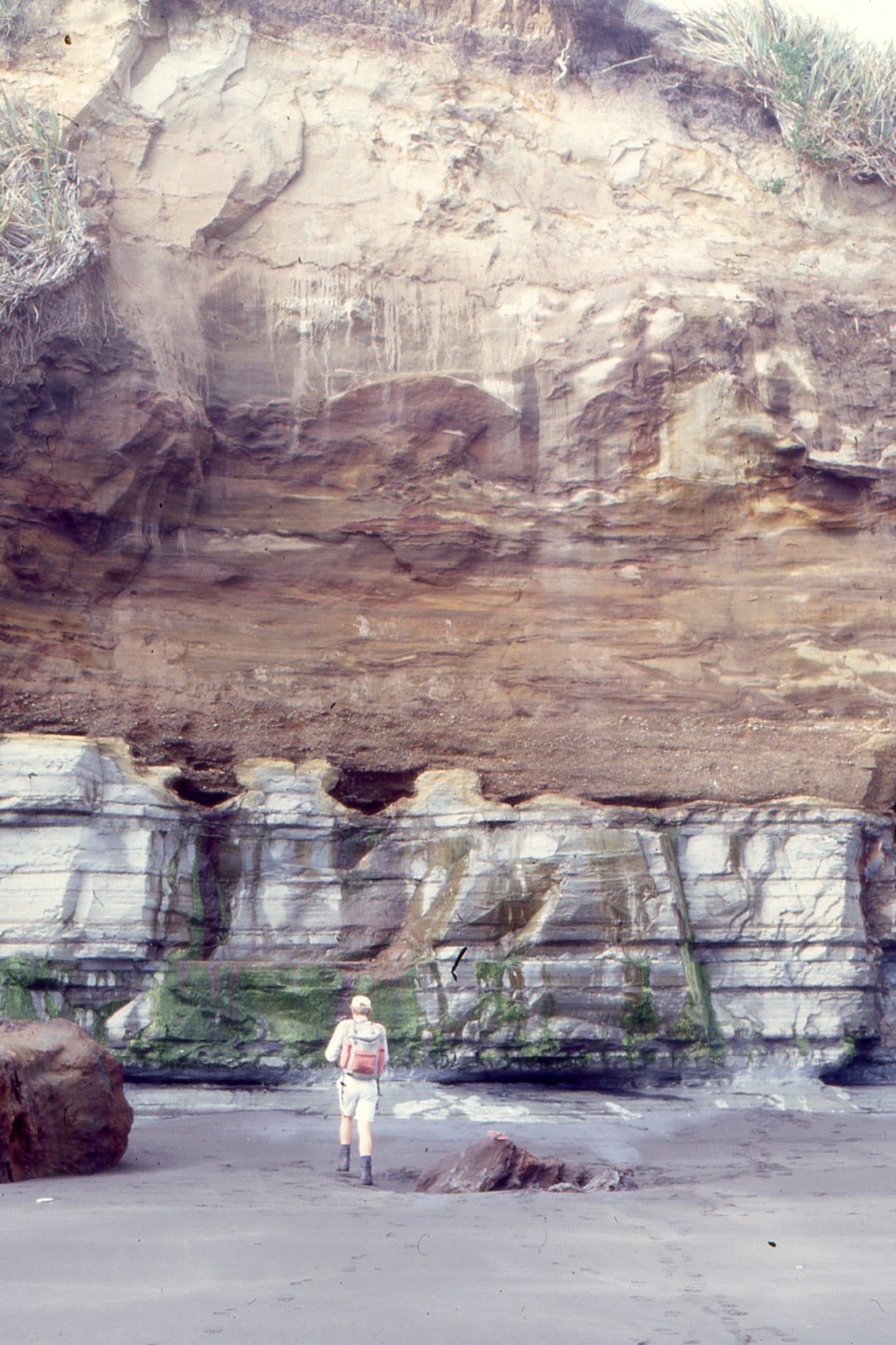
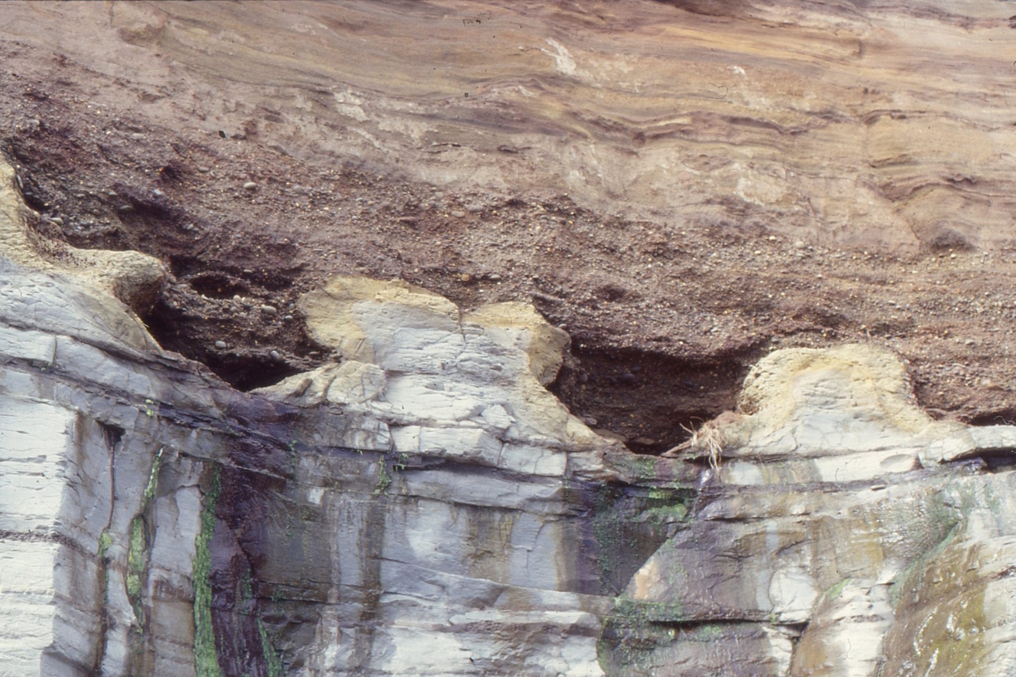
The abrupt, corrugated surface here is a Late Pleistocene wave-cut platform, eroded across Pliocene mudstones (Tangahoe Fm). The wave-cut platform and overlying estuarine-dune sands are part of the Rapanui Formation, near Hawera, New Zealand. The eroded corrugations and channels contain wood, shells and pebbles.
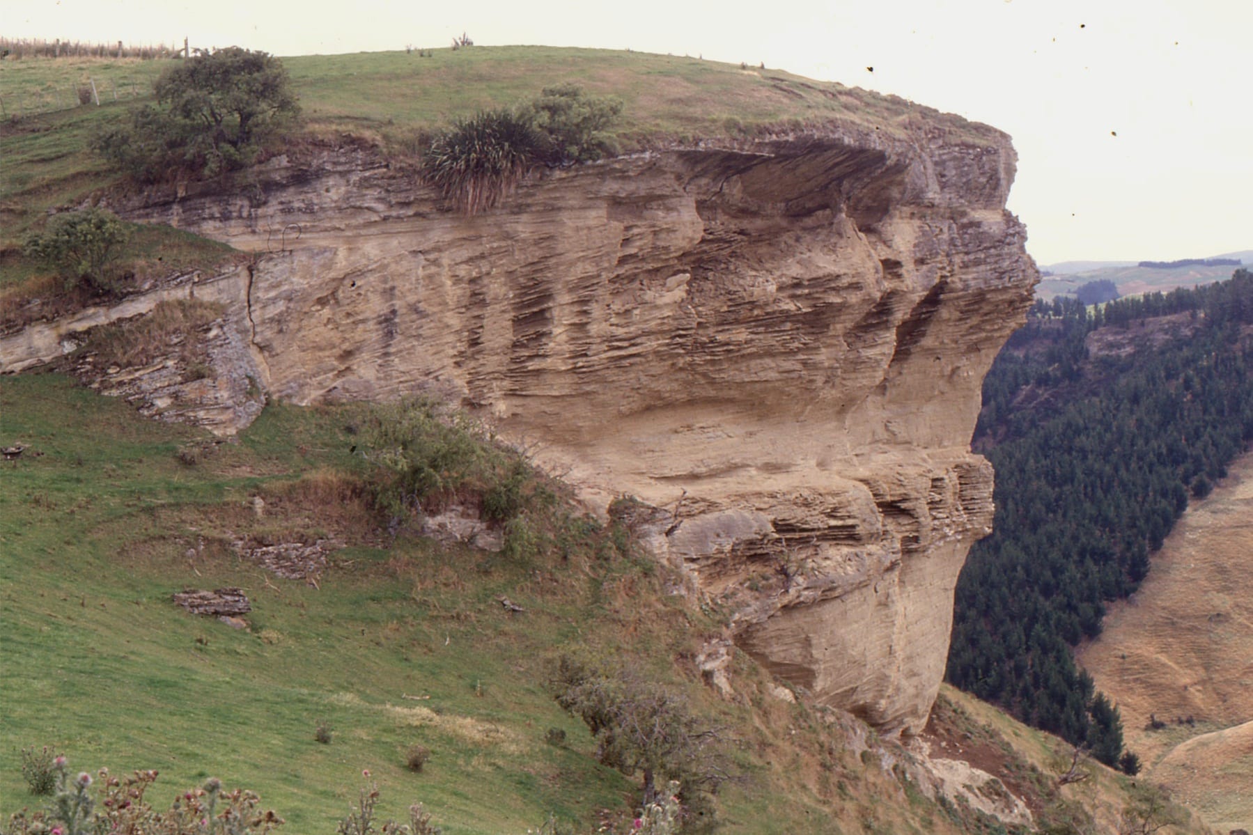
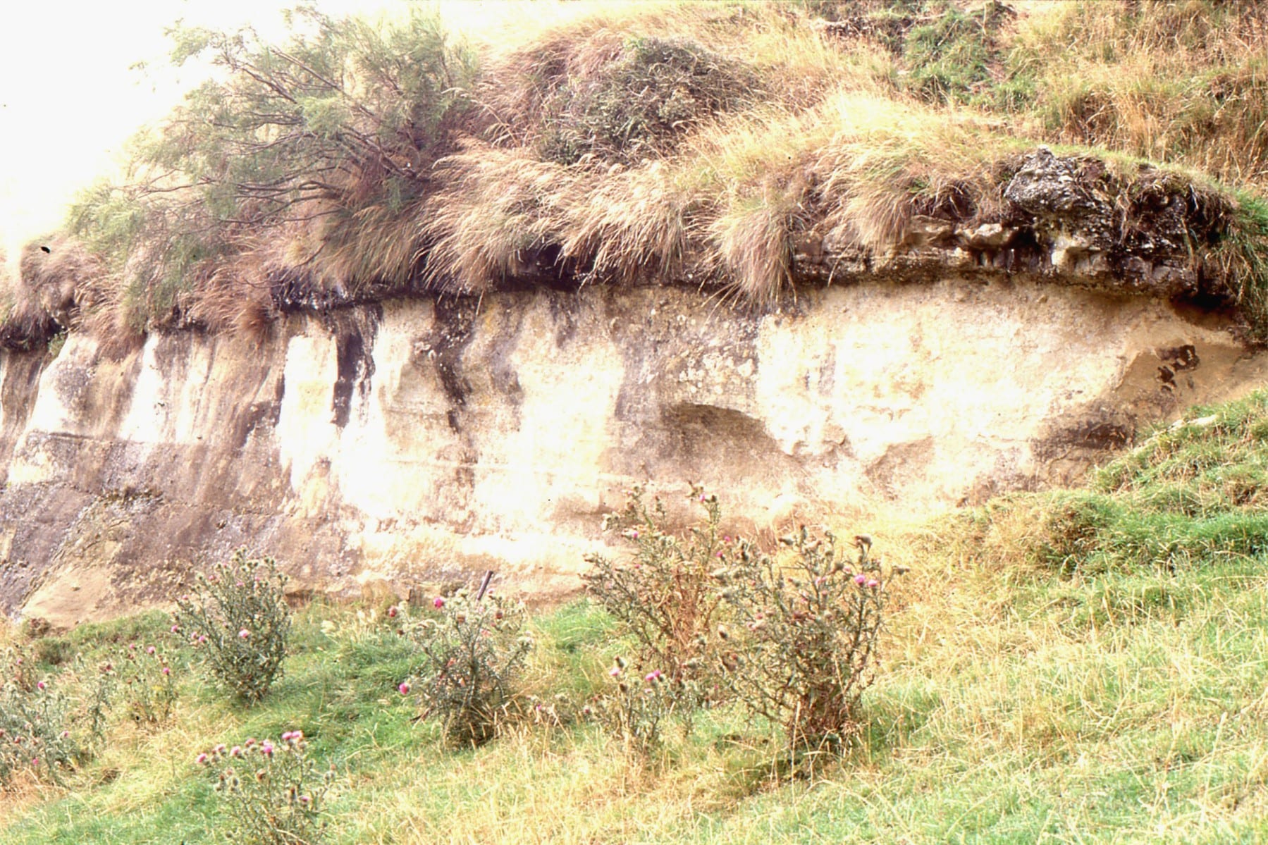
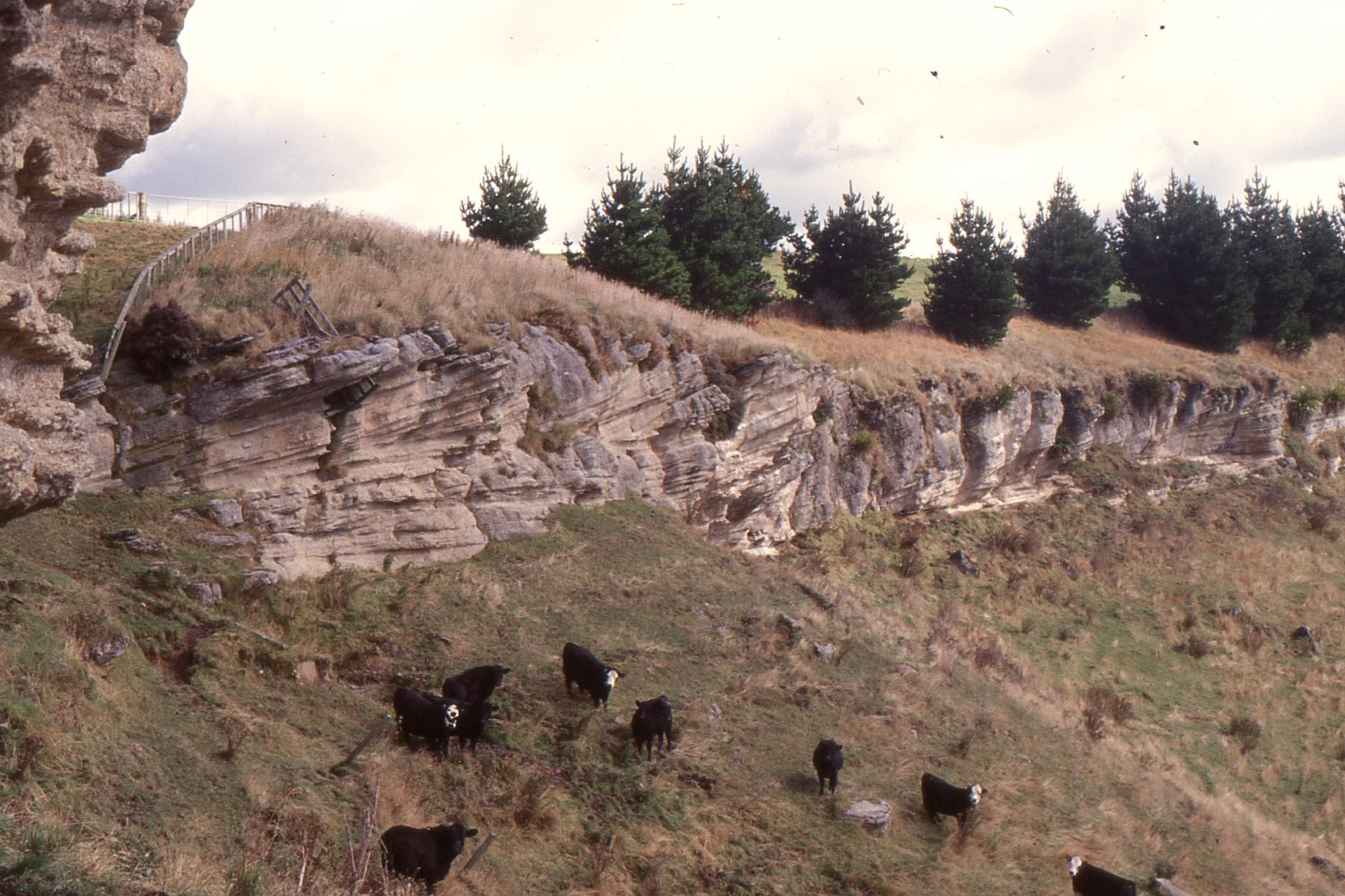
Late Miocene – Early Pliocene coarsening upward shelf cycles, from outer-mid shelf siltstone-sandstone, to shoreface, tidally induced sandy coquina sandwaves (left image). The 3 images show part of the highstand systems tract. The carbonate facies are part of the classic, cool-temperate water limestones of Wanganui Basin, New Zealand. Matemateaonga Fm, Blackhill.
 Thick HST calcareous sandstone – limestone, Late Miocene – Early Pliocene Matemateaonga Fm, Blackhill.
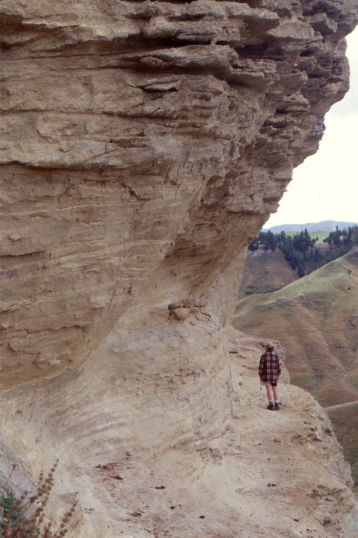
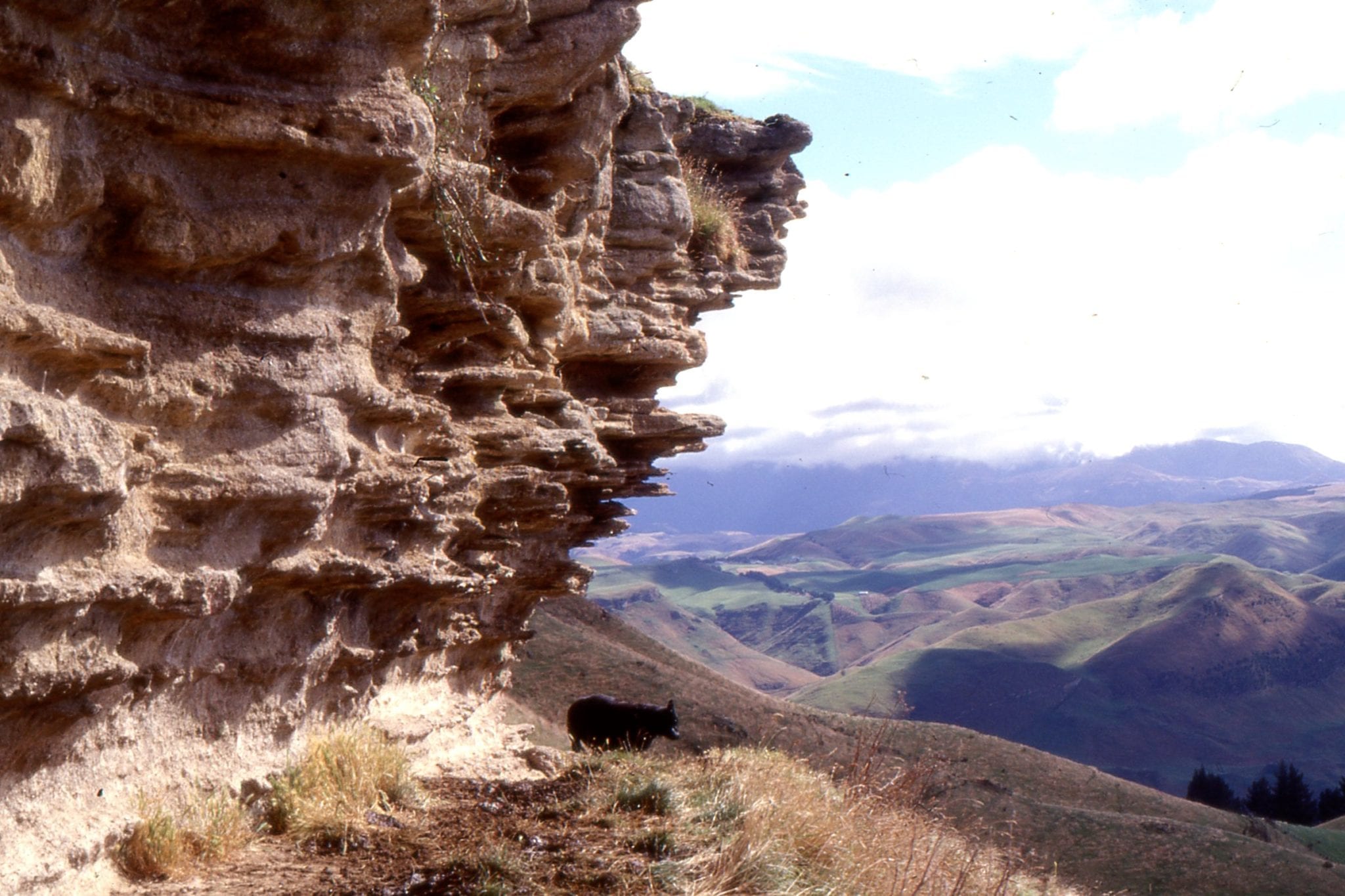
 Large planar crossbeds in shelf sandwaves (HST), overlain by a pebbly shellbed deposited during the next transgressions (TST). Late Miocene – Early Pliocene Matemateaonga Fm, Blackhill.
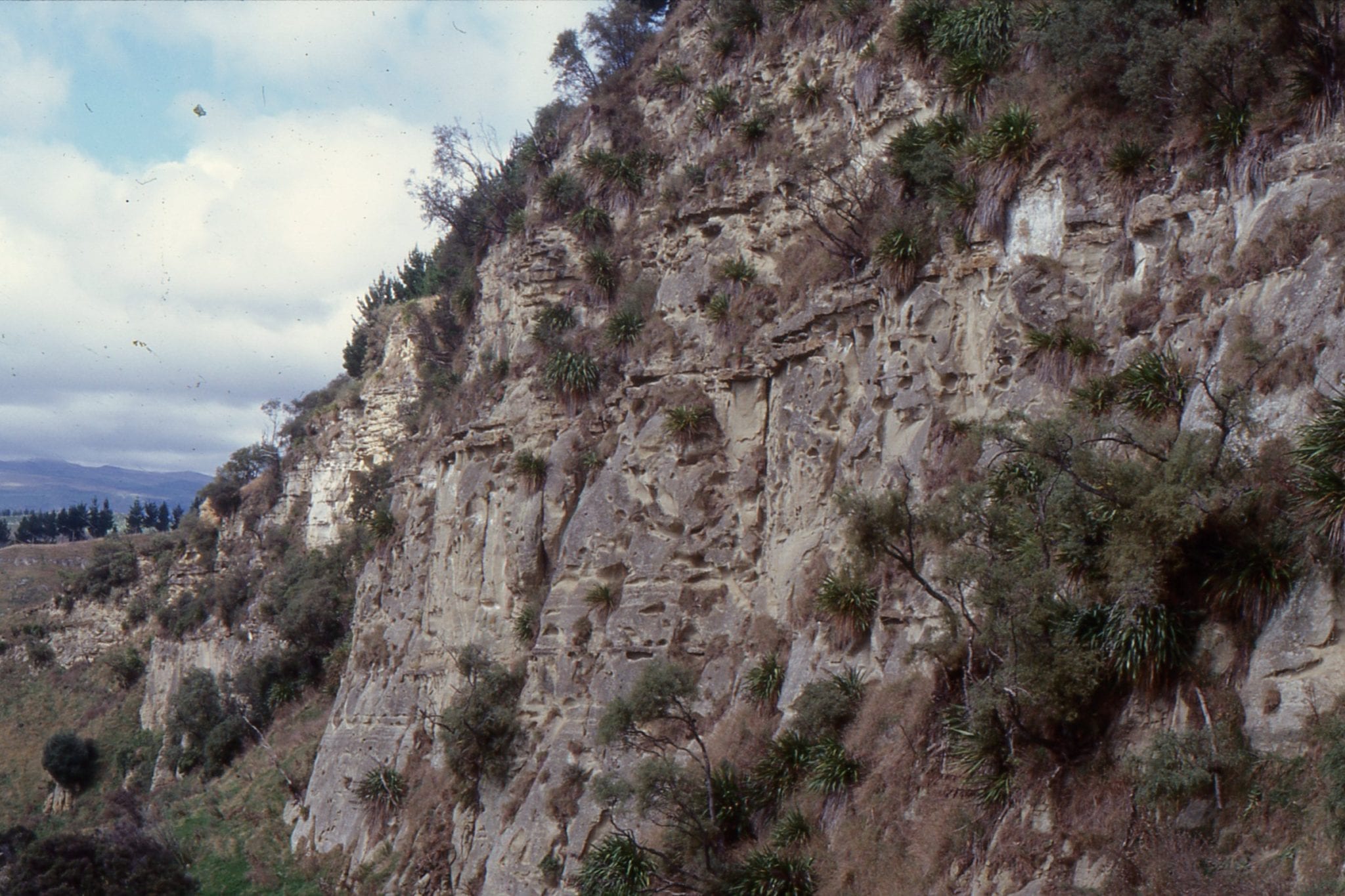
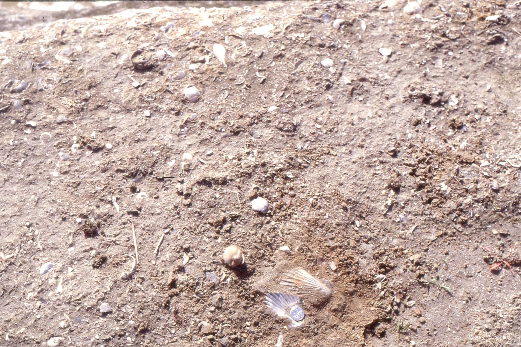 Typical transgressive systems tract (TST) shellbed, Late Miocene – Early Pliocene Matemateaonga Fm, Blackhill.
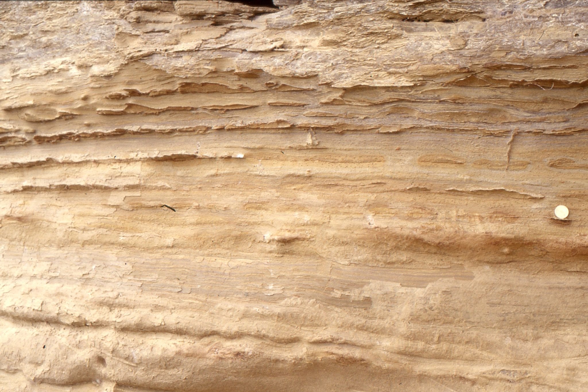
 Detail of shelf dune foresets with backflow ripples climbing up foreset dip. Late Miocene – Early Pliocene Matemateaonga Fm, Blackhill.
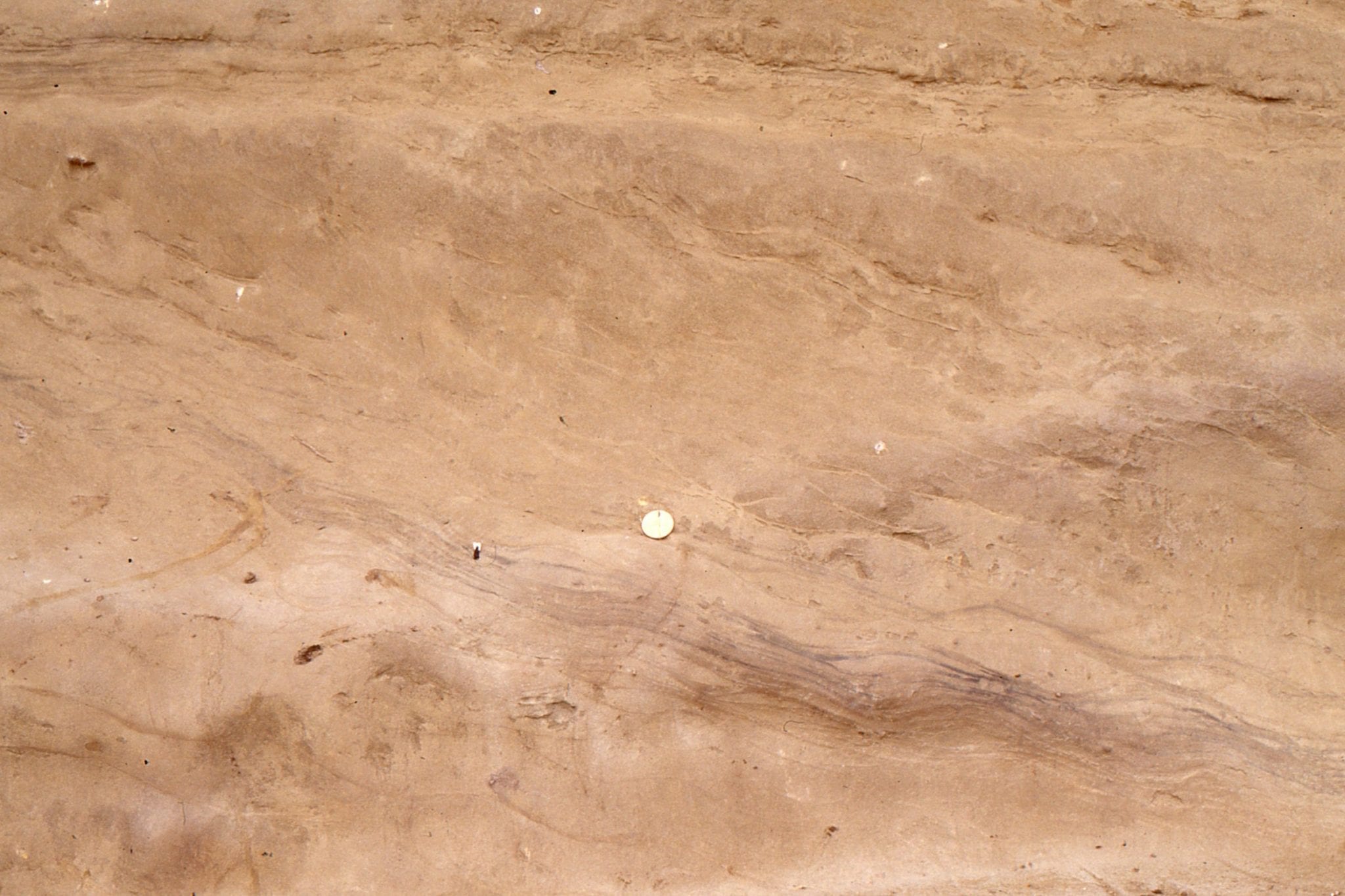
 Subtidal sandstone with lenticular and wavy bedding deposited during ebb-flood tides. Late Miocene – Early Pliocene Matemateaonga Fm, Blackhill.
 Large planar crossbedded calcareous sandstone, formed either as shelf sandwaves or platform of a tidal inlet flood delta. Late Miocene – Early Pliocene Matemateaonga Fm, Blackhill.