
The Atlas, as are all blogs, is a publication. If you use the images, please acknowledge their source (it is the polite, and professional thing to do).
Marine slopes are bona fide geological settings in themselves, but from a geotectonic perspective they are the region where continental crust is transitional to oceanic crust, and where sediment bypasses the shelf as it heads towards the deep ocean floor – typically as submarine fans. Slopes, as their name suggests, have significantly greater dip than an adjacent shelf; the break between the shelf and slope is defined by this break in sea floor gradient. Slopes are frequently cut by gullies and submarine canyons; the gullies tend to be localized across the shelf-slope break, whereas canyons extend across the shelf (sometimes coming within a few 100m of the shore), to the full depth of the slope. Gullies and canyons focus sediment transfer to the ocean deep. The Black’s Beach and Point Lobos canyons were visited on an AAPG trip with Tor Nilsen; the Bowser Basin examples I worked on in the late 1980s – early 90s.
This link will take you to an explanation of the Atlas series, the ownership, use and acknowledgment of images. There, you will also find links to the other categories.
Click on the image for an expanded view, then ‘back page’ arrow to return to the Atlas.
The images:
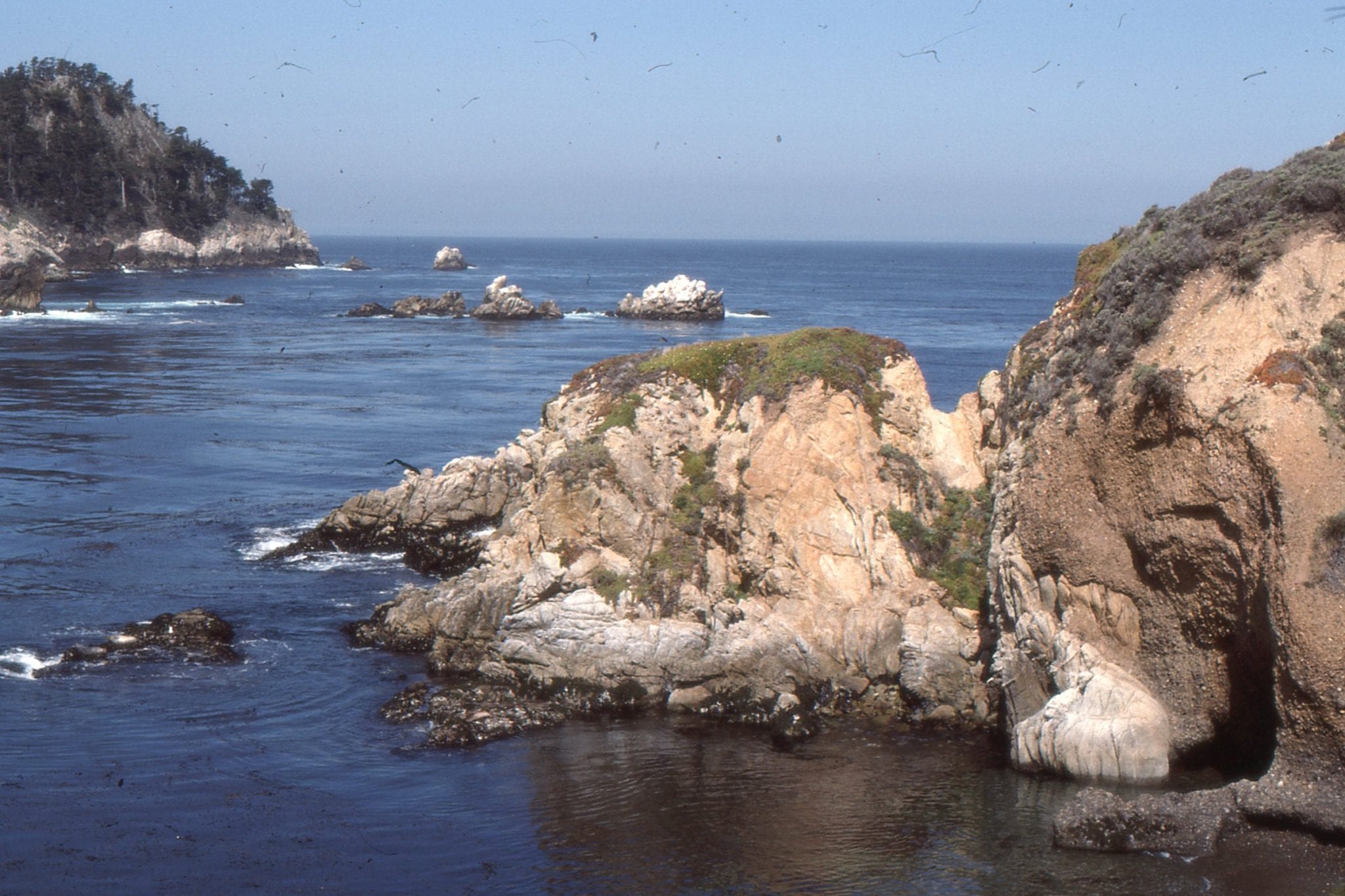
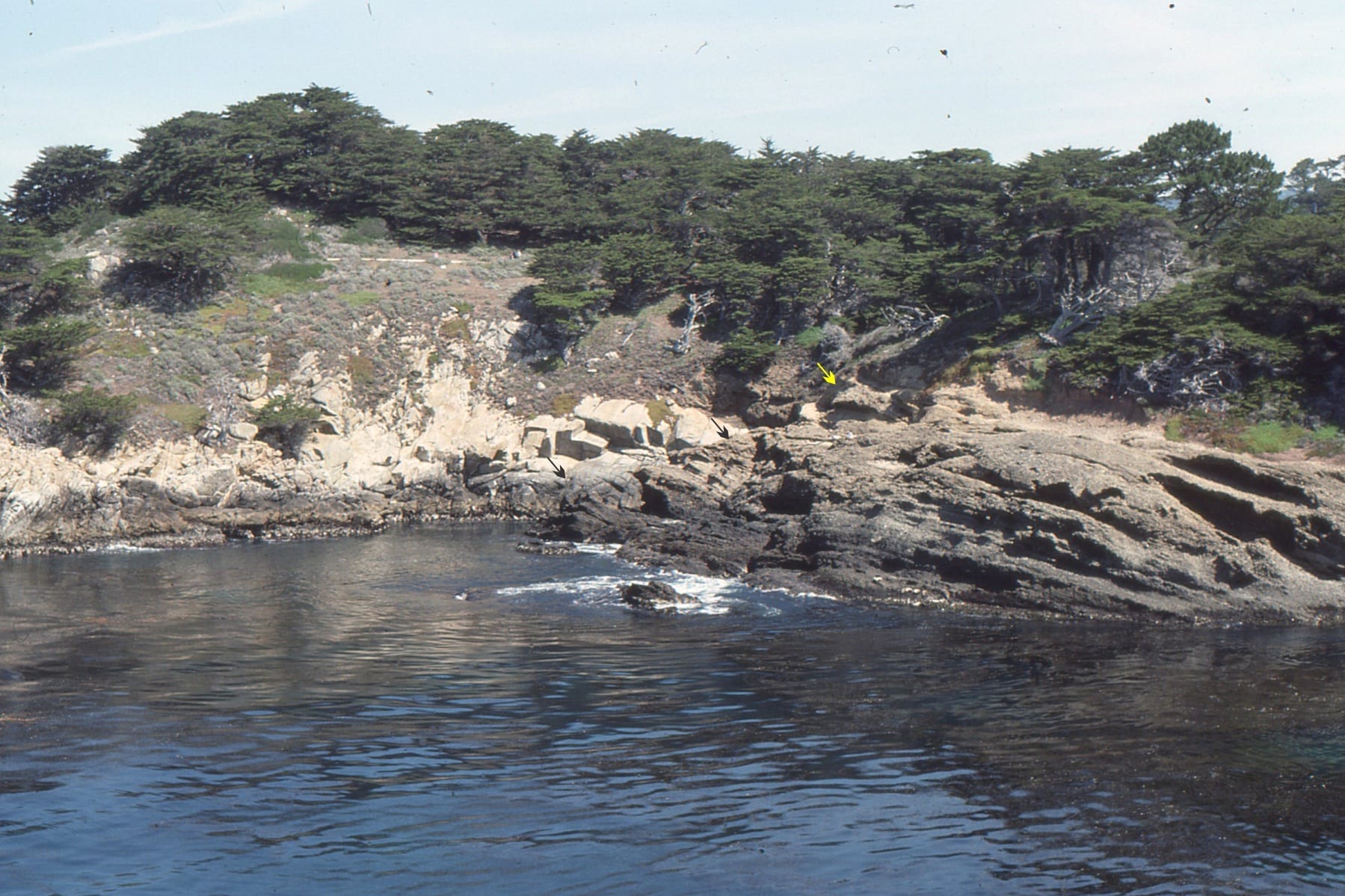
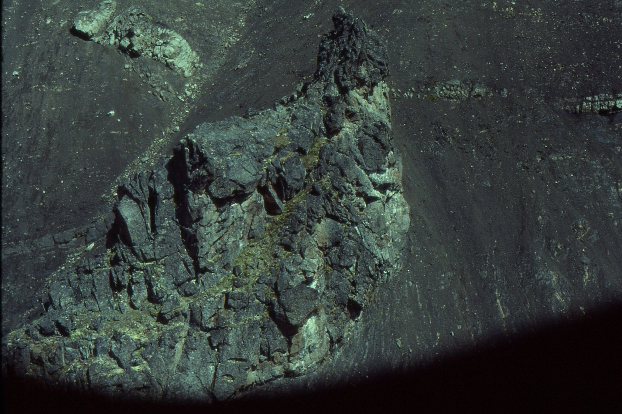
The iconic, Eocene Pt. Lobos submarine canyon, California, where canyon-fill conglomerate (brown hues) is in abrupt contact with Salinian granodiorite (white weathering) – an example of a steep canyon wall.
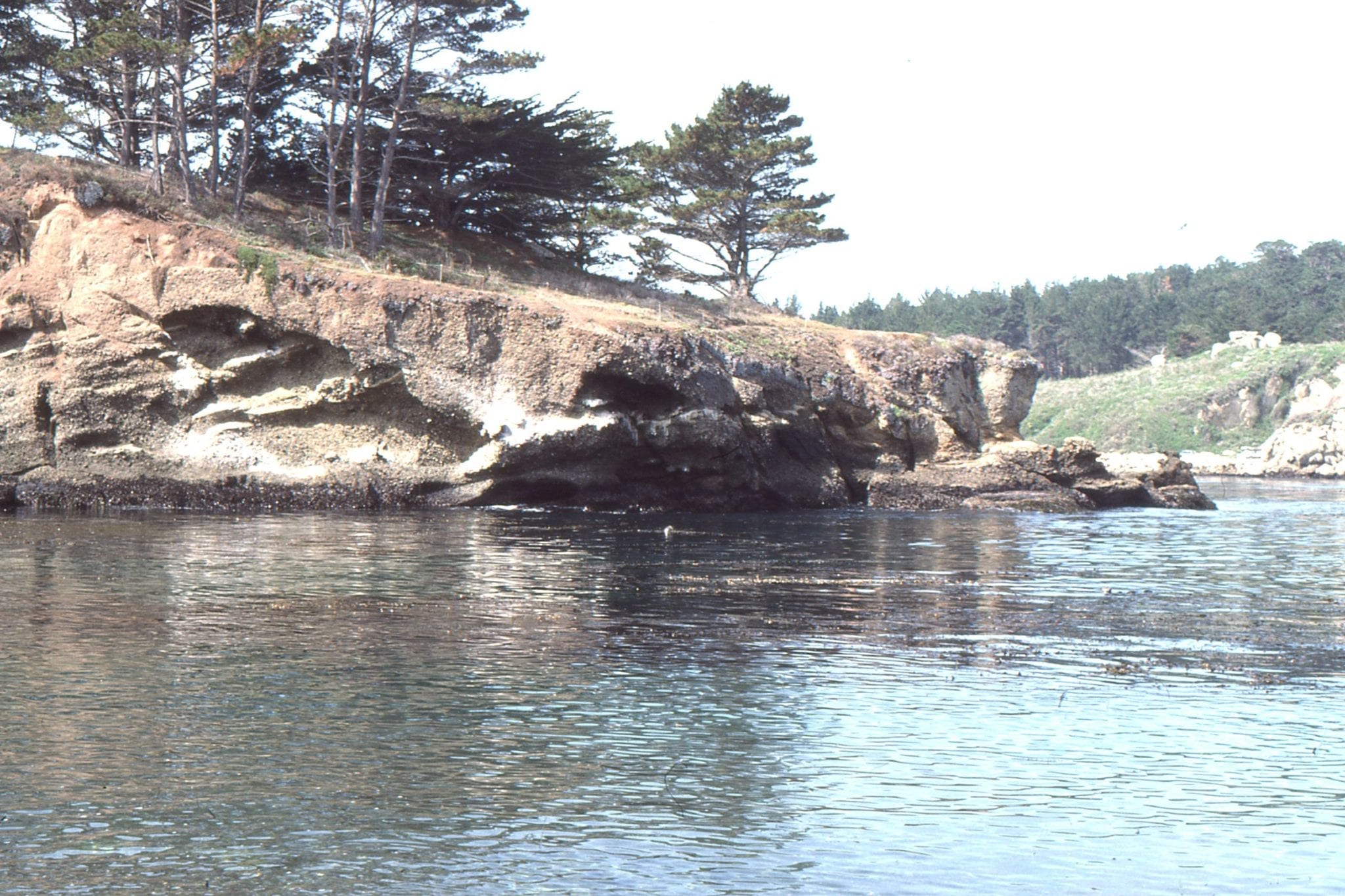
 Looking south, along the Pt. Lobos canyon axis. Conglomerate at the base, overlain by turbidites.
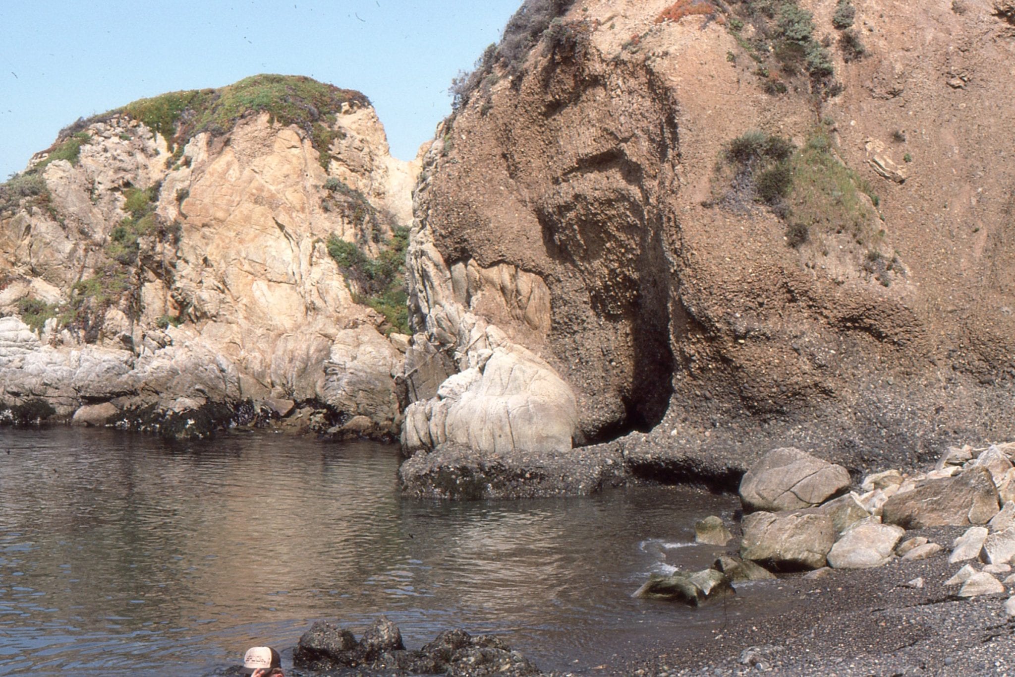
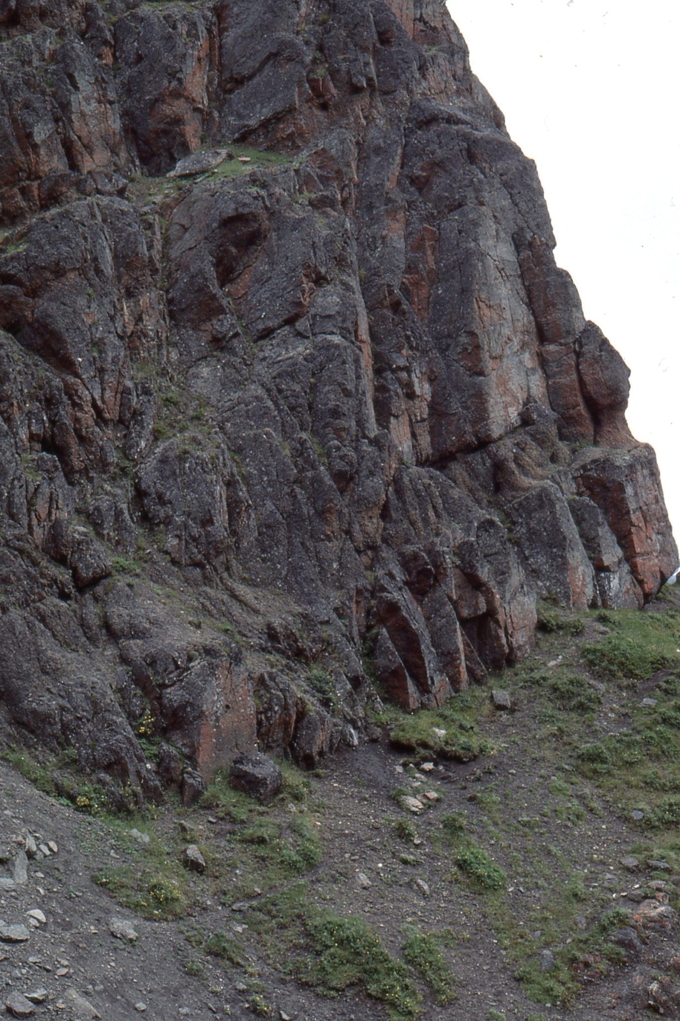
 Layered Pt Lobos canyon-fill conglomerate against the blocky weathering granodiorite bedrock. California. The canyon wall is indicated by arrows.
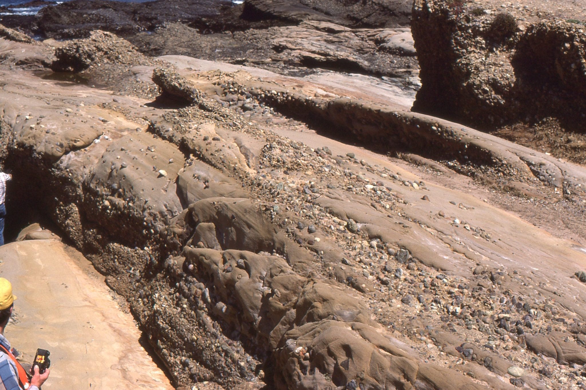
 Discordant packages of conglomerate canyon-fill, Eocene Pt. Lobos submarine canyon, California.
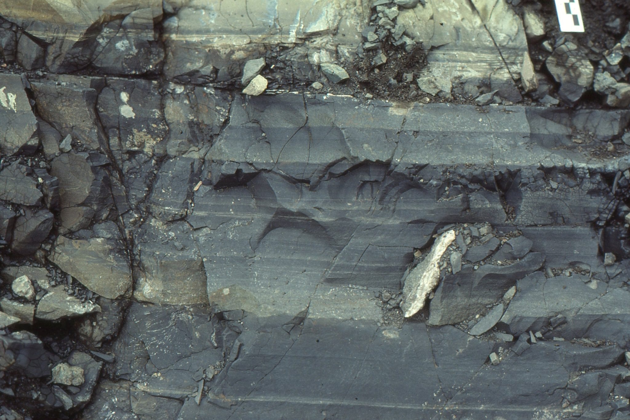
 Interbedded canyon-fill conglomerate and turbidites, Eocene Pt. Lobos submarine canyon, California. Some of the conglomerate beds have debris flow characteristics, others may be down-canyon traction current deposits.
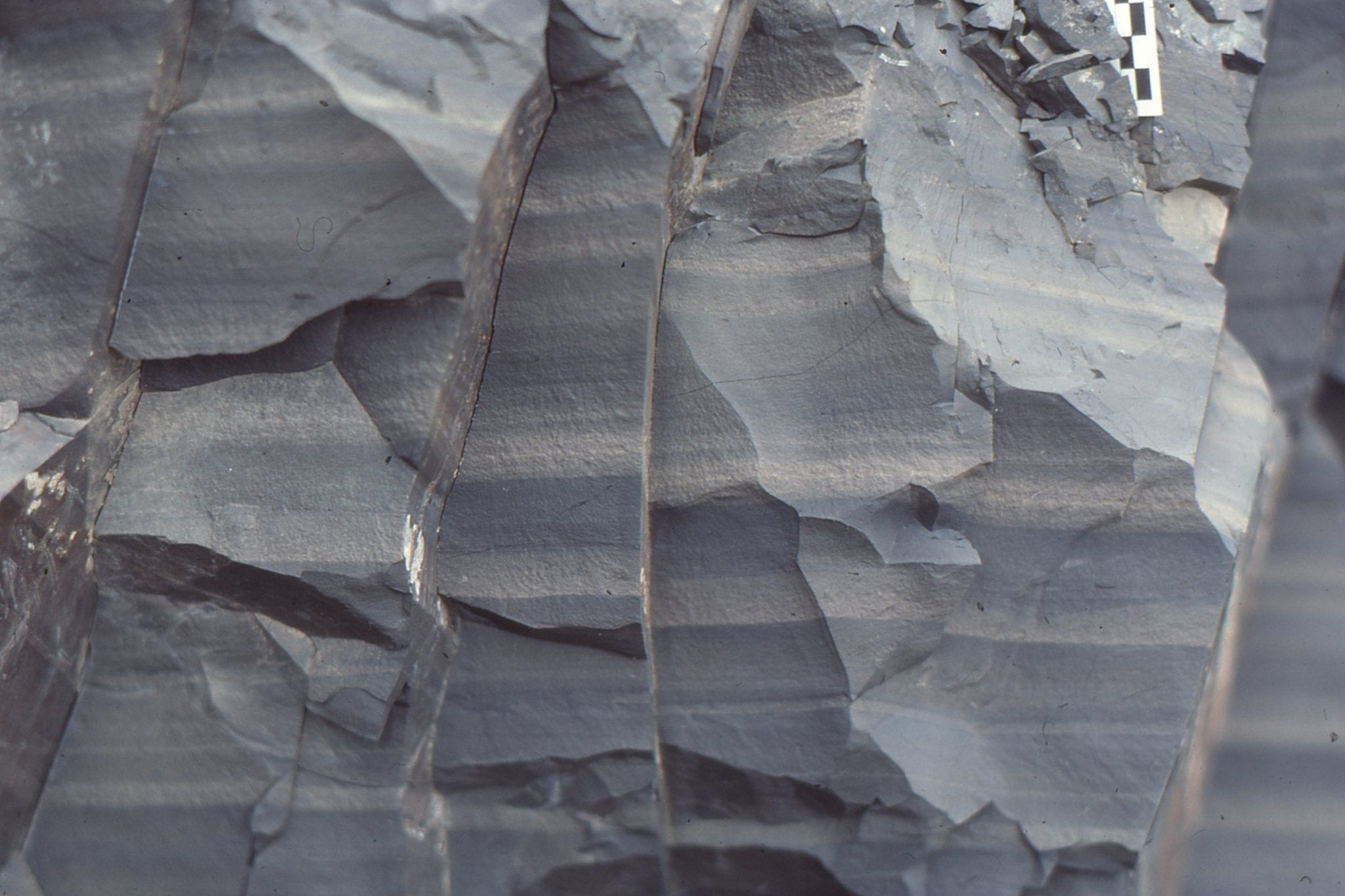
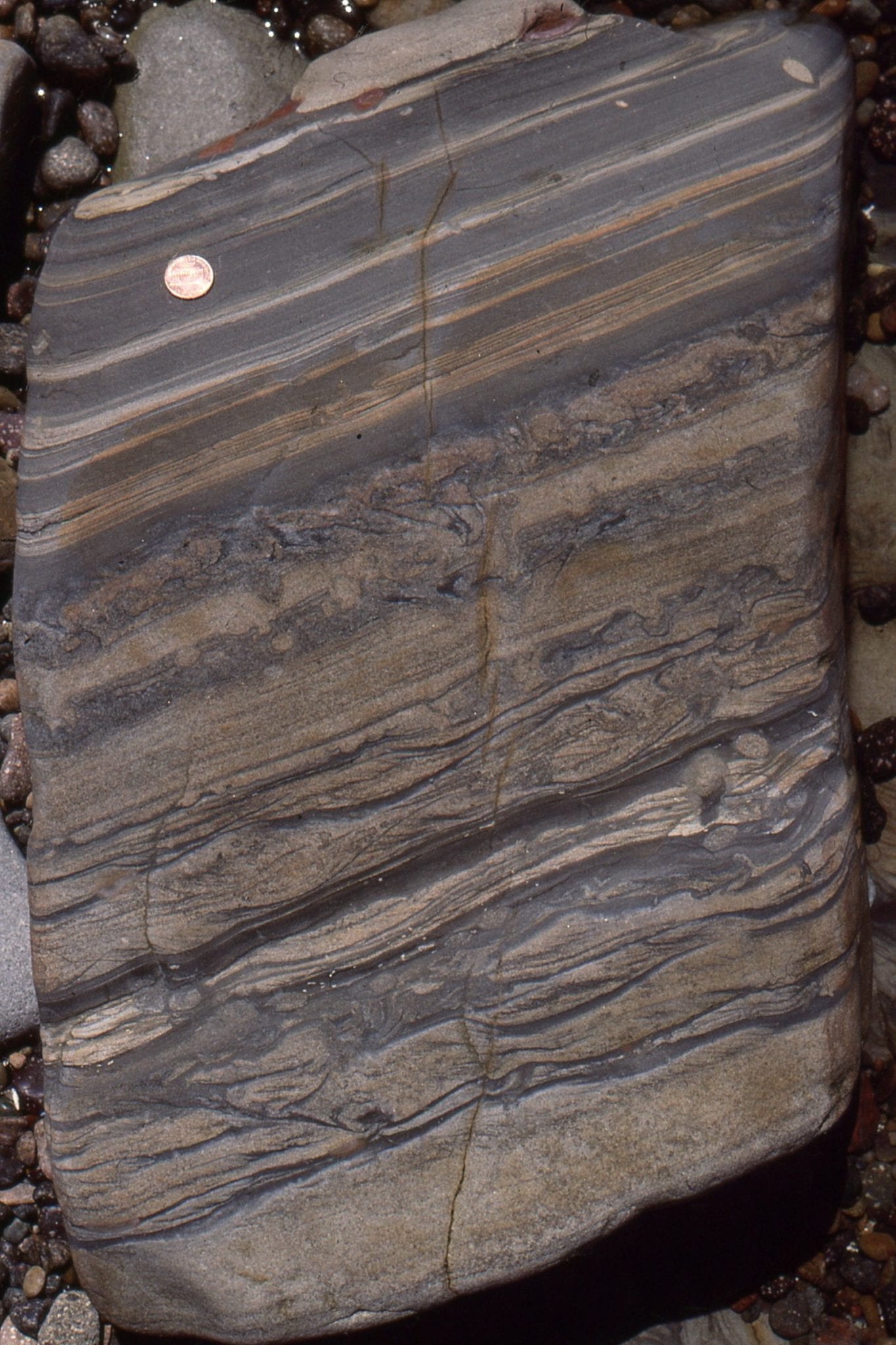 Local slope facies between channelised, canyon-fill conglomerate, presenting delicately laminated siltstone-mudstone, starved ripples with mud-drapes, thin graded beds (looking more like distal turbidites),soft-sediment load structures, and a few sand-filled burrows. Eocene Pt. Lobos submarine canyon, California.
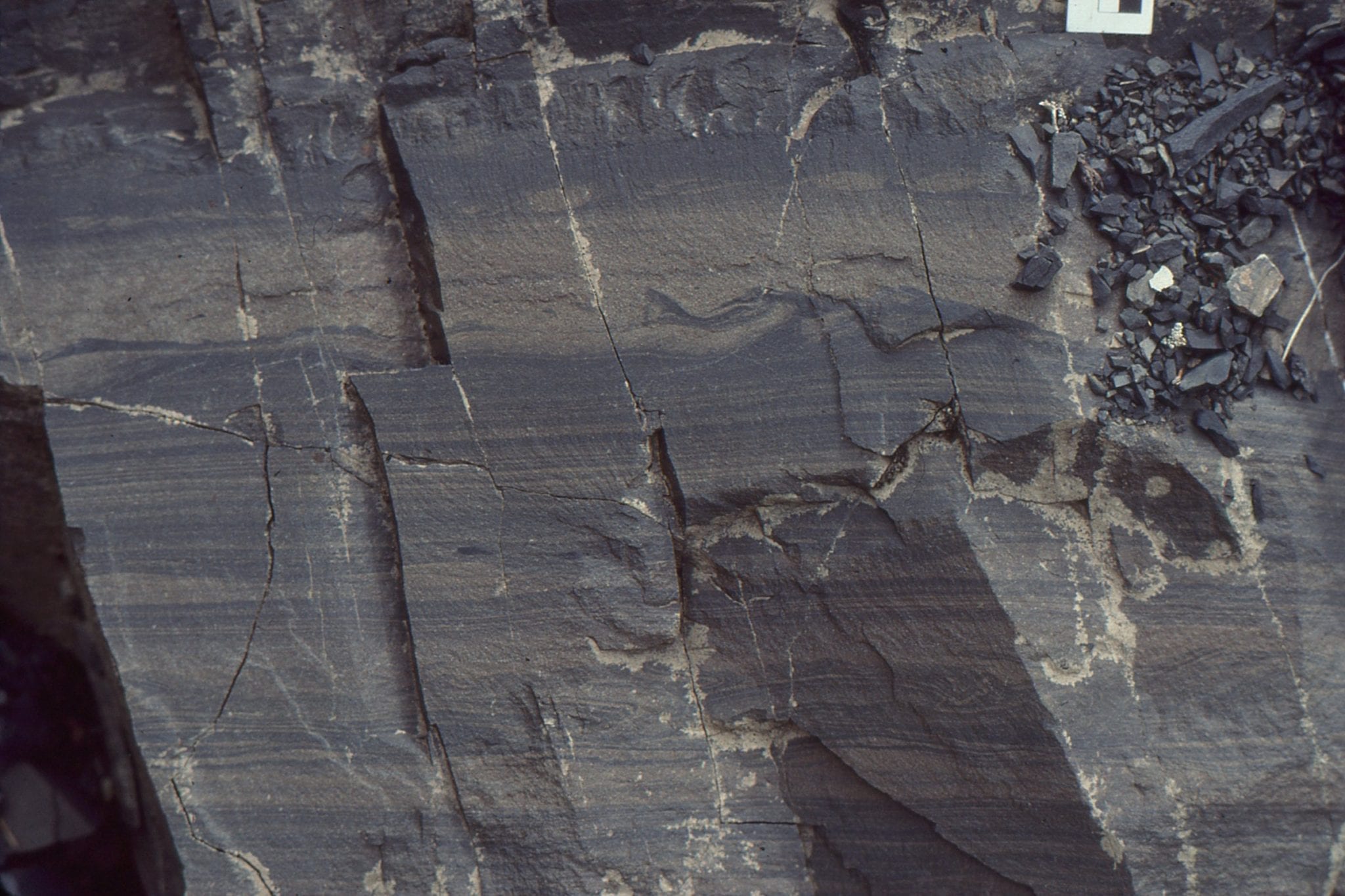
 Slump discordant packages of interchannel, thin-graded fine-grained sandstone, Eocene Pt. Lobos submarine canyon, California
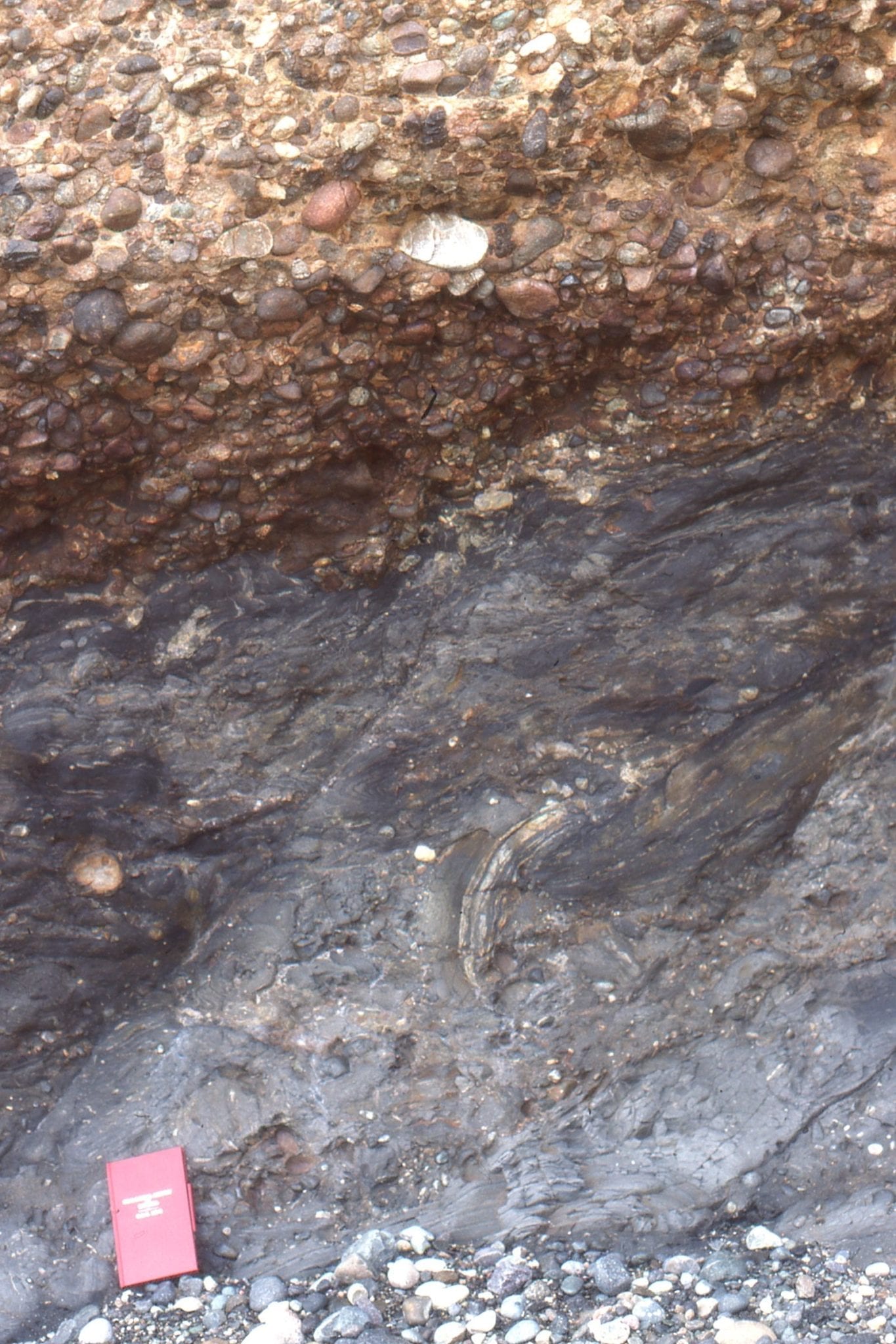 A muddy debris flow consisting almost entirely of slope facies mudstone rip-ups, plus a few pebbles, overlain by clast-supported, canyon-fill conglomerate. Eocene Pt. Lobos submarine canyon, California
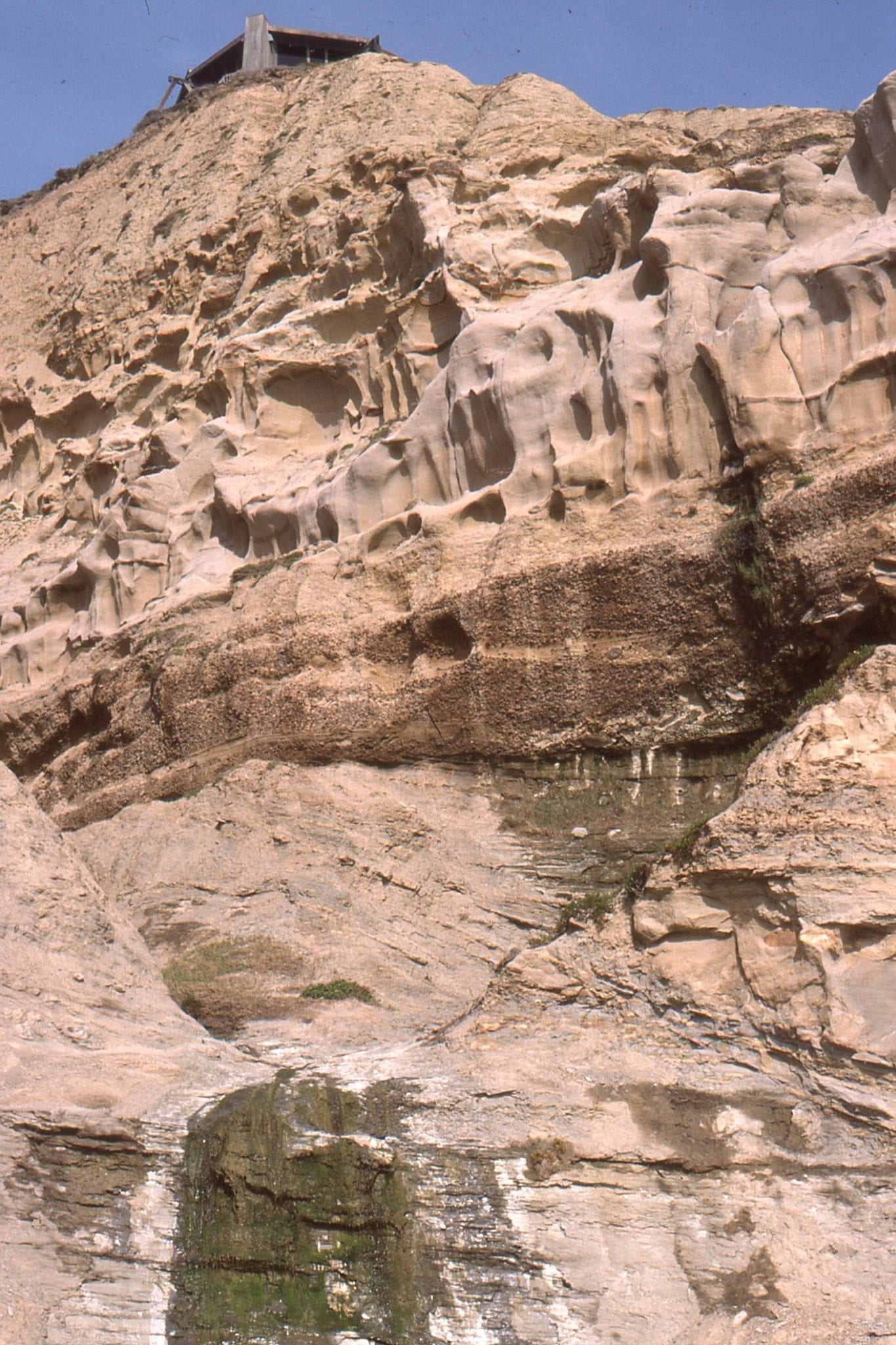
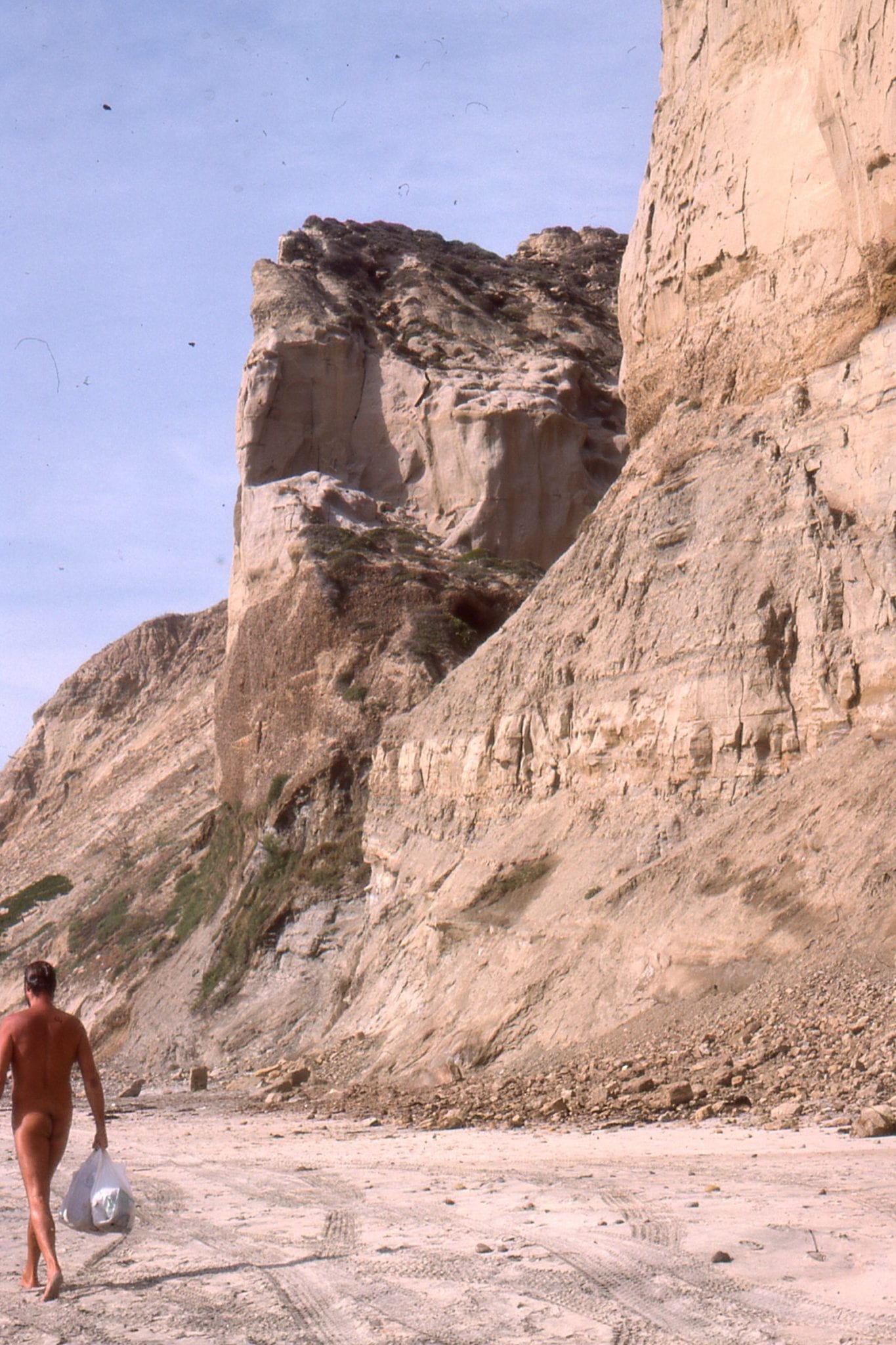
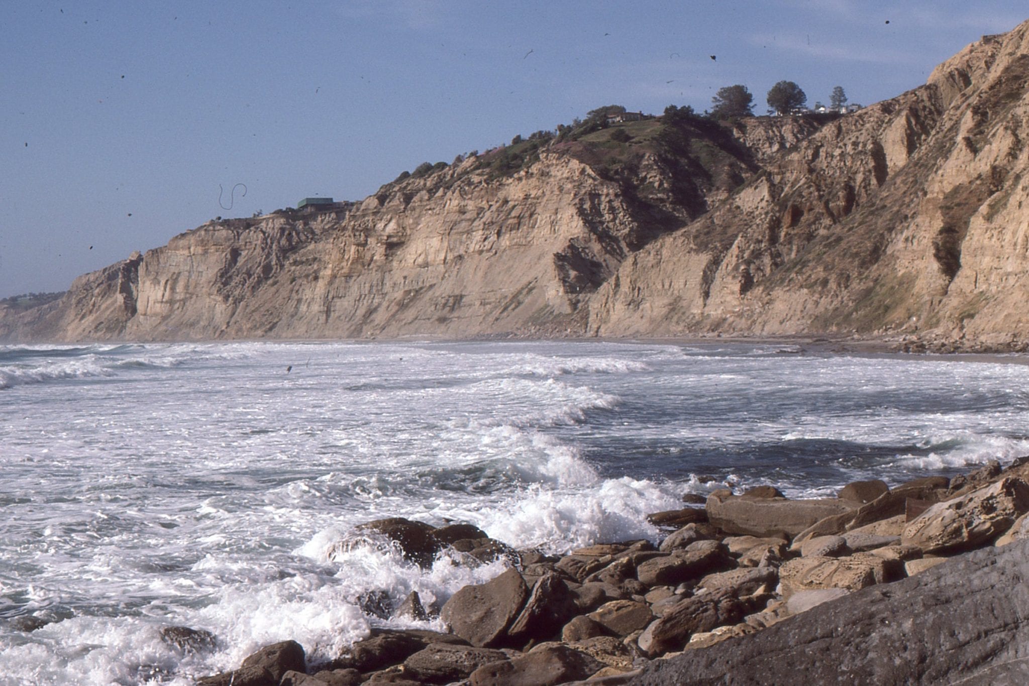 Black’s Beach, iconic coastal cliffs that reveal sediment gravity flow deposits (mainly turbidites and debris flows), and the remnants of an Eocene submarine canyon. This view is north of Scripps Pier, California.
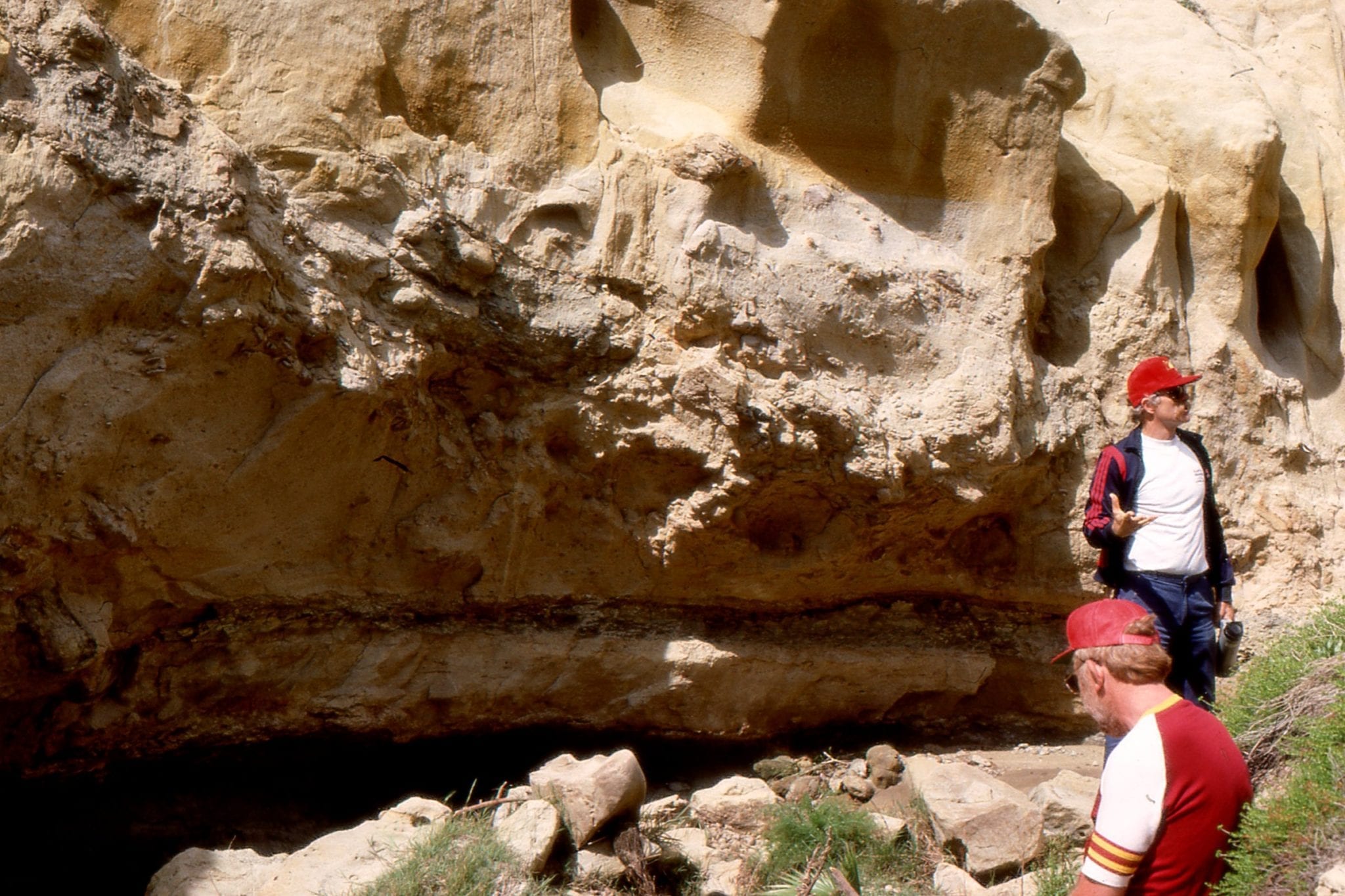
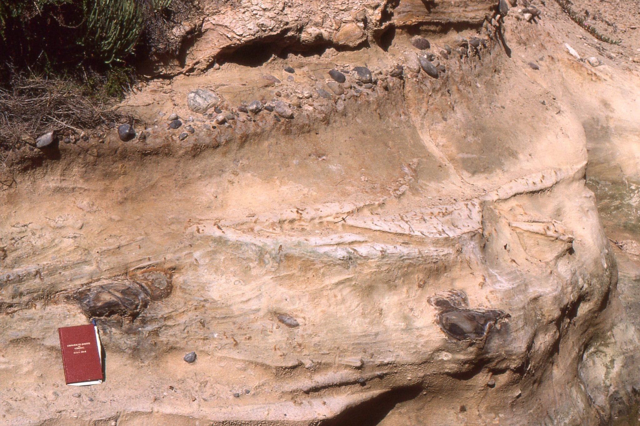
Pebble-lined canyon floor at Black’s Beach, cutting into estuarine and other paralic facies (root structures and burrows are common). Eocene, California
 Basal conglomerate filling the canyon floor, Black’s Beach, California
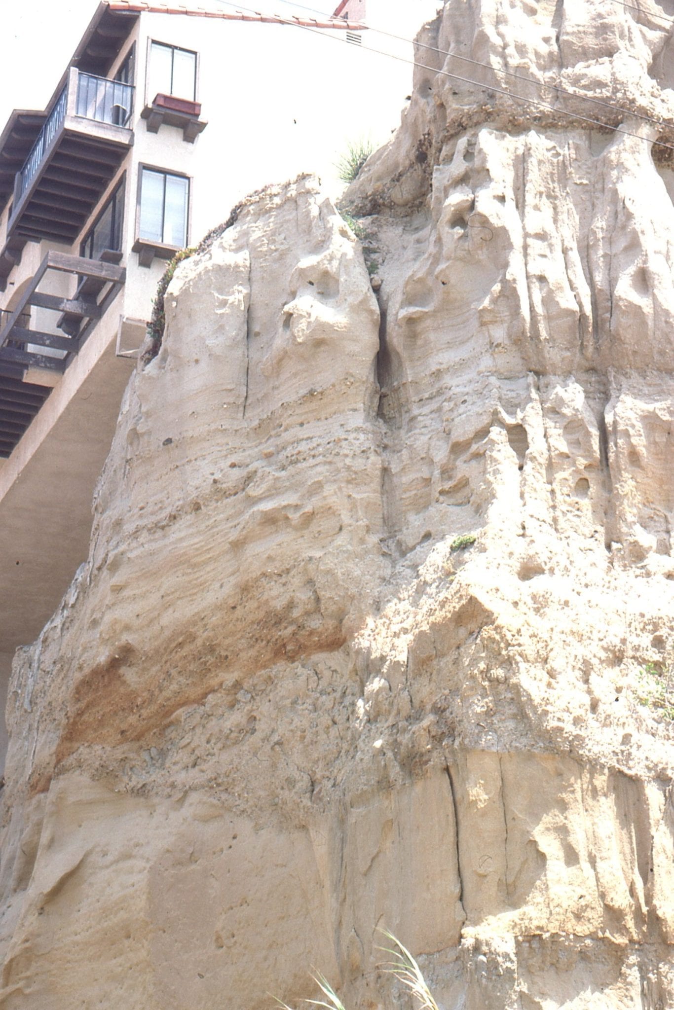
Typical channel conglomerates eroding into thick (proximal) turbidites and thinner channel overbank facies, Black’s Beach submarine canyon. Signs at the beach entrance warn of rock falls, house collapses, and other exposures.
Discordant canyon-filling conglomerate and thick proximal turbidites, Black’s Beach, California.
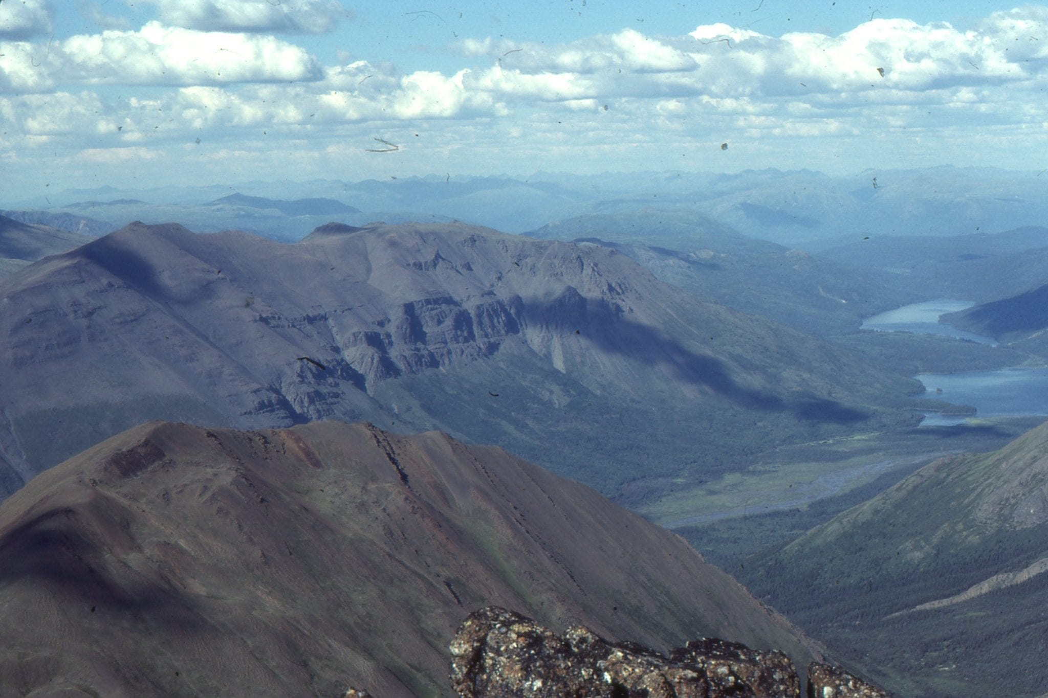
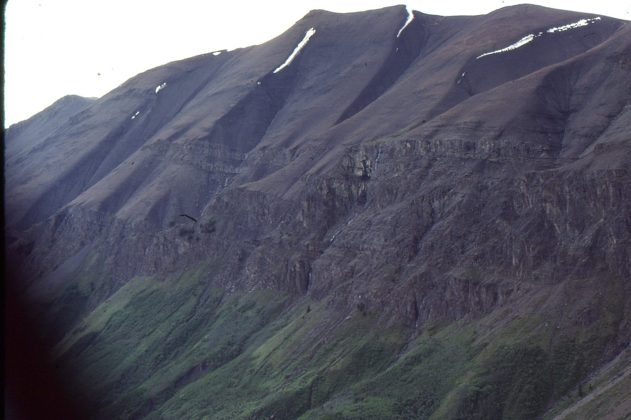
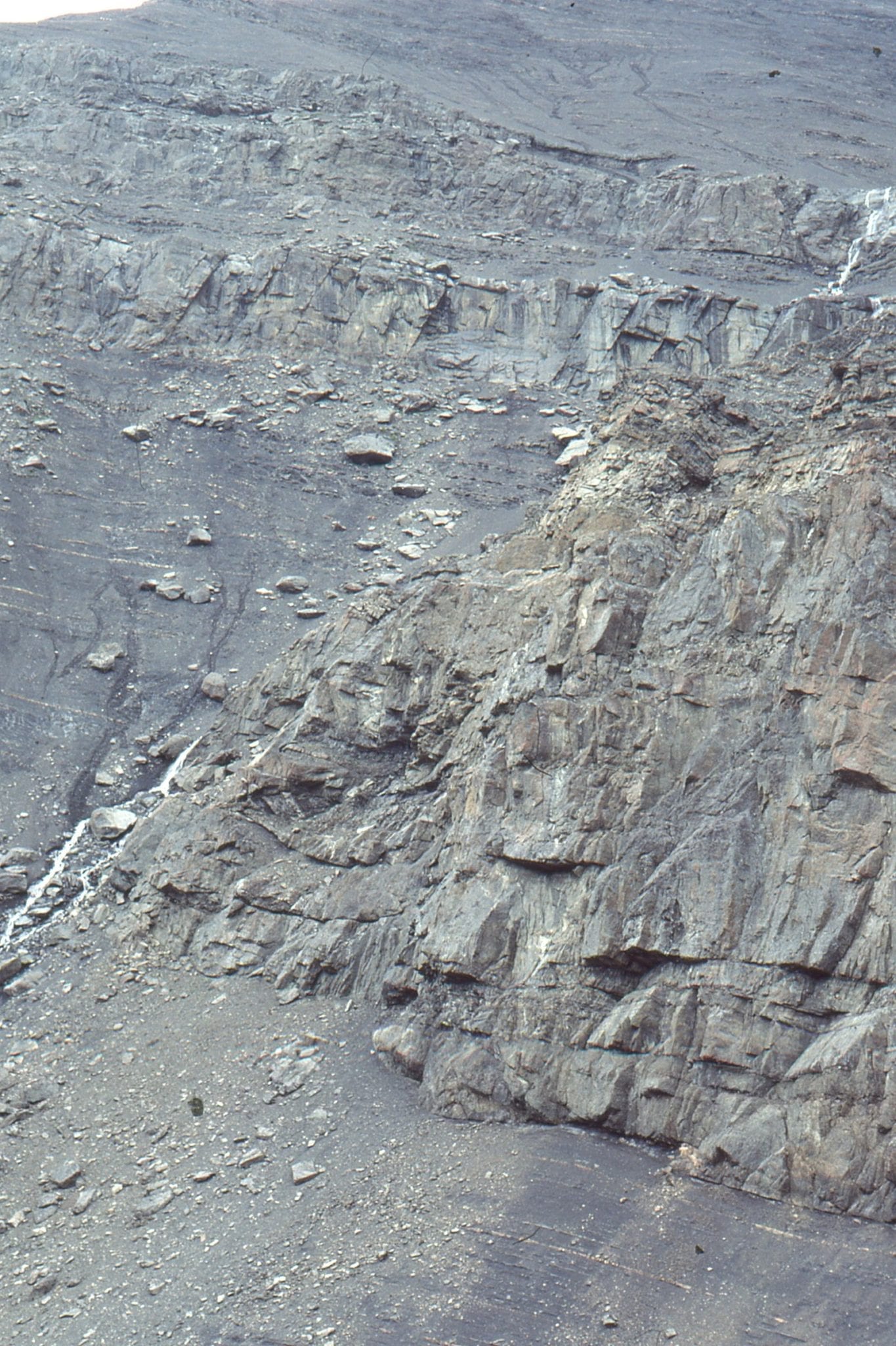
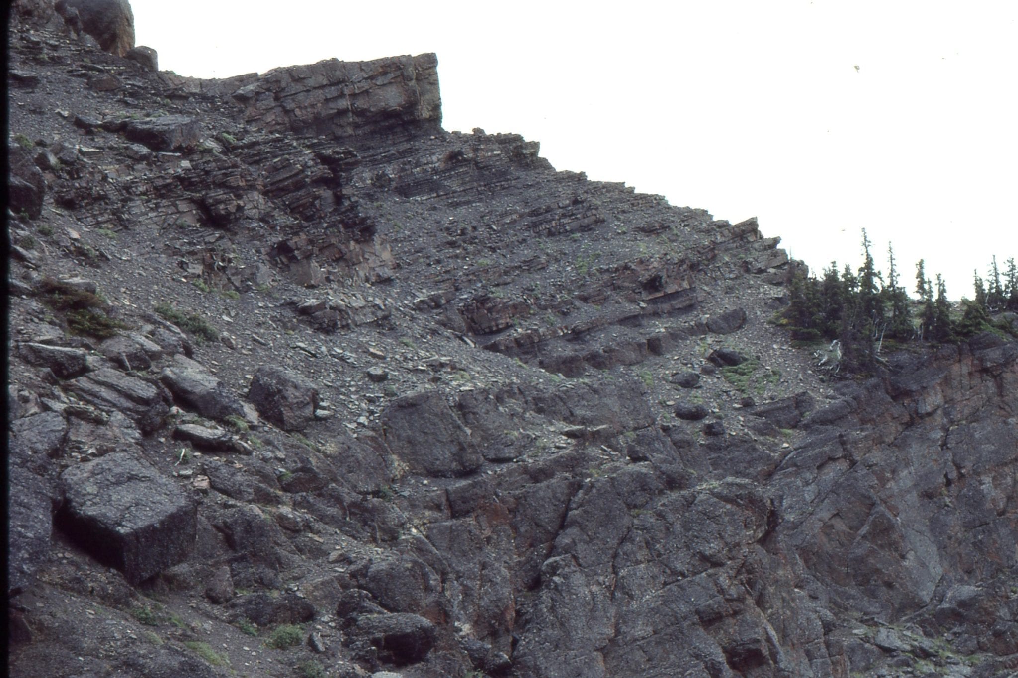
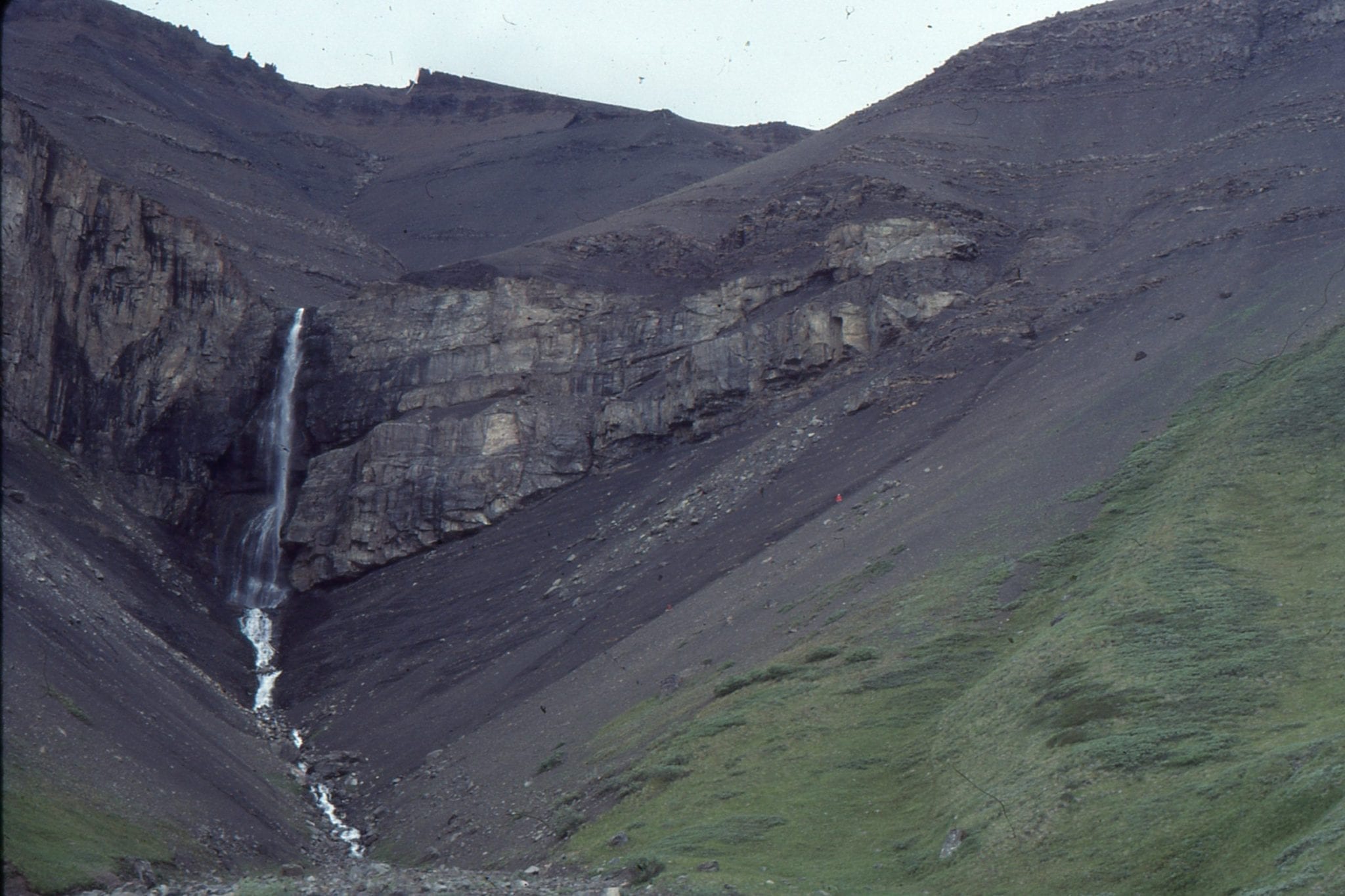 A shelfbreak gully, incised into slope deposits, overlain by cyclothemic, and progressively shallowing shelf facies. Gully fill is mostly conglomerate. It is thickest at the waterfall (about 40m). Initiation of gullies was by fluvial erosion during sea level lowstands, aided by slumping in inherently unstable slope deposits. The gullies delivered gravel and sand to the basin beyond the slope. Upper Jurassic, Tsatia Mt, Bowser Basin, British Columbia.
A paper on this topic: Ricketts, B.D. and Evenchick, C.A. 1999. Shelfbreak gullies; Products of sea-level lowstand and sediment failure: Examples from Bowser Basin, Northern British Columbia. Journal of Sedimentary Research, v. 69, p. 1232-1240.
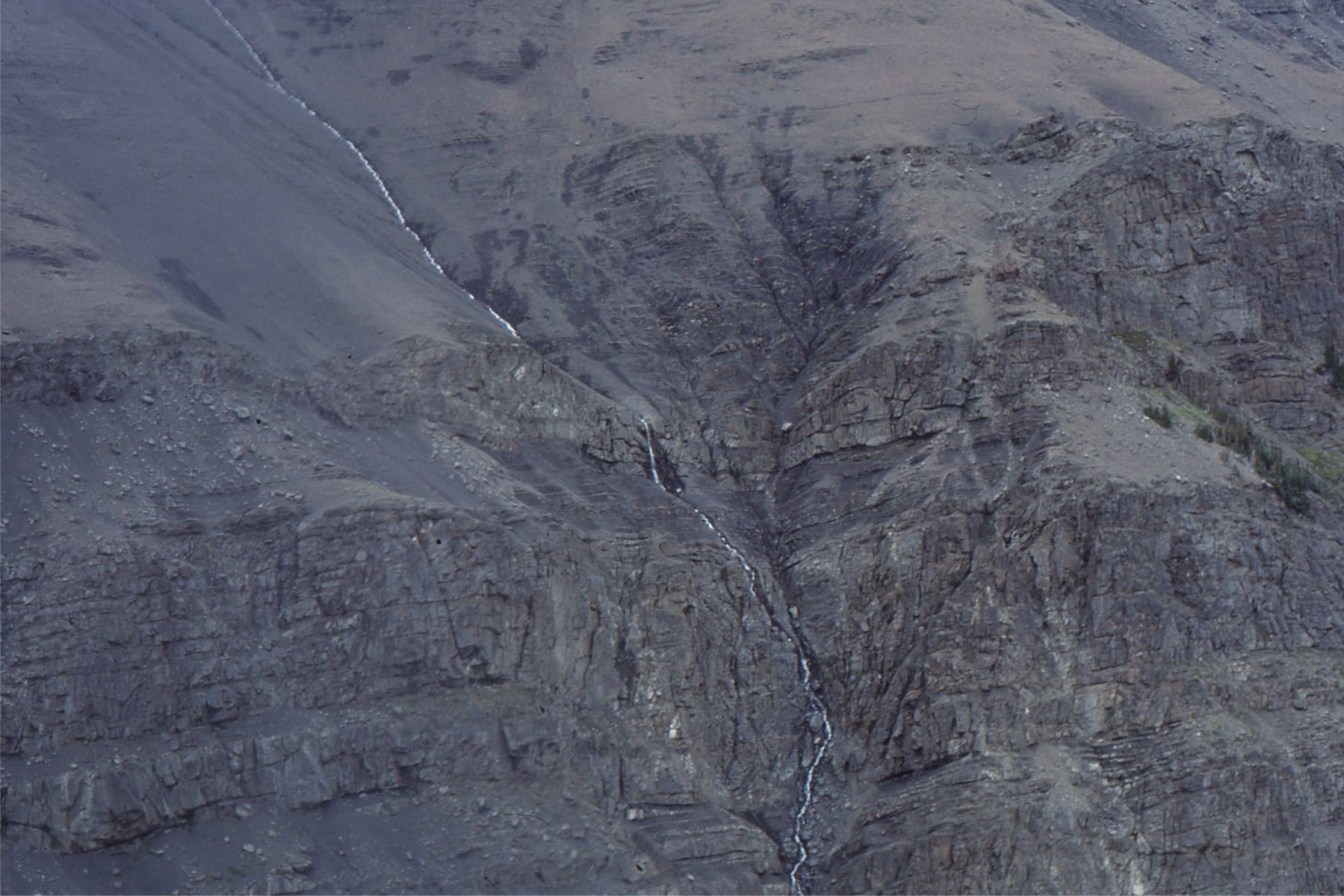
 The base of ‘waterfall’ shelfbreak gully, overlying slope mudrock and thin turbidites. Bowser Basin, British Columbia.
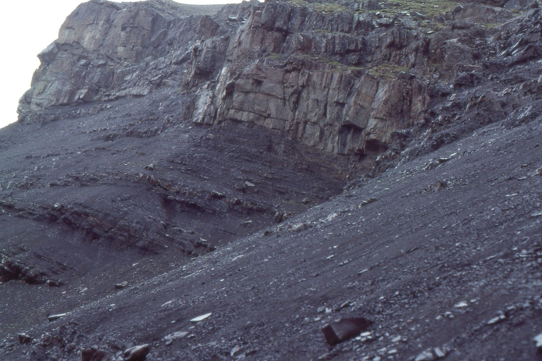
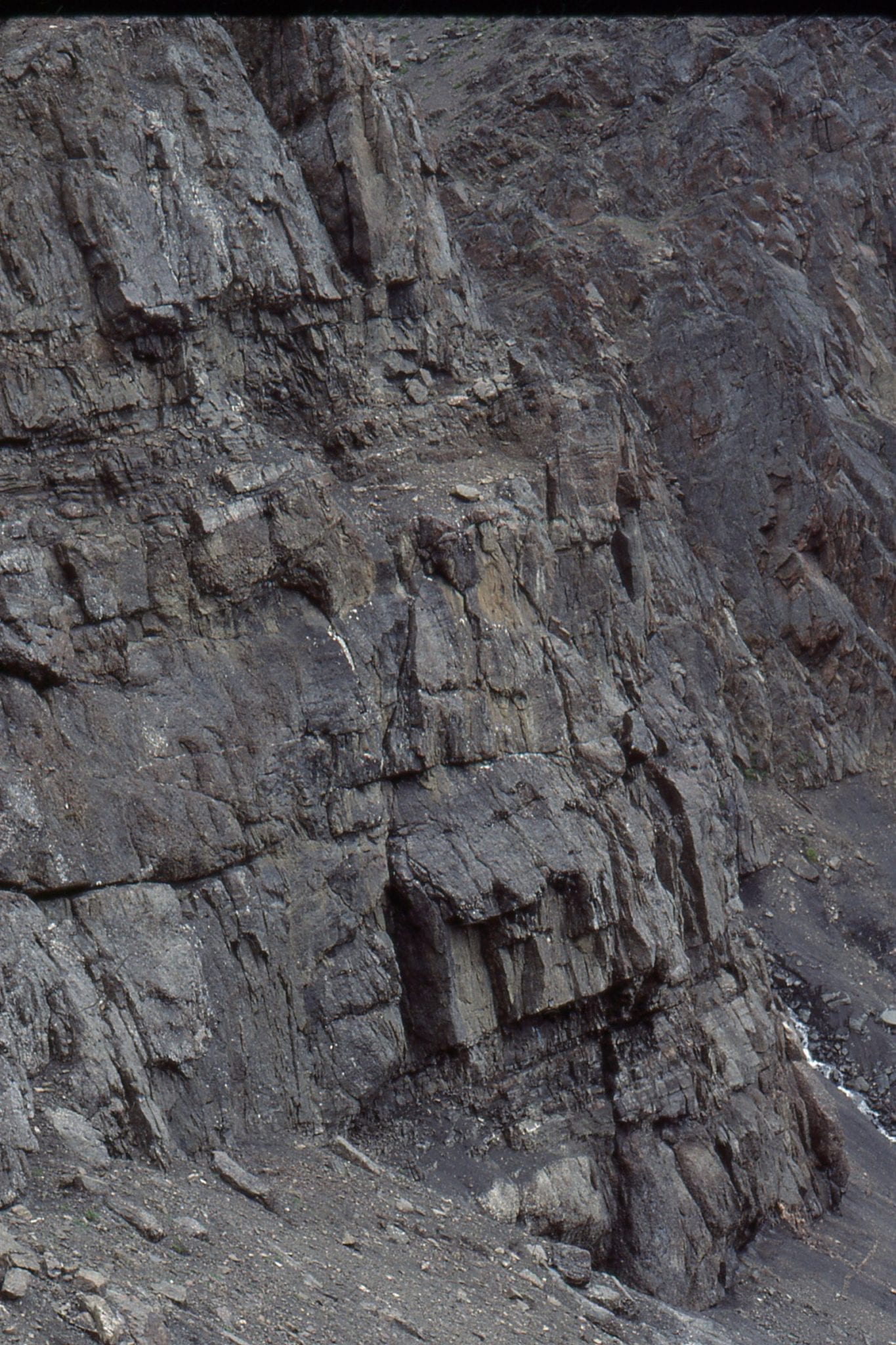
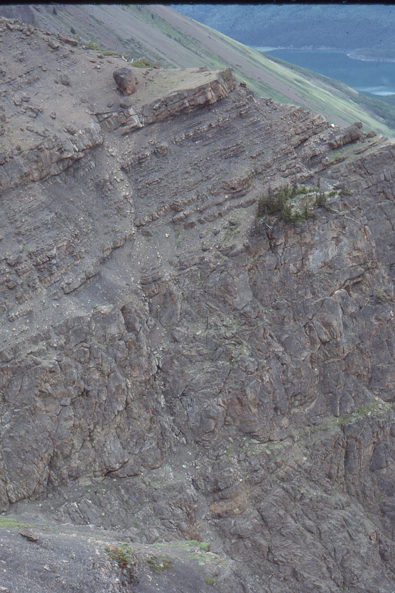
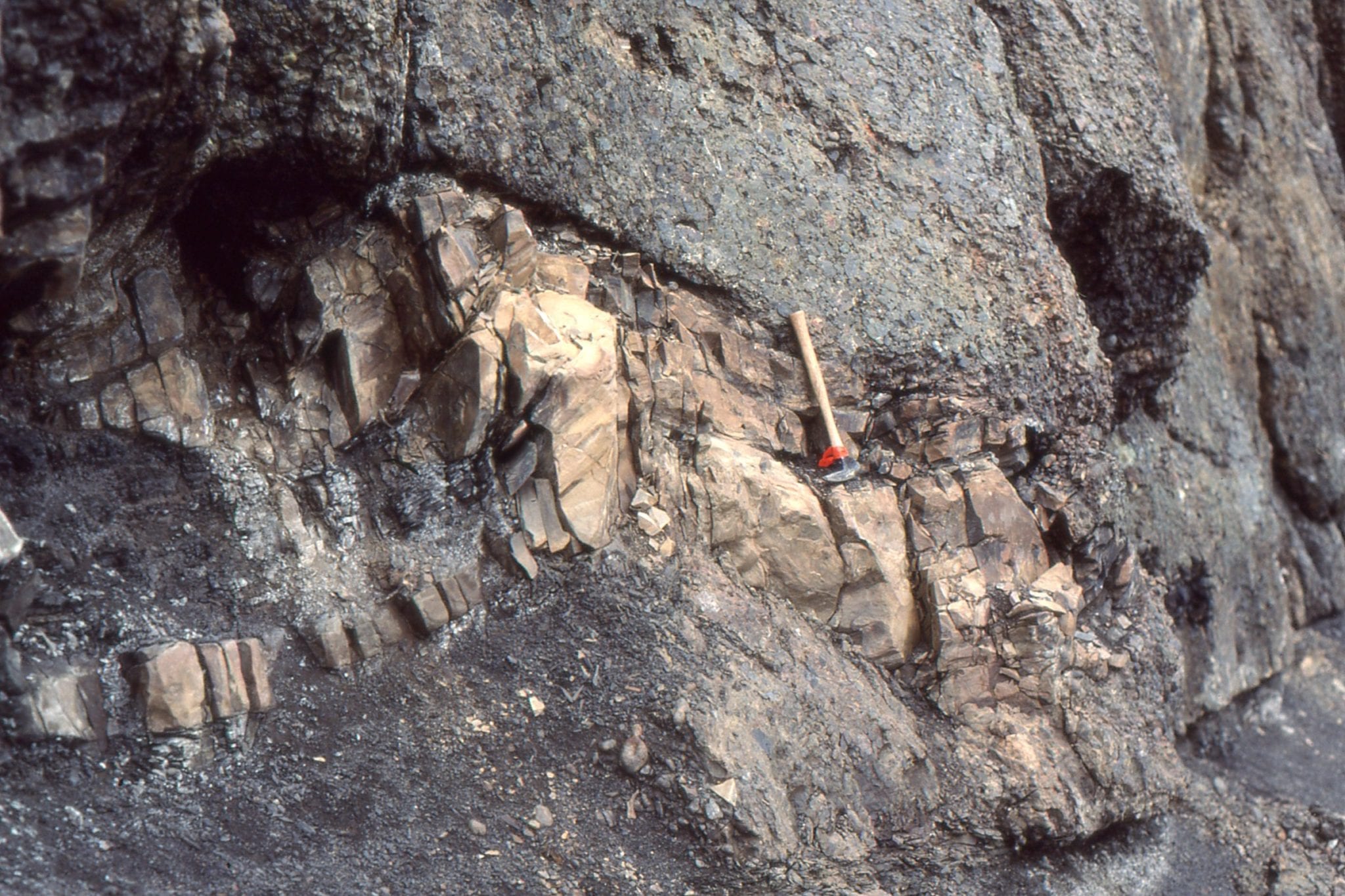
 A closer view of the ‘waterfall’ gully margin (Tsatia Mt), showing numerous discordant contact within the slope mudrock facies, and minor slumping of the gully fill. At least two major episodes of fill are recorded here. Bowser Basin, British Columbia.
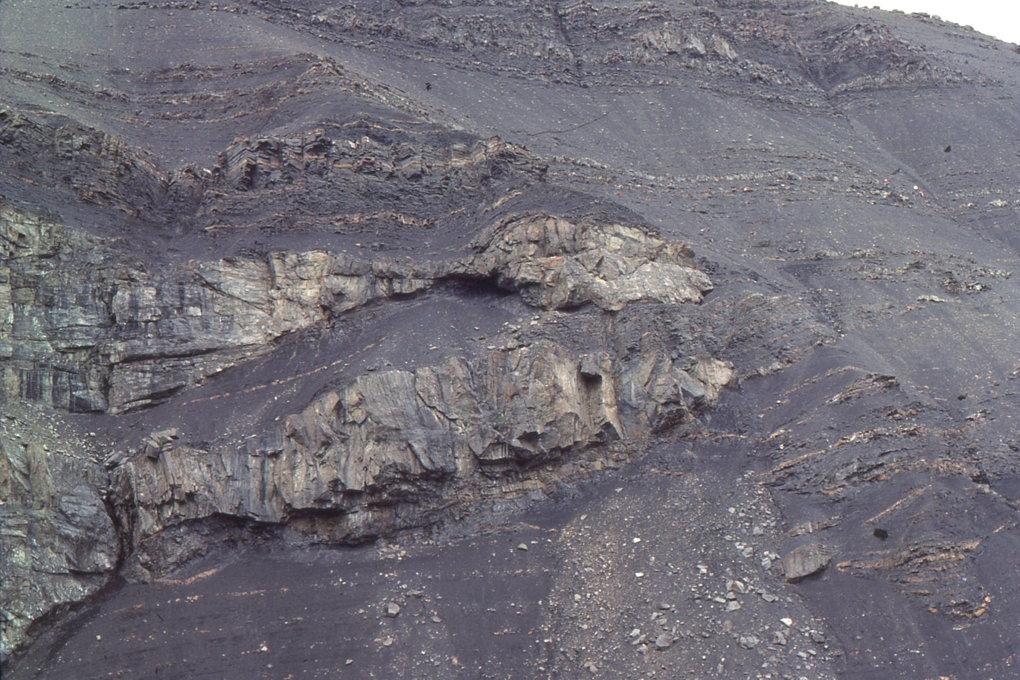
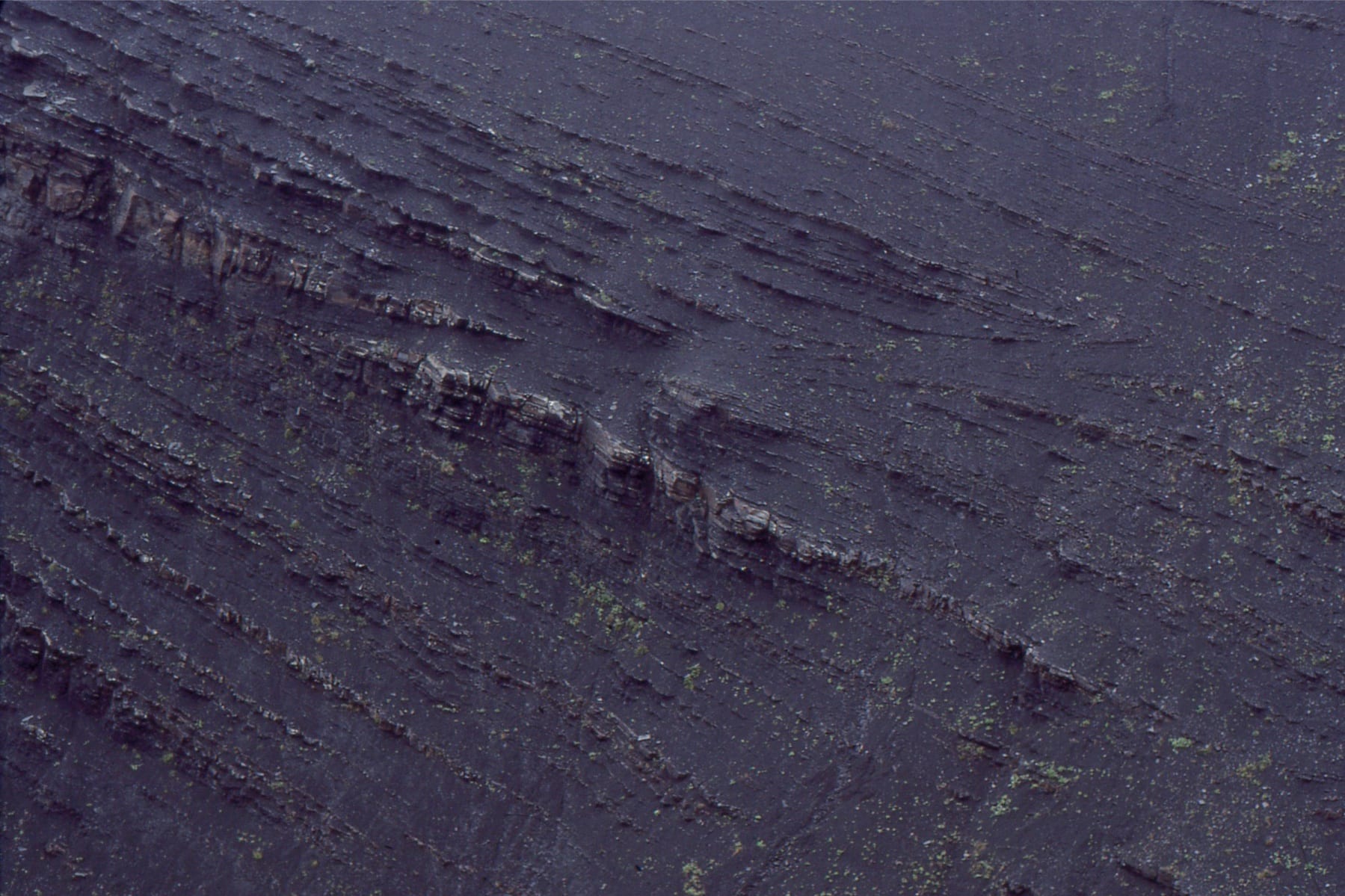
 Shelfbreak gullies extend down slope. Here, two packages of channelized conglomerate (along the ridge line) occur entirely within slope facies. The small lenses of conglomerate below are thought to represent channel spillover lobes. Joan Lake, Bowser Basin, British Columbia.
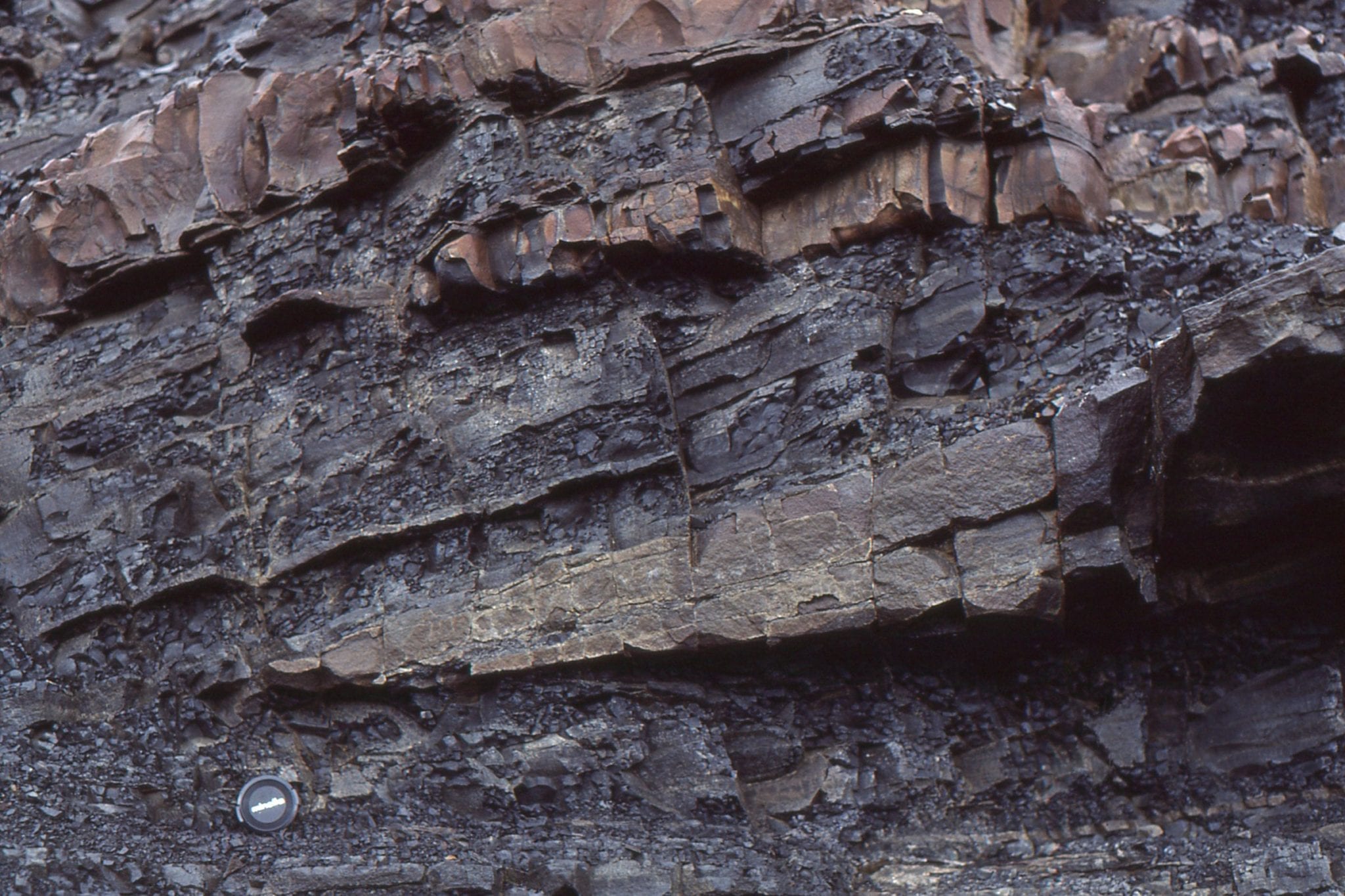
 A large slump block of gully-fill conglomerate, embedded in slope mudrocks, shows the inherent instability of the gullies and associate slope deposits. Bedding within the block are also disrupted. The block is located just below the right margin of the ‘waterfall’ gully, shown in the above images. Tsatia Mt, Bowser Basin, British Columbia.
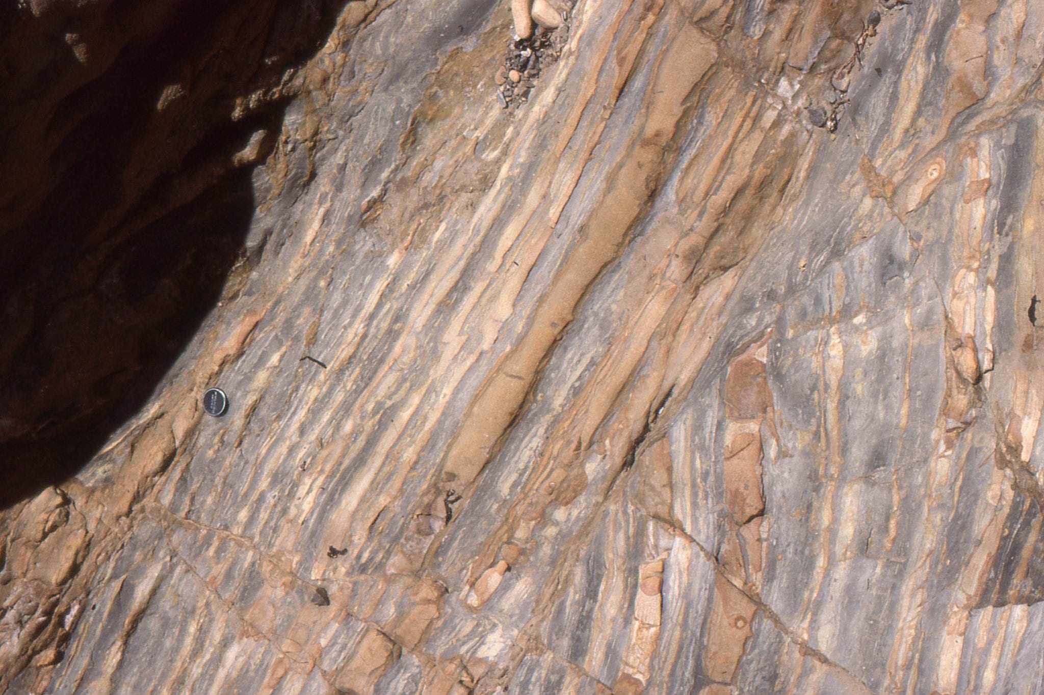
Slope facies, here consisting of relatively undisturbed thin, graded, very-fine grained sandstone-mudstone (thin turbidites), and a few small starved ripples in the laminated mudstone-shale. Bowser Basin, British Columbia.
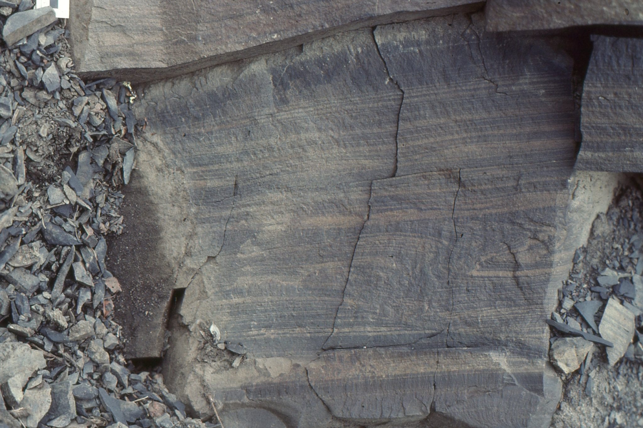
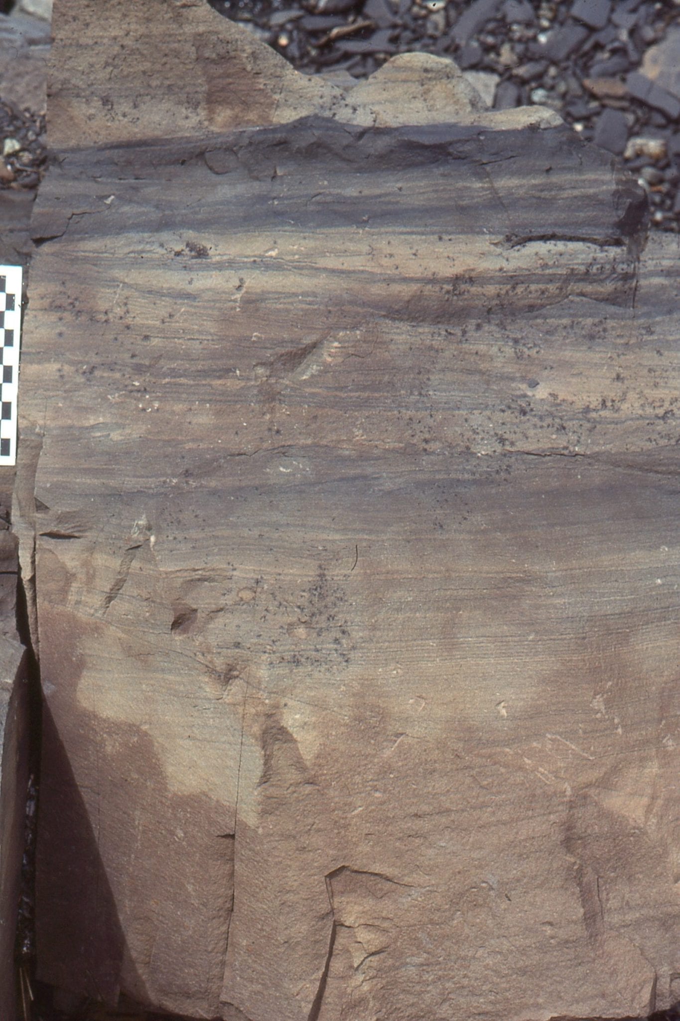
Thin graded sandstone beds, starved ripples, laminated sandy mudstone, small slump folds, syn-sedimentary pull-aparts or boudinage, and microfaults, all features that are typical of slope facies mudrocks. Bowser Basin, British Columbia.
Left: laminated mudstone-siltstone and a few thin graded sandstone beds. Slope facies, Bowser Basin, British Columbia. Right: stratigraphic discordances occur at all scales in the Bowser Basin slope deposits. Many are caused by slumping, but discordant mudrock packages also arose from flows spilling over the channel-gully margins.
 Slump-induced, listric-style fault in slope mudrocks, Tsatia Mt. The fault flattens out along a thin turbidite bed; displacement decreases towards the fault tip at top right, where overlying beds are continuous. Bowser Basin, British Columbia.
 Slope mudrock and thin sandstone beds are truncated by a synsedimentary fault (just above the lens cap). Bowser Basin, British Columbia.
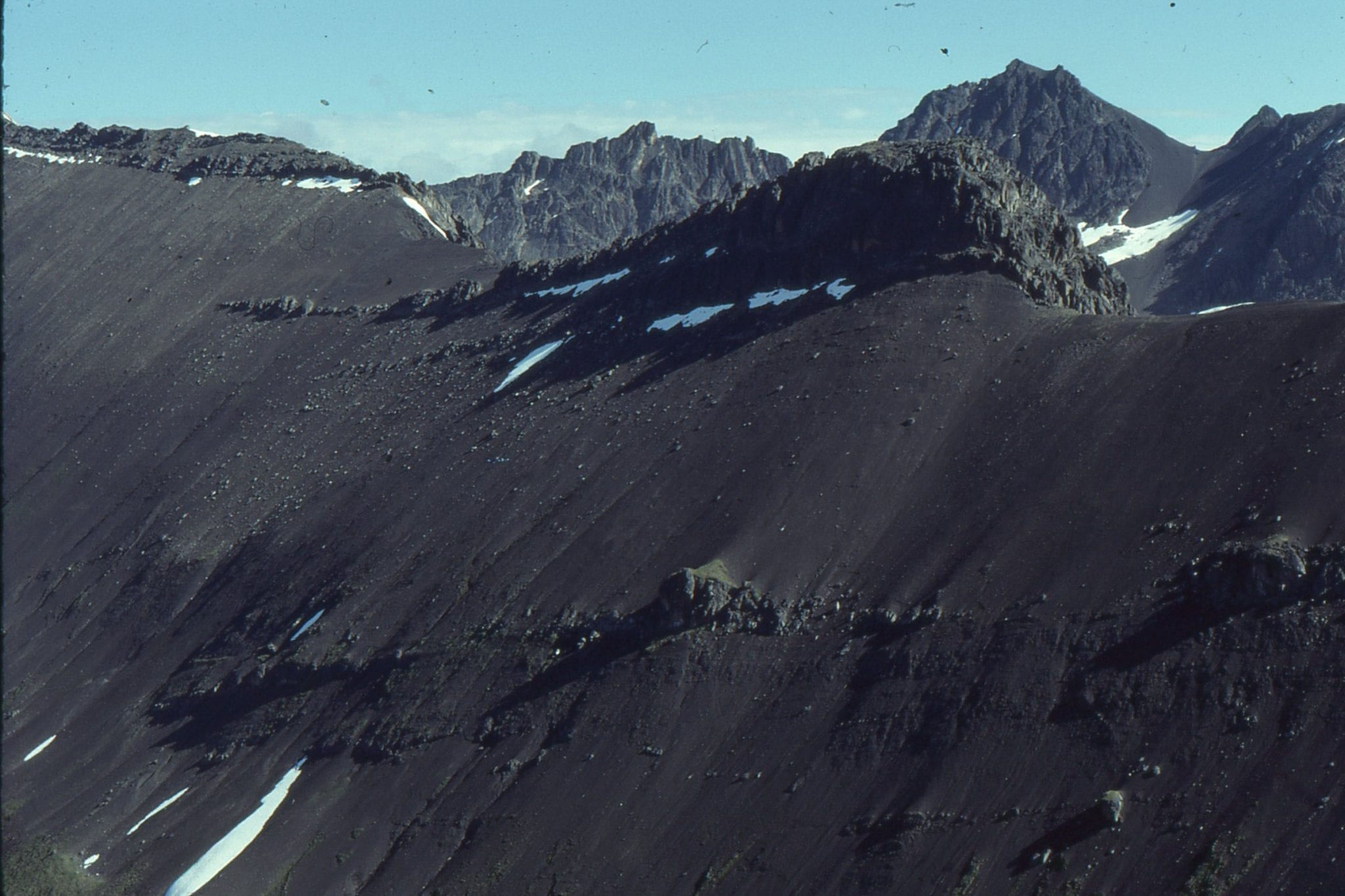
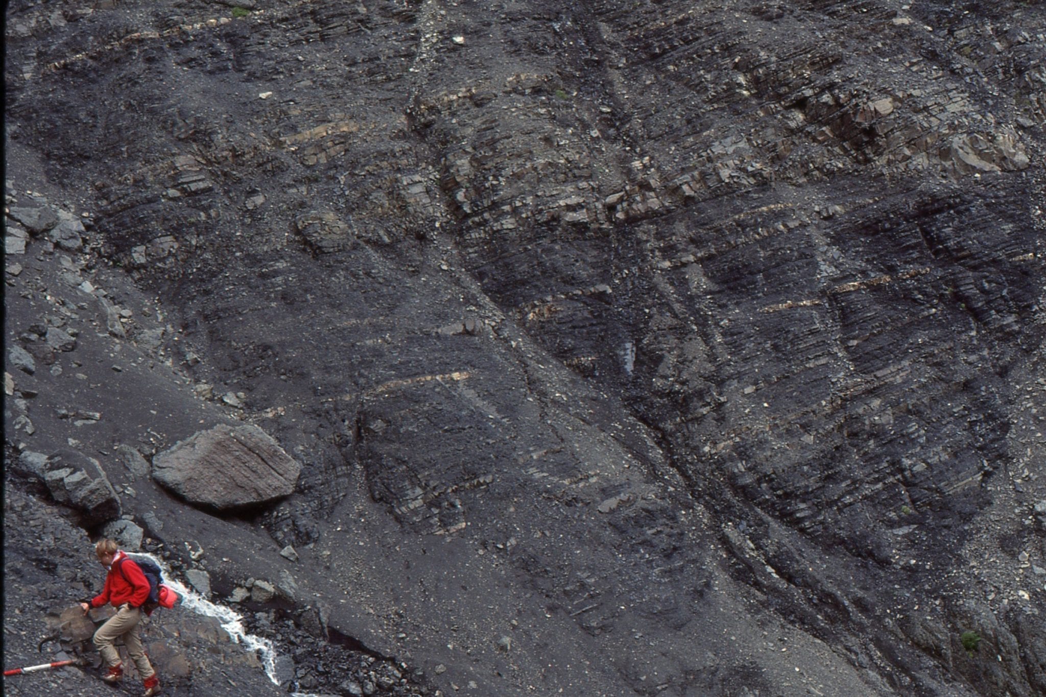
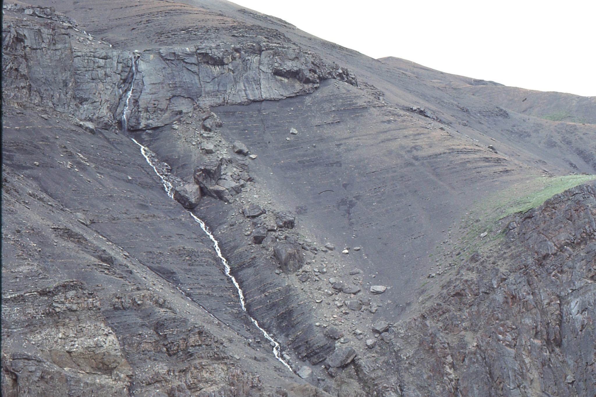
Upper Jurassic Submarine canyon complex of stacked channels, within a slope assemblage, Todagin Mt, Bowser Basin, British Columbia. Like the shelfbreak gullies, although on a grander and more prolonged scale, the canyon delivered mud, sand and gravel to the deeper Bowser Basin This view taken from Tsatia Mt.
 View from the center of Todagin canyon-fill, showing the step-like stacking of successive channels. Maximum thickness of the conglomerate-fill exceeds 300m. On this ridge, an equivalent thickness of slope mudrock overlies the canyon. Bowser Basin, British Columbia.
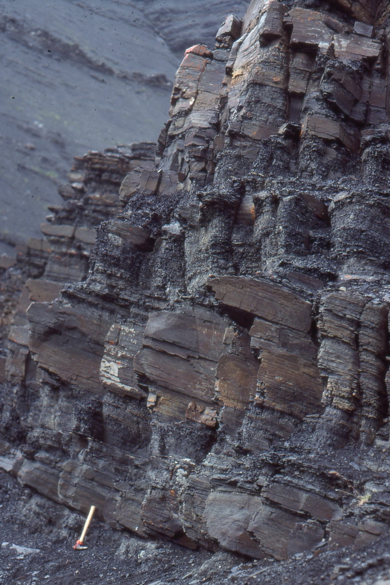
Two views of the Todagin canyon base, and bedded conglomerate-fill, most of which was deposited by debris flows, sometimes separated by thin turbidites. Each view shows about 25m of section. Bowser Basin, British Columbia.
 Stacked channel conglomerate; the channel margin is almost vertical through about 20m thickness. The steep margin may be synsedimentary fault controlled – the overlying beds are not displaced. Opposite the margin are typical slope mudrocks and thin turbidites. Bowser Basin, British Columbia.
 The upper section of Todagin canyon, showing back-stepping channel stacking. Bowser Basin, British Columbia.
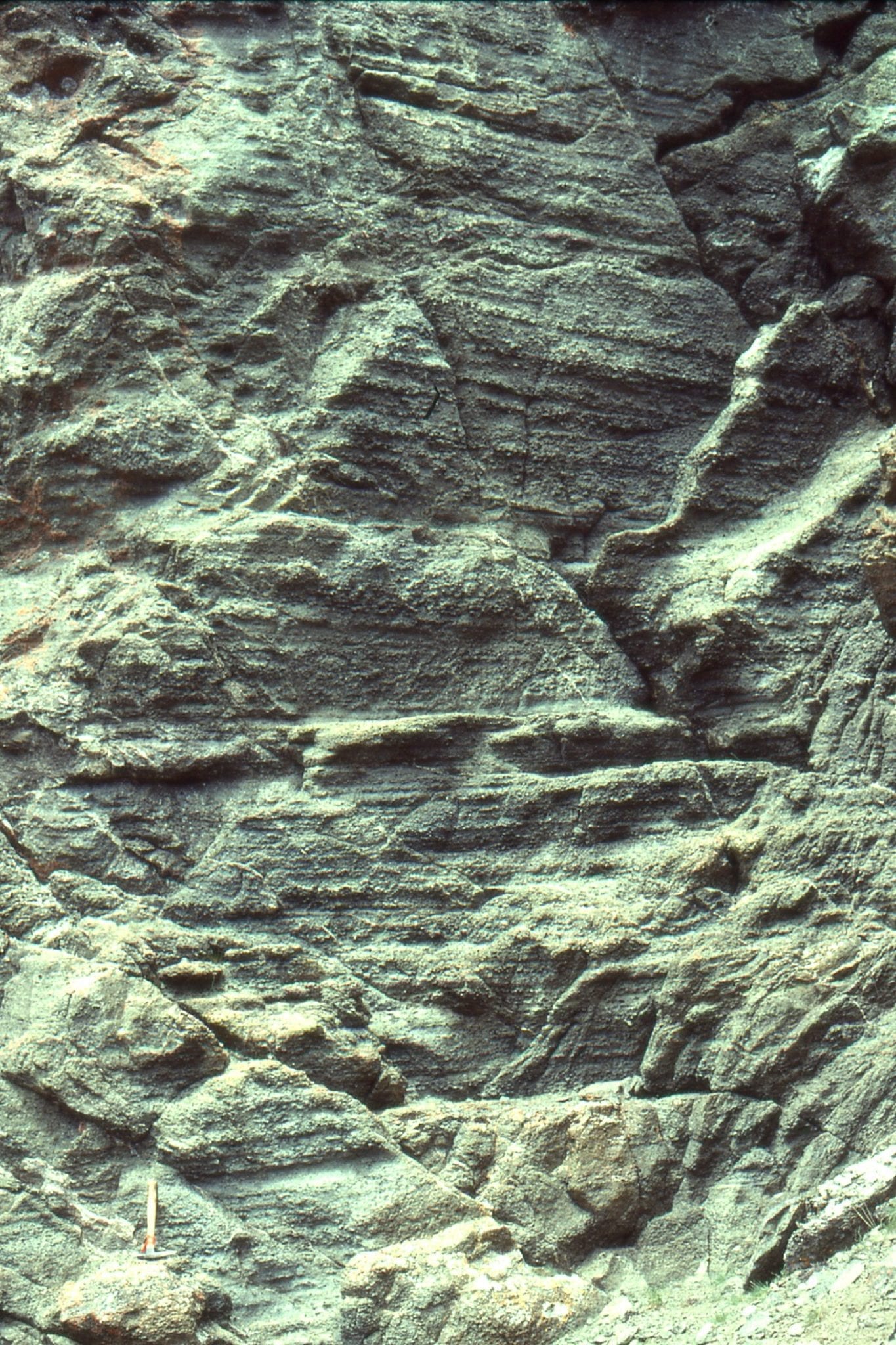
 Near the top of the canyon succession, two cycles of thinning- upward turbidites, that may have formed as the active channel moved across the canyon floor, away from this site of deposition. Note the slump discordance in the lower cycle. Bowser Basin, British Columbia.
 Turbidites overlie the main Todagin canyon-fill conglomerate, about 10m thick, capped by a smaller channel. Note the slump discordance in the lower cycle. Bowser Basin, British Columbia.
 The top of the main canyon-fill conglomerate here is overlain by slope mudrock, cf. the image above. Turbidites, at the location in the image above, have thinned significantly or pinched out completely in this exposure. The overlying conglomerate forms a smaller, more isolated channel, pinching out to the right. The overall influence of the submarine canyon is waning at this stage. Bowser Basin, British Columbia.
 Mudstone rafts, captured by debris flows, near the base of the Todagin canyon succession. Bowser Basin, British Columbia.
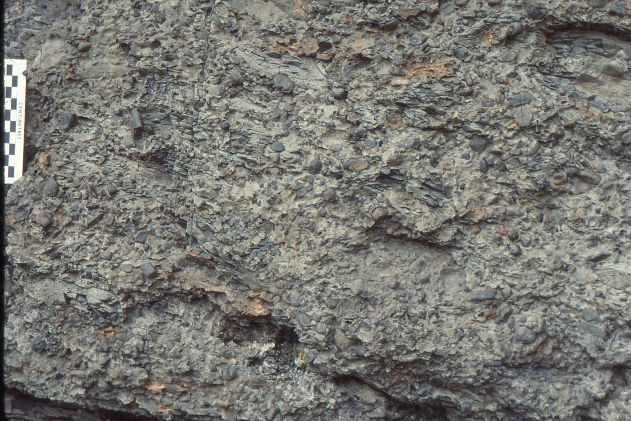
Contrasting debris flow textures. Left: mud-supported clasts in a more plastic debris flow. Right: clast-supported frameworks that probably formed in a more fluid, sheared debris flow. Both types are common in the Todagin canyon succession, and in the gullies. Bowser Basin, British Columbia.
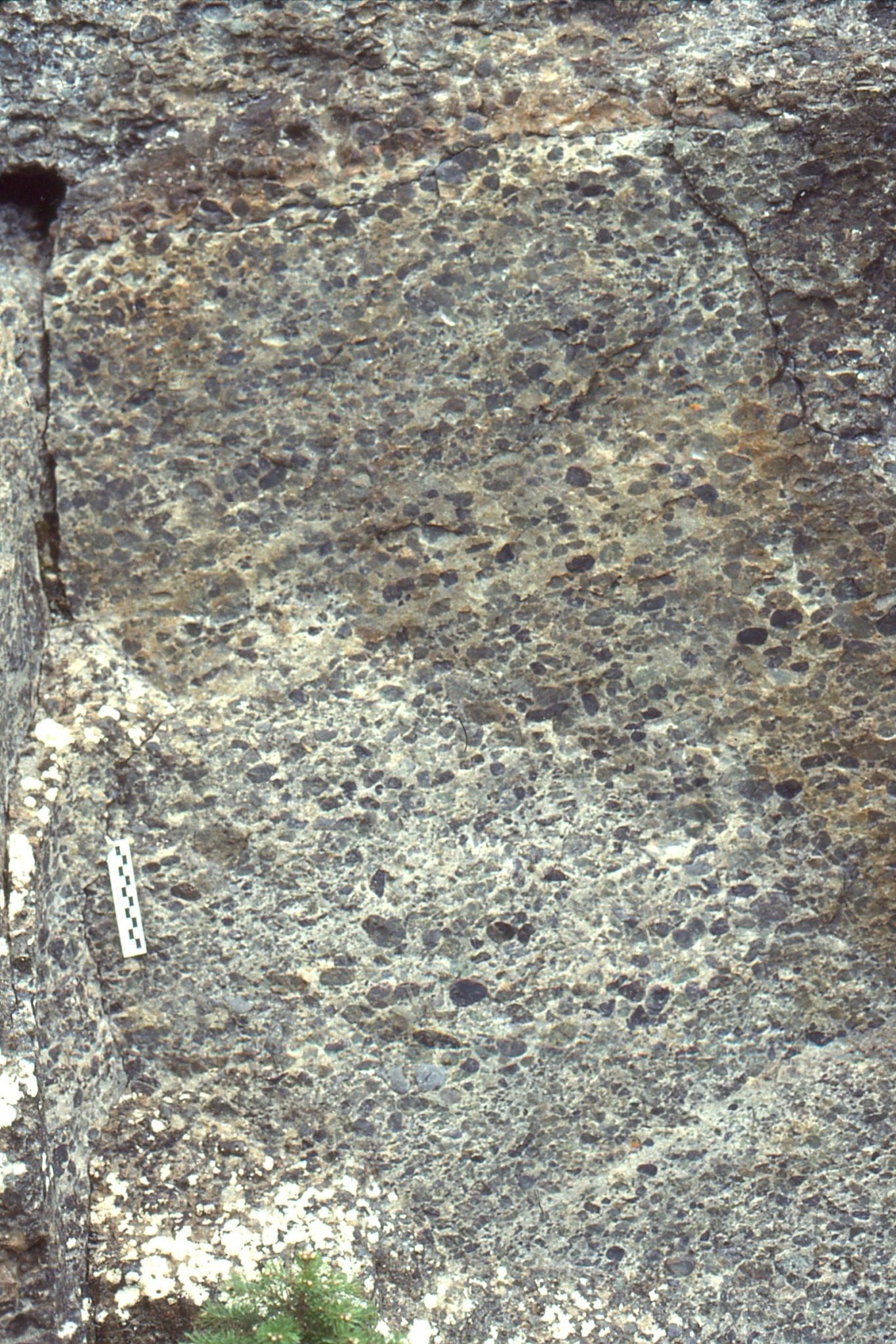
 Well-developed layering in this debris flow, probably formed during prolonged, quasi-continuous surging flow of grit to cobble sized clasts. The whole unit is about 8m thick. Hammer bottom left. Todagin canyon.