Submarine fans and channels
The Atlas, as are all blogs, is a publication. If you use the images, please acknowledge their source (it is the polite, and professional thing to do).
Beyond the slope (continental slope or delta slope) is the deep ocean floor, at depths usually measured in 100s to 1000s of metres. Sediment that has bypassed the shelf is transported through submarine canyons and gullies by turbulent flows of mud and sand (turbidites), or debris flows that are capable of moving a much greater range of clast sizes, from pebbles to chunks of rock or dislodged sediment having dimensions in the 10s to 100s of metres. A lower sea floor gradient at the base of the slope, plus frictional forces along the sea floor and overlying water, causes these flows to decelerate. The sediment accumulates in submarine fans, that have dimensions measured in 10s to 100s of kilometres.
The earliest models of submarine fan construction and architecture in the late 60s early 70s (e.g. Walker, Normark, Mutti and Ricci Luchi), and the plethora of model variations since, are based primarily on reconstructions from the rock record, with a smattering of new, actualistic observations. All these models have certain commonalities – in terms of their stratigraphic and geomorphic architecture, they contain elements of proximal to distal components of fan lobes, submarine channels, channel levees and overbank, and dislocation of slope, fan or channel sediment packages by slumping and sliding. Sediment dispersal is generally attributed to turbulent flows (turbidity currents), debris flows (ranging from highly fluid to plastic), and grain flows (less common), against a background of normal oceanic traction currents and pelagic-hemipelagic sedimentation. I have tried to illustrate as many of these attributes as possible in the images that follow.
Ancient submarine fan deposits illustrated here include: the Lower Miocene Waitemata Basin near Auckland, New Zealand; the Paleocene of Point San Pedro, Upper Cretaceous Pigeon Point, and Dana Point successions, all in California; and Proterozoic examples from Belcher Islands (about 1800-1900 Ma).
This link will take you to an explanation of the Atlas series, the ownership, use and acknowledgment of images. There, you will also find links to the other categories.
Click on the image for an expanded view, then ‘back page’ arrow to return to the Atlas.
The images:
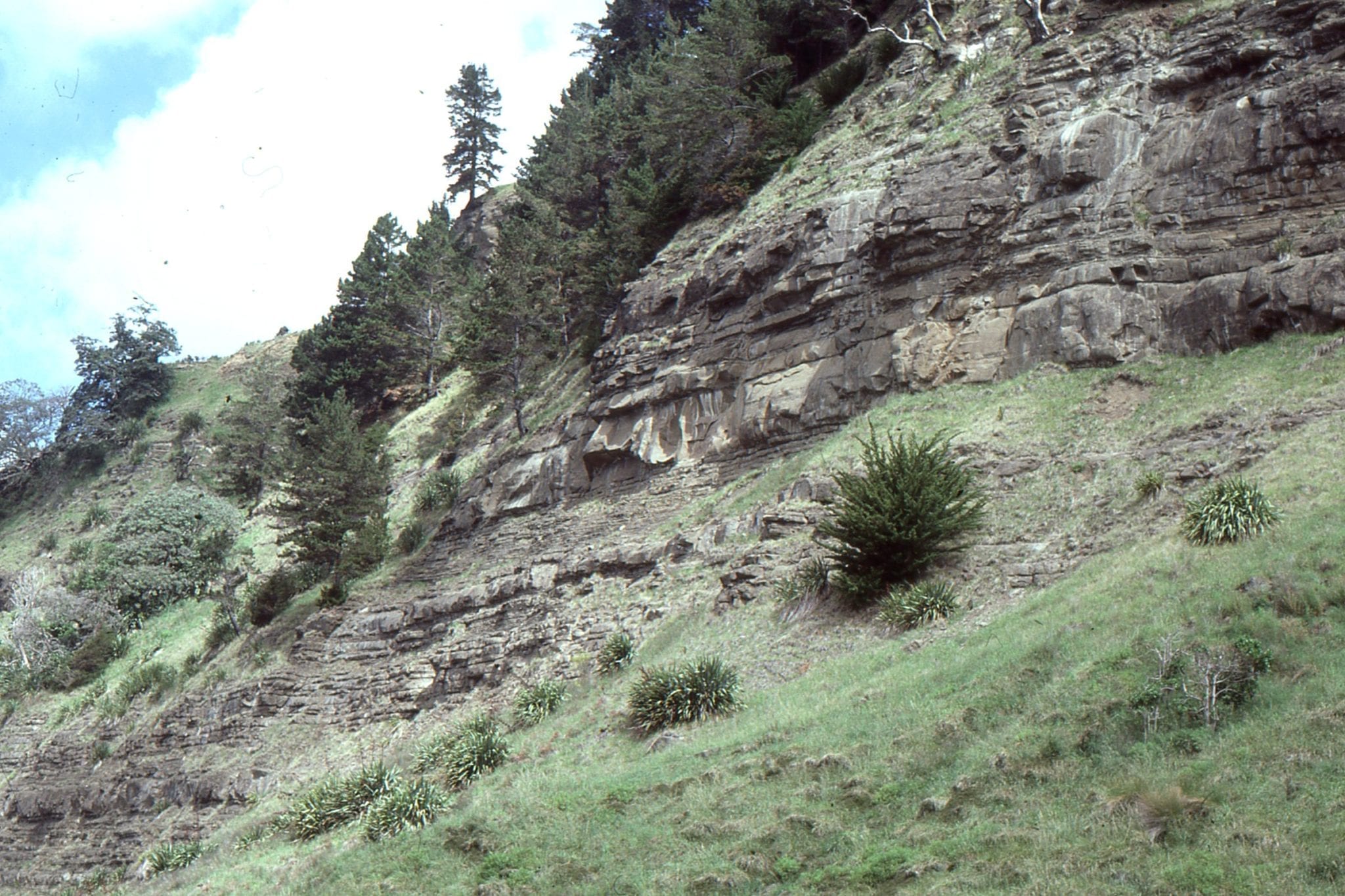
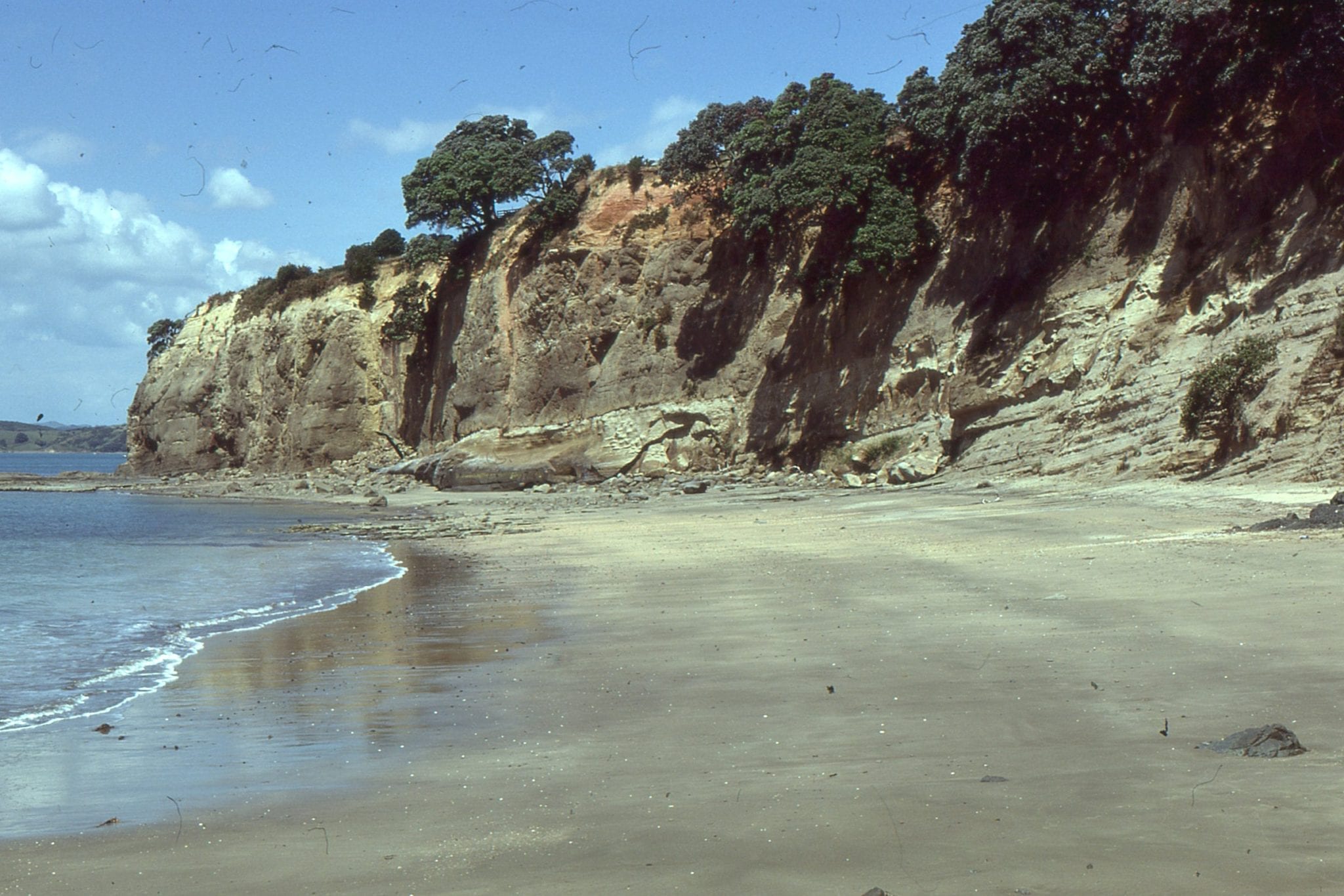
Typical exposure of Waitemata Basin strata around Auckland coastal cliffs: Left; mid-fan turbidites at Takapuna Beach. Right; thick, proximal submarine fan-channel capped by thinning-upward overbank facies, north end of Goat Island Marine Reserve.
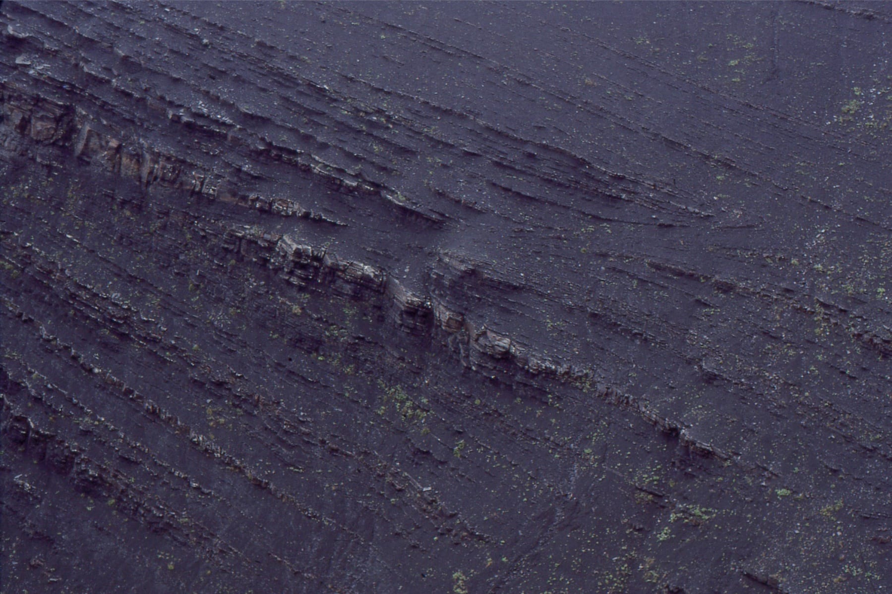
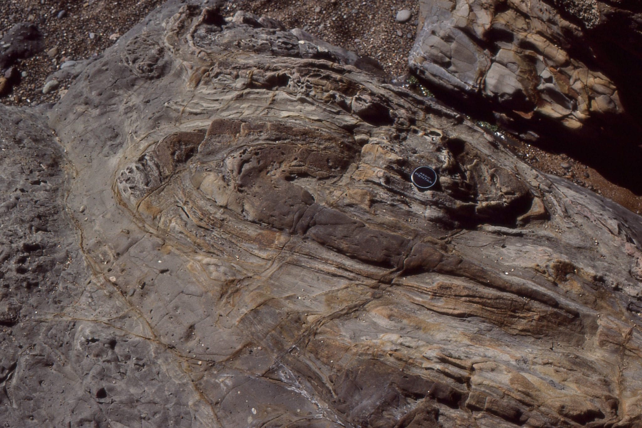
 Waitemata Basin turbidites near the base of the succession, folded by compaction over paleotopographic highs on Jurassic-Permian metagreywacke basement. Omana Beach, south Auckland
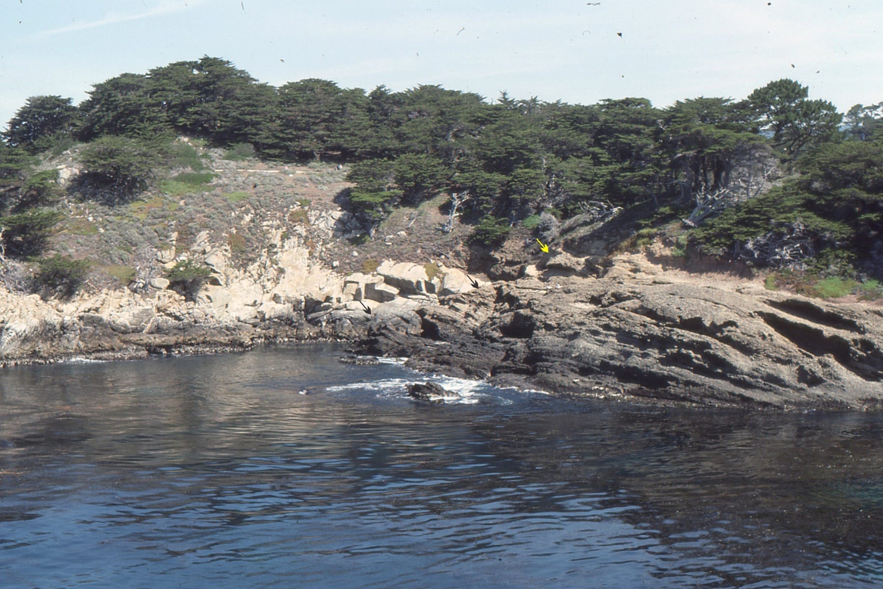
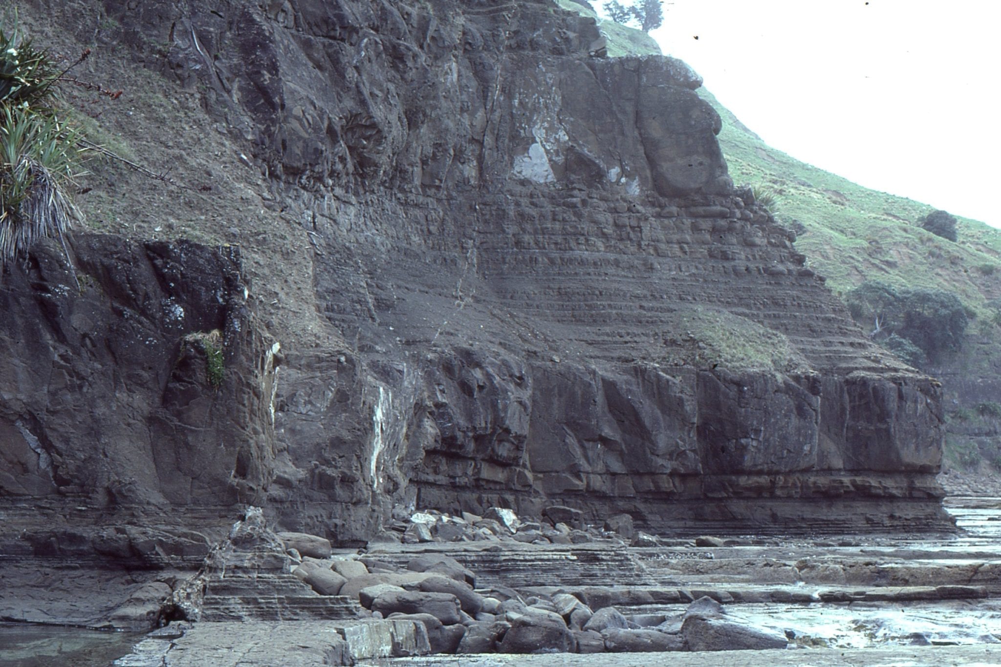
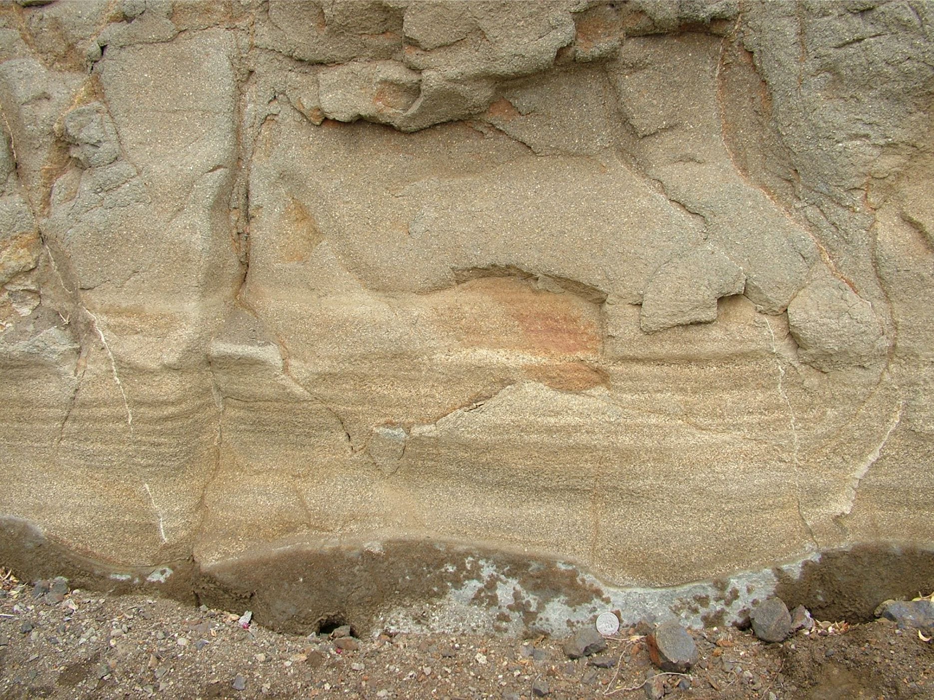
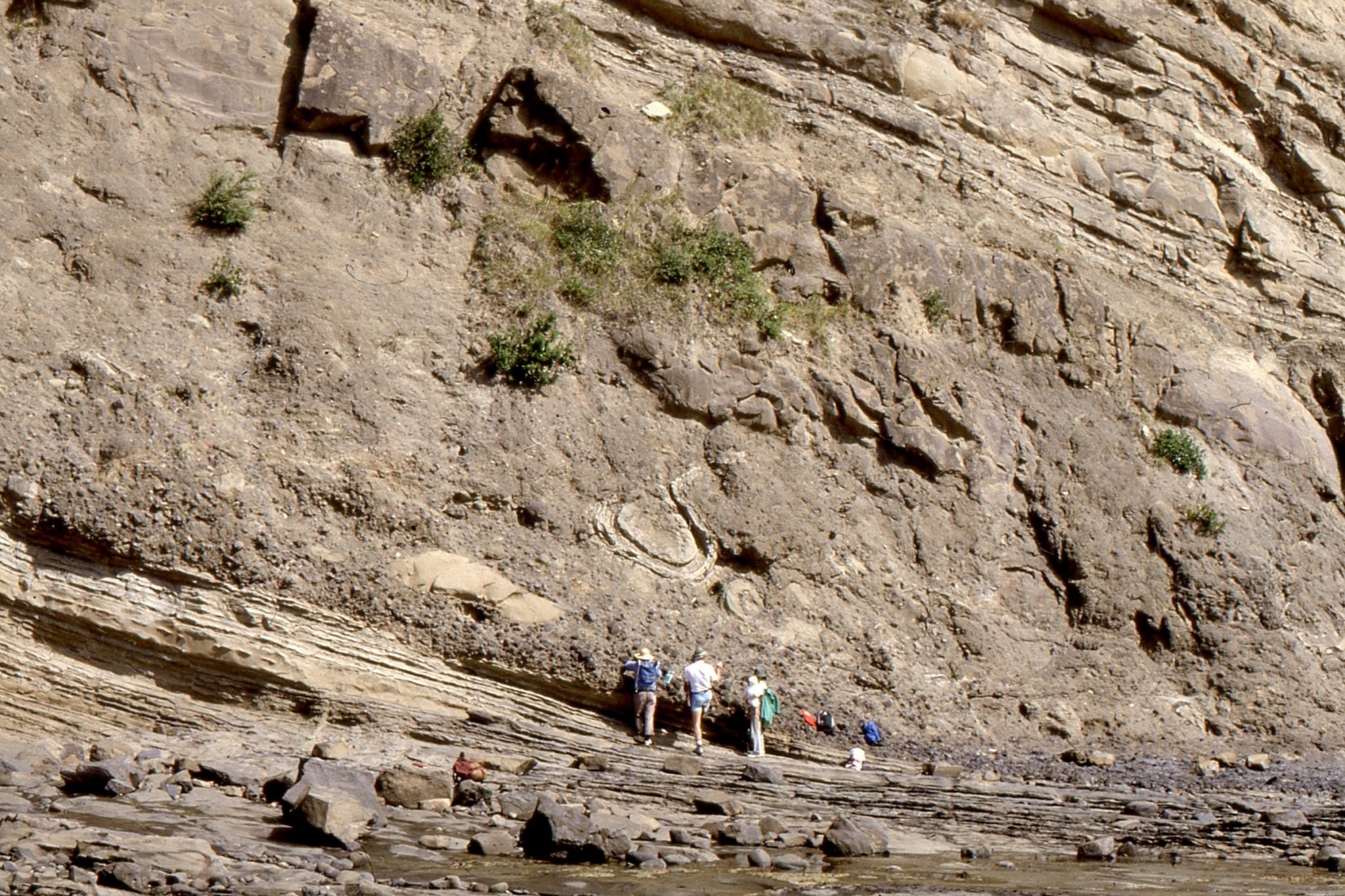
 Thick, proximal to mid-fan turbidites and possible channel overbank, Waitemata Basin, Goat Island Marine Reserve.
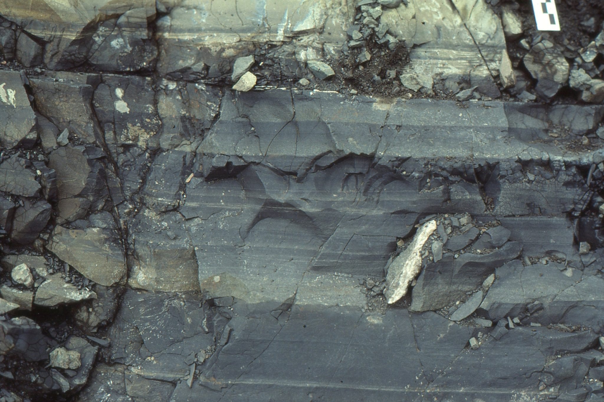
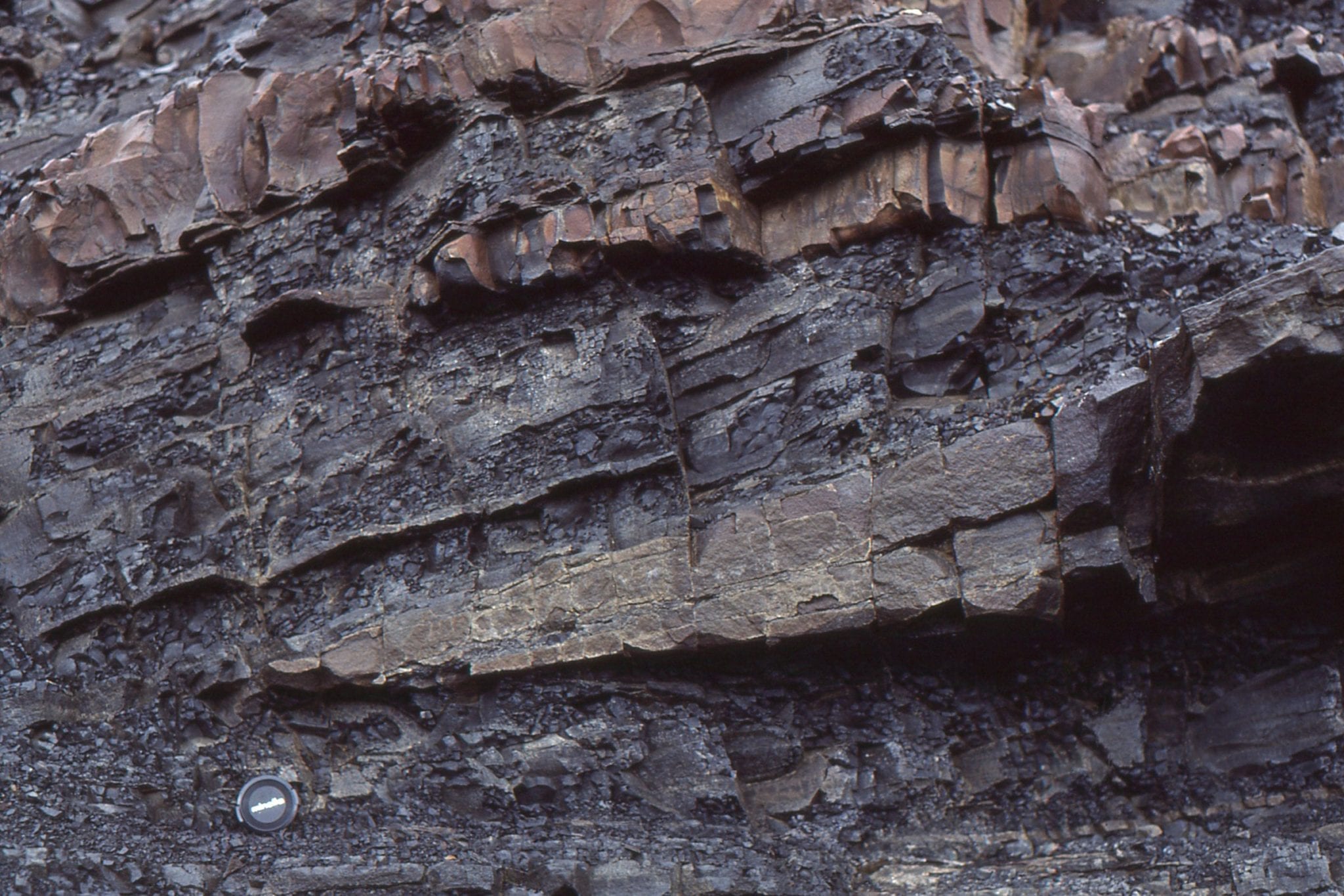
 The thicker, upper unit is is a laminated Tb Bouma interval with mudstone rip-up clasts, and a partly eroded-disrupted Td interval at the top – traced laterally this unit becomes composite. The thick mudstone beds are probably a combination of Td,e intervals. Takapuna Beach, Auckland.
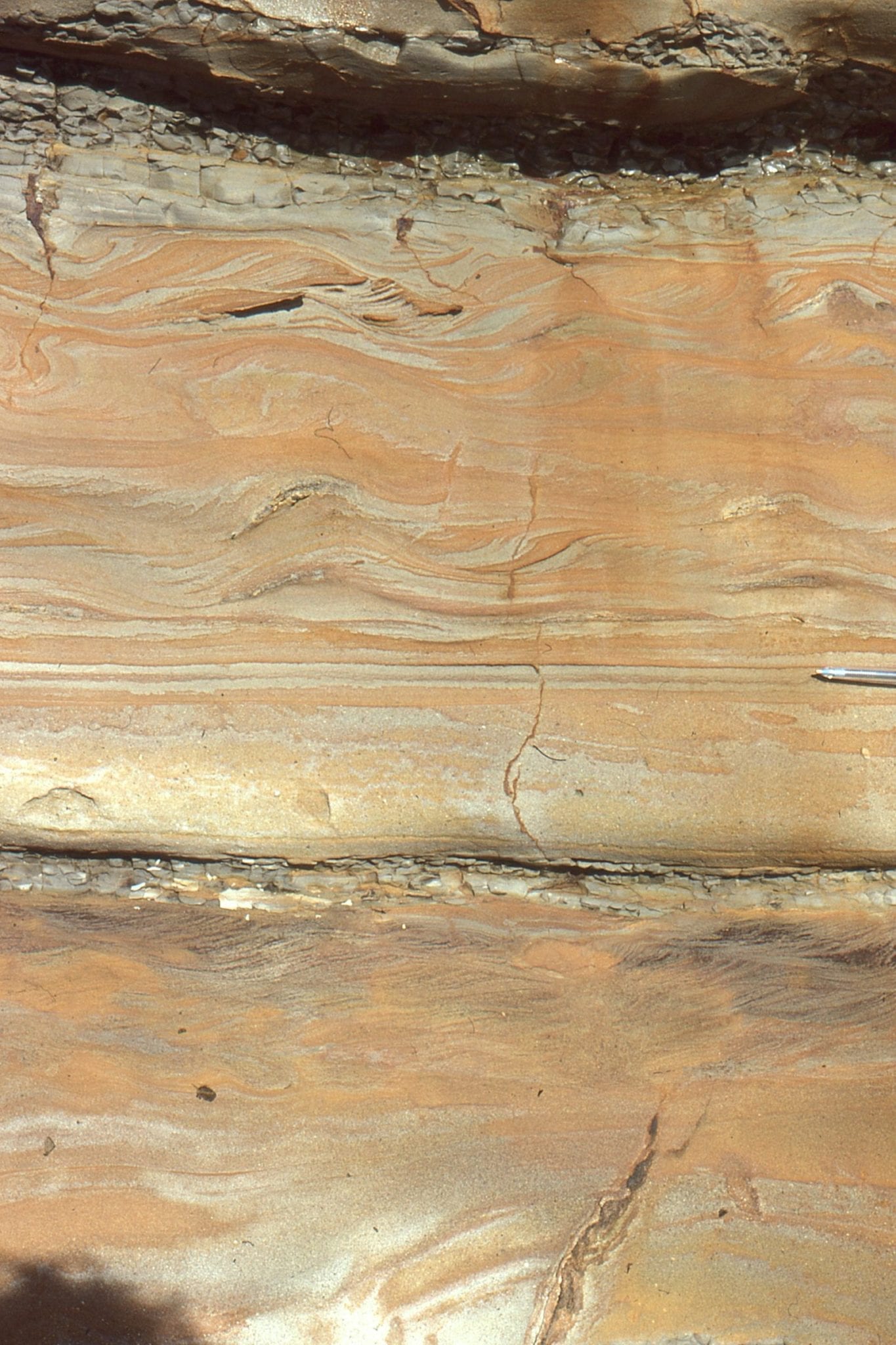
Turbidite beds, well developed Bouma Tb-d intervals, with oversteepened and convoluted ripple drift (Tc interval), Lower Miocene Waitemata Basin, Cockle Bay, Auckland.
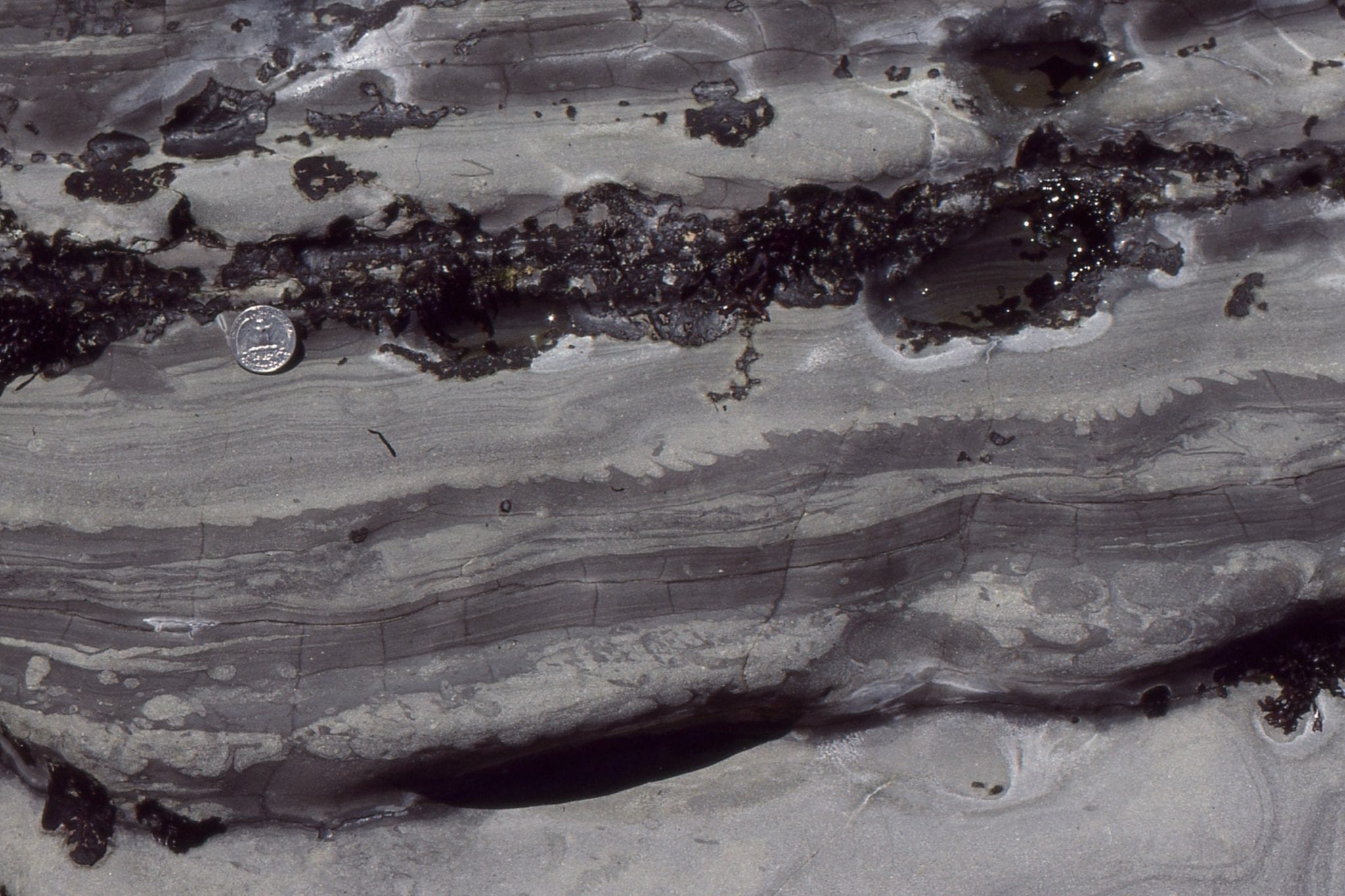
 A thin Bouma Tb layer (at the coin) is overlain by a thin, rippled Tc (just above the coin), that subsequently was eroded by a thin, but coarse-grained sandy flow that ripped up local mudstone slabs and wafers. The middle grey mudstone is mostly Te (hemipelagic) with small bottom-current ripples redistributing sand across a thin layer. Waitemata Basin, Cockle Bay, south Auckland.
 Convoluted siltstone-fine sandstone, truncated by the next flow unit, in which there is a thin, gritty Ta interval. Waitemata Basin, Cockle Bay, south Auckland.
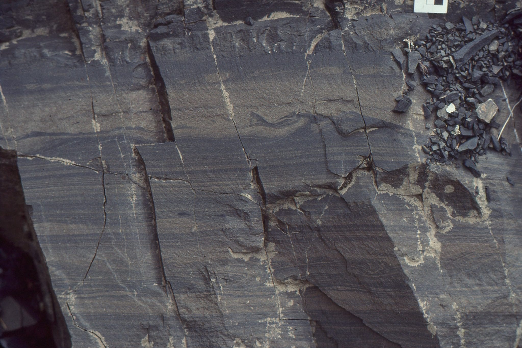
 A composite flow unit with well developed Tb laminations (lowest), and near the top a scour surface formed by the succeeding flow. Waitemata Basin, north end of Goat Island Marine Reserve.
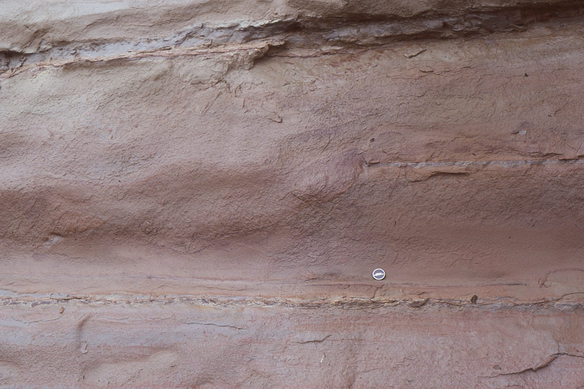
 Thick, coarse-grained laminated Tb interval, Musick Point, Auckland.
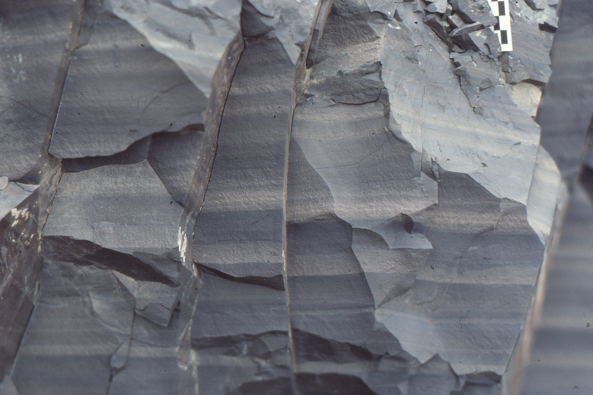
 Thick Bouma Ta-b composites; most of the intervening, skinny Td mudstone (center) has been eroded. Waitemata Basin, Cockle Bay.
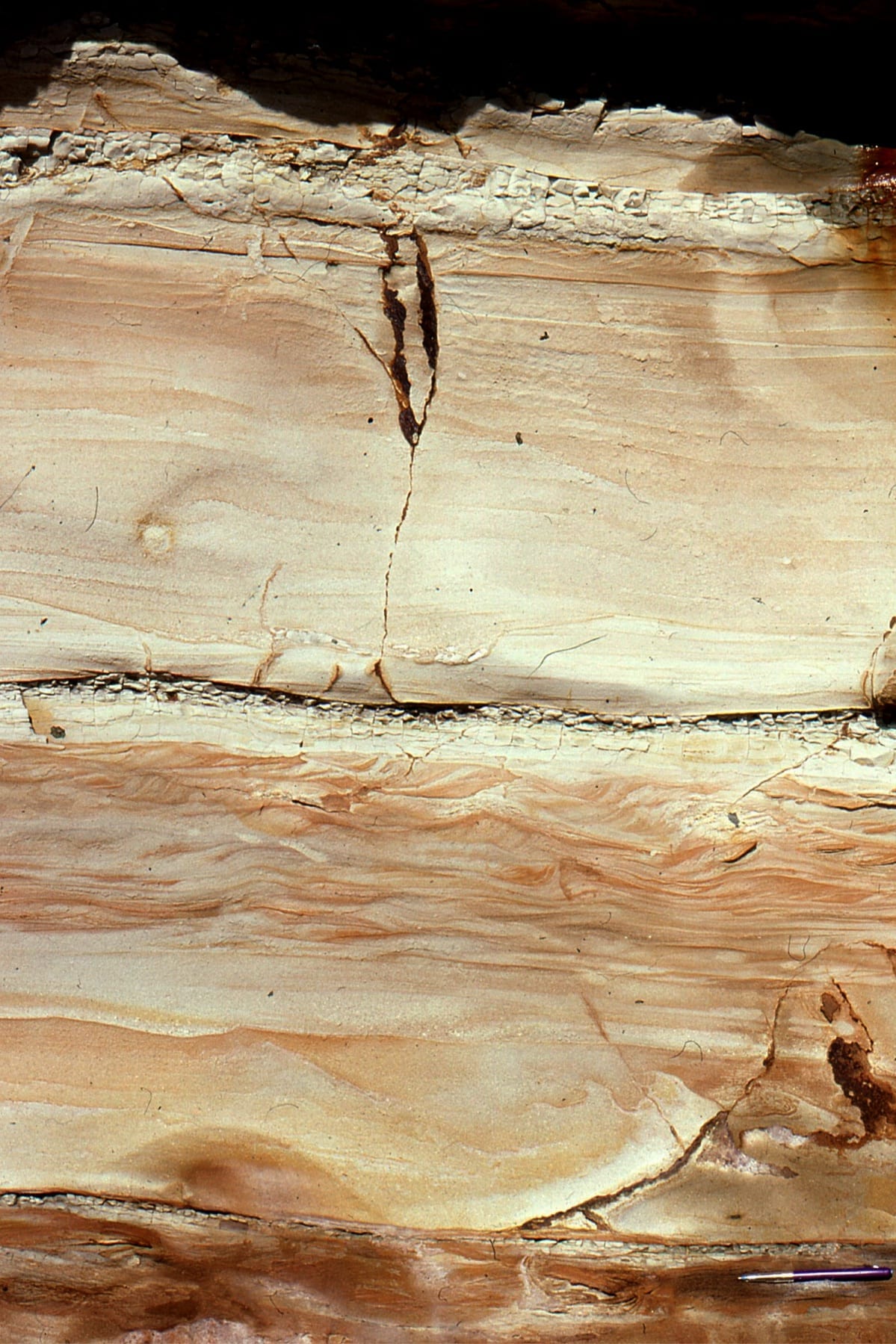
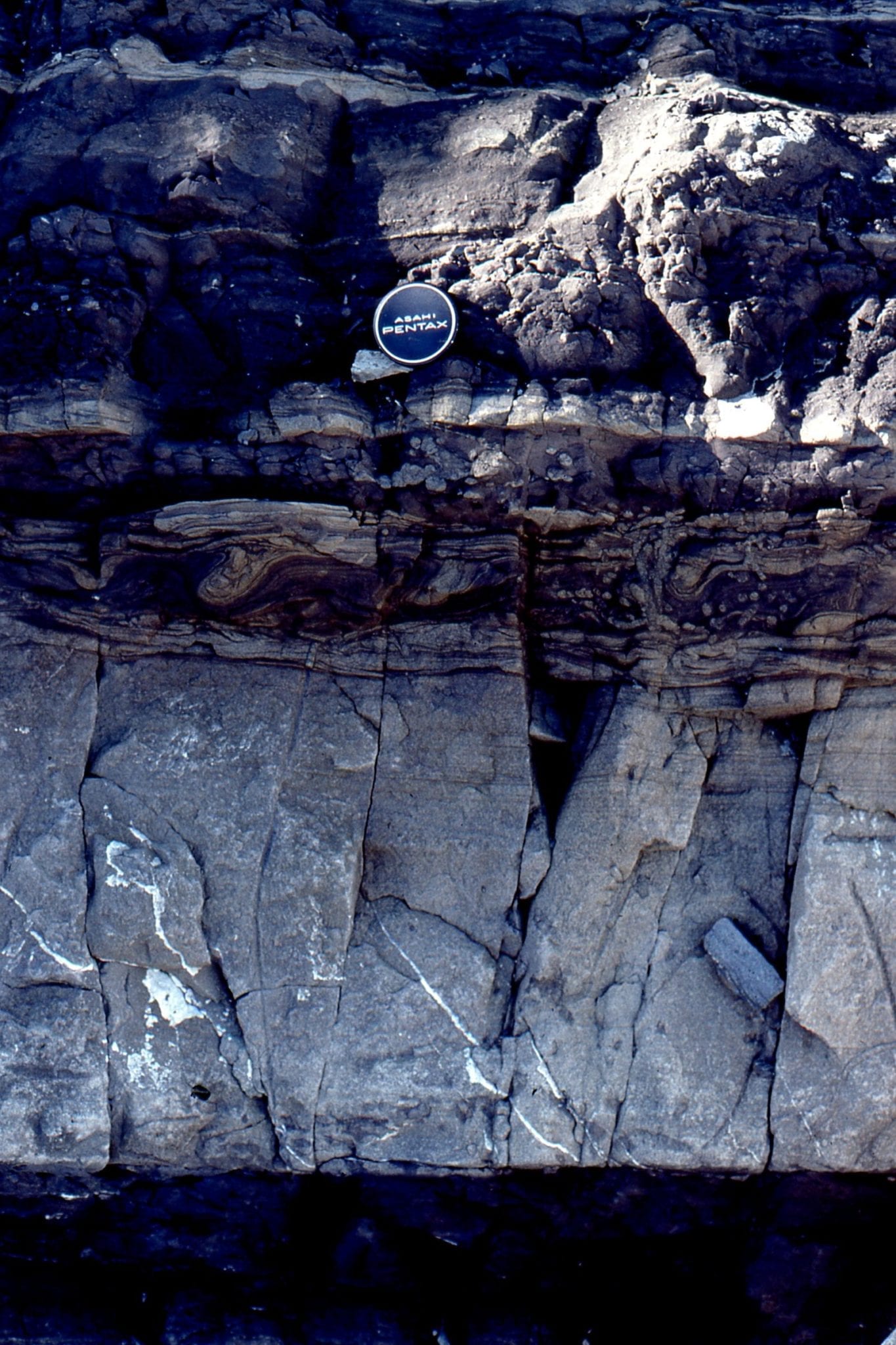
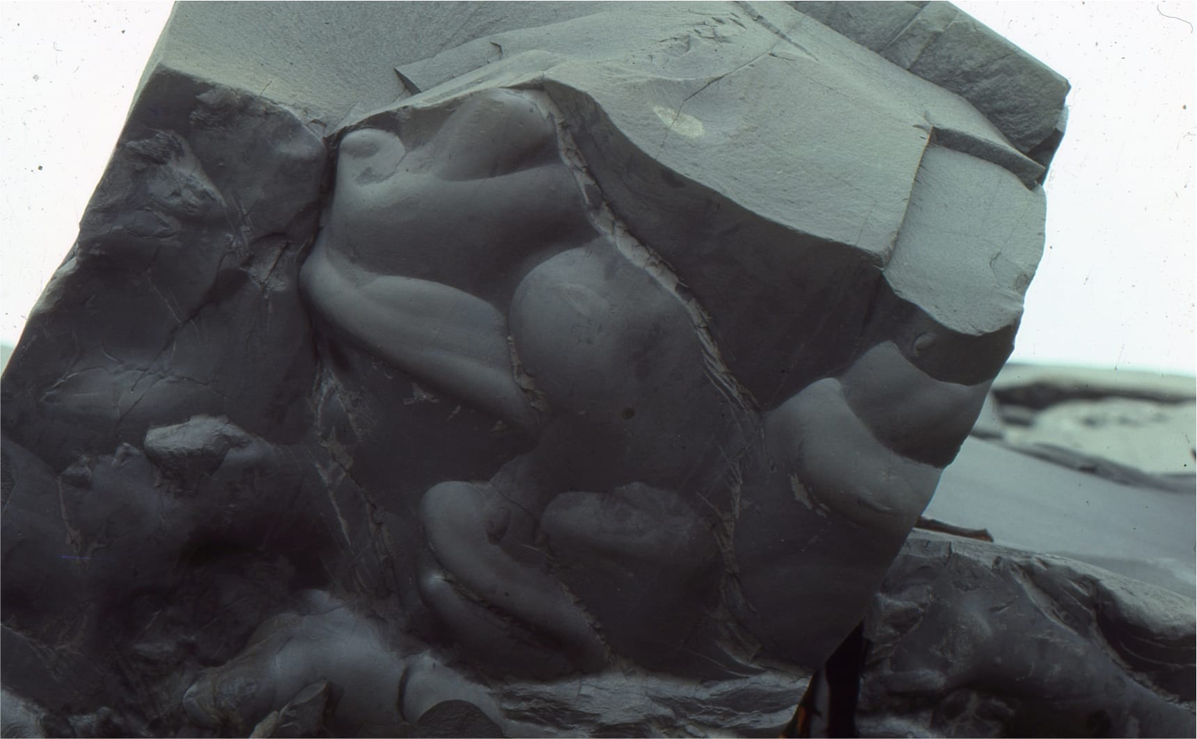
 Dewatering of this turbidite (during very early burial) is indicated the concave-up dish structures, and small synsedimentary faults that terminate just above the dish structures. Waitemata Basin, Musick Point,
 Coalified wood fragment (outlined), intensely bored by Miocene Toredo-like marine worms, Waitemata Basin, Goat Island Marine Reserve.
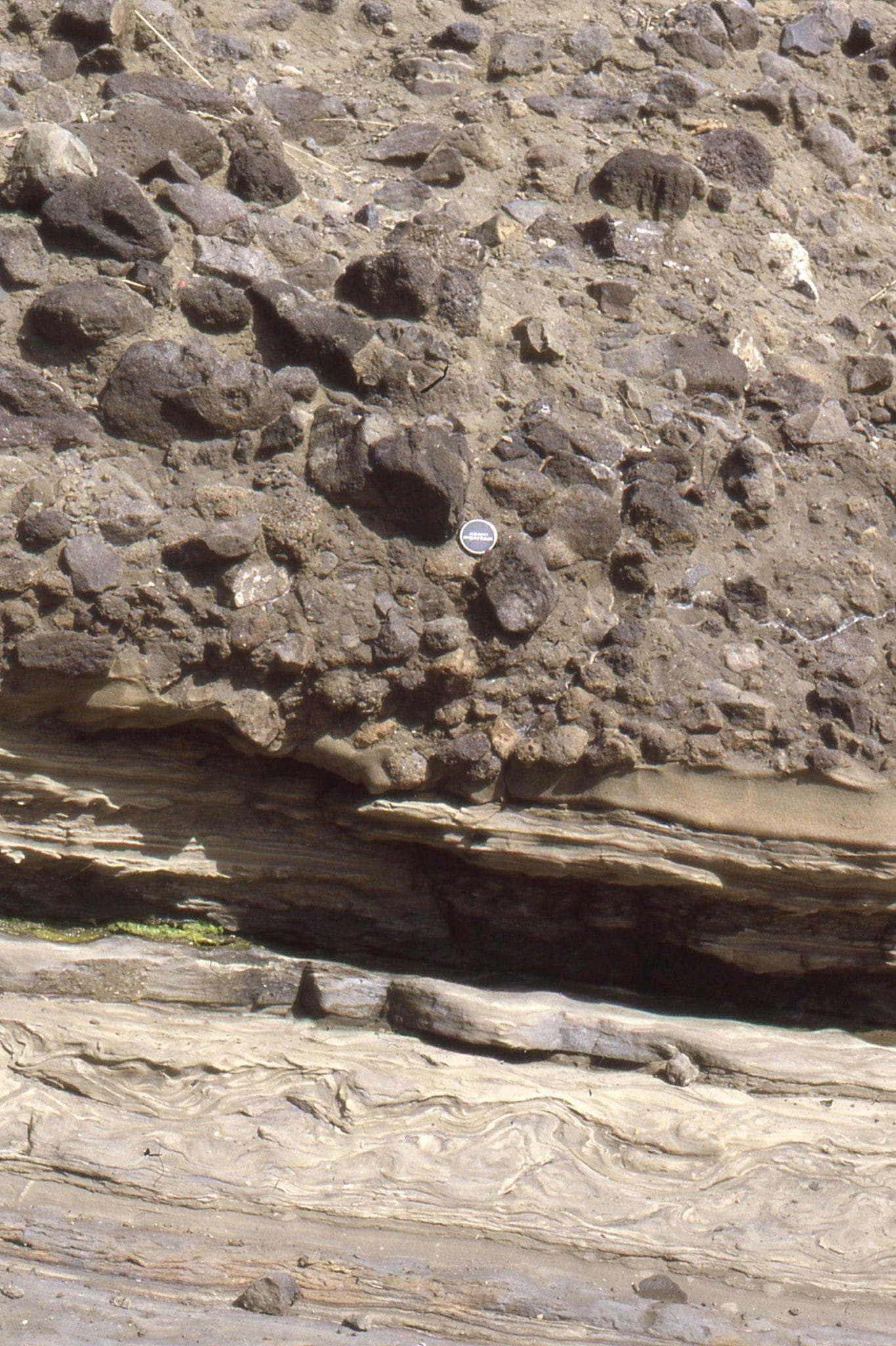
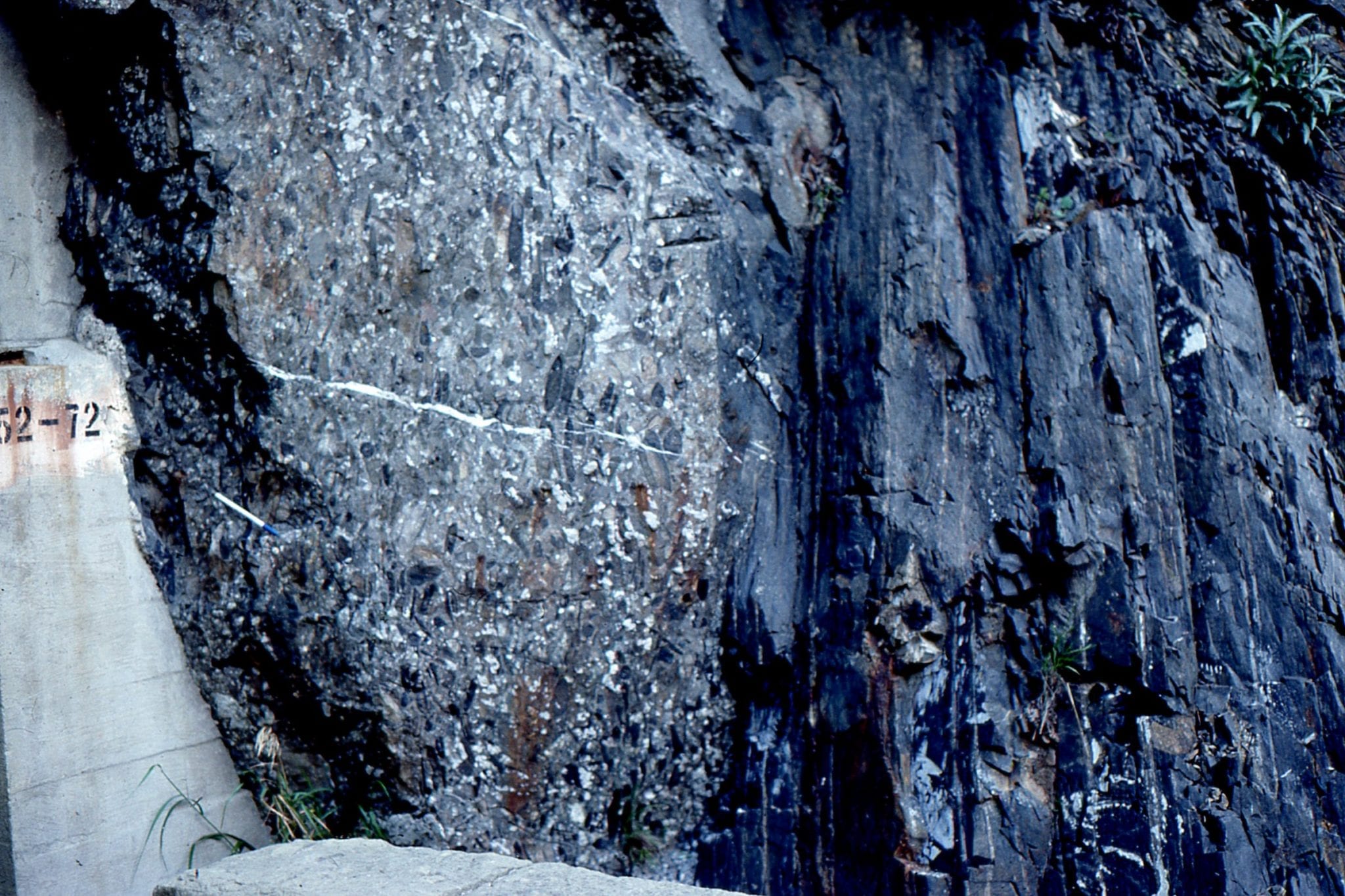
Very think, composite debris flows containing abundant pebbles, cobbles and boulders of basalt, and subordinate sedimentary and mafic igneous clasts. Interpreted provenance of the clasts varies between two extremes: an active, early Miocene volcanic arc on the western margin of Waitemata Basin; and more recently as debris from oceanic islands (see Shane et al, 2010, Geochemistry, Geophysics, Geosystems, open access). Left: Motuihe Island, Auckland. Right: an iconic outcrop at Waiwera, north Auckland. Lower flow units have large rafts of locally derived, deformed mudstone. The debris flow is overlain by thick, proximal fan turbidites.
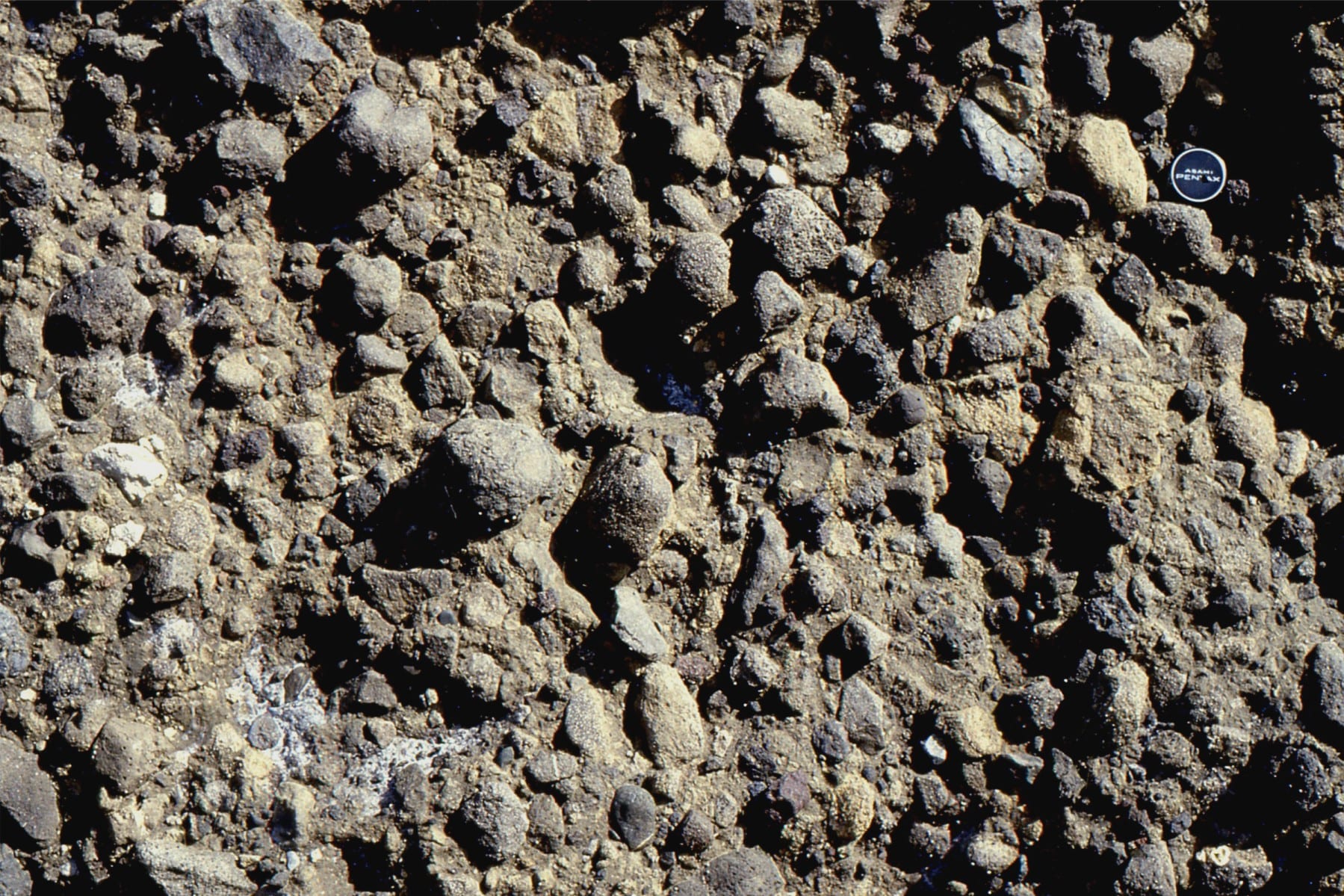
Mixed matrix-supported and some clast-supported textures in Waitemata Basin debris flows. Left: Waiwera (same as the left image above); Right: Karekare, Auckland west coast.
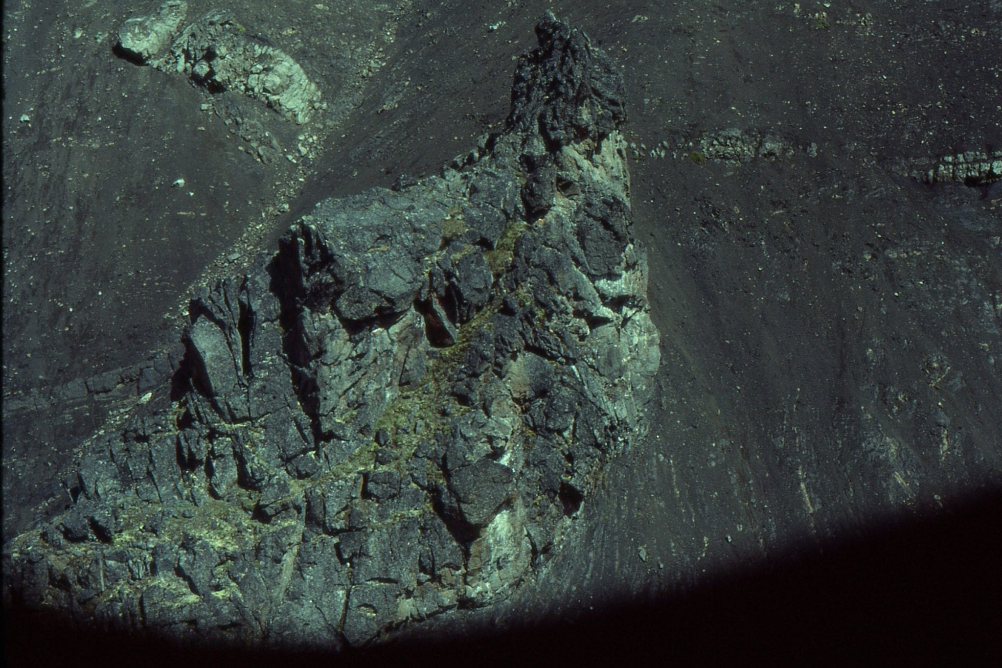
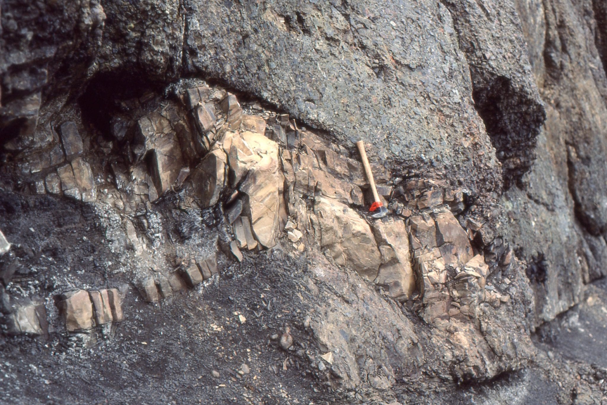
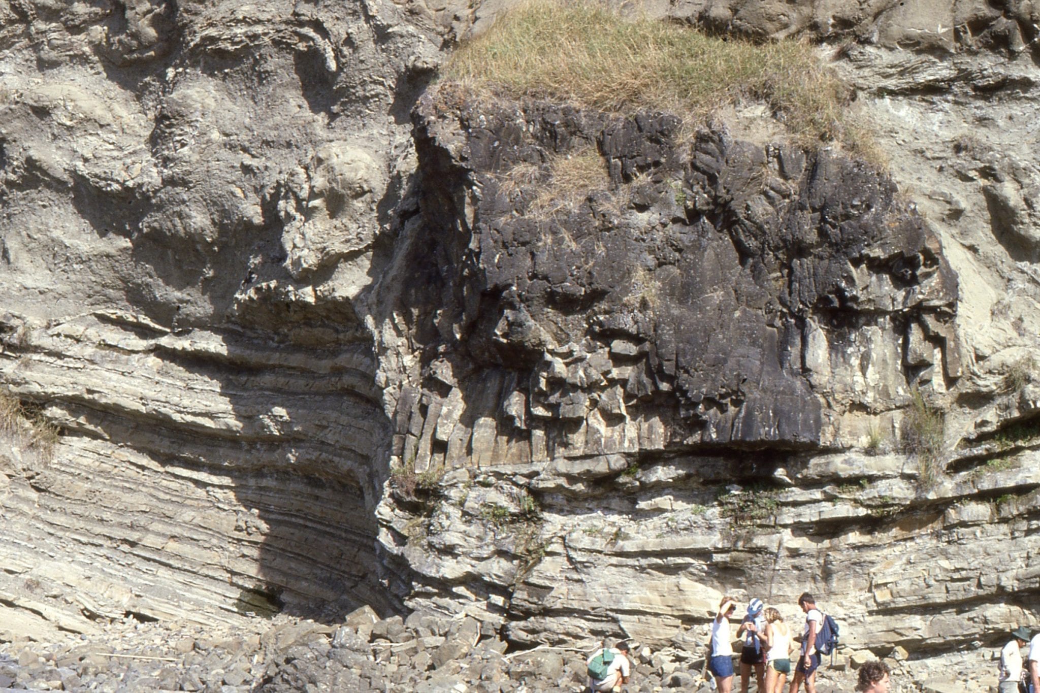 A massive raft of columnar-jointed basalt, a remnant of either a lava flow of dyke from an oceanic island somewhere west of the basin. The weight of the block and compaction have pushed it into the underlying turbidite beds. Waitemata Basin, Army Bay, Auckland.
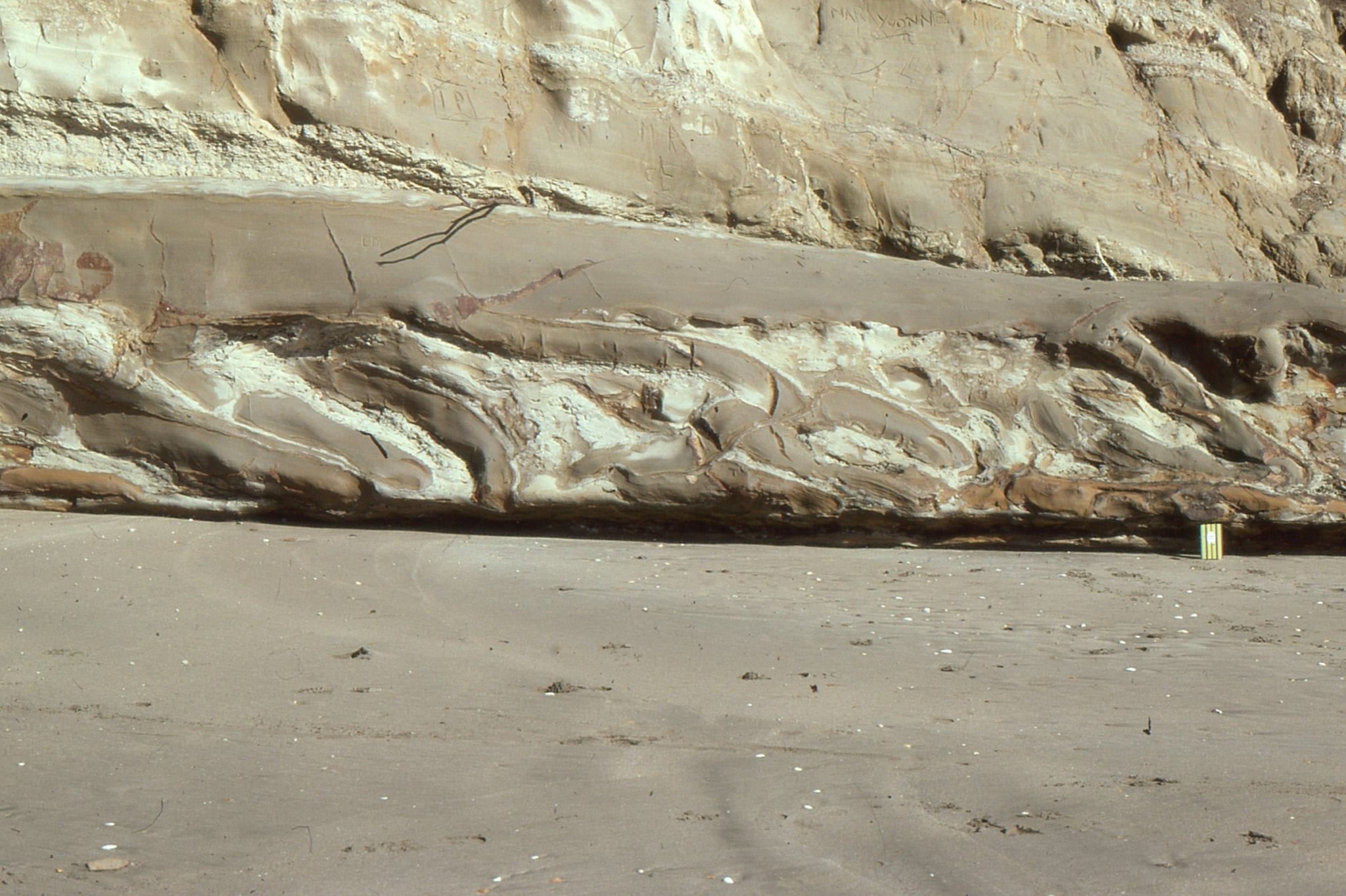
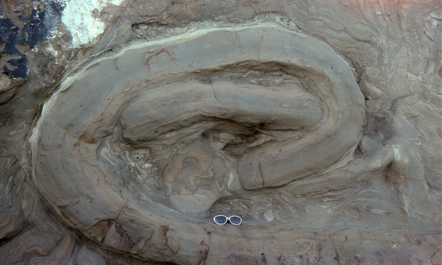
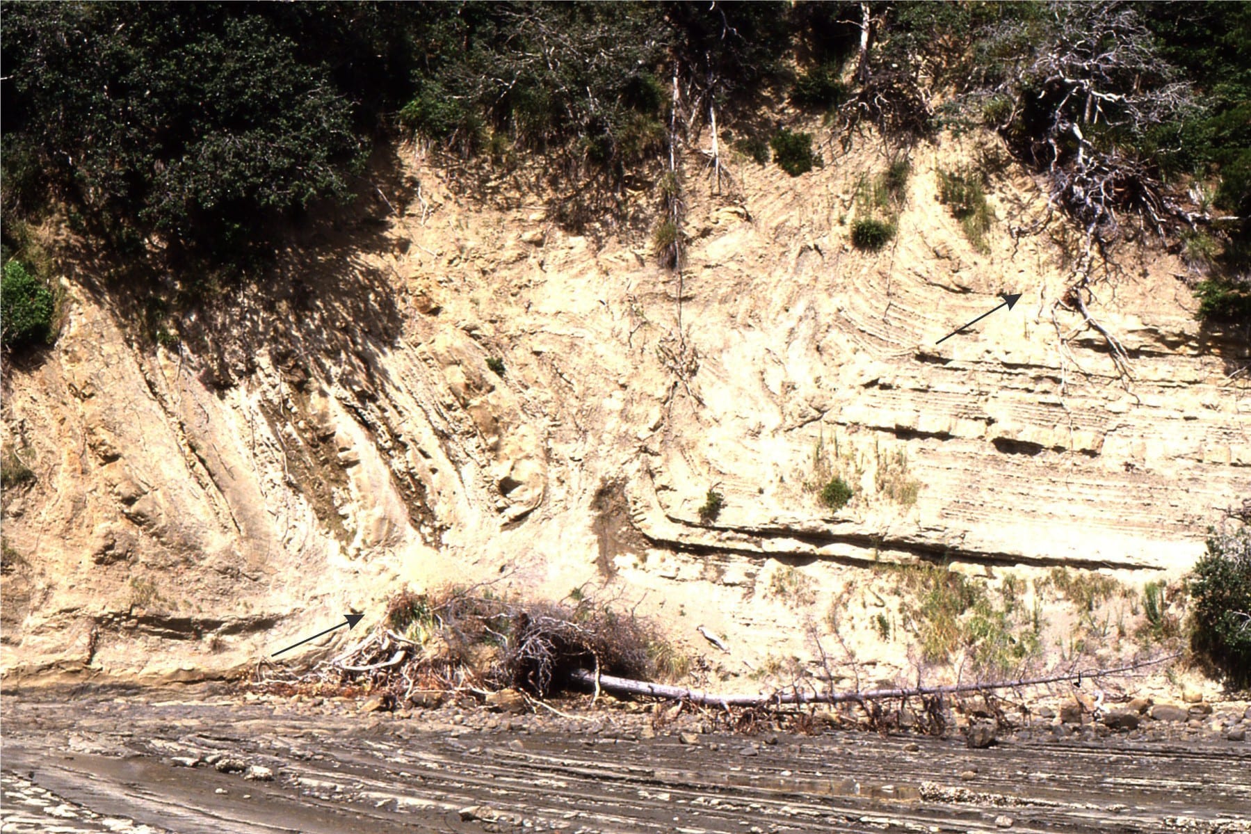
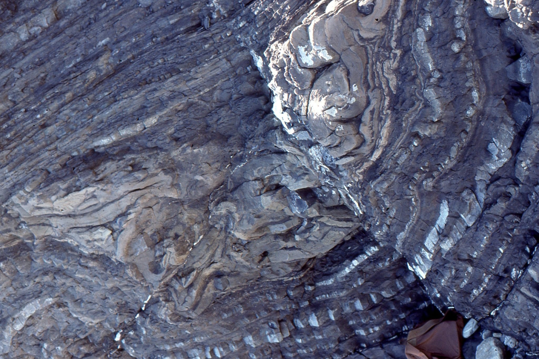
Probably the most photographed slump fold in Waitamata Basin, Army Bay. The recumbent structure is detached from strata below along a relatively undisturbed glide plane. The lower limb is also cut by small faults.
Left: Classic slump folded turbidites, confined to a specific interval; strata above and below are relatively undeformed. Fold sandstone limbs are partly detached or pulled apart, and some mudrocks have been fluidized, Waitemata Basin, Takapuna, Auckland. Right: Broken soft-sediment fold, with partially fluidized mudrock below the central detached limb. Waitemata Basin, Little Manly Beach.
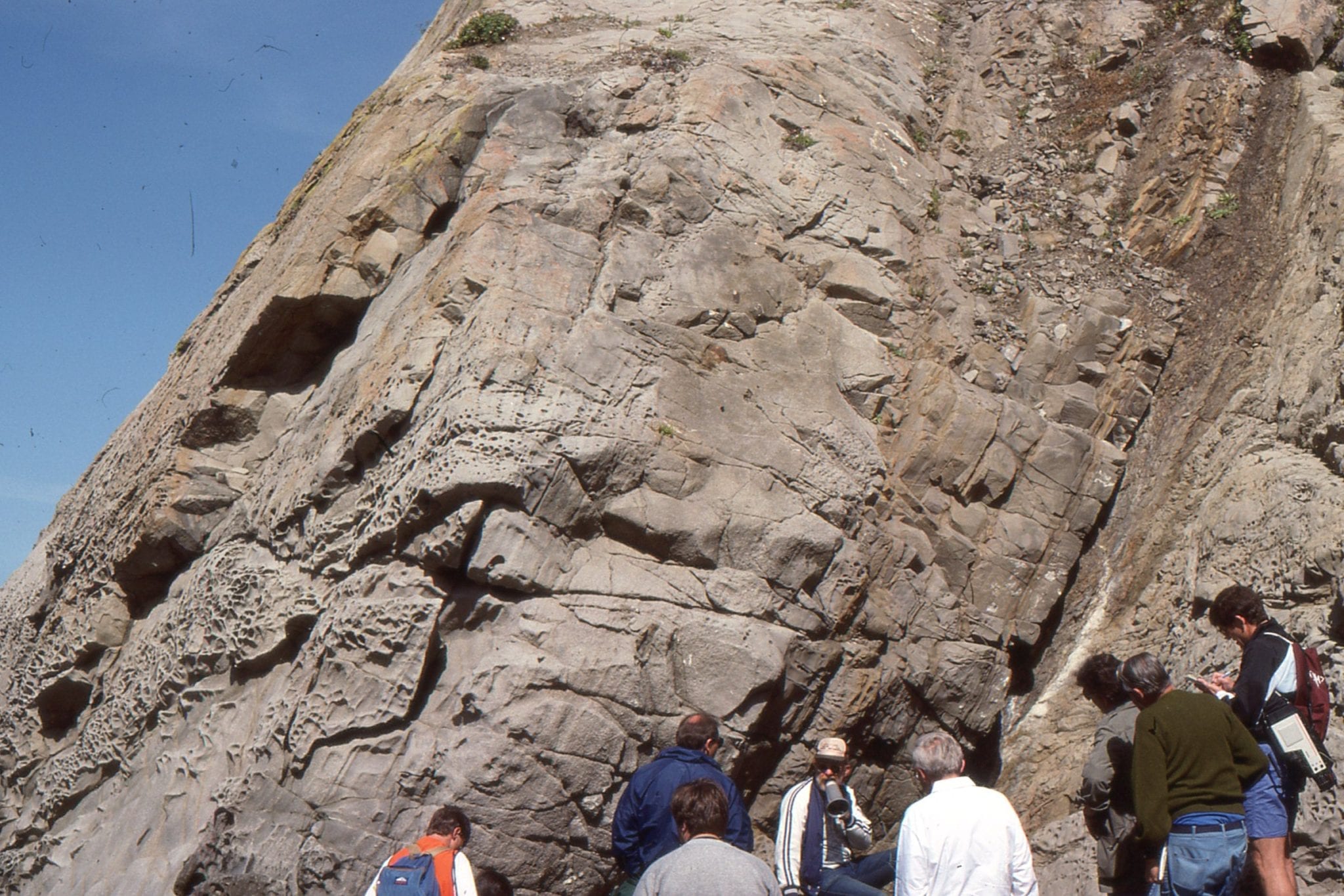
 Isoclinal folding in thin-bedded mudstone-sandstone (left center), and a sandy turbidite bed deformed by rotated boudins (upper right). All these structures formed while the sediment was at a transition from relatively soft to weakly indurated. Waitemata Basin, Army Bay, north Auckland.
 Soft sediment deformation in Waitemata Basin, includes small thrusts (fault plane indicated by arrows), with folded strata in the hanging wall, and small drag folds in the footwall. Waiwera, north Auckland.
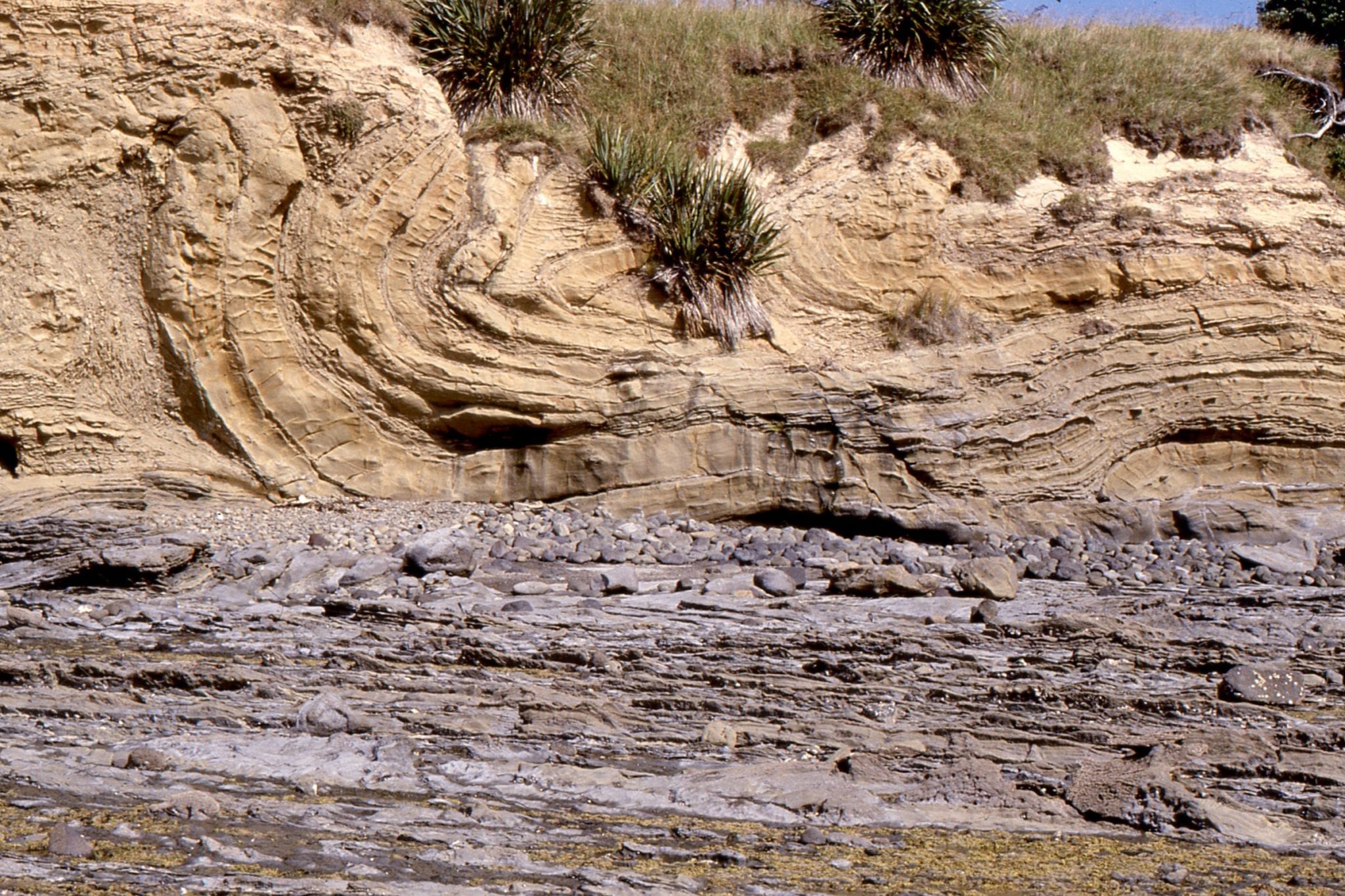
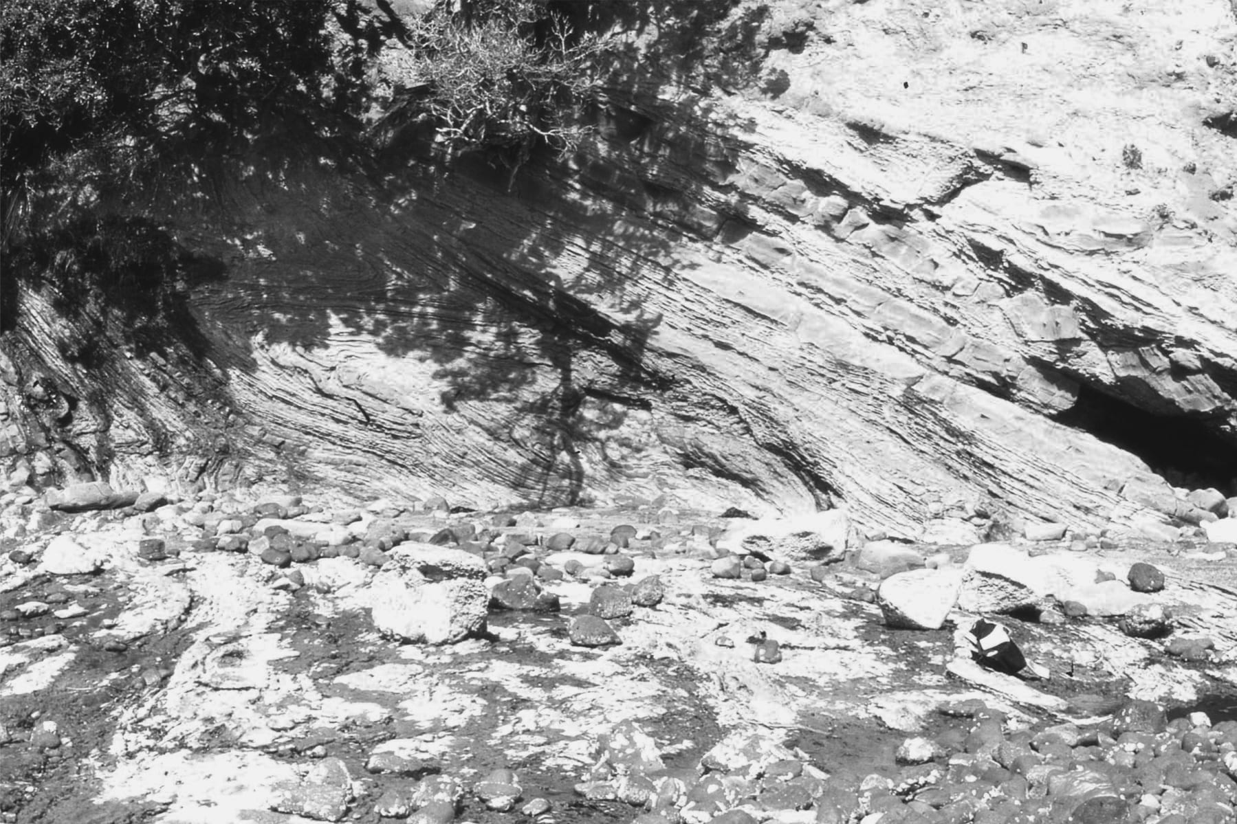
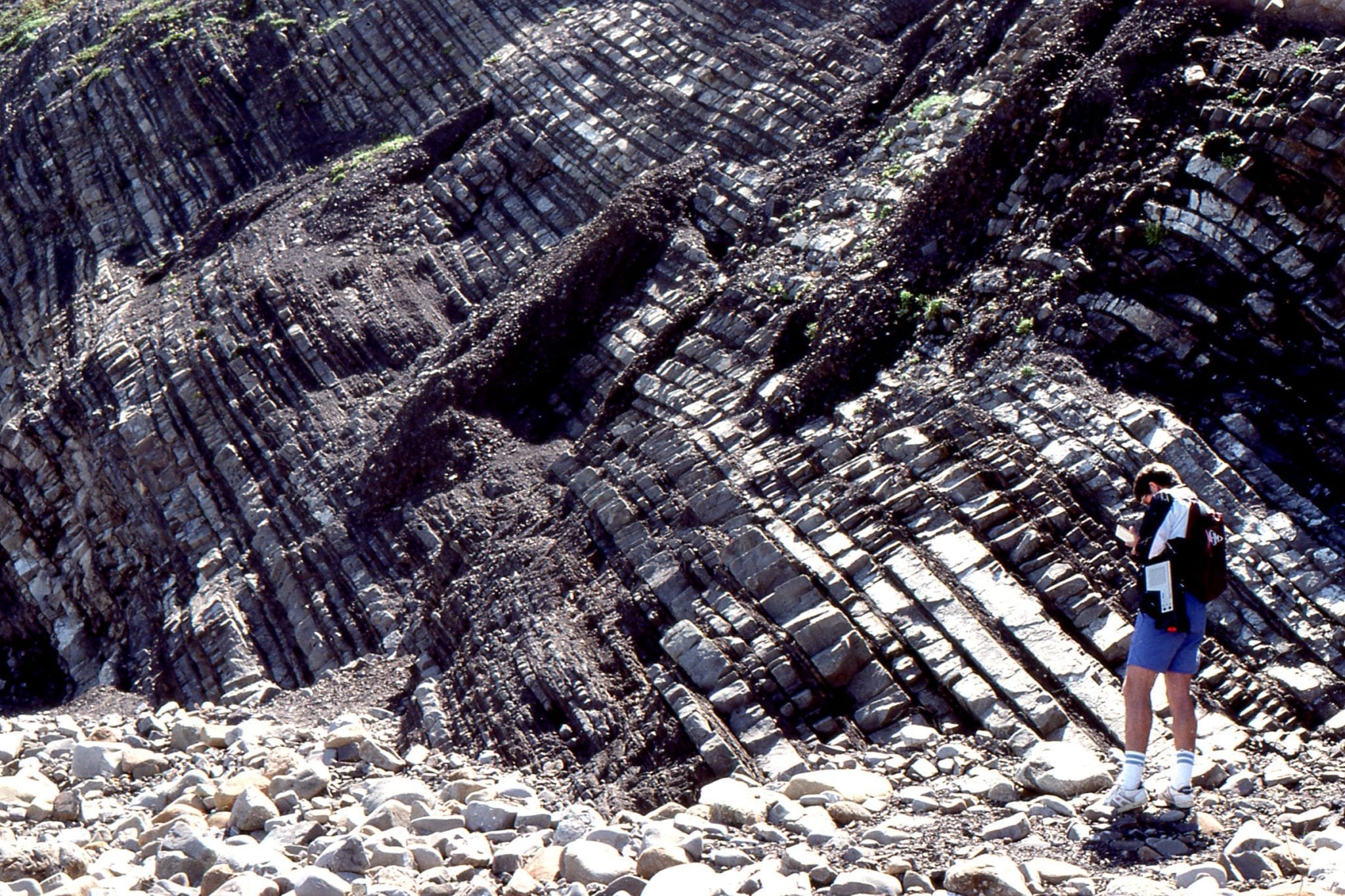
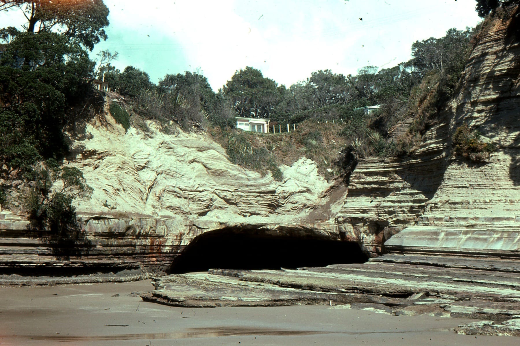 Intensely folded turbidites on a horizontal, undeformed glide plane, Waitemata Basin, Orewa Beach, Auckland.
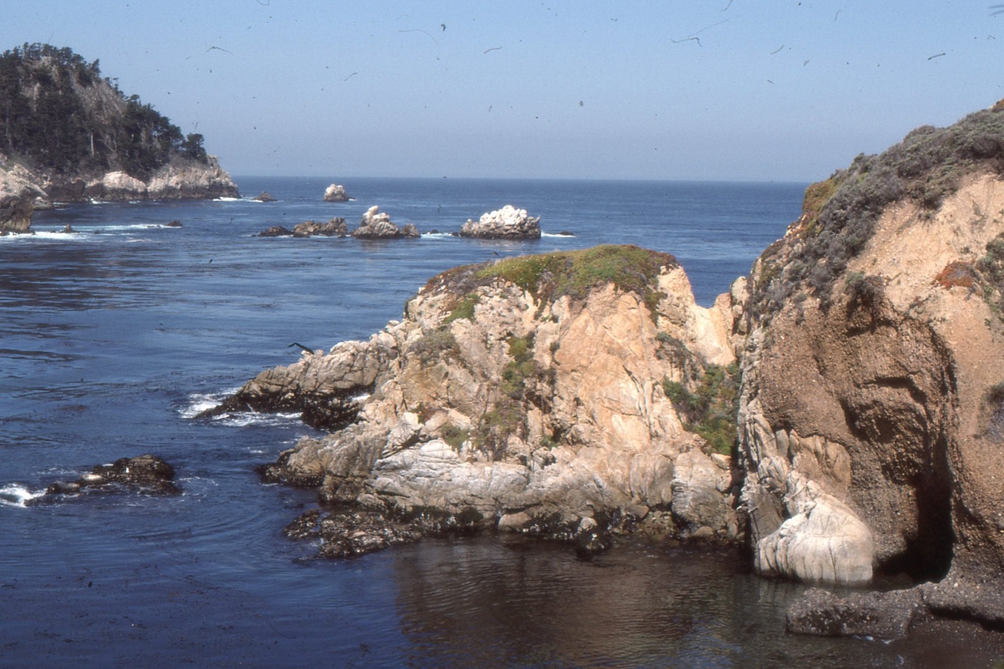
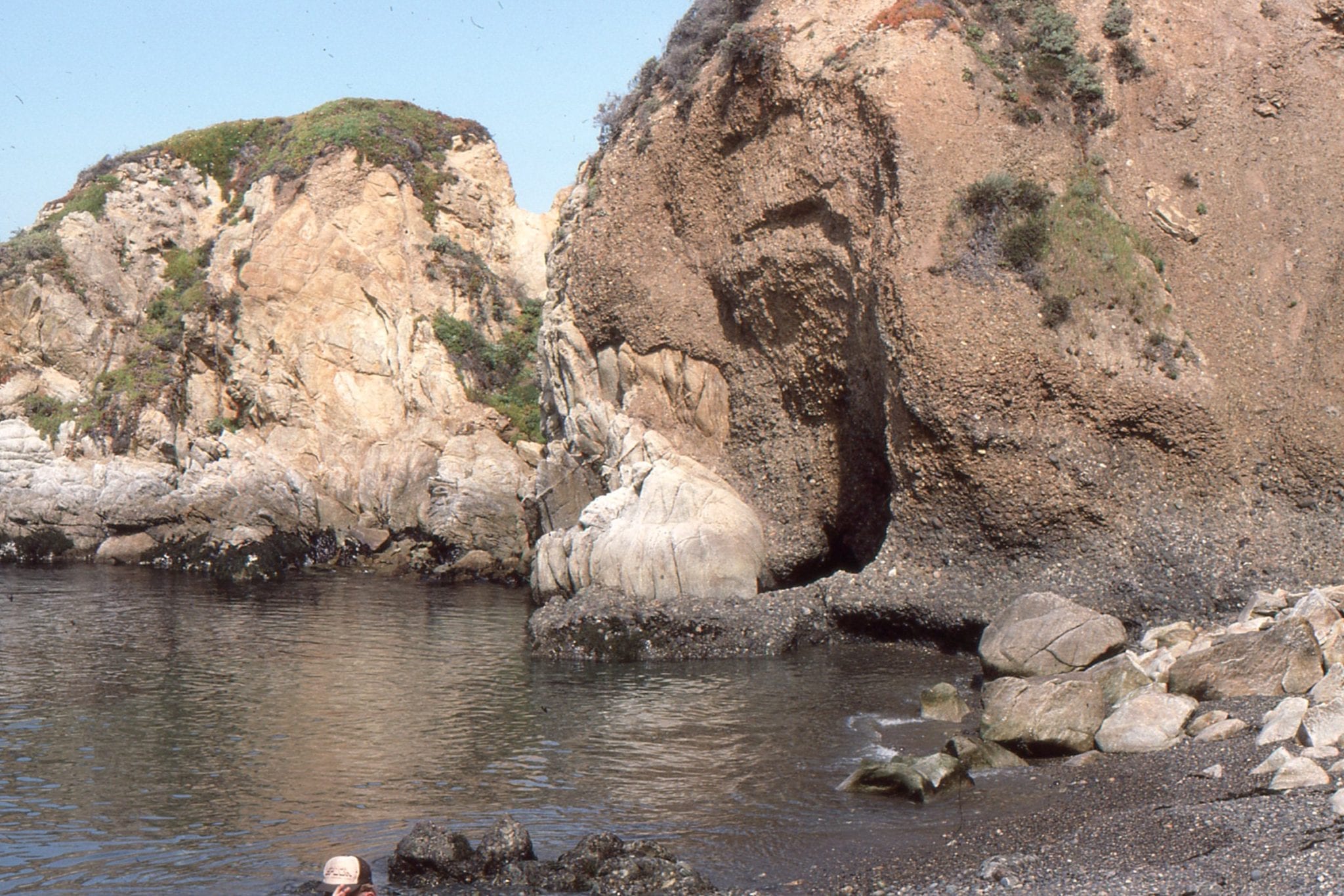
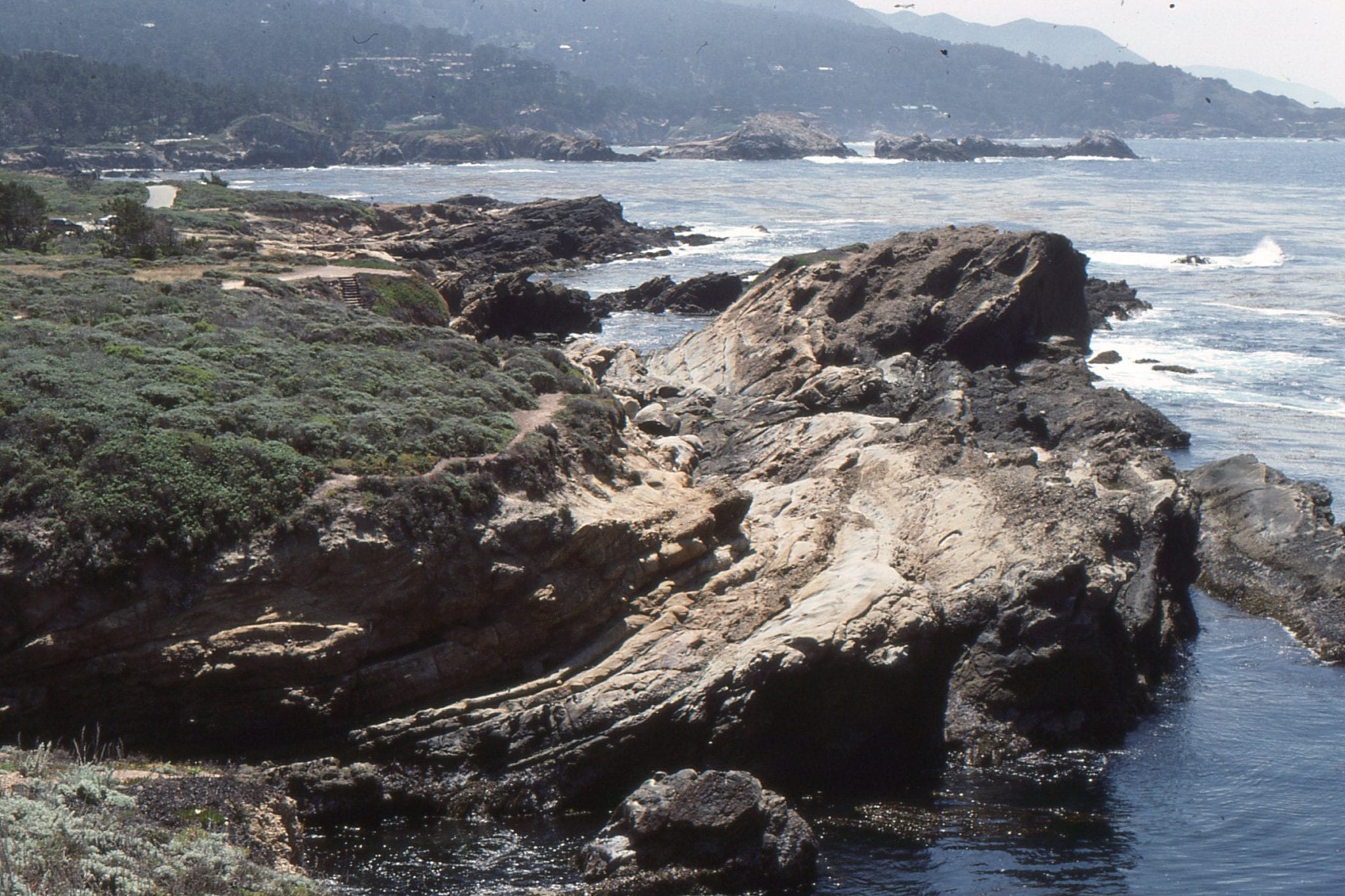
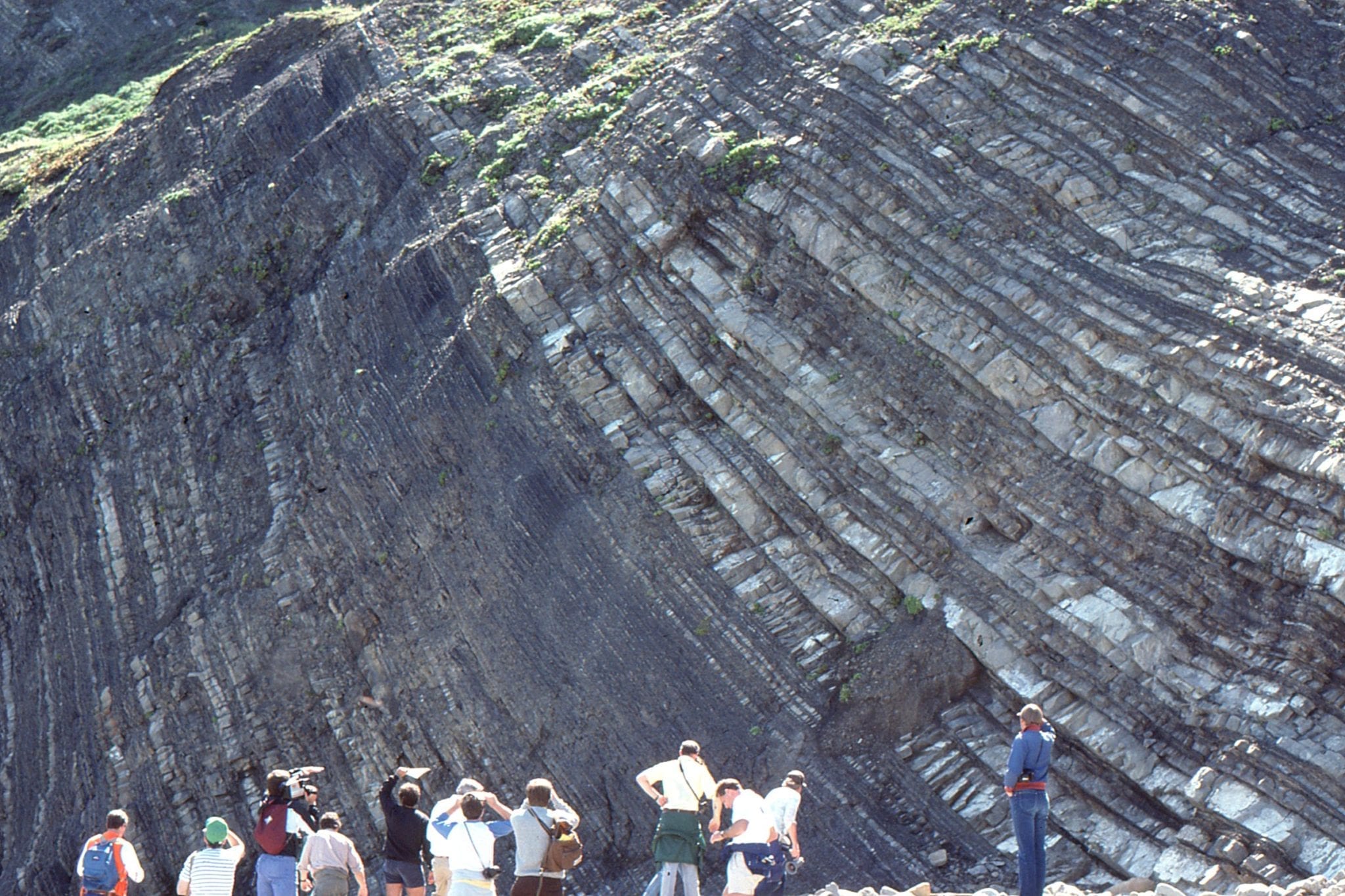
 Paleocene turbidites, Point San Pedro, California.
Left: Successive cycles of thinning upward and thin bedded, distal fan turbidites, Point San Pedro, California. Right: Cyclic, thinning upward interchannel facies, Paleocene Point San Pedro, California.
 Small slump package in thinly bedded distal fan facies, Point San Pedro, California.
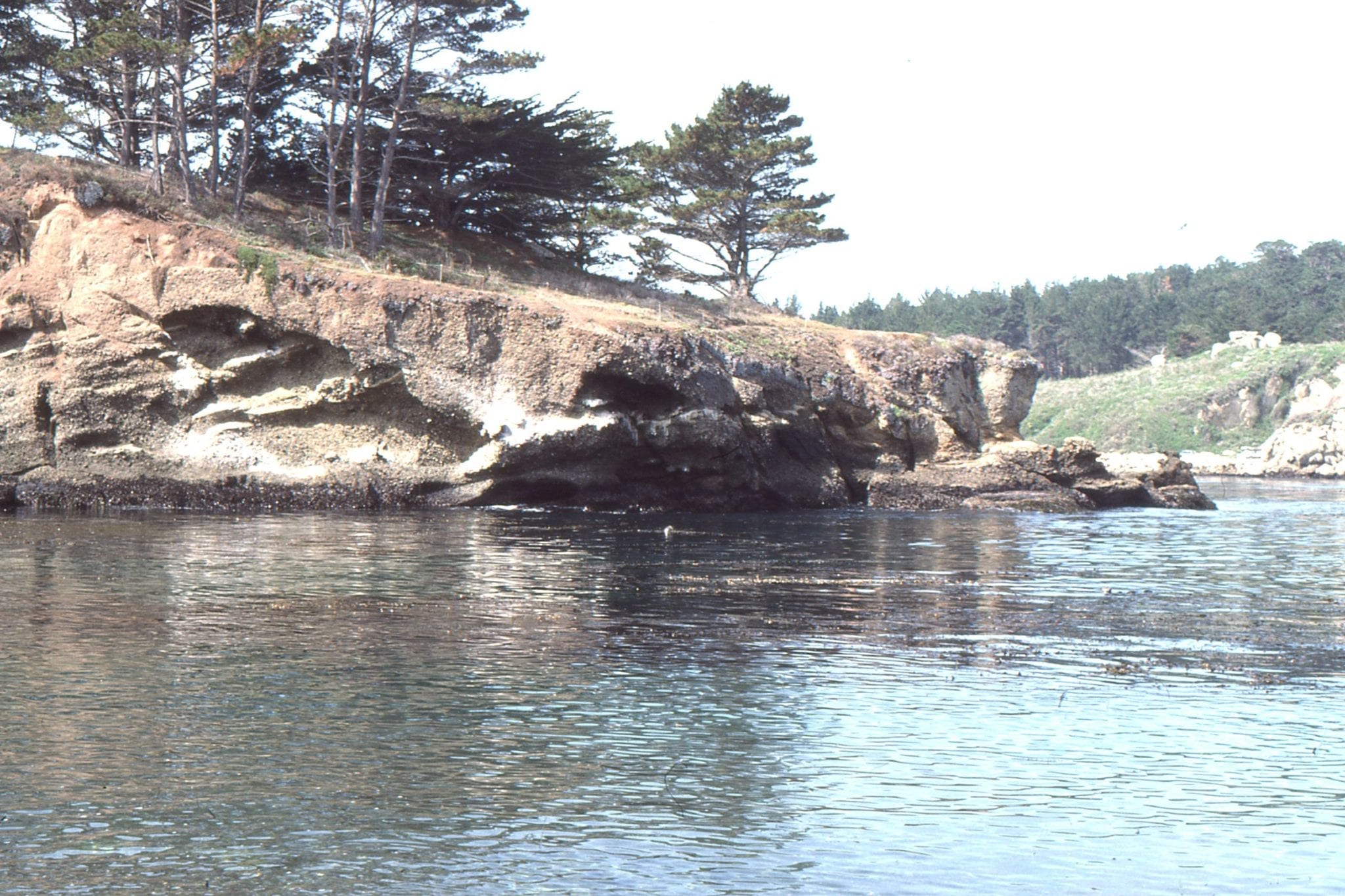
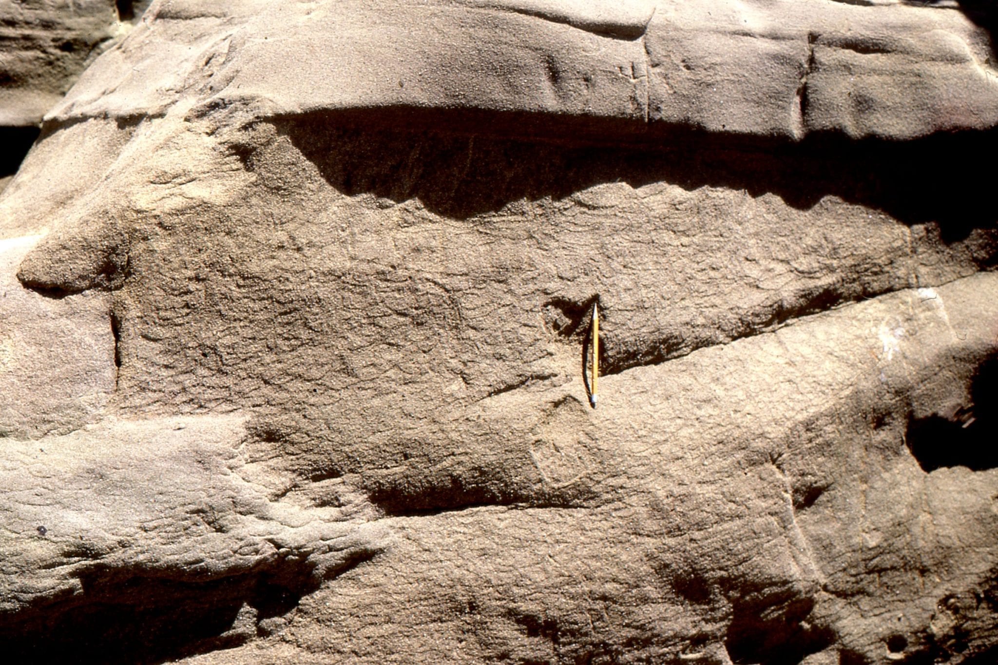
 Submarine channel sandstone overlain by thin sandy turbdites and overbank mudstone. Point San Pedro, California.
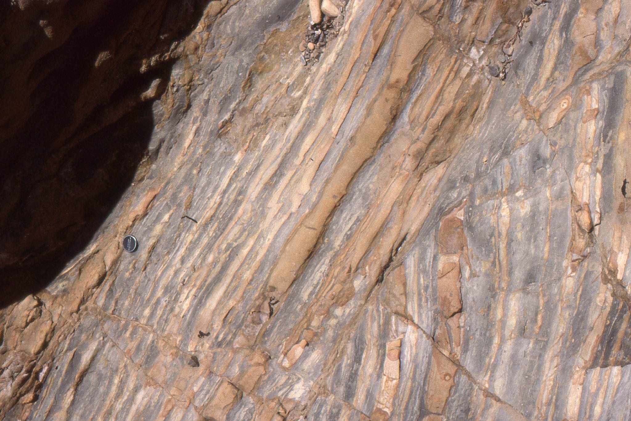
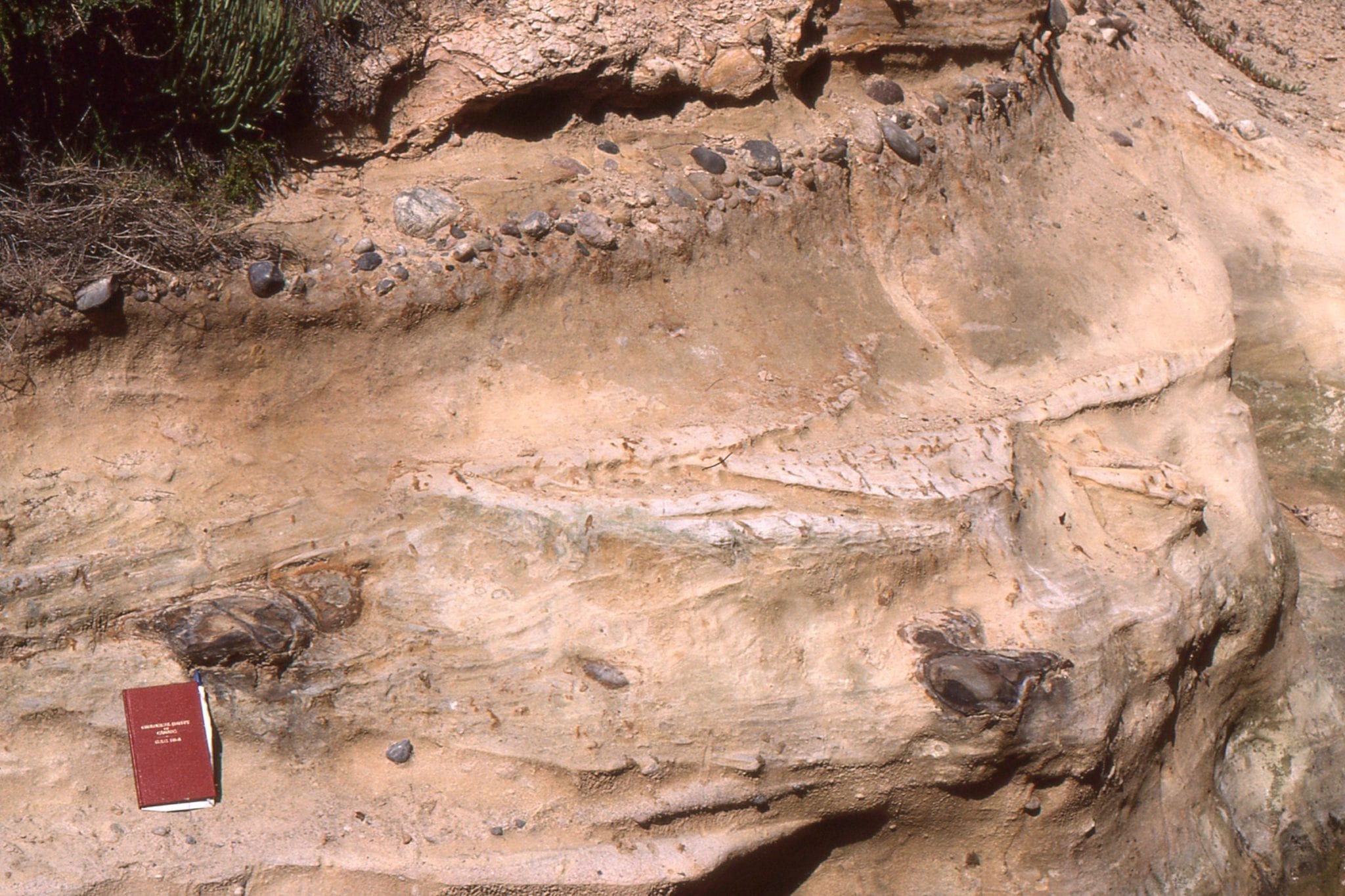
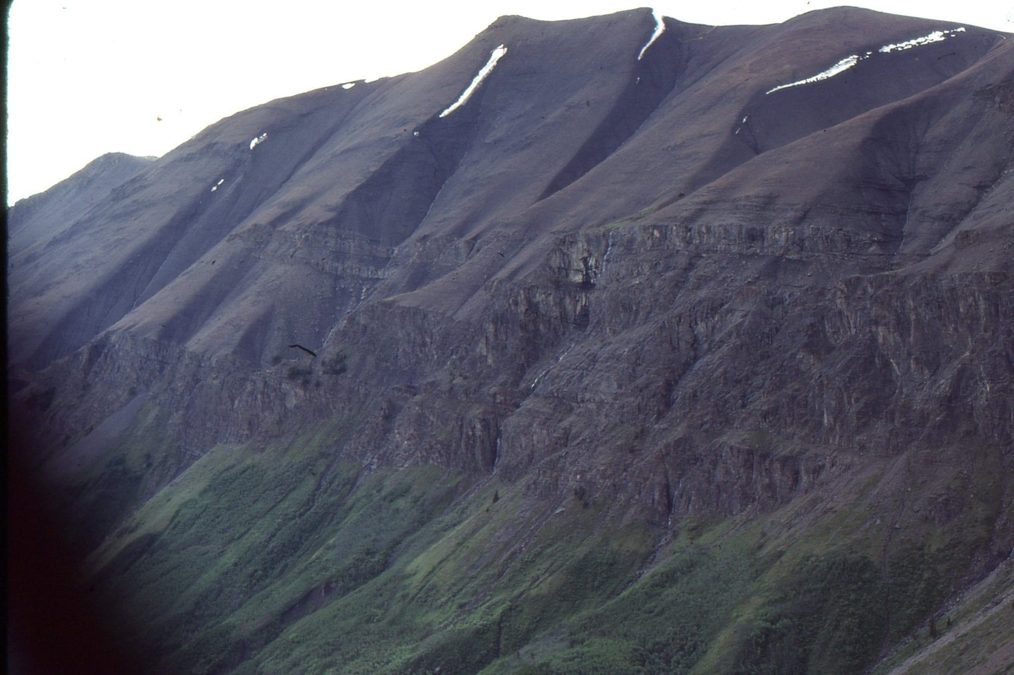
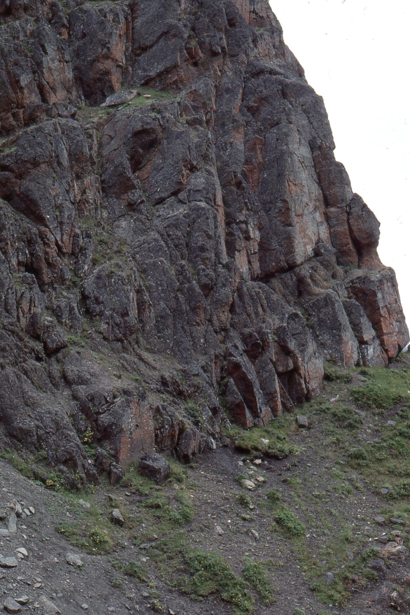
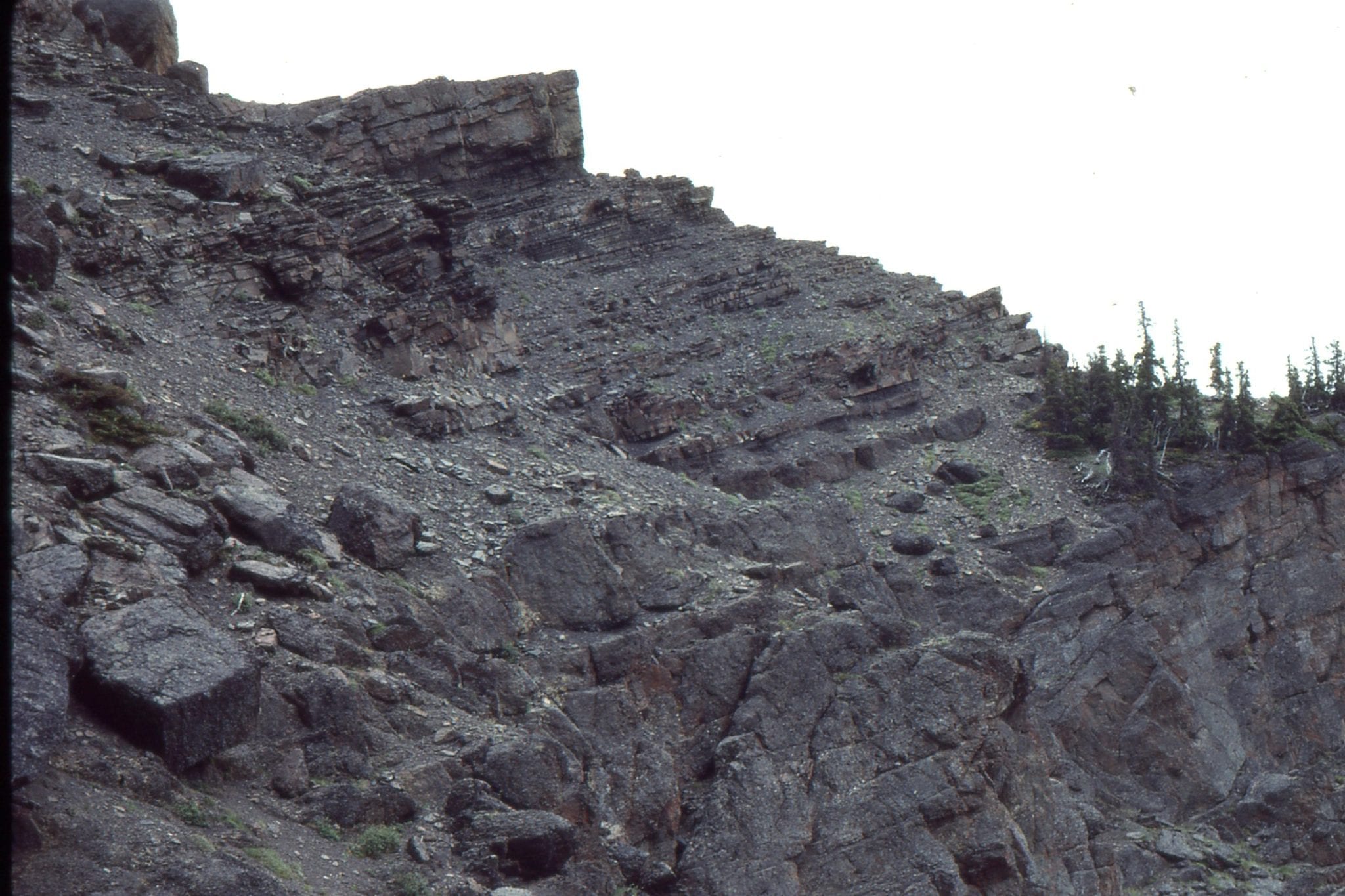
 Thick submarine fan channel and overbank, Point San Pedro, California.
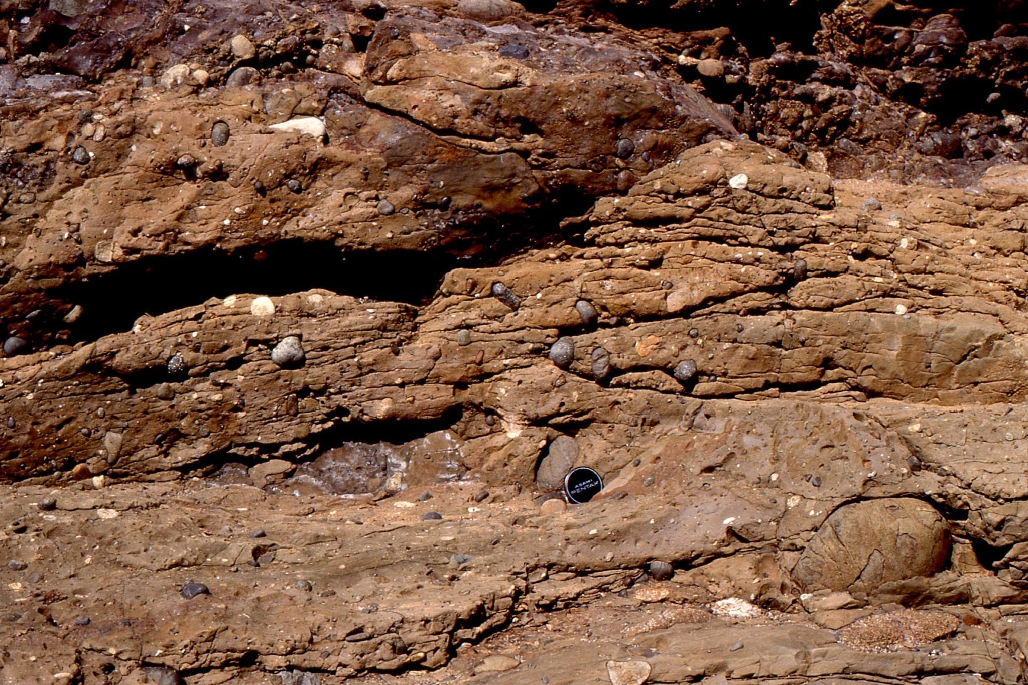
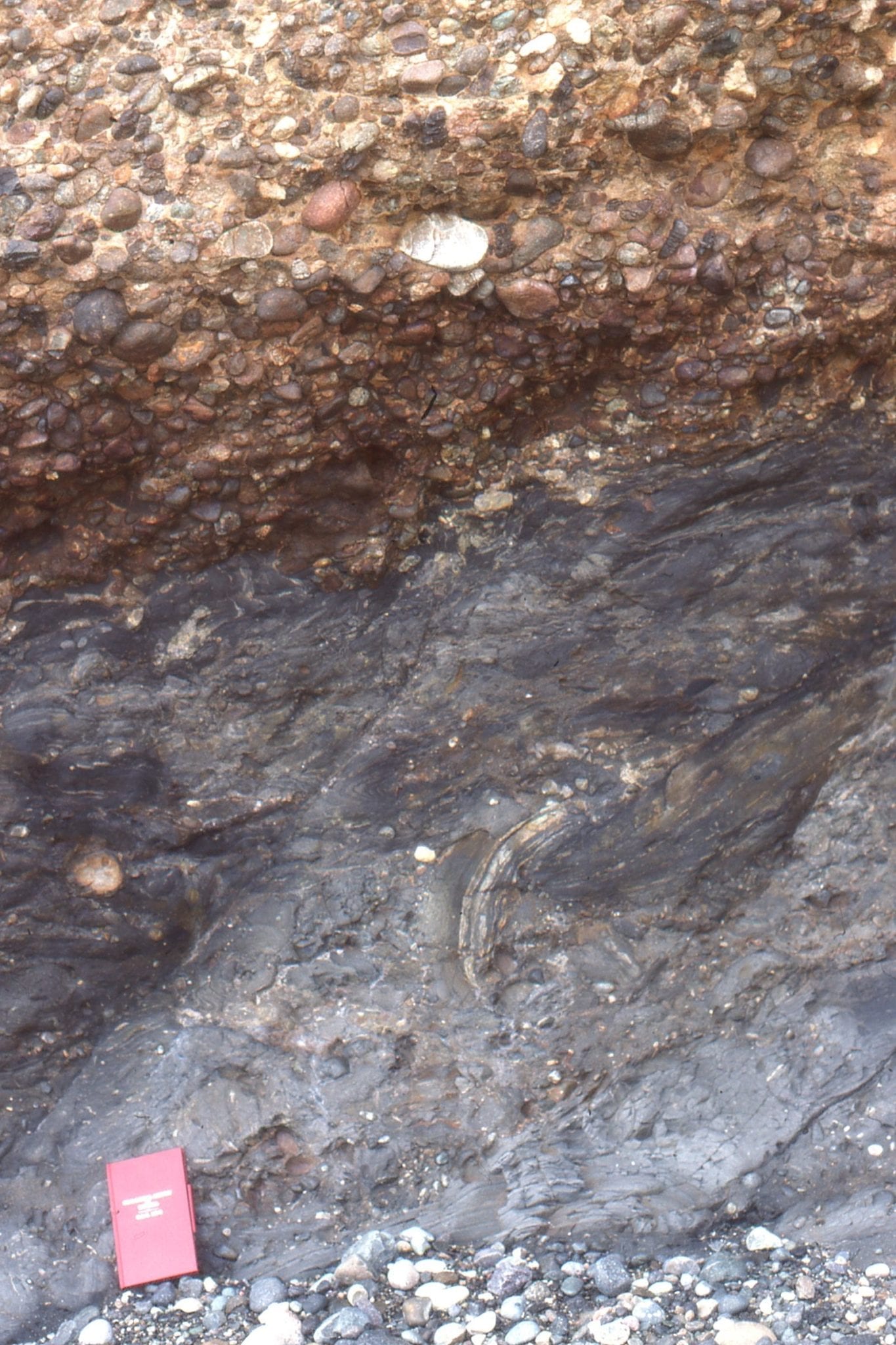
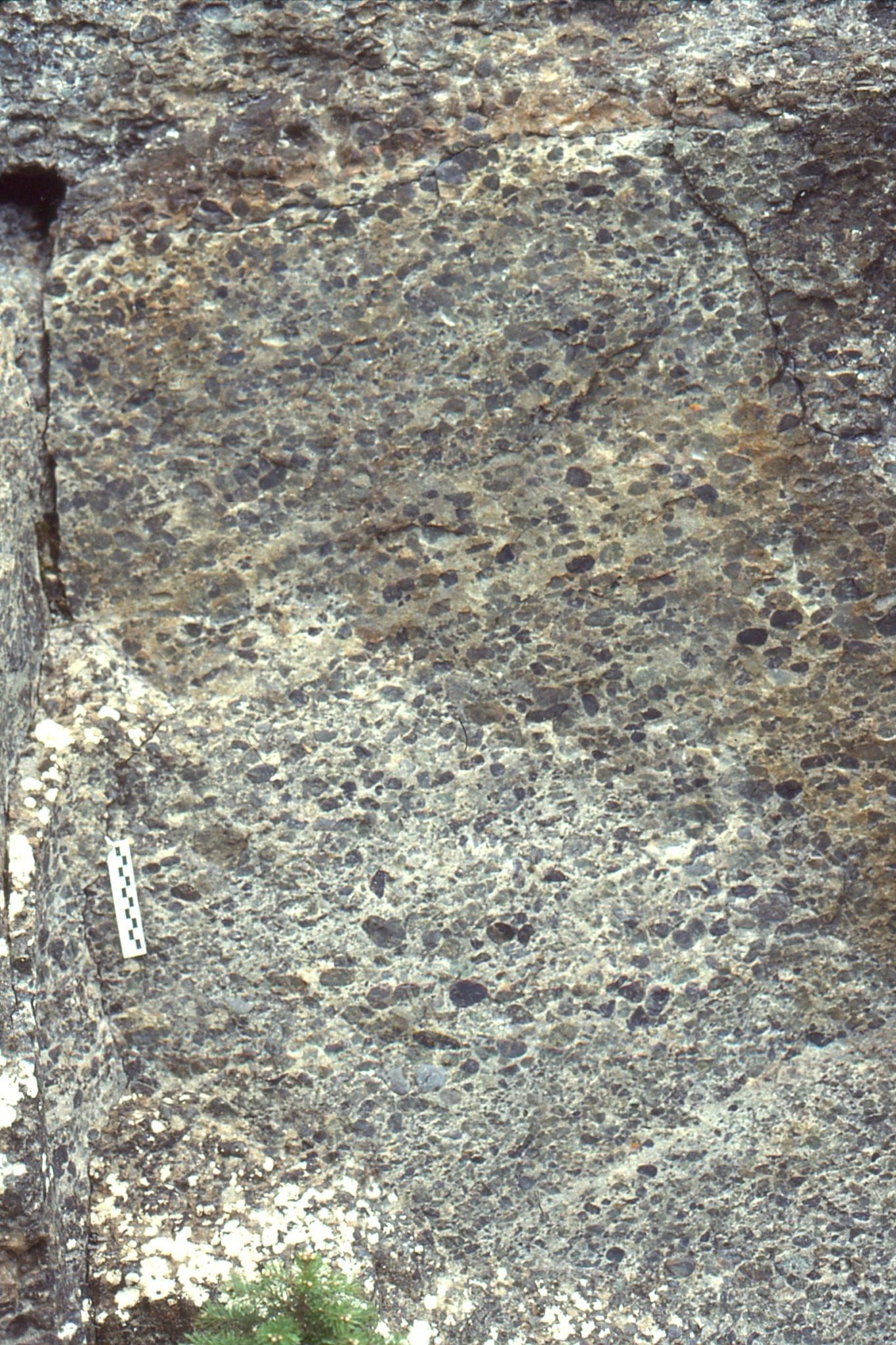
Classic outcrops of pebbly mudstone – matrix-supported debris flows, that probably accumulated in proximal fan channels. Upper Cretaceous Pigeon Point, California.
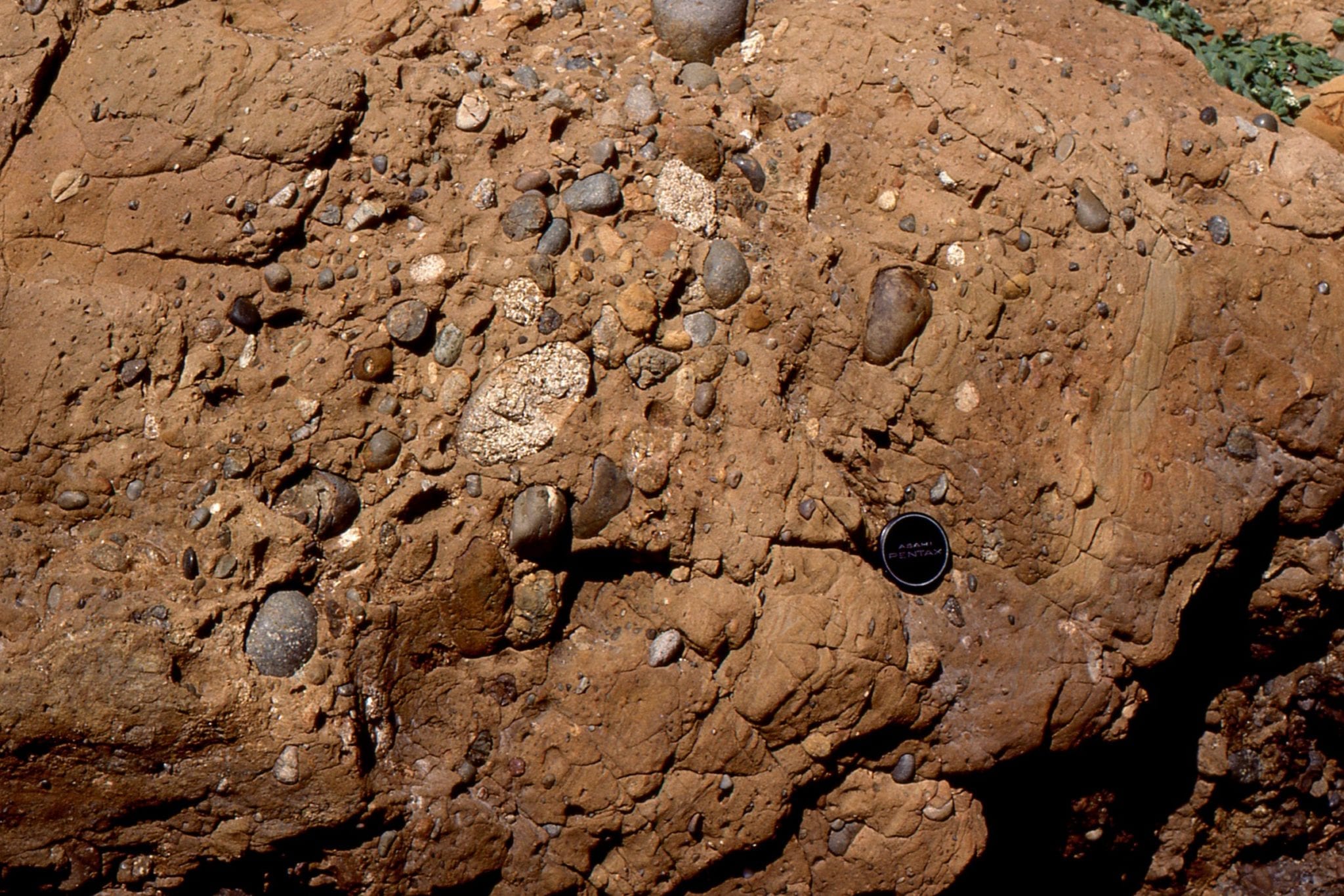
 A variation on the debris flow theme, with well stratified conglomerate and commonly clast-supported frameworks, that are inferred to have formed from more fluid flows than their pebbly mudstone counterparts. Upper Cretaceous Pigeon Point, California.
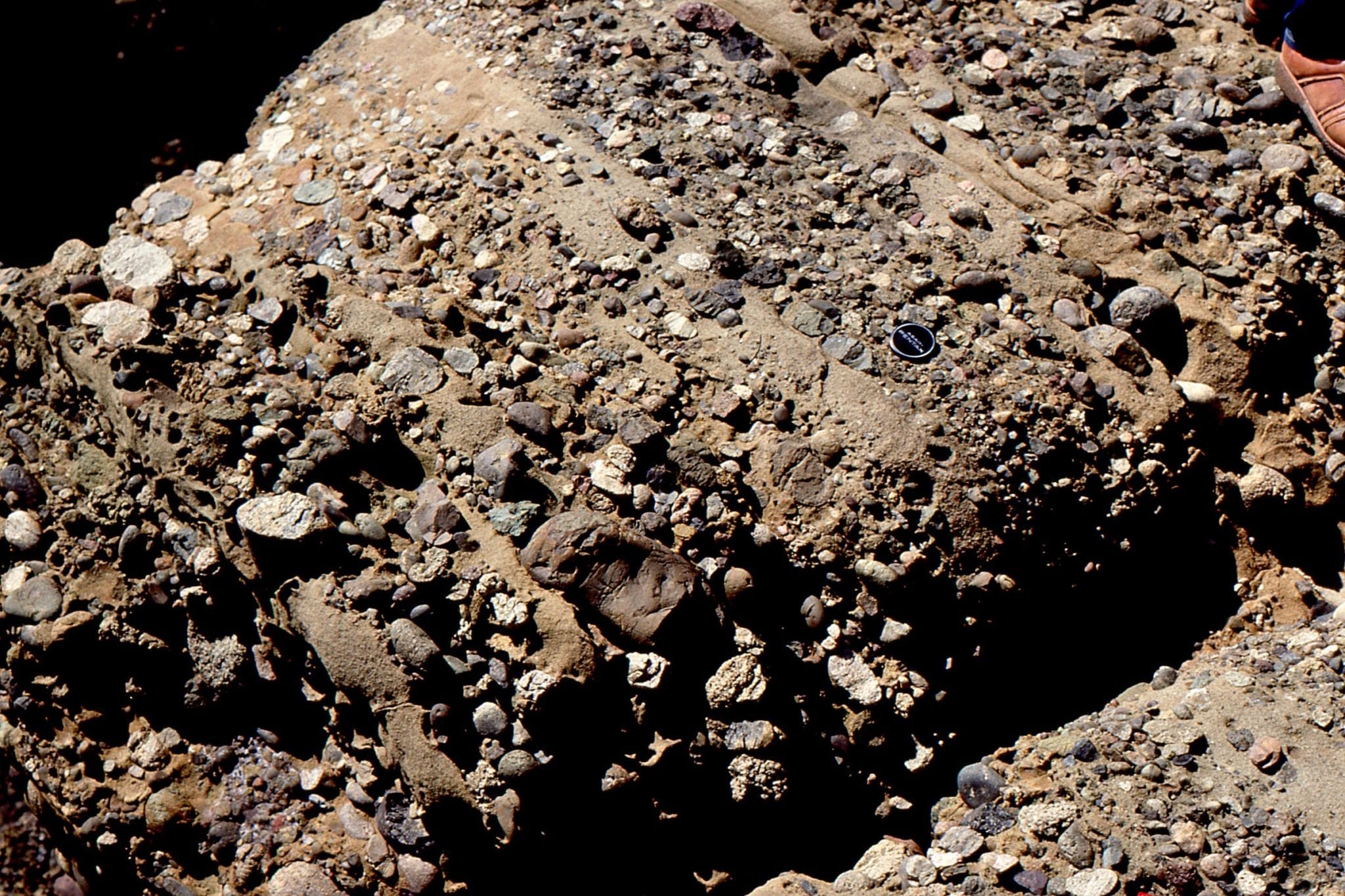
 A broader view of stratified, possibly surging debris flows in proximal fan channels. Upper Cretaceous Pigeon Point, California.
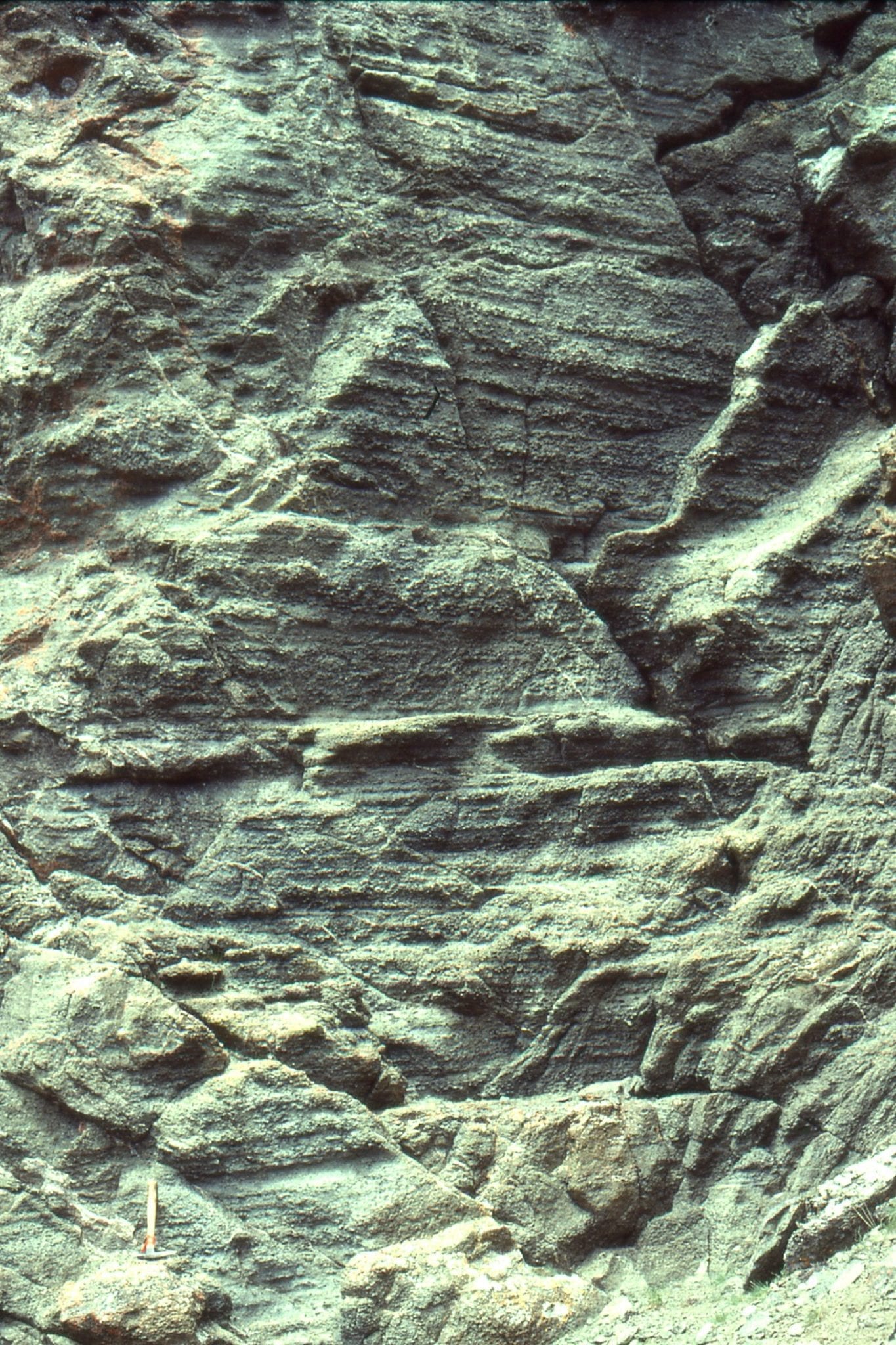
 Slump folded, and partly fluidized turbidites in Upper Cretaceous Pigeon Point, California.
 Thin Bouma Tb-c flow units, Pebble Beach, California. the middle unit has developed some excellent flame structures. the lower unit contains sand-filled burrows, and detached load casts.
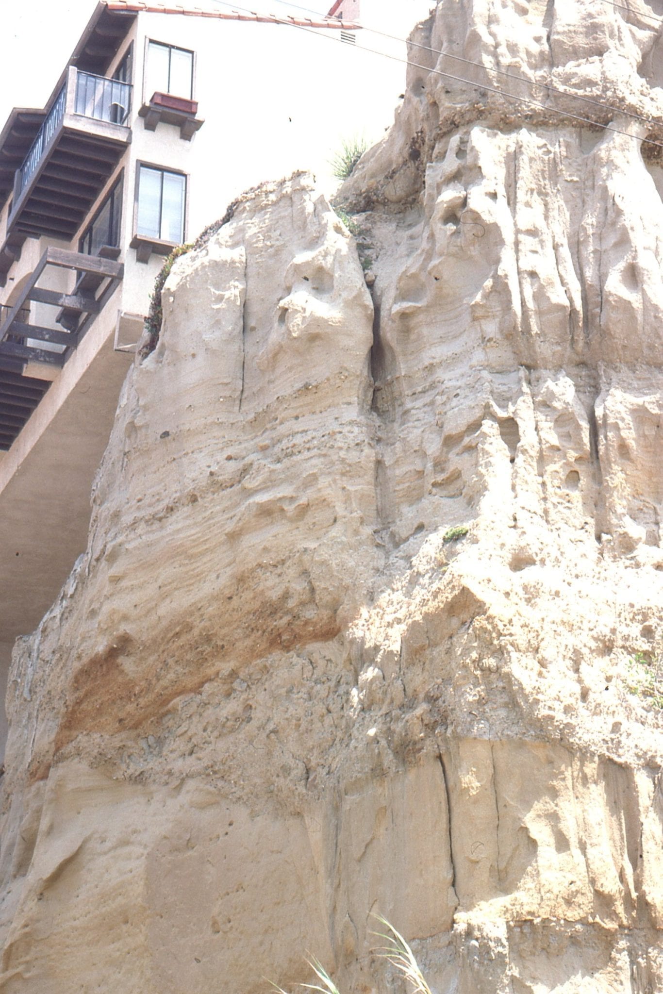
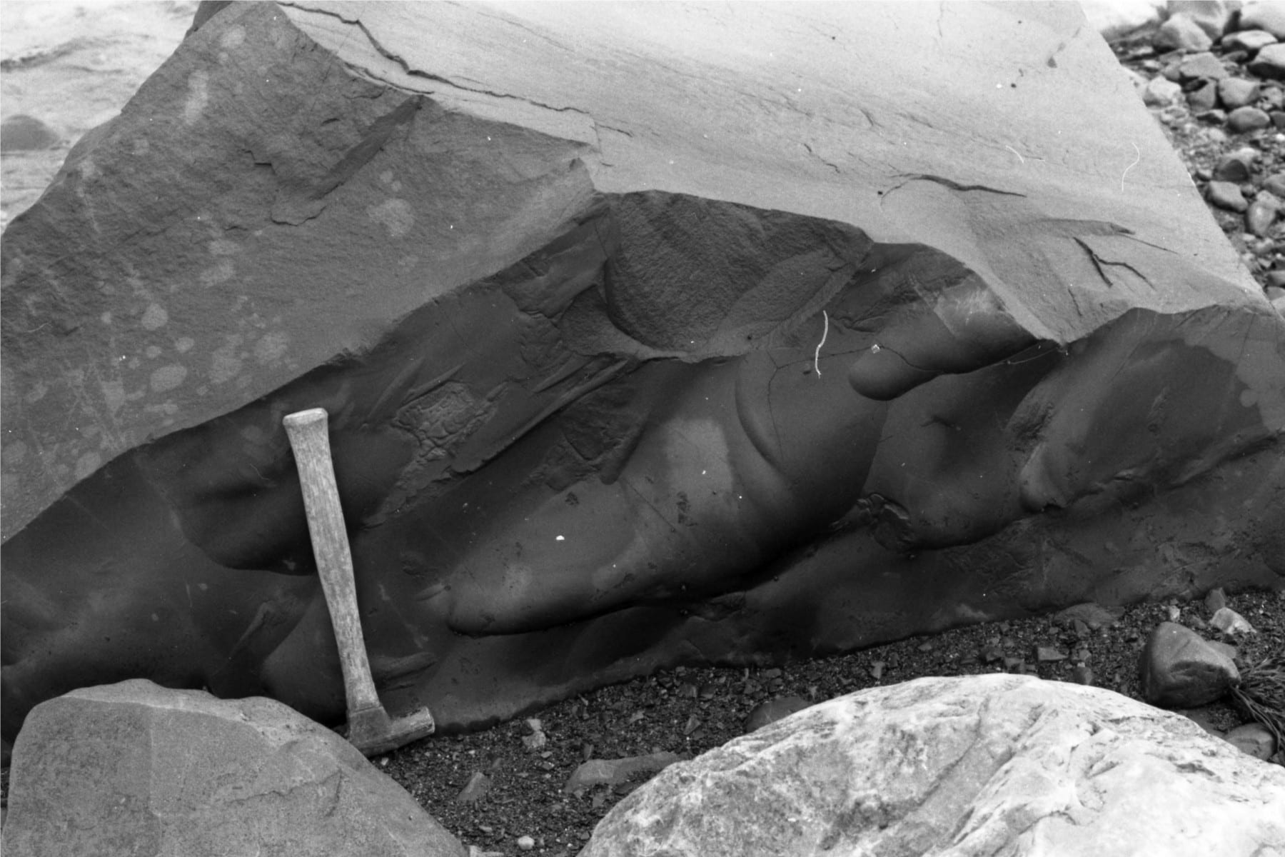
 Dish structures and pillars indicating dewatering (fluid expulsion) during early burial by the overlying sandy turbidites. Rosario Group, San Diego.
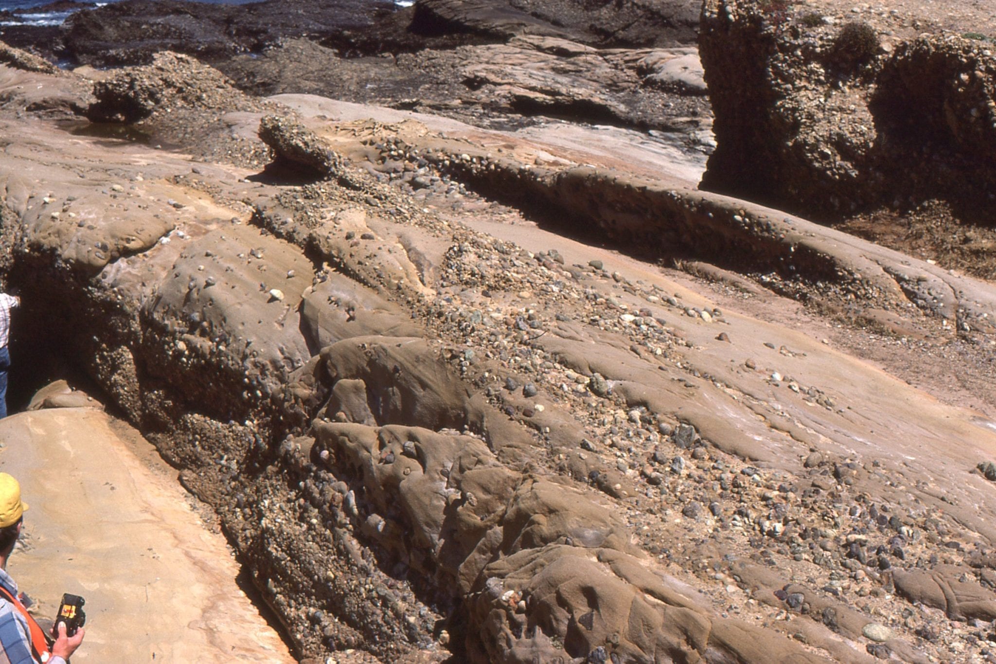
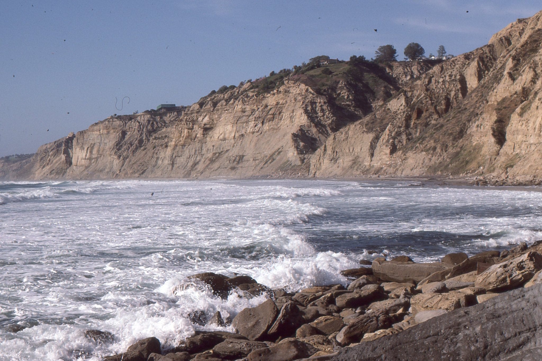
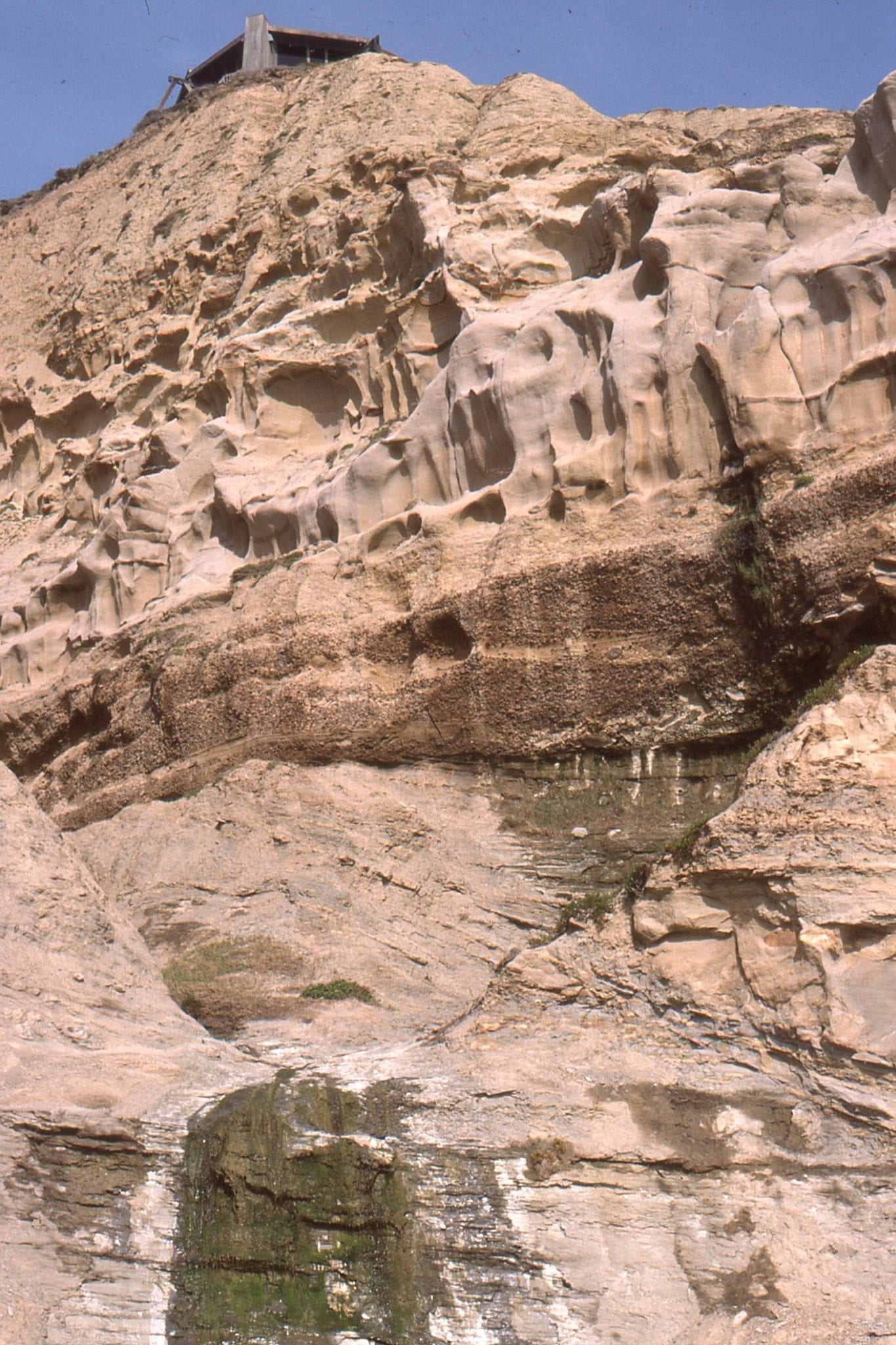
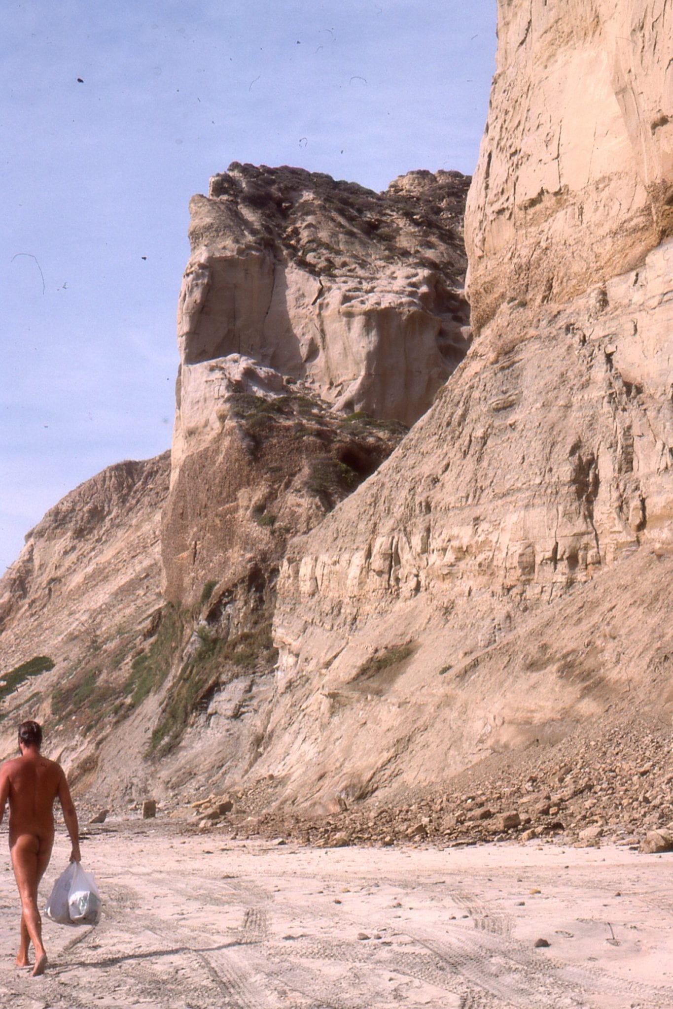
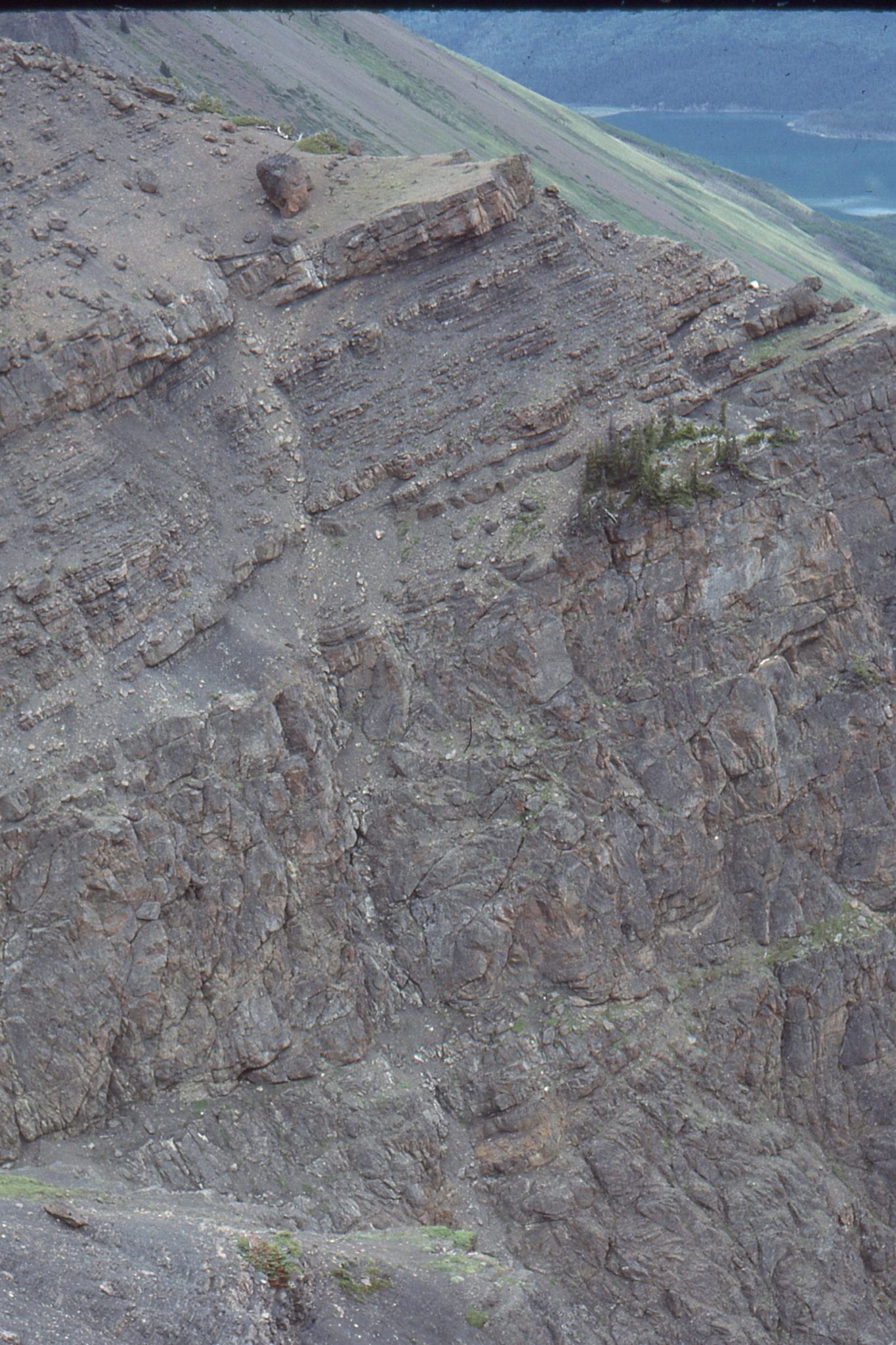
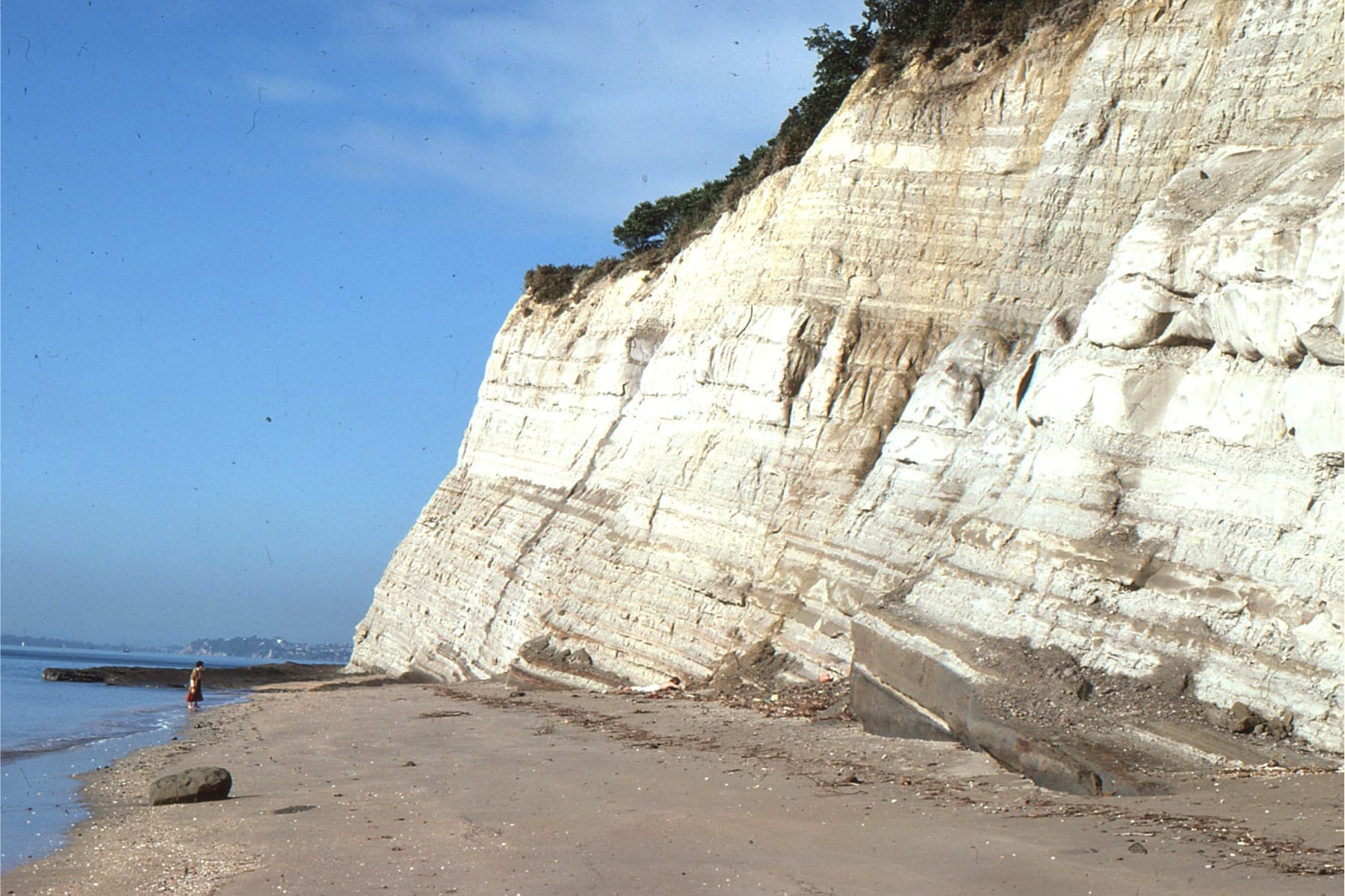
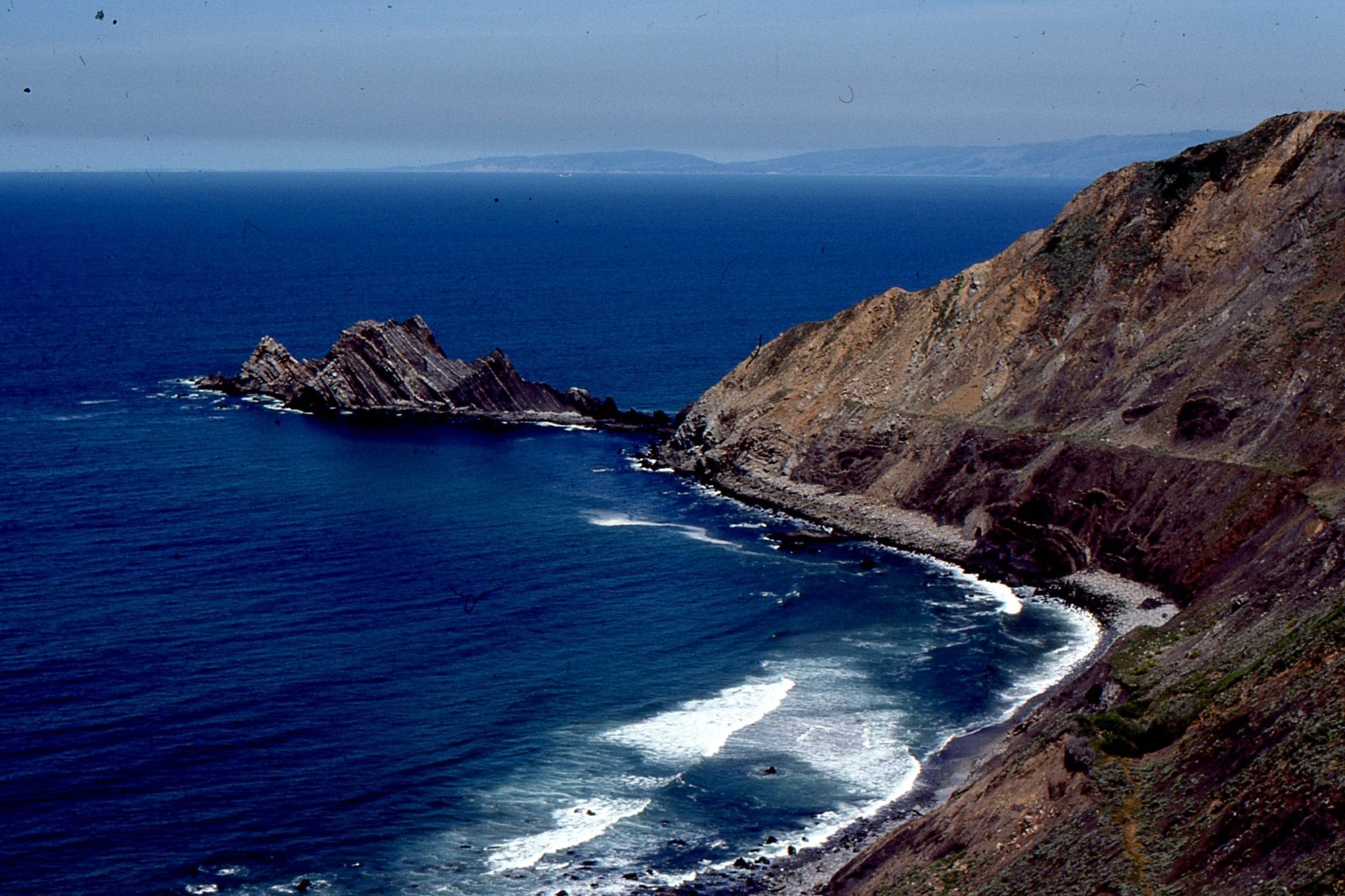
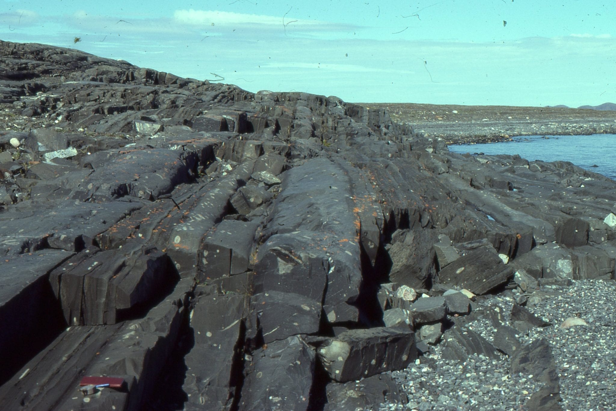
 Stacking of sandstone and conglomerate-filled submarine channels in the Miocene Capistrano Formation, Dana Point, California.
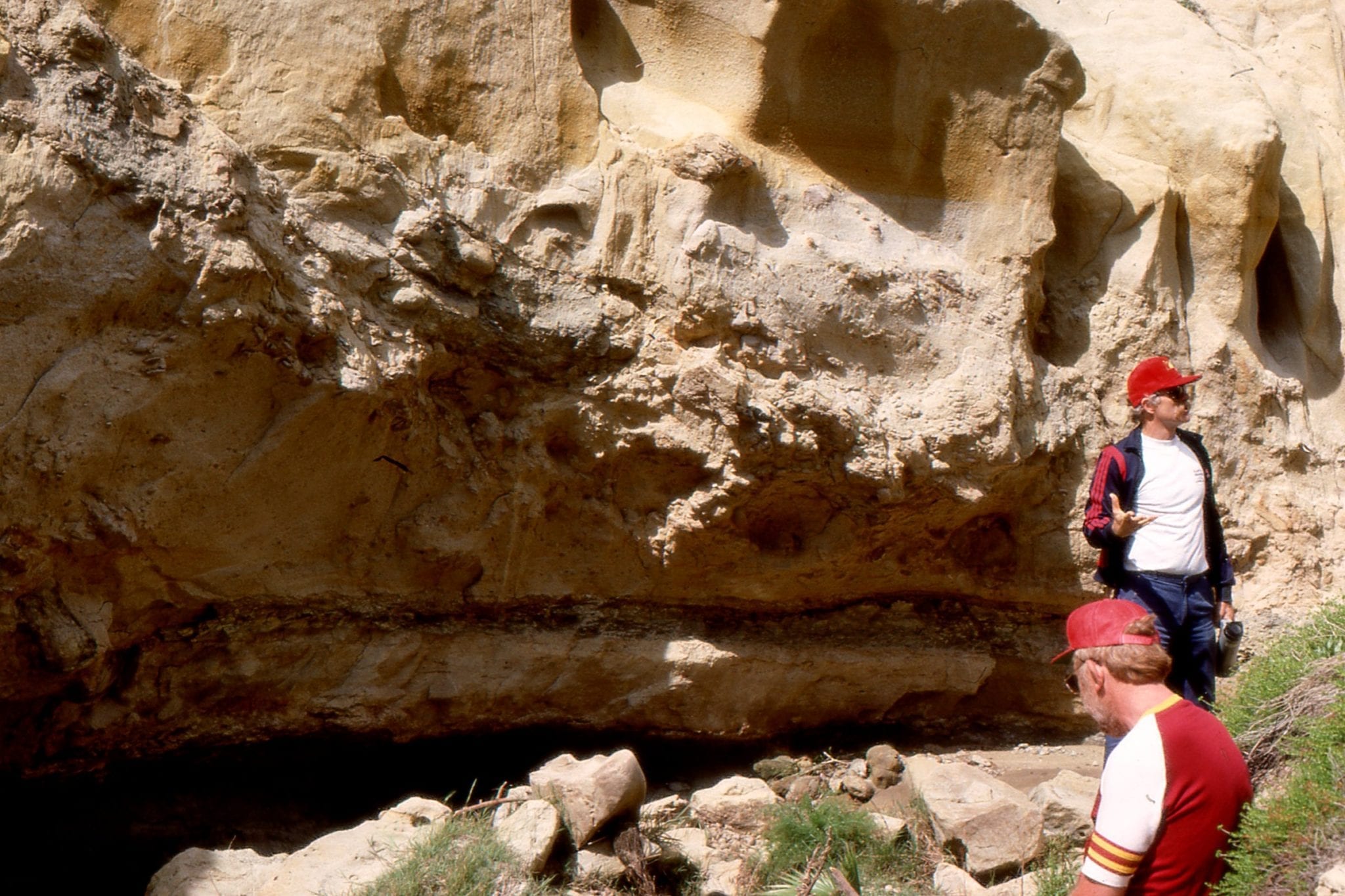
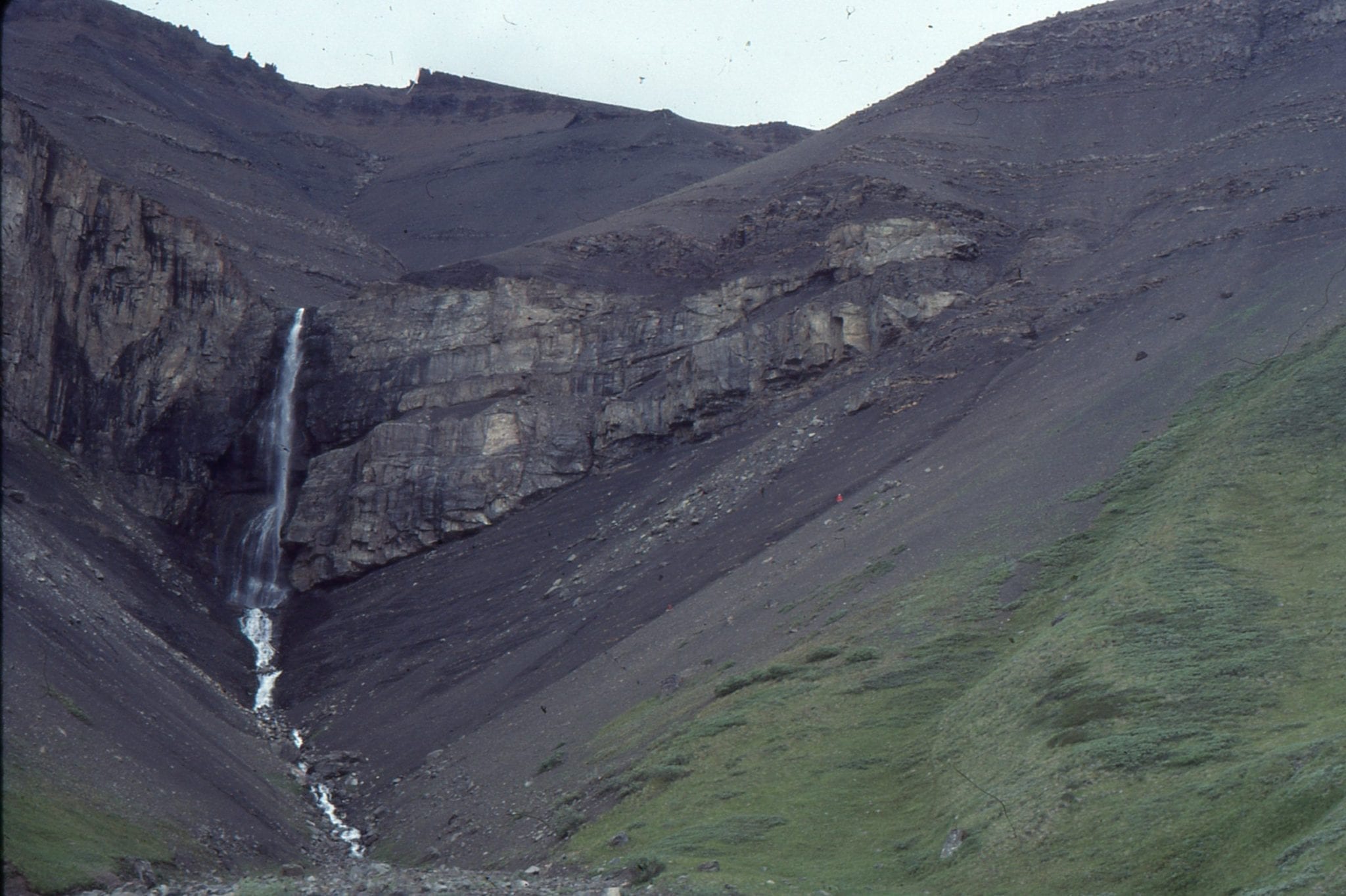
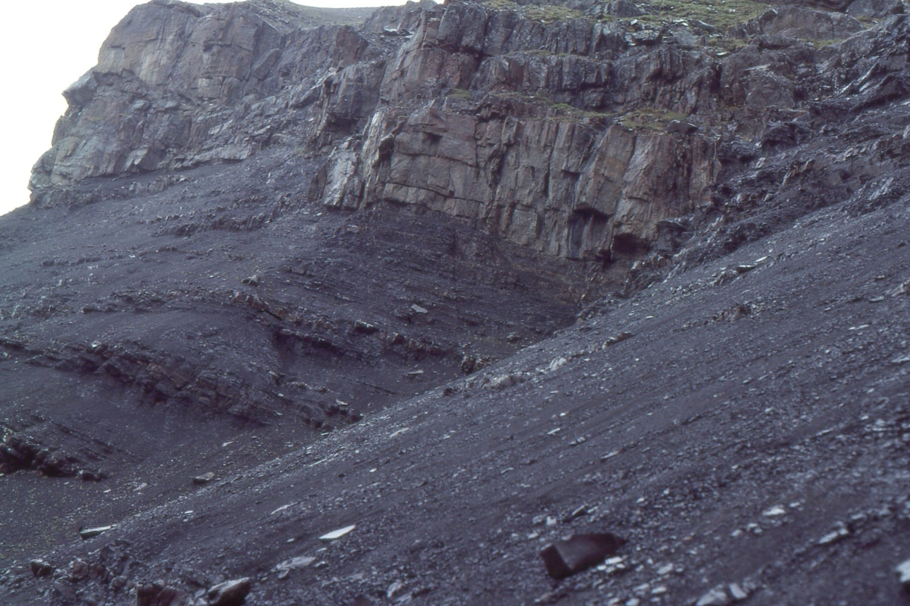
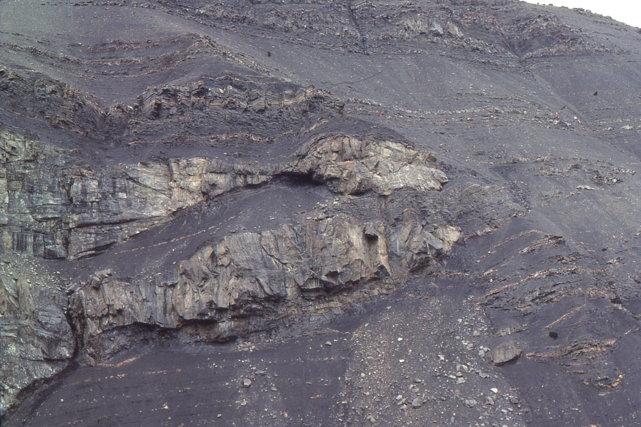
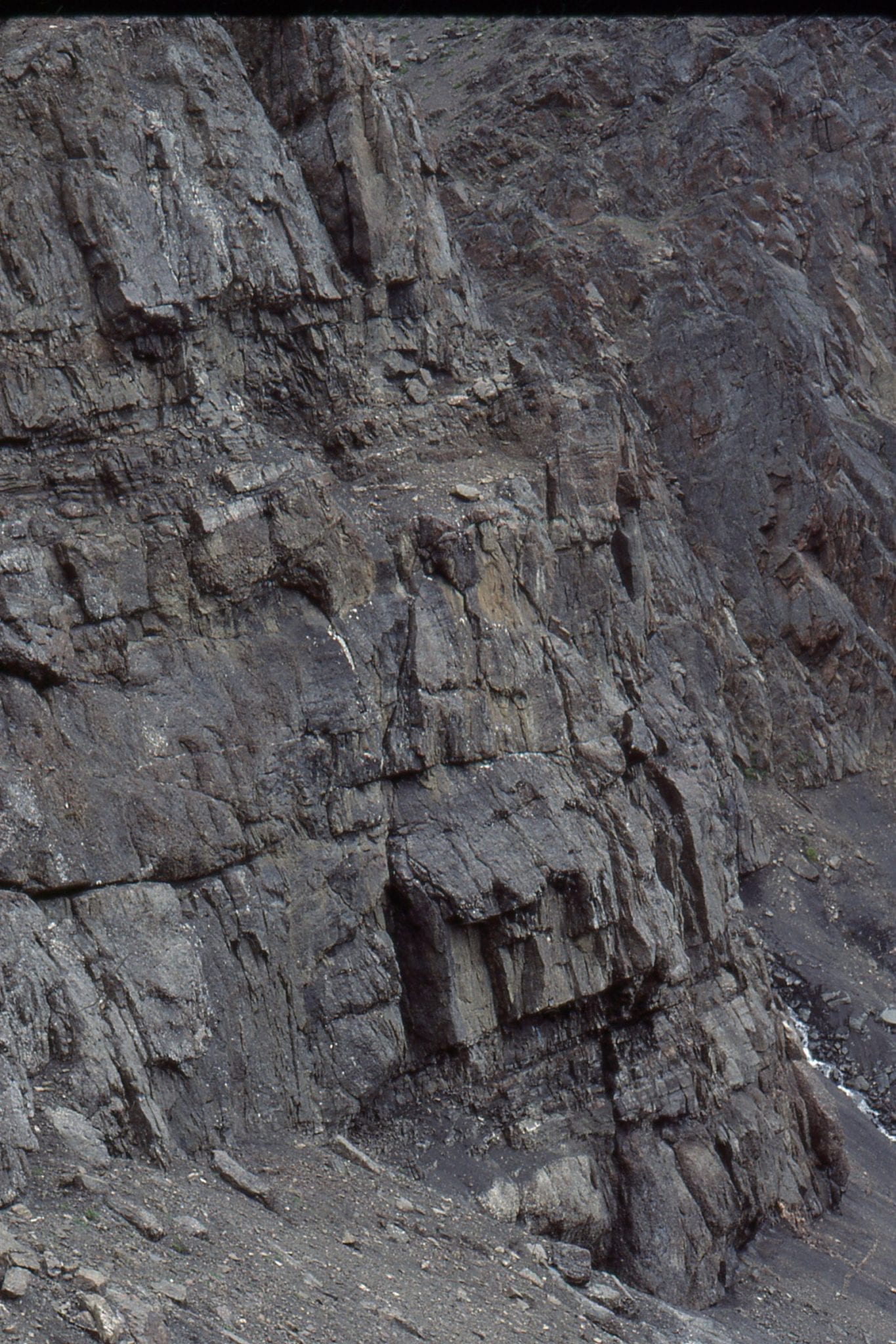
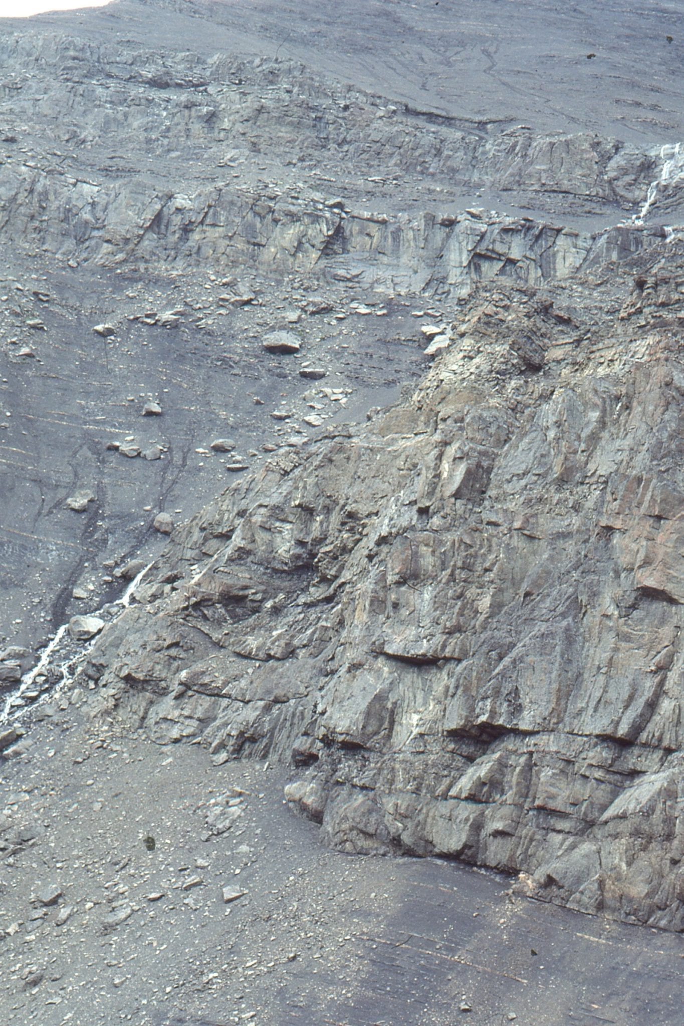
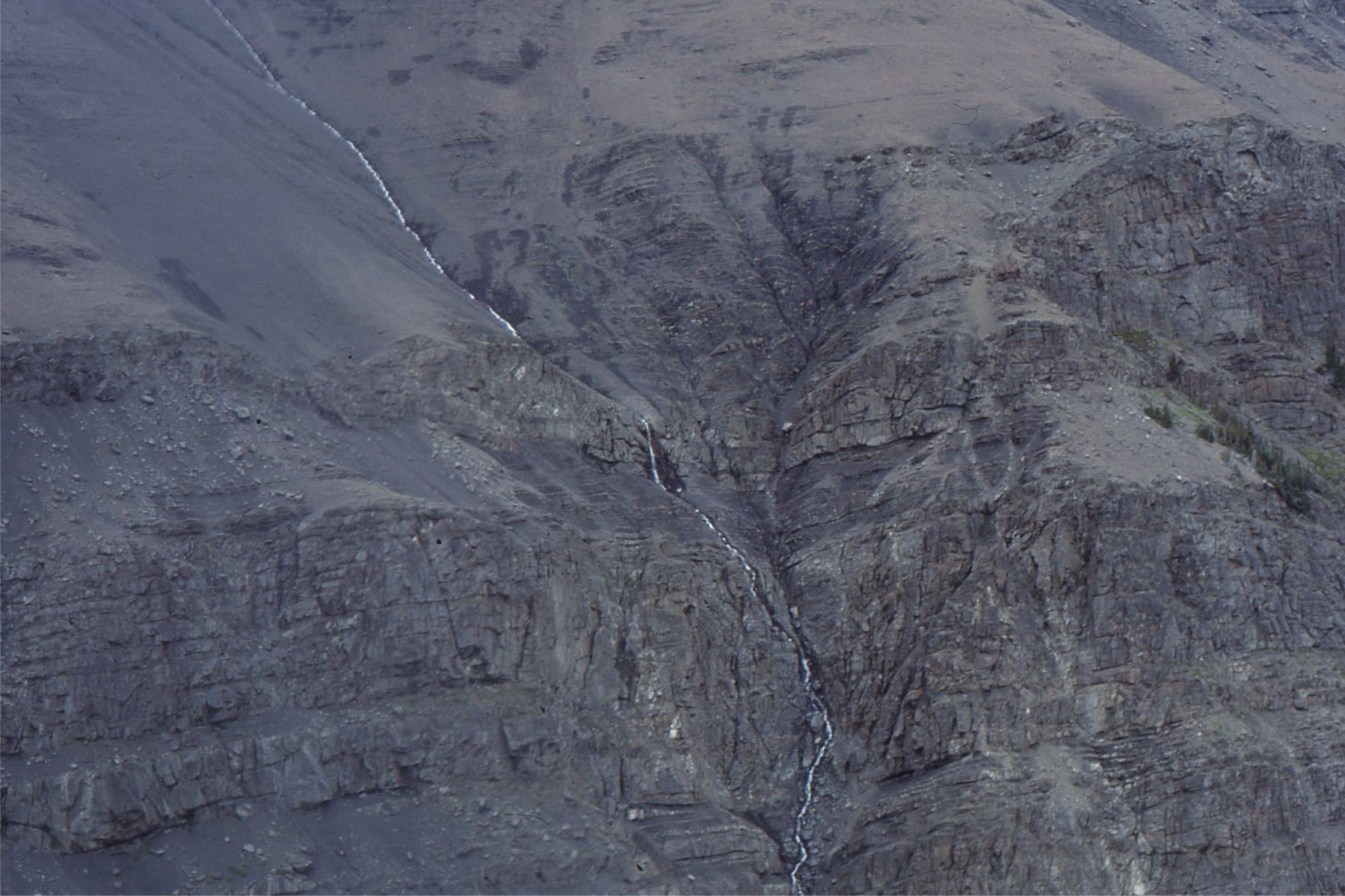
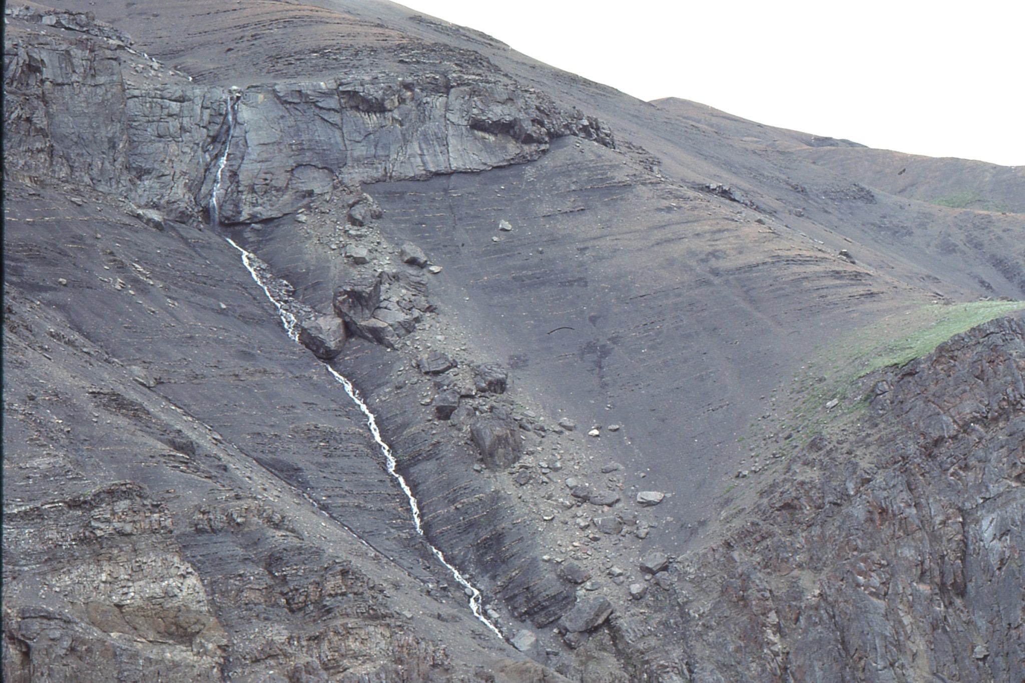
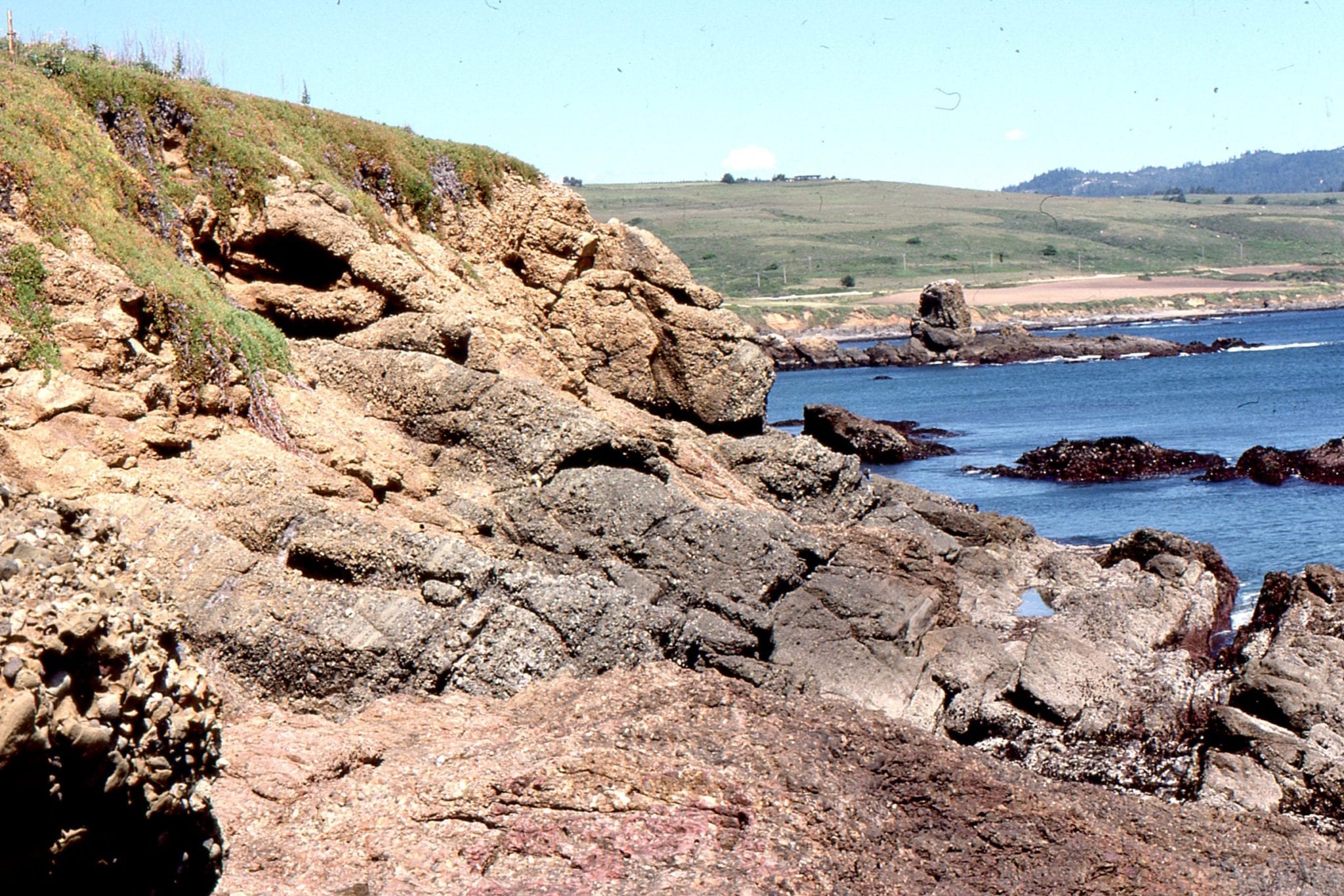
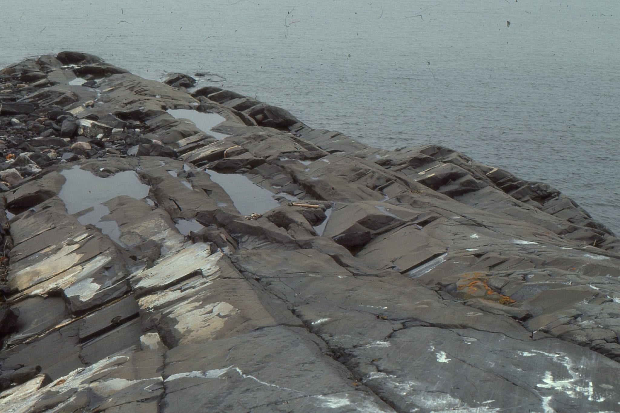
Submarine channel sandstones and overbank facies exposed at Wheeler Gorge, California.
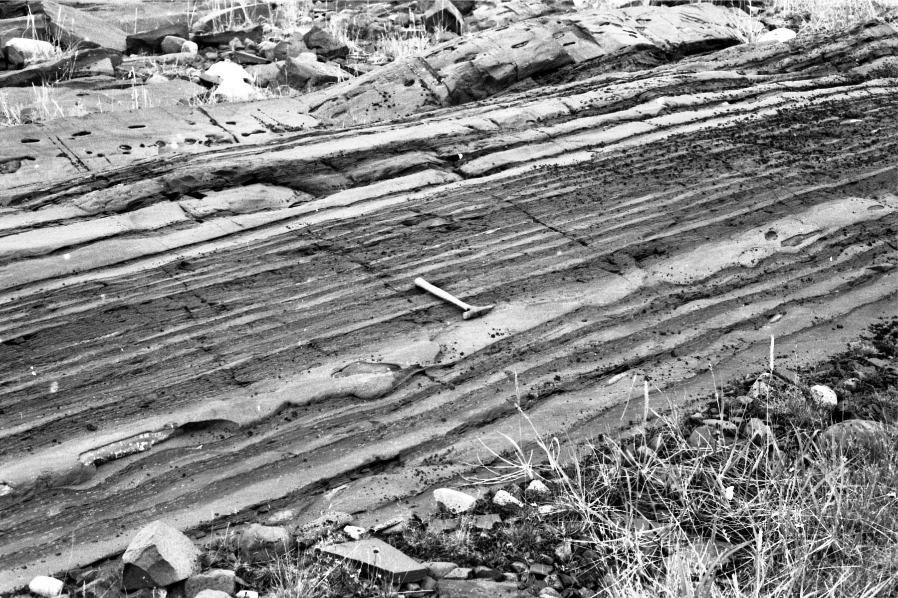
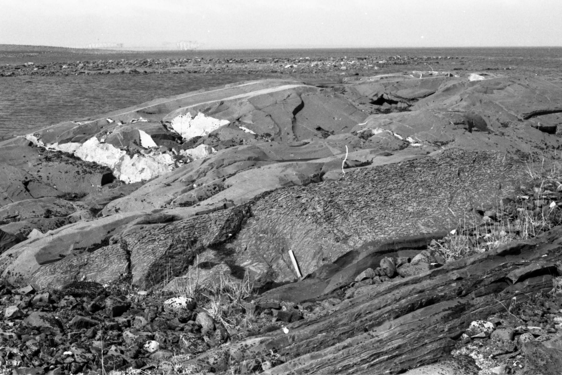
Bedding style in the Omarolluk Fm. turbidite succession, Proterozoic, Belcher Islands (about 1800-1900 Ma). On the left, mid fan channel sandstone and overbank; on the right more proximal sandstone facies.
A paper on the Omarolluk Formation: Ricketts, B.D. 1981: A submarine fan – distal molasse sequence of Middle Precambrian age, Belcher Islands, Hudson Bay; Bulletin Canadian Petroleum Geology, v. 29, p. 561-582.
 Channel overbank facies containing thin graded sandstone, thin sandstone beds with ripples and starved ripples, and Bouma Td-e mudstones. Omarolluk Fm. Proterozoic, Belcher Islands
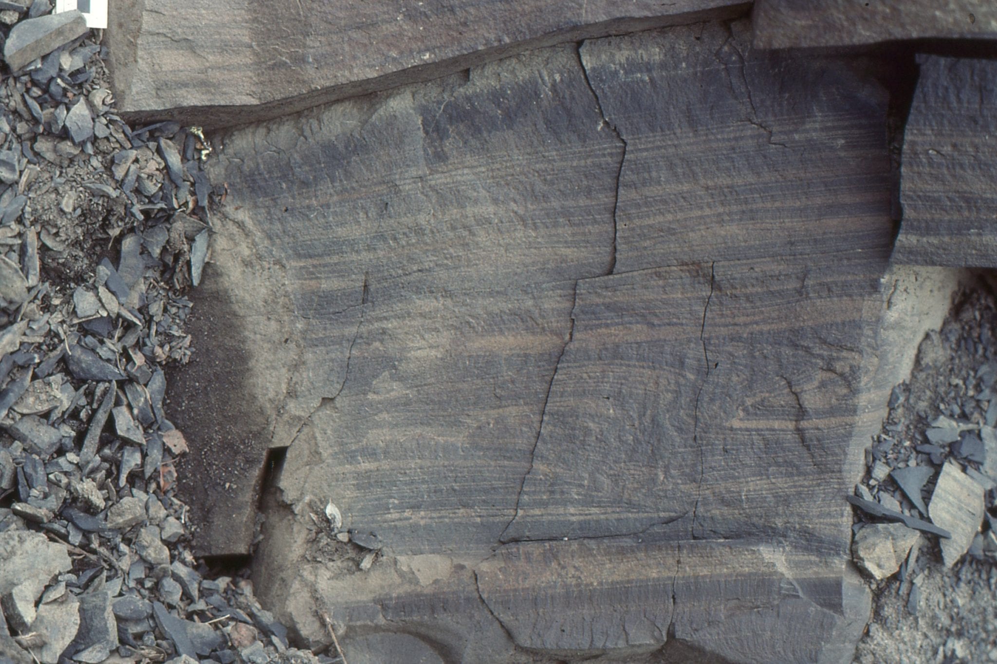
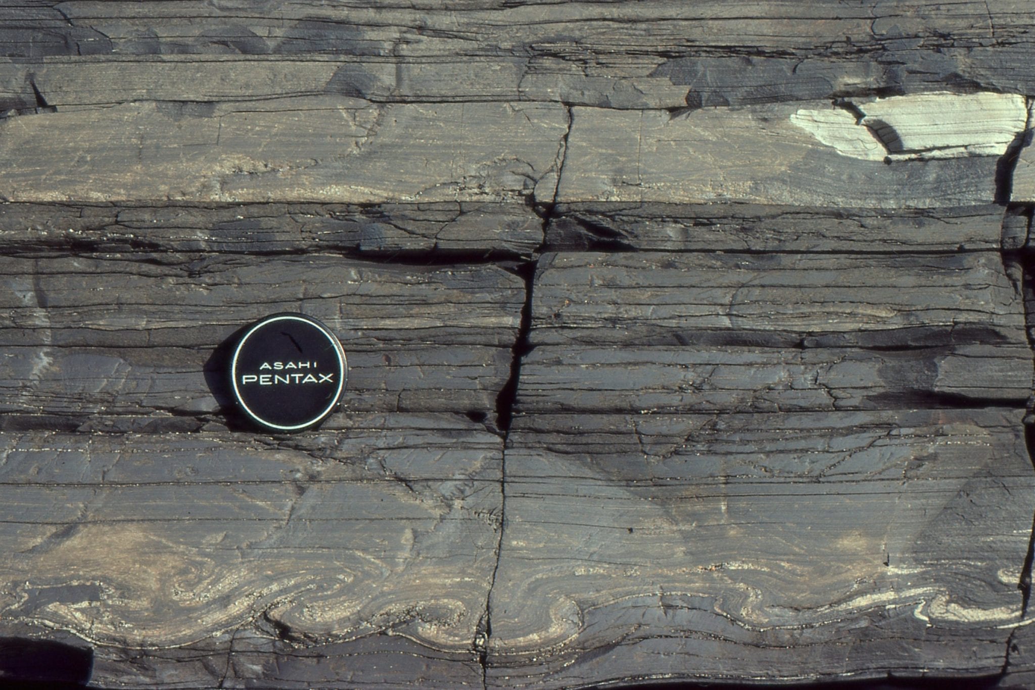
 Four incomplete Bouma cycles, each Tb with thin Tc. The whitish patches are very early diagenetic concretions. Omarolluk Fm. Proterozoic, Belcher Islands.
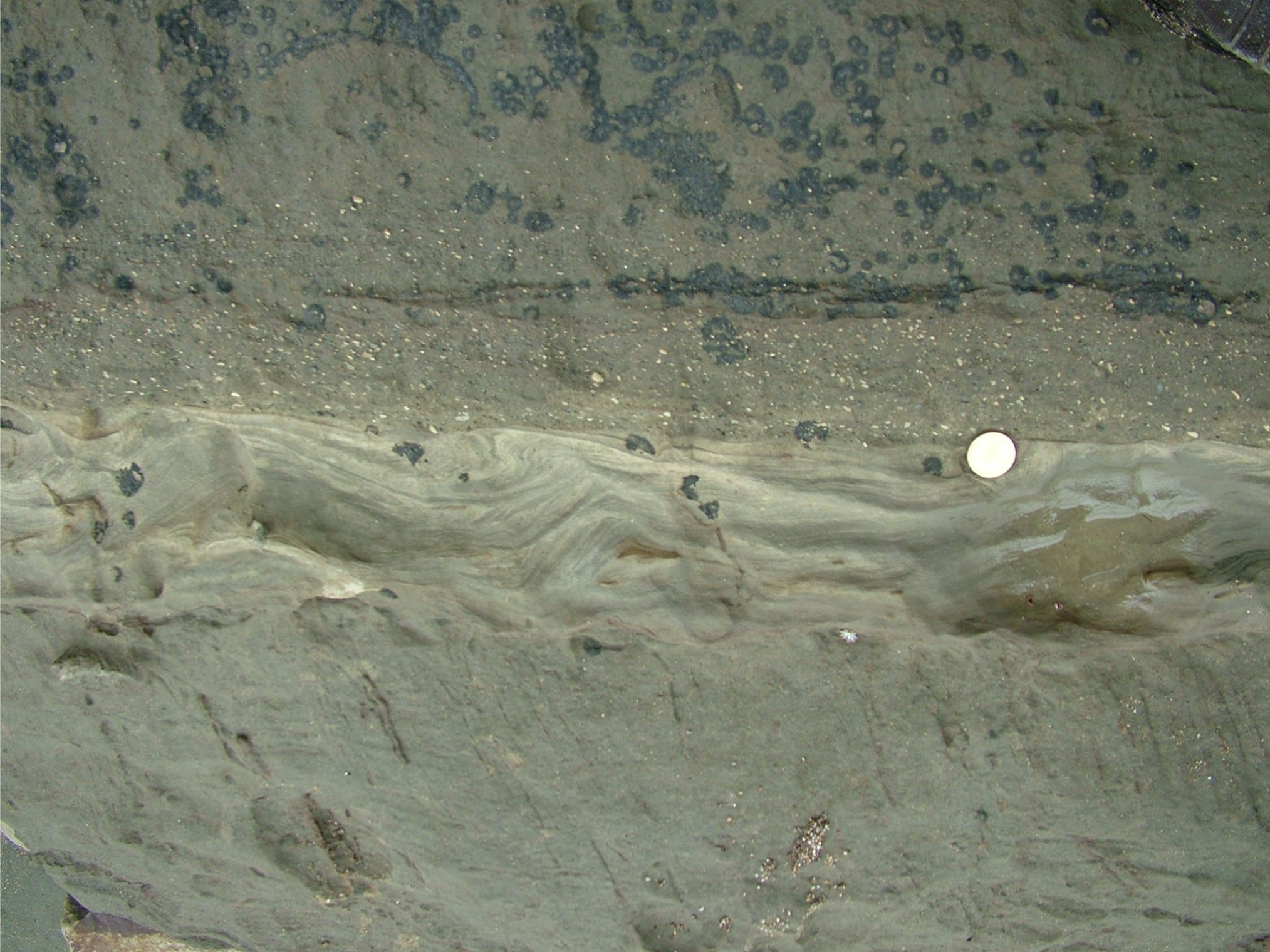
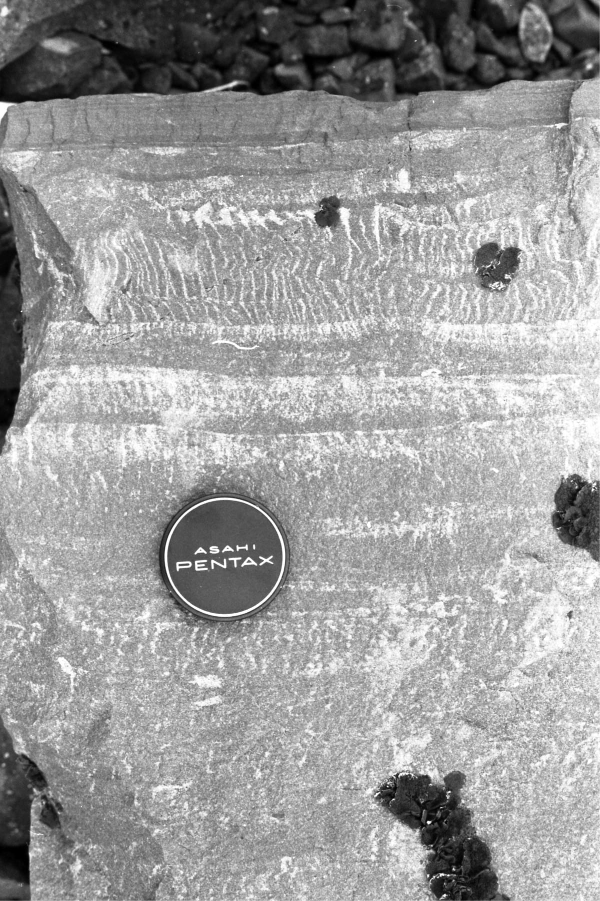
 Thin Bouma Tc-d mid-fan cycles, with ripple drift, flame structures, and a small scour. Omarolluk Fm. Proterozoic, Belcher Islands.
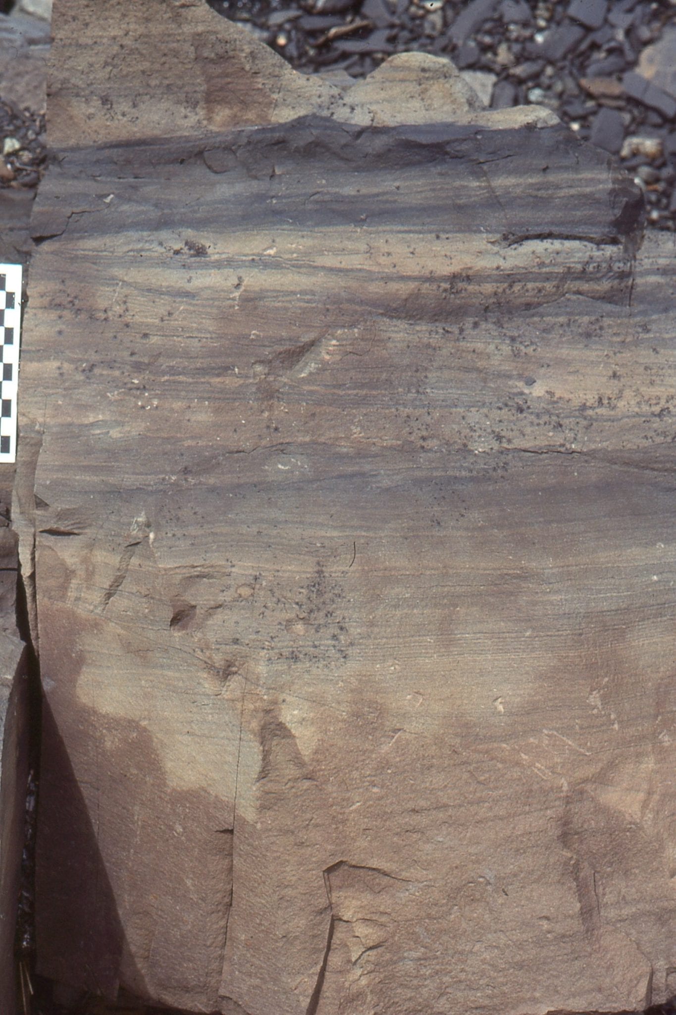
 A Bouma Tb-c cycle with well developed and oversteepened ripple drift, overlain by a thicker Tb cycle with only a thin Td cap. Omarolluk Fm. Proterozoic, Belcher Islands
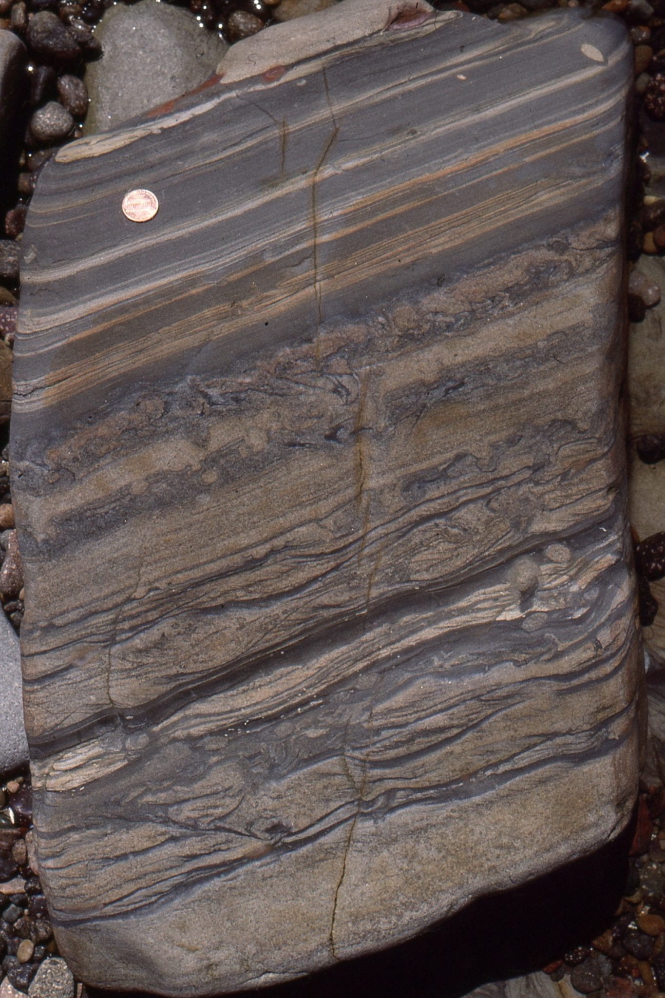
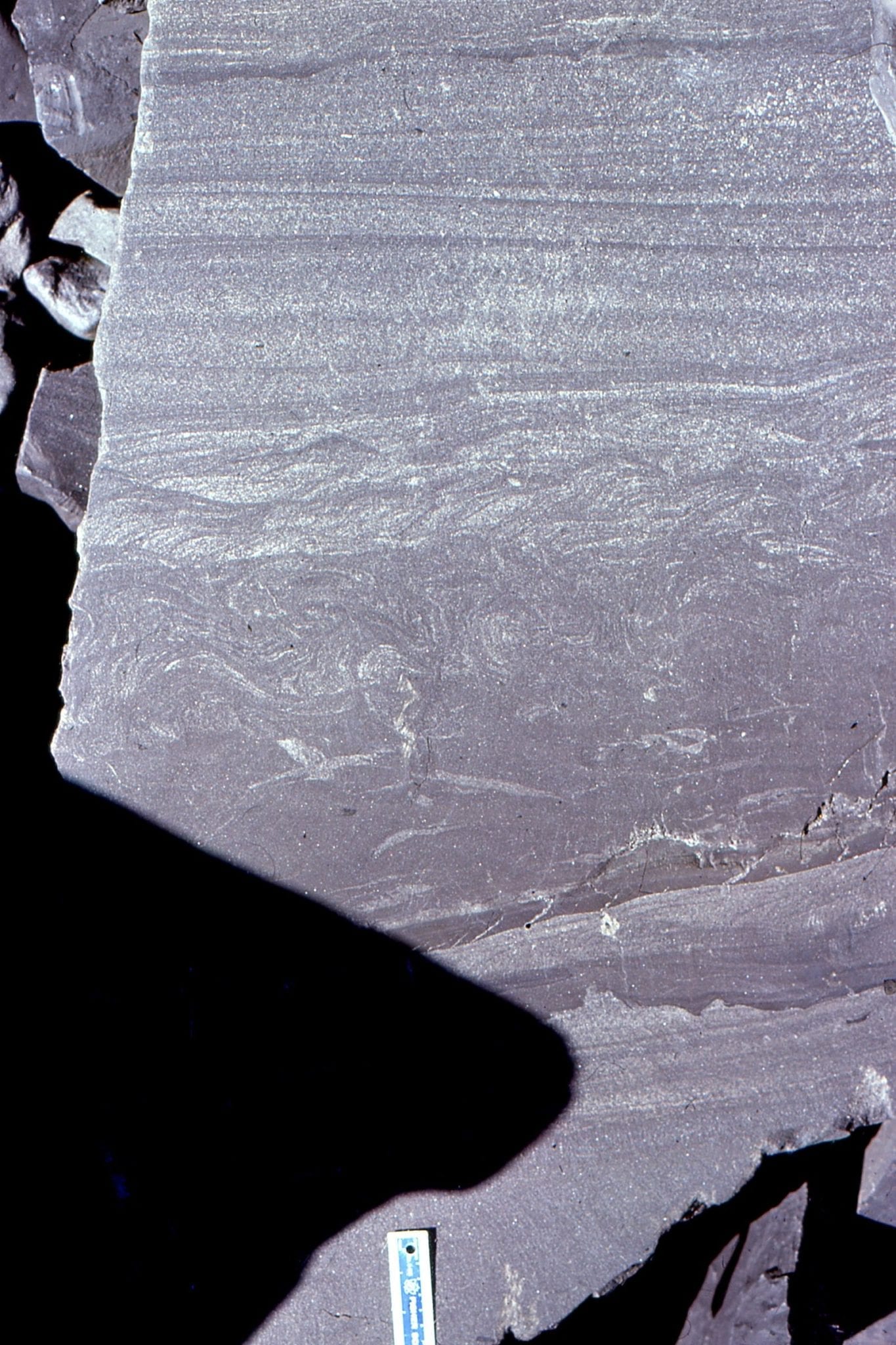
 A view of Bouma Tc-d intervals and convoluted laminae. Omarolluk Fm. Proterozoic, Belcher Islands
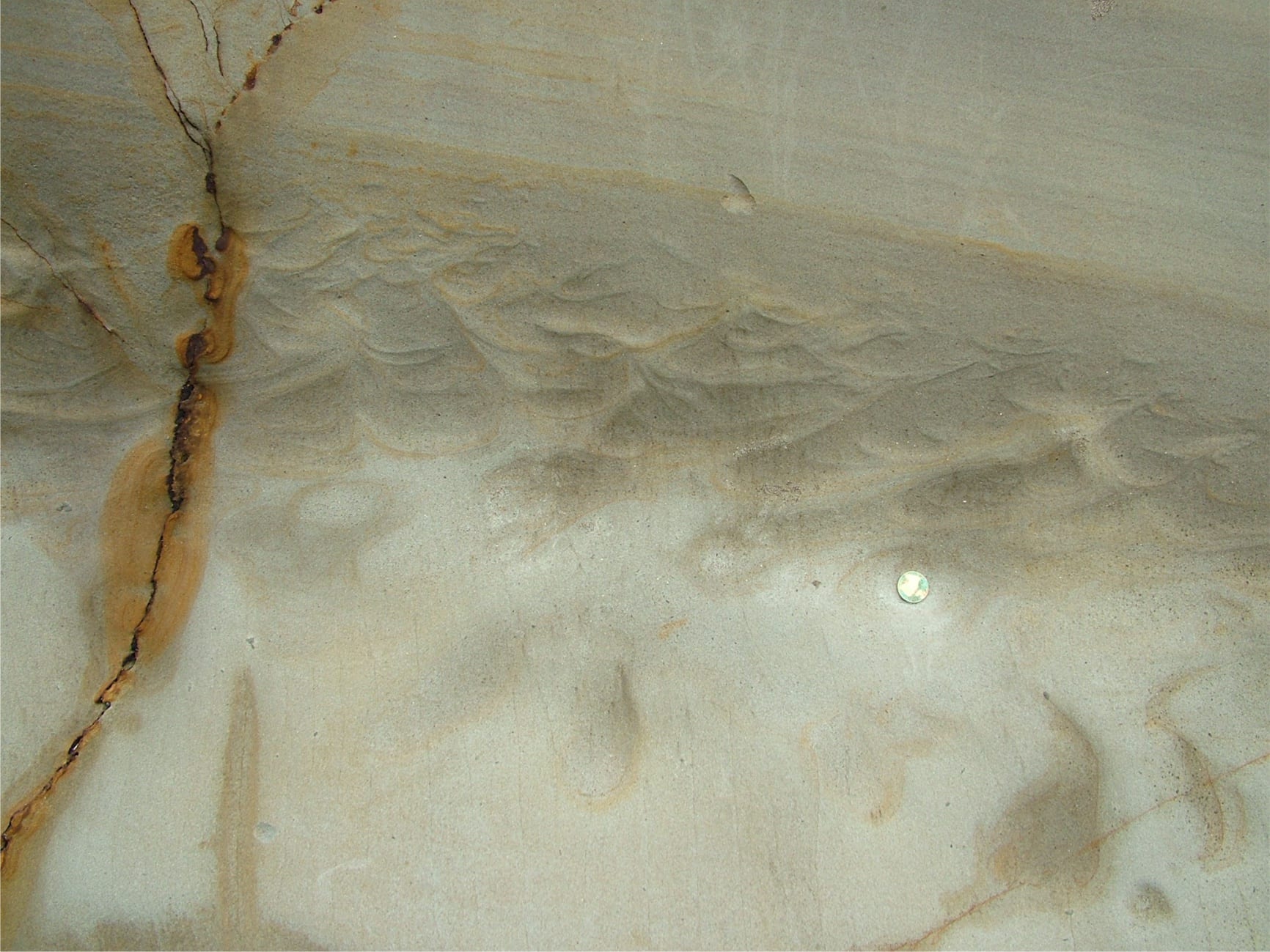
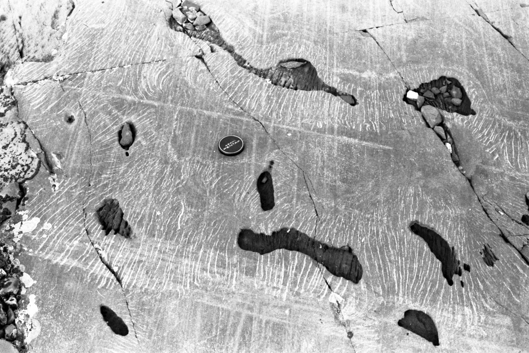
Sole structures beneath sandy turbidites. On the left, flute casts are superposed on grooves. On the right, large flute casts are slightly deformed (block is about a metre across). Omarolluk Fm. Proterozoic, Belcher Islands.
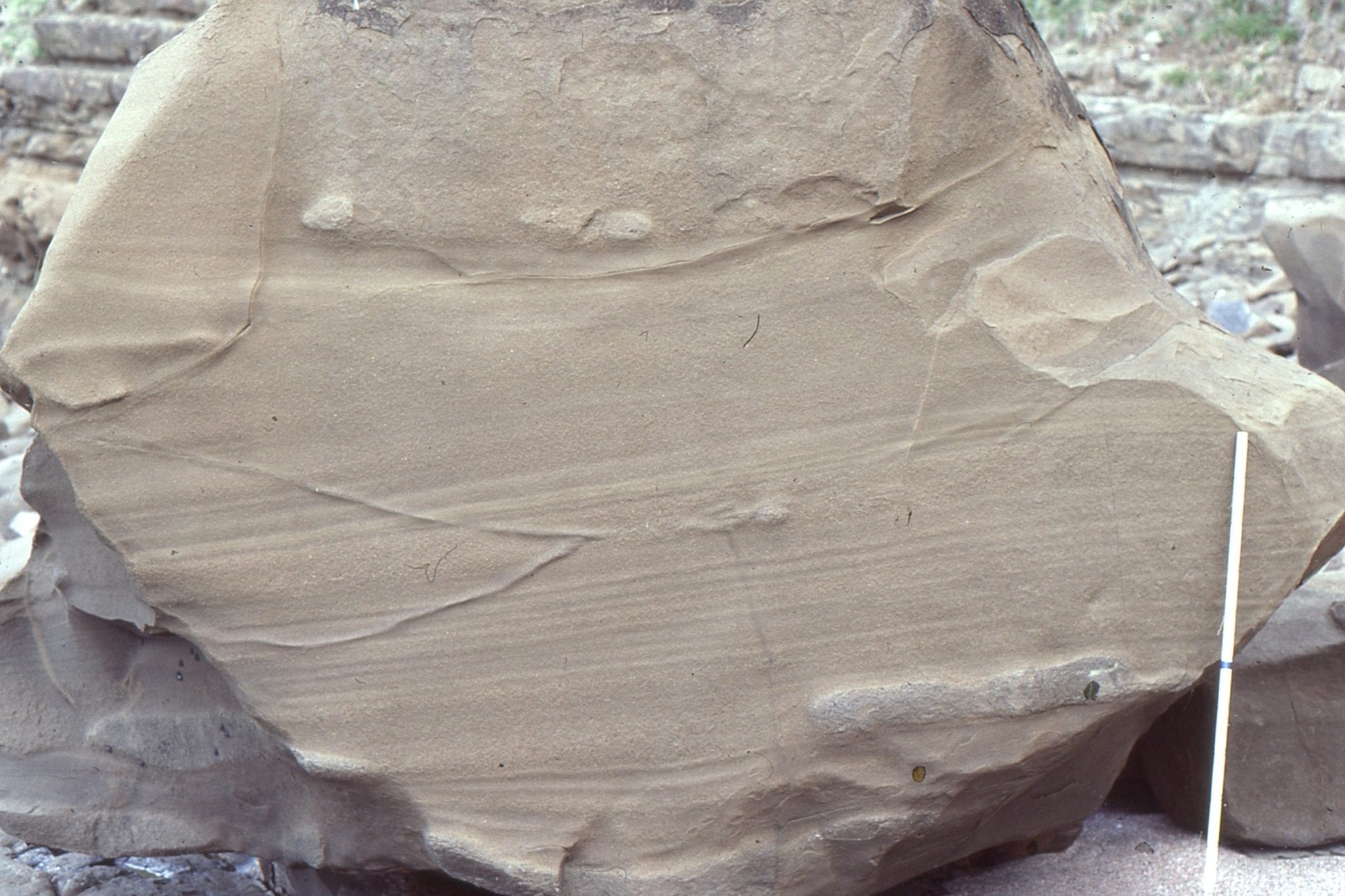
 Large flute cast, paleoflow to top right. Omarolluk Fm. Proterozoic, Belcher Islands
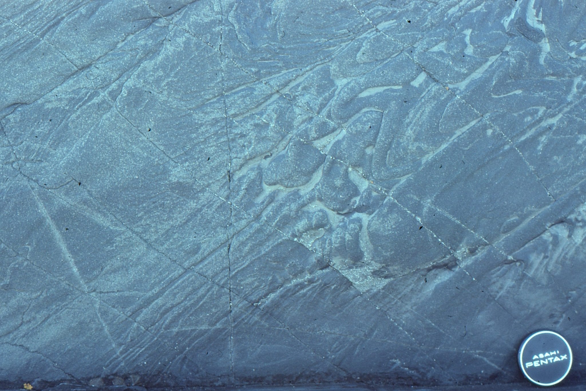
Dewatering of turbidites, soon after deposition, produced thin fluid-escape pillars (left, cross-section view), and on bedding planes, small sand-mud volcanoes. Right image is a bedding view. Omarolluk Fm. Proterozoic, Belcher Islands
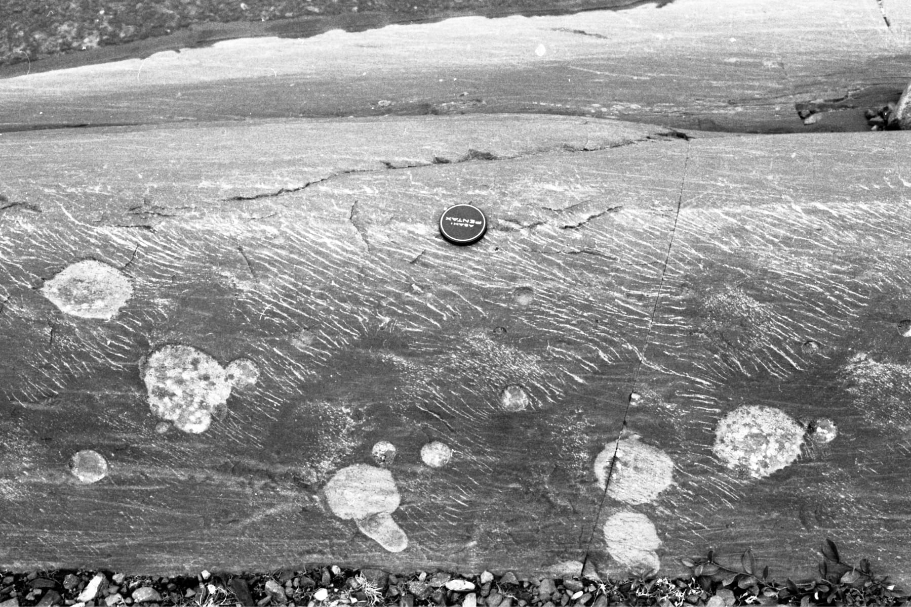
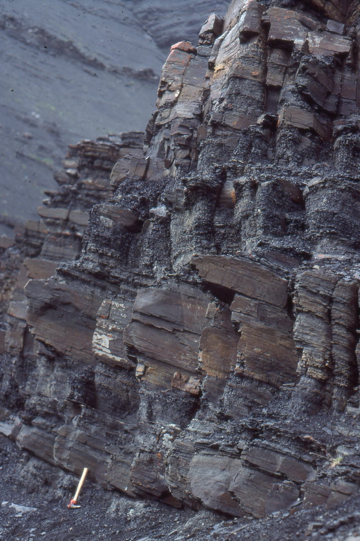
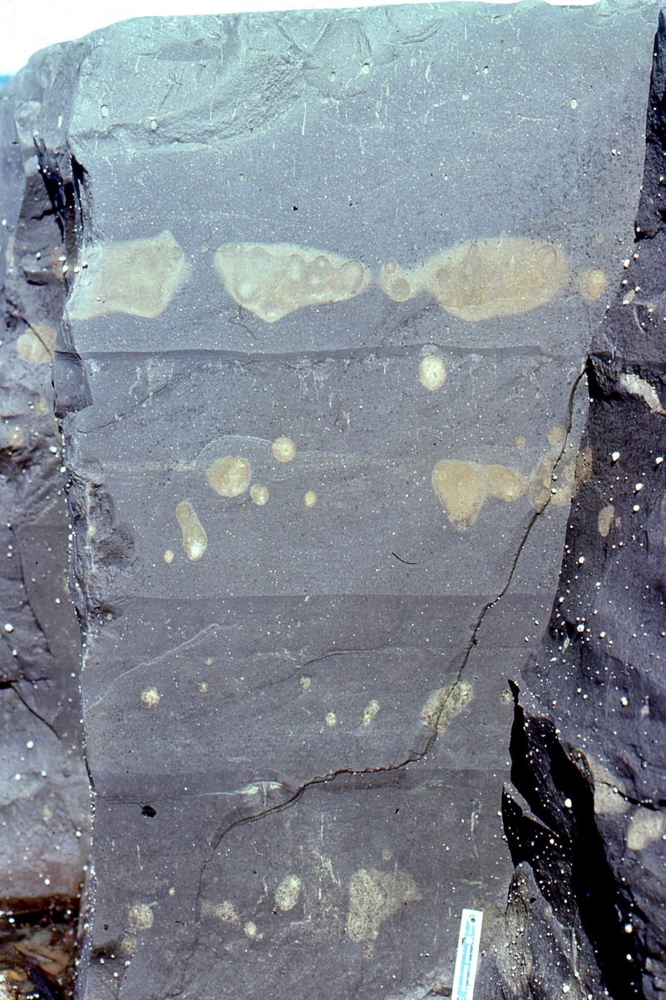
Oblique views of thick Bouma Tb units, and sheets of dewatering pillars formed during very early burial and compaction. Segregation of sheets through the sandstones is a function of different permeabilities between successive flow layers. Dark globular shapes on left image, and white patches in the middle image, are early diagenetic calcite concretions (see images below). Omarolluk Fm. Proterozoic, Belcher Islands
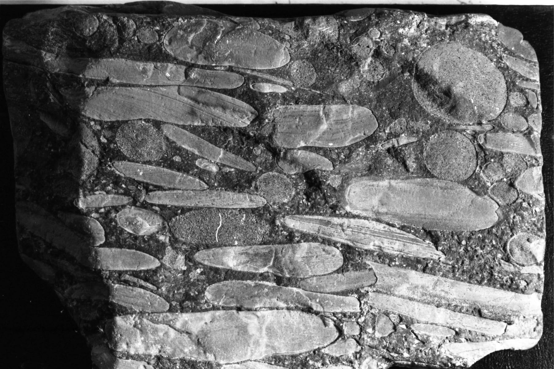
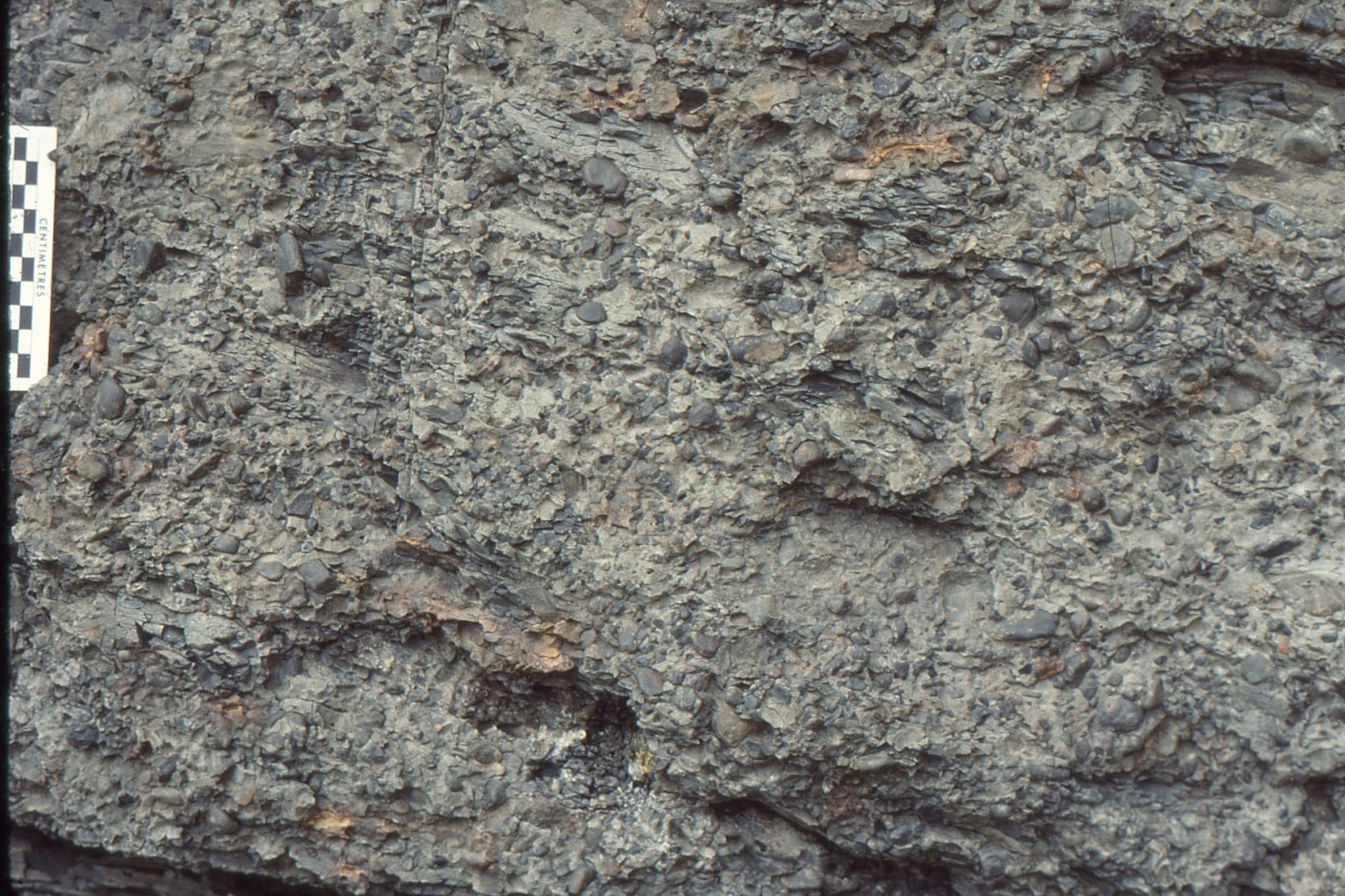
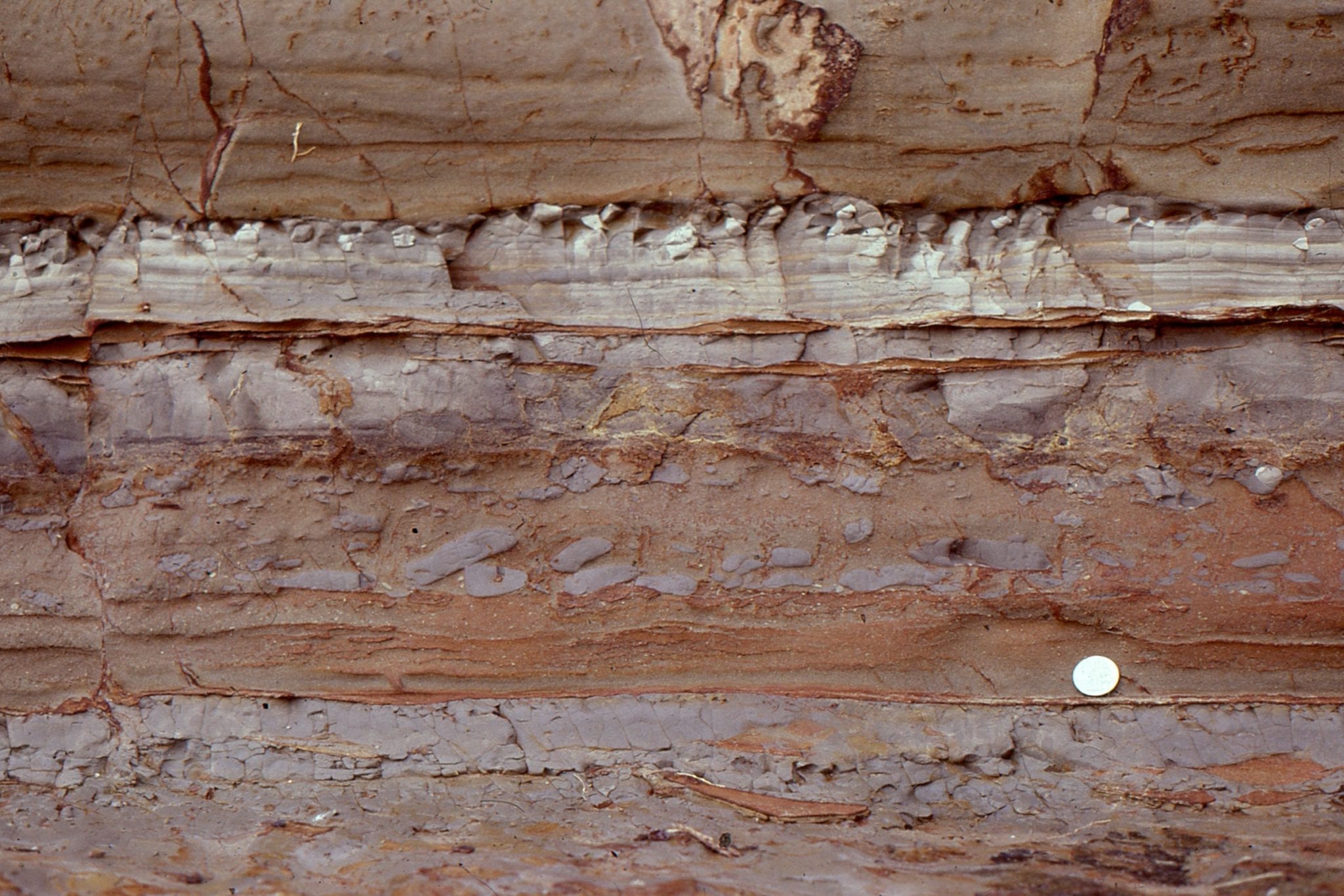
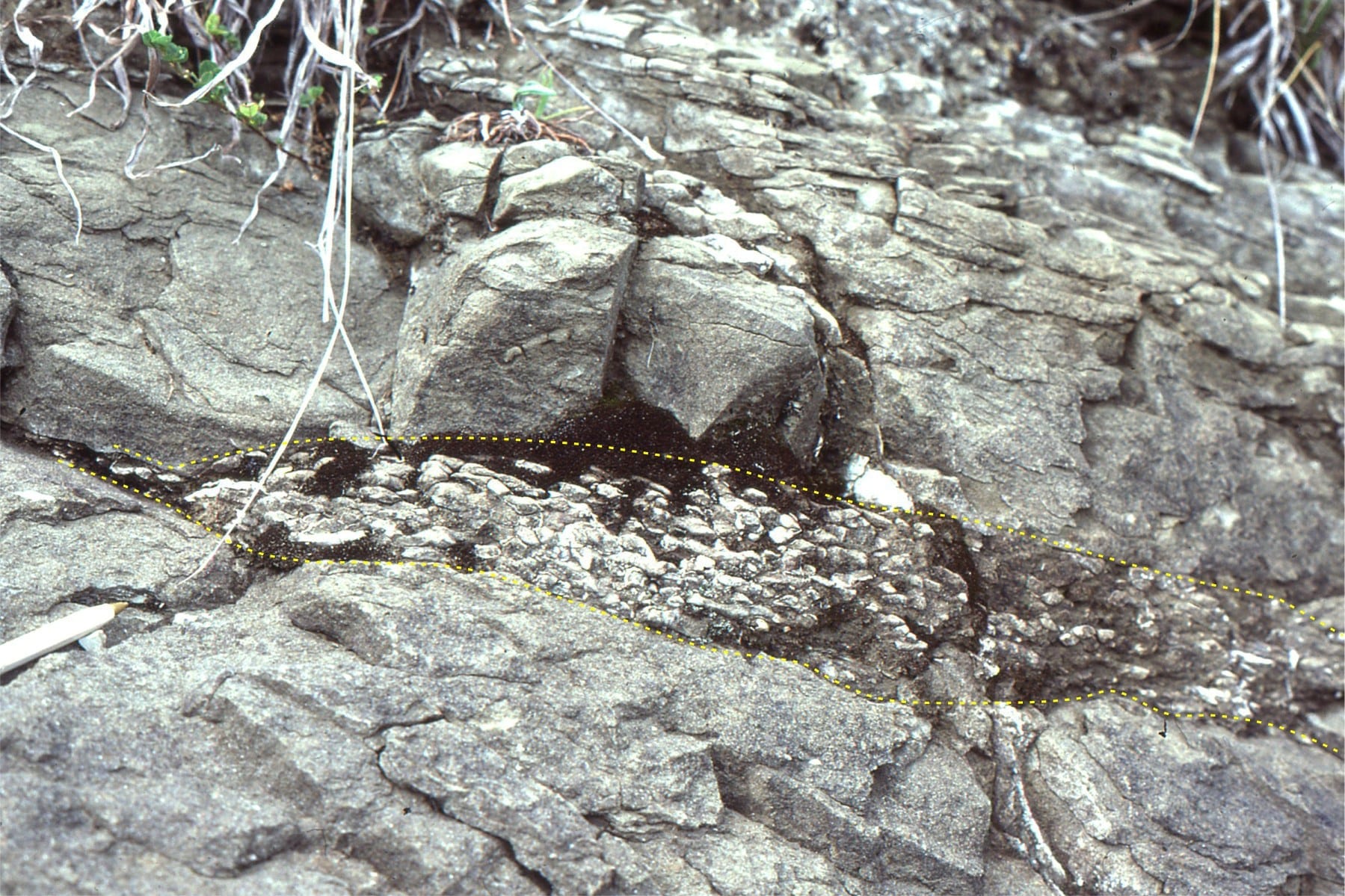
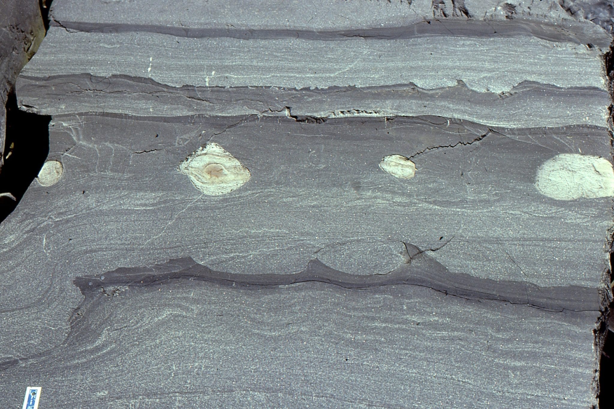
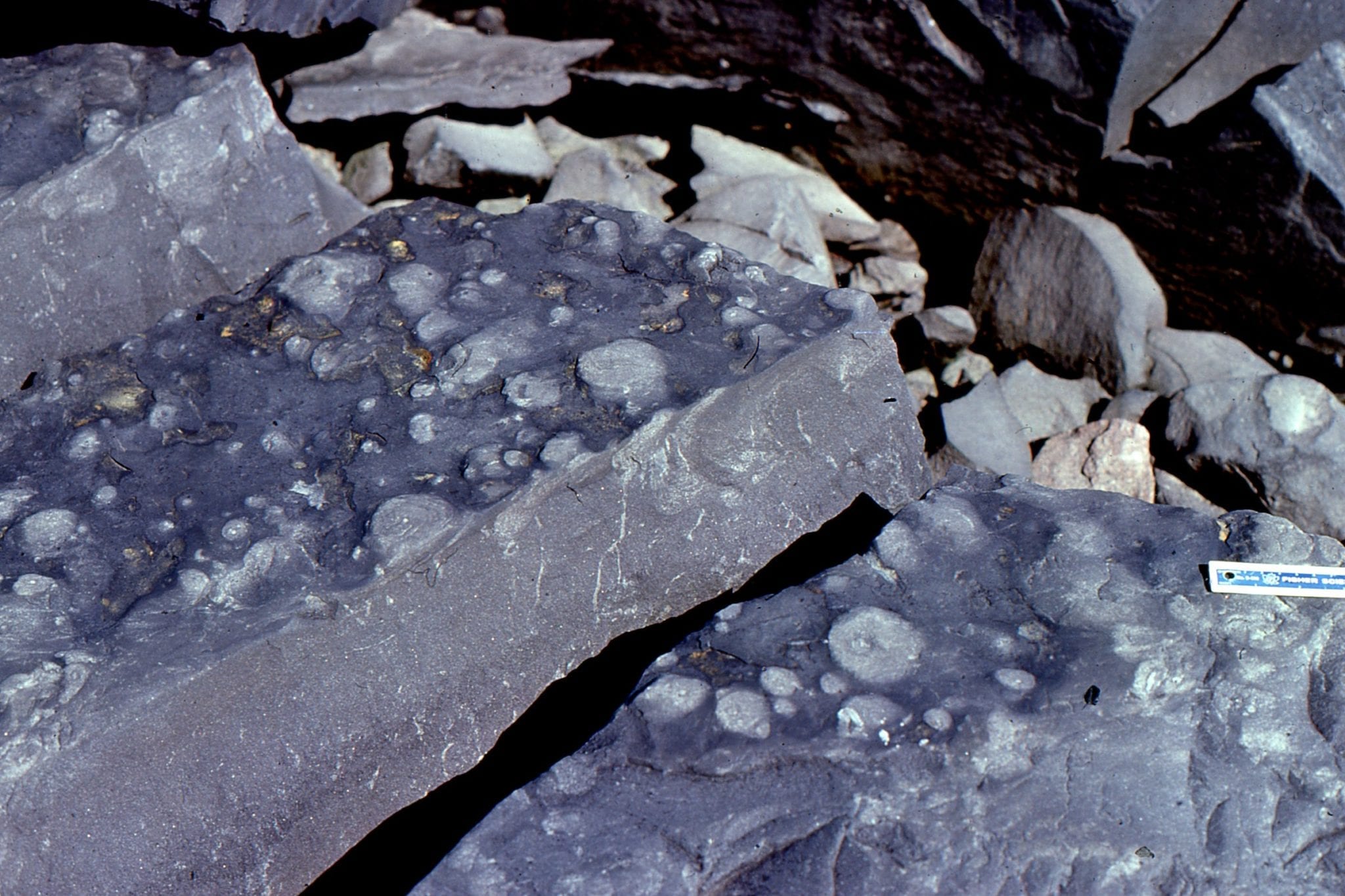
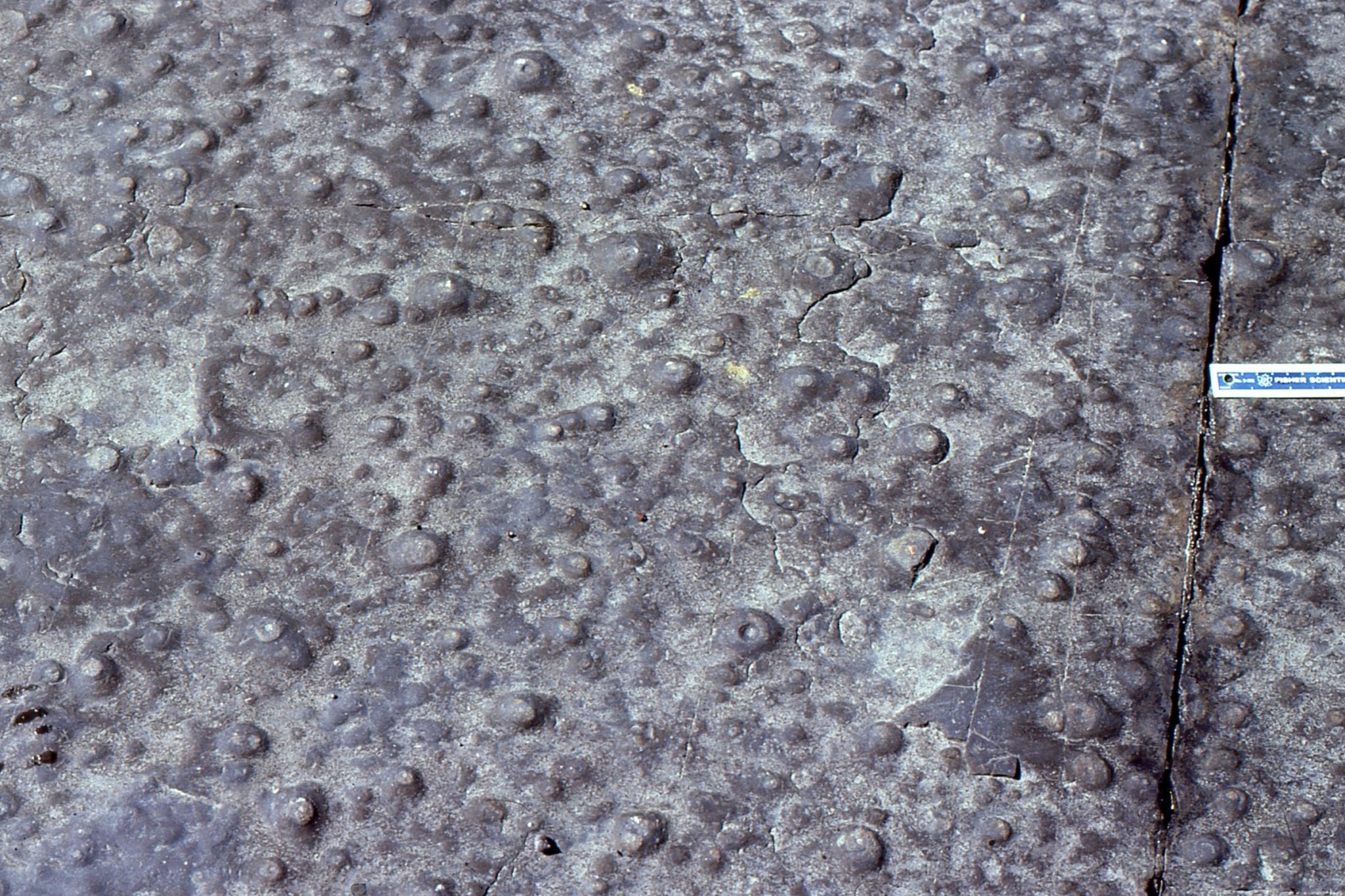
Left: Proximal submarine channel conglomerate consisting almost entirely of reworked calcite concretions. Right: Detail of the channel conglomerate clasts. Elongate clasts are concretions that formed in laminated and rippled Tc intervals; the ovoid and spherical concretions are coarser grained and formed in Ta or Tb Bouma intervals. Omarolluk Fm. Proterozoic, Belcher Islands.
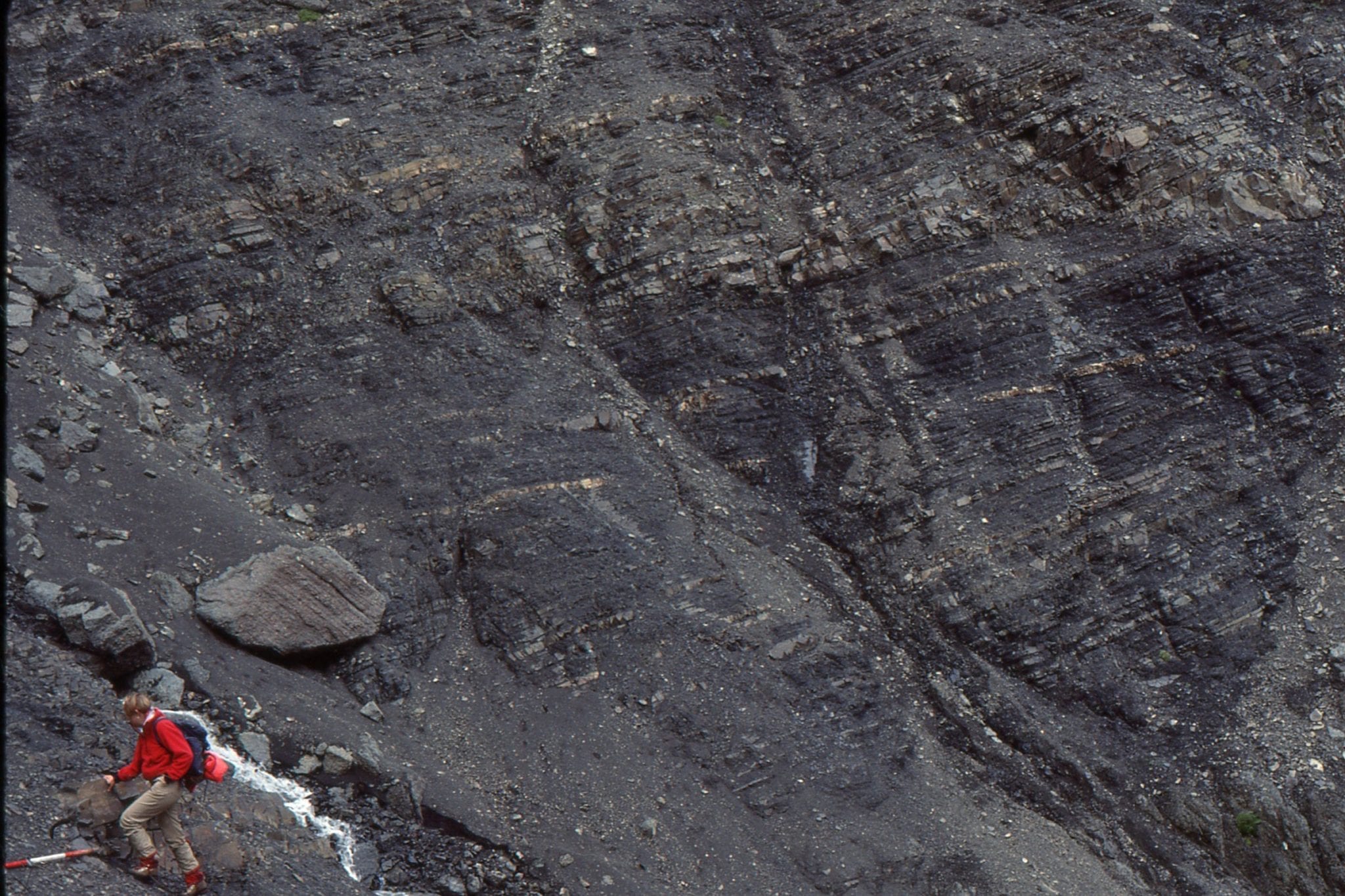
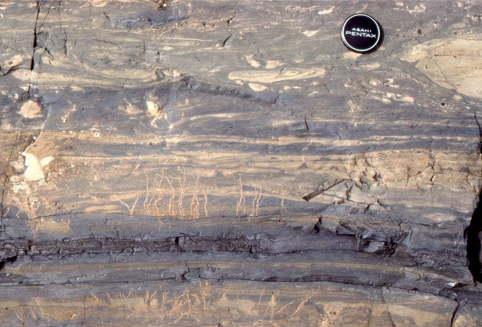 Stacked event beds, mostly in Td intervals in this view, with significant detachment of convoluted-folded very thin sandstone beds. Subvertical, wrinkled conduits, 2-3 mm wide, are dewatering pillars formed by escaping fluids during early compaction. These units are associated with inter- lava flow turbidites in the volcanic Flaherty Fm, Proterozoic Belcher Islands (Flaherty volcanics overlie the Omarolluk Fm.),