Deformation of sediment while it is soft or semi-consolidated
The Atlas, as are all blogs, is a publication. If you use the images, please acknowledge their source as indicated below (it is the polite, and professional thing to do).
Deformation of sediment while it is soft or semi-consolidated, is common. The rock record is replete with folded and slumped strata, strata that slid in coherent packages, strata that lose their coherence during liquefaction or fluidization, displacement by faults where soft or plastic sediment seemingly acts like its brittle rock counterparts, or dyke-like injections where sediment is locally overpressured.
The term syn-sedimentary tends to be used rather loosely, as deformation that takes place during or soon after deposition; the ‘soon’ is the loose part of this broad definition. Sediment begins to compact almost immediately following deposition, where framework grains begin to move closer together. Interstitial water is expelled, and this process in itself can deform the sediment. Water expulsion in compacting deeper strata can also increase local pore pressures that in turn reduce sediment shear strength. Other common triggers are gravitational instability and seismic tremors. Coastal storm surges can produce instability in sea floor sediments caused by rapid fluctuations in pore pressure.
This link will take you to an explanation of the Atlas series, the ownership, use and acknowledgment of images. There, you will also find links to the other categories.
Click on the image for an expanded view, then ‘back page’ arrow to return to the Atlas.
Five of the images shown in this tranche also appear in the Submarine fans and channels category; there are several more examples of soft- or syn-sedimentary structures on the Submarine fans page.
Check out this post for brief descriptions of deformation mechanisms and annotation of outcrop images.
The images:
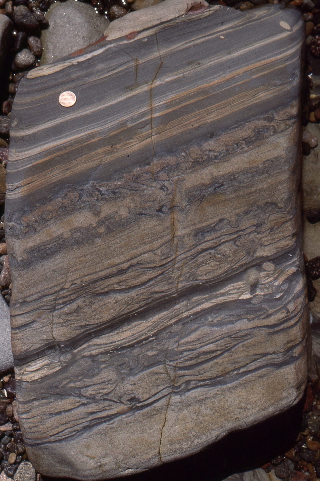
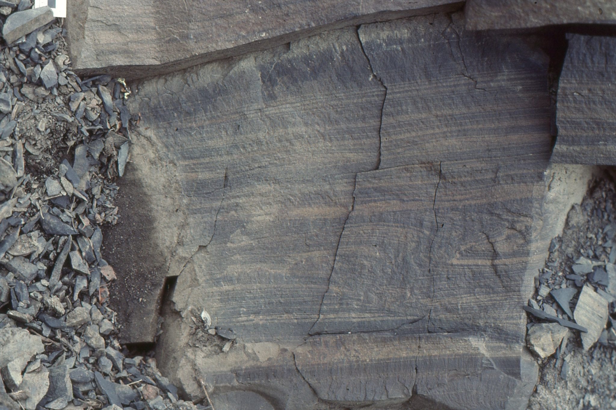
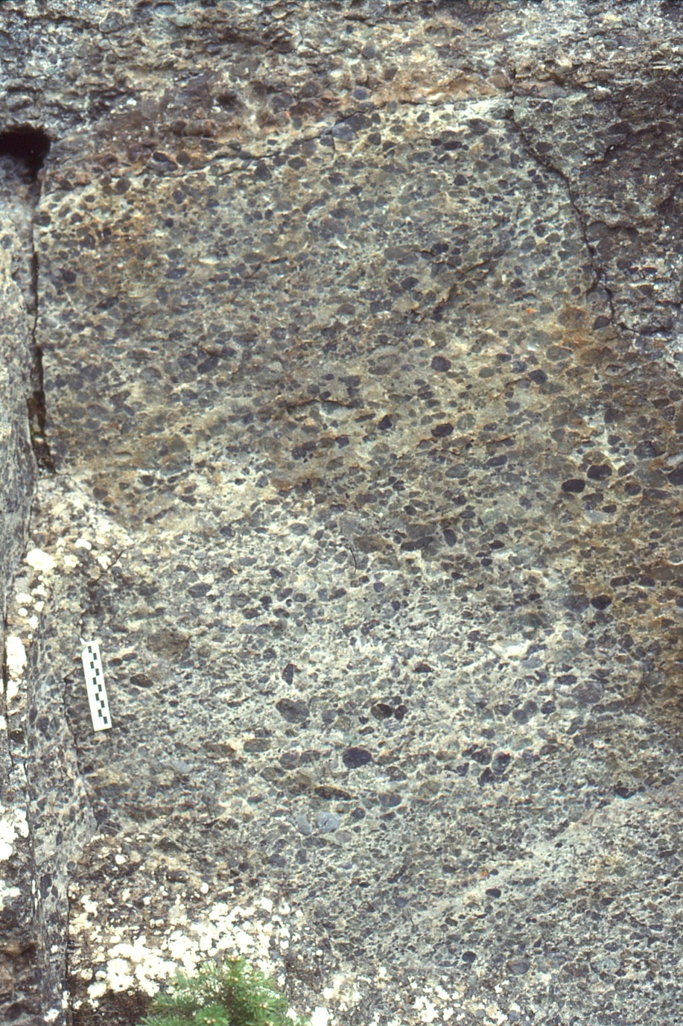
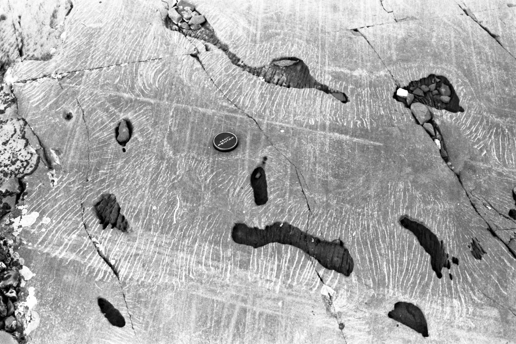
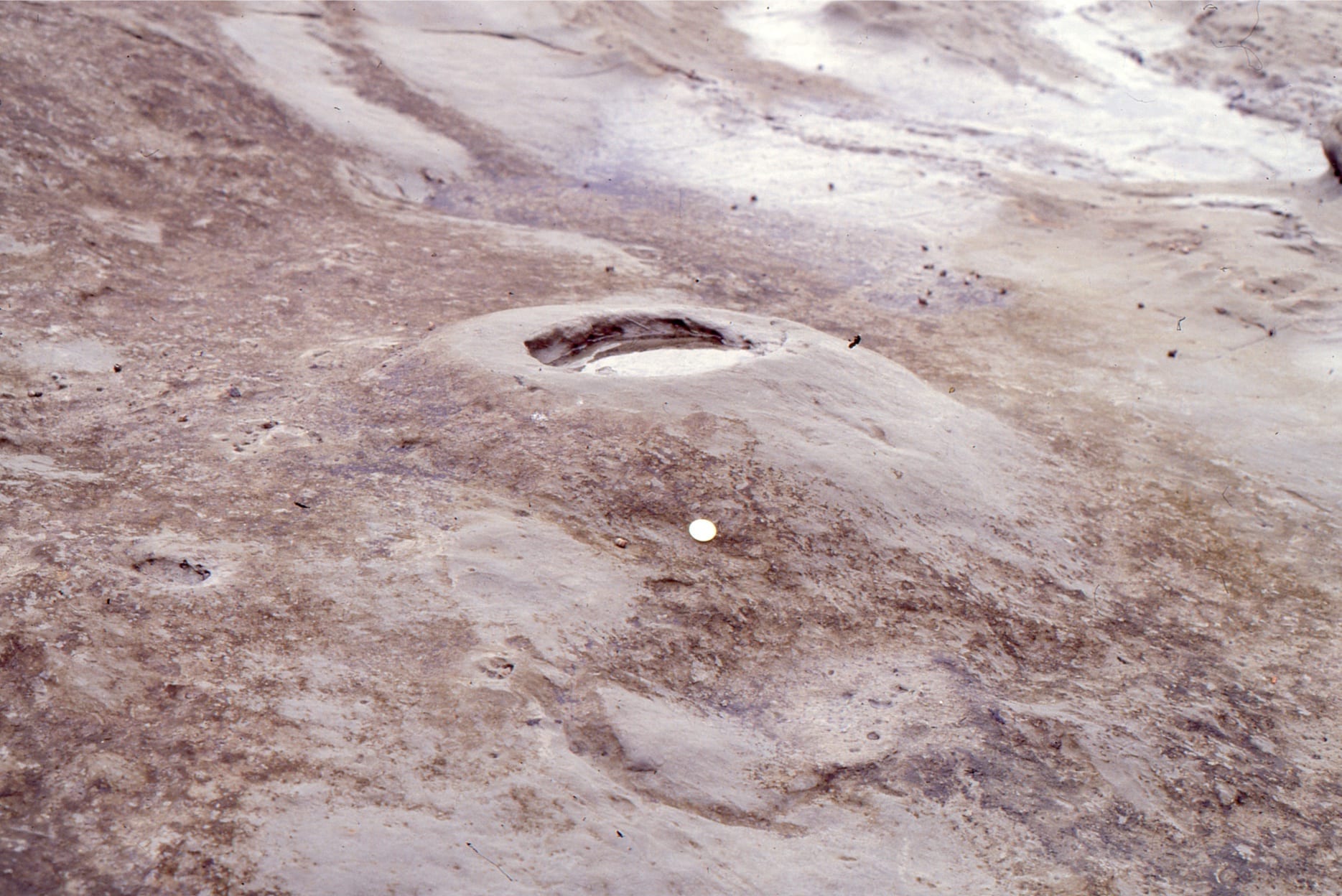
 Sediment deposited rapidly will have a high water content. Immediately following deposition and incipient compaction, excess water will be forced towards the sea floor. Muddy sediment, like a turbidite will present natural permeability barriers to water expulsion, resulting in either deformation of laminae and other structures, or formation of dewatering pipes, or pillars. Water escaping at the sea floor will deposit fine sediment that it has picked up along its trajectory, and deposit this as small mud-silt pimples or volcanoes. This example (Omarolluk Fm, Proterozoic, Belcher Islands) shows the mud volcanoes on bedding, and in cross-section, thin whitish pillars that represent water escape routes – they are white because the muddy matrix has been removed.
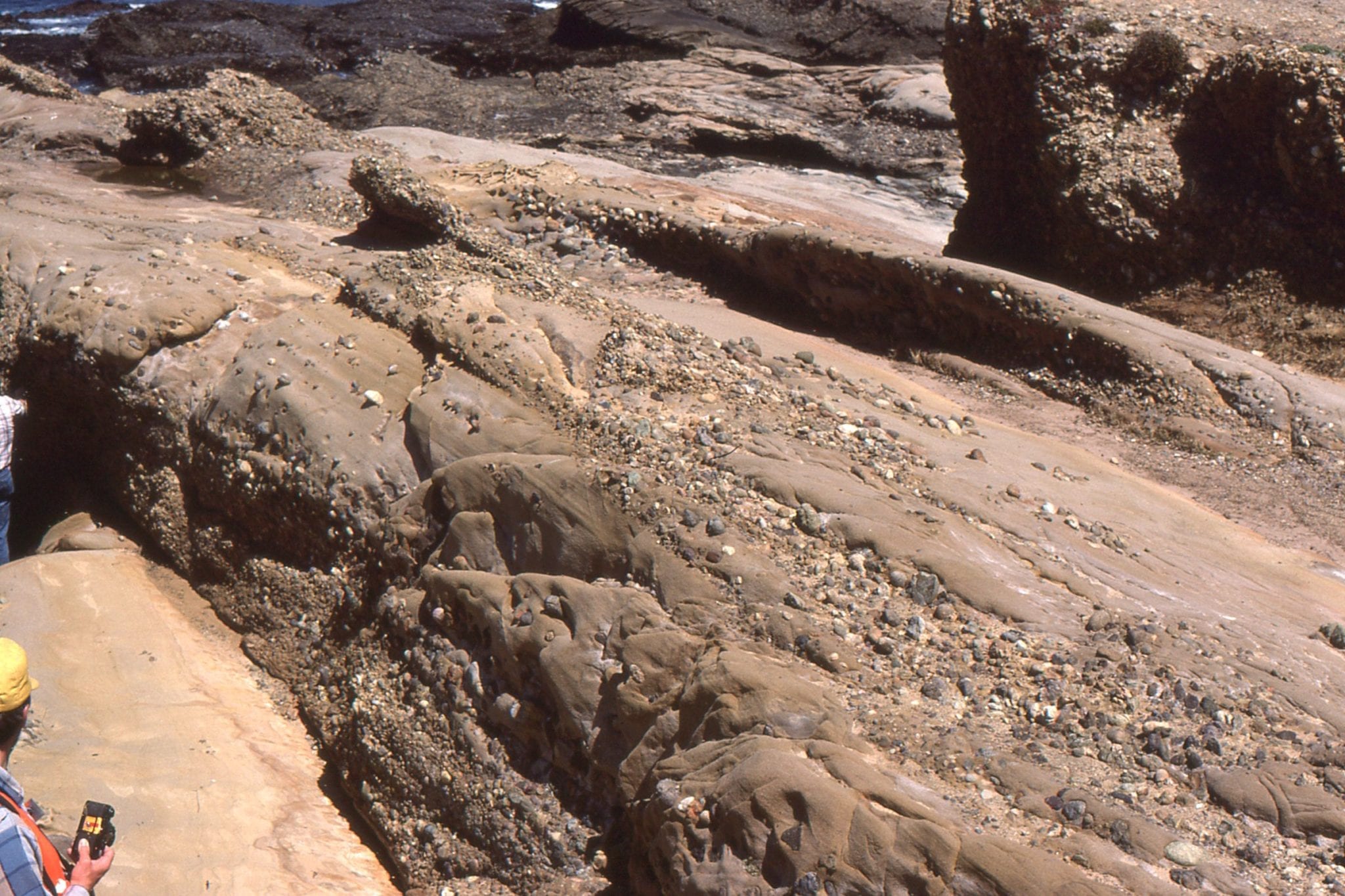
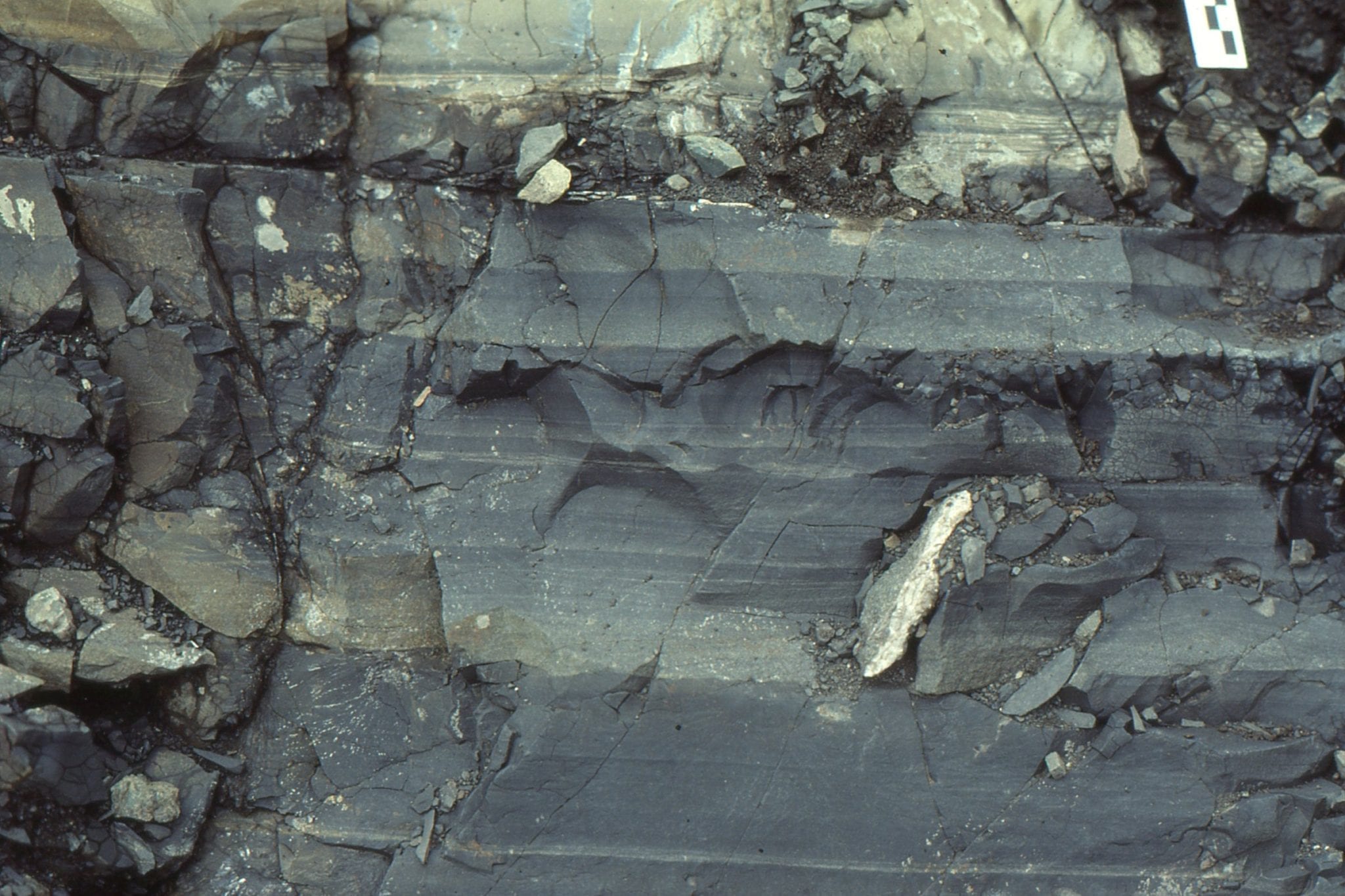
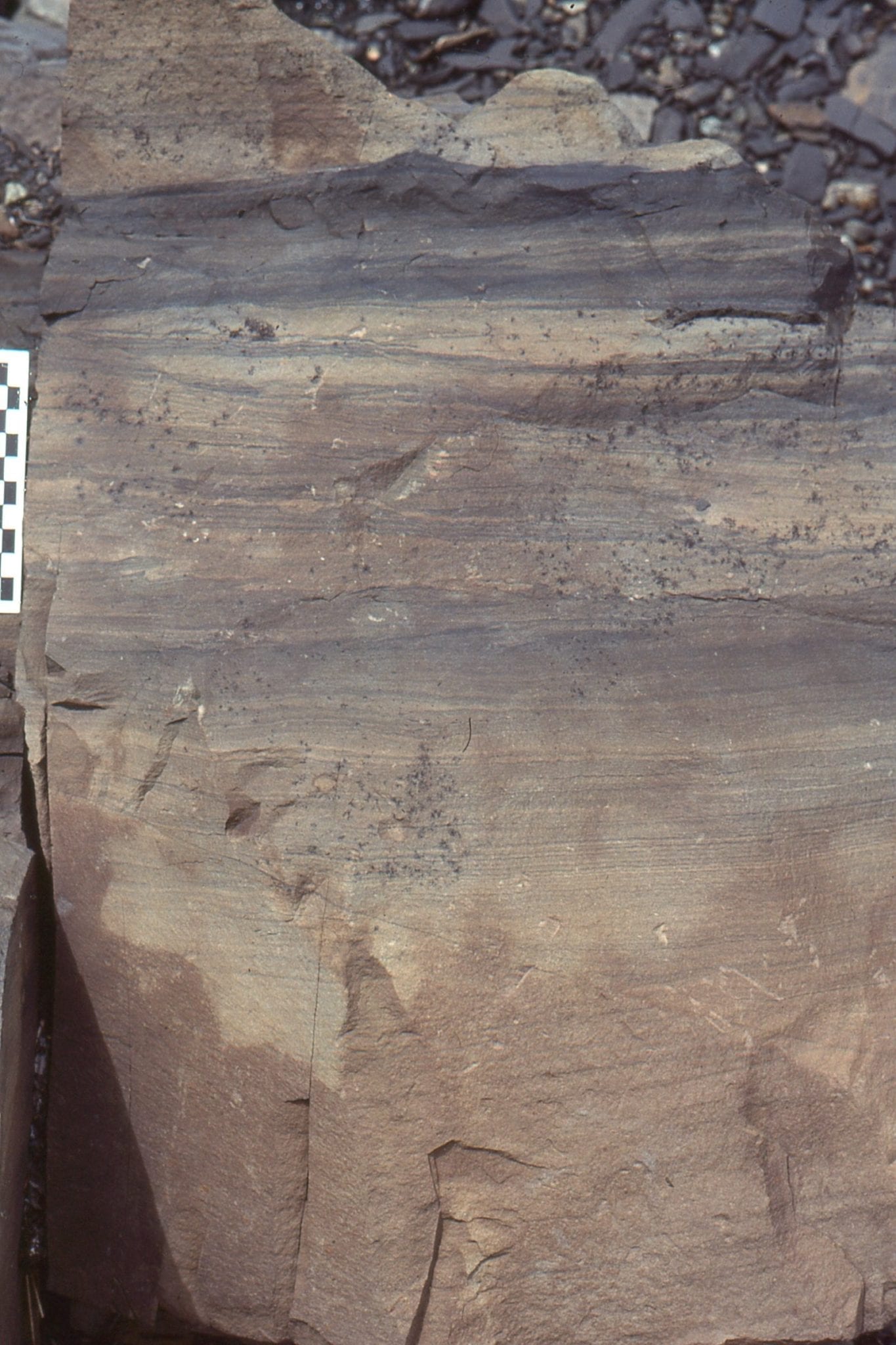
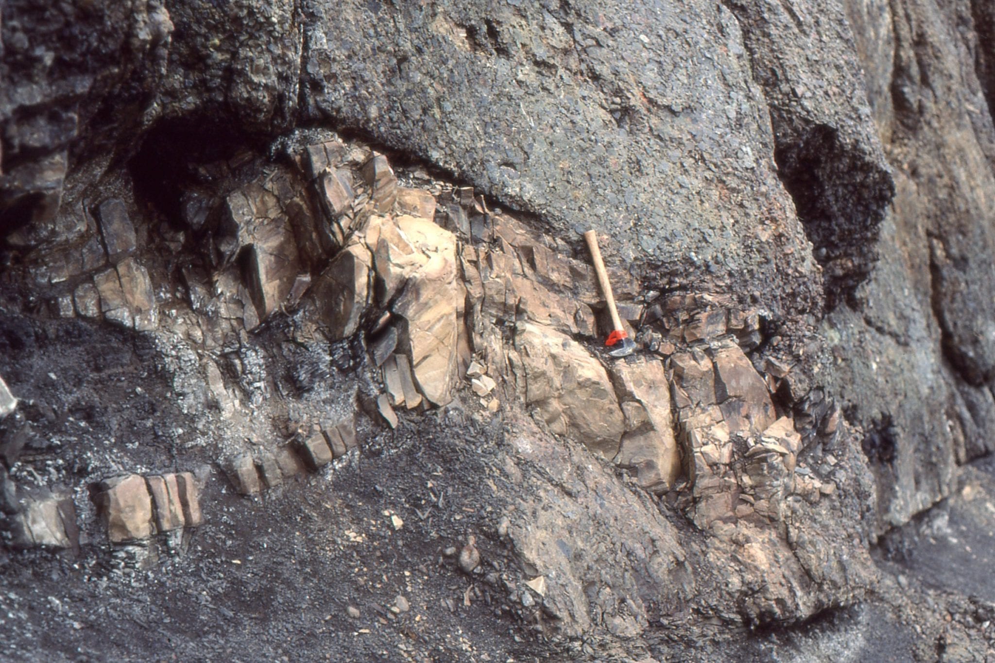
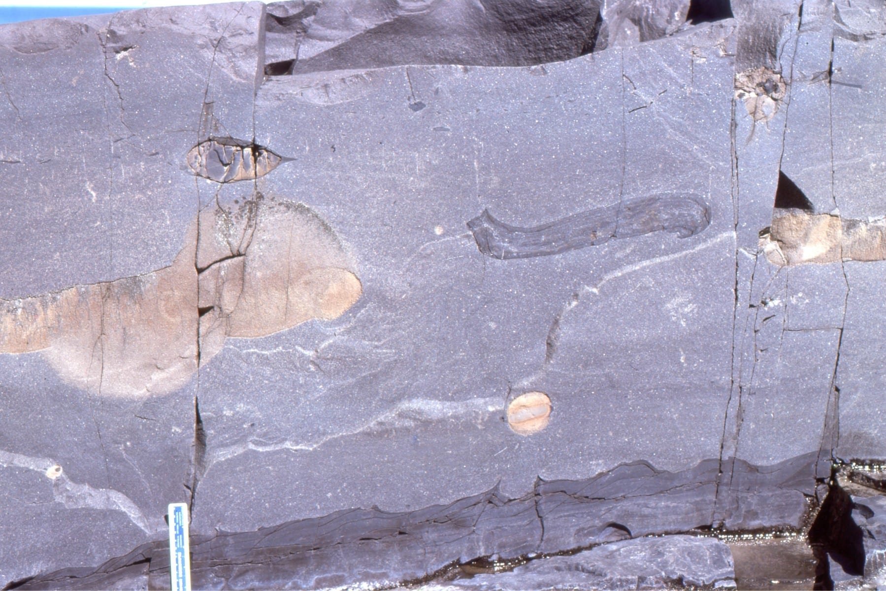
 Dewatering pillars can occur in sheets within single beds, in this case a Proterozoic turbidite. The position of sheets within a bed is probably associated with permeability barriers. Omarolluk Fm. Belcher Islands (1.8-1.9 billion years). The black patches are calcite concretions; pillars pass through the concretions.
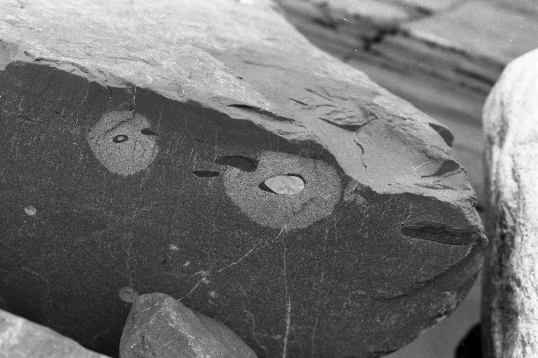
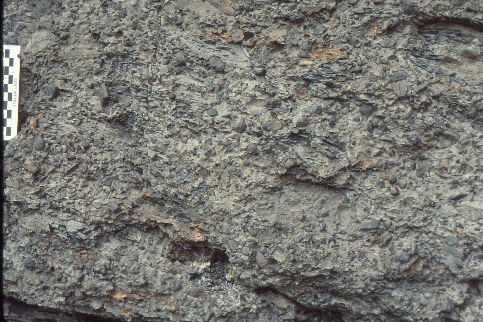
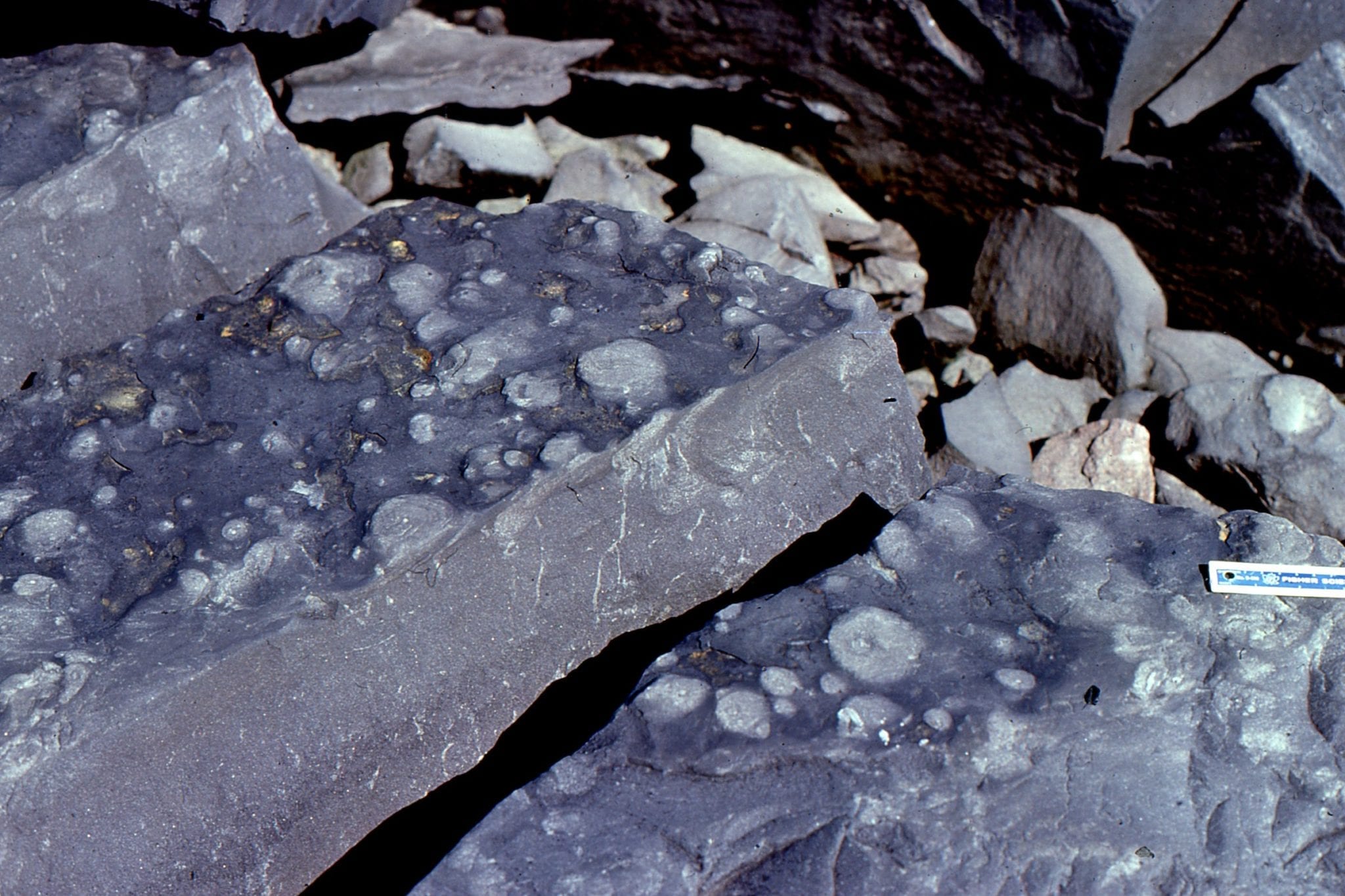
Calcite concretions in turbidites, Omarolluk Fm, Belcher Islands, formed during very early stages of burial. This very early stage of diagenesis was shallow enough for the concretions to be reworked in submarine channels.
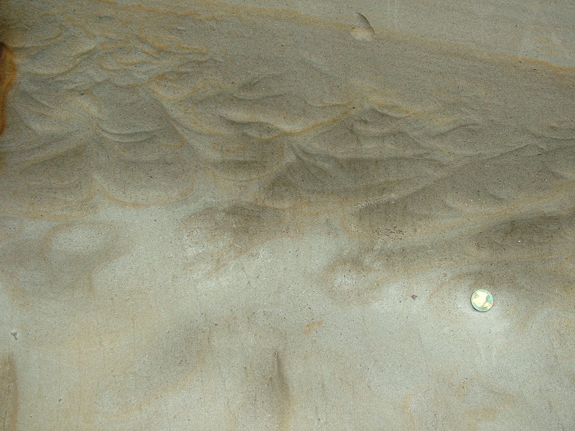
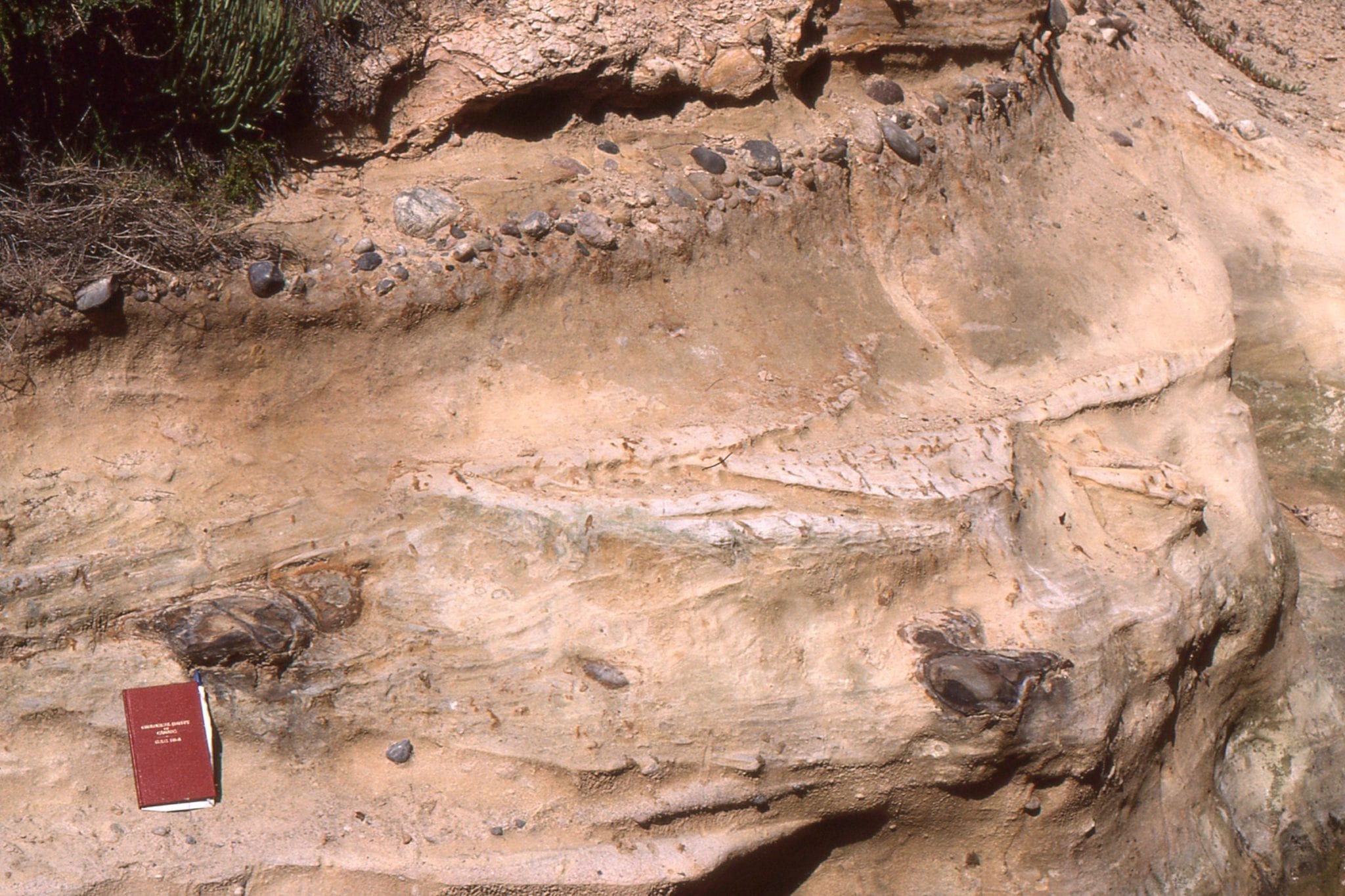
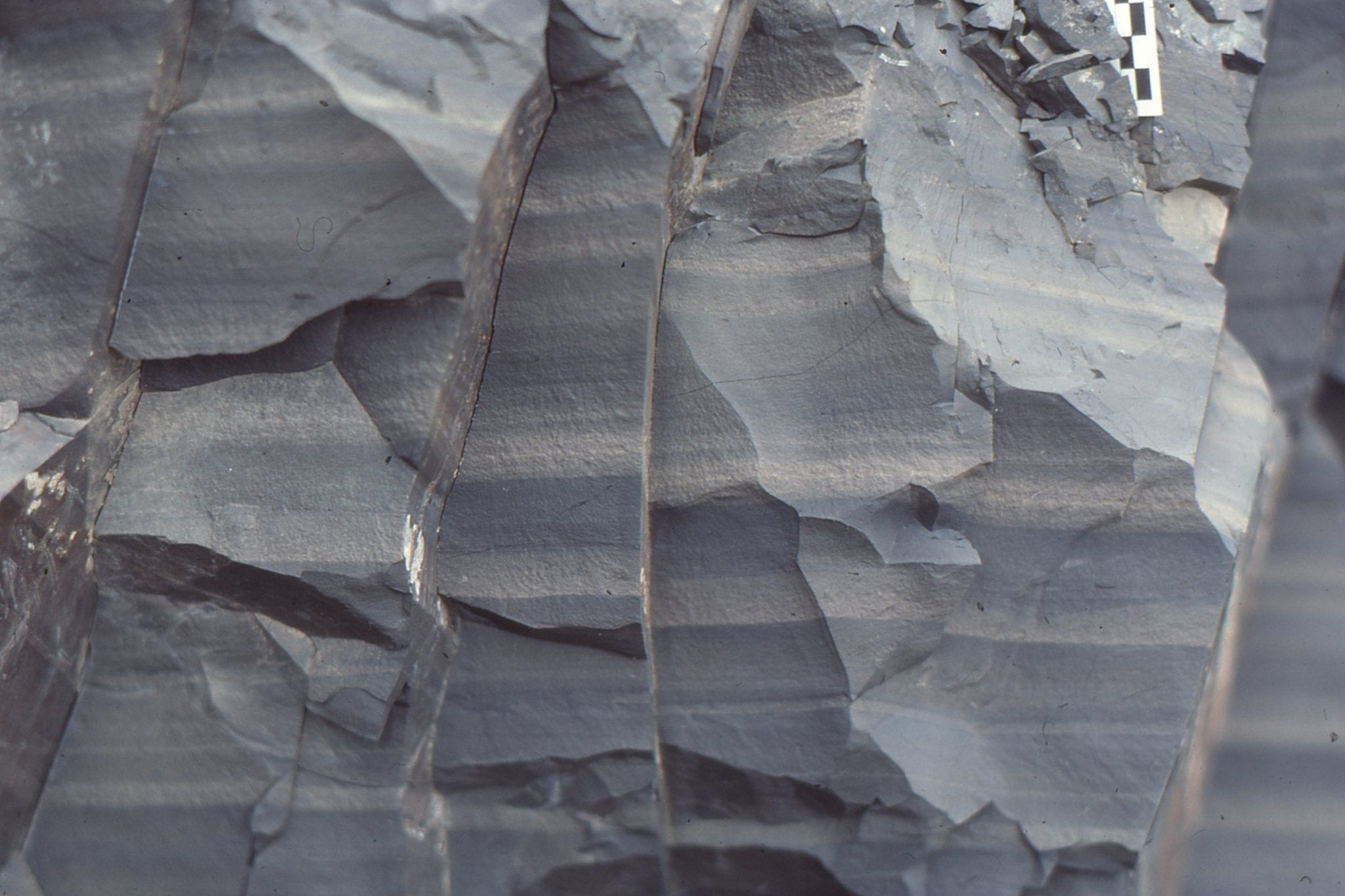
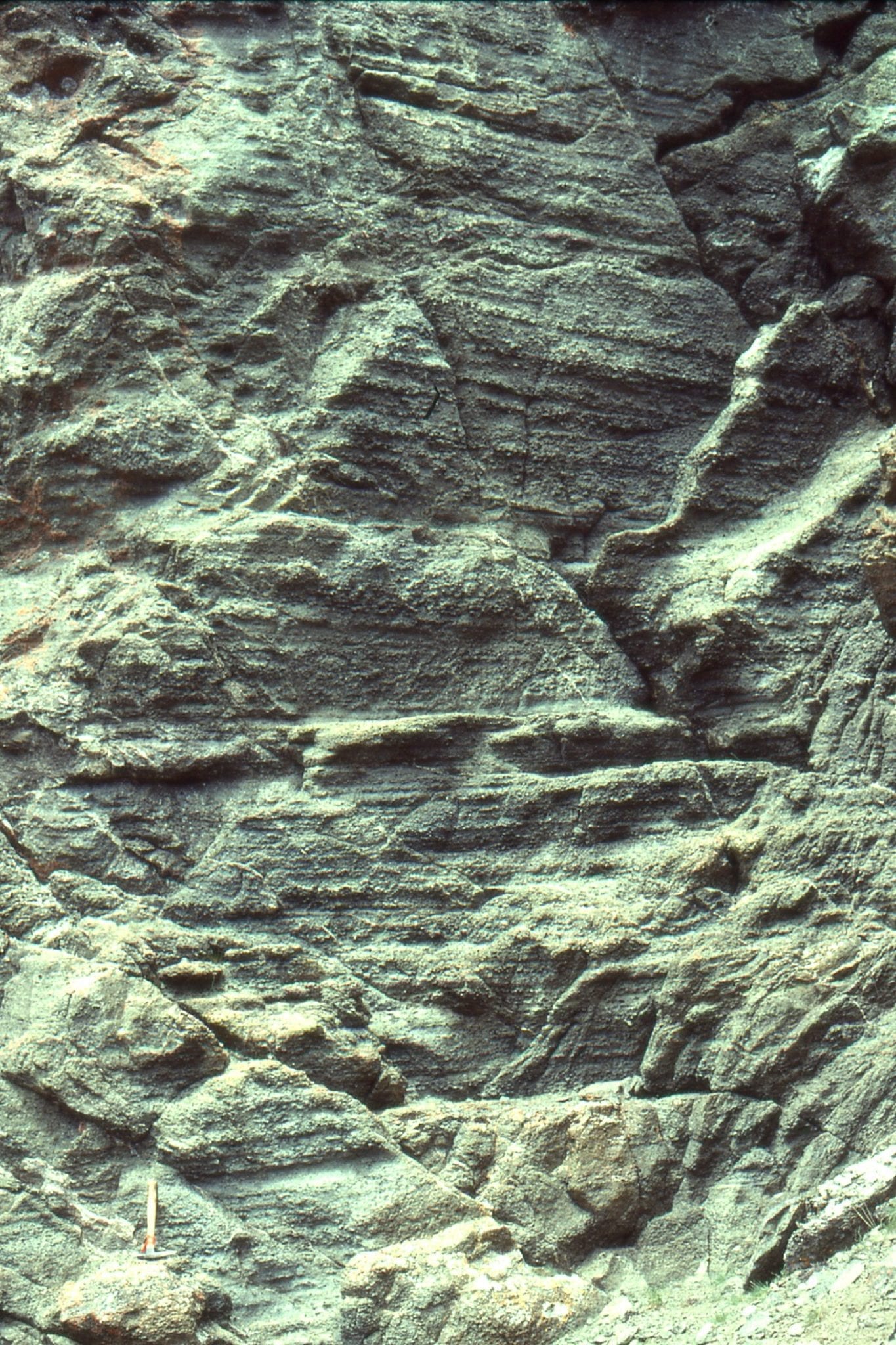
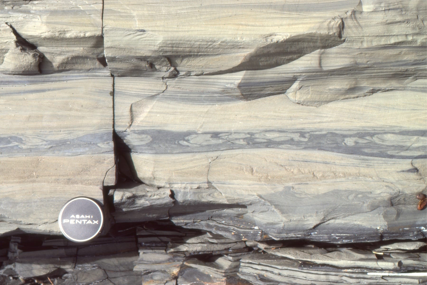
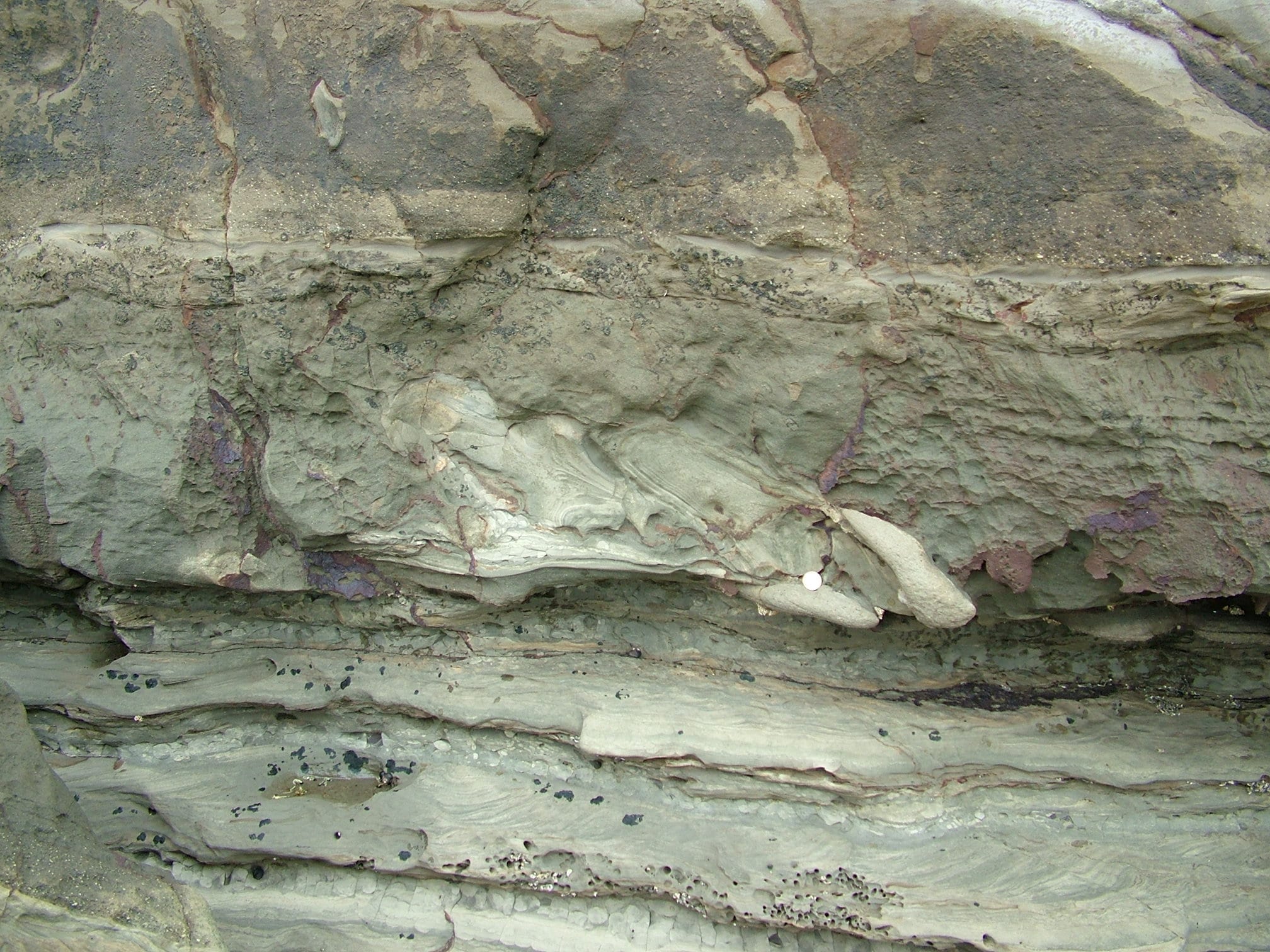
Dish structures are another product of dewatering. Water that escapes though narrow conduits, will drag sand laminae upwards; laminae between adjacent dewatering pillars will appear concave upwards, or dish-shaped. Left is from Lower Miocene Waitemata Basin, Musick Point; Right is from the Rosario Group, San Diego.
 Fluvial trough crossbeds here have been turned on end during early compaction and dewatering, producing what are commonly called ball and pillow structure. Proterozoic Loaf Fm. Belcher Islands.
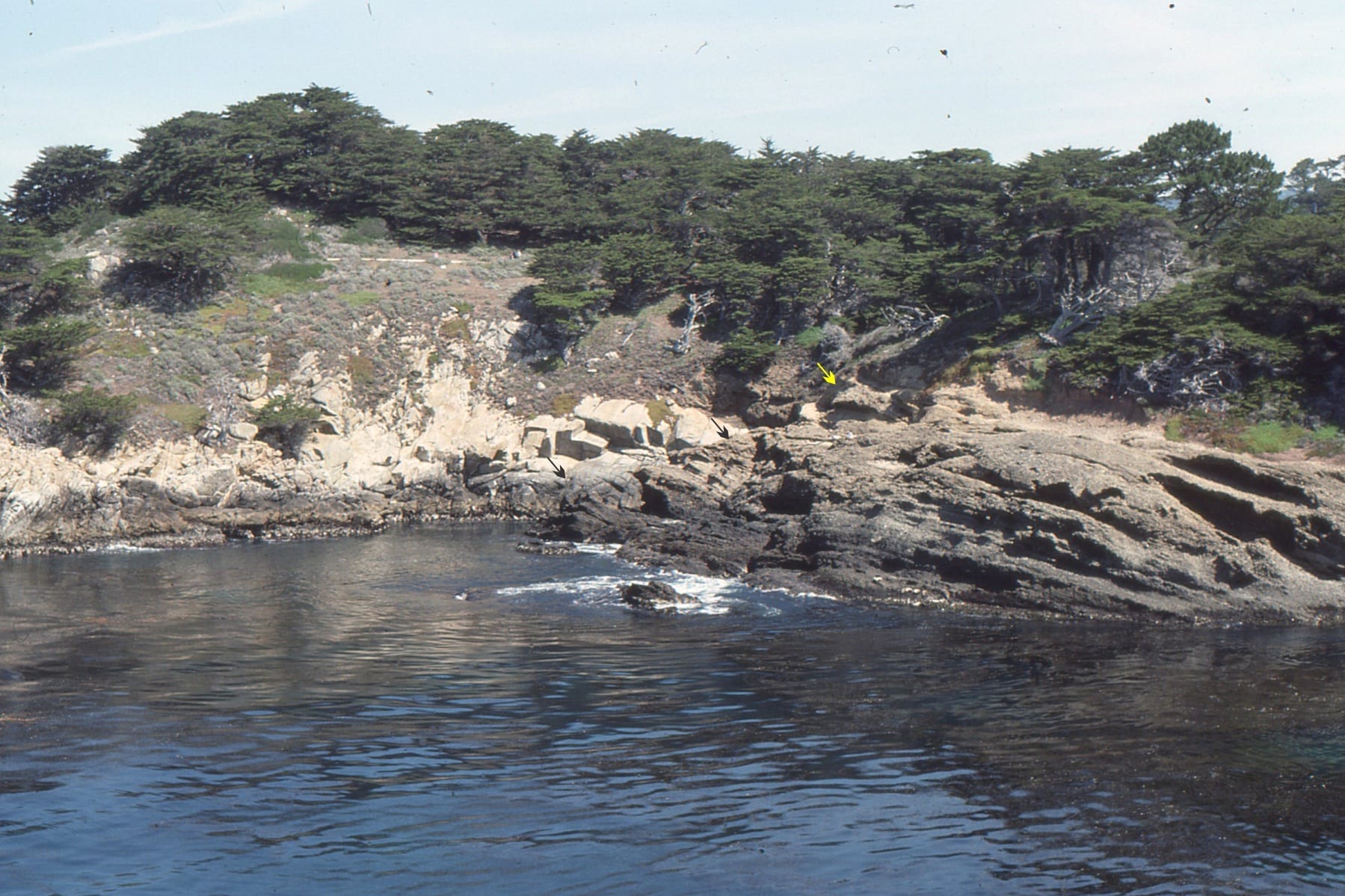
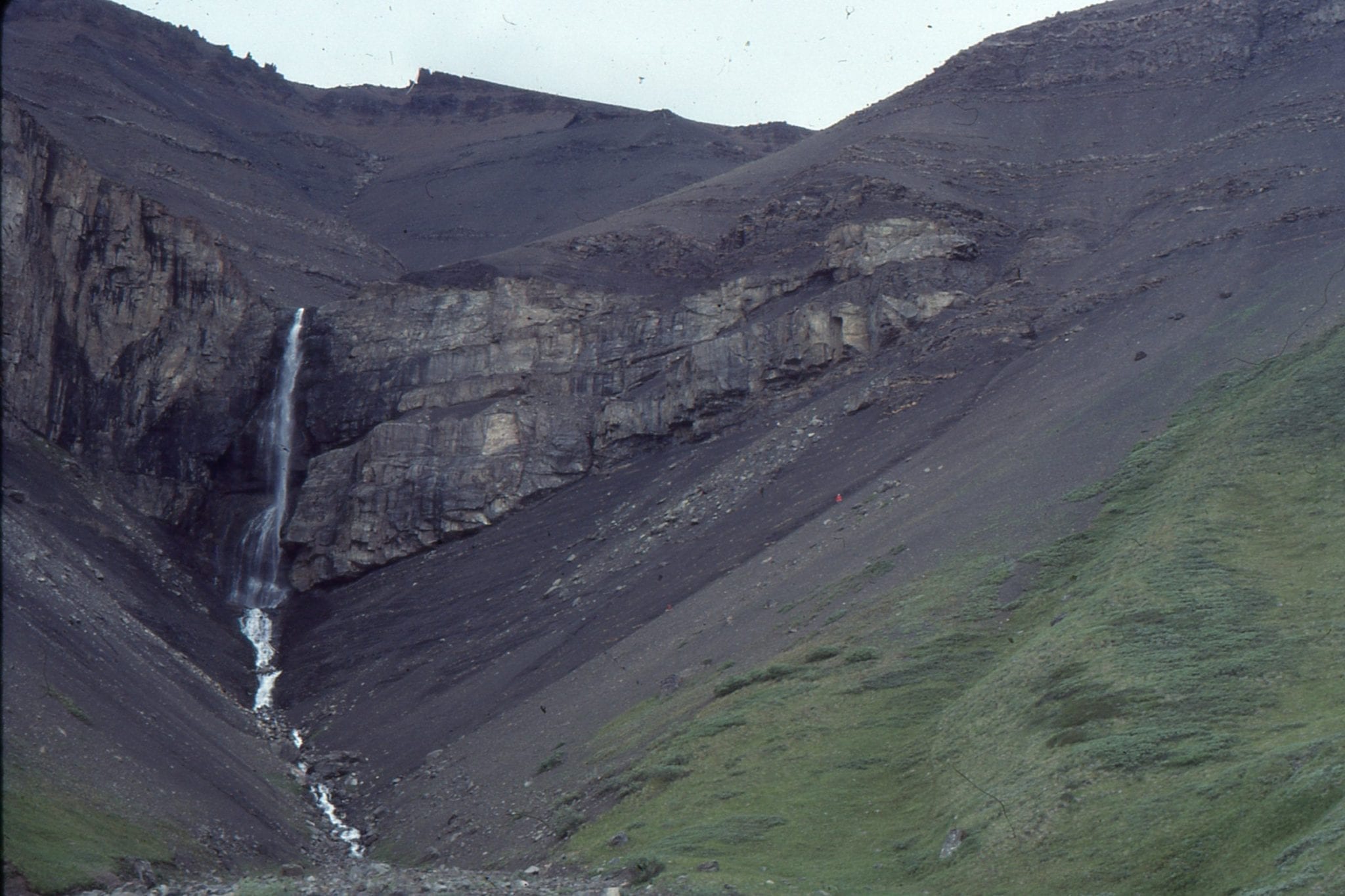
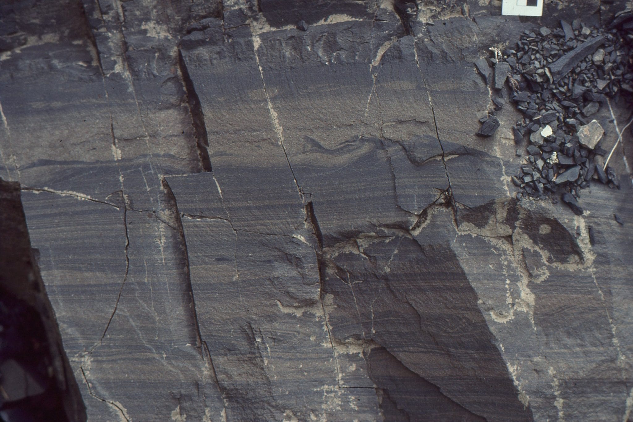
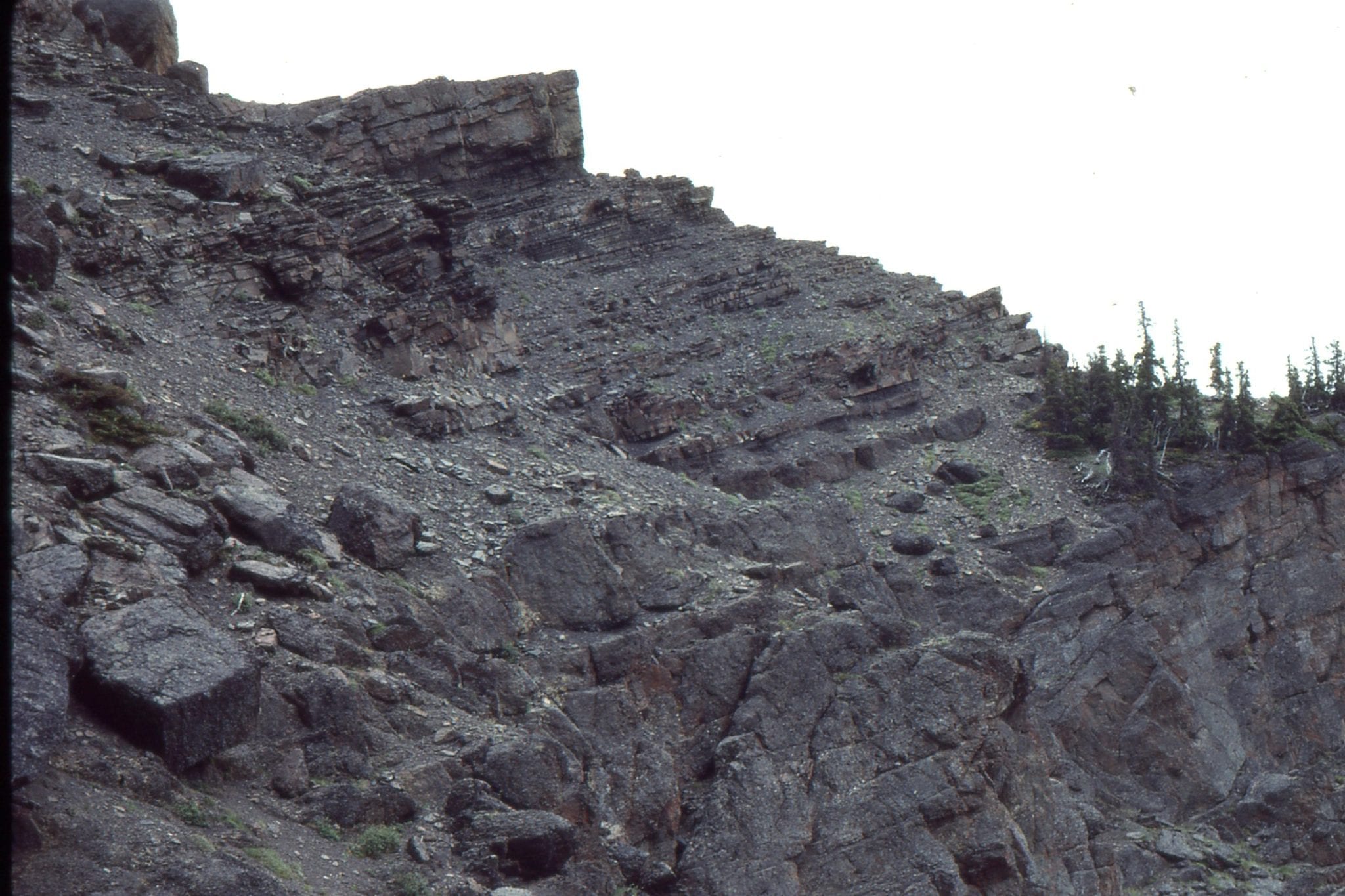
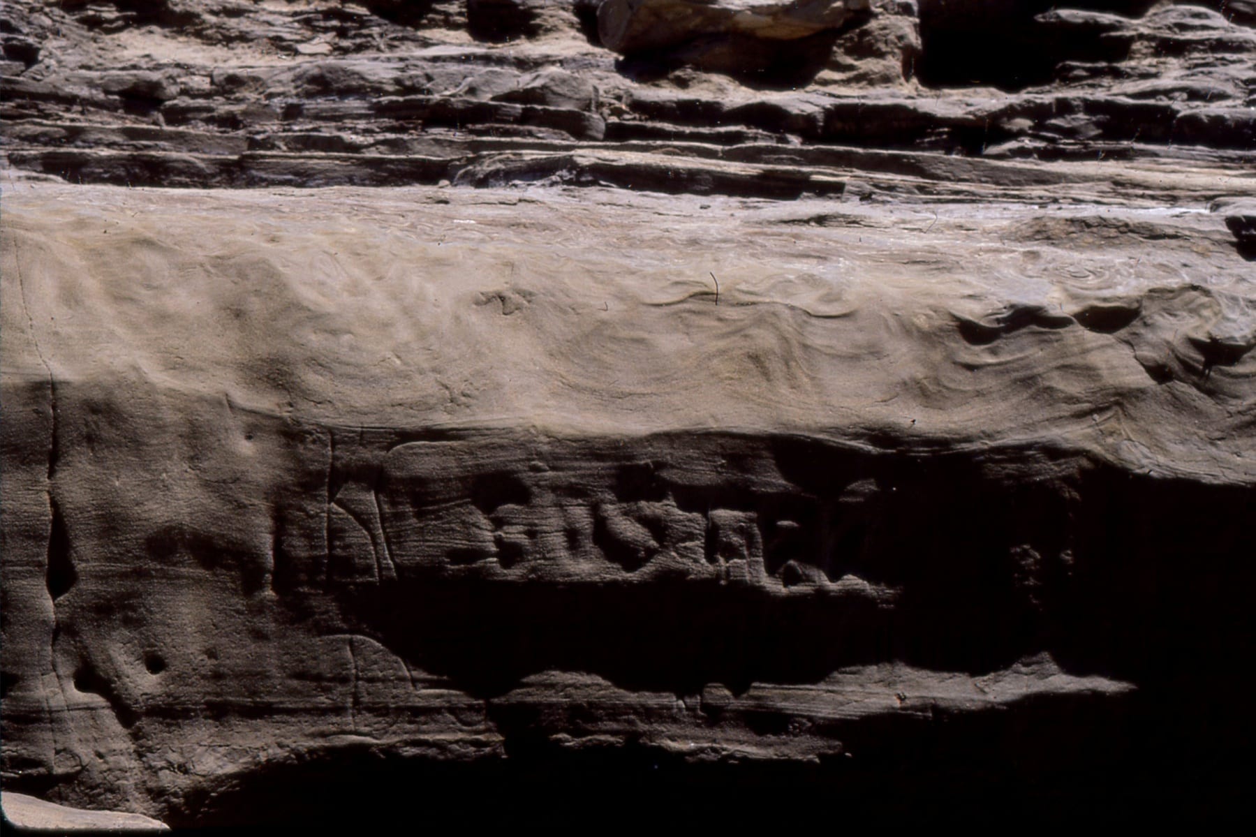
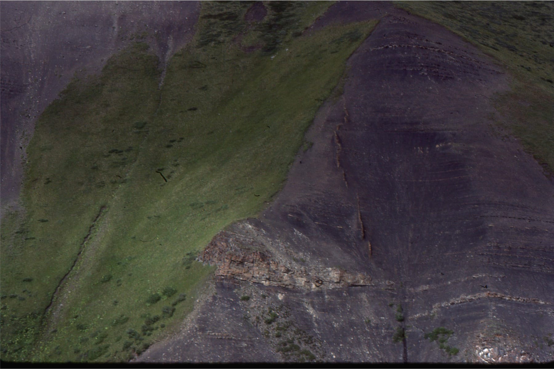
Ripples and bed contacts in this sandstone-mudstone unit have been deformed by liquefaction, and in places pulled apart. Evidence from nearby strata indicates a possible seismic event has jostled these beds (see image below). Fairweather Fm, Belcher Islands, about 2 billion years old.
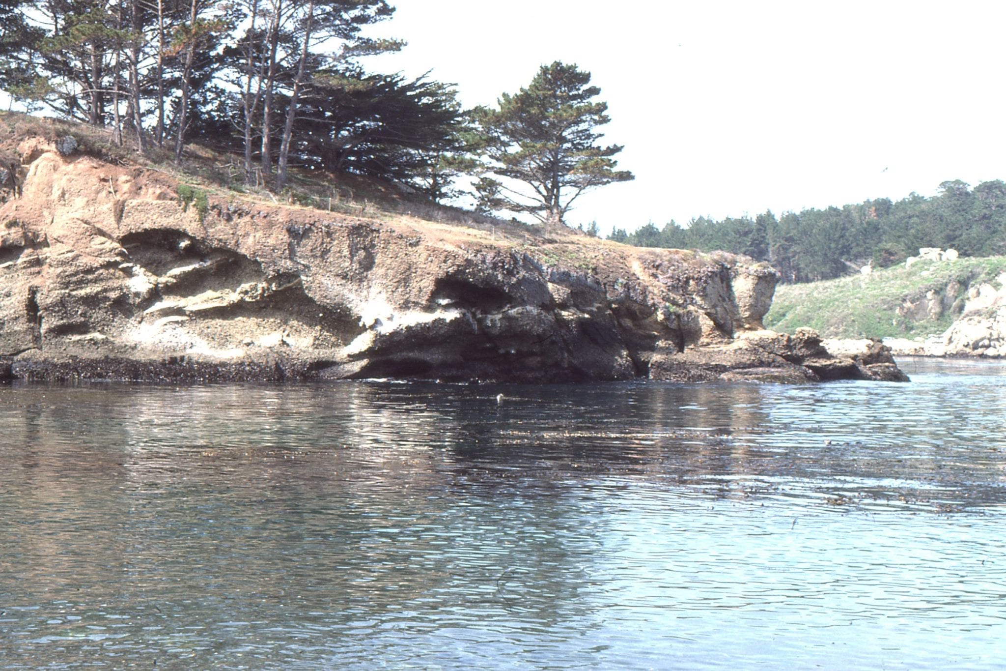
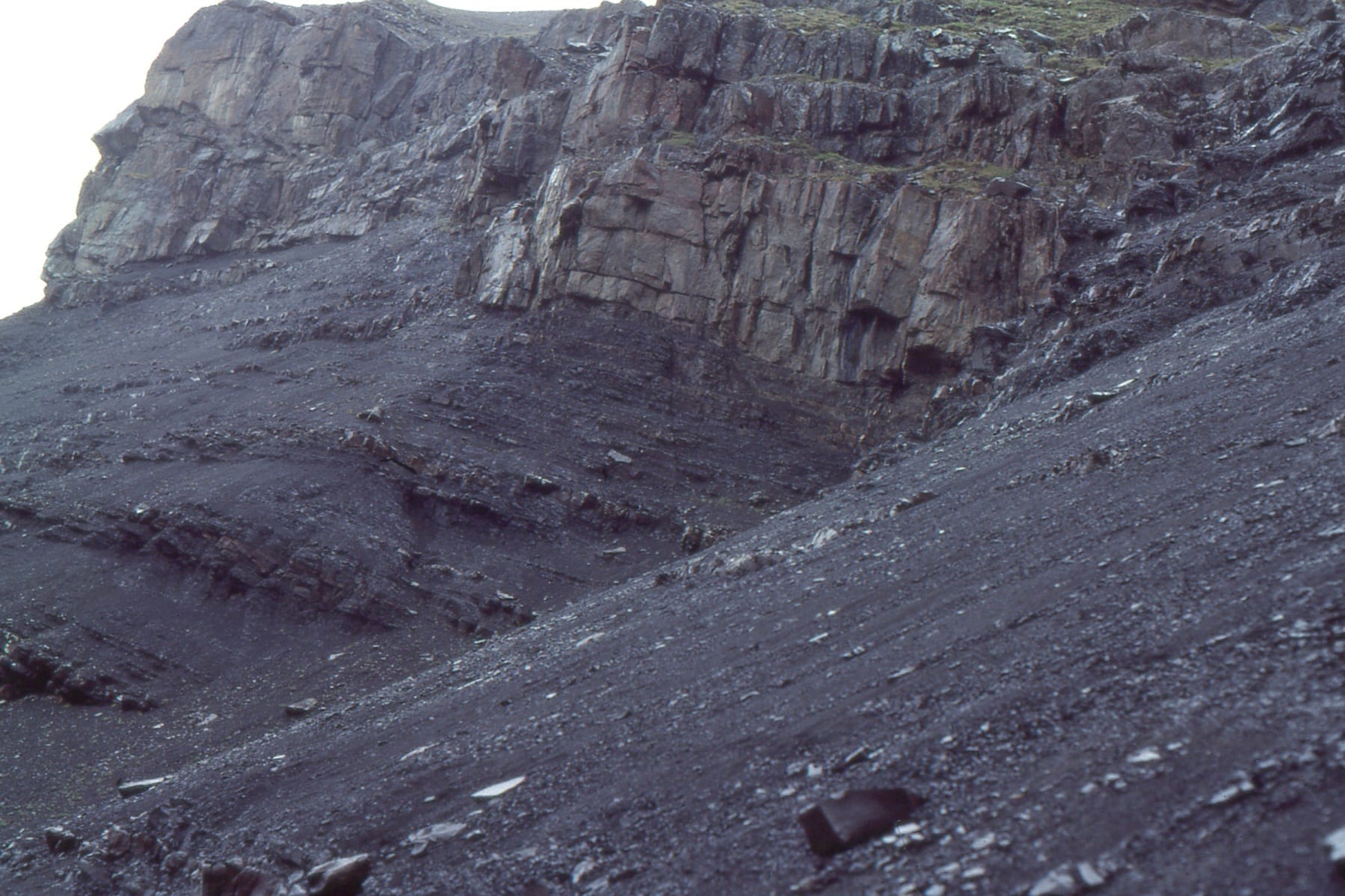
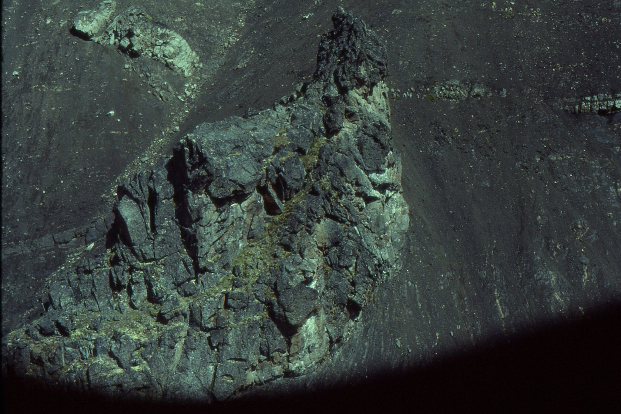
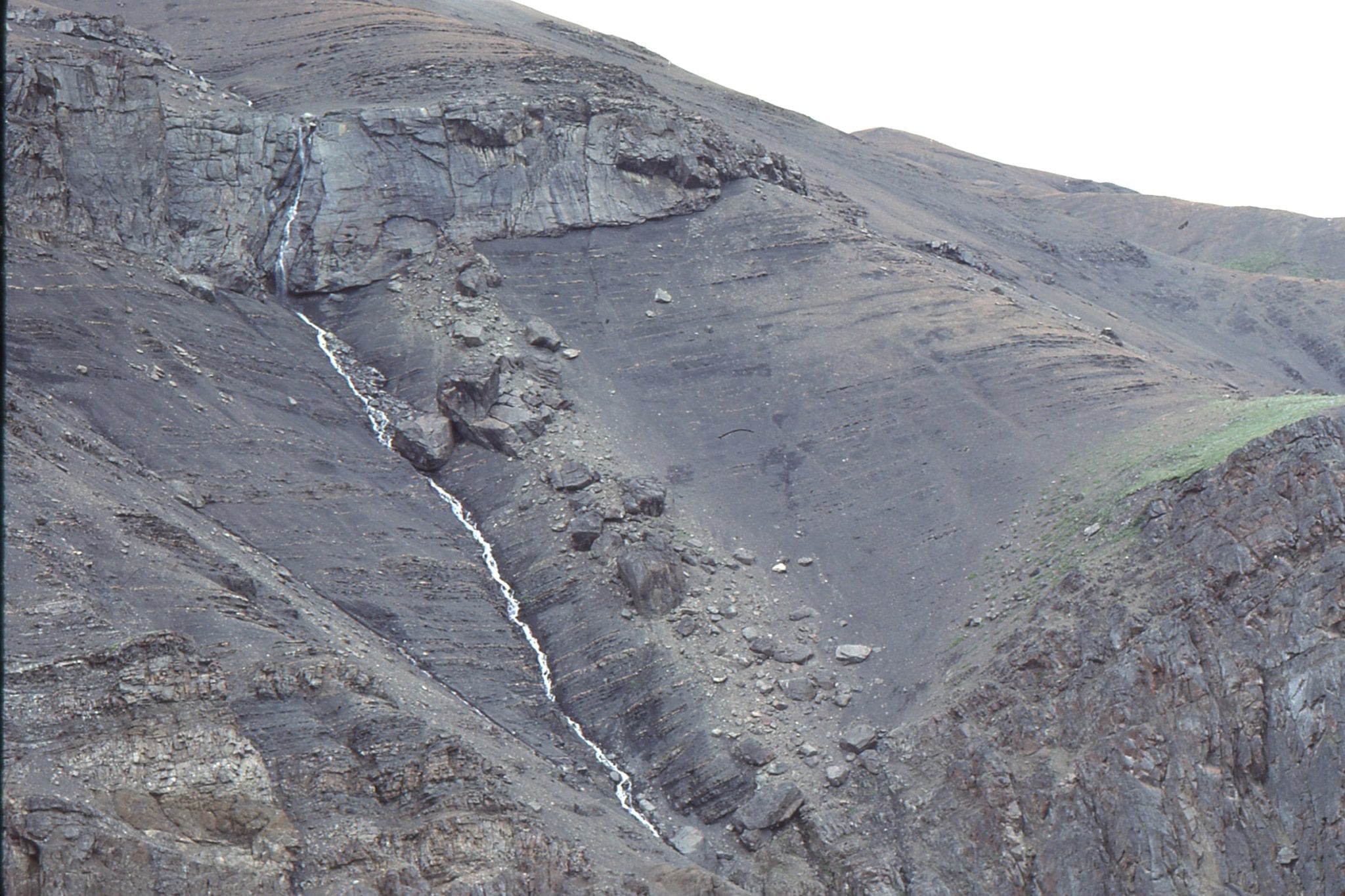
 This sandstone dyke terminates in, and probably breached shallow intertidal deposits. The surrounding layers have been dragged upwards during sand intrusion. Structures like this commonly form during earthquakes when soft sediment is liquefied. Fairweather Fm, Belcher Islands, about 2 billion years old.
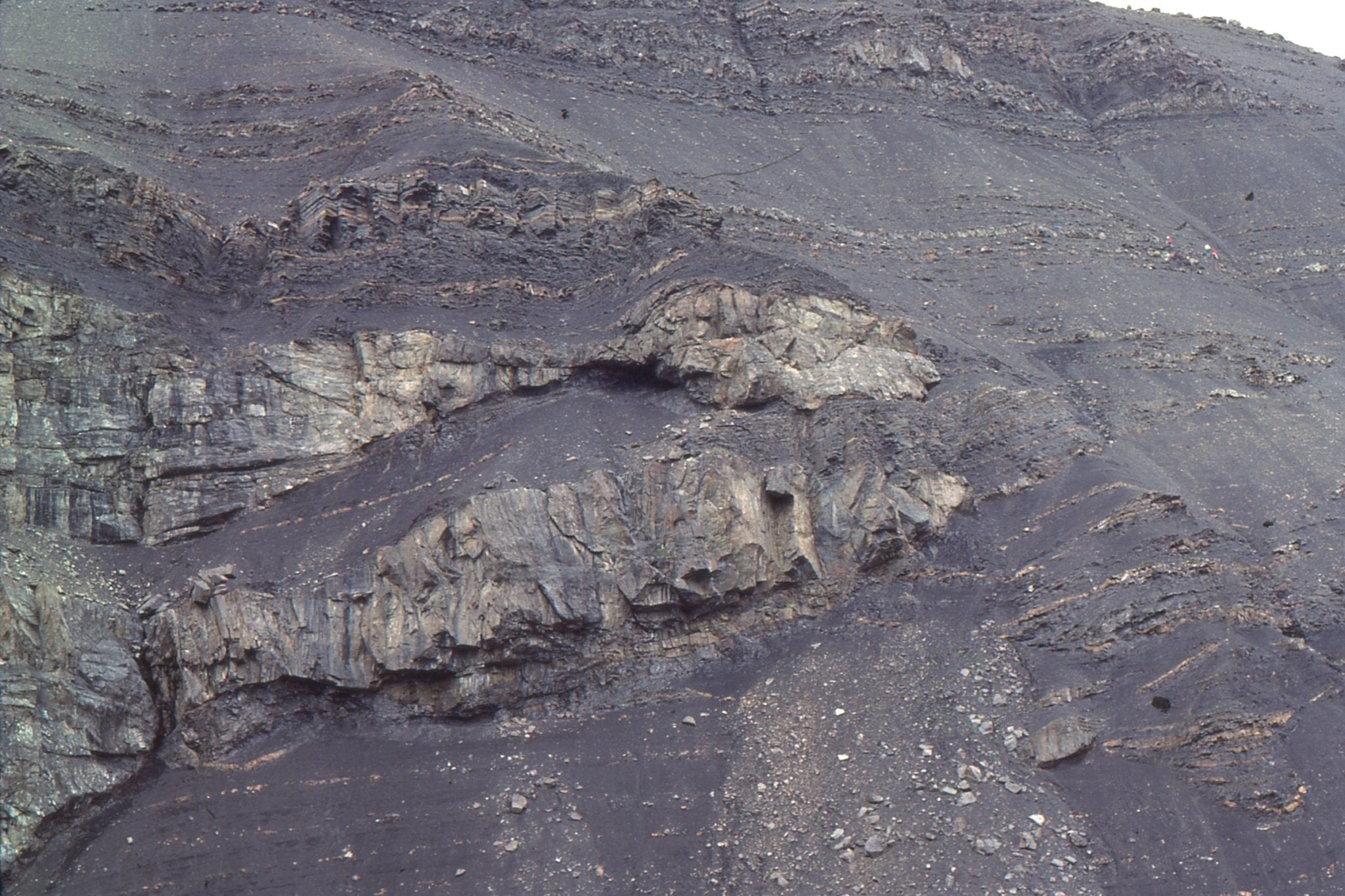
 Detached load casts in laminated, locally rippled volcaniclastics. Flaherty (volcanic) Fm, Belcher Islands, about 2 billion years old.
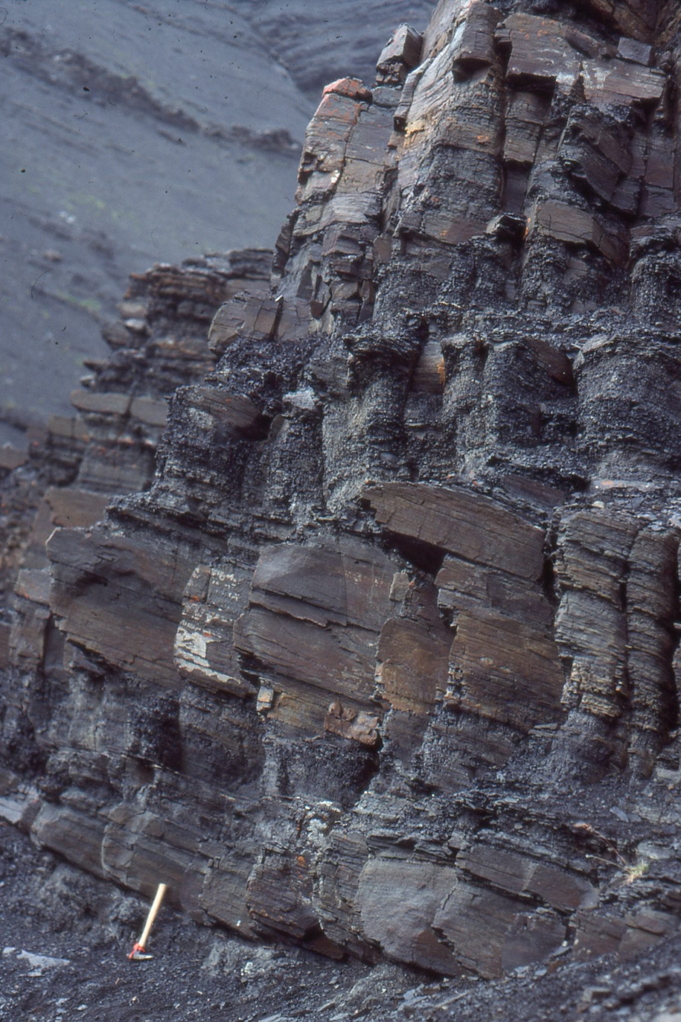
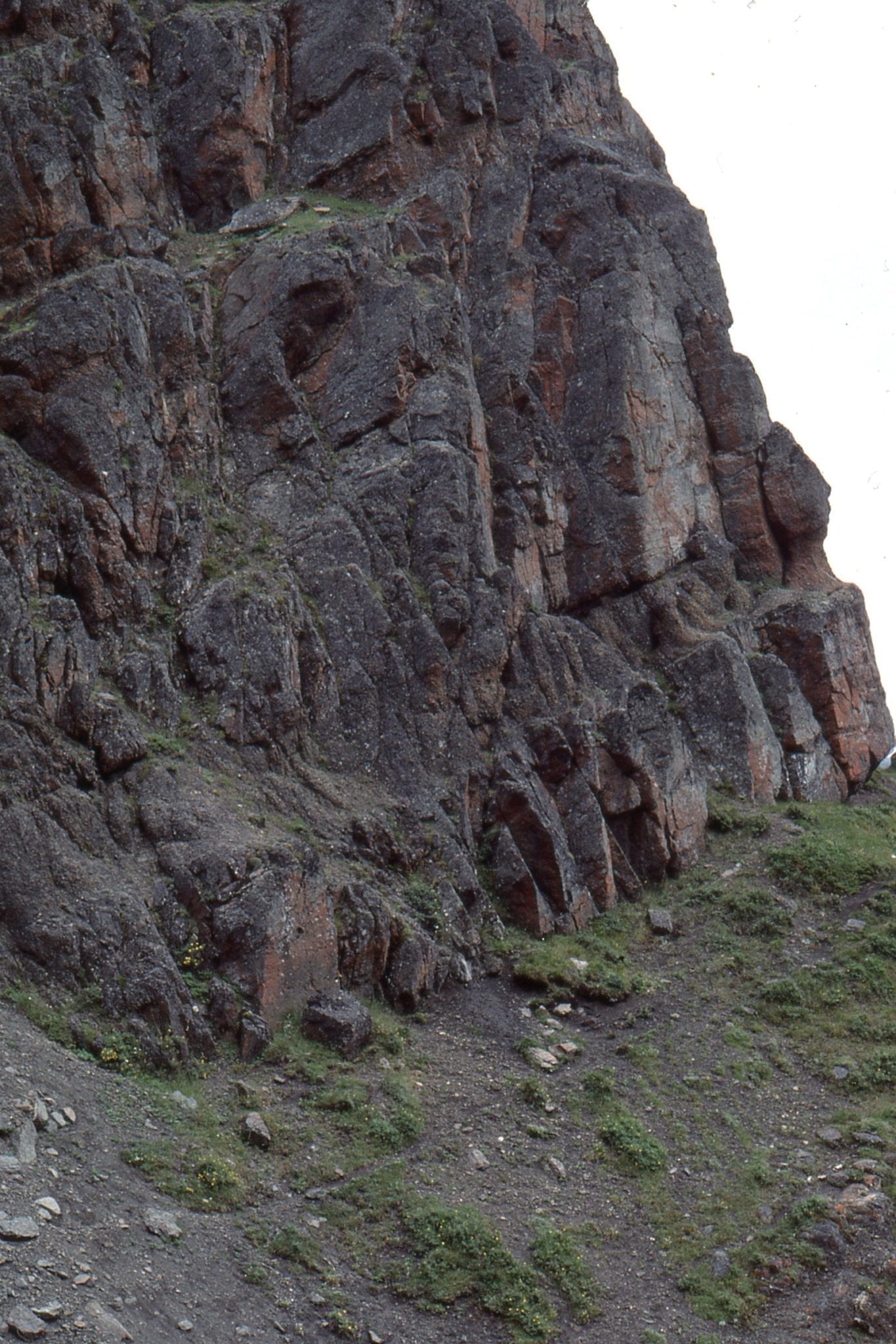
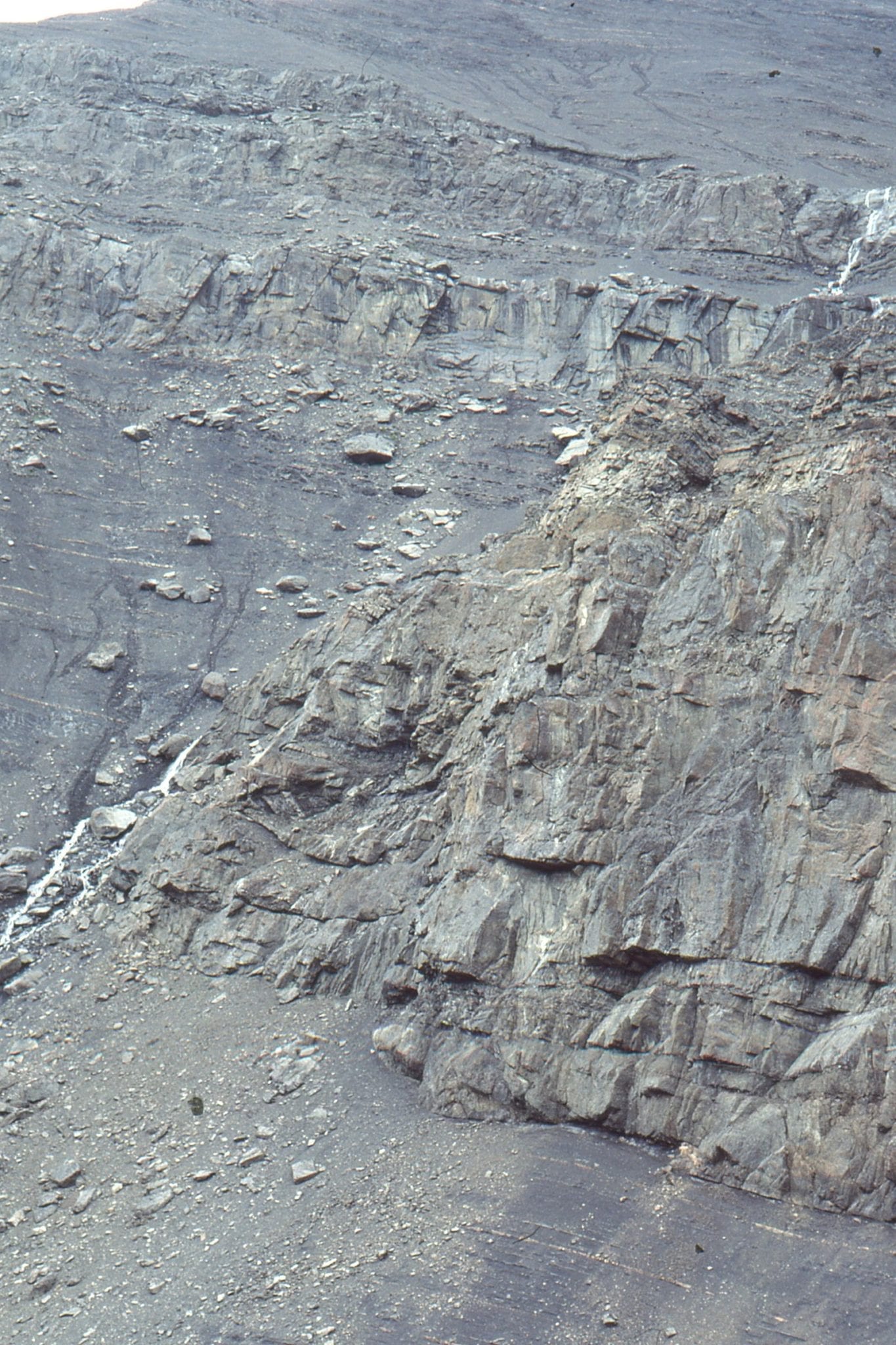
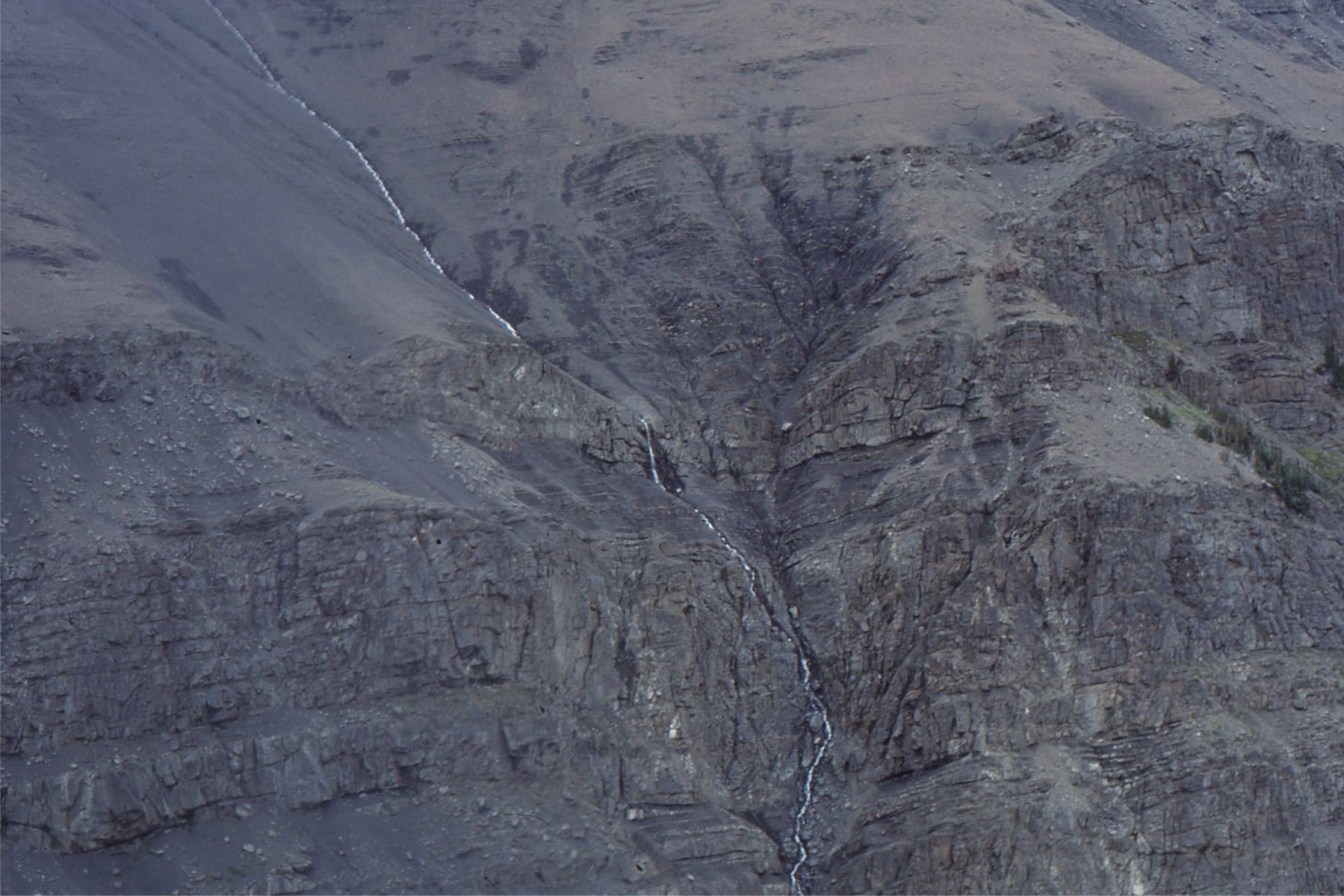
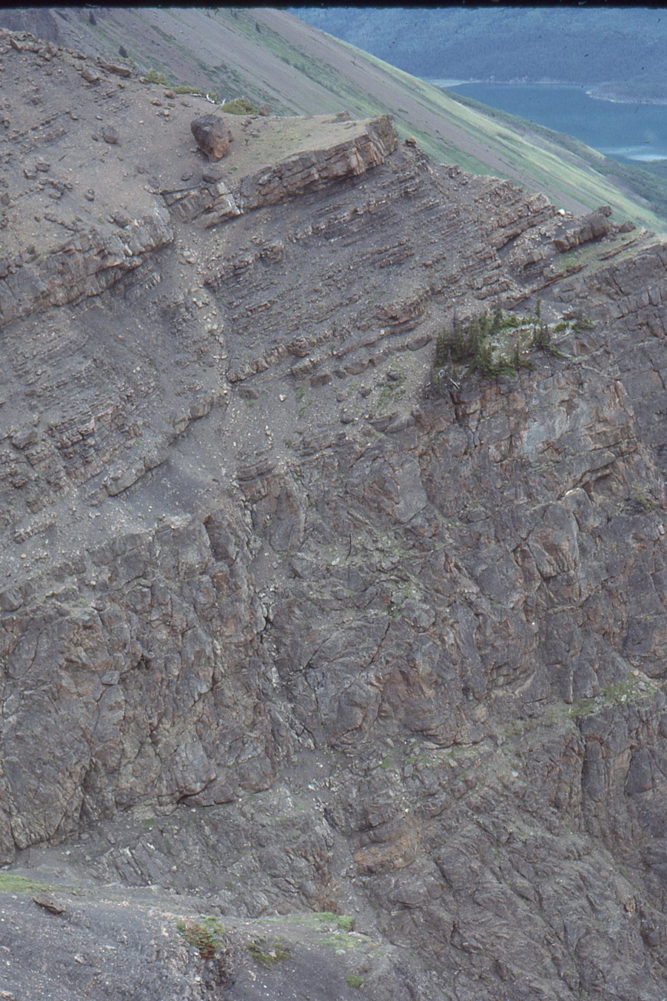
 A sandstone dyke that originated from deformed – slumped sandy turbidites; the dyke intrudes a slope mudstone-siltstone succession, and extends about 40m up the exposed face. Both the slumping and sandstone intrusion are thought to have formed during a seismic event. Upper Jurassic, Tsatia Mt, Bowser Basin.
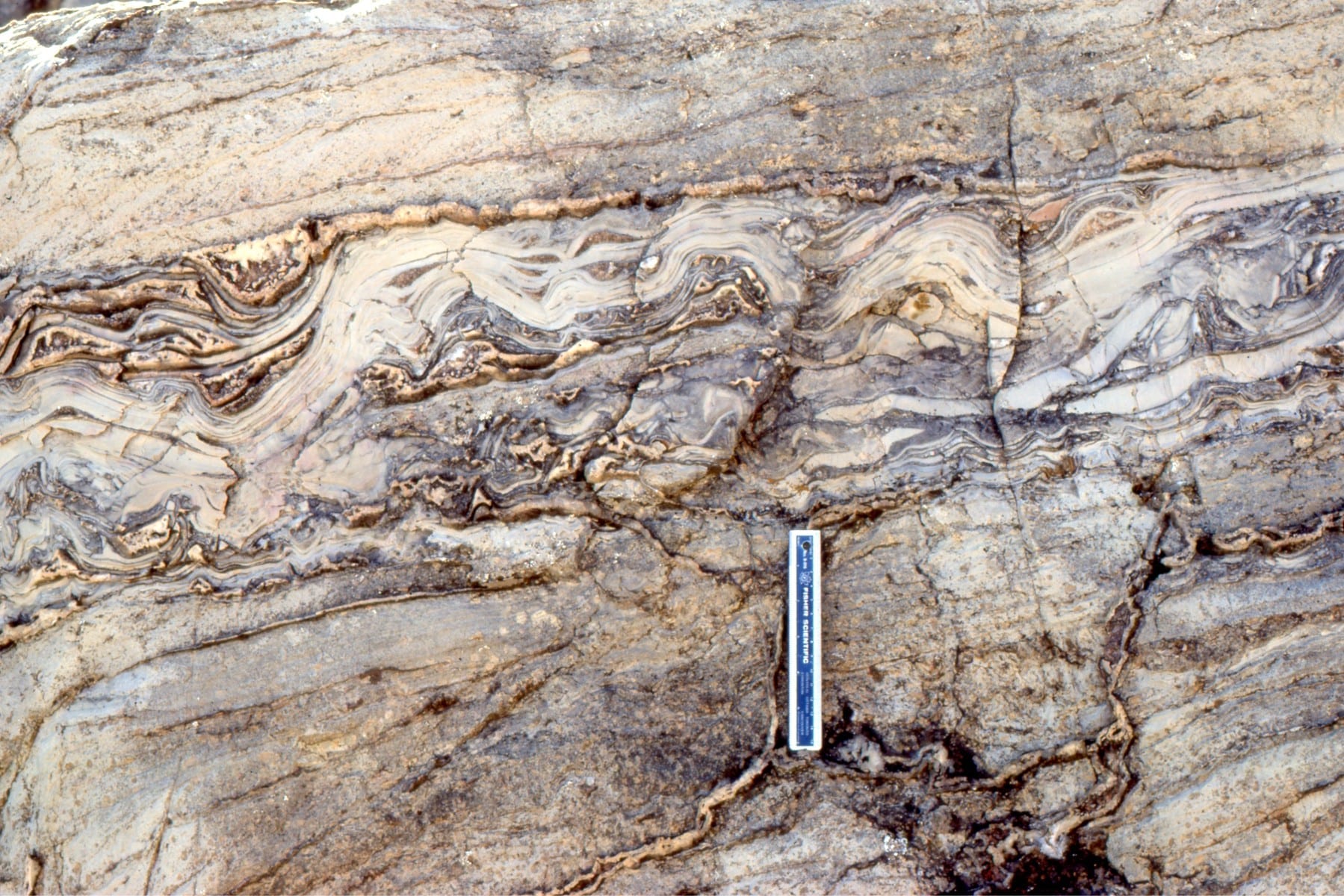
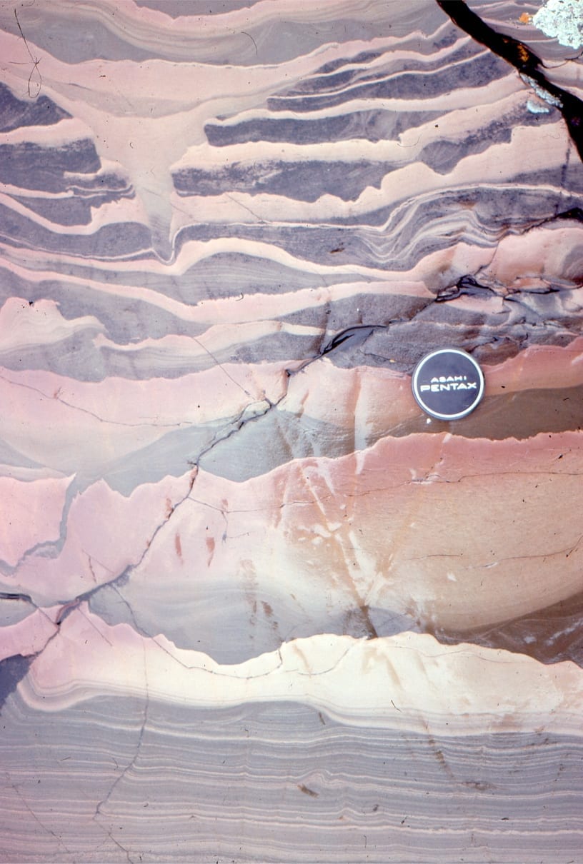
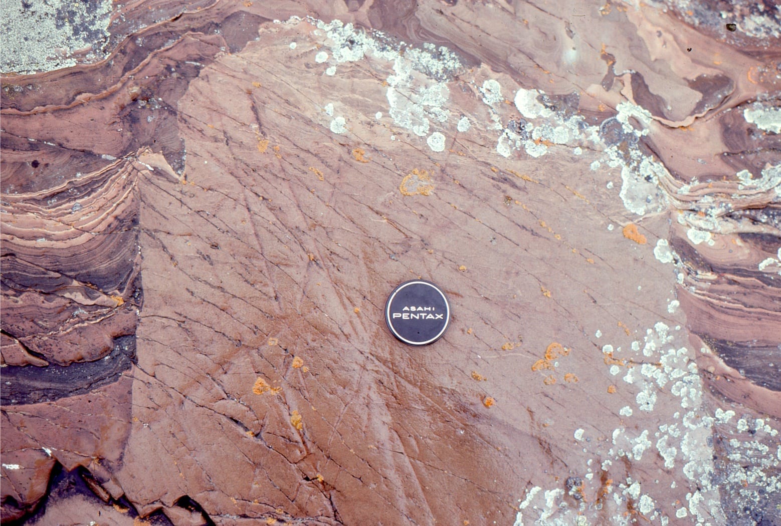
Dololutite beds deformed while in a plastic state, are interbedded with undeformed crossbedded (dolomitic) grainstone. These folds probably formed as packages of sediment were moved during karstification. Some layers have detached from one another, forming voids that were eventually filled by aragonite-fibrous calcite – subsequently converted to dolomite. Both images from the Rowatt Fm, Belcher Islands, about 2 billion years old.
 Detached folds in ice-contact glacial outwash. Elevated pore pressures and deformation were probably caused by ice loading. Late Pleistocene, Ottawa.
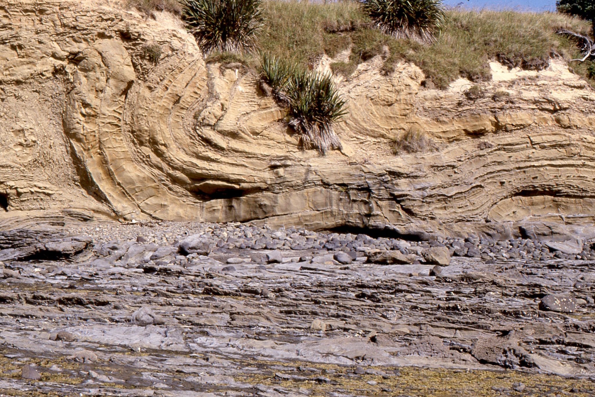
Classic folded, faulted, and detached turbidite beds, caused by sliding, slumping, syn-depositional faulting, and some liquefaction. Left; Lower Miocene Waitemata Basin, Army Bay, Right: Lower Miocene Waitemata Basin Manly Beach, Auckland.
Classic folded, faulted, and detached turbidite beds, caused by sliding, slumping, synsedimentary faulting, and local liquefaction. Left; Lower Miocene Waitemata Basin, Takapuna Beach , Auckland. Right: highway roadcut, Albany, Auckland.
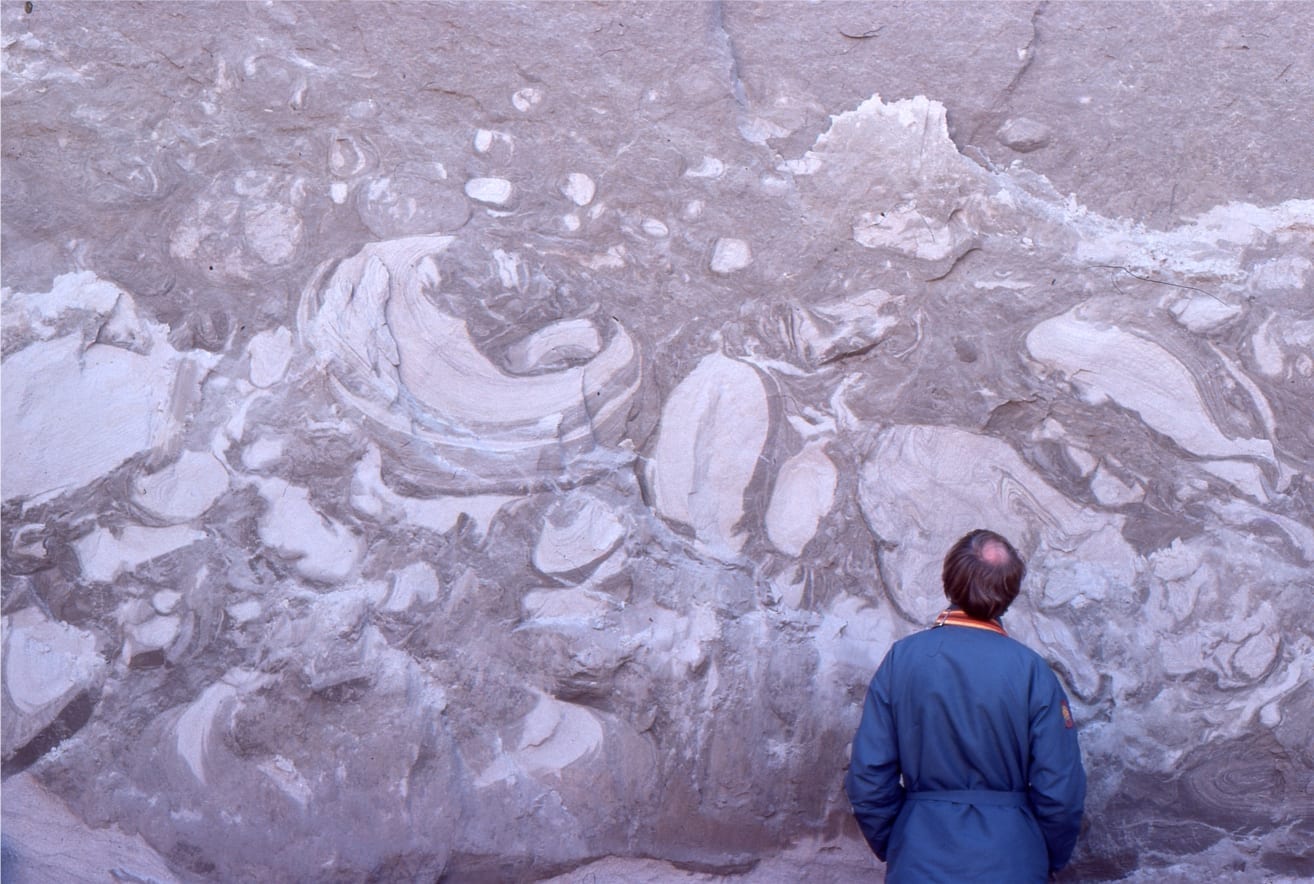
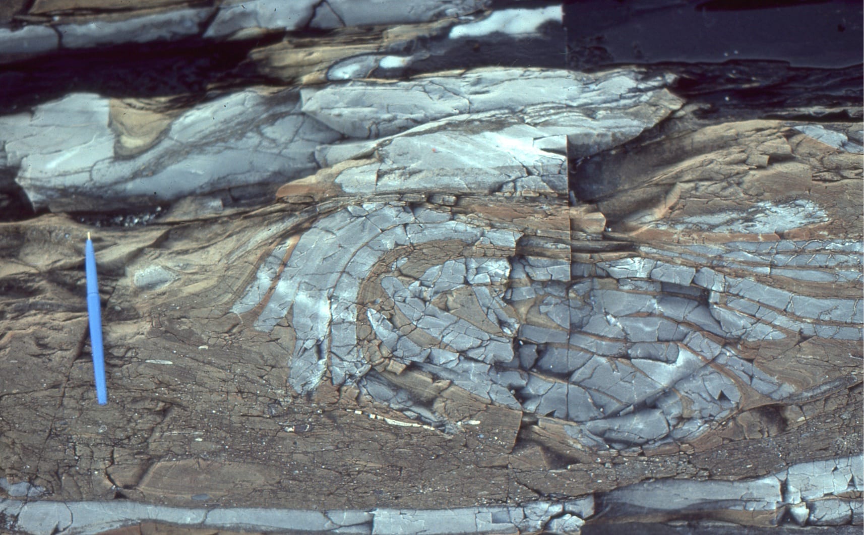
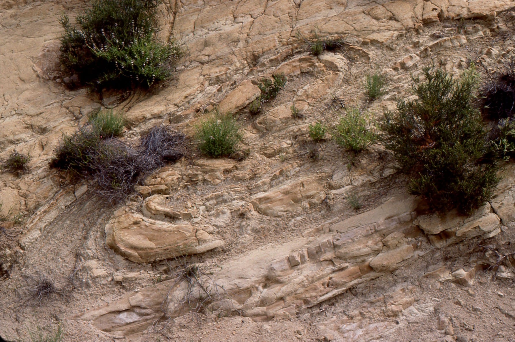
 Small, detached slump fold carried along the base of a turbidity current. Lower Miocene Waitemata Basin, Cockle Bay, Auckland
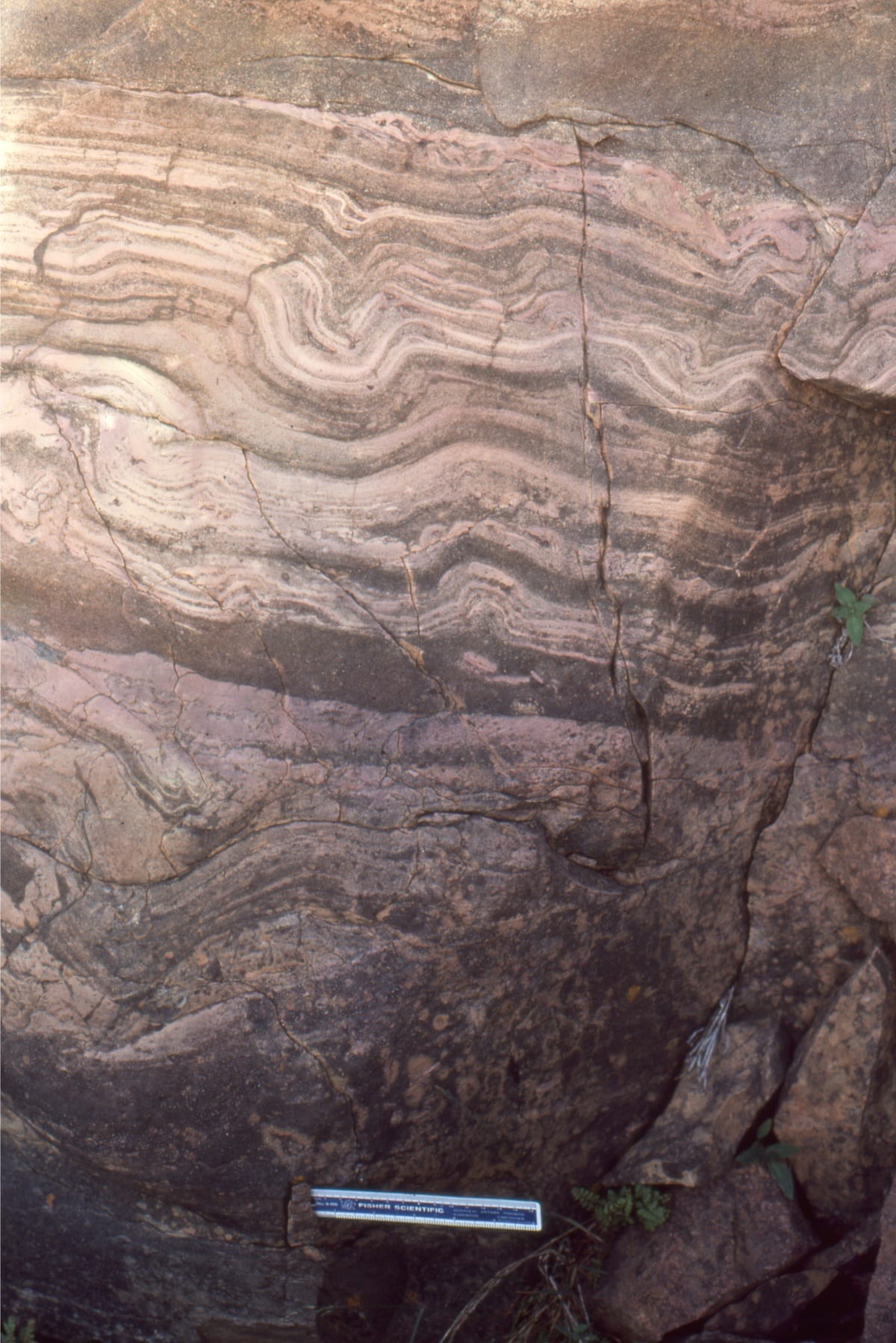
 Detached slump folded dololutite-calcilutite. These thin carbonate beds were deposited on a Proterozoic slope (Costello Fm. Belcher Islands), outboard of really large, platform stromatolite reefs.
 Folded, and possibly thrust faulted turbidites, above which are undisturbed beds. Lower Miocene Waitemata Basin, Pukenihinihi Point, north Auckland.

Slump folds in Late Miocene Castaic Fm, Ridge Basin turbidites, probably initiated by seismic events on the bounding San Gabriel strike-slip fault, that was an offshoot of the evolving San Andreas transform system. Left: a fold pair. Right: folding, pull-apart, and small accommodation faults.
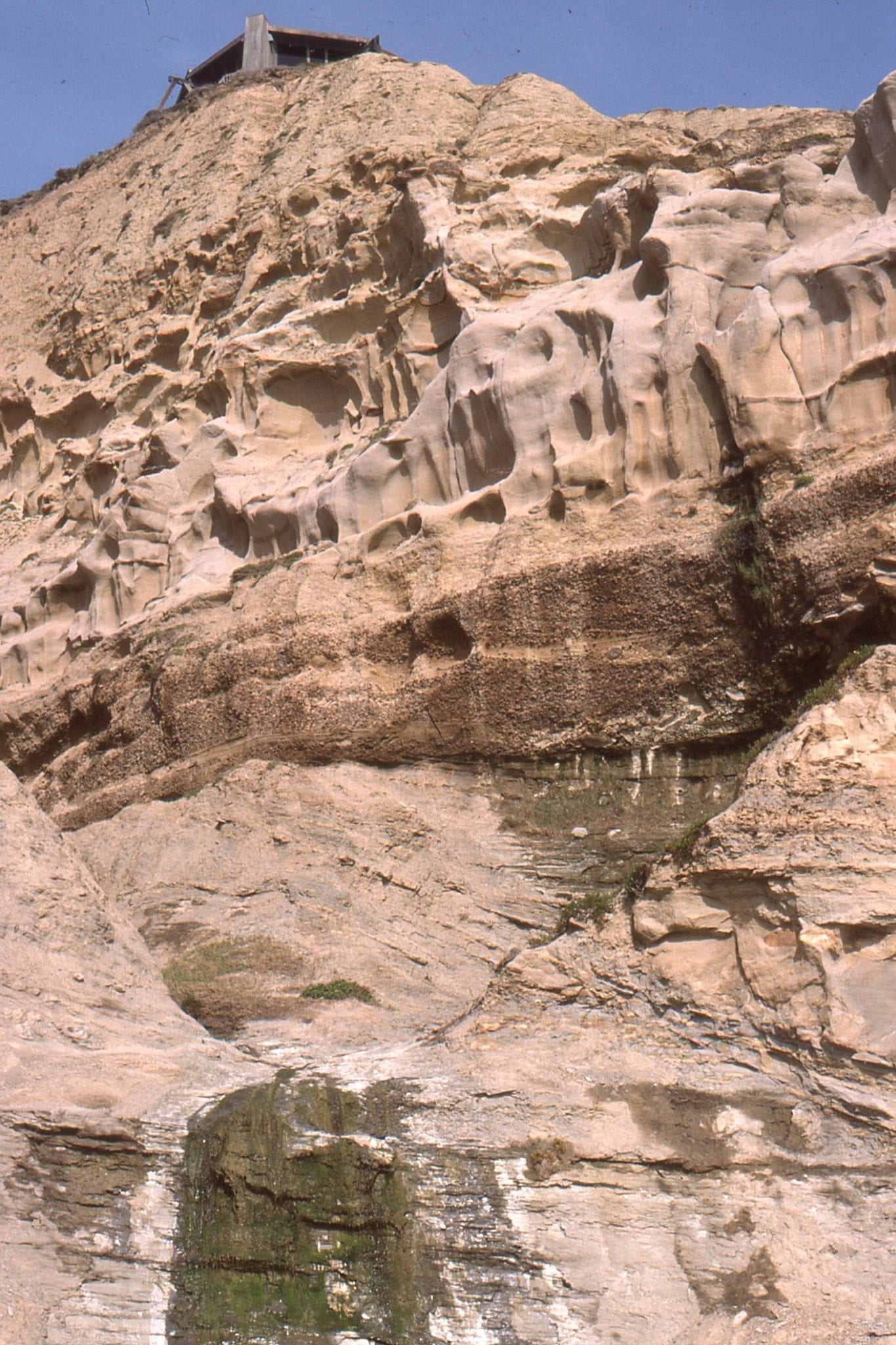
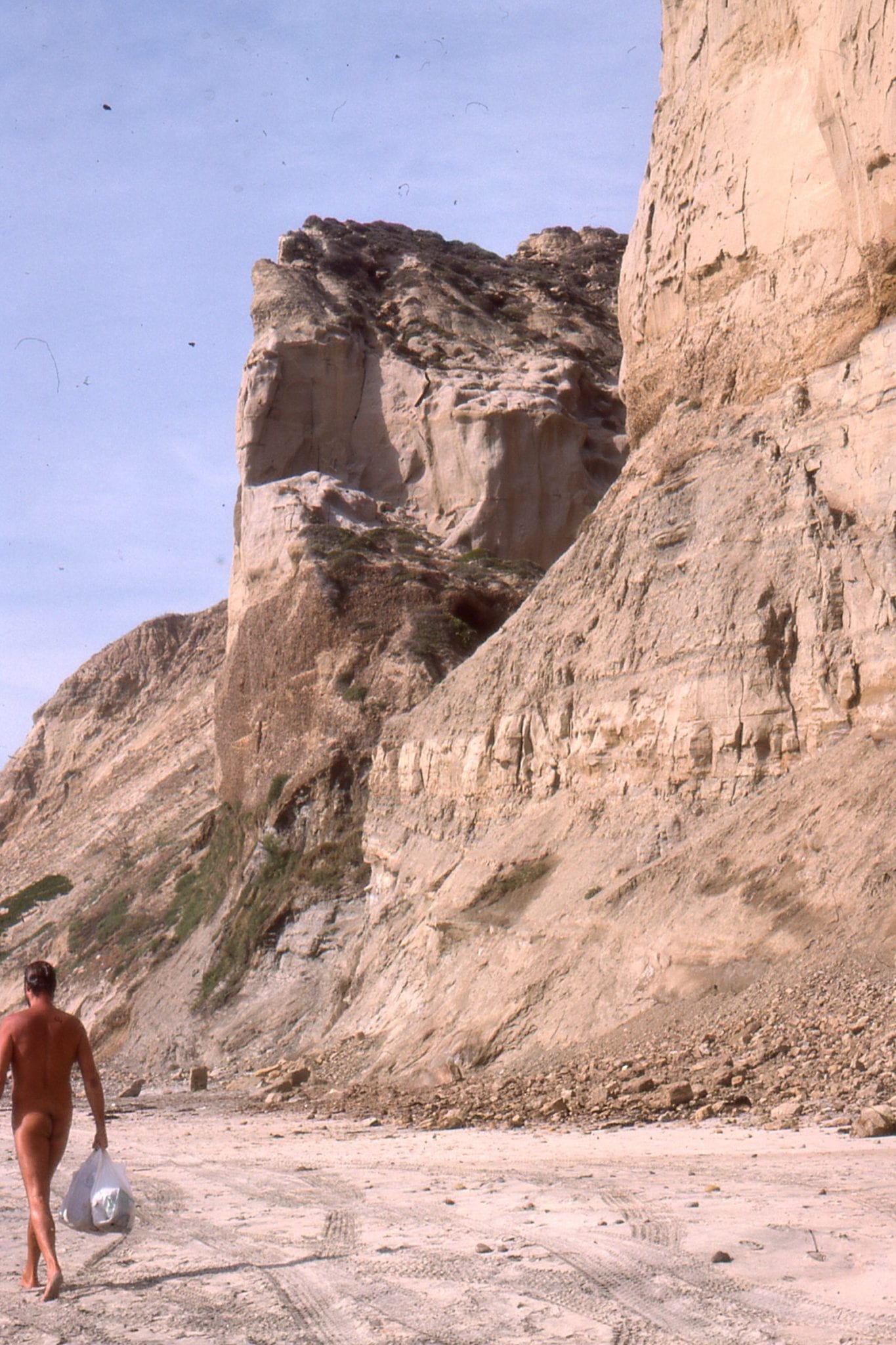
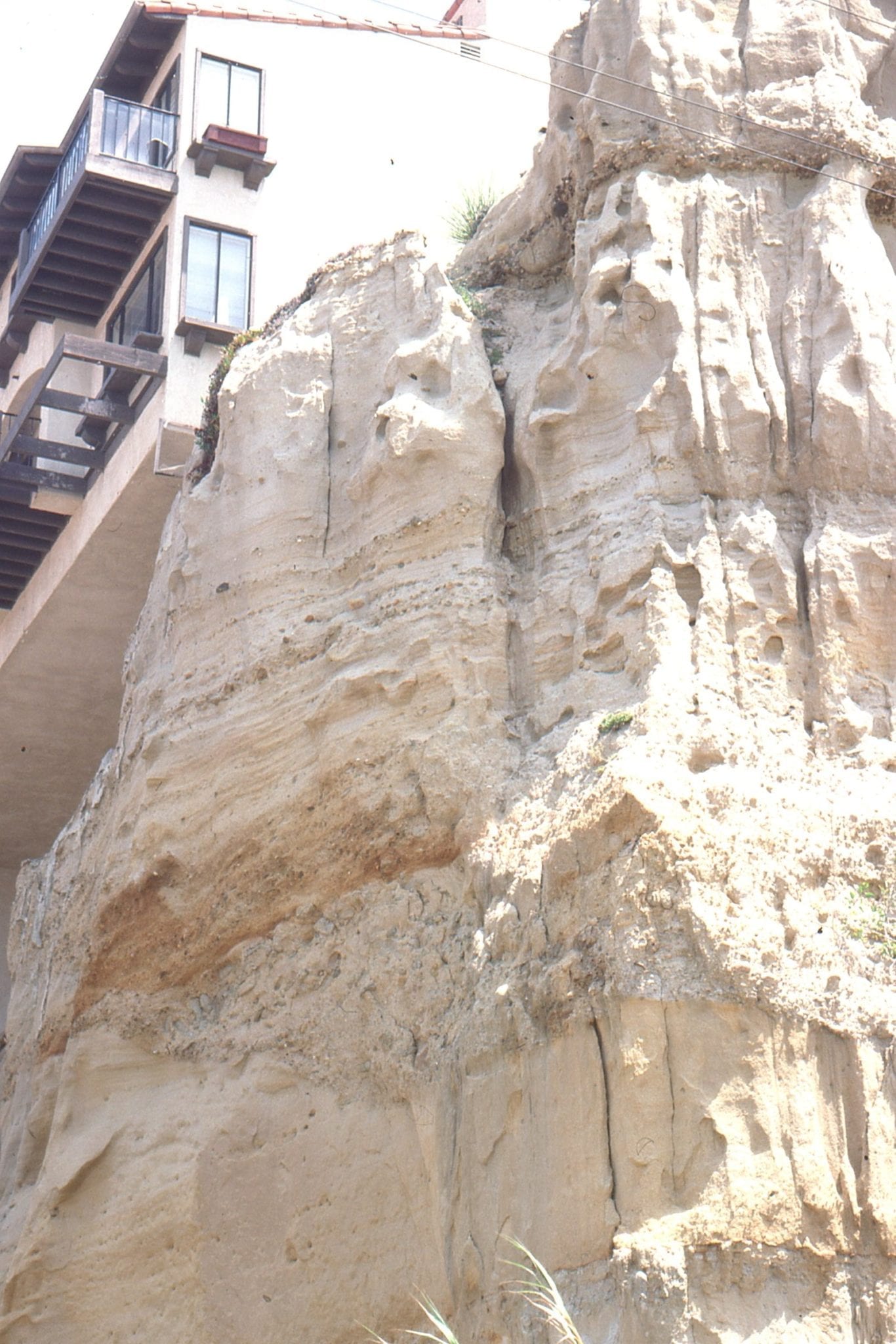
 Folding and intrusion of liquefied sand in the Rosario Group, San Diego
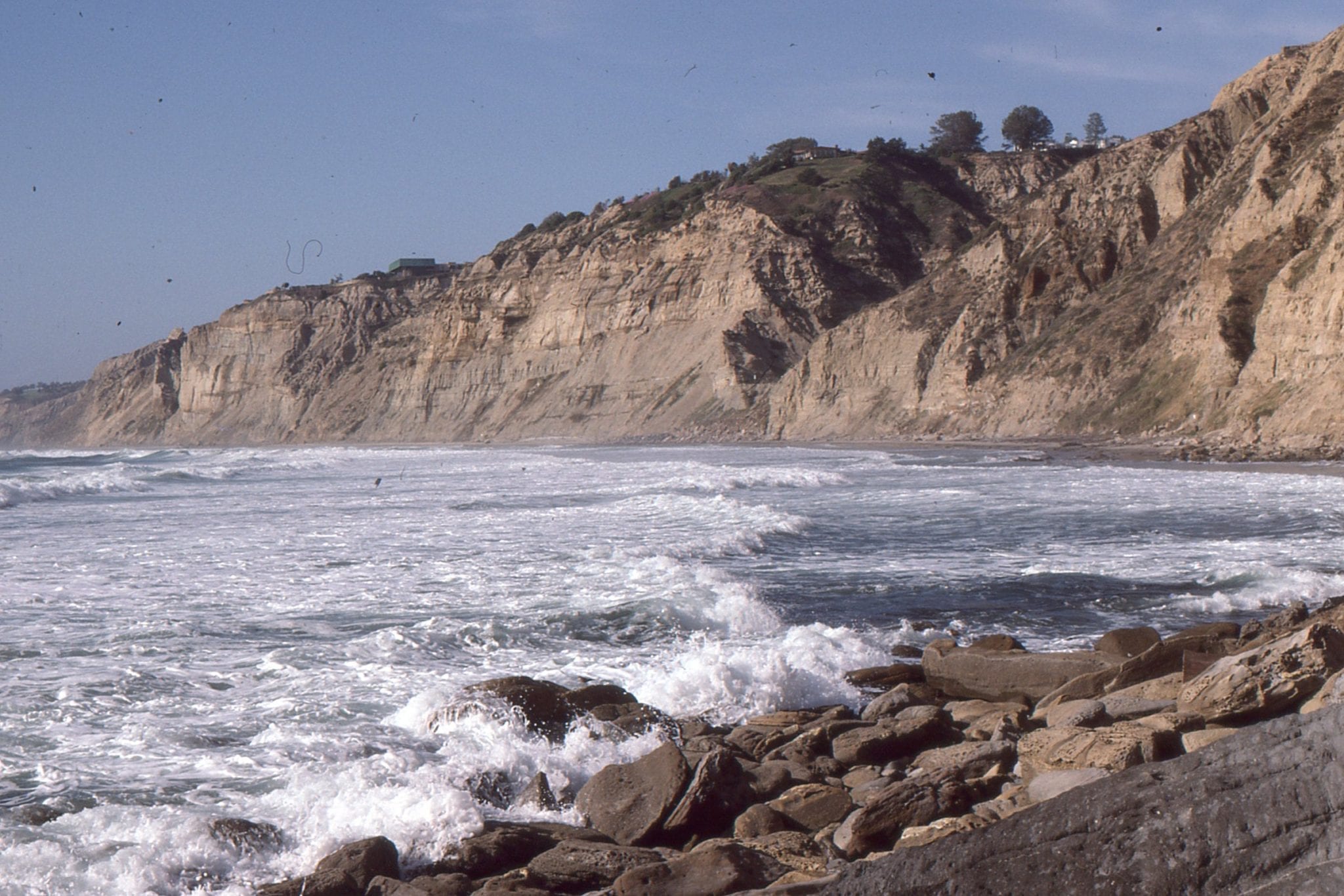
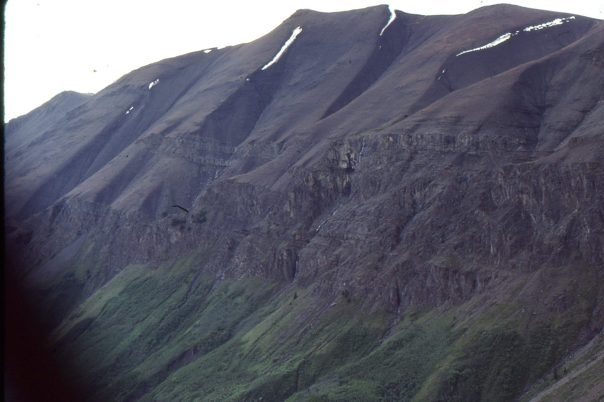
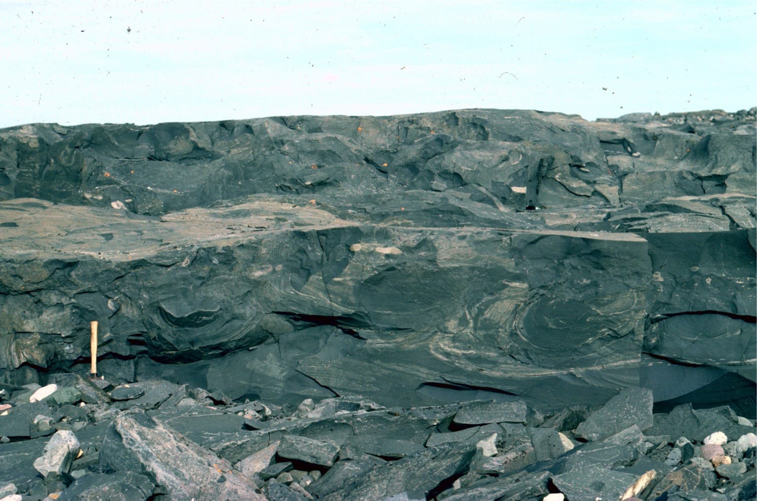
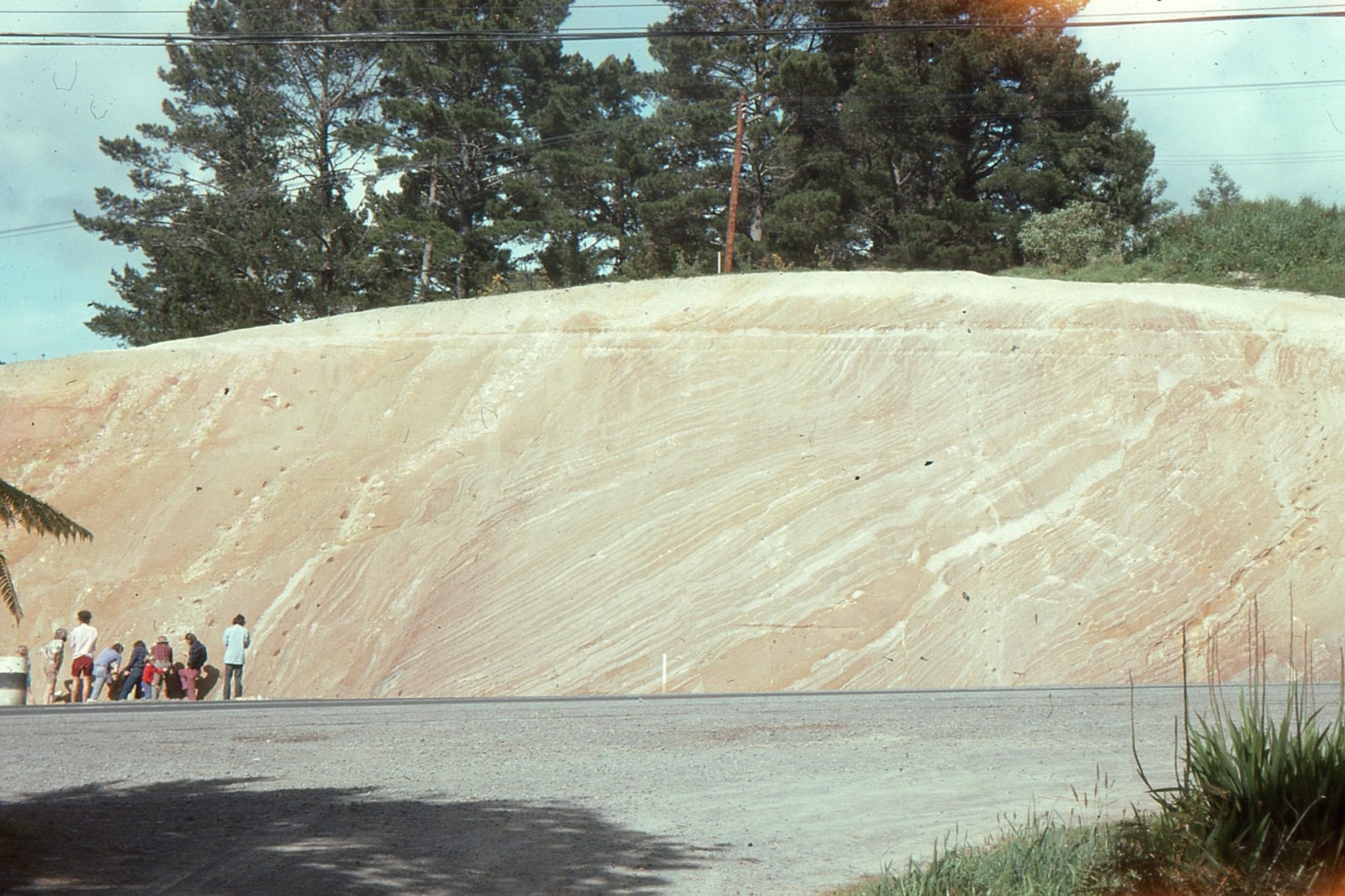
 Large recumbent slump fold in a Late Miocene basin floor submarine fan, Mt. Messenger Formation, North Taranaki, New Zealand.
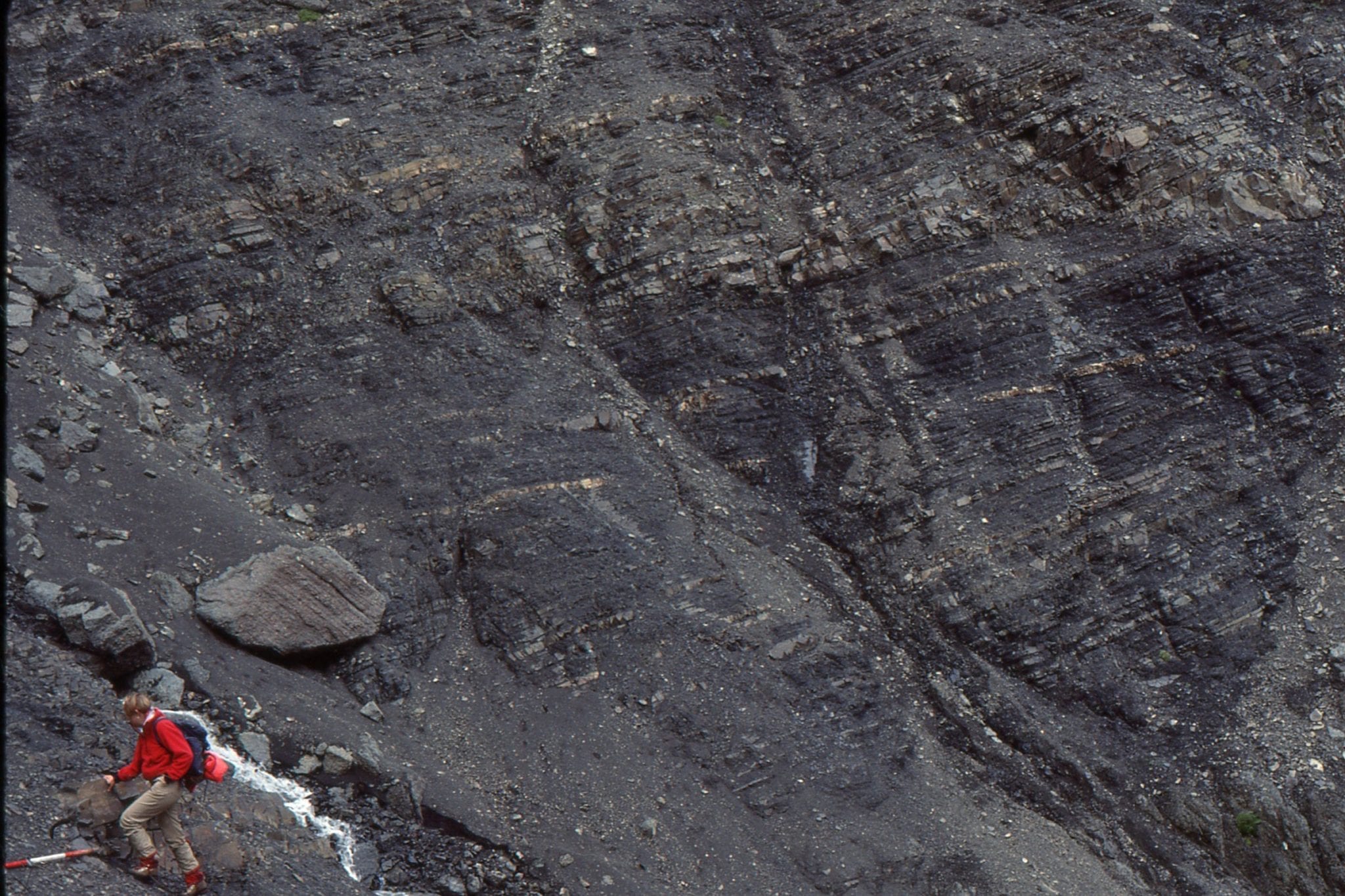
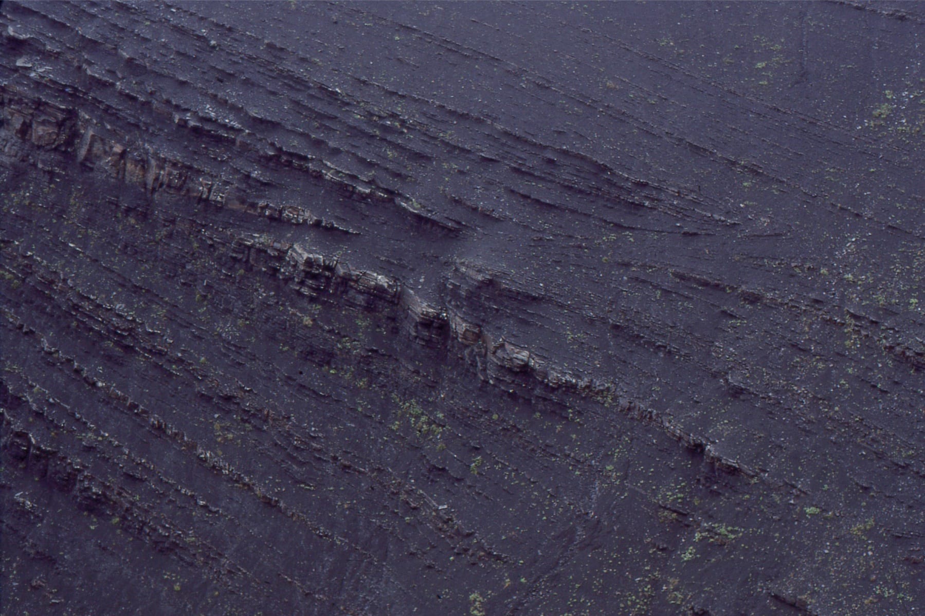
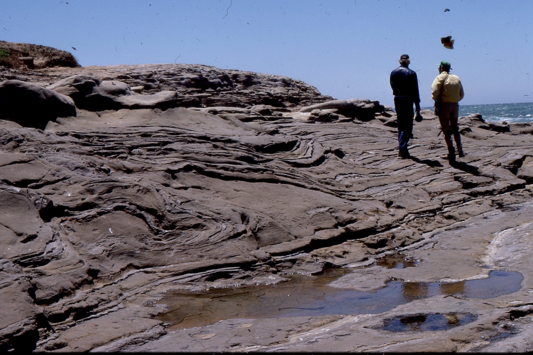
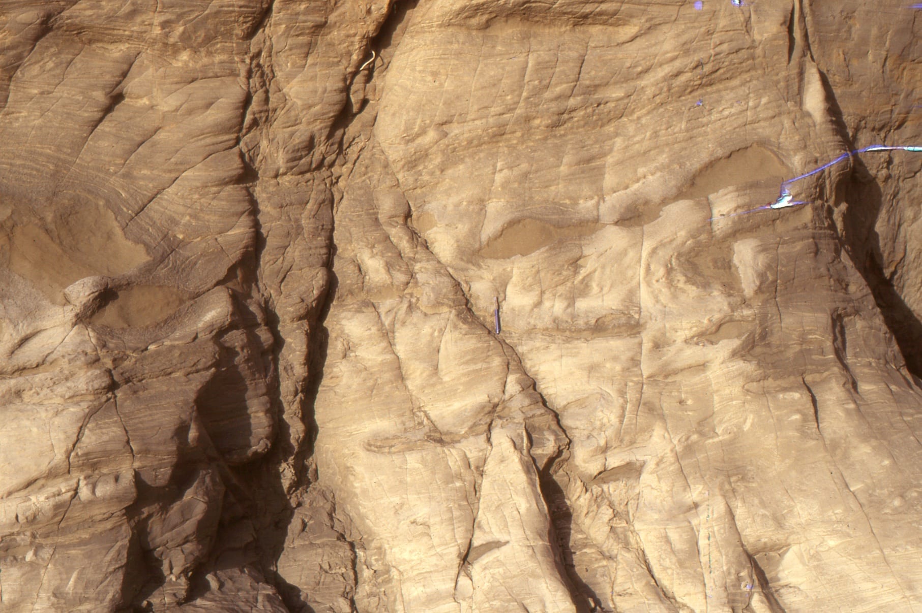
Seriously deformed and detached slumps, boudinage, and slides in Late Miocene, basin floor submarine fan, Mt. Messenger Formation, North Taranaki, New Zealand. Strata below the detachment are not deformed.
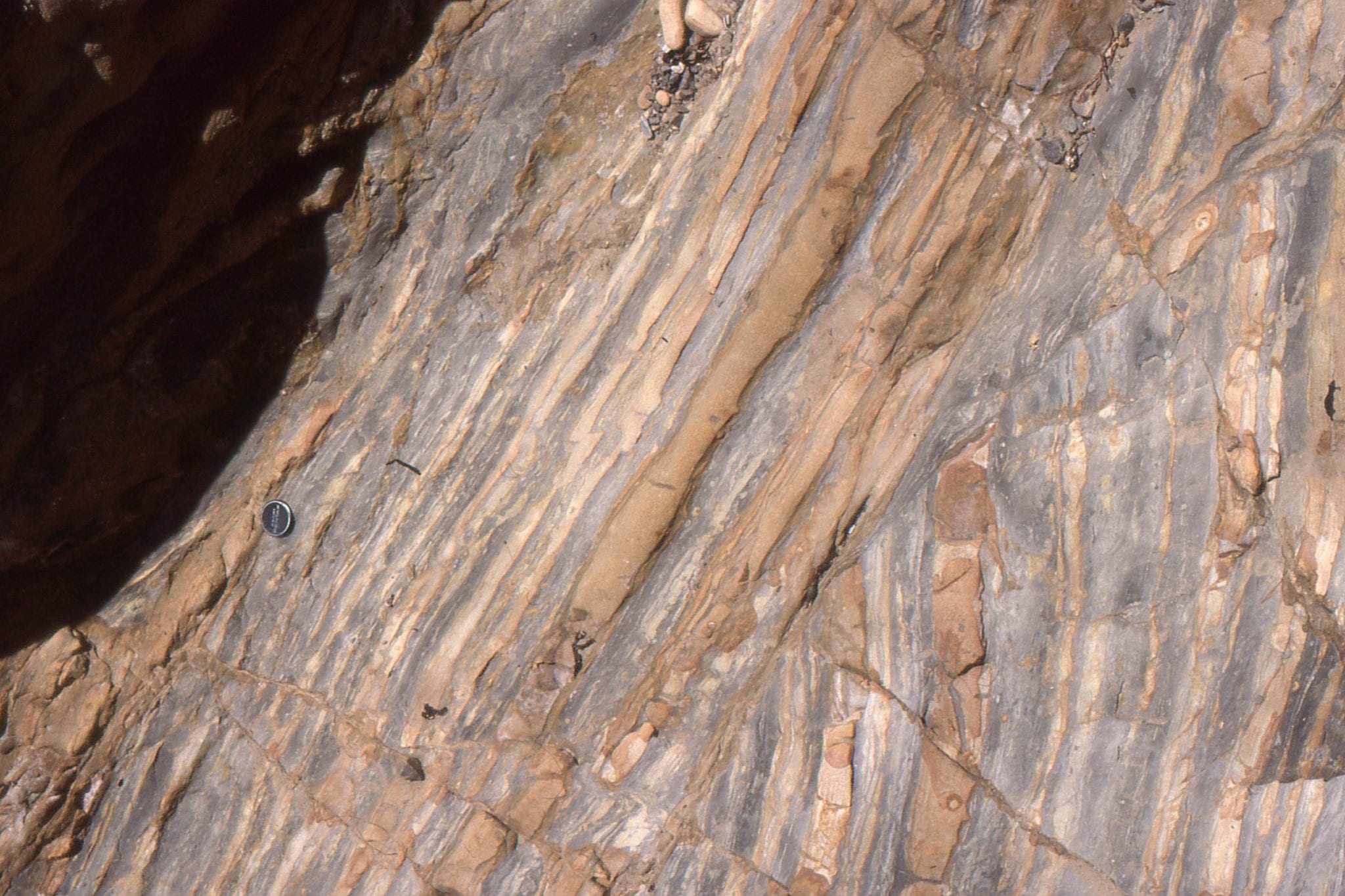
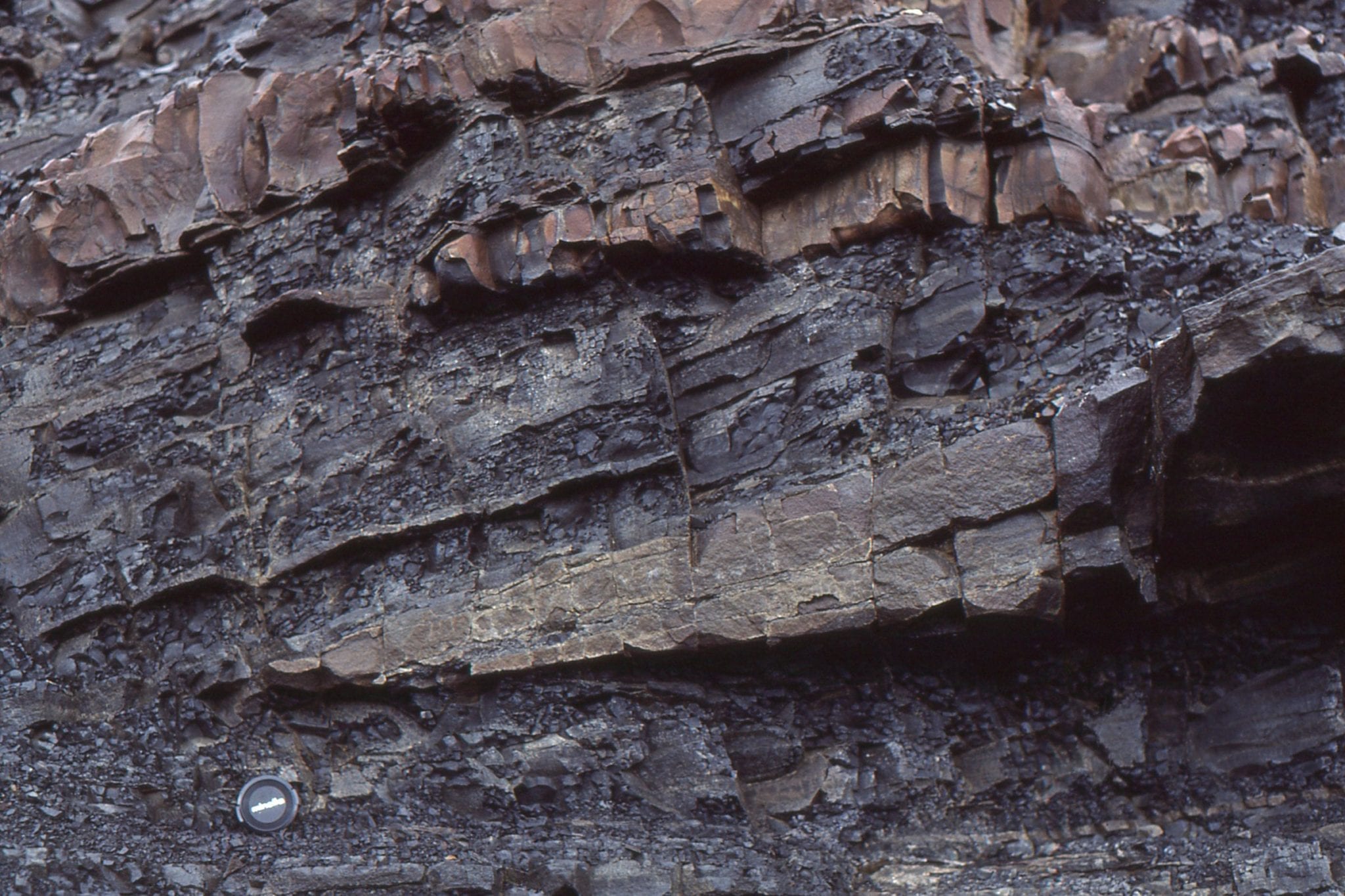
 Detail of deformation associated with slumping – here, boudinage and tight recumbent folds in dark brown sandstone layers. Late Miocene, basin floor submarine fan, Mt. Messenger Formation, North Taranaki, New Zealand.
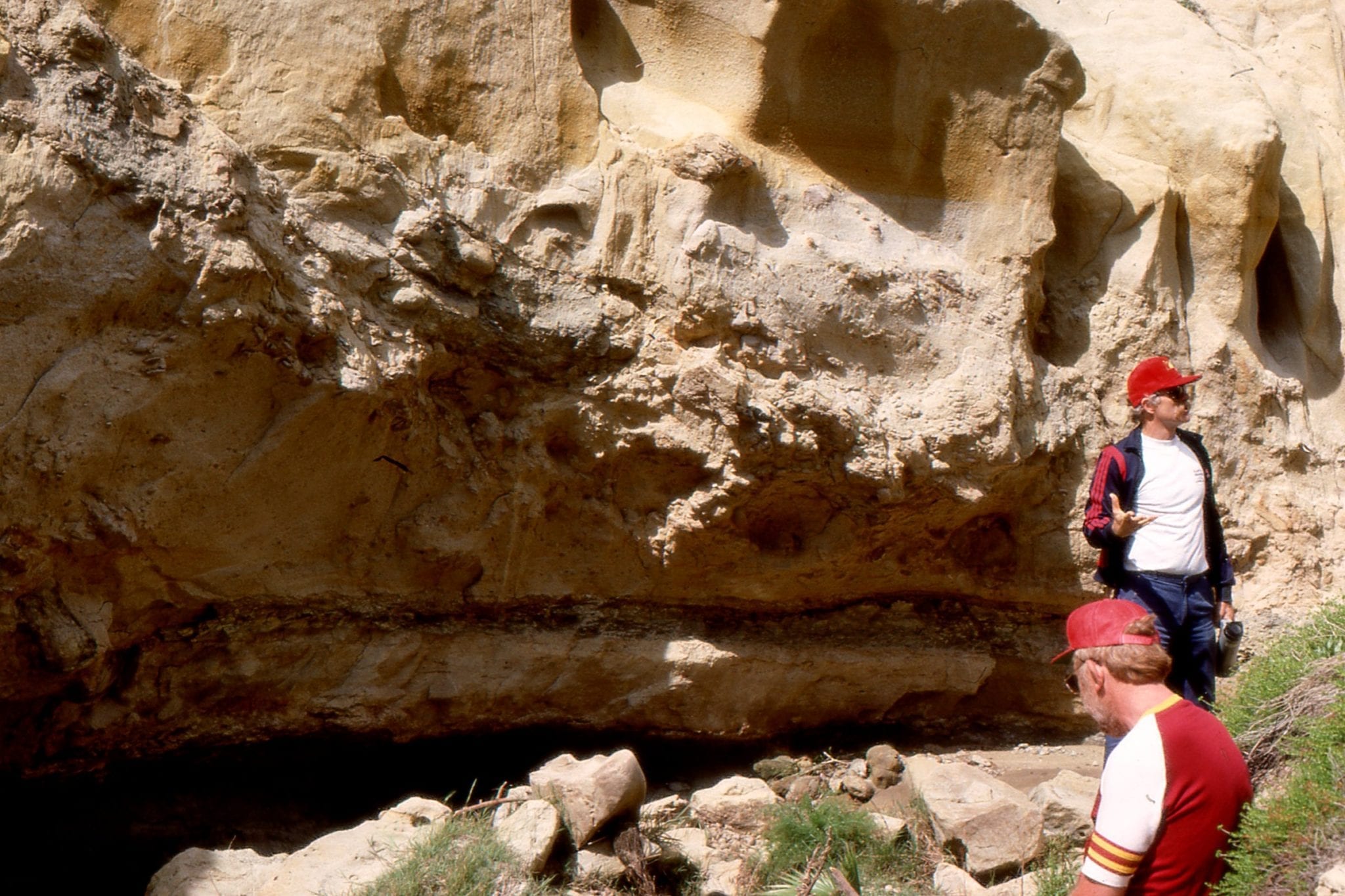
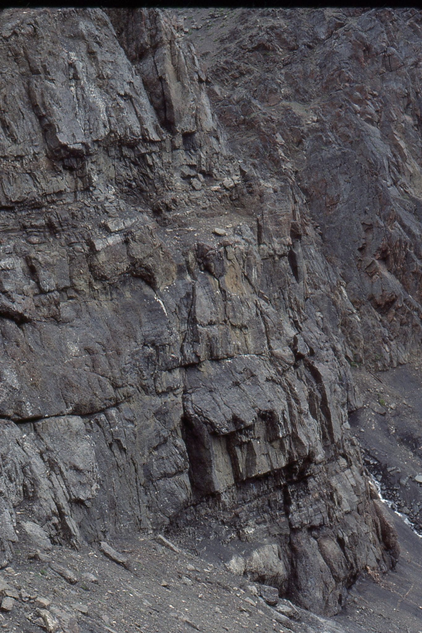
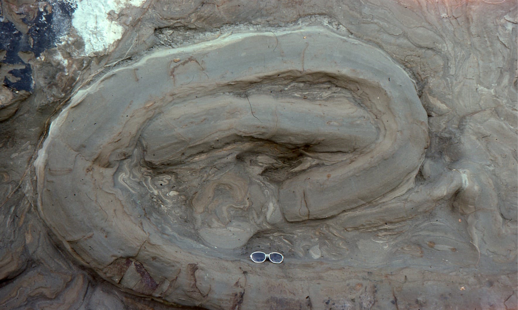
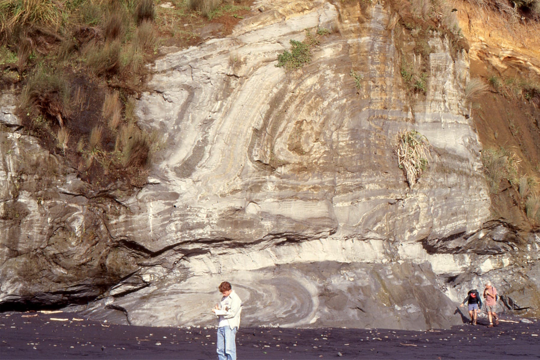
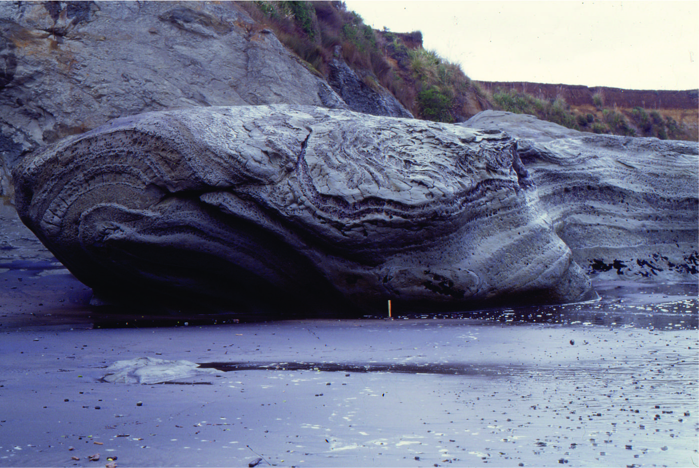 The iconic ‘Jam Roll’ slump in Late Miocene, basin floor submarine fan, Mt. Messenger Formation, North Taranaki, New Zealand. Folded sandstone-mudstone almost completely encloses the structure.
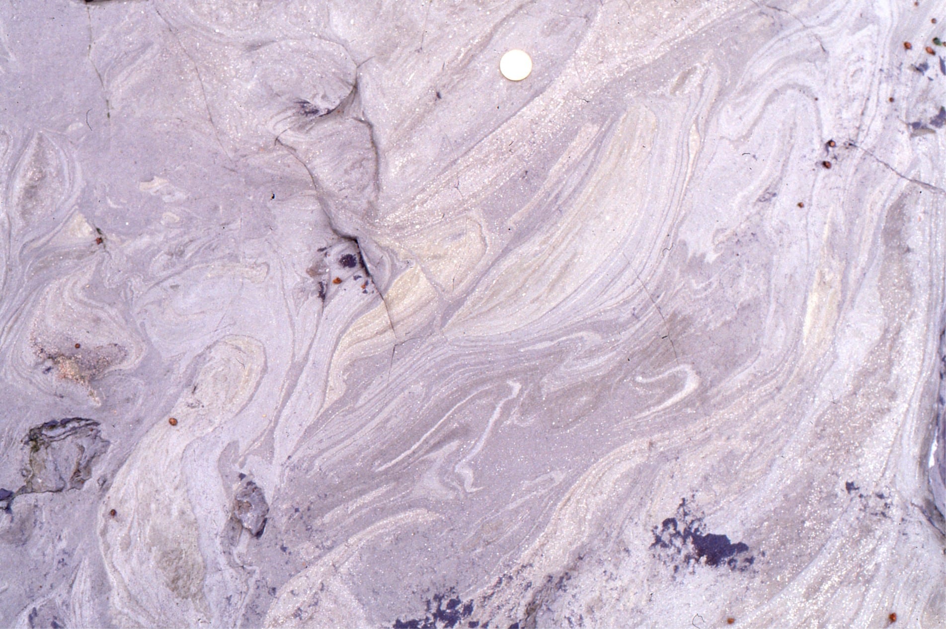
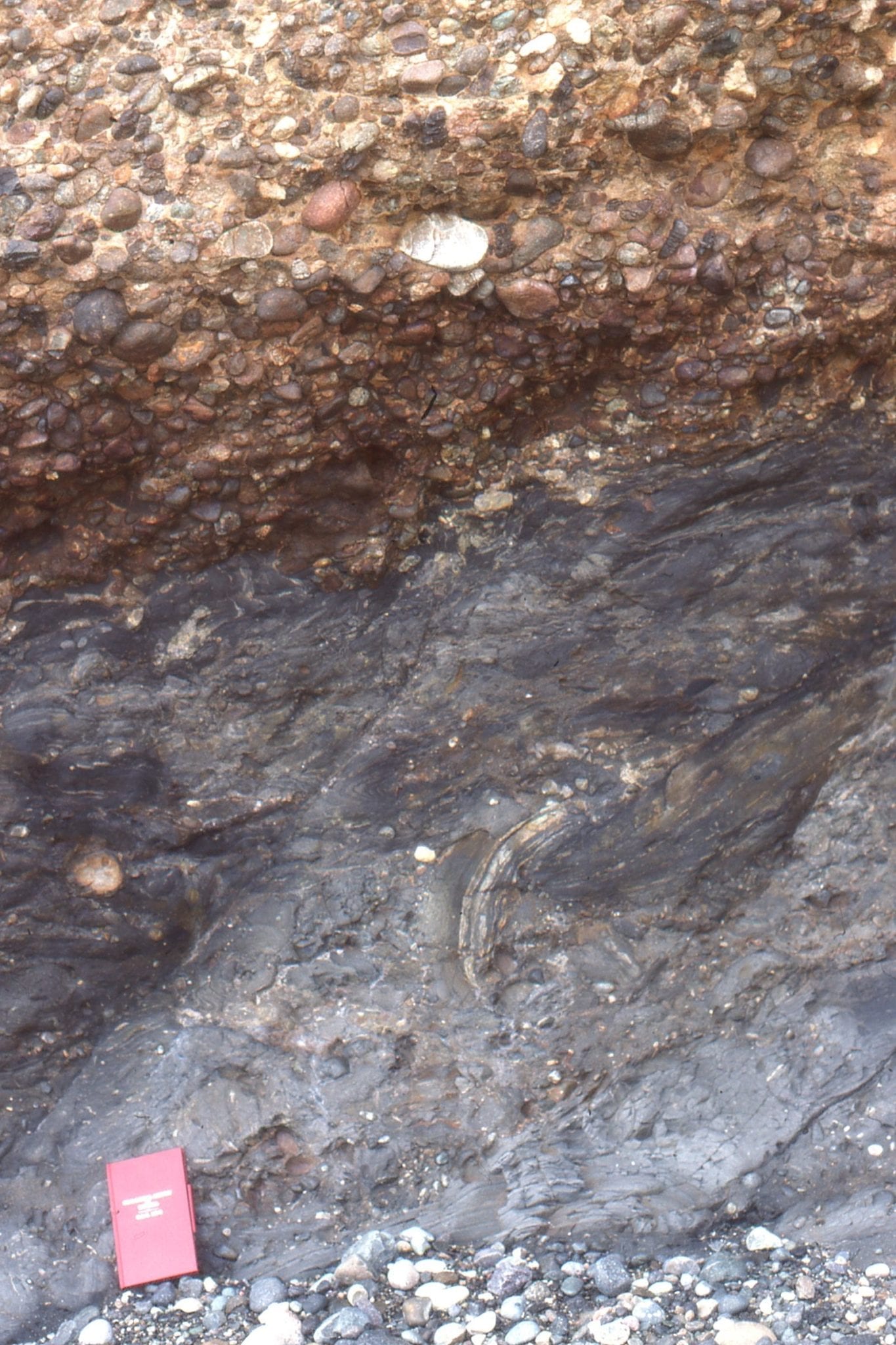
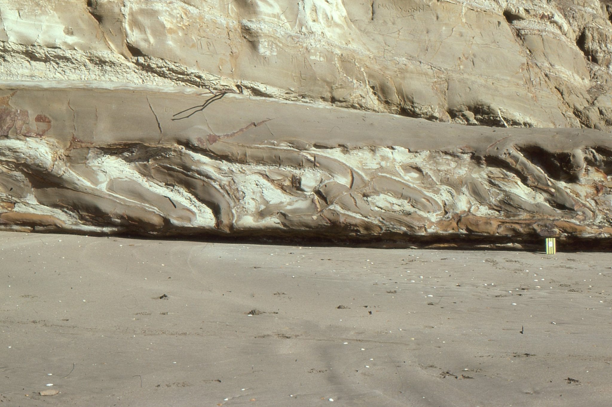
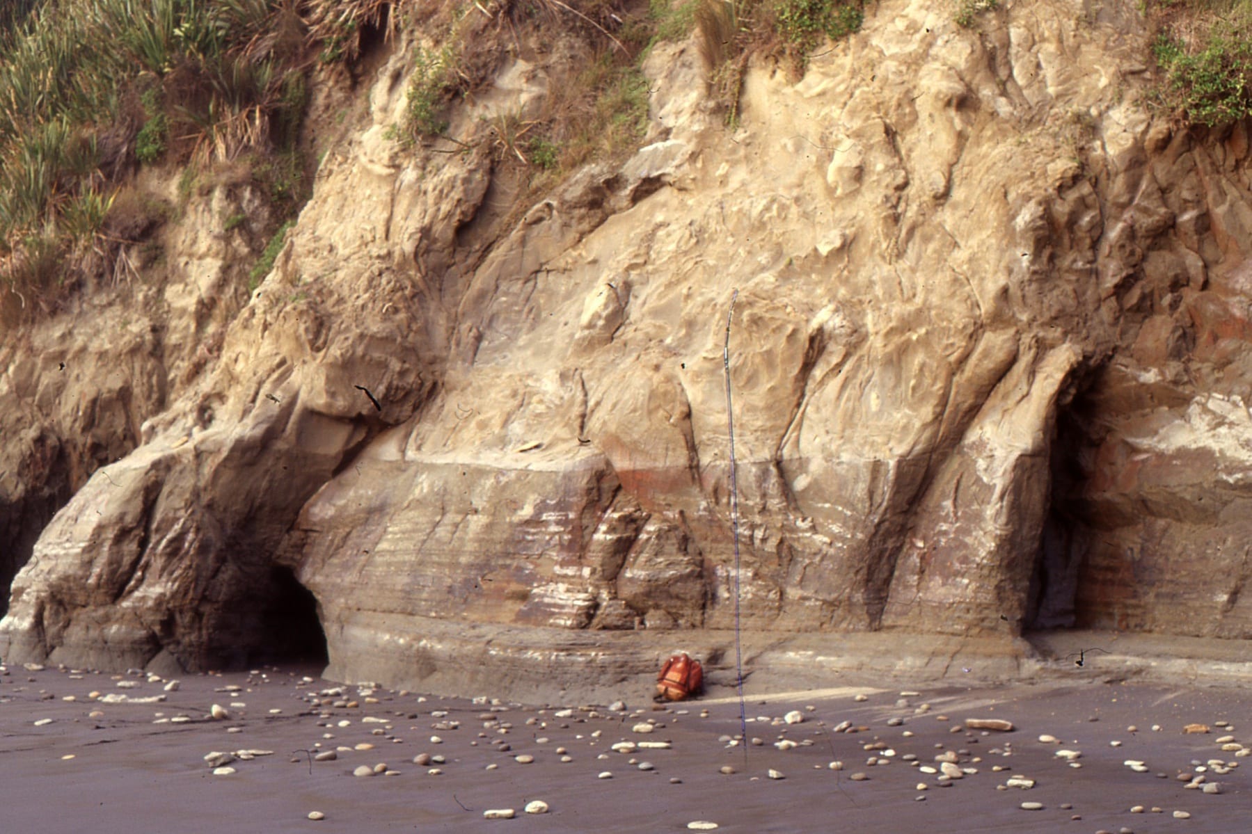
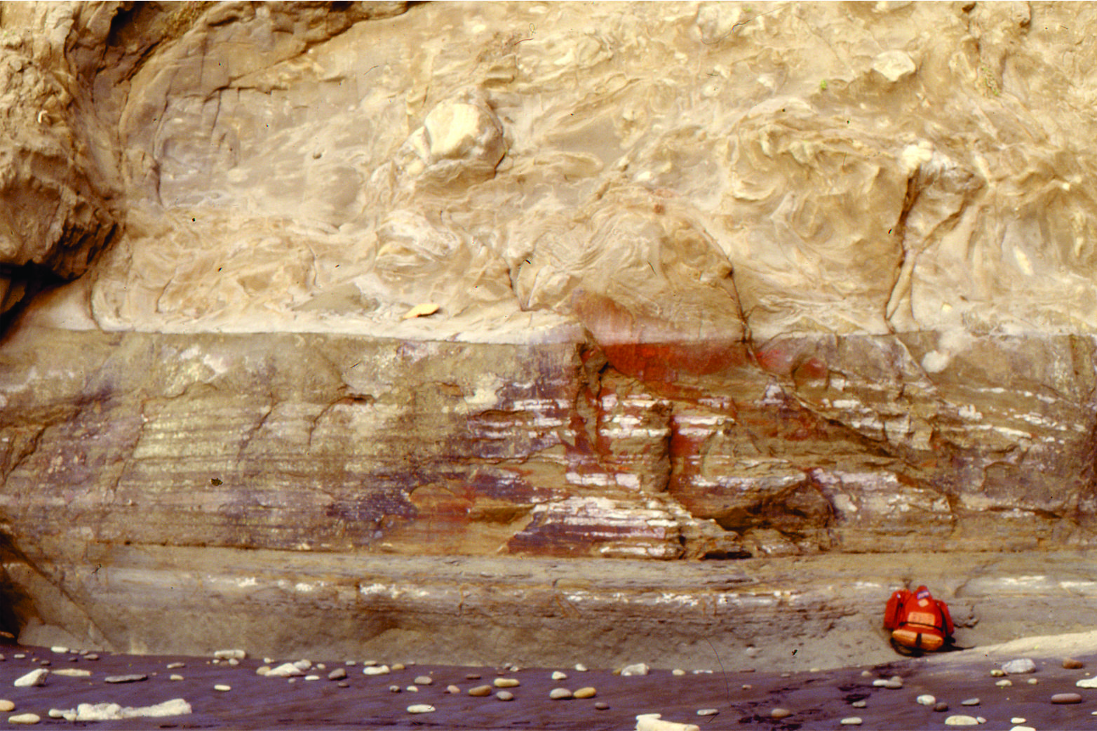
Detail of liquefaction and dewatering structures in the Jam Roll slump. Left: a modest size mud volcano. Right: Highly fluid mud layers that were squeezed during liquefaction. Late Miocene, basin floor submarine fan, Mt. Messenger Formation, North Taranaki, New Zealand.