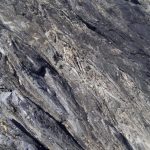
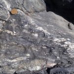
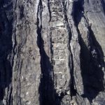
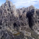
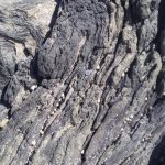
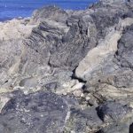
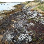
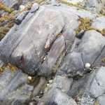
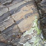
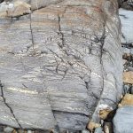
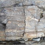
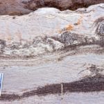
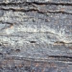
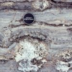
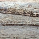
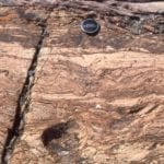
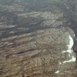
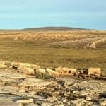
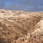
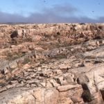
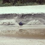
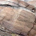
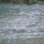
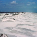
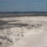
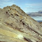
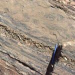
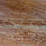
Category Archives: The (really) Ancient Earth

The Moine Thrust: An idea that unravelled mountains

Facebooktwitterlinkedininstagram

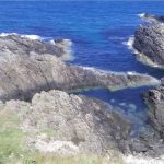
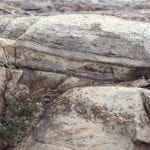
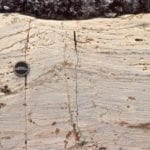
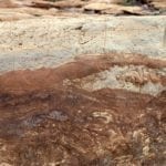
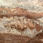
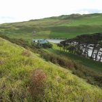
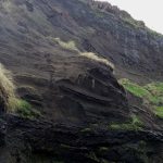
Glencoul Thrust

Preamble
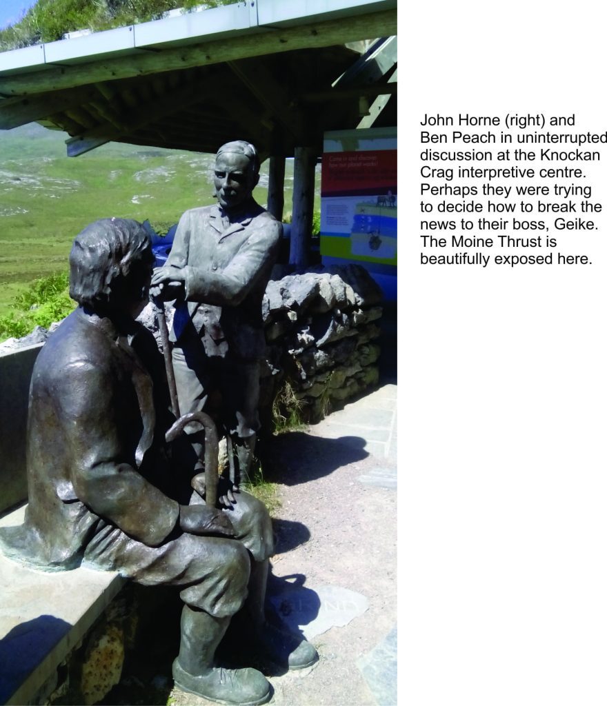
I first heard about the Moine Thrust (northwest Scotland) during my undergraduate studies at Auckland University. Our department structural geology guru spoke of it with a kind of reverence – “the principles of thrust faulting discovered in the Scottish Hebrides provide us with the tools to unravel the history of mountain belts. At some time in your career you must visit this iconic geological treasure”. It’s taken 48 years, but here I am, courtesy of my good friend and colleague, Randell Stephenson (Aberdeen University). The Moine – Old Red Sandstone unconformity at Portskerra, Lewisian gneisses and Moine schists near Tongue and Durness, and the Moine Thrust, complete with duplexes and mylonites at Eriboll, Glencoul, and Knocken Crag. And a quick chat with bronzed Ben Peach and John Horne.

My structural geology mentor would be pleased, but might have quipped “what took you so long?”


There have been times in the history of geology when a simple explanation of a complex problem has not only been proven correct – it has revolutionized the way we think about earth processes. The horizontal (or nearly so) transport of thick slabs of the Earth’s crust over large distances is one such problem. We now know that the movement of panels of rock takes place along faults – thrust faults, and that mountain belts past and present owe their existence to a process we refer to as thrusting. The discovery of thrust faults in the latter part of the 19th century is an intriguing tale with two interwoven threads: a scientific thread of astute geological observation and field mapping in the Scottish Hebrides that led to the formulation of a revolutionary idea, and the tension among members of the professional geological fraternity who were confronted not only with a complicated scientific problem, but also had to contend with professional arrogance and institutional bias.

The beginning of such a story is not always easy to pin-point, but we’ll start with one of its main characters, Roderick Murchison, a Scottish geologist who counted among his acquaintances, Adam Sedgwick, Charles Lyell, and Charles Darwin. His forté was the Silurian System (now known to be about 444 – 419 million years old). The Scottish Hebrides contain some of the oldest rocks in Europe – highly metamorphosed Precambrian schists and gneisses as old as 3.1 billion years. In the 18th and 19th centuries they were referred to as the ‘Primitive’ series; they now are collectively called the Lewisian. The Primitives are overlain by younger rocks, including fossiliferous Cambrian sandstones and limestones, but in places these younger rocks are in turn overlain by slices of Primitive metamorphic rocks (Lewisian). Herein lies a fundamental conundrum; the oldest Primitives should not overlie younger fossiliferous rocks. Murchison, during his field excursions in the late 1850s, recognised this sequence of strata, but determined that the Primitives were not as old as previously thought, and in fact were younger than the fossil-bearing rocks.

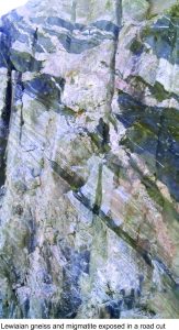
Road cut of Lewisian gneiss and migmatite, Scottish Hebrides

James Nicol, another Scot, a Fellow of the Geological Society of London, and clearly a better field geologist than Murchison, continued the Hebridean researches and discovered that there is a significant break in the stratigraphy, in particular between the fossiliferous beds and the primitive metamorphic rocks. In other words, Murchison was incorrect in his interpretation that the whole sequence of strata continued, one group of rocks upon the other, in an unbroken sequence.  It seems Murchison took exception to this, and for Nicol it became a case of dodging slings and arrows from the gentrified professionals.

Enter Archibald Geikie, well known in Victorian geological circles (eventually sporting a knighthood, and directorships of both the Scottish and British Geological Surveys). Geikie’s primary task in conducting his own field work was to verify Murchison’s version of the story (published 1861). He did just that by ignoring, as a recent paper by John Dewey and colleagues suggests, some basic geological and stratigraphic principles (in fact Dewey et al. refer to Geikie as a Murchison “acolyte” and “sycophant” – it doesn’t get more denigrating than that in scientific circles).

The Murchison view prevailed for a few years until James Callaway, in the late 1870s-80s, conducted some detailed mapping in the Glencoul area, and discovered that a slab of primitive rocks (Lewisian gneiss) had been carried over younger limestones, and that there was a definite discordance between the two sequences marked by highly deformed and fractured rock. About the same time, Charles Lapworth mapped in detail similar rocks around Loch Eriboll, and he too found primitive schists discordantly overlying younger limestones and sandstones (the discordances in both areas are now known to be part of the Moine Thrust).

Not to be outdone, Geikie, who by then was director of the British Geological Survey and who probably had the last say in anything geological, charged some of his geologists to map the Assynt area in detail (of course Lapworth and Callaway had already done this). Unfortunately for Geikie, his team confirmed the conclusions of Lapworth and Callaway. In what is now a classic in geological literature, Ben Peach and John Horne in 1884, and later in 1907, concluded that the Primitive rocks had indeed been tectonically pushed over the younger strata. They coined the term “thrust” for this process. Geikie, in an about face, also published this same conclusion in 1884, but made little or no reference to the previous (correct) interpretations of Nicol, Lapworth, or Callaway. The main thrust, and the one that caused all the discord, is the Moine Thrust. It stretches almost 200km along northwest Scottish Highlands.

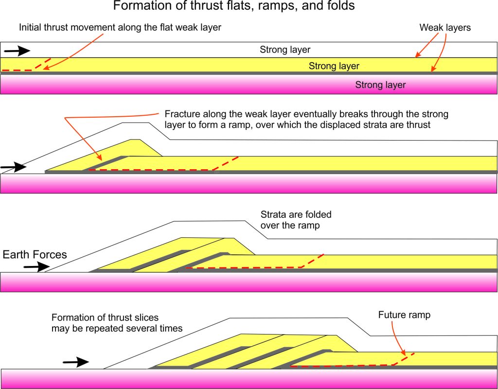
Our understanding of thrust faults and the processes of thrusting has advanced over the decades since the opus of Peach and Horne. The basic geometric relationships are shown in the cartoon below. Fundamental to the formation of thrust faults are ‘pushing’ forces that act roughly horizontally. Prior to the late 1960s – 1970s the existence of such forces were problematic for earth scientists; there was no obvious large-scale mechanism that could generate them. But the advent of plate tectonic theory, based as it is on the surface-parallel movement of great slabs of the Earth’s crust and mantle, helped solve this dilemma. Particularly helpful in plate tectonic theory are the gargantuan horizontal and oblique forces that are generated when continental plates collide.

Formation of thrust flats, ramps and folds

As the cartoon shows, a thrust fault will form when the pushing forces acting on the crust exceed the strength of weak rock layers. Rock failure, in the form of a ramp, allows the moving panel of strata (which may be 100s of metres thick) to ride up the ramp and thence across a relatively flat surface. The thrust sheet is commonly folded over the ramp. If the pushing forces continue, a second thrust fault may form beneath the first, resulting in a second panel of strata that carries, piggy-back style, the first thrust panel.  This process can be repeated several times, such that the end-product is a stack of thrust sheets, one on top of the other, 100s to 1000s of metres thick. Such stacks are commonly called duplexes. The culmination of this process is a mountain belt.

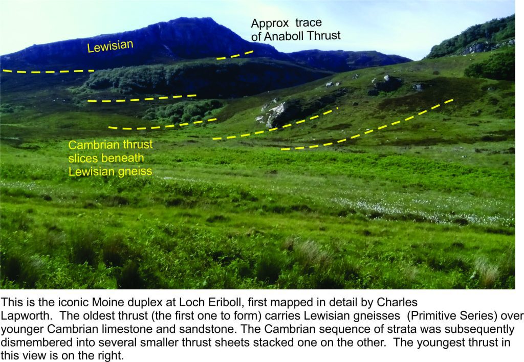
One of the main identifying traits of thrusting is the repetition of strata: older rocks structurally imposed over younger rocks, that in turn are overlain by younger rocks etc. etc. For Murchison and all those who followed, this was the fundamental problem.  Lapworth recognised this at Loch Eriboll, where several thrust panels are stacked one upon the other. Peach and Horne referred to it as a “zone of complication”. Ancient Lewisian gneiss was emplaced in the topmost thrust panel, and beneath this is a repetition of much younger Cambrian sandstone and limestone.  This is a classic example of a thrust duplex.

Moine thrust duplex at Loch Eriboll, Scottish Hebrides

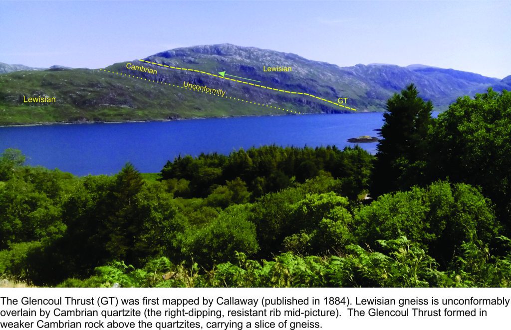
Callaway’s mapping in the Glencoul area showed what has become another classic example of thrust repetition. From the lake shore, Lewisian gneiss is unconformably overlain by Cambrian quartzites (quartz-rich sandstones) and related sedimentary rocks; this is a stratigraphic contact, albeit one in which a great deal of time is missing. However, the gneisses and their overlying Cambrian rocks reappear above the Cambrian strata; the contact here is the Glencoul Thrust (part of the Moine Thrust complex).

Glencoul Thrust

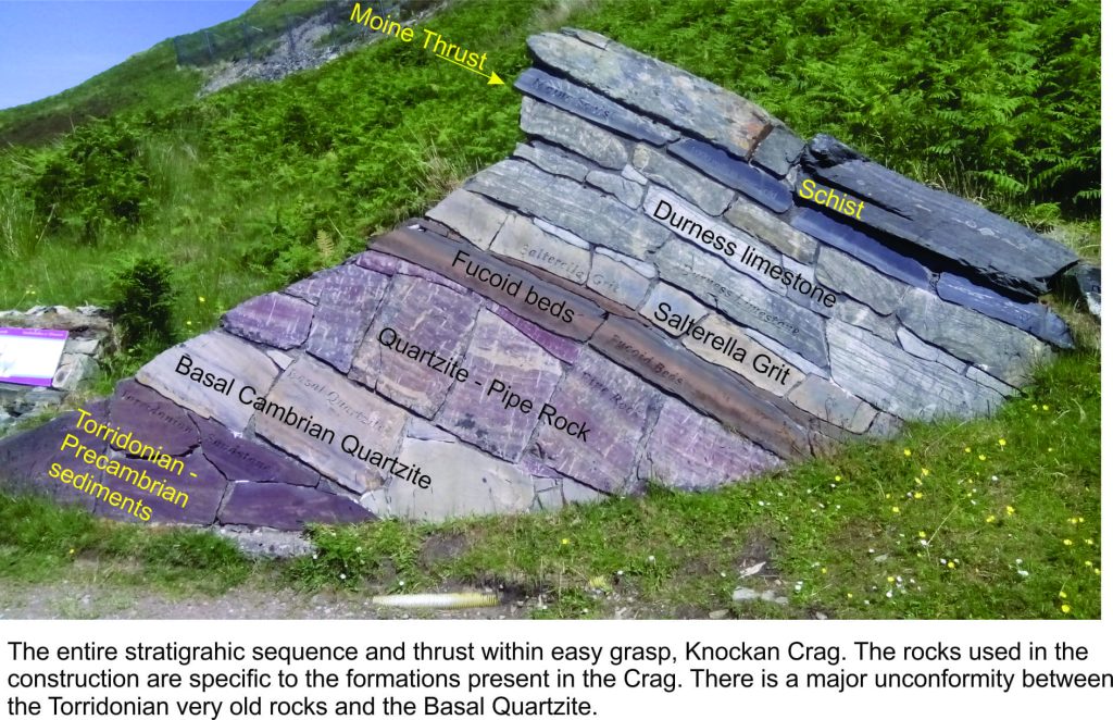
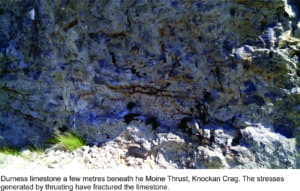
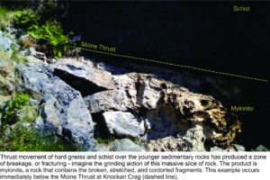
The iconic stratigraphic section and exposure of the Moine Thrust at Knockan Crag is designated a Geo-Heritage Site. Peach and Horne, bronzed and looking on approvingly, point the way to a short hike that takes one through the key elements of the Cambrian stratigraphy to the Moine Thrust and overlying panel of ‘Primitive schist’.  The thrust occurs above the Durness Limestone where there are excellent examples of mylonite, rock that was ground up and fractured as the thrust fault formed – giving us some insight into the massive forces that generated these structures.

Presentation of the thrust stratigraphy at the visitor centre, Knockan Crag. Scottish Hebrides


(Click on the images below for a larger view of Knockan Crag stratigraphy)


Horne and Peach havng a conversation, visitor centre Knockan Crag

The Moine Thrust was an integral part of a protracted period of mountain building from 475 to 405 million years ago, when three continental plates collided as the intervening Iapetus Ocean was consumed by subduction: Laurentia (now North America and Greenland), Baltica (Scandinavia and northern Europe), and Avalonia (southern England and east Newfoundland).  The ancient mountain chain is called the Caledonides, the Roman name for all those unruly Celts. Remnants of these once lofty peaks can be traced from Scandinavia to northwest Scotland and Ireland, eastern Greenland, and the Appalachians of eastern North America.

Our understanding of the Caledonides and mountain belts in general, took a great leap forward with the field work of Nicol, Lapworth and Callaway; the icing on this thrust-cake was provided by Peach and Horne. This story, like many others in the history of science, is interwoven with personal feuds and institutional bias. Arguing against accepted wisdom is always fraught. It is worth remembering the trials of the folk who wage, in their search for truth, against the establishment. So, the next time you put your finger on a thrust fault, spare a thought for those whose common sense and sound scientific reasoning ultimately prevailed.

 

Facebooktwitterlinkedininstagram
Facebooktwitterlinkedin

Atlas of the Dalradian from Scotland and Ireland

Facebooktwitterlinkedininstagram

Dalradian rocks and structures

The Atlas, as are all blogs, is a publication. If you use the images, please acknowledge their source (it is the polite, and professional thing to do).

The Dalaradian, a 15+km-thick sequence of metasediments and metavolcanics occupies a broad swath through central Scotland. This is the Grampian Terrane, a patch of rock that originally accumulated on the Late Precambrian – early Paleozoic margin of the ancient continent Laurentia, washed by the equally ancient Iapetus Ocean. The Grampian Terrane is now sandwiched between two crustal-scale sutures: Great Glen Fault in the north, and the Highland Boundary Fault. Dalradian rocks overlie Laurentian basement.

Dalradian polyphase deformation, metamorphism, and syn- and post-kinematic intrusions have been the subject of intense study, conjecture and debate since the 1800s. In 1893 George Barrow published his discovery of a coherent metamorphic zonation in the Dalradian sequence, that ever since has promoted theoretical concepts of crustal processes such as pressure-temperature effects during burial, elucidation of structural complexities, and exhumation of deep crustal realms.  Barrovian metamorphism and deformation took place during the late Cambrian – Ordovician Grampian Orogeny, an early phase of Caledonian mountain building during closure of the Iapetus, and collision between Laurentia and an oceanic island arc.

Below are some images taken during a recent visit to Macduff and Portsoy (coastal Moray Firth, Banffshire, Scotland), and Connemara, County Galway, Ireland.

This link will take you to an explanation of the Atlas series, the ownership, use and acknowledgment of images.  There, you will also find links to the other Atlas categories.

Some useful references:

B.E. Leake, 1986. The geology of SW Connemara, Ireland: A fold and thrust Dalradian and metagabbroic-gneiss complex. J Geological Society of London, v.143, p. 221-236.

D.M. Chew and R.M. Strachan, 2015. The Laurentian Caledonides of Scotland and Ireland. Geological Society of London Special Publication 390, p. 45-91

Banffshire coast – an excursion – introduction to geology. British Geological Survey, 2015


Macduff: On the coast near the old swimming pool, thick bedded psammites, possibly crossbedded, with thinner intervals of pelite-shale, with a suggestion of ripple, despite the garnet-zone metamorphism. There is some penetrative fabric here, but not as intense as that seen along the Portsoy coast. An excellent Cullen Skink can be sampled in any of the local cafes in the nearby town of Cullen.


Massive bedded psammites and thin interlayered pelitic rocks. Bedding is well preserved, despite the relatively high grade metamorphism. There are hints of crossbedding. Cullen.


Thin bedded and laminated pelites with interleaved lenses of coarser-grained lithologies, possibly rippled.  Macduff.


Massive bedded psammites with internal discordant contacts resembling crossbeds. Macduff.


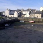
Portsoy (about 5km east of Cullen). The old harbour here was constructed in the 17th century and has stood the test of time and North Sea storms. Stone blocks (mostly psammite) in the original harbour walls were oriented vertically.  Dalradian outcrop (from the disused swimming pool west of the village, to East Point) are part of the Portsoy Shear Zone. Kyanite-zone metamorphism produced well developed micaceous foliation; folding and cleavage records 3 or 4 stages of deformation.  Post-tectonic pegmatites intrude the sequence. The first set of images are west Portsoy near the disused swimming pool. The second set is along a coastal transect towards East Point.


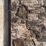
Blocks of psammite were aligned vertically in the old Portsoy harbour walls because it was thought at the time of construction, that this configuration would be more stable. It seems to have worked.
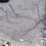
 

Elsewhere, house and wall construction used the more familiar horizontal block-stone style of construction.


Portsoy west (near the old swimming pool)


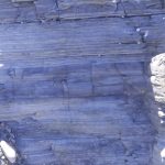
Views west of Portsoy. Large mullions in quartzite are clearly visible in the left image. Here, fold axes are steeply plunging (approximately north).


Another view of the mullions – located between the disused swimming pool and Portsoy village. (focus mot brilliant in this image – it was a very windy day)


Shearing in interlayered psammites-pelites has disrupted  the earlier foliation and folding.


A patch of reasonably coherent foliations and small, recumbent, isoclinal folds and boudinage.


Folding in thin bedded psammites-pelites and limestone (fold axes here are almost horizontal). Folds In the right image have been sheared.
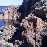
 

Foliated and folded, thin bedded psammites.  This exposure is very close to the two images immediately above; here the fold axes have been rotated.
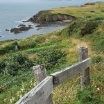
 

Detail of shearing and stretching of small-scale folds.


Tension fractures in bedded psammite.


Portsoy east

Foliated psammites, steep-dipping cleavage, and some shearing.


Small-scale folds in thin bedded psammite-pelite sequence


Left: folded psammites and boudinage of thicker limestone (light grey). Right: Small-scale folds in thin bedded psammite-pelite.


Small-scale folding and boudinage in laminated pelite-limestone.


Post-shear pegmatite dyke in sheared psammites (near East Point)


Clifden coast, Connemara

The Sky Coastal route west of Clifden. The Dalradian here is part of the Connemara Metamorphic Complex and is a continuation of that seen in Scotland. It contains quartzites, schists, marbles and amphibolites.  The outcrops shown here are primarily strongly foliated schists with a later phase of tight, isoclinal folding.


Left: the open Atlantic coast; Right, one of several estuaries, home to small fishing villages,


Strongly foliated and folded amphibolites exposed in the shore platform opposite Omey Island


Small-scale, recumbent, isoclinal folds


Small-scale folding, near Cleggan Harbour, NW of Clifden. Note the small thrusts near the center of the left image.


Facebooktwitterlinkedininstagram
Facebooktwitterlinkedin

The Pink and White Terraces, Magic Lanterns, and 19th Century Narratives

Facebooktwitterlinkedininstagram

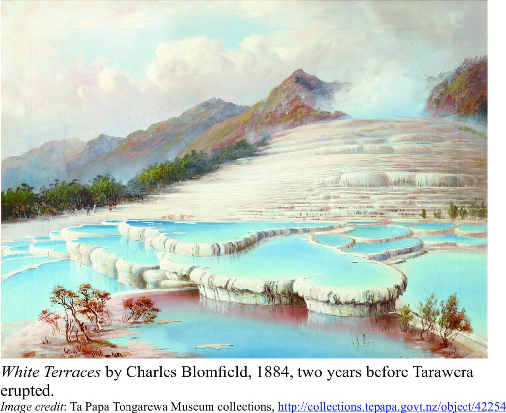
White Terraces, painted by Charles Blomfield 1884

Preamble

A collection of late 19th century lantern slides made by Arthur Whinfield, a native of Worcester, England, has recently been restored and digitized.  I was alerted to the Whinfield collection by an old friend Justin Hughes, an archaeologist working in Worcester, UK, who indicated that the collection contained several slides of the famed Pink and White Terraces near Rotorua, New Zealand. These iconic geothermal wonders were destroyed by the eruption of Tarawera, on June 10, 1886.

Lake Rotomahana, in the shadow of Tarawera volcano, looks peaceful enough. Its waters are ruffled only by wind and the wakes of small boats. No hint of impending doom. No hint of the destructive explosions 132 years ago, eruptions that completely changed the local landscape, destroyed a village and its inhabitants, and obliterated a geological icon – the Pink and White Terraces.

New Zealanders look upon the Pink and White Terraces with a kind of fondness, even though no one alive has seen them. Mineral-rich waters spurting from geothermal springs and erupted from geysers above the former Lake Rotomahana, deposited silica in a cascade of rimmed terraces and pools; ever shrouded in steam. As their name indicates, there were two sets of terraces. The larger White Terraces descended 25m, stair-like, into the lake.  Their pink counterparts were terraced through 22m. Mineral content was more pronounced in the pink variety, with precipitation of arsenic and antimony minerals, and gold.

The terraces disappeared on June 10, 1886. Eruption of Tarawera was focused along a 17 km rift that extended from the volcano summit, through the terraces, and into Lake Rotomahana. Whether the terraces were obliterated, buried, or partly submerged in modern Lake Rotomahana is still debated.

By all accounts the terraces were spectacular; witness the written testimonies of geologists (like Ferdinand von Hochstetter in 1859) and Victorian gentlefolk, renditions in oil and water-colour (like the Blomfield painting above), and photographs – grainy, black and white, tinted amber with age. This was the late 1800s, and photography was in its infancy, the act of recording an image a laborious process.

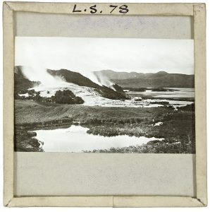
Enter Arthur Whinfield. Whinfield was a peripatetic photographer who in the 1880s captured the magic of cities and landscapes in the Americas, Asia, Africa, Europe, Australia, and New Zealand. Part of his legacy resides in a collection of lantern slides (more than 2100 of them) that were donated to the Worcester Diocesan Church House Trust by his wife in 1918. A century later, in partnership with the Worcestershire Archive and Archaeology Service, the slides have been restored, digitized, and made available for public display. Included in the collection are 11 glass slides of the Pink and White Terraces, and the aftermath of the Tarawera eruption.

Whinfield took many of the photographs he used in his slides, but also borrowed from other photographers, and this seems to have been the case for several Pink and White Terraces images.  Te Papa Tongarewa  (the New Zealand National Museum) has an extensive, publicly accessible collection of photographs, paintings and prints related to the Terraces. I was able to identify individual photographers in some of the slides from the Te Papa collection.

Click on each image below for a larger format, then use the back-click arrow to return to the article.

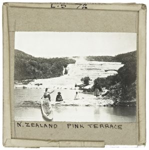
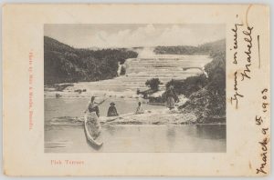
The classic image of the Pink Terrace with Maori guides (or is this a family scene?) and a canoe in the foreground is shown below. This iconic photograph was taken by Burton Brothers Studio in 1885, and later used by Muir and Moodie Studio in a popular postcard (early 1900s; one penny postage required). Whinfield’s slide (left) is a copy of this scene (acknowledging the photographer on the lower left corner).


Whinfield slide left; Muir & Moodie postcard right


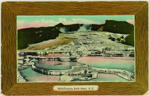
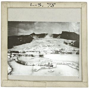
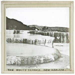
Moodie and Muir also produced a postcard from the White Terraces image below (left); the colour would have been added by hand to the printed photo. The Whinfield slide (right) is an uncoloured version of this image (compare the shape of the steam clouds at the top).  The terrace flights are nicely portrayed in this slide.


Muir & Moodie postcard left; Whinfield slide right


One of the more panoramic views of the White Terraces shown by Whinfield (left) is similar to a photograph taken by Burton Brothers in January-May 1886 (in the Te Papa collection) but is viewed from a lower elevation and records a different steam profile; the original photographer may have taken more than one shot from this location (I have not been able to determine who the photographer was for Whinfield’s slide). Here the terraces clearly dip their toes in Lake Rotomahana.  The terraces were a popular tourist attraction, in part because bathing was possible in the lower pools.


Whinfield slide left; Burton Brothers photo right


The original black and white photograph for the three slides below (Pink Terraces), was taken by Charles Spencer.  The three Whinfield slides are identical, with the right image slightly enlarged and a mirror of the other two. The view provides some detail of several small pools that appear to have been filled completely by silica.


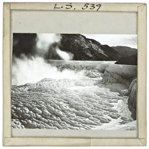
The two slides below show detail of White Terrace pools and the intricate patterns wrought by precipitation of silica.  Dark stains daubed on the pool walls may have been algae. I have not been able to determine the attribution of either slide. The slide on the right is labelled ‘White Terrace Crater’ and may have been taken close to one of the active geysers near the top of the terraces.


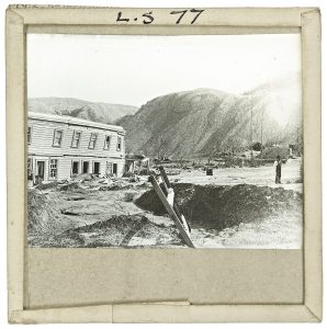
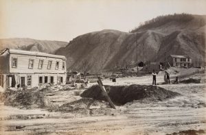
Whinfield’s slide (below, left) showing the aftermath of the eruption at McRae’s Hotel is slightly different to one taken by photographer George Valentine (1886, McRae’s Hotel and Sophia’s whare) – the man on the right in Valentine’s image has his arms folded; in Whinfield’s slide they are not. The viewing angle is also slightly different – the ladder (foreground) is more oblique in the Whinfield slide.  The hotel probably collapsed under the weight of volcanic ash. Other photographs (not in the Whinfield collection) show the back of the hotel to be demolished completely. The trees were also stripped of foliage.


Whinfield slide right; George Valentine photo right


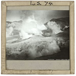
The title of the slide below Rotomahana Looking to Site of Pink Terrace, indicates a view towards the former terrace, or perhaps close to it, in the aftermath of the eruption. If the location is correct, the image is important because it shows that destruction of the Pink Terraces was complete. The Mounds of volcanic ash cover almost everything. Characteristic erosional rills suggest rain soon after the eruption, where surface water run-off redistributed the ash (probably towards the lake).  I could not determine who the photographer was.

Whinfield’s slides, recently brought to life, are delighting and informing audiences today, just as they must have done when he presented them to an eager 19th century public. These days we never think twice about the projection media at our fingertips. It seems almost to be part of our subconscious, but to Whinfield’s audiences there must have been a sense of excitement, awe, and puzzlement, not just in the images they were seeing, but the fact they were seeing them at all. The havoc wreaked by distant volcanic eruptions, was delivered to their living rooms by a rapidly developing technology.

The Whinfield Terrace collection may not contain photographs of his own taking, but this is not important. An iconic landscape was taking shape in people’s minds, a narrative in images. Folk who may never have left their own village became informed; witnessing the real world shaped by unimaginably ferocious forces – a kind of 19th century Scicomm.


I would like to hear from anyone who has additional information on the images in Whinfield’s slides, particularly information relating to the original photographers.


Credits: The Whinfield collection is owned by the Worcester Diocesan Church House Trust. I am grateful to the Trust for permission to use the digital images of the slides. Thanks also to Justin Hughes of the Worcestershire Archive and Archaeology Service for bringing the slide collection to my attention, for arranging to forward the images, and for his patience with my incessant questions.

Facebooktwitterlinkedininstagram
Facebooktwitterlinkedin

A chance encounter with James Ussher, circa 1650

Facebooktwitterlinkedininstagram

A chance encounter of a different kind. The 9th century Book of Kells is exhibited in the Trinity College library (Dublin). The book contains 340 sumptuously illustrated folios written on vellum (calf skin), that make up the four Gospels (the entire book can be viewed online). It was written and illustrated around 800AD, in either Iona (Argyllshire, Scotland) or Kells (County Meath, Ireland), and possibly both. Monks from the St. Colum Cille Monastery in Iona, fled to Kells in 806 to evade further slaughter by marauding Vikings (who seemed to have a penchant for religious orders). Hence the uncertainty surrounding the location of the Book’s compilation.

Folio 32v of the Book of Kells.

Two or three folios are exhibited at any one time in the library.  There is something special about seeing this, regardless of one’s beliefs. That a document this ancient has survived pestilence, religious and political purges, plundering and the general ravages of time, is a testament to the enduring belief that human history is worth preserving.

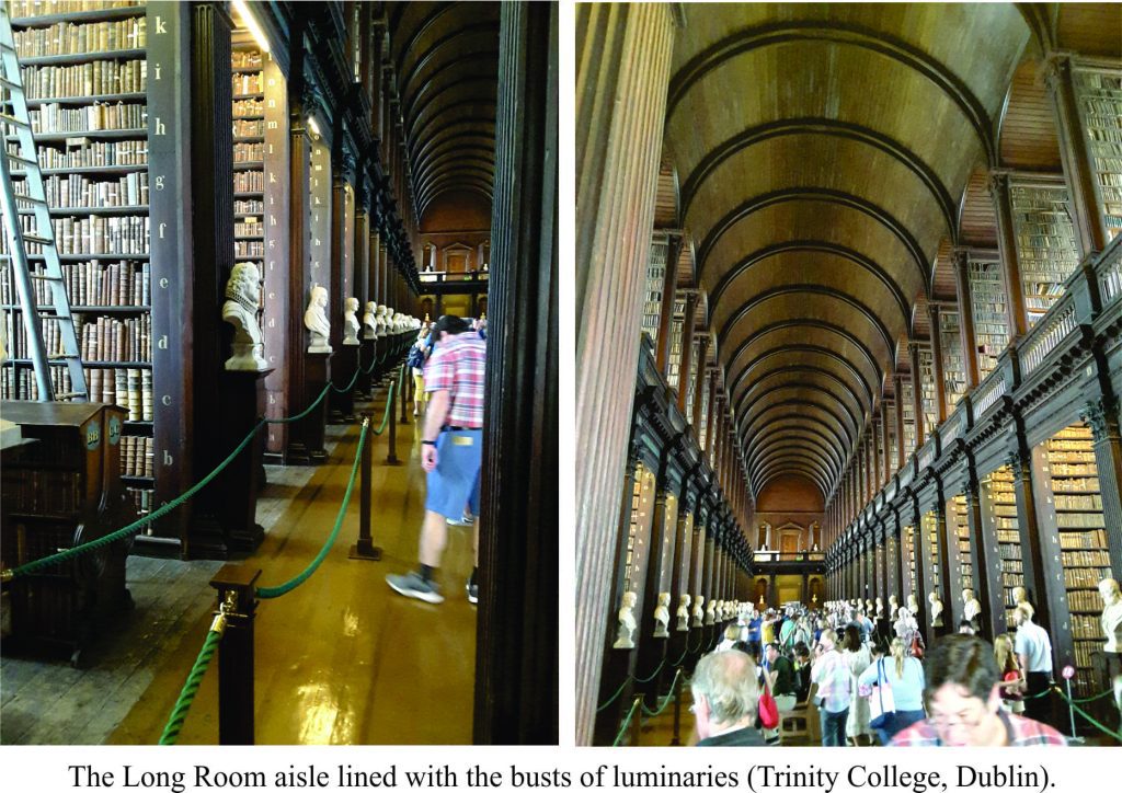
A visit to the Book of Kells exhibit eventually leads to the Long Room, a cathedral-like hall with high barrel-vaulted ceiling dedicated to preserving old and ancient manuscripts, tomes, letters and assorted documents. It was first built in 1712) but enlarged in 1860 to accommodate a burgeoning collection.

The Long Room, a library of ancient manuscripts at Trinity College, Dublin.

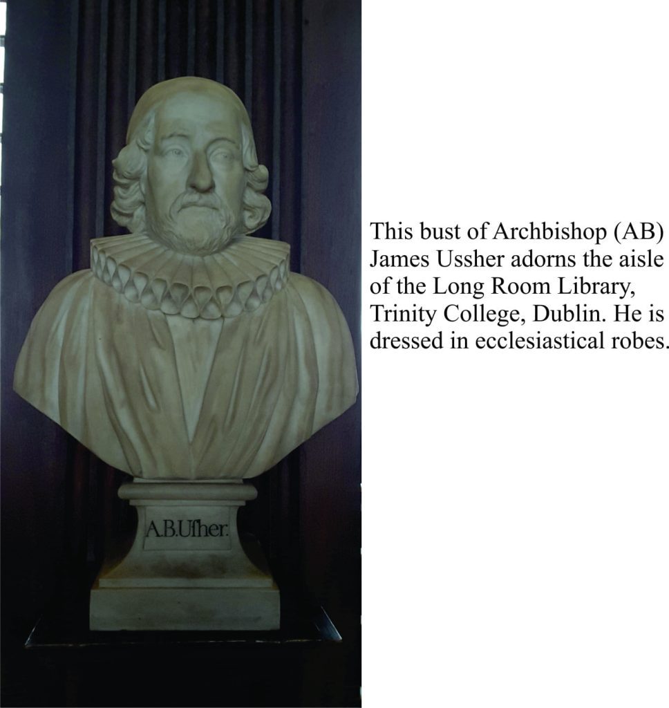
One of the College’s 17th century benefactors was James Ussher, Archbishop of Armagh (although he never lived to see the actual Long Room). He was instrumental in purchasing books for the then nascent College library. Ussher became famous, or infamous, for his dating of Genesis creation at October 23rd, 4004 BC. He based this calculation (published in 1650) on biblical genealogies and historical events. Given what we now know about the age of the earth, Ussher’s calculation is generally viewed with a mix of ridicule and begrudging respect.

Bust of Archbishop Ussher in the Long Room Library.

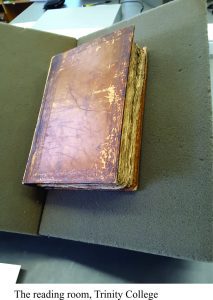
Acting on a hunch, I asked one of the library attendants if any of Ussher’s books were available for viewing. He suggested I check with the folk in charge of ‘reading room’ passes. This took a while but I was eventually issued a pass and ushered (sic) to the reading room. The first task was to search the catalogues.  One index of books had an entry annotated with scribbled comments on “creation dates”. Bingo. This particular volume appeared shortly thereafter in its own protective box. A rather plain unassuming book was placed carefully on a special reading rack. Instructions were given on how to turn the thin, brittle, dog-eared pages.

The journey through 400 year old documents like these is more one of personal discovery than some momentous event of universal import. The book was a collection of Ussher’s notes, annotated texts, and the odd piece of correspondence. Flicking through these pages gave, for a moment, a view into Ussher’s thinking. Here were his working notes, in a mix of Latin and English. Marginal scribblings on printed text and fragments of scripture, ecclesiastical compositions, calculations of cumulative dates gleaned from the scriptural register of births and deaths, crossings-out and corrections. Here was a person, a Bishop of repute, who tried genealogical combinations, recognized errors, approximated, and perhaps even fudged the odd date. Maybe there were even doubts about the progression of time.

The opportunity to look at Ussher’s notes came out of the blue. It was worth the multiple forms I was required to sign, acknowledging Trinity College’s copyright. I took photos of the text, but cannot display them. What a shame. A 400 year-old document originally intended to be read by all and sundry, now (figuratively) locked away by some arcane law (unless I payed a fee). I don’t decry all copyright conditions, just this one, that applies to a document written by a person who probably never intended such conditions of ownership to apply.

We now know that Ussher’s date for the beginning of earth history has a rather large margin of error. As absurd as his date may sound, it was derived from serious scholarship, in a manner we would now call ‘multidisciplinary’. This in itself is something to celebrate.

Here is a slightly different take on Ussher’s scholarship

Facebooktwitterlinkedininstagram
Facebooktwitterlinkedin

Bishop James Ussher, and the beginning of everything

Facebooktwitterlinkedininstagram

[I had the opportunity to browse some of Ussher’s notes and scribblings during a visit to Trinity College, Dublin – A chance encounter with Bishop Ussher – or how I caught up with him]


In 1650 AD/CE, James Ussher, Bishop of Amargh and Primate of all Ireland, published the scholarly “Annals of the Old Testament, deduced from the first origins of the world” where he concluded that the universe, and everything in it, began at noon, October 23, 4004 BC. To many modern scholars of the earth, this seems outlandish, even ridiculous. Creationists though still attest to its veracity.

It is easy to fall into the trap of judging old ideas with modern concepts and proofs, rather than judging them according to the precepts and traditions of their day; of course, the real kicker here is that one needs to have some knowledge of those cultural contexts and traditions. I was reminded of this during a re-read of Stephen J. Gould’s Fall in the House of Ussher (Natural History, 1991). In an early paragraph Gould writes “To this day, one can scarcely find a textbook in introductory geology that does not take a swipe at Ussher’s date as the opening comment in an obligatory page or two on older concepts of the earth’s age (before radioactive dating allowed us to get it right). Other worthies are praised for good tries in a scientific spirit (even if their ages are way off), but Ussher is excoriated for biblical idolatry and just plain foolishness. How could anyone look at a hill, a lake, or a rock pile and not know that the earth must be ancient?” (Gould often used diverse ‘lead-ins’ to his essays, the pithy import of which don’t become apparent until one is well into the reading).  It is basically a statement about making judgements.

Confronted by a “hill, lake, or rock pile”, you try to imagine how long it took to get there. Your cogitation will go no further, from the point of view of actual explanation or some empirical value, unless you also happen to know about geological and geomorphic processes, their short-livedness or longevity. Without this knowledge, a priori, the longevity of this pile of rock will remain a mystery. For Ussher, this kind of knowledge was not part of his paradigm, his view of the universe.  Quite the opposite; his view was imbued with a theological tradition that was still trying to deal with the monstrous notion that man and earth were not the centre of the universe. Galileo’s excommunication had taken place a mere 17 years earlier.

Ussher lived and rationalised the universe in a tradition of theological doctrine, a tradition imbued with a belief in divine intervention. He was admired at the time as a scholar, who impressed the nobility so much that on his death in 1656, Oliver Cromwell ordered him buried at Westminster. The starting point for Ussher’s Old Testament genealogy was the death of King Nebuchadnezzar II (634-562 BC/BCE) of Babylon; from there he worked back through the generations to Adam, using a combination of biblical patriarchy and secular history.


Ussher was by no means the first to calculate a creation time-line. Luminaries like the Venerable Bede (672-735), who counted all the begets and begots in Genesis, traced creation to 3952 BC. Even Isaac Newton and Johannes Kepler, two giants in the history of science who we tend to associate with the rise of empiricism, concurred that 4000 BC was not just a nice round number but had meaning as the beginning of everything, based on biblical and secular histories. However, it was Dr. John Lightfoot, Chancellor of the University of Cambridge no less, who in 1642 used biblical genealogies and classical history to calculate the beginning at 9am, October 23, 4004 BC. October the 23rd was a Sunday (appropriate) and close to the autumnal equinox. Ussher must have been aware of Lightfoot’s work, and some historians have suggested that there was a degree of one-upmanship between the two academics. One historical footnote has even suggested that Lightfoot’s addition of “9 am” to the October 23rd date, was inserted after Ussher’s 1650 publication in a fit of academic pique (I guess some things haven’t changed).    Lightfoot’s work is now little more than a historical footnote to Ussher’s opus.

Following Ussher’s publication, The King James Bible (first completed in 1611) added dates to the margins of Old Testament scripture. Thus, “In the beginning…” (Genesis 1:1) has the margin note ‘4004 BC’, and the date Noah’s ark became stranded on Mt Ararat “May 5, 1491 BC. The annotations have been attributed to Ussher rather than Lightfoot, perhaps because he was in court-favour at the time. Use of Ussher’s dates in marginal notation continued in some published Bibles into the 20th century.  Perhaps the whole idea of a creation time-line needed a personality, and James Ussher was it.  Ussher’s legacy is that he still bears the brunt of the creationist claims of a ‘young’ earth, and a tendency to denigration from the scientific community who know how old earth really is.

And this is the central theme of Stephen Gould’s complaint. We now know earth is about 4.6 billion years old; this knowledge derives from radiometric dating of the most ancient earth rock, meteorites, and moon rocks.  But this knowledge was established only in the last half of the 20th century. Earlier estimates of the age of the earth (and solar system) through the 19th century, ranged from a few 100,000 to 300 million years (e.g. Charles Darwin, Charles Lyell, Lord Kelvin). All these early calculations by learned folk are taken (as they should) to be the best estimates at that time, given what was known about earth processes. The calculations were scholarly, and for the most part, well considered. We don’t ridicule them, simply because we now know them to be incorrect (radiometric dating methods were not part of the geologists’ toolbox until the early 1900s).

Likewise, Ussher and Lightfoot used, in a considered fashion, the information available at that juncture of the 17th century – the genealogies in biblical scripture and classical history. Galileo and Copernicus had certainly rocked the boat in terms of humanity’s place in the universe, but not its longevity. In the 17th century, the only way to decipher time past was through written history, or a vivid imagination.

According to the Old Testament, there were 75 generations between Adam and Jesus, and if we assume that each lived 50 years (with overlap of first-born sons – sorry, but it was all about the patriarchy back then), some quick, back-of-the-envelope arithmetic gives us about 3000-4000 years from creation. And again, if we treat the 6 days of creation as a kind of metaphor, where ” For a thousand years in thy sight are but as yesterday when it is past, and as a watch in the night” (Psalm 90, King James Bible), then 6000 years gives an upper limit for Day 1. These dates became ingrained in Renaissance and Enlightenment Christian views of the universe. For some in the 21st century they are still ingrained.

By all accounts, neither Ussher or Lightfoot were charlatans; they did not take all those BC genealogies through arcane twists and turns to prove a point (something modern Creationists are quite good at).  They were not trying to disprove science. No doubt there were errors of interpretation, and perhaps errors of omission.  There were certainly difficulties in aligning events according to the Julian, Gregorian, and Hebrew calendars, as Gould and other scholars have pointed out.

We often think of the Enlightenment as the beginning of modern science, but in the 17th century it was still nascent, and in a state of almost continuous tension with approved church doctrine. Ussher and Lightfoot may have been sympathetic with the emerging science (I’m not sure historians really know this), but they were also immersed in theological tradition. They took the information that was available and used it in a scholarly fashion.

So, next time you hear someone disparage Ussher and his colleagues, remind them that cultural, philosophical, political, and religious contexts are important when judging historical events. It is also worth keeping in mind that, 100 years hence, theories and hypotheses that today have scientific value, may send future generations into paroxysms of laughter.

Footnote: The historical annotations CE (Common Era) and AD (Ano Domini) refer to dates since the first year of the Gregorian calendar. Thus, BCE is before the common era, and refers to the same dates as BC (before Christ). The difference between the older BC/AD and recent BCE/CE notations is that the latter has no Christian connotations.


Facebooktwitterlinkedininstagram
Facebooktwitterlinkedin

Atlas of stromatolites and cryptalgal laminates

Facebooktwitterlinkedininstagram


Stromatolites. The Precambrian is replete with them. In many ways they define the Precambrian, that period of earth history, about 90% of it, that set the scene for the world we currently live in – its atmosphere, hydrosphere, lithosphere, and biosphere. It’s the period when life began more than 3.4 billion years ago, taking its time (about 3 billion years) to get over that first rush of DNA replication.

The Atlas, as are all blogs, is a publication. If you use the images, please acknowledge their source (it is the polite, and professional thing to do).

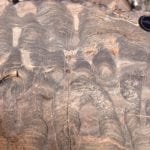
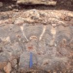
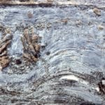
Stromatolites are the sedimentary record of that really prolonged period of geological time. Some of the oldest known, bona fide cryptalgal structures are found in the 3.4 Ga North Pole deposits. They represent fossil slime – mats of photosynthetic, prokaryotic cyanobacteria. They were responsible for producing the oxygen we, and most other life forms breath.

Stromatolites really came into their own by about 2.5Ga, forming extensive buildups, and reef-like structures, by slow, incremental addition, mat-by-mat, in the ancient shallow seas. Growth habits varied from broad flat domes to intricately branched columns. Stromatolite structure, shape and distribution were primarily controlled by environmental conditions such as water depth, wave and current energy, and substrate (muddy, sandy).  Glacially polished rock outcrops on Belcher Islands (where all the following images are from) show these structures in exquisite detail.

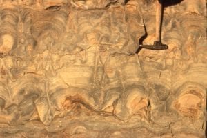
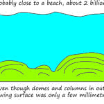
Stromatolites in outcrop commonly appear huge, as columns or domes extending vertically several metres. But their sea floor profiles, or synoptic relief during growth was low. We can visualize this when tracing individual laminae or sets of laminae (ie. the original mat surface) from one column to the next. Your average shallow shelf or platform stromatolite extended no more than a few millimeters or centimeters above the sea floor. Some large mounds, or reef-like structures had a few metres relief; but nothing like more recent coral reefs. This also means that the environmental conditions for incremental growth must have been stable for long periods of time. This needs to be kept in mind when looking at cryptalgal structures in outcrop; their apparent size can be misleading.

Check out this post for outcrop descriptions of stromatolite morphological features

This link will take you to an explanation of the Atlas series, the ownership, use and acknowledgment of images.  There, you will also find links to the other categories.

Click on the image for an expanded view, then ‘back page’ arrow to return to the Atlas.

A few publications that have a bearing on the set of images below:

Ricketts, B.D.  1983: The evolution of a Middle Precambrian dolostone sequence – a spectrum of dolomitization regimes; Journal of Sedimentary Petrology, v. 53, p. 565-596.

Ricketts, B.D. and Donaldson, J.A. 1981: Sedimentary history of the Belcher Group of Hudson Bay; Geological Survey of Canada, Paper 81-10, p. 235-254. F.A.H. Campbell, Editor

Ricketts, B.D. and Donaldson, J.A.  1989: Stromatolite reef development on a mud-dominated platform in the Middle Precambrian Belcher Group of Hudson Bay; Canadian Society of Petroleum Geologists, Memoir 13, p. 113-119.

Donaldson, J.A. and Ricketts, B.D.  1979:     Beachrock in Proterozoic dolostone of the Belcher Islands, Northwest Territories; Journal of Sedimentary Petrology, v. 49, p. 1287-1294.


The images:


Bulbous, dolomitized stromatolites in the lower part of the outcrop become progressively more branched towards the top. The view is oblique to bedding; the surface polished by Laurentide glacial ice. McLeary Fm. Right: dashes follow the synoptic surface, which approximates the actual growing mat morphology and relief at the sea floor.  Whereas the stromatolites in outcrop appear large, at the time of growth (2 billion years ago) the sea floor would have looked vaguely dimpled or domed. Bedding-parallel stylolites have thinned the rock sequence by 10-20%.


The cartoon refers to the synoptic surface outlined in the image above. Even though columns and dome appear in outcrop to be quite large (10s of cm to metres), their actual growth profiles at the sediment-water interface was measured in only millimetres to centimetres.


Bulbous stromatolites similar to those shown above.  The original carbonate (calcite-high Mg calcite-aragonite) has been completely replaced by dolomite.  Some of the upstanding, resistant edges are subsequent chert replacement. Image on the right shows excellent preservation of original laminae that in some cases can be traced across 2 and 3 branches. Both are oblique to bedding. McLeary Fm. Intercolumn sediment is dolomitized carbonate mud.


Stromatolite form here changes from bulbous to more digitate branching, back to bulbous. McLeary Fm.


Large, laterally extensive stromatolite domes more than 8m thick, but having synoptic relief of only a few centimetres. There were very few interruptions in growth; they probably accumulated on a subtidal shelf-platform lacking strong bottom currents. Kasegalik Fm.


Large, closely-spaced, low relief stromatolite domes; synoptic relief was 5-8cm.  Look closely at the laminae and in some you will see continuity from one dome to another, and in others discontinuities and overlaps 2-4 laminae thick. Mavor Fm.


Large stromatolite domes like those above, can transform to more digitate columns higher in the bedding unit. This probably represents subtle changes in environment, such as local bottom currents, or growth that was interrupted by storms. Mavor Fm.


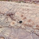
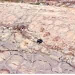
Exhumed stromatolite domes on bedding, McLeary Fm. Their internal structure is similar to the domes shown above. The domes are slightly elongated, with long axis parallel to subtidal paleocurrents (determined from other sedimentary structures).  Inter-dome sediment is dolomitized carbonate mud. Hammer, centre-right.


Bedding and cross-section views of subtidal platform, domal stromatolites. Synoptic relief here is a bit less than in the image above. McLeary Fm. Stromatolites in the uppermost bed are eroded, overturned, or oversteepened, probably by storm waves.


This distinctive stromatolite unit can be traced 10s of kilometres. Closely spaced vertical, digitate columns grew on a shallow subtidal platform. Columns are relatively uniform width, usually branched, with tangential laminae forming a sturdy wall. Synoptic relief was only a few millimetres. McLeary Fm.


Polished slabs of the digitate stromatolites shown above. The scale on the right is centimetres. Preserved laminae are mm to sub-mm thick. The rock has been completely dolmitized, and yet delicate structure is preserved. McLeary Fm.


Isometric reconstruction of slabbed digitate stromatolites (based on several polished slabs like the one above). McLeary Fm. The (barely visible) scale is in centimetres.


Closely packed columnar stromatolites – bedding view. Raised rims on each column is due to silicification. McLeary Fm.


Several growth stages from domal stromatolites to narrower, closely-spaced, digitate columns, Mavor Fm. Intercolumn sediment is dolomitized mud. Three stylolites (top, centre, bottom) have reduced section thickness by 15-20%. Although completely dolomitized, mm and sub-mm scale laminae are well preserved.


Disruption of stromatolite columns and small domes by erosion. Rip-ups include largish mudstone slabs. McLeary Fm.


Digitate stromatolite columns in cross-section (left) and bedding (right). Dolomitiztion here has produced coarse crystalline textures that have partly obliterated outlines and laminae. Mavor Fm.


Domal, digitate, and coalescing stromatolite columns, growth habits that changed with environmental conditions or interruptions in growth (e.g. storms), McLeary Fm. Image on right has an erosional discordance at the pen tip. branching began during mat regrowth.


Radiating, digitate, branching columns. Left: the radiating cluster is a solitary buildup in surrounding flat, laminated mats. Right: The digitate cluster has been disrupted and partly eroded by crossbedded sandstone, indicating a significant change in local environmental conditions (shallow subtidal to intertidal).


Domal masses with silicified, subsidiary columns growing from the margins. An erosional discordance (just below the coin) terminated growth. Kasegalik Fm.


Wavy mats give way to columnar stromatolites with cone-shaped laminae. This form has historically been called Conophyton.  McLeary fm.

Irregularly branched columns with significant silica replacement. The white crystals are coarse, late diagenetic dolomite


Ornately branched stromatolite, a possible example of what historically was called Tungussia.  Mavor Fm.


Left: Dolomite pseudomorphs of gypsum in dolarenite.  Right: Fine-grained dolarenites interbedded with carbonate mudstone (dolomite) and simple, laminated crpytalgal mats (partly silicified). Gypsum psuedomorphs (spots) are scattered throughout. A layer of algal mat and mud rip-ups is present at the lens cap. McLeary Fm.


Teepee structures in carbonate mudstone and laminated cryptalgal mats; disruption of the mudstone slabs was probably caused by salt-gypsum expansion. McLeary Fm.


Beachrock is common in the McLeary Fm. Here, a block of dislodged beachrock (preferentially cemented dolomitic sandstone) has been overturned, as evidenced by the small, upside-down stromatolite columns.


Molar tooth structures in dolomitic mud. Their origin has been described variously as shrinkage cracks caused by changes in salinity, CO2 gas expansion (from decaying mats?), wave loading, clathrates, and seismically-induced changes in pore pressures.  They are not worm burrows!


Subtidal to outer platform stromatolite mounds that have undergone more intense recrystallization during dolomite replacement of the original carbonate, such that original column-bulb outlines are partly obscured. Remnants of small columns are visible in the upper dome layers (right). There is a hint of coloumn or mat detachment, and possibly pisoliths in the centre. The vugs are secondary diagenetic features from dissolution of (?) sparry calcite and dolomite replacement. Tukarak Fm (immediately overlies the McLeary Fm).


Recrystallized, dolomitic mounds where the original carbonate has been replaced by one or two generations of dolomite spar. The void is lined with late diagenetic dolomite spar, and even later calcite (white crystals).  Tukarak Fm.


Microdigitate mats, here associated with grainstone. Left: mats above the dark cherty layer show at least three stages of growth, each following an episode of erosion. Mats below the chert are more simple wavy forms. The grainstone above contains numerous mud and mat rip-ups. Right: Slightly larger, but no less delicate microdigitate mats and columns, again showing evidence of erosion and regrowth. Both examples formed in intertidal to supratidal flats. McLeary Fm.


A coarse grainstone (completely dolomitized) containing abundant mat rip-ups, pisoliths, and a single continuous mat that has regrown over pisoliths. Subtidal to supratidal flat, McLeary Fm.


Wavy and crinkley mats, and faintly preserved microdigitate columns, show the changes in growth habit possible over a scale of millimetres to centimetres. Scale top (bottom left) is 20 mm wide. McLeary Fm.


Left: Small dome, beginning with flat laminae at the base, and successions of microdigitate columns above.  Right: Small domes capped by microdigitate columns.  Laminated mudstone above are discordant and eroded. The white, silicified masses were probably larger domal structures. McLeary Fm.


Partly silicified microdigitate mats overlying a pavement of edgewise lutite slabs, or beach rosettes. Grainstone above contains mat rip-ups and pisoliths. McLeary Fm.


Dolomitized carbonate mudstone and thin mats, totally disrupted, ripped up, and folded by storm surges into a supratidal flat. McLeary Fm.


Successive microdigitate columns and laminated dololutite-mat interbeds. The resistant ridges are silicified, cherty mats. McLeary Fm.


Both images show wavy mats and microdigitate columns, disrupted by supratidal desiccation, storm-loading pull-aparts, and fragmentation. The interval in the left image is capped by larger domal masses that in turn have been locally overturned. McLeary Fm.


Bulbous to domal masses, partly disrupted and overturned, have stabilized an edgewise conglomerate (beach rosette) pavement. Slabs in the pavement are thin, probably partly lithified-cemented lutite, ripped up during earlier storm events.  McLeary Fm.


One of the more spectacular stromatolite buildups, or reefs, in the Proterozoic Mavor Formation, Belcher Group. The aerial view shows a transition from shallow subtidal, flat laminates to simple mounds, to large domes with 3-5m synoptic relief at the platform margin – slope deposits (Costello Fm) extend from the margin on the right. Smaller mounds on the left coalesce into larger mounds. Field of view along mound length is about 800m. Stratigraphic thickness is about 150m along this section of Tukarak Island.


Slightly oblique view across several large mounds and intervening troughs. The relief here is close to synoptic relief. Keep in mind the entire structure was made up of cryptalgal laminates. There were interruptions in growth, at the scale of individual mounds, evidenced by numerous discontinuity surfaces. There is little evidence for wholesale erosion, and the conclusion is that the larger mound structures accumulated below storm wave-base. Mavor Fm.


Left: View approximately along strike. Second-order mounds are nicely exposed here (by the hammer). Right: View is slightly oblique to depositional dip. Here too we can see smaller mounds superposed on the larger structure. Mavor Fm.


View down dip across smaller mounds that are superposed on the larger structures. Mavor Fm.


Cross-section through the smaller mounds (hammer right centre) showing the distinctive geometry and regularity of the laminae. There are numerous stylolites (thin dark bands) that tend to mimic the mound outline.  Synoptic relief is 20-40 cm. Mavor Fm.


Detail of the wavy and crinkley cryptalgal laminae, through a (2nd order) mound crest (left) and trough (right). The synoptic relief on any lamination is rarely more than a centimetre.


Flat to wavy cryptalgal laminae in a 2nd order mound, with prominent stylolites. At least 5 seams here account for about 20% loss of stratigraphic thickness. Below the upper stylolite seam is a thin layer of mat rip-ups, evidence for briefly interrupted growth. Mavor Fm.


Reconstruction of the progressive changes in mound amplitude and spacing, from shallow subtidal platform at the base (corresponds with the left side of the aerial image above), through coalescing mounds at the platform margin, to the slope deposits beyond (Costello Fm). For completeness, an example of the slope rocks is shown below.


Regular bedded (that can be traced laterally for 100s to 1000s of metres) calci-dololutite and red marls in slope deposits, outboard of the Mavor Formation platform-wide buildups-reefs. There are a few slumps and the occasional small channel filled with eroded lutite and shale. There are a few thin, graded beds, likely deposited as calci-turbidites.


Facebooktwitterlinkedininstagram
Facebooktwitterlinkedin

Atlas of beach, lagoon, bar, estuary, tidal flats

Facebooktwitterlinkedininstagram

Shallow marine – estuarine – tidal flat – lagoon and coastal dunes

This collection of images spans the shallowest marine environments including beach, lagoon-bay with all the associated environments such as sand-spits and barrier-bars, tidal flatsestuaries and coastal dunes.  Where possible I have paired modern analogues with ancient examples.

The Atlas, as are all blogs, is a publication. If you use the images, please acknowledge their source (it is the polite, and professional thing to do).

This link will take you to an explanation of the Atlas series, the ownership, use and acknowledgment of images.

Click on the image for an expanded view, then ‘back one page‘ arrow to return to the list

The images:


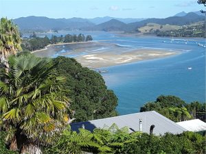
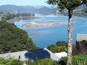
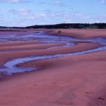
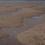
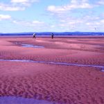
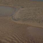
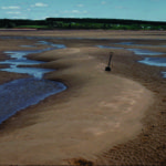
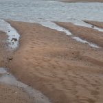
Tairua estuary, east coast Coromandel Peninsula, New Zealand.  Two images taken during falling tide, exposing attached and semi-detached sand-shell bars. The main channel is at bottom of each image.


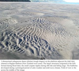
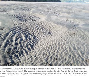
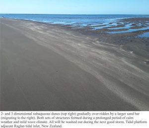
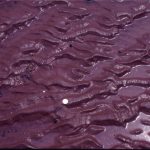
Raglan ebb tidal delta, bedforms on the platform attached to the permanent shoreface


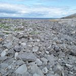
The estuary on the south side of Galway Bay, County Clare, Ireland, near New Quay. The boulder-cobble beach consists almost entirely of Burrens limestone (Carboniferous). Left view from Abbot Hill.

Mudflats and algae, Kinvara, at the head of the estuary, south side Galway Bay.


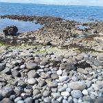
Karst in Burren Limestone at Flaggy Shore, New Quay, County Clare, has been accentuated by salt corrosion and mechanical erosion. It is overlain by boulders of locally derived Carboniferous limestone


Boulder storm ridge at Black Head, County Clare – the heart of the Burrens. All boulders are locally derived Carboniferous limestone


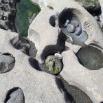
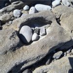
Potholes in Burren Limestone, Flaggy Shore, County Clare.


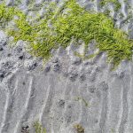
Sea grass, ripples, and burrow excavations in a tidal pool, Flaggy Shore, County Clare


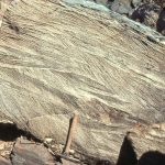
Large, 2D dunes, intertidal Minas Basin, Fundy Bay


Shallow subtidal to intertidal, 2D subaqueous dunes, Rowatt Fm, Belcher Islands (Aphebian, about 2 billion years old). Hammer for scale.


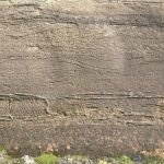
Cross-sectional view of 2D subaqueous, intertidal dunes, showing complex migrating dune-formed crossbedding, and dune reactivation, Rowatt Fm, Belcher Islands (Aphebian, about 2 billion years old). The sands are mixed siliciclastic-carbonate (dolomite).


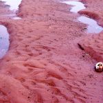
Reactivated 2D dunes with superposed ebb tide ripples, Minas Basin, Fundy Bay


Proterozoic tidal inlet, showing cross-section of reactivated subaqueous dunes (mid image), possible herringbone crossbeds, and smaller ripples. Rowatt Fm, Belcher Islands (about 2 billion years old). Lens cap bottom right.


Multiple dune sets, intertidal, Minas Basin, Fundy Bay


Sandy tidal flat ripples, Minas Basin, Fundy Bay


Paleocene, straight crested and bifurcating intertidal ripples, Expedition Fm, Axel Heiberg Is;and, Canadian Arctic


Straight-crested ripple train in Paleocene intertidal deposits, Expedition Fm, Axel Heiberg Island, Canadian Arctic. Hammer left-mid image.


Flood tide ripples over-ridden by smaller ebb tide ripples sets. Minas Basin, Fundy Bay


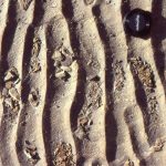
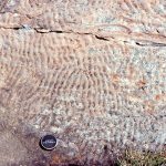
Interference ripples in Proterozoic tidal flat facies, Belcher Islands


Large 2D and 3D dunes, and superposed run-off ripple sets, Minas Basin Fundy Bay


Tidal flat, interference ripples, Minas Basin Fundy Bay


Ebb tide run-off & reactivation of 3D dunes, Minas Basin Fundy Bay


Large 3D dunes, Minas Basin Fundy Bay


2D flood tide dunes and small ebb tide ripples,  Minas Basin Fundy Bay


2D and 3D intertidal dunes, Minas Basin Fundy Bay


Eroded salt marsh cycles, Minas Basin Fundy Bay


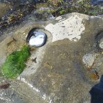
Small meandering tidal channel in very muddy estuarine tidal flats, Whitford Estuary, south Auckland. Bank failure is common.


Salt marsh, sedges and small mangroves being transgressed and eroded by tidal flat. This is a modern example of a ravinement surface. Whitford, south Auckland


Eroded salt marsh deposits, transgressed by sandy tidal flat – beach. The erosion surface is a modern, active ravinement surface. Galveston, Texas.


Two examples of Paleocene tidal bedding (mostly lenticular and wavy bedding) interfingering with  lagoon and marsh. Eureka Sound Group, Ellesmere Island


Paleocene tidal bedding interfingering with marsh-lagoon-bay sediment. On the right, the thicker sandstones may represent storm washovers into the bay. Eureka Sound Group, Ellesmere Island


Coarsening- and sandier-upward bay or lagoon subtidal to beach, cut by small tidal channels (lenticular sandstones). Eocene, Eureka Sound Group, Ellesmere Island.


Ebb tidal delta at the mouth of Waikato River, south Auckland.


Paleocene subaqueous dunes up to 2m amplitude, in tidal inlet-delta, overlain by thin tidal flat-salt marsh deposits. Expedition Fm, Axel Heiberg Island, Canadian Arctic


Large within-channel dunes in a tidal inlet associated with a sand spit facies; the spits and bars were attached to (paleotopographic) headlands across an unconformity eroded into Ordovician carbonates. Paleocene, Eureka Sound Group, Ellesmere Island.


Two views of the unconformity between Ordovician carbonates and Paleocene estuarine-tidal channel-spit facies. Eureka Sound Group, Ellesmere Island.


Typical beach stratification in an eroded berm; primarily laminated sets with low-angle truncations, parallel, or slightly inclined to the beach face.


Tidal inlet standing waves (antidunes) in an outgoing tide, Mangawhai Heads, north Auckland. The antidunes migrate up-current (against the current) and gradually build until they break, subsequently reforming.


Proterozoic tidal channel – inlet trough crossbeds; this outcrop gives a 3-dimensional view of individual sets. Paleoflow was into the image. Rowatt Fm. Belcher Islands.


Flaser, lenticular and wavy bedding in late Pleistocene deposits near Ihumatao, Auckland.  White muddy sediment overlies and envelopes grey sandy ripples, and fills troughs between ripples.


Coastal dunes, Galveston coast, Texas


Washover fan breaching coastal dunes, Galveston coast, Texas


Paleocene washover fan sandstone associated with barrier island and tidal inlets (see images above from the same formation), Expedition Fm, Axel Heiberg Island, Canadian Arctic.


Stacked storm deposits associated with an upper tidal flat, each layer consisting of ripped up muds. Rowatt Fm, Belcher Islands. Proterozoic.


Mudcracks in salt marsh, Kaiua, NZ


Proterozoic supratidal desiccation cracks and voids in multiple layers of delicately laminated dololutite. Some curled slabs may be coated with crpytalgal laminae. A layer of storm-derived lutite rip-ups at the bottom of the image. Rowatt Fm. Belcher Islands. See below for a modern analogue.


Desiccated, curled, algal mats from a salt marsh near Galveston Texas. The mats are easily disturbed during high or storm tides.


Mangroves: Left image: stabilizing shell banks (storm ridges) adjacent a tidal Inlet, Auckland Harbour; Right image: in a salt marsh, Kaiua, bordering Hauraki Gulf.


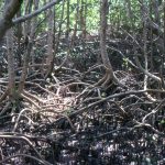
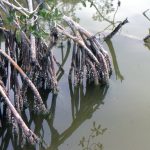
Everglades Mangroves, Florida.  A tangle of roots and pneumatophores  that are living quarters for so many species.  On the right, an epifauna of barnacles, small snails and bryozoa.

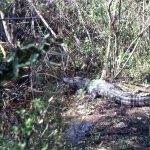
Everglades alligators, including the little guy on its parent’s head.


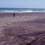
Gravel bar formed at the intersection between a high energy, West coast New Zealand beach, and the Tangahoe River mouth


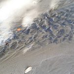
ripples heavy mineral concentration

Ripples on a sand flat, with concentration of heavy minerals from local rhyolites and dacites. Little Bay, Coromandel.


Facebooktwitterlinkedininstagram
Facebooktwitterlinkedin

Atlas of aeolian deposits

Facebooktwitterlinkedininstagram

Aeolian dunes along coasts and in deserts

Here are some examples of modern and ancient sand dunes from continental and coastal settings. Click on the images for an expanded view.

The Atlas, as are all blogs, is a publication. If you use the images, please acknowledge their source (it is the polite, and professional thing to do). 

This link will take you to an explanation of the Atlas series, the ownership, use and acknowledgment of images.

Click on the image for an expanded view, then ‘back one page‘ arrow to return to the list


The images:

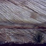
Close up of Jurassic Navajo Sandstone dune crossbeds with tangential toe-sets, Zion National Park, Utah. Image height is about 2m. Large sand dune complexes in a continental desert, about 180 million years ago.


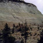
Really big dune foresets (lee-face deposits) in the Jurassic Navajo Sandstone, Zion National Park, of southern Utah


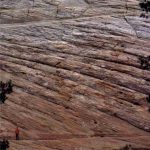
Closer view of the exposure in above image, showing large foresets and individual dune truncation. The person (bottom left) is about 2m tall. Navajo Sandstone, Zion National Park, Utah


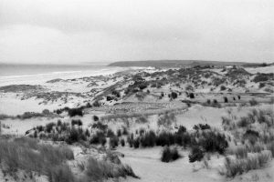
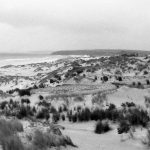
Coastal dunes bordering Great Exhibition Bay, northernmost New Zealand. The white sand contains 90-95% quartz.  Much of the sand for the modern dunes comes from reactivation of late Pleistocene dune complexes, and sand stored on the sea floor.


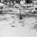
Dune sets in Late Pleistocene deposits, Great Exhibition Bay, northernmost New Zealand.


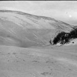
Large, active barchan dunes traverse Kokota sandspit that forms a protextive barrier to Parengarenga Harbour, northernmost New Zealand. This view is of the main lee face. The dune is about 8m high.


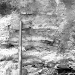
Small lakes and ponds that are sometimes perched between sand dunes, accumulate mud, sand and peaty material from plants. Here are at least 6 interdune pond mud layers, some with fossil roots (also replaced by clays). See also the image below. Late Pleistocene, Great Exhibition Bay.


Interdune lake near the inland margin of stabilized, Pleistocene sand dunes, Kariotahi, south Auckland, NZ.


Multiple dune sets in a Pleistocene sand barrier, Kariotahi, south Auckland. Formation of the old sand barrier and dune field eventually created the straightened coastline that typifies the west coast of North Island.  The barrier formed during repeated rises and falls in sea level over about 2 million years.


Multiple dune sets in Pleistocene sands (Same cliff face as image above), indicating a fairly consistent orientation of the preserved lee faces, and the direction of dune migration (to the left – east). Kariotahi, Southwest Auckland, New Zealand.


Barrier and dune sands, Kariotahi, south Auckland. Here an older set of dunes (orange weathering) are capped by an thin soil and bands of iron oxide (along the surface that slopes steeply to the left). The soil would have stabilized the older dune sands. A younger set of dunes formed over the top of the old soil.


A more panoramic view of the old soil and dunes in the image above.


The landward margin of Pleistocene sand dunes, now stabilized. The steep slopes are the old lee slopes (the steep surface of the dune that faces down-wind). When active, the dunes would have migrated towards the viewer. Kariotahi, south Auckland.


Reddened sandstone with large dune crossbedding, in the New Red Sandstone on Arran, west Scotland. The red colours are formed by iron oxides, after the sand was deposited during the Permian through Triassic – 280 to 200 million years ago.


Multiple dune crossbed sets in New Red Sandstone, Arran, west Scotland, 280 to 200 million years old.


Salt-tolerant grasses and shrubs extend their roots deep into the dunes to capture as much moisture as possible, and in so doing help to stabilize the dune.


Mesquite Flat dunes, Death Valley, near Stovepipe Wells.  An inland ‘sea’ of sand, usually organized as dunes, is called an erg.


Dune sand at Mesquite Flat, migrating over desiccated pond silts. Death Valley


At least two generations of wind ripples in Mesquite Flat dunes. All those trails attest to numerous insects and the larger critters that hunt them.

Facebooktwitterlinkedininstagram
Facebooktwitterlinkedin

In the field: Windows into two billion year-old rocks

Facebooktwitterlinkedininstagram

My early geological education was very much New Zealand centered; the gamut of sedimentary, igneous and metamorphic rocks (there are no Precambrian rocks in New Zealand), in the context of a landmass (and attached submerged bits) still rent by active faults and erupting volcanoes. The timing was fortuitous. We were taught at the cusp of the ‘new tectonics’, sea-floor spreading, and the morphing of continental drift into plate tectonics.  The fixists were a disappearing breed; now everything was on the move, attached in some way to one tectonic plate or another, rifted, drifted, and eventually subducted. Now, the rock formations, faults (particularly the Alpine Fault), and the volcanoes, were all connected in one, all-encompassing global, plate tectonic system.  Geologically active New Zealand had a place in this grand scheme.

Admittedly, not all our professors found it easy to teach these revolutionary ideas. We would be exhorted to go and read the latest journal papers, and come back with questions – I guess this gave the teachers time to read the articles themselves. But it was an exciting time, reading the claims and counterclaims. It really was a (Thomas Kuhn) paradigm shift.

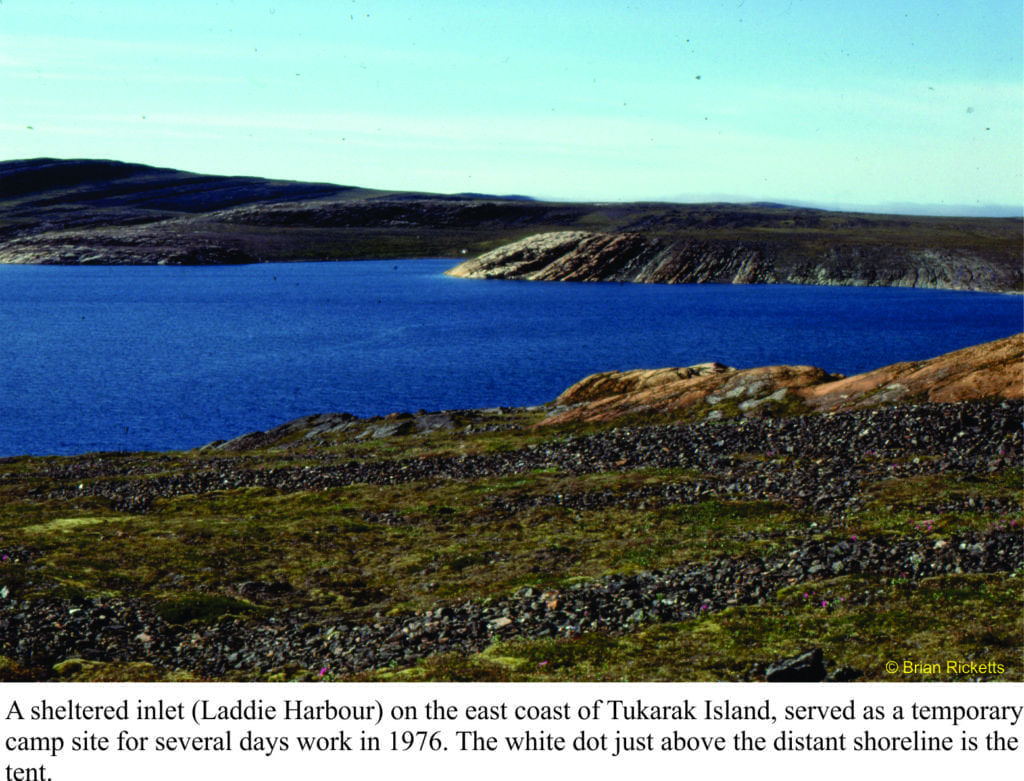
Landing on the shores of Belcher Islands (Hudson Bay) was also something of a mind warp; from a country that straddles a plate boundary, has a volcanic rift zone in central North Island, and faces a subduction zone within a stone’s throw of the east coast, to a part of the Canadian Shield where not much has happened over the last two billion years.  Perhaps that’s a bit of an exaggeration, but this prolonged period of stasis had its advantages.  The rocks, despite being about 2000 million years old, are loaded with beautifully preserved structures and fossils.  They were not cooked by metamorphism during the time they spent being buried, nor fractured beyond recognition by tectonic forces. Basically, everything was intact. Stunning.

For someone interested in deciphering ancient sedimentary environments, being parachuted into the Belchers and being told to take the rocks apart, layer by layer, sequence by sequence, was initially a tad scary; an emotional response that quickly dissipated once the measuring, observation, and interpretations had begun. On finishing the work on one set of exposures, we couldn’t wait to get to the next, and the next.

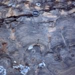
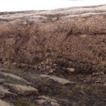
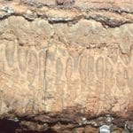
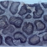
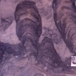
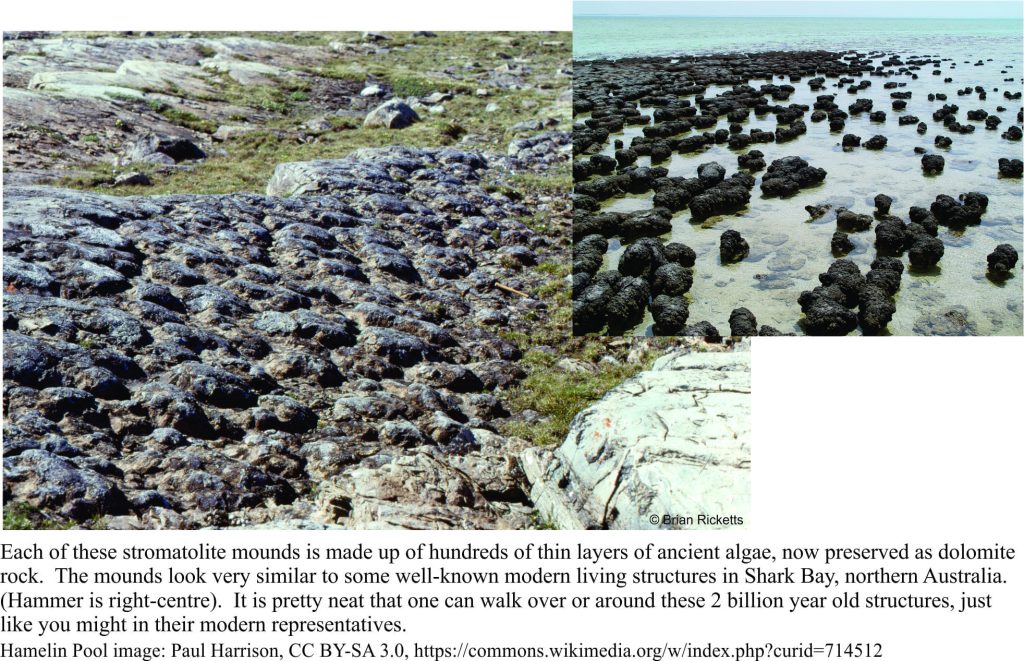
Ancient and modern stromatolite domes

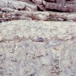
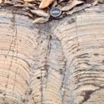
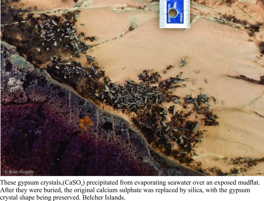
If you were to stand all the Belcher strata in a single pile, it would be almost 9 km thick. But this pile was subsequently tipped on its side. Over the eons, the rocks were eroded by rivers and scraped by ice, fortuitous levellers that provided windows into each layer. Geologists are enticed to enter these portals, at least in their mind’s eye; the rewards are huge.  We can envisage times when there were broad platforms of limestone (now all converted to the mineral dolomite), that harboured a massive biomass of primitive algae, stromatolites of all shapes and sizes; layers as thin as a fingernail, and reefs 10s of metres high. The platforms were covered by warm, seas that shoaled into tidal flats and (deserted) beaches. Some areas infrequently inundated by high tides, became desiccated; there are remnants of minerals like gypsum and halite (common salt) that attest to salty seas. Walking over rocks like these kindles the imagination; a beach stroll, waves rolling in like they have done for billions of years, or parched landscapes exposed to the full effects of sunlight uninhibited by oxygen and the UV dampening effects of ozone (the incidence of UV light must have been intense). The experience is humbling.

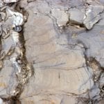
Gypsum (replaced by dolomite) in a Paleoproterozoic tidal-supratidal flat

However, idylls have a tendency to dissipate in the fog of time or, as was the case here, a smothering by erupting ash columns and lava flows. Now we get to walk across the tops of really ancient lava flows, around piles of pillow lavas, or along catastrophic pyroclastic flows of ash and pumice.  The earlier tropical paradise had been obliterated, but even in this volcanic brutality there is wonder.

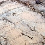
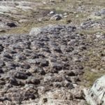
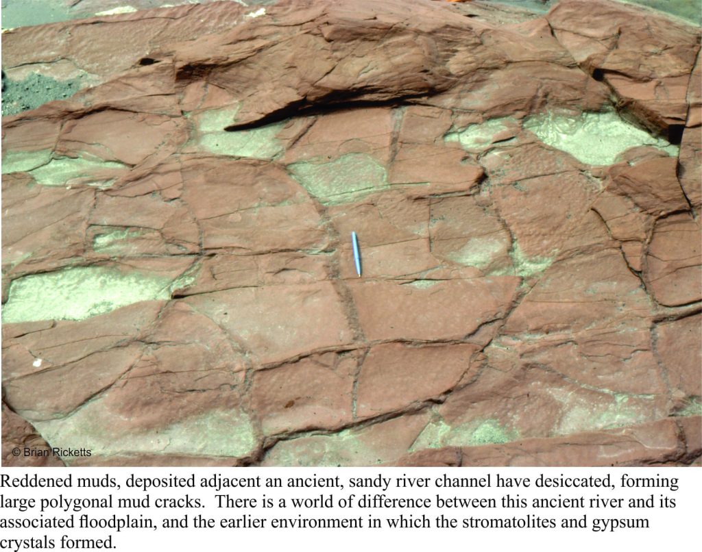
Mud cracks in a 2 billion year river deposit

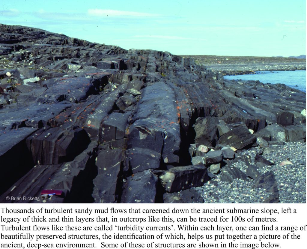
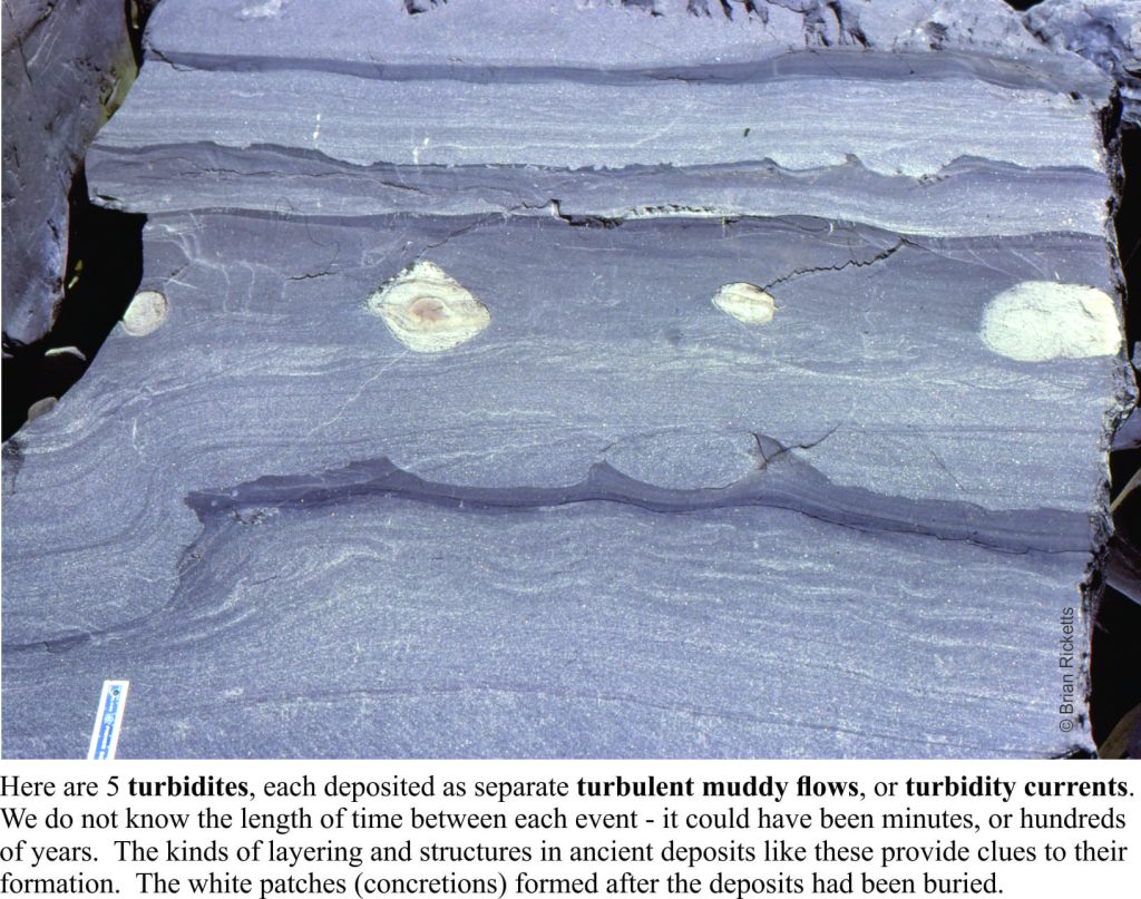
Other strata tell of deep seas fed by turbulent mud flows cascading down an ancient submarine slope, and of sandy rivers turned red by iron oxidized by the gradually increasing levels of oxygen in the ancient atmosphere (deposits like this are commonly referred to as red beds). In every layer, every rock we looked at, there were mysteries waiting to be unravelled. A geologist cannot hope to solve all such questions, but finding a solution to even one of them is incredibly satisfying.
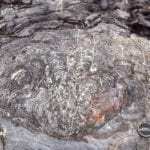
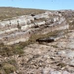
Lots of turbidites in a deep, Paleoproterozoic basin

I spent a total of 5 months in the field during the 1976-77 summers. This was not the kind of location where, if I’d forgotten to do something, I could whip back for a couple of days to sort things out. Several of my student colleagues were doing similar kinds of research in remote parts of the country – field seasons were long. Once you had arrived, you were there for the duration. And despite the sense of excitement and discovery, it was always good to get back home.

Some details of turbidite beds showing complete and partial Bouma intervals

Facebooktwitterlinkedininstagram
Facebooktwitterlinkedin

Ropes, pillows and tubes; modern analogues for ancient volcanic structures

Facebooktwitterlinkedininstagram

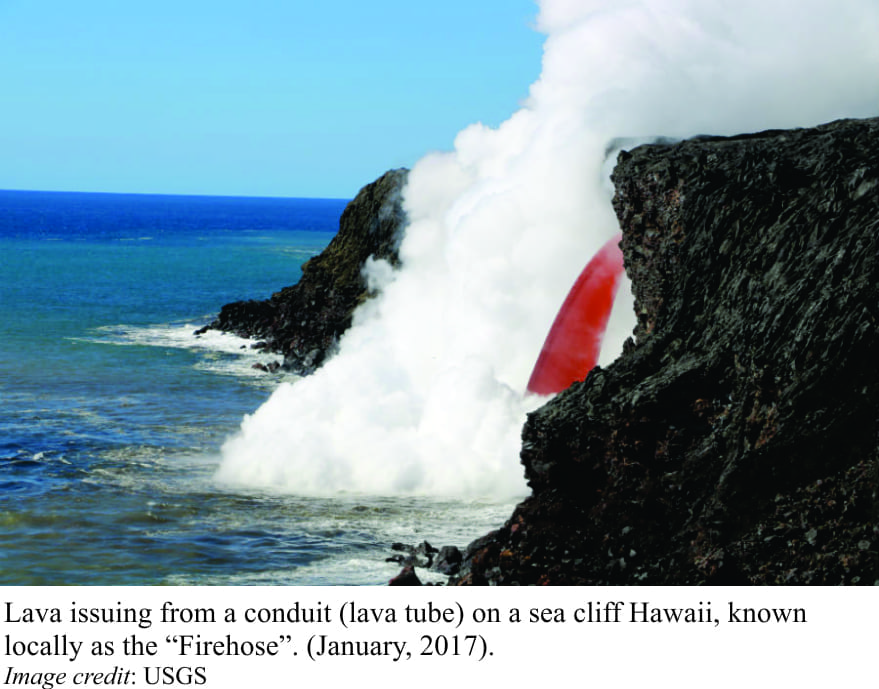
Analogies are the stuff of science. In geology, we frequently employ modern analogies of physical, chemical, or biological processes to help us interpret events that took place in the distant past. We cannot observe directly geological events beyond our own collective memory. Instead, we must infer what might have taken place based on evidence that is recorded in rocks, fossils, chemical compounds, and the various signals that the earth transmits (such as acoustic or electrical signals).  Analogies are not exact replicas of things or events, although they may come quite close. Their primary function is to guide us in our attempts to interpret the past.  As such, they are part of our rational discourse with deep time. Analogies are at the heart of the concept of Uniformity espoused by our 18th and 19th century geological heroes, James Hutton and Charles Lyell; they are the foundation for the common dictum “the present is the key to the past”, coined by Archibald Geikie, an early 20th century Scottish geologist.

Even though lots of people have written about this, I figure one more example that illustrates the methodology won’t hurt. Forty years ago, I worked on some very old rocks on Belcher Islands, Hudson Bay, that included volcanic deposits. Looking at the photos (35mm slides), I still marvel at the geology, the fact that something almost 2 billion years old is so well preserved, makes it look like the volcano just erupted.
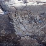
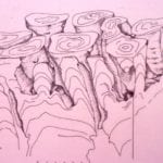
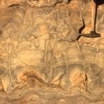
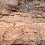
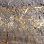
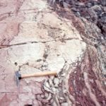
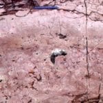
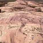
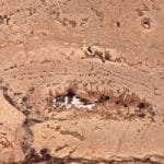
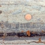
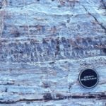
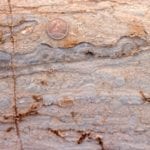
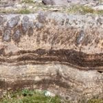
Here are three ancient structures that were constructed by flowing basalt lava. Each can be compared with modern volcanic structures and processes that we can observe directly.  We can interpret the ancient structures according to the similarities and differences between the modern analogues and the ancient versions. The examples are from strata known as the Flaherty Formation, a succession of volcanic rocks exposed on Belcher Islands, Hudson Bay. Continue reading
Facebooktwitterlinkedininstagram
Facebooktwitterlinkedin