 Unconformities – missing geological time
The Atlas, as are all blogs, is a publication. If you use the images, please acknowledge their source (it is the polite, and professional thing to do).
Stratigraphy is a cornerstone (sic) of the earth sciences. With it, we unravel earth’s history, the sequence of events and processes that have given us the world we live in. It is the story, written in rocks and fluids, of the physical, chemical, and biological world. Perhaps we should now include the social and psychological spheres of our existence, as part of the latest geological period, the Anthropocene – layer upon layer of human thought, actions, consequences.
Unconformities are a fundamental part of Stratigraphy. They are that part of the rock record in which time and rock are missing – periods of time in which rocks either did not form, or if they did form were subsequently removed. In both cases, the “missing” information tells us that something happened; the ‘something’ may have been local, confined to our own backyard, or of global extent such as extinction events, the construction of mountains or destruction of oceans. So, geologists who find unconformities don’t throw up their hands in despair; they rub their hands in glee at the promise of so many possible explanations.
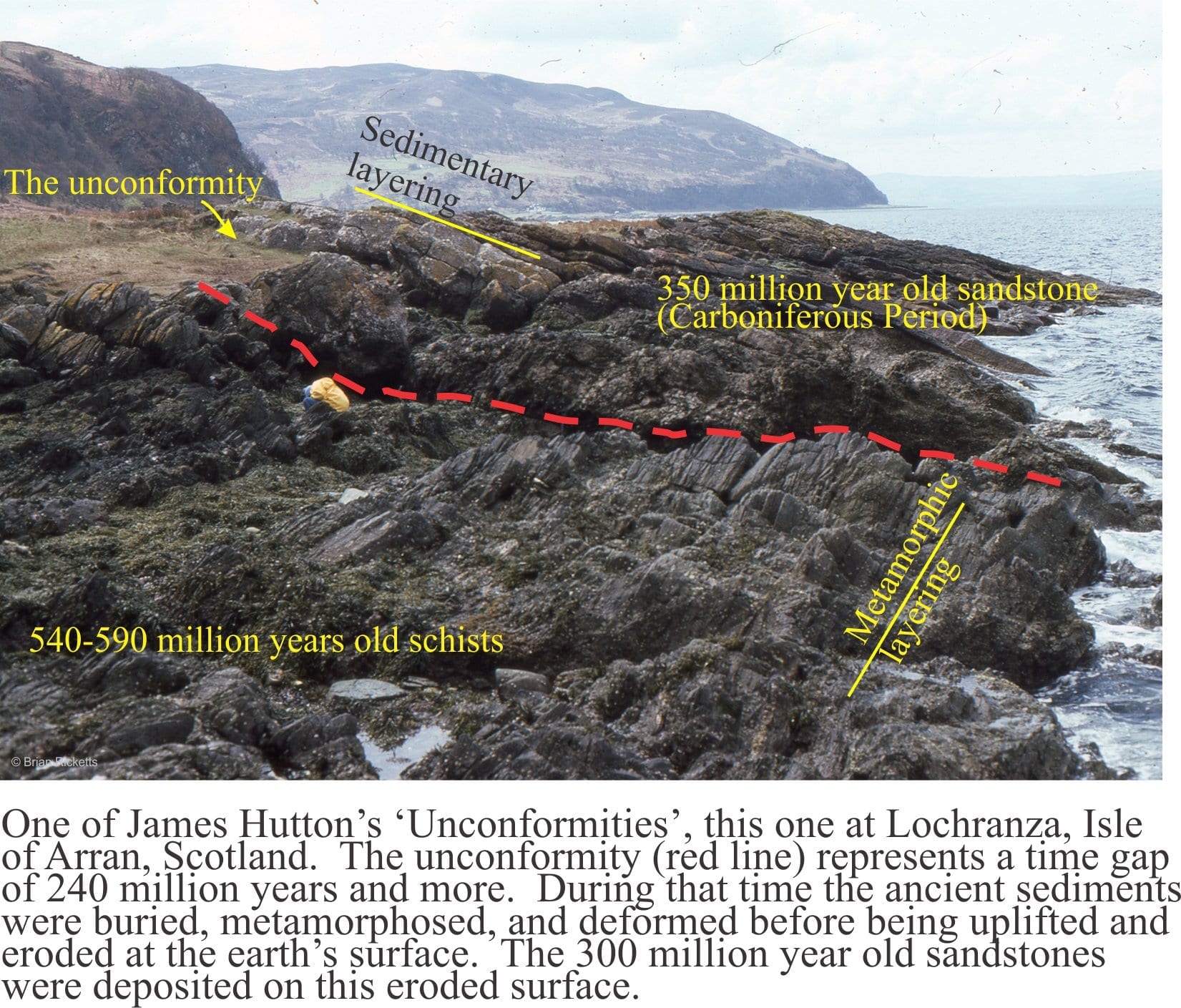
What better example to begin with than one of James Hutton’s classic localities on Arran, west Scotland (image above). This is the unconformity at Lochranza where Carboniferous sandstone overlies Late Precambrian Dalradian schist. The unconformity here represents about 240 million years of time, seemingly missing, and yet it also represents a period of mountain building, where deeply buried metamorphic rocks were uplifted many kilometres, exposed and worn down by the vagaries of ancient weather systems, and buried by sand shed from the rising mountains. This tale of the evolving earth is encapsulated in the seemingly innocuous contact between the two different groups of rock.
The images: This link will take you to an explanation of the Atlas series, the ownership, use and acknowledgment of images. There, you will also find links to the other Atlas categories.
Click on the image for an expanded view, then ‘back page’ arrow to return to the Atlas.
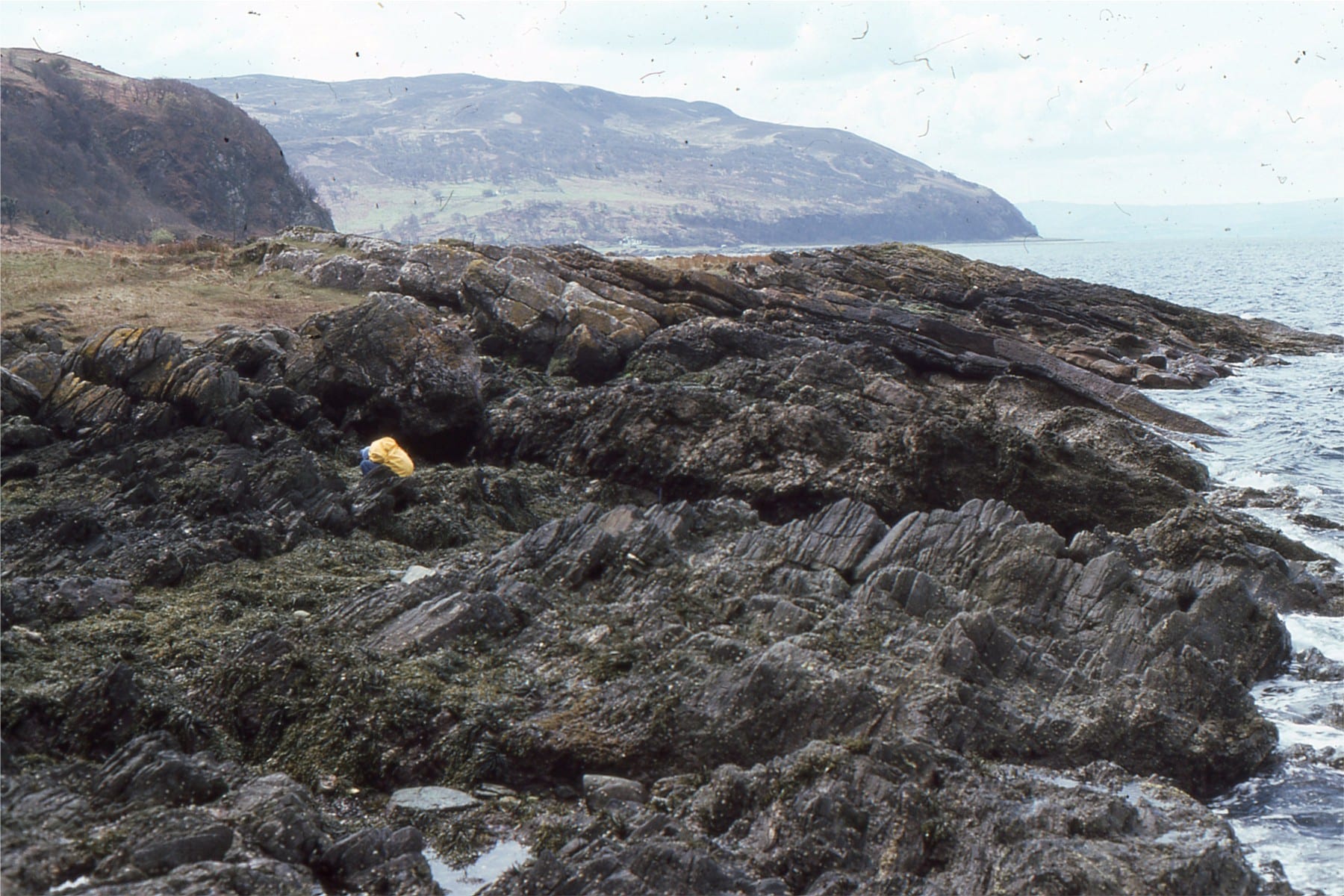
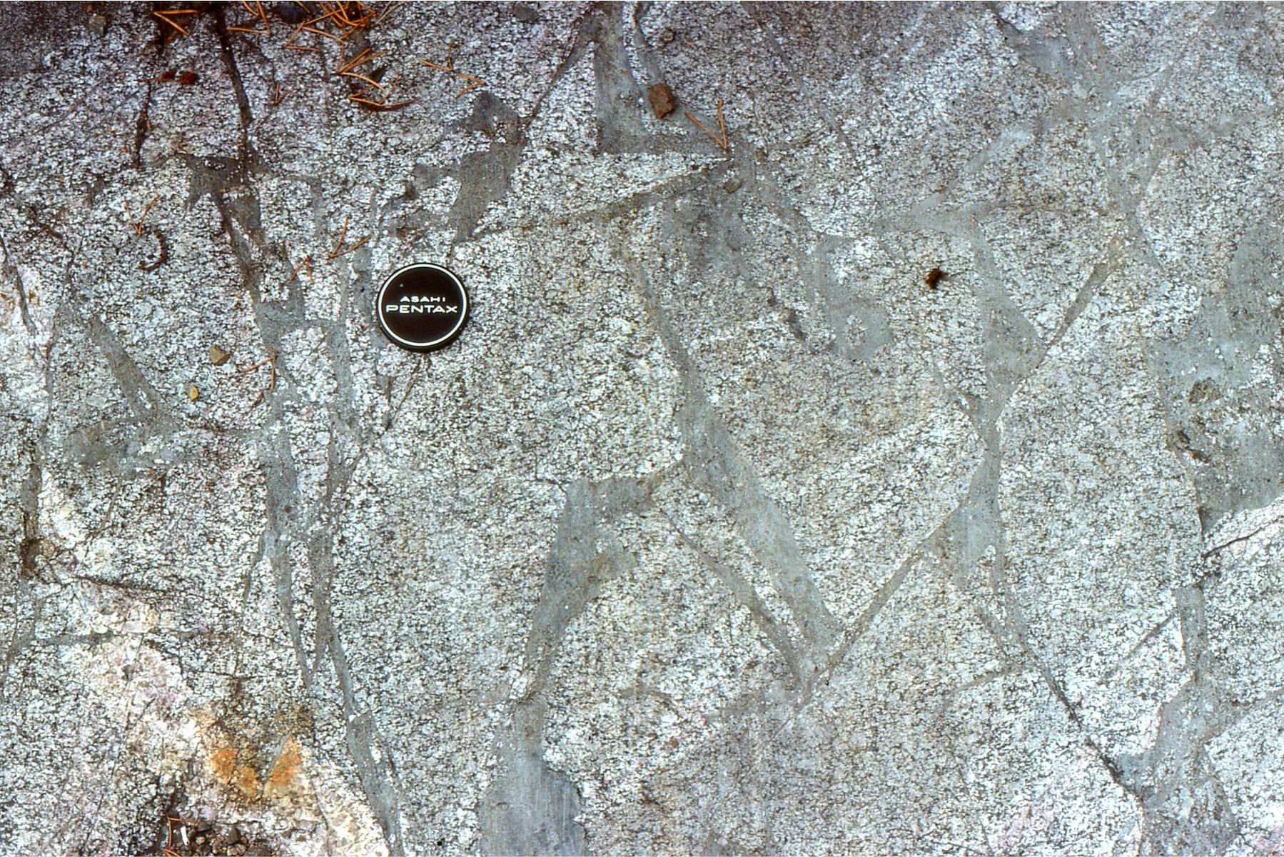
An uncluttered view of Hutton’s unconformity at Lochranza (same location as the image above)
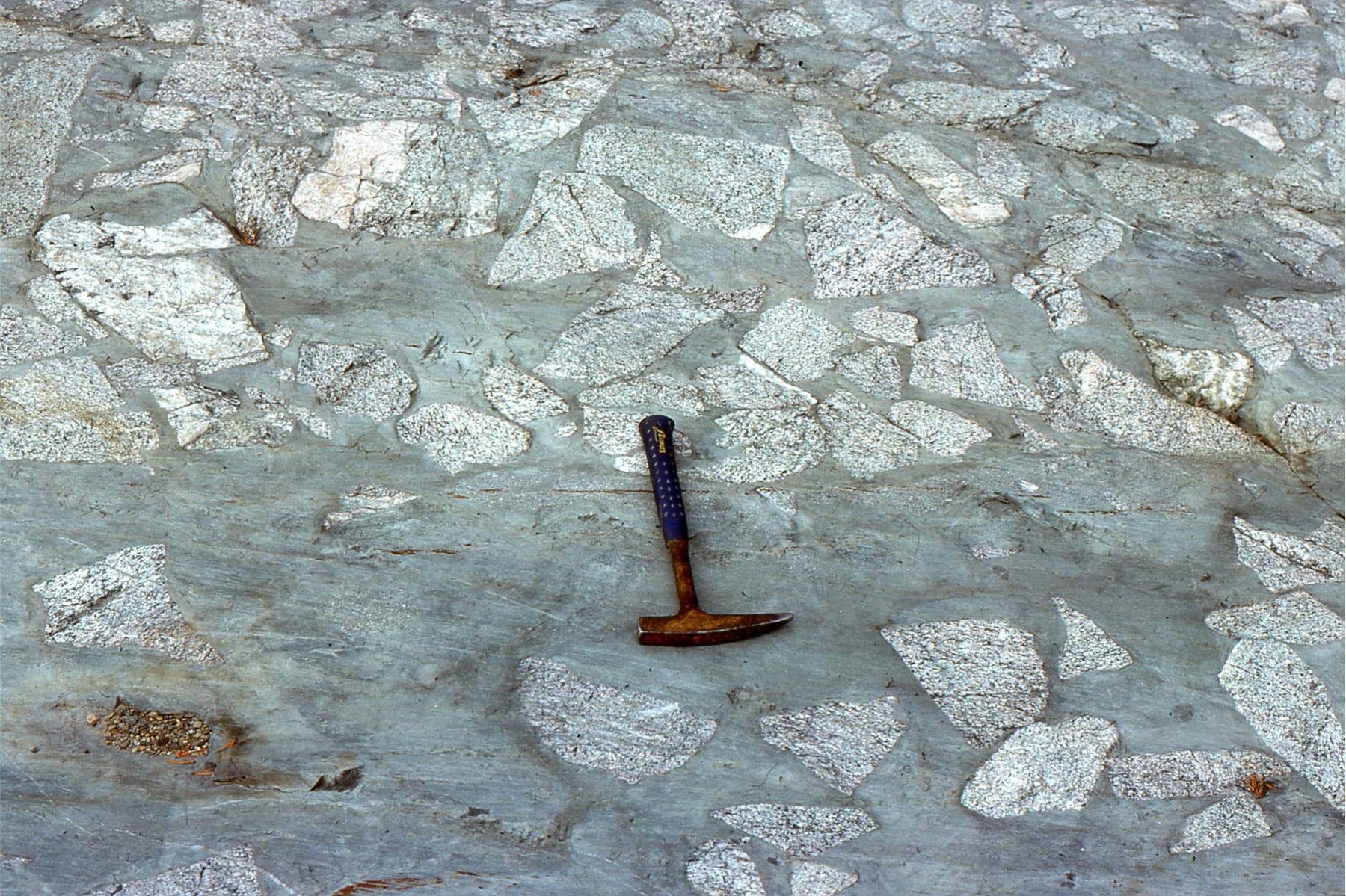
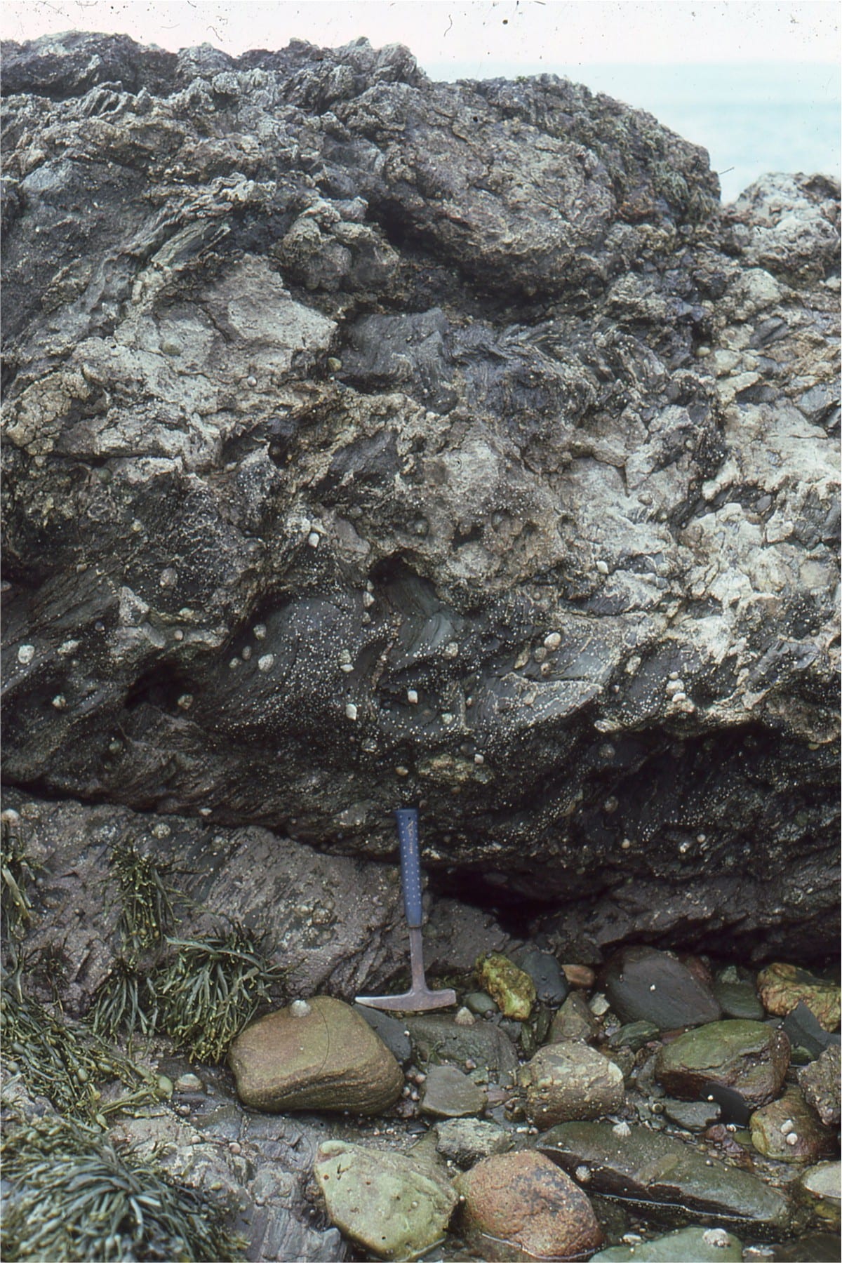 Basal conglomerate of the Carboniferous succession that onlaps Dalradian schist at Lochranza. Hammer is at the unconformity.
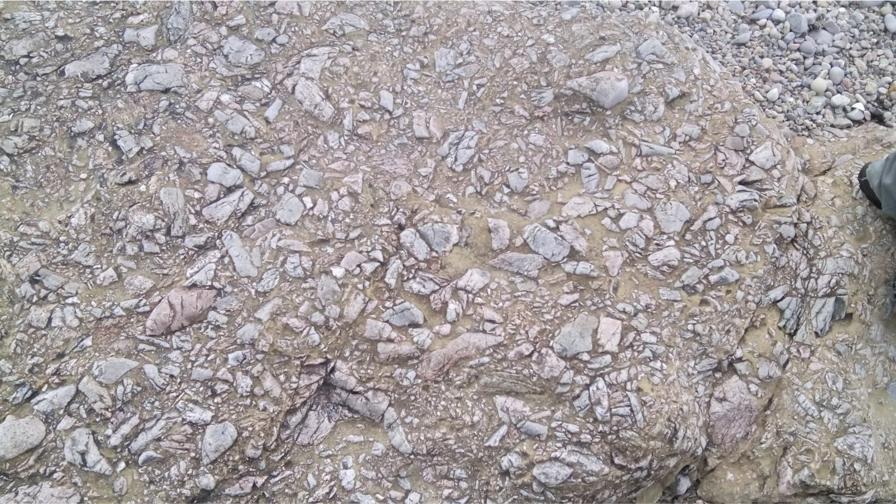
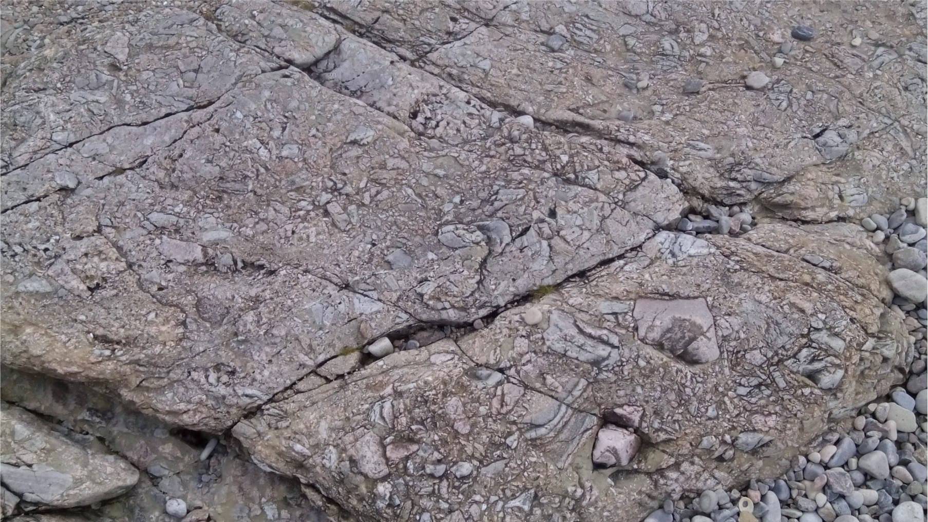
The unconformity between Archean metavolcanic and plutonic rocks at Cobalt, Ontario, and the Proterozoic Gowganda Formation, is marked by a regolith of blocky granodiorite and granite, that is overlain by diamictites deposited during Early Proterozoic glaciation.
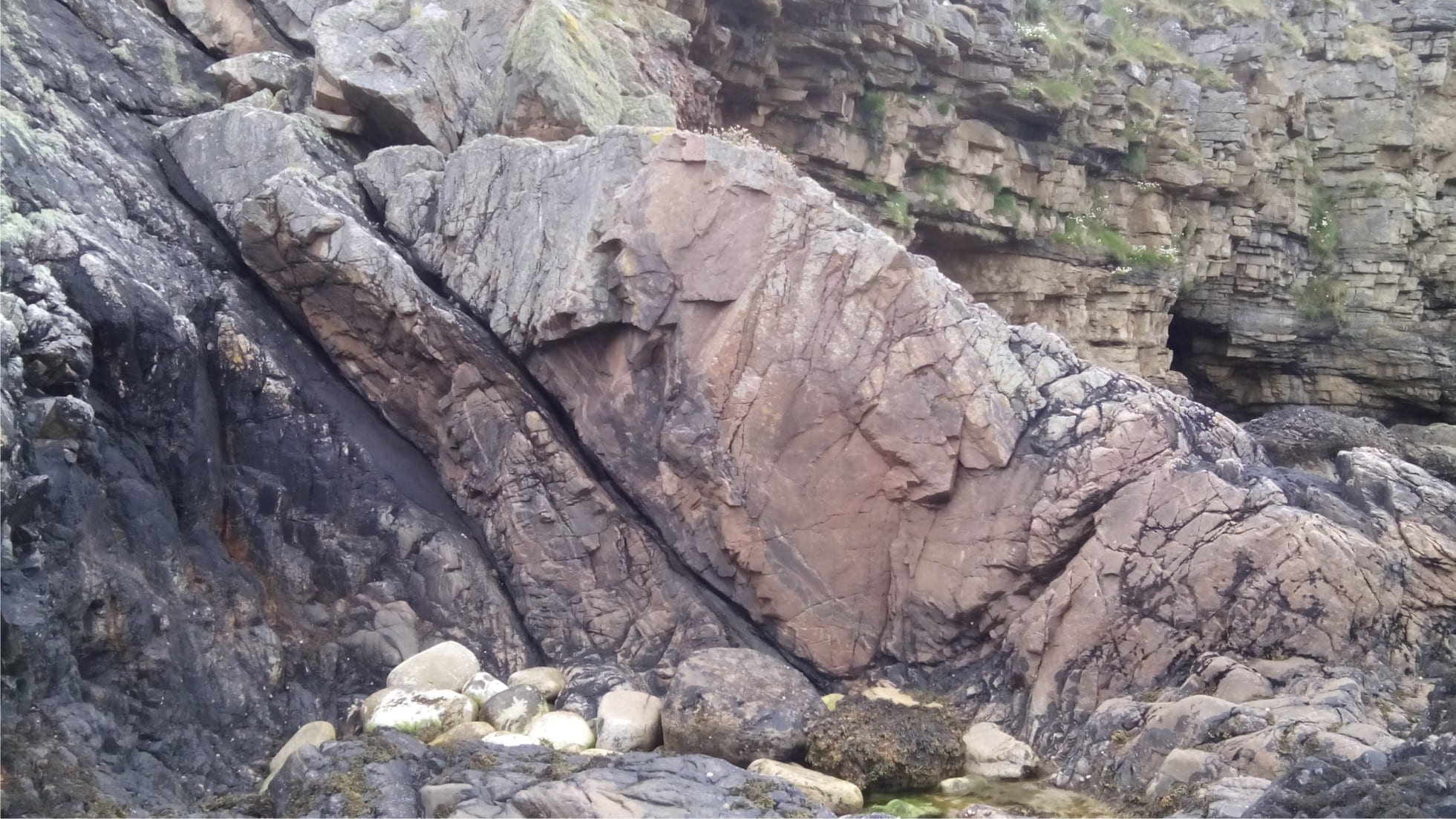
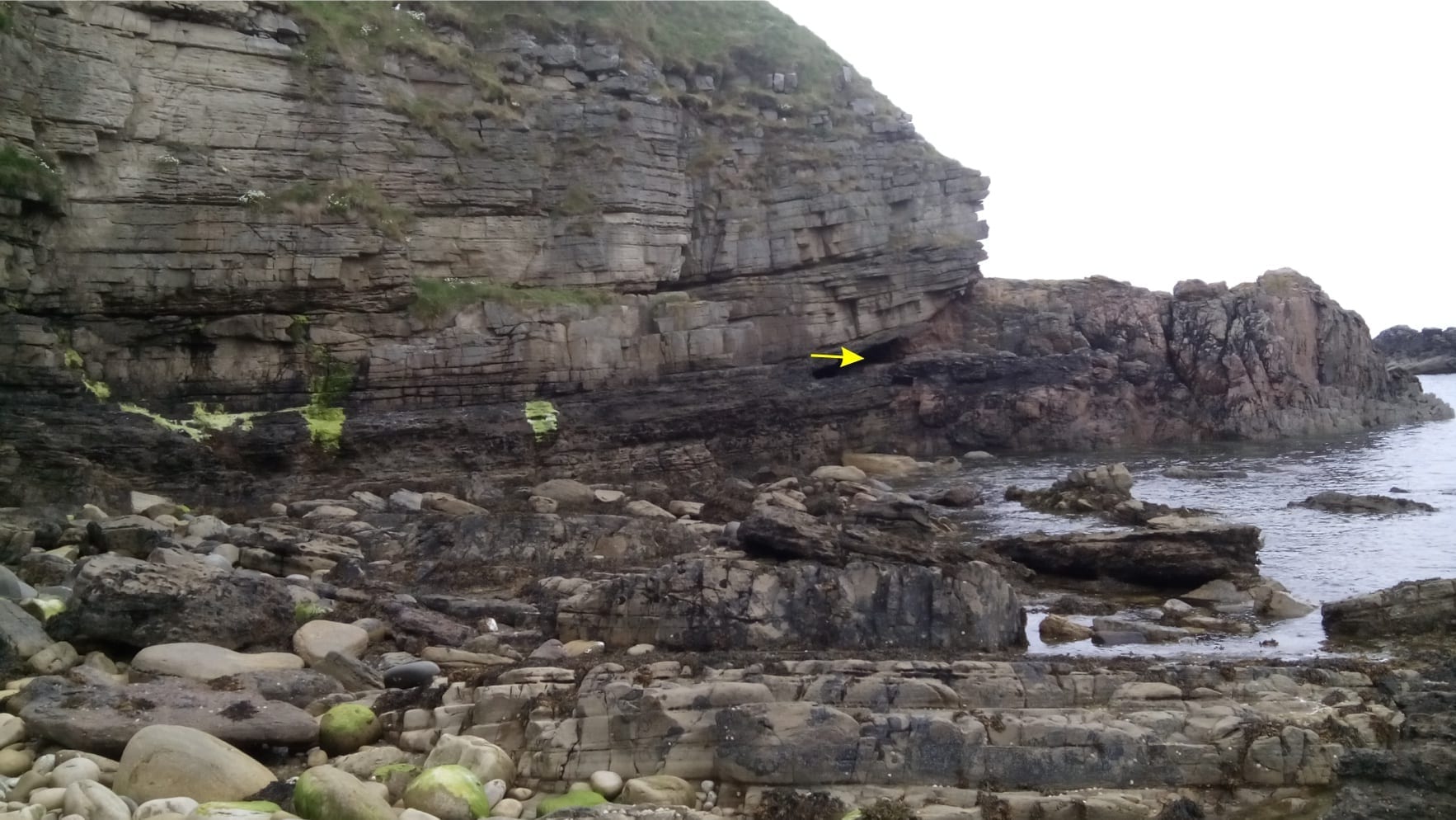
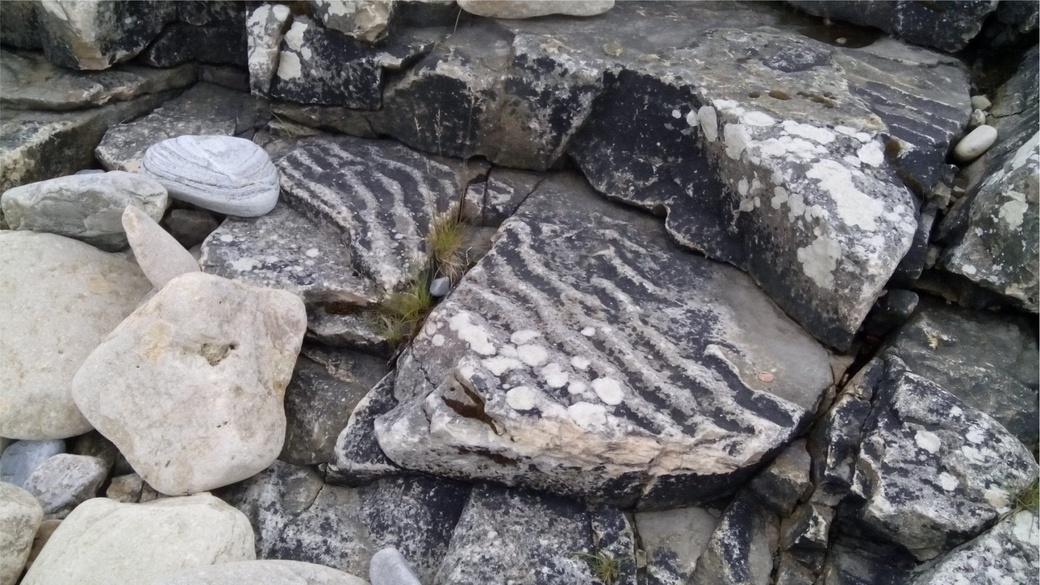
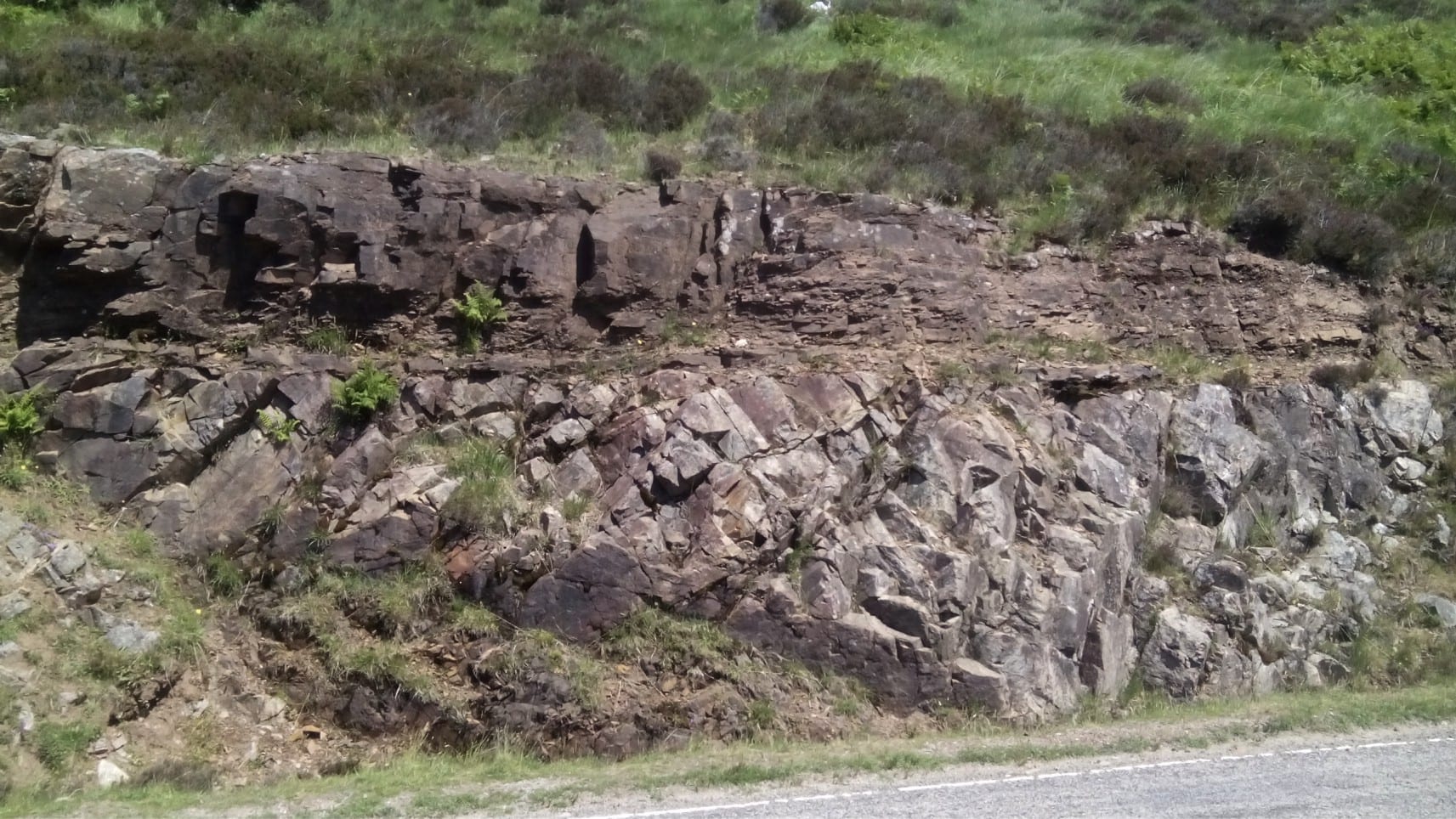
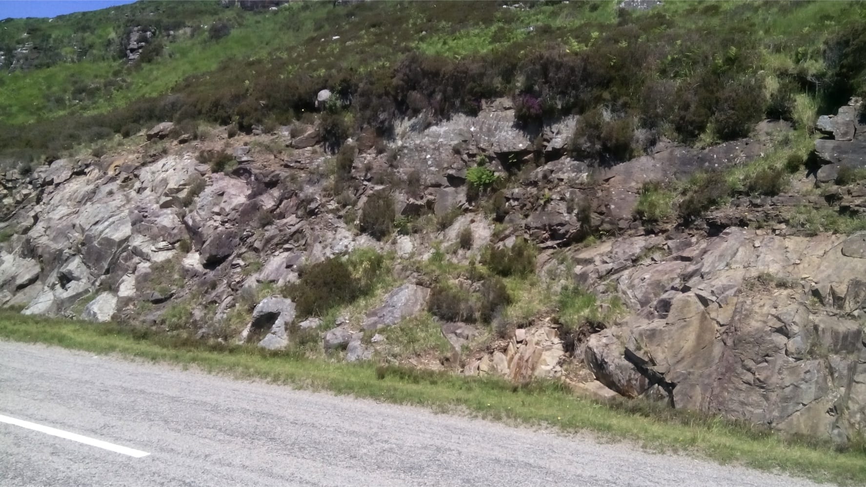
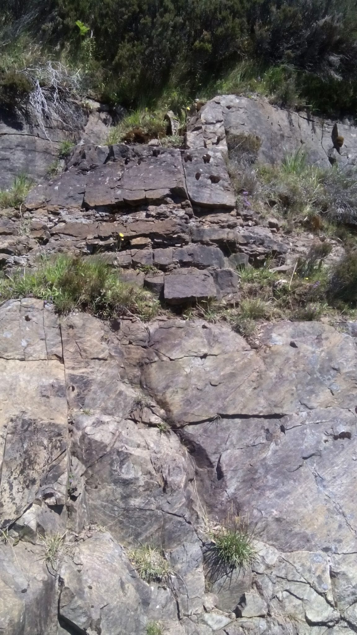
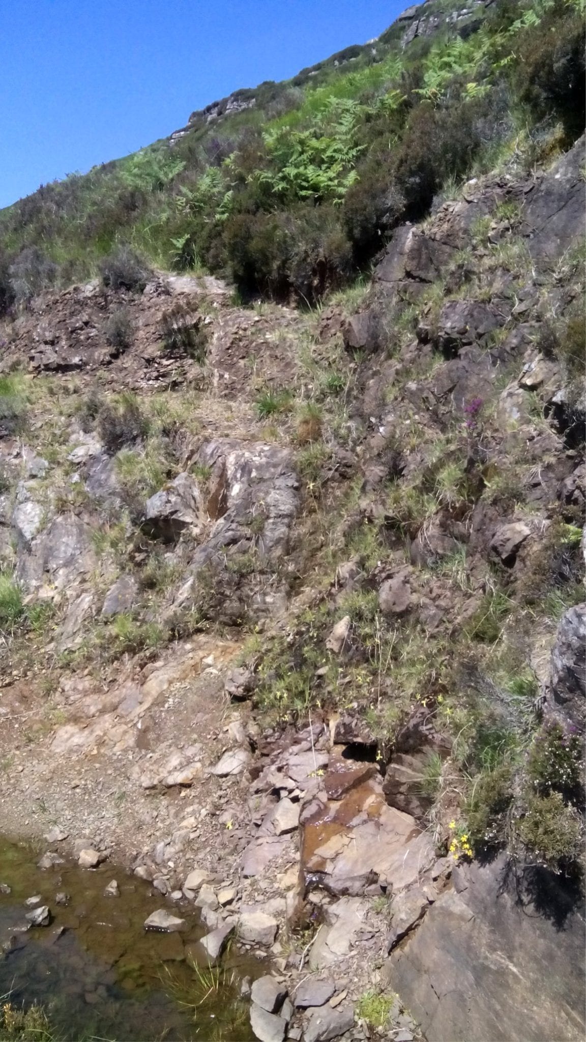
Portskerra: Old Red Sandstone (ORS) on Moine schists, north Scotland
The ORS is a mixed bag of sedimentary rocks, mostly Devonian, but extending into the late Silurian and early Carboniferous. Their importance lies in the direct association with Caledonide tectonics, where sediment was shed from the rising mountains into adjacent foreland basins. The ORS is sometimes compared with the younger Molasse foredeep successions of Europe. The unconformity at Portskerra is an erosional surface, where the ORS fills paleotopographic lows and drapes the intervening highs.
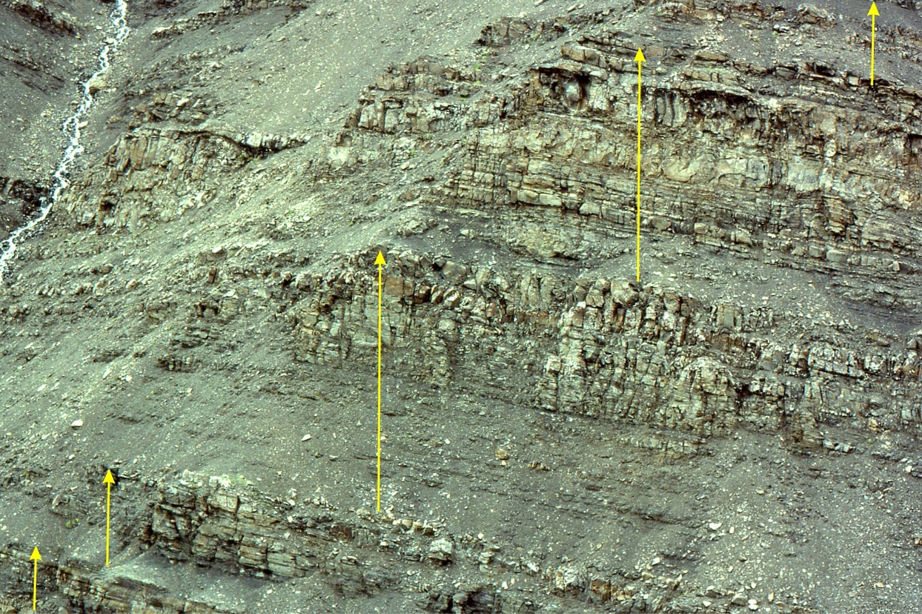
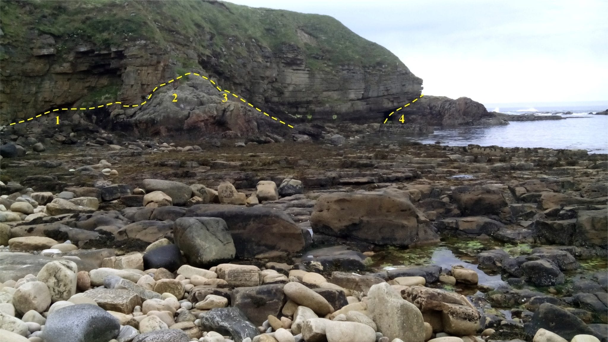 Numbered sites refer to the thumbnail images below.
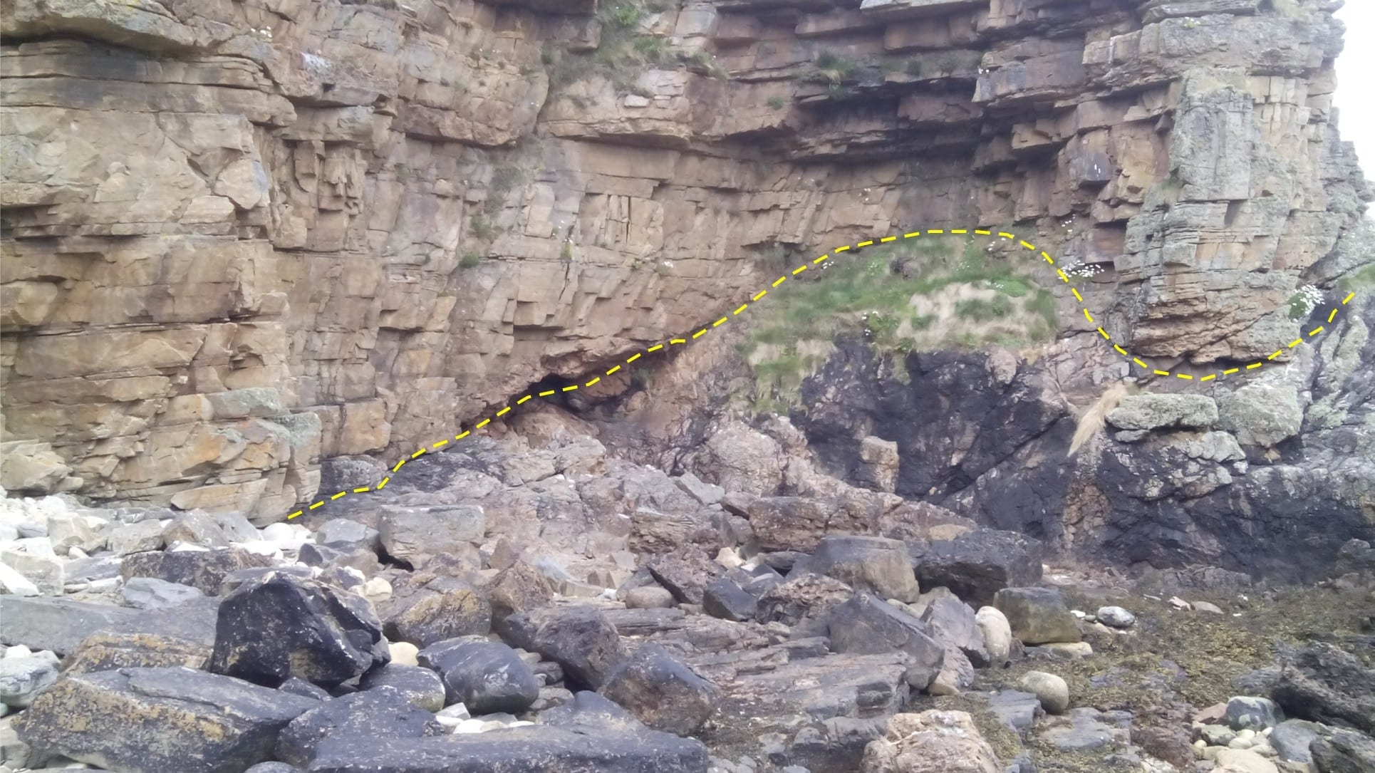
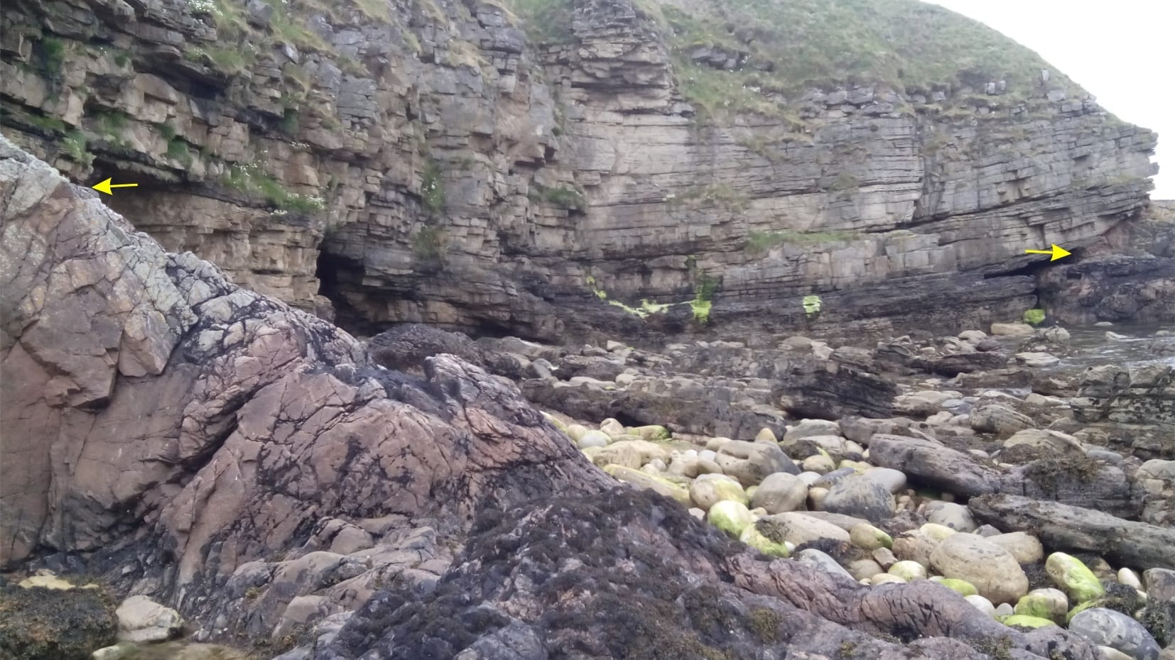
Sites 1 (left) to 4 as shown in the general view above. Moine rocks were exposed during Caledonian uplift and subsequent erosion that removed many kilometres of overlying rock. Much of this sediment was deposited as ORS.
A coarse ORS breccia, consisting almost entirely of fragmented Moine schist, overlies the unconformity.
The ORS beds contain shallow trough crossbeds and ripples, and occasional pebble-cobble lags that mark the base of channels.
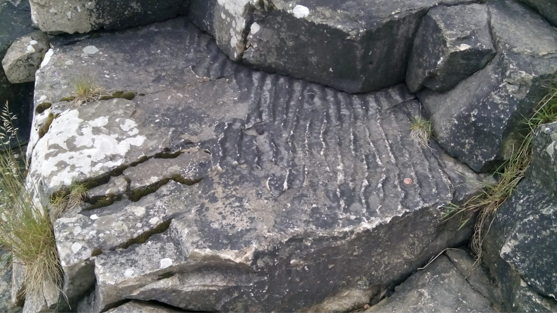
Rippled sandstone in beds a metre above the unconformity.
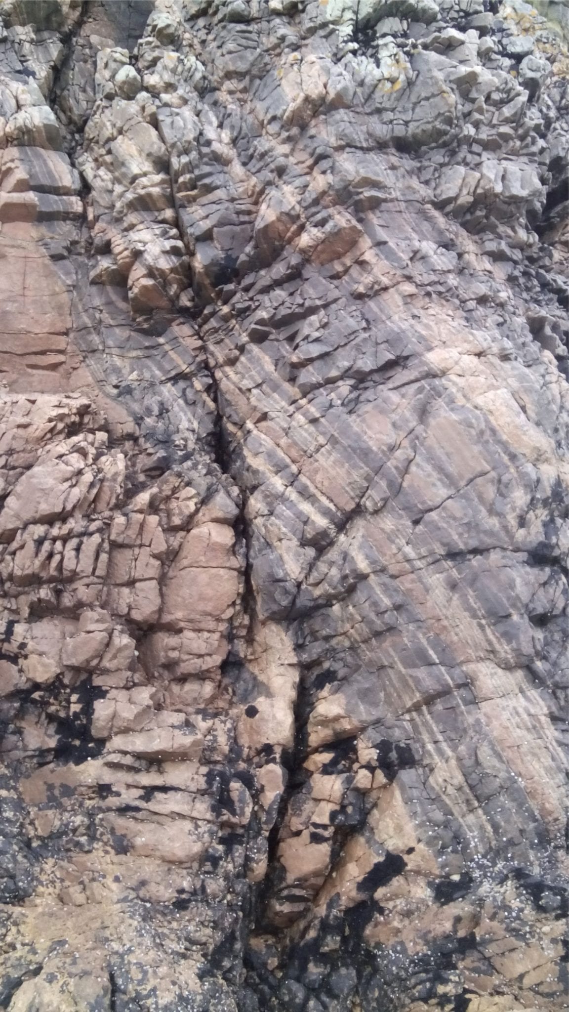
Typical, strongly foliated Moine schist.
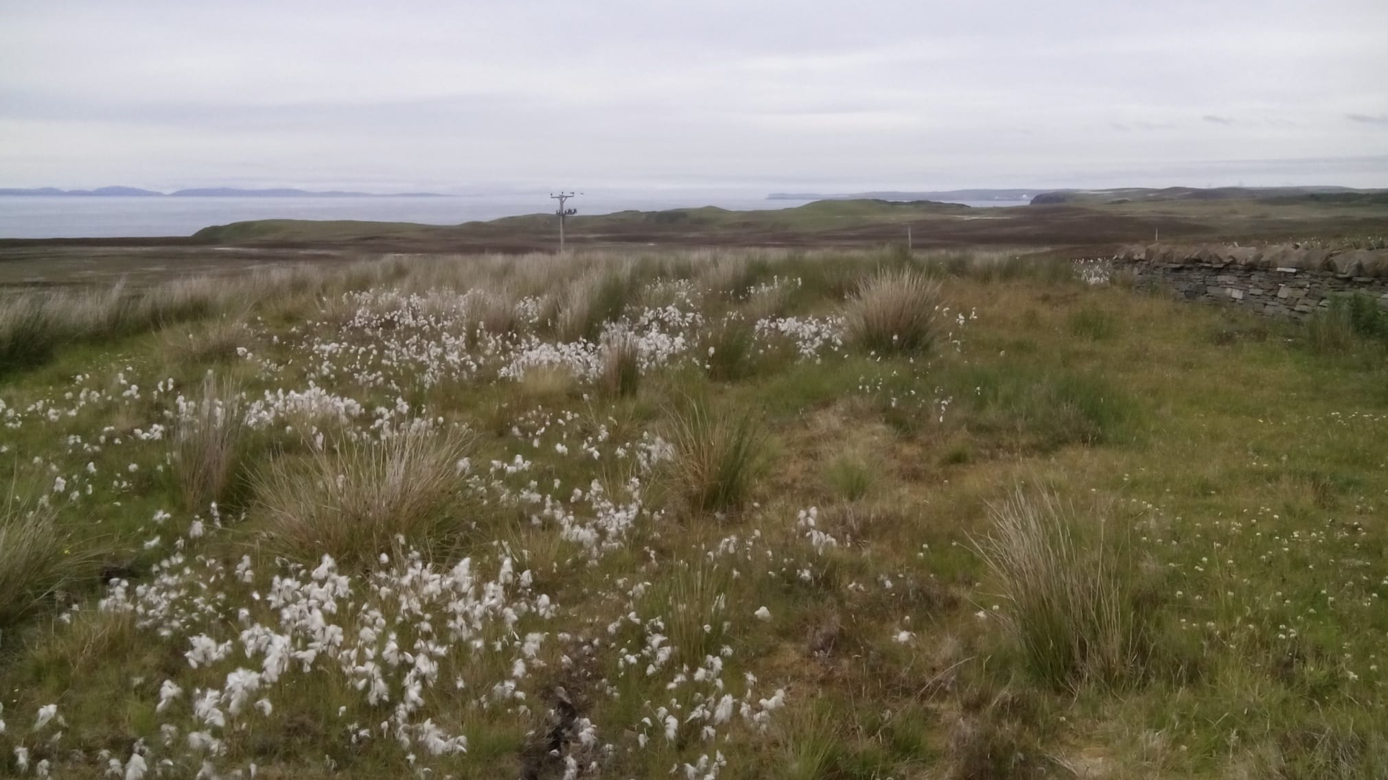
The NW coast, towards Portskerra and the distant Orkney archipelago.
Loch Assynt, northwest Scotland
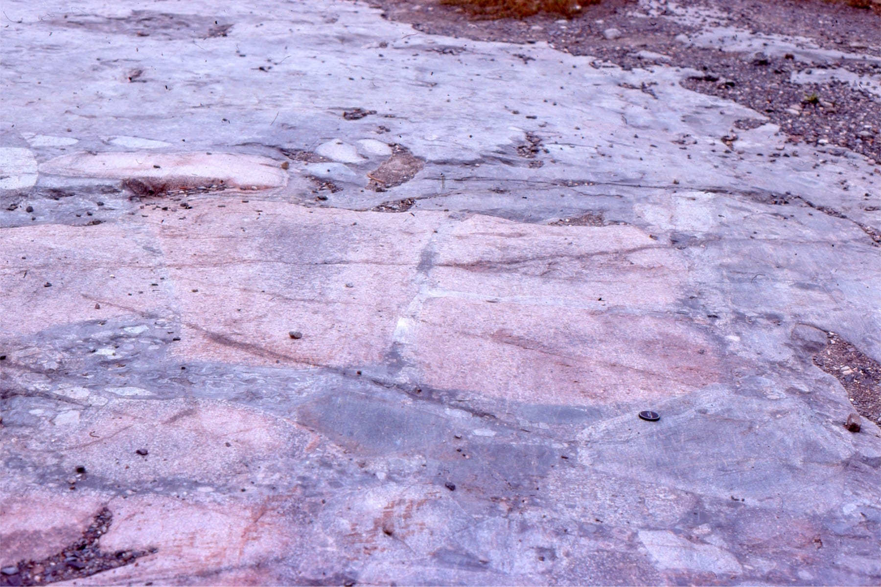
Lewisian gneisses and migmatites (Archean) are overlain unconformably by Torridonian sandstone (Proterozoic). The roadcut adjacent Loch Assynt is west of the Moine Thrust complex; both rock assemblages are part of the ancient Laurentian continental block. The three thumbnail images below are from the same general location. At this locality there is subdued paleotopographic relief on the unconformity.
Expedition Formation, Canadian Arctic
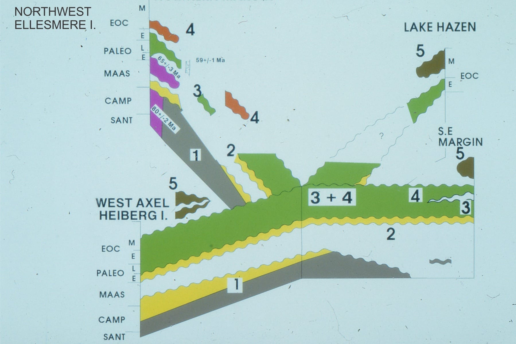
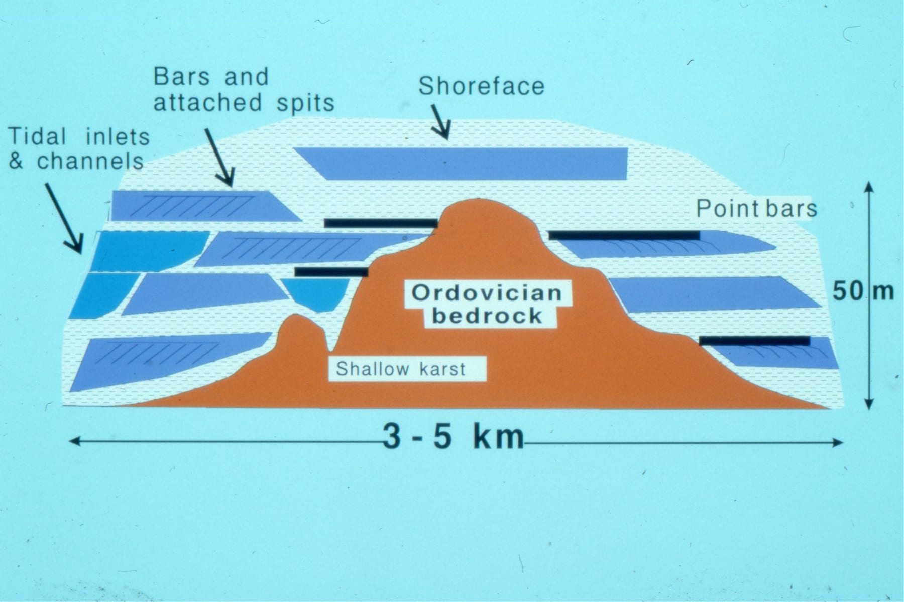
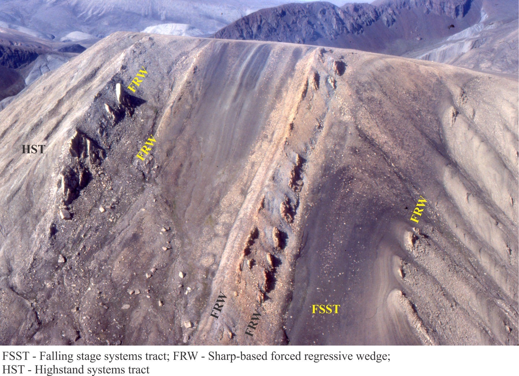
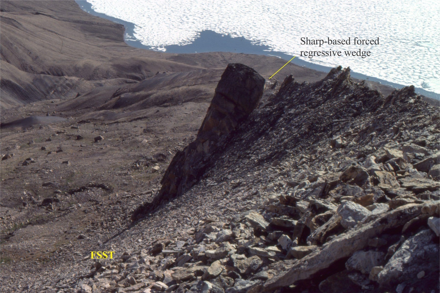
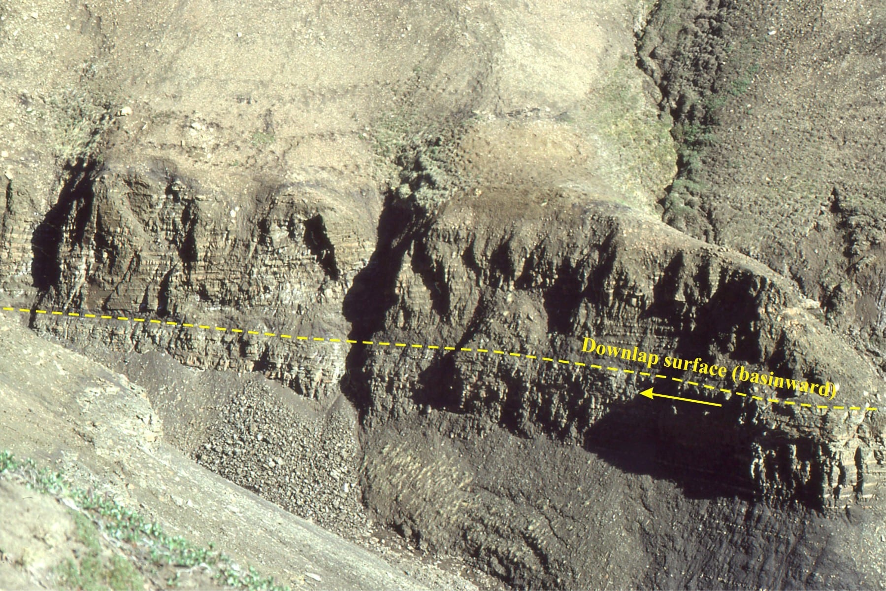
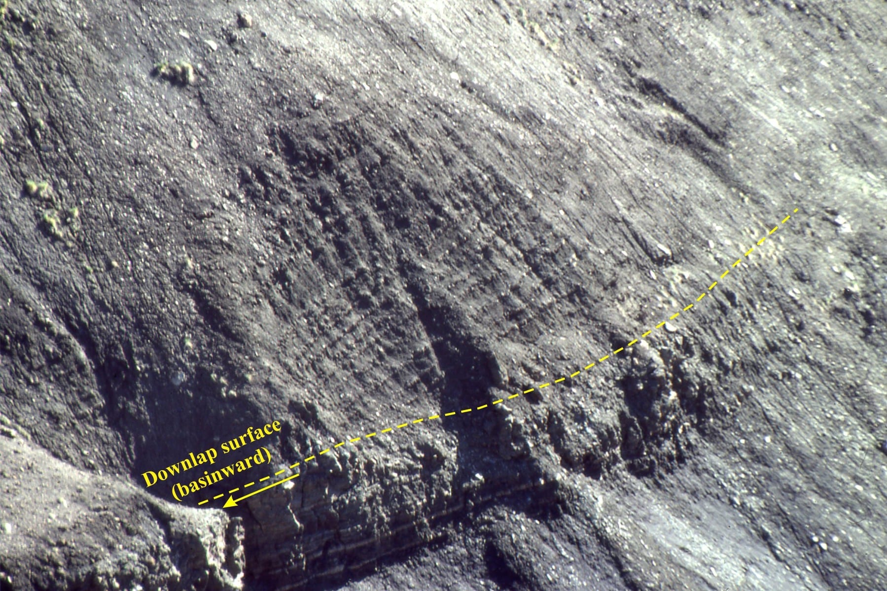
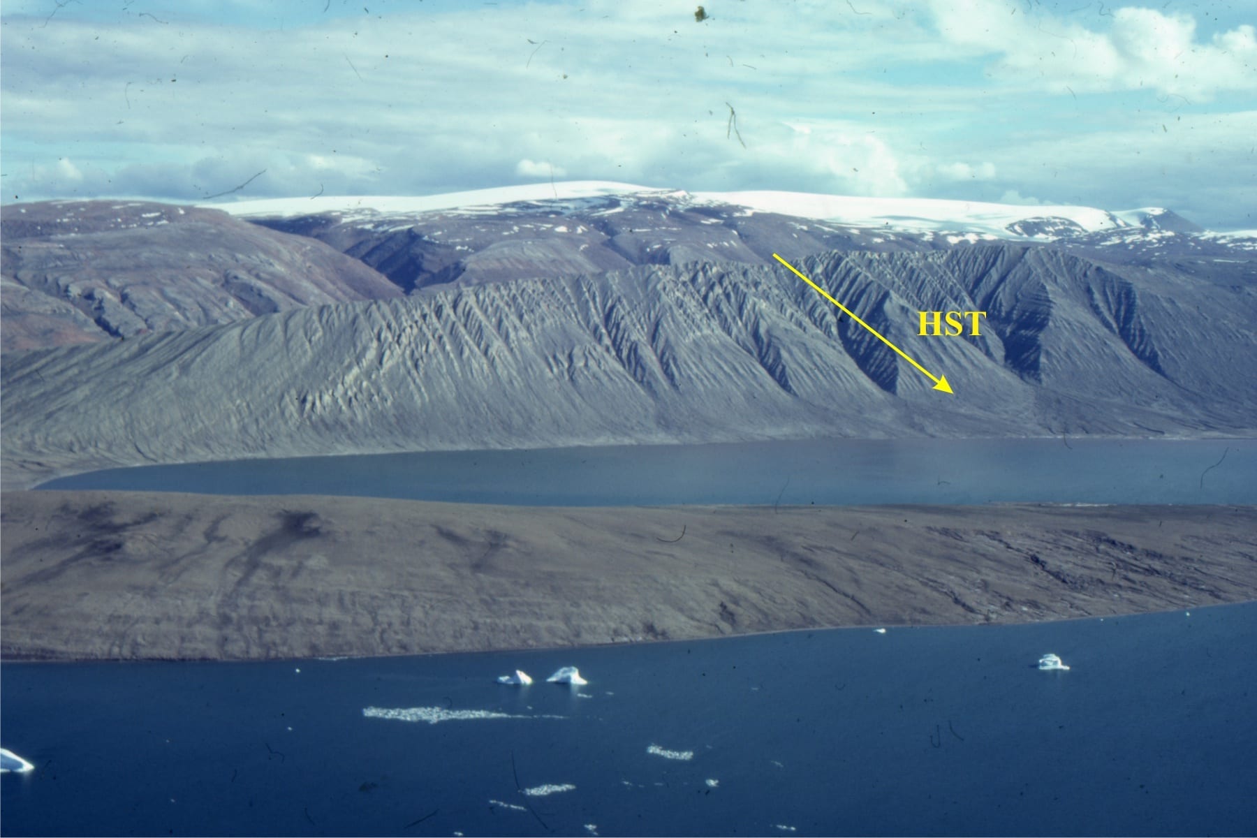
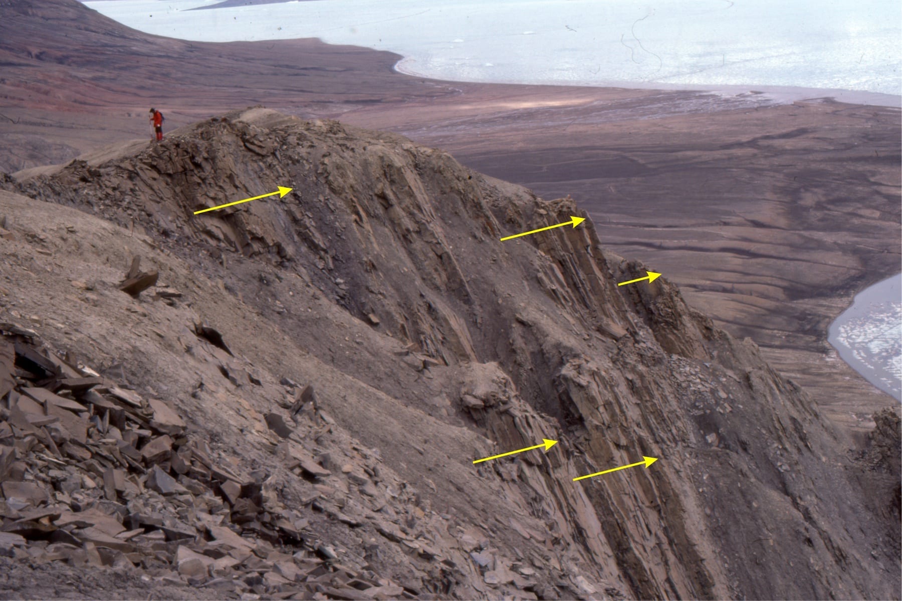
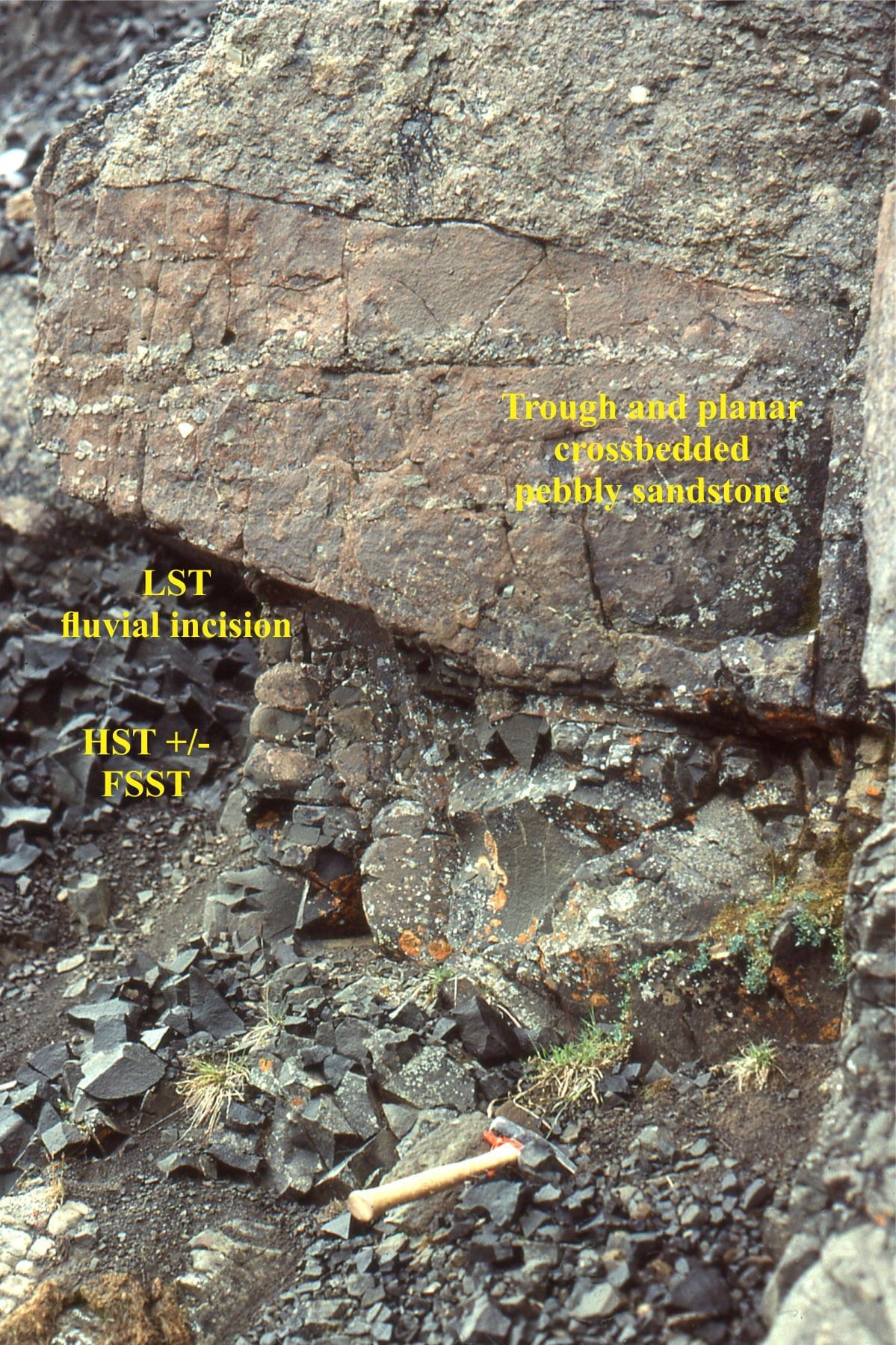
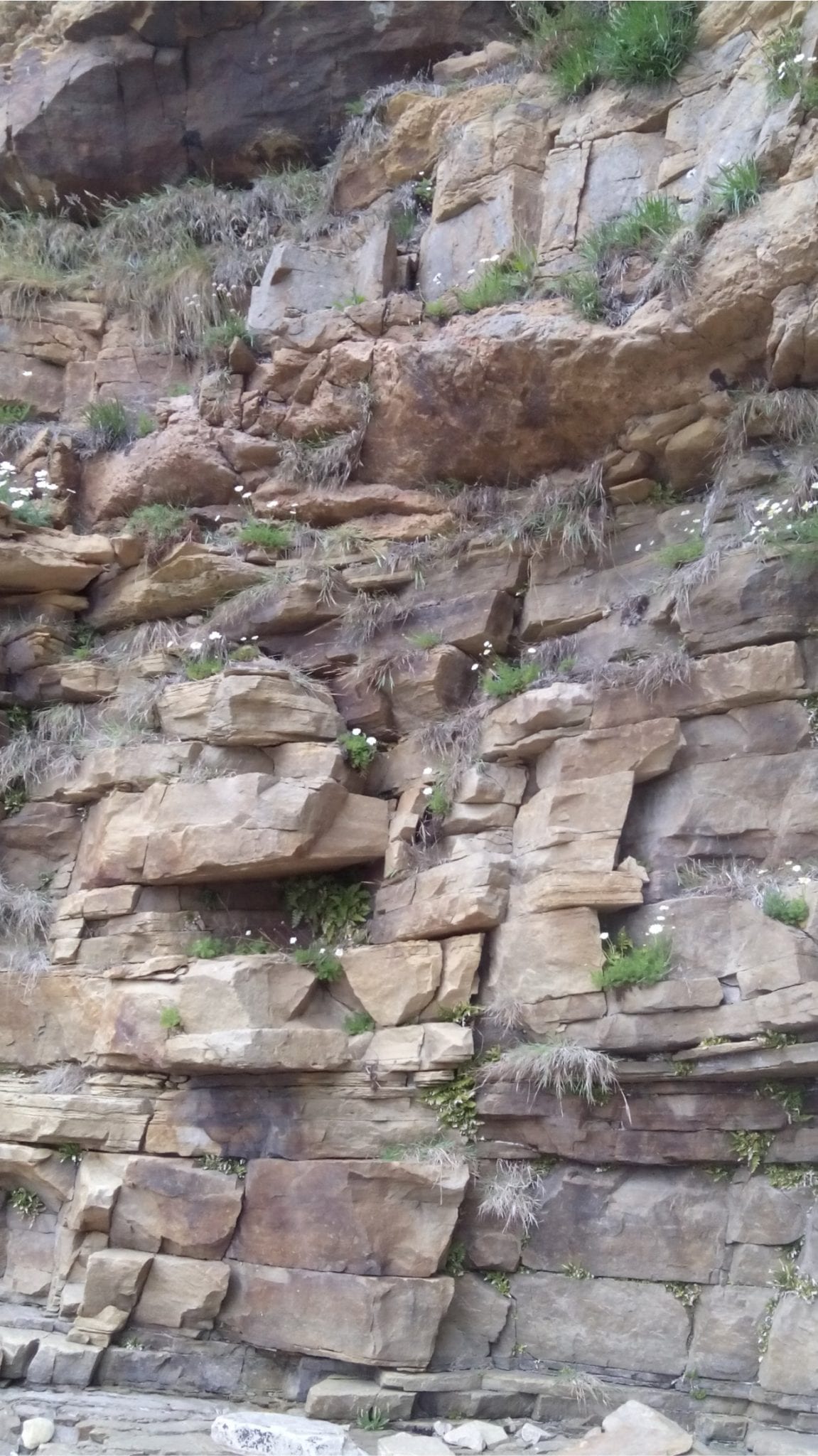
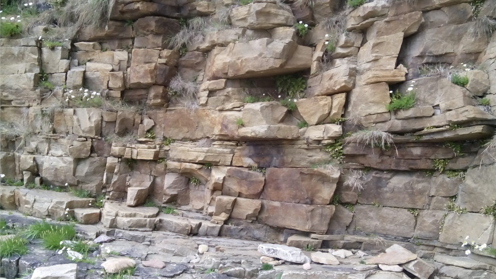
The Campanian to Middle Eocene Eureka Sound Group on Ellesmere and Axel Heiberg Islands represents the last gasp of sedimentation in a thermally subsiding Sverdrup Basin. In the central part of the basin, The Expedition Formation contains two stratigraphic sequences separated by a disconformity where most of the Maastrichtian is missing. Along the basin margins Sequence 1 is commonly missing such that Sequence 2 onlaps Paleozoic bedrock.
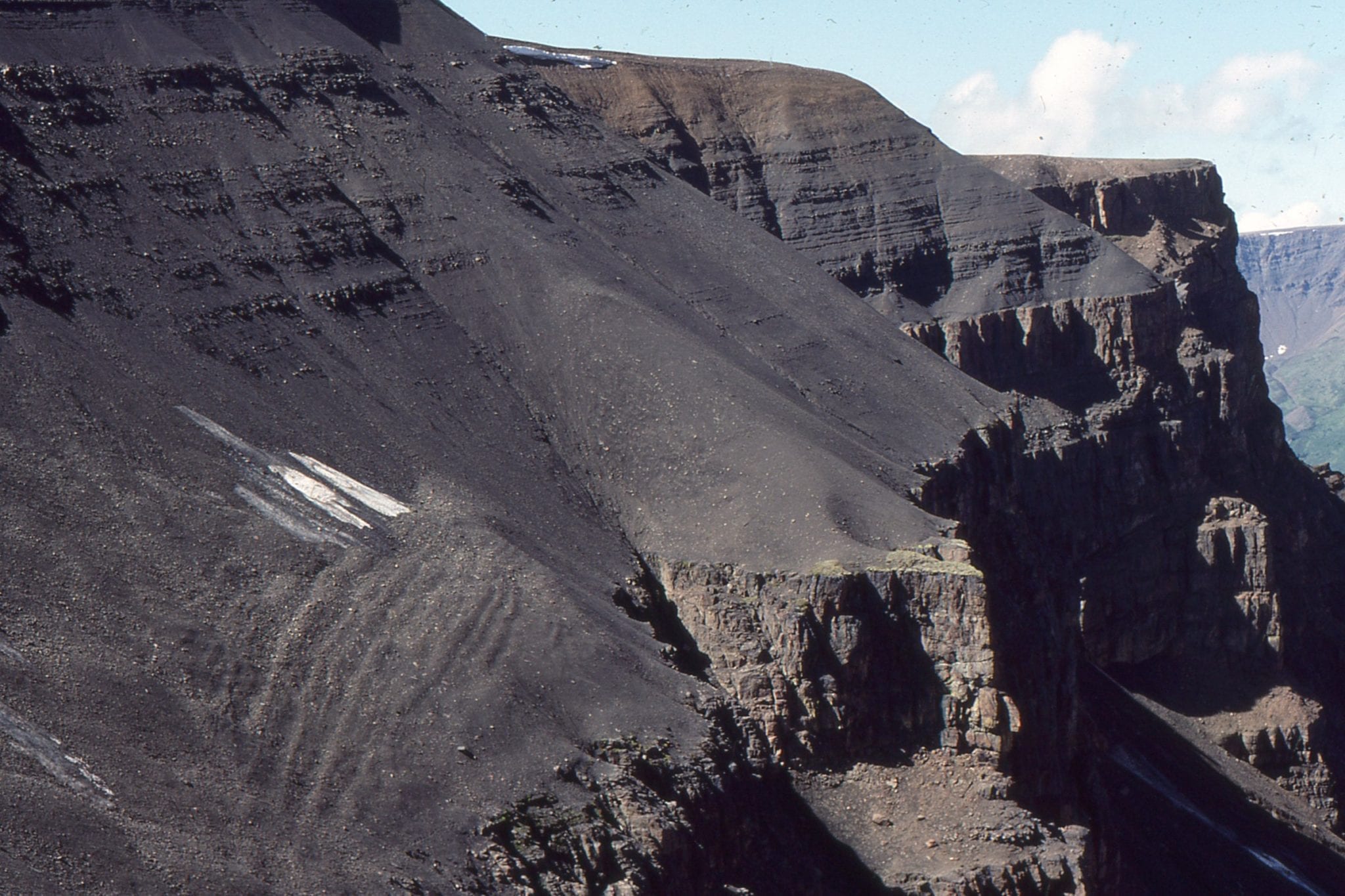
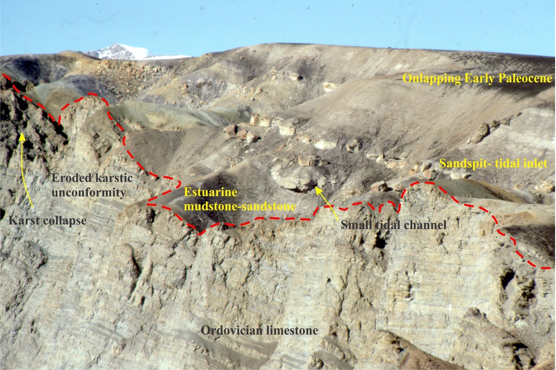
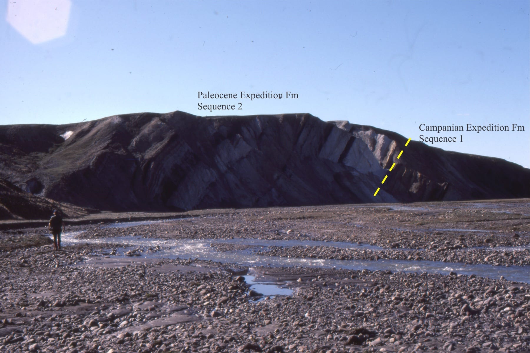 The Campanian-Lower Paleocene unconformity at Hot Weather Creek, Ellesmere Island. Throughout the basin, the base of the Paleocene is characterised by thick quartz-rich sandstones deposited in estuaries, sandspits and bars.

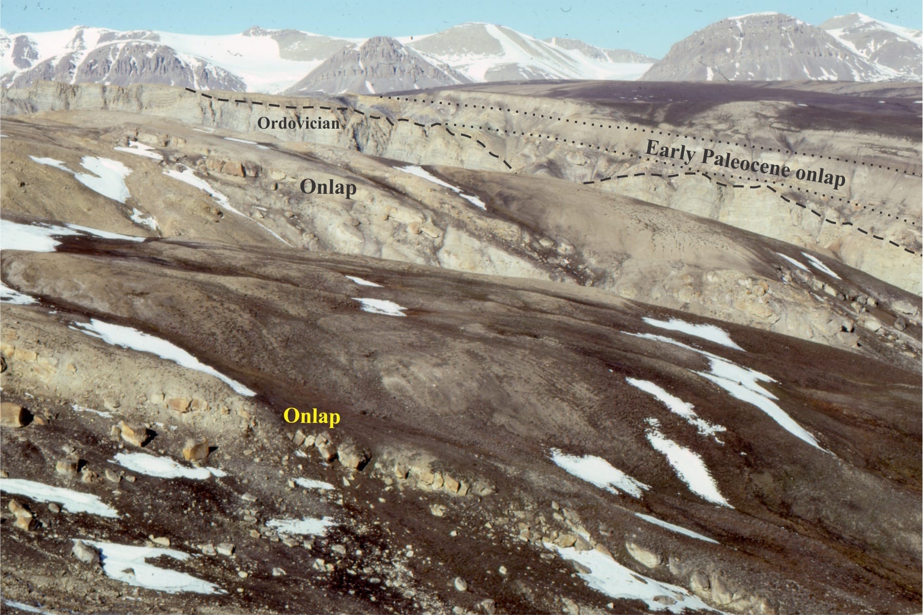
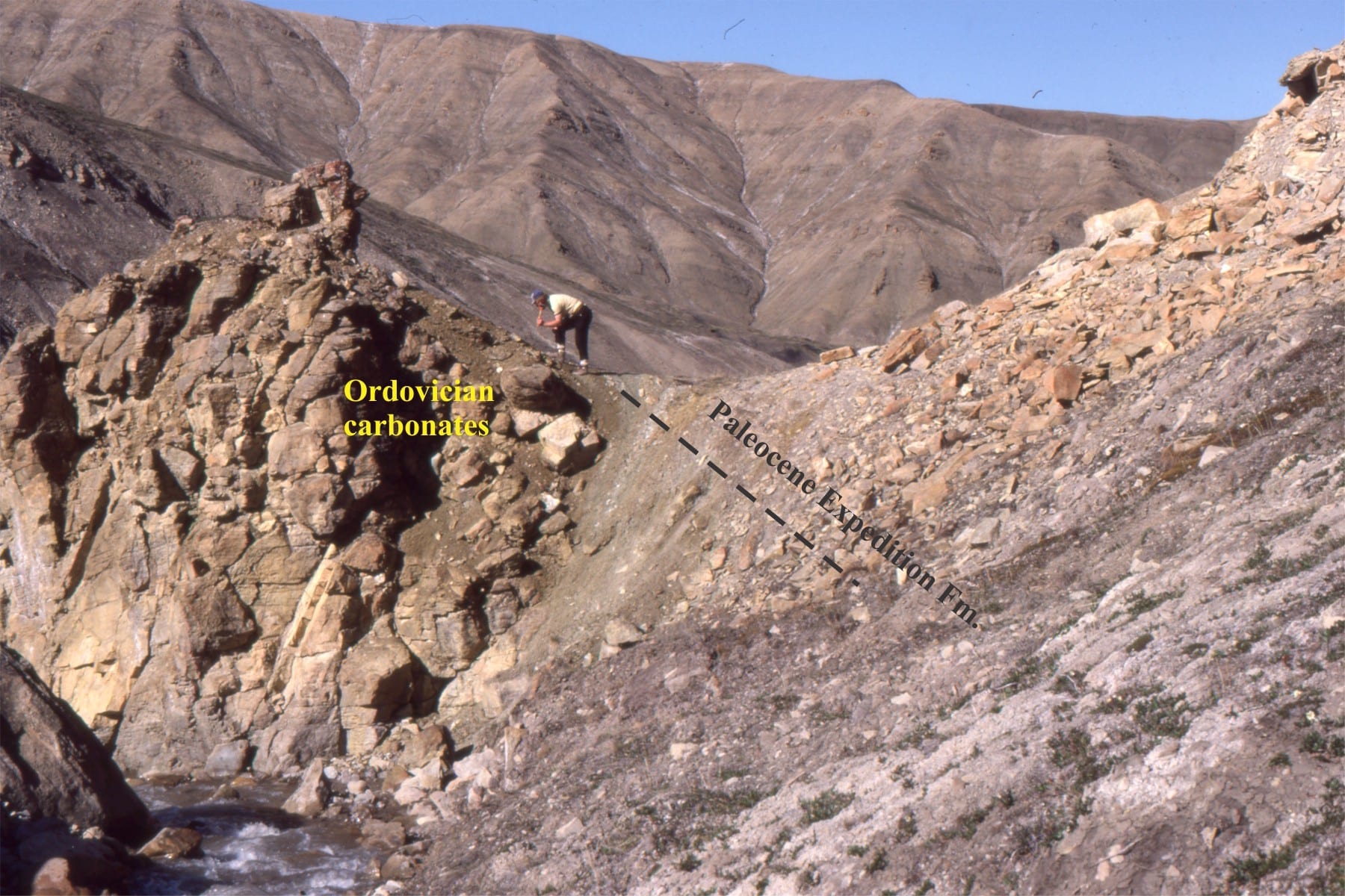
Lower Paleocene Sequence 2 along the basin margins commonly onlaps Paleozoic rocks – here Ordovician carbonates. The earliest sediments infilled a karst paleotopography. Mt. Moore, Ellesmere Island.
This Lower Paleocene – Ordovician unconformity has a well developed regolith in the carbonates. Mt Moore area.
Left: Lower Paleocene Sequence 2 on Devonian sandstone-limestone. The trace of the unconformity coincides with the stream (lower right). Right: Lower Paleocene Sequence 2 on Permian limestones-grainstones near Canon Fiord. The trace of the unconformity coincides with the stream (center).
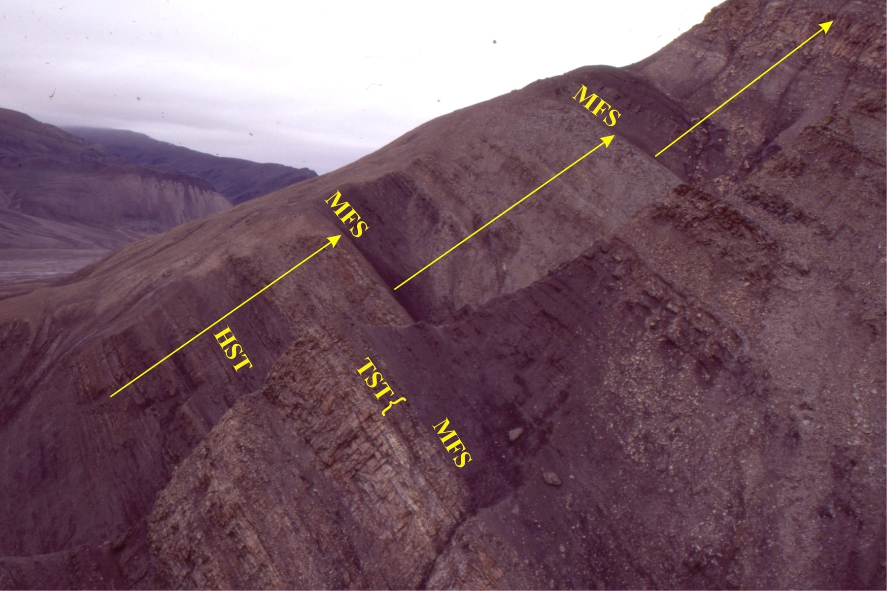
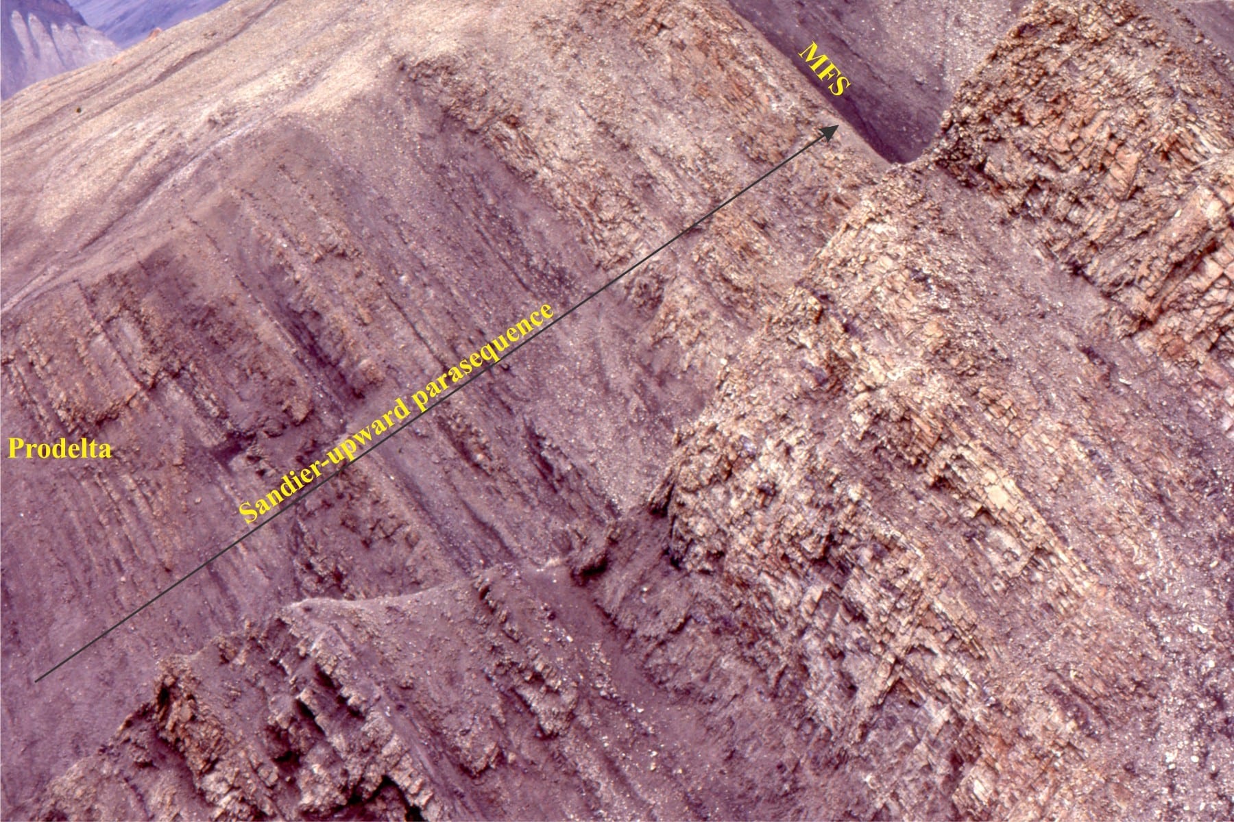
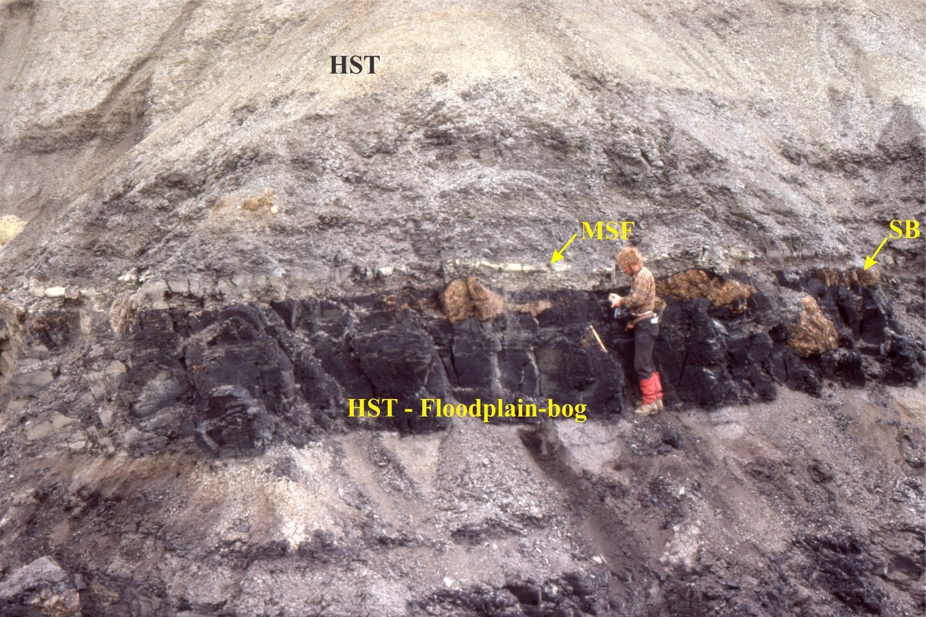
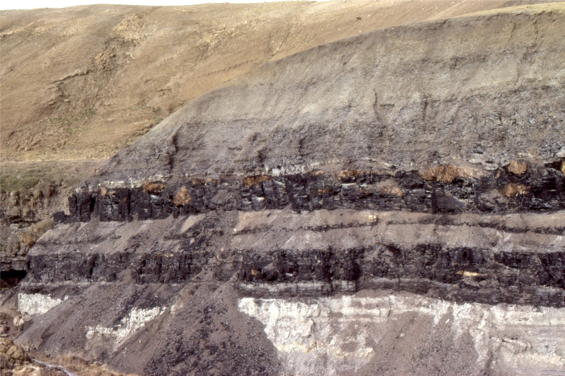
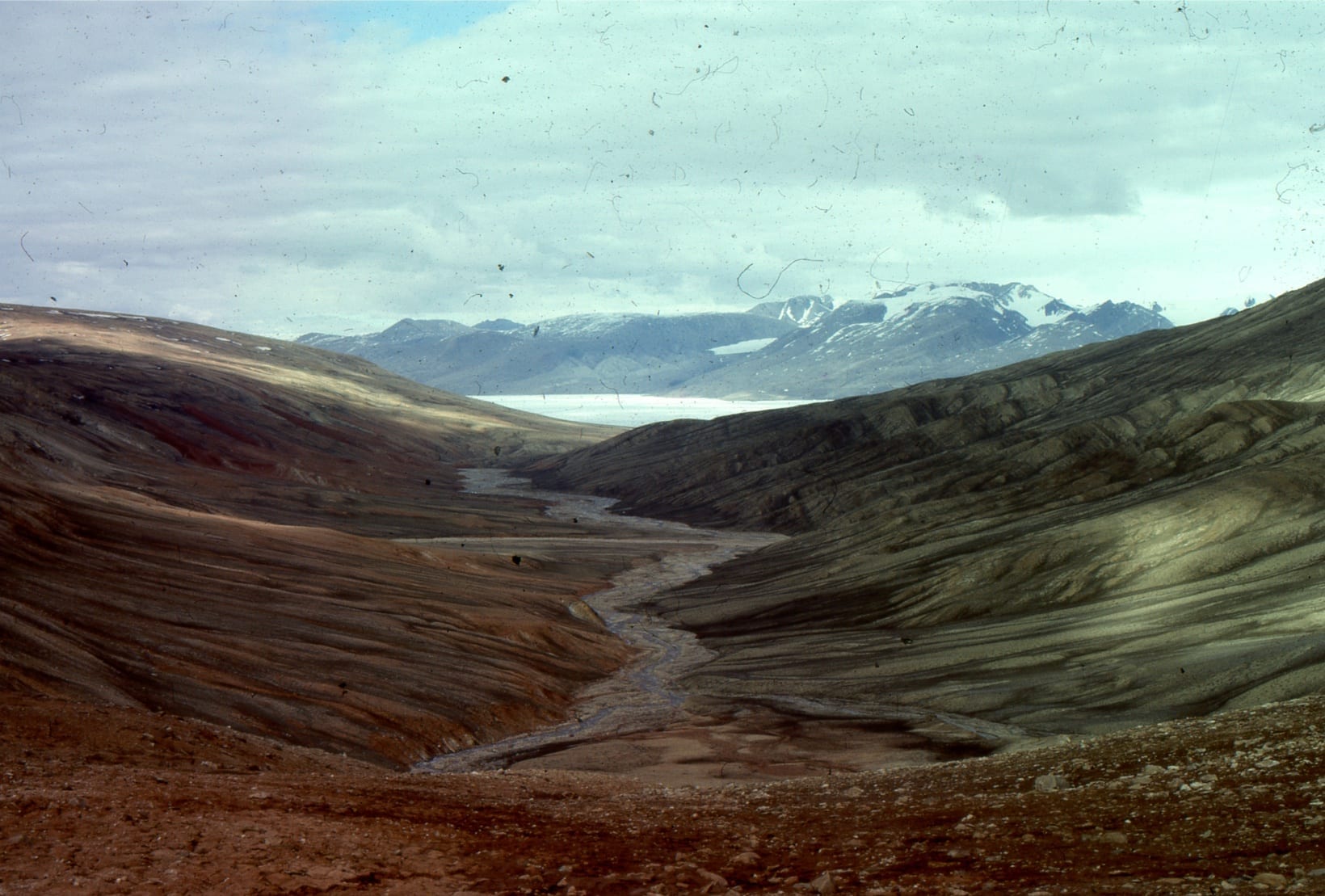
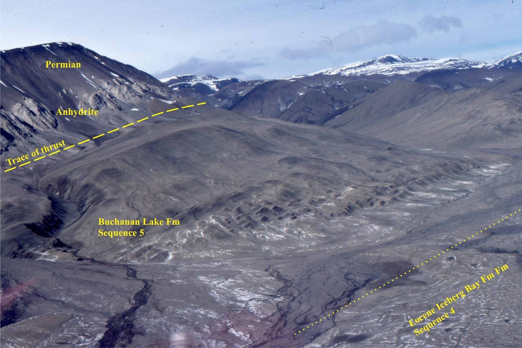
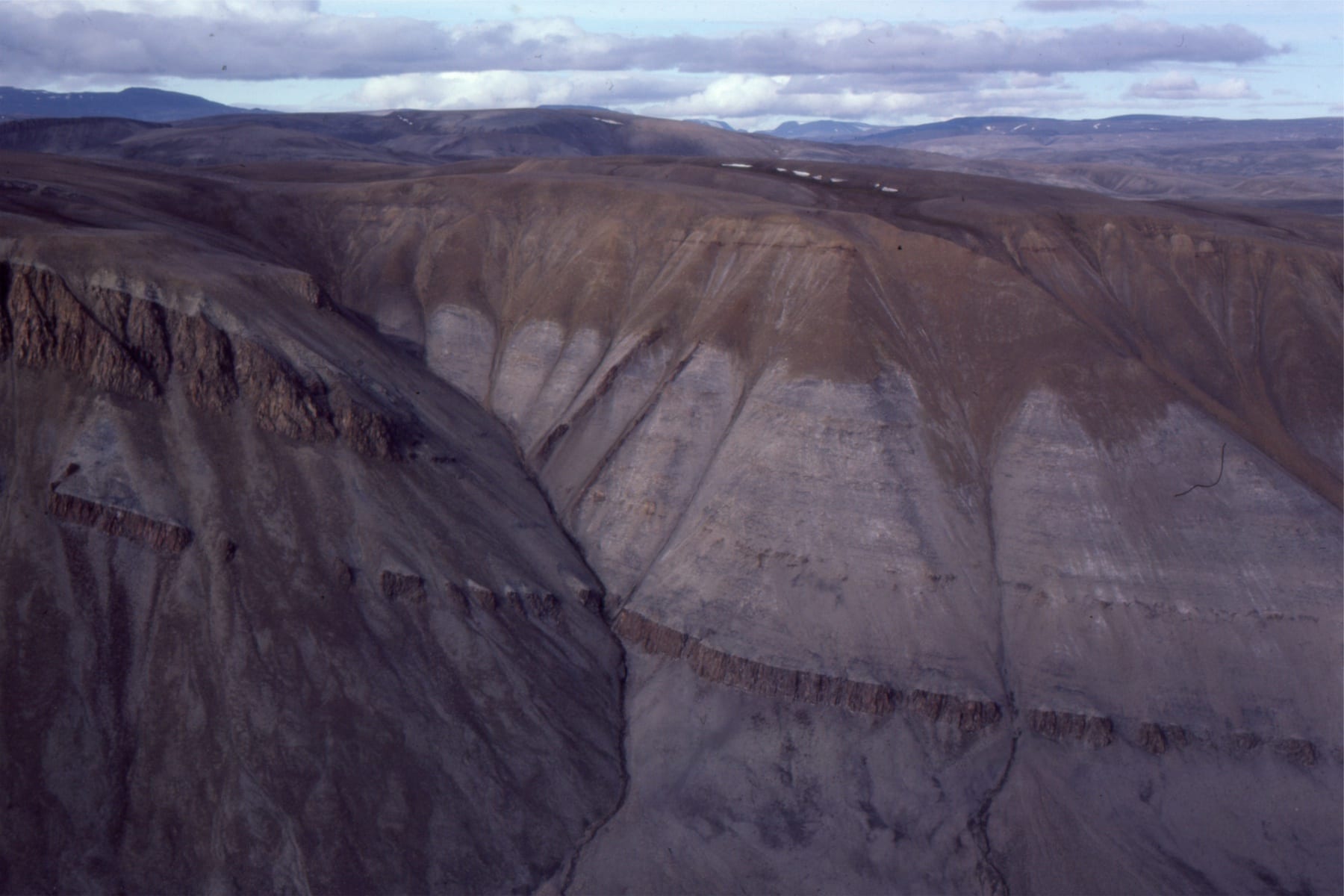
Buchanan Lake Formation, Canadian Arctic
This is the youngest formation in the Eureka Sound Group. Its deposits record inversion and dismembering of Sverdrup Basin by thrust-dominated tectonics during the Middle Eocene. Deposition took place in several foredeeps, that also were involved in the deformation.
![]()
Syntectonic, Middle Eocene Buchanan Lake strata disconformably overly Lower-Mid Eocene delta deposits (Iceberg Bay Fm, Sequence 4). Sediment was derived from uplifted Late Paleozoic and Triassic rocks. They were subsequently overthrust by Late Paleozoic anhydrite and Permian mudstone-sandstone. North of Whitsunday Bay, Axel Heiberg Island.
Syntectonic Buchanan Lake conglomerate (brown hues) overlies unconformably Triassic sandstone. Stang Bay, Axel Heiberg Island.
New Zealand Paleogene-Neogene basins
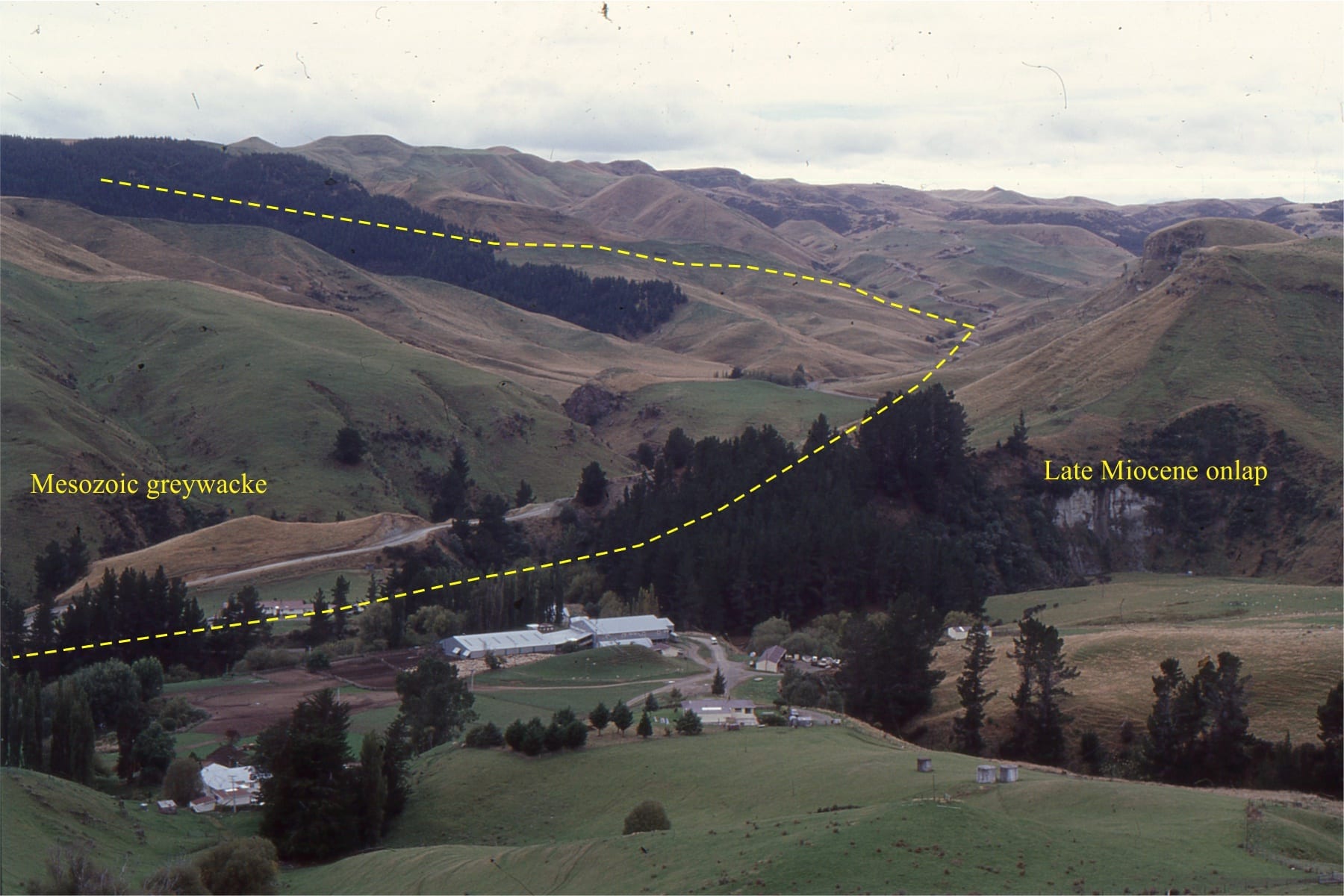
The Plio-Pleistocene Wanganui Basin occupies a position between the Hikurangia subduction zone and the Late Cretaceous – Miocene rift-passive margin succession comprising Taranaki Basin. Along its eastern margin, Wanganui Basin strata onlap much older greywacke-greenschist basement, shown above at Otupae Station (about 30km SE of Waiouru, along the west flank of the Ruahine Ranges.
Marine terraces eroded into Middle Pliocene Tangahoe Mudstone are exposed on the south Taranaki coast. Here there are excellent examples of shallow, shore platform channels and potholes, filled by pebbly sand of the Rapanui Formation. Pollen assemblages indicate that shallow marine-beach and dune deposition took place during interglacial conditions in the late Pleistocene.
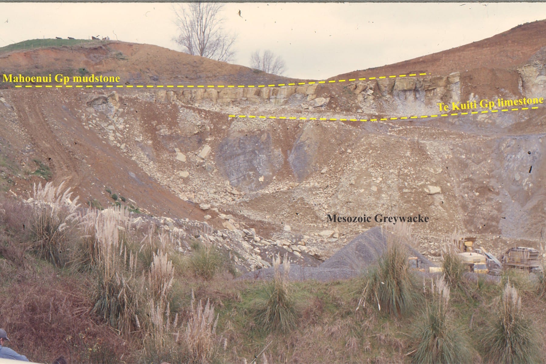
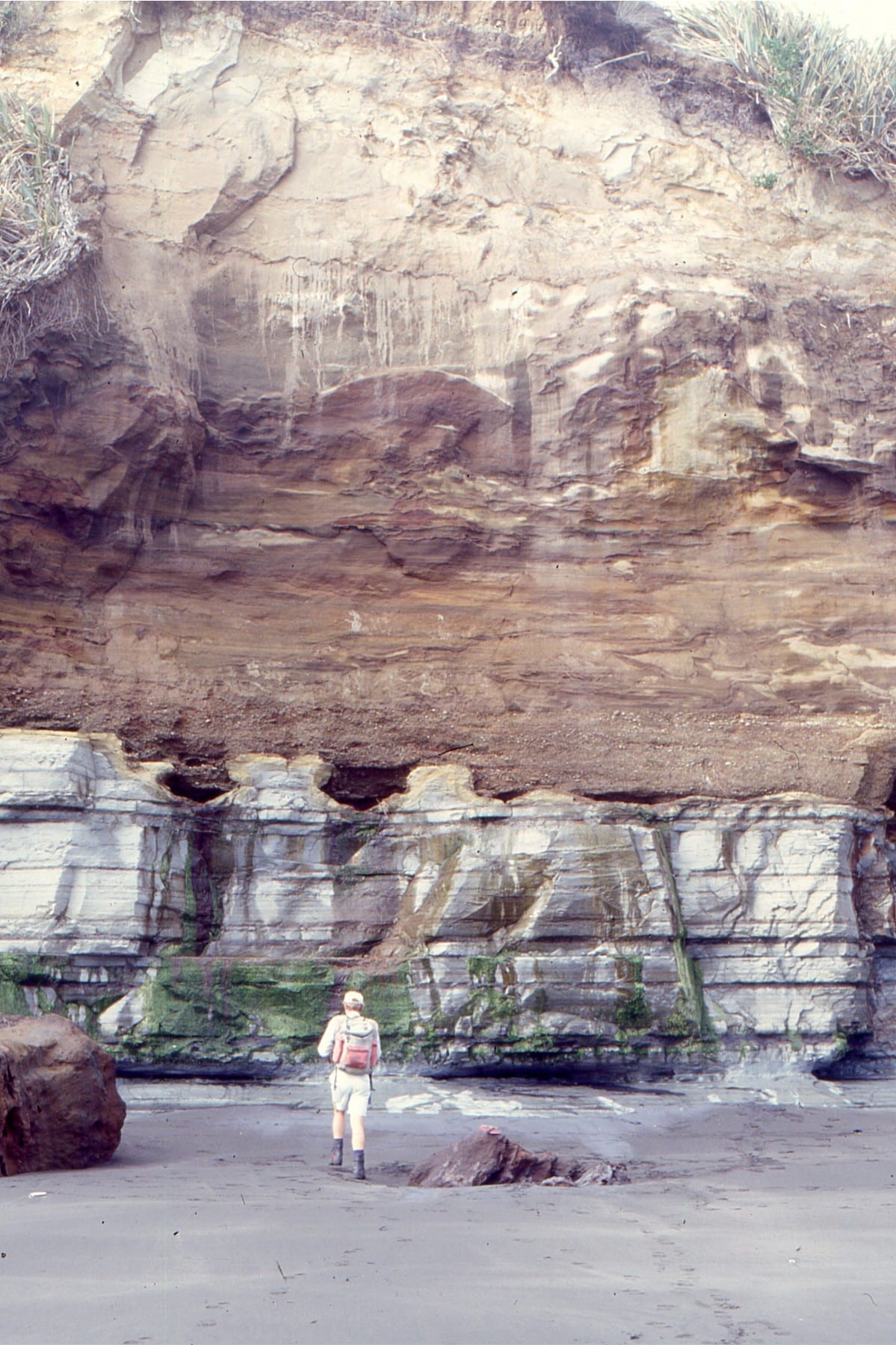
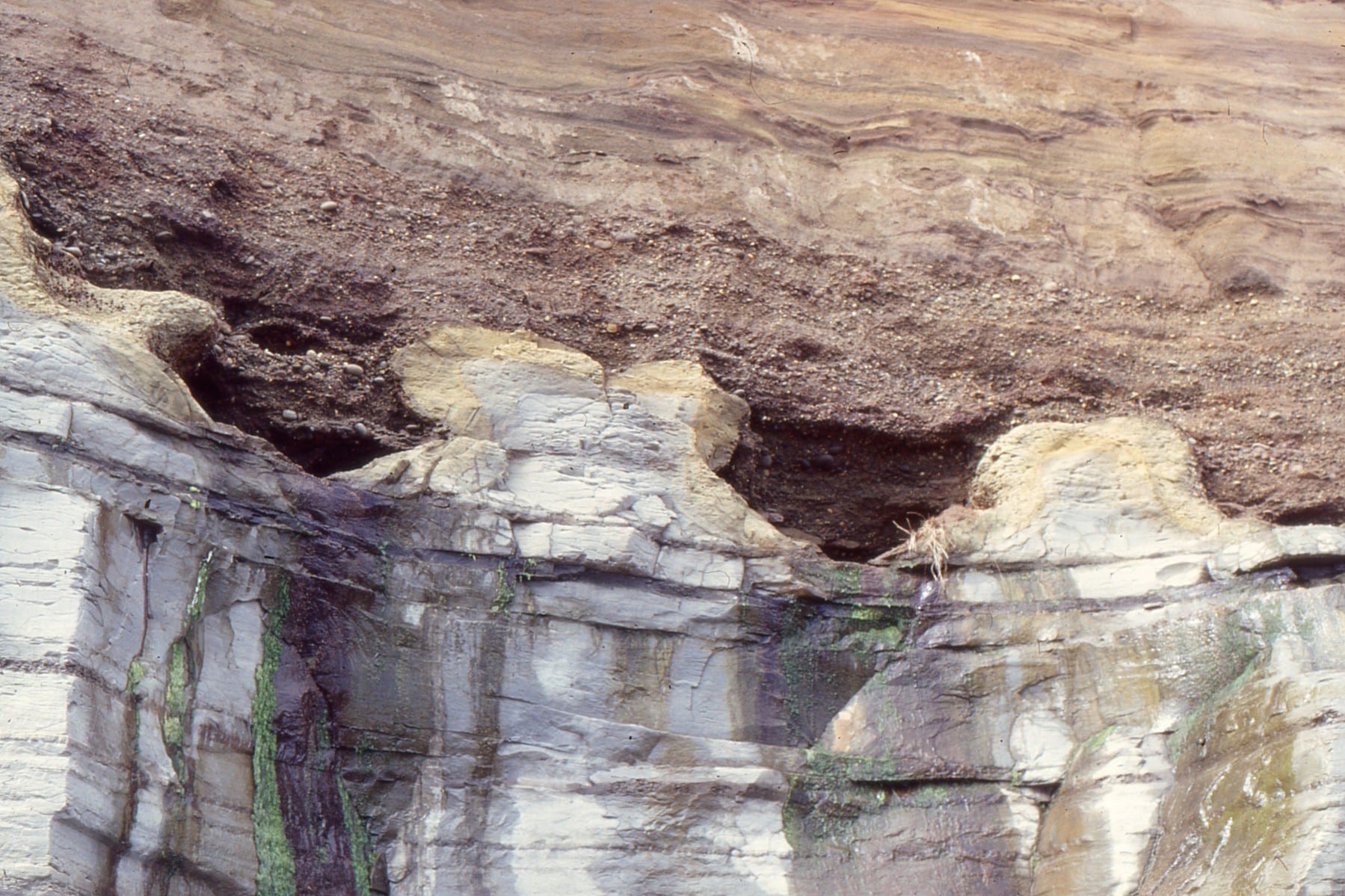
The Late Eocene-Oligocene Te Kuiti Group (New Zealand) contains cool-water carbonates and associated mudrocks, that accumulated on a broad platform during a period of relative crustal stability. The deposits gradually onlapped eroded greywacke basement (Torlesse-Waipapa terranes), as shown in this quarry, west of Te Kuiti town. The limestone unit is the Otorohanga Limestone. This stratigraphic pinchout is unconformably overlain by Early Miocene, deeper water Mahoenui mudstone.
Waitemata Basin
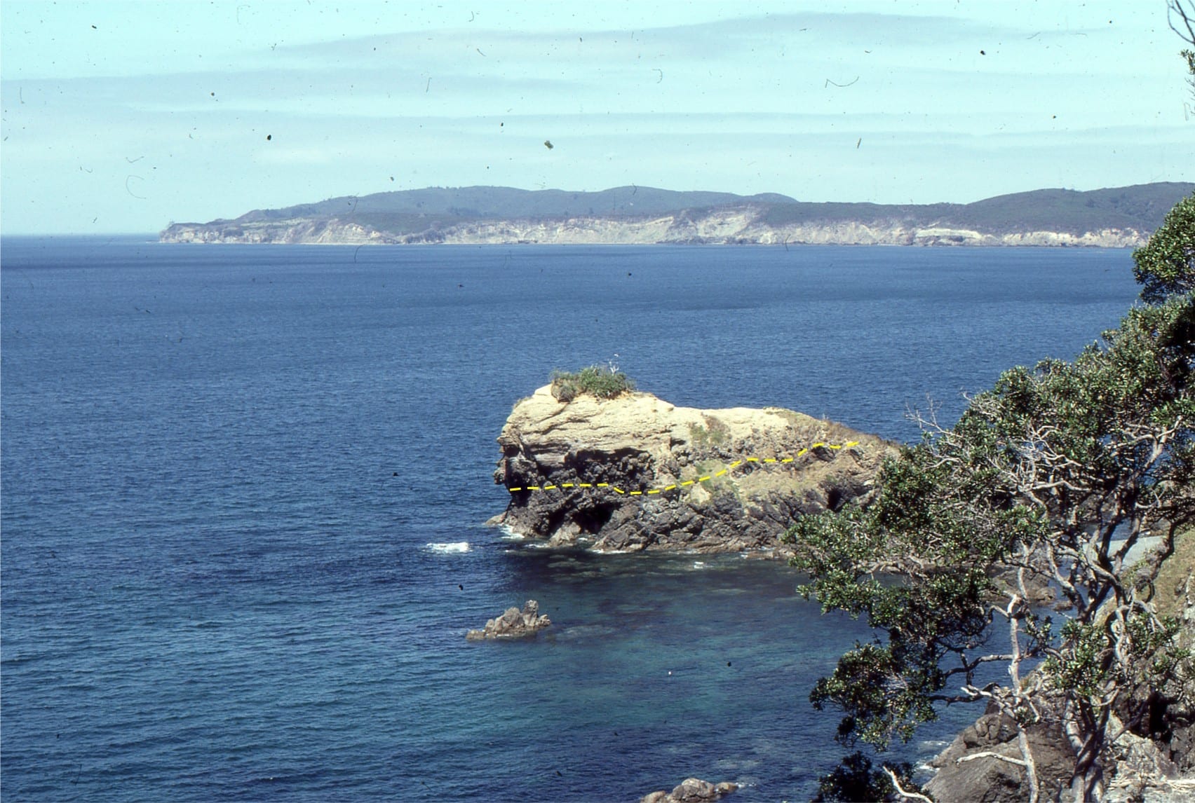
The Lower Miocene Waitemata Basin extends from greater Auckland into Northland, New Zealand. The fill is dominated by turbidites deposited at bathyal water depths. The basin mainly overlies Mesozoic greywacke. In what is a remarkable contrast in water depth, the basal few metres consists of conglomerate, fossiliferous sandstone and limestone that were deposited in shallow shelf and pocket beach settings. The pre-Miocene surface has considerable paleotopographic relief. Along the Early Miocene coastline this was manifested as greywacke islands, sea cliffs and sea stacks.
The cartoon below shows a rough reconstruction of the Early Miocene environment (drawn more than 30 years ago). Panels a and b show shoreline, beach, subtidal facies, complete with cliff rock-falls and landslides. Panel c depicts the early stages of draping and blanketing by bathyal turbidites and debris flows.
Brian Ricketts, Peter Ballance, Bruce Hayward, and Wolfgang Meyer, 1989. Basal Waitemata Group lithofacies: rapid subsidence in an Early Miocene interarc basin, New Zealand. Sedimentology v. 36(4): 559 – 580
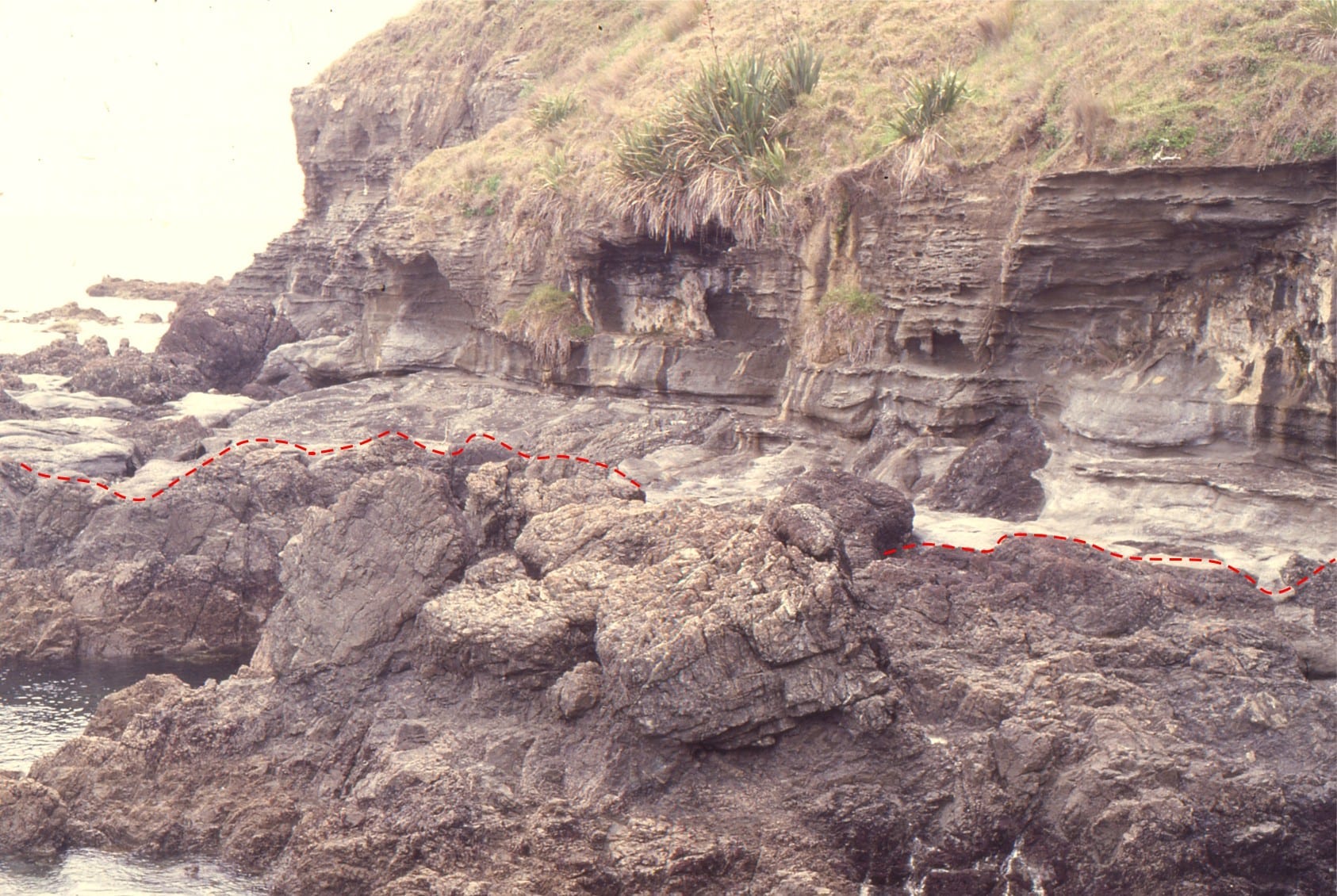
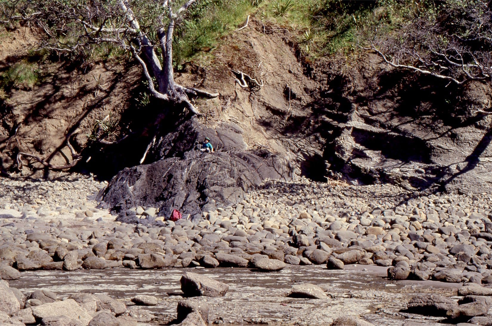
The unconformity in the shore platform below Leigh Institute of Marine Sciences. Intensely deformed greywacke below the red line, is overlain by flat-lying, shallow water calcareous and fossiliferous sandstone. Fossils include abundant barnacles, bivalves (including large oysters), gastropods, solitary corals, bryozoa, calcareous algae (Lithothamnion rhodoliths), foraminifera, and trace fossils.
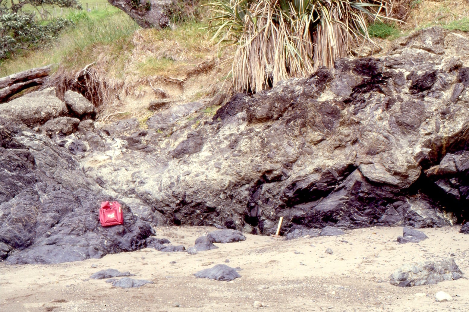
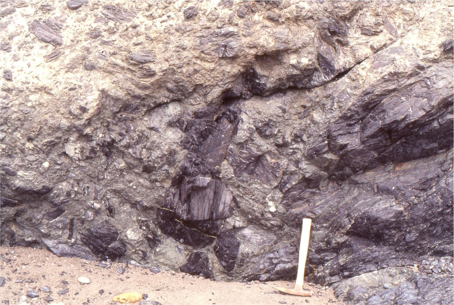
The unconformity at Matheson’s Bay. The steep paleosurface (just left of hammer) is overlain by angular boulders and cobbles of greywacke. Some boulders contain evidence of pre-Miocende weathering.
Paleo-seastacks of greywacke that, following rapid subsidence to bathyal depths, were draped by turbidites. Left: North end of Matheson’s Bay. This sea-stack has remnant pholad borings (bivalves that bore into hard rock). Right: Omana Bay, south Auckland. Here, drape folds over greywacke sea-stacks have been exhumed in the modern shore platform.
Panorama of lower Waitemata Basin strata, looking south from Takatu Point. The unconformity on the small island is overlain by boulder conglomerate and well bedded calcareous sandstone.
Kariotahi, Pleistocene dune-barrier bar complex
There are several very large barrier island-bar systems along the North Island west coast. during the Pleistocene, they effectively straightened the coastline, blockading harbours and estuaries with shallow marine and subaerial dune sands, with entrance and egress of water through narrow tidal inlets.
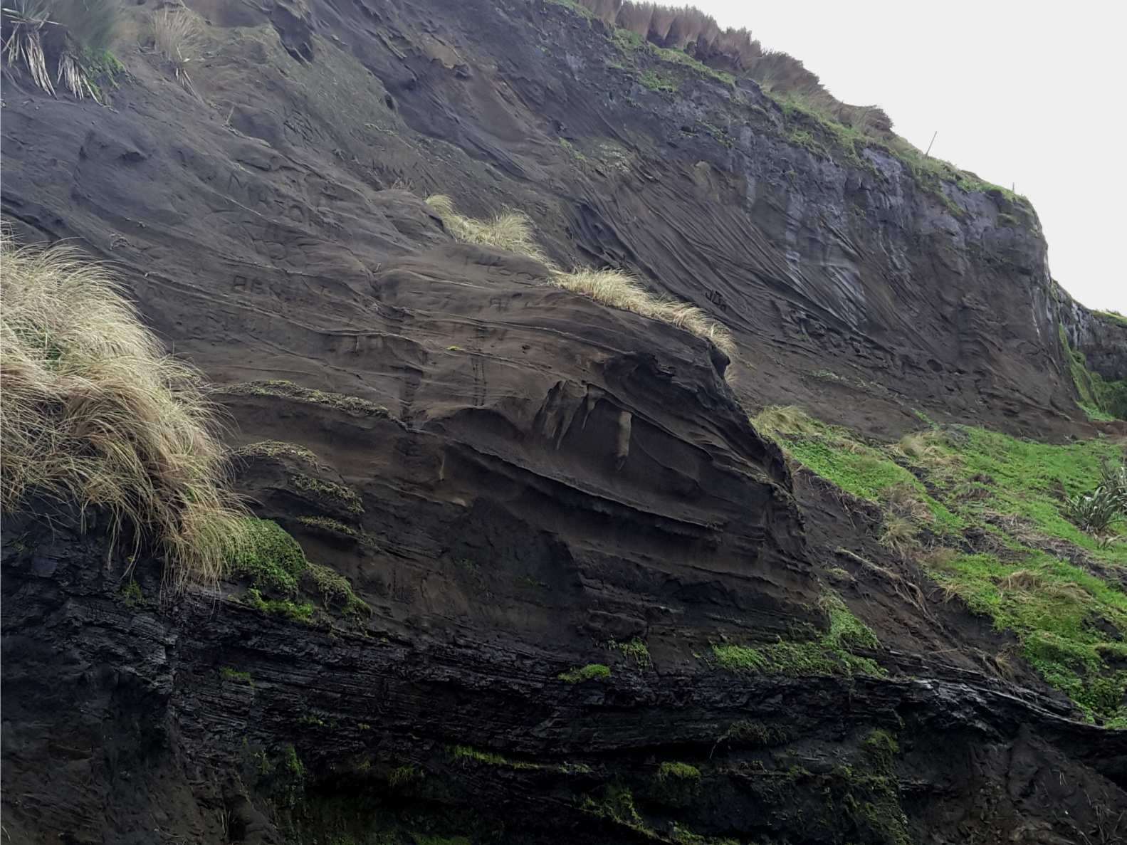
The coastal exposure at Kariotahi beach, west of Auckland city, contains a nice example of an ancient valley cut into older dune sands, that was subsequently filled with a new generation of dune sands and stream deposits, only to be exhumed much later in the Pleistocene. The unconformity between the original valley margin and the infilling dunes is shown below. The unconformity also shows signs of old soils and weathering.
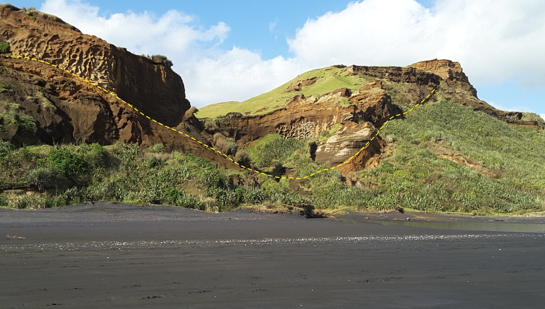
The valley margins (outlined) are overlain by younger dune sands. The present valley has cut into both of generations of Pleistocene dunes. Kariotahi, west Auckland.
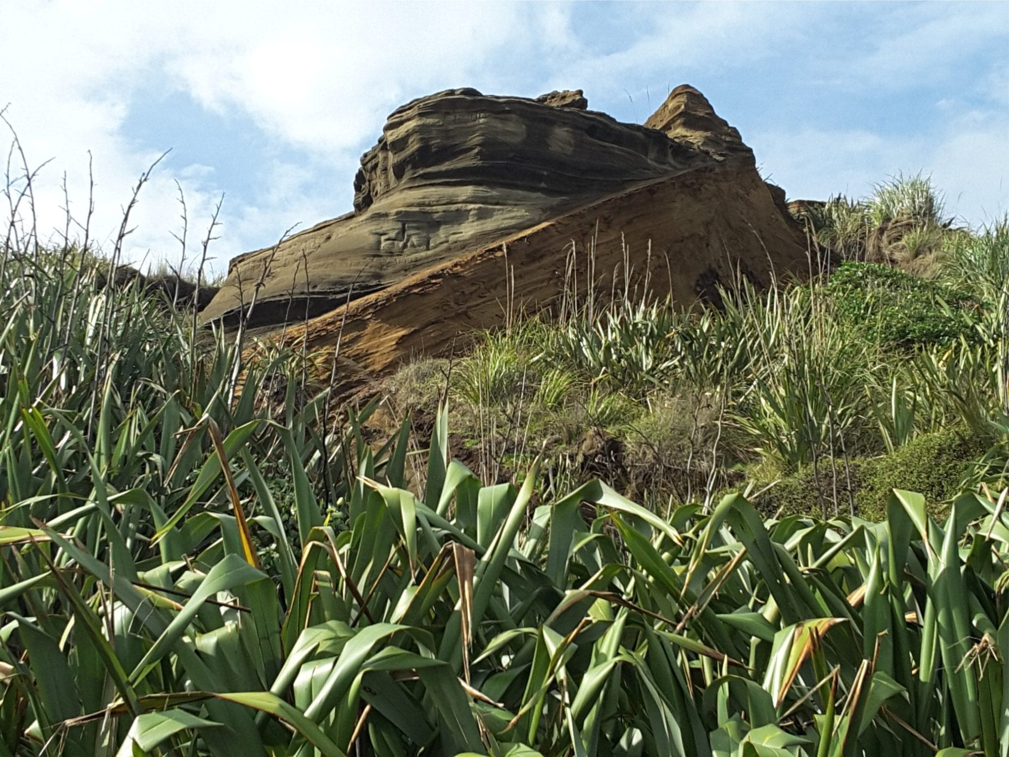
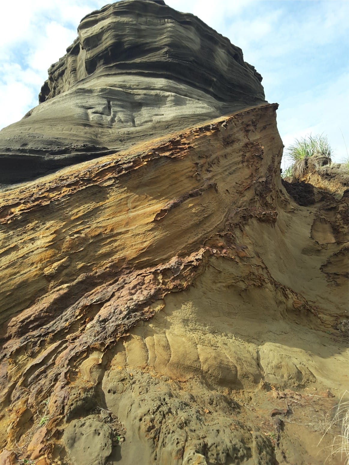
Closer views of the Pleistocene valley unconformity. The older (brown) deposits occur below the steeply dipping surface; the younger dunes above. The irregular, rust-coloured resistant layers are iron-pan; iron oxides that have precipitated during groundwater seepage. Kariotahi, west Auckland.
Typical dune cross bedding in the younger valley fill. The muddy, concave layer near the bottom of the image is thought to have formed in an interdune pond. Kariotahi, west Auckland.