
Sequence stratigraphy
The Atlas, as are all blogs, is a publication. If you use the images, please acknowledge their source as indicated below.
Brian Ricketts – www.geological-digressions.com
This category of Atlas images, is not intended as a comprehensive outline or set of definitions of sequence stratigraphy, but rather field examples of strata, stratigraphic trends (an essential component of systems tracts), and stratigraphic surfaces. There are many excellent journal papers, text books, and conference short courses devoted to sequence stratigraphy, so consult them if needs be.
Short articles on important sequence stratigraphic themes are listed here
Some key sequence stratigraphic components illustrated here include (abbreviations on the images):
HST Highstand Systems Tract (progradational-aggradational) overlies the MFS and underlies the erosion surface formed during the FSST)
FSST Falling Stage Systems Tract (forced regression and progradation during relative sea-level fall)
LST Lowstand systems tract (now restricted to end of relative sea-level fall and beginning of sea-level rise)
TST Transgressive Systems Tract (above the transgressive surface; Retrogradational onlapping during rising relative sea-level and low sedimentation rates. Condensed stratigraphy).
MSF Maximum Flood Surface (at the transition to sedimentation rates greater than creation of accommodation space. Also the base of the overlying HST).
Each example has a pair of images, one annotated, the other without annotation.
This link will take you to an explanation of the Atlas series, the ownership, use and acknowledgment of images. There, you will also find links to the other categories.
Click on the image for an expanded view, then ‘back page’ arrow to return to the Atlas.
The images:
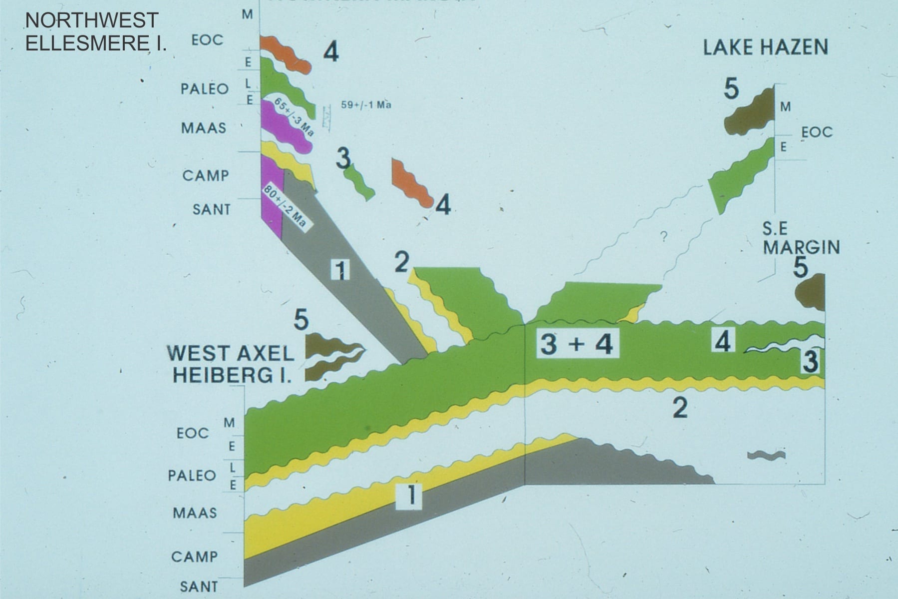
Sequence stratigraphic framework for the Late Cretaceous – Paleogene Eureka Sound Group, Canadian Arctic. The numbered sequences are referred to for each outcrop image.
Late Cretaceous to Middle Eocene 3rd-order stratigraphic sequences in the Eureka Sound Group, Canadian Arctic Islands (mostly Ellesmere and Axel Heiberg islands). Sequences 1 and 2, mainly wave-dominated deltas, and along the eastern basin margin, estuarine – shelf. Sequences 3 and 4: river-dominated deltas, sandy inner shelf, muddy outer shelf; Sequence 5 basin inversion and fragmentation into small, thrust-related, syntectonic basins. Sequence 5 represents the acme of the Eurekan Orogeny.
![]()
Sequence 1, wave-dominated delta parasequences, Strand Fiord, Axel Heiberg Island. There is about 150m of stratigraphy in this view.
![]()
Detail of Sequence 1 coarsening upward, wave-dominated delta parasequence and MFS. Axel Heiberg Island.
![]()
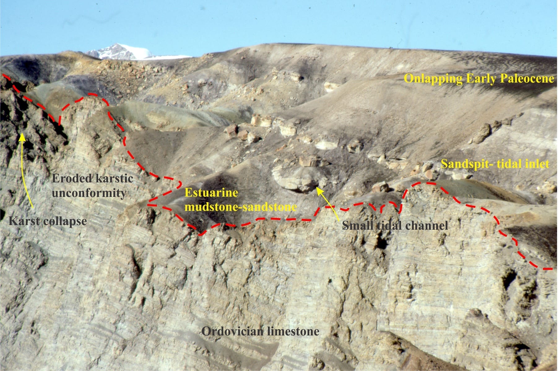
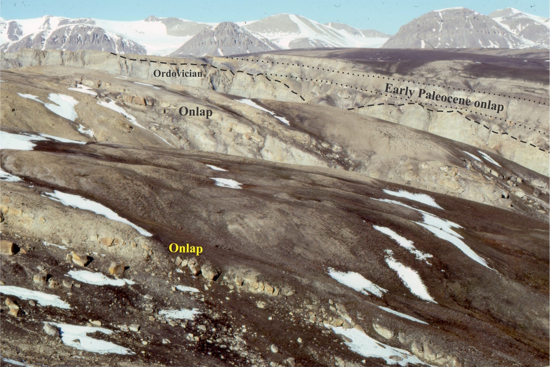
Sequence 1, Major subaerial unconformity between Ordovician limestone and onlapping Lower Paleocene estuarine, sandy shelf-bar-sand spit. Combined karstification and erosion of the limestones produced significant paleotopography. Mount Moore, eastern Ellesmere Island.
![]()
Sequence 1 estuarine, sand spit, and shallow shelf bars, onlapping karsted Ordovian limestones, Mount Moore, eastern Ellesmere Island. In the foreground, crossbedded sandstone is in direct contact with paleotopography.
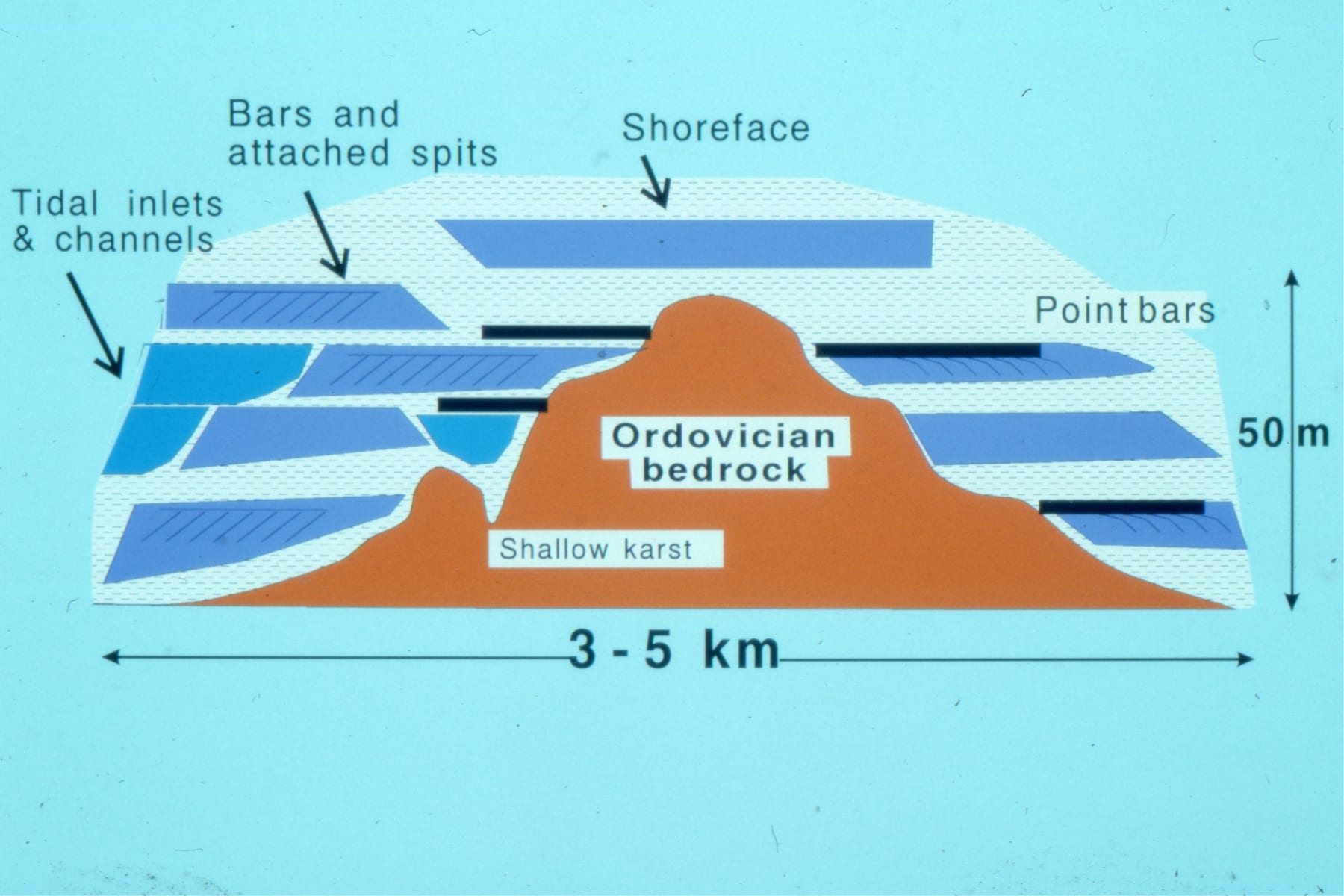
Reconstructed Early Paleocene paleotopography and Sequence 1 facies. For details see: Ricketts, B.D. 1991: Lower Paleocene drowned valley and barred estuaries, Canadian Arctic Islands: aspects of their geomorphological and sedimentological evolution; in Clastic Tidal Sedimentology, Rahmani, R.A., Smith, D.G., Reinson, G.E., and Zaitlin, B.A. (ed.); Canadian Society of Petroleum Geologists, Memoir 16, p. 91-106.
![]()
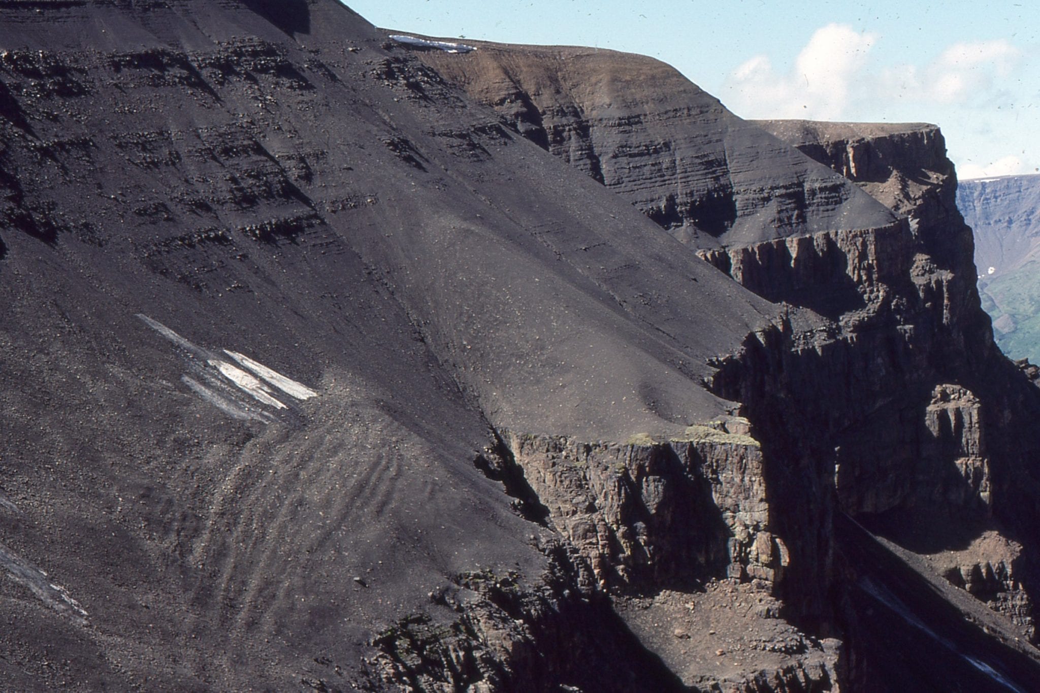
Sequence 3. River-dominated prodelta – delta front parasequences. About 300m of stratigraphy here. Abrupt, mappable parasequence tops coincide with the MFS. Axel Heiberg Island.
![]()
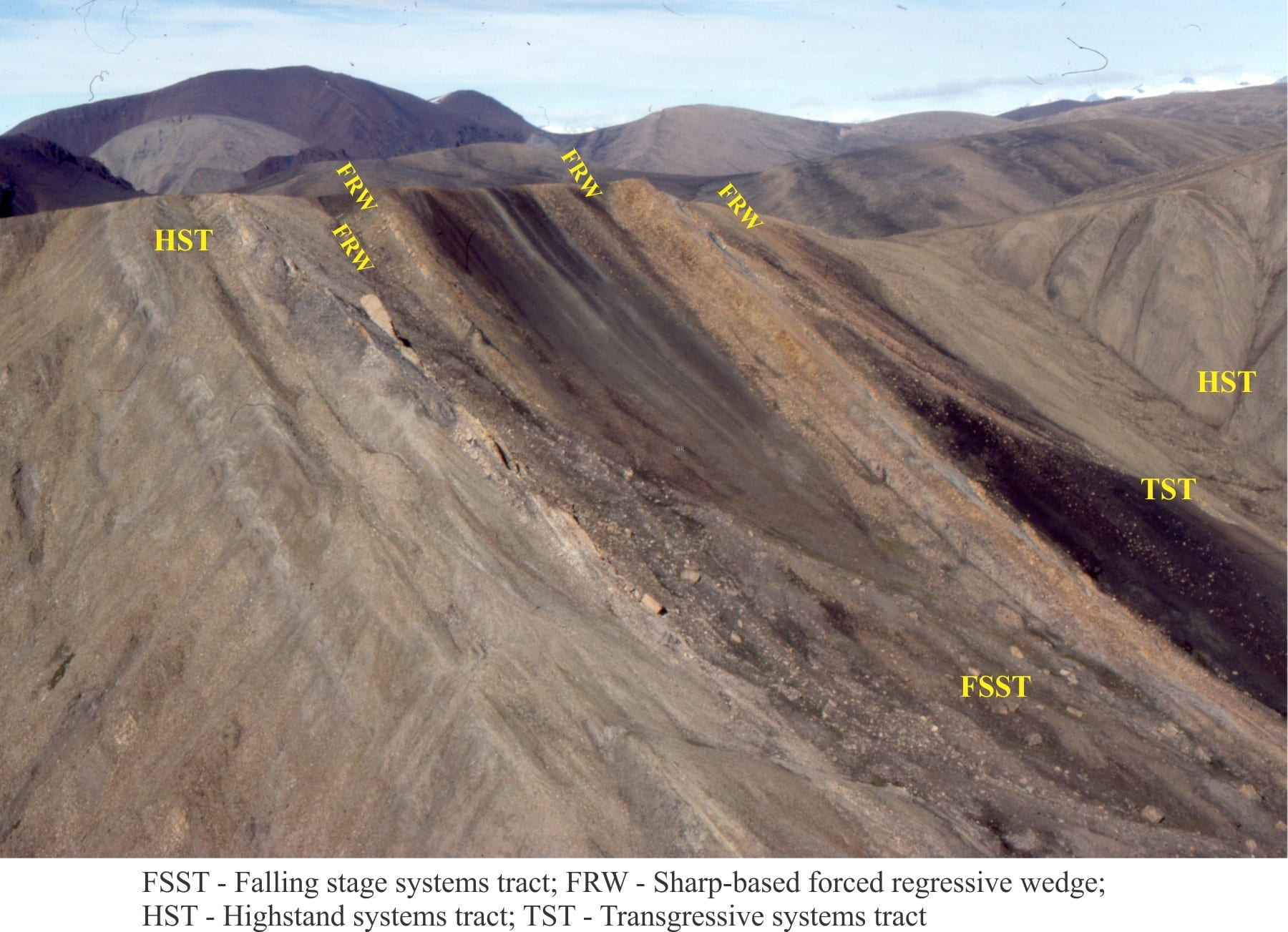
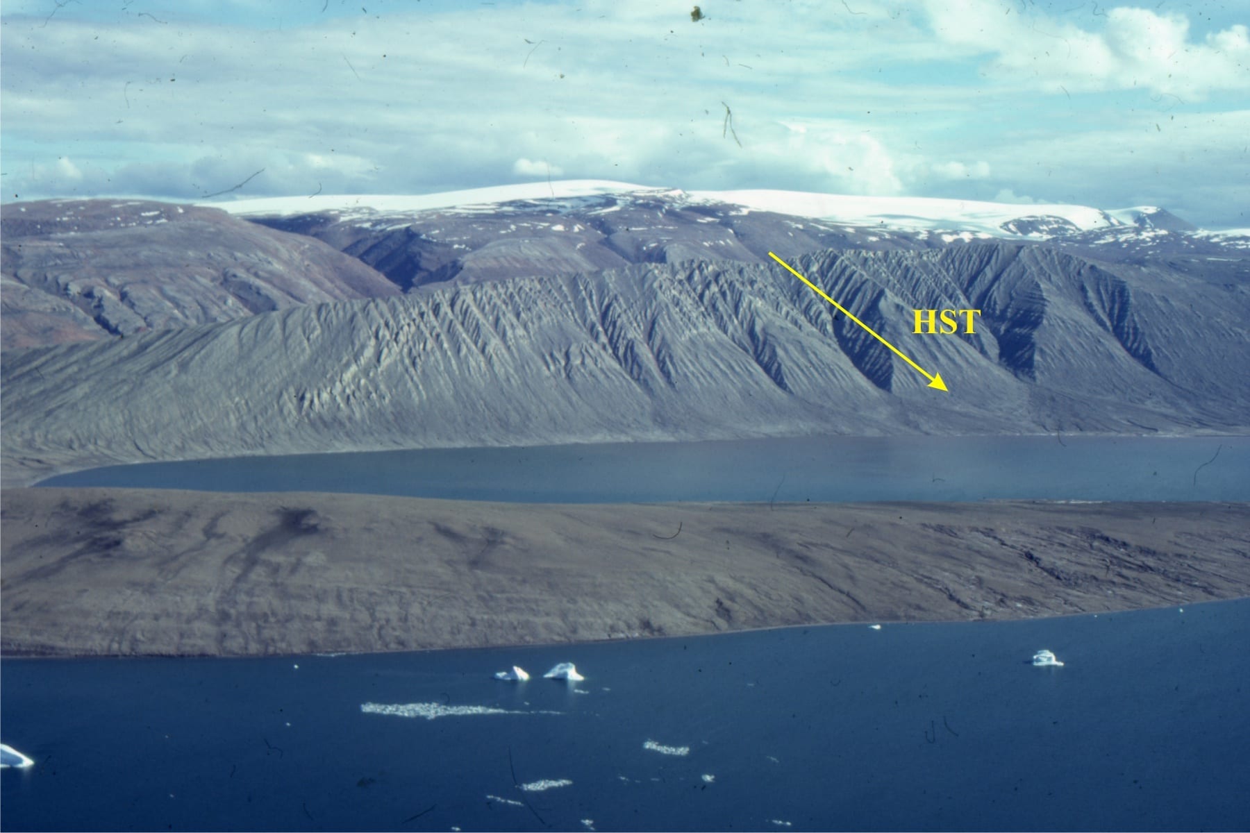
Sequence 3: FSST with forced regressive wedge – sharp-based shoreline sandstones formed by wave erosion as sea-level falls. The subsequent TST and HST extends to the right of the image. Axel Heiberg Island.
![]()
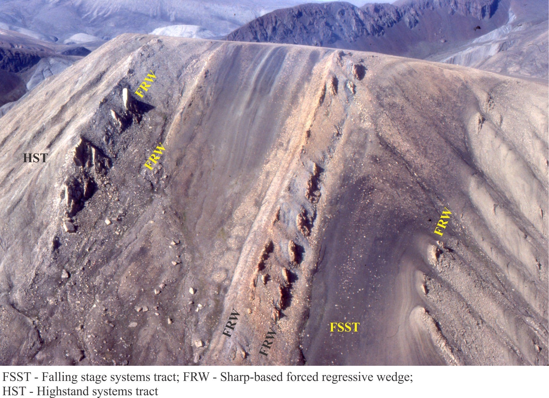
Sequence 3, as in the above image pair, focusing on the FSST and forced regressive sandstone wedges. Axel Heiberg Island.
![]()
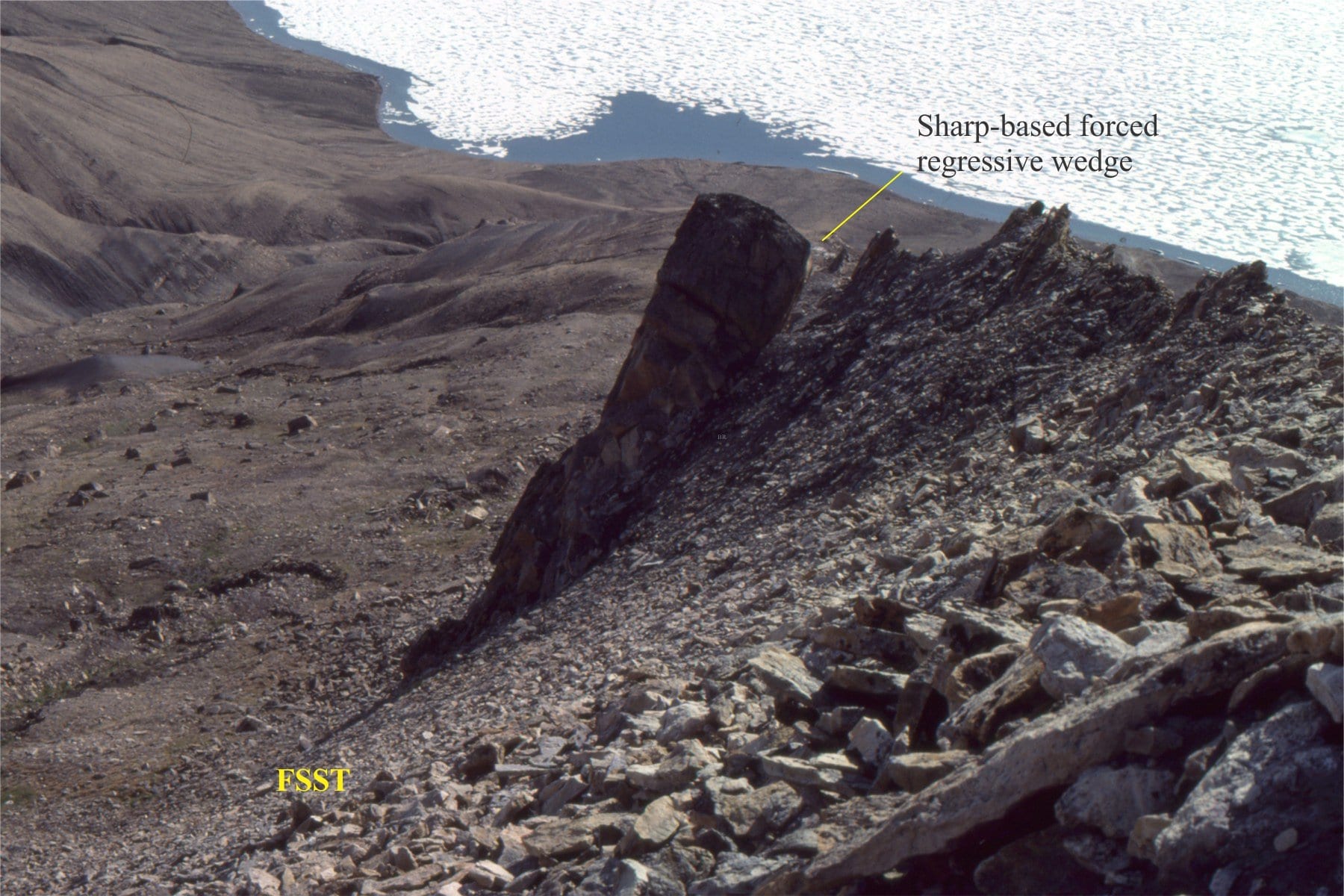
The basal part of the FSST in Sequence 3 (as above), featuring a sharp-based forced regressive shoreline wedge.
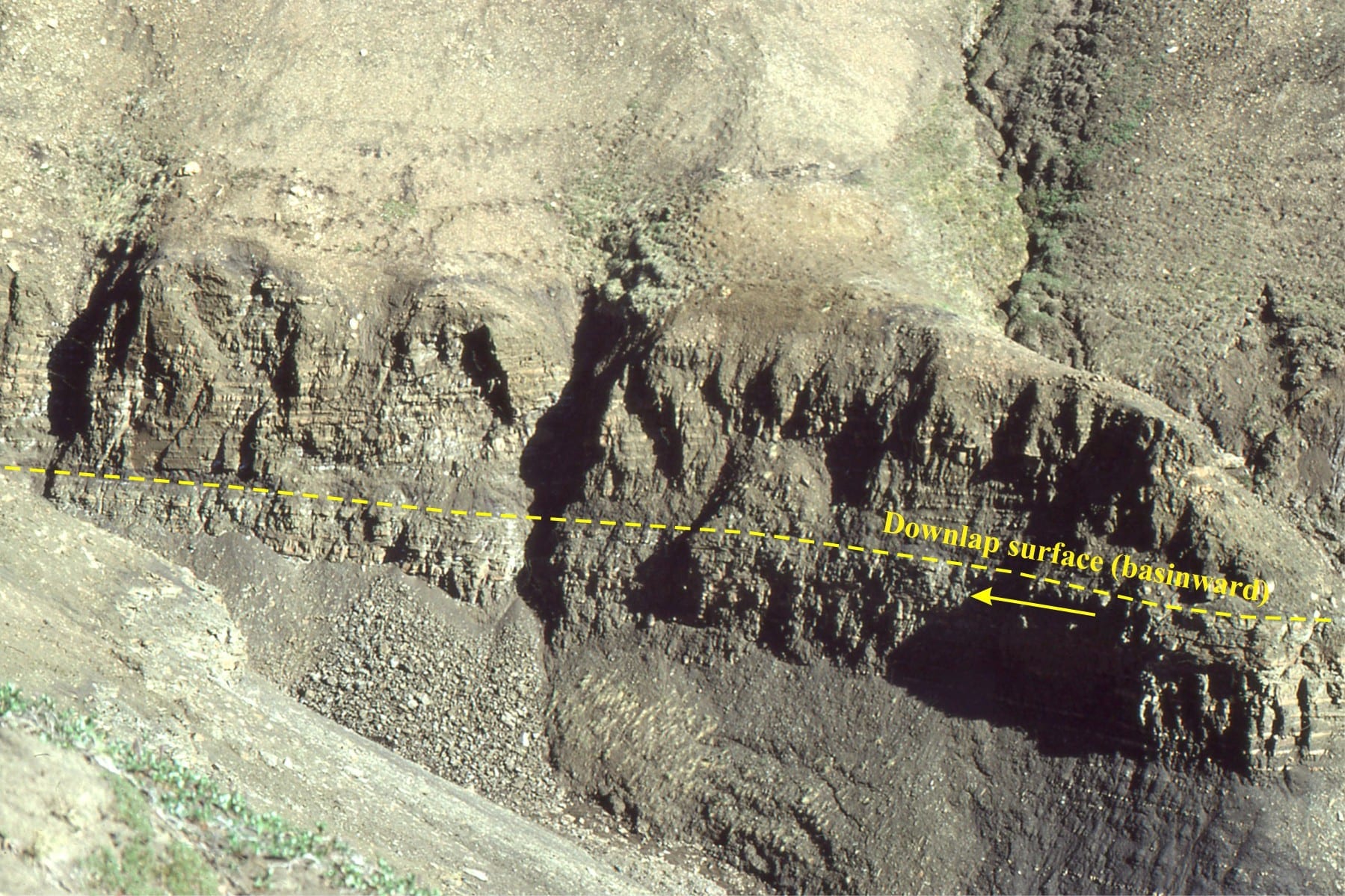
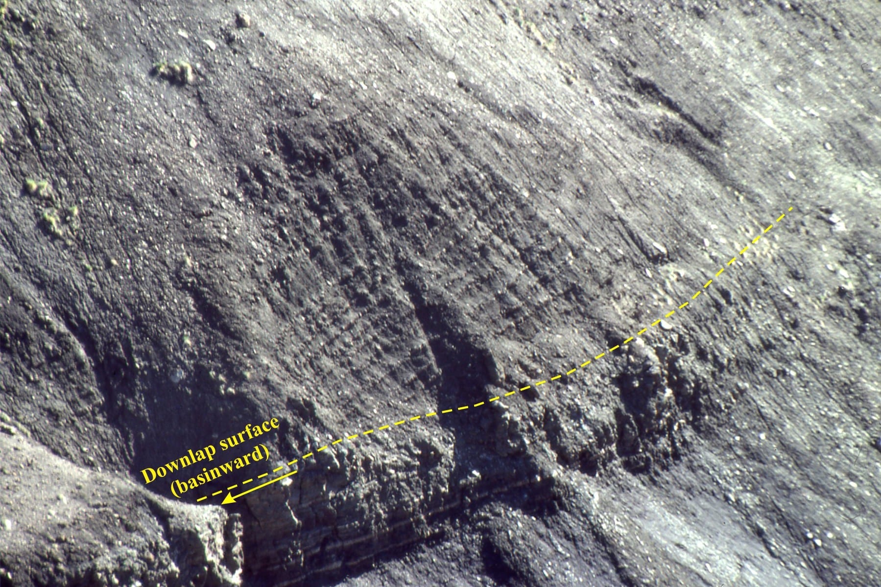
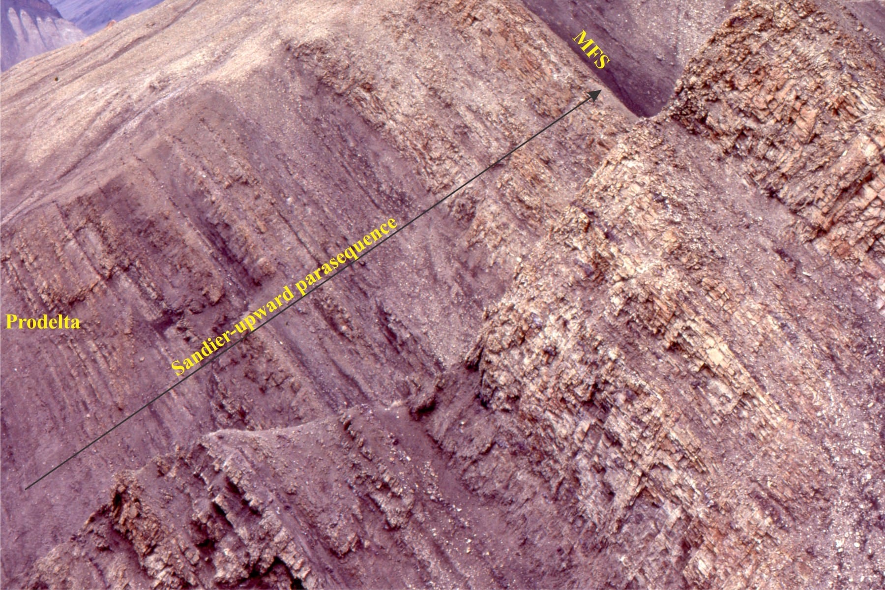
Sequence 3. Downlap surface with basinward progradation of prodelta mudstone fine-grained sandstone.
![]()
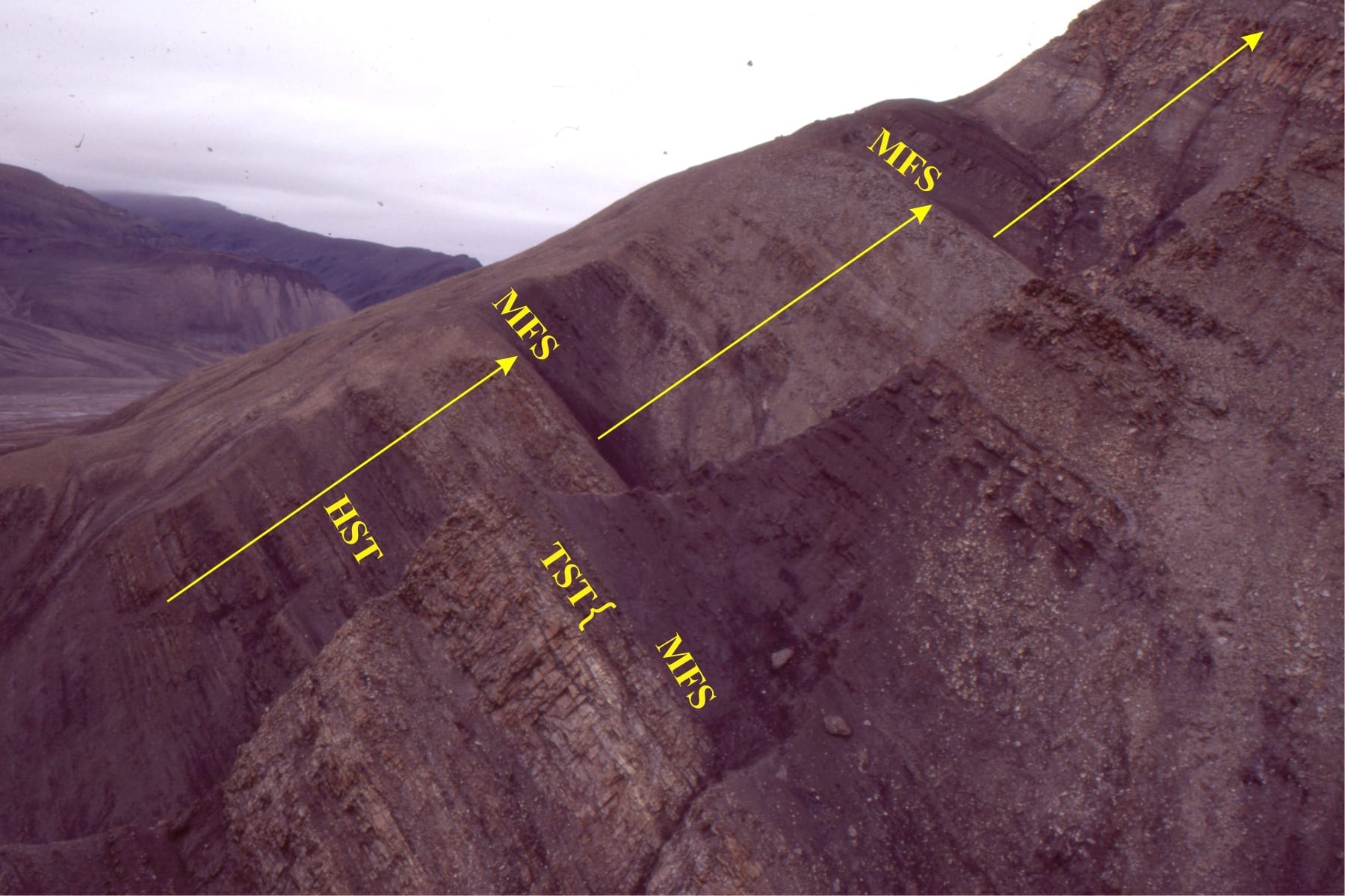
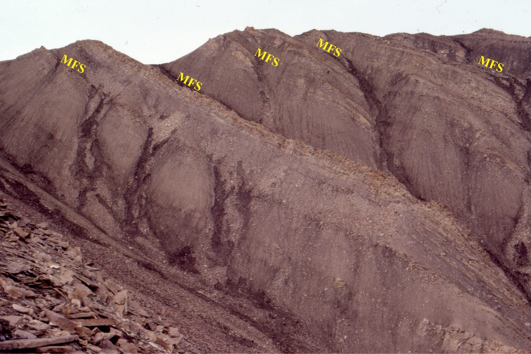
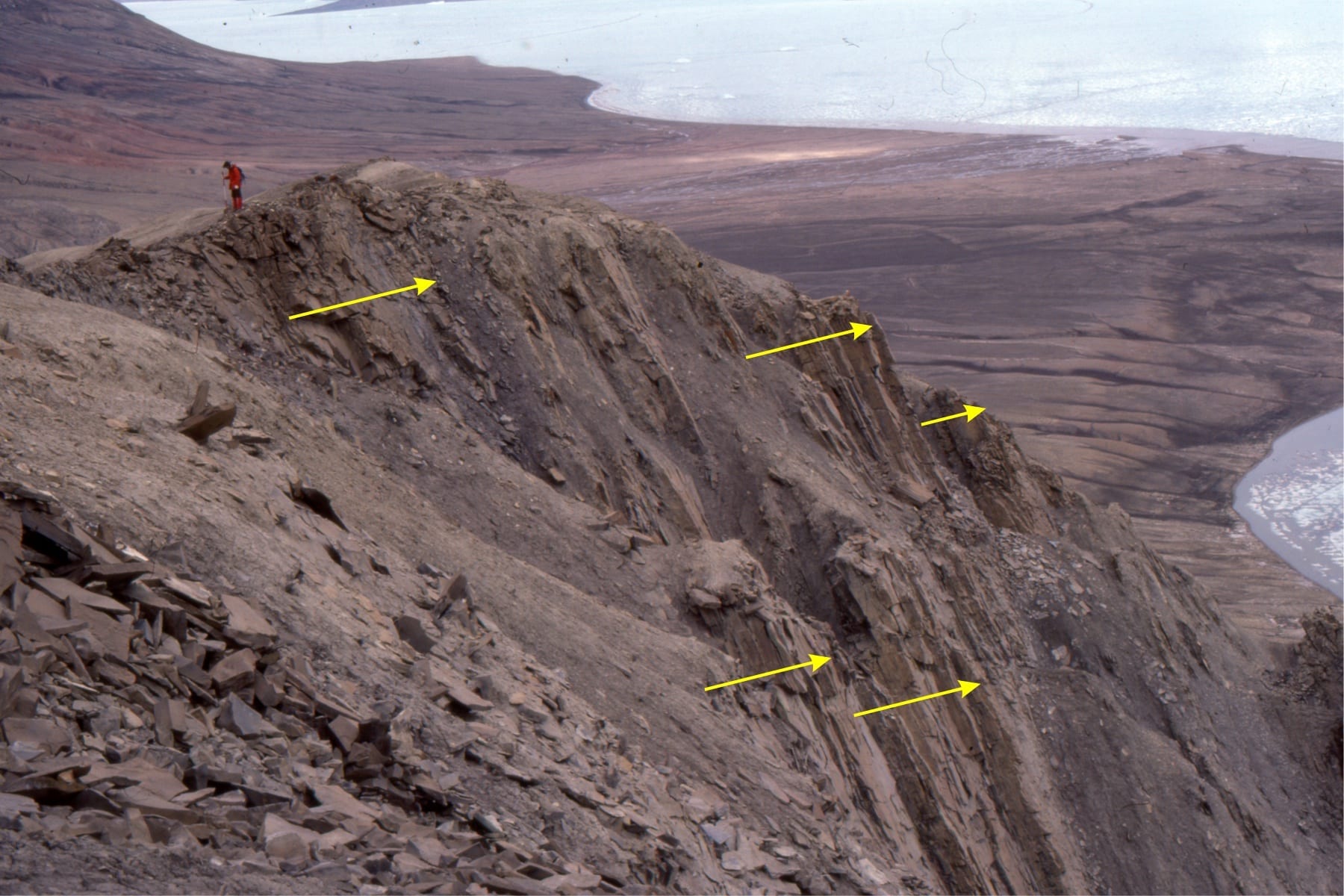
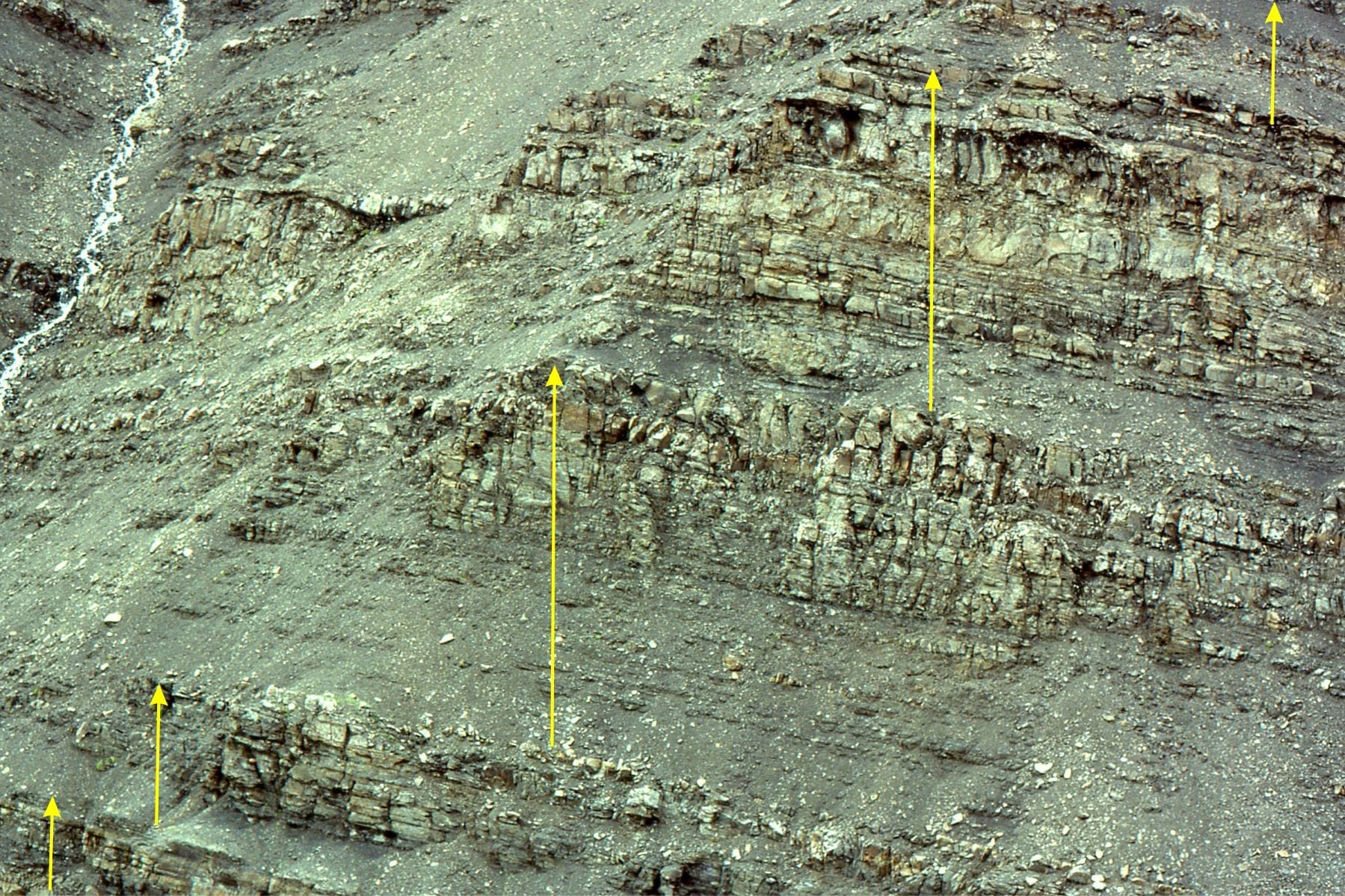
Sequence 3: Strongly aggradational HST, shelf parasequences, South Bay, Ellesmere Island.
![]()
Sequence 3: Shelf parasequences, mostly HST, thin TST, and MFS that corresponds with the resistant top of each cycle. For an overview see the next images above. South Bay
![]()
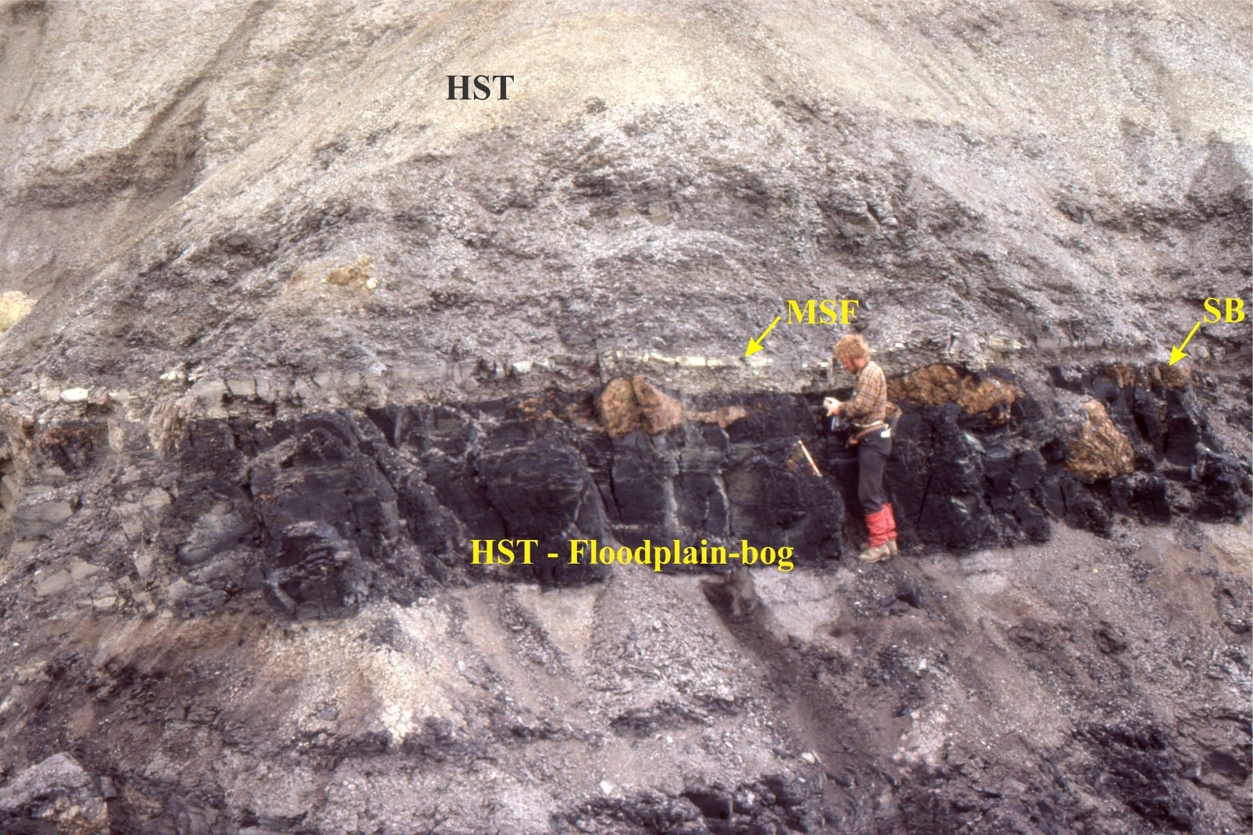
Sequence 3: A great example of a higher-order subaerial sequence boundary (SB) (top of coal seam), thin TST muddy sandstone, MFS, and HST. The orange blobs are mineralized tree roots. It’s also a much younger me. Strathcona Fiord, Ellesmere Island.
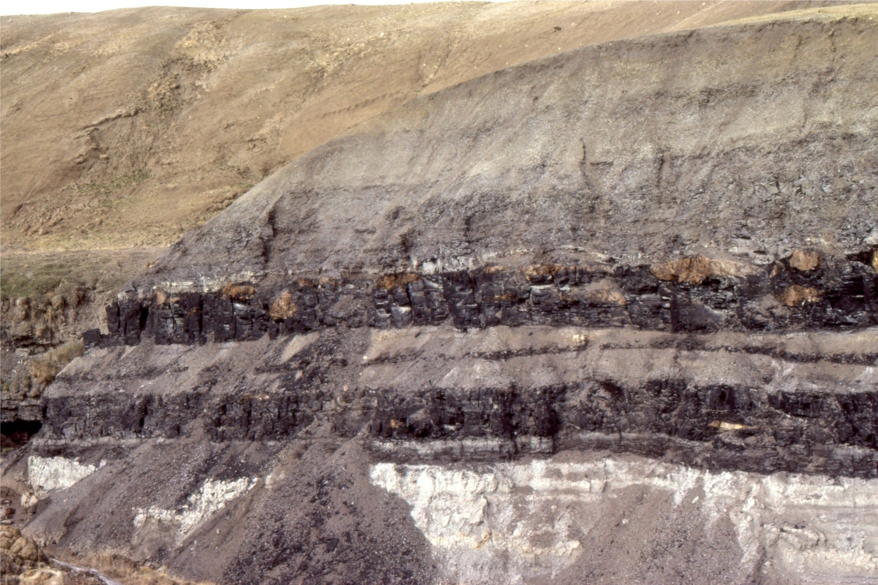
Sequence 3, a different perspective, as immediately above.
Jurassic mid-outer shelf parasequence, Bowser Basin. The MFS immediately overlies the resistant ledge, above which is a thick coarsening upward HST. Tsatia Mountain, northern British Columbia.
![]()
Mid-shelf parasequences with well defined MFS, transgressive surfaces, and TSTs. Tsatia Mountain, Bowser Basin.
![]()
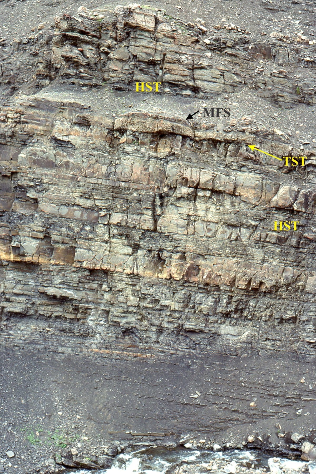
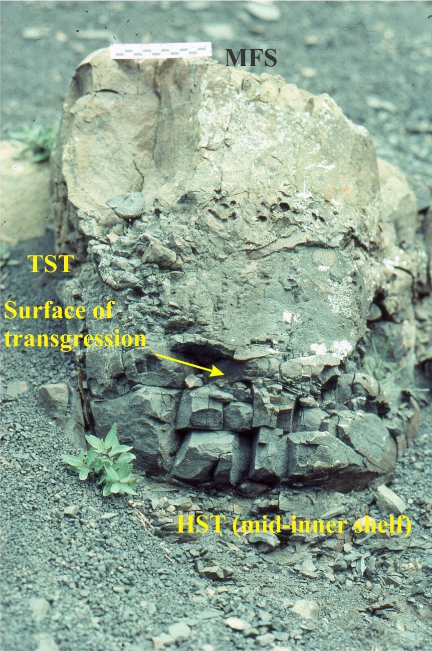
Closer view of a mid-inner shelf parasequence, Tsatia Mountain, Bowser Basin. The coarsening upward HST is capped by a pebbly, fossiliferous TST and MSF. The transgressive surface is one of marine erosion during changing wave-base.
![]()
Detail of the top HST, transgressive surface (of erosion), the fossiliferous, pebbly TST (ammonites and bivalves), a calcareous mudstone that is part of the condensed TST stratigraphy when terrigenous sediment input was at its lowest, the MFS, and succeeding HST. Tsatia Mountain, Bowser Basin.
![]()
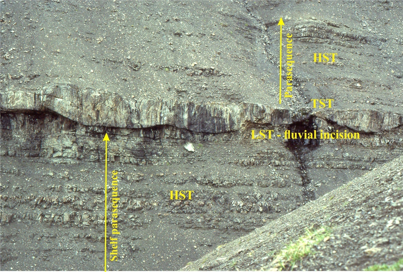
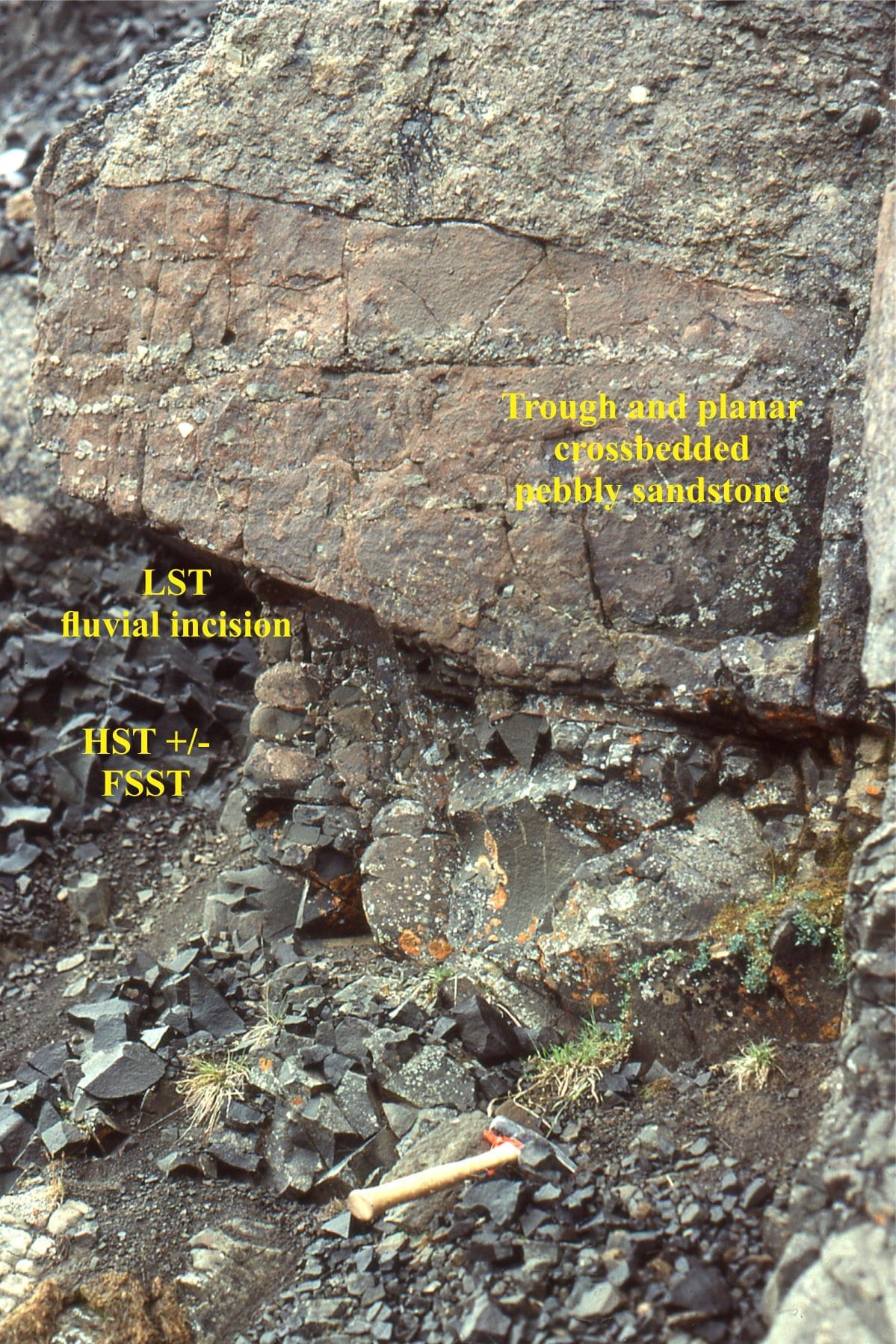
The Tsatia Mountain section contains some shelf parasequences that are truncated by lowstand, channelized fluvial sandstone – the LST. The TST is a thin, pebbly mudstone similar to that in the image immediately above. Bowser Basin.
![]()
The abrupt contact between the erosional base of the TST fluvial channel, and the preceding shelf parasequence. Tsatia Mountain, Bowser Basin.