Tag Archives: subaerial unconformity

Stratigraphic surfaces in outcrop – baselevel fall

Facebooktwitterlinkedininstagram
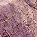
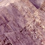
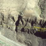
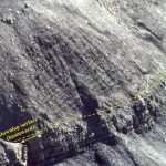
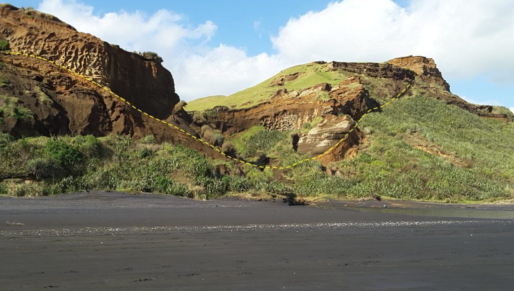
Valley (outlined) erosded into Pleistocene coastal dunes during sea level lowstand. The vallety was later filled by a younger dune complex as sea level rose. Kariotahi, New Zealand

A subaerial unconformity (dashed line) outlines this paleotopographic low where drainage eroded into Pleistocene coastal dunes during falling sea level. The valley was later filled by a younger dune complex as sea level rose and sand on the exposed shelf was moved landward in concert with the migrating shoreline . Kariotahi, New Zealand.

Outcrop expression of subaerial unconformities and regressive surfaces of marine erosion

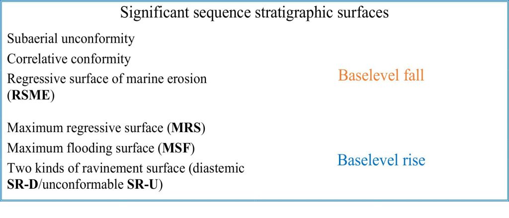
Six stratigraphic surfaces define the important boundaries of stratigraphic sequences and their system tracts. The significance of these surfaces in sequence stratigraphy is based on a model of baselevel change, a model that, in turn is based on interpretation of facies and stratigraphic trends, experimental studies (e.g., flumes), theoretical considerations, and numerical simulations. The baselevel model dictates that surfaces develop as a function of changes in sediment accommodation and supply, migrating shorelines, and the consequent shifts in environmental conditions.
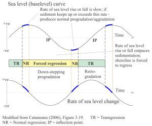
A schematic representation of the baselevel model that makes a bold statement about shoreline trajectories and stratigraphic trends in terms of accommodation space and sediment supply.

A schematic representation of the baselevel model that makes a bold statement about shoreline trajectories and stratigraphic trends in terms of accommodation space and sediment supply.

The diagnostic criteria for recognition of these surfaces in outcrop and core are based on sedimentary, bio-, and chemical facies and, if the exposure is panoramic, bed geometries such as onlap and offlap.

Five of these surfaces are included here; there are no criteria that ensure definitive identification of correlative conformities in outcrop.  These are best identified on seismic profiles where reflections can be traced from the shelf or platform to the deeper basin.

A companion article looks at sequence stratigraphic surfaces formed during baselevel rise.

Several Sverdrup Basin images here and in the companion post on Falling baselevel have been generously donated by Ashton Embry. Some key references are added at the bottom of the page.


Subaerial unconformities

Criteria commonly used to identify subaerial unconformities in outcrop include (some of these also apply to core):

  • Evidence of subaerial exposure (e.g., paleosols, regoliths, caliche, karst, and other vadose zone diagenetic features).
  • Erosion and truncation of underlying strata.
  • Paleotopography.
  • Onlap of overlying strata.
  • Map extent.
  • A significant hiatus (one that has regional or basin-wide extent).


Sverdrup Basin, Arctic Canada
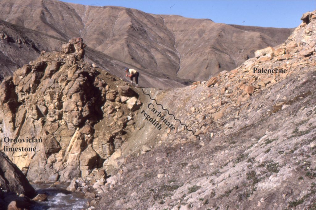
Estuarine deposits, paleosols, blocky regoliths and karst paleotopography (Expedition Fm, Eureka Sound Group) developed on deformed Ordovician to Devonian carbonates and siliciclastics, heralding renewed subsidence and stratigraphic onlap across Sverdrup Basin. The angular unconformity between Ordovician carbonates and Early Paleocene estuarine mudrocks is underlain by regolith. Fractured limestone is arranged in jig-saw fit patterns; there is no evidence of reworking – shown in the image following. The unconformity is overlain by estuarine mudstone, sandstone and thin coals, and locally tidal channel sandstones. Expedition Fm. Mount Moore, Ellesmere Island.
Estuarine deposits, paleosols, blocky regoliths and karst paleotopography (Expedition Fm, Eureka Sound Group) developed on deformed Ordovician to Devonian carbonates and siliciclastics, heralding renewed subsidence and stratigraphic onlap across Sverdrup Basin.
The angular unconformity between Ordovician carbonates and Early Paleocene estuarine mudrocks is underlain by regolith. Fractured limestone is arranged in jig-saw fit patterns; there is no evidence of reworking – shown in the image following. The unconformity is overlain by estuarine mudstone, sandstone and thin coals, and locally tidal channel sandstones. Expedition Fm. Mount Moore, Ellesmere Island.


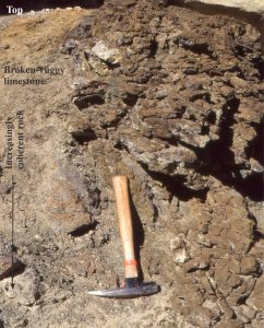
A closer look at the regolith developed on Ordovician limestone. The surfaces of fracture blocks are pitted and embayed by dissolution. Fracturing and dissolution decrease downwards from the upper contact. Elsewhere there is evidence for karstification. Same location as above.
A closer look at the regolith developed on Ordovician limestone. The surfaces of fracture blocks are pitted and embayed by dissolution. Fracturing and dissolution decrease downwards from the upper contact. Elsewhere there is evidence for karstification. Same location as above.


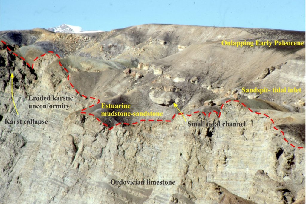
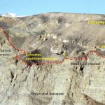
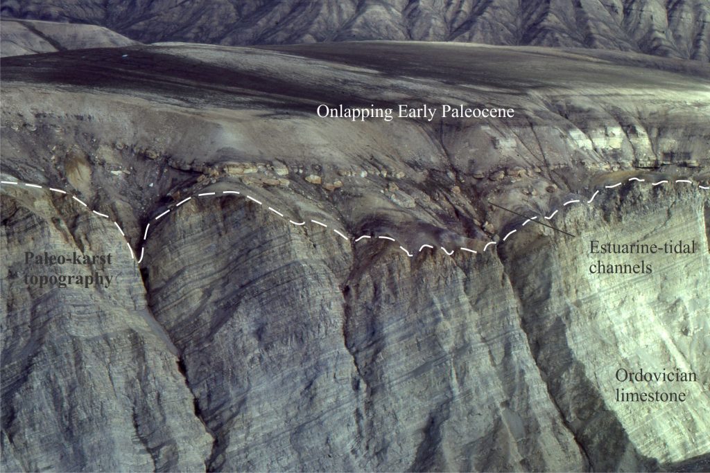
A more expansive view of the Ordovician – Paleocene subaerial unconformity showing the paleotopography developed by karstification during protracted exposure of the Ordovician carbonates (dashed line). The karst surface contains regoliths, dissolution collapse pits, and in places collapse breccias. Lower Paleocene estuarine, tidal channel, sand spit and bar deposits onlap the unconformity from right to left. Same location as above.
A more expansive view of the Ordovician – Paleocene subaerial unconformity showing the paleotopography developed by karstification during protracted exposure of the Ordovician carbonates (dashed line). The karst surface contains regoliths, dissolution collapse pits, and in places collapse breccias. Lower Paleocene estuarine, tidal channel, sand spit and bar deposits onlap the unconformity from right to left. Same location as above.


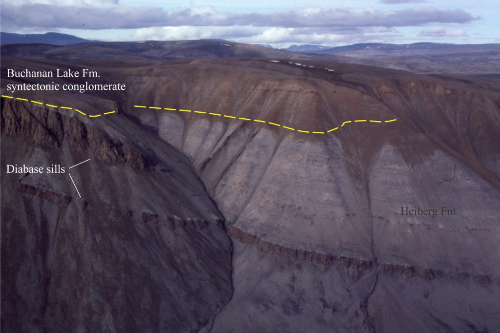
The Middle Eocene Buchanan Lake Fm. is a syntectonic conglomerate derived from Mesozoic and Paleozoic rocks carried in the hanging wall of crustal-scale thrusts during the Eurekan Orogeny. The deformation resulted in dismemberment of Sverdrup Basin. The conglomerates were deposited in alluvial fans and more distal fluvial systems. The subaerial unconformity at this locality (Stang Bay) records an abrupt change from Triassic marine sandstone intruded by diabase sills to coarse, diabase-rich conglomerate. Axel Heiberg Island.

The Middle Eocene Buchanan Lake Fm. is a syntectonic conglomerate derived from Mesozoic and Paleozoic rocks carried in the hanging wall of crustal-scale thrusts during the Eurekan Orogeny. The deformation resulted in dismemberment of Sverdrup Basin. The conglomerates were deposited in alluvial fans and more distal fluvial systems. The subaerial unconformity at this locality (Stang Bay) records an abrupt change from Triassic marine sandstone intruded by diabase sills to coarse, diabase-rich conglomerate. Axel Heiberg Island.


Scottish Hebrides

The paleotopographic expression of the unconformity between Late Precambrian Moine schists and Devonian Old Red Sandstone is nicely presented at Portskerra, north Scotland. Basal fluvial deposits that drape the paleotopographic highs overlie remnants of a regolith (see following image), with channel-like crossbedded sandstones filling the topographic lows. The paleo-relief above and below the shore platform is projected to be about 5-10 m.
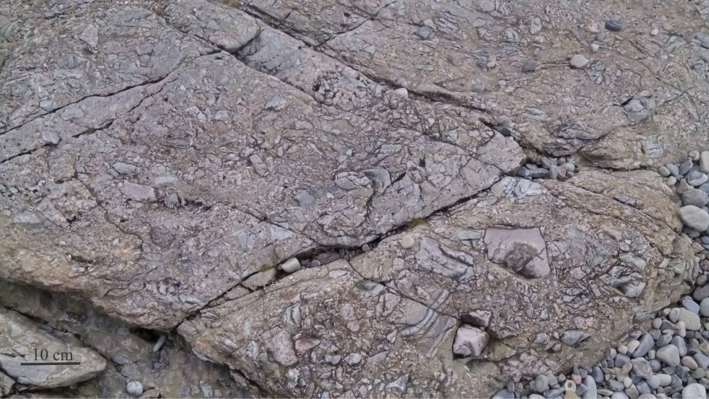
The paleotopographic expression of the unconformity between Late Precambrian Moine schists and Devonian Old Red Sandstone is nicely presented at Portskerra, north Scotland. Basal fluvial deposits that drape the paleotopographic highs overlie remnants of a regolith (see following image), with channel-like crossbedded sandstones filling the topographic lows. The paleo-relief above and below the shore platform is projected to be about 5-10 m.


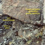
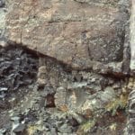
Regolithic breccia at the Moine-Old Red Sandstone unconformity contains broken fragments of schist and pelite. The fragments are mostly angular and unsorted; some are fitted. Interstices between fragments are filled mostly with grit and sand. The regolith is overlain by fluvial sandstone of the Devonian Old Red Sandstone (shown above). Portskerra, north Scotland.

Regolithic breccia at the Moine-Old Red Sandstone unconformity contains broken fragments of schist and pelite. The fragments are mostly angular and unsorted; some are fitted. Interstices between fragments are filled mostly with grit and sand. The regolith is overlain by fluvial sandstone of the Devonian Old Red Sandstone (shown above). Portskerra, north Scotland.


Regressive surface of marine erosion (RSME)

Sverdrup Basin
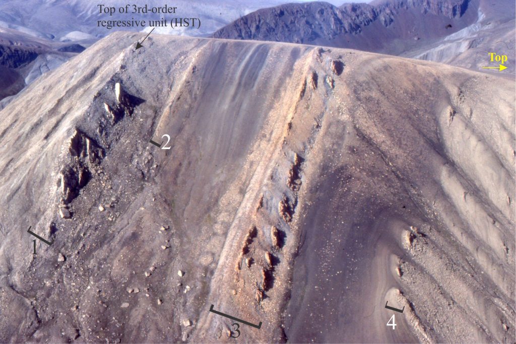
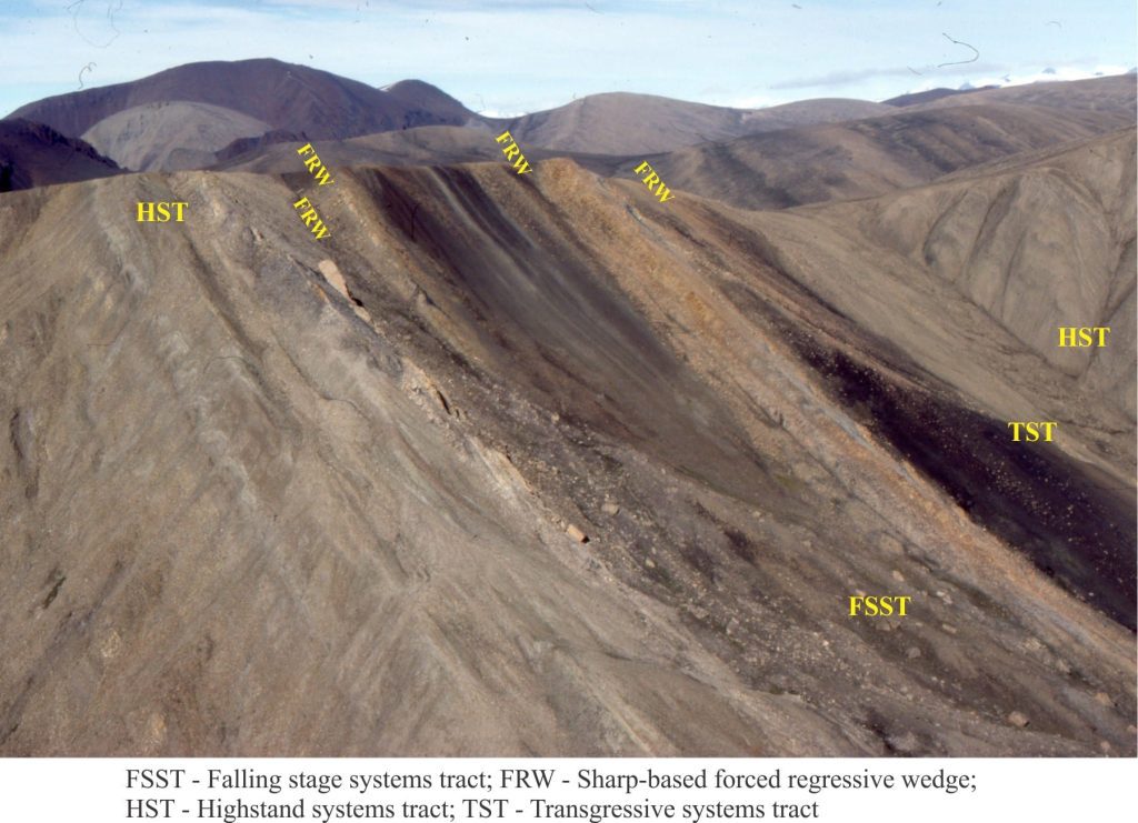
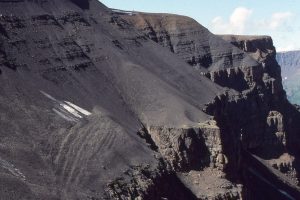
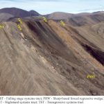
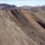
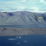
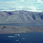
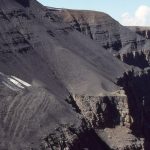
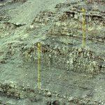
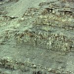
The examples of RSME surfaces are from the Paleocene Stand Fiord Formation on Axel Heiberg Island (Arctic Canada), part of a third-order sequence. The transition from normal regression (left side, labelled HST) to forced regression is recorded by shelf mudrocks interleaved with abrupt-based, tabular-bedded sandstone units; the base of each sandstone unit is an RSME. The top of each unit is relatively abrupt but conformable. There are three main periods of RSME development that in this view are the three packages of resistant beds (labelled 1 to 3); each package may represent a higher-order cyclicity that is superposed on the 3rd order sequence. In outcrop, the sandstones have blocky profiles (see image below) compared with the more recessive weathering mudstones. Each sandstone unit represents a period of shoreface progradation where sediment supply briefly kept pace with falling baselevel. The overall shoreline trajectory during baselevel fall was gentle seaward downstepping.
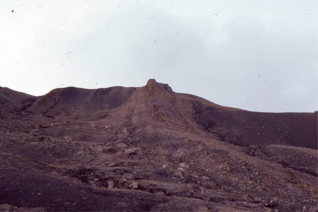
The examples of RSME surfaces are from the Paleocene Stand Fiord Formation on Axel Heiberg Island (Arctic Canada), part of a third-order sequence. The transition from normal regression (left side, labelled HST) to forced regression is recorded by shelf mudrocks interleaved with abrupt-based, tabular-bedded sandstone units; the base of each sandstone unit is an RSME. The top of each unit is relatively abrupt but conformable. There are four main periods of RSME development that in this view are the packages of resistant beds (labelled 1 to 4); each package may represent a higher-order cyclicity that is superposed on the 3rd order sequence.
In outcrop, the sandstones have blocky profiles (see image below) compared with the more recessive weathering mudstones. Each sandstone unit represents a period of shoreface progradation where sediment supply briefly kept pace with falling baselevel. The overall shoreline trajectory during baselevel fall was gentle seaward downstepping.


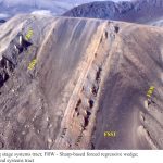
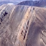
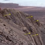
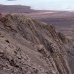
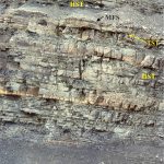
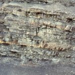
An along-strike view of three forced regressive sandstone wedges (package #2 in the image above). The base of each is an abrupt, locally scoured surface of marine erosion (RSME) that overlies discordantly shelf mudrocks, and in turn are overlain conformable by shelf deposits. The sandstones contain planar and trough crossbeds that formed as subaqueous dunes that migrated across a shallow, sandy shoreface-beach. Each sandstone wedge prograded as the shoreline down-stepped seaward during baselevel fall.
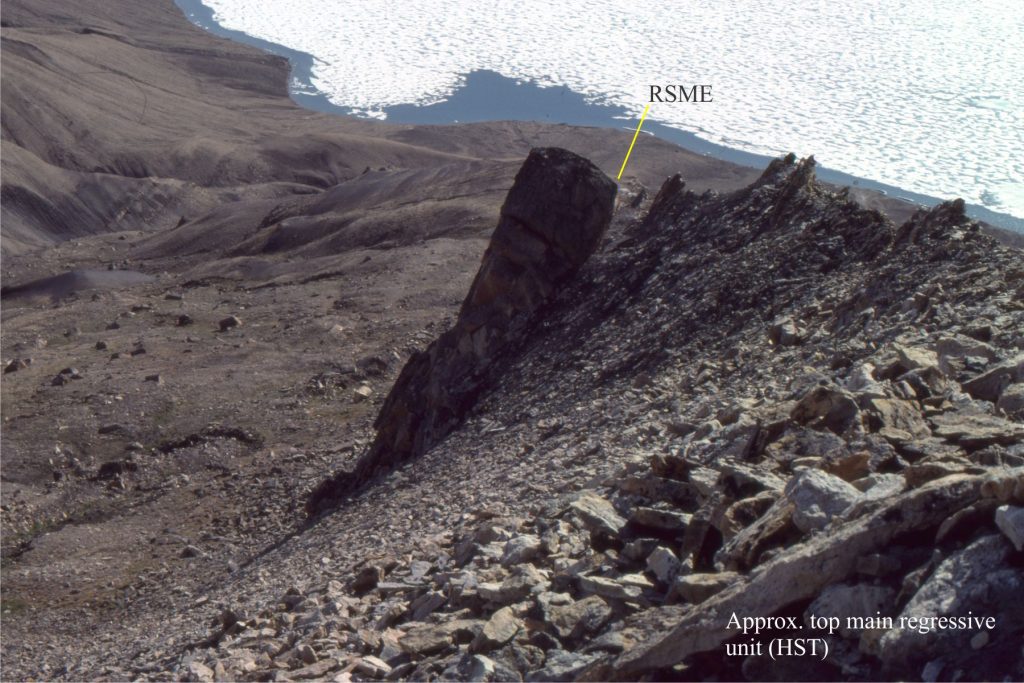
An along-strike view of three forced regressive sandstone wedges (package #2 in the image above). The base of each is an abrupt, locally scoured surface of marine erosion (RSME) that overlies discordantly shelf mudrocks, and in turn are overlain conformable by shelf deposits. The sandstones contain planar and trough crossbeds that formed as subaqueous dunes that migrated across a shallow, sandy shoreface-beach. Each sandstone wedge prograded as the shoreline down-stepped seaward during baselevel fall.


A different view of the abrupt erosional base of a forced regressive sandstone wedge (RSME) – this event is part of package #1. The Crossbedded sandstone is underlain by shale and thin bedded fine-grained sandstone.
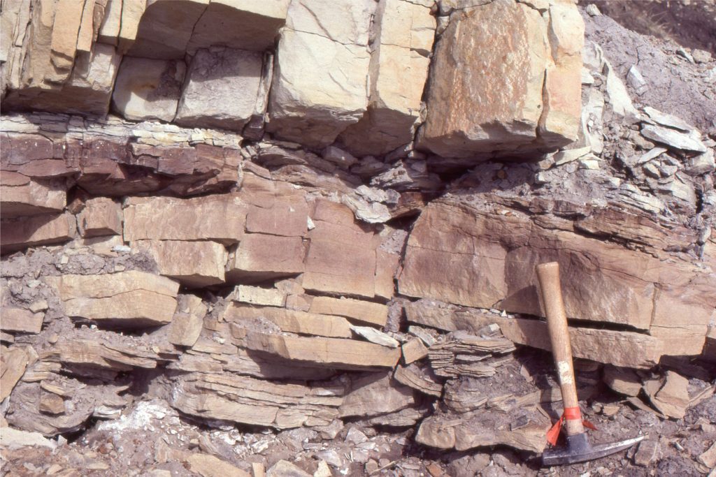
A different view of the abrupt erosional base of a forced regressive sandstone wedge (RSME) – this event is part of package #1. The Crossbedded sandstone is underlain by shale and thin bedded fine-grained sandstone.


The base of forced regressive sandstone units have shallow scours like this example (at the hammer head) and discordantly overlie grey shale. Sandstones are medium to fine grained and well sorted. The basal sandstone here has shallow trough crossbeds (the lowest unit in package #2).

The base of forced regressive sandstone units have shallow scours like this example (at the hammer head) and discordantly overlie grey shale. Sandstones are medium to fine grained and well sorted. The basal sandstone here has shallow trough crossbeds (the lowest unit in package #2).


Some Sverdrup Basin sequence stratigraphy papers

Embry, A.F. 2011. Petroleum prospectivity of the Triassic–Jurassic succession of Sverdrup Basin, Canadian Arctic Archipelago. In Chapter 36, Spencer, A. M., Embry, A. F., Gautier, D. L., Stoupakova, A. V. & Sørensen, K. (eds) Arctic Petroleum Geology. Geological Society, London, Memoirs, 35, p. 545–558.

Embry, A.F., and Johannessen, E.P. 2017 Two Approaches to Sequence Stratigraphy. In; Chapter 27, Stratigraphy & Timescales, Volume 2, Elsevier. PDF available

Embry, A.F. 2018. Triassic history of the Tanquary High in NE Sverdrup Basin, Canadian Arctic Archipelago. In; Piepjohn, K., Strauss, J.V., Reinhardt, L., and McClelland, W.C., eds., Circum-Arctic Structural Events: Tectonic Evolution of the Arctic Margins and Trans-Arctic Links with Adjacent Orogens. The Geological Society of America Special Paper 541, p. 285–301.

Embry, A., and B. Beauchamp. 2019. Chapter 14. Sverdrup Basin. In; A.D. Miall, (Ed.), The Sedimentary Basins of the United States and Canada, Elsevier, p.559-592.

Ricketts, B.D. and Stephenson, R.A. 1994. The demise of Sverdrup Basin: Late Cretaceous – Paleogene sequence stratigraphy and forward modelling. Journal of Sedimentary Research (1994) 64 (4b): 516–530.


Other posts in this ‘outcrop’ series

Sedimentary structures: Shallow marine

Sedimentary structures: Turbidites

Sedimentary structures: Mass transport deposits

Sedimentary structures: Fine-grained fluvial

Sedimentary structures: coarse-grained fluvial

Sedimentary structures: Alluvial fans

Sedimentary structures: Stromatolites

A submarine channel complex

Volcanics in outcrop: Lava flows

Volcanics in outcrop: Secondary volcaniclastics

Volcanics in outcrop: Pyroclastic fall deposits

Volcanics in outcrop: Pyroclastic density currents

Ignimbrites in outcrop and thin section

Block and ash flows

Accretionary aggregates and accretionary lapilli

Facebooktwitterlinkedininstagram
Facebooktwitterlinkedin

Sequence stratigraphic surfaces

Facebooktwitterlinkedininstagram

A brief look at the key stratigraphic surfaces that help us construct sequence stratigraphic models.


Look at any pile of sedimentary or volcanic rock and you will see a multitude of stratigraphic surfaces: bedding planes, lava and ash-flow tops, unconformities, and erosional discordances. Each is important in its own way and has a story to tell.

Genetic stratigraphic models, like sequence stratigraphy, use specific surfaces to define (and in some respects be defined by) abrupt changes in baselevel (regression, transgression) and sediment accommodation, changes in the direction of shoreline migration, the boundaries of stratigraphic trends (e.g. coarsening or fining upwards trends), and the stacking of parasequences and other high-order cycles. The main stratigraphic surfaces are (Catuneanu et al. 2011):

  1. Subaerial unconformity
  2. Correlative conformity
  3. Regressive surface of marine erosion (RSME)
  4. Maximum flooding surface (MSF)
  5. Maximum regressive surface (MRS)
  6. Two kinds of ravinement surface (tide- and wave-formed)

All have been referred to by different names and synonyms over the decades since sequence stratigraphy was first formalized (Payton, 1977). Details on this terminological jungle are documented by Catuneanu (2006).

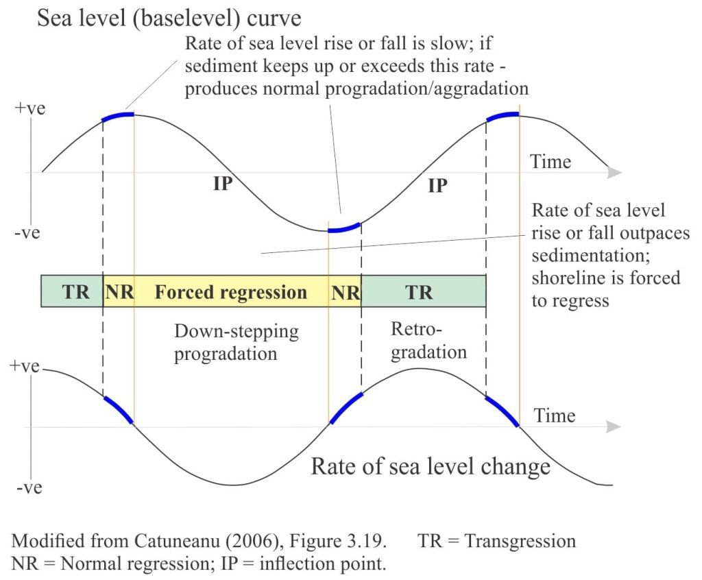
There are four conditions under which these surfaces form – conditions that are related to the different stages of baselevel rise and fall, shoreline trajectory, sediment accommodation, and depositional environments. For each stage, refer to the relative sea level curve below:

Stages of regression and transgression in relation to relative sea level, in a sequence stratigraphy context

Stages of regression and transgression in relation to relative sea level, in a sequence stratigraphy context

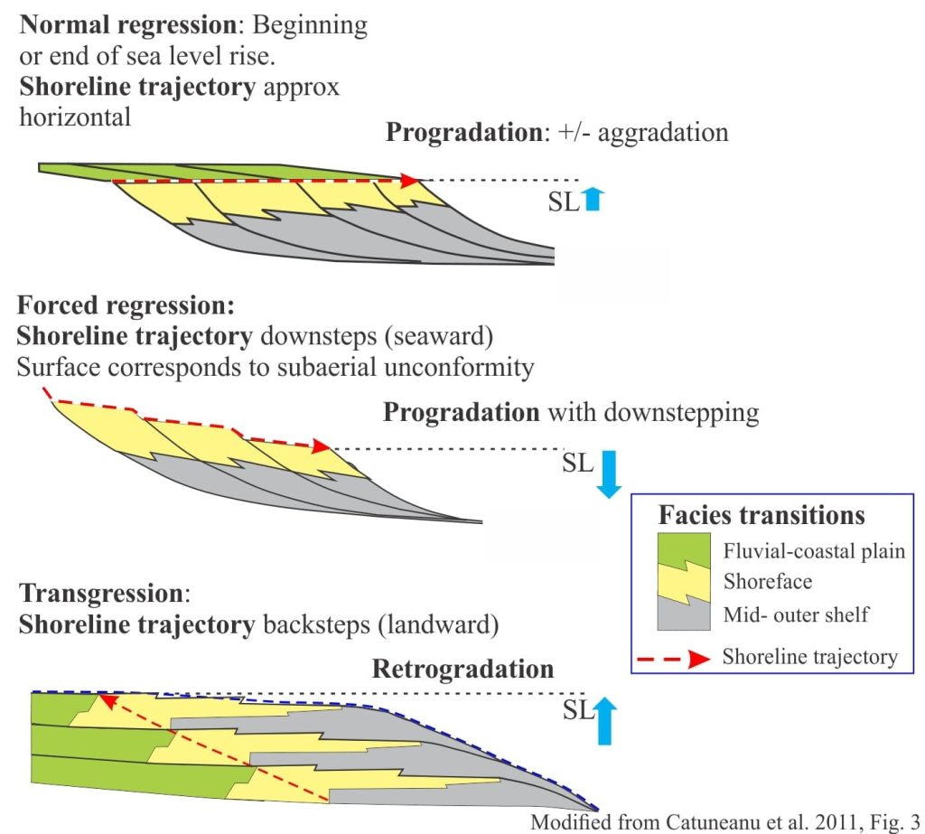
  • Beginning of baselevel fall and forced regression: Forced regression takes place when relative sea level fall outpaces sediment supply, forcing the shoreline and associated shelf facies seaward. Deposition associated with forced regression produces a succession of seaward-stacked shoreface wedges, where each wedge in succession is stranded as the shoreline moves seaward. In profile, the shoreline trajectory defining these wedges, downsteps in concert with falling sea level. Landward, a correlative surface will develop via fluvial incision.
  • The end of forced regression and the beginning of normal regression: In this case normal regression produces a typical prograding (the shoreline trajectory is approximately horizontal) and aggrading profile (the shoreline trajectory has a vertical component) and usually signifies that the supply of sediment is keeping pace with or exceeding the changes to baselevel and accommodation. Landward, fluvial incision will slow or cease as drainage adjusts to the lowstand baselevel.
  • End of regression and the beginning of transgression: Transgression occurs when baselevel rises and accommodation increases, such that the shoreline and associated shelf facies move landward. The back-stepping sediment packages are referred to as retrogradational. Landward, rivers will begin to aggrade, or change their sinuosity to accommodate the rising baselevel.
  • End of transgression and the beginning of the next phase of normal regression: Here, the shoreline trajectory reverses such that deposition changes from retrogradational to progradational – aggradational.
Schematic dip-section showing shoreline trajectories and depositional trends resulting from normal and forced regression, and transgression. across a siliciclastic shelf.

Schematic dip-section showing shoreline trajectories and depositional trends resulting from normal and forced regression, and transgression. across a siliciclastic shelf.

Subaerial unconformity

As relative sea level falls, the shoreline migrates seawards and the siliciclastic shelf or carbonate platform is progressively exposed. Exposure of sediment and bedrock results in various kinds of weathering – wind and water erosion, soil development, and diagenesis. Exposed marine carbonates are particularly prone to meteoric diagenesis because a fresh watertable will move seaward in concert with the shoreline. Rivers draining across the shelf will erode to depths controlled primarily by local baselevel (during sea level fall this baselevel will also fall); much of the sediment produced by these lowstand rivers will be delivered to the slope and deep basin.

Subaerial unconformities are sequence boundaries. The hiatus at a subaerial unconformity is commonly variable because the depth and breadth of erosion changes across the exposed shelf. They are generally considered to represent chronostratigraphic surfaces; in reality, it takes time for shorelines to move seaward or retreat landward, but the hiatus is considered to be short relative to the duration of an entire sequence – hence its chronostratigraphic rank.

Subaerial unconformities develop during regression and sea level lowstand, and for at least some of the subsequent transgression until the shelf is completely flooded.

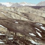
Karstic and erosional relief on a subaerial unconformity developed on Ordovician carbonates, onlapped by Paleocene estuarine and shallow shelf deposits. Ellesmere Island.

Karstic and erosional relief on a subaerial unconformity developed on Ordovician carbonates, onlapped by Paleocene estuarine and shallow shelf deposits. Ellesmere Island.


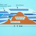
Outcrop and schematic reconstruction of onlapping Paleocene estuarine - sandspits & bars deposits attached to Ordovician bedrock headlands, Ellesmere I. Detail of the unconformity and onlap surface is shown in the previous image.

Outcrop and schematic reconstruction of onlapping Paleocene estuarine – sandspits & bars deposits attached to Ordovician bedrock headlands, Ellesmere I. Detail of the unconformity and onlap surface is shown in the previous image.


Successive vadose pisolite layers indicate variable meteoric watertables indicate prolonged subaerial exposure of platform carbonates, Paleoproterozoic, Belcher Islands.

Successive vadose pisolite layers indicate variable meteoric watertables and prolonged subaerial exposure of platform carbonates, Paleoproterozoic, Belcher Islands.


Valley (outlined) erosded into Pleistocene coastal dunes during sea level lowstand. The vallety was later filled by a younger dune complex as sea level rose. Kariotahi, New Zealand

Valley (outlined) eroded into Pleistocene coastal dunes during sea level lowstand. The valley was later filled by a younger dune complex as sea level rose. Kariotahi, New Zealand


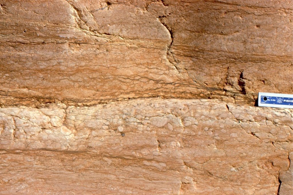
Same location as image above. The dipping surface is the valley margin, cut into Pleistocene dunes. The weathered profile in the lower dune sands contains abundant limonite-goethite hard-pans that developed from water seepage.

Same location as image above. The dipping surface is the valley margin, cut into Pleistocene dunes. The weathered profile in the lower dune sands contains abundant limonite-goethite hard-pans that developed from groundwater seepage.

Correlative conformity

A subaerial unconformity encroaches upon the shelf or platform in concert with the shoreline, until the end of regression. As sea level falls, sediment is delivered to the slope and basin floor, accumulating as a relatively conformable, deep-water, succession – commonly submarine fan and related deposits. Although the subaerial unconformity (the sequence boundary) ends at the lowest shoreline, there will be an equivalent surface, marking the end of sea level fall (regression) at the top of the lowstand deposits. This surface is referred to as a correlative conformity. It is the surface corresponding to the end of relative sea level fall and, according to Hunt and Tucker (1992) the end of forced regression. As such, it is the marine extension of a sequence boundary. The Hunt and Tucker systematics also indicate a period of normal regression at the beginning of sea level (baselevel) rise, when the rate of rise is relatively low compared with the rate of sediment supply (they call this the Lowstand Prograding Wedge). Thus, the correlative conformity, and therefore the sequence boundary, lie between the deposits of forced regression and normal regression.

Diagramatic view (dip-section) of a subaerial unconformity across a shelf and forced regressive wedges, and the correlative conformity over basin floor submarine fans. The overlying lwostand prograding wedge is deposited during normal regression at the beginning of the subsequent sea level rise.

Diagrammatic view (dip-section) of a subaerial unconformity across a shelf and forced regressive wedges, and the correlative conformity over basin floor submarine fans. The overlying lowstand prograding wedge is deposited during normal regression at the beginning of the subsequent sea level rise.

Regressive surface of marine erosion

This surface is manifested as an abrupt contact beneath the regressive shoreface wedges (commonly resistant sandstone), that form during forced regression and are subsequently abandoned as baselevel falls. The RSME commonly develops where wave orbitals impact the sea floor, at and above fairweather wave-base. It forms in concert with the basinward down-stepping shoreline trajectory as sea level falls (Plint, 1988). The RSME will erode mudrocks deposited on the mid to outer shelf. Sandstones deposited above the RSME are commonly crossbedded, reflecting the high-energy shoreface conditions. The RSME overlies highstand deposits that accumulated during the previous stage of normal regression.

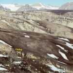
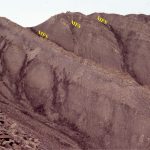
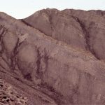
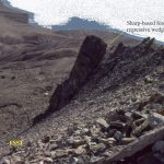
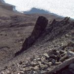
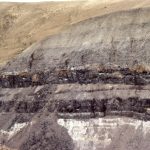
Successive sharp-based shoreface sandstones deposited during forced regression. The sandstones overlie highstand deposits, and are in turn overlain by transgressive mudstones. Paleocene, Axel Heiberg Island.

Successive sharp-based shoreface sandstones deposited during forced regression. The sandstones overlie highstand deposits, and are in turn overlain by transgressive mudstones. Paleocene, Axel Heiberg Island. The subaerial unconformity probably lies atop the highest sharp-based wedge (right), but is covered by scree.

Maximum regressive surface (transgressive surface)

This surface represents the sea floor at the time when regression ends and transgression begins, and the shoreline trajectory reverses from seaward to landward. Its preservation potential is relatively high because erosion by continued regression has ceased, and burial by deeper water sediment begins as shoreline migration reverses (landward). However, in some circumstances shoreface ravinement during transgression may erode the MRS (and the subaerial unconformity).

Fluvial channels lie between two shelf parasequences. Lowstand fluvial incision – the landward extension of the max reg surface that represents the position of the sea floor at the maximum basinward extent of the sea level lowstand. Jurassic, Bowser Basin.

Channelized, crossbedded, fluvial sandstones lie between two shelf parasequences. Fluvial incision took place during sea level lowstand – it is interpreted as the landward extension of the maximum regressive surface that represents the position of the sea floor at the maximum basinward extent of the sea level lowstand. Jurassic, Bowser Basin.

Maximum flooding surface

During the late stages of transgression, the rate of sediment supply is usually very low, resulting in thin, condensed stratigraphy that commonly includes organic mudstone (black shale), calcareous mudstone or limestone, glauconite, or phosphatized fossils and nodules. Gamma tool signatures frequently record high levels of natural radioactivity through this condensed interval.  The MFS is usually located at the top of this condensed section.

The MFS is the paleo sea floor at the end of transgression, marking the change to normal regression where the shoreline trajectory reverses from landward to seaward. The initiation of progradation during the subsequent normal regression means that the MFS will be a downlap surface for prograding clinoforms.

The (transgressive) condensed section overlies coarsening-upward, highstand deposits from the previous regression. The MFS is in turn overlain by muddy lithologies of the succeeding normal regression. The contrast between the condensed strata and the overlying muddy facies is expressed in outcrops as an abrupt change from resistant to recessive exposure. In outcrop, this produces a stair-like appearance in successive cycles (a good example is shown below).

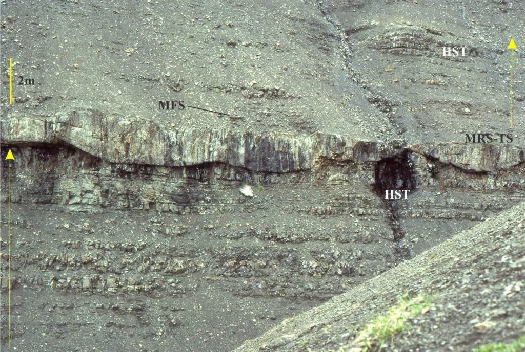
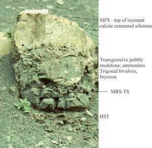
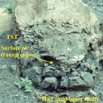
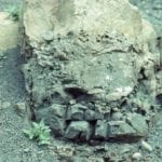
Two surfaces are present in this top part of a Jurassic shelf parasequence; the maximum regressive surface or transgressive surface, fossiliferous pebbly mudstones depsited during transgression, and a condensed, cemented mudstone, the top of which is the maximum flood surface. The MFS is overlain by normal shelf deosits of the next parasequence

Two surfaces are present in the top part of a Jurassic shelf parasequence; the maximum regressive surface or transgressive surface (MRS-TS), fossiliferous pebbly mudstones deposited during transgression, and a condensed, cemented mudstone, the top of which is the maximum flood surface. The MFS is overlain by normal shelf deposits of the next parasequence. Bowser Basin.


Two surfaces are present in this top part of a Jurassic shelf parasequence; the maximum regressive surface or transgressive surface, fossiliferous pebbly mudstones depsited during transgression, and a condensed, cemented mudstone, the top of which is the maximum flood surface. The MFS is overlain by normal shelf deosits of the next parasequence

Typical stair-like exposure of stacked parasequences; the resistant beds are normal and forced regressive sandstones, capped by resistant, transgressive deposits. The prominent bench corresponds to the maximum flood surface. Jurassic, Bowser Basin.


Ravinement surface

During transgression the shoreline, beach, and shoreface migrate landward, the attendant waves and tidal currents scouring as they go. The distinction between wave- and tide-dominated ravinement is often made, although depending on coastal dynamics, both can occur along the same stretch of coast. The depth of erosion of the underlying regressive deposits and their stratigraphic surfaces, such as the subaerial unconformity, RSME and MRS, depends on the wave climate and the efficiency of tidal currents to redistribute the eroded sediment. Thus, it is possible for the ravinement surface to overlie highstand deposits directly, where beach and other associated shoreline deposits have been removed. In other situations, scouring may be quite shallow, such that lagoon and estuarine deposits are preserved below the ravinement surface.

As the shoreline moves landward, the ravinement surface is overlain by deeper shoreface deposits. The contrast in facies through a ravinement surface is one of the more recognisable characteristics in outcrop and core. For example, deeper shoreface deposits containing interbedded mudstone and sandstone, or typical storm wave-base structures like hummocky crossbeds, will onlap the ravinement surface that, in turn, overlies lagoonal muds. Trace fossils, benthic faunas, and sedimentary structures will help your identification of the erosional surface separating these disparate facies. Facies transitions across a ravinement surface will vary depending on whether delta lobes, sand barriers, tidal channels, lagoons or estuaries are transgressed.

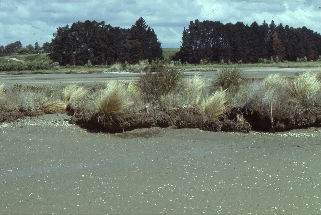
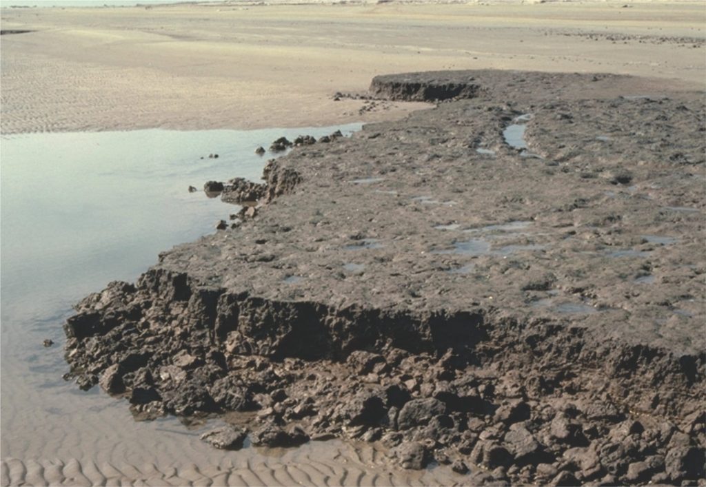
Wave erosion of Late Quaternary tidal flat and salt marsh - mangrove deposits at two locations: left – an estuary in Auckland Harbour (New Zealand), and the Galveston coast. The ravinement surface in both examples is at the level of the modern beach-tidal flat. The resulting stratigraphy will present in ascending order as tidal flat or beach sands, overlain by a thin remnant of salt marsh mud, the scoured (wave) ravinement surface, overlain by beach or subtidal deposits


Wave erosion of Late Quaternary tidal flat and salt marsh – mangrove deposits at two locations: above – an estuary in Auckland Harbour (New Zealand), and the Galveston coast (below). The ravinement surface in both examples is at the level of the modern beach-tidal flat. The resulting stratigraphy will present in ascending order as tidal flat or beach sands, overlain by a thin remnant of salt marsh mud, the scoured (wave) ravinement surface, overlain by lower intertidal or subtidal deposits.


Salt marsh muds currently being eroded as the Galveston (Texas) shoreline retreats. The erosional surface is a ravinement surface.


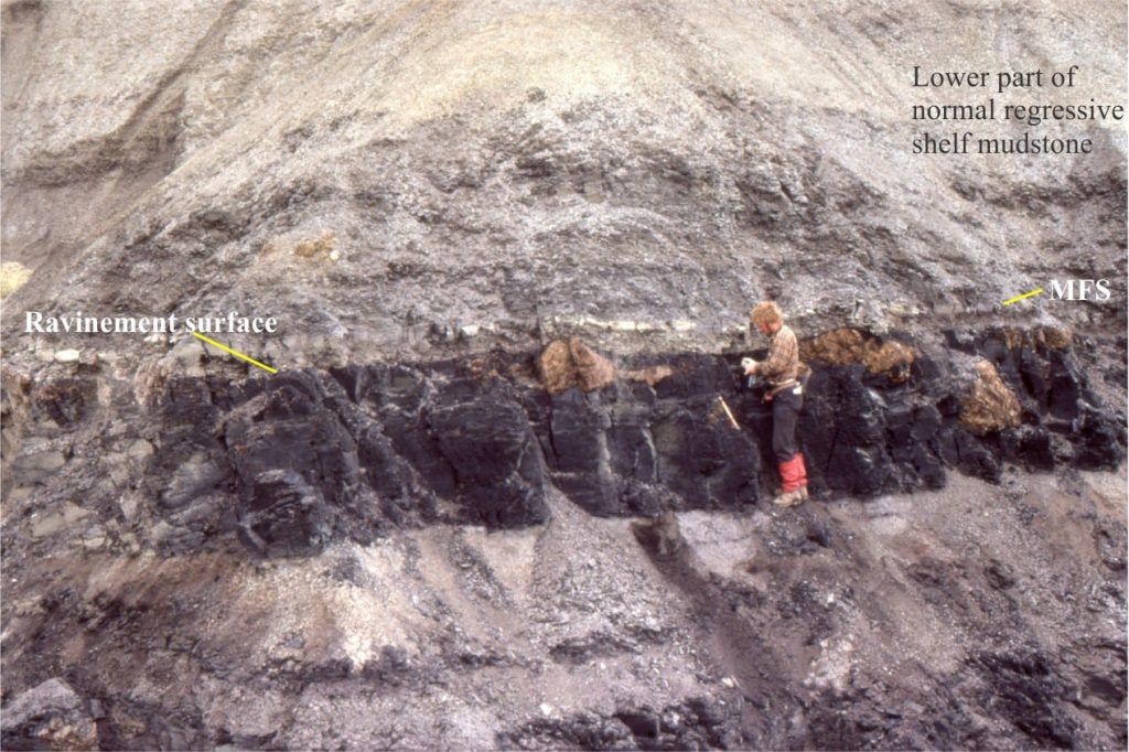
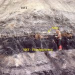
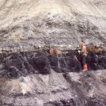
ravinement at coal contact has removed any beach and shoreface deposits, and is instead overlain by thin silty sandstones. The top of these sandstones is inferred to be a MFS. Above the MFS is a thick unit of normal regressive mudstone (HST). Eocene, Ellesmere Island.

Ravinement at coal contact has removed any beach and shoreface deposits, and is instead overlain by thin silty sandstones. The top of these sandstones is inferred to be a MFS. Above the MFS is a thick unit of normal regressive mudstone (HST). Eocene, Ellesmere Island.

This is part of the How To…series  on Stratigraphy and Sequence Stratigraphy

Other posts in this series on Stratigraphy and Sequence Stratigraphy

Stratigraphic surfaces in outcrop – baselevel fall

Stratigraphic surfaces in outcrop – baselevel rise

A timeline of stratigraphic principles; 15th to 18th C

A timeline of stratigraphic principles; 19th C to 1950

A timeline of stratigraphic principles; 1950-1977

All the stratigraphies

Baselevel, Base-level, and Base level

Sediment accommodation and supply

Facies and facies models

How to read a sea level curve

Autogenic or allogenic dynamics in stratigraphy?

Stratigraphic cycles: What are they?

Parasequences

Shorelines and shoreline trajectories

Stratigraphic trends and stacking patterns

Clinoforms and clinothems

Stratigraphic lapout

Stratigraphic condensation – condensed sections

Depositional systems and systems tracts

Which sequence stratigraphic model is that?

Facebooktwitterlinkedininstagram
Facebooktwitterlinkedin

Atlas of Sequence stratigraphy

Facebooktwitterlinkedininstagram

Sequence stratigraphy

The Atlas, as are all blogs, is a publication. If you use the images, please acknowledge their source as indicated below.

Brian Ricketts –  www.geological-digressions.com

This category of Atlas images, is not intended as a comprehensive outline or set of definitions of sequence stratigraphy, but rather field examples of strata, stratigraphic trends (an essential component of systems tracts), and stratigraphic surfaces.  There are many excellent journal papers, text books, and conference short courses devoted to sequence stratigraphy, so consult them if needs be.

Short articles on important sequence stratigraphic themes are listed here

Some key sequence stratigraphic components illustrated here include (abbreviations on the images):

HST        Highstand Systems Tract (progradational-aggradational) overlies the MFS and underlies the erosion surface formed during the FSST)

FSST       Falling Stage Systems Tract (forced regression and progradation during relative sea-level fall)

LST         Lowstand systems tract (now restricted to end of relative sea-level fall and beginning of sea-level rise)

TST        Transgressive Systems Tract (above the transgressive surface; Retrogradational onlapping during rising relative sea-level and low sedimentation rates. Condensed stratigraphy).

MSF        Maximum Flood Surface (at the transition to sedimentation rates greater than creation of accommodation space. Also the base of the overlying HST).

Each example has a pair of images, one annotated, the other without annotation.

This link will take you to an explanation of the Atlas series, the ownership, use and acknowledgment of images.  There, you will also find links to the other categories.

Click on the image for an expanded view, then ‘back page’ arrow to return to the Atlas.


The images:

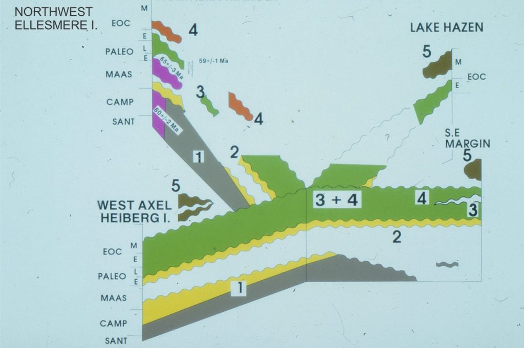
Sequence stratigraphic framework for the Late Cretaceous - Paleogene Eureka Sound Group, Canadian Arctic. The numbered sequences are referred to for each outcrop image.

Sequence stratigraphic framework for the Late Cretaceous – Paleogene Eureka Sound Group, Canadian Arctic. The numbered sequences are referred to for each outcrop image.

Late Cretaceous to Middle Eocene 3rd-order stratigraphic sequences in the Eureka Sound Group, Canadian Arctic Islands (mostly Ellesmere and Axel Heiberg islands). Sequences 1 and 2, mainly wave-dominated deltas, and along the eastern basin margin, estuarine – shelf. Sequences 3 and 4: river-dominated deltas, sandy inner shelf, muddy outer shelf; Sequence 5 basin inversion and fragmentation into small, thrust-related, syntectonic basins. Sequence 5 represents the acme of the Eurekan Orogeny.


Sequence 1, wave-dominated delta parasequences, Strand Fiord, Axel Heiberg Island. There is about 150m of stratigraphy in this view.


Detail of Sequence 1 coarsening upward, wave-dominated delta parasequence and MFS. Axel Heiberg Island.


Sequence 1, Major subaerial unconformity between Ordovician limestone and onlapping Lower Paleocene estuarine, sandy shelf-bar-sand spit. Combined  karstification and erosion of the limestones produced significant paleotopography. Mount Moore, eastern Ellesmere Island.


Sequence 1 estuarine, sand spit, and shallow shelf bars, onlapping karsted Ordovian limestones, Mount Moore, eastern Ellesmere Island. In the foreground, crossbedded sandstone is in direct contact with paleotopography.


Reconstructed Early Paleocene paleotopography and Sequence 1 facies.  For details see: Ricketts, B.D.  1991: Lower Paleocene drowned valley and barred estuaries, Canadian Arctic Islands: aspects of their geomorphological and sedimentological evolution; in Clastic Tidal Sedimentology, Rahmani, R.A., Smith, D.G., Reinson, G.E., and Zaitlin, B.A. (ed.); Canadian Society of Petroleum Geologists, Memoir 16, p. 91-106.


Sequence 3. River-dominated prodelta – delta front parasequences.  About 300m of stratigraphy here. Abrupt, mappable parasequence tops coincide with the MFS. Axel Heiberg Island.


Paleocene Highstand, Falling Stage and Lowstand systems tracts, Axel Heiberg I.                    

Sequence 3: FSST with forced regressive wedge – sharp-based shoreline sandstones formed by wave erosion as sea-level falls.  The subsequent TST and HST extends to the right of the image. Axel Heiberg Island.


Paleocene Highstand, Falling Stage systems tracts, Axel Heiberg I.                     


Sequence 3, as in the above image pair, focusing on the FSST and forced regressive sandstone wedges. Axel Heiberg Island.


Paleocene Falling Stage systems tract, Axel Heiberg I.                       


The basal part of the FSST in Sequence 3 (as above), featuring a sharp-based forced regressive shoreline wedge.


Sequence 3. Downlap surface with basinward progradation of prodelta mudstone fine-grained sandstone.


Sequence 3: Strongly aggradational HST, shelf parasequences, South Bay, Ellesmere Island.


Sequence 3: Shelf parasequences, mostly HST, thin TST, and MFS that corresponds with the resistant top of each cycle. For an overview see the next images above. South Bay


Sequence 3: A great example of a higher-order subaerial sequence boundary (SB) (top of coal seam), thin TST muddy sandstone, MFS, and HST. The orange blobs are mineralized tree roots. It’s also a much younger me. Strathcona Fiord, Ellesmere Island.


Sequence 3, a different perspective, as immediately above.


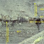
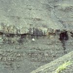
Jurassic mid-outer shelf parasequence, Bowser Basin. The MFS immediately overlies the resistant ledge, above which is a thick coarsening  upward HST. Tsatia Mountain, northern British Columbia.


Mid-shelf parasequences with well defined MFS, transgressive surfaces, and TSTs. Tsatia Mountain, Bowser Basin.


Closer view of a mid-inner shelf parasequence, Tsatia Mountain, Bowser Basin. The coarsening upward HST is capped by a pebbly, fossiliferous TST and MSF. The transgressive surface is one of marine erosion during changing wave-base.


Detail of the top HST, transgressive surface (of erosion), the fossiliferous, pebbly TST (ammonites and bivalves), a calcareous mudstone that is part of the condensed TST stratigraphy when terrigenous sediment input was at its lowest, the MFS, and succeeding HST. Tsatia Mountain, Bowser Basin.


The Tsatia Mountain section contains some shelf parasequences that are truncated by lowstand, channelized fluvial sandstone – the LST. The TST is a thin, pebbly mudstone similar to that in the image immediately above. Bowser Basin.


The abrupt contact between the erosional base of the TST fluvial channel, and the preceding shelf parasequence. Tsatia Mountain, Bowser Basin.

Facebooktwitterlinkedininstagram
Facebooktwitterlinkedin